| NAD83 COORDINATES (1986 adj.): |
|---|
| * X= 553386.54 Y= 173214.51 Z= 0 LSQ 10/18/1991 M FLT |
| 11/30/2009 | Placed ties on the CIM. see CofL 0004-2266-A.pdf |
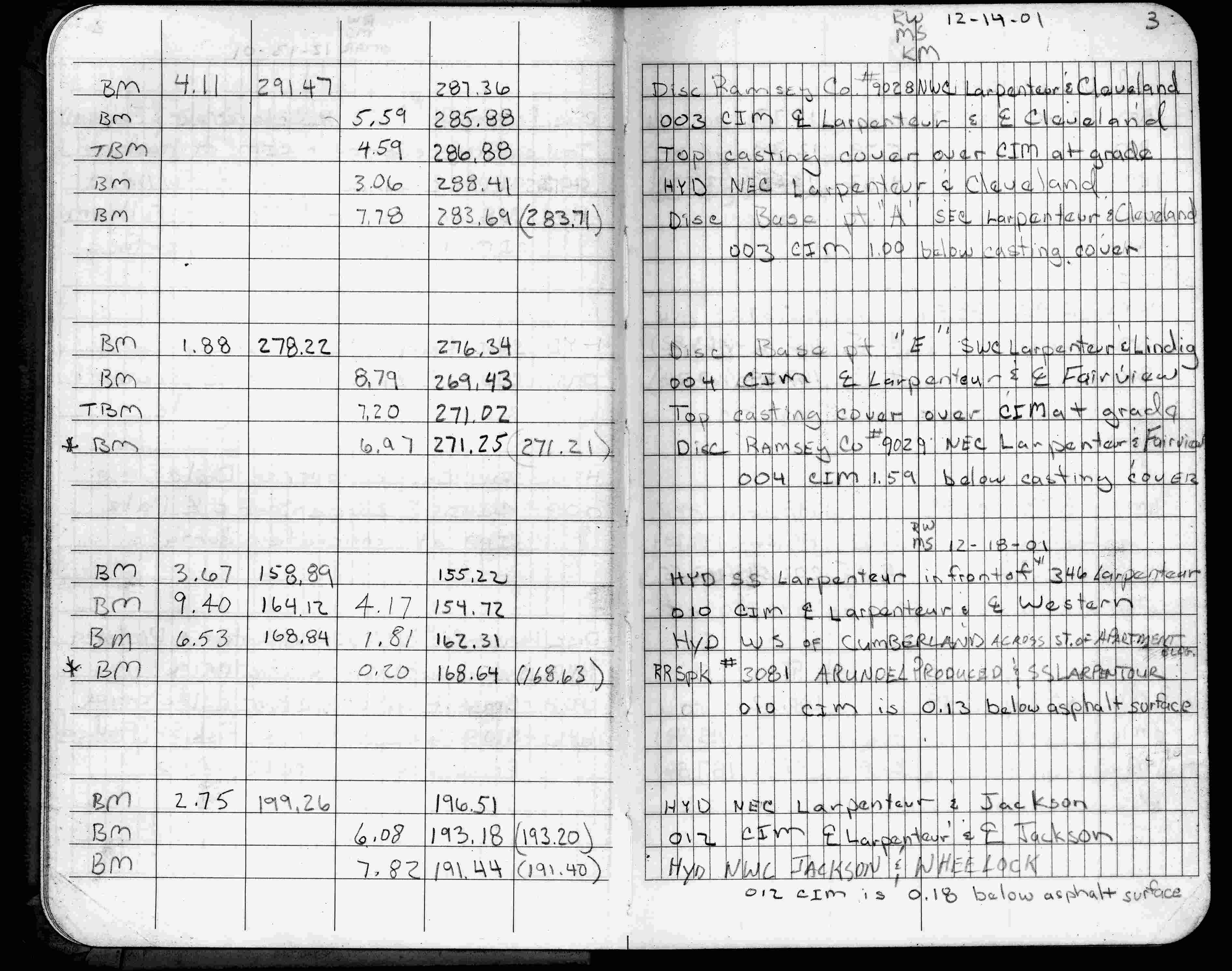
| 12/14/2001 | Elev 269.43 ft on CIM in casting, 1.59 ft below existing surface. See FB 1736 p.3 |
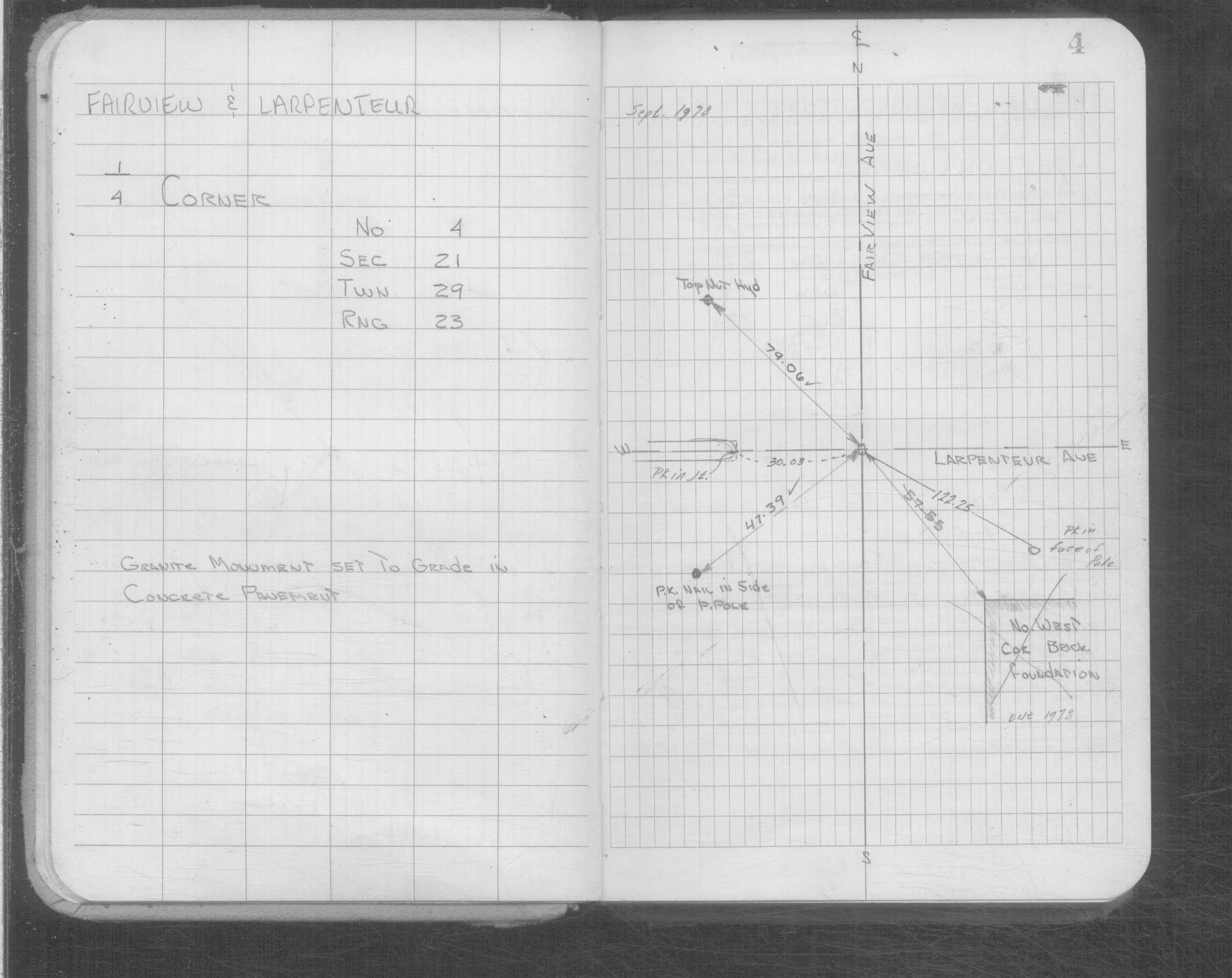
| 3/25/1991 | Fd GM at grade in concrete pavement & retied. See CofL 0004-xxxx-A |
| 4/1/1891 | (Unknown date Apr __, 1891 ) Monument set by J H Armstrong. See Standard Map of Sec 21-29-23 |
| 11/1/1847 | (Unknown date Nov __, 1847 ) Isaac N Higbee deputy surveyor set post. Tied to 1 BT. See IH p.106-107 2923 |
| 1/1/1800 | (Unknown date ___ __, ____ ) GM set to grade in concrete pavement. |
Above is NOT an all inclusive history of this point. Please review all the links below.
| PLS NOTES | Field | Cross Section | Sewer | J.B. Irvine | Monument | River Survey |
|---|---|---|---|---|---|---|
| IH p.106-107 | FB 0335CPYp. 60 ,69 | |||||
| FB 1422Bp. 52 ,53 | ||||||
| FB 1565Bp.59 | ||||||
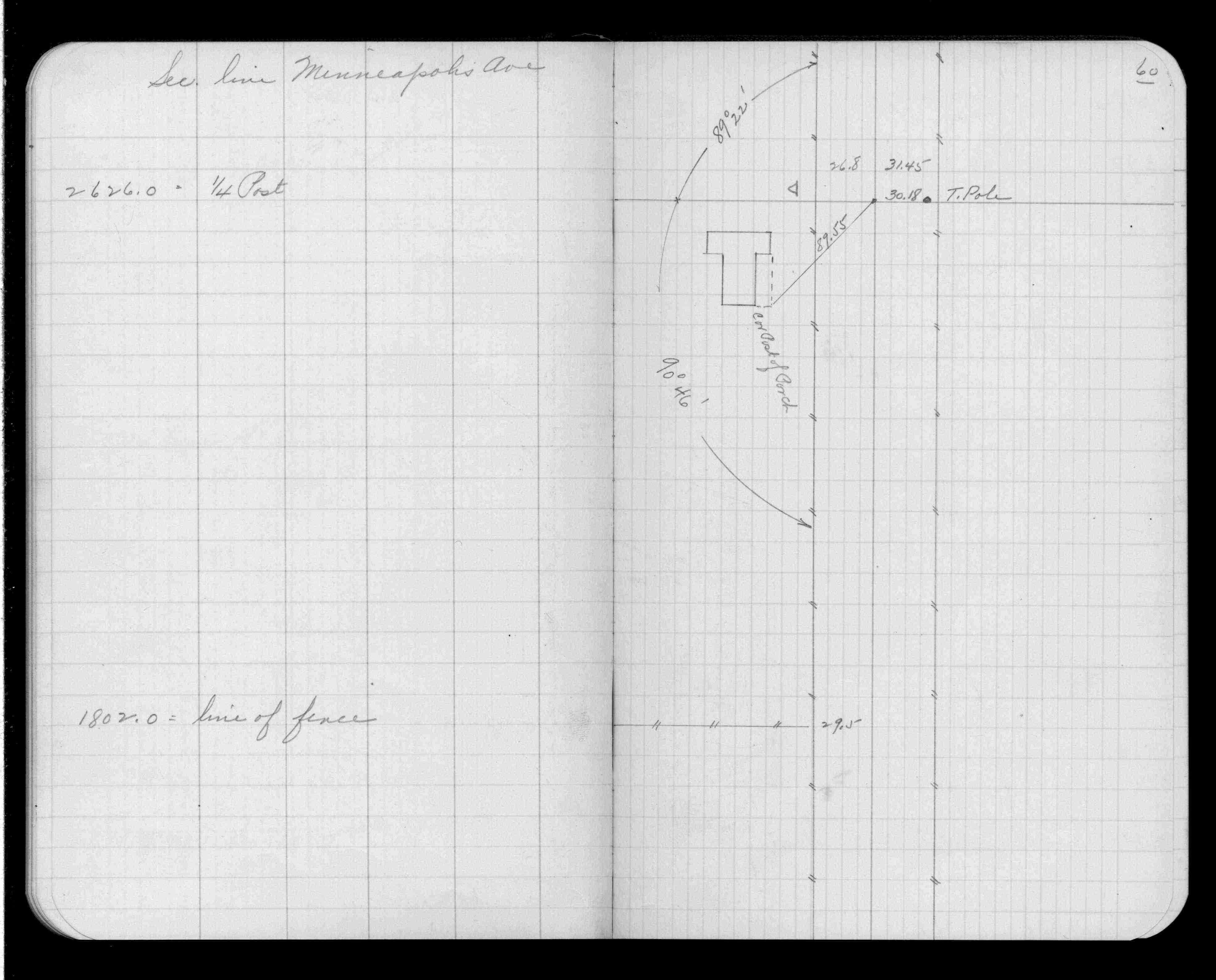
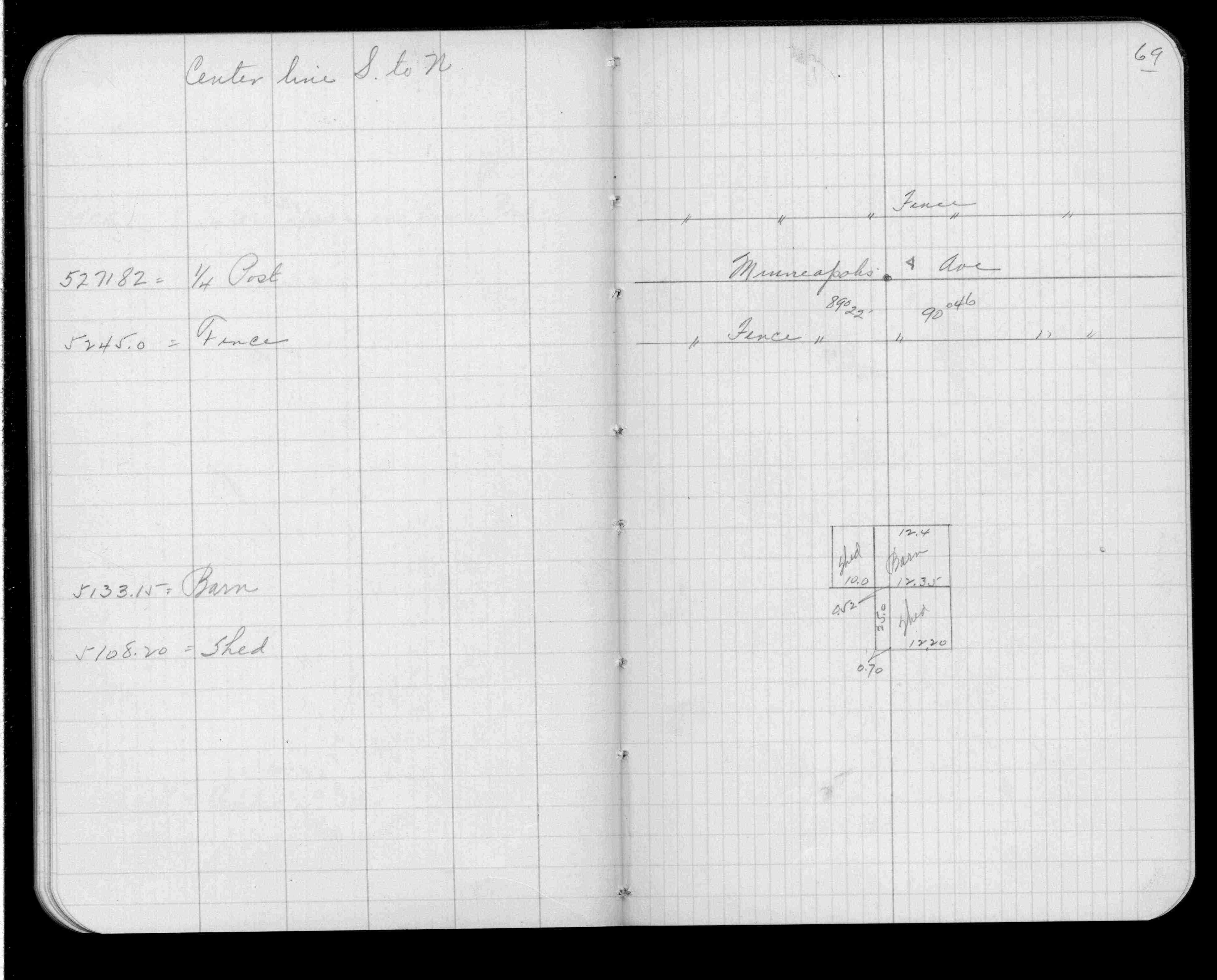
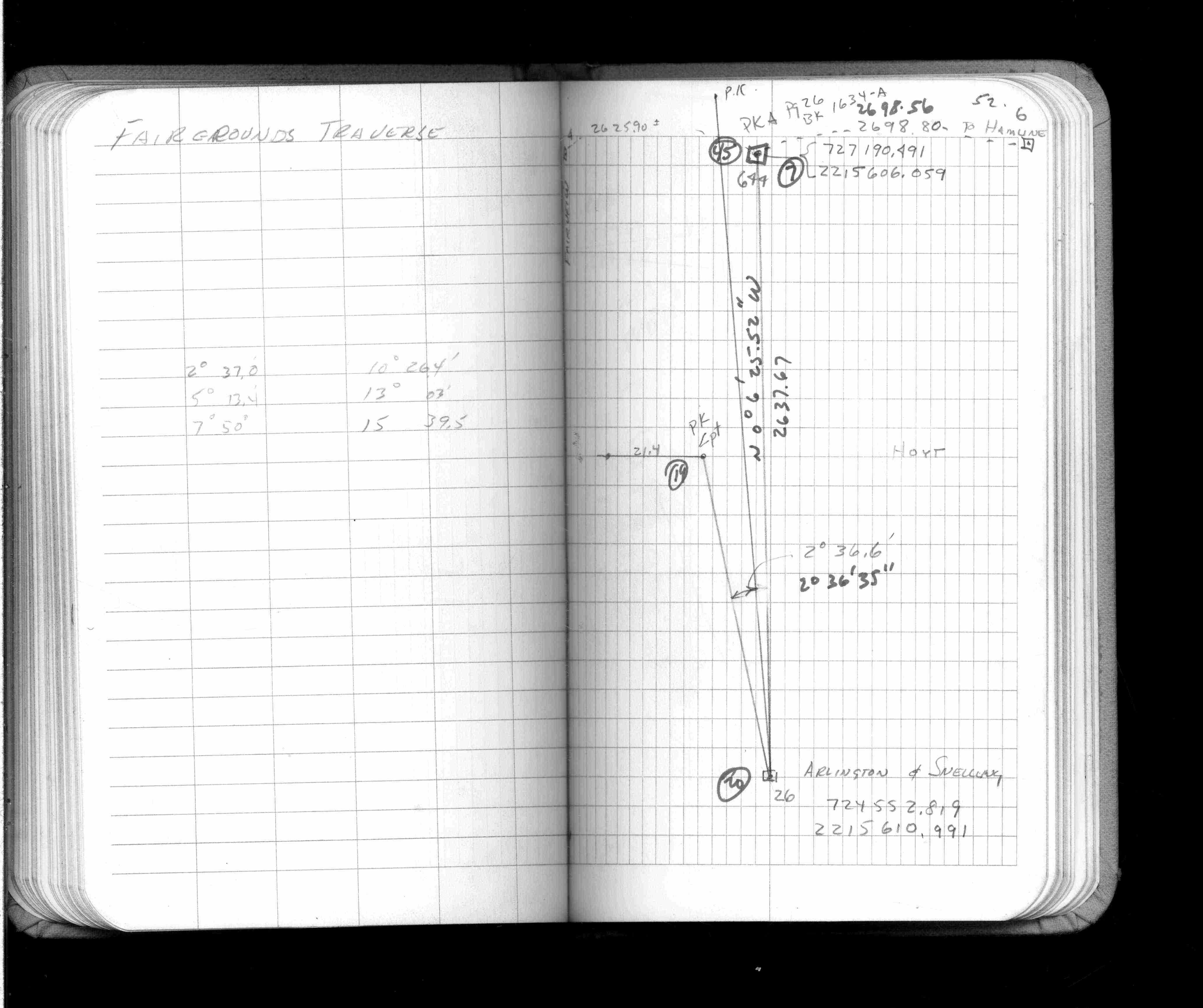
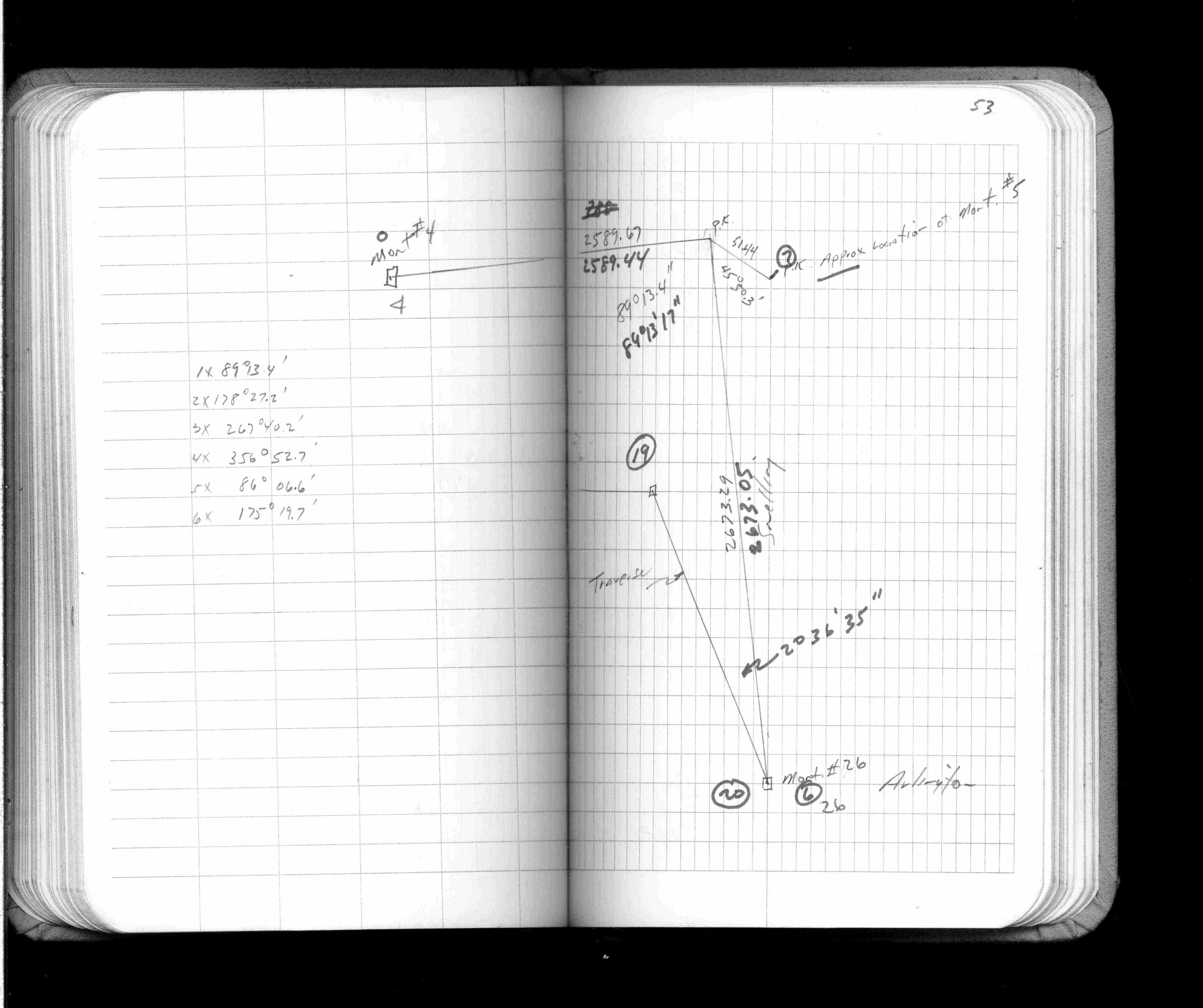
| FB 1634Ap.27 | ||||||
| FB 1671p.27 | ||||||
| FB 1736p.03 |
| FILE | SURVEYOR | LIC. NO. | DATE SIGNED | DATE TIED |
|---|---|---|---|---|
| 0004-2266-A.pdf | Samuel D. Gibson | 44880 | February 3, 2010 | November 30, 2009 |
| 0004-xxxx-A.tif | none | none | none | March 25, 1991 |
| ST_001-078p004.jpg | none | none | none | none |
| 0004-xxxx-A.dwf | none | none | none | none |
| FILE | PHOTO DATE | COMMENTS |
|---|---|---|
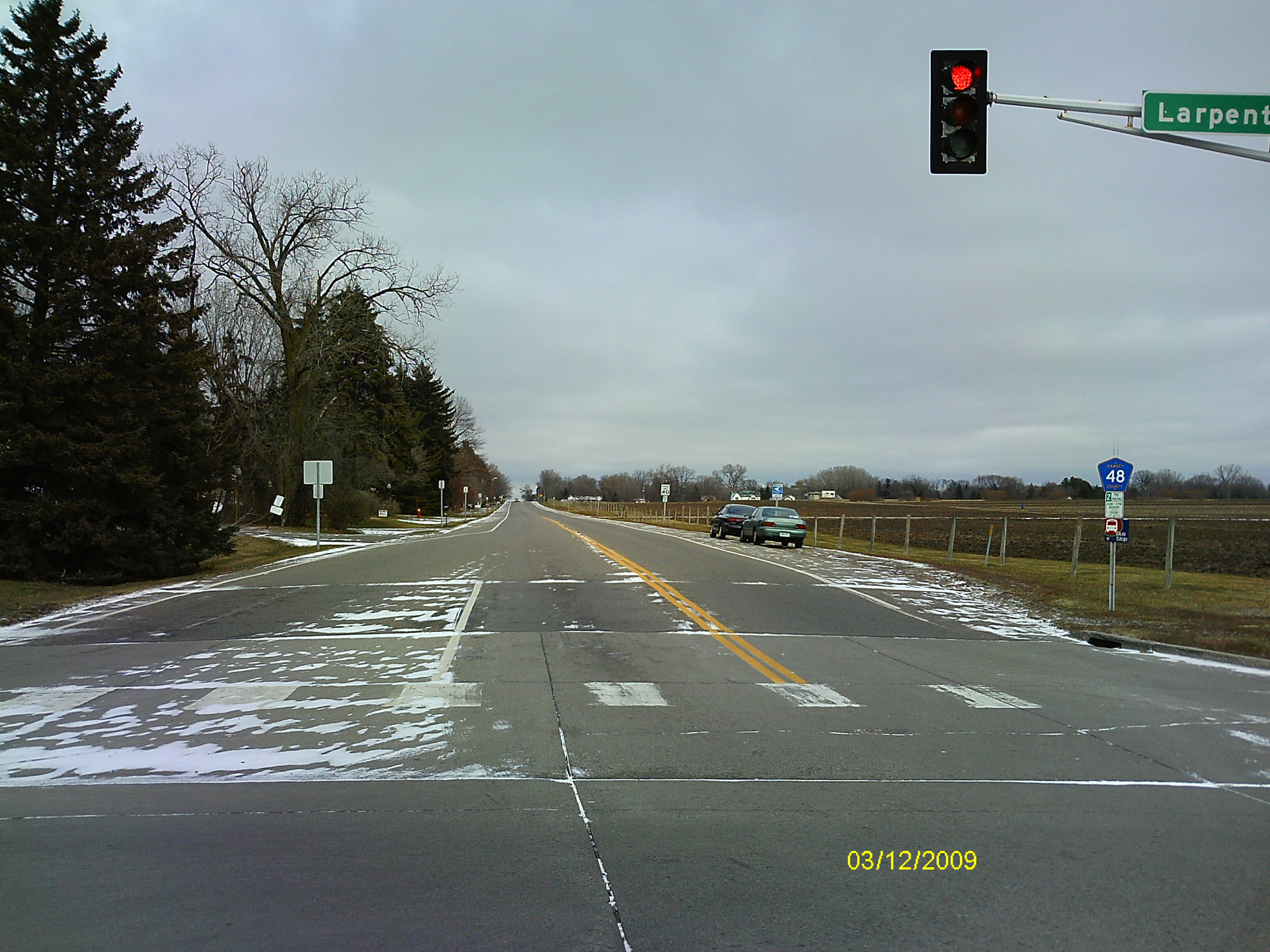
| 0004-2266-5.jpg | December 3, 2009 | Looking West along the center of Larpentuer Ave. |
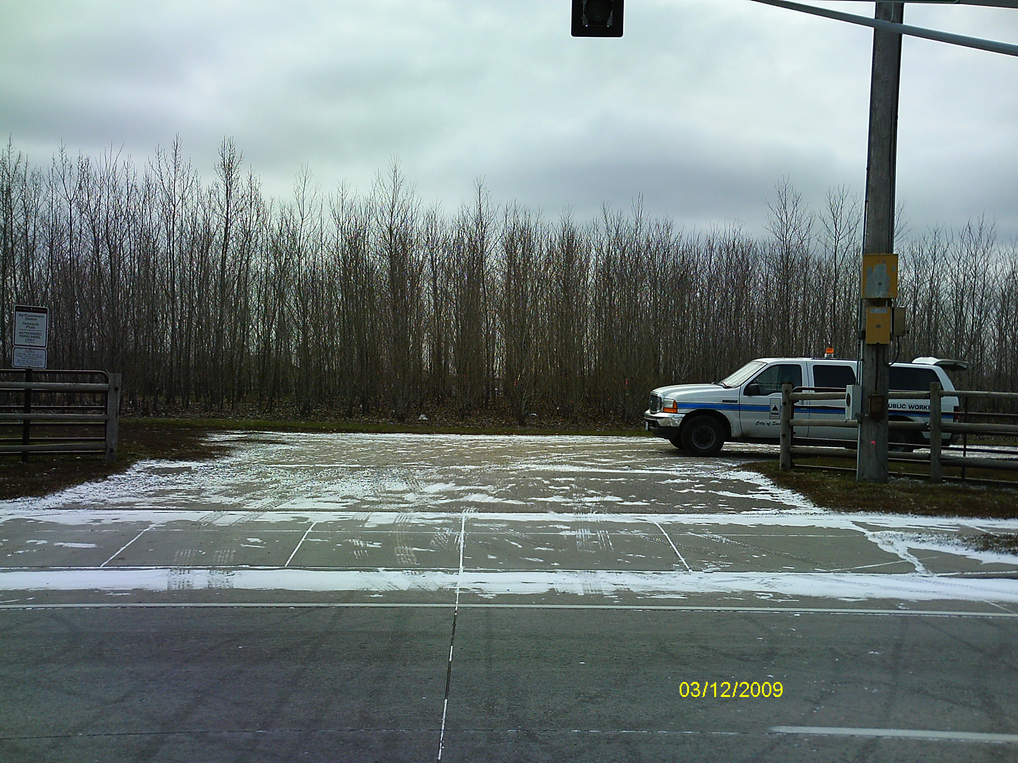
| 0004-2266-4.jpg | December 3, 2009 | Looking South. |
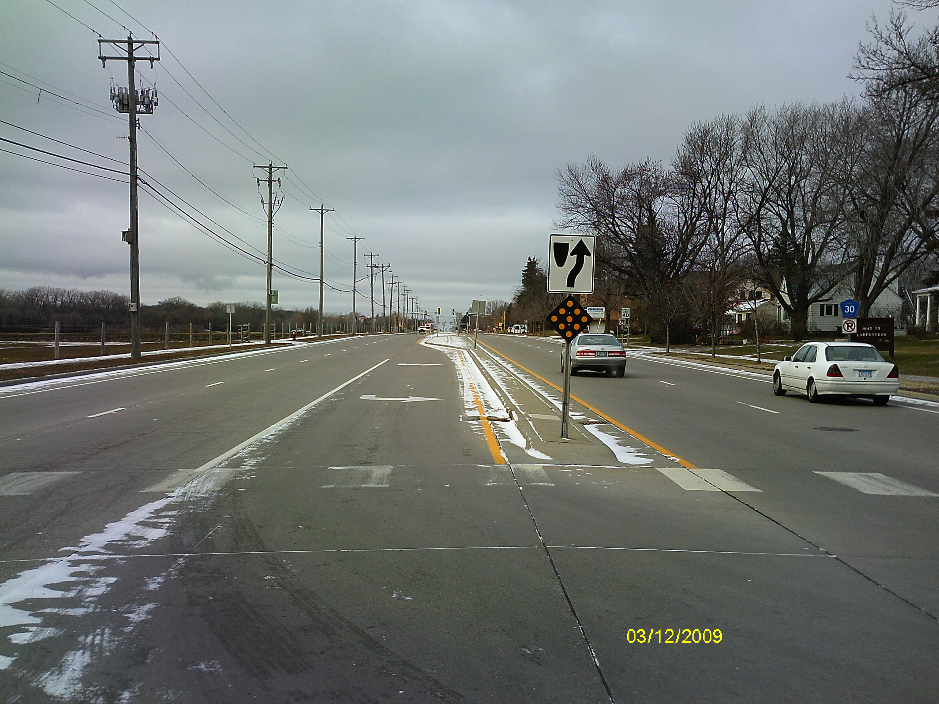
| 0004-2266-3.jpg | December 3, 2009 | Looking East along the center of Larpentuer Ave. |
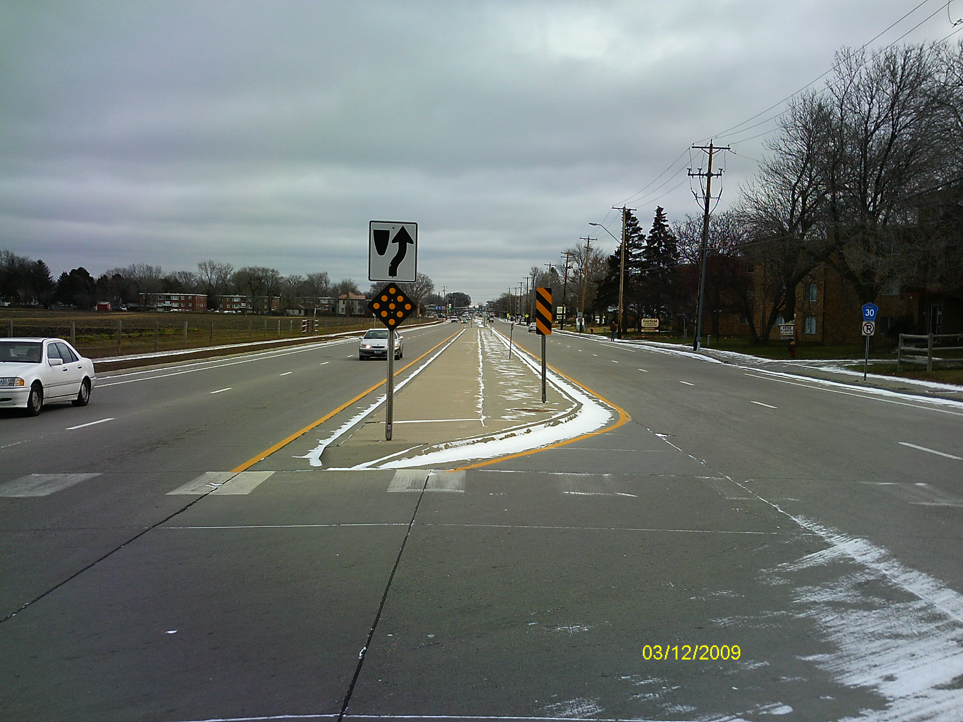
| 0004-2266-2.jpg | December 3, 2009 | Looking North along Fairview Ave. |
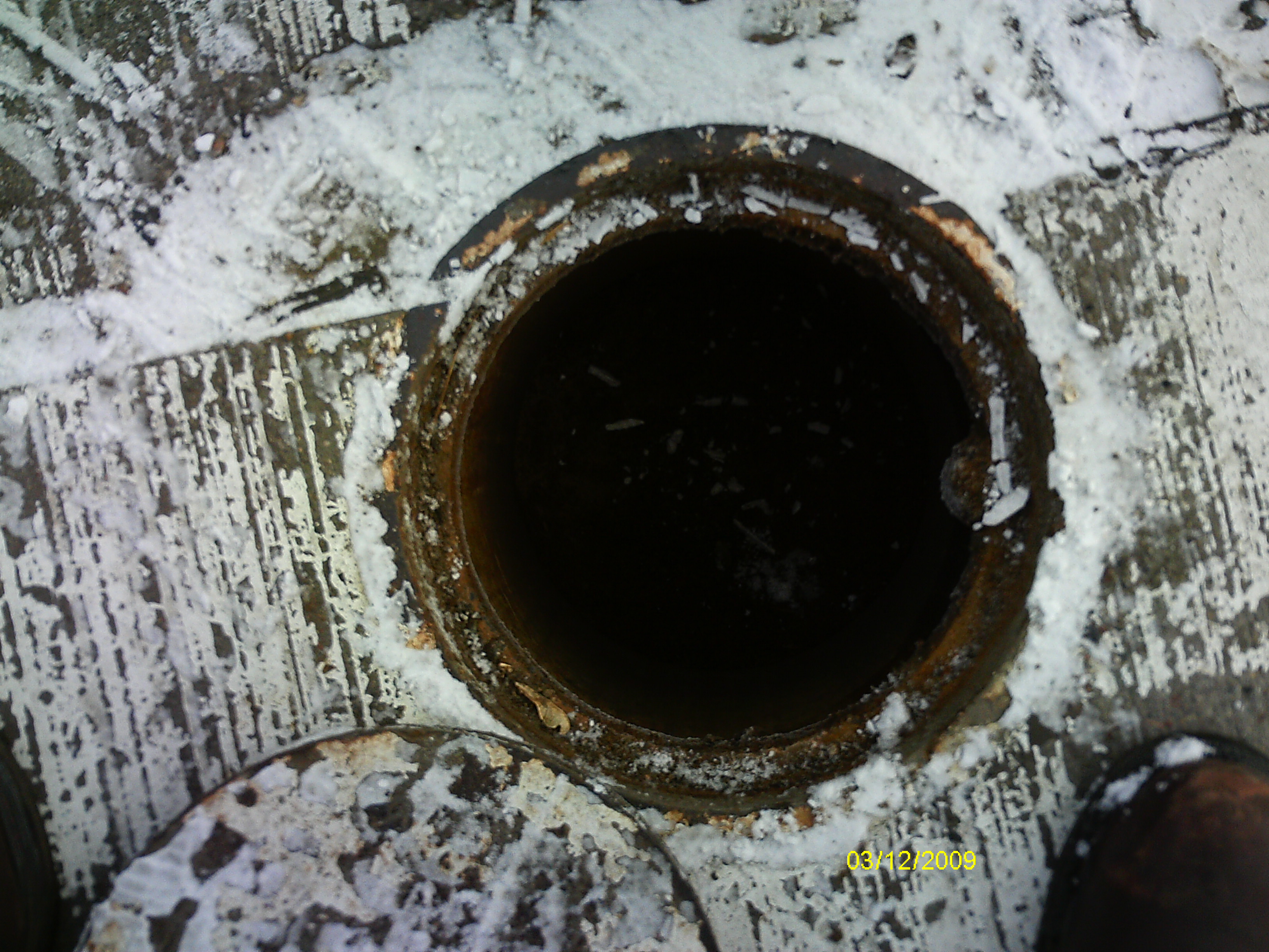
| 0004-2266-1.jpg | December 3, 2009 | Close-up of the casting opening over the CIM. |