| NAD83 COORDINATES (1986 adj.): |
|---|
| * X= 561285.08 Y= 173327.47 Z= 0 LSQ 10/18/1991 M FIX |
| 12/3/2009 | Placed ties on the CIM. See CofL 0007-1044-A.pdf Photos taken. |
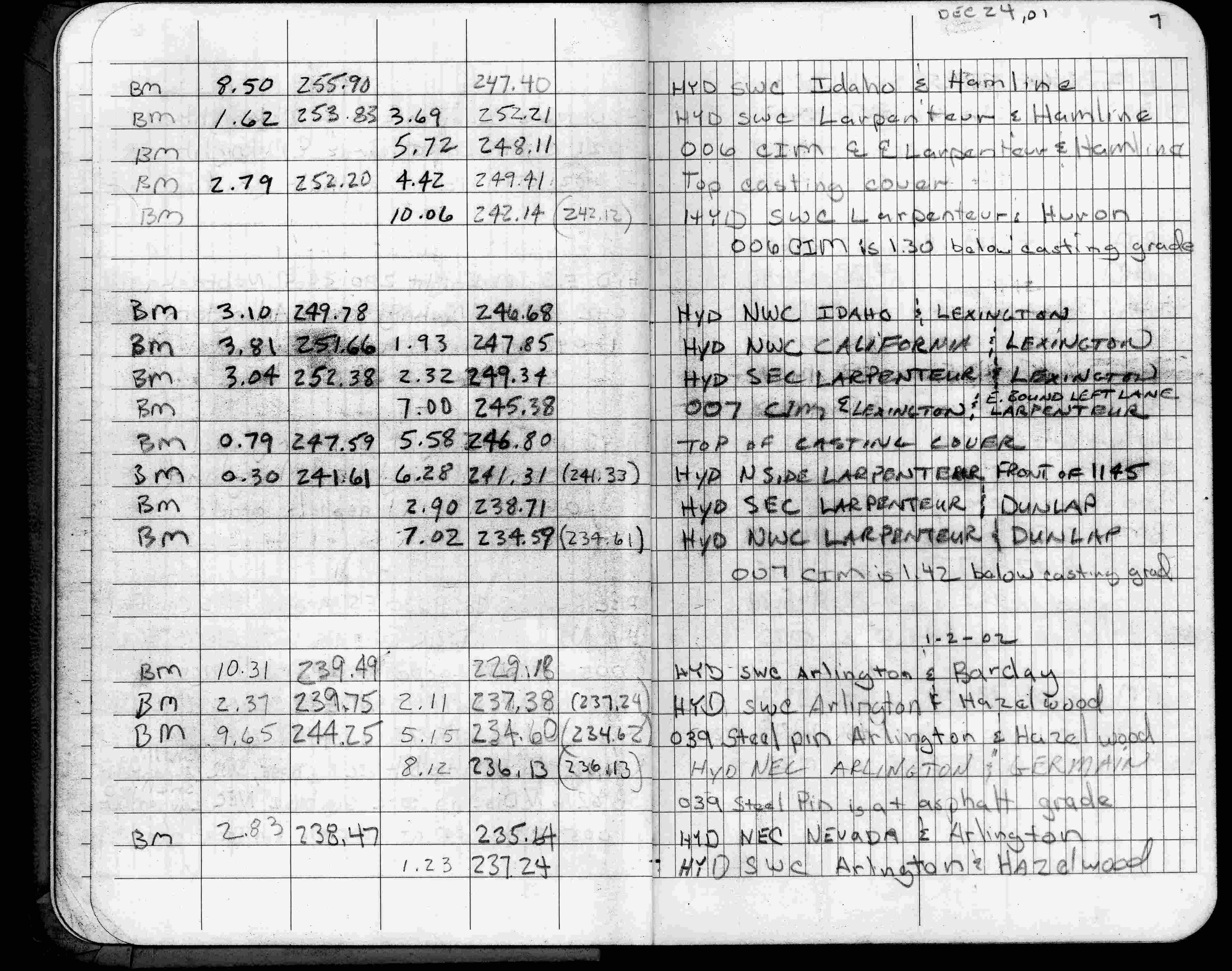
| 12/24/2001 | Elev 245.38 ft on CIM in casting, 1.42 ft below casting grade. See FB 1736 p.7 |
| 3/4/1996 | Elev 247.18 ft on CIM. See 97adj.pts, 1996/lex-i94-larp.org/bmlex.sdr (loop 087) |
| 3/25/1991 | Recovered CIM at grade in concrete pavement. (Ties not checked) See CofL 0007-1044-B |
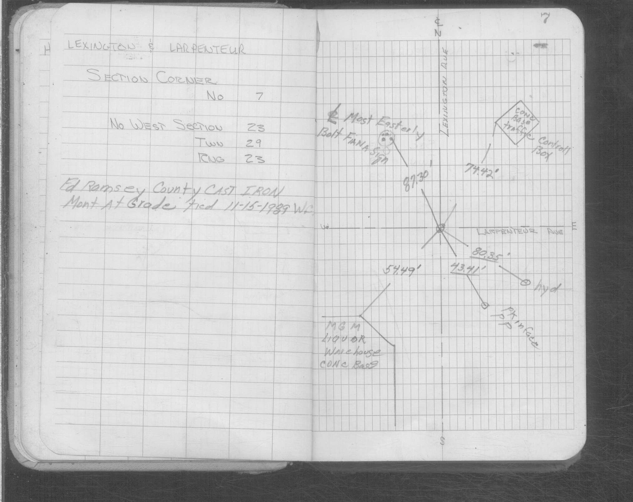
| 11/15/1989 | Recovered Ramsey County CIM, left CIM as found & placed ties. See CofL 0007-1044-A |
| 11/15/1989 | Fd Ramsey County CIM at grade. See Yellow Tie Book. |
| 1/1/1989 | (Unknown date ___ __,1989 ) Historic, one time only GPS survey = S600 |
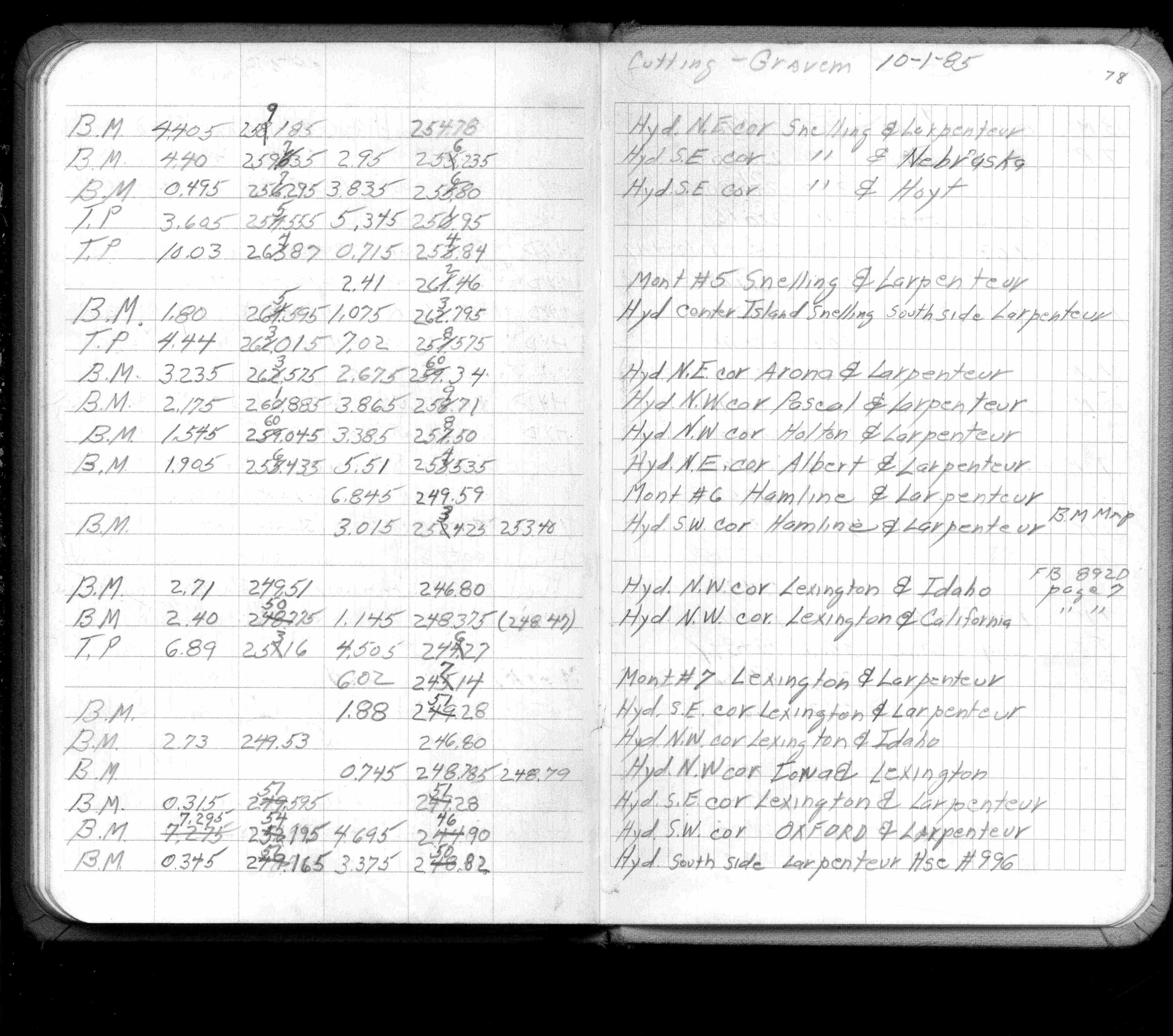
| 8/1/1985 | (Unknown date Aug __, 1985 ) Elev 247.14 ft on ?. See FB 1421A p.78 |
| 3/24/1972 | Fd hole in concerte pavement, no monument or iron pin fd. See FB 1689A p.9 |
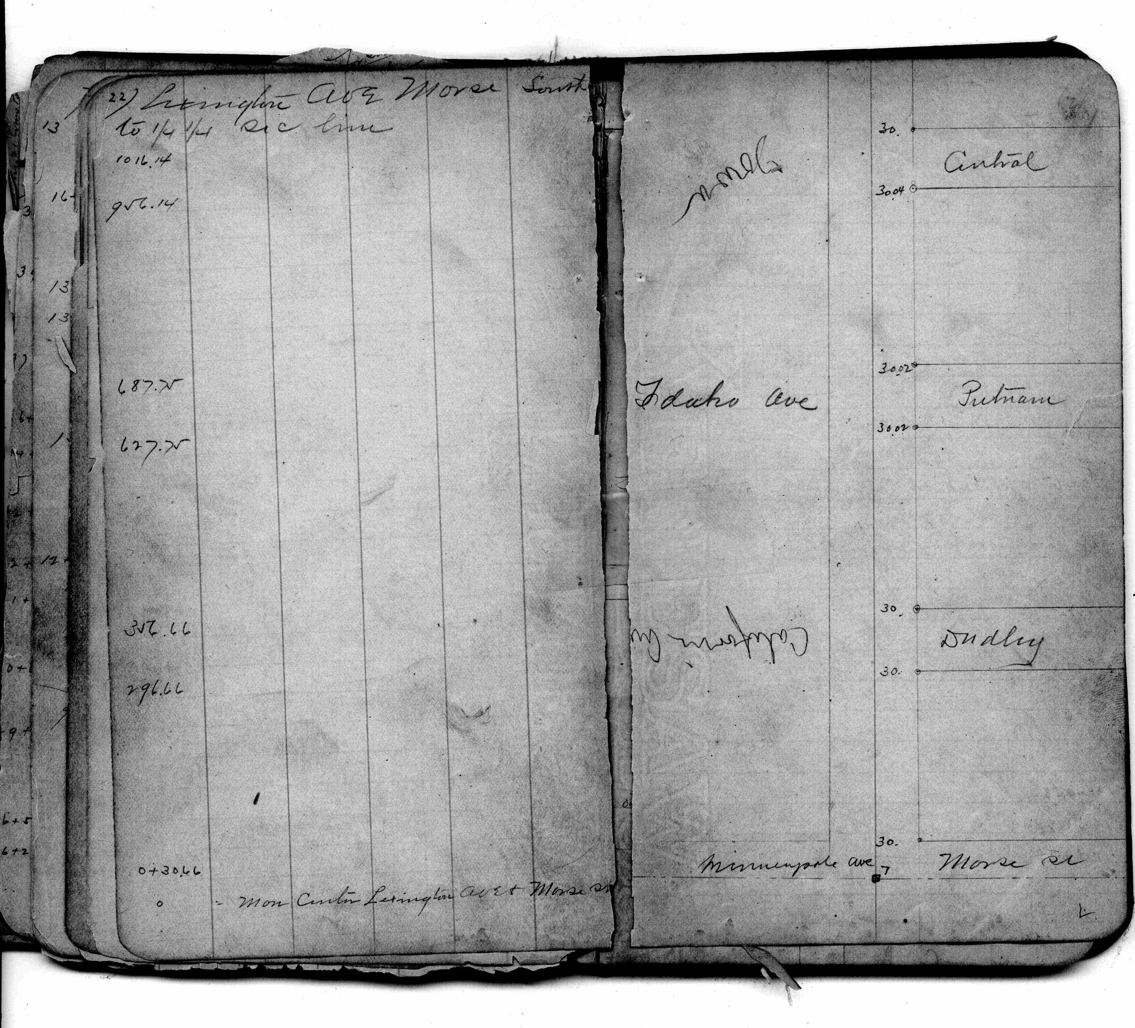
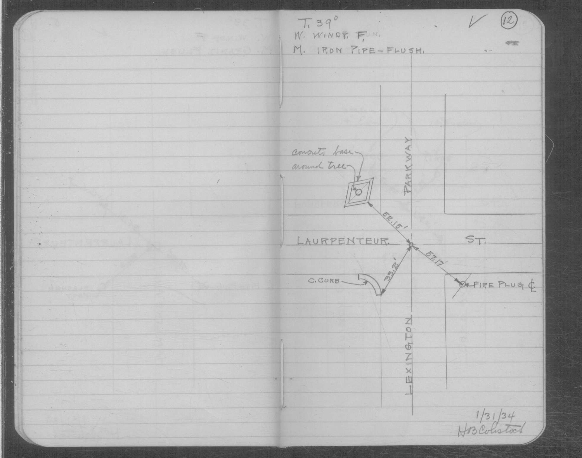
| 1/31/1934 | Placed ties on the Iron Pipe at grade. See book MSX 4 p.12 |
| 3/1/1891 | (Unknown date Mar __, 1891 ) Placed ties. See FB 345 p.35 |
| 8/1/1887 | (Unknown date Aug __, 1887 ) Monument set by J H Armstrong |
| 11/1/1847 | (Unknown date Nov __, 1847 ) Isaac N Higbee deputy surveyor set post. Tied to 2 BTs. See IH p.084-085 2923 |
| 1/1/1800 | (Unknown date ___ __, 18?? ) Elev 246.900 ft on GM. See Old Benches Book, Entry 1522 |
Above is NOT an all inclusive history of this point. Please review all the links below. Yellow Tie Books are 'ST' in the Monument category.
| PLS NOTES | Field | Cross Section | Sewer | J.B. Irvine | Monument | River Survey |
|---|---|---|---|---|---|---|
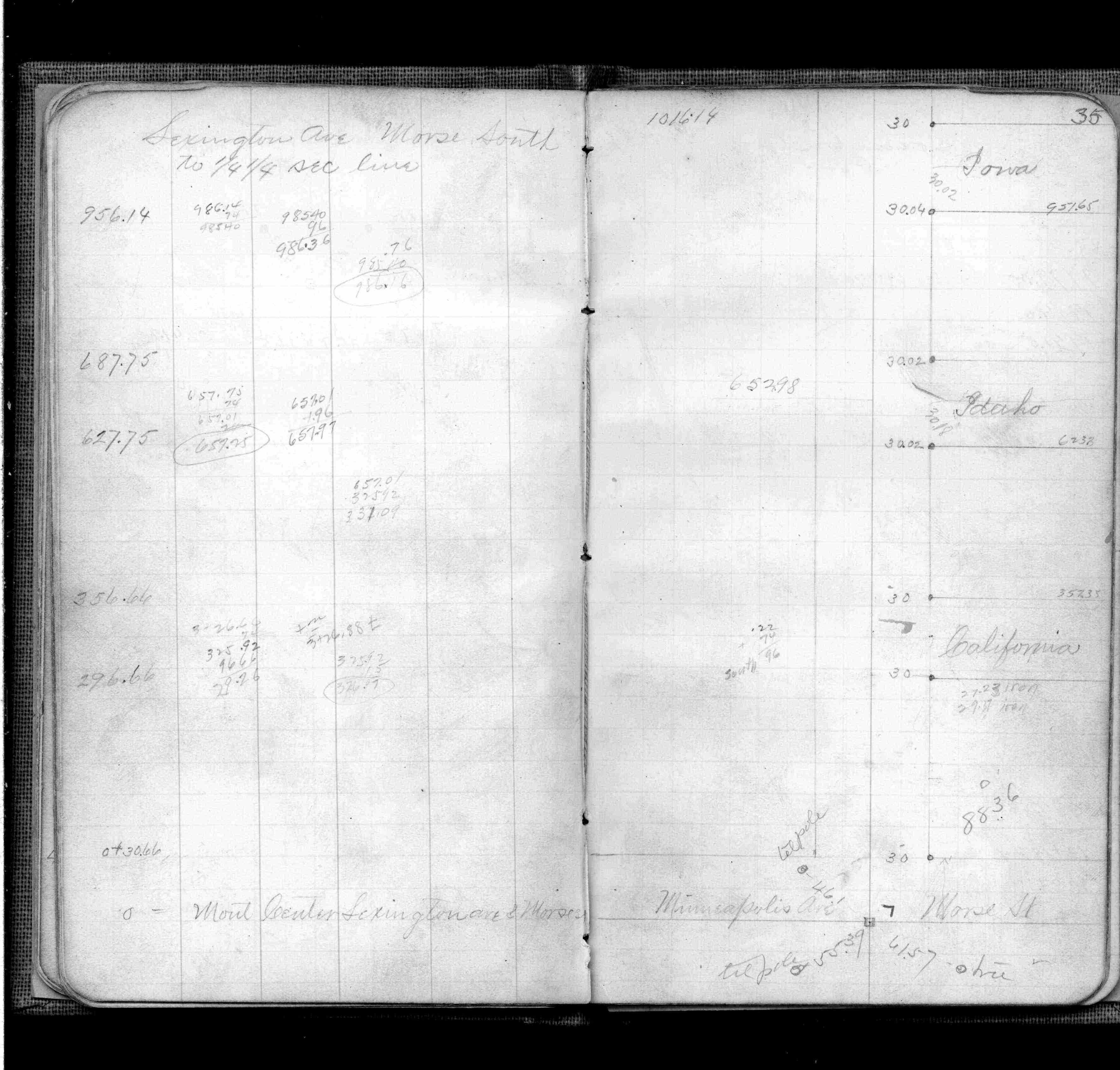
| IH p.084-085 | FB 0169p.22 | ST 001-078 p.007 | ||||
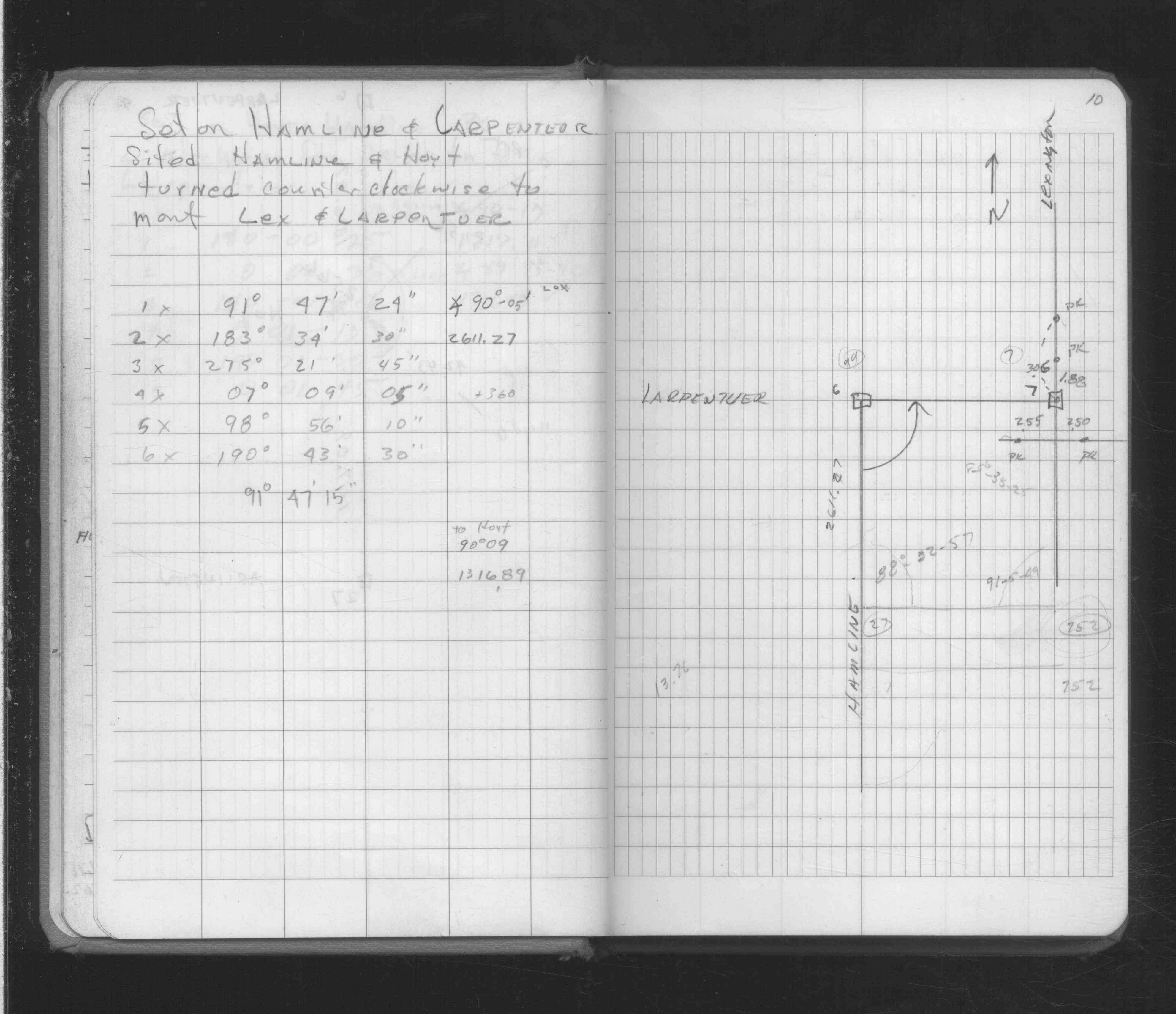
| FB 0206p. 45 ,46 | MSX 0004 p.012 | |||||
| FB 0313p. 17 ,23 | ||||||
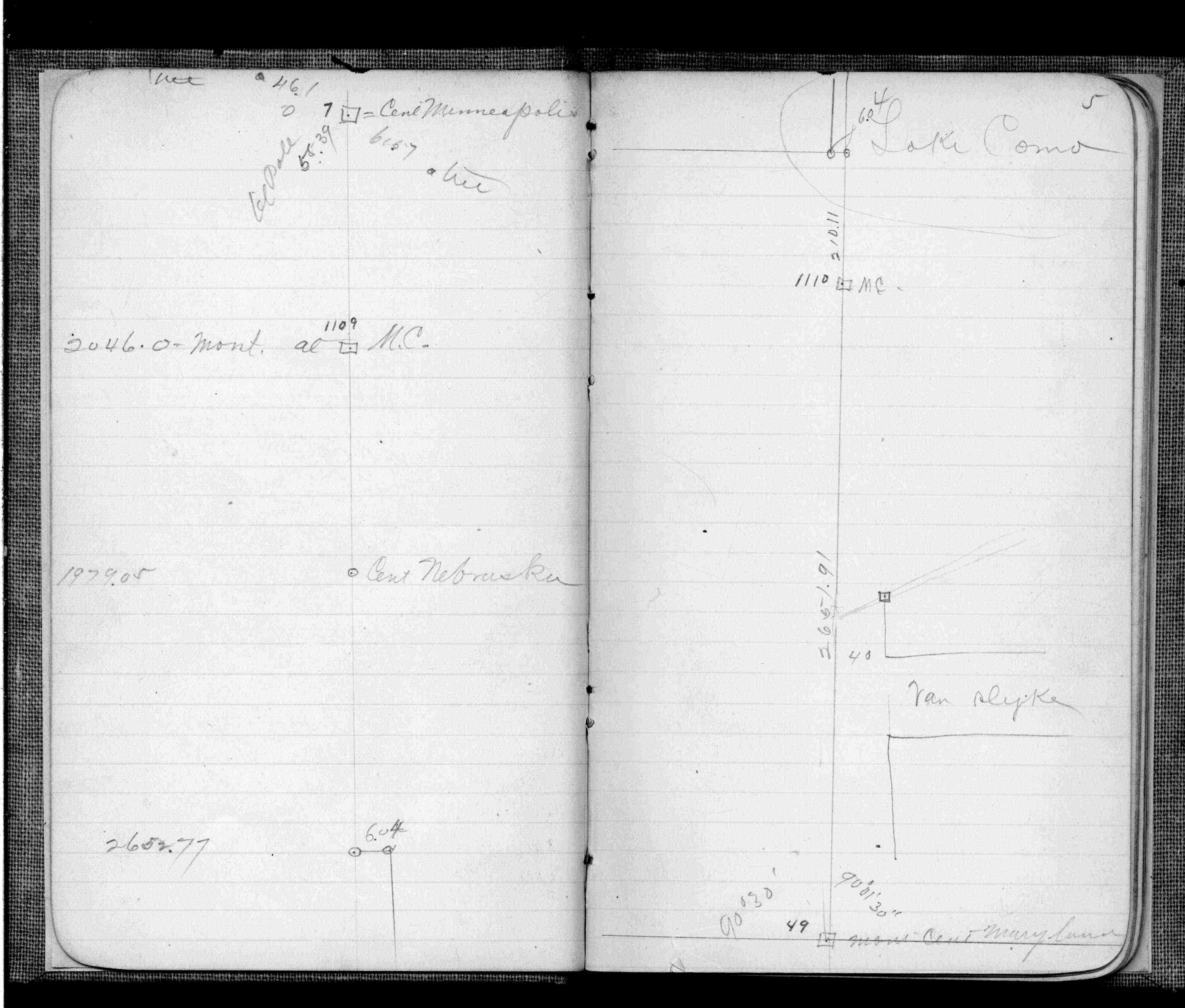
| FB 0345p. 28 ,35 | ||||||
| FB 0345p.35 | ||||||
| FB 0403p.05 | ||||||
| FB 0580p.10 | ||||||
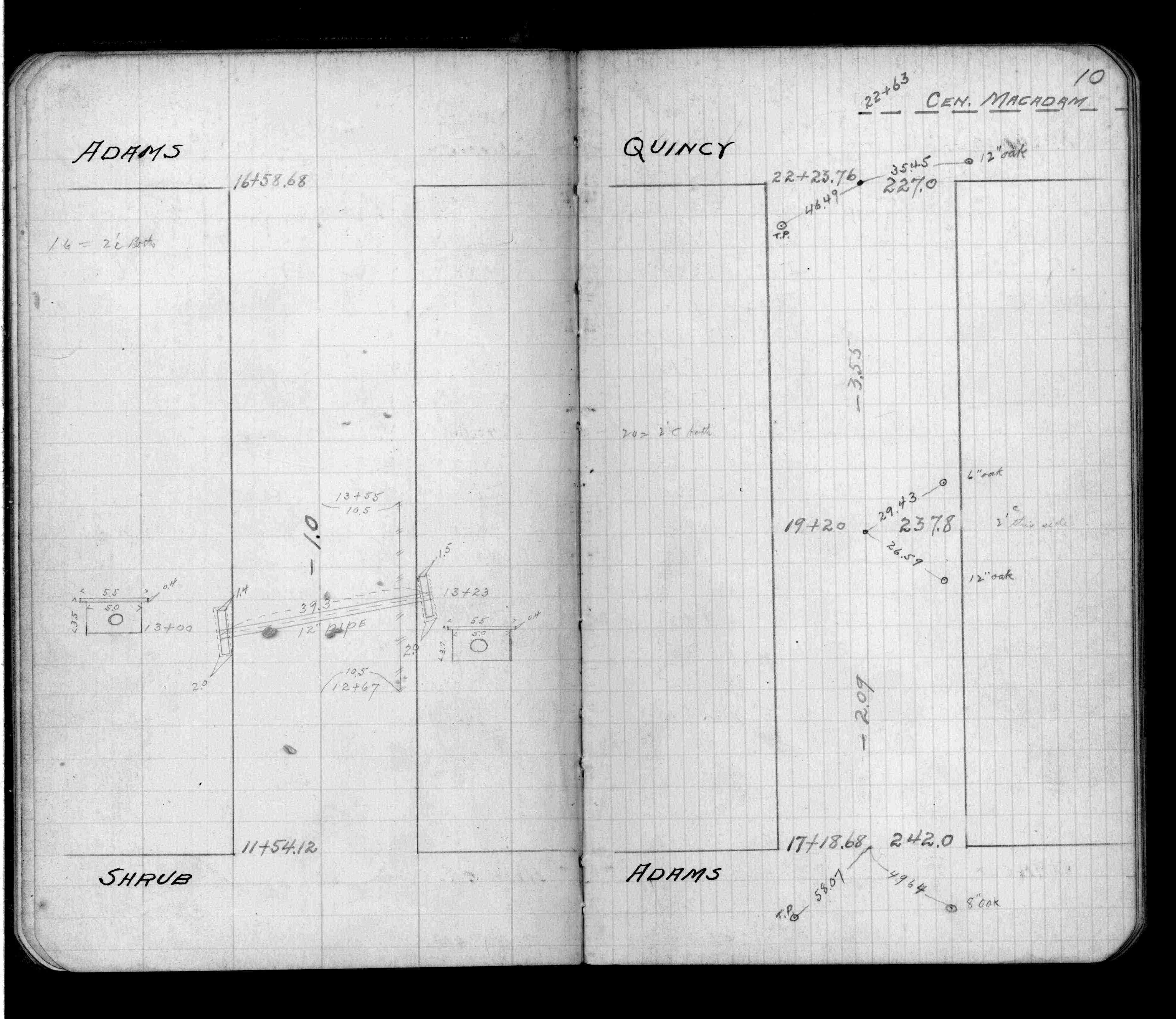
| FB 1137p.26 | ||||||
| FB 1213p.27 | ||||||
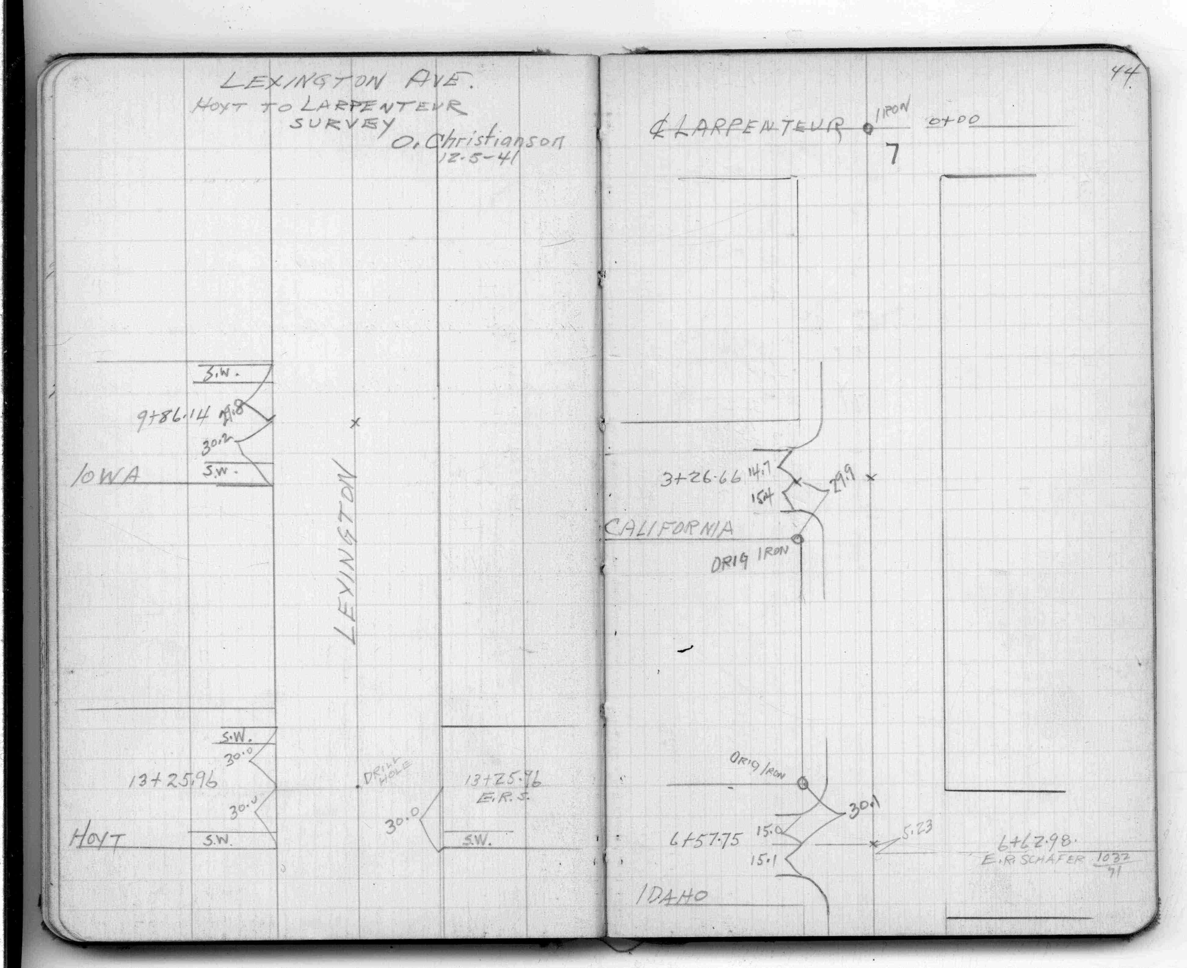
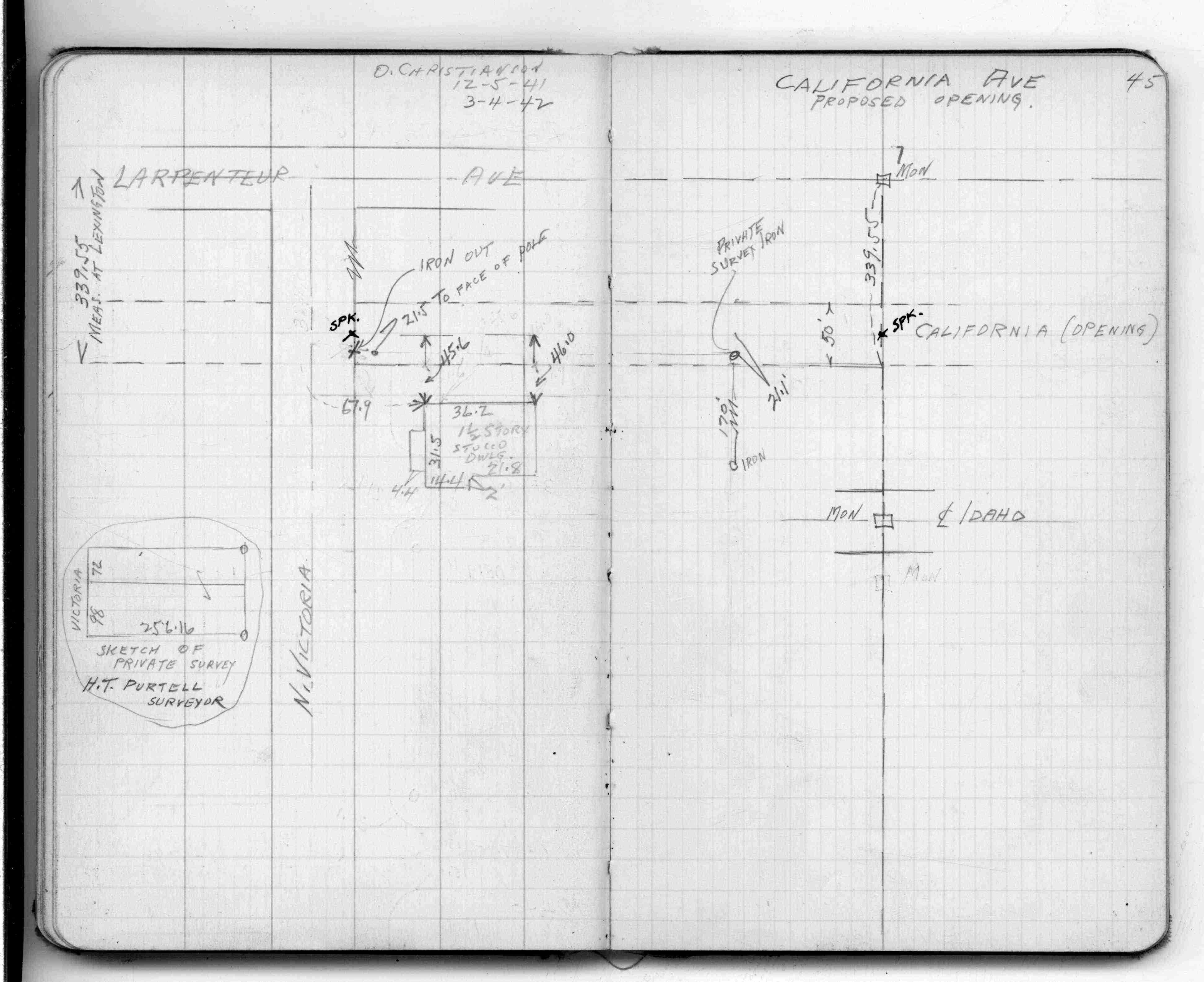
| FB 1328p. 44 ,45 | ||||||
| FB 1421Ap.78 | ||||||
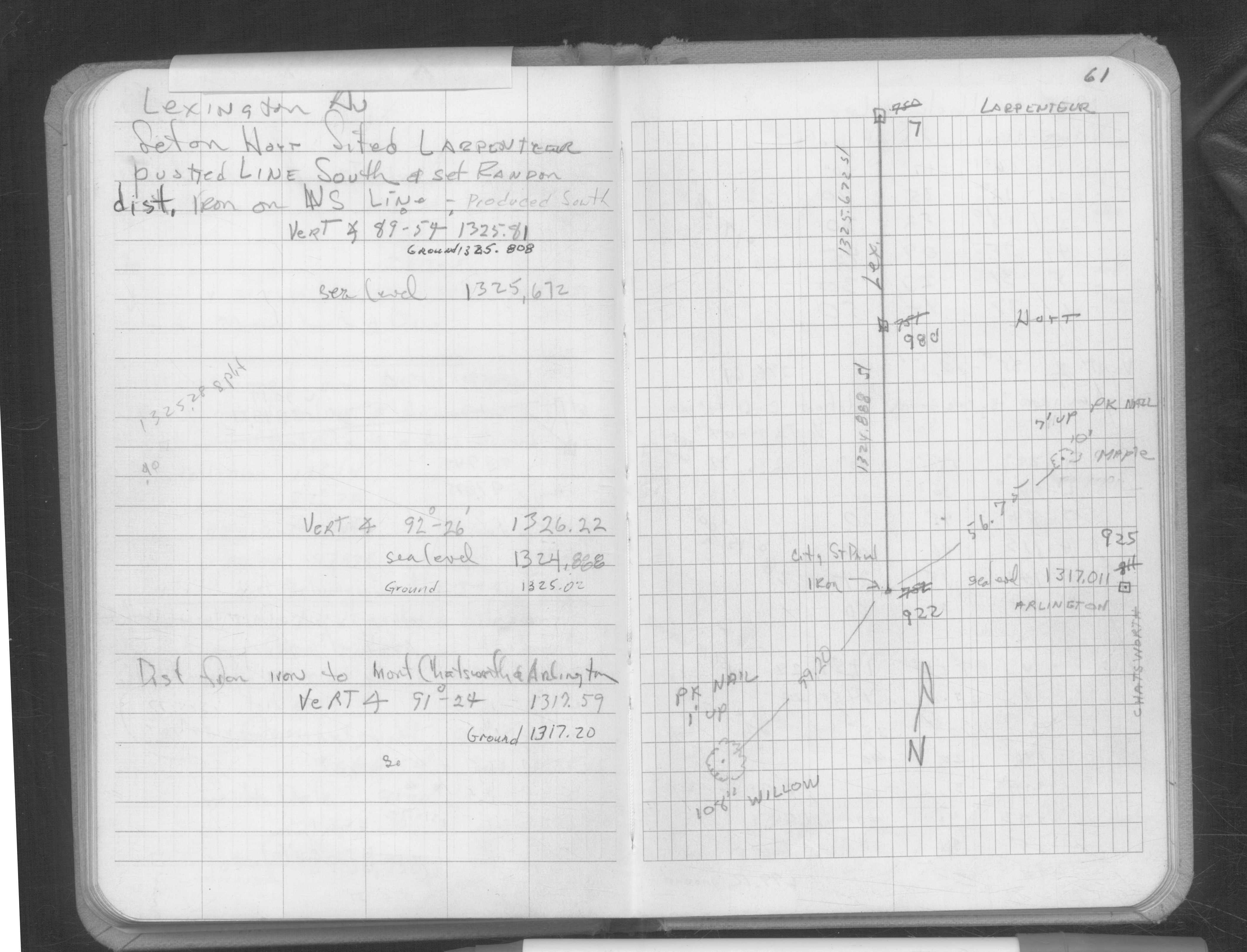
| FB 1649p.61 | ||||||
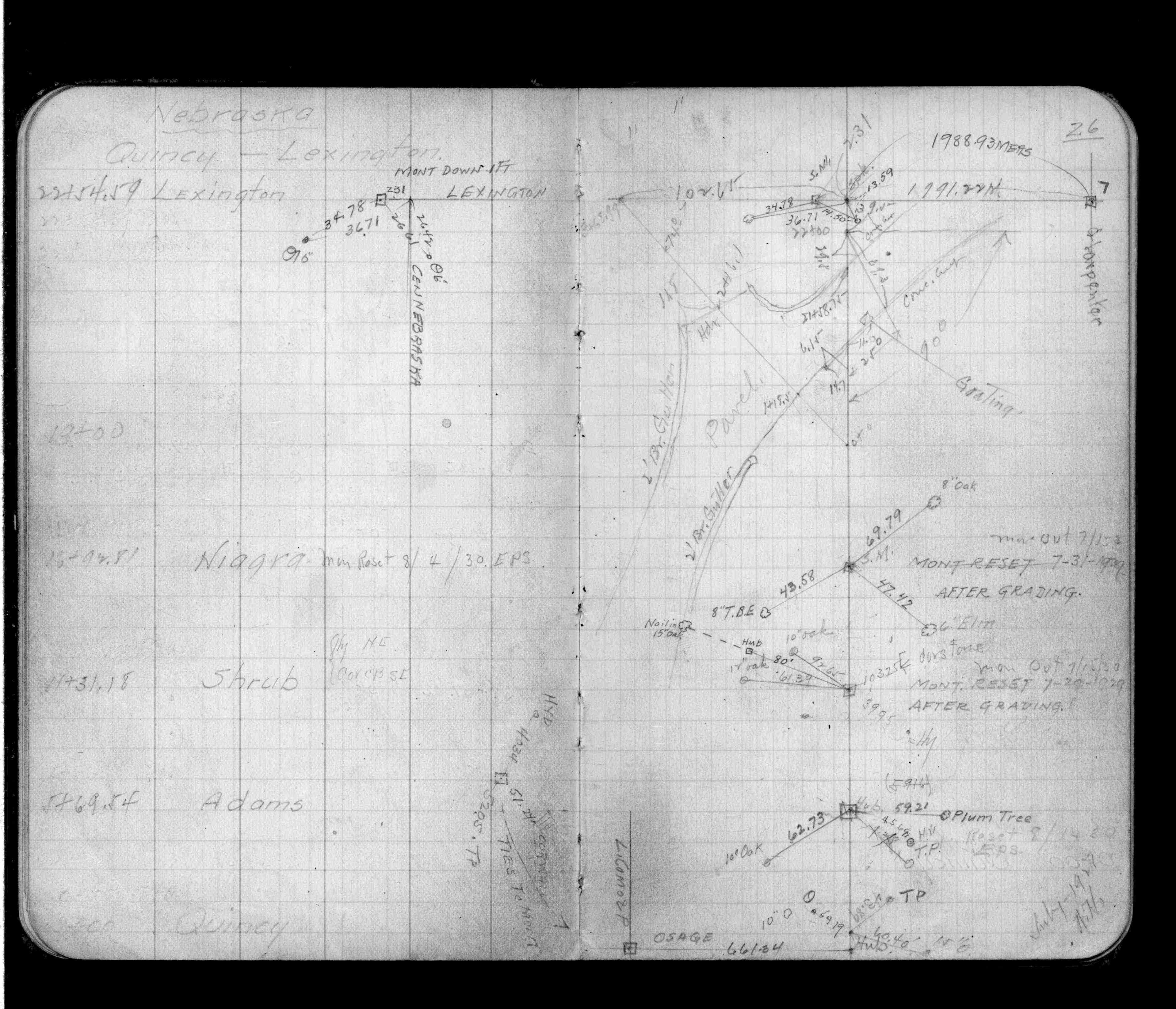
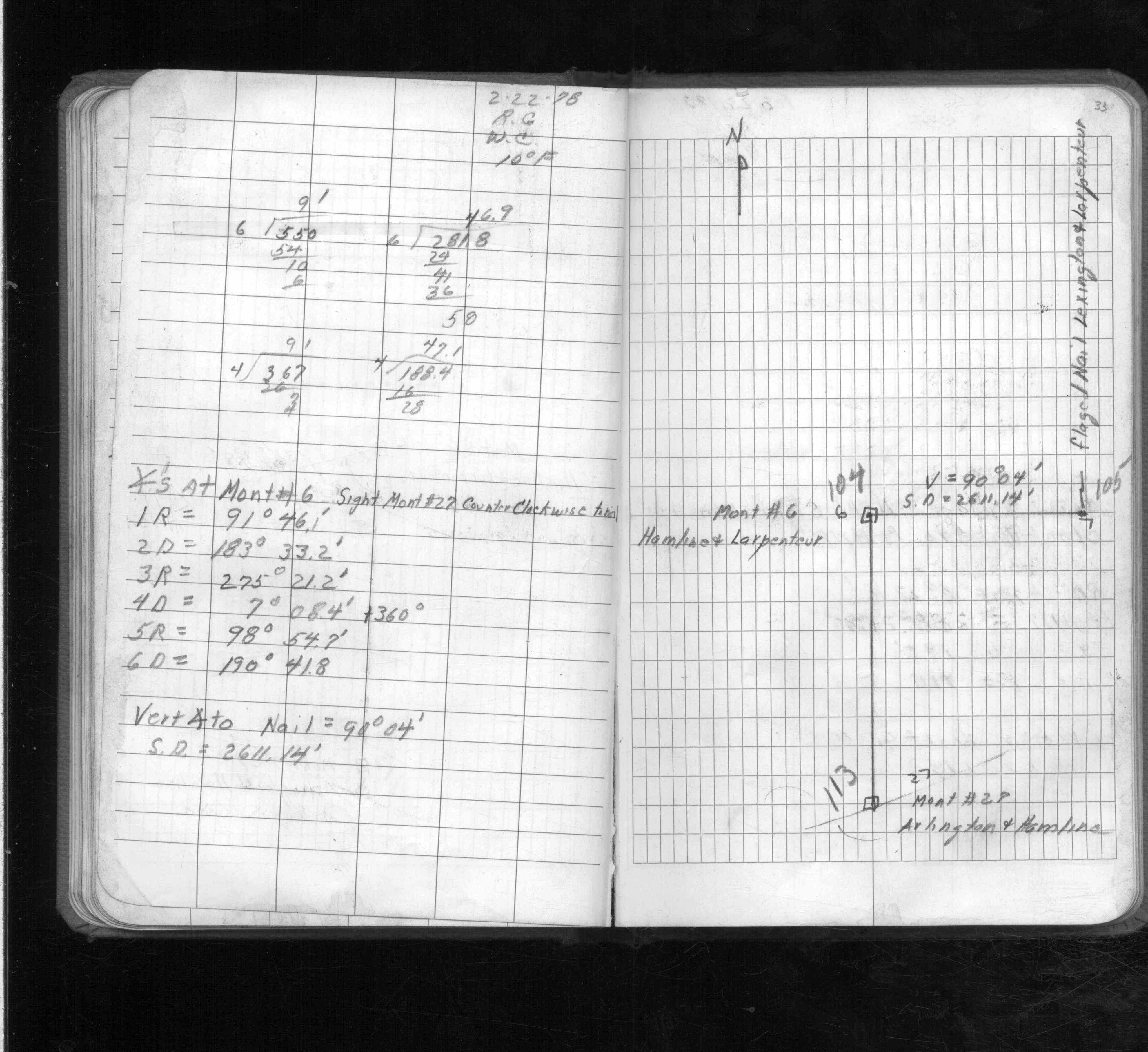
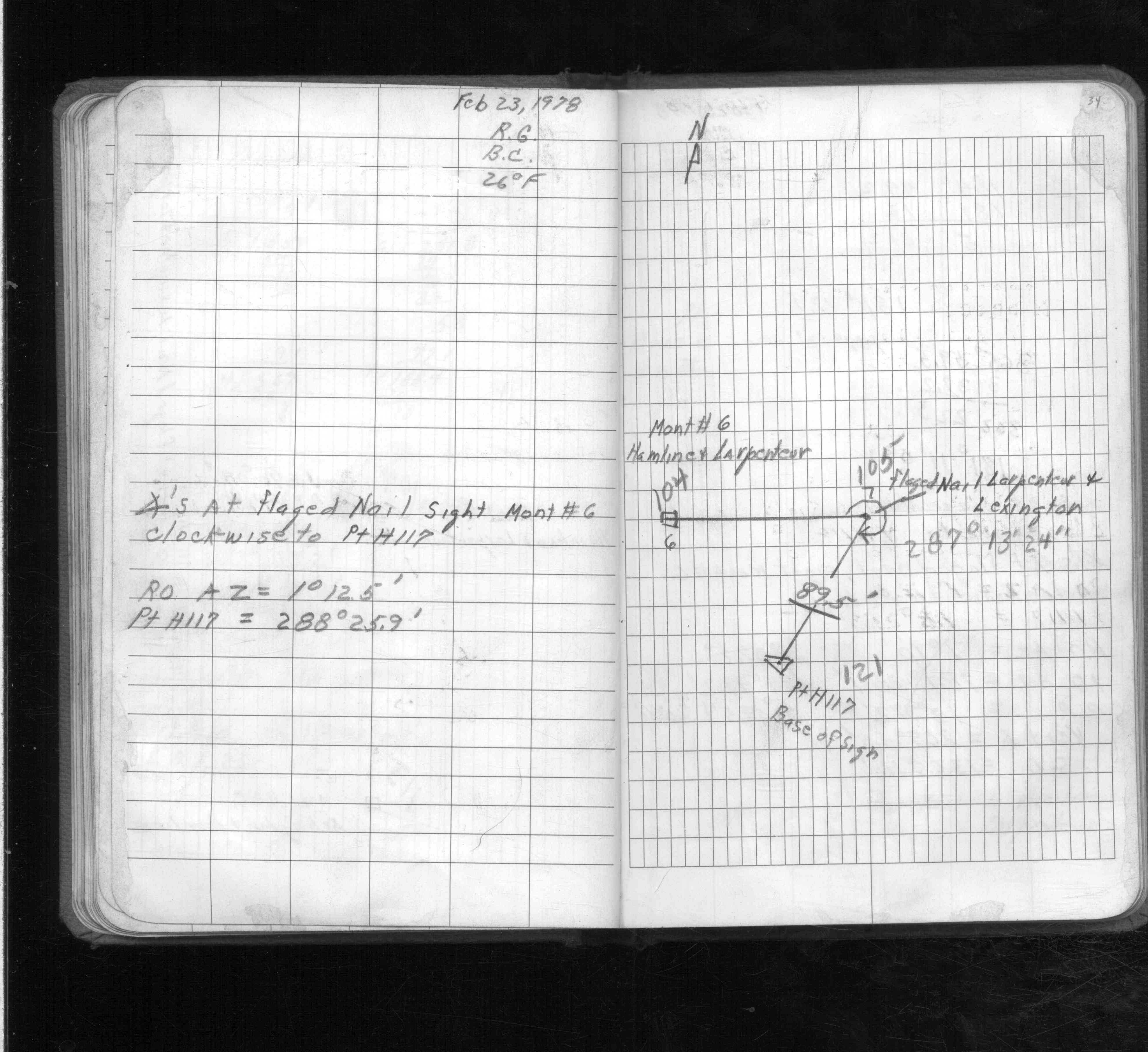
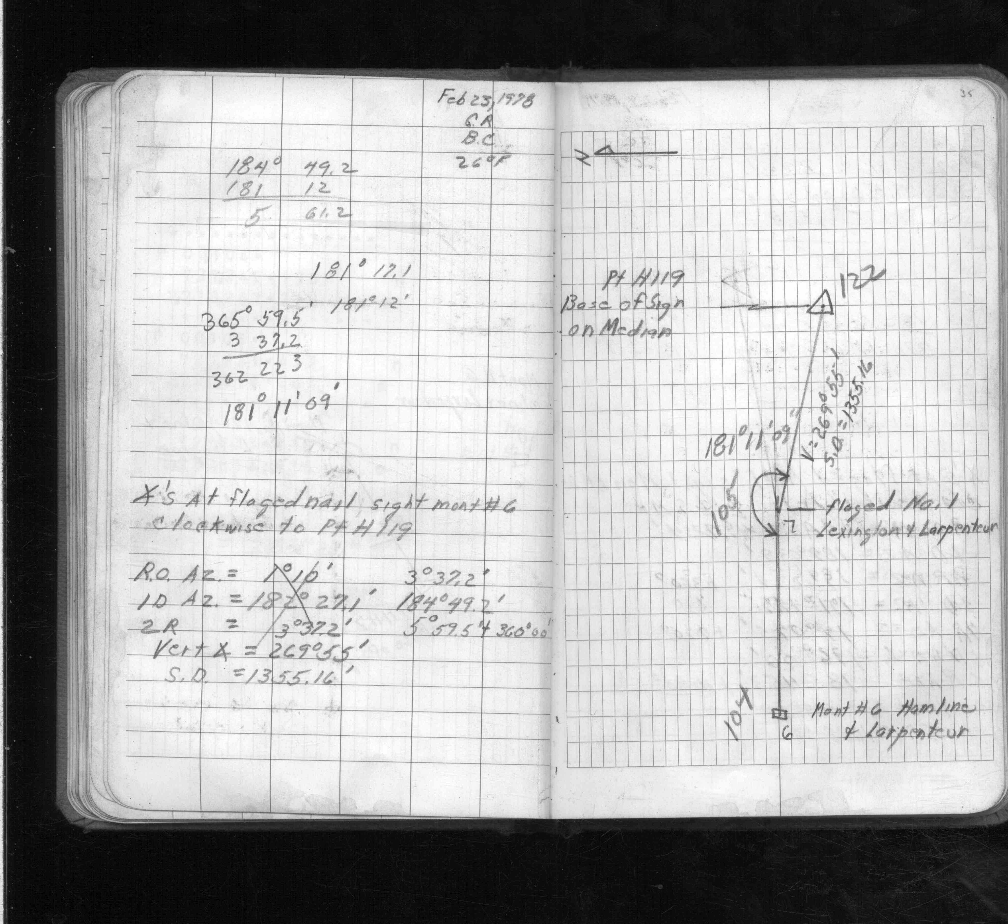
| FB 1671p. 33 ,34 ,35 ,36 ,37 | ||||||
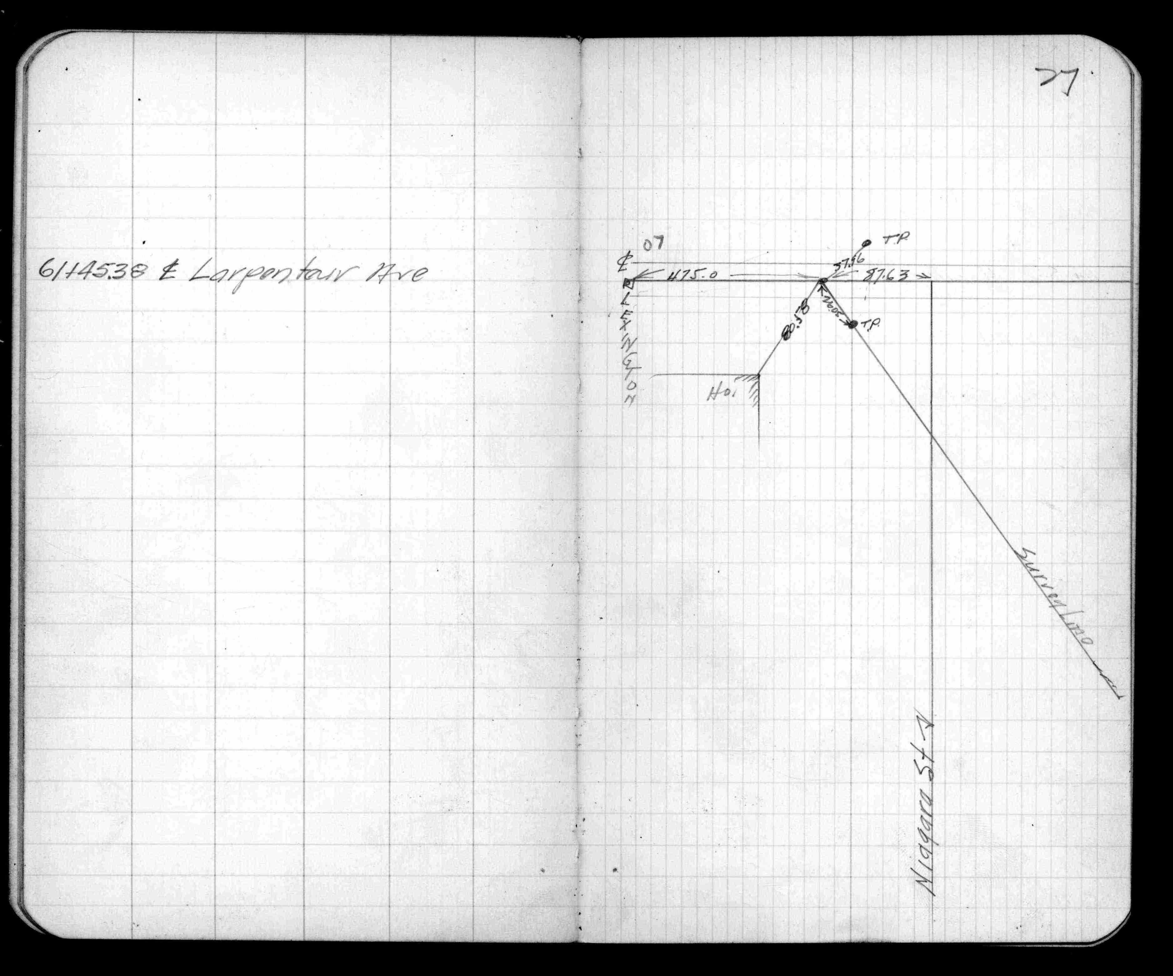
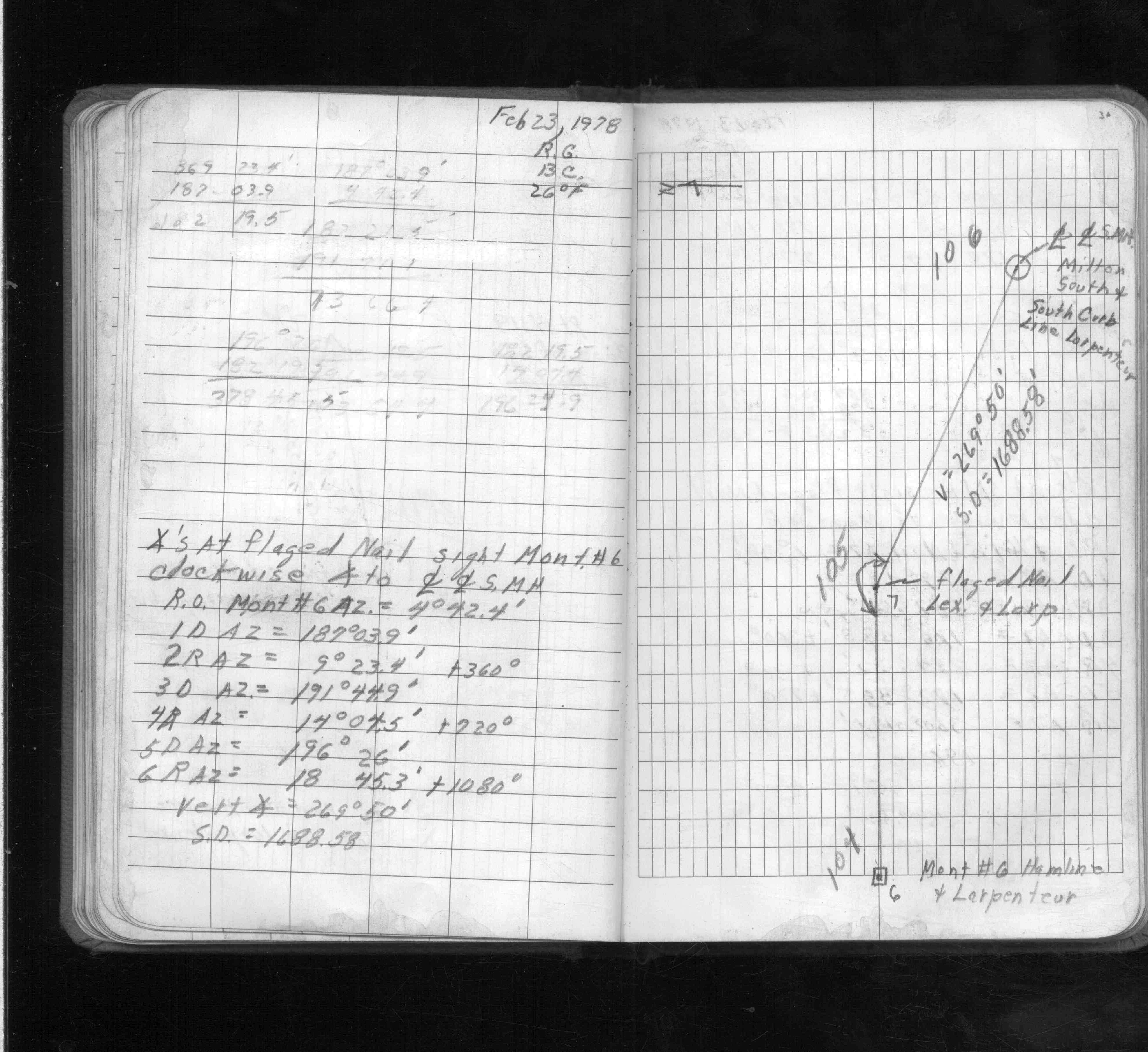
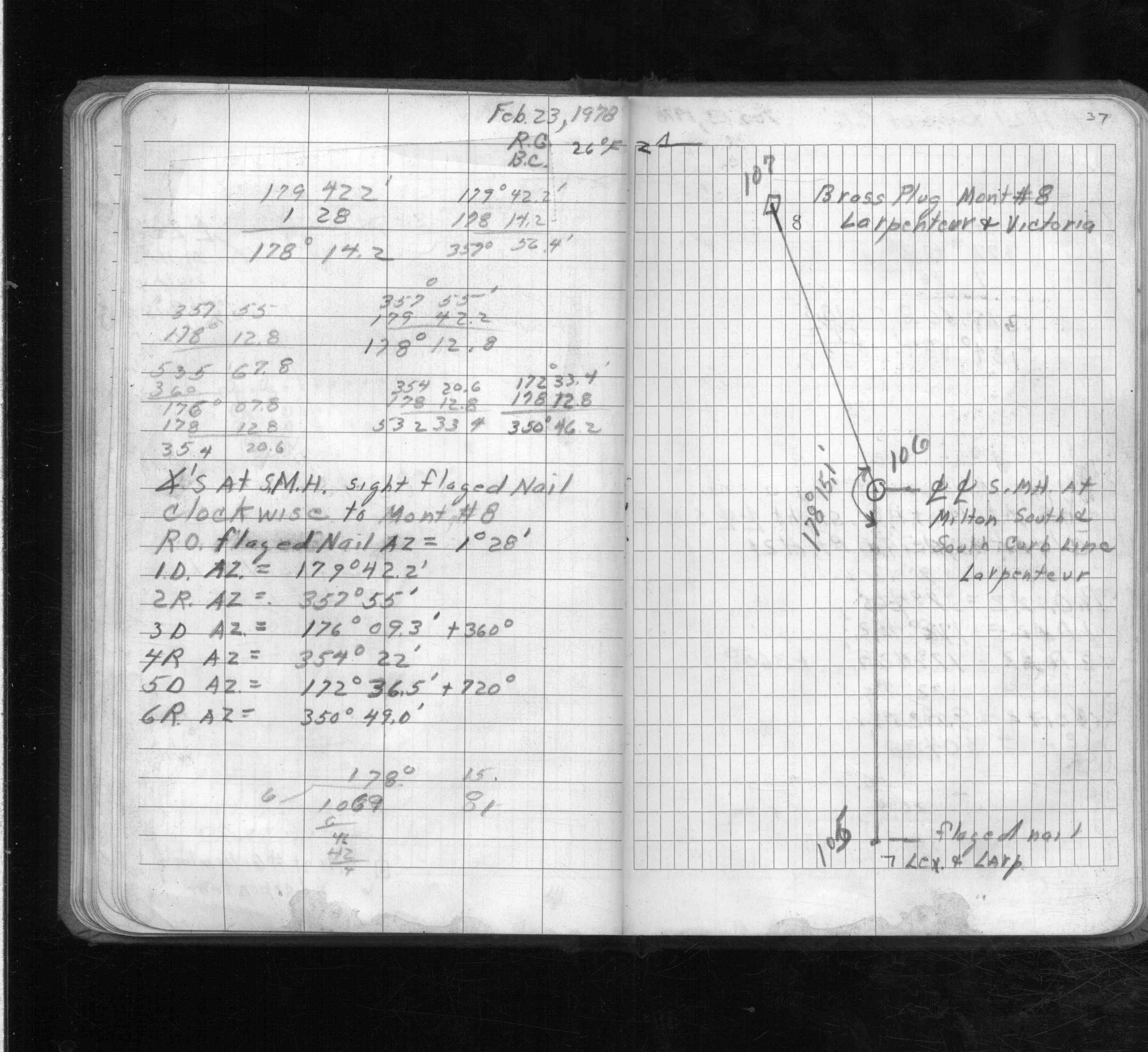
| FB 1689Ap.09 | ||||||
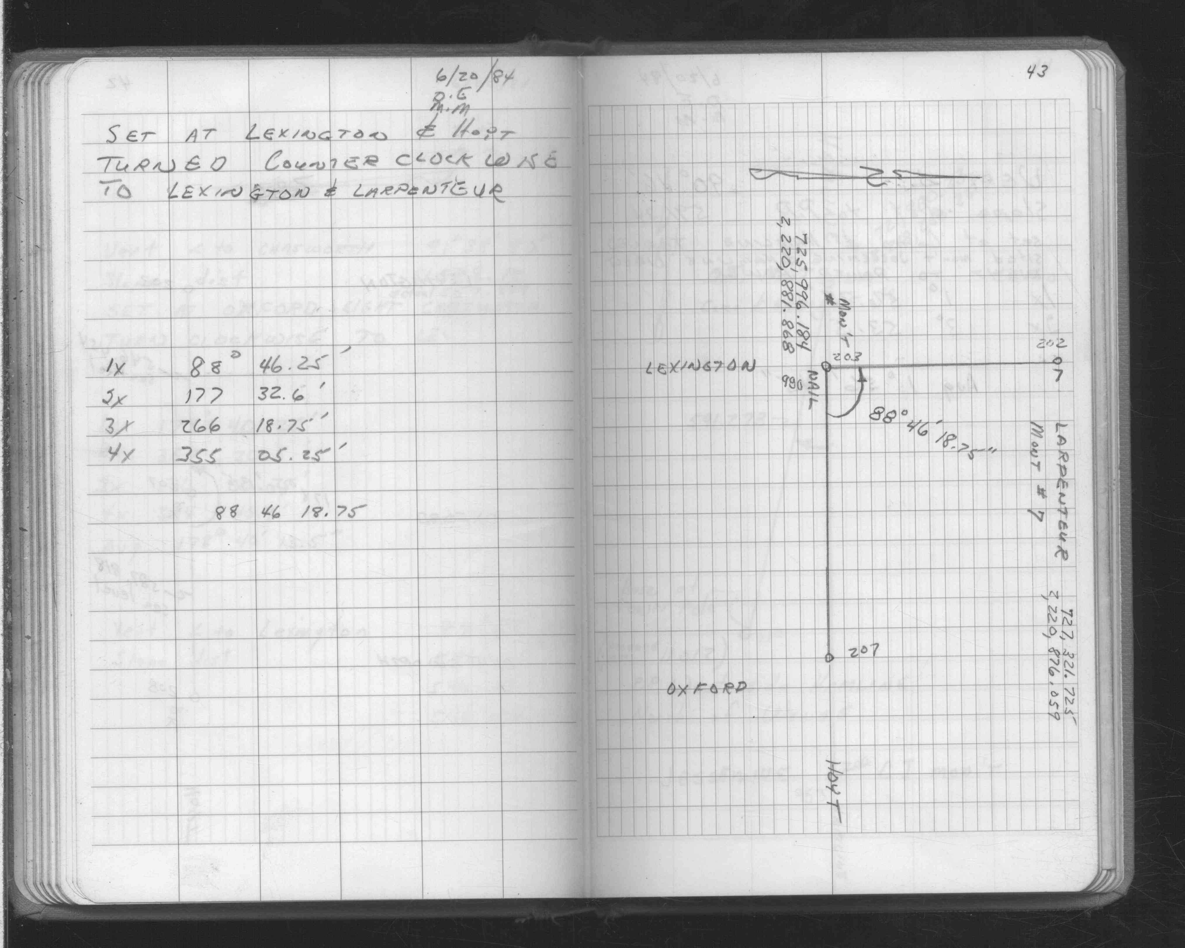
| FB 1690p. 10 ,43 | ||||||
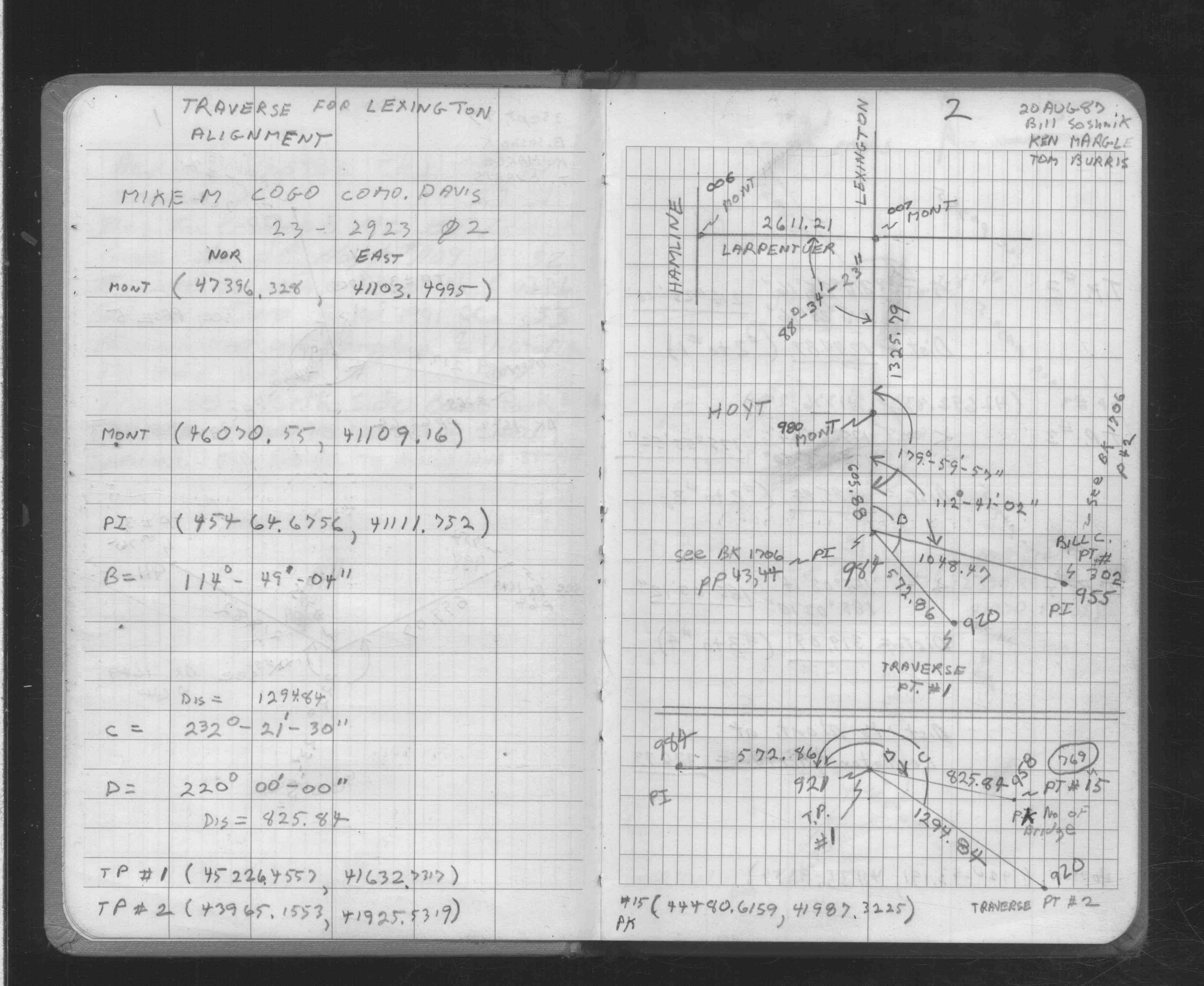
| FB 1706Ap. 02 ,13 | ||||||
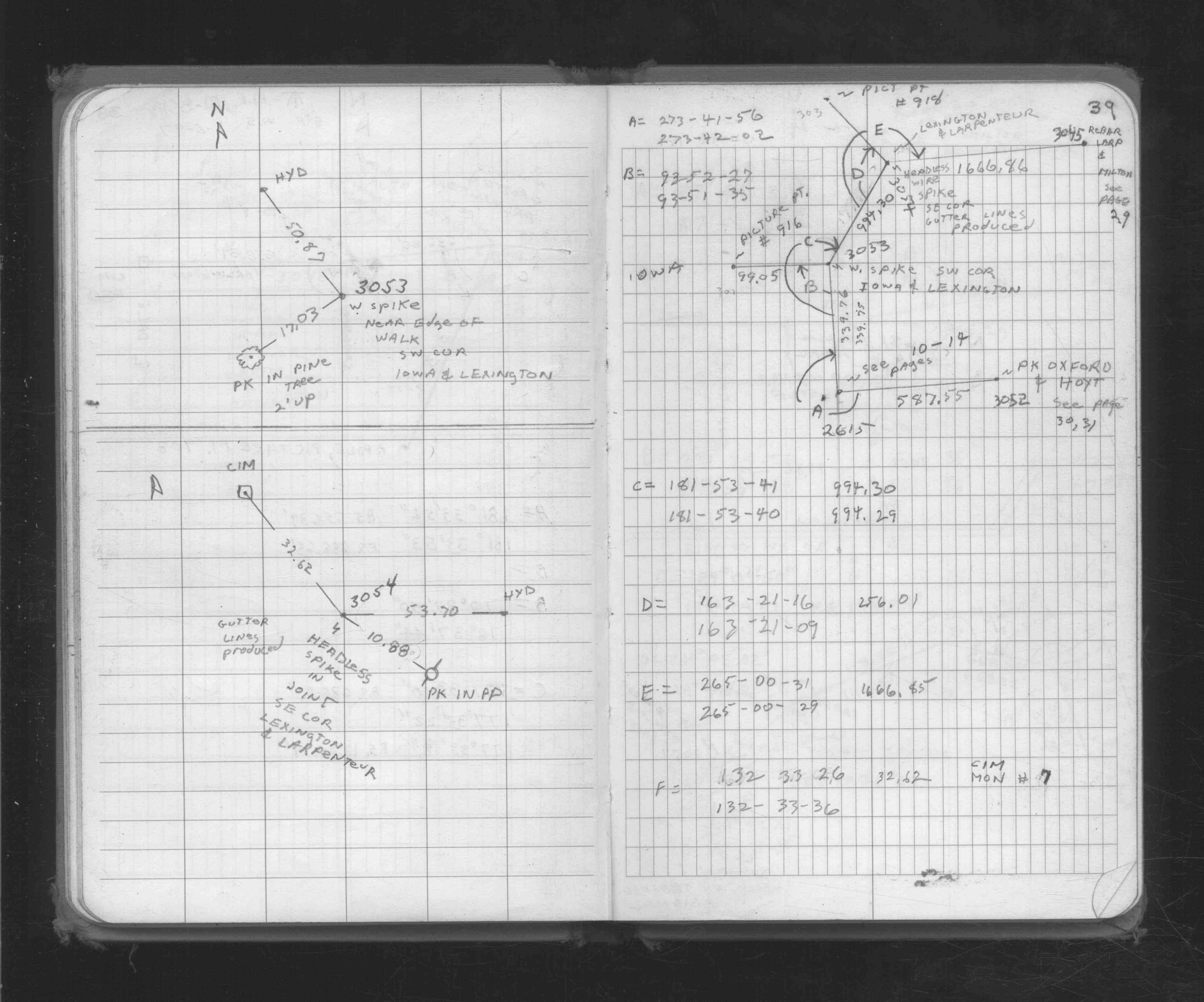
| FB 1727p.39 | ||||||
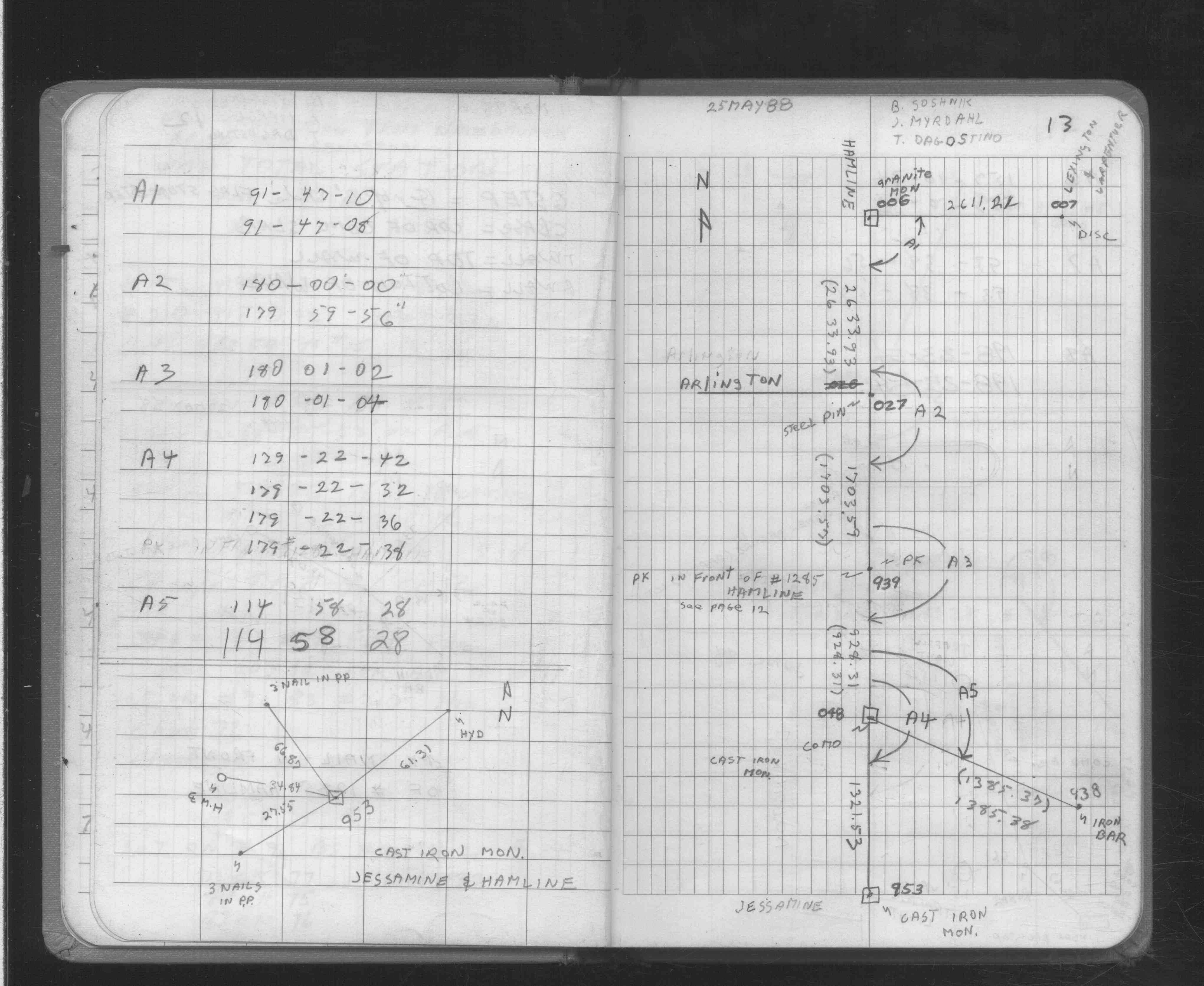
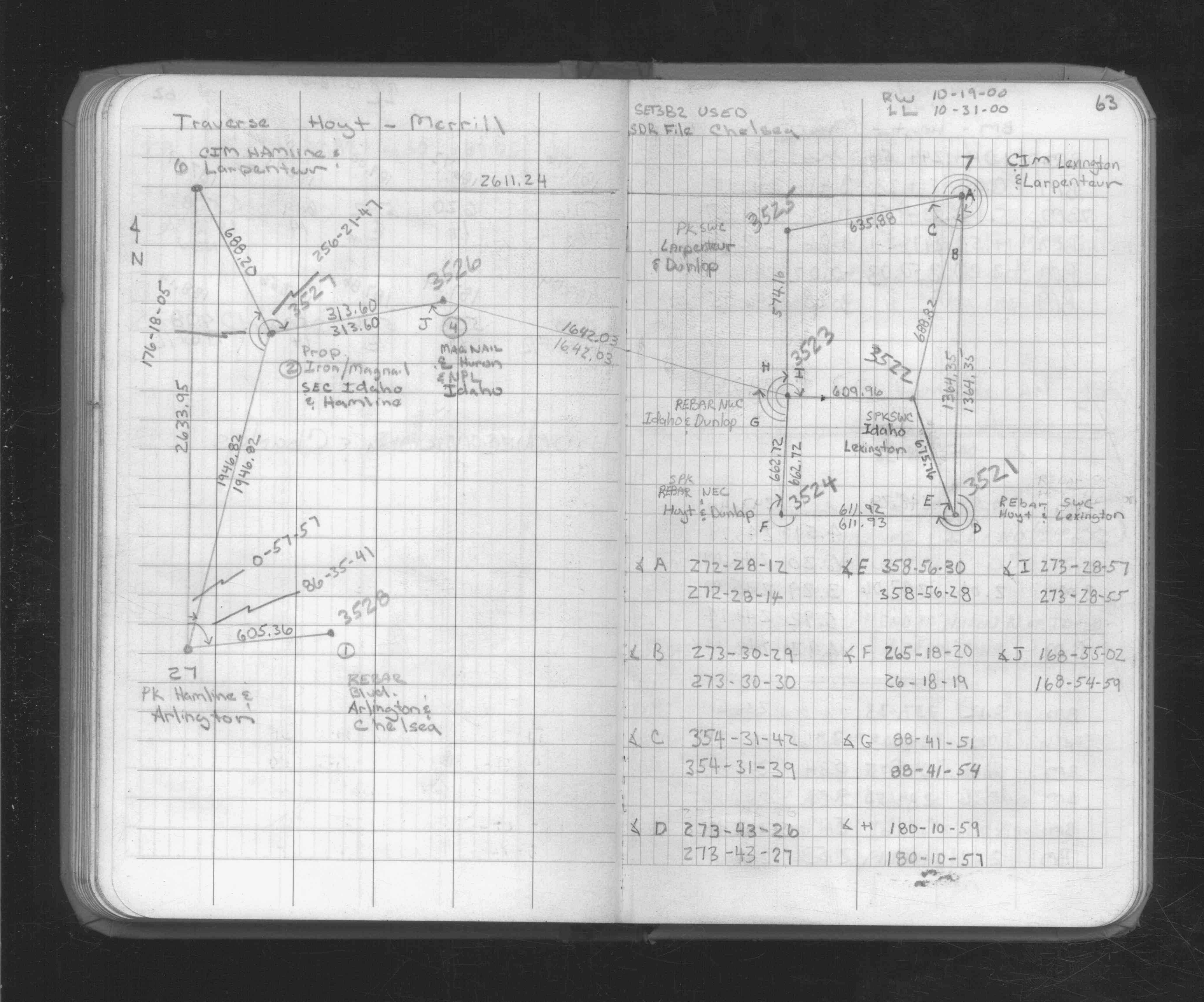
| FB 1734Ap.63 | ||||||
| FB 1736p.07 |
| FILE | SURVEYOR | LIC. NO. | DATE SIGNED | DATE TIED |
|---|---|---|---|---|
| 0007-1044-A.pdf | Samuel D. Gibson | 44880 | February 3, 2010 | December 3, 2009 |
| 0007-1044-B.tif | none | none | none | March 25, 1991 |
| 0007-1044-A.tif | William J. Cutting | 20576 | August 5, 1991 | November 15, 1989 |
| ST_001-078p007.jpg | none | none | none | none |
| 0007-1044-A.dwf | none | none | none | none |
| FILE | PHOTO DATE | COMMENTS |
|---|---|---|
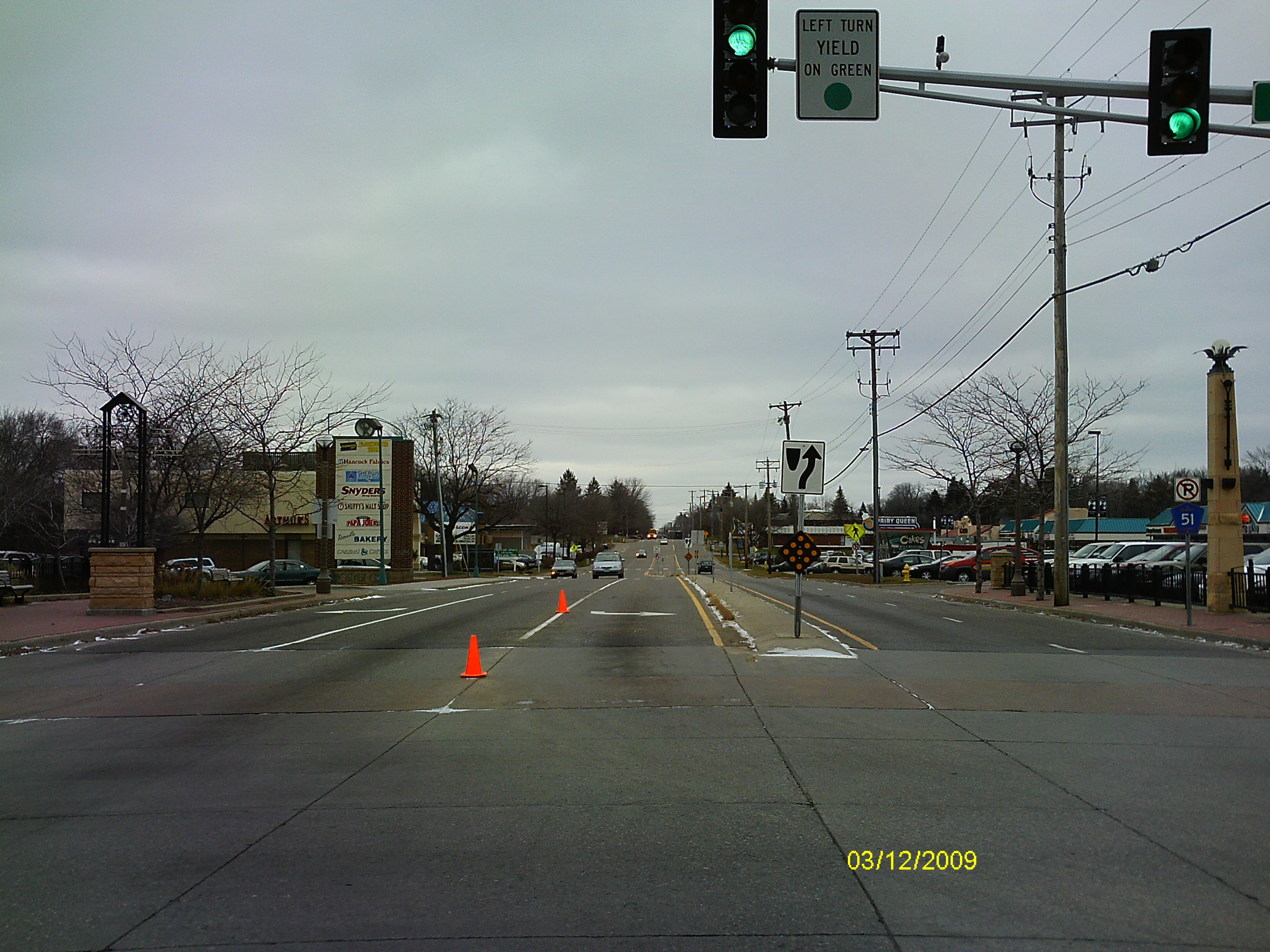
| 0007-1044-6.jpg | December 3, 2009 | Looking West along the center of Larpentuer Ave. |
| 0007-1044-5.jpg | December 3, 2009 | Looking South along the Center of Lexington Ave. |
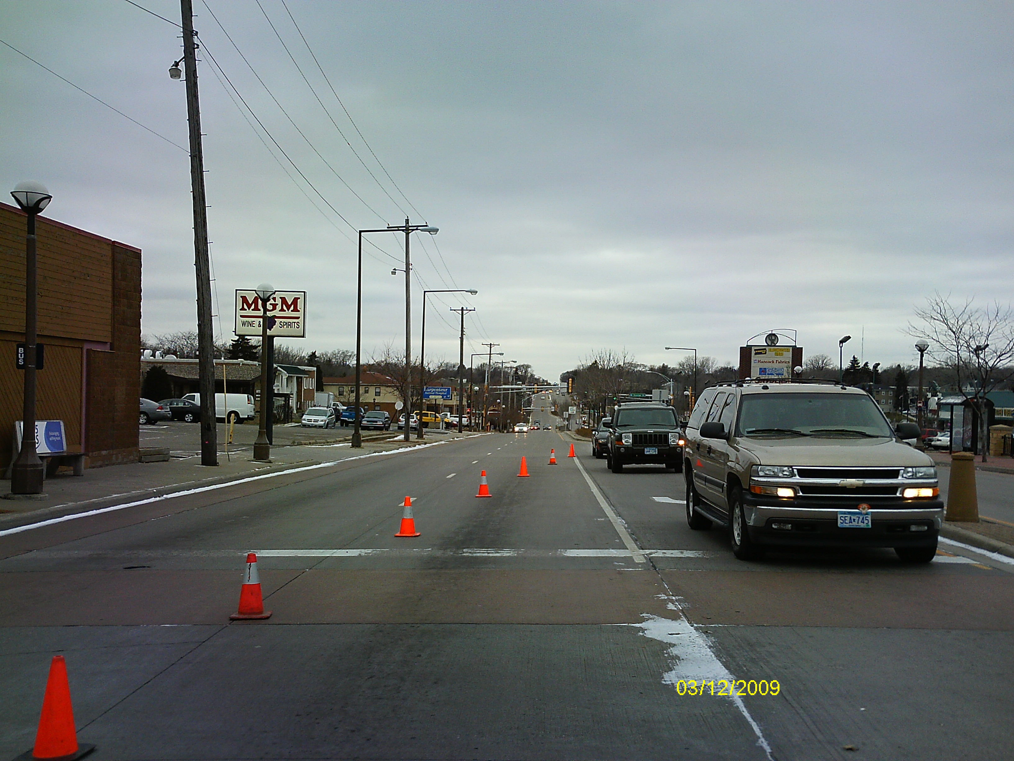
| 0007-1044-4.jpg | December 3, 2009 | Looking East along the center of Larpentuer Ave. |
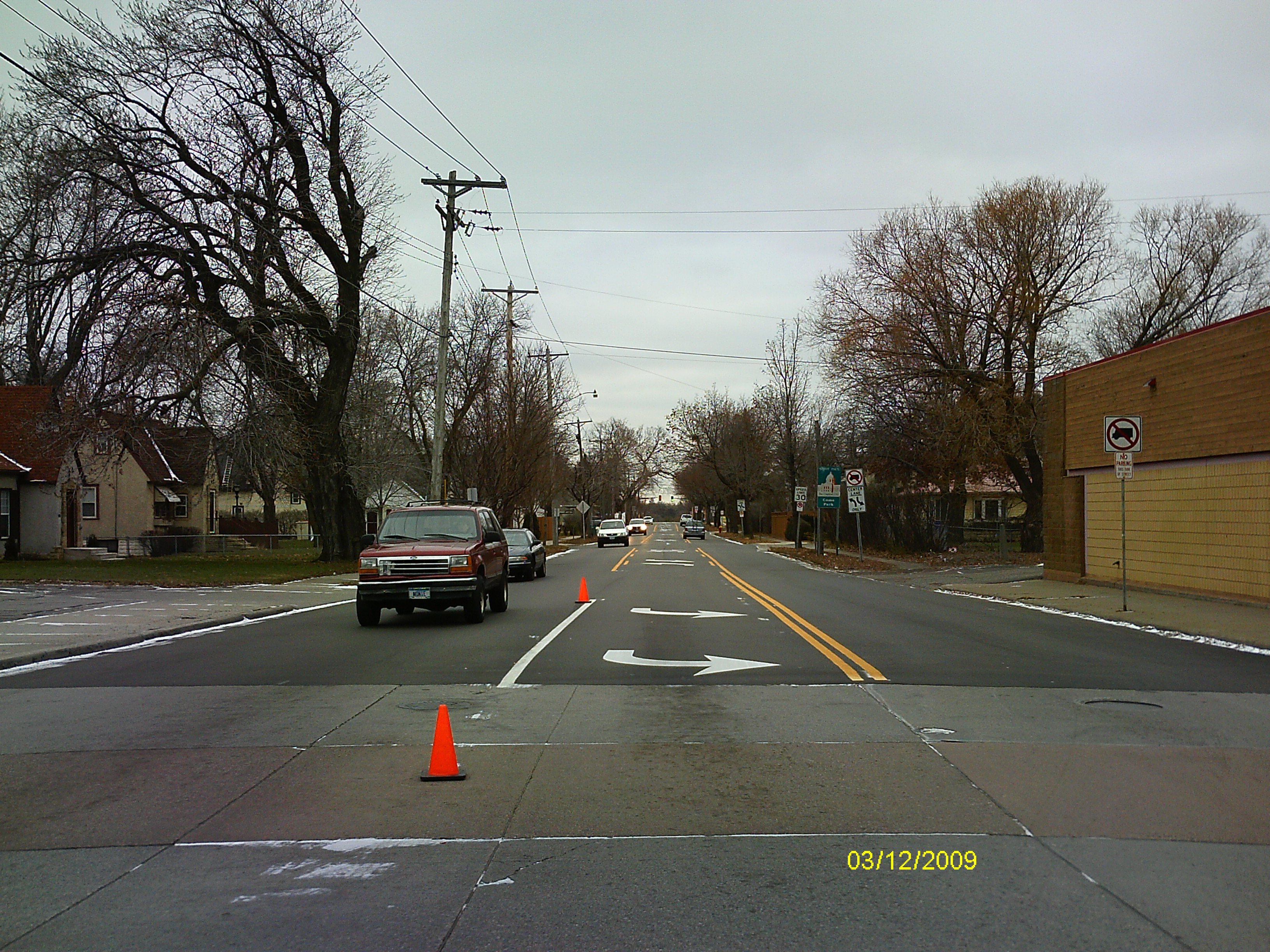
| 0007-1044-3.jpg | December 3, 2009 | Looking North along the Center of Lexington Ave. |
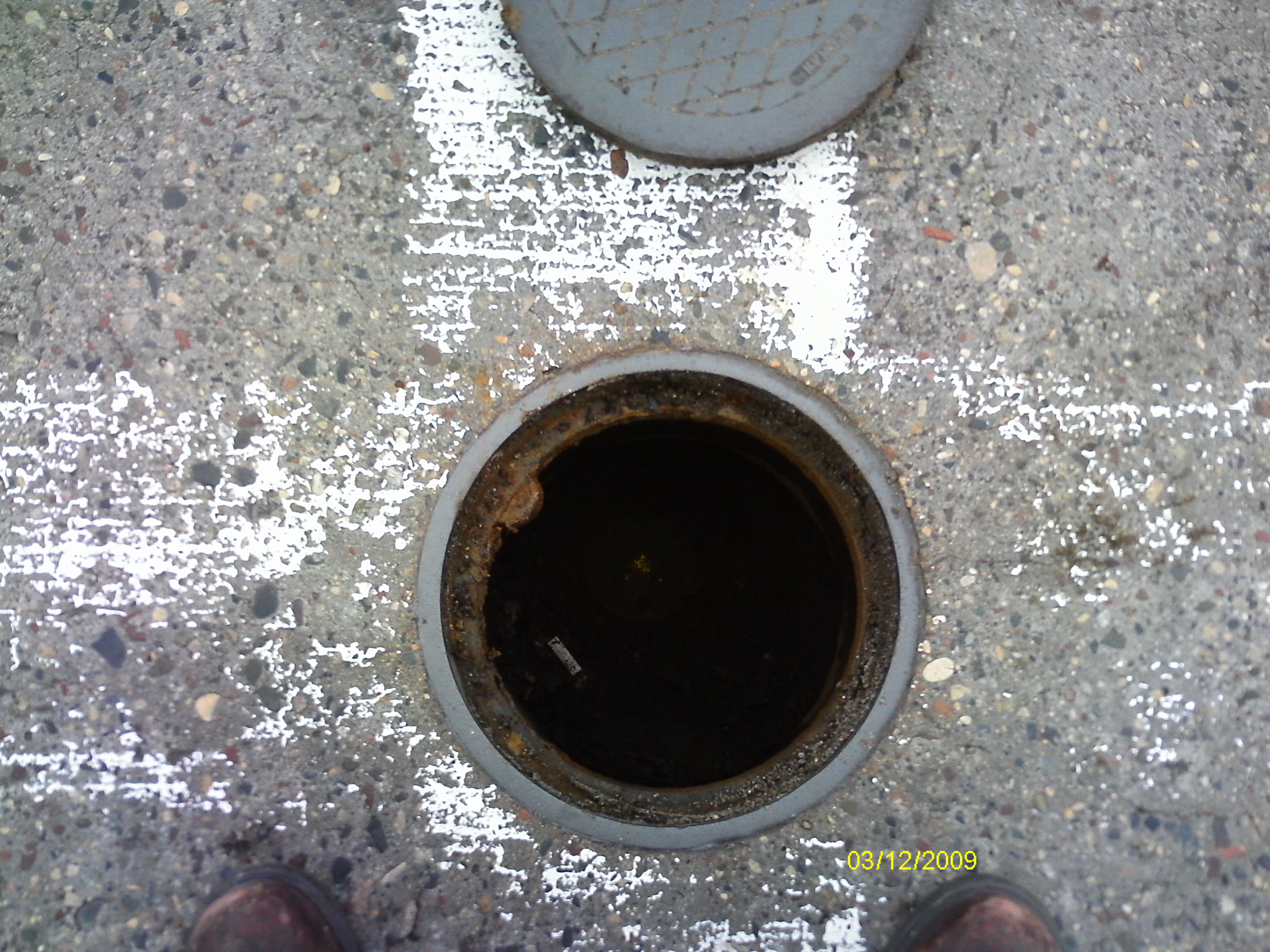
| 0007-1044-2.jpg | December 3, 2009 | Close-up of the casting opening over the CIM. |
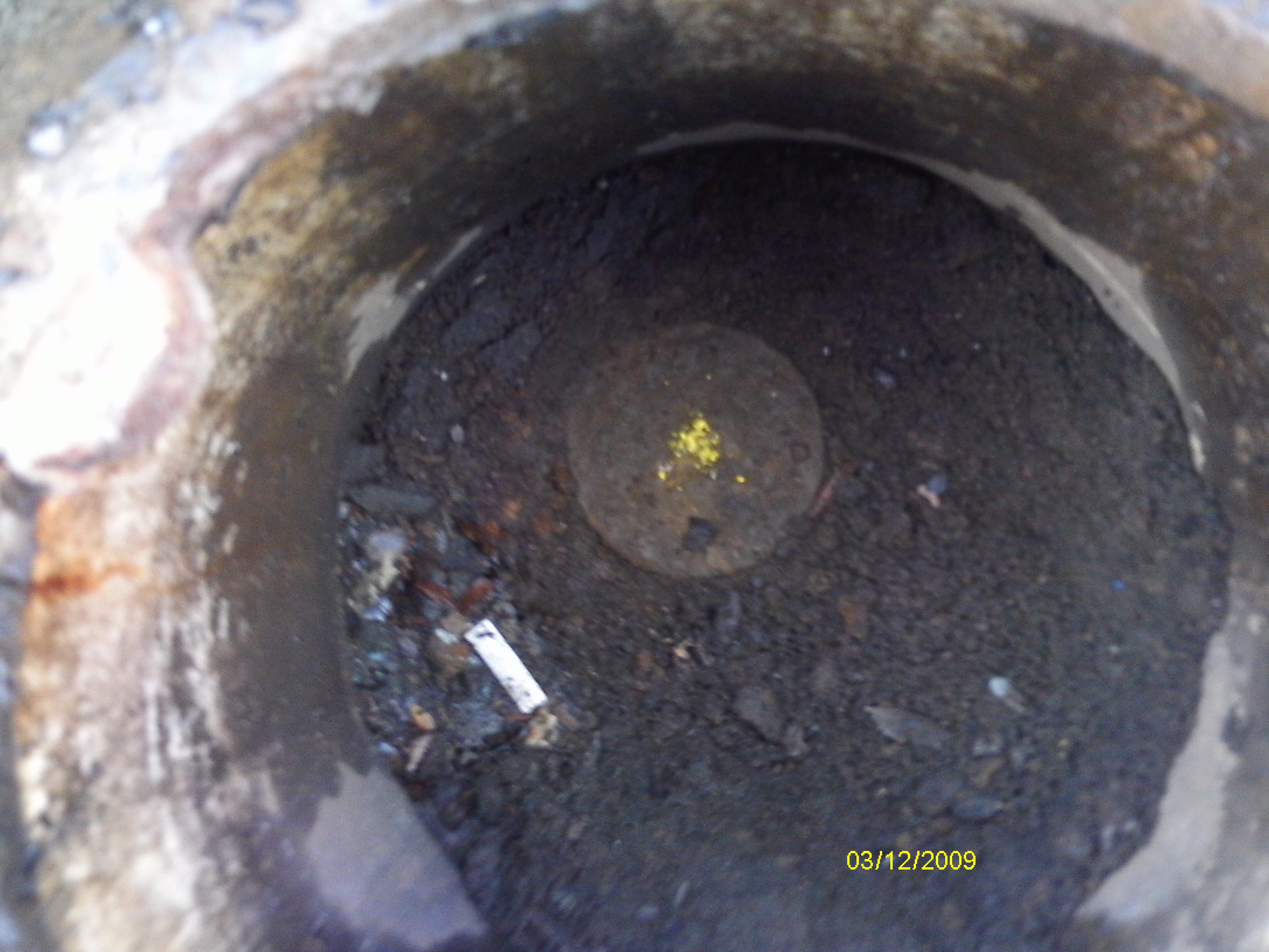
| 0007-1044-1.jpg | December 3, 2009 | Close-up of the CIM. |