| NAD83 COORDINATES (1986 adj.): |
|---|
| * X= 566554.26 Y= 173277.37 Z= 0 LSQ 10/18/1991 M FIX |
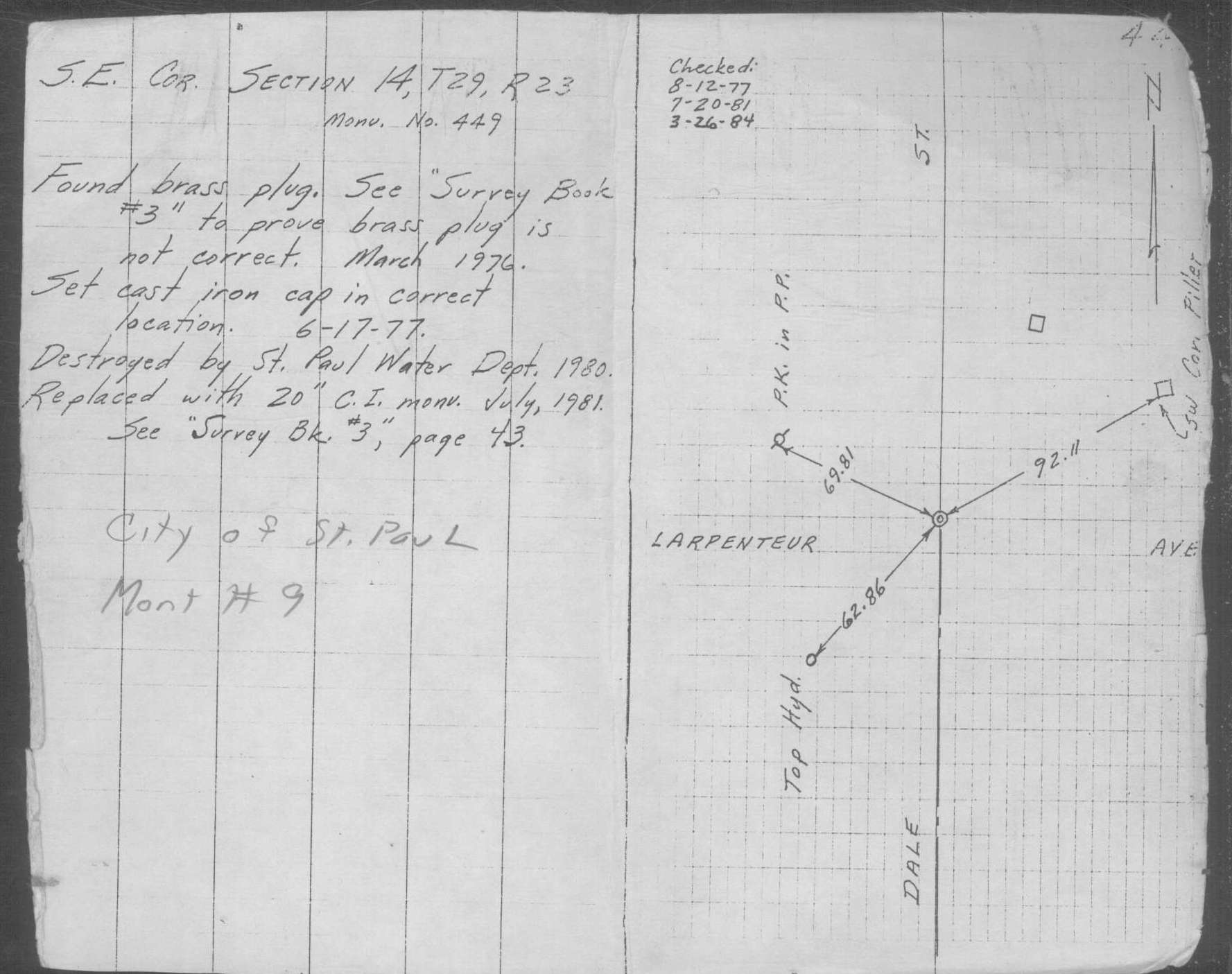
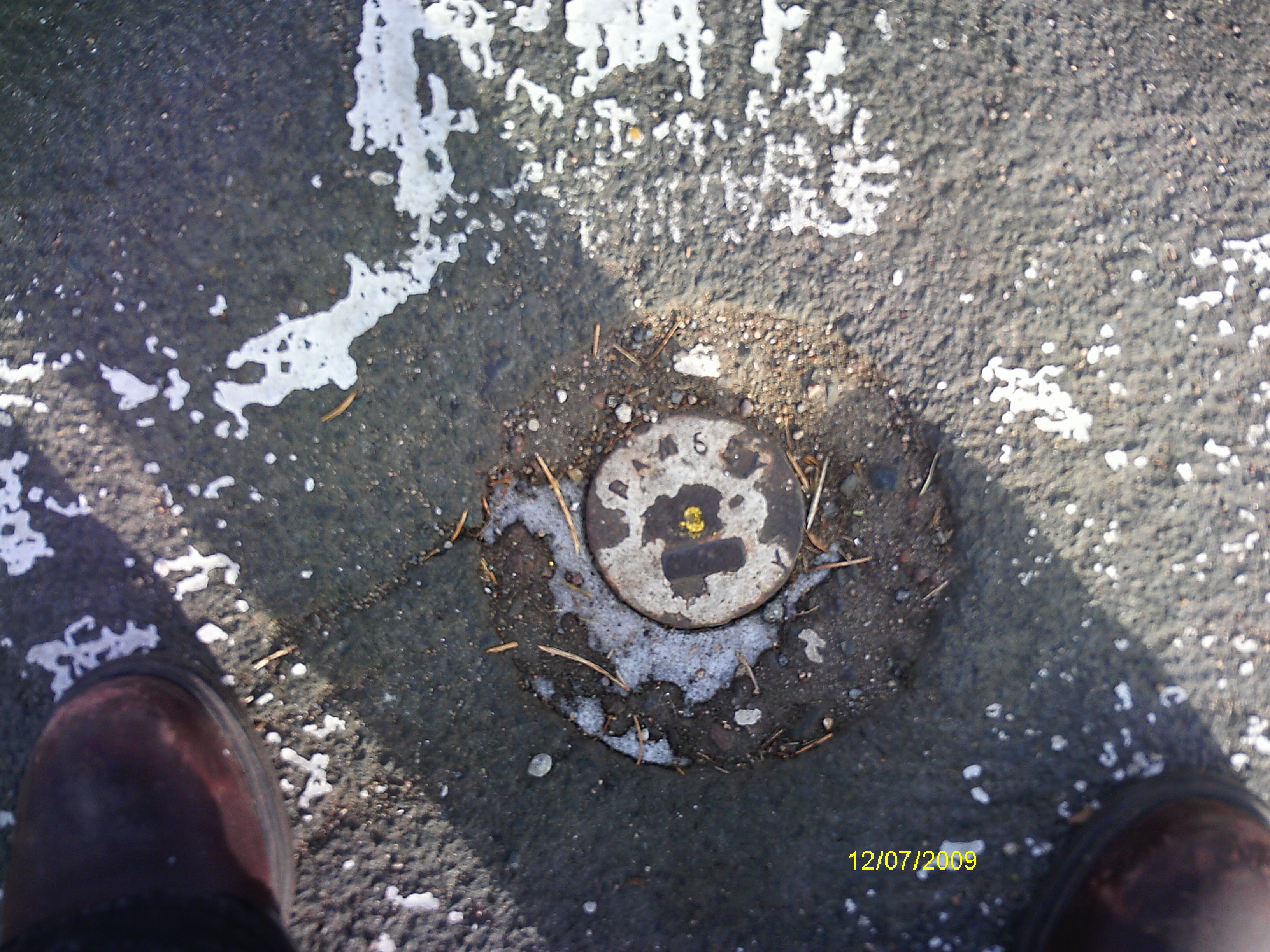
| 12/7/2009 | Placed ties on the CIM. See CofL 0009-1718-A.pdf Photos taken. |
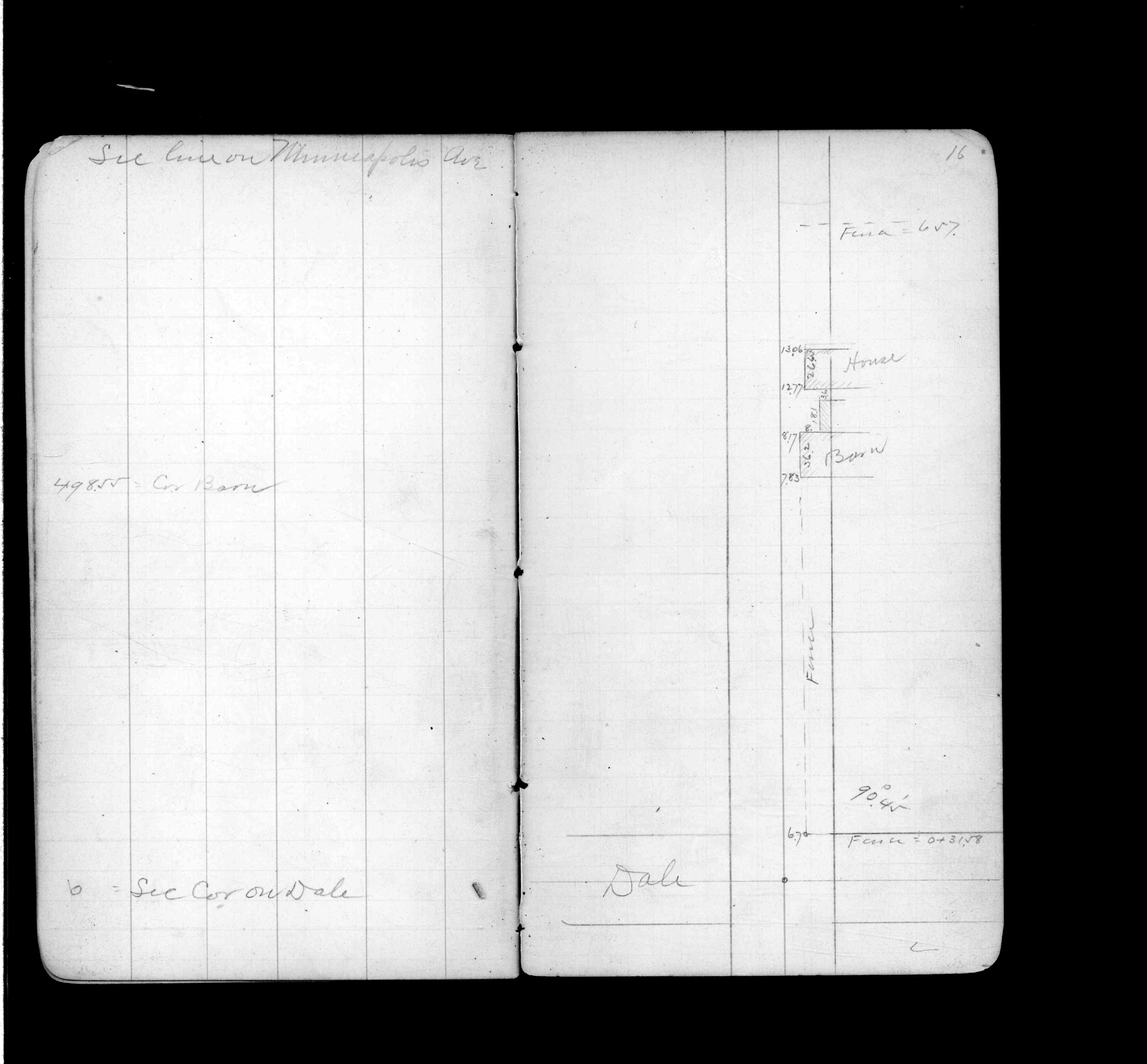
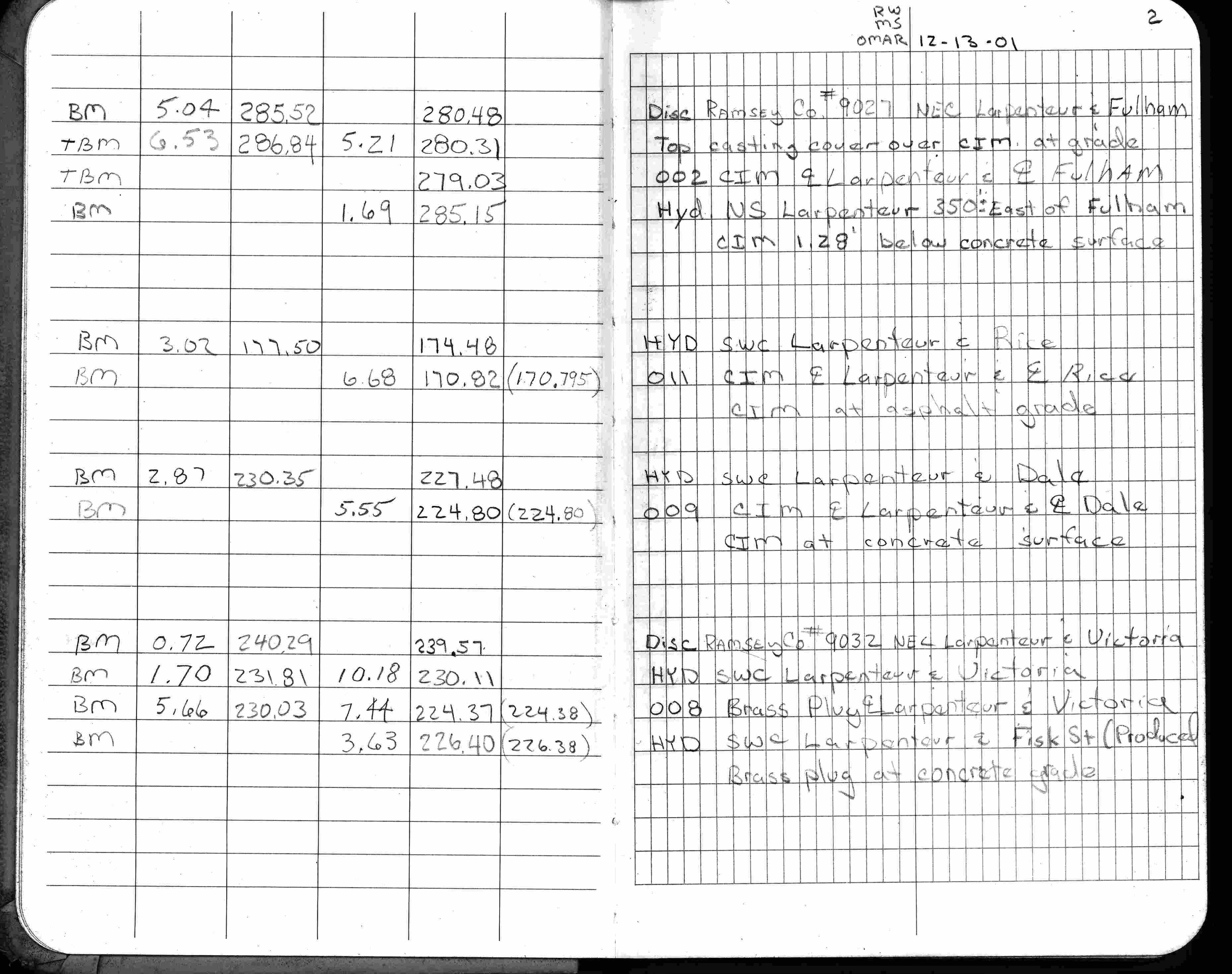
| 12/13/2001 | Elev 224.80 ft on CIM at concrete surface. See FB 1736 p.2 |
| 3/9/2001 | Fd CIM at grade and placed ties. See CofL 0009-1718-A |
| 3/5/1996 | Elev 224.80 ft on CIM. See 97adj.pts, 1996/bmdale.org/bmdale.sdr (loop 091) |
| 1/1/1989 | (Unknown date ___ __,1989 ) Historic, one time only GPS survey = S601 |
| 3/1/1984 | (Unknown date Mar __, 1984 ) Set CIM |
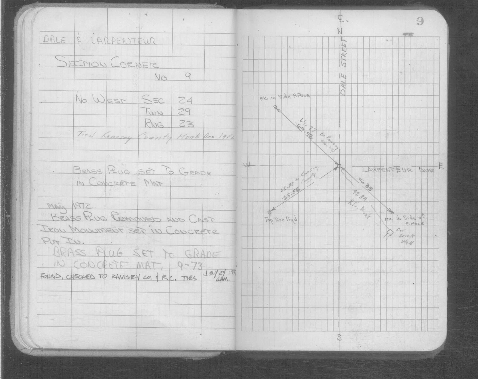
| 12/1/1982 | (Unknown date Dec __, 1982 ) Placed ties on Ramsey County Monument. See Yellow Tie Book. |
| 9/1/1973 | (Unknown date Sep __, 1973 ) Brass plug set to grade in concrete. See Yellow Tie Book. |
| 5/8/1972 | Removed brass plug & set CIM in concrete. See Yellow Tie Book & FB 1689A p.14 |
| 12/1/1939 | (Unknown date Dec __, 1939 ) Placed ties. See FB 1357 p.1 |
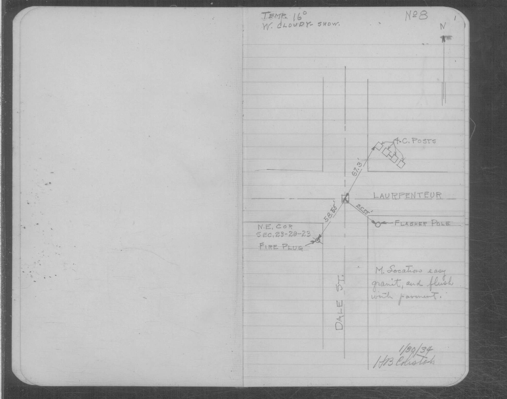
| 1/30/1934 | Placed ties on the GM at grade. See book MSX 4 p.1 |
| 4/2/1890 | Monument set by J H Armstrong. See FB 313 p.1-17 |
| 11/1/1847 | (Unknown date Nov __, 1847 ) Isaac N Higbee deputy surveyor set post. Tied to 2 BTs. See IH p.072-073 2923 |
| 1/1/1800 | (Unknown date ___ __, 18?? ) Elev 224.520 ft on GM. See Old Benches Book, Entry 1692 |
| 1/1/1800 | (Unknown date ___ __, ____ ) See FB 314 p.16 |
| 1/1/1800 | (Unknown date ___ __, ____ ) Brass plug set to grade in concrete mat. See Yellow Tie Book. |
Above is NOT an all inclusive history of this point. Please review all the links below. Yellow Tie Books are 'ST' in the Monument category.
| PLS NOTES | Field | Cross Section | Sewer | J.B. Irvine | Monument | River Survey |
|---|---|---|---|---|---|---|
| IH p.072-073 | FB 0234p.79 | ST 001-078 p.009 | ||||
| FB 0274p. 65 ,69 | MSX 0004 p.001 | |||||
| FB 0313p.10 | ||||||
| FB 0313p. 04 ,20 | ||||||
| FB 0314p.16 | ||||||
| FB 0314p.16 | ||||||
| FB 0438p.10 | ||||||
| FB 1332p.77 | ||||||
| FB 1353p.06 | ||||||
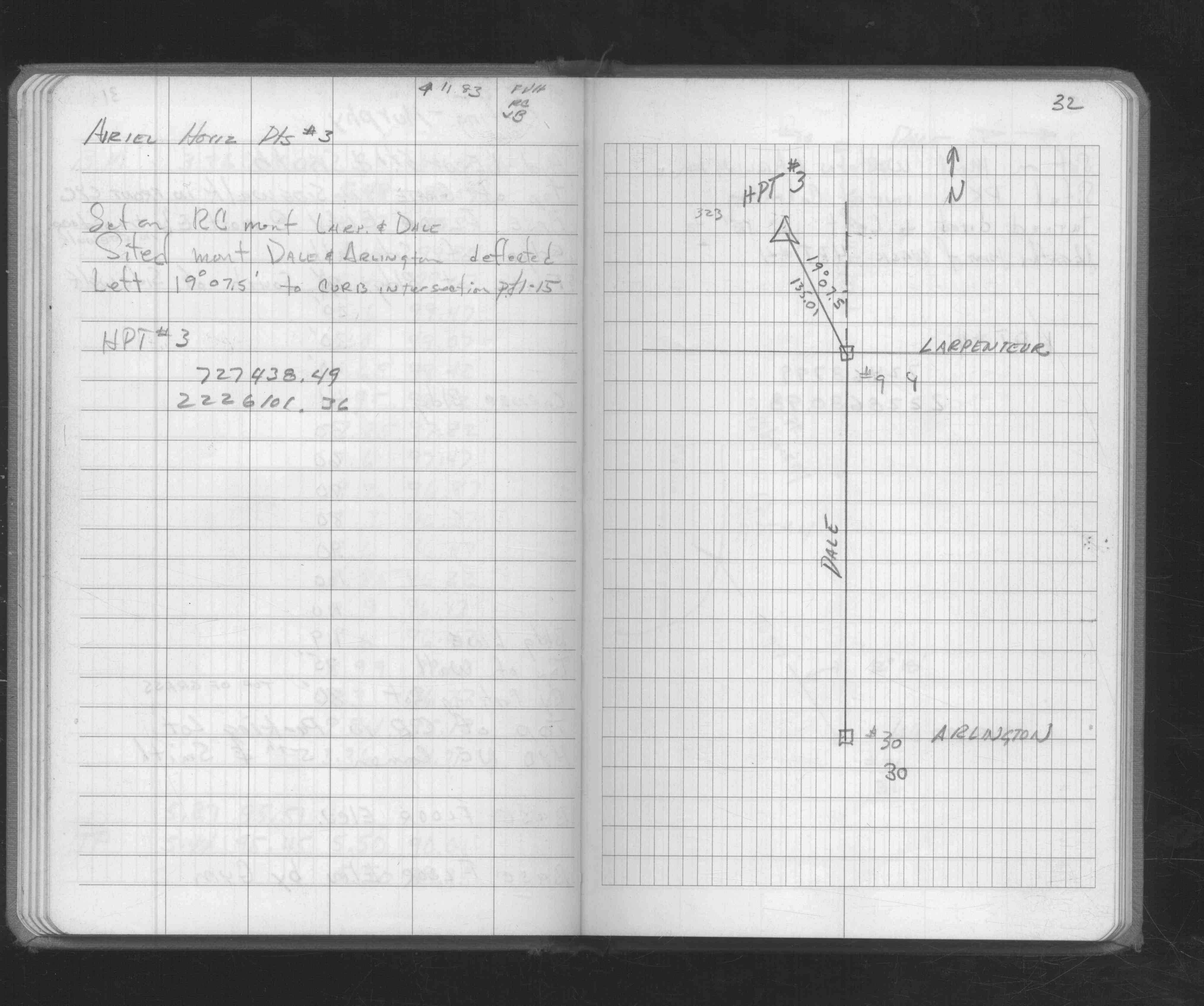
| FB 1354p.28 | ||||||
| FB 1357p.01 | ||||||
| FB 1397p.26 | ||||||
| FB 1483p.12 | ||||||
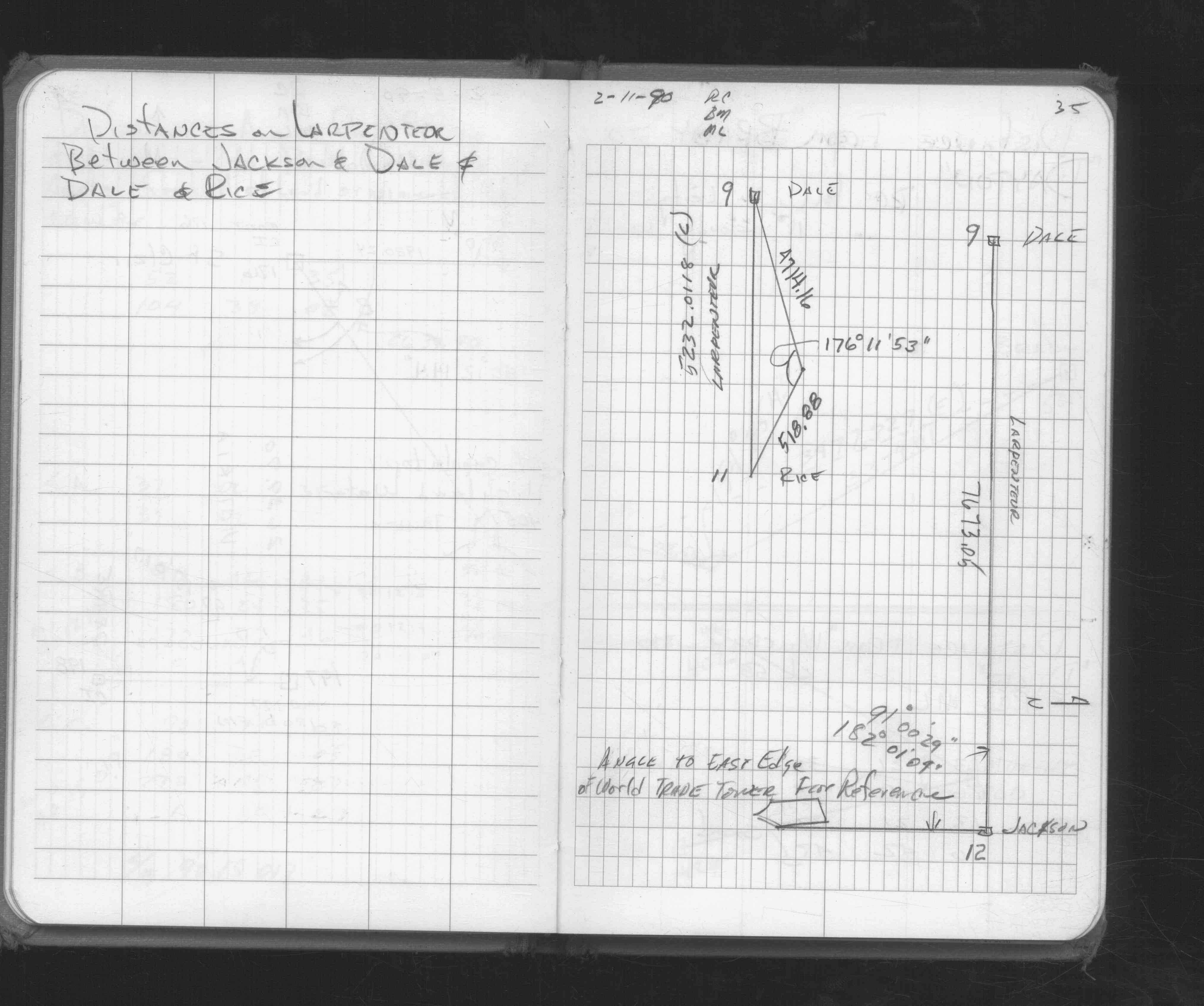
| FB 1549Ip.69 | ||||||
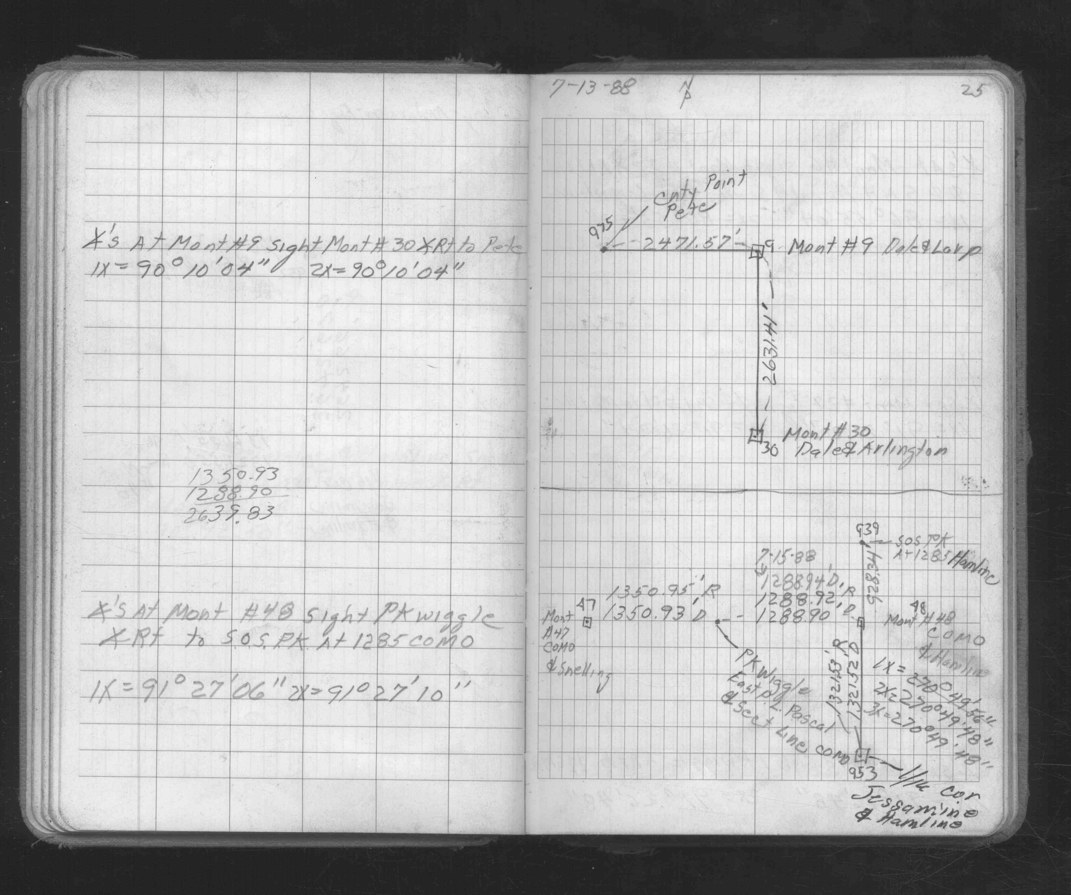
| FB 1671p. 39 ,40 ,41 ,42 ,43 | ||||||
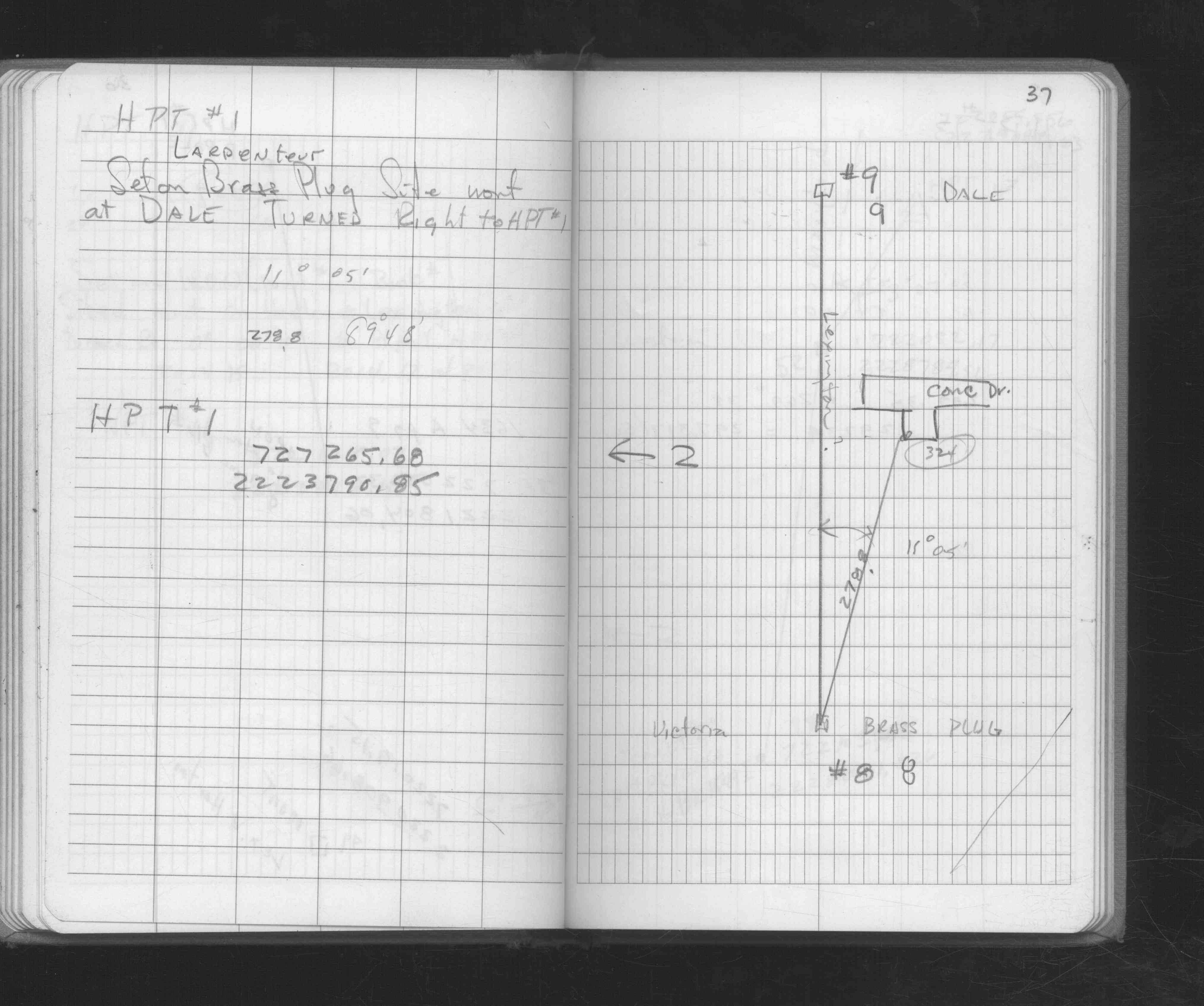
| FB 1673Ap. 15 ,16 ,17 ,25 | ||||||
| FB 1676Ap. 32 ,37 | ||||||
| FB 1676Dp.35 | ||||||
| FB 1689p.33 | ||||||
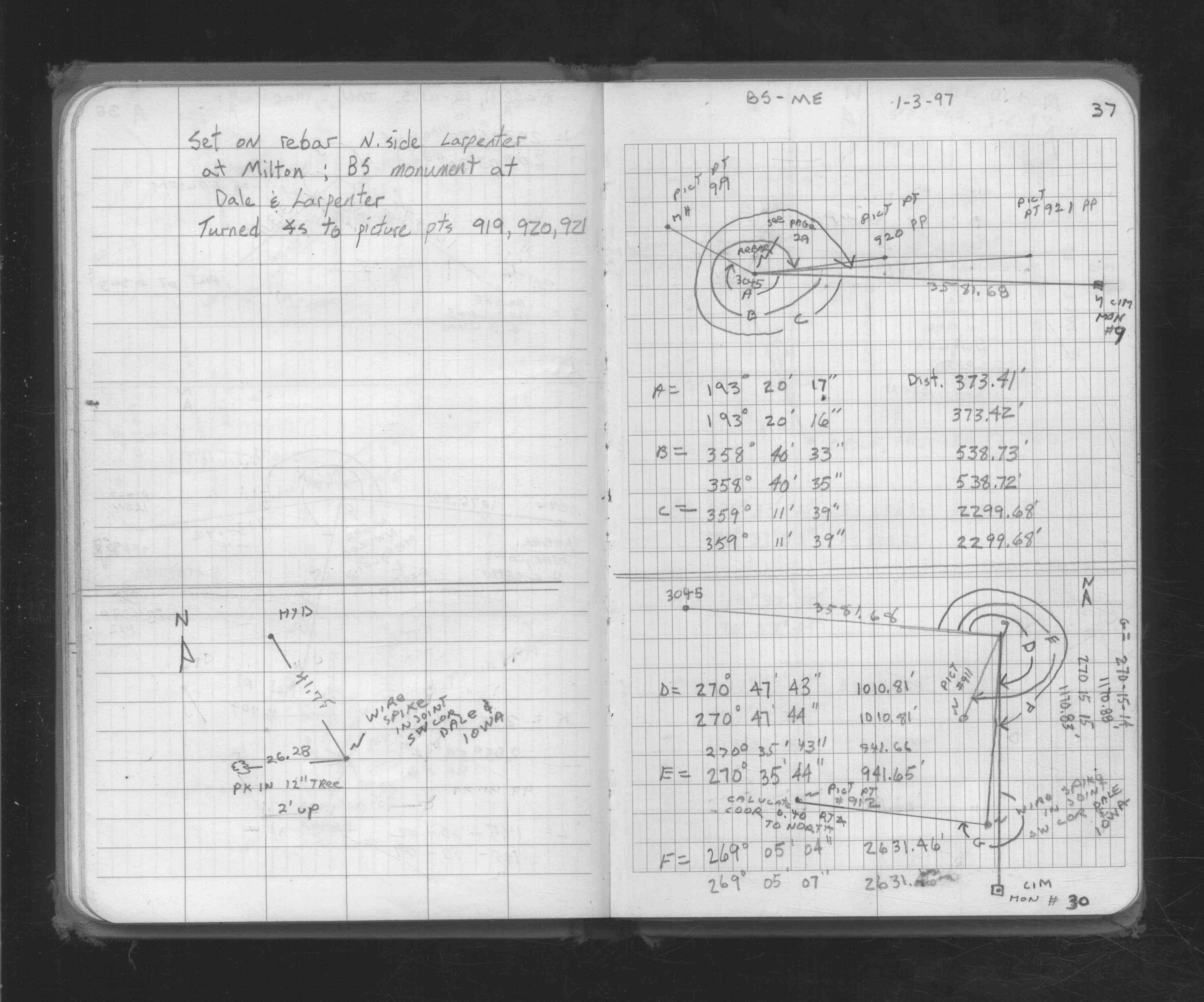
| FB 1727p. 29 ,37 | ||||||
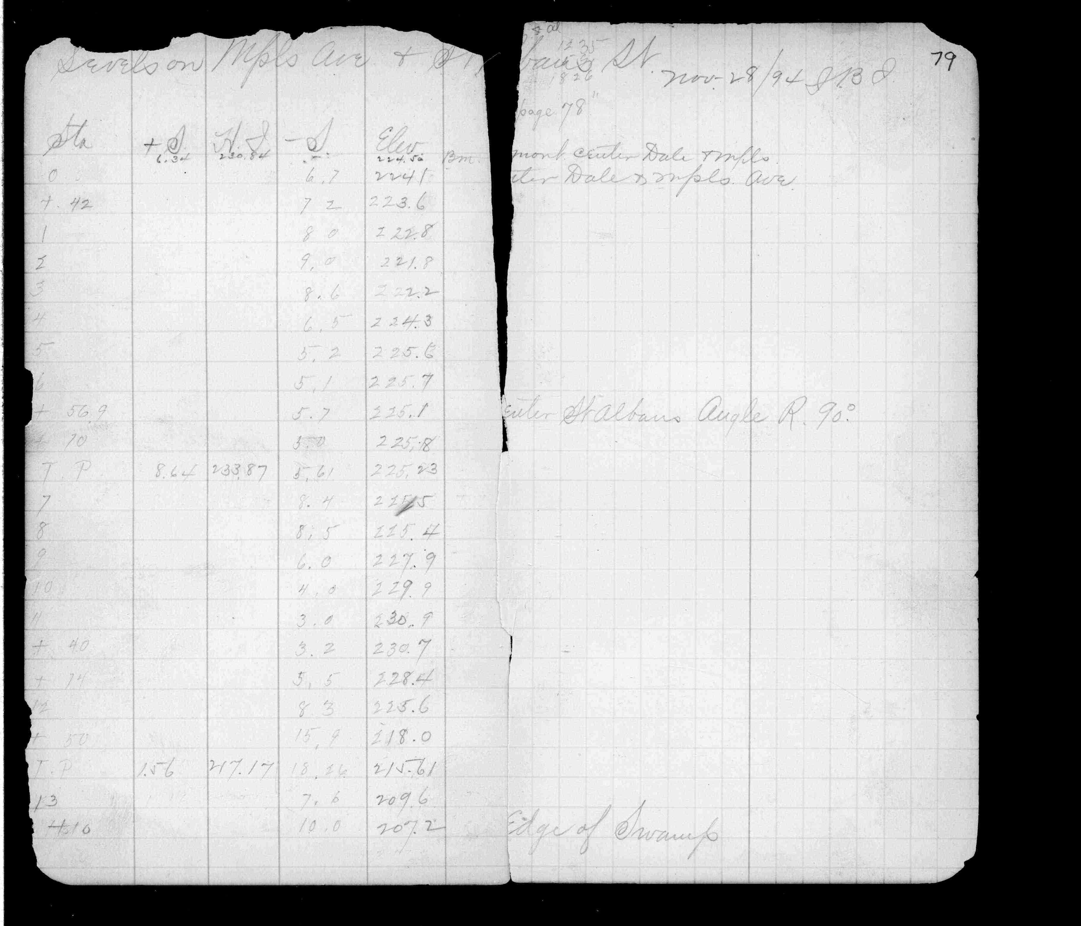
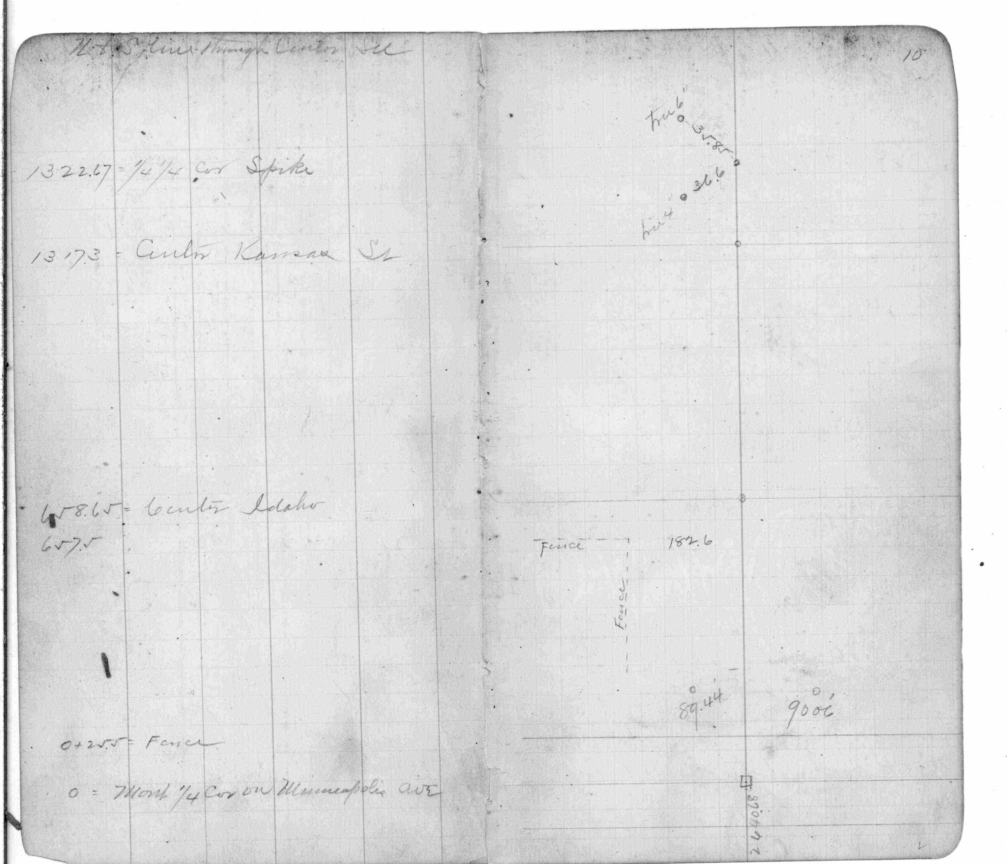
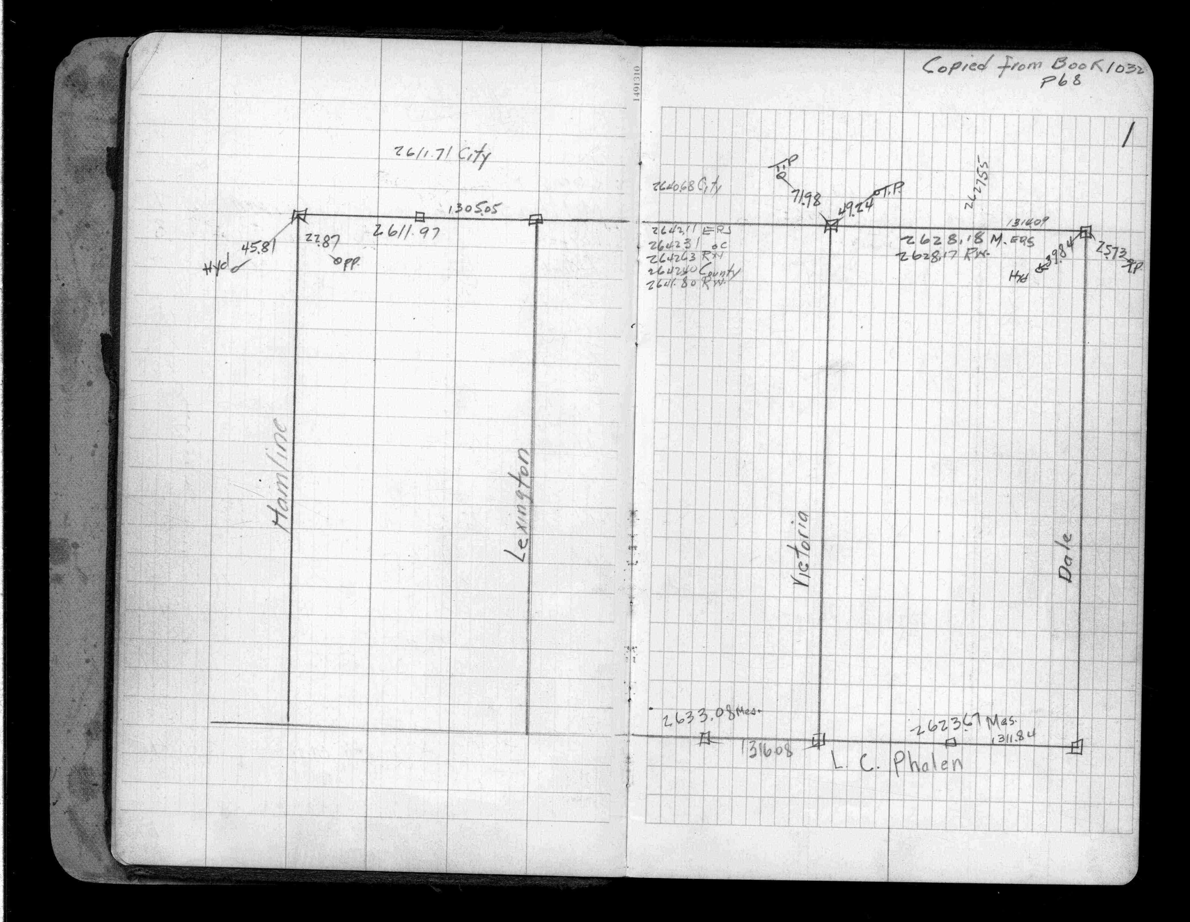
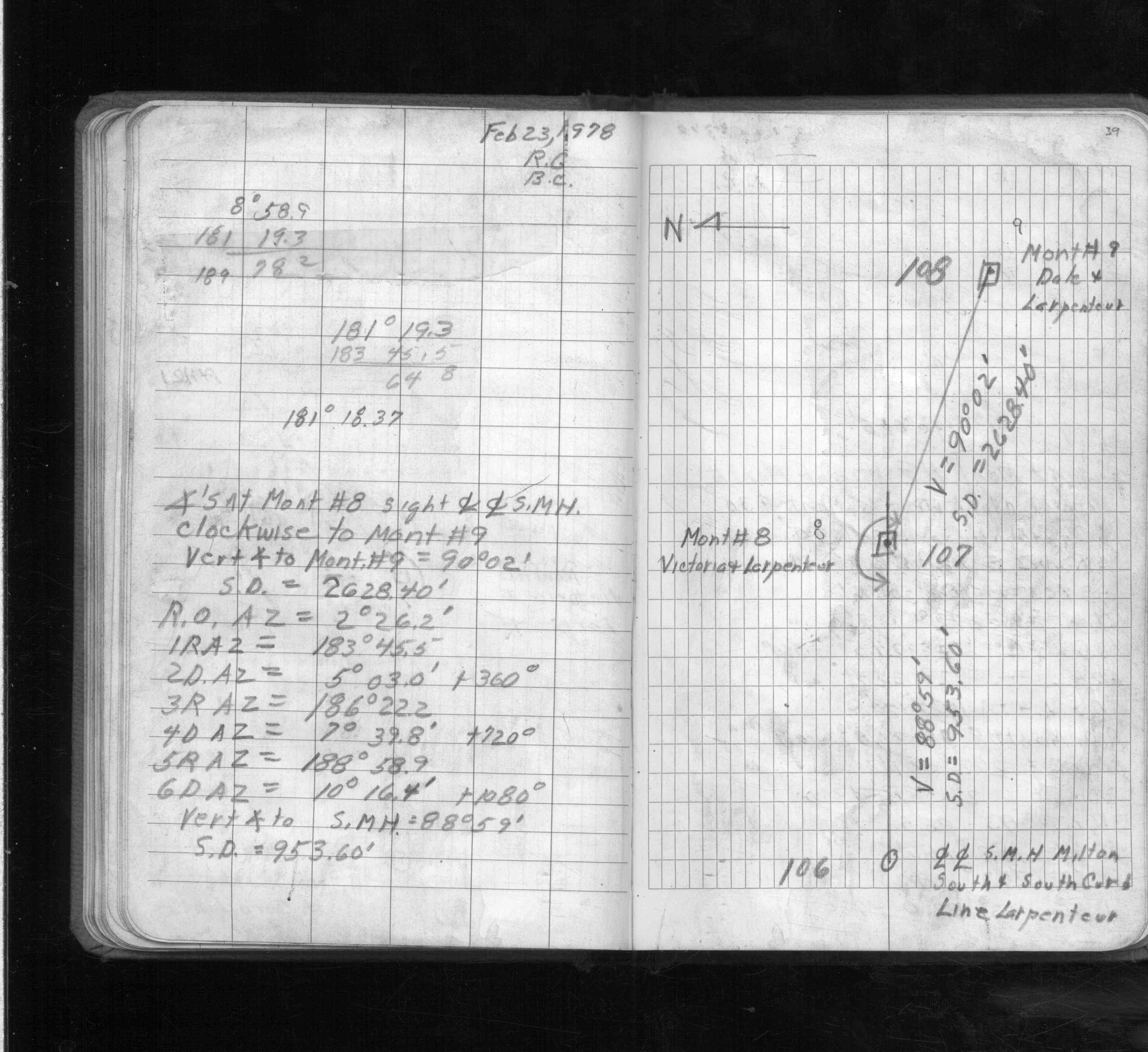
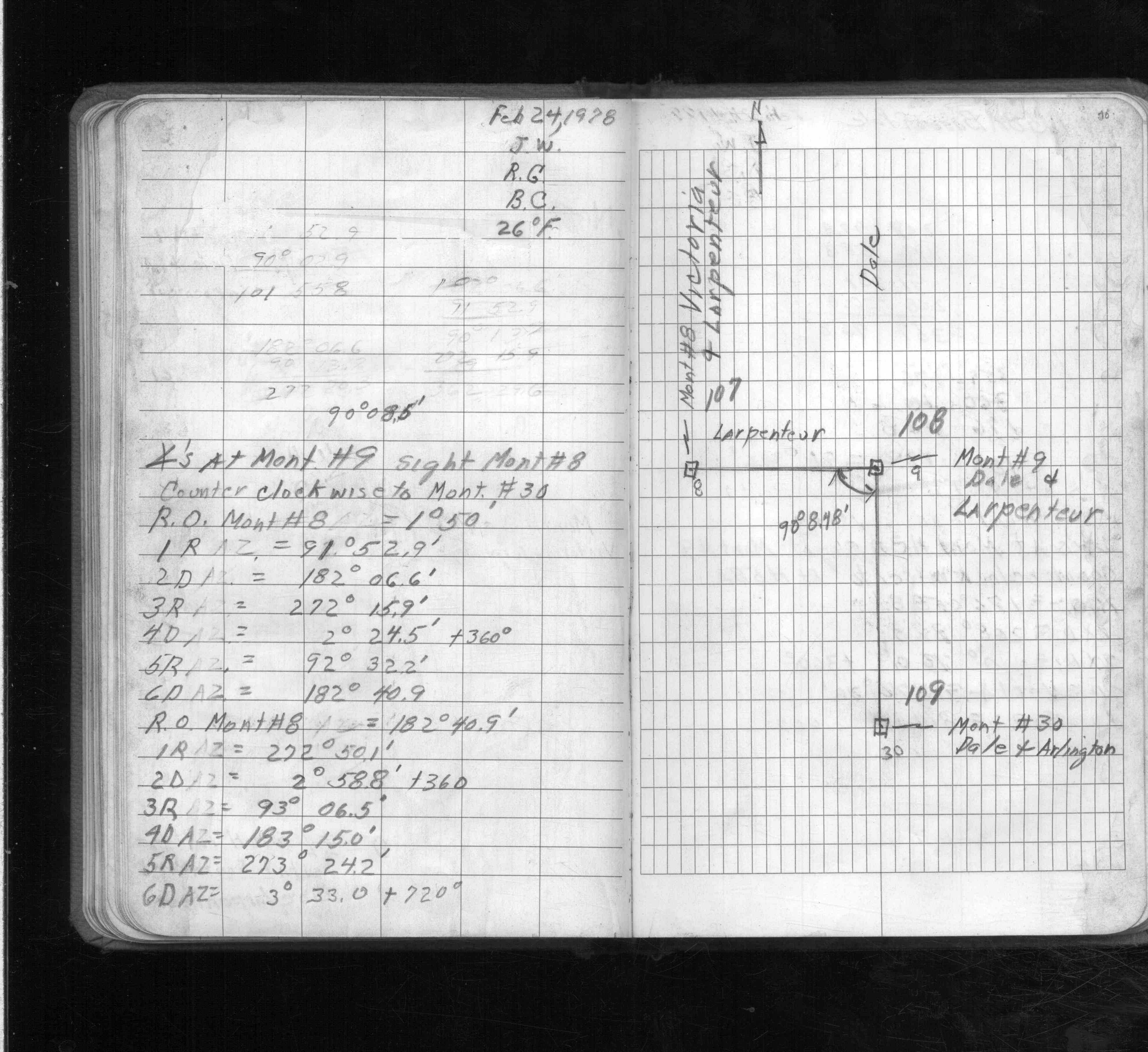
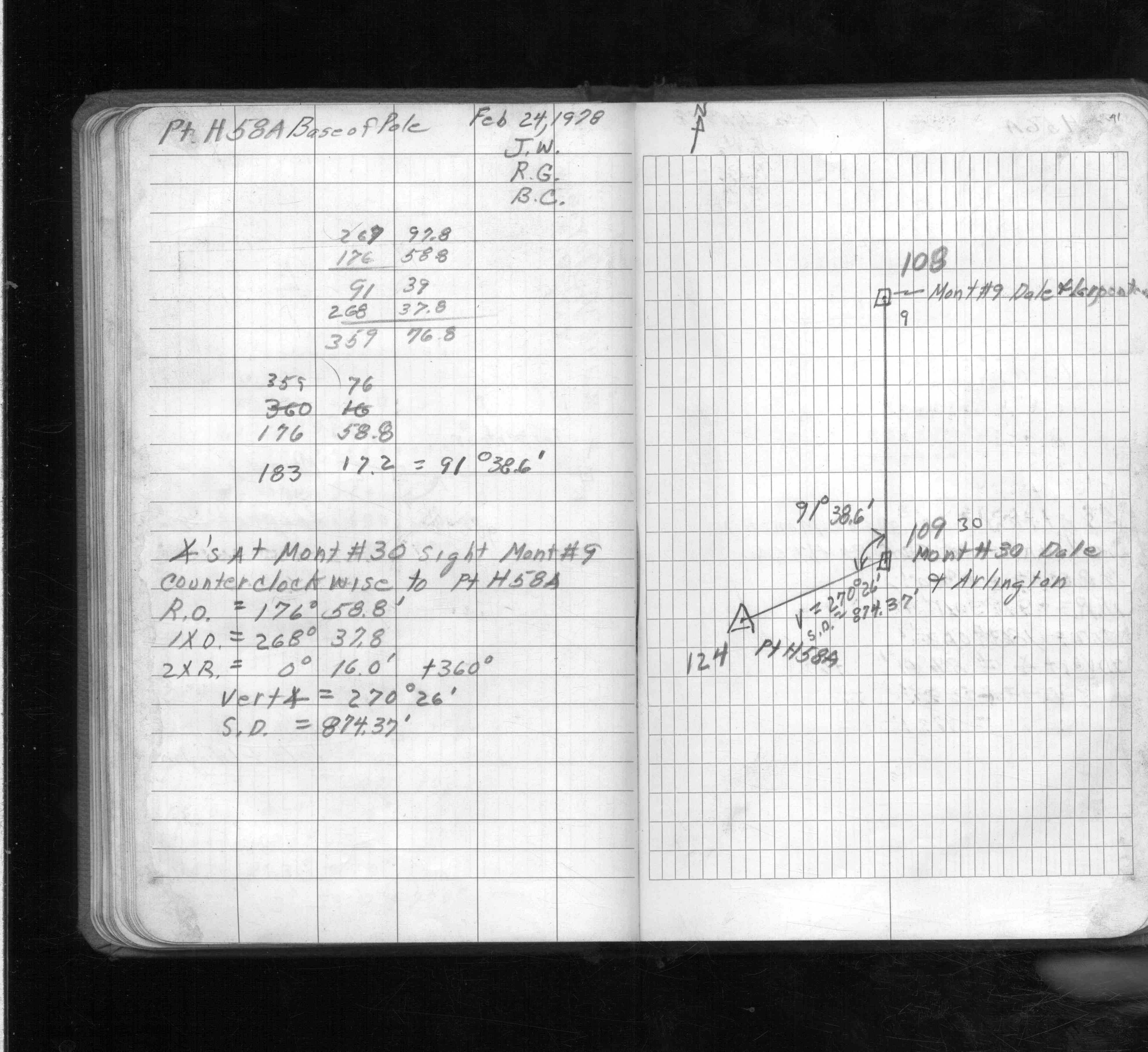
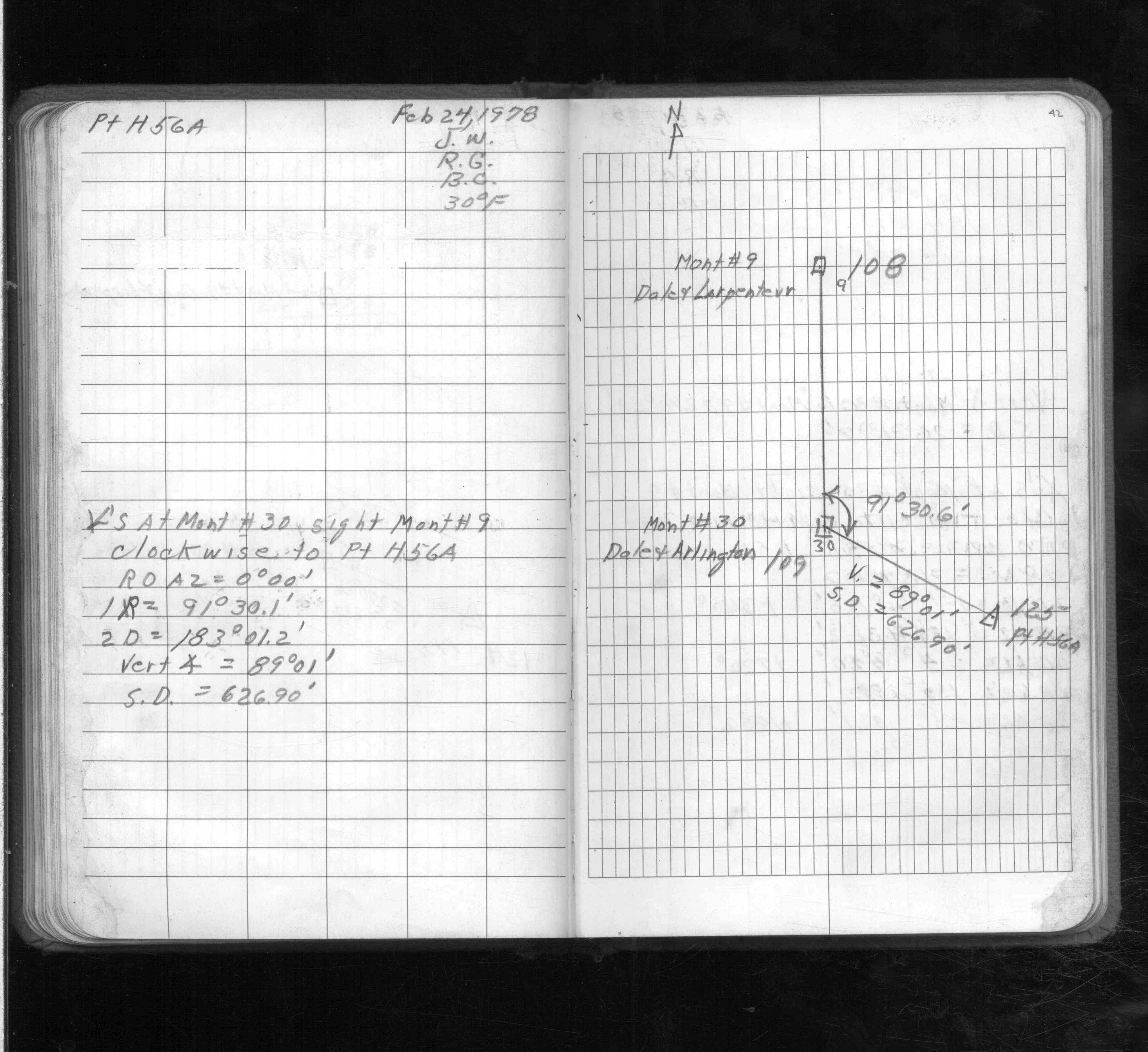
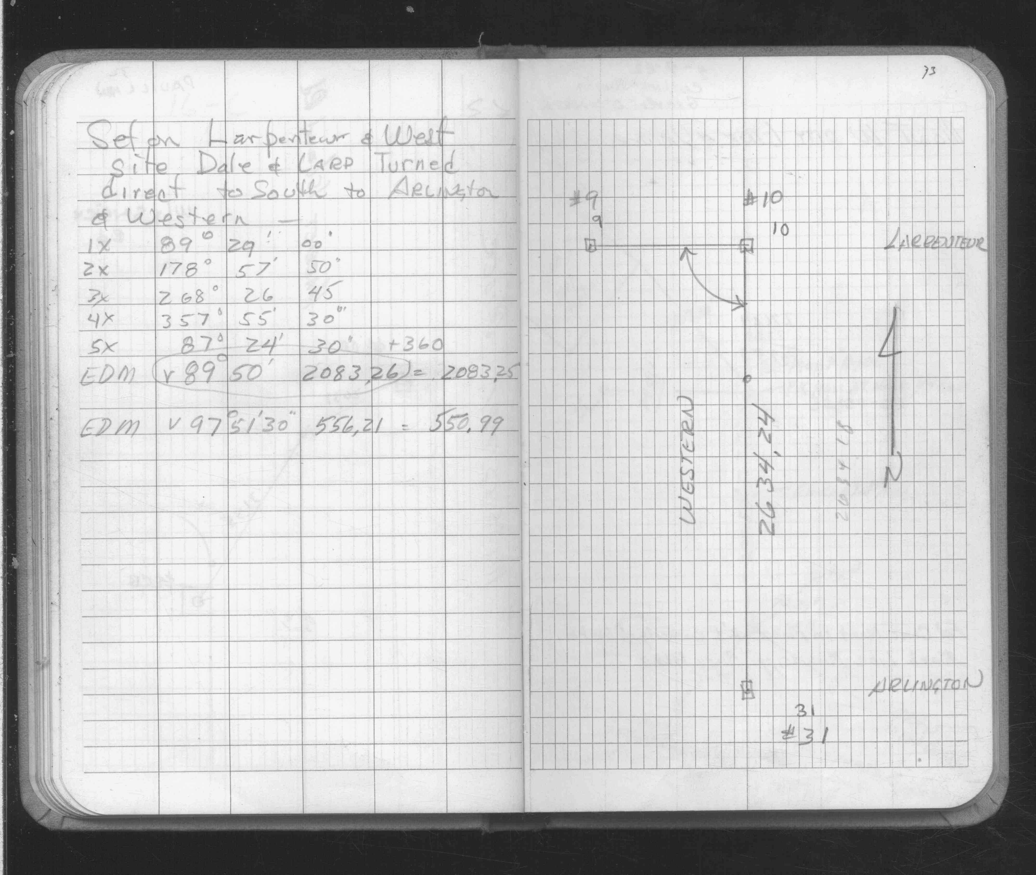
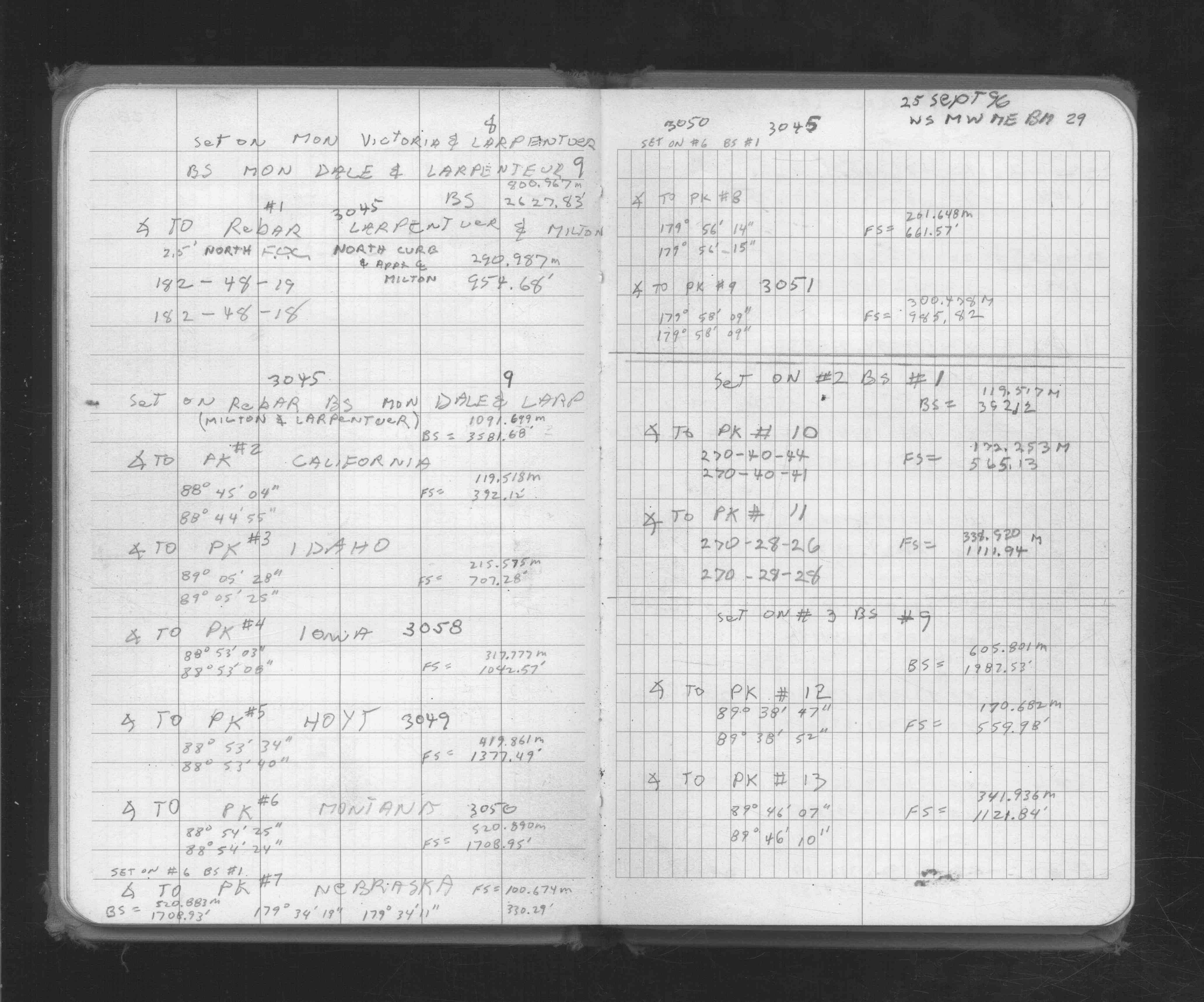
| FB 1736p.02 |
| FILE | SURVEYOR | LIC. NO. | DATE SIGNED | DATE TIED |
|---|---|---|---|---|
| 0009-1718-A.pdf | Samuel D. Gibson | 44880 | February 3, 2010 | December 7, 2009 |
| 0009-1718-A.tif | Jeffery L. Grosso | 13144 | March 14, 2001 | March 9, 2001 |
| ST_001-078p009a.jpg | none | none | none | none |
| ST_001-078p009.jpg | none | none | none | none |
| 0009-1718-A.dwf | none | none | none | none |
| FILE | PHOTO DATE | COMMENTS |
|---|---|---|
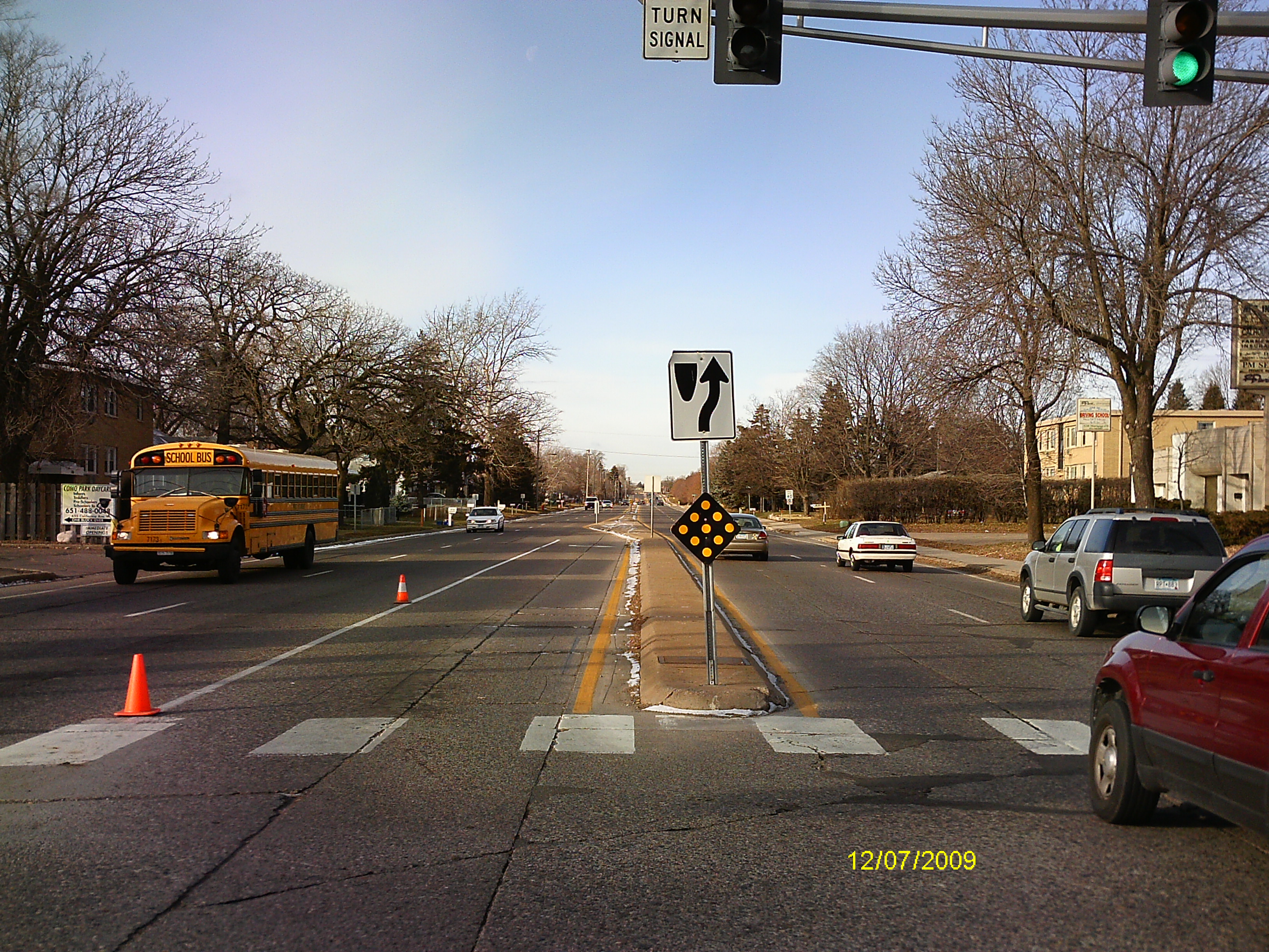
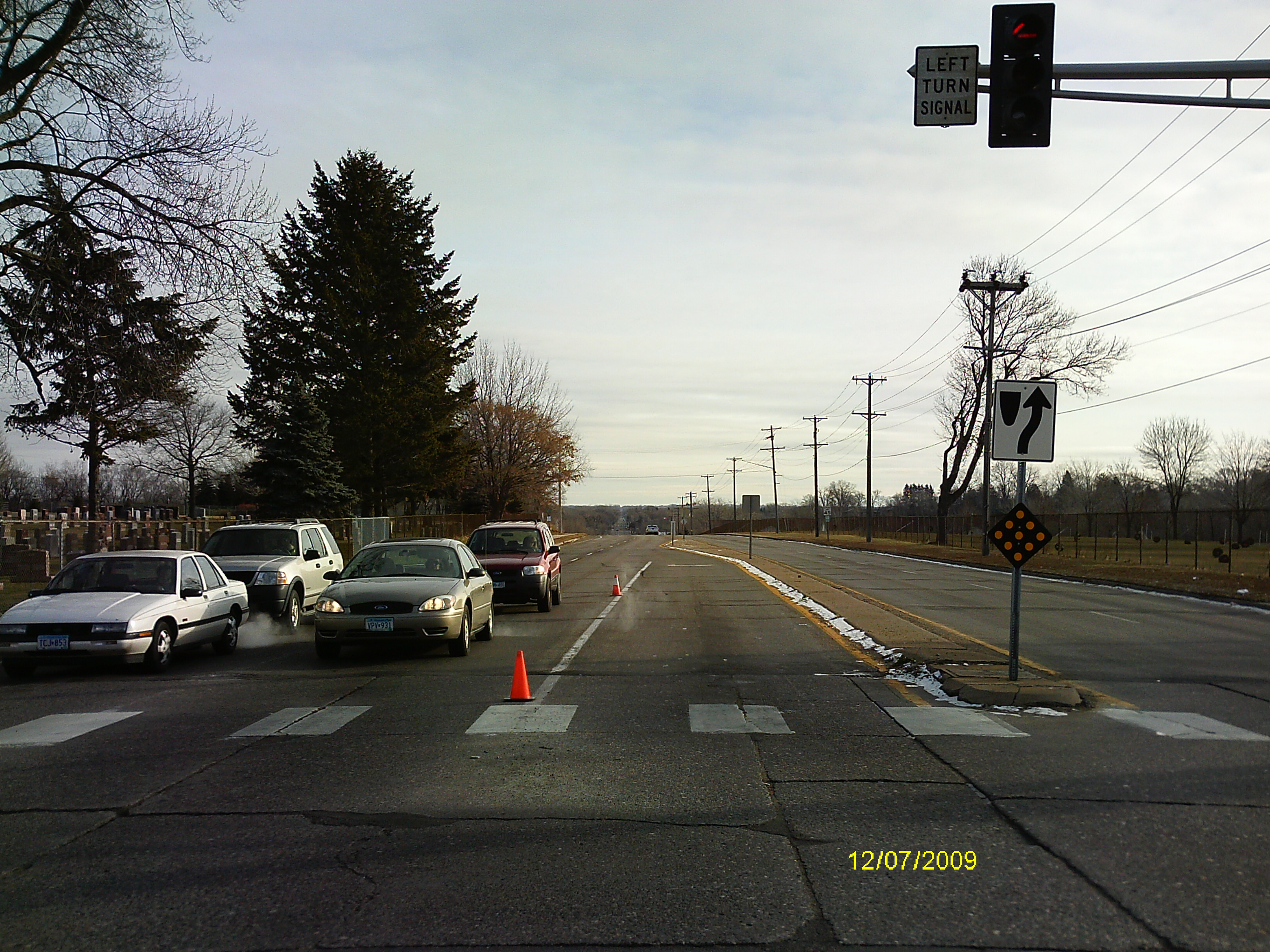
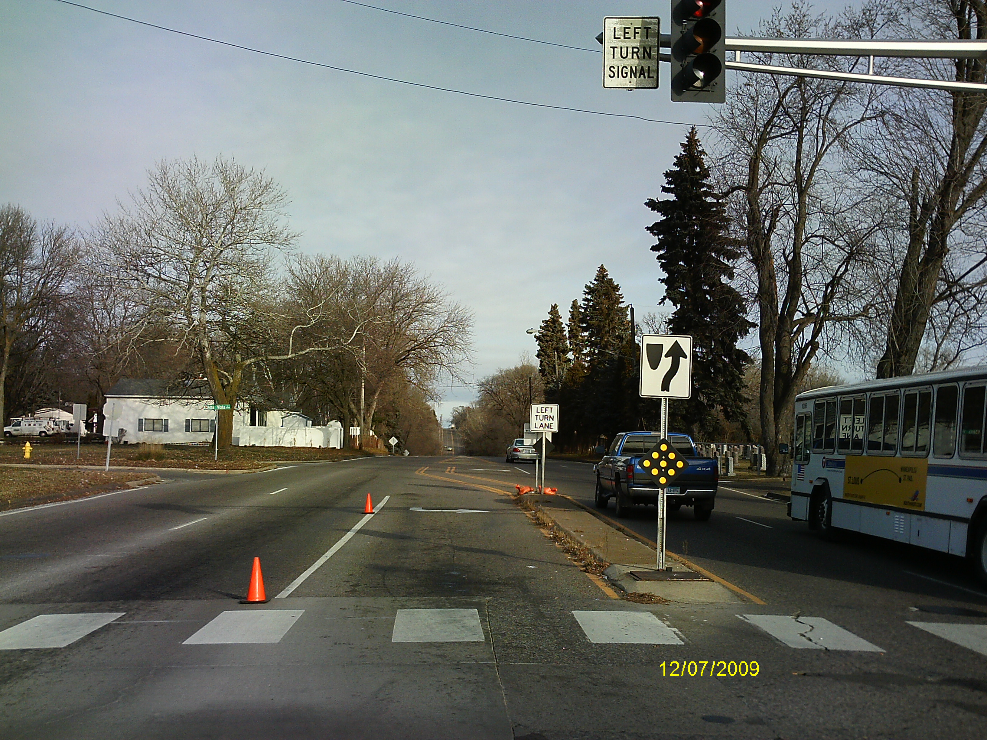
| 0009-1718-5.jpg | December 7, 2009 | Looking West along the center of Larpentuer Ave. |
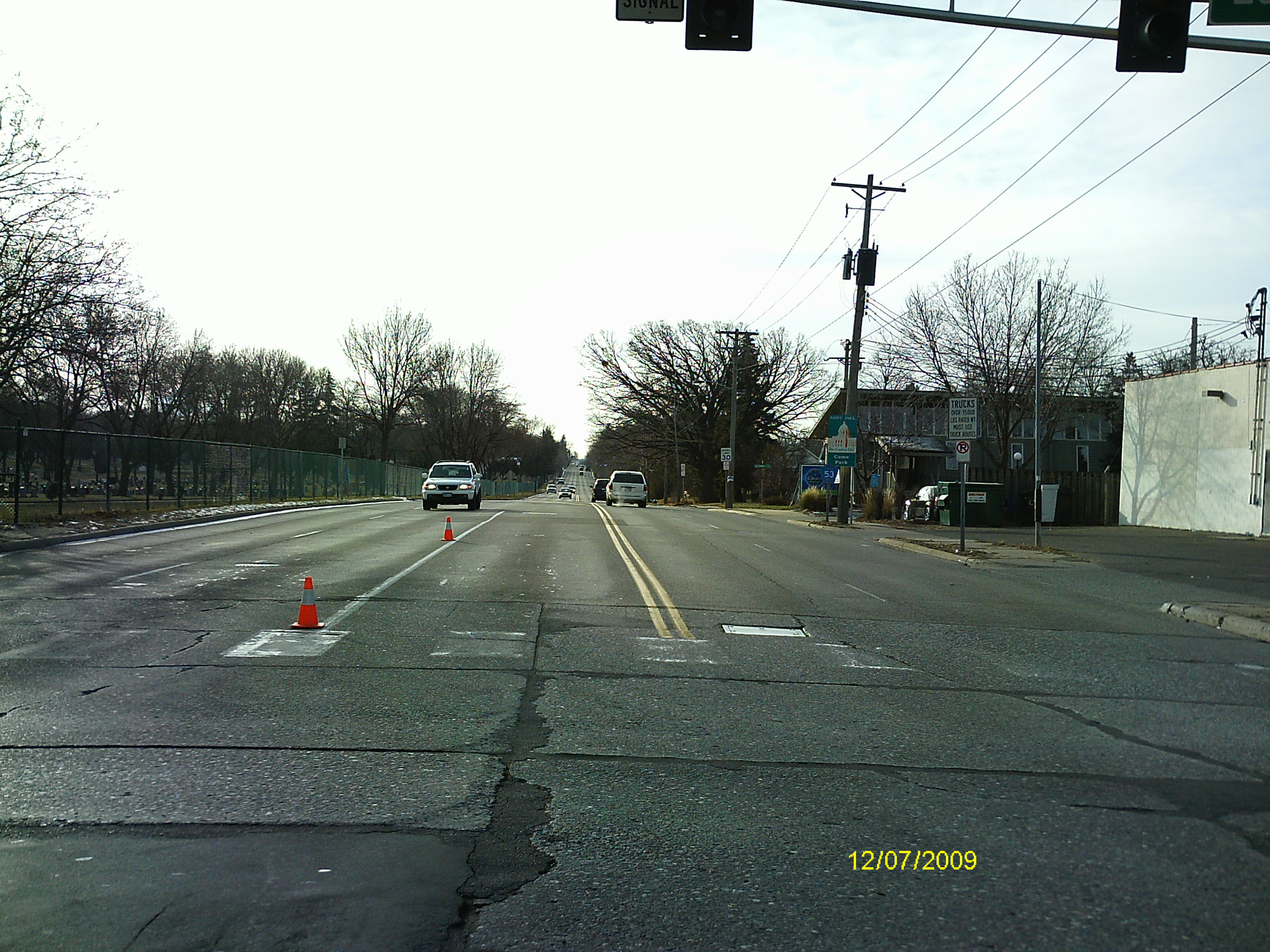
| 0009-1718-4.jpg | December 7, 2009 | Looking South along the center of Dale St. |
| 0009-1718-3.jpg | December 7, 2009 | Looking East along the center of Larpentuer Ave. |
| 0009-1718-2.jpg | December 7, 2009 | Looking North along the center of Dale St. |
| 0009-1718-1.jpg | December 7, 2009 | Close-up of the CIM. |