| NAD83 COORDINATES (1986 adj.): |
|---|
| * X= 555997.86 Y= 170598.14 Z= 0 LSQ 12/6/1991 S FIX |
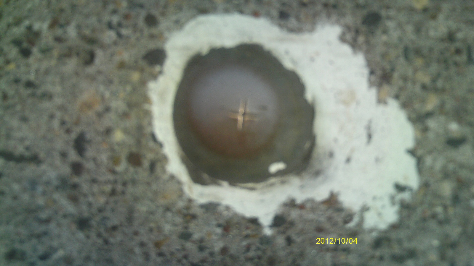
| 10/4/2012 | Found Bronze Cap at street grade. Photos taken. |
| 9/28/2002 | Fd drill hole in concrete pavement. Placed ties. Set bronze cap 0.02 below concrete pavement. See CofL 0026-2684-A |
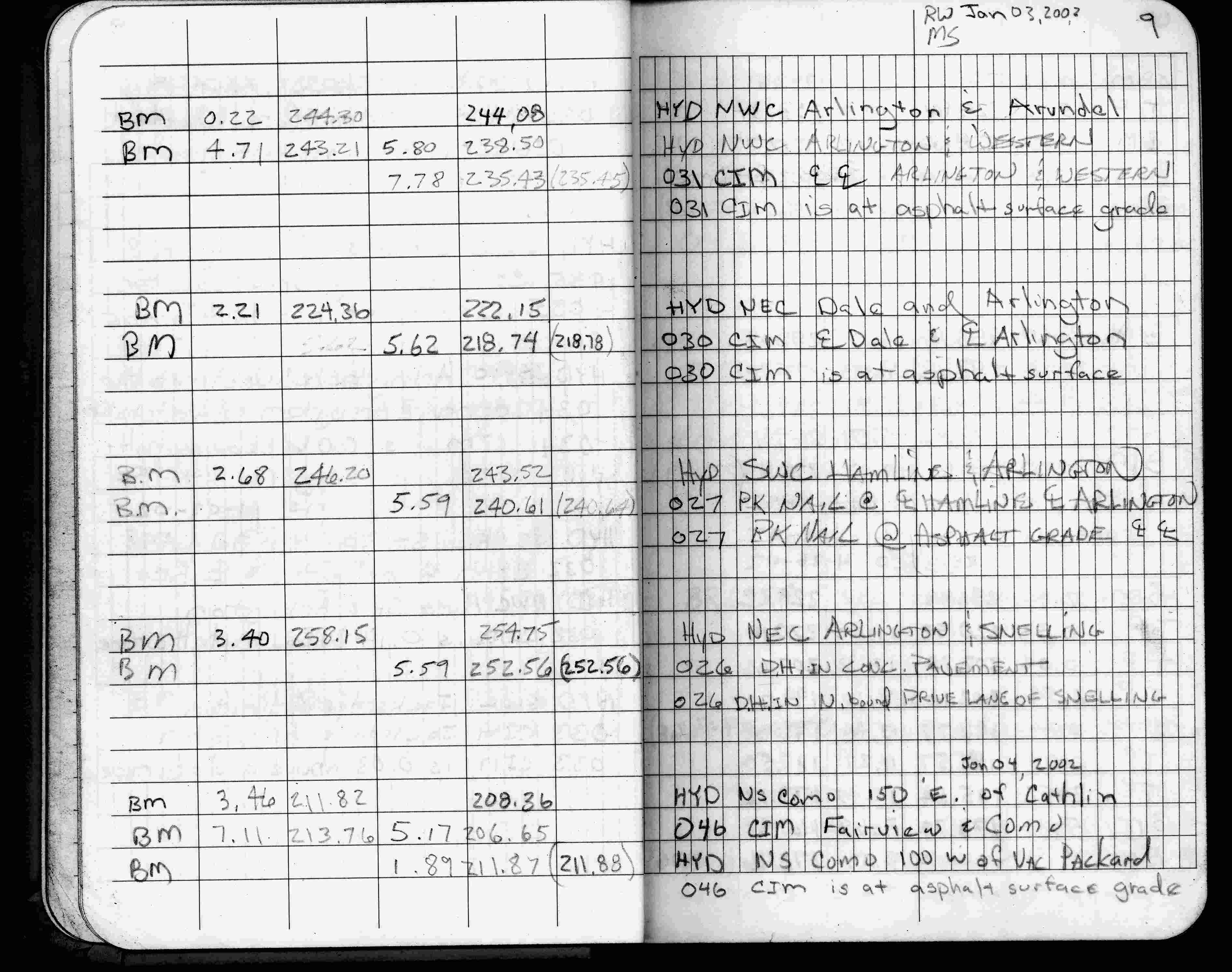
| 1/3/2002 | Elev 252.56 ft on drill hole in concrete pavement N bound drive lane on Snelling Ave. See FB 1736 p.9 |
| 3/17/2000 | Drill hole in concrete pavement (marked for painting target for 2000 aerial) |
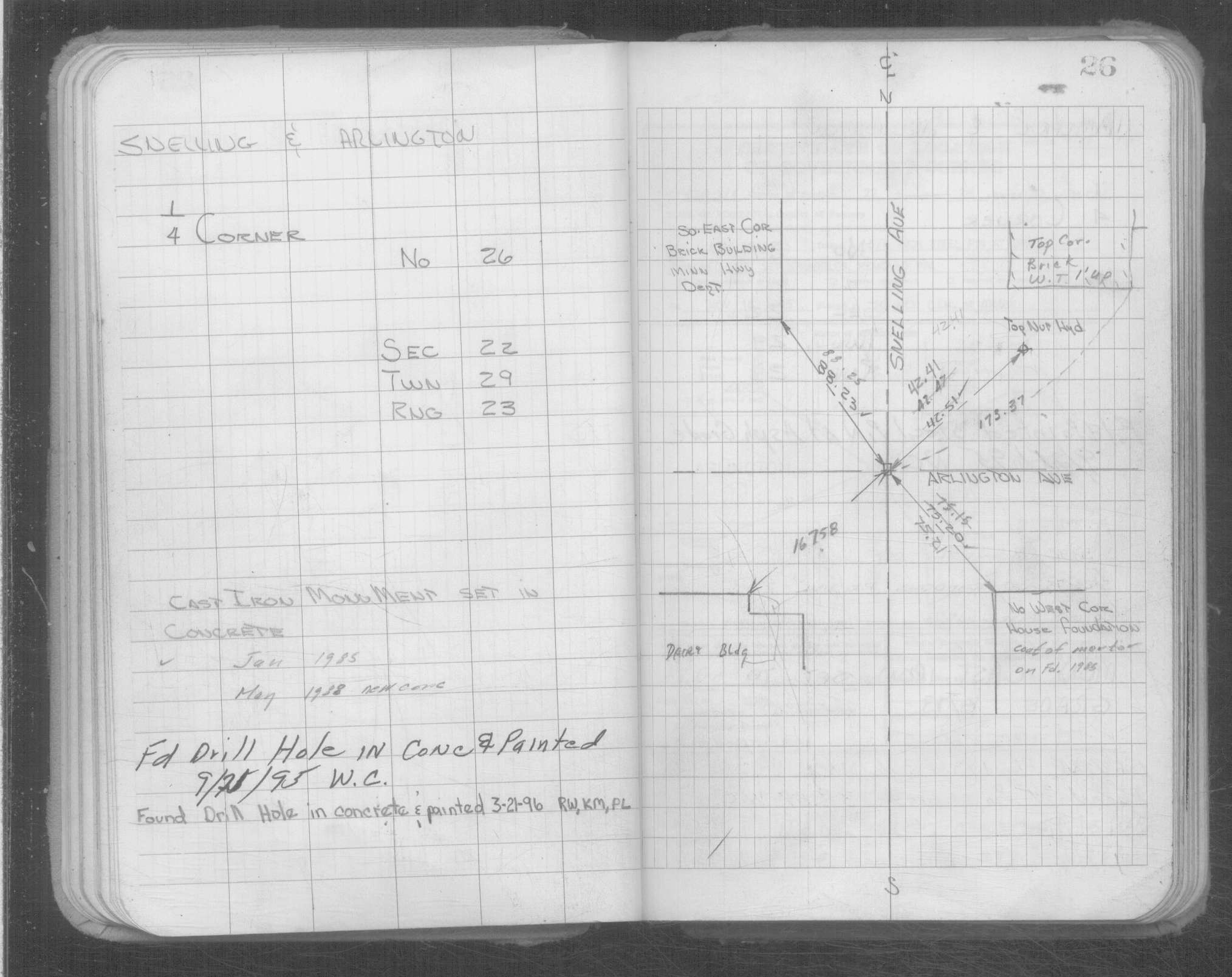
| 9/21/1995 | Fd drill hole (marked for painting target for 1995 aerial) |
| 8/25/1994 | Elev 252.56 ft on drill hole. See 97adj.pts, 1994/hoyt.org/hoyt.fbk (loop 002) Digital-Adj |
| 1/1/1989 | (Unknown date ___ __,1989 ) Historic, one time only GPS survey = S605 |
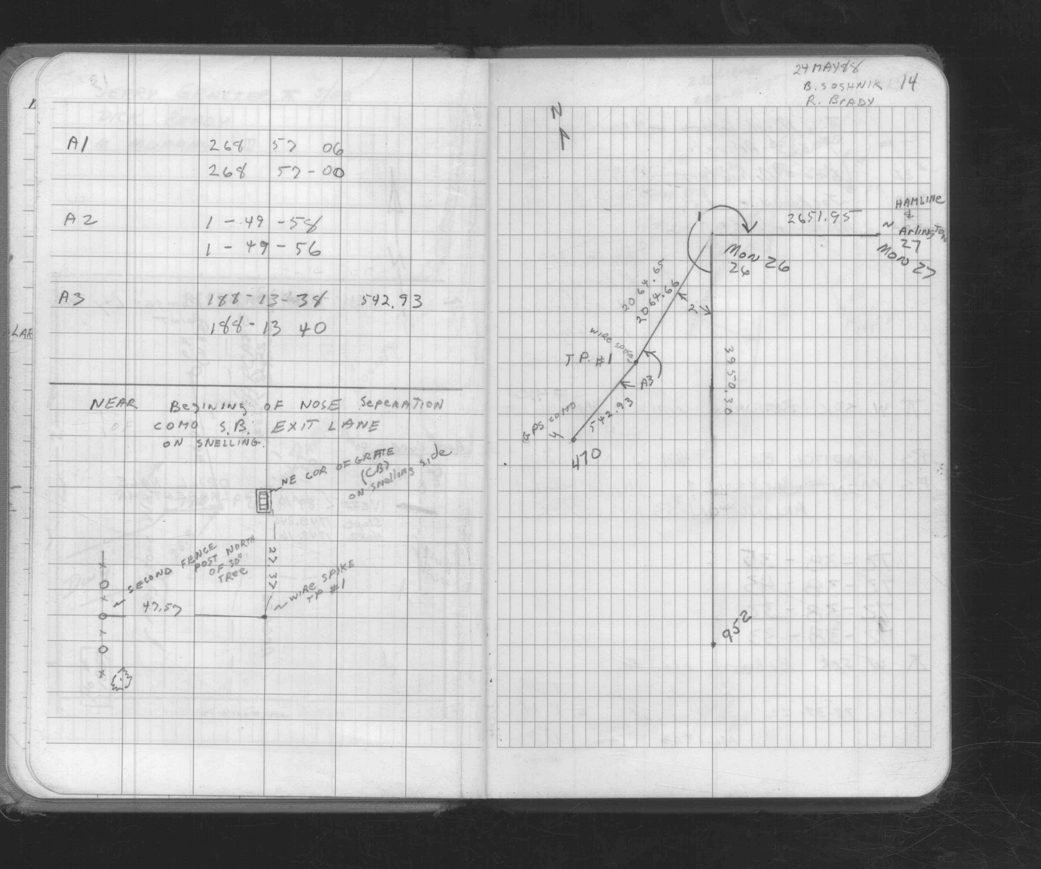
| 5/1/1988 | (Unknown date May __, 1988 ) CIM set in concrete |
| 4/1/1891 | (Unknown date Apr __, 1891 ) Monument set by J H Armstrong see Standard Map of Sec 21-29-23 See Old Index Book, Entry 2684 |
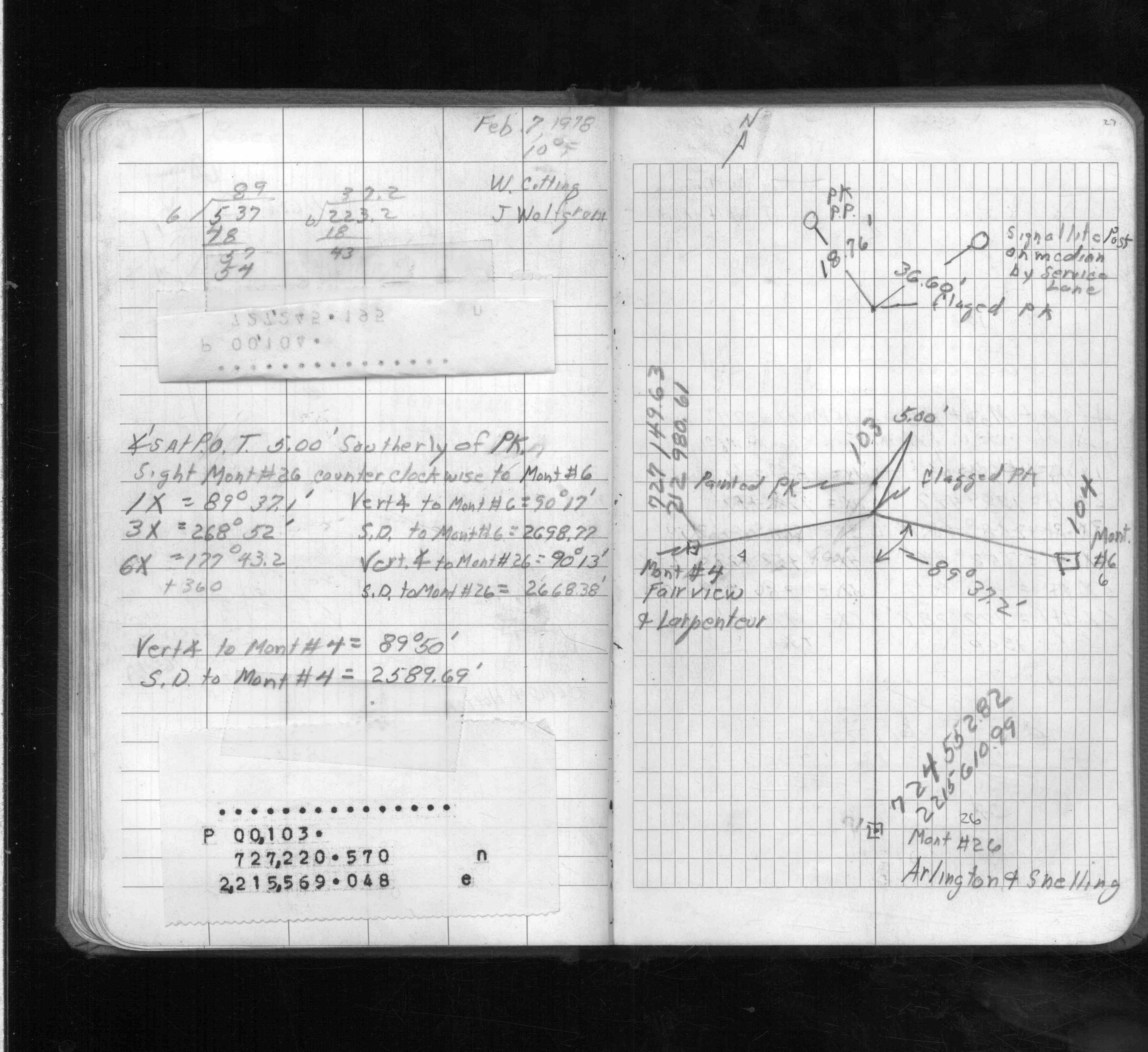
| 3/1/1891 | (Unknown date Mar __, 1891 ) Placed ties. See FB 345 p.22 |
| 3/1/1891 | (Unknown date Mar __, 1891 ) Monument set by J H Armstrong See FB 345 p.22,24 See Old Index Book, Entry 2270 |
| 11/1/1847 | (Unknown date Nov __, 1847 ) Isaac N Higbee deputy surveyor set post. Tied to 2 BTs. See IH p.094-095 2923 |
Above is NOT an all inclusive history of this point. Please review all the links below.
| PLS NOTES | Field | Cross Section | Sewer | J.B. Irvine | Monument | River Survey |
|---|---|---|---|---|---|---|
| IH p.094-095 | FB 0168p.15 | |||||
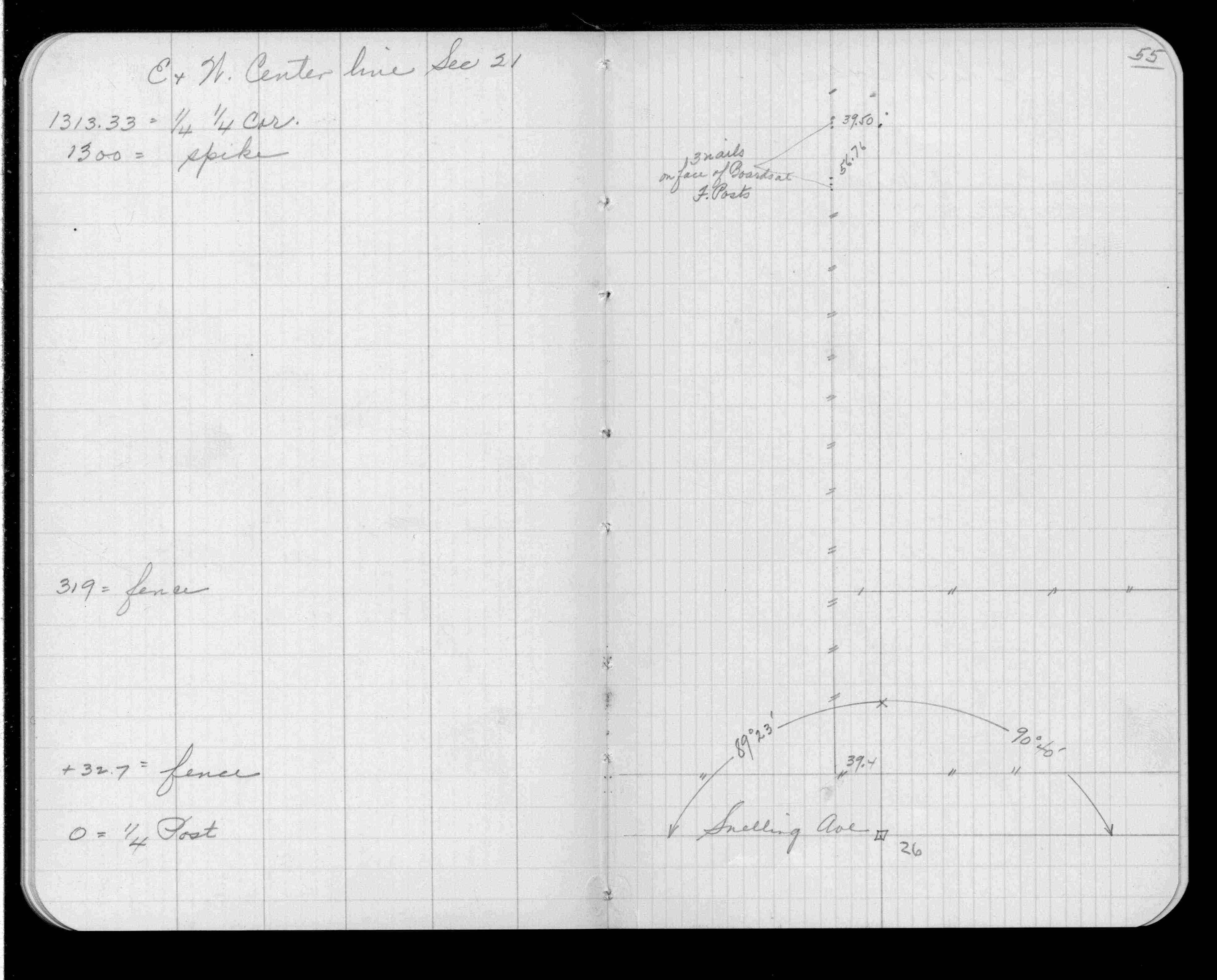
| FB 0335CPYp.55 | ||||||
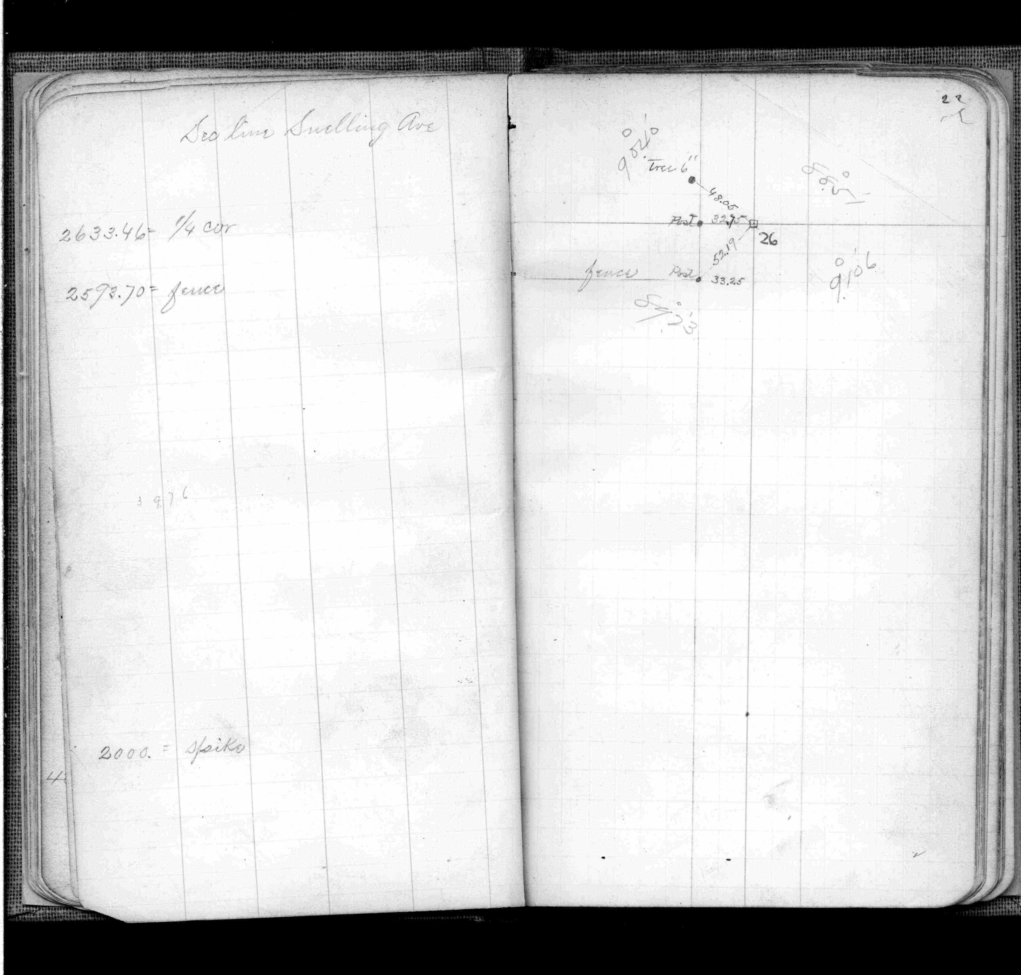
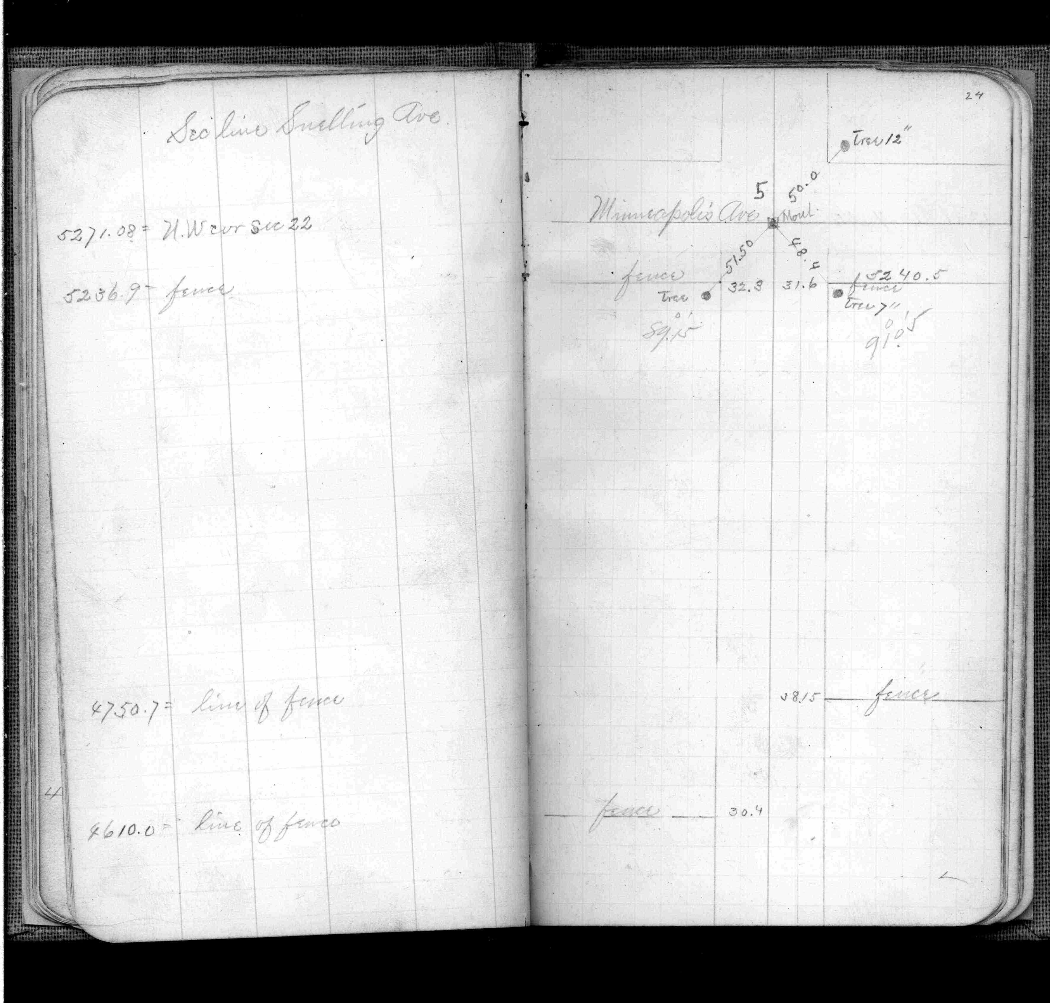
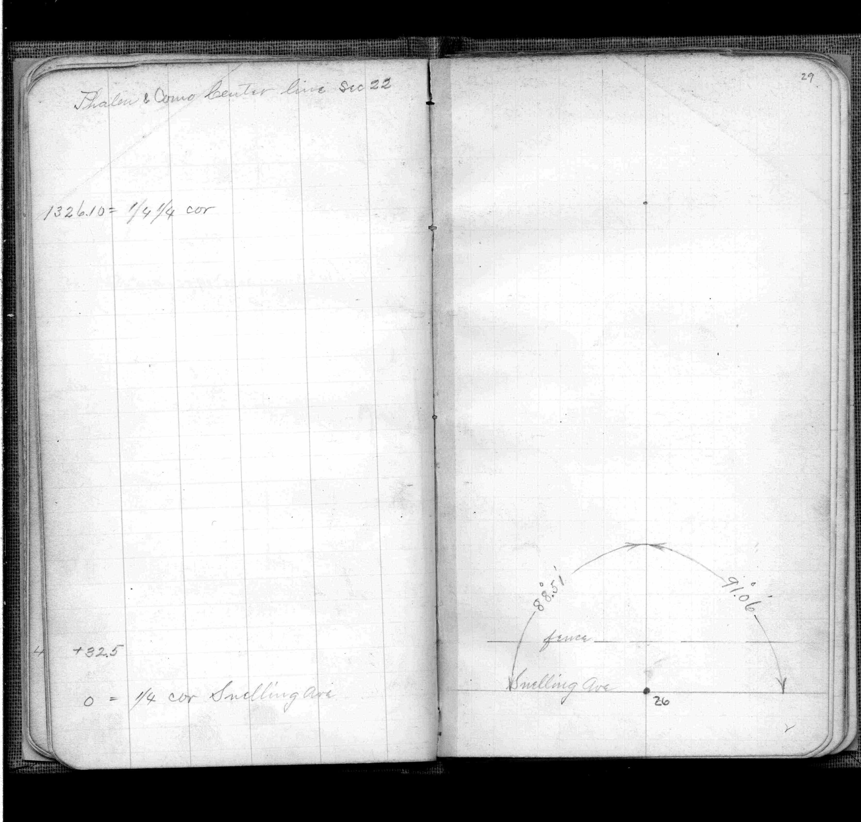
| FB 0345p. 22 ,24 ,29 | ||||||
| FB 1422Bp. 52 ,53 | ||||||
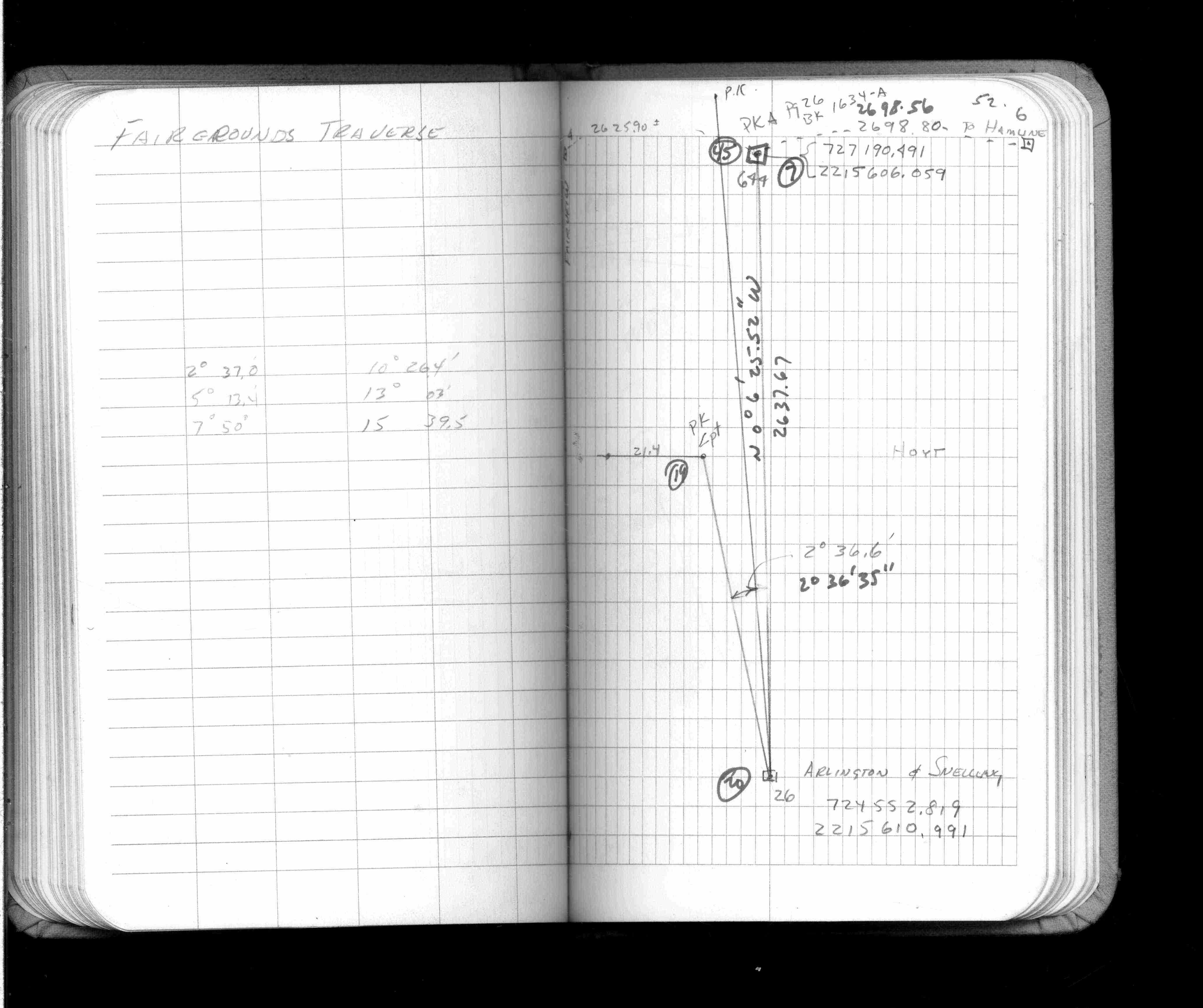
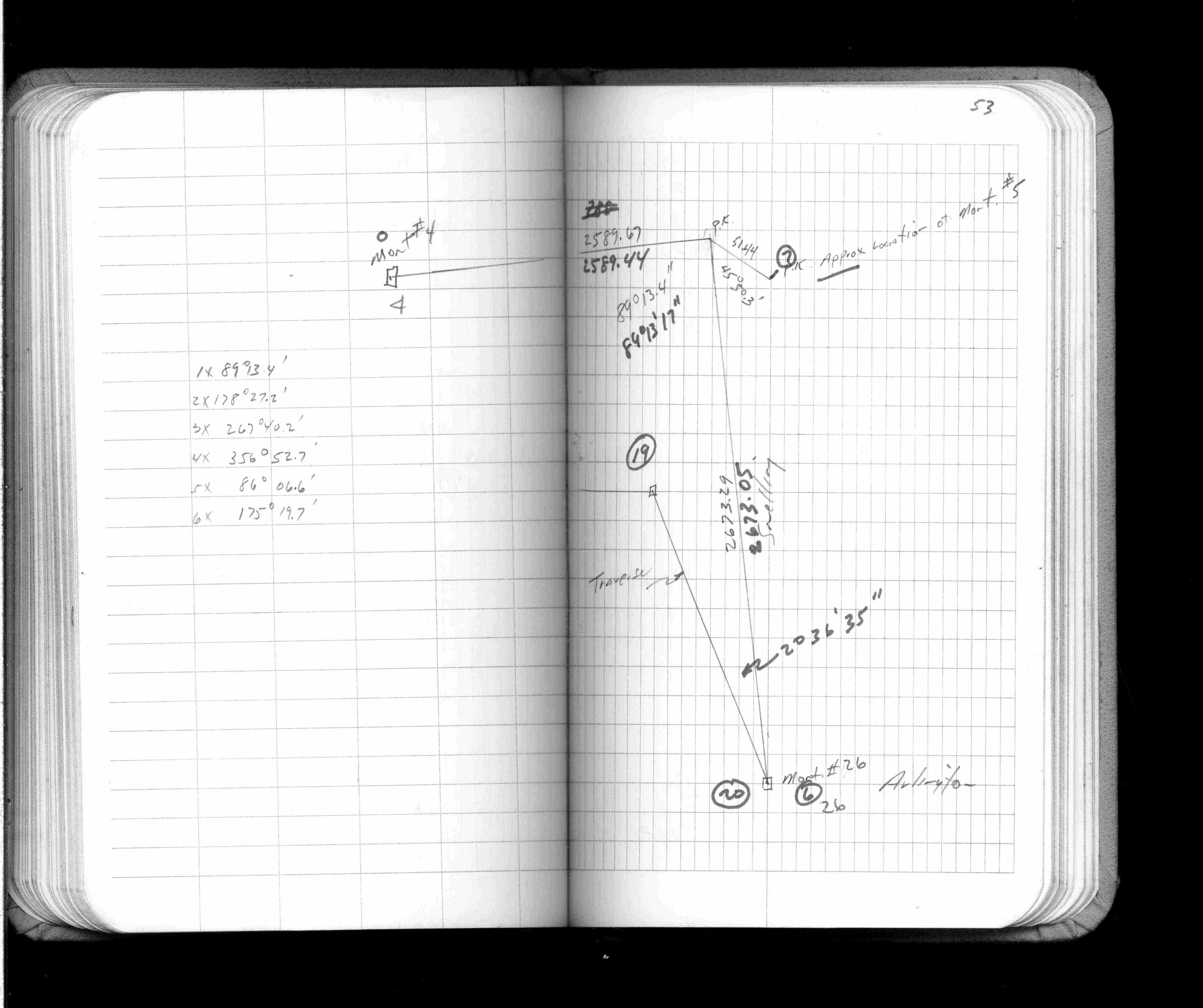
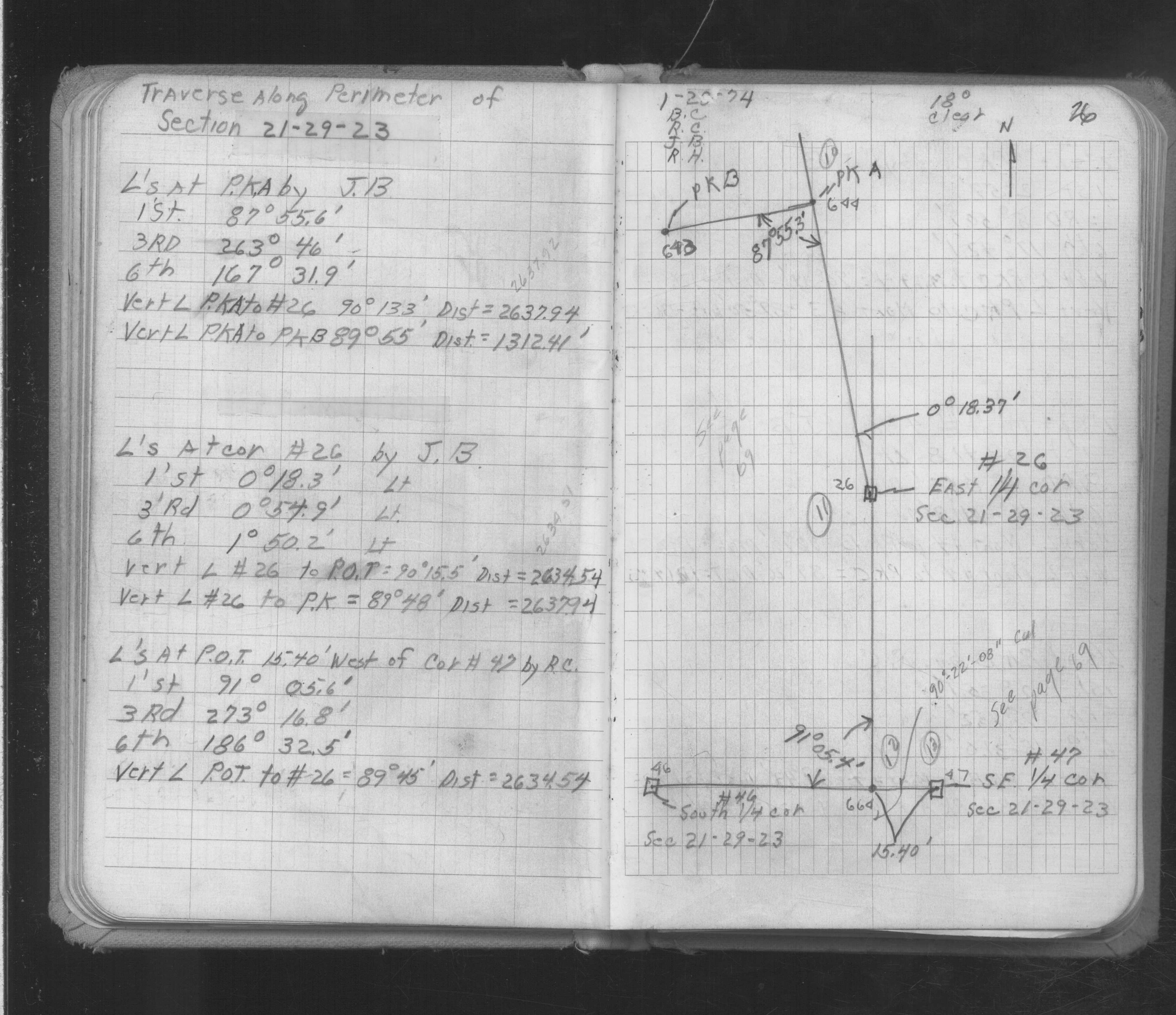
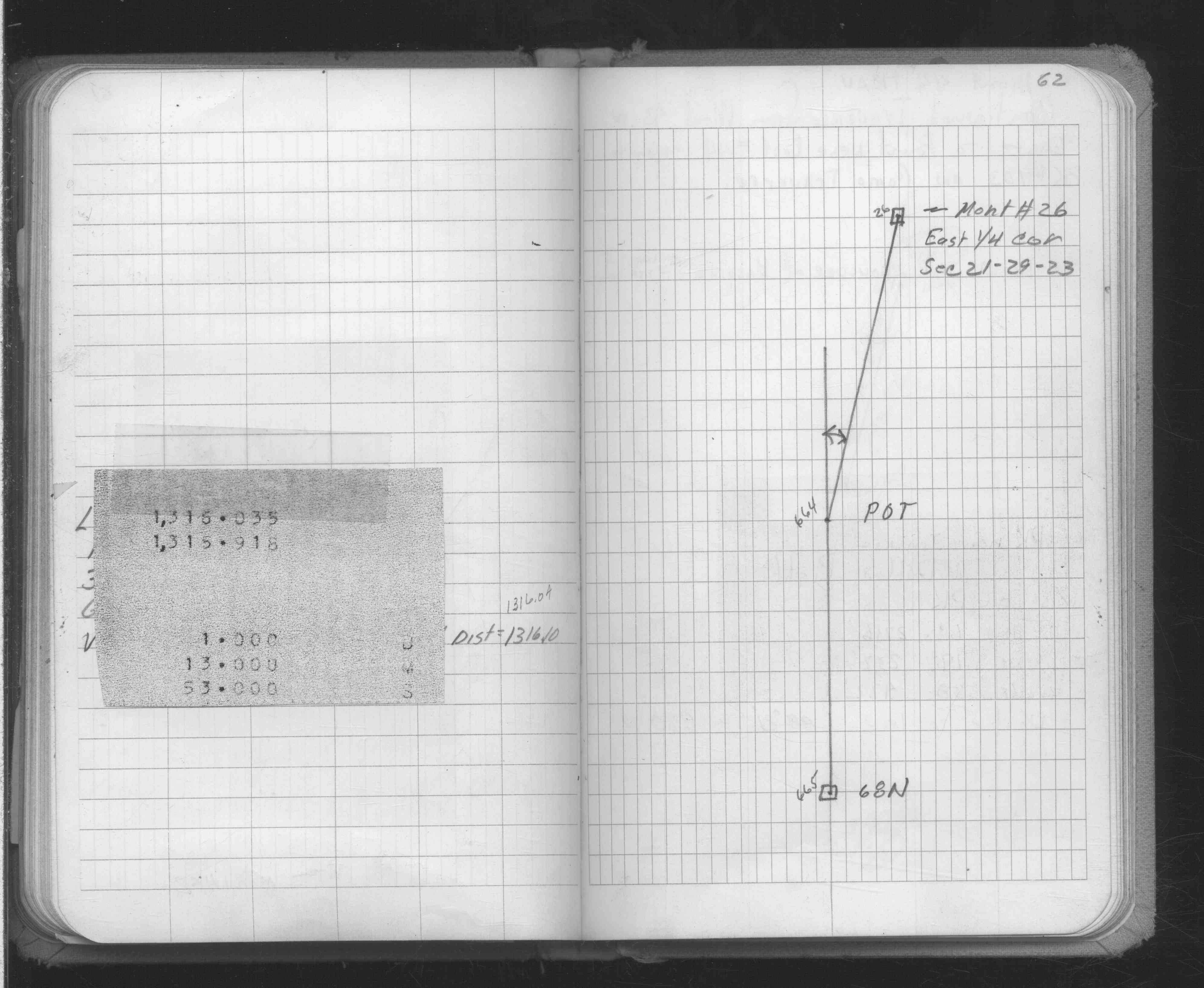
| FB 1634Ap. 26 ,62 | ||||||
| FB 1671p.27 | ||||||
| FB 1673Ap.23 | ||||||
| FB 1676Cp.14 | ||||||
| FB 1736p.09 |
| FILE | SURVEYOR | LIC. NO. | DATE SIGNED | DATE TIED |
|---|---|---|---|---|
| 0026-2684-A.tif | Jeffery L. Grosso | 13144 | October 8, 2002 | September 28, 2002 |
| ST_001-078p026.jpg | none | none | none | none |
| 0026-2684-A.dwf | none | none | none | none |
| FILE | PHOTO DATE | COMMENTS |
|---|---|---|
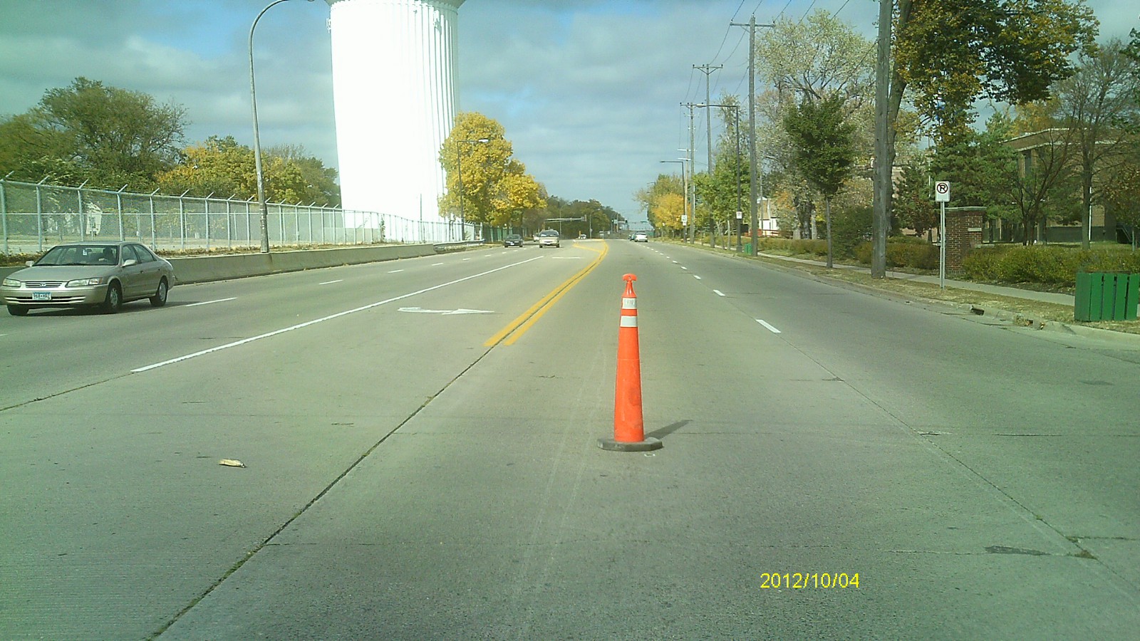
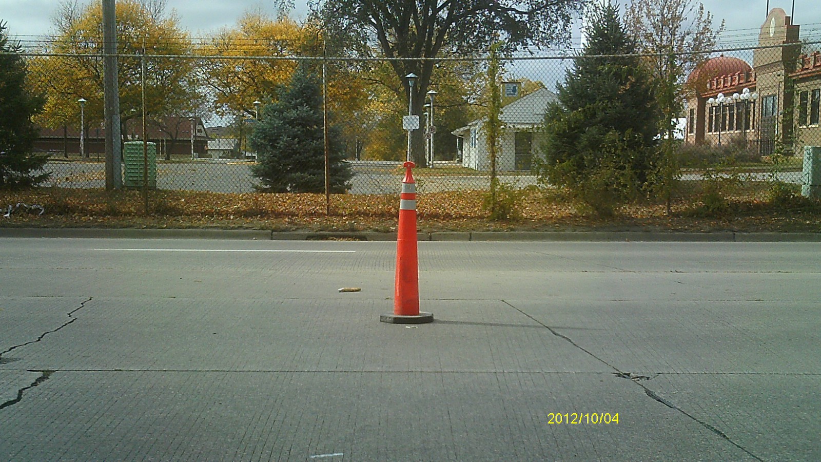
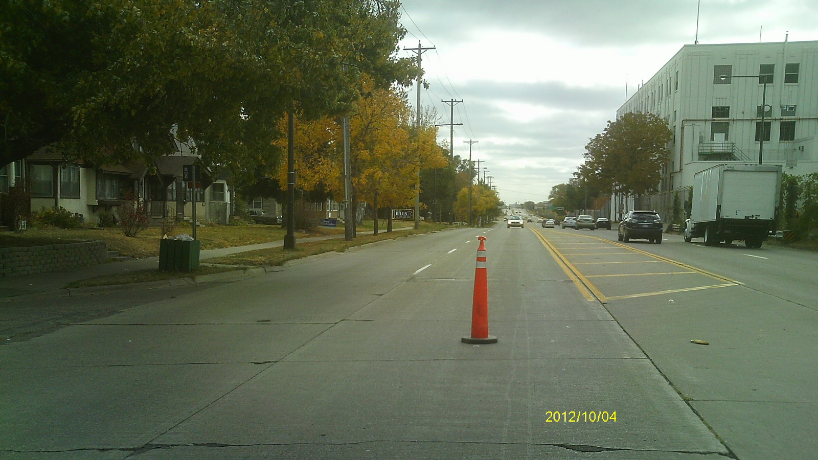
| 0026-2684-9.jpg | October 4, 2012 | Looking east along Arlington Ave. |
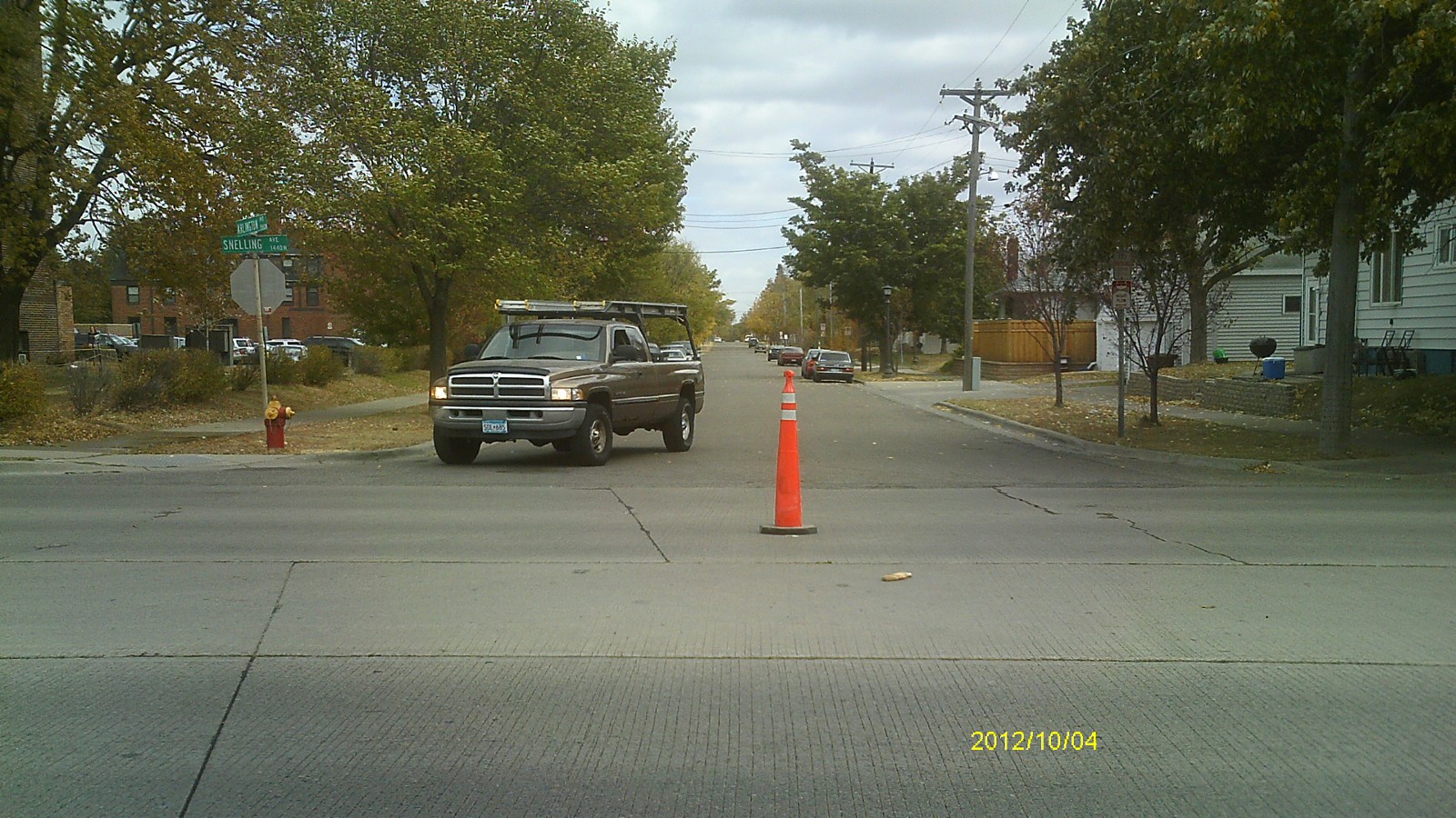
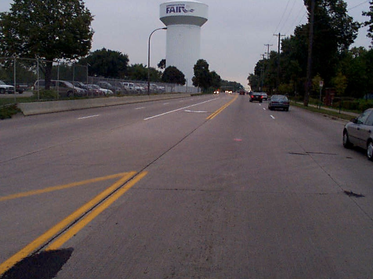
| 0026-2684-8.jpg | October 4, 2012 | Looking north along Snelling Ave. |
| 0026-2684-7.jpg | October 4, 2012 | Close up of monument. |
| 0026-2684-11.jpg | October 4, 2012 | Looking west along Arlington Ave. |
| 0026-2684-10.jpg | October 4, 2012 | Looking south along Snelling Ave. |
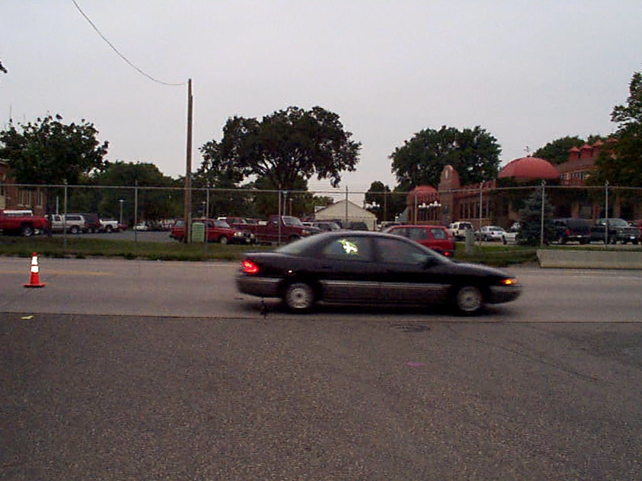
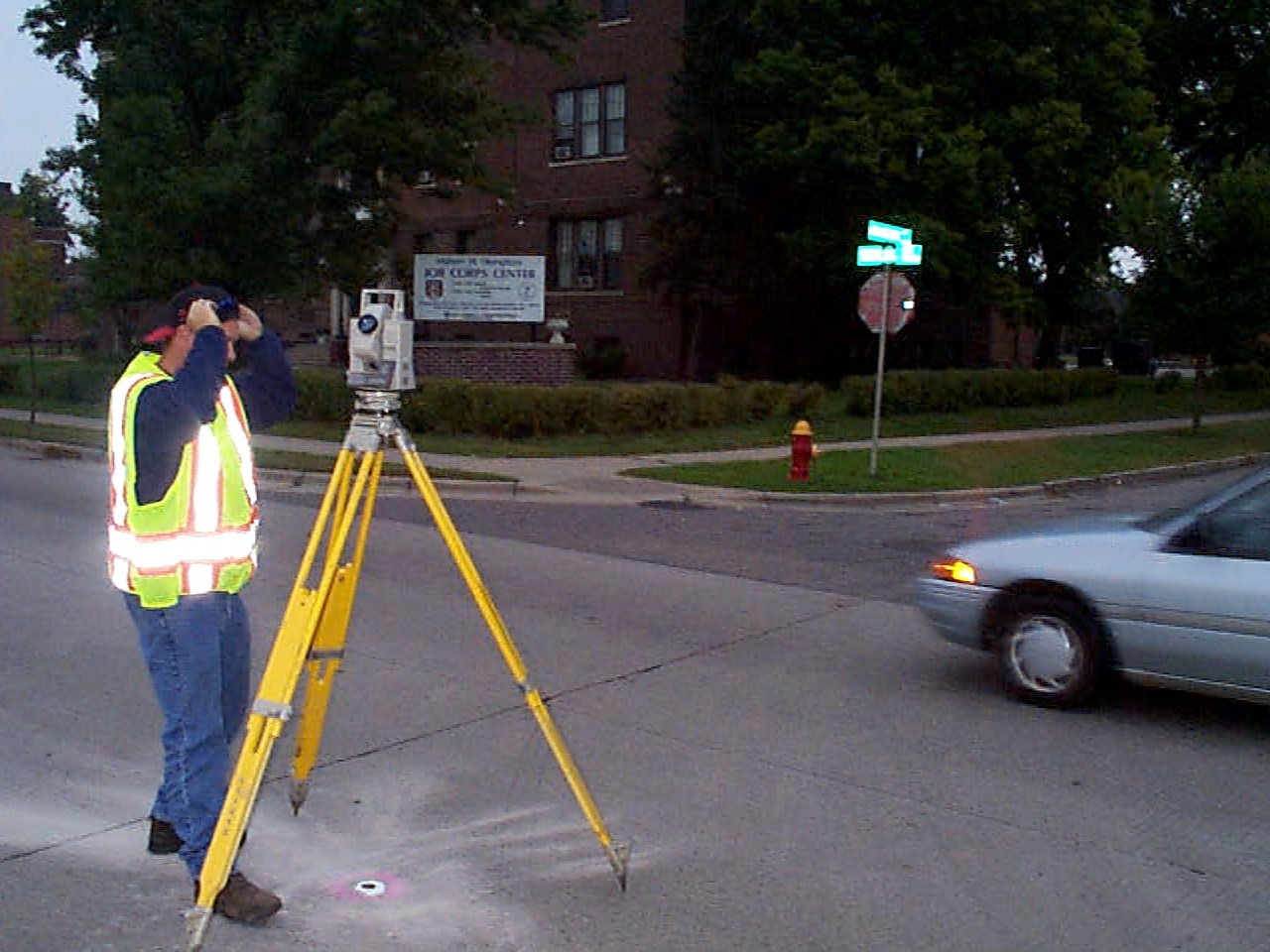
| 0026-2684-6.jpg | September 28, 2002 | Looking southeast towards tie points. |
| 0026-2684-5.jpg | September 28, 2002 | Looking west towards tie points. |
| 0026-2684-4.jpg | September 28, 2002 | Looking north towards power pole tie on east side of Snelling. |
| 0026-2684-3.jpg | September 28, 2002 | Looking northeast towards tie points. |
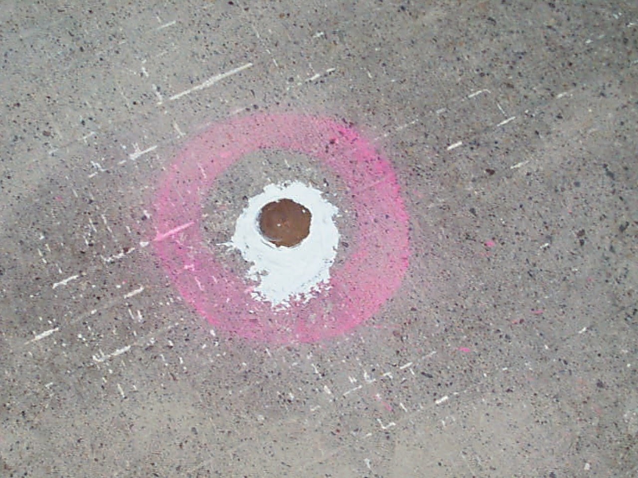
| 0026-2684-2.jpg | September 28, 2002 | Close up of bronze cap set in place of drill hole. |
| 0026-2684-1.jpg | September 28, 2002 | Close up of drill hole. |