| NAD83 COORDINATES (1986 adj.): |
|---|
| * X= 566532.69 Y= 170646.03 Z= 0 LSQ 12/6/1991 S FLT |
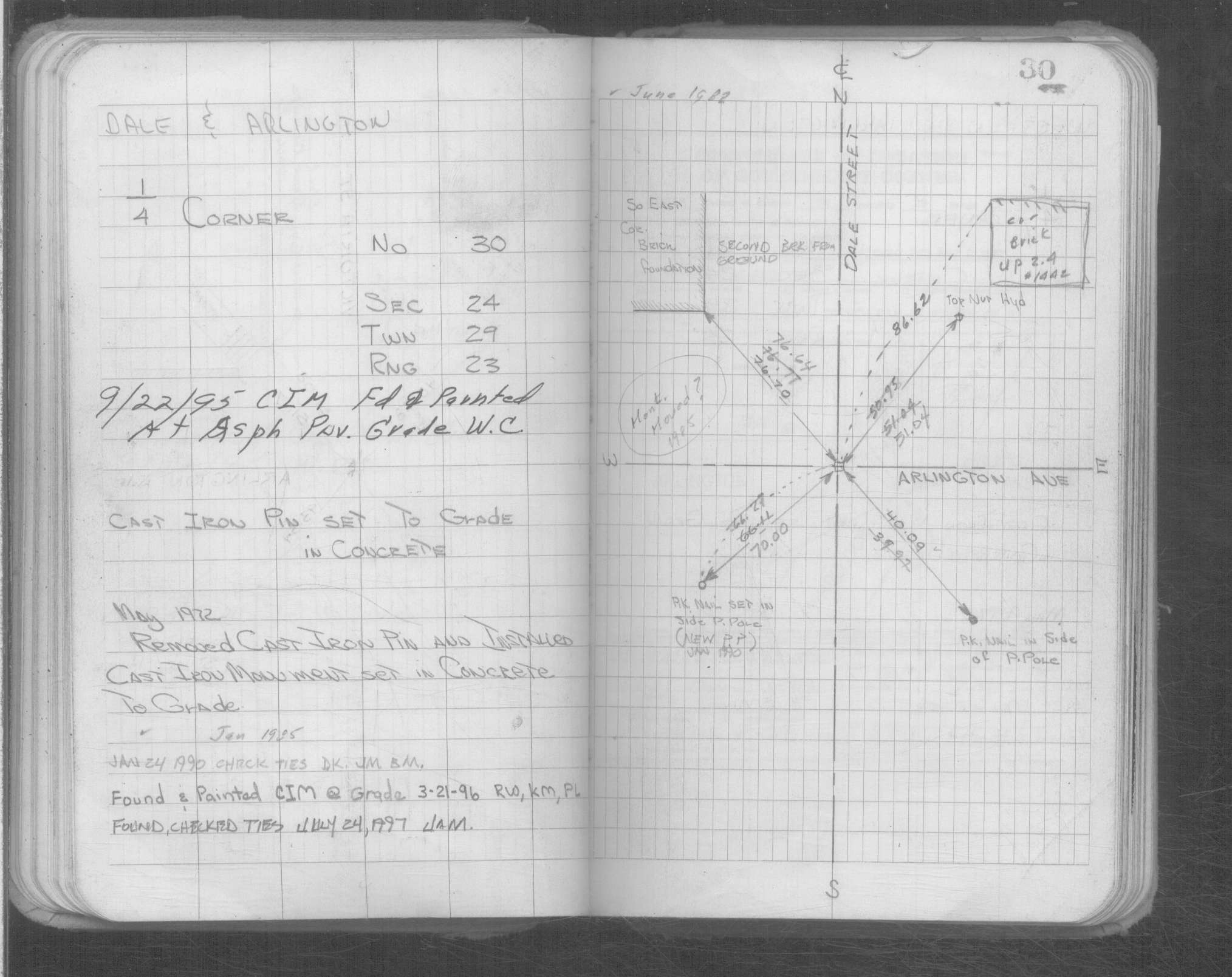
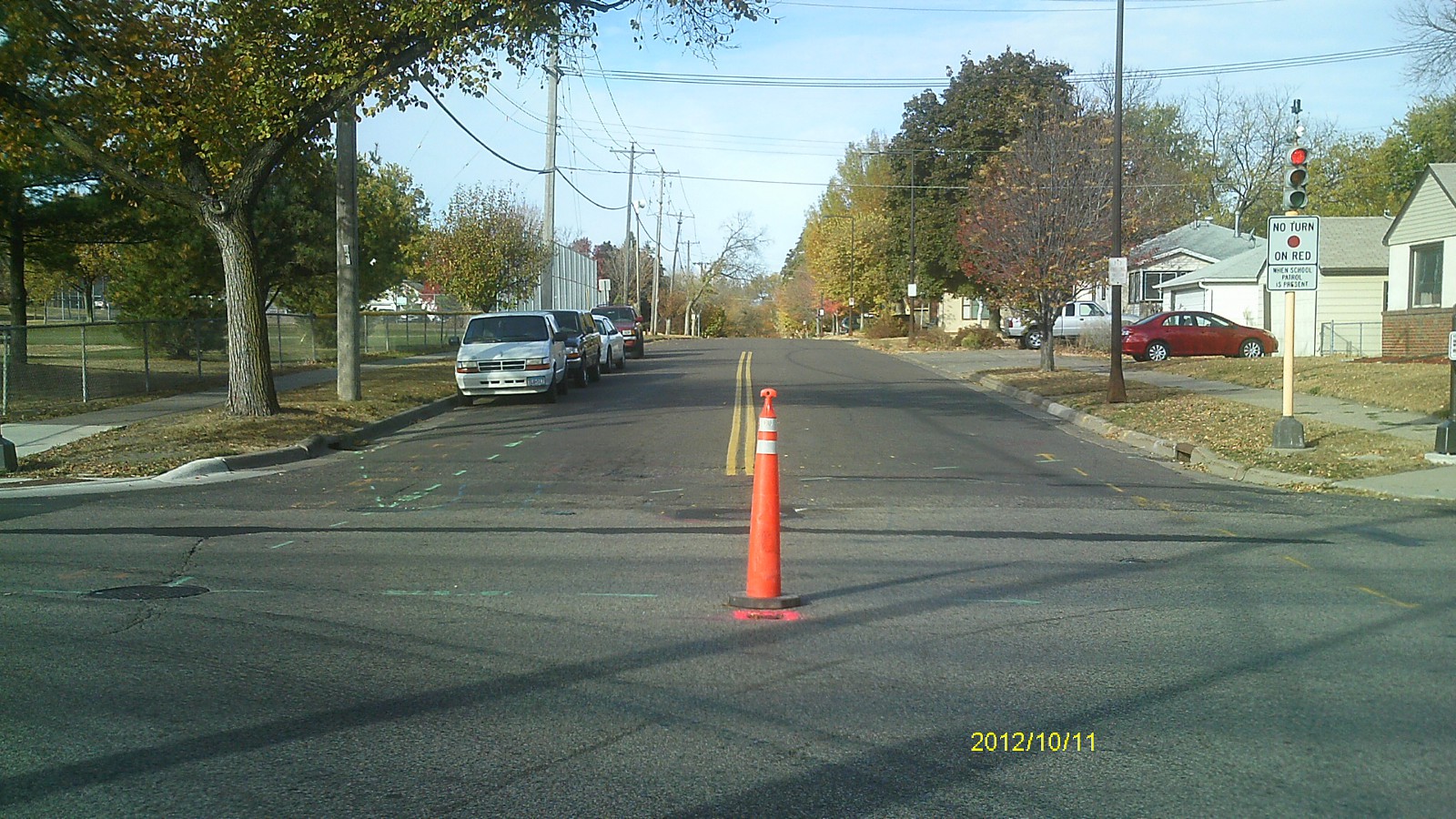
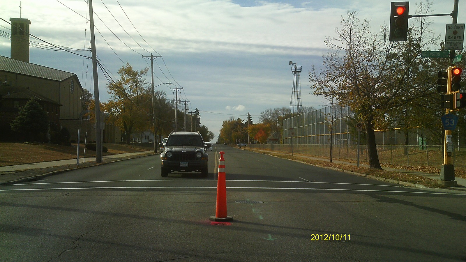
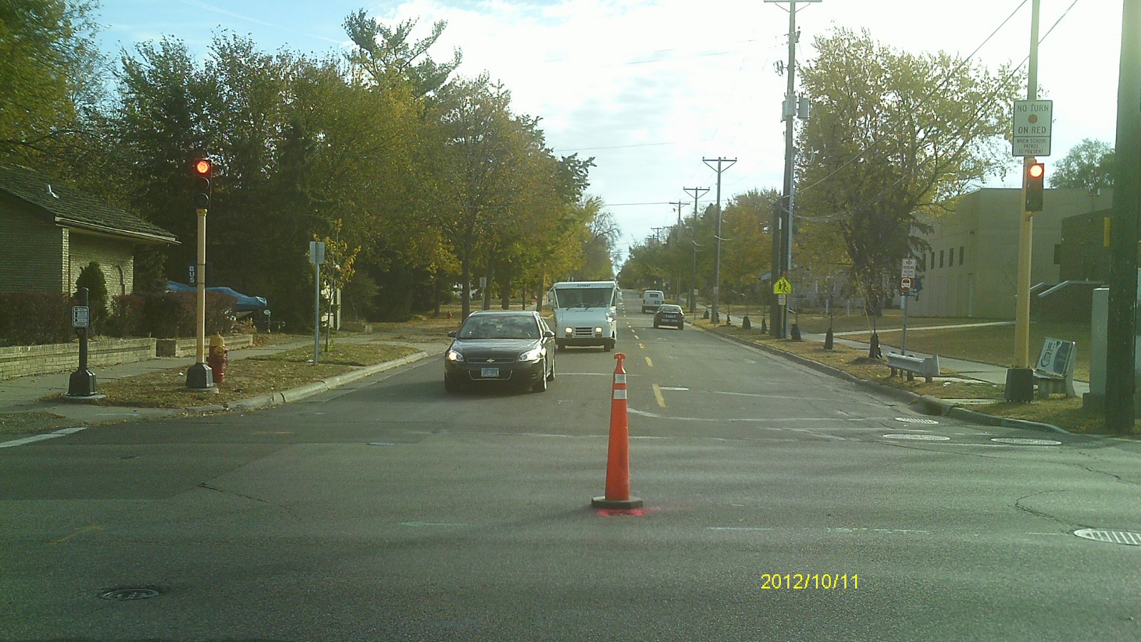
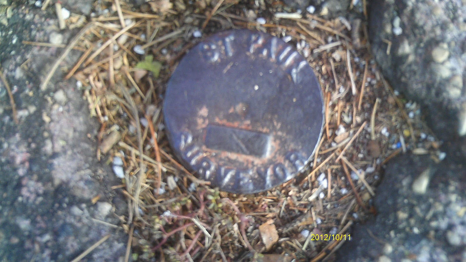
| 10/11/2012 | Found CIM at street grade. Photos taken. |
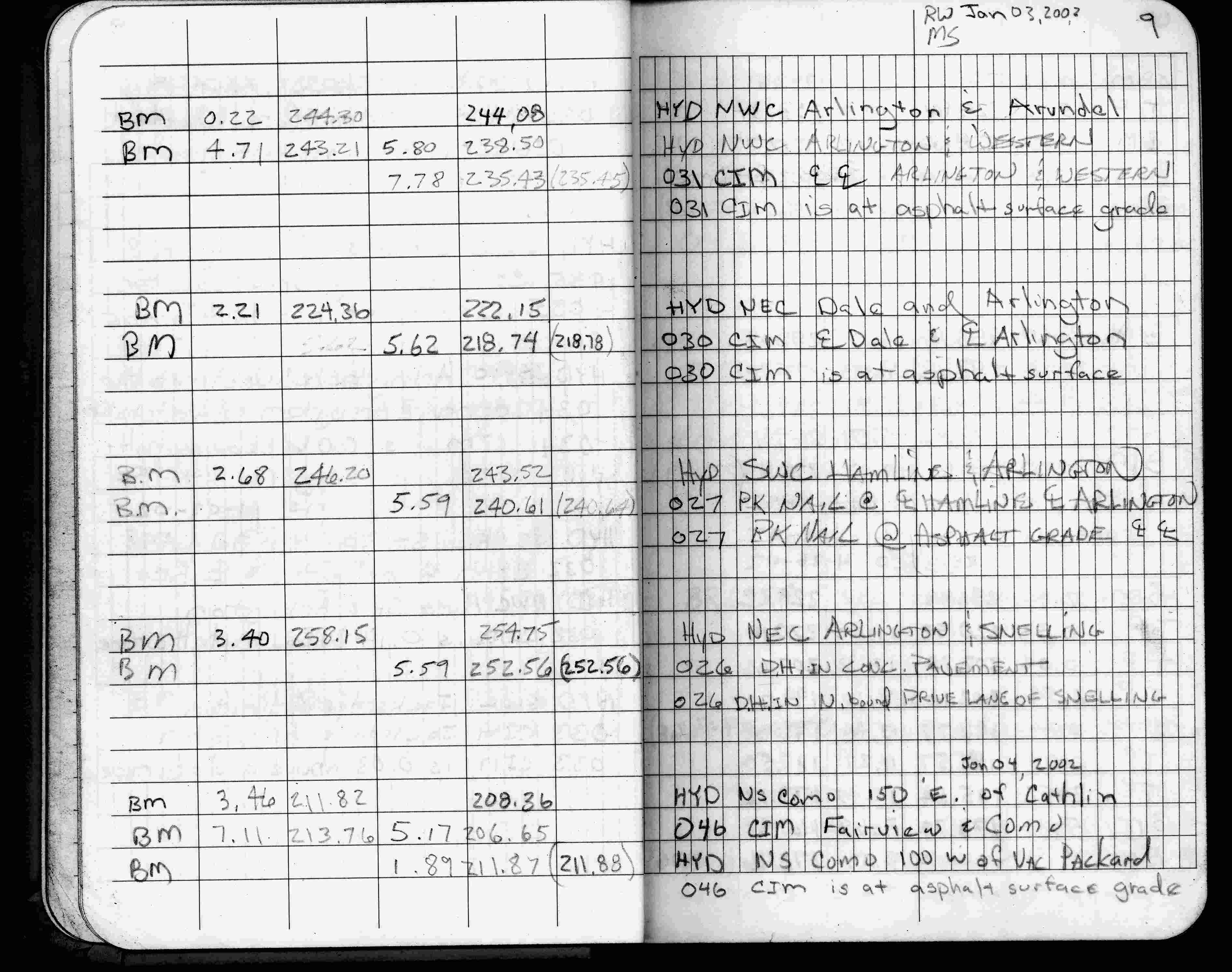
| 1/3/2002 | Elev 218.47 ft on CIM at asphalt surface. See FB 1736 p.9 |
| 3/17/2000 | Fd CIM at grade (marked for painting target for 2000 aerial) |
| 9/8/1999 | Place 4" thick concrete around CIM. See CofL 0030-0005-A |
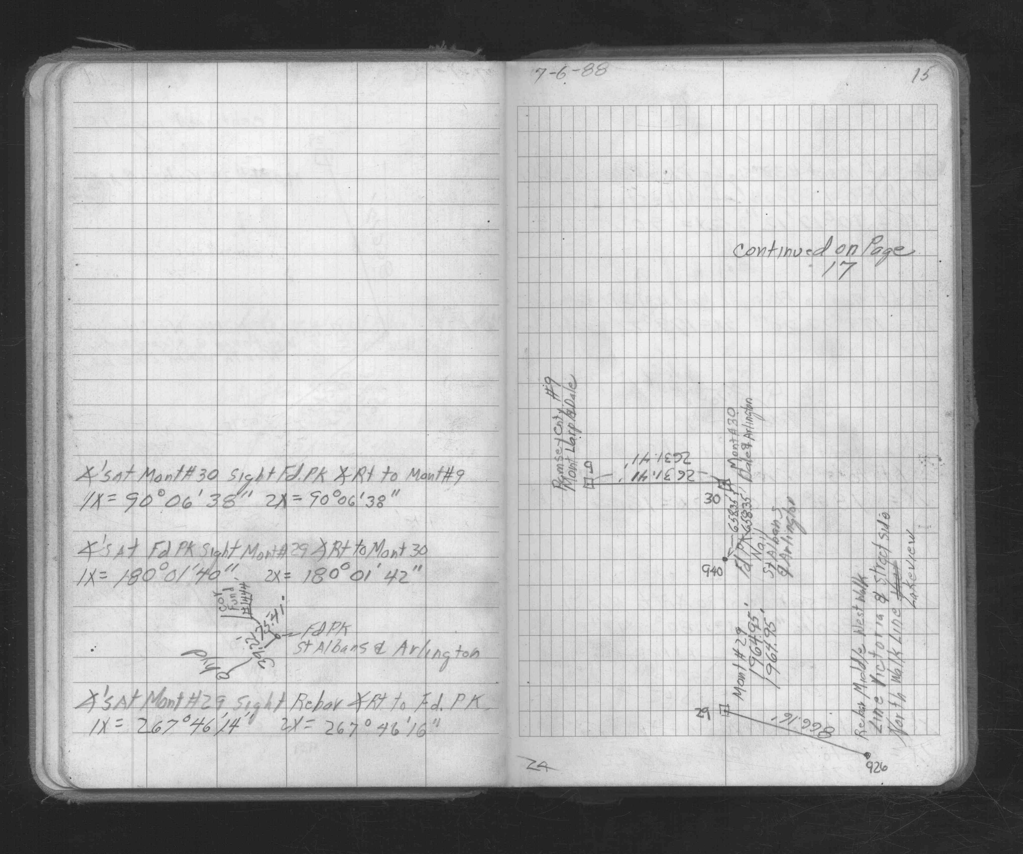
| 6/29/1999 | Place a 20" long CIM. See CofL 0030-0005-A |
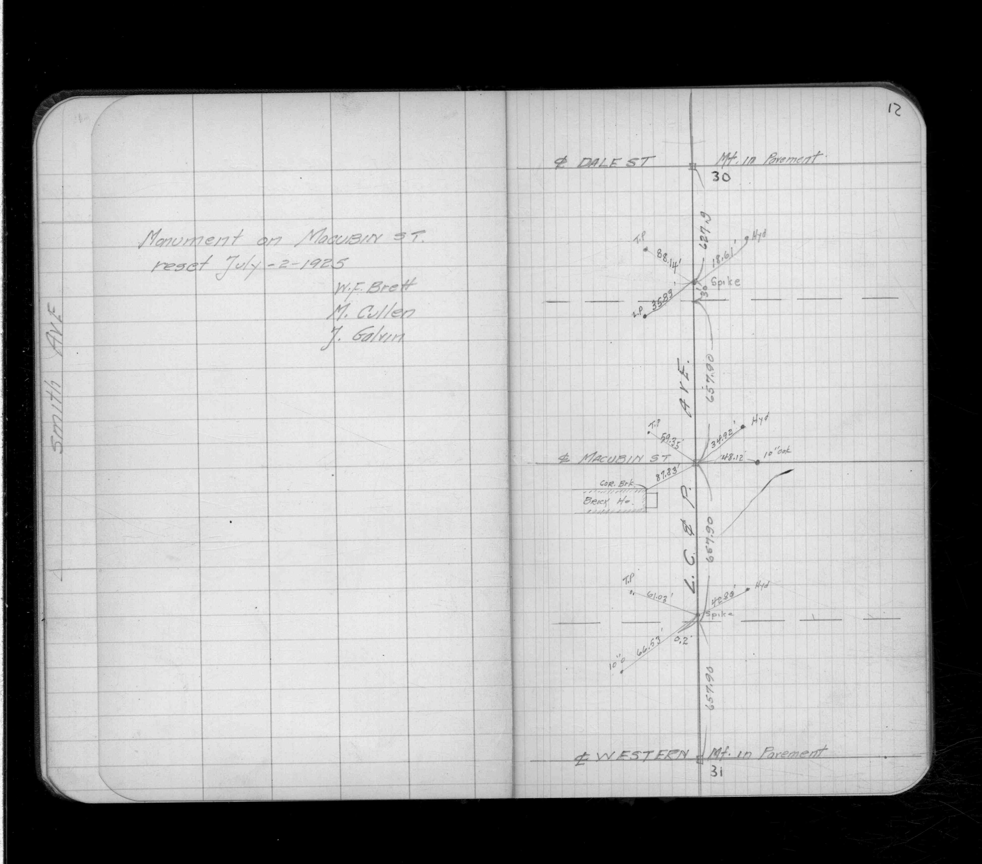
| 9/24/1998 | Recovered CIM set in concrete (top broken off). See CofL 0030-0005-A |
| 3/5/1996 | Elev 218.78 ft on CIM. See 97adj.pts, 1996/bmdale.org/bmdale.sdr (loop 091) Digital-Adj |
| 9/21/1995 | Fd CIM (marked for painting target for 1995 aerial) |
| 1/1/1990 | (Unknown date Jan __, 1990 ) CIM set to grade |
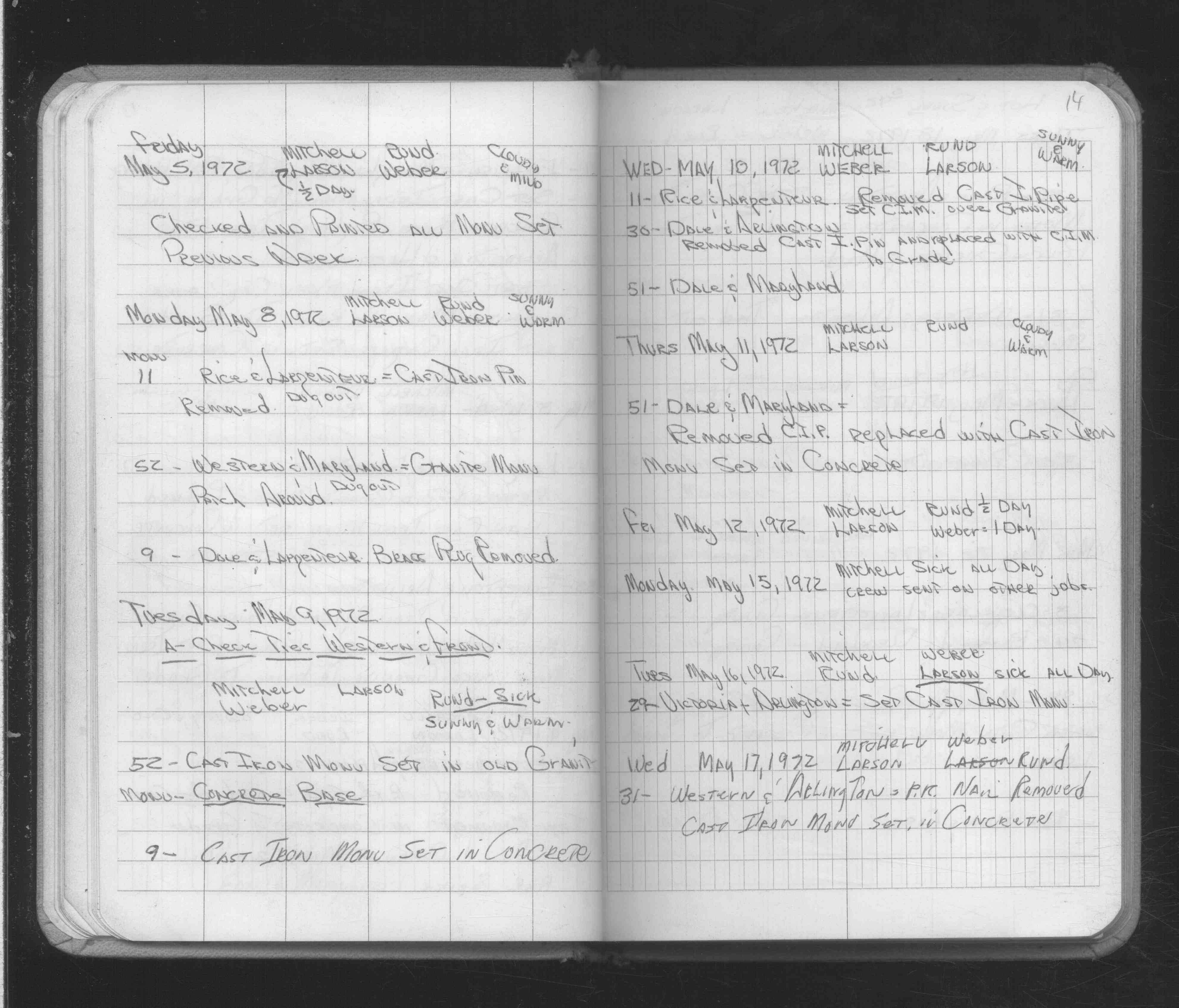
| 5/10/1972 | Removed cast iron pin, replaced with CIM to grades. See FB 1689A p.14 |
| 4/2/1890 | Monument tied by J H Armstrong in FB 313 p.2 |
| 3/27/1877 | Hub put in from bearing stump furtherest west |
| 11/1/1847 | (Unknown date Nov __, 1847 ) Isaac N Higbee deputy surveyor set post. Tied to 2 BTs. See IH p.072-073 2923 |
| 1/1/1800 | (Unknown date ___ __, 18?? ) Elev 219.960 ft on GM. See Old Benches Book, Entry 1691 |
| 1/1/1800 | (Unknown date ___ __, ____ ) See FB 314 p.10 |
Above is NOT an all inclusive history of this point. Please review all the links below.
| PLS NOTES | Field | Cross Section | Sewer | J.B. Irvine | Monument | River Survey |
|---|---|---|---|---|---|---|
| IH p.072-073 | FB 0234p.79 | |||||
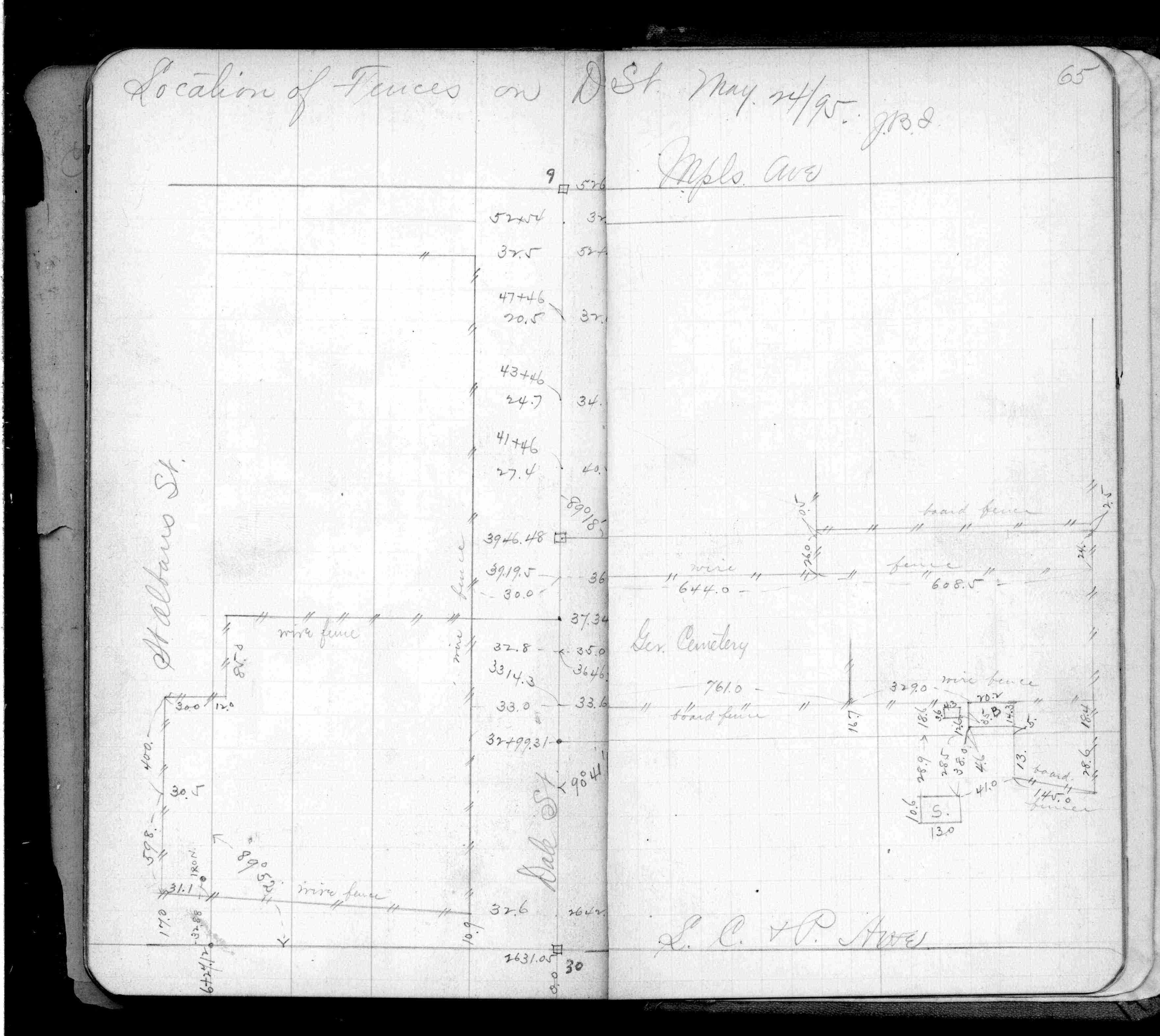
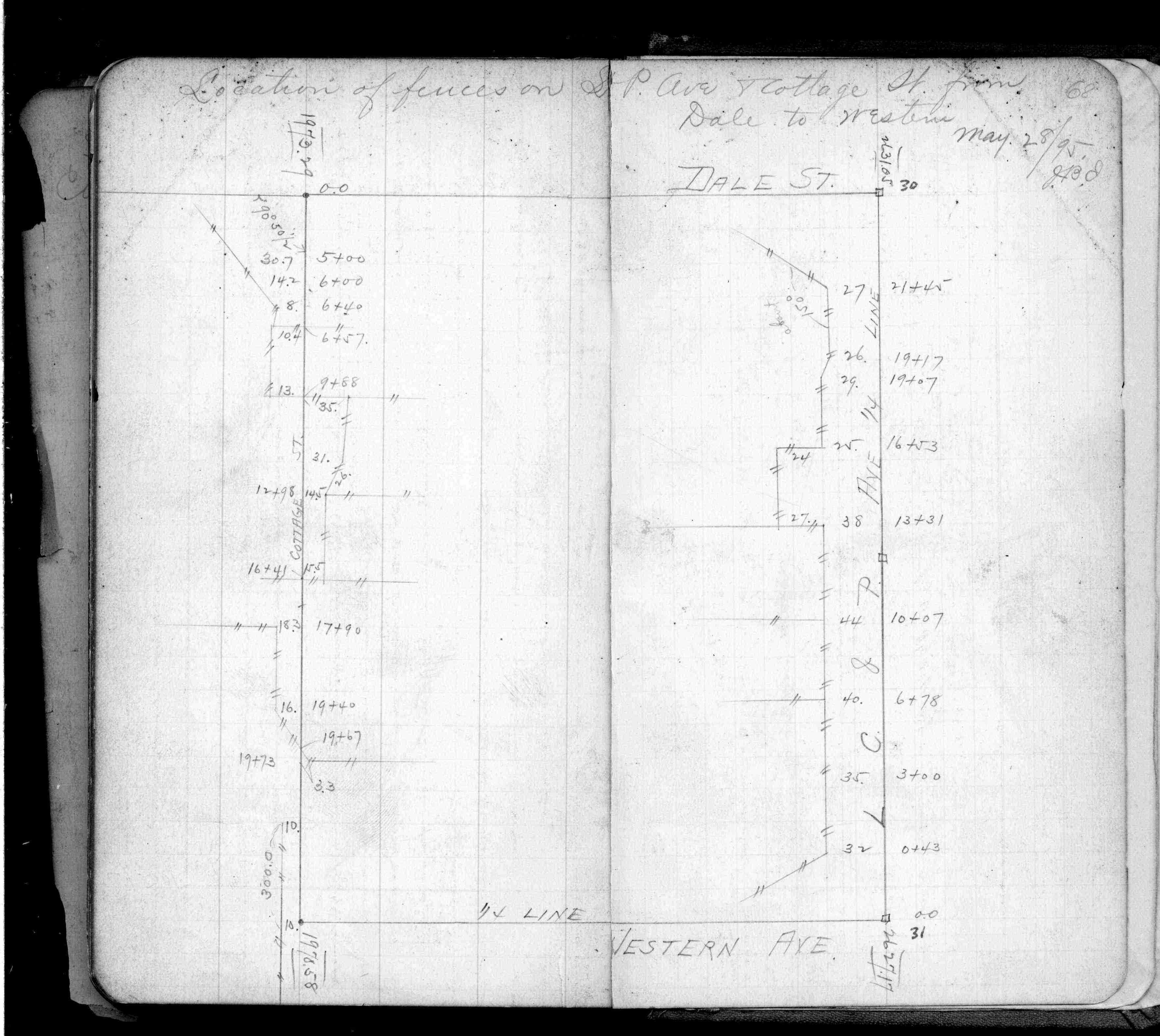
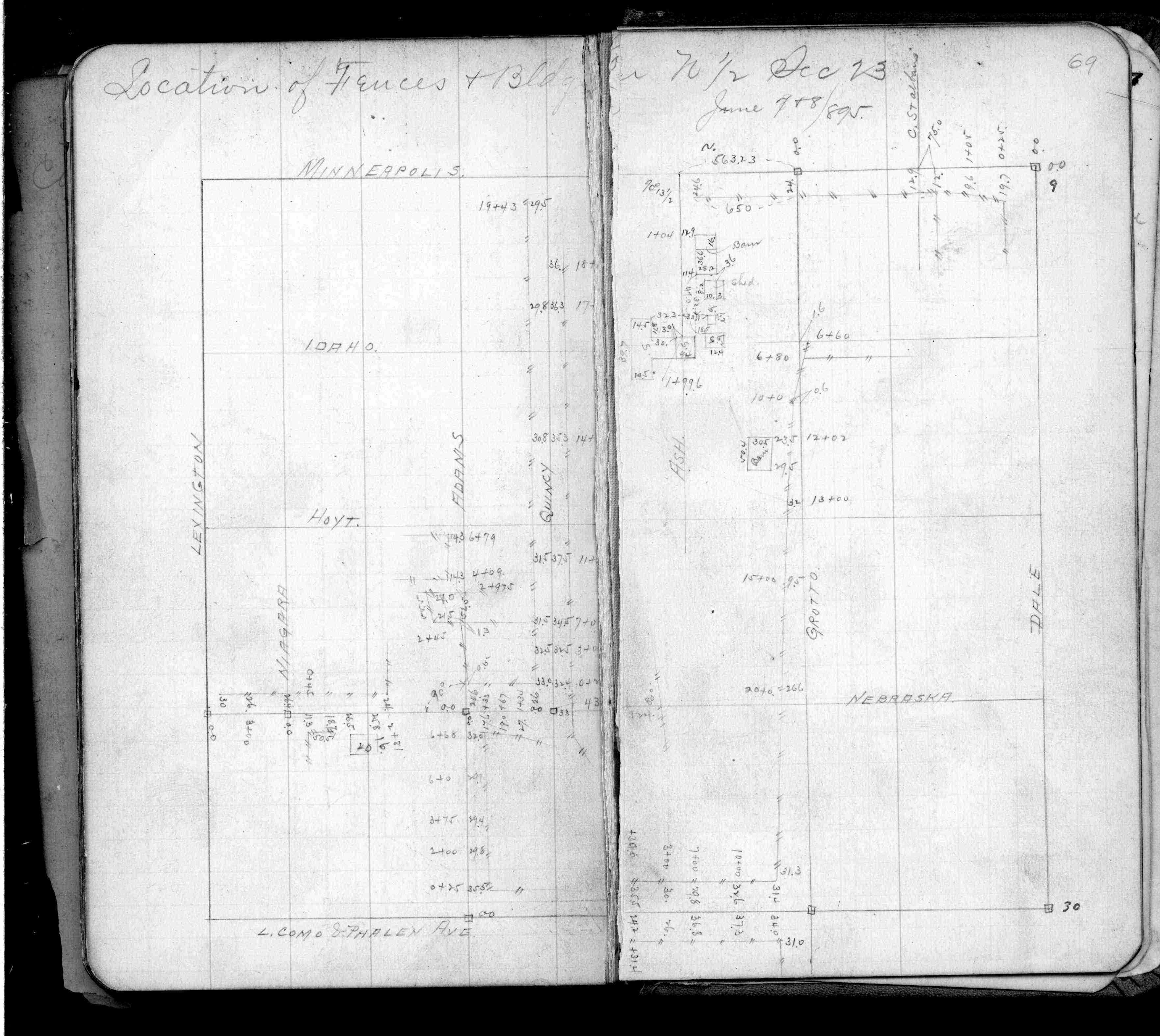
| FB 0274p. 65 ,68 ,69 | ||||||
| FB 0313p. 02 ,05 | ||||||
| FB 0314p.10 | ||||||
| FB 0314p.10 | ||||||
| FB 0353p.44 | ||||||
| FB 0438p.10 | ||||||
| FB 0596p.02 | ||||||
| FB 0819p.02 | ||||||
| FB 1132p.12 | ||||||
| FB 1483p.04 | ||||||
| FB 1549Fp.73 | ||||||
| FB 1549Ip.69 | ||||||
| FB 1641p.01 | ||||||
| FB 1671p. 40 ,41 ,42 ,43 ,44 ,47 ,48 | ||||||
| FB 1673Ap. 15 ,16 ,17 ,25 | ||||||
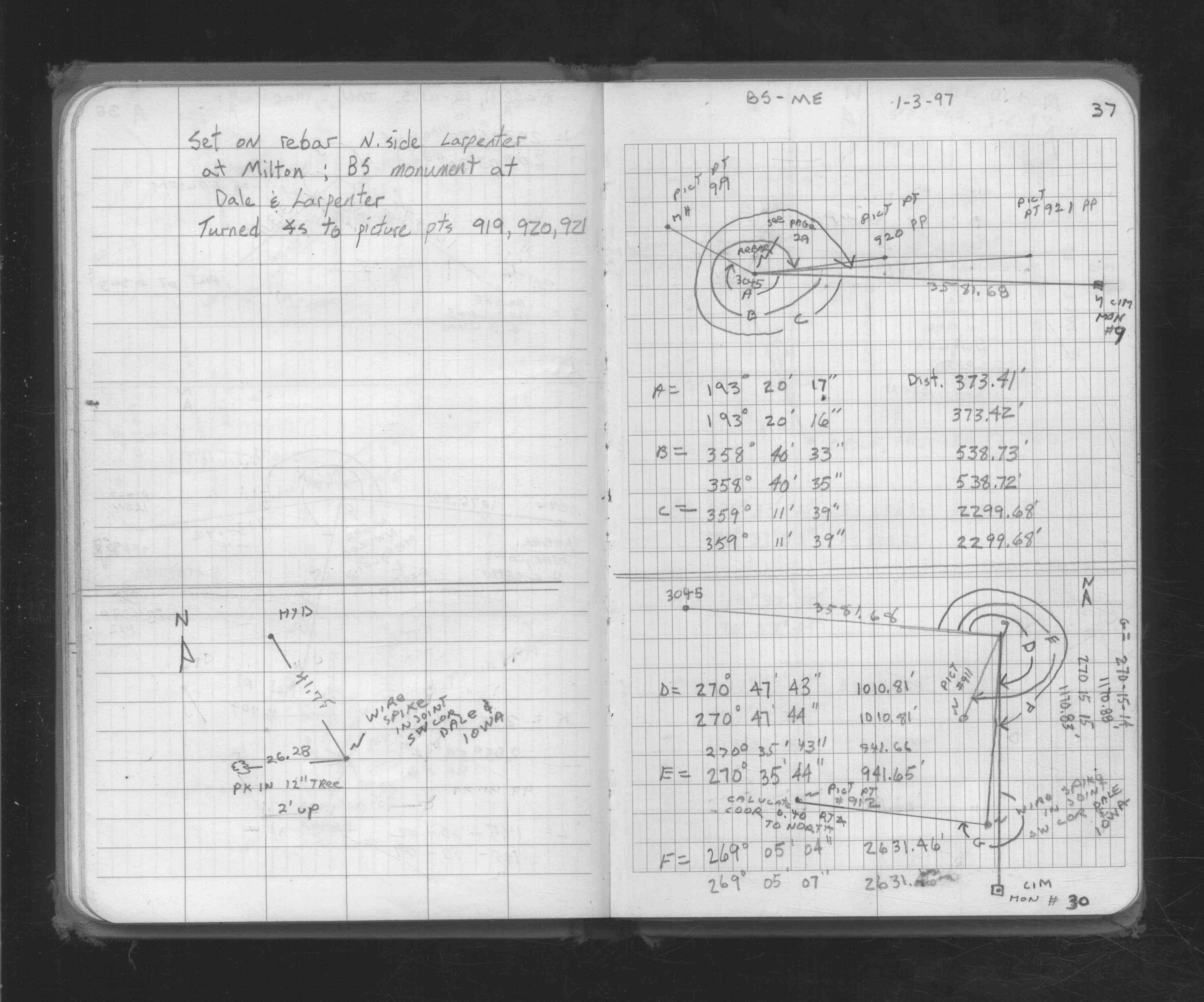
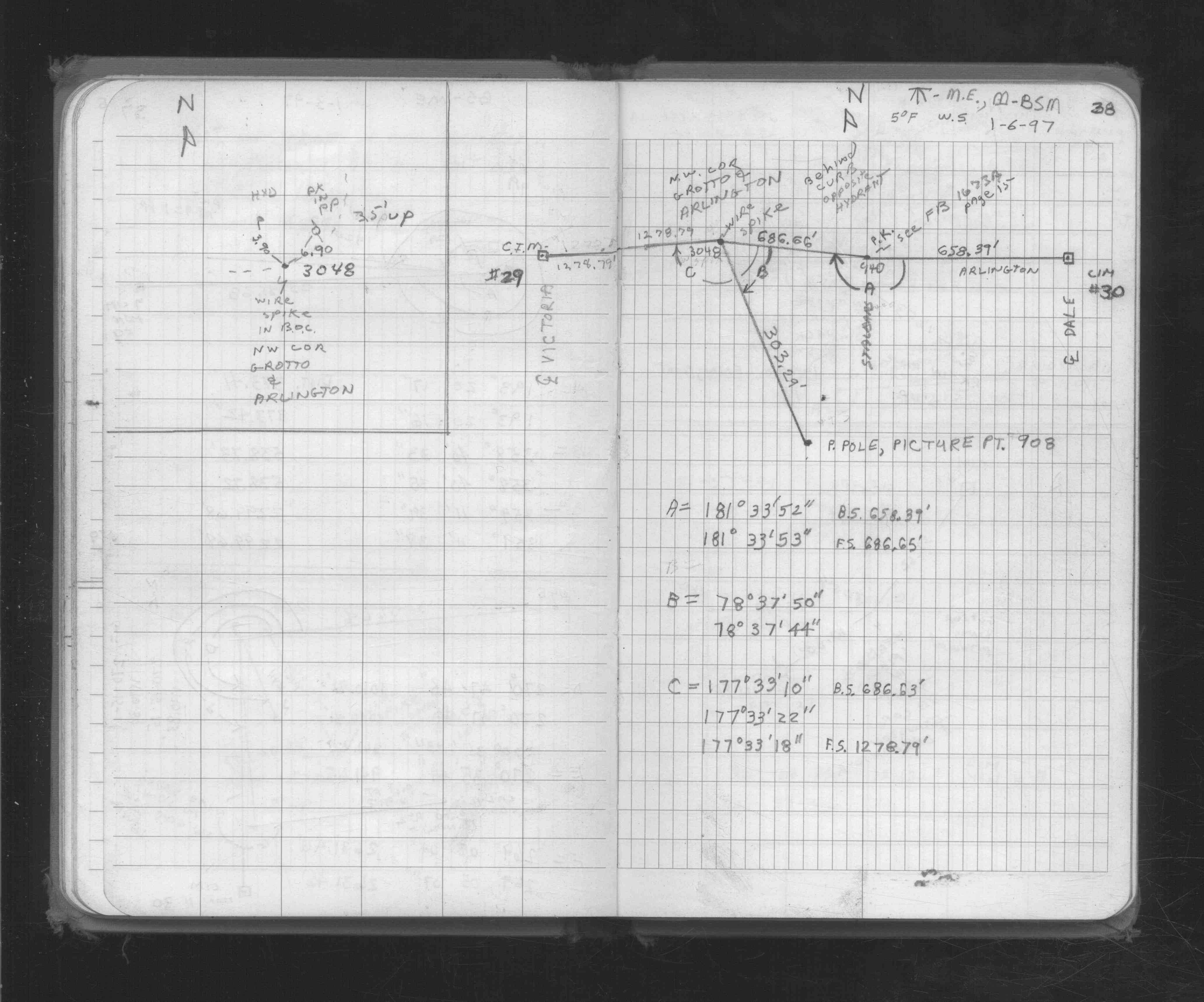
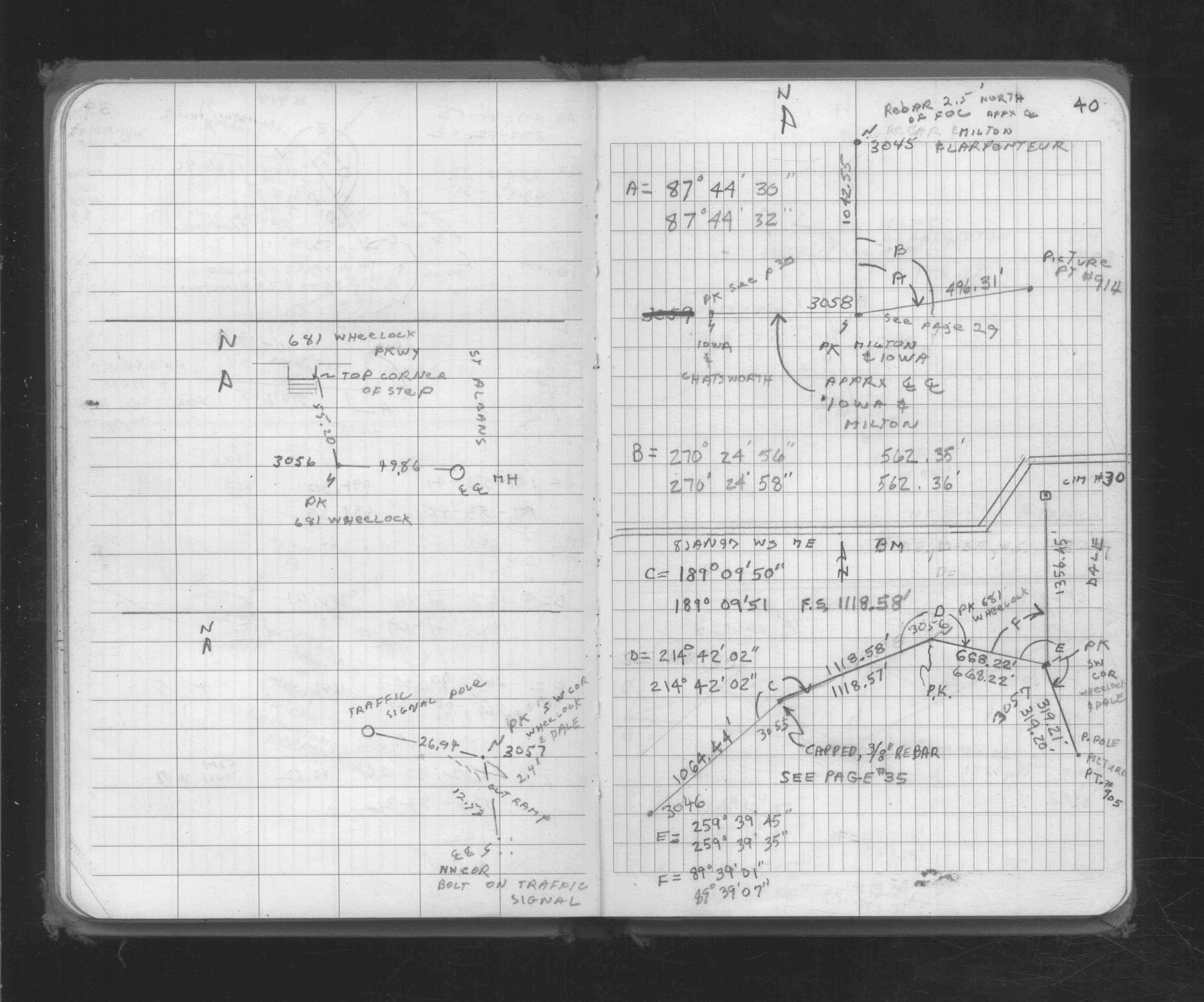
| FB 1676Ap. 32 ,33 | ||||||
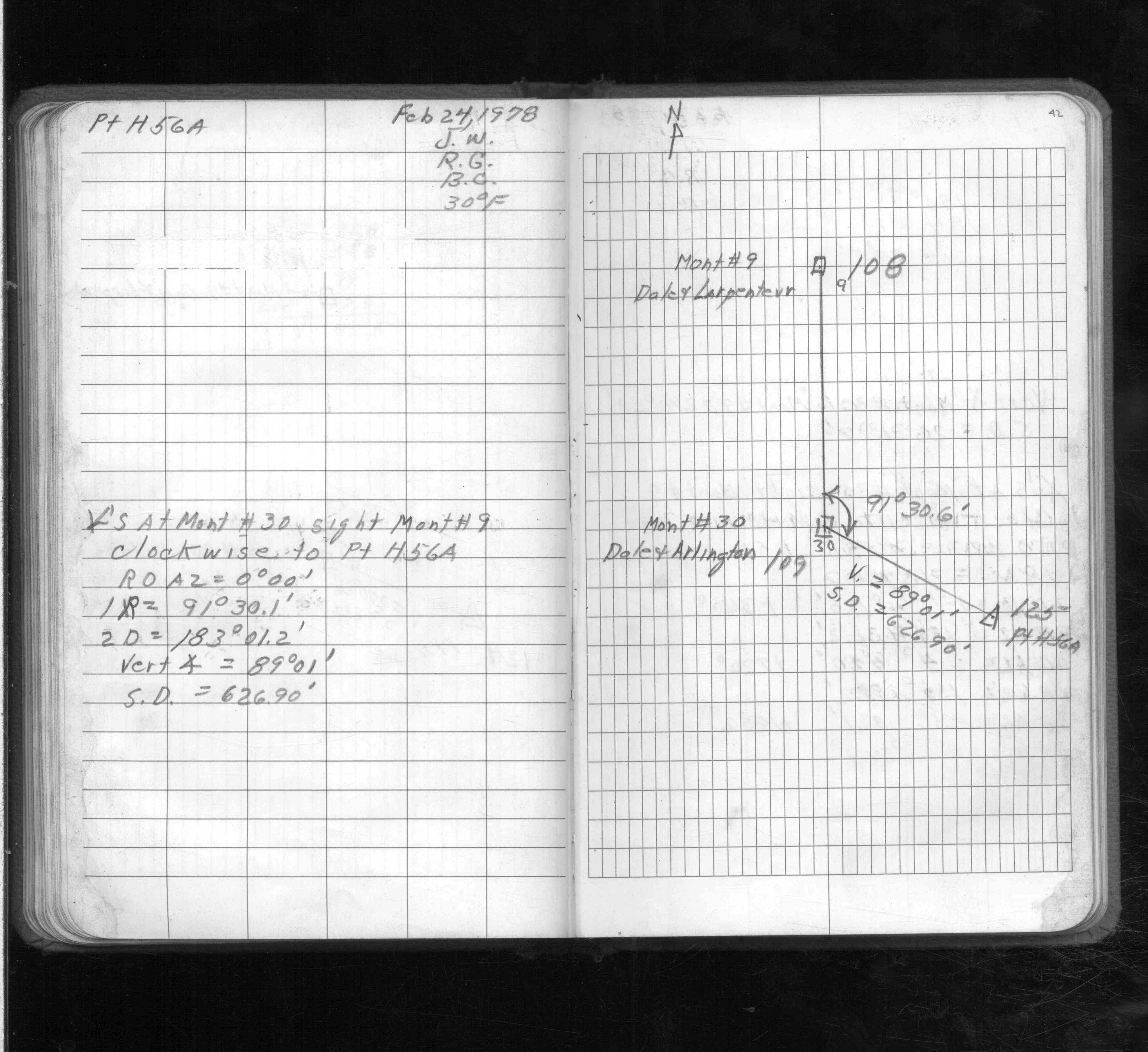
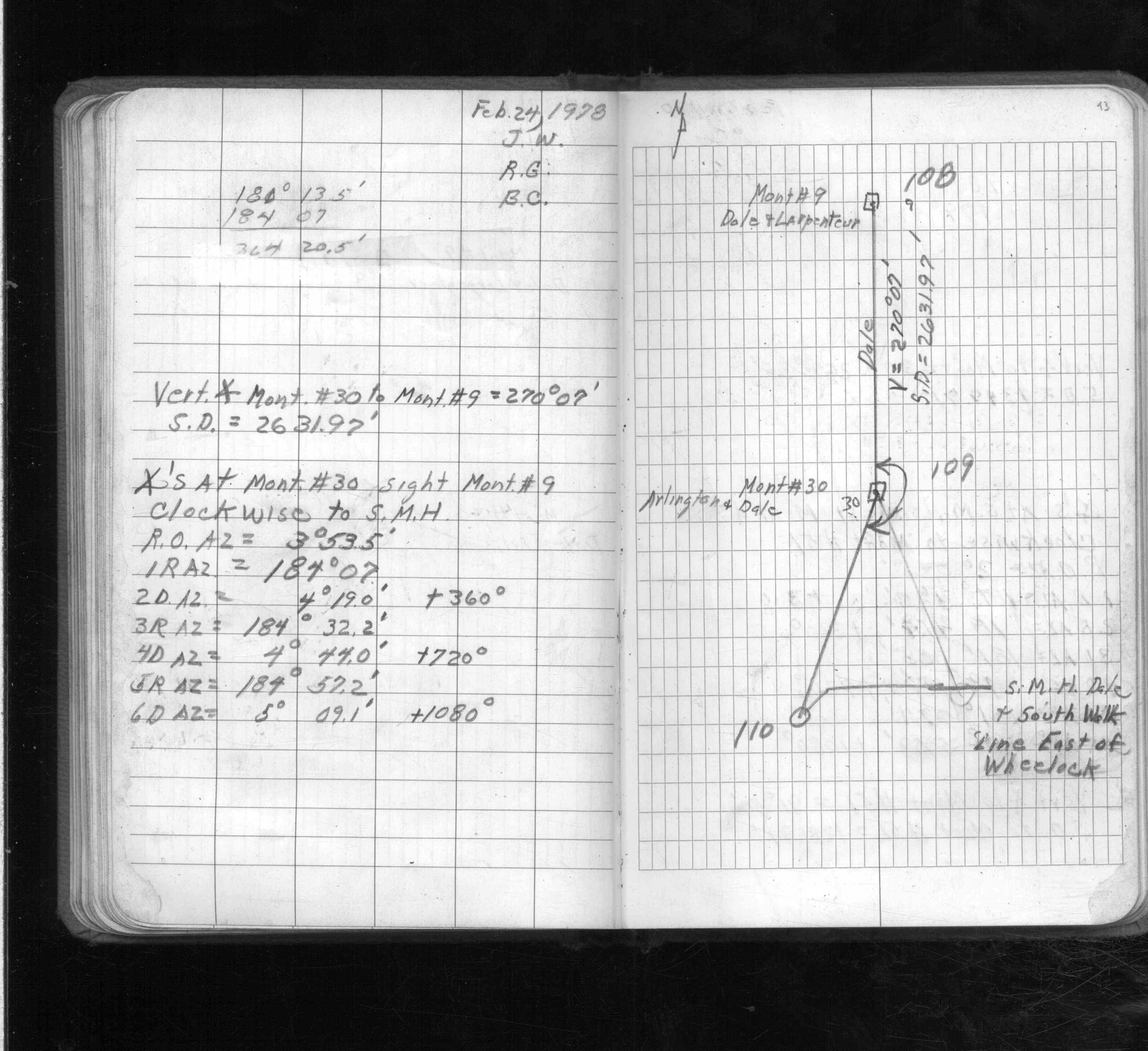
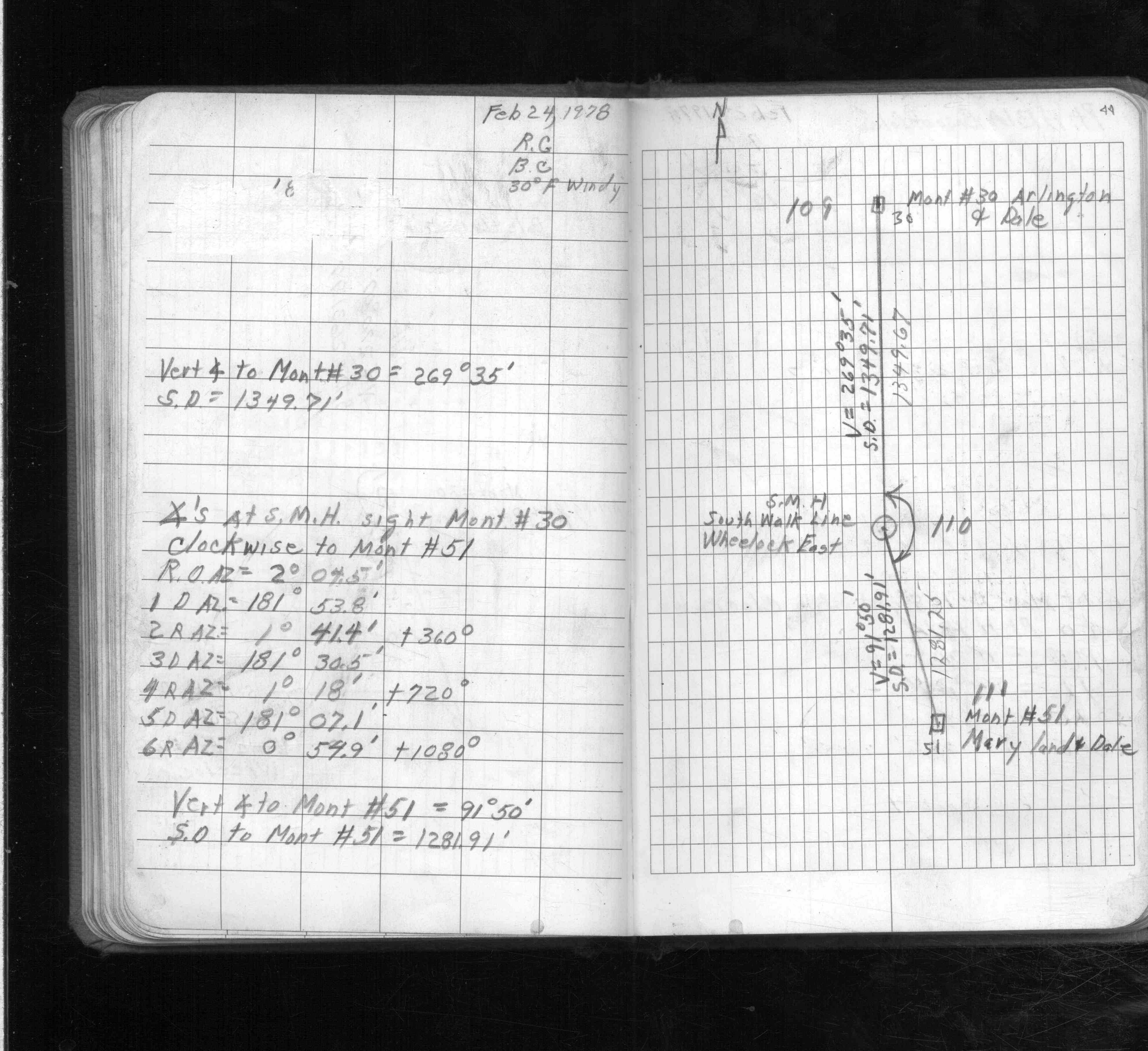
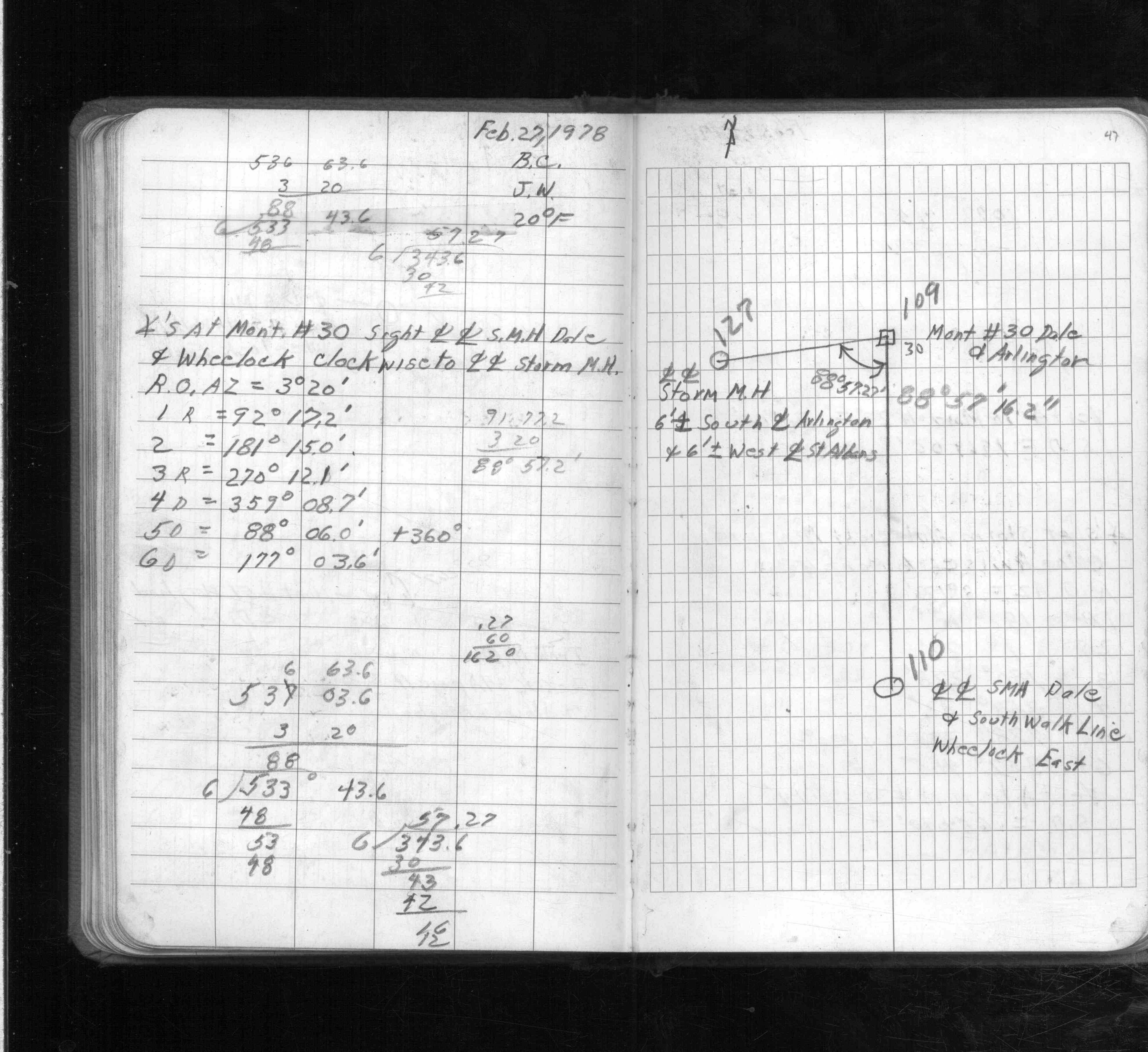
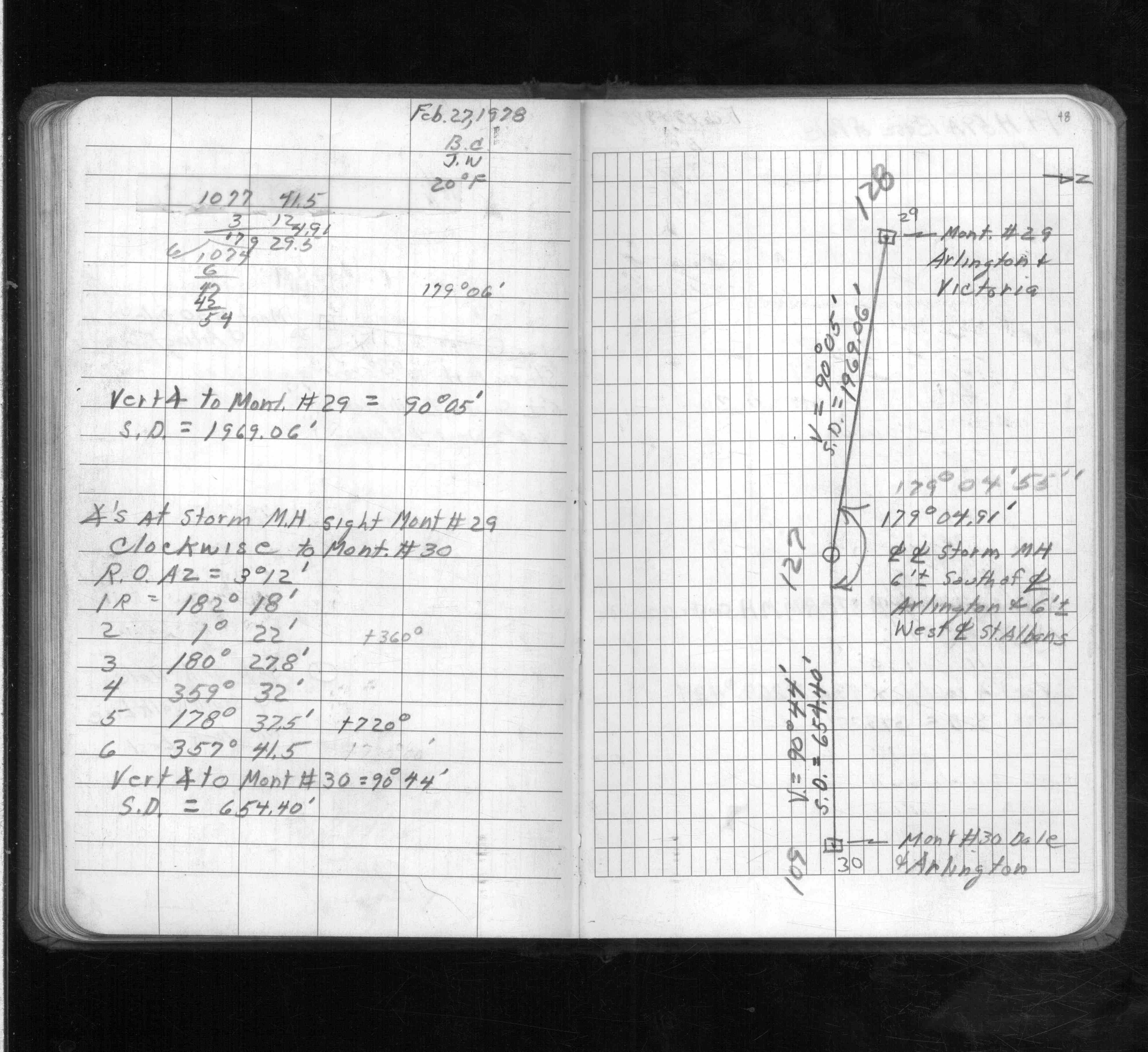
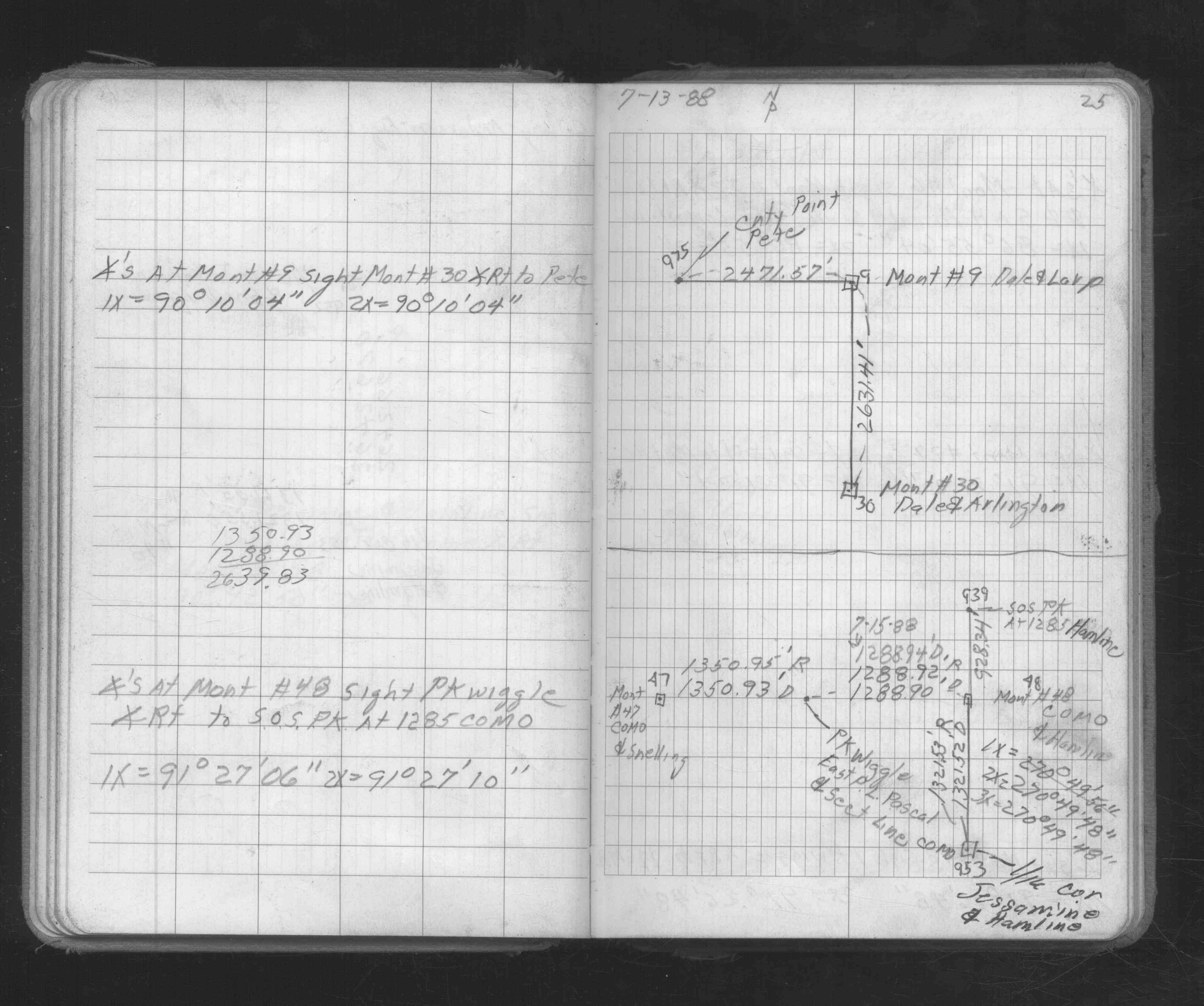
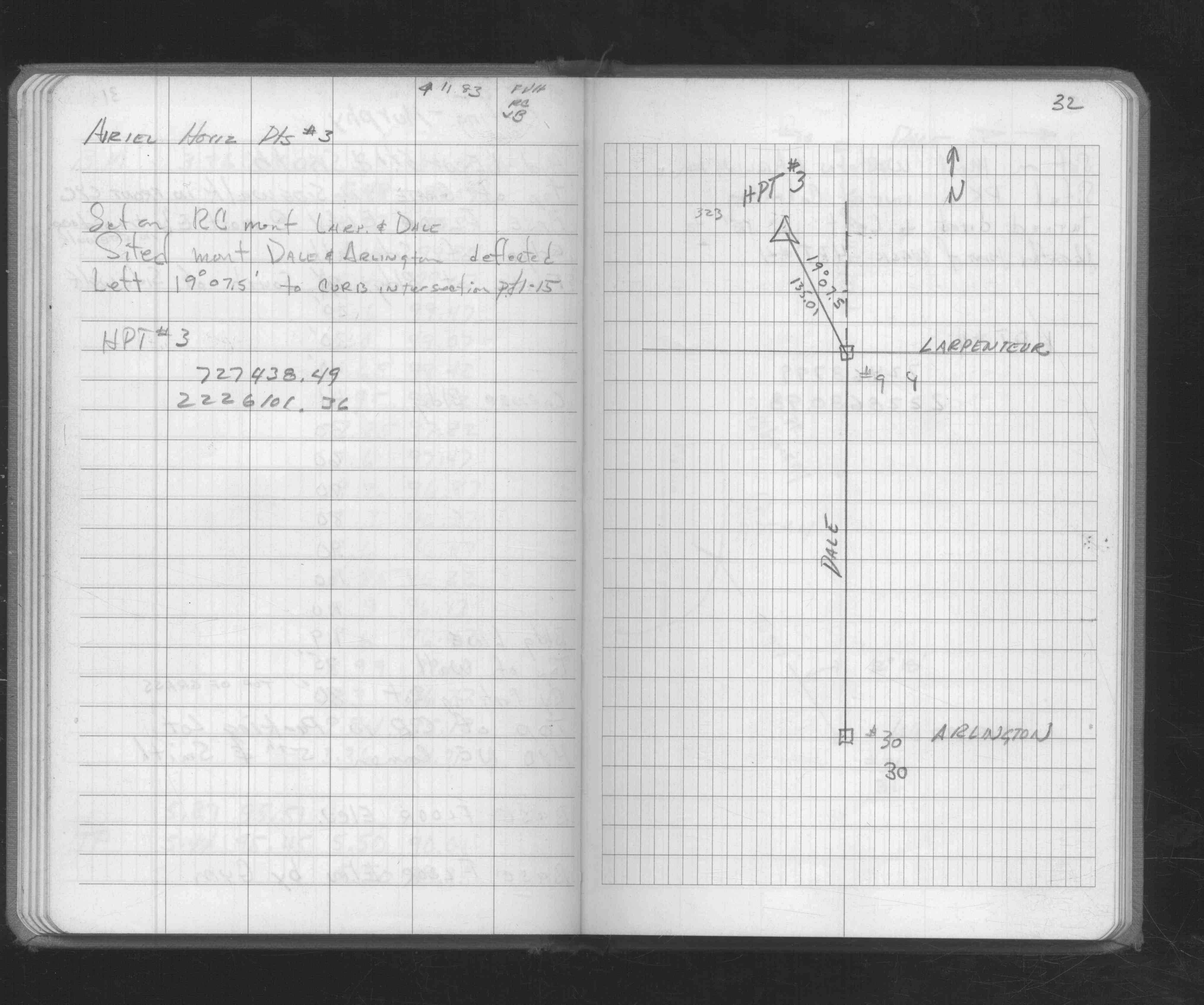
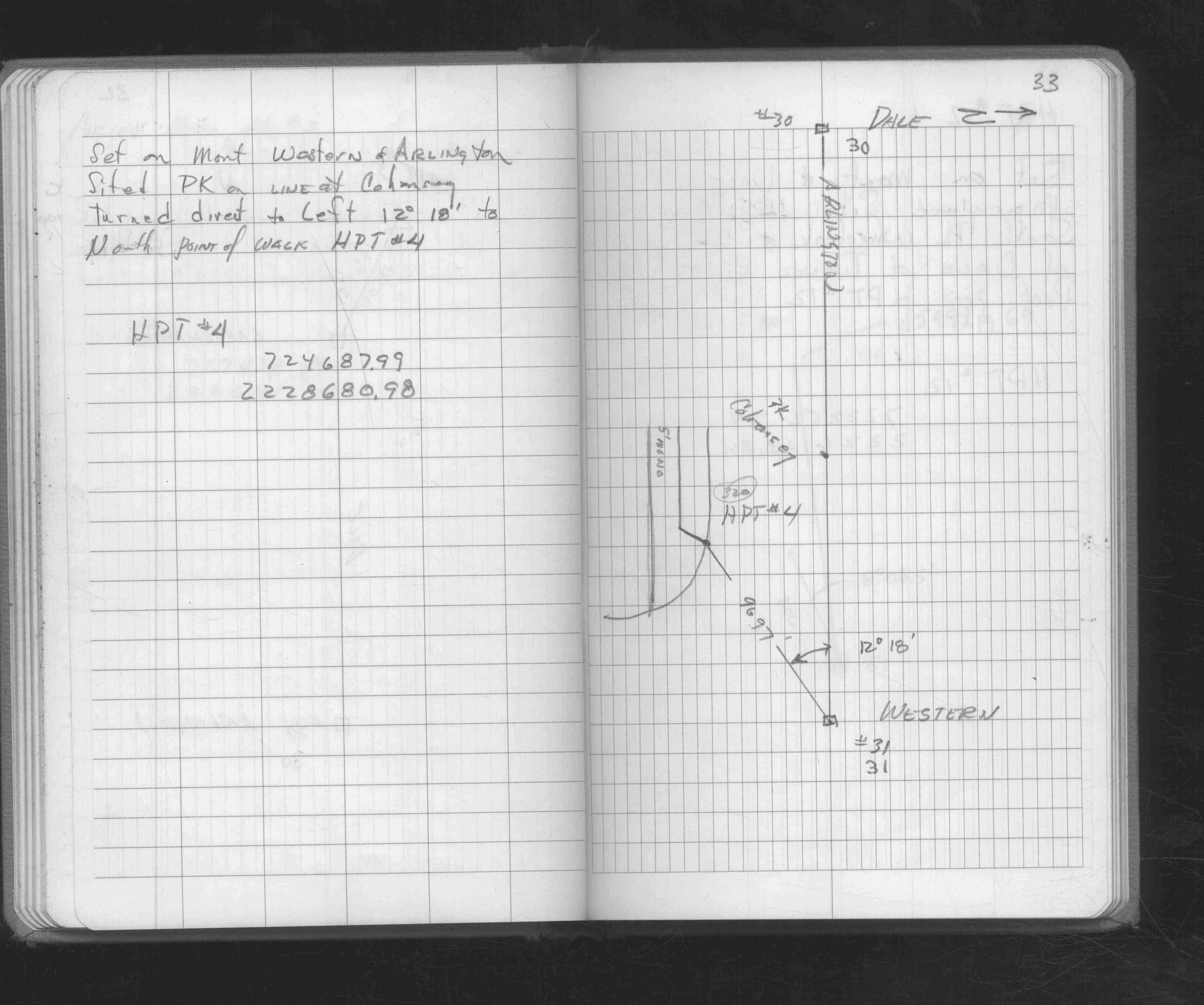
| FB 1689Ap.14 | ||||||
| FB 1727p. 37 ,38 ,40 | ||||||
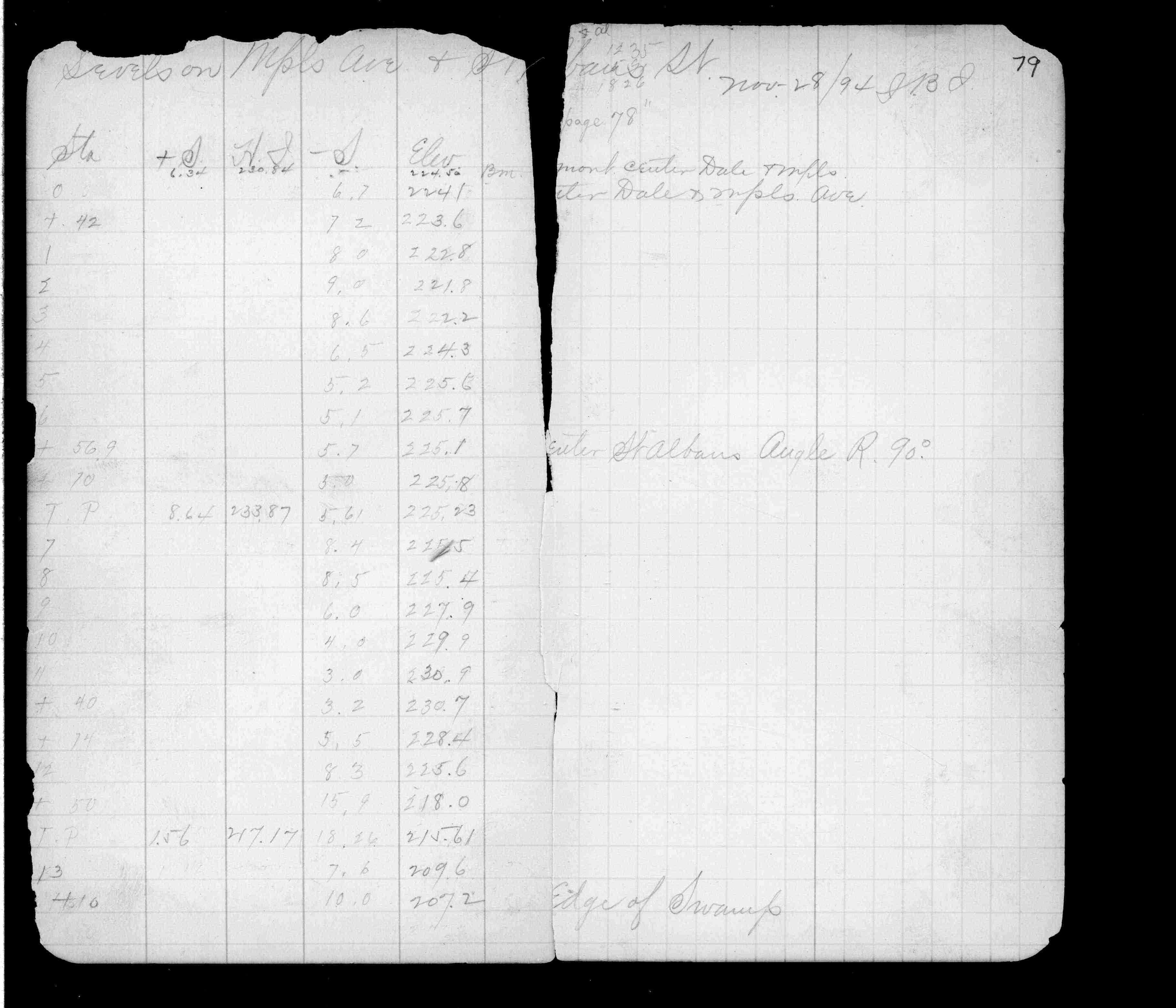
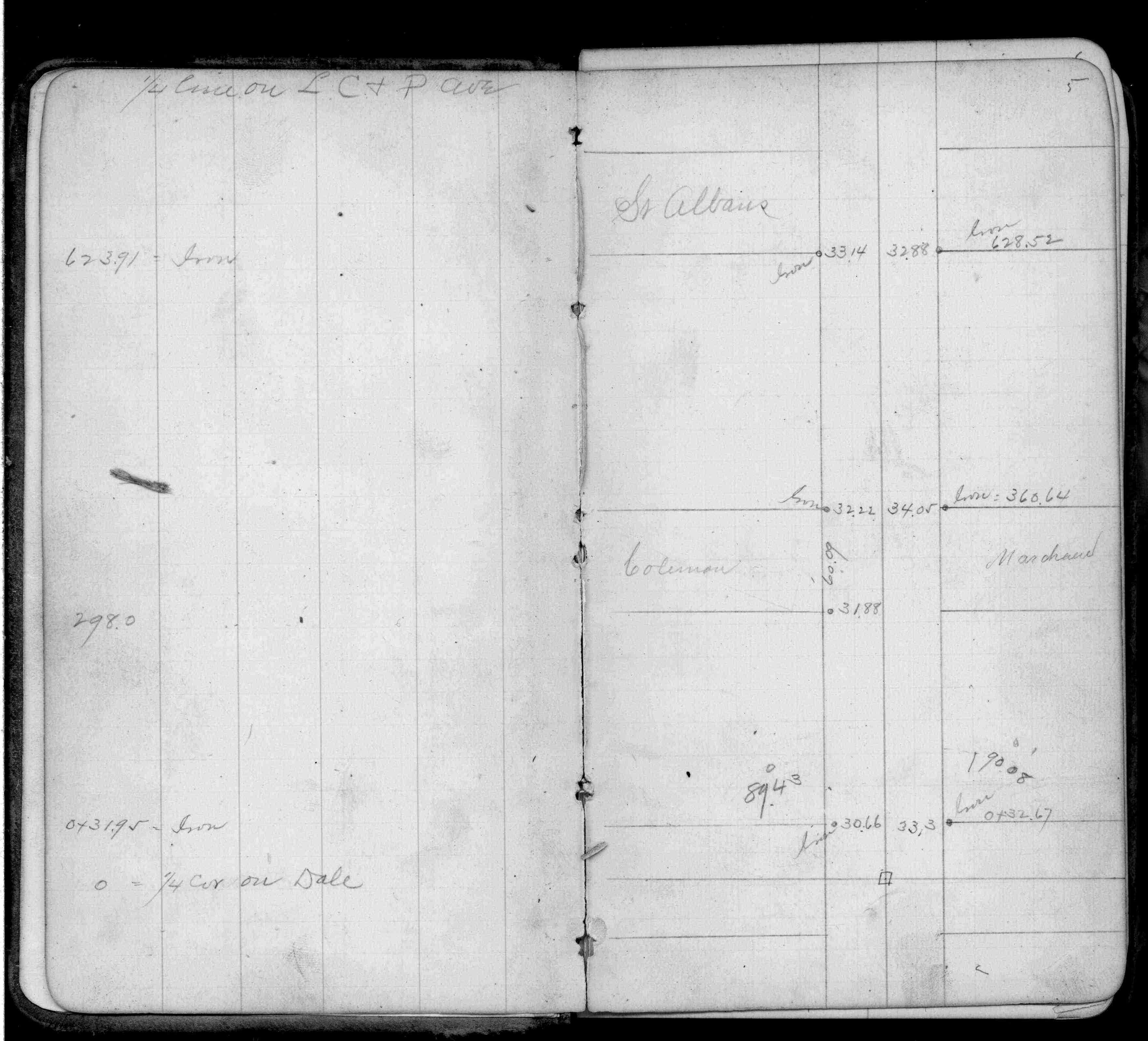
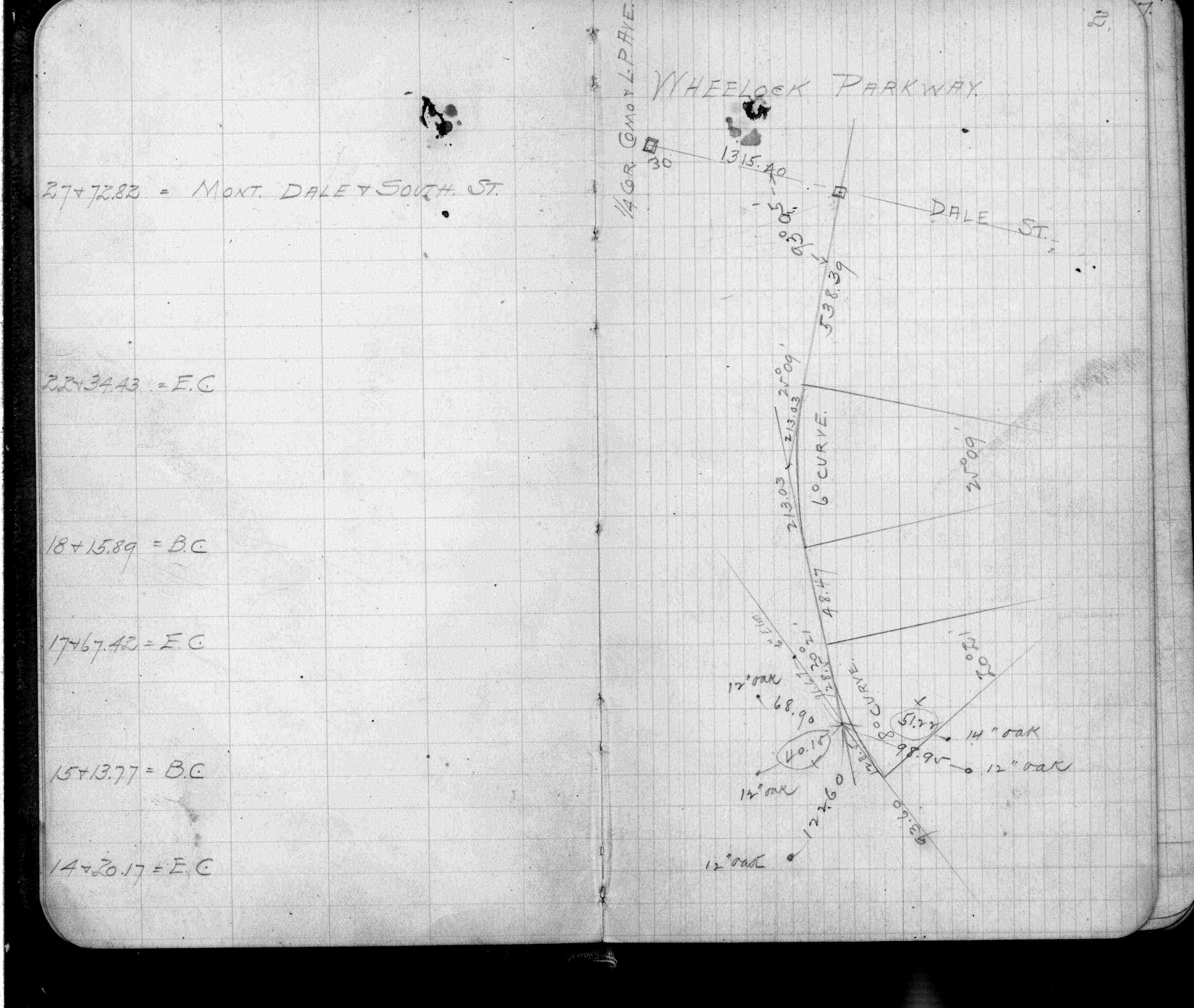
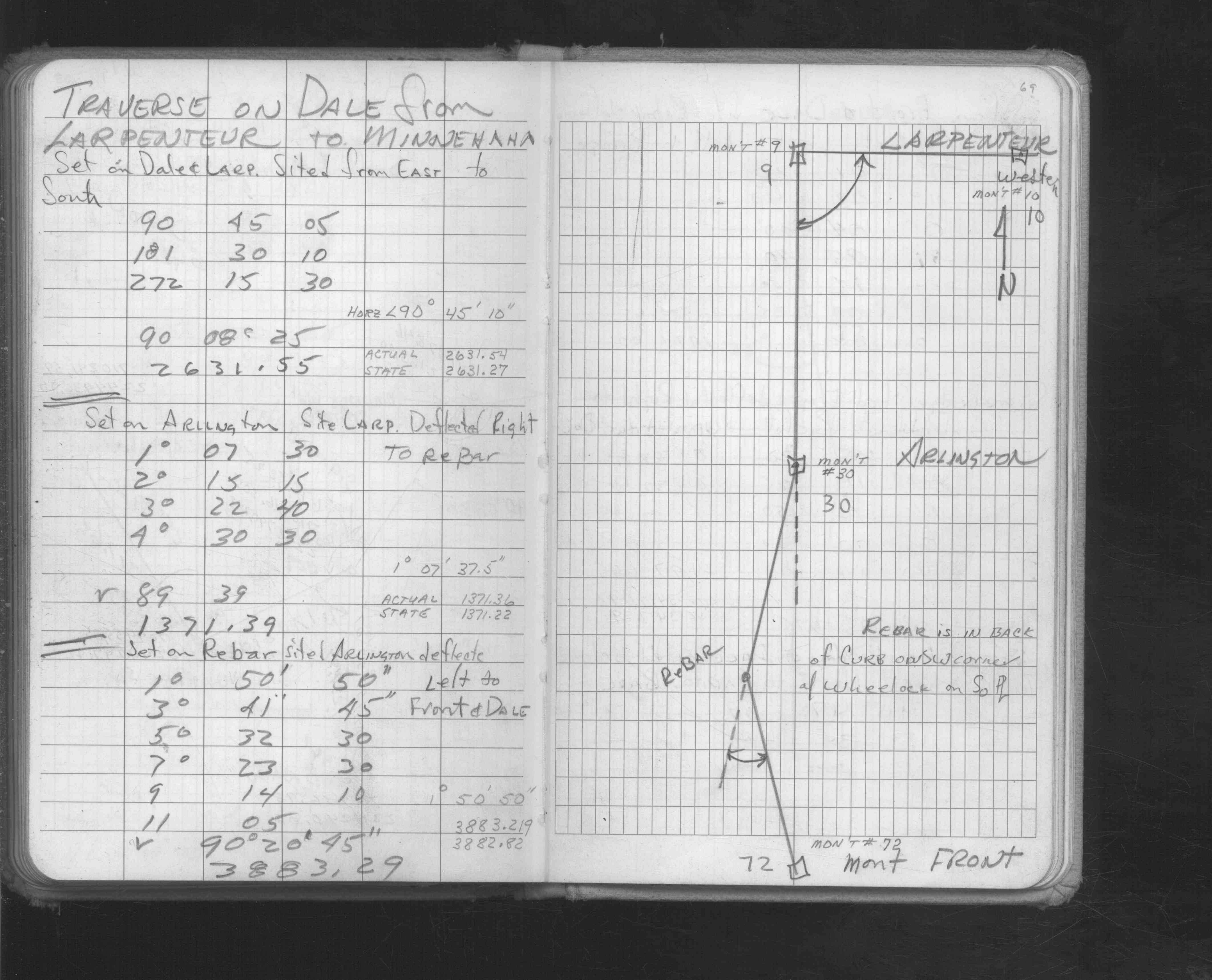
| FB 1736p.09 |
| FILE | SURVEYOR | LIC. NO. | DATE SIGNED | DATE TIED |
|---|---|---|---|---|
| 0030-0005-A.tif | Ronald F. Meyer | 9051 | September 9, 1999 | September 8, 1999 |
| ST_001-078p030.jpg | none | none | none | none |
| 0030-0005-A.dwf | none | none | none | none |
| FILE | PHOTO DATE | COMMENTS |
|---|---|---|
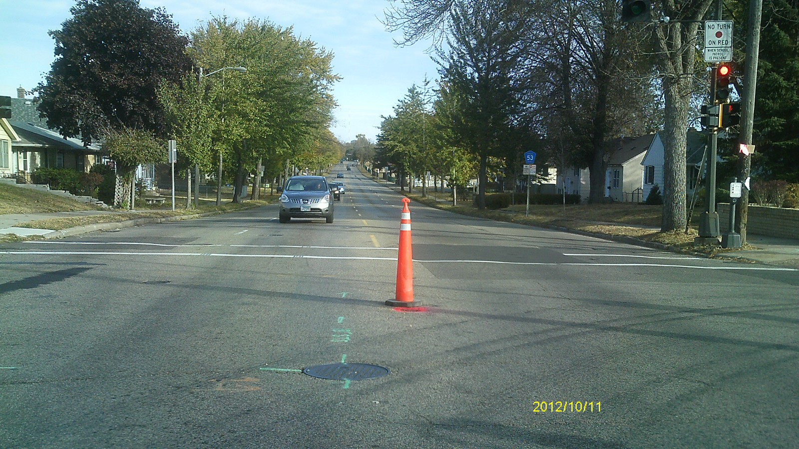
| 0030-0005-5.jpg | October 11, 2012 | Looking west along Arlington Ave. |
| 0030-0005-4.jpg | October 11, 2012 | Looking south along Dale St. |
| 0030-0005-3.jpg | October 11, 2012 | Looking east along Arlington Ave. |
| 0030-0005-2.jpg | October 11, 2012 | Looking north along Dale St. |
| 0030-0005-1.jpg | October 11, 2012 | Close up of monument. |