| NAD83 COORDINATES (1986 adj.): |
|---|
| * X= 571798.79 Y= 170666.69 Z= 0 LSQ 12/6/1991 S FLT |
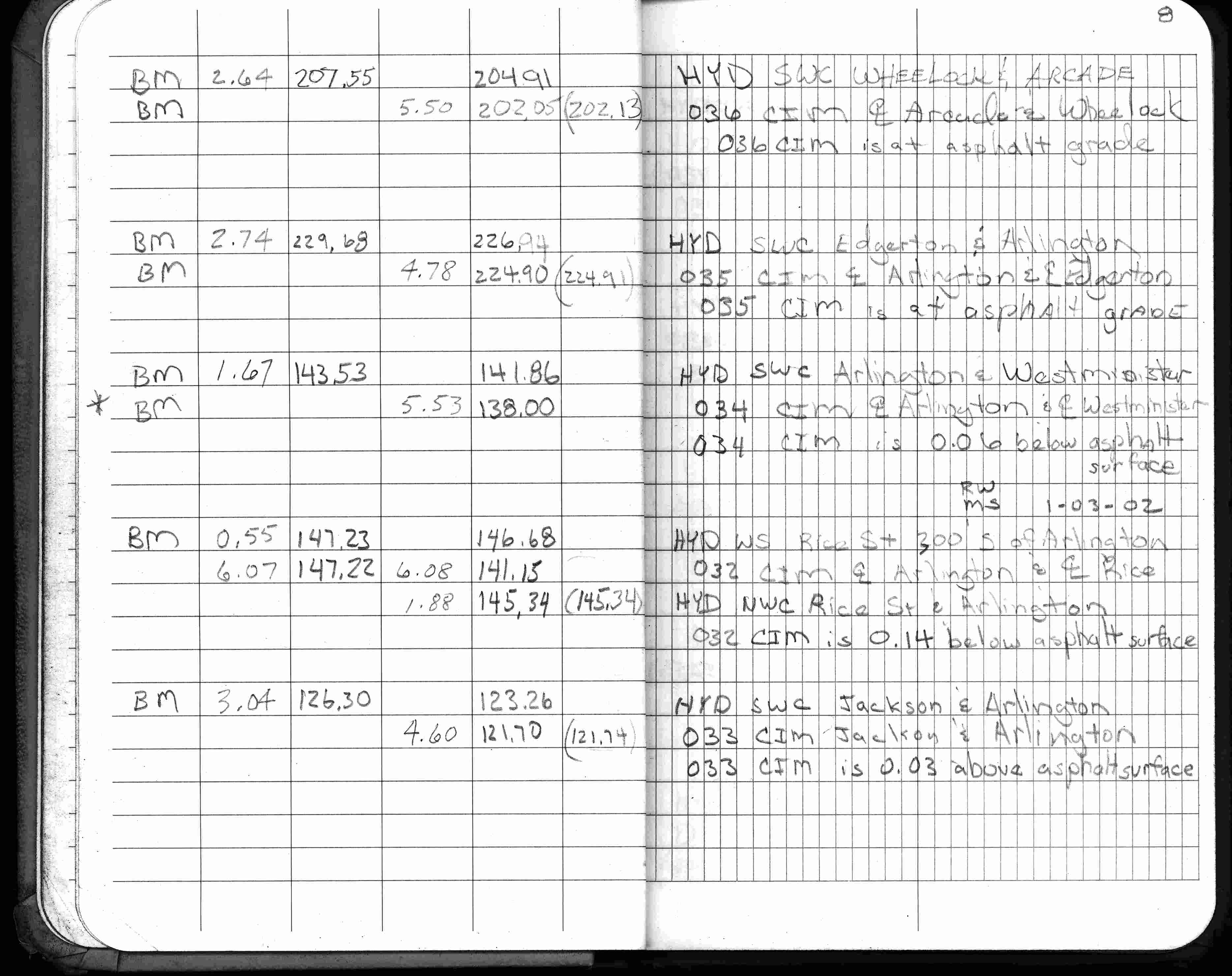
| 1/3/2002 | Elev 141.15 ft on CIM 0.14 ft below asphalt surface. See FB 1736 p.8 |
| 3/17/2000 | Fd CIM 0.15 ft below grade placed 4-2 ft straddles (marked for painting target for 2000 aerial) |
| 2/5/1990 | Used ties of Sep 21, 1989 and set a pk nail at grade. It appears the CIM was removed for sewer construction. |
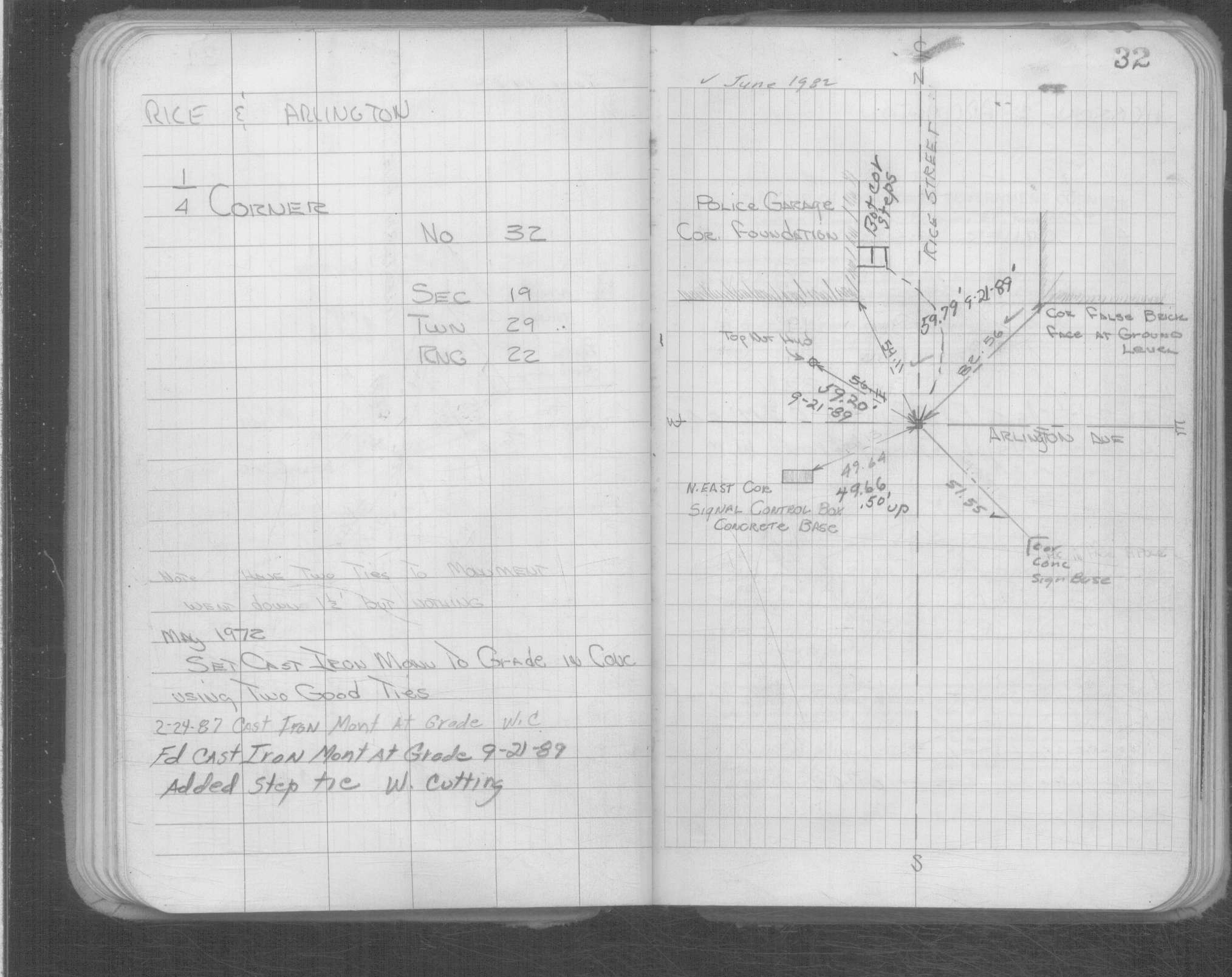
| 9/21/1989 | CIM set to grade & tied. |
| 8/1/1985 | (Unknown date Aug __, 1985 ) Elev 141.27 ft on ?. See FB 1421A p.72 |
| 4/1/1982 | (Unknown date Apr __, 1982 ) Elev 141.47 ft on CLCL. See FB 1421A p.26 |
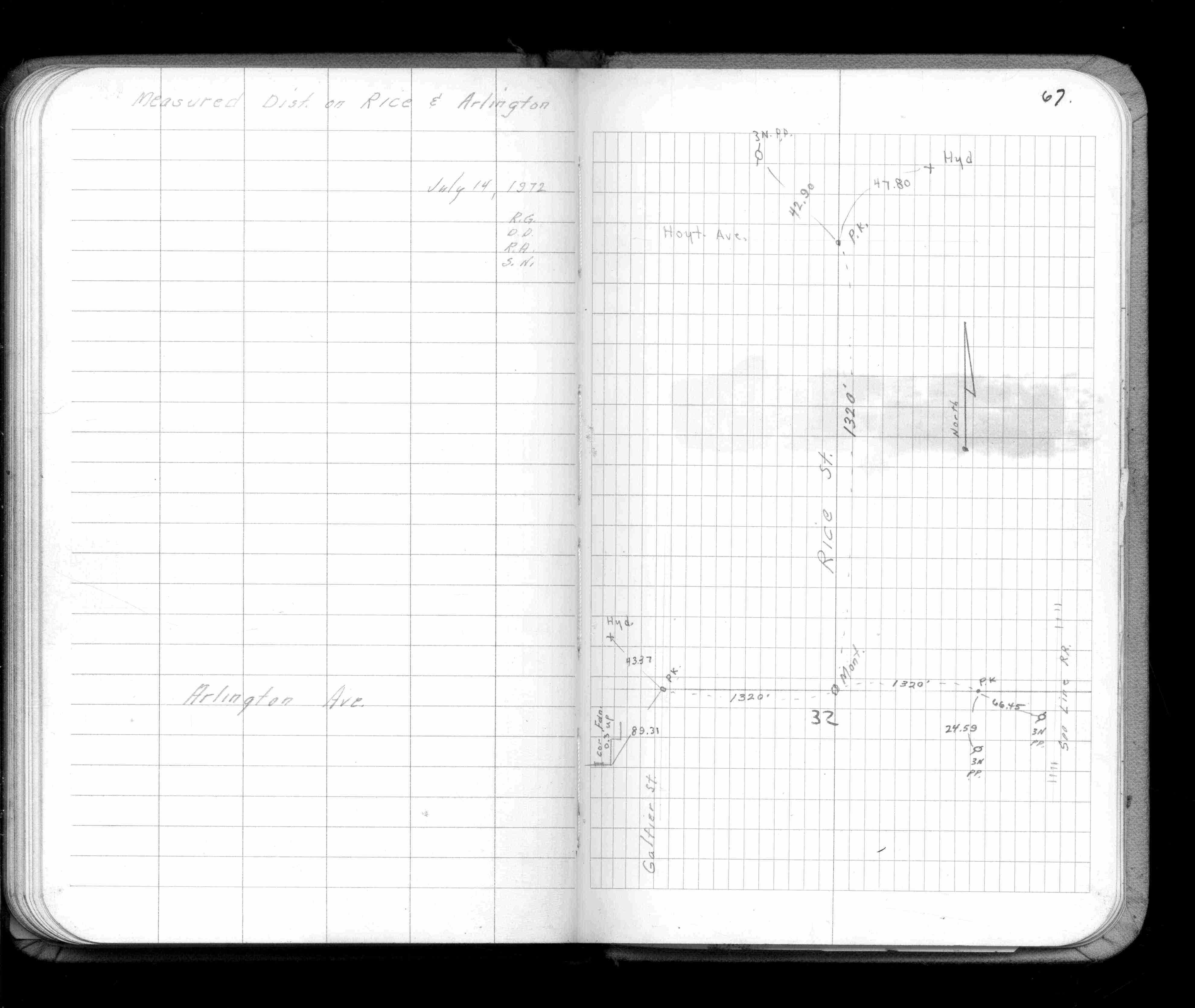
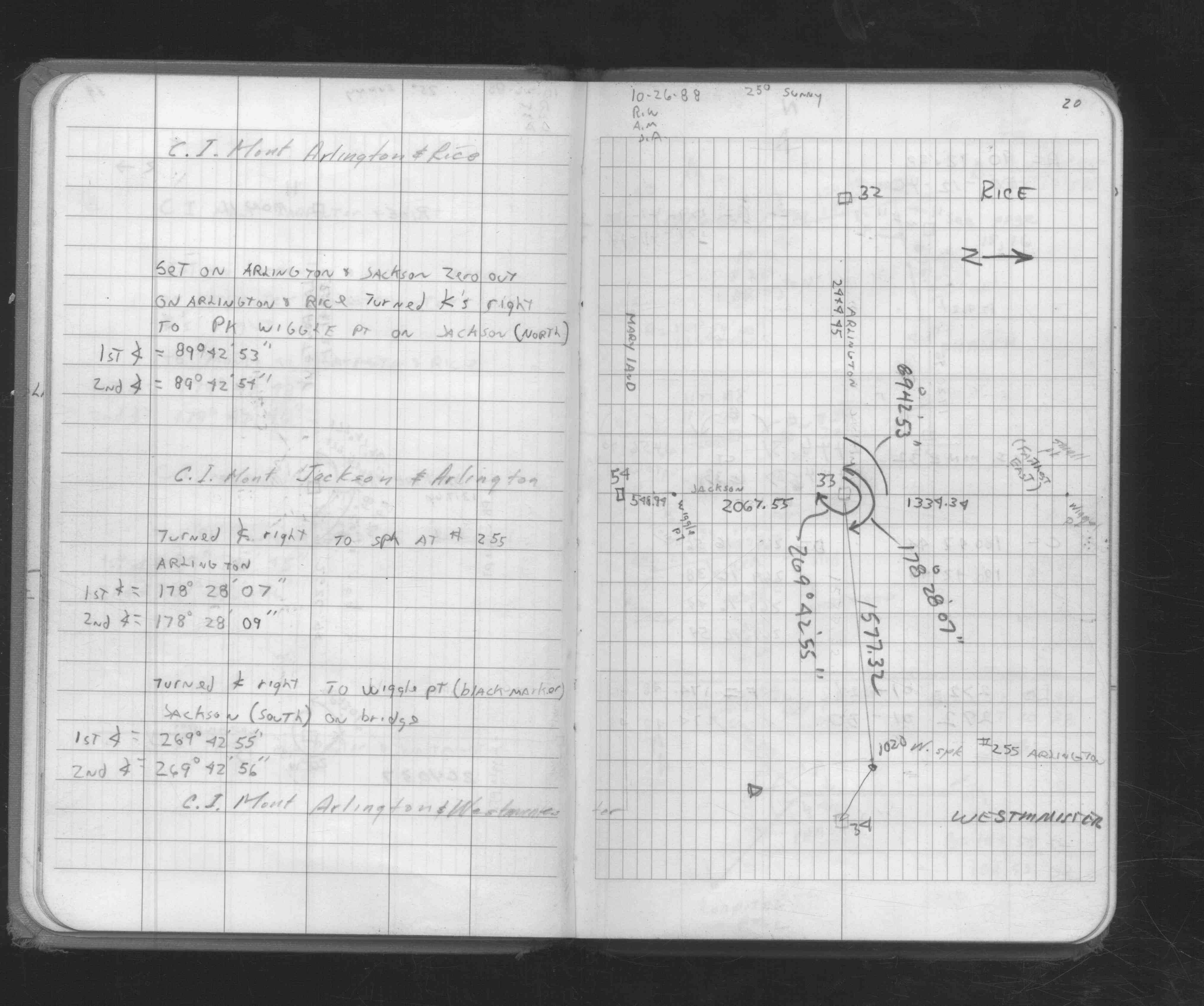
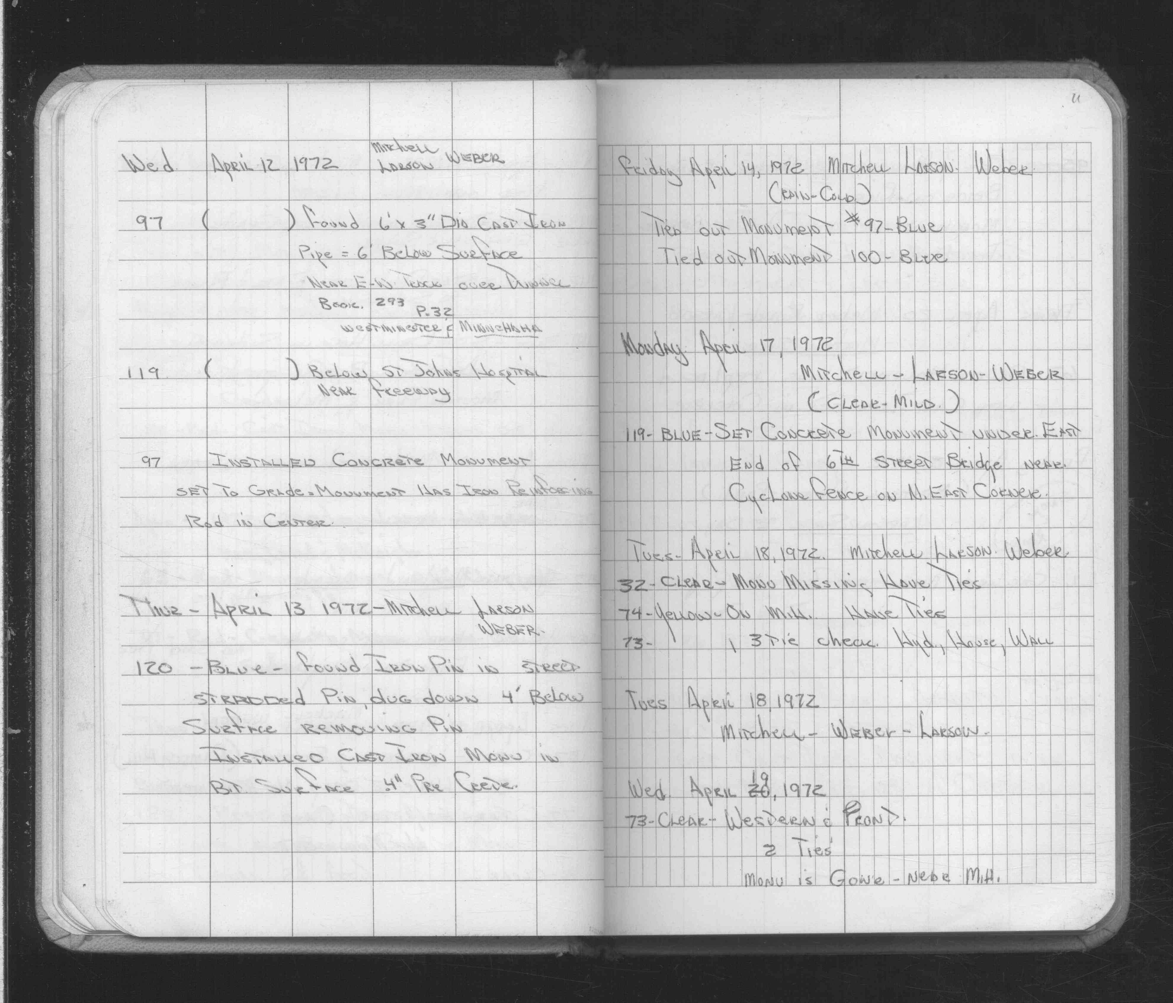
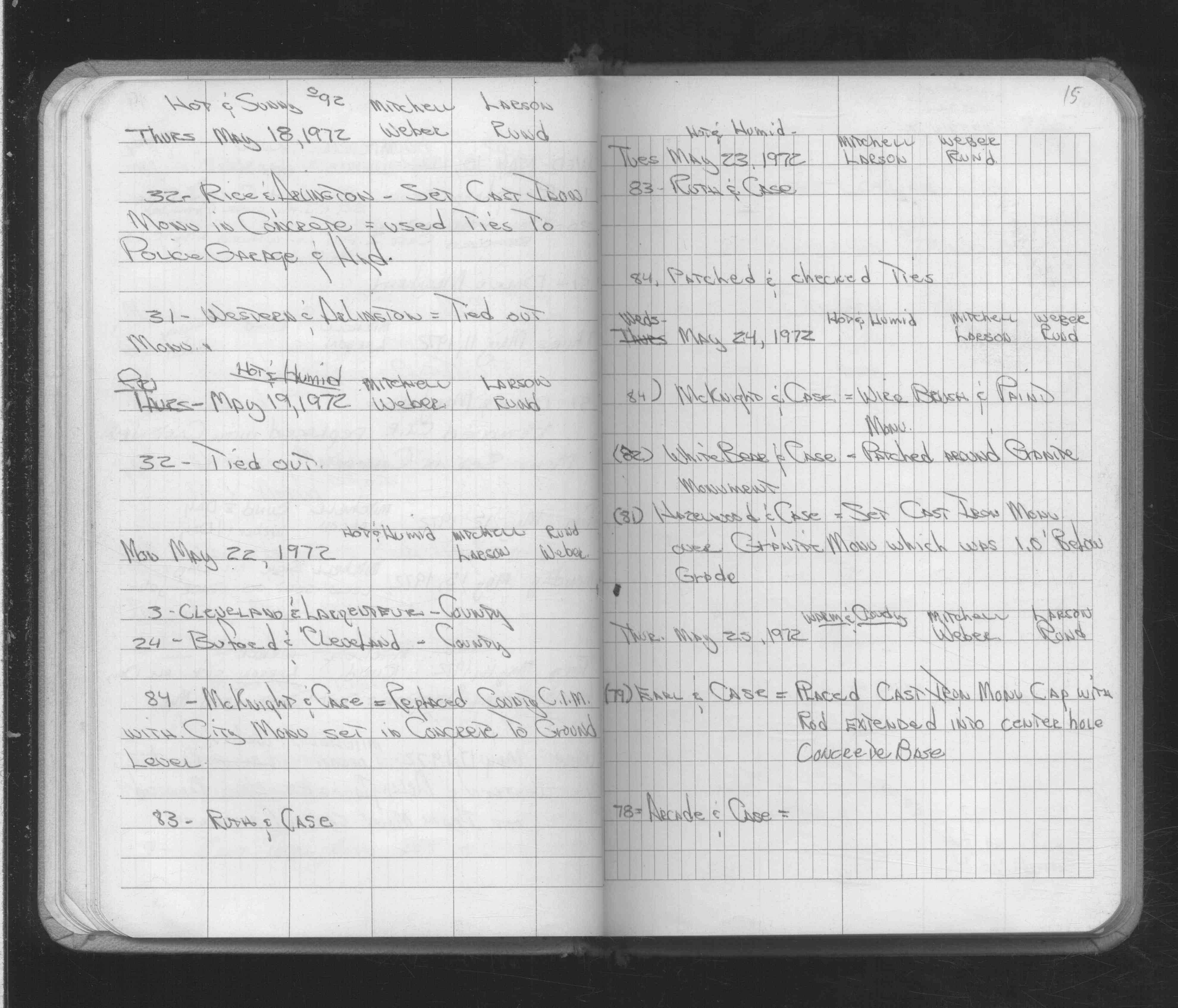
| 5/19/1972 | Placed ties. See FB 1689A p.15 |
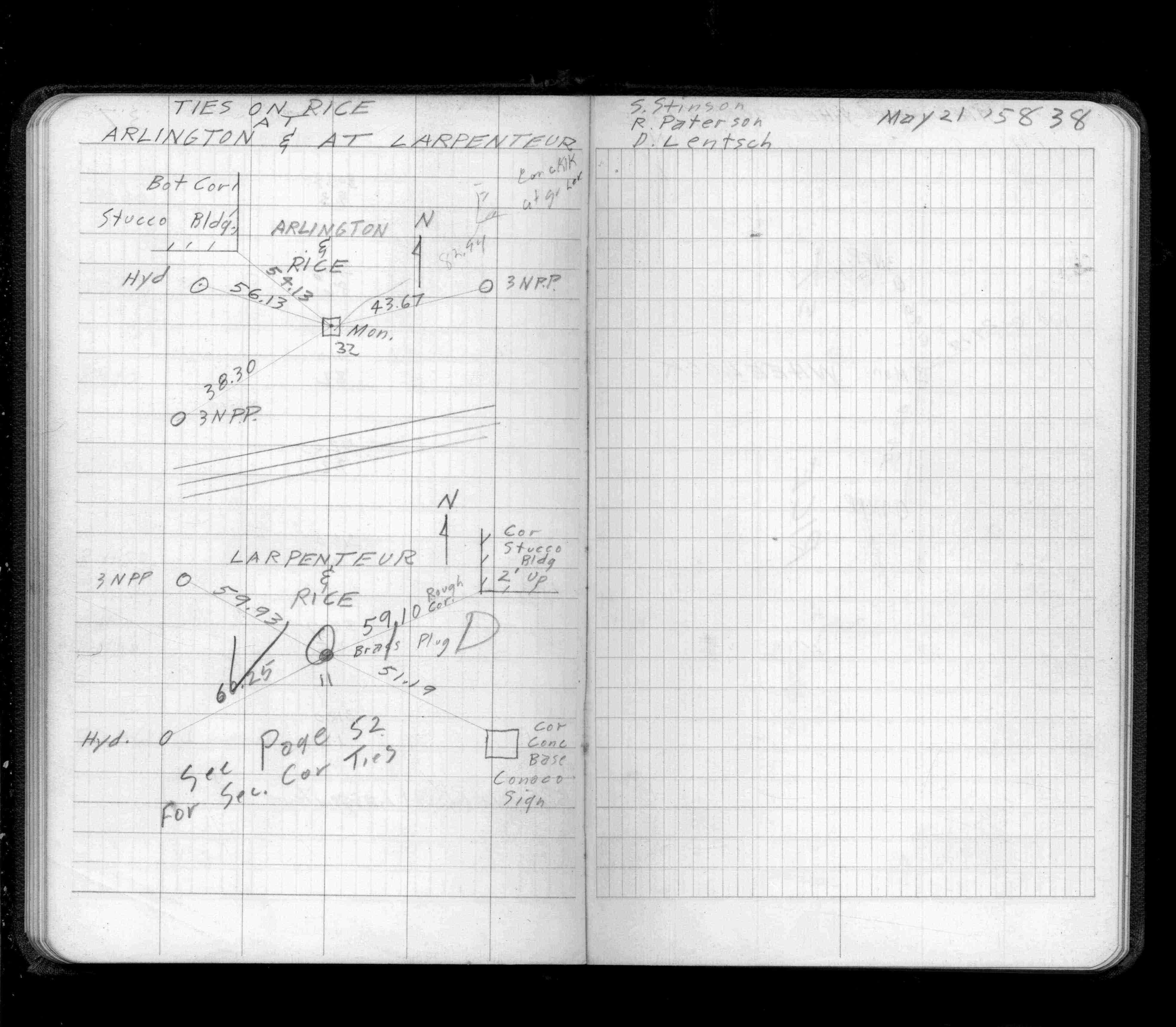
| 5/18/1972 | Set CIM from ties to police garage & hydrant. See FB 1689A p.15 |
| 4/18/1972 | Monument not fd, have ties. See FB 1689A p.11 |
| 5/1/1938 | (Unknown date May __, 1938 ) Placed ties. See FB 1472 p.38 |
| 4/15/1890 | Monument set by J H Armstrong. See FB 314 p.2,15 |
| 10/8/1847 | James M Marsh deputy surveyor set post. Tied to 2 BTs. See JM p.076-077 border |
Above is NOT an all inclusive history of this point. Please review all the links below.
| PLS NOTES | Field | Cross Section | Sewer | J.B. Irvine | Monument | River Survey |
|---|---|---|---|---|---|---|
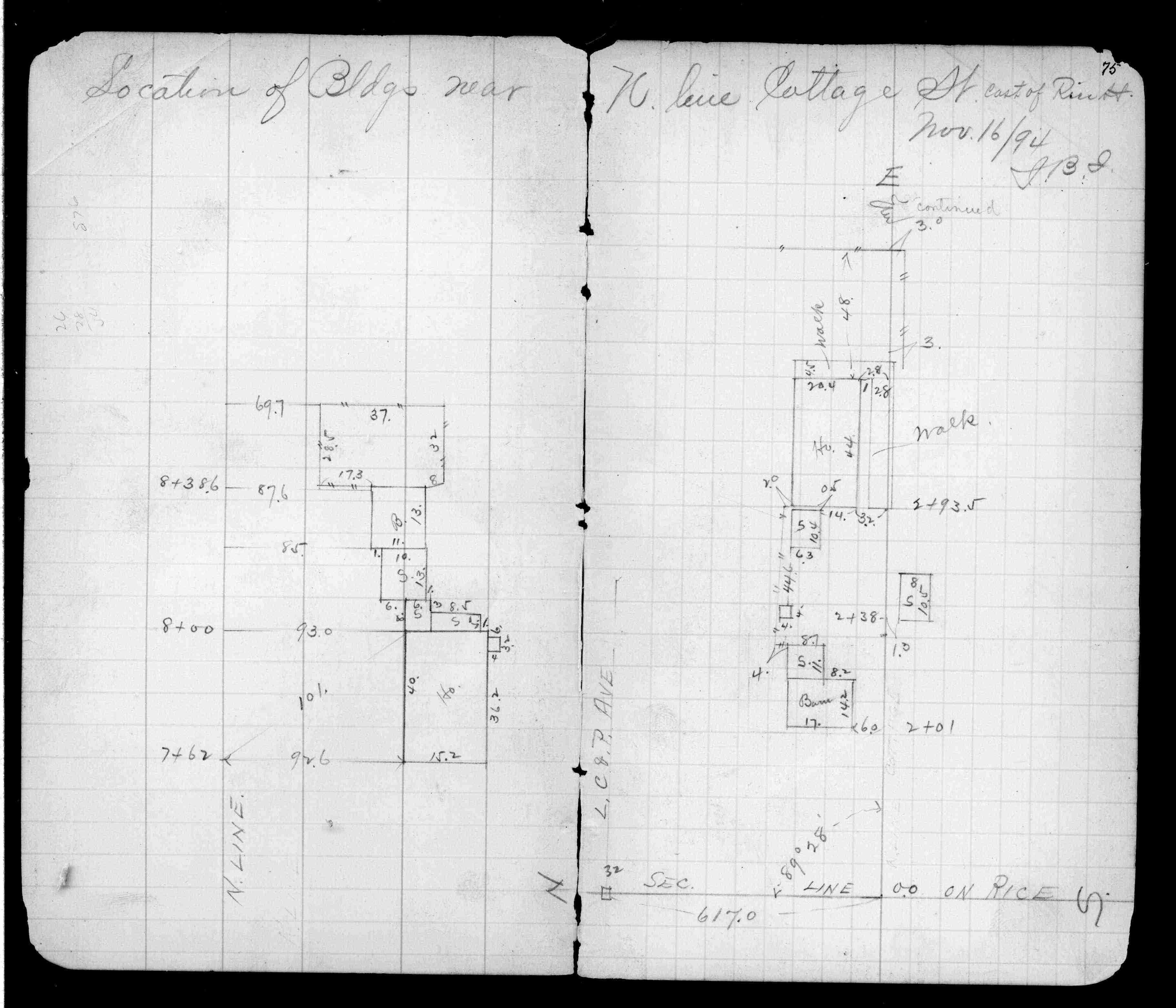
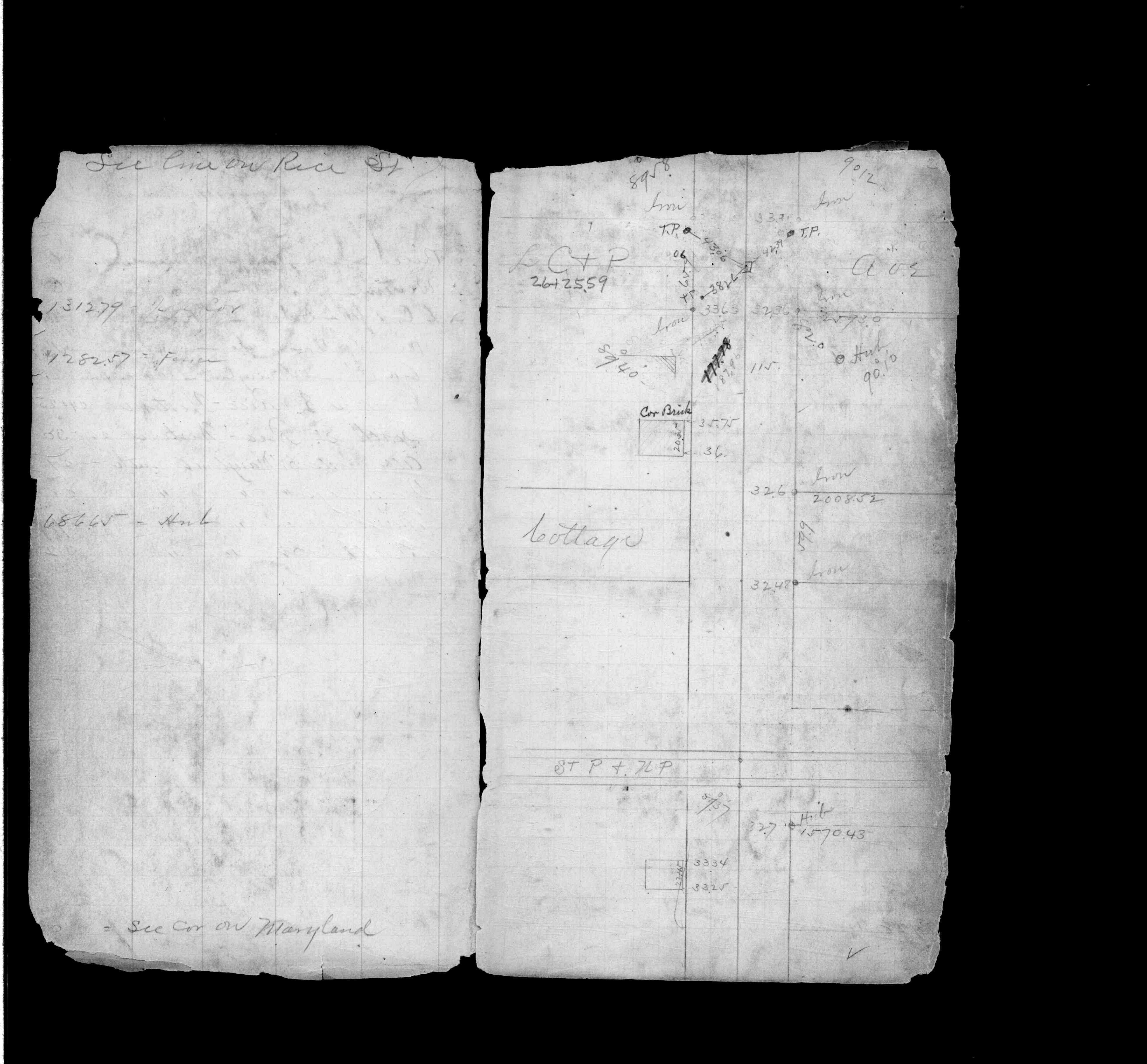
| JM p.076-077 | FB 0234p.75 | |||||
| FB 0314p. 02 ,15 | ||||||
| FB 0314p. 02 ,15 | ||||||
| FB 0317p.17 | ||||||
| FB 0353p.50 | ||||||
| FB 0441p.21 | ||||||
| FB 1154p.43 | ||||||
| FB 1421Ap.26 | ||||||
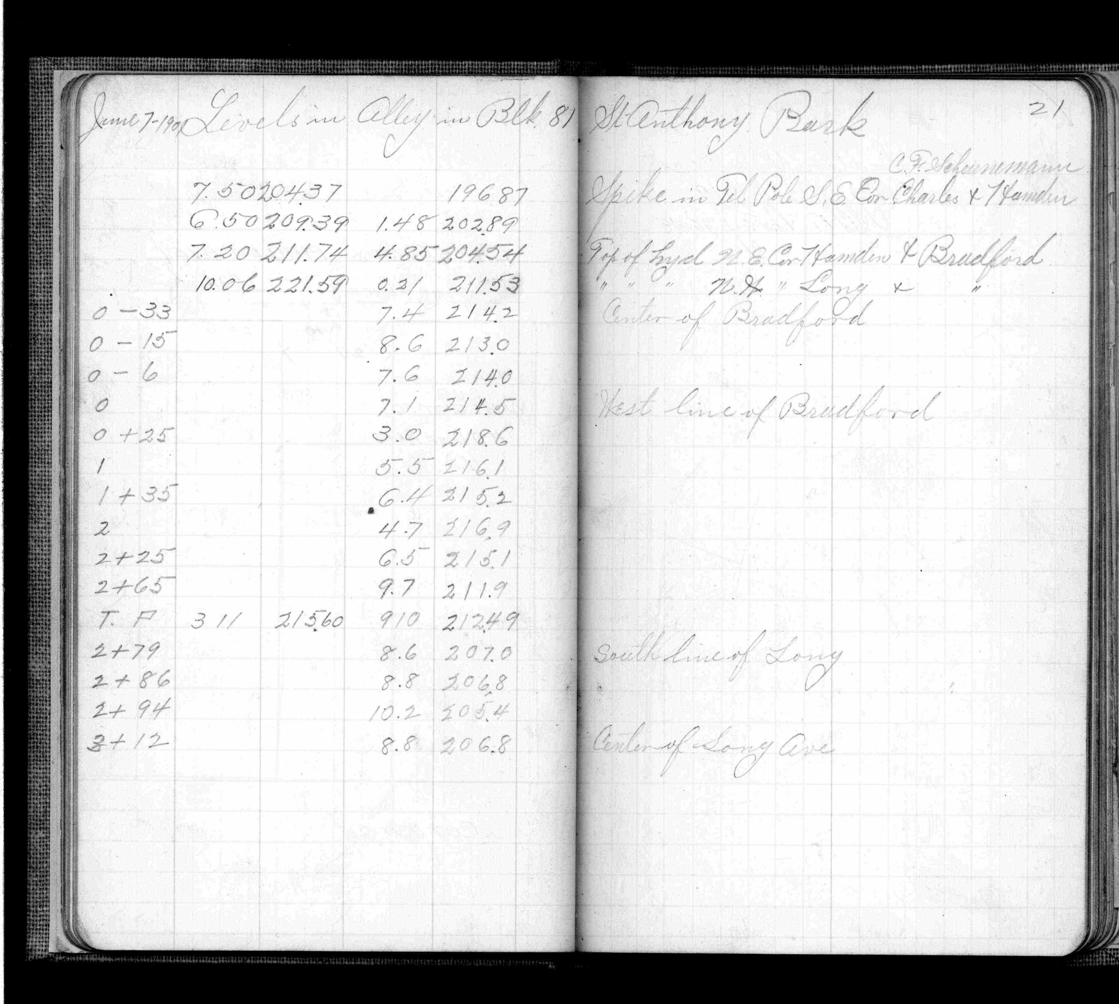
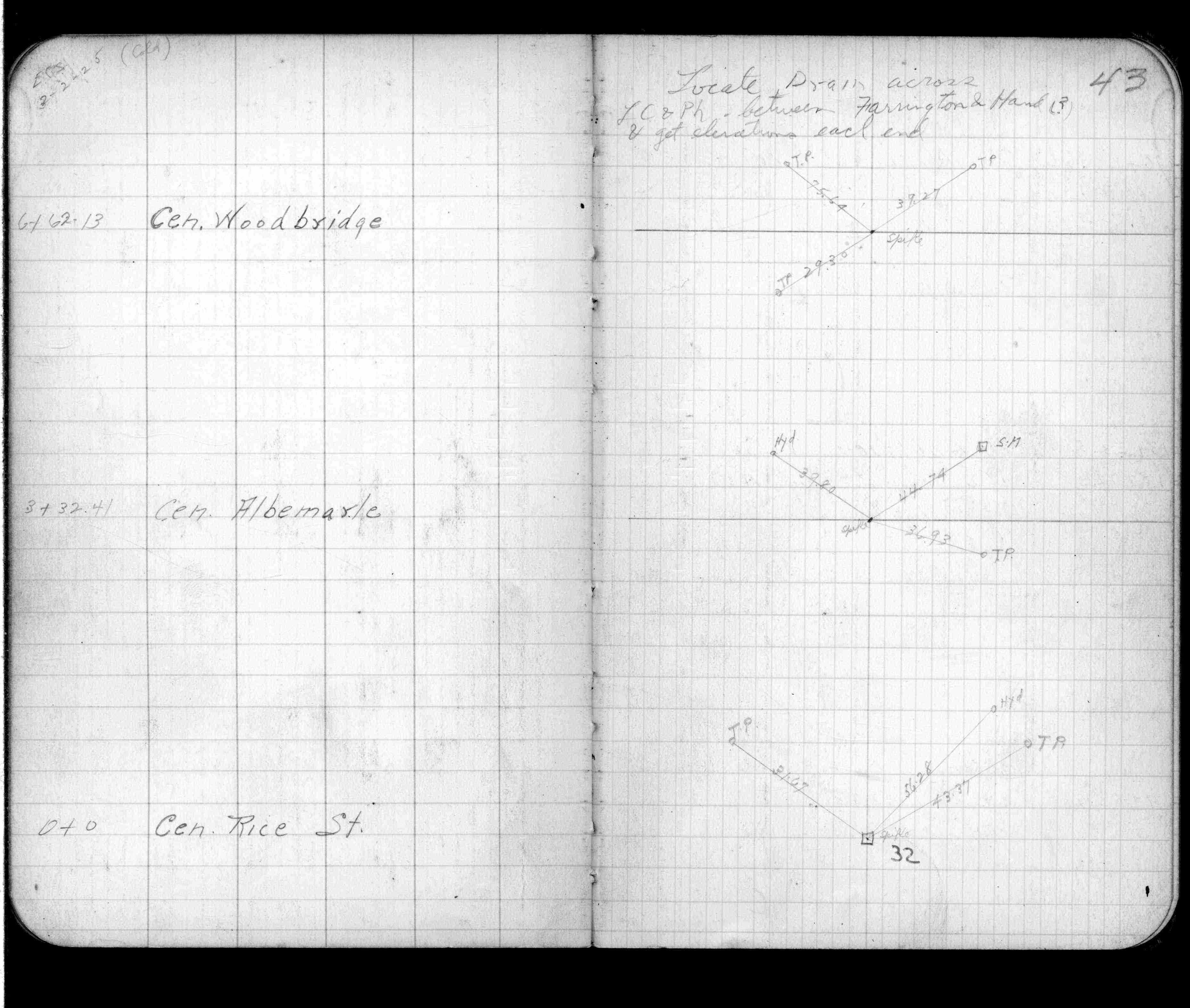
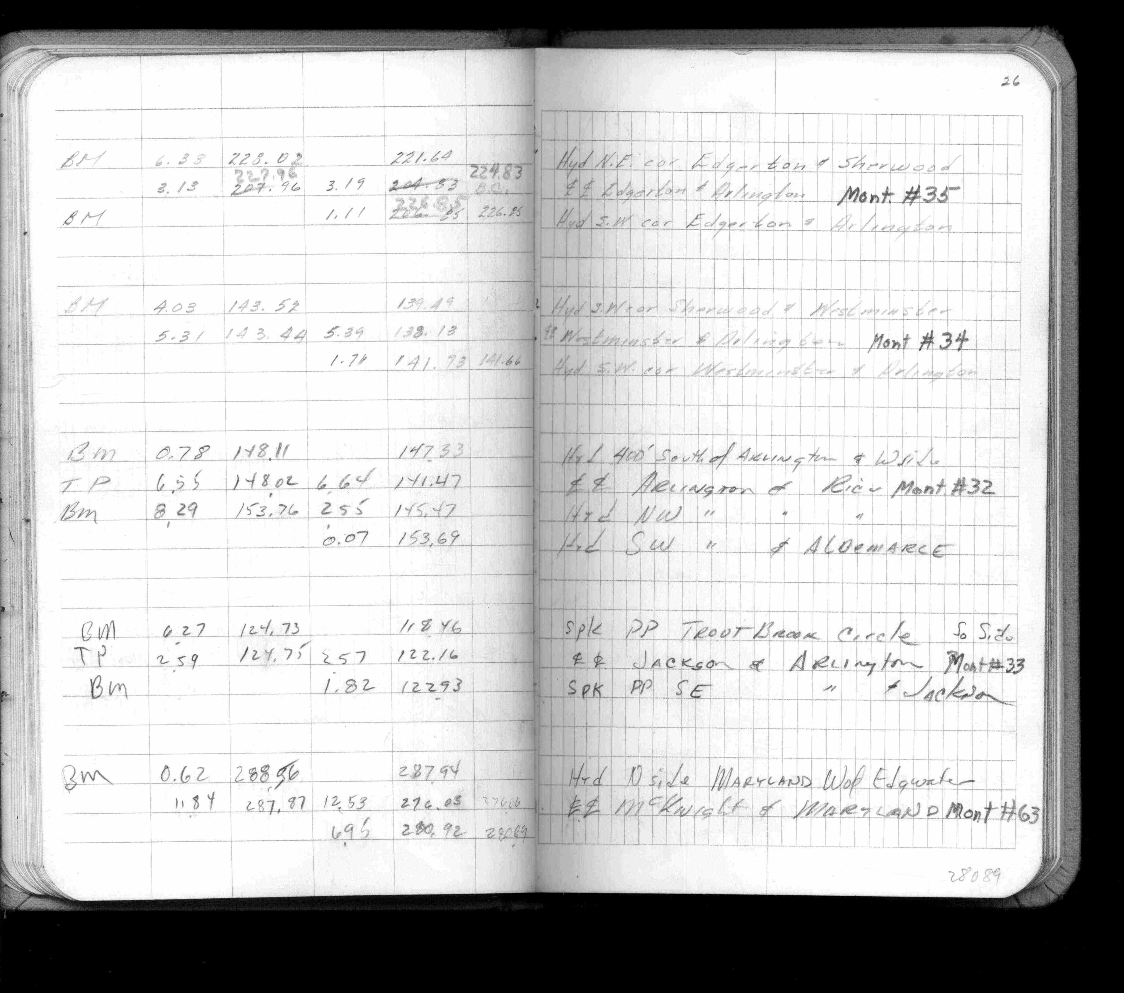
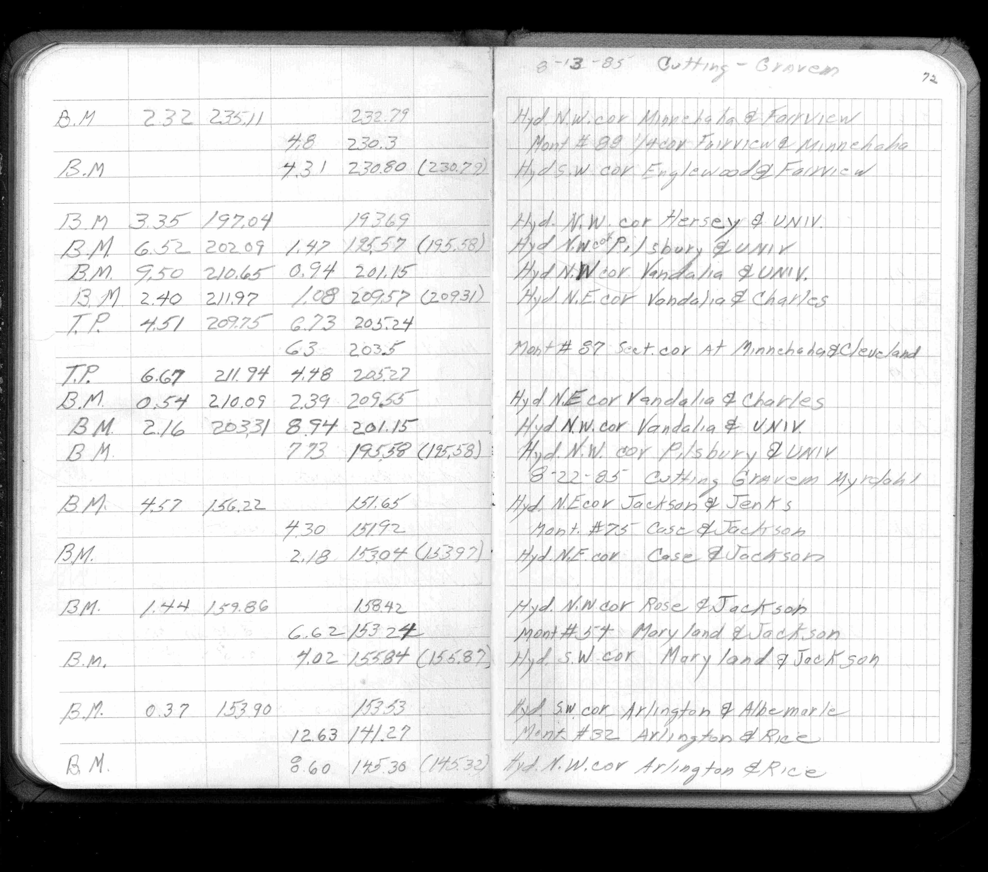
| FB 1421Ap.72 | ||||||
| FB 1422Ap.67 | ||||||
| FB 1472p.38 | ||||||
| FB 1472p.38 | ||||||
| FB 1549D2p.11 | ||||||
| FB 1549Fp.72 | ||||||
| FB 1673Ap. 10 ,16 ,20 | ||||||
| FB 1676Cp. 15 ,20 ,21 | ||||||
| FB 1689Ap.11 | ||||||
| FB 1689Ap.15 | ||||||
| FB 1736p.08 |
| FILE | SURVEYOR | LIC. NO. | DATE SIGNED | DATE TIED |
|---|---|---|---|---|
| ST_001-078p032.jpg | none | none | none | none |
| 0032-1749-A.dwf | none | none | none | none |