| NAD83 COORDINATES (1986 adj.): |
|---|
| * X= 545460.94 Y= 167906.4 Z= 0 LSQ 12/6/1991 S FIX |
| X= 545460.95 Y= 167906.37 Z= 862.1 3/20/2008 RTK-VRS |
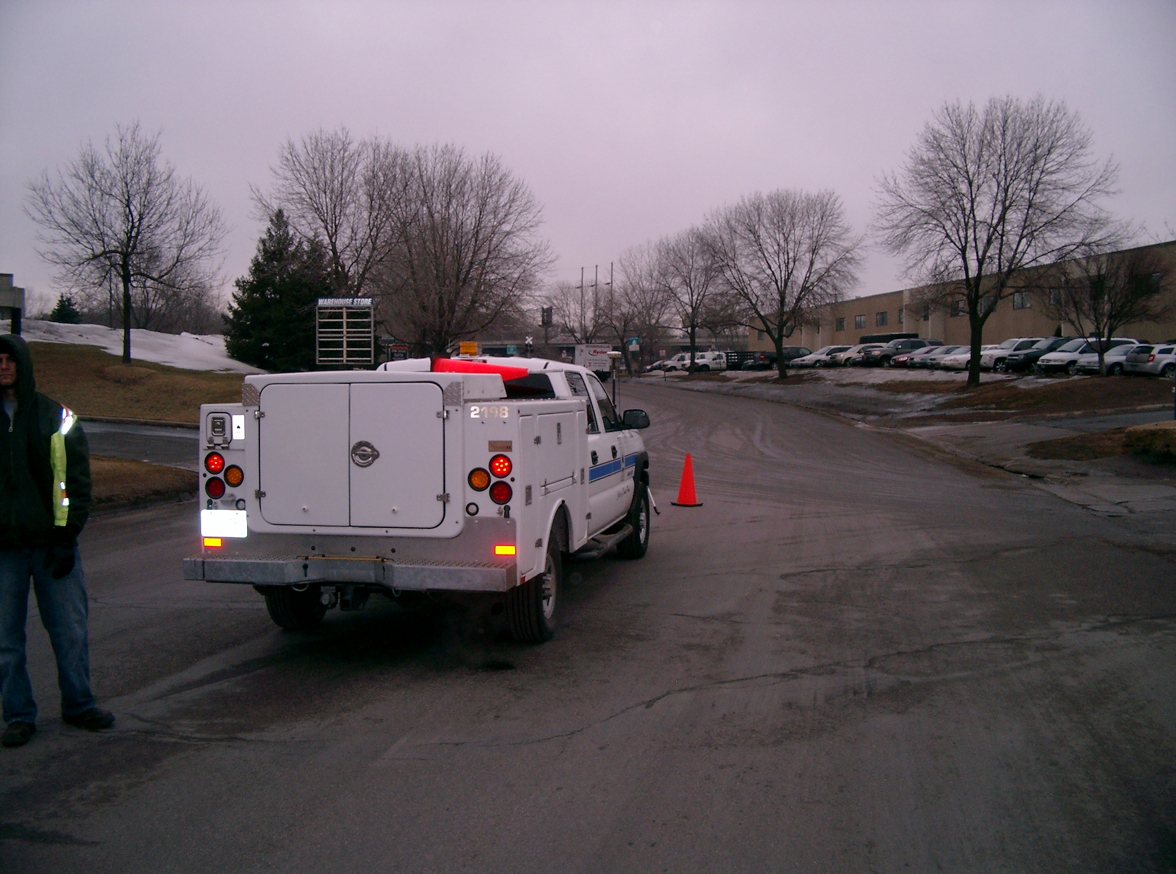
| 3/25/2008 | Photos taken. |
| 3/20/2008 | Fd CIM set in concrete at street grade. Position established by RTK-VRS GPS. Elev 862.1 ft |
| 4/26/2002 | Elev 167.96 ft on CIM at asphalt surface. See FB 1736 p.10 |
| 3/17/2000 | Fd CIM at grade (marked for painting target for 2000 aerial) |
| 12/22/1998 | Fd Iron Pin from ties. Placed 4 PKs as 2 ft straddles. Removed pin & set CIM in concrete. See CofL 0043-1090-A & FB 1716 p.55 |
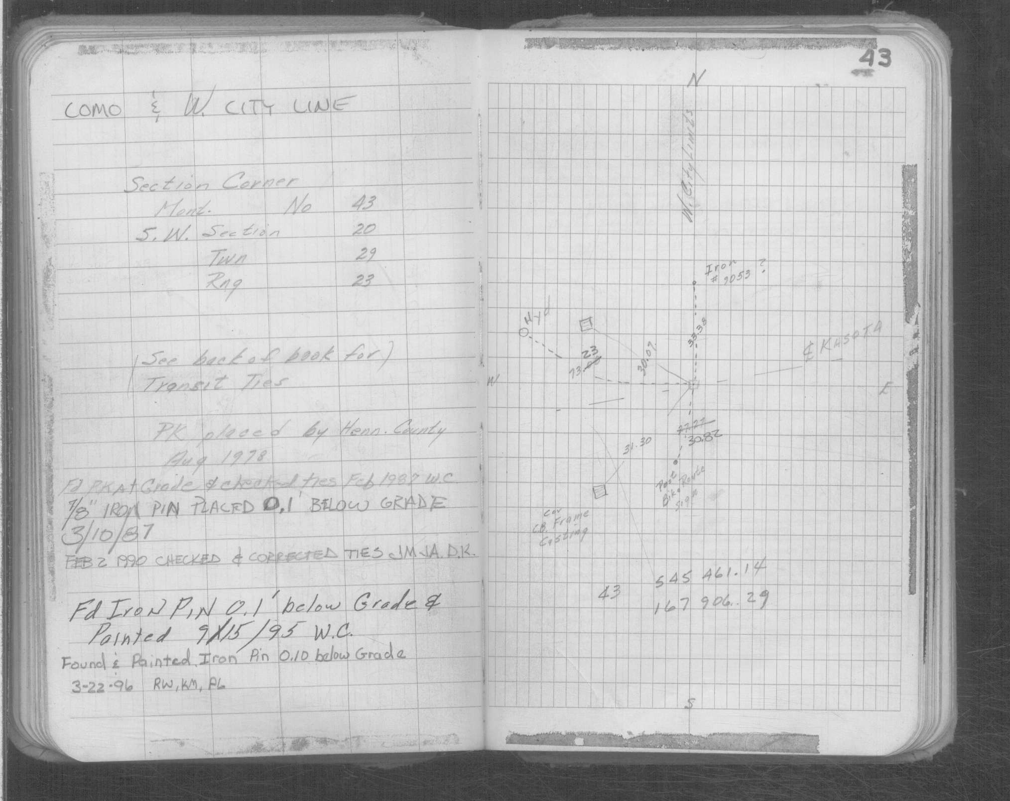
| 6/26/1998 | Hennepin Cnty Surveyors recovered 1" iron pin 0.1' below bituminous road surface checked and added ties. See CofL 0043-1090-B |
| 9/21/1995 | Fd iron pin 0.1' below grade (marked for painting target for 1995 aerial) |
| 1/28/1992 | Hennepin Cnty Surveyors recovered 1" steel pin 0.1' below bituminous surface,checked and added ties |
| 3/10/1987 | 7/8" iron pin placed 0.1' below grade |
| 2/1/1987 | (Unknown date Feb __, 1987 ) Fd pk at grade and checked St Paul Surveyor ties |
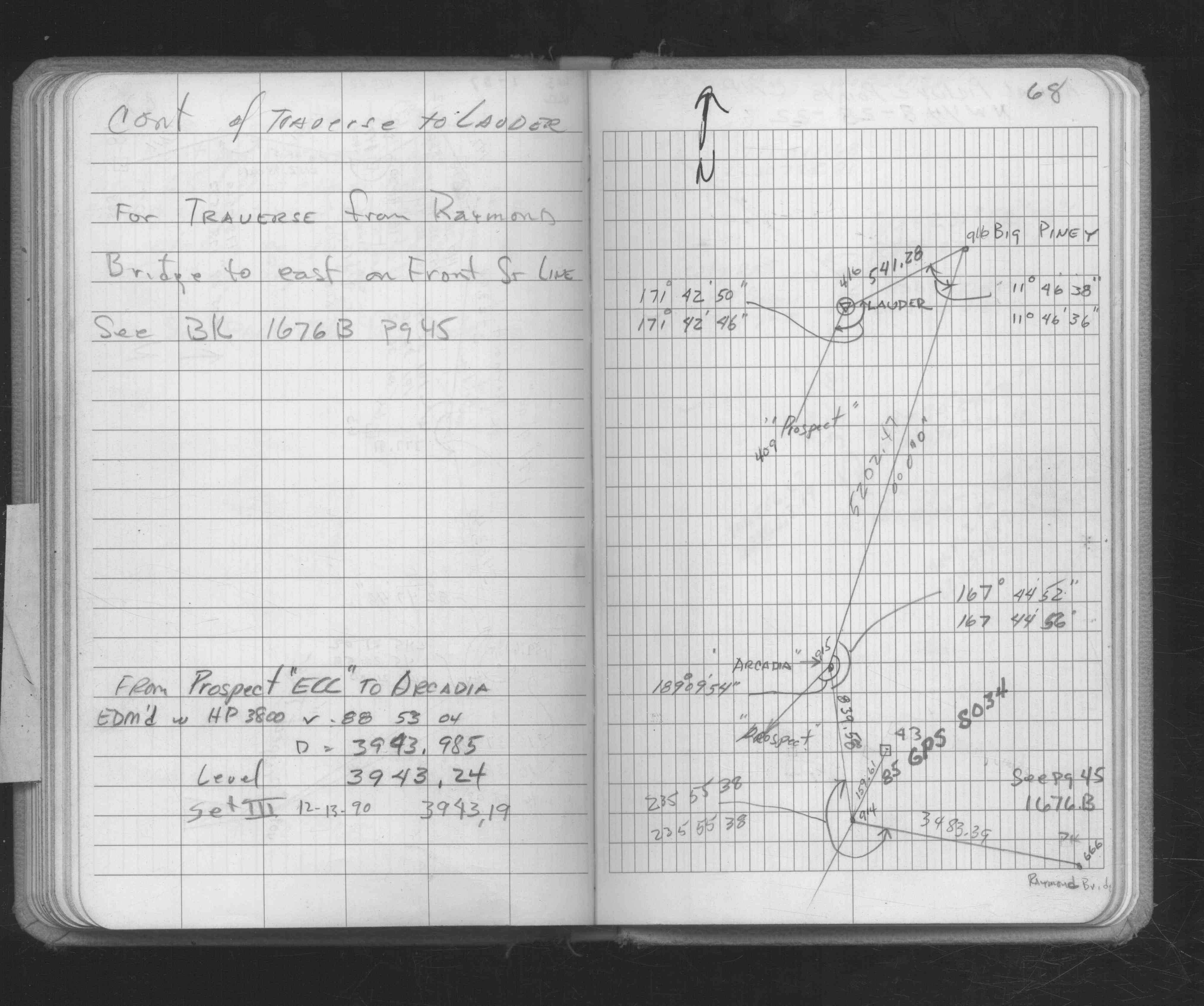
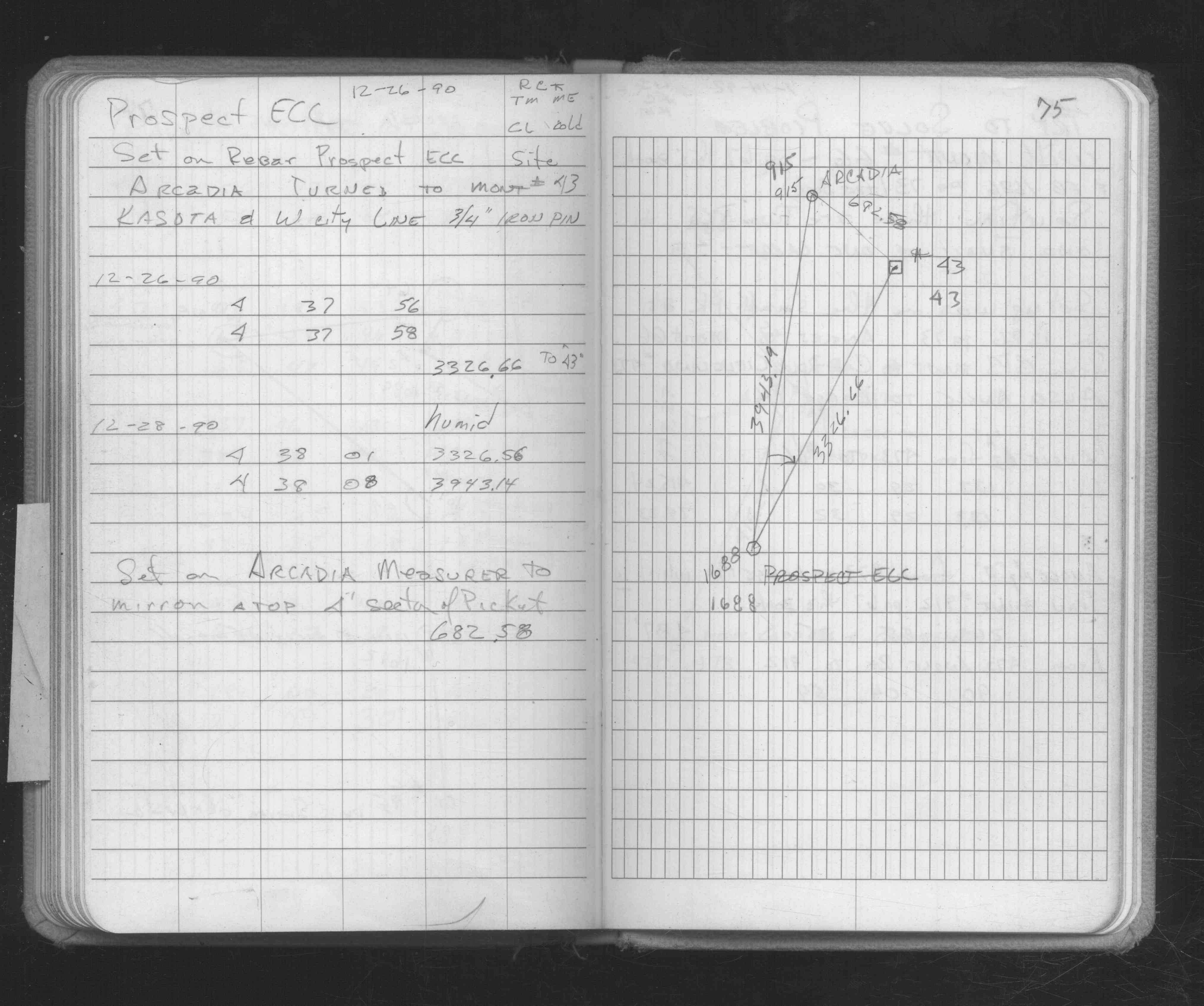
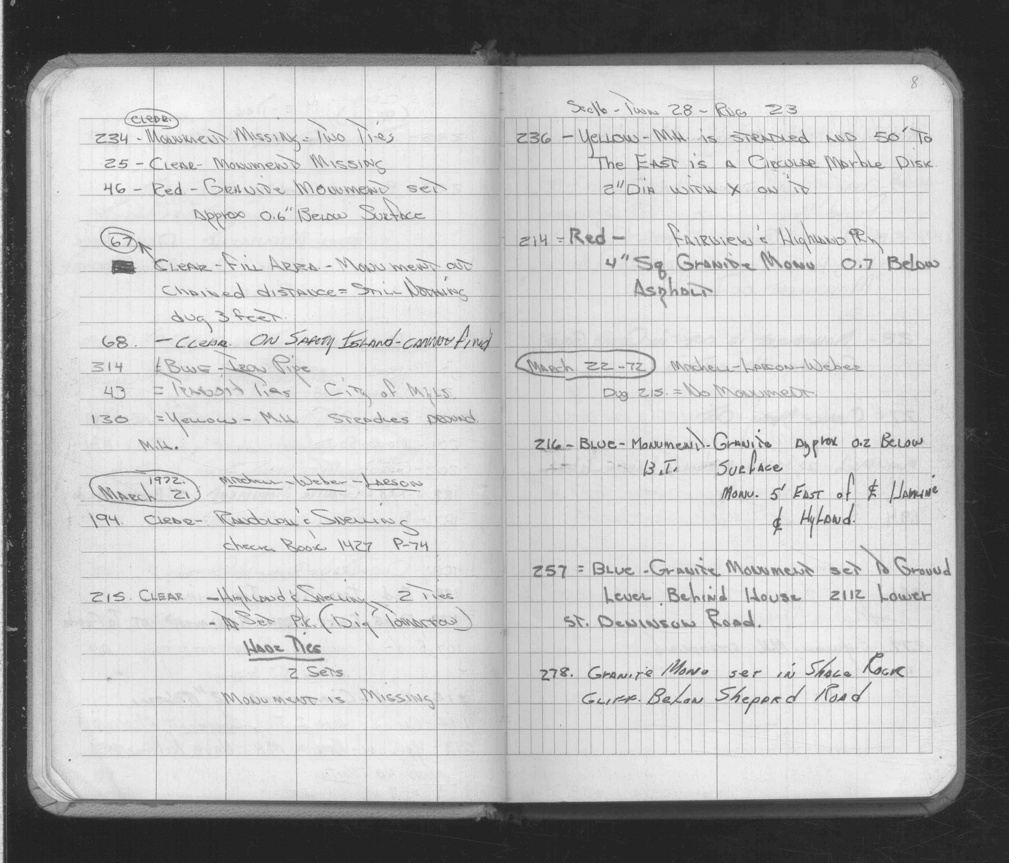
| 3/21/1972 | Transit ties, City of Mpls. See FB 1689A p.8 |
| 6/27/1970 | Hennepin Cnty Surveyors placed transit ties on a 6"x6" limestone monument |
| 11/12/1888 | Monument set by J H Armstrong |
| 9/1/1887 | (Unknown date Sep __, 1887 ) One bearing tree in. See J B Irvine's Book 3 p.61 |
| 11/1/1847 | (Unknown date Nov __, 1847 ) Isaac N Higbee deputy surveyor set post. Tied to 2 BTs. See IH p.116-117 2923 |
| 1/1/1800 | (Unknown date ___ __, ____ ) Hennepin Cnty Surveyors placed a pk nail using their 1970 transit ties which intersected |
Above is NOT an all inclusive history of this point. Please review all the links below.
| PLS NOTES | Field | Cross Section | Sewer | J.B. Irvine | Monument | River Survey |
|---|---|---|---|---|---|---|
| IH p.116-117 | FB 0216p. 12 ,13 ,14 | |||||
| FB 0278p. 01 ,03 | ||||||
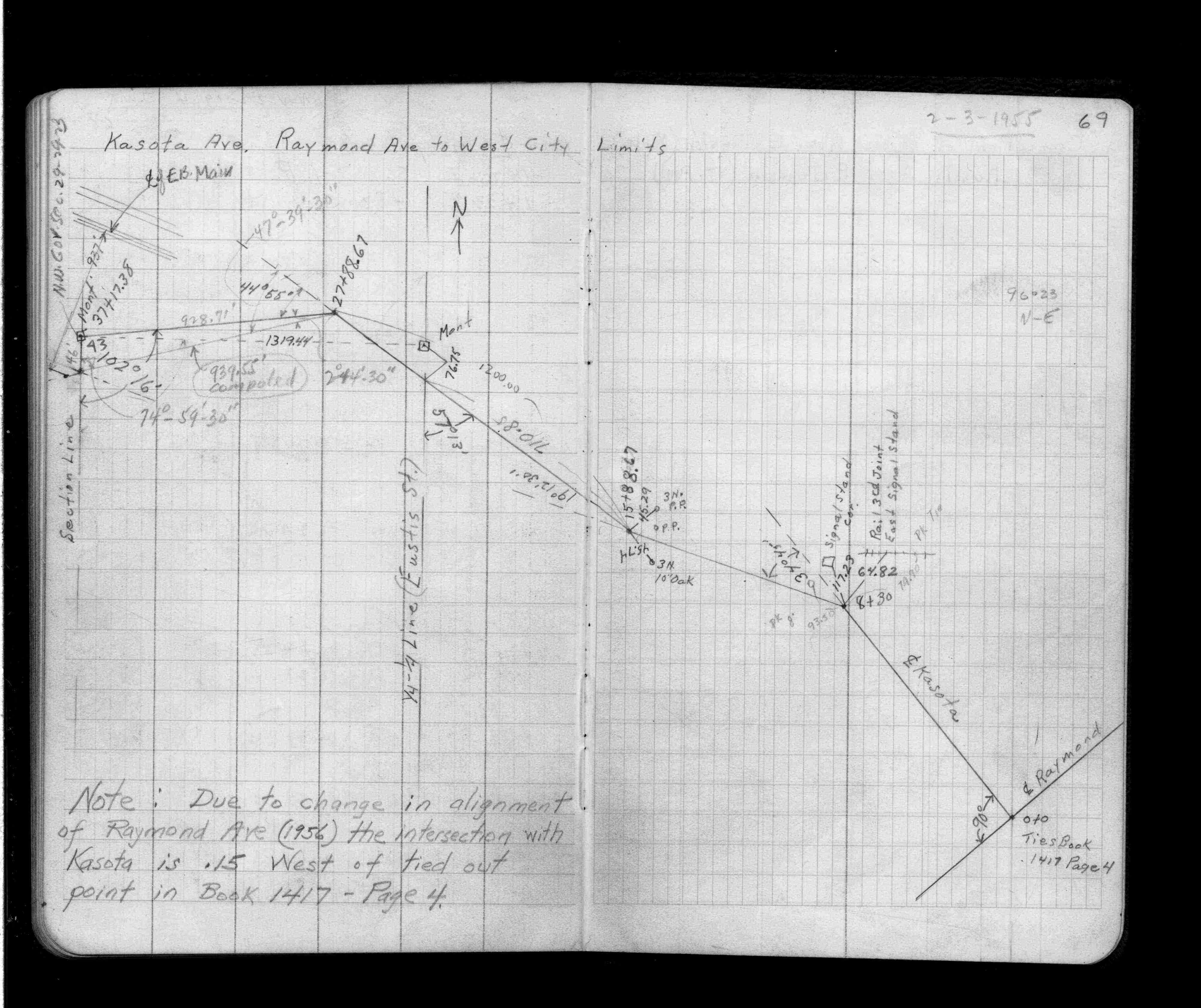
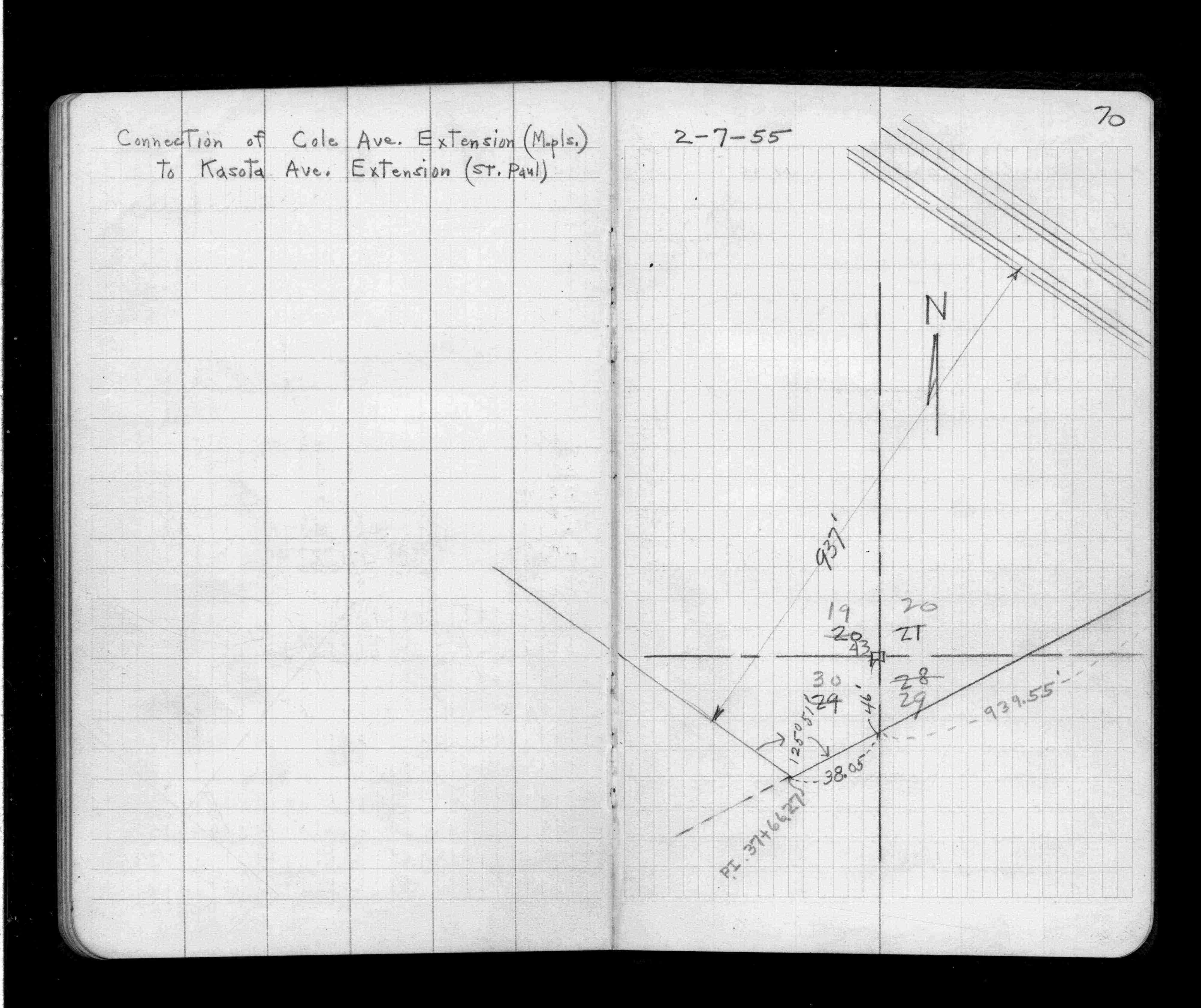
| FB 1397p. 69 ,70 | ||||||
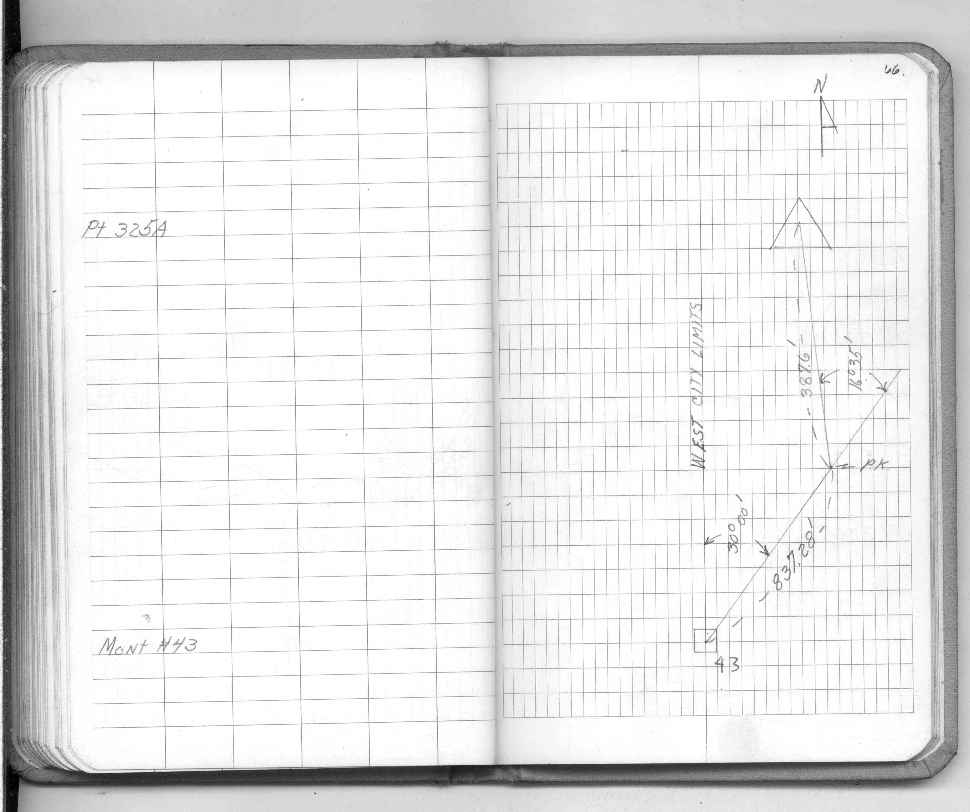
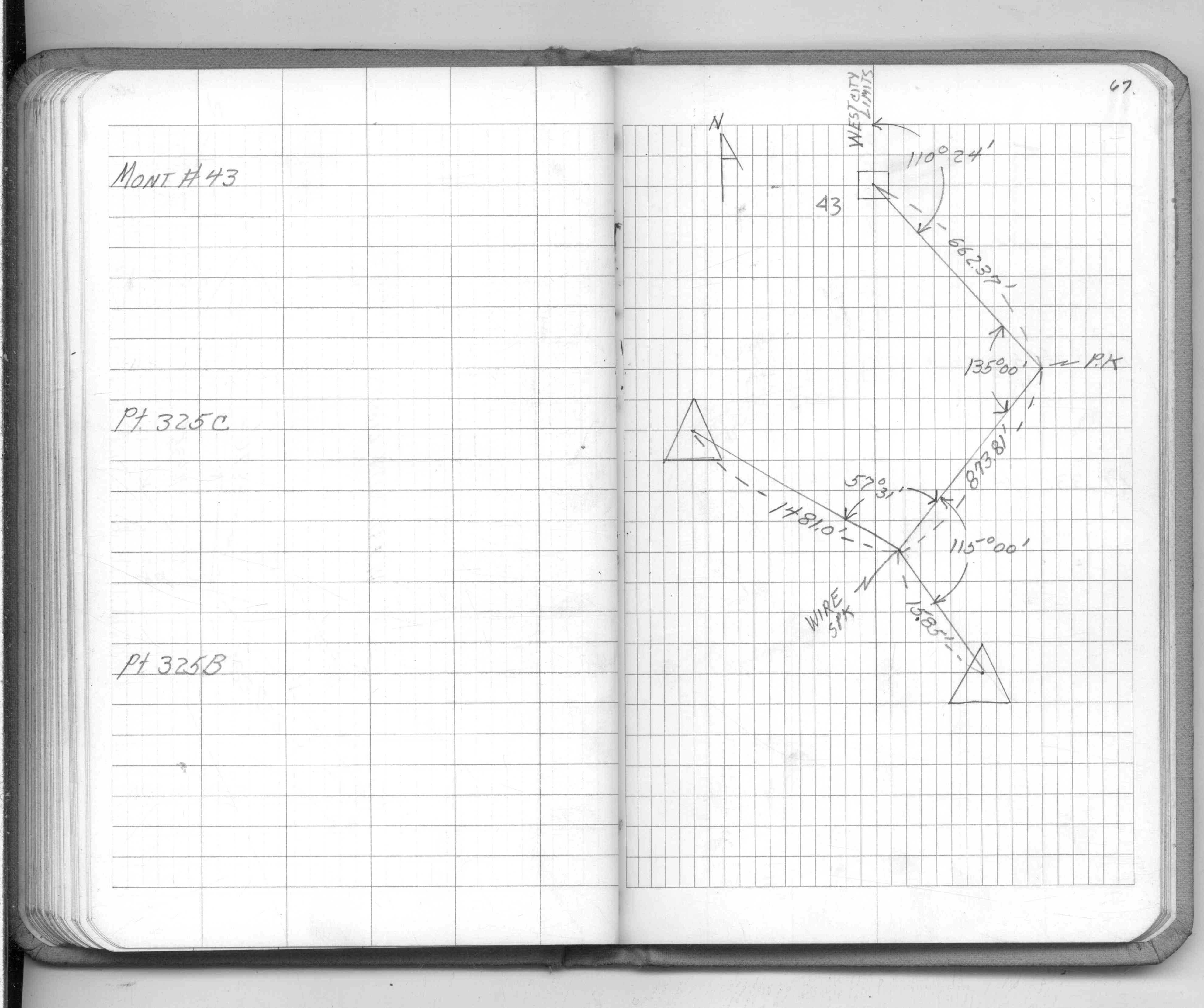
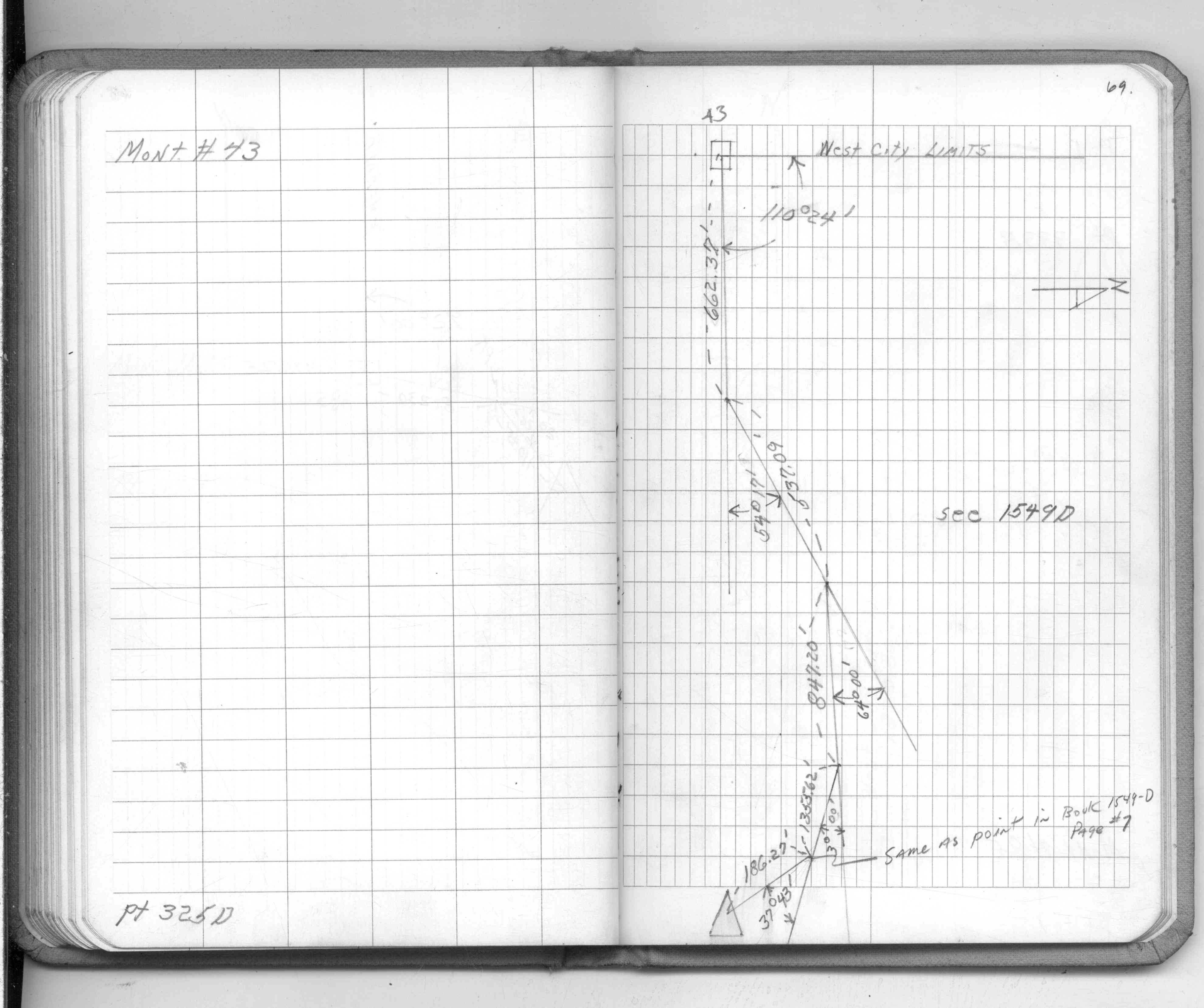
| FB 1549Cp. 66 ,67 ,69 | ||||||
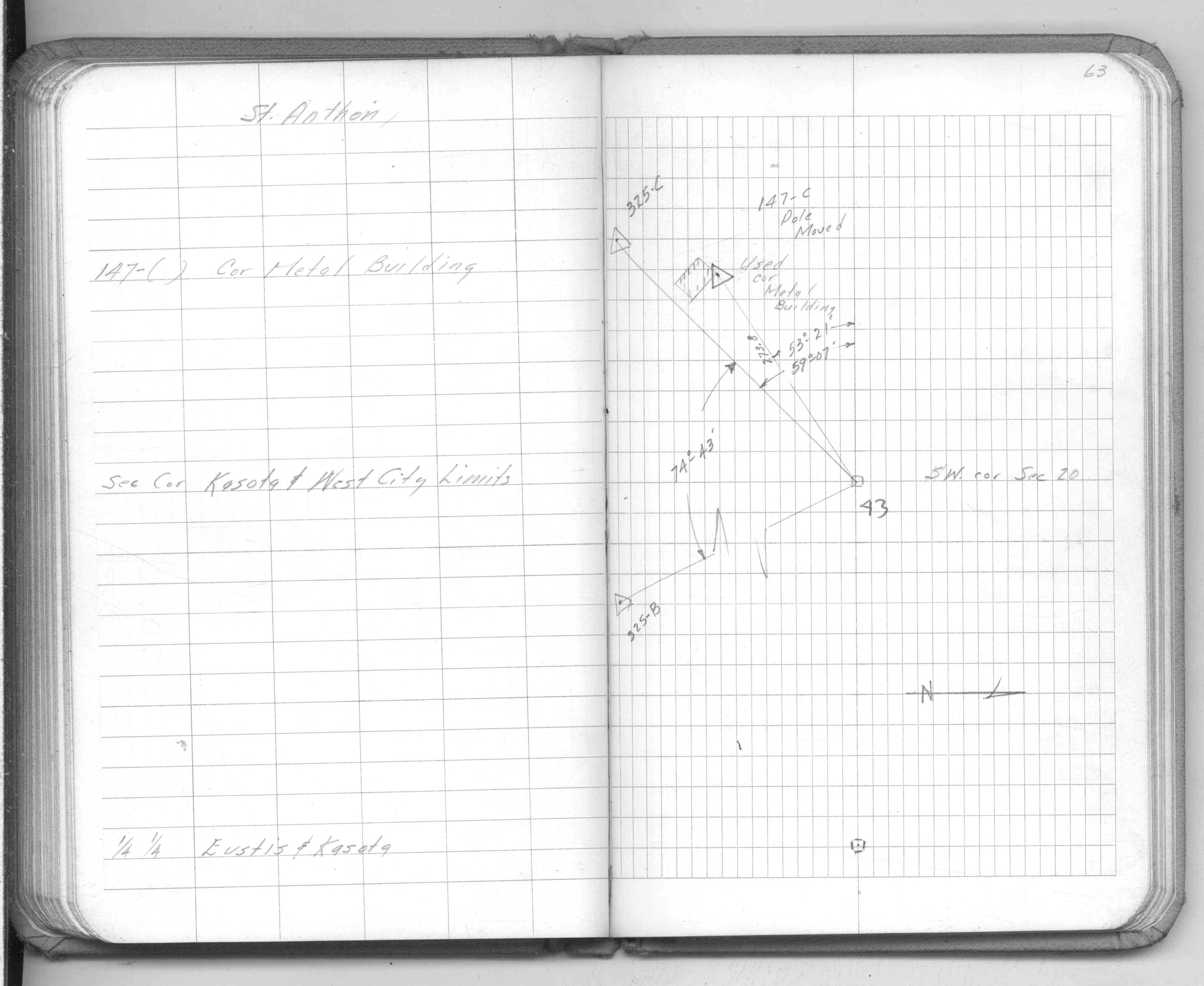
| FB 1549Ep.63 | ||||||
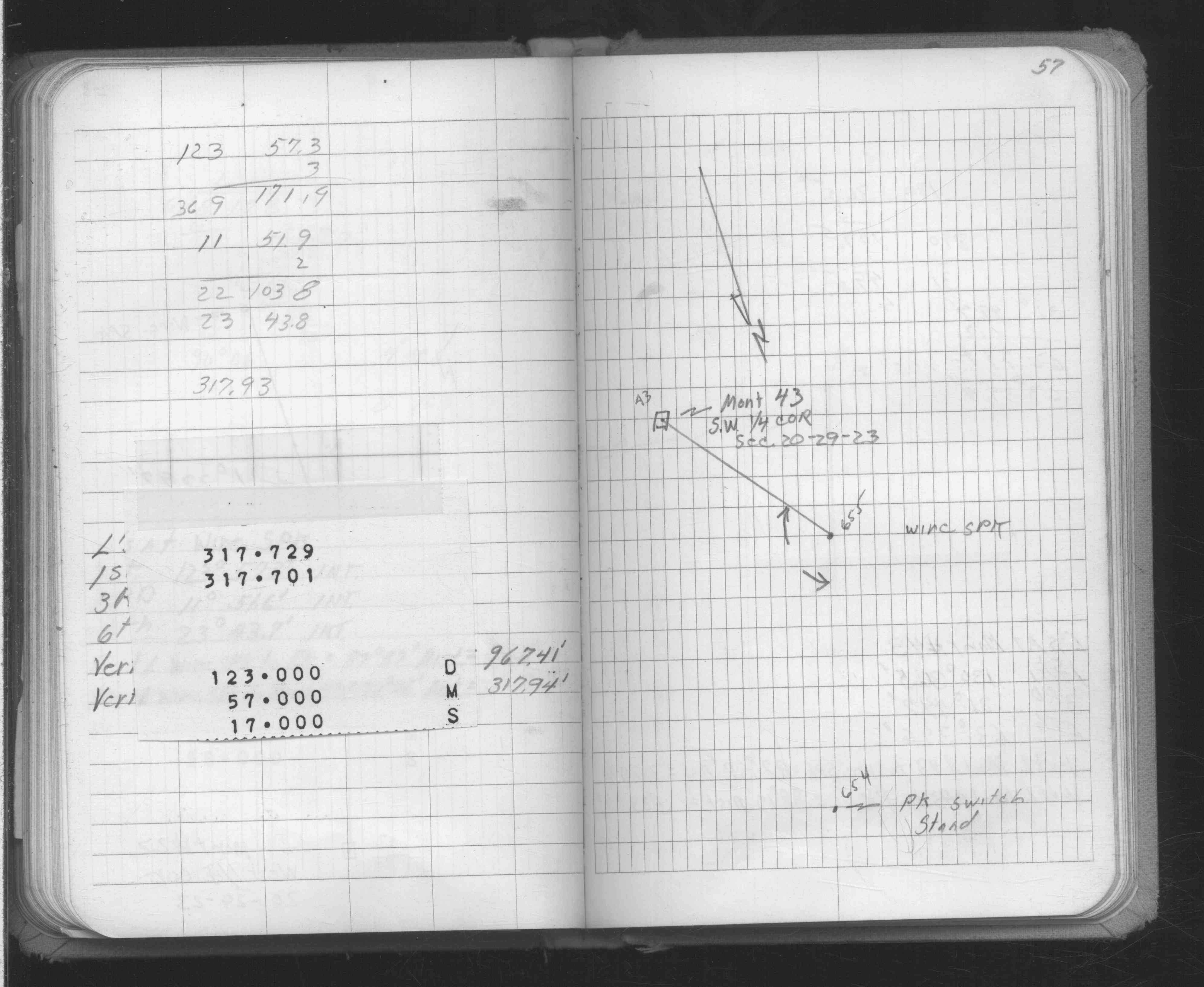
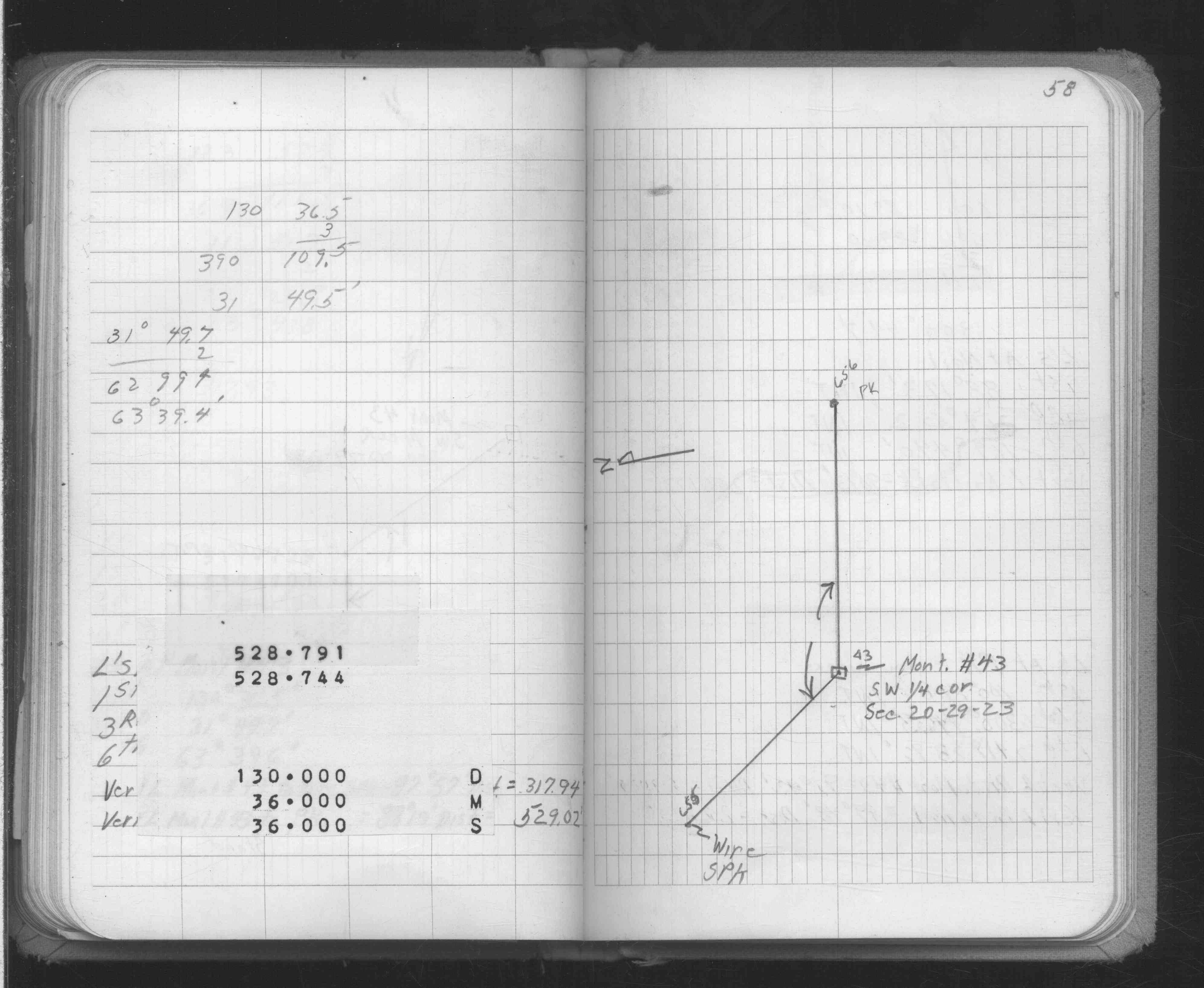
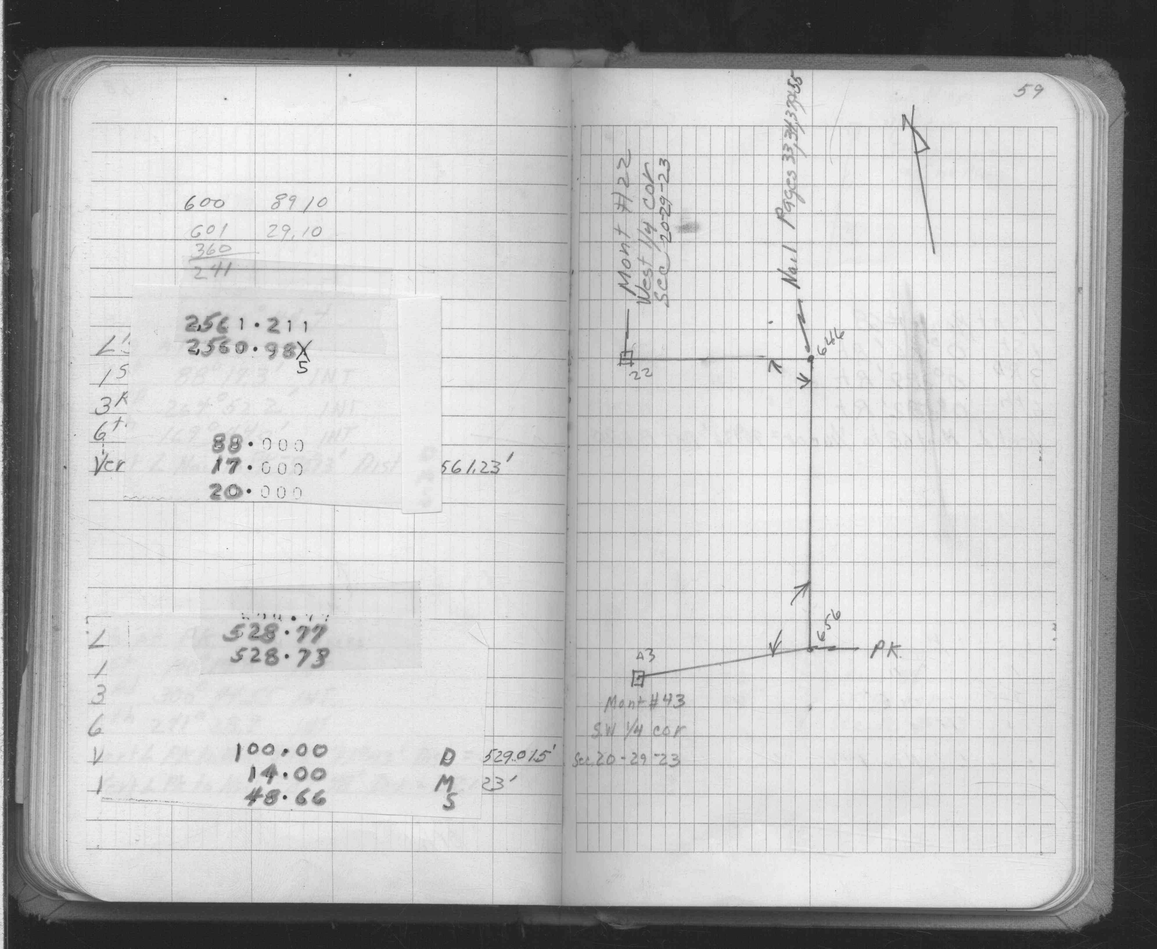
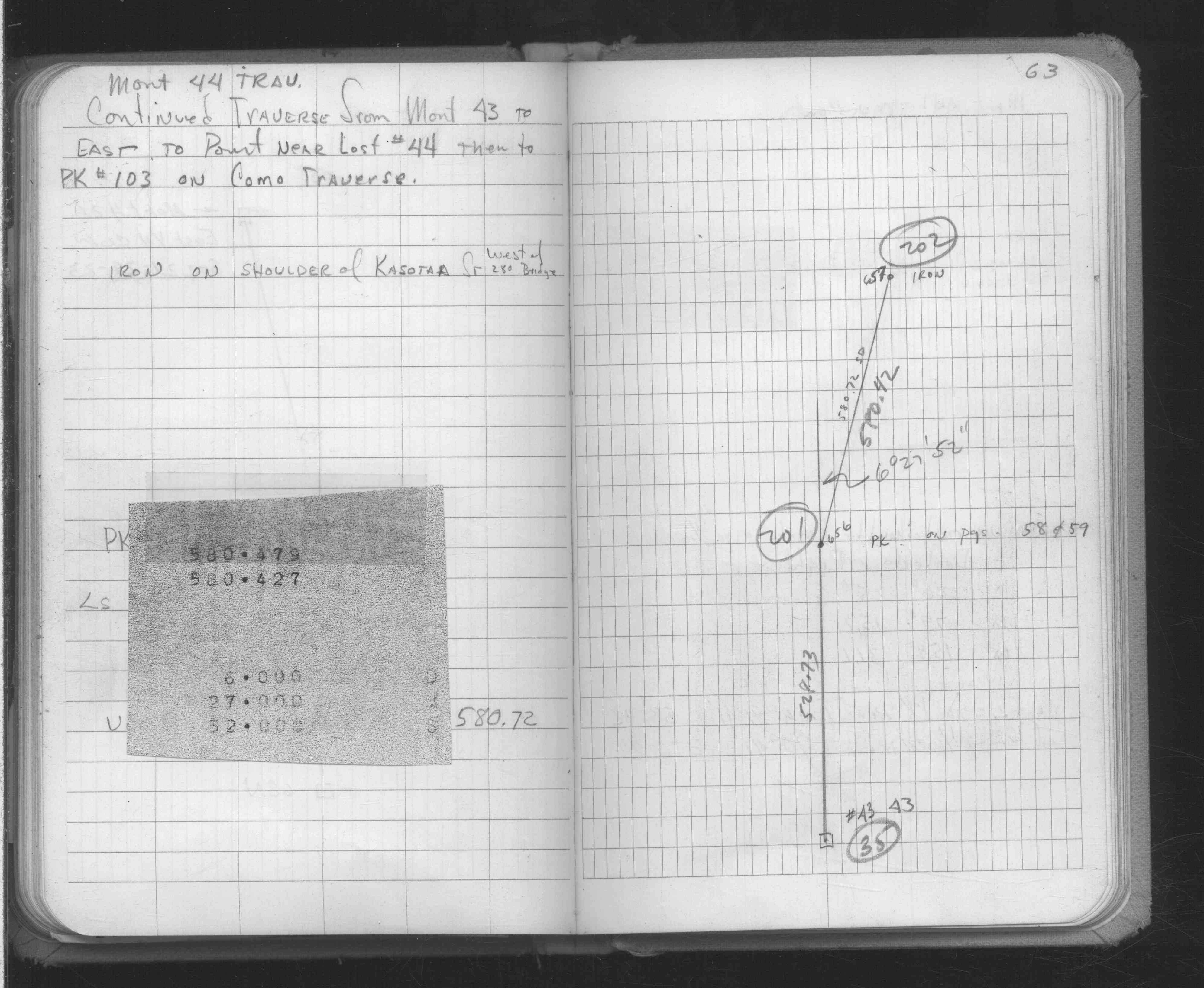
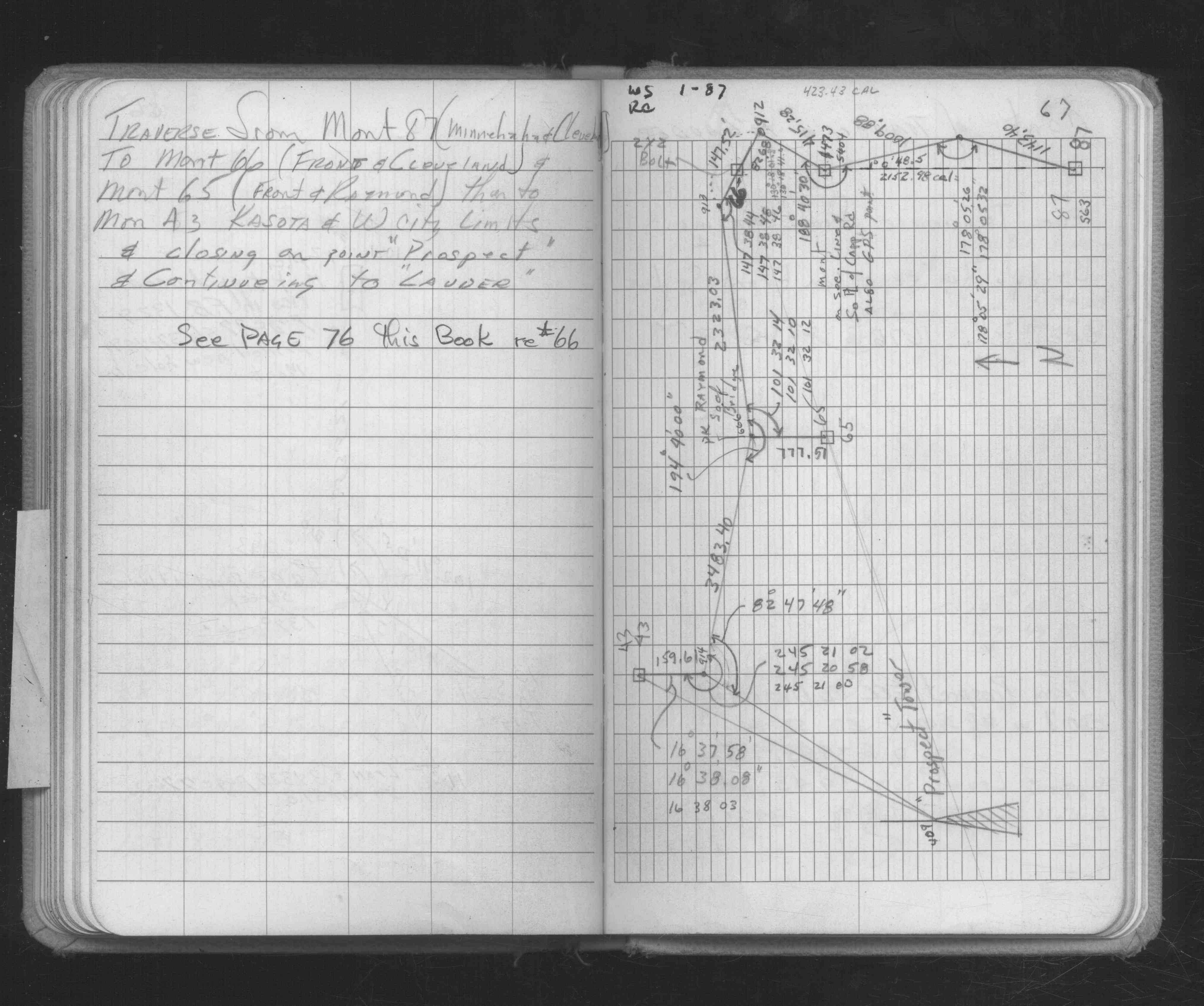
| FB 1634Ap. 57 ,58 ,59 ,63 | ||||||
| FB 1686p. 67 ,68 ,75 | ||||||
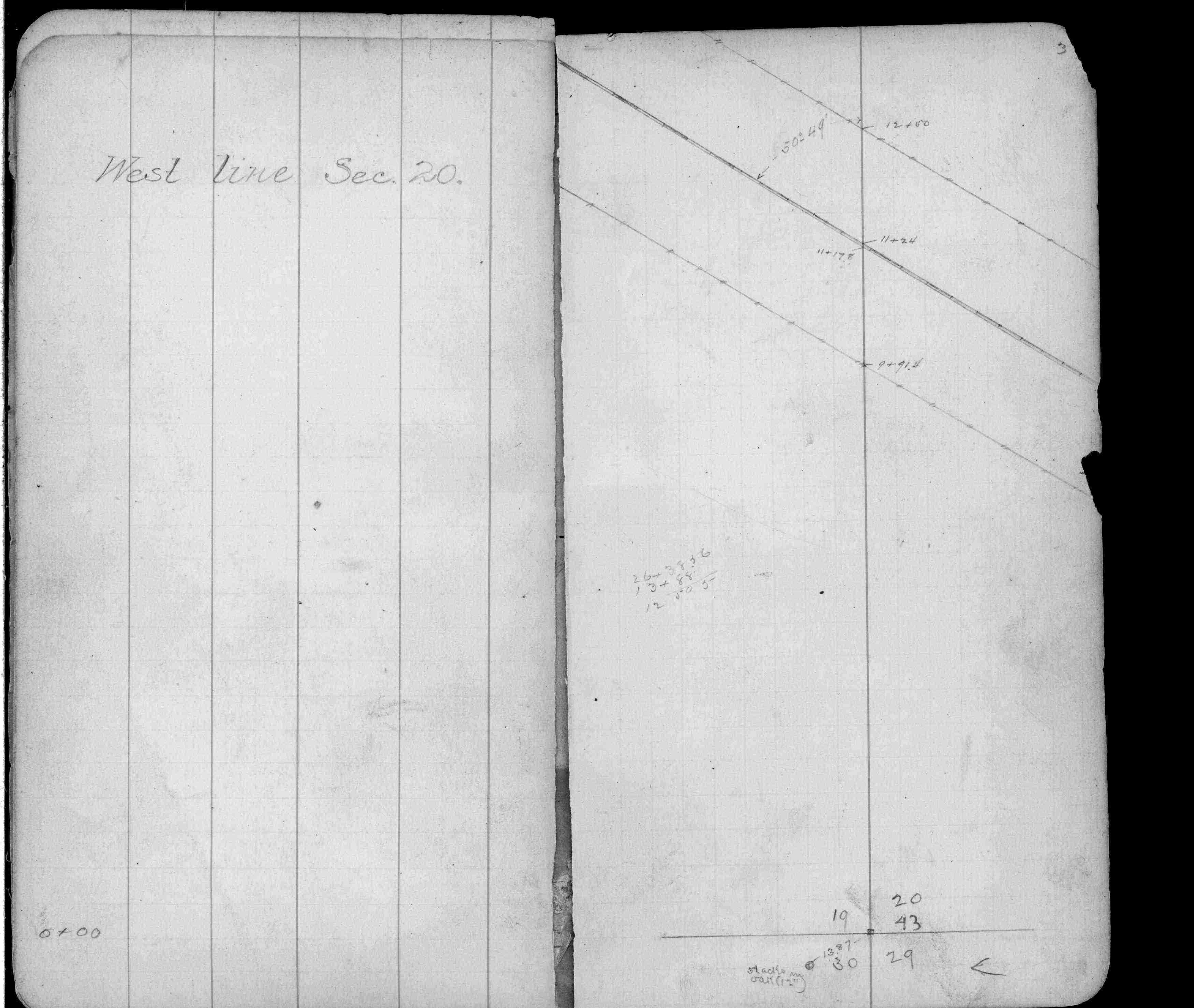
| FB 1689Ap.08 | ||||||
| FB 1736p.10 |
| FILE | SURVEYOR | LIC. NO. | DATE SIGNED | DATE TIED |
|---|---|---|---|---|
| 0043-1090-A.tif | Jeffery L. Grosso | 13144 | December 29, 1998 | December 22, 1998 |
| 0043-1090-B.tif | Hennepin County Surveyors Office | none | none | June 26, 1998 |
| ST_001-078p043.jpg | none | none | none | none |
| 0043-1090-A.dwf | none | none | none | none |
| FILE | PHOTO DATE | COMMENTS |
|---|---|---|
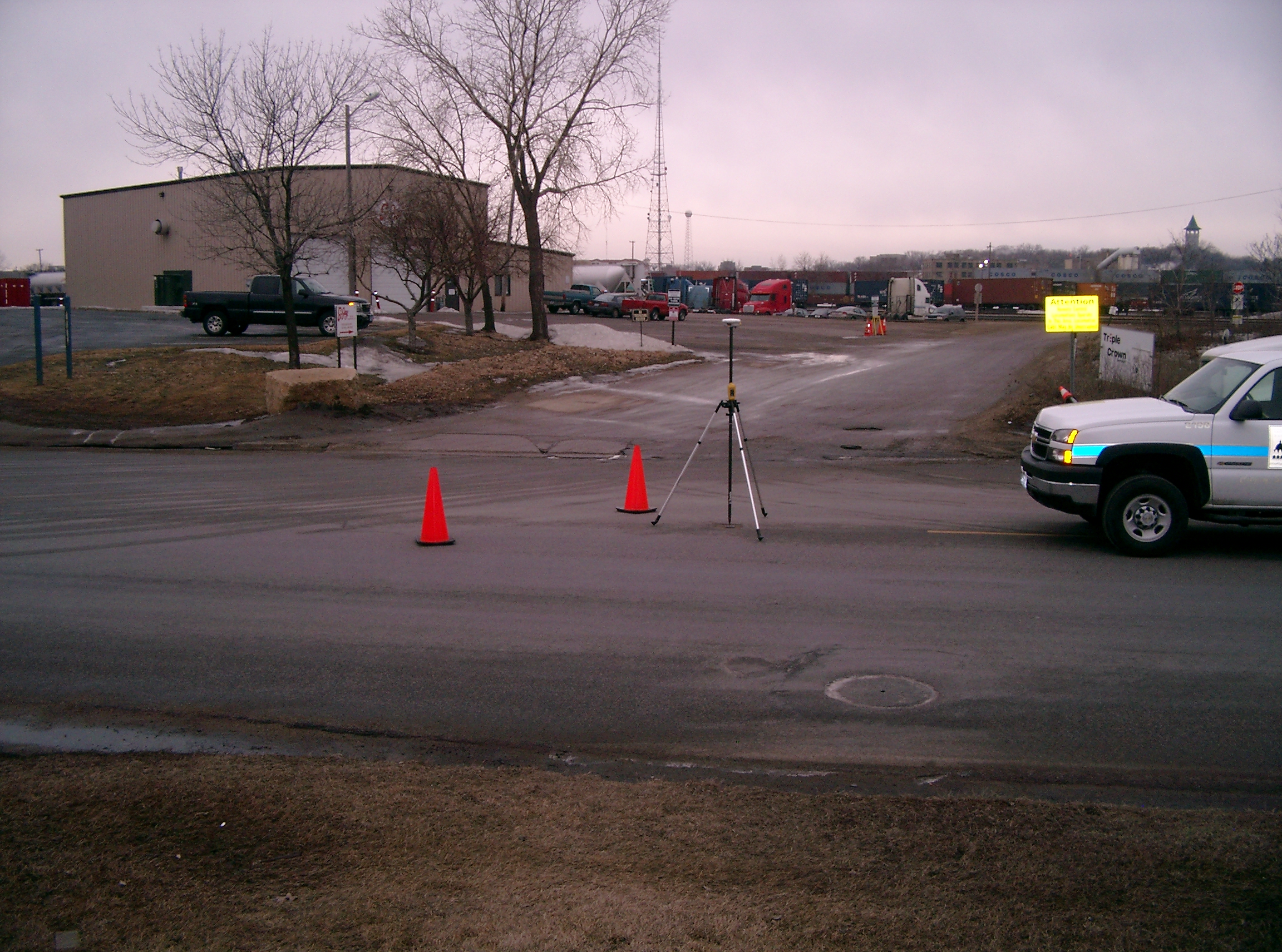
| 0043-1090-5.jpg | March 25, 2008 | Looking West along Kasota towards urbi amentes. |
| 0043-1090-4.jpg | March 25, 2008 | Looking South across Kasota along the West city limits. |
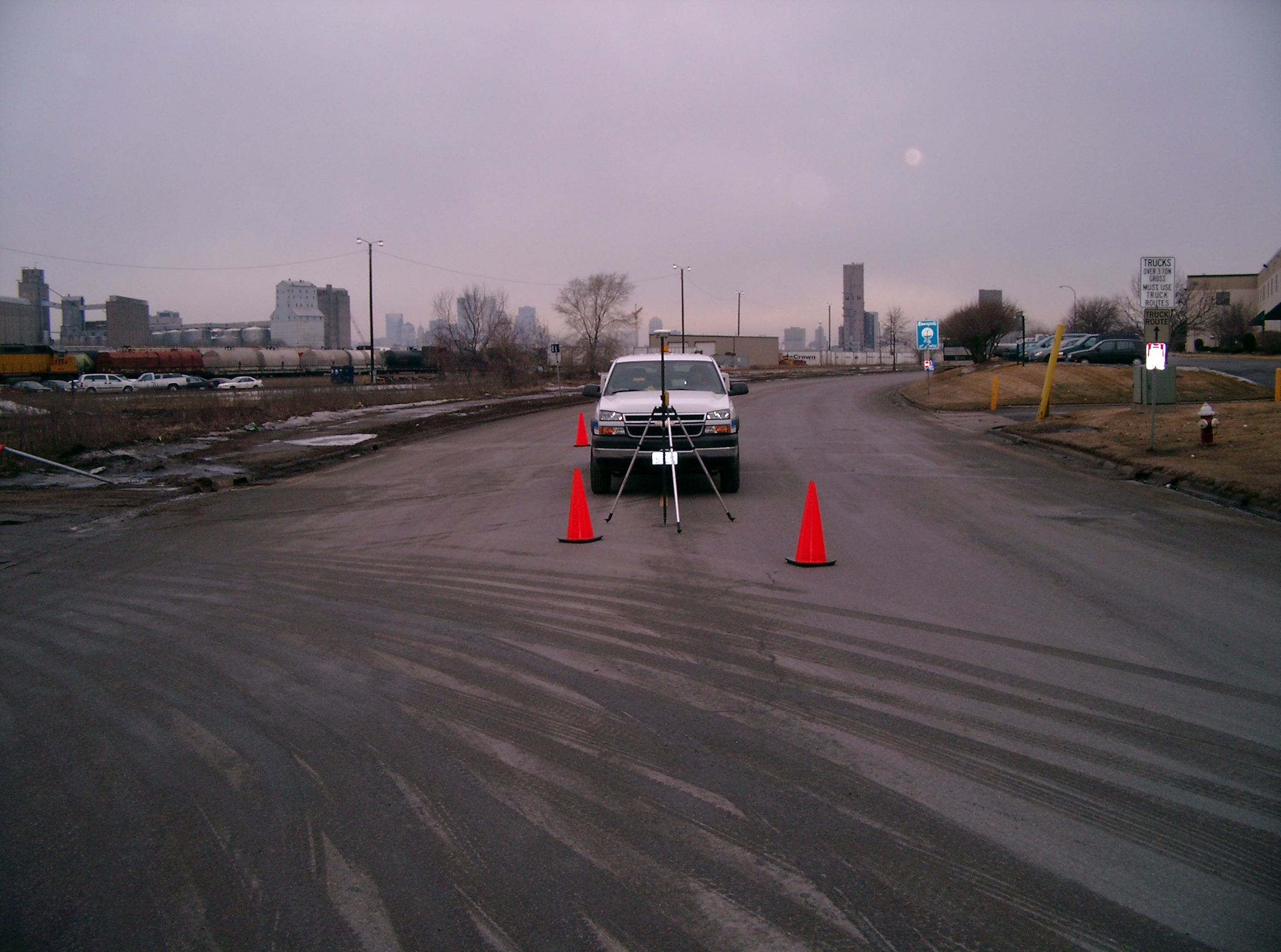
| 0043-1090-3.jpg | March 25, 2008 | Looking East along the center of Kasota. |
| 0043-1090-2.jpg | March 25, 2008 | Looking North across Kasota along the West city limits. |
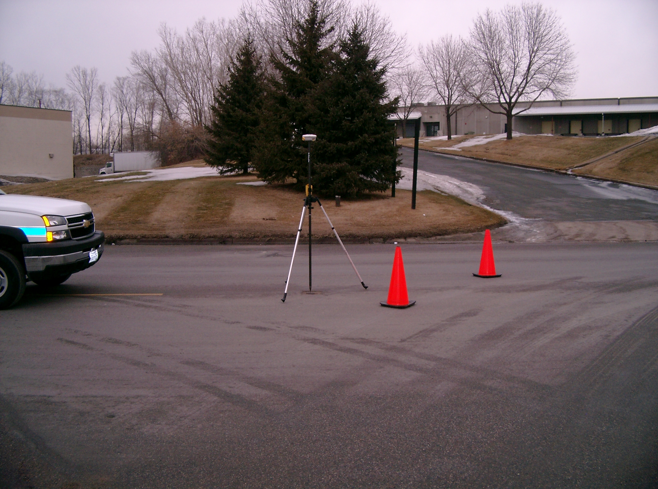
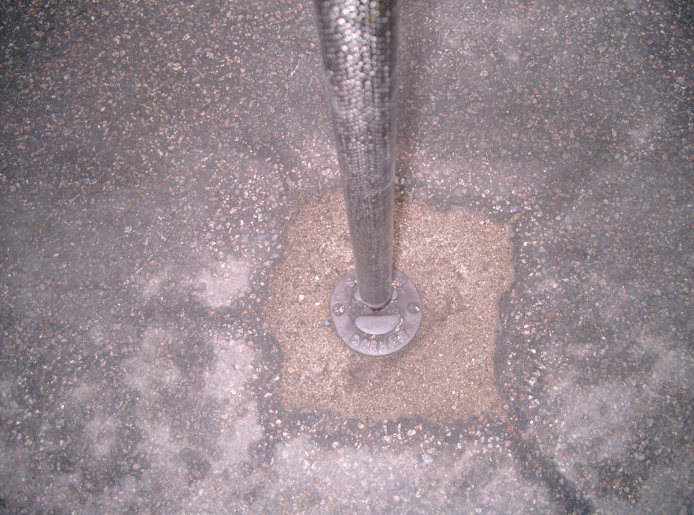
| 0043-1090-1.jpg | March 25, 2008 | Close-up of CIM set in concrete at street grade. |