| NAD83 COORDINATES (1986 adj.): |
|---|
| * X= 553355.09 Y= 167942.51 Z= 0 LSQ 12/6/1991 S FIX |
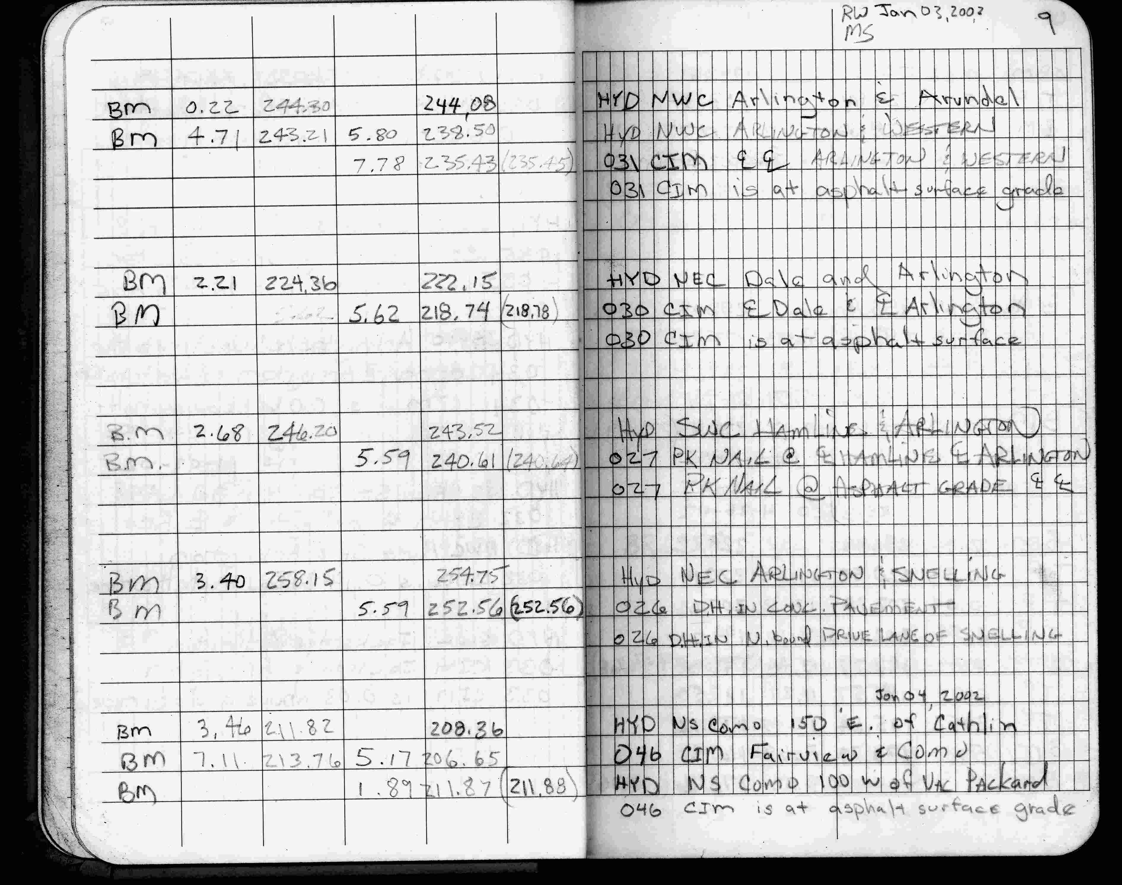
| 1/4/2002 | Elev 206.65 ft on CIM at asphalt surface. See FB 1736 p.9 |
| 3/17/2000 | Fd CIM at grade (marked for painting target for 2000 aerial) |
| 10/10/1996 | Set CIM to grade. See CofL 0046-1787A-A |
| 3/22/1996 | Fd & painted pk nail for aerial. See Yellow Tie Book. |
| 1/1/1995 | (Unknown date ___ __, 1995 ) CIM & GM taken out during 1995 sewer construction. |
| 10/25/1990 | Asphalt over lay. See Yellow Tie Book. |
| 10/1/1990 | (Unknown date Oct __, 1990 ) CIM over GM. |
| 2/1/1990 | (Unknown date Feb __, 1990 ) Ties checked. See Yellow Tie Book. |
| 2/26/1985 | Monument checked. See Yellow Tie Book. |
| 1/1/1985 | (Unknown date ___ __,1985 ) Historic, one time only GPS survey = S079 |
| 5/1/1972 | (Unknown date May __, 1972 ) Set CIM 0.6 ft of concrete over GM. See Yellow Tie Book. |
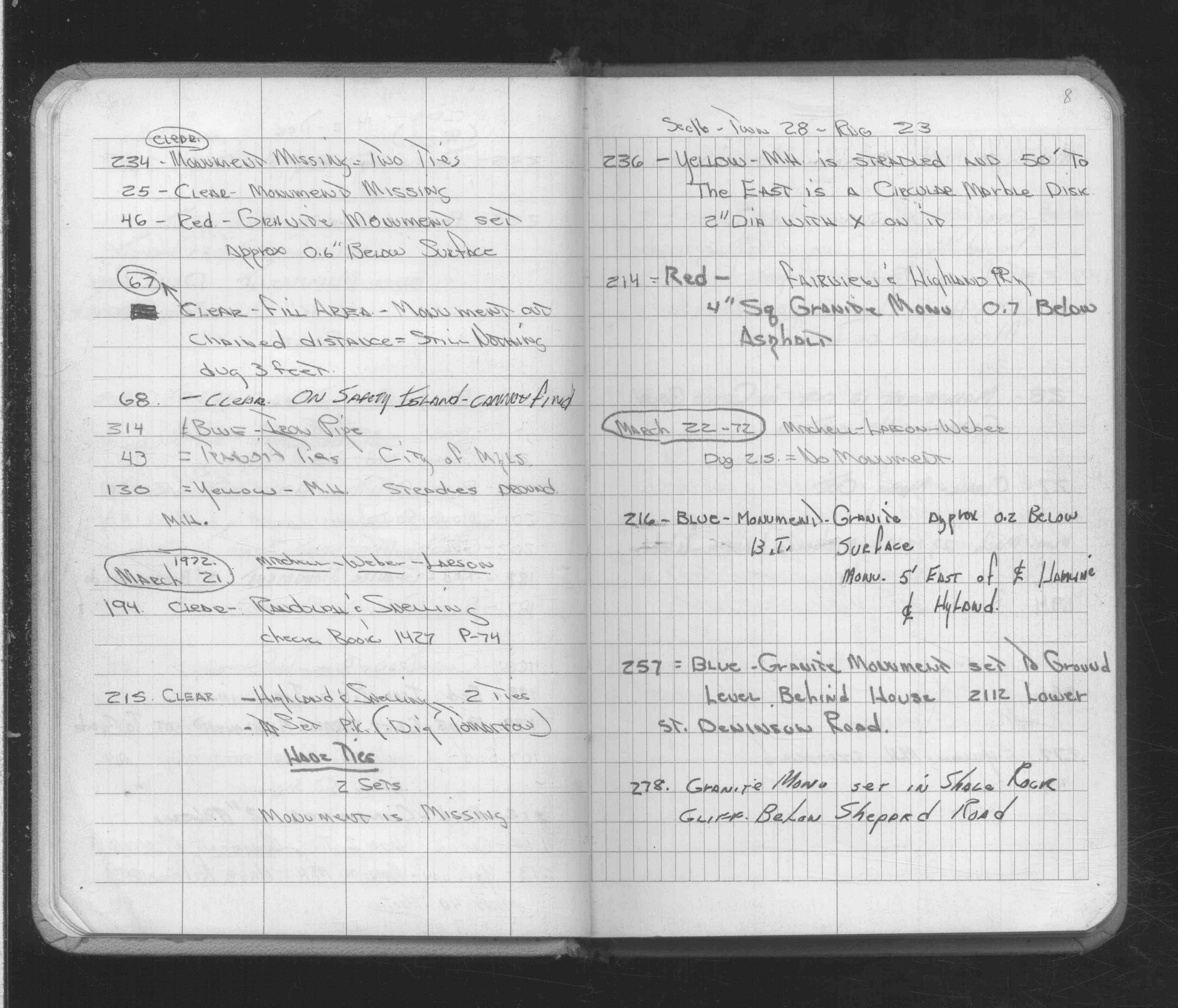
| 2/16/1972 | Fd GM 6" below grade. See FB 1689A p.8 |
| 9/2/1889 | Monument set by G Saulez after grading. |
| 11/1/1847 | (Unknown date Nov __, 1847 ) Isaac N Higbee deputy surveyor set post. Tied to 2 BTs. See IH p.104-105 2923 |
Above is NOT an all inclusive history of this point. Please review all the links below. Yellow Tie Books are 'ST' in the Monument category.
| PLS NOTES | Field | Cross Section | Sewer | J.B. Irvine | Monument | River Survey |
|---|---|---|---|---|---|---|
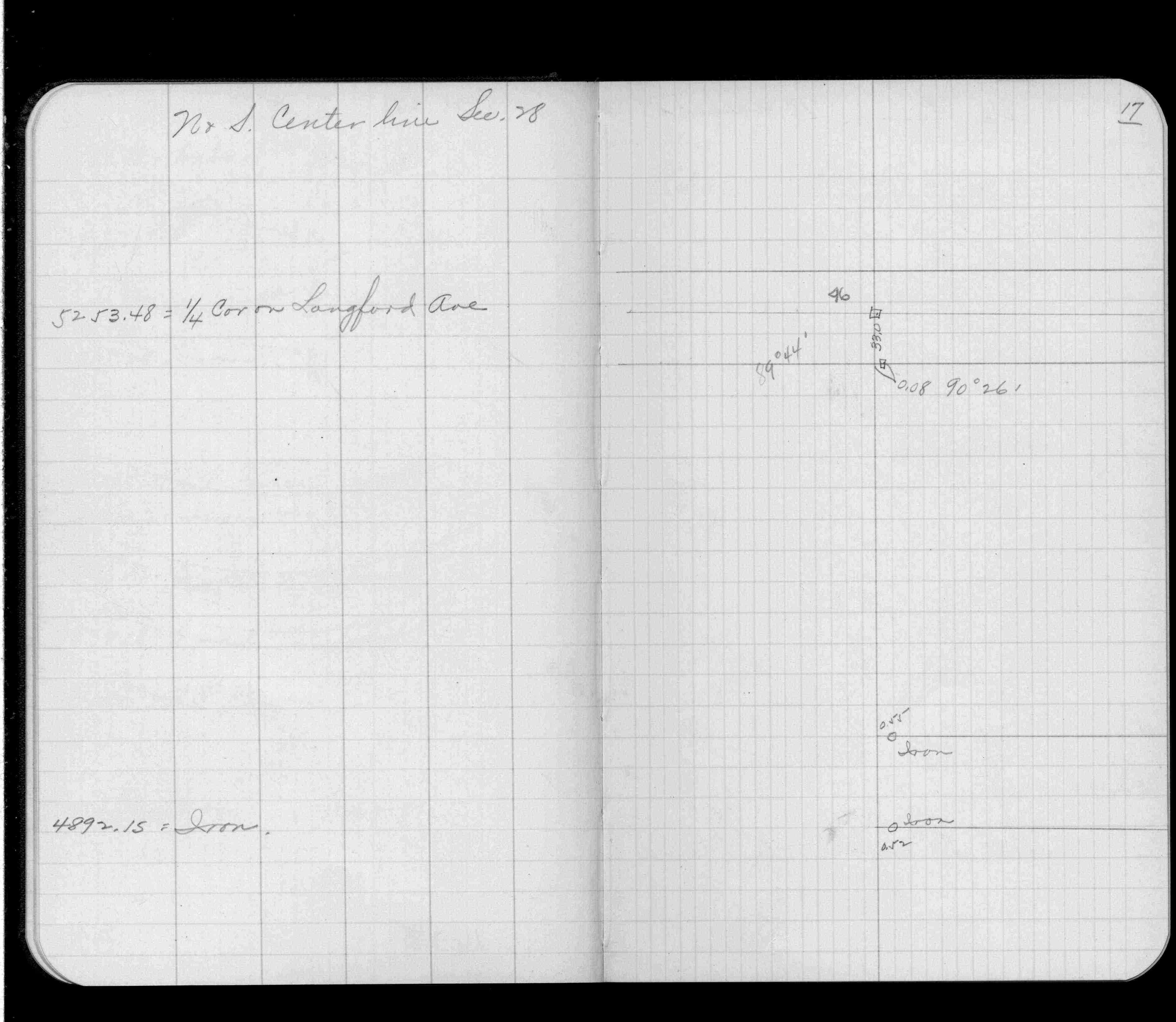
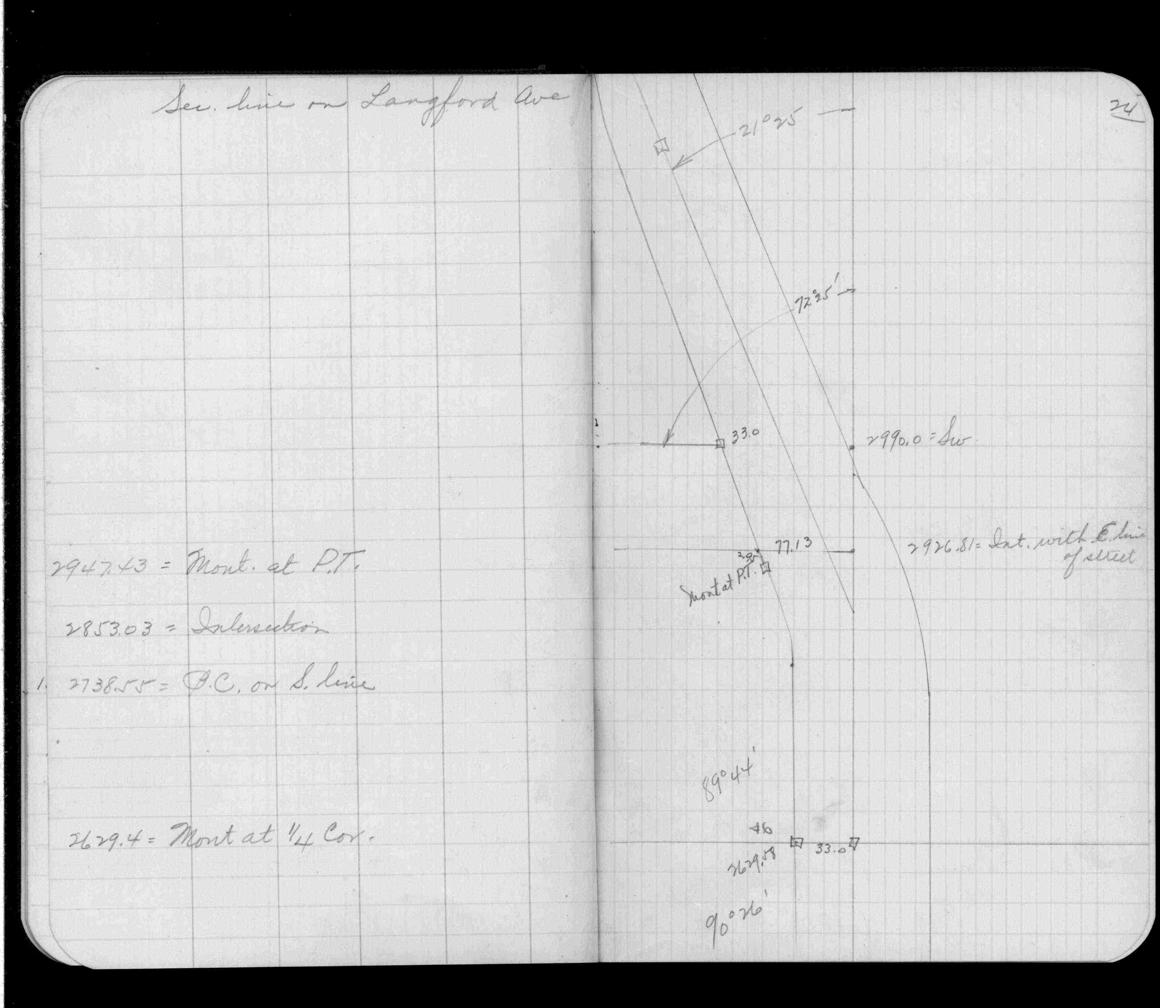
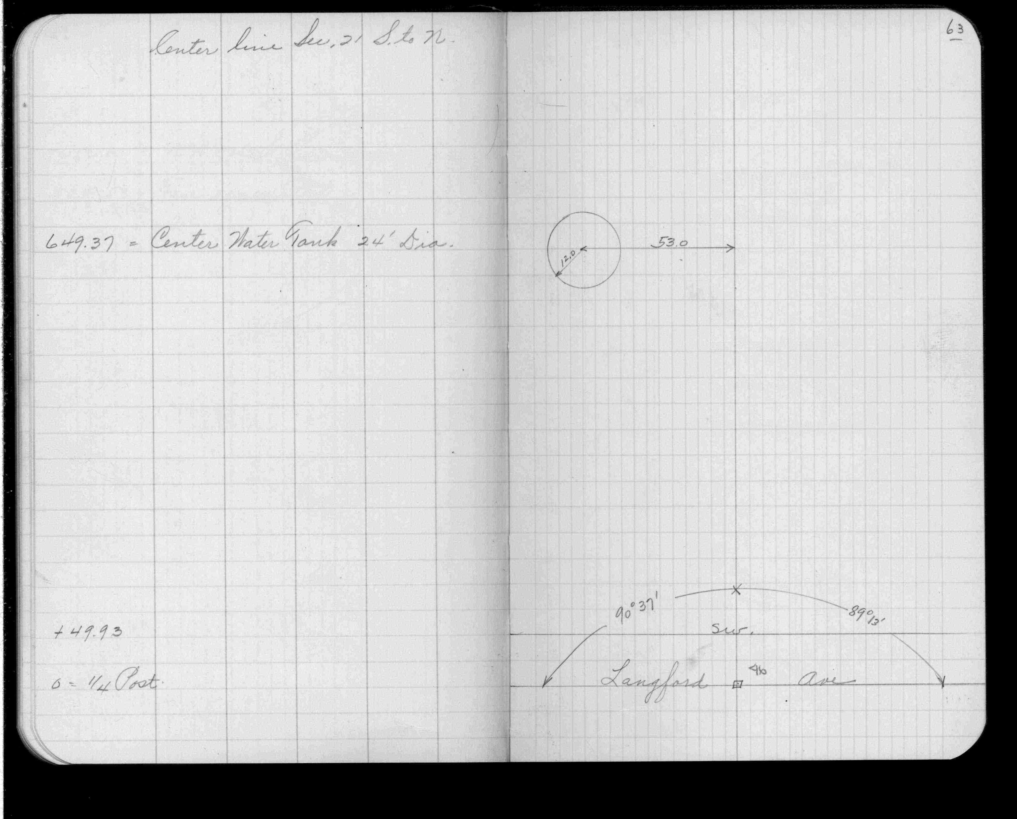
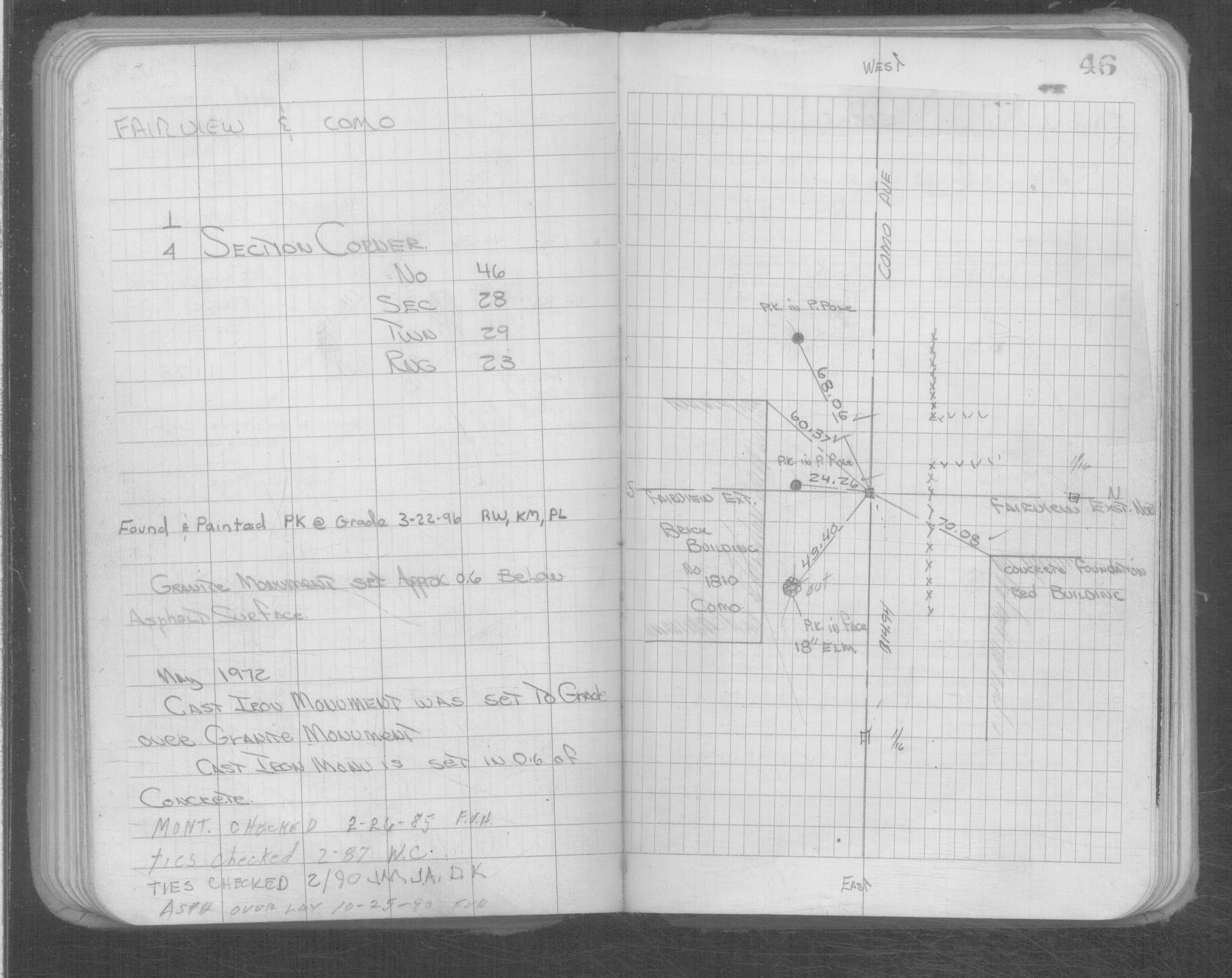
| IH p.104-105 | FB 0335CPYp. 17 ,24 ,63 | ST 001-078 p.046 | ||||
| FB 0610p.15 | ||||||
| FB 1549D2p.63 | ||||||
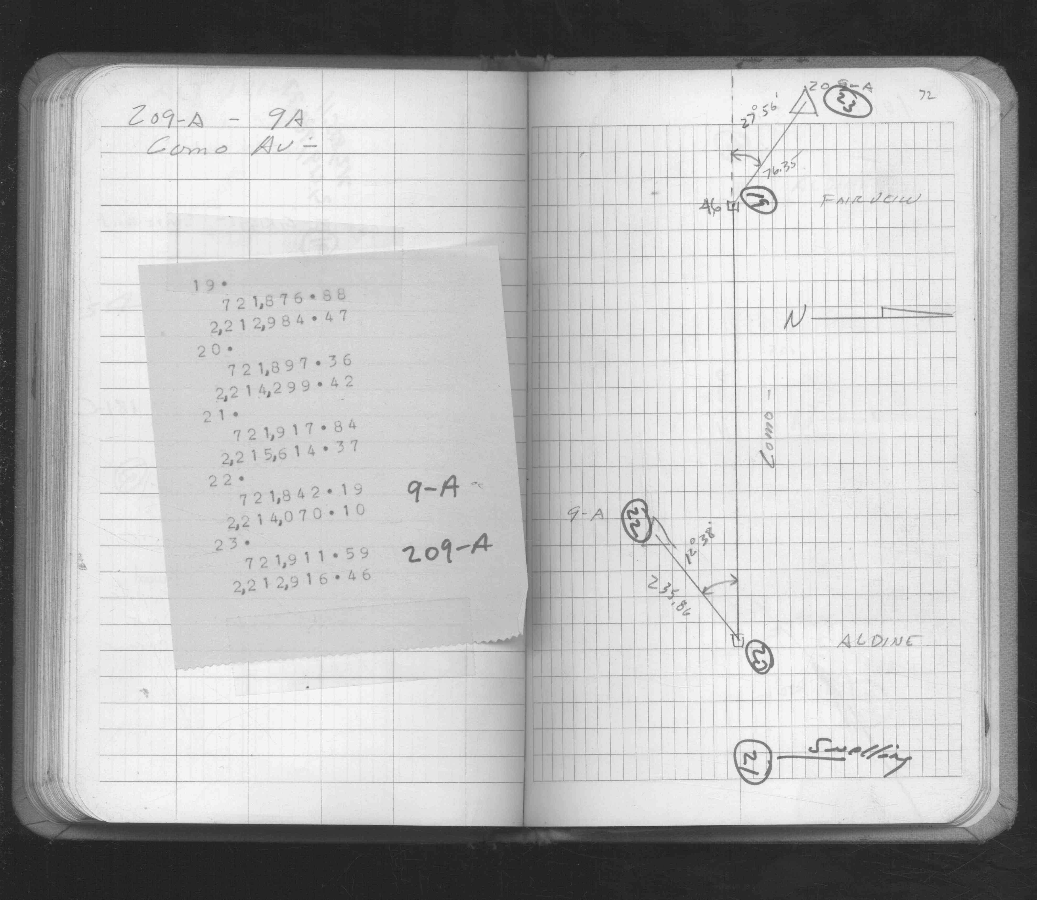
| FB 1549Gp.72 | ||||||
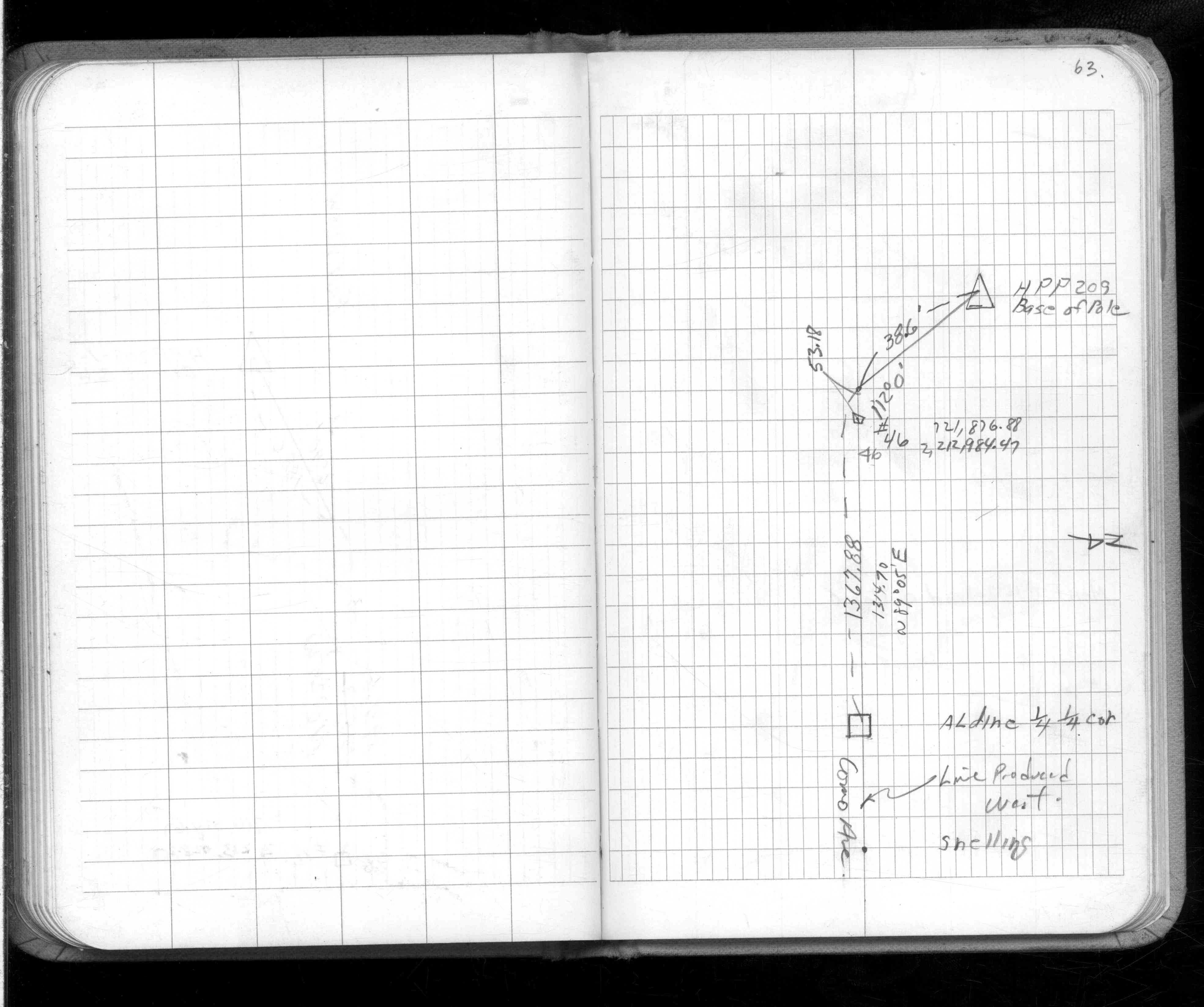
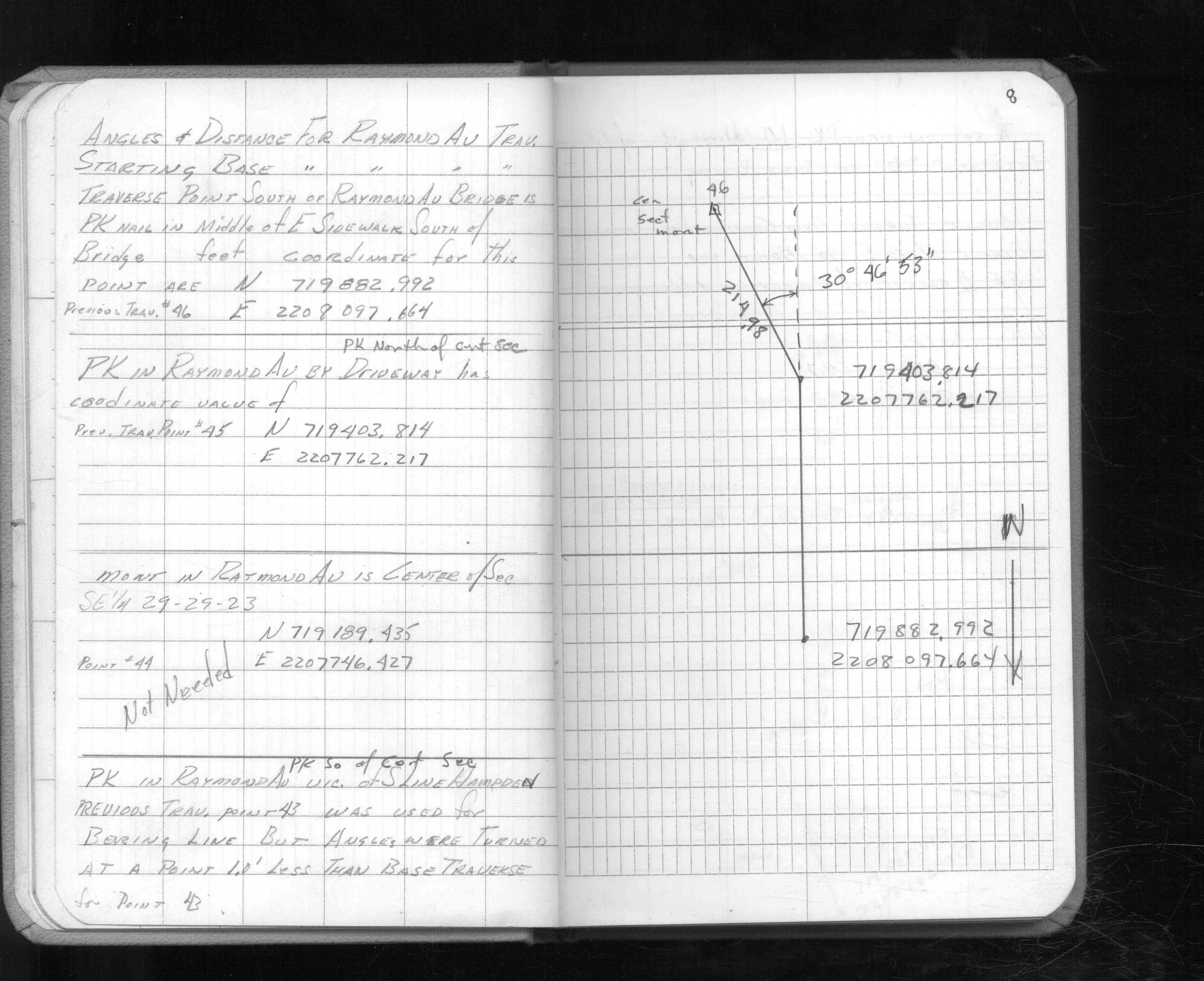
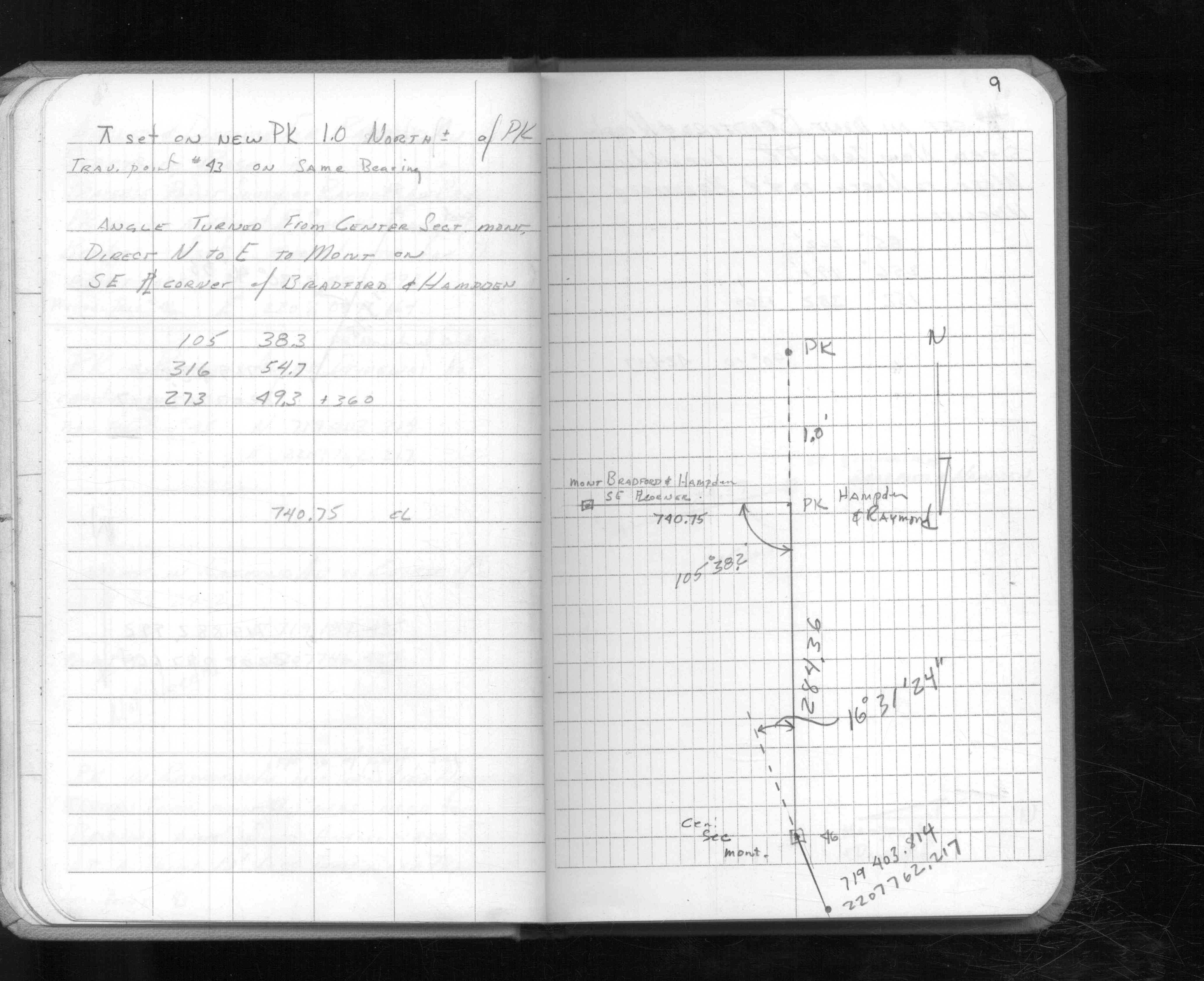
| FB 1611Ap. 08 ,09 | ||||||
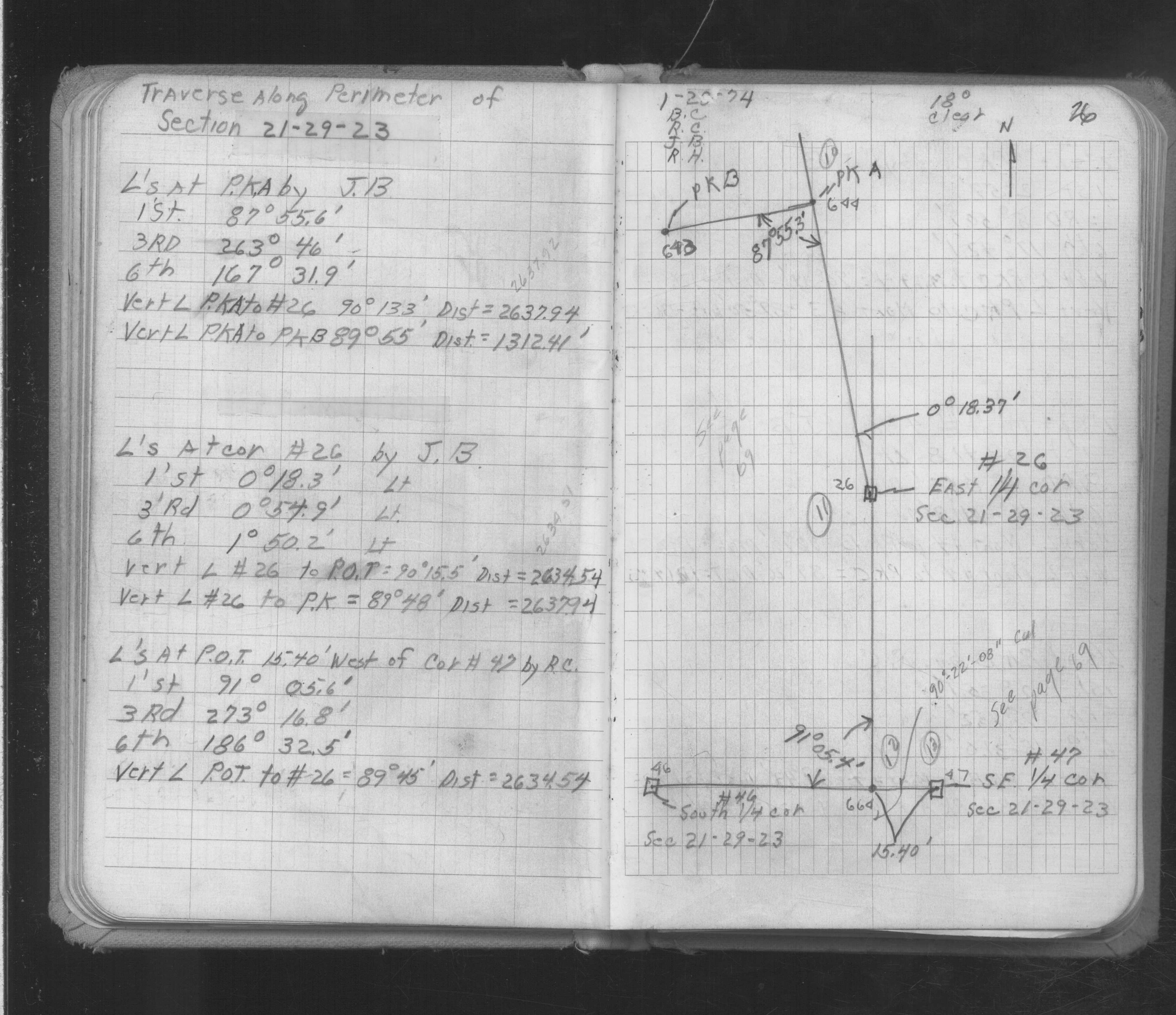
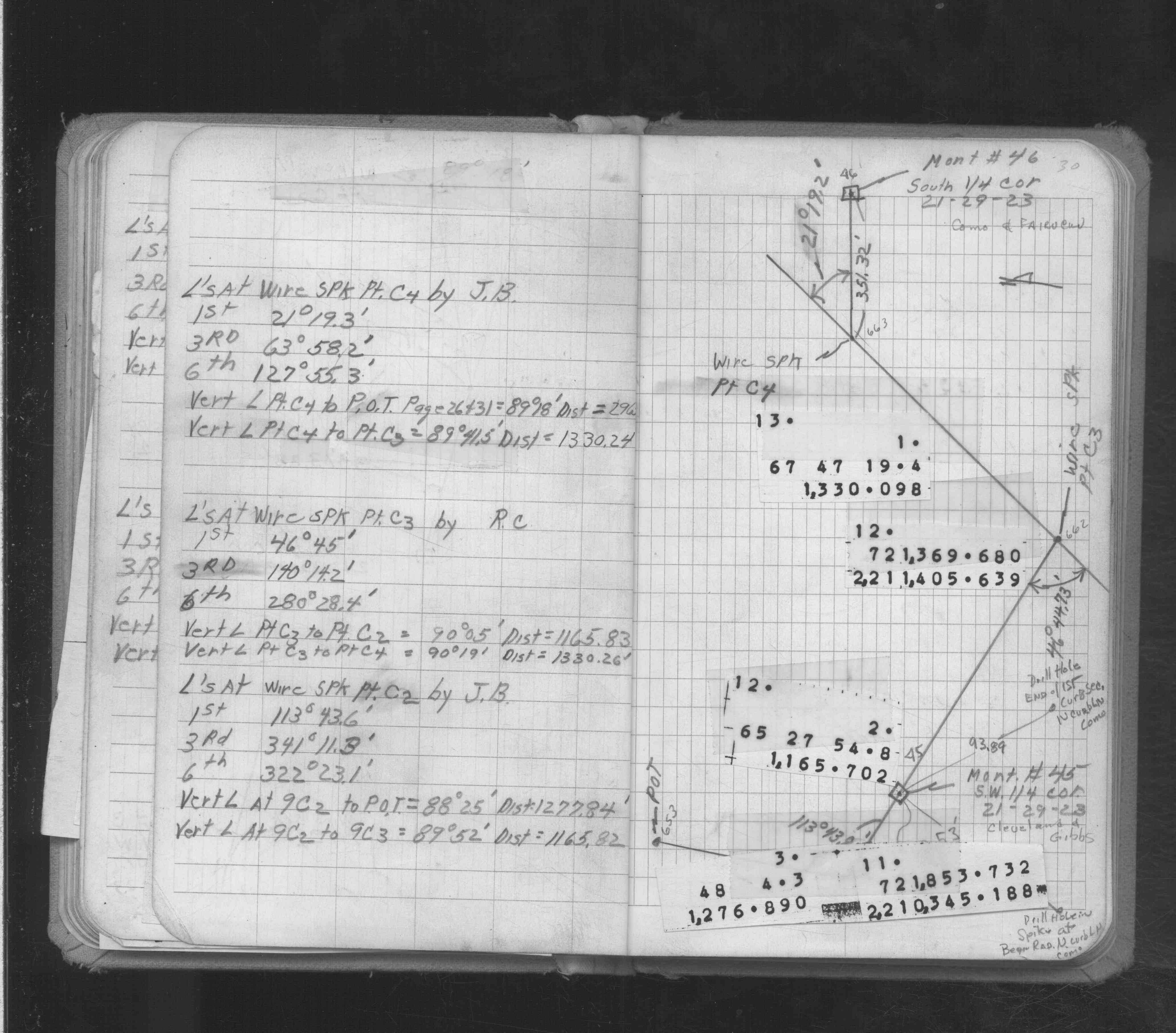
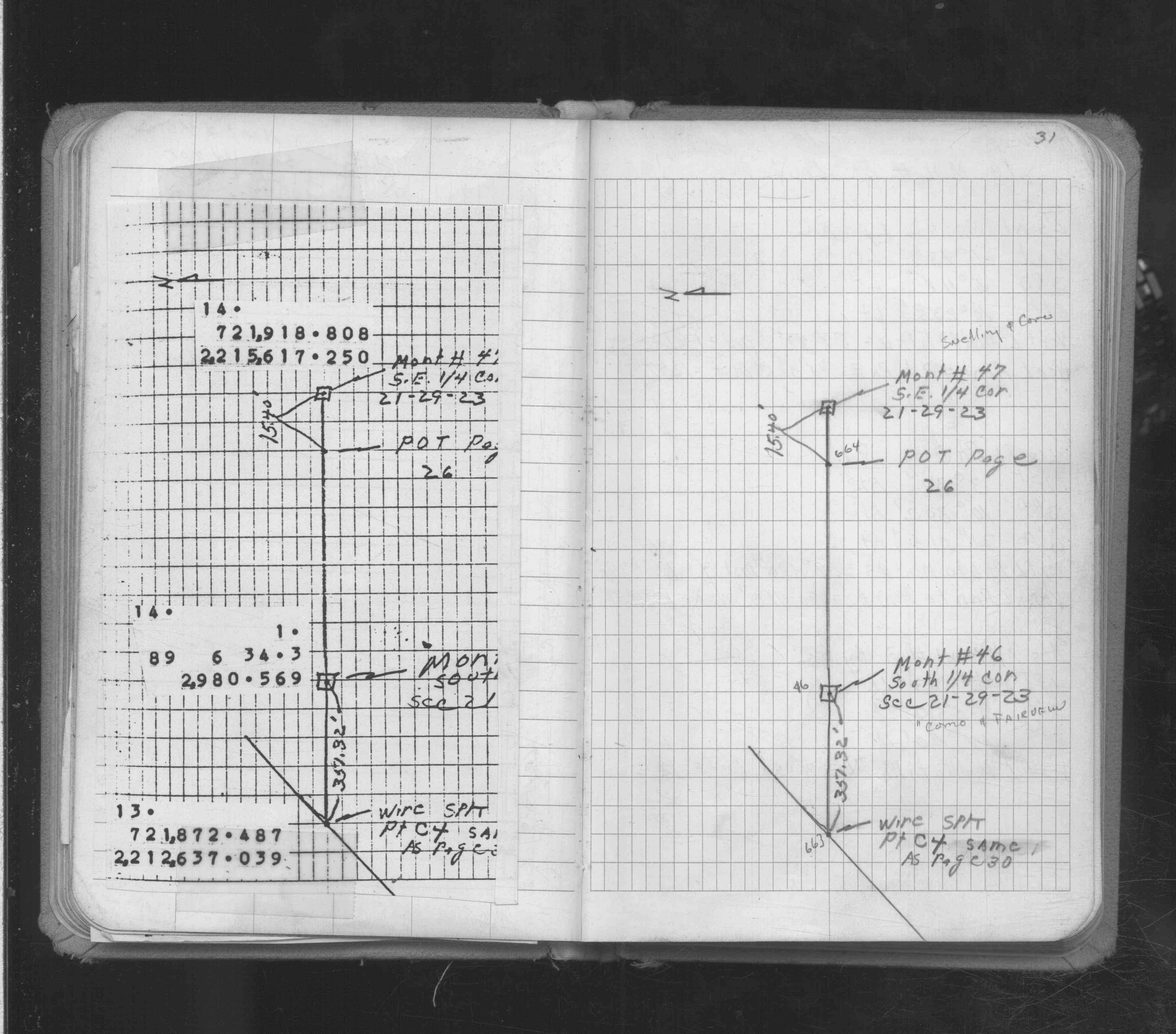
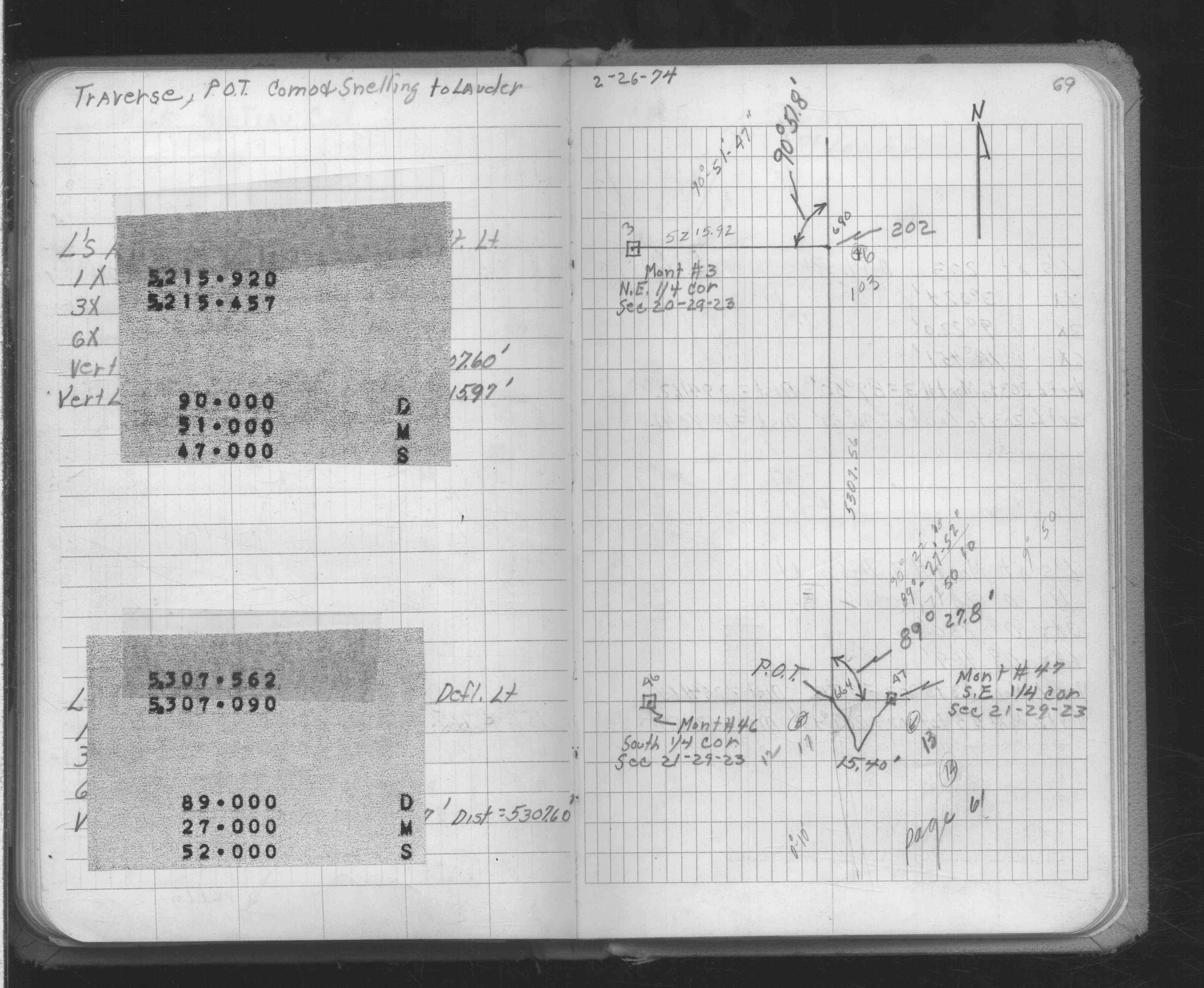
| FB 1634Ap. 26 ,30 ,31 ,69 | ||||||
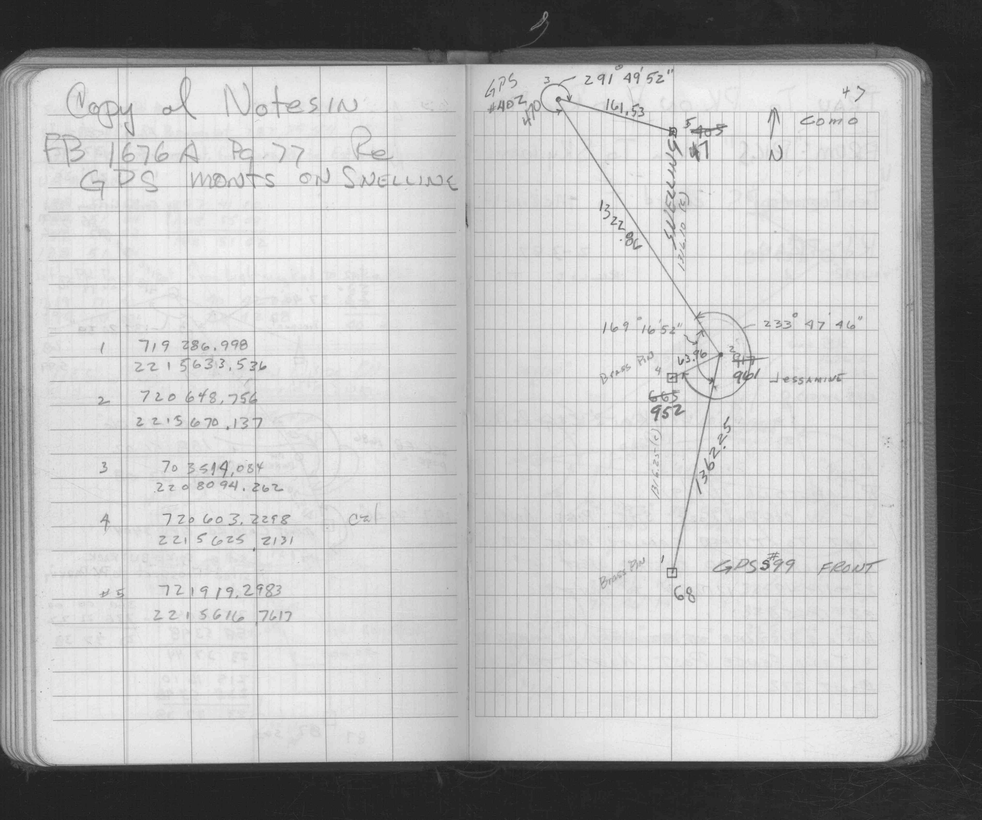
| FB 1676Bp.47 | ||||||
| FB 1689Ap.08 | ||||||
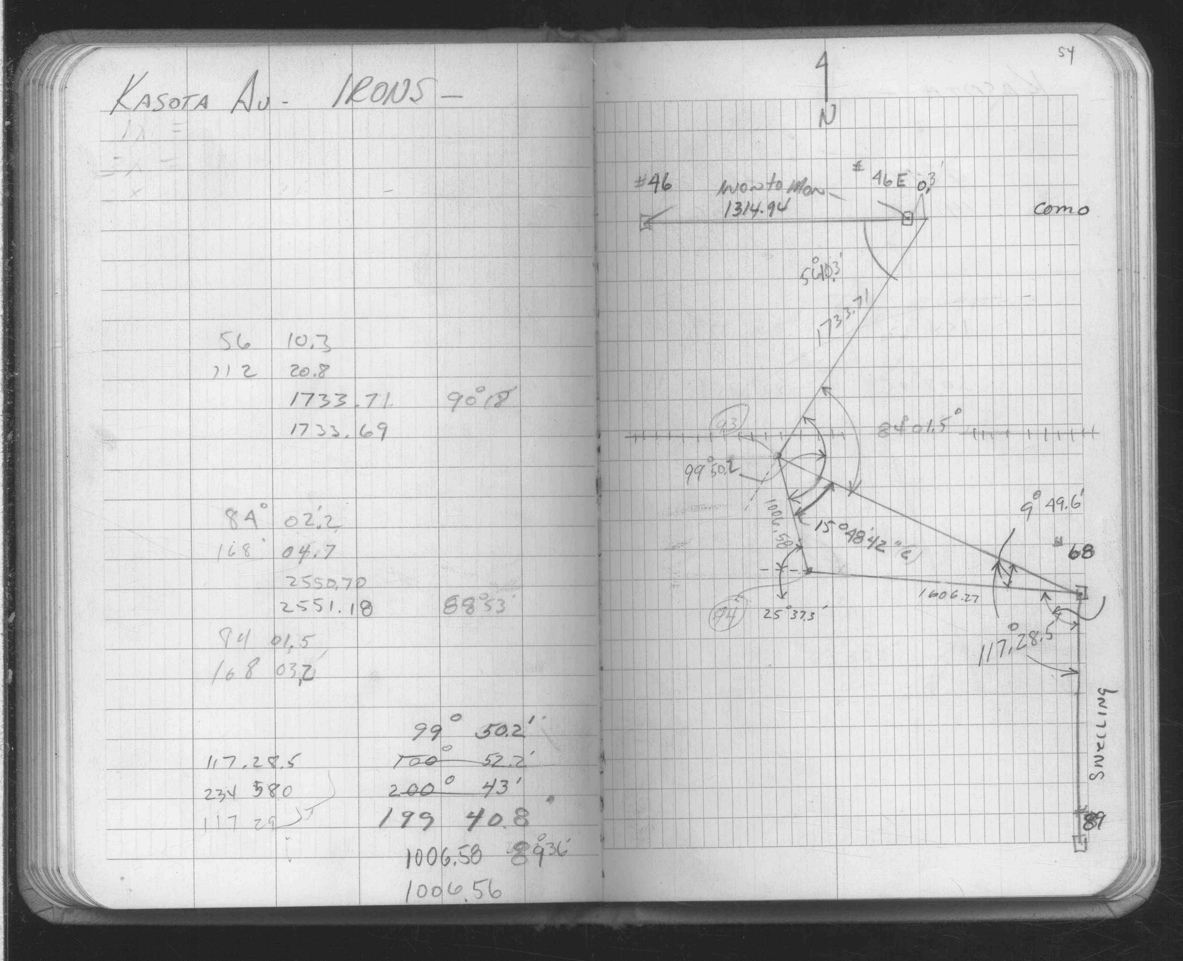
| FB 1689Bp.54 | ||||||
| FB 1736p.09 |
| FILE | SURVEYOR | LIC. NO. | DATE SIGNED | DATE TIED |
|---|---|---|---|---|
| 0046-1787A-A.tif | William J. Cutting | 20576 | October 18, 1996 | October 10, 1996 |
| ST_001-078p046.jpg | none | none | none | none |
| 0046-1787A-A.dwf | none | none | none | none |