| NAD83 COORDINATES (1986 adj.): |
|---|
| * X= 555984.54 Y= 167963.96 Z= 0 LSQ 12/6/1991 S FLT |
| 1/4/2002 | Elev 220.77 ft on CIM at asphalt surface. See FB 1736 p.10 |
| 3/17/2000 | Fd CIM at grade falls under Snelling Ave Bridge (not marked for painting target for 2000 aerial) |
| 10/10/1996 | Set CIM to grade. See CofL 0047-1766-A |
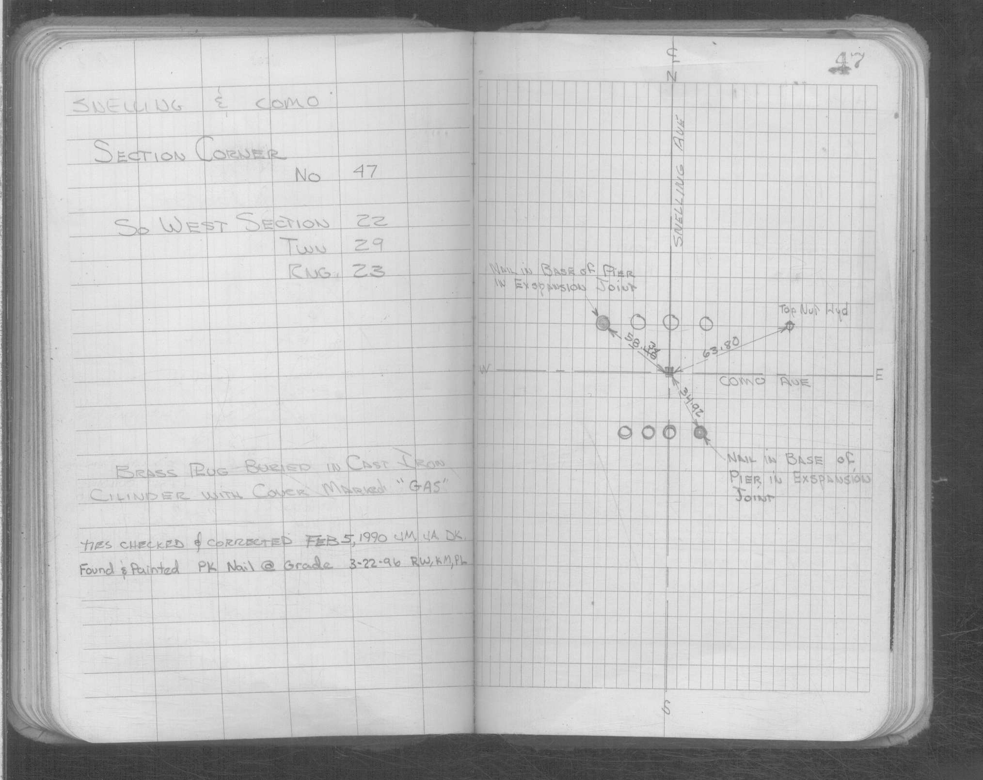
| 2/1/1990 | (Unknown date Feb __, 1990 ) Brass plug buried in CI cylinder w/cover marked "GAS" |
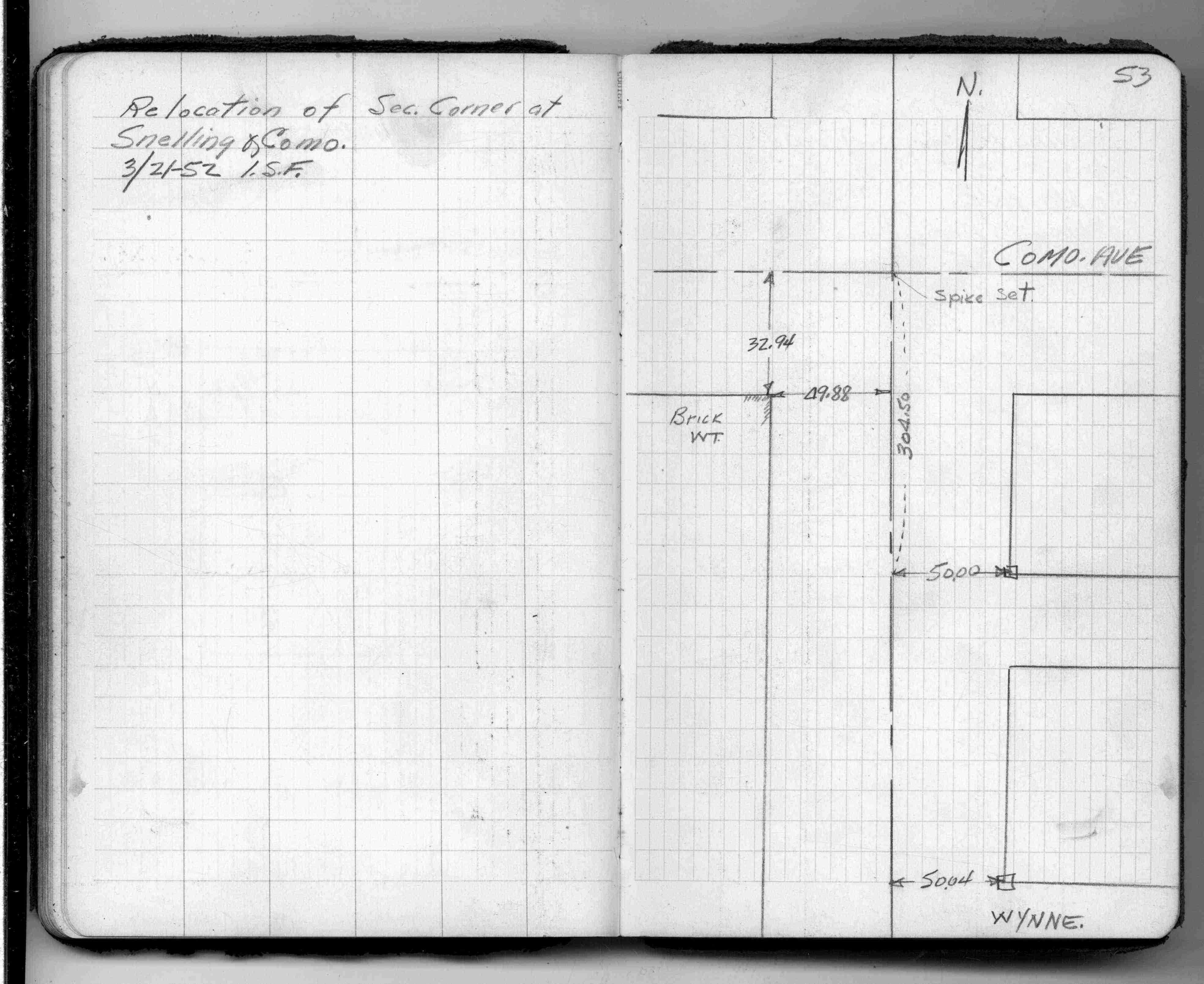
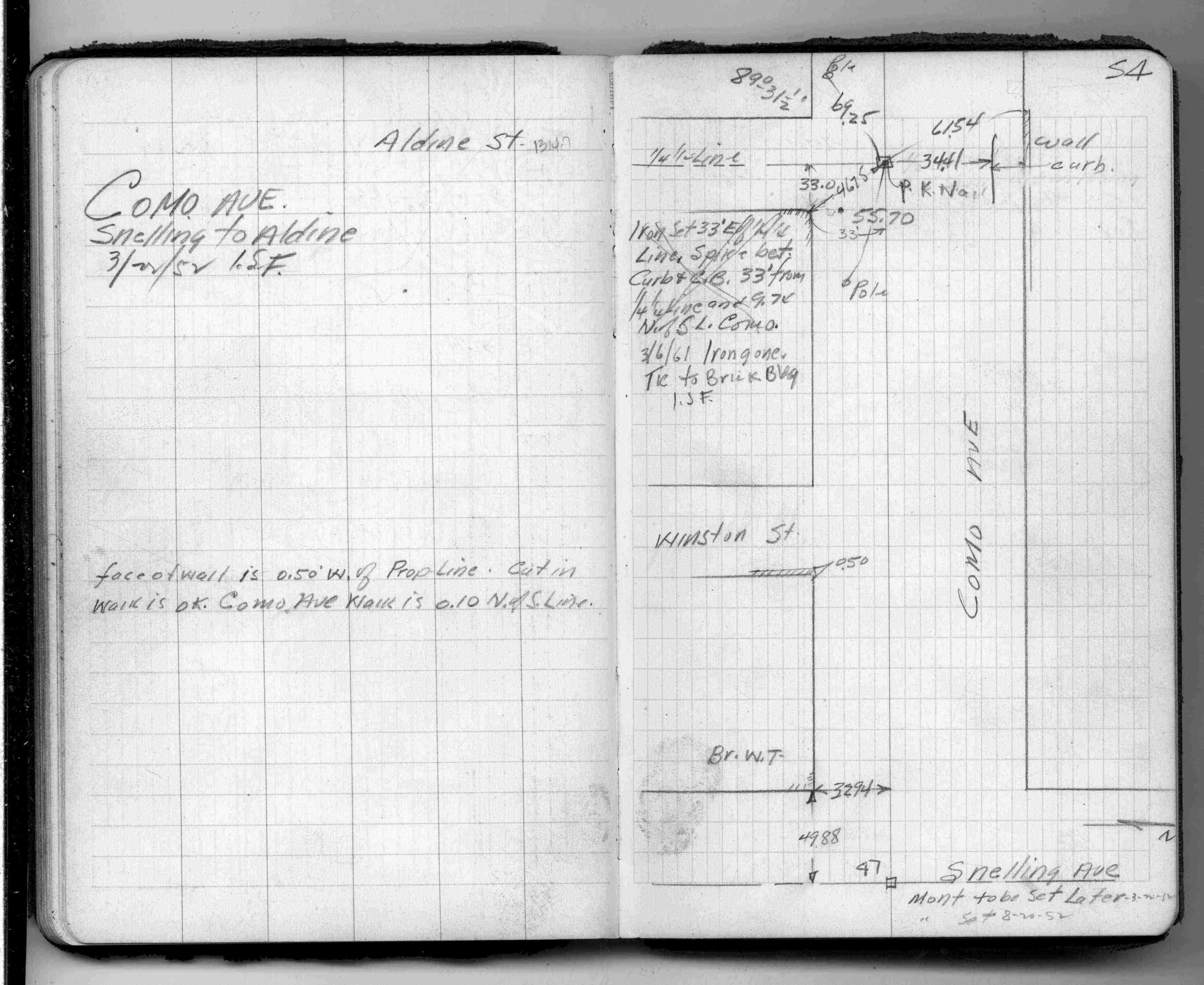
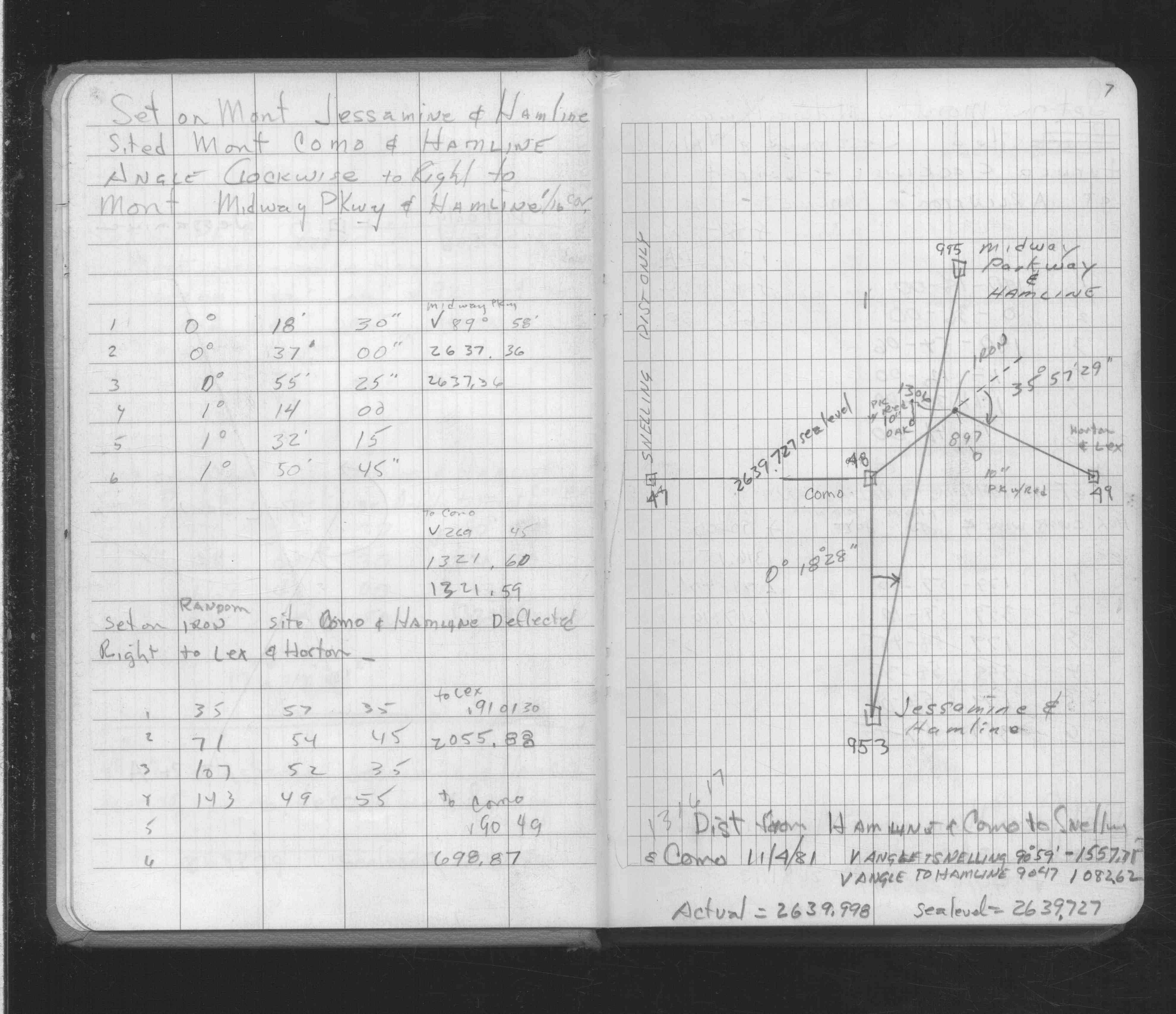
| 3/21/1952 | Set spike from ties in FB 727 p.64 See FB 1362 p.53 |
| 9/2/1889 | Monument set by Chas A Hunt after grading. |
| 11/1/1847 | (Unknown date Nov __, 1847 ) Isaac N Higbee deputy surveyor set post. Tied to 1 BT. See IH p.092-093 2923 |
Above is NOT an all inclusive history of this point. Please review all the links below.
| PLS NOTES | Field | Cross Section | Sewer | J.B. Irvine | Monument | River Survey |
|---|---|---|---|---|---|---|
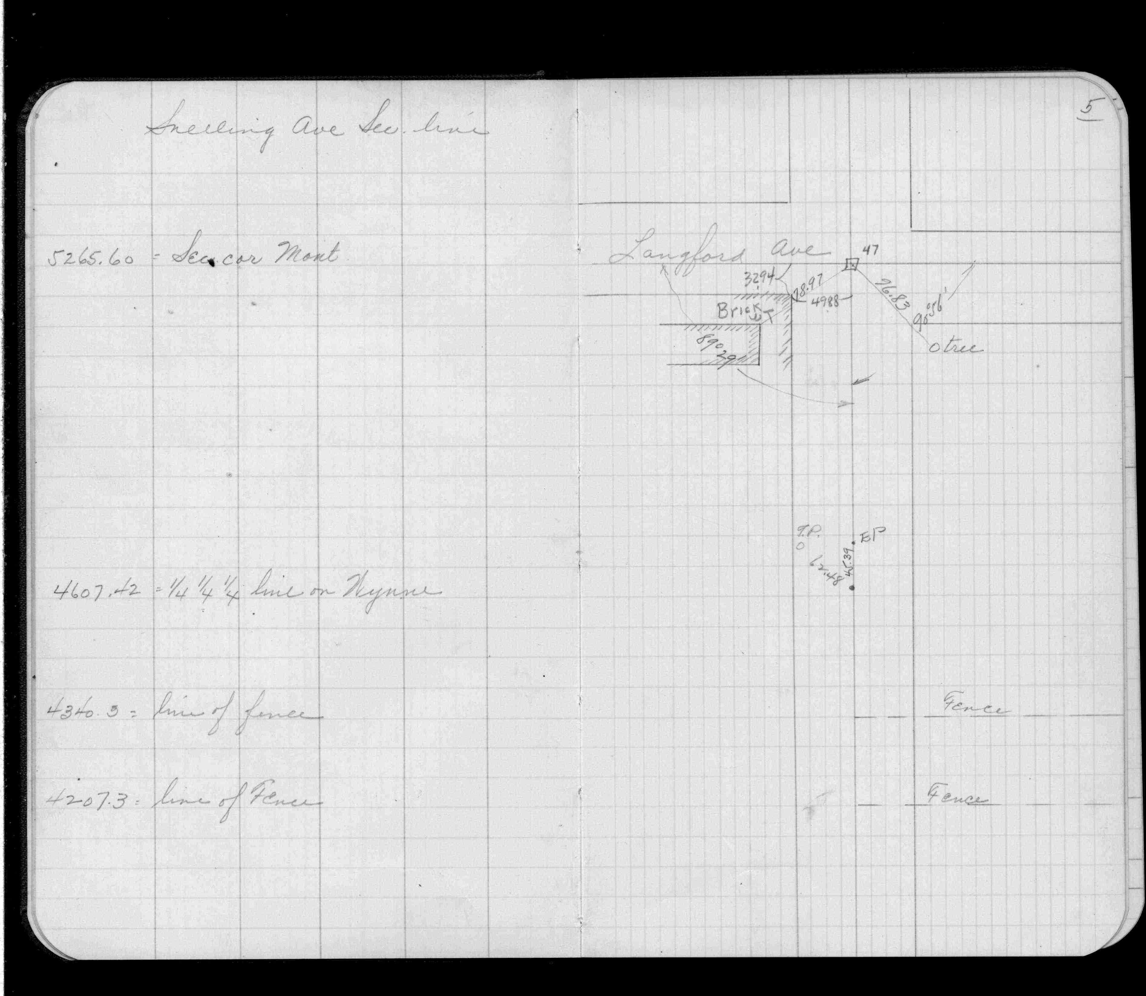
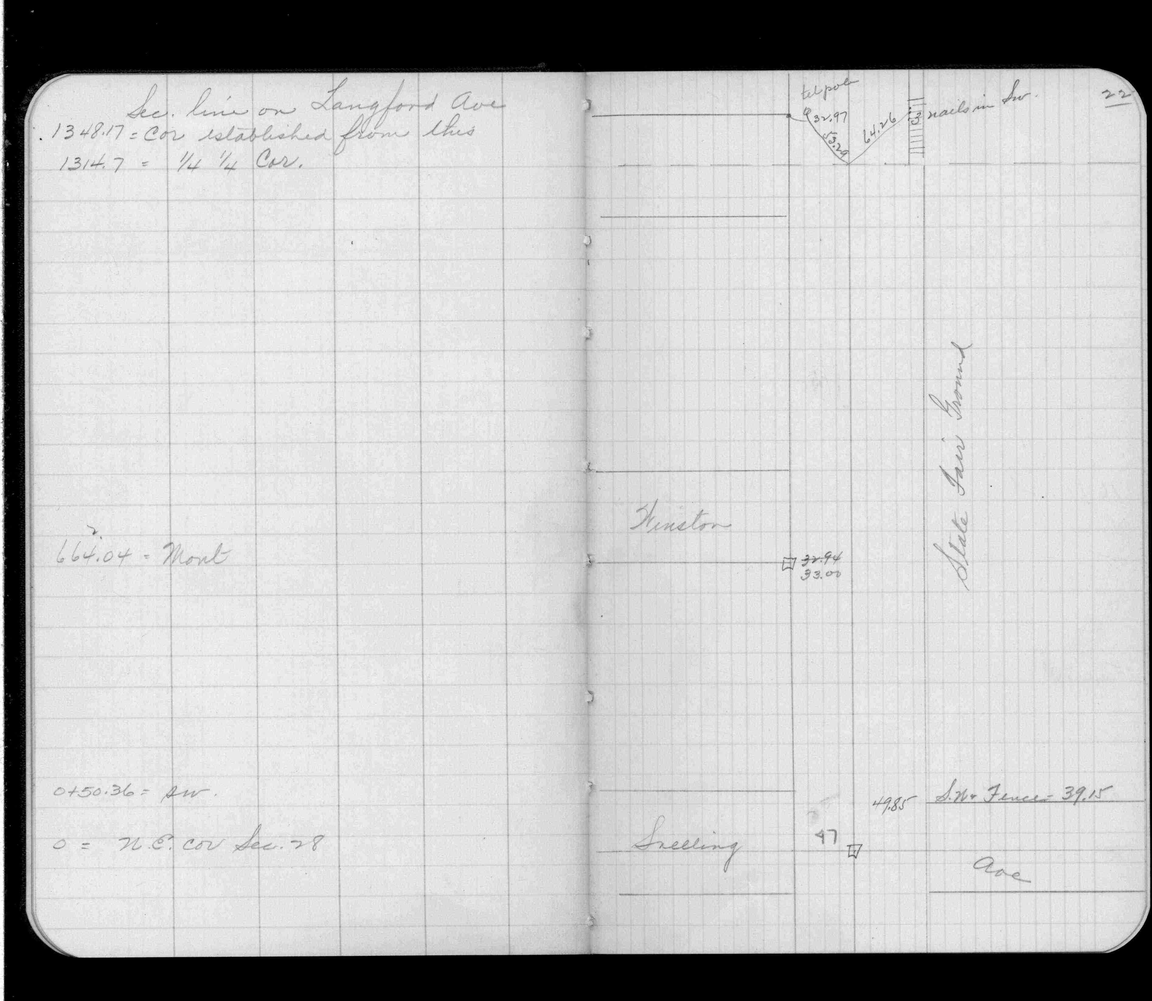
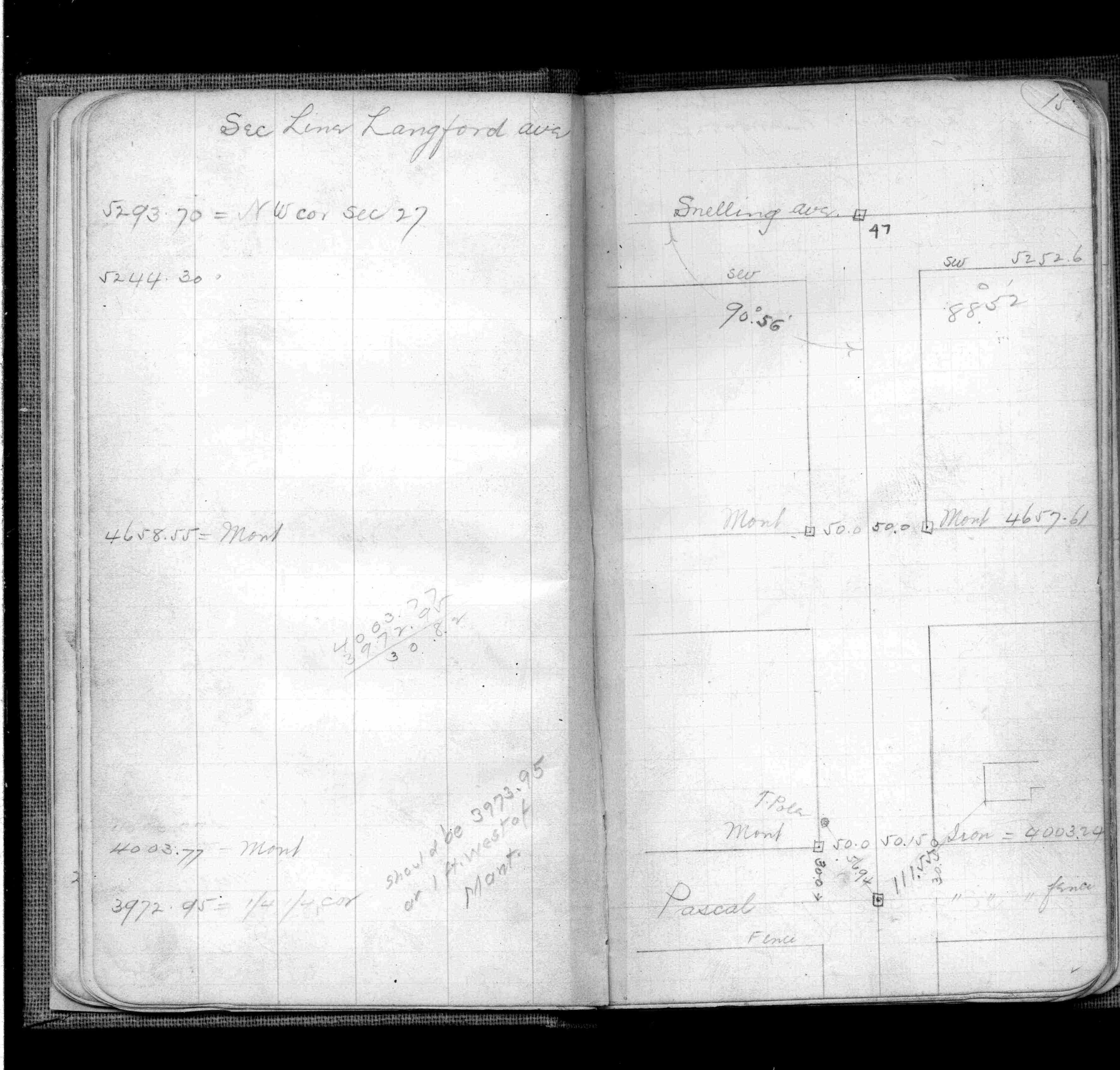
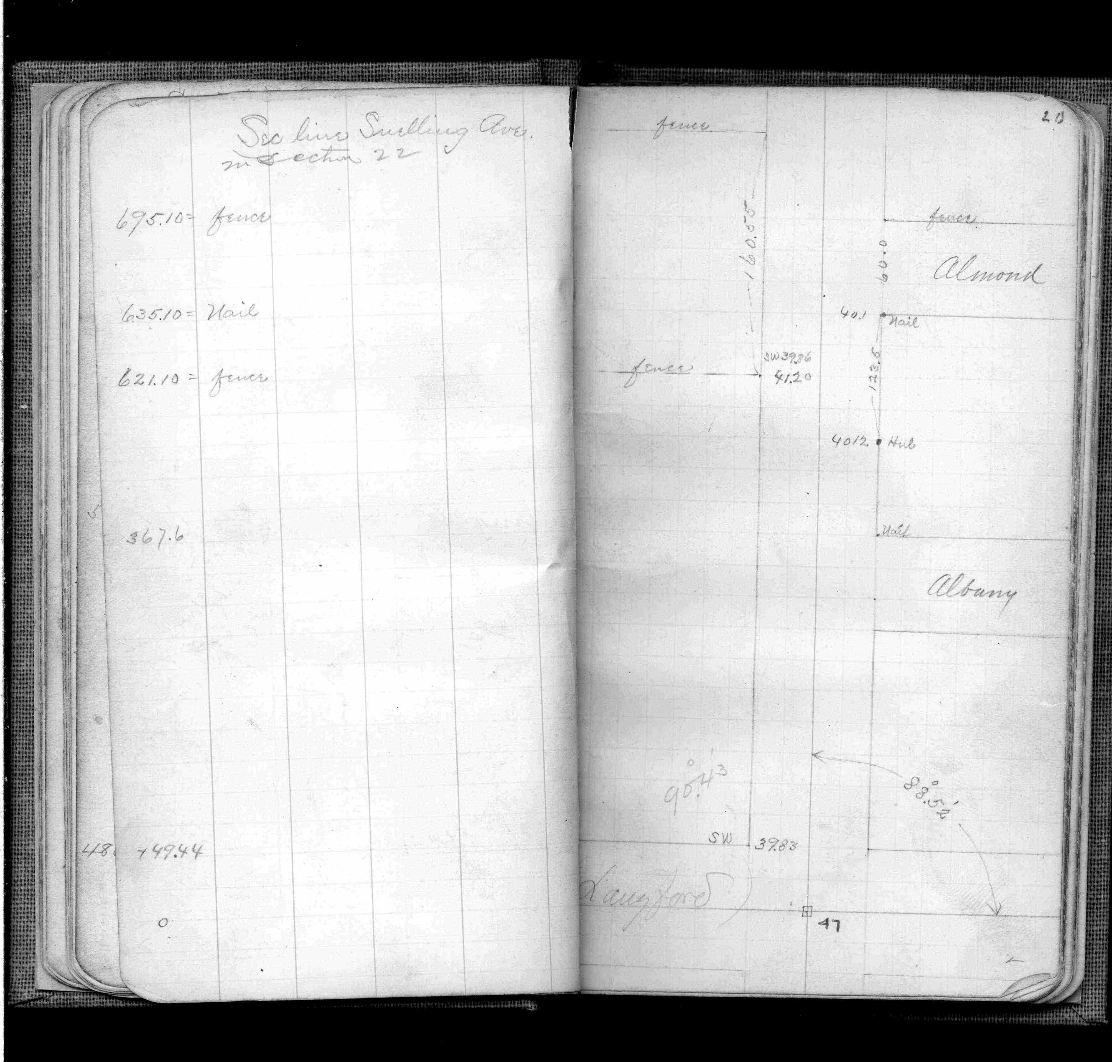
| IH p.092-093 | FB 0168p.15 | |||||
| FB 0335CPYp. 05 ,22 | ||||||
| FB 0345p. 15 ,20 | ||||||
| FB 0610p.09 | ||||||
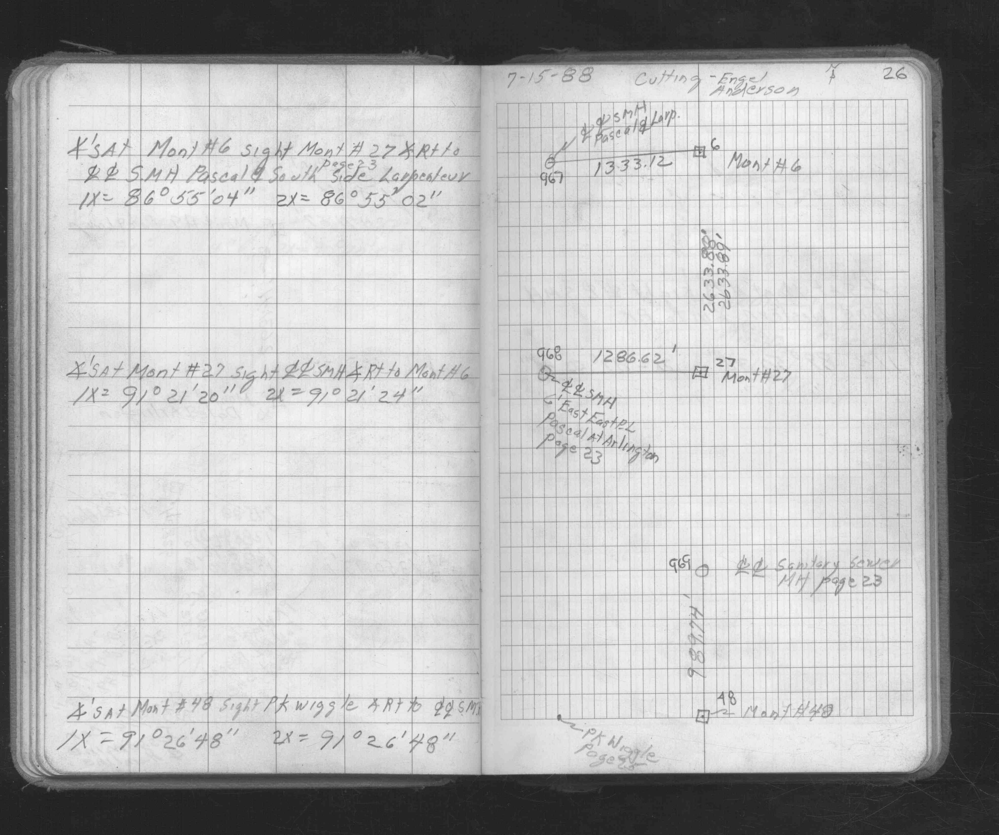
| FB 1362p.53 | ||||||
| FB 1362p.54 | ||||||
| FB 1549Gp.73 | ||||||
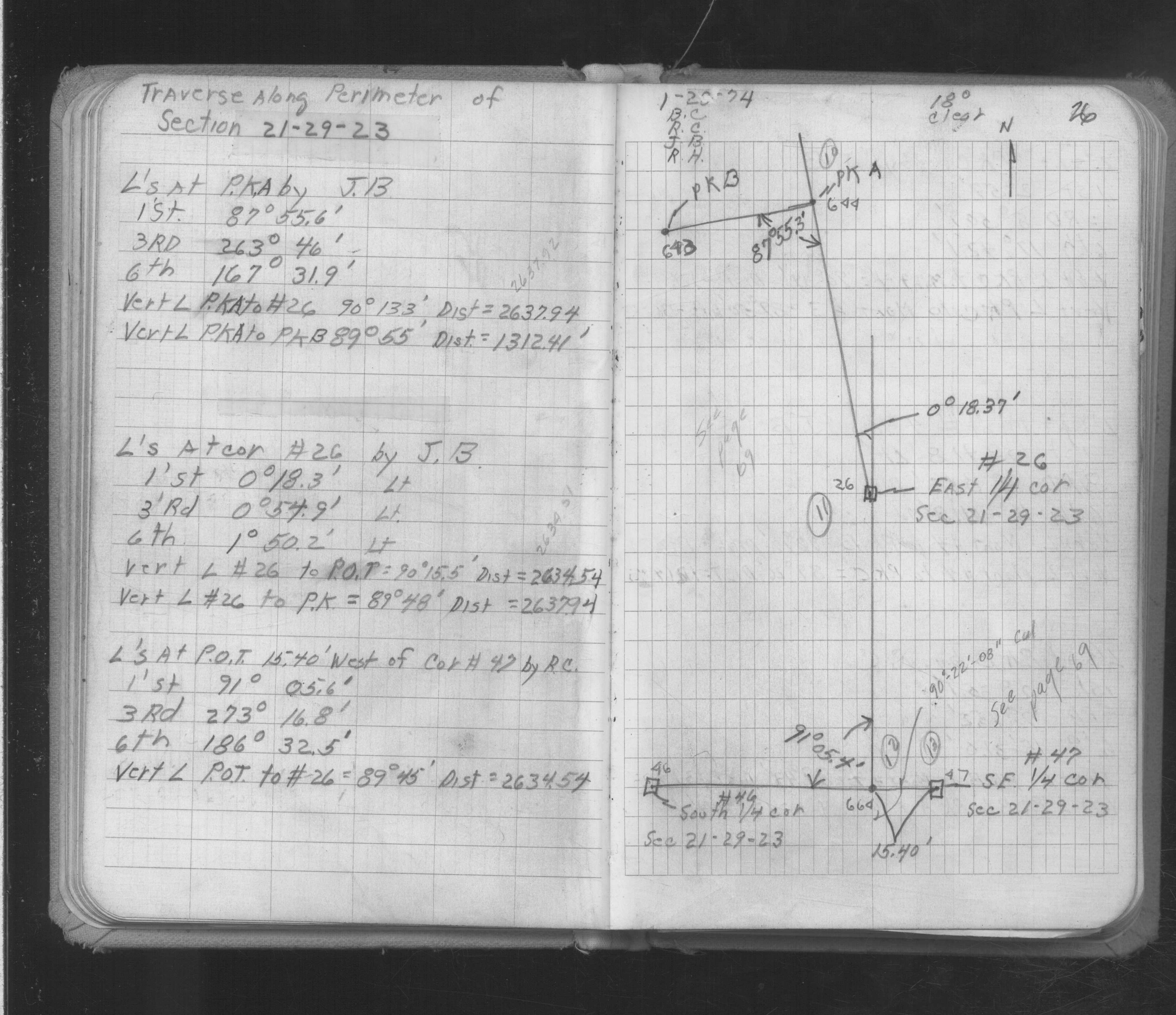
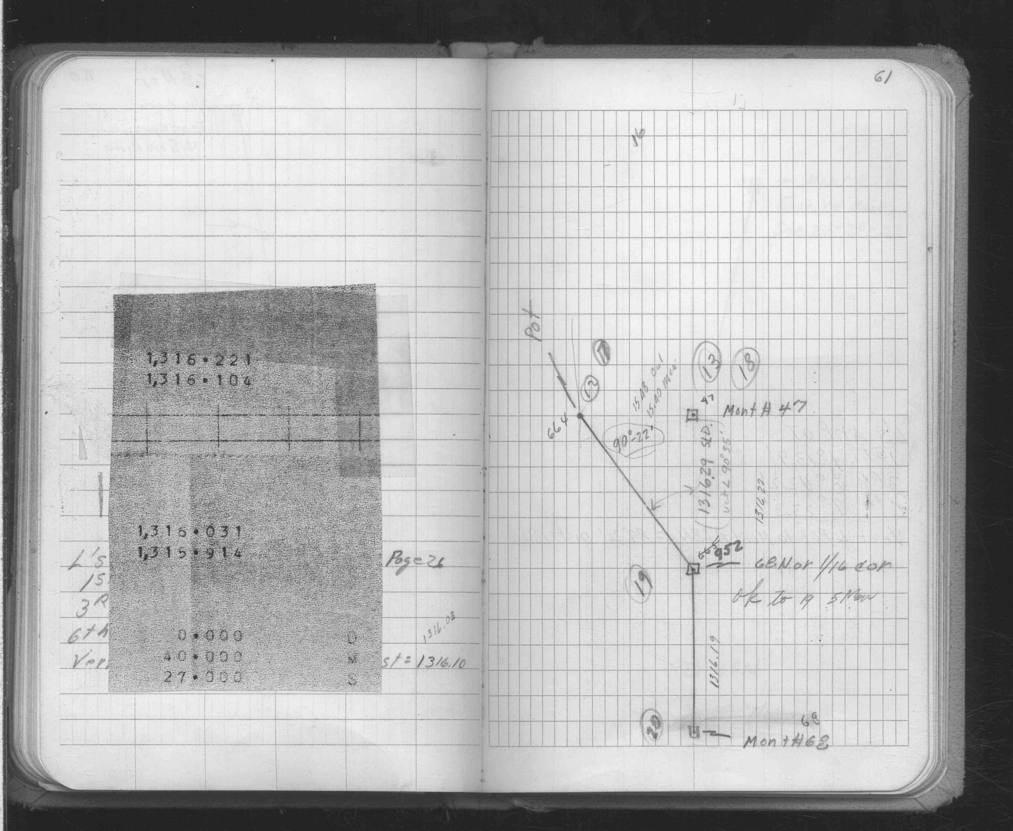
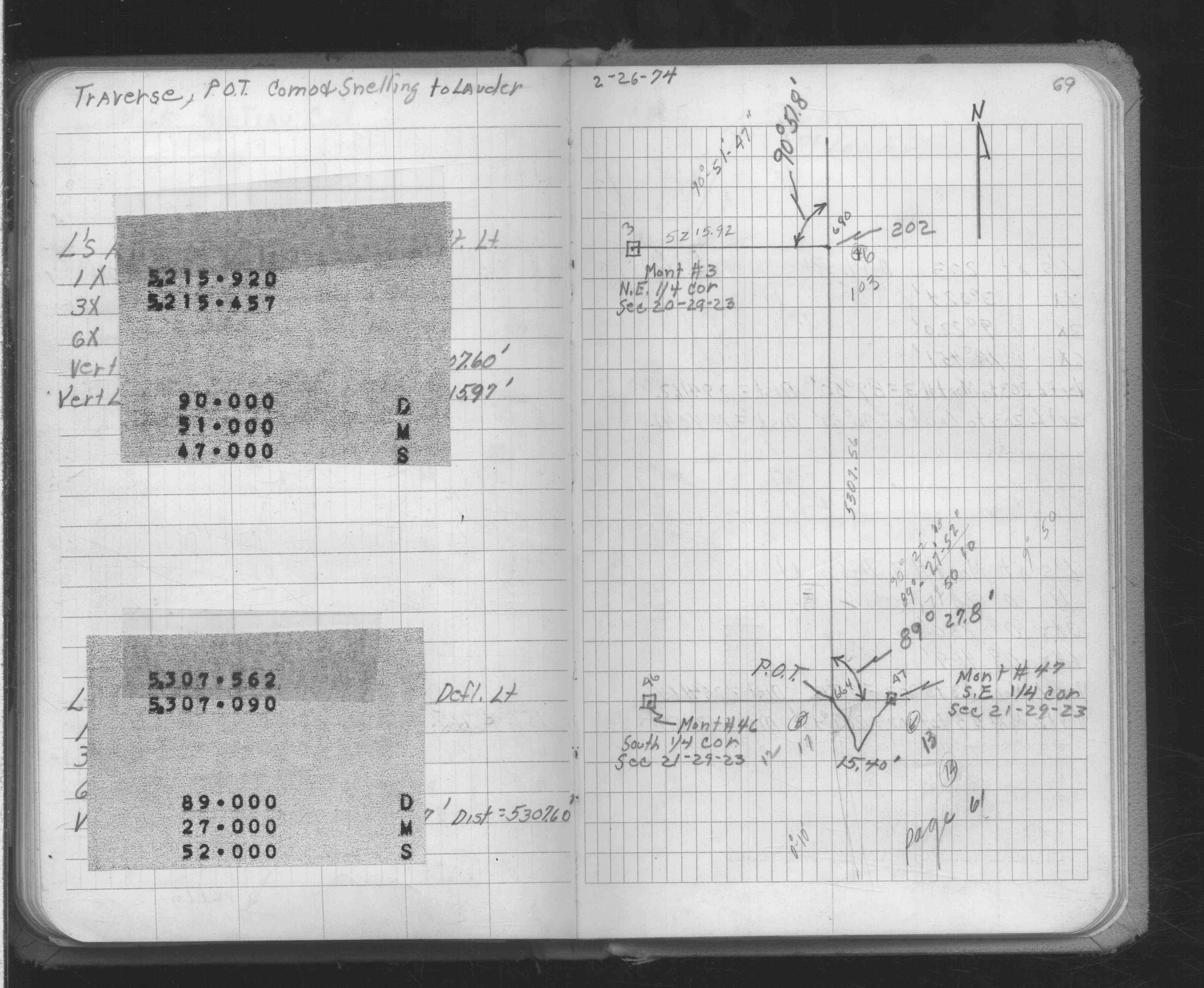
| FB 1634Ap. 01 ,26 ,61 ,69 | ||||||
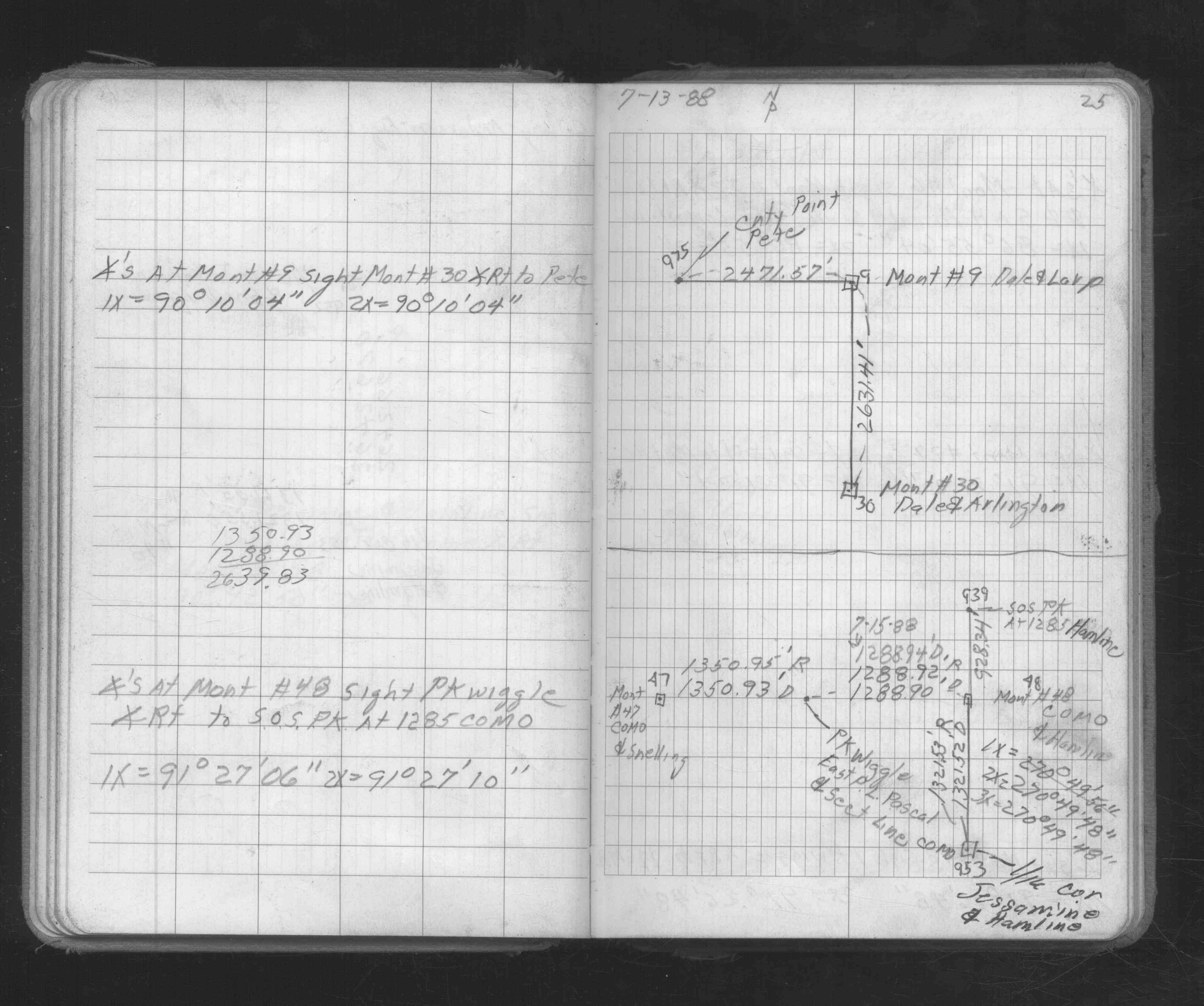
| FB 1673Ap. 25 ,26 | ||||||
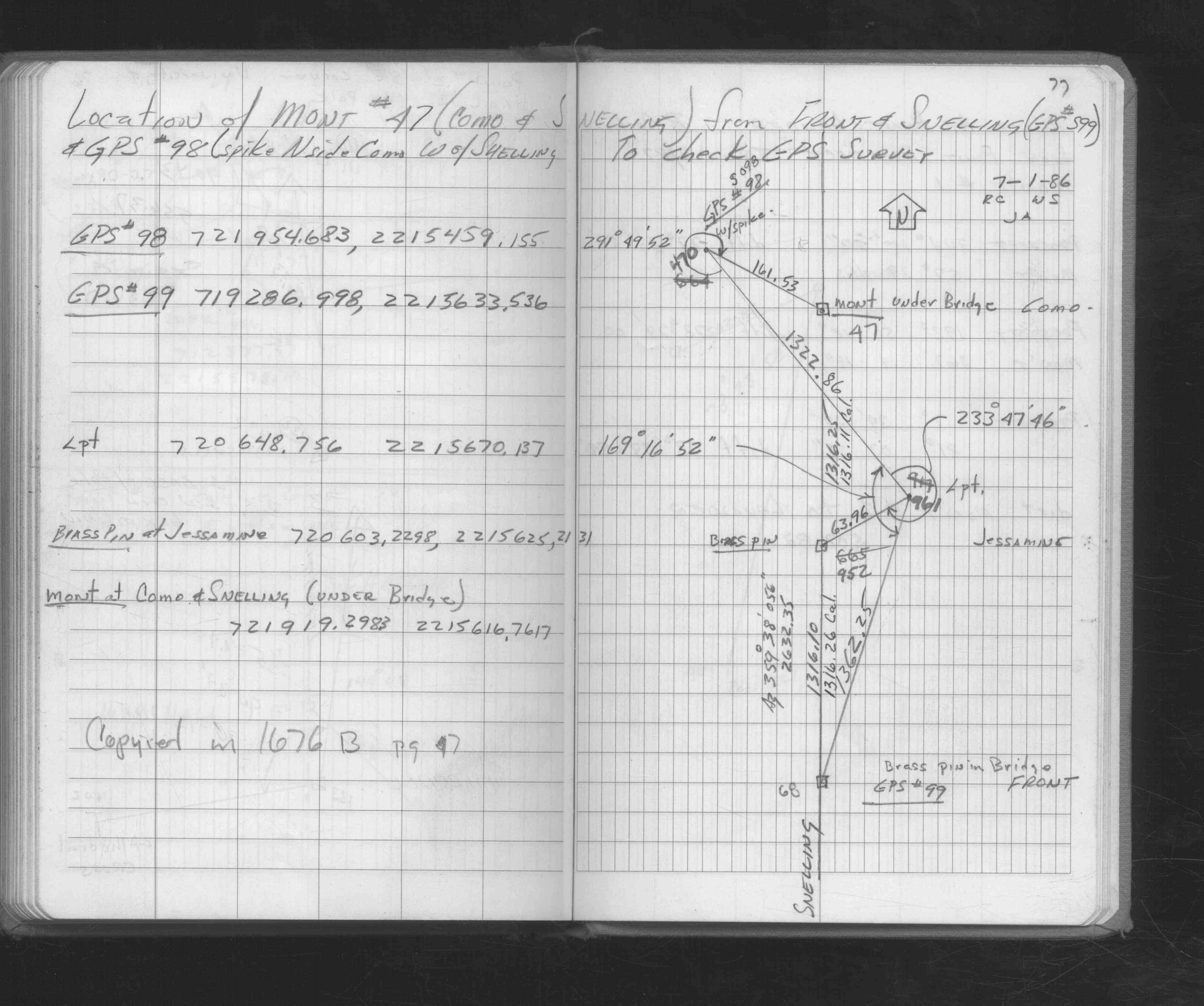
| FB 1676Ap.77 | ||||||
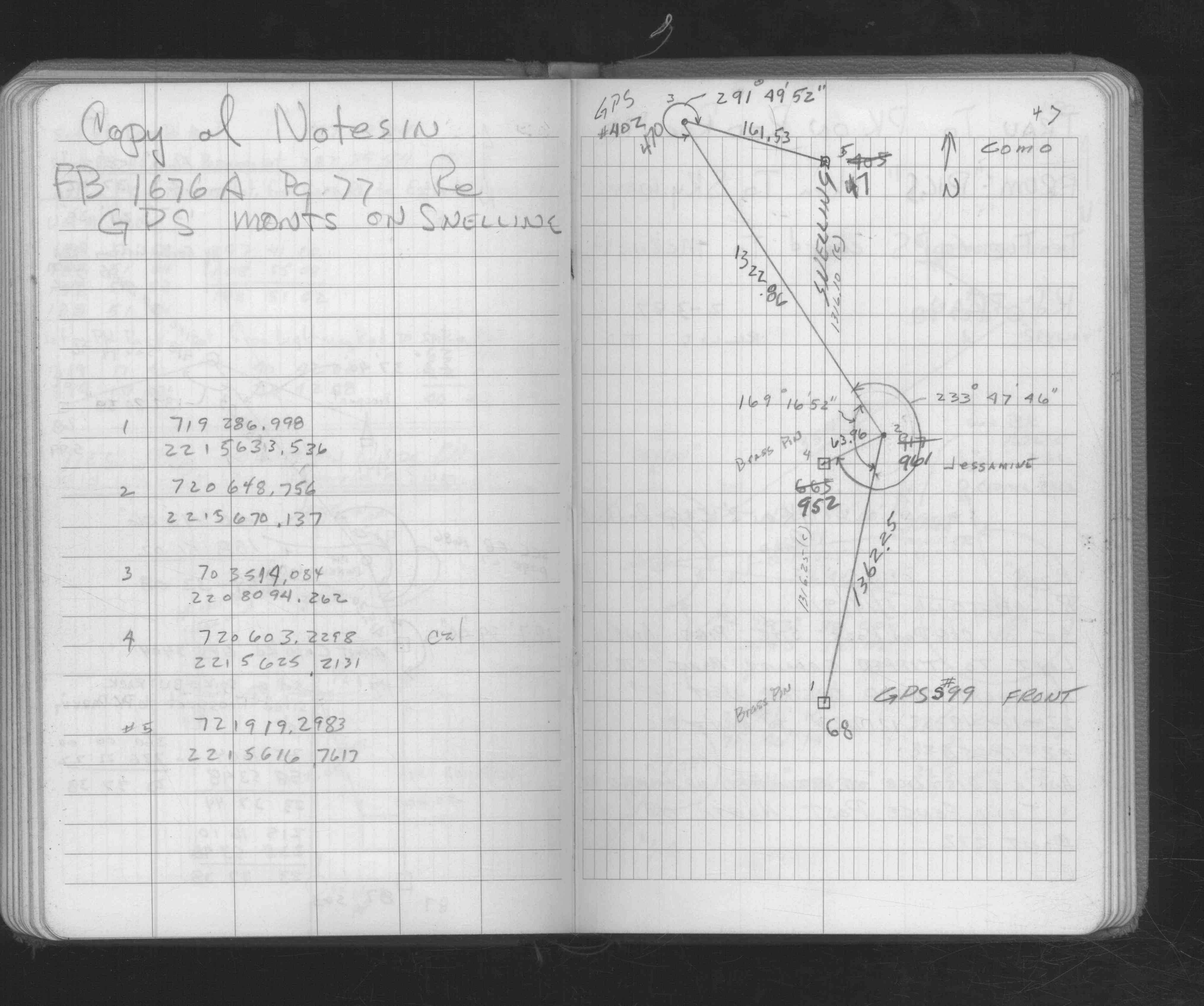
| FB 1676Bp.47 | ||||||
| FB 1690p.07 | ||||||
| FB 1736p.10 |
| FILE | SURVEYOR | LIC. NO. | DATE SIGNED | DATE TIED |
|---|---|---|---|---|
| 0047-1766-A.tif | William J. Cutting | 20576 | October 18, 1996 | October 10, 1996 |
| ST_001-078p047.jpg | none | none | none | none |
| 0047-1766-A.dwf | none | none | none | none |