| NAD83 COORDINATES (1986 adj.): |
|---|
| * X= 561278.13 Y= 168024.25 Z= 0 LSQ 12/6/1991 S FIX |
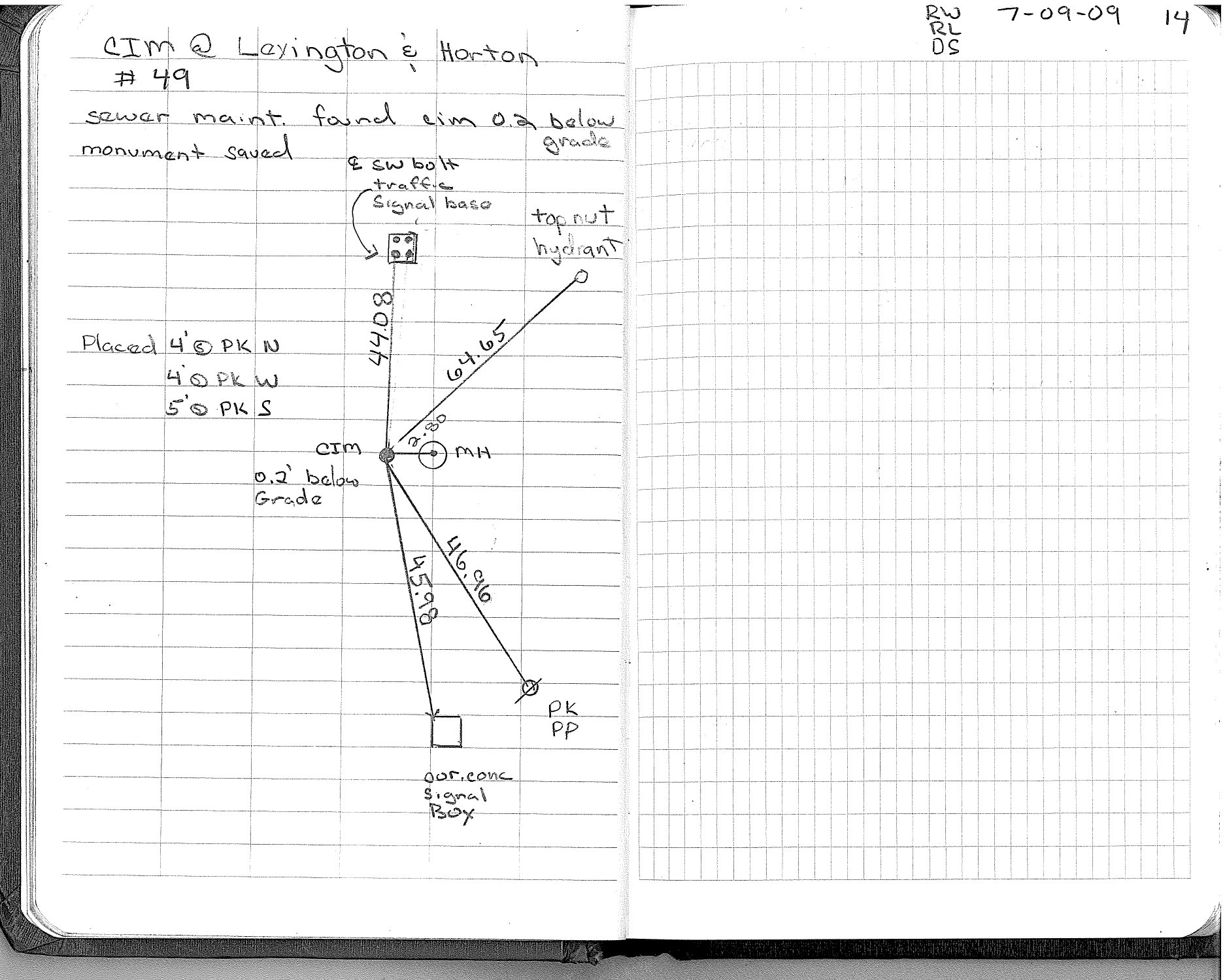
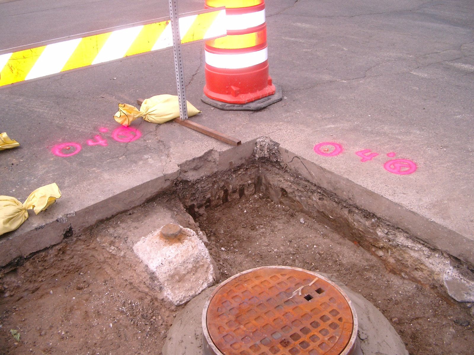
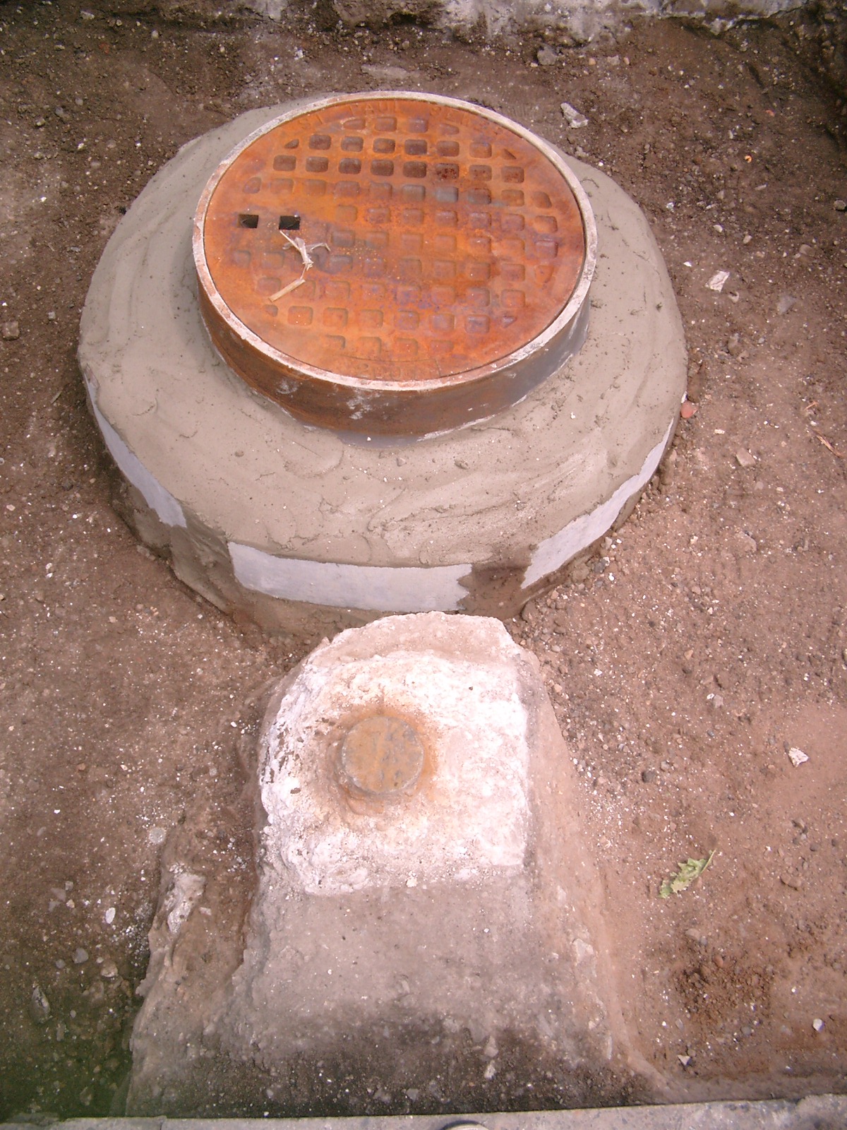
| 7/9/2009 | Photos taken. |
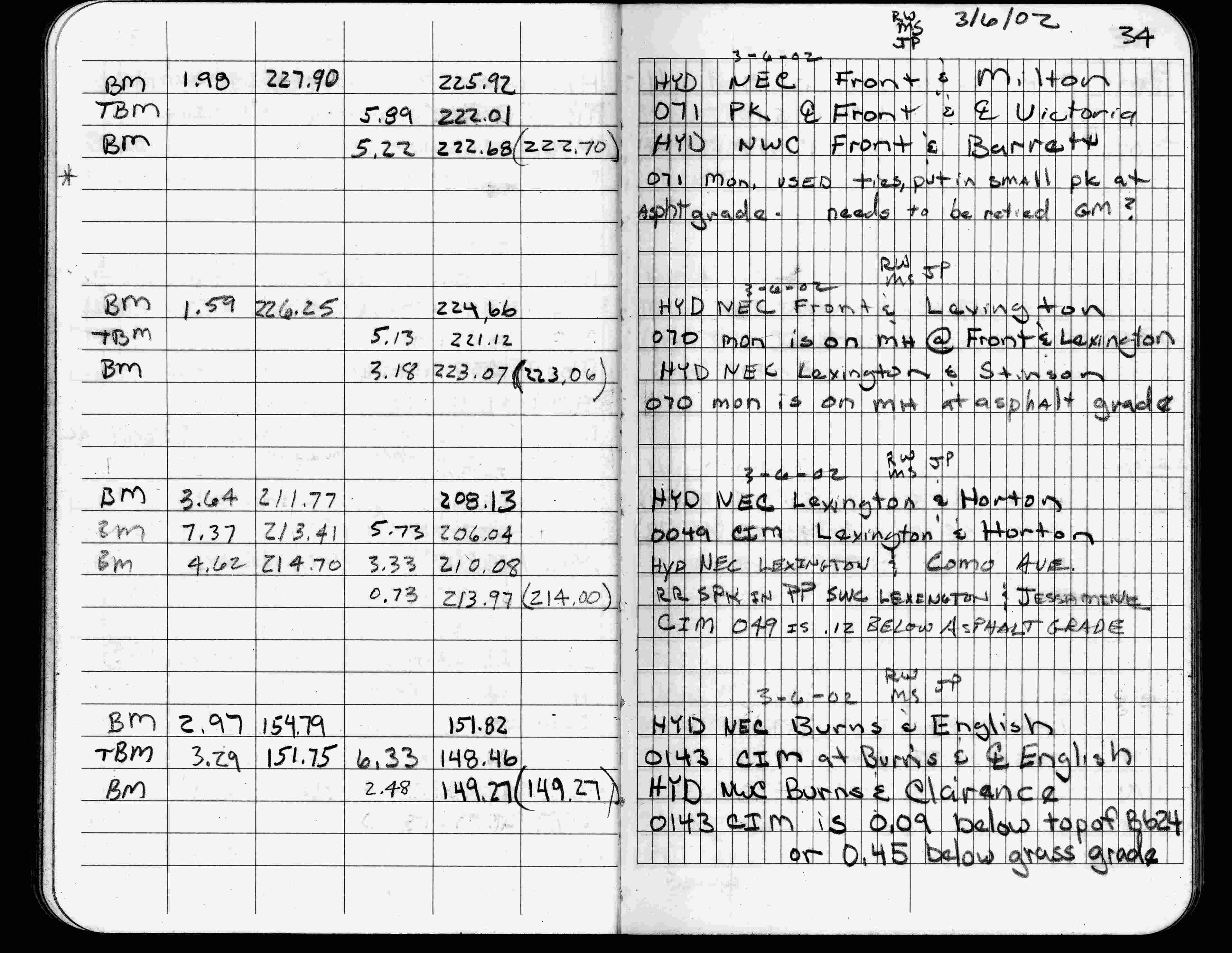
| 3/6/2002 | Elev 206.04 ft on CIM 0.12 ft below asphalt surface. See FB 1736 p.34 |
| 3/17/2000 | Fd CIM 0.10 ft below grade (marked for painting target for 2000 aerial) |
| 9/21/1995 | Fd CIM (marked for painting target for 1995 aerial) |
| 9/19/1995 | Recovered CIM 0.10 ft below grade & placed ties. See CofL 0049-0009-A |
| 9/1/1992 | (Unknown date Sep __, 1992 ) Recovered CIM. |
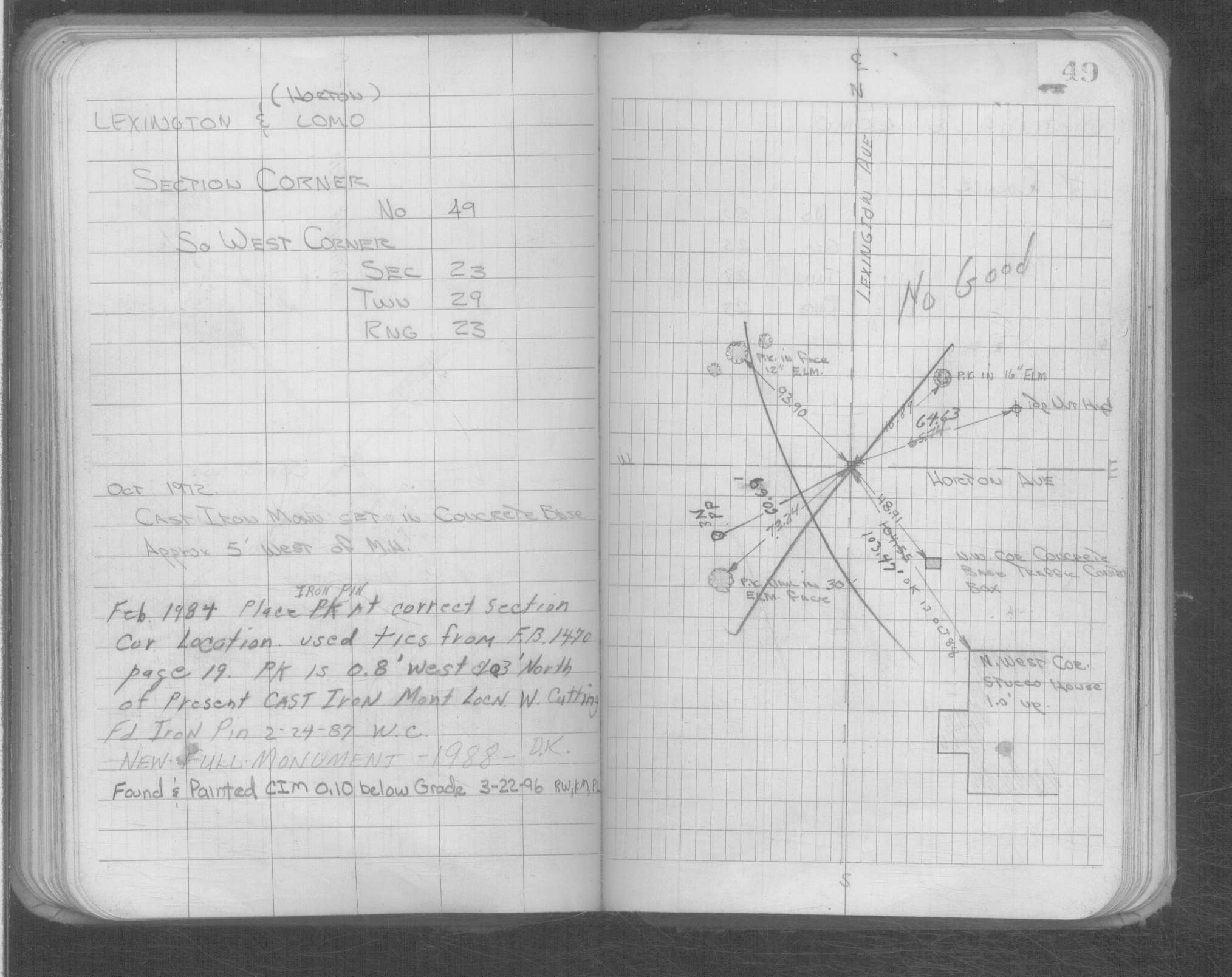
| 1/1/1988 | (Unknown date ___ __, 1988 ) New full monument. |
| 2/24/1987 | Fd iron pin. See Yellow Tie Book. |
| 1/1/1985 | (Unknown date ___ __,1985 ) Historic, one time only GPS survey = S116 |
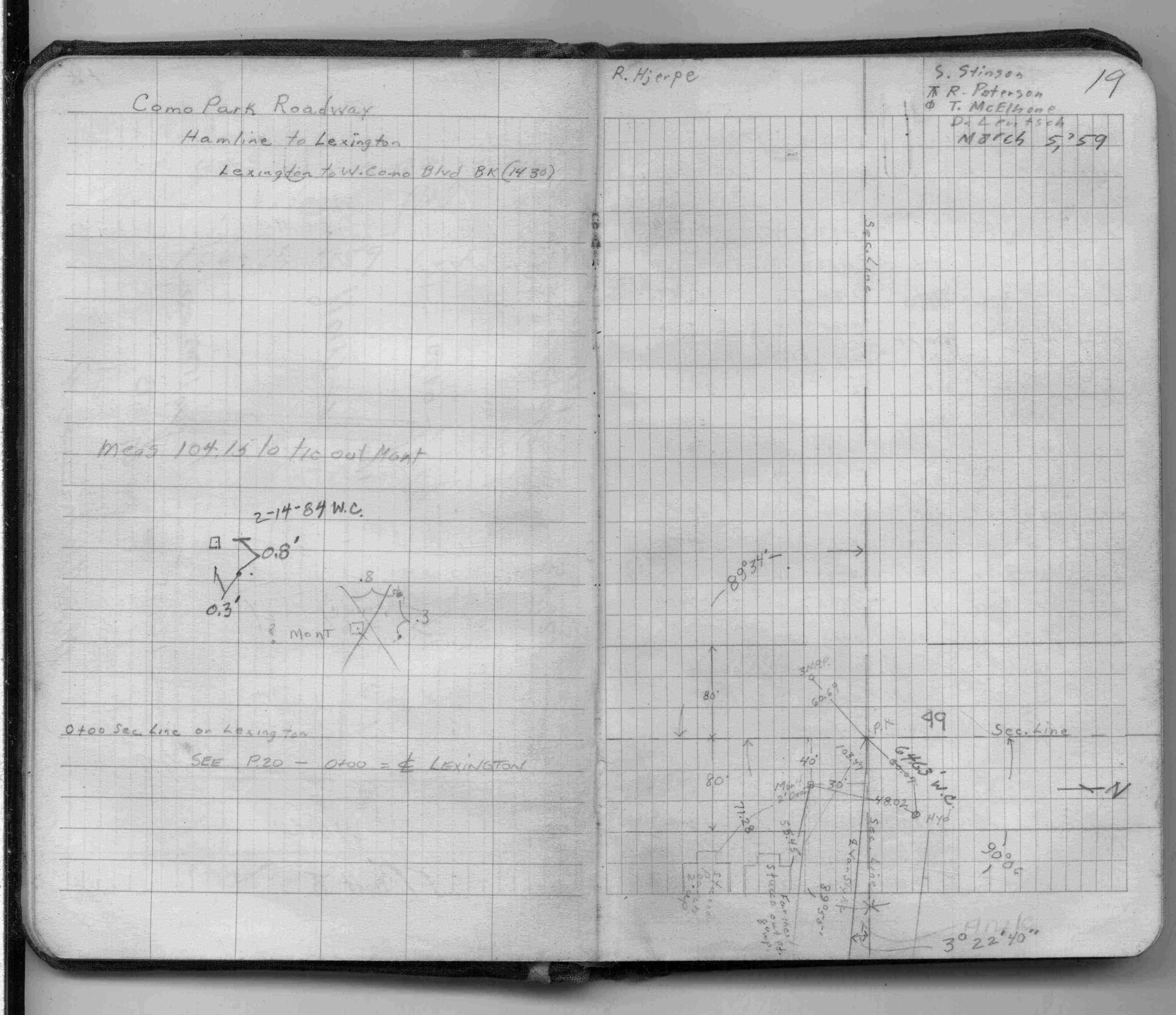
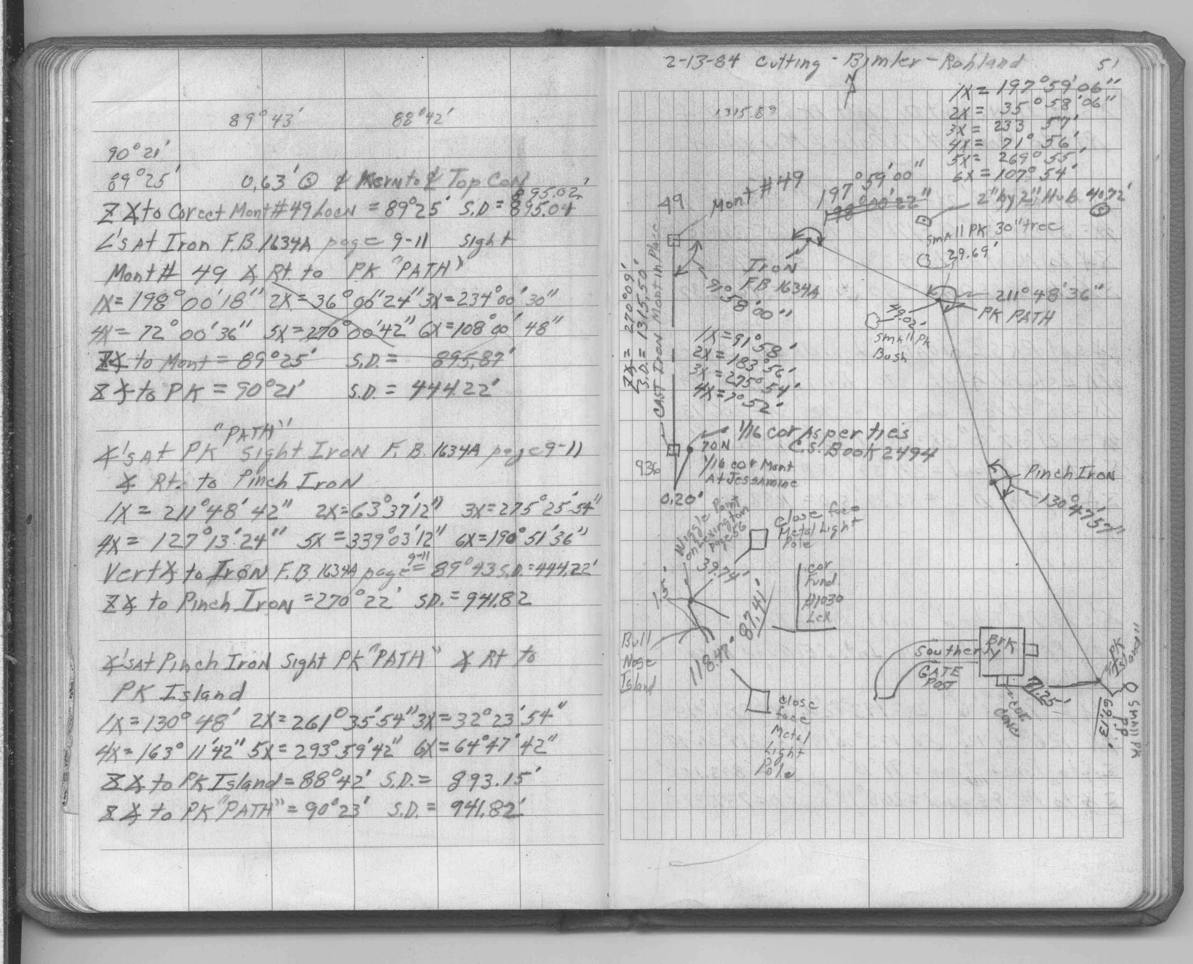
| 2/1/1984 | (Unknown date Feb __, 1984 ) Placed iron pin at correct corner location. Used ties in See Yellow Tie Book. See FB 1470 p.19 |
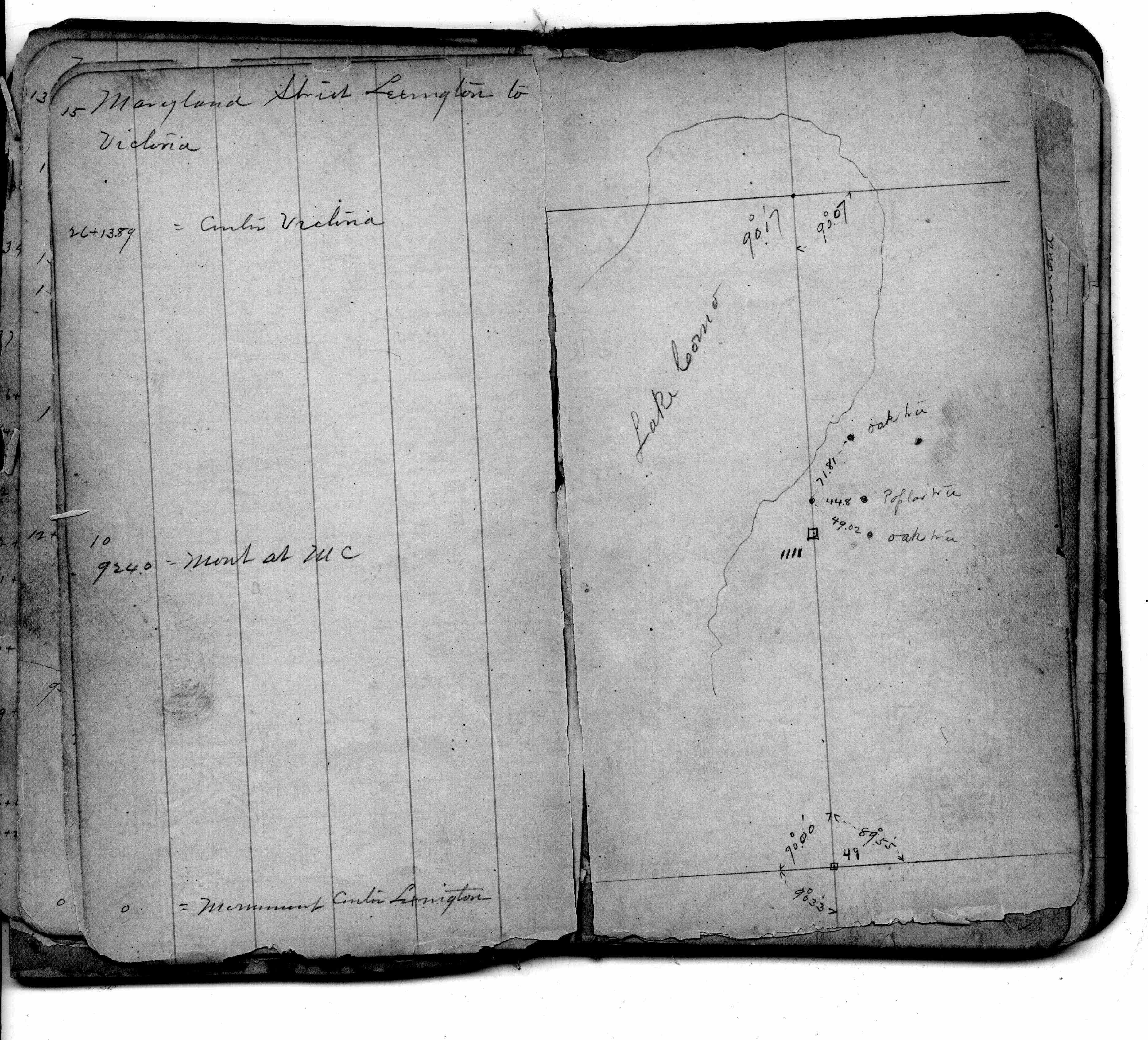
| 10/1/1972 | (Unknown date Oct __, 1972 ) CIM set in concrete base, approx 5 ft west of MH. See Yellow Tie Book. |
| 8/19/1889 | Monument reset after grading by Chas Hunt. |
| 8/18/1889 | Monument set after grading by Chas Hunt. See Old Index Book, Entry 9 |
| 3/21/1870 | Bearing Stump in. |
| 11/1/1847 | (Unknown date Nov __, 1847 ) Isaac N Higbee deputy surveyor set post. Tied to 2 BTs. See IH p.082-083 2923 |
Above is NOT an all inclusive history of this point. Please review all the links below. Yellow Tie Books are 'ST' in the Monument category.
| PLS NOTES | Field | Cross Section | Sewer | J.B. Irvine | Monument | River Survey |
|---|---|---|---|---|---|---|
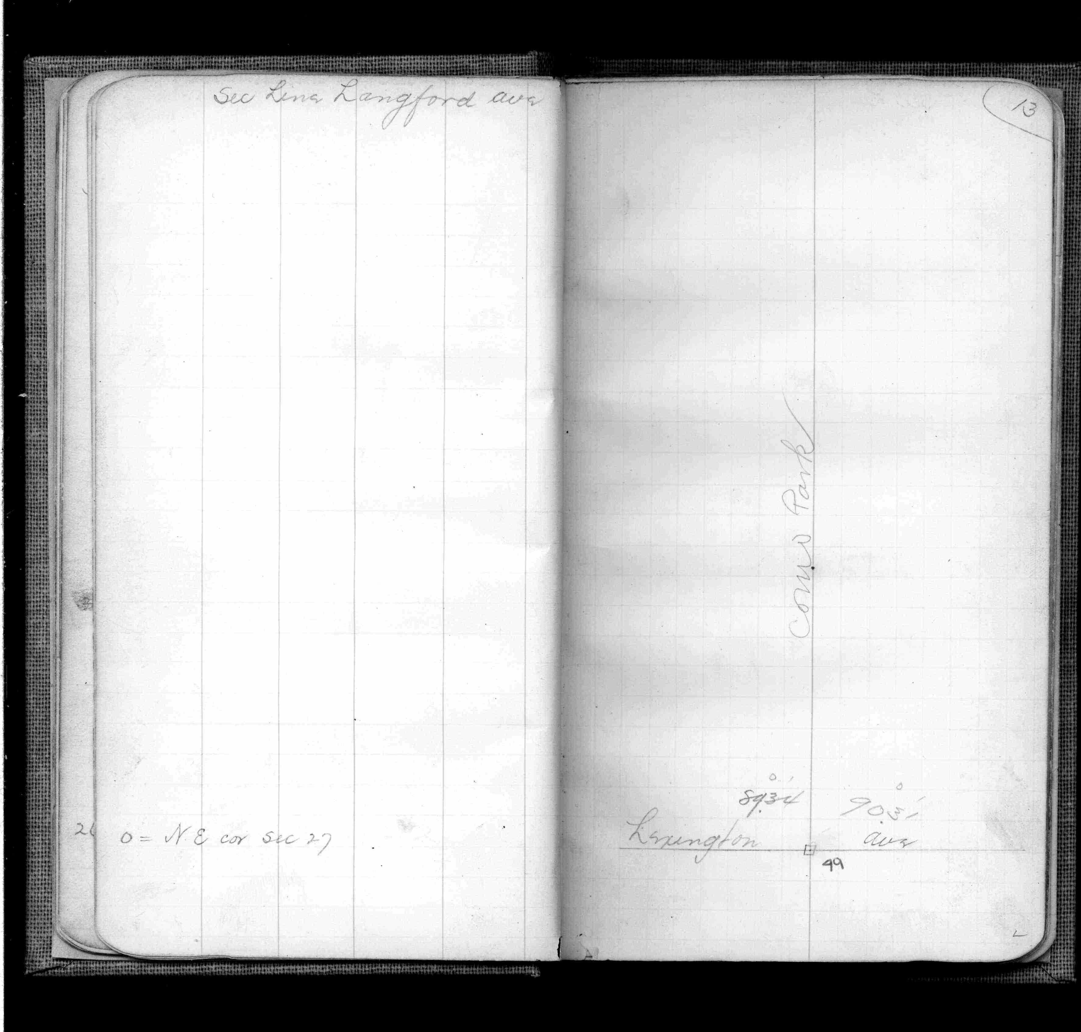
| IH p.082-083 | FB 0169p.15 | ST 001-078 p.049 | ||||
| FB 0311p. 26 ,48 | ||||||
| FB 0345p. 13 ,38 | ||||||
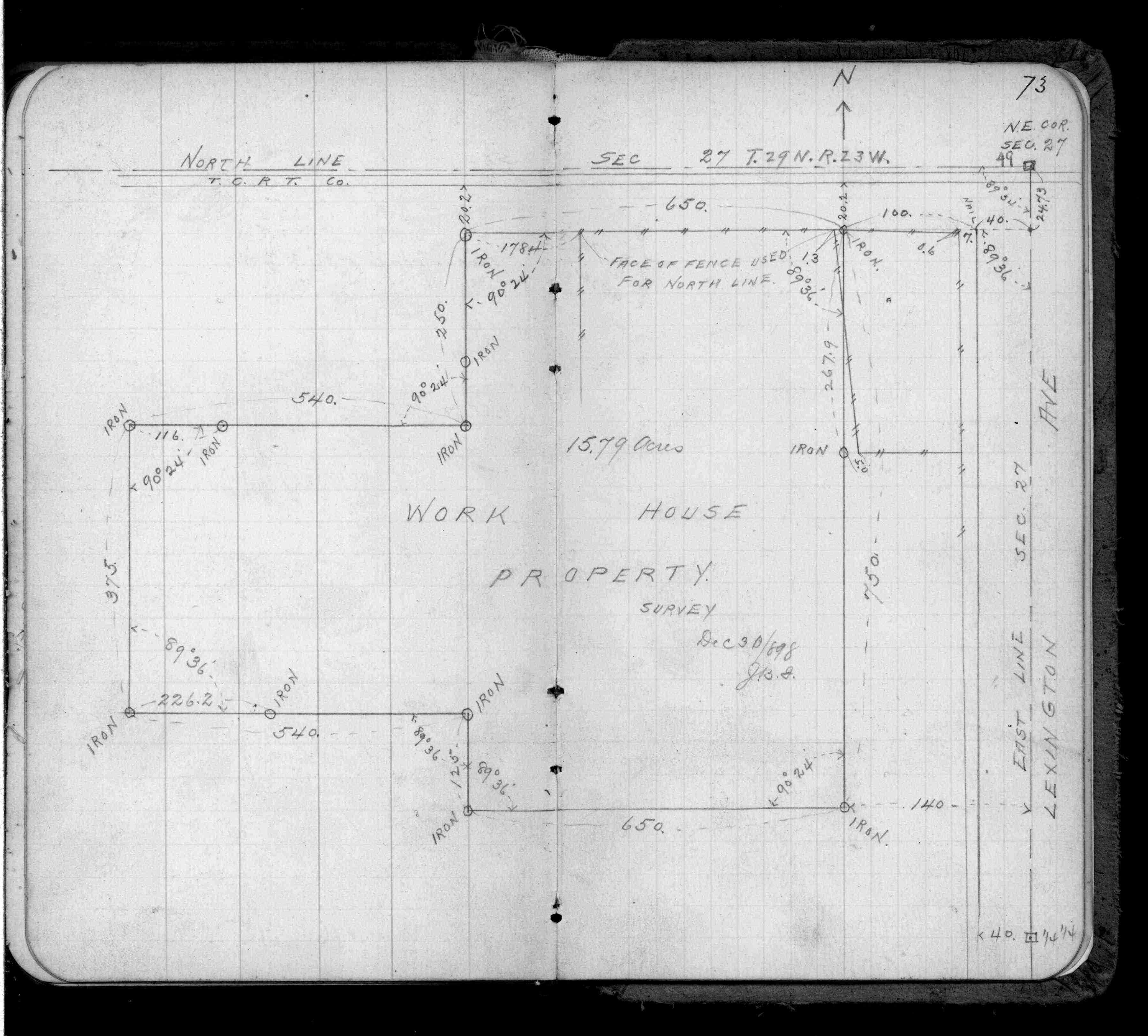
| FB 0388p.73 | ||||||
| FB 0403p. 05 ,06 | ||||||
| FB 1085p.01 | ||||||
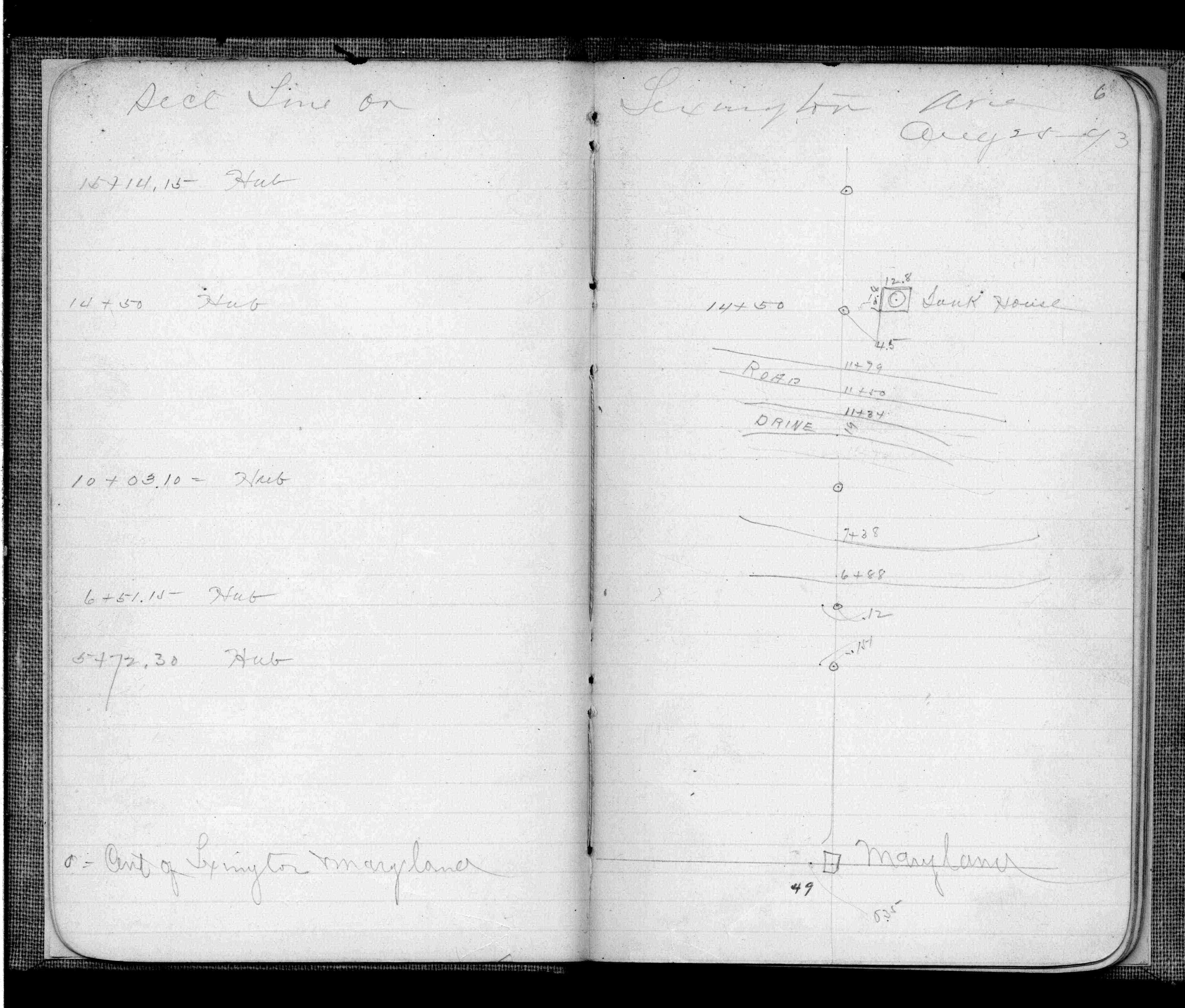
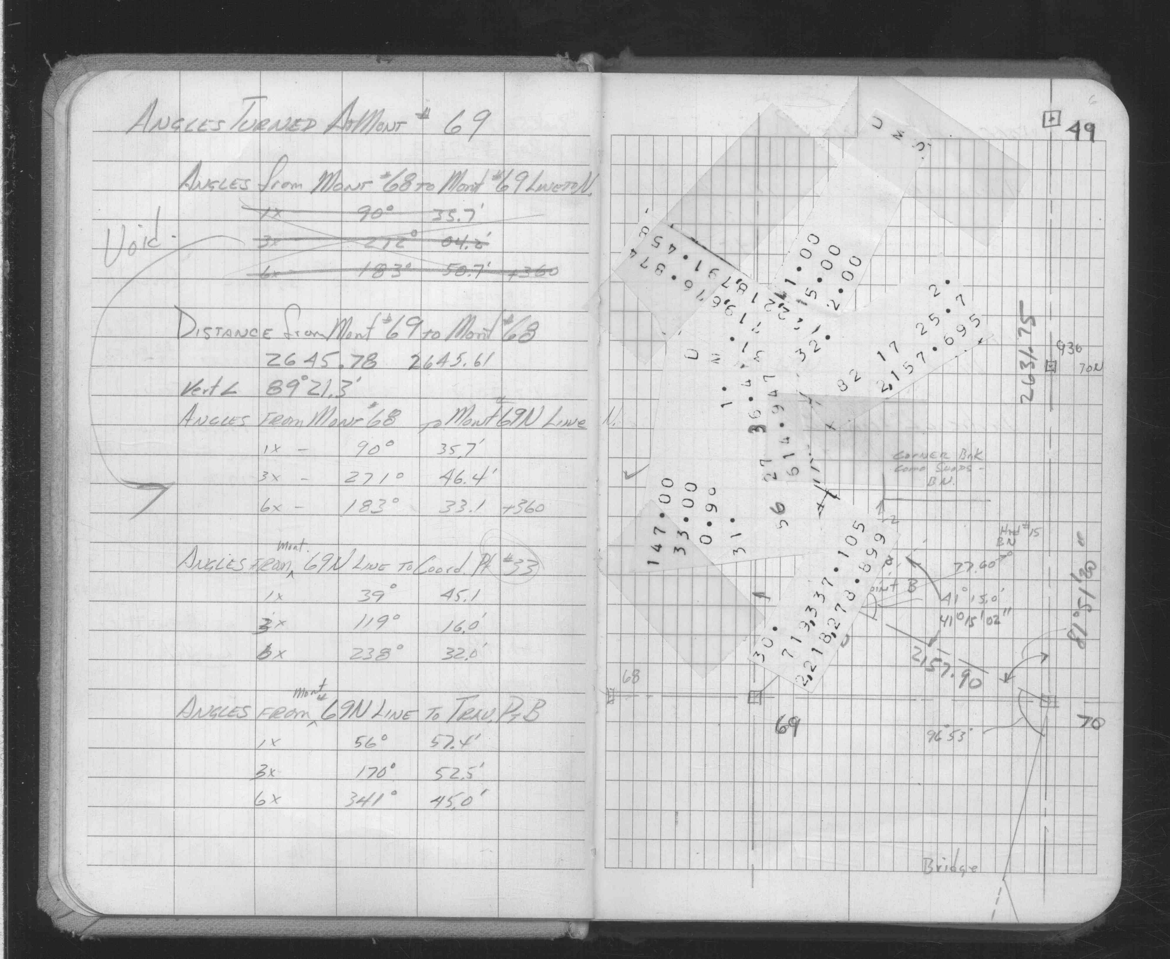
| FB 1470p.19 | ||||||
| FB 1470p.19 | ||||||
| FB 1549Gp.78 | ||||||
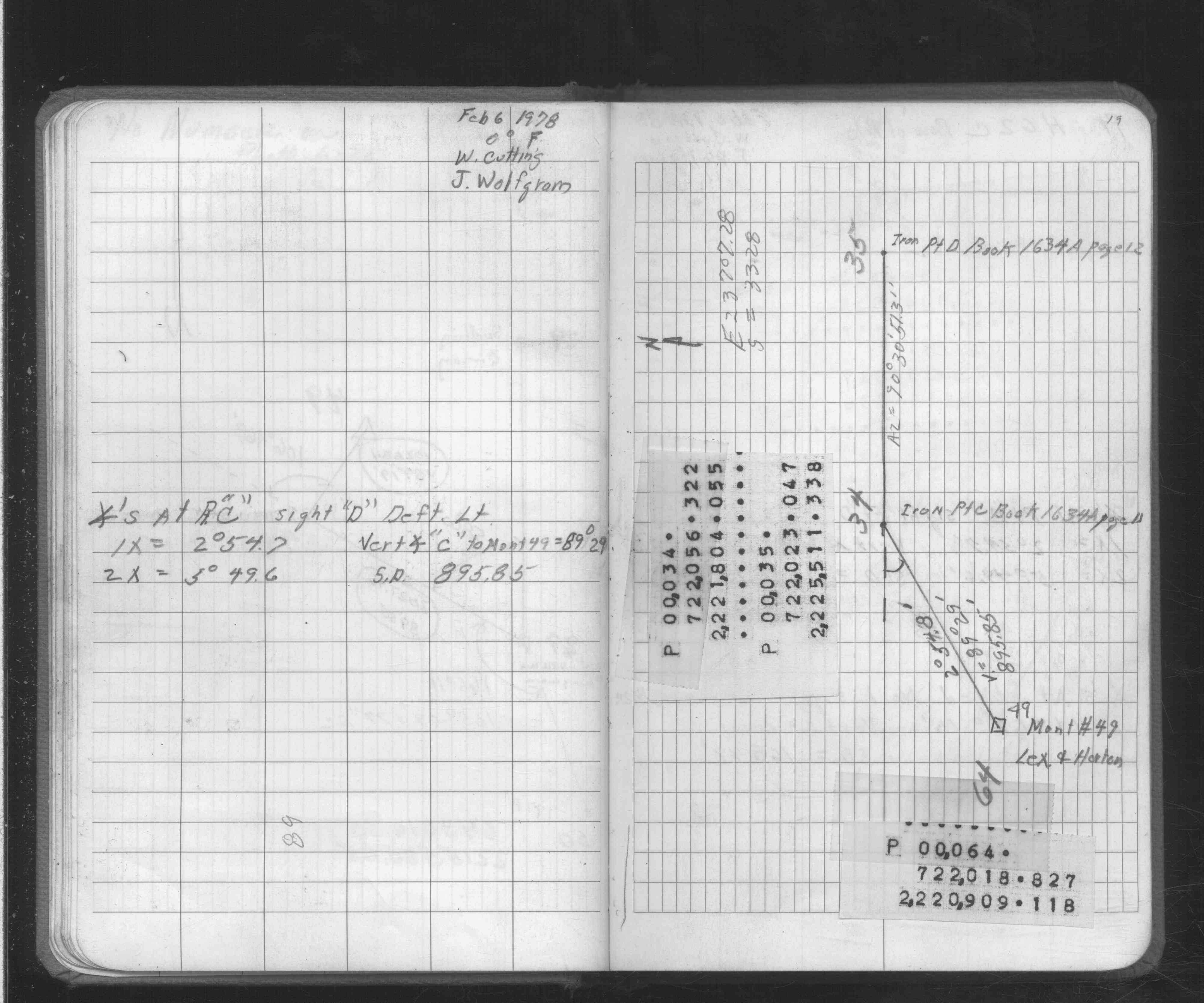
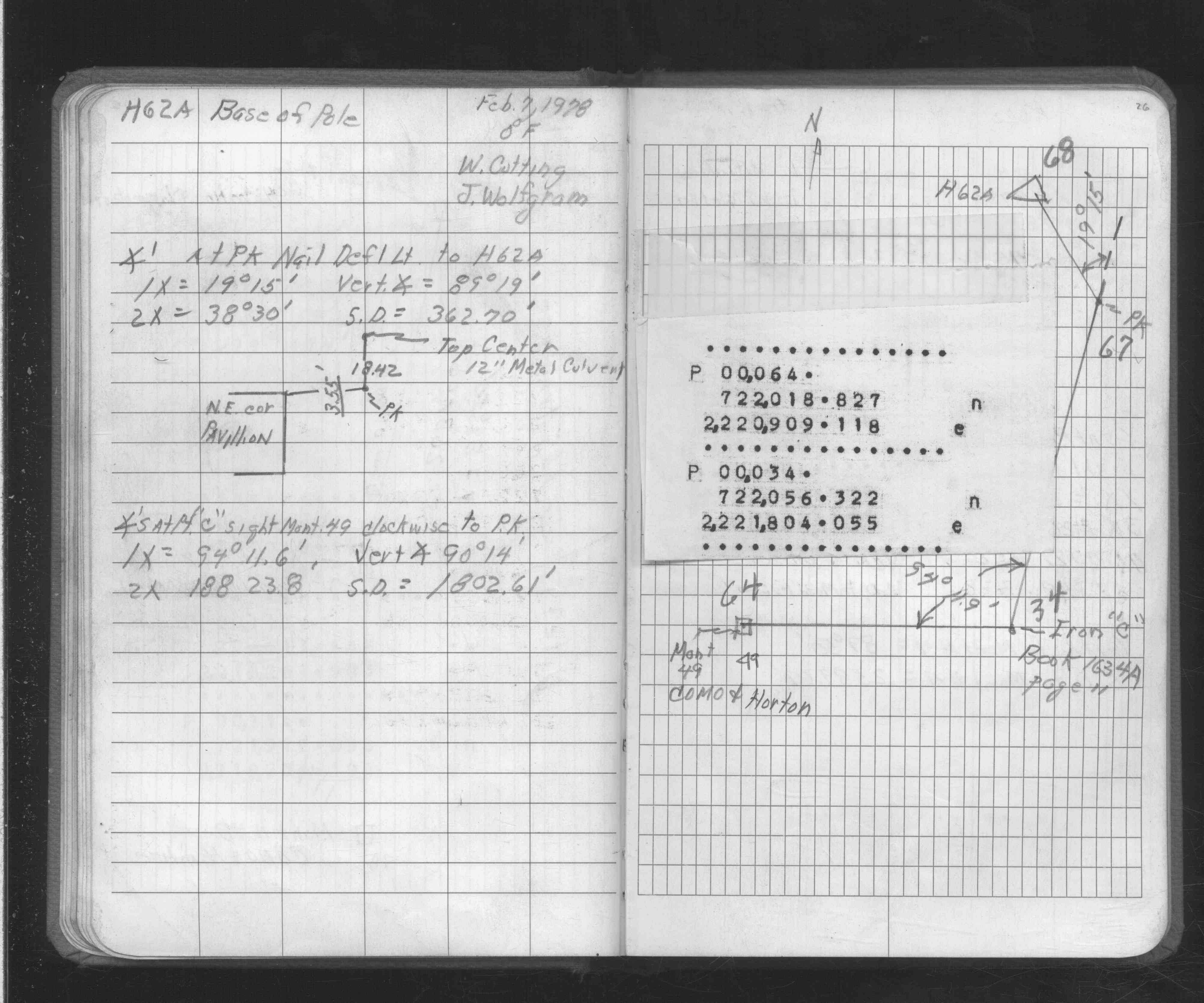
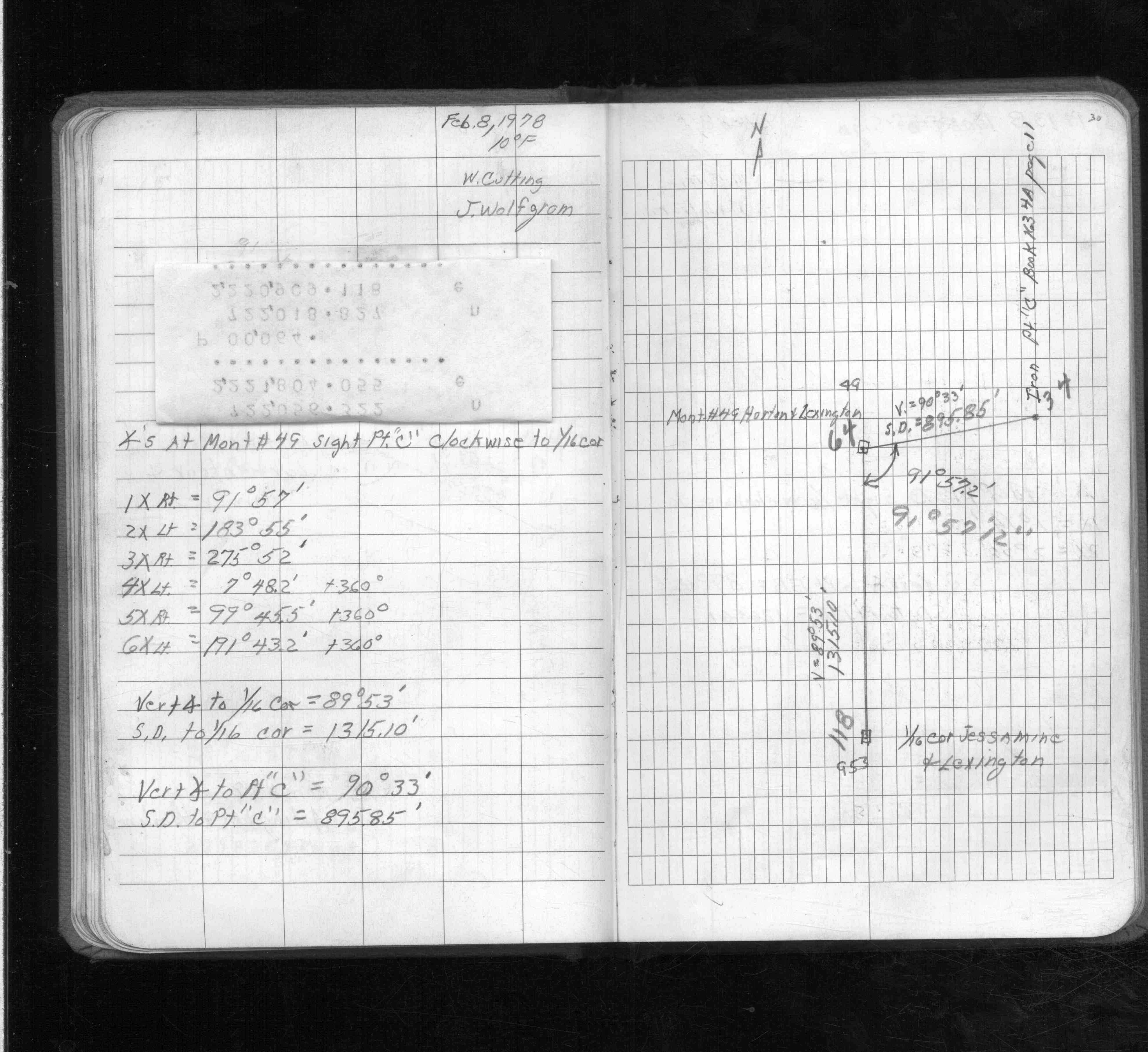
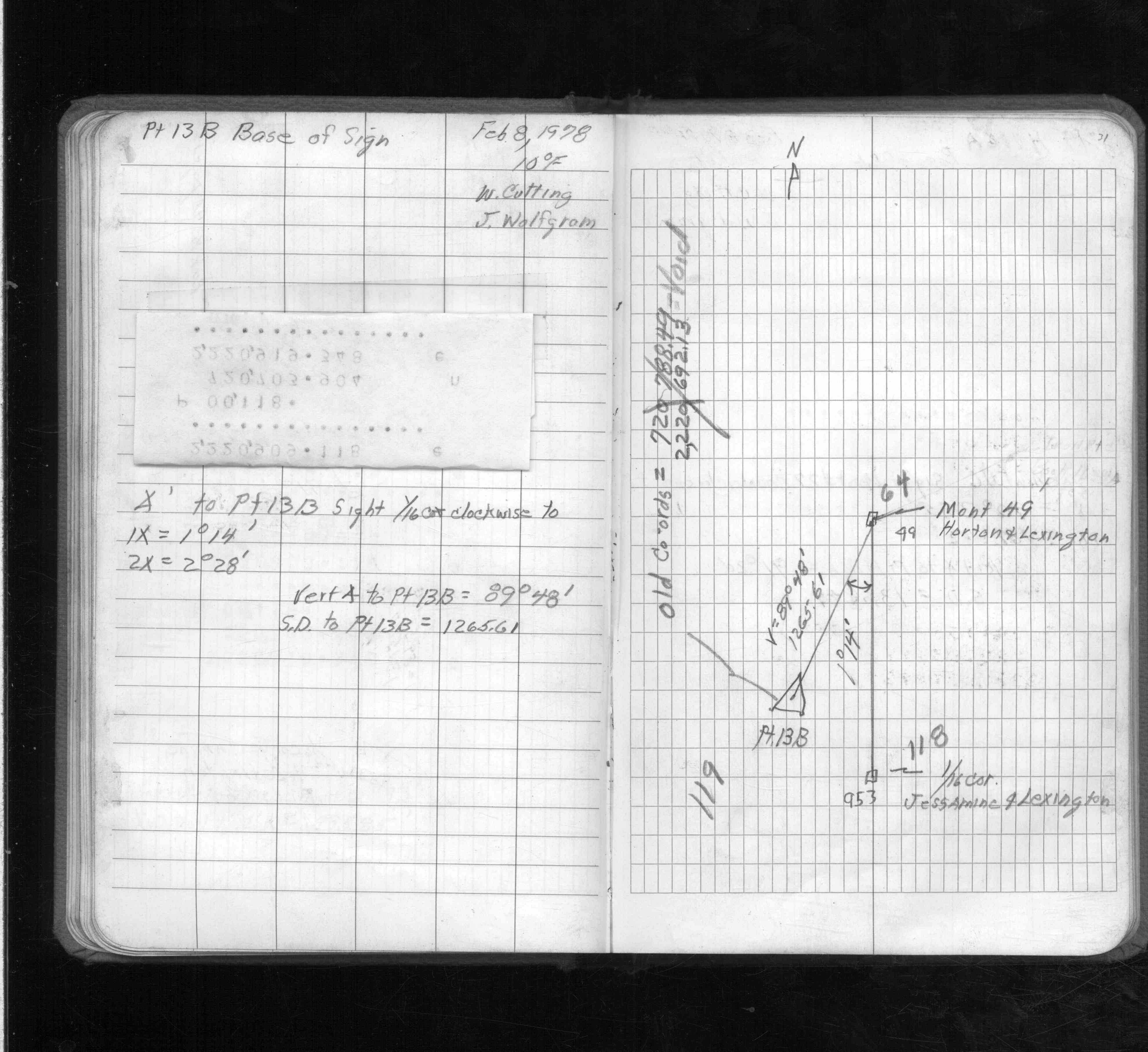
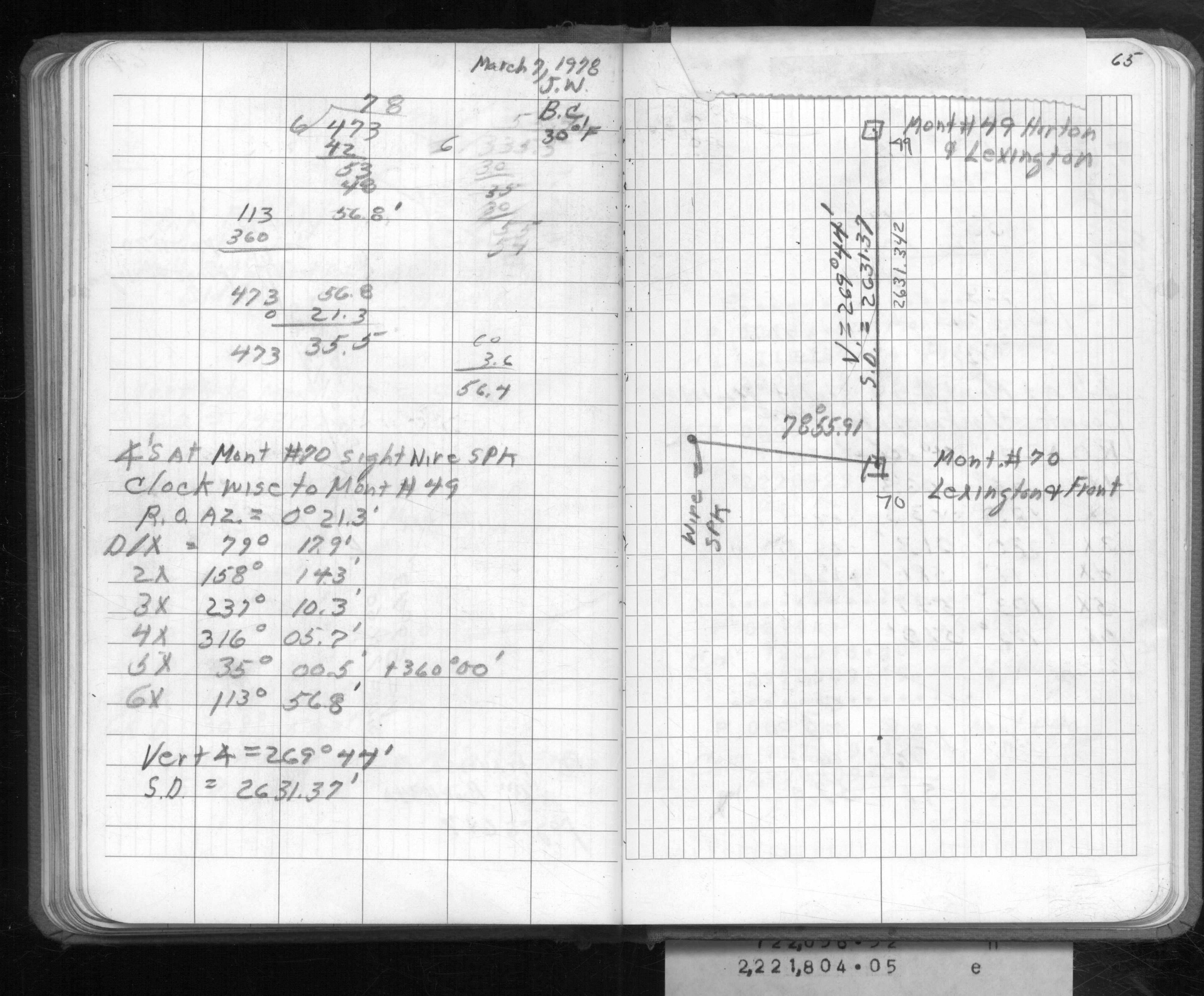
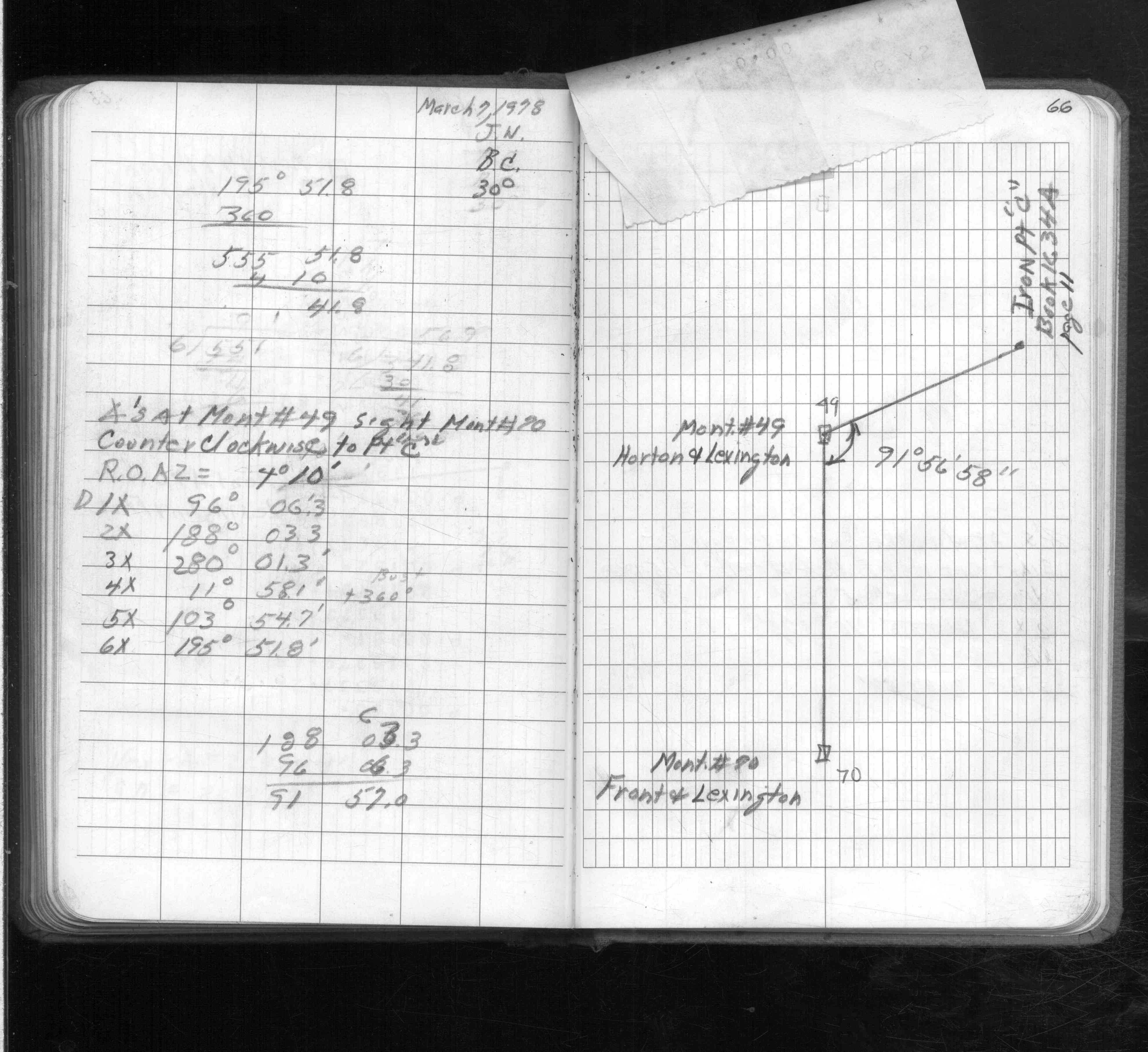
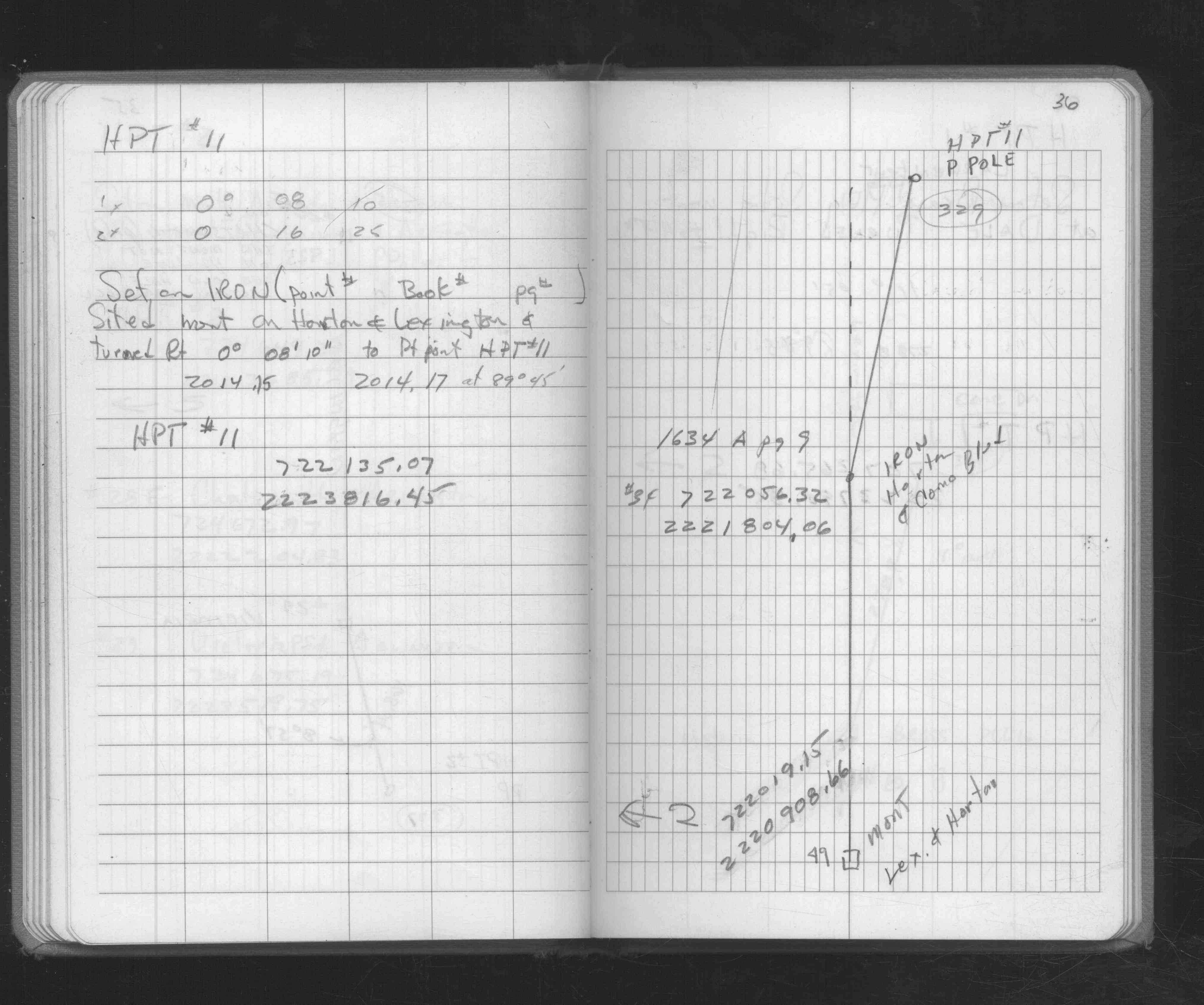
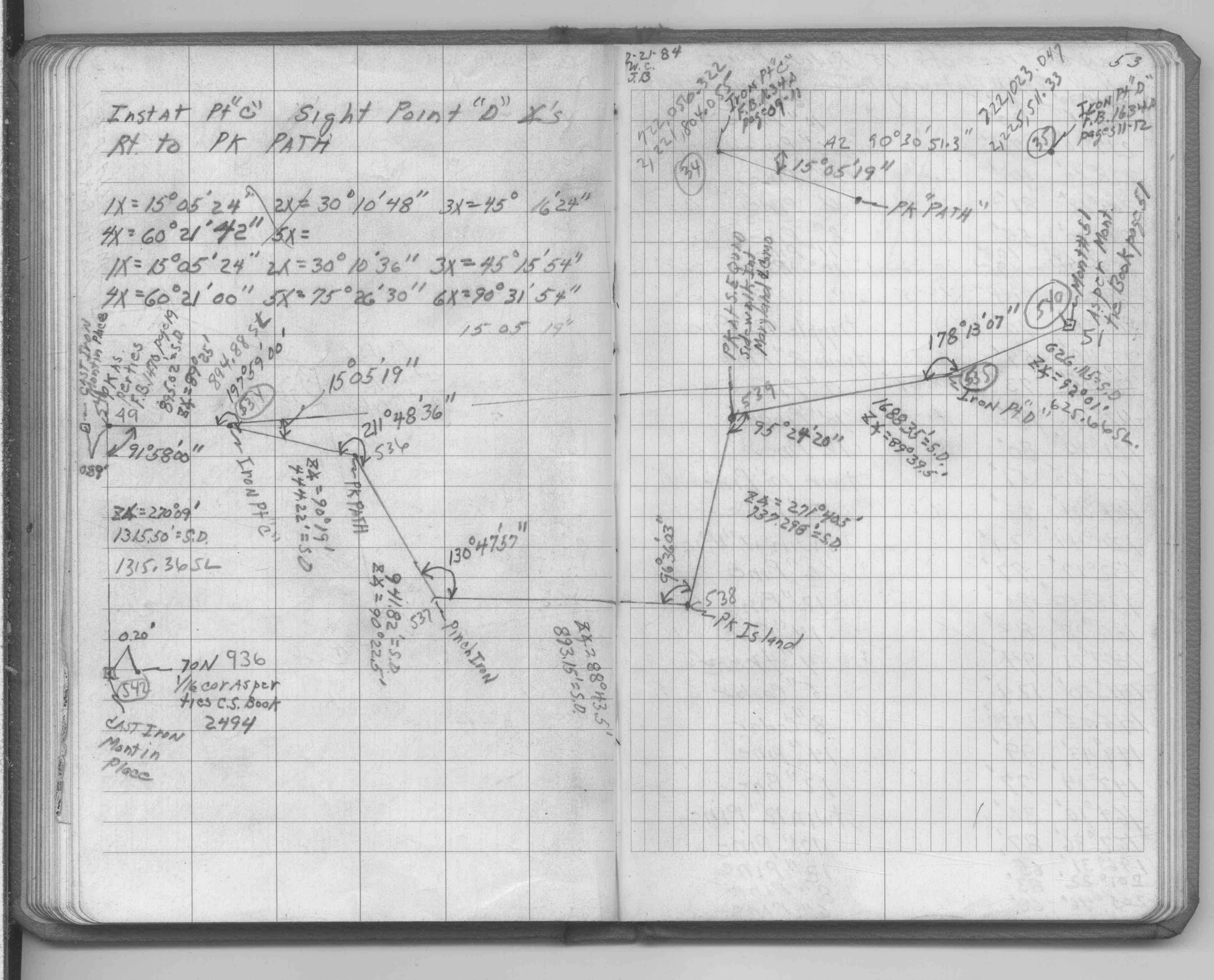
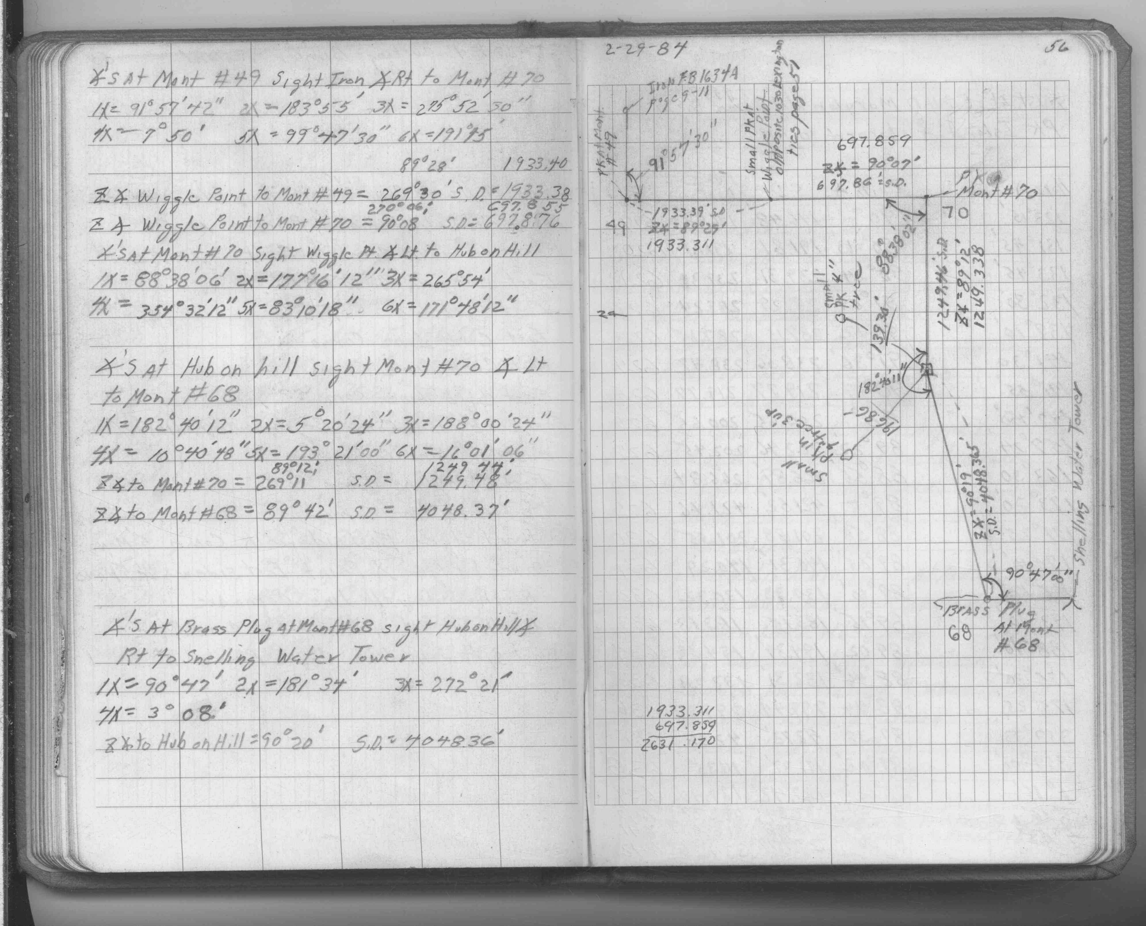
| FB 1634Ap. 06 ,09 ,11 | ||||||
| FB 1649p.62 | ||||||
| FB 1671p. 19 ,26 ,30 ,31 ,65 ,66 | ||||||
| FB 1676Ap.36 | ||||||
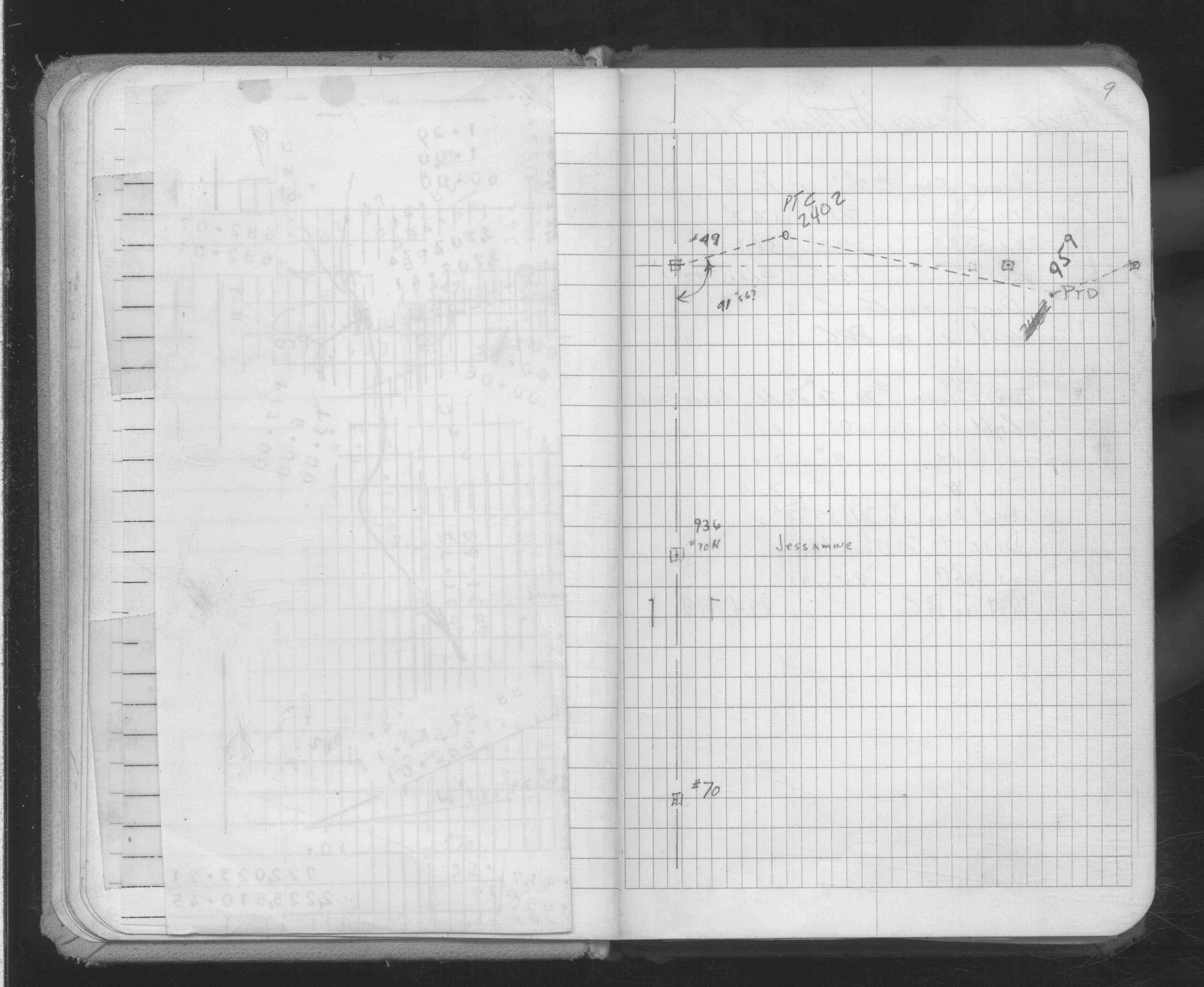
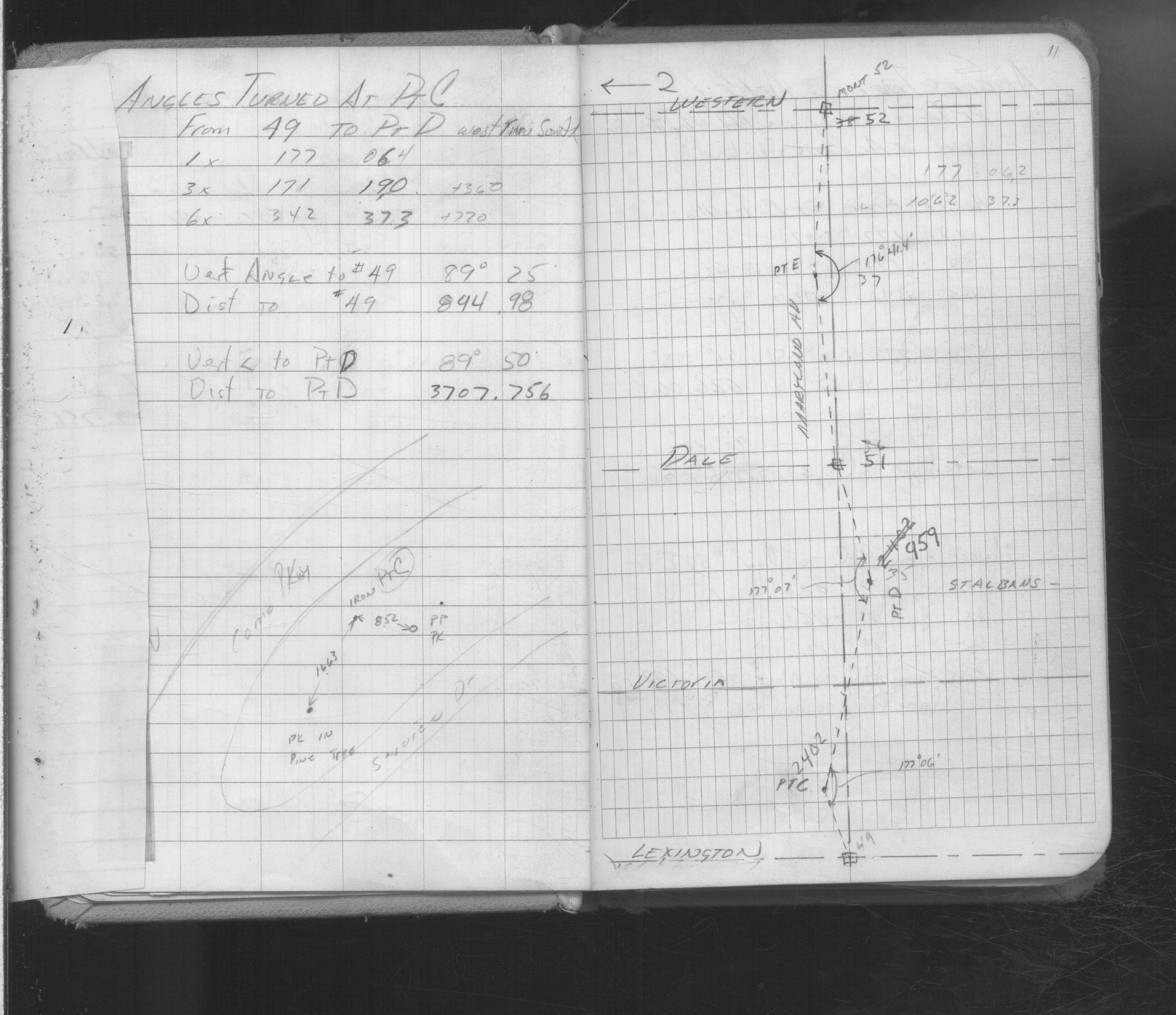
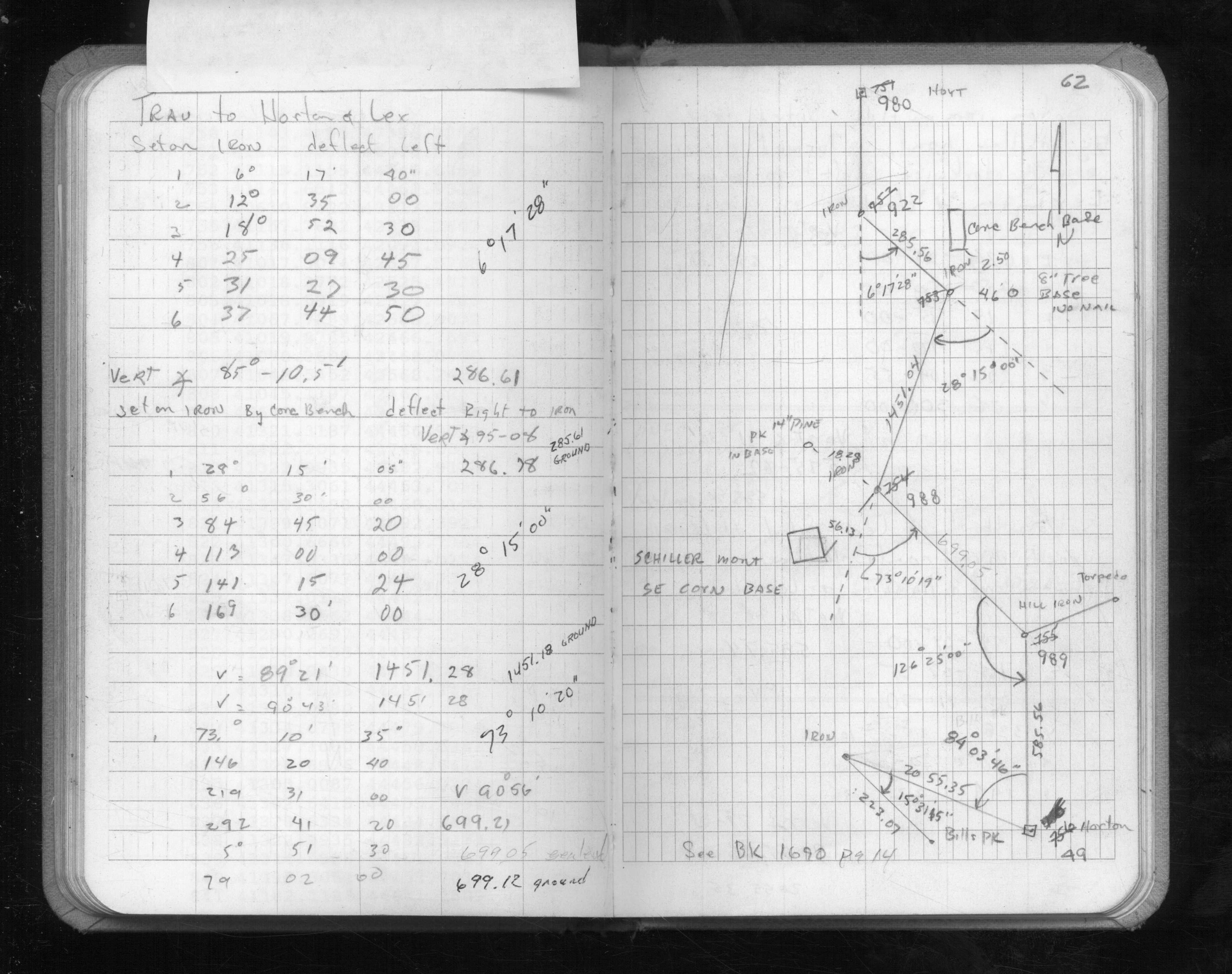
| FB 1690p.07 | ||||||
| FB 1690Ap. 51 ,53 ,56 | ||||||
| FB 1706Ap. 03 ,14 ,19 | ||||||
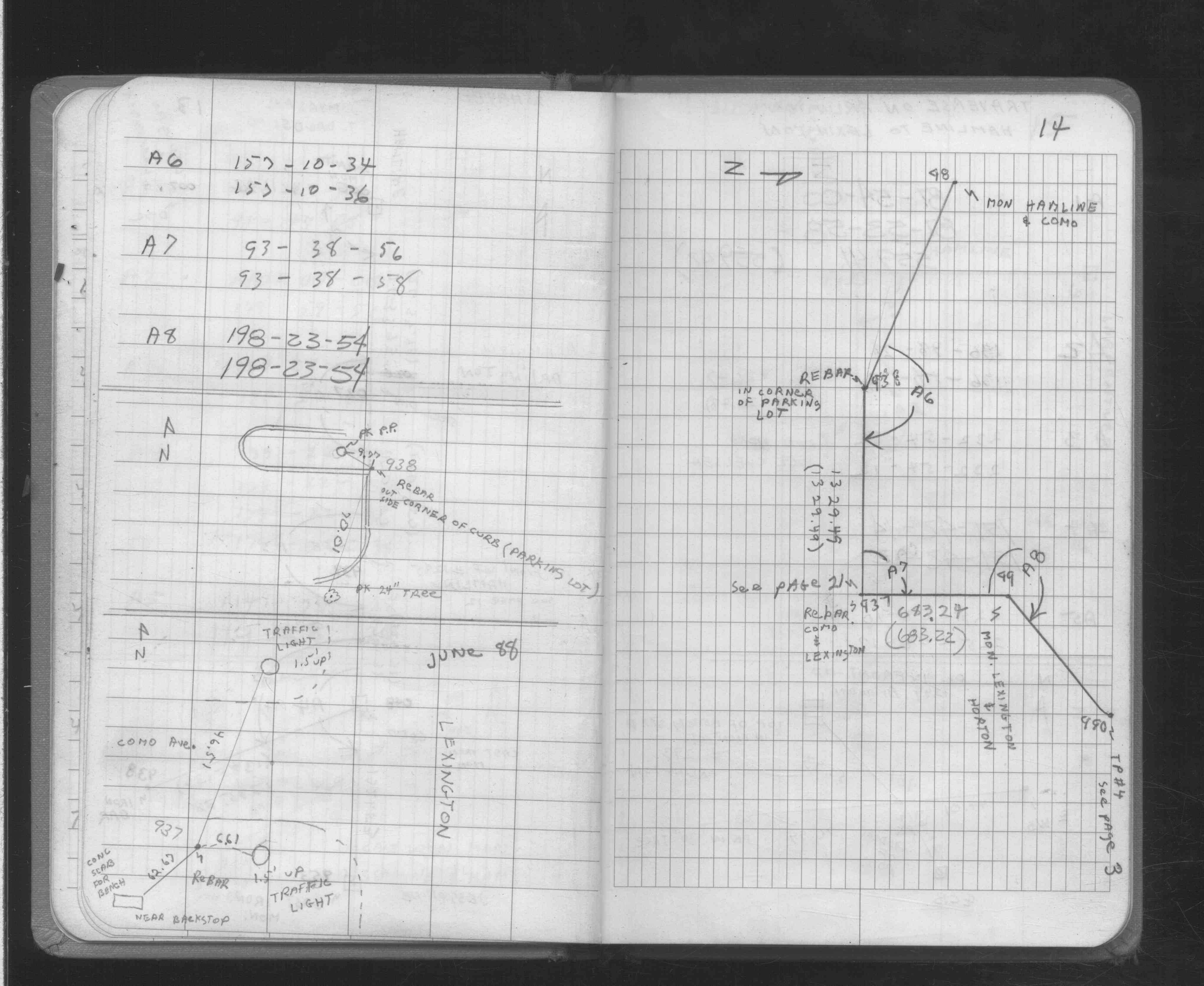
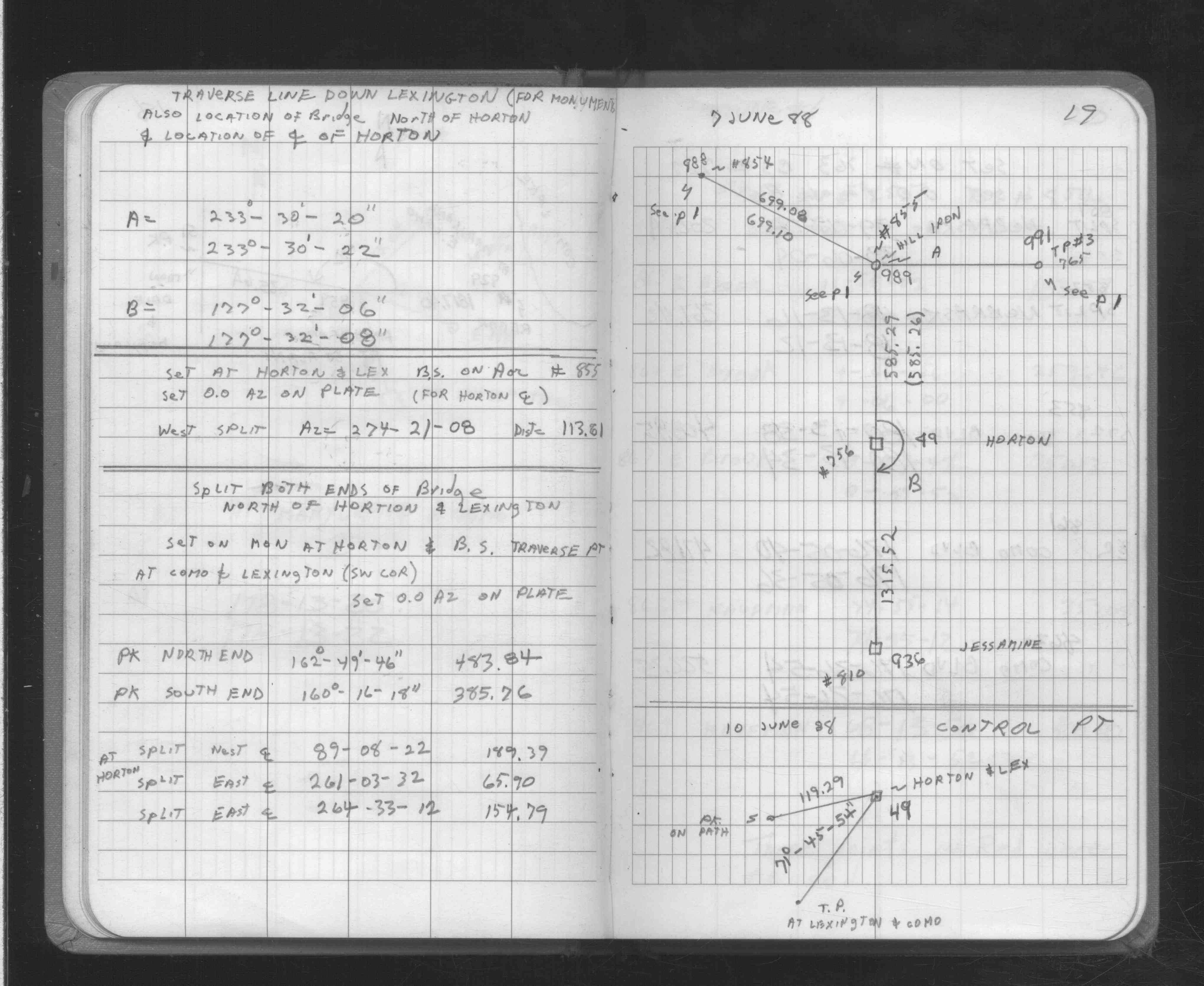
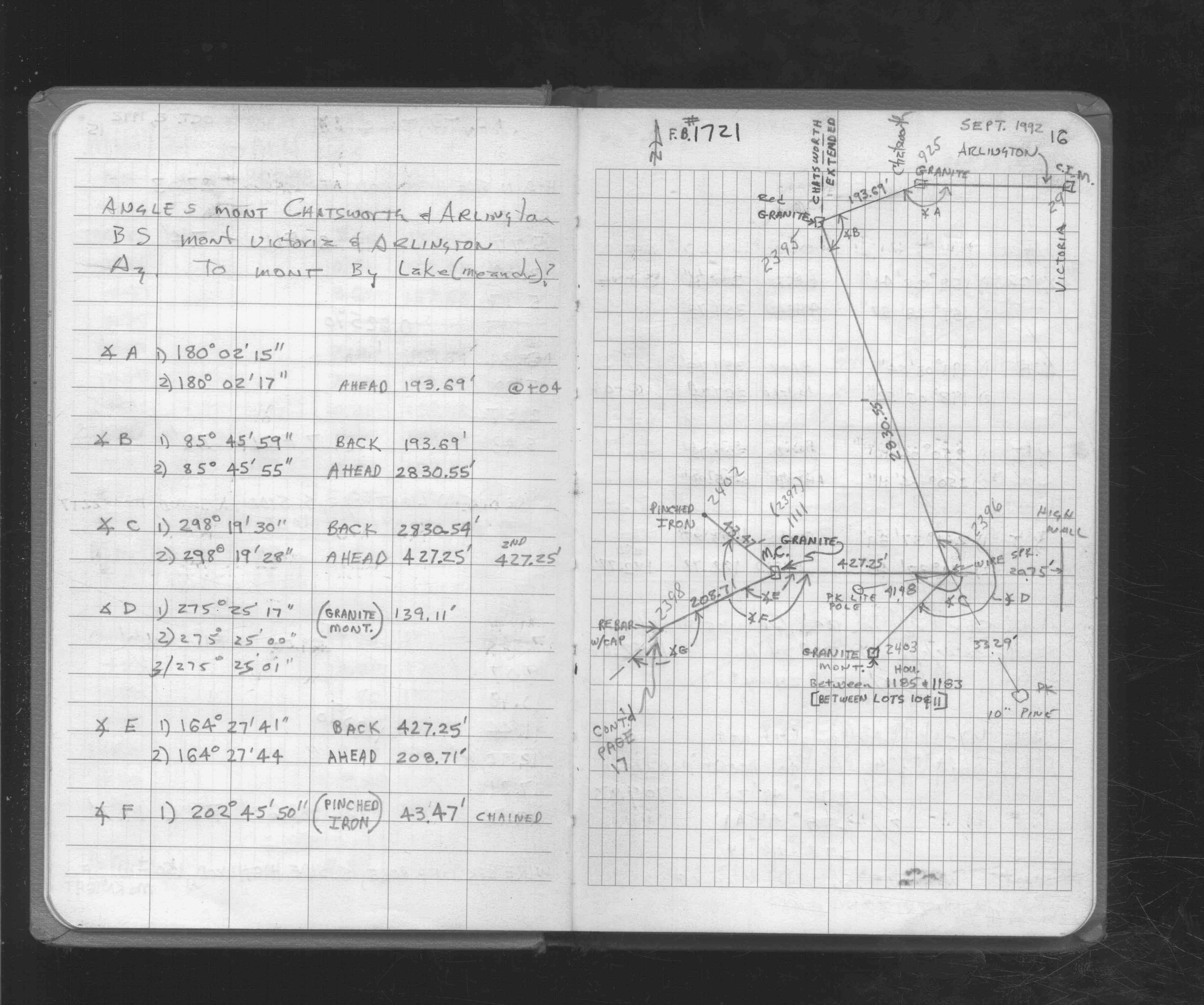
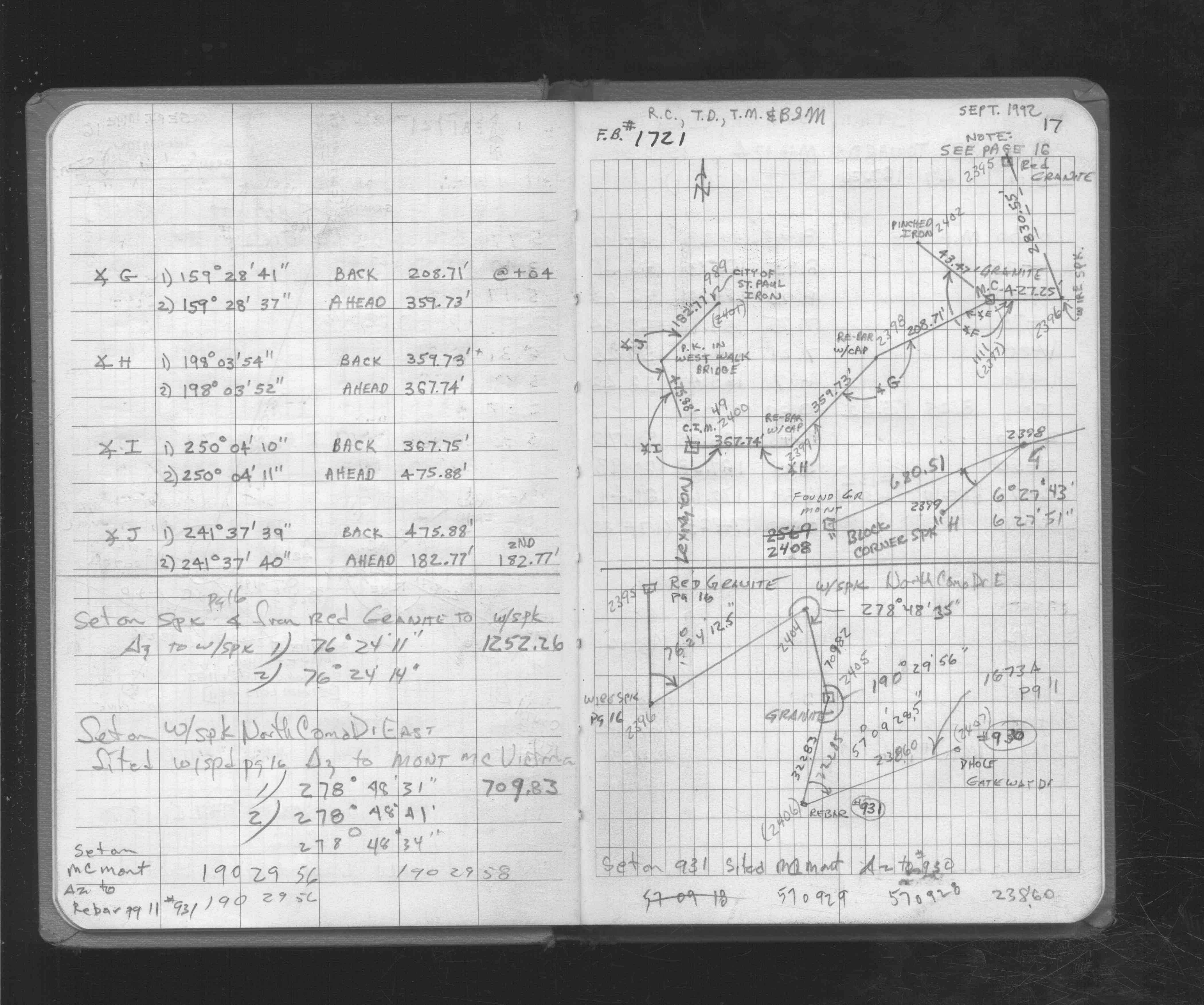
| FB 1721p. 16 ,17 | ||||||
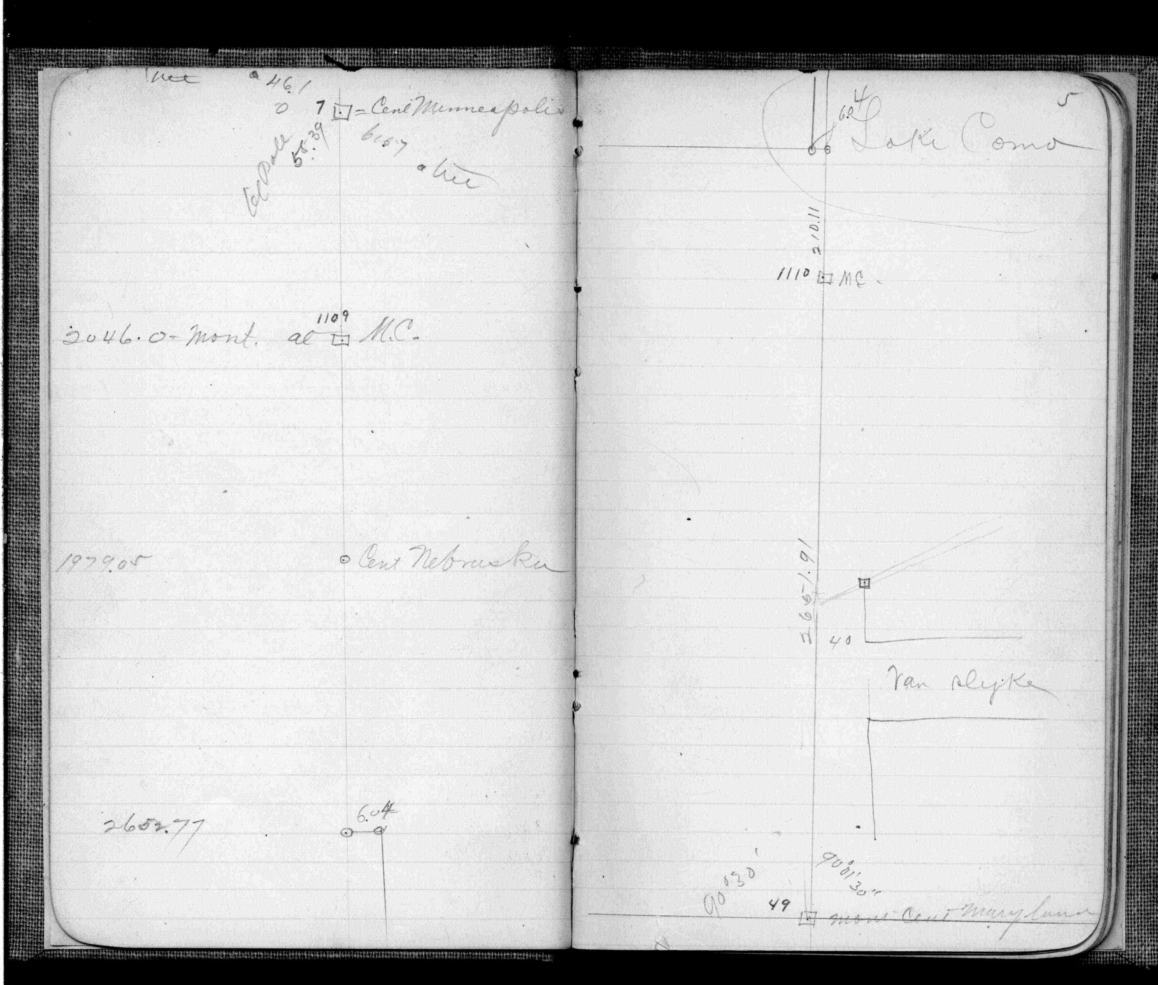
| FB 1736p.34 | ||||||
| FB 1741p.14 |
| FILE | SURVEYOR | LIC. NO. | DATE SIGNED | DATE TIED |
|---|---|---|---|---|
| 0049-0009-A.tif | William J. Cutting | 20576 | September 19, 1995 | September 19, 1995 |
| ST_001-078p049.jpg | none | none | none | none |
| 0049-0009-A.dwf | none | none | none | none |
| FILE | PHOTO DATE | COMMENTS |
|---|---|---|
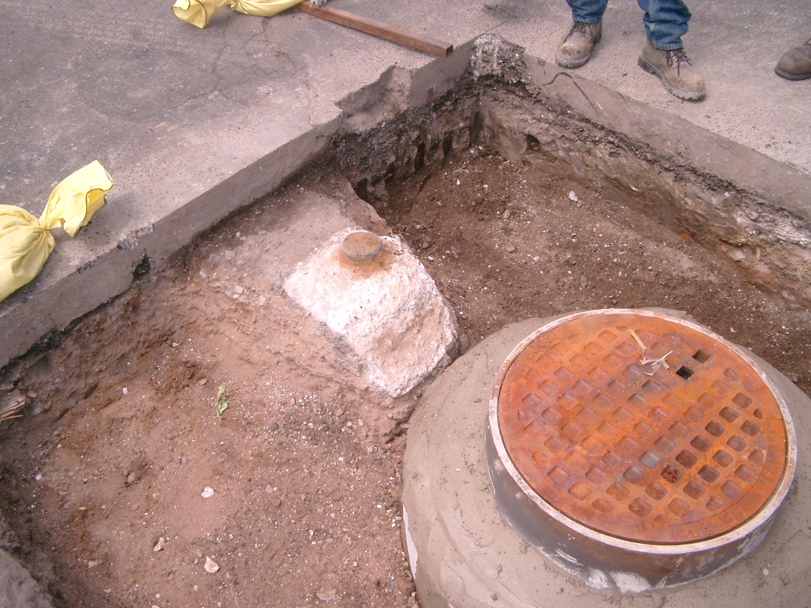
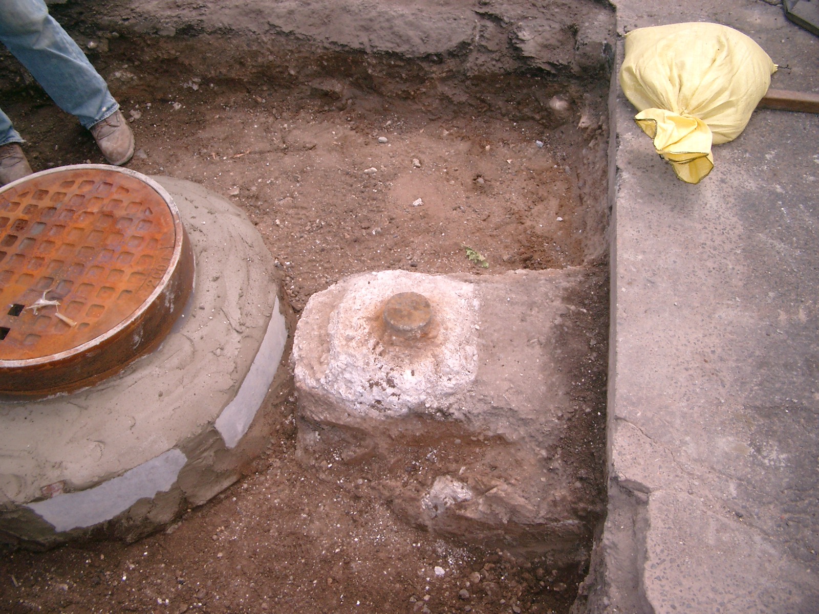
| 0049-1763-4.jpg | July 9, 2009 | Looking southwest toward monument. |
| 0049-1763-3.jpg | July 9, 2009 | Close up of monument location looking northwest. |
| 0049-1763-2.jpg | July 9, 2009 | Close up of monument looking east. |
| 0049-1763-1.jpg | July 9, 2009 | Close up of monument looking south. |