| NAD83 COORDINATES (1986 adj.): |
|---|
| * X= 579515.78 Y= 168082.35 Z= 0 LSQ 12/6/1991 S FLT |
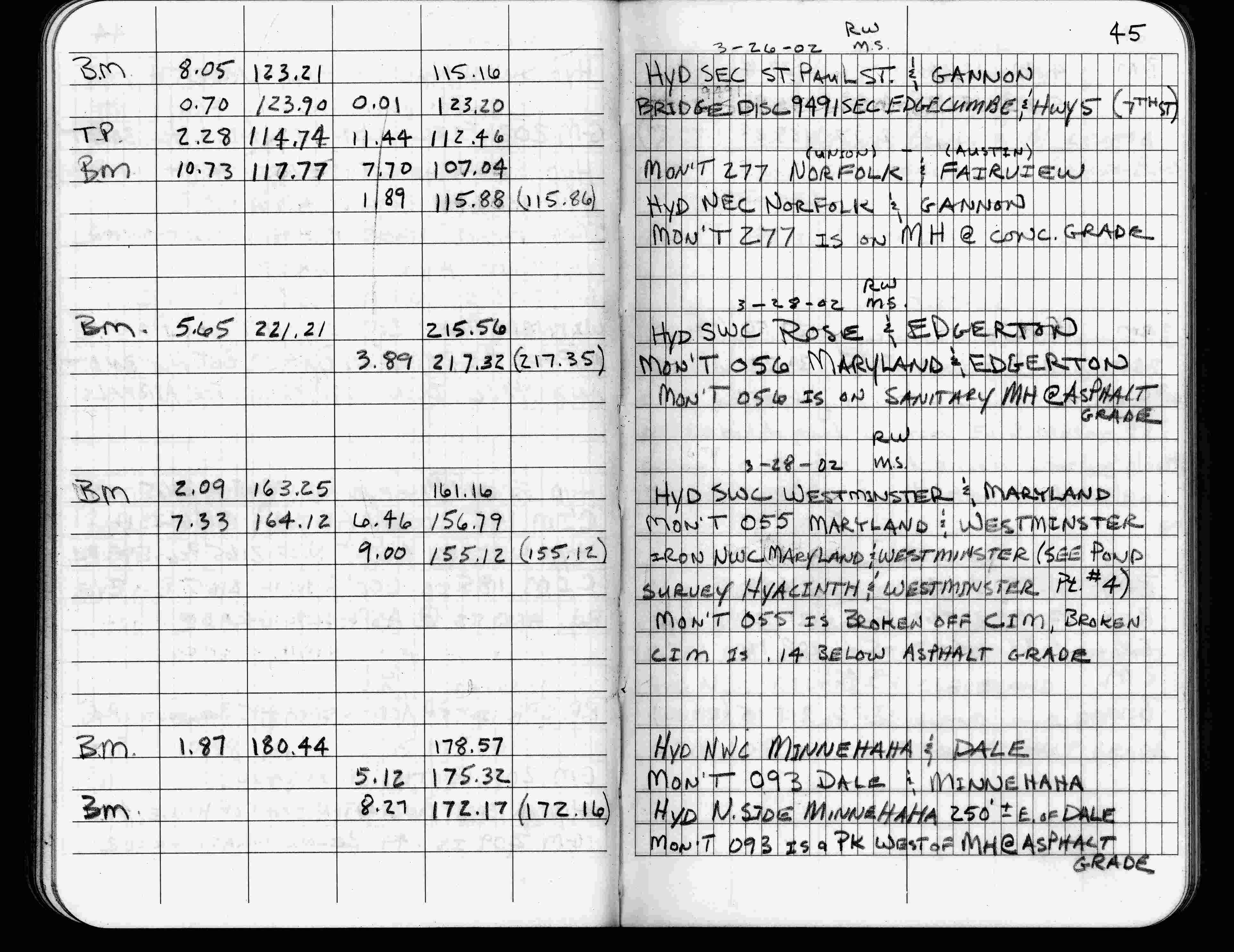
| 3/28/2002 | Elev 217.32 ft on sanitary MH at asphalt surface. See FB 1736 p.45 |
| 1/21/1999 | Elev 217.35 ft on MH CLCL. See 1999/edgerton2/edgerton2.sdr (loop 190) Digital-Unadj |
| 4/1/1982 | (Unknown date Apr __, 1982 ) Elev 216.94 ft on CLCL. See FB 1421A p.21 |
| 4/1/1982 | (Unknown date Apr __, 1982 ) Elev 216.92 ft on CLCL. See FB 1421A p.28 |
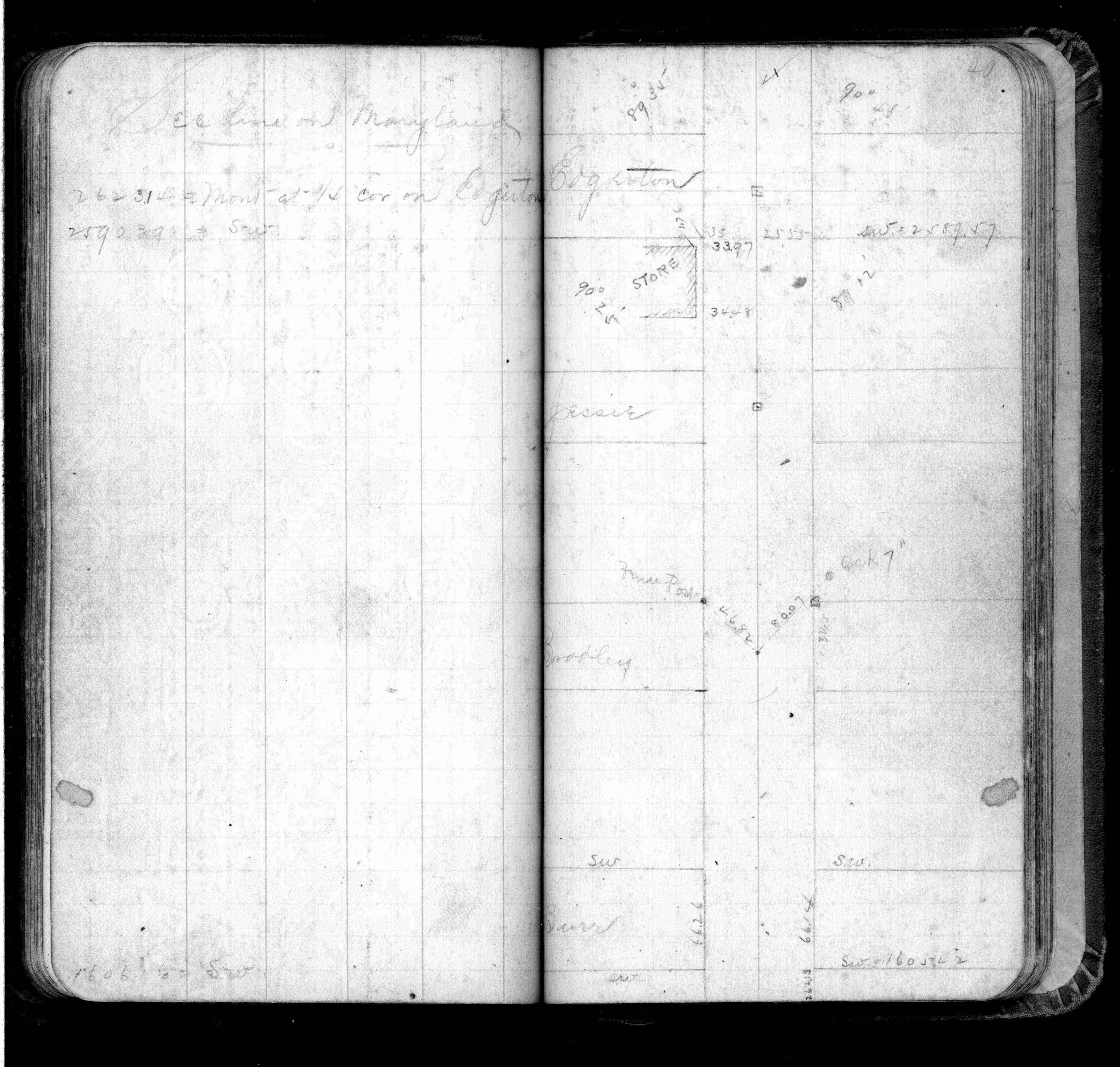
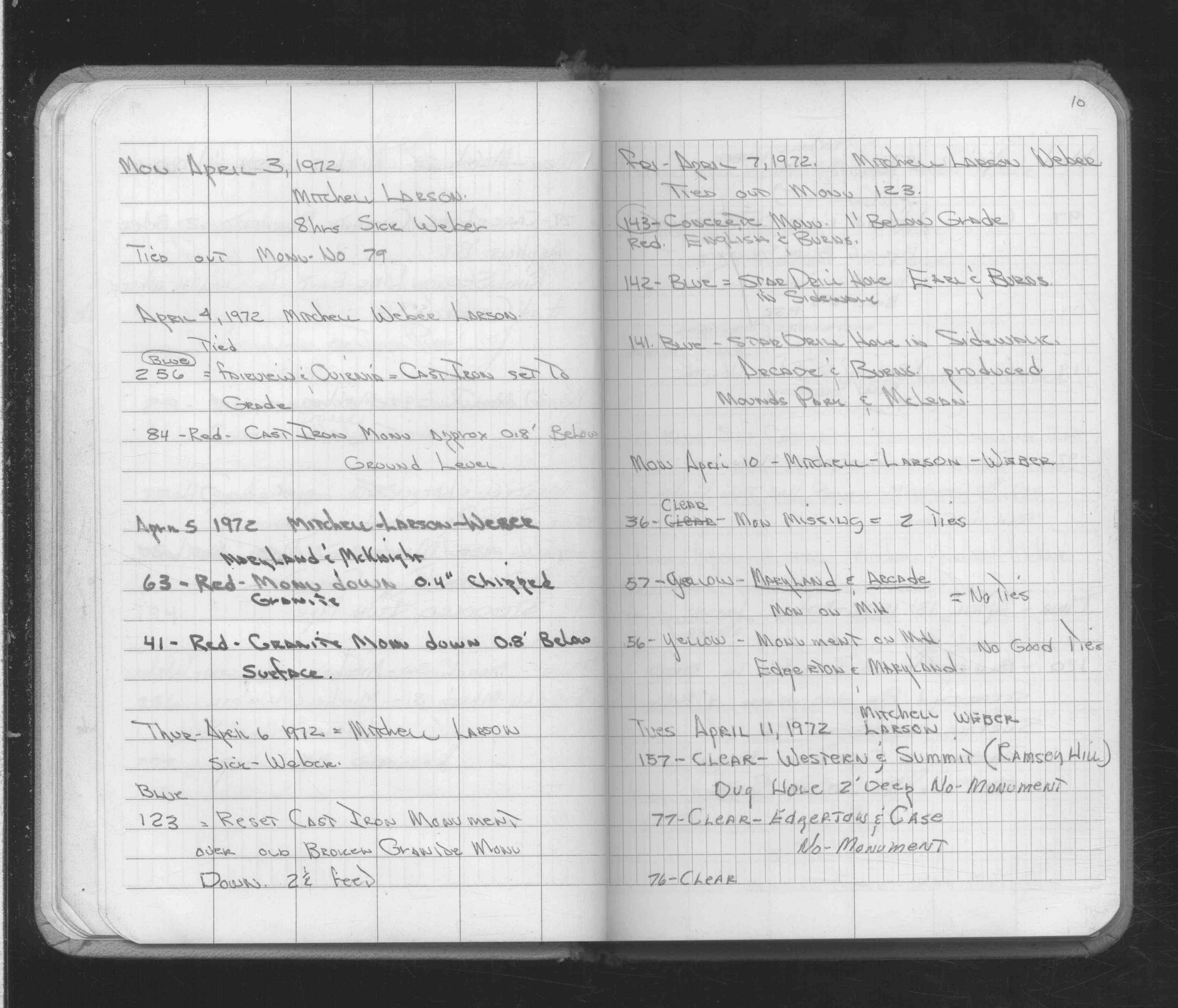
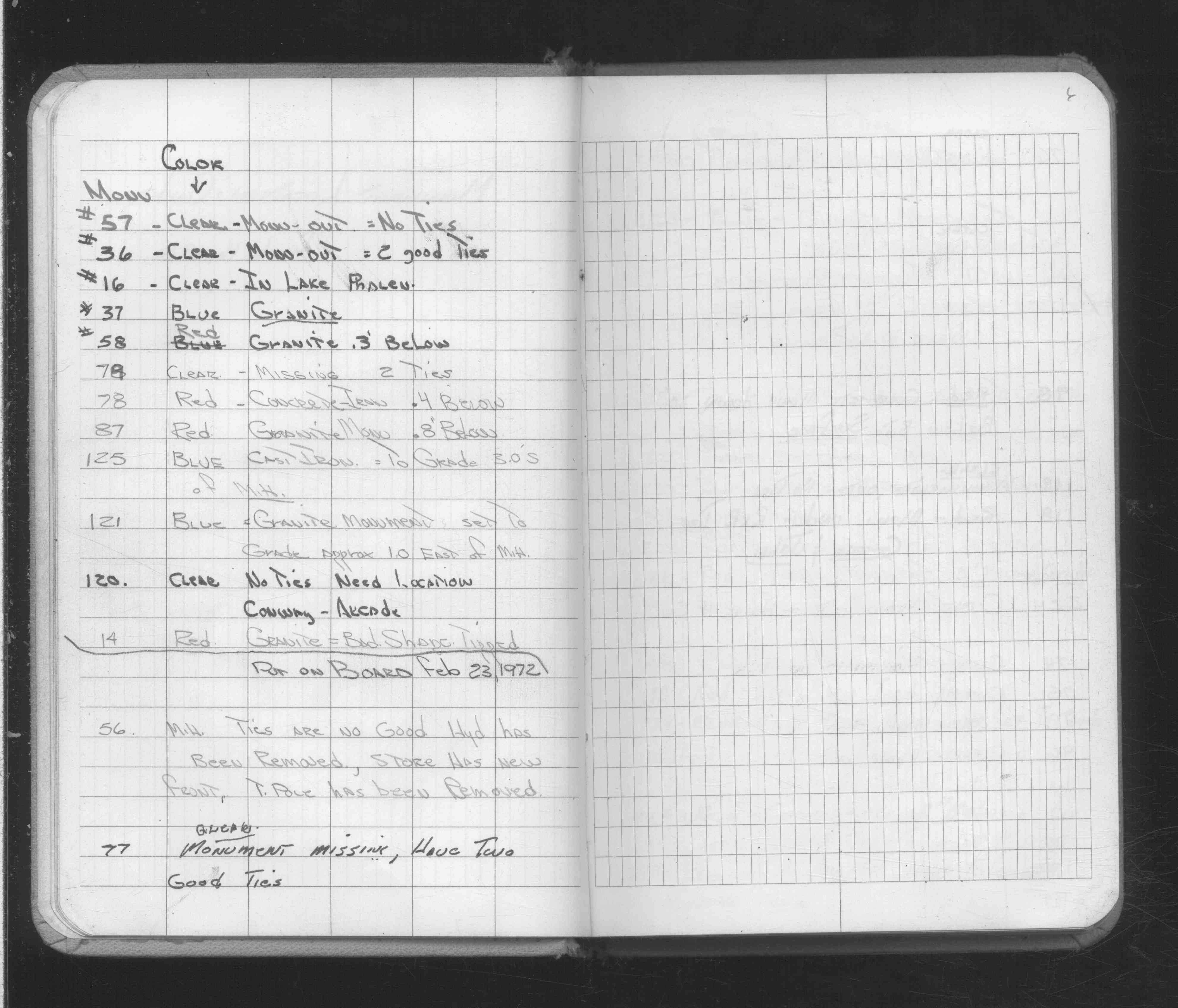
| 4/10/1972 | Falls on MH, no good ties. See FB 1689A p.10 |
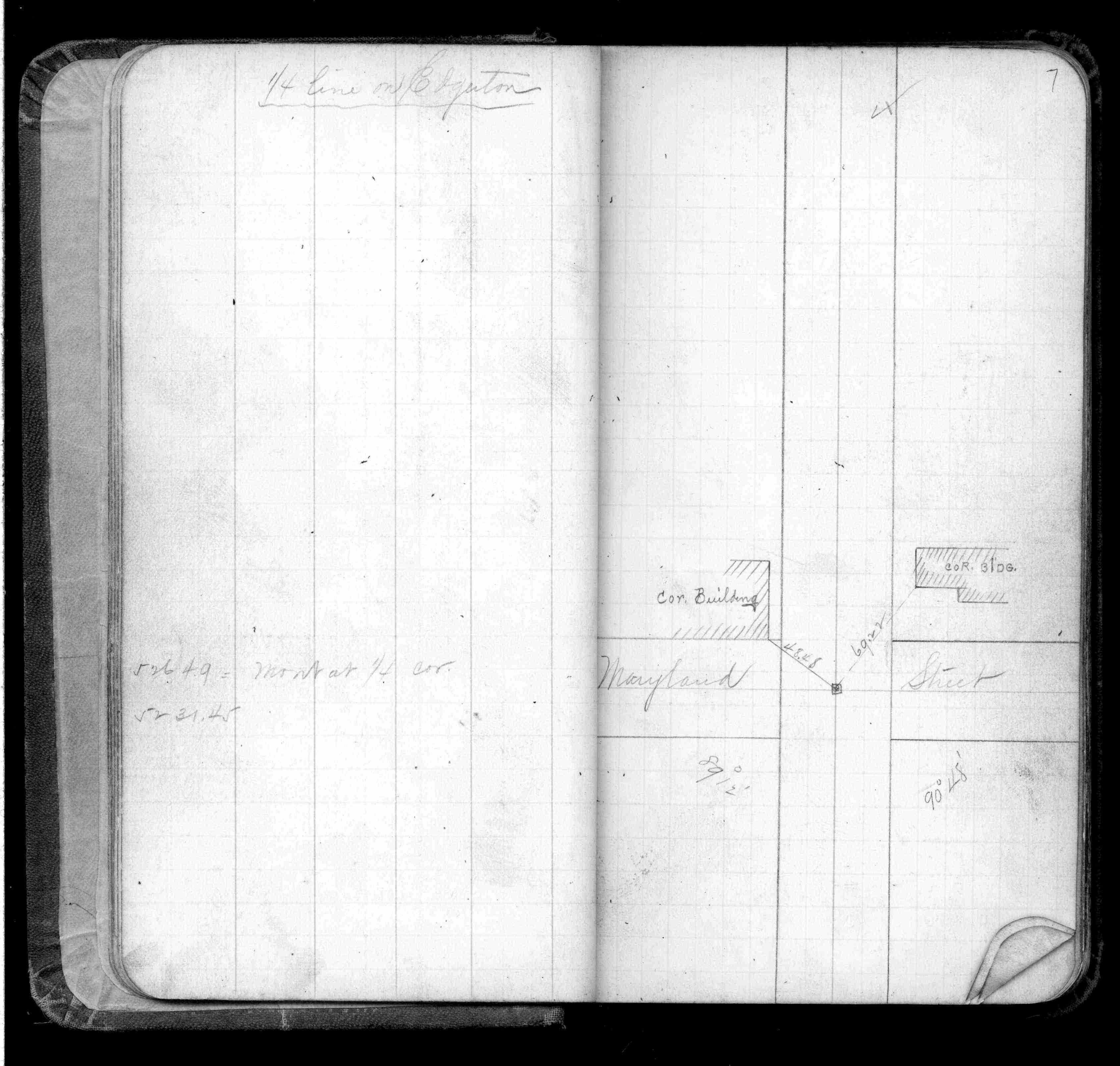
| 2/16/1972 | Falls on MH, ties are no good, hyd removed, store has new front, tele pole removed. See FB 1689A p.6 |
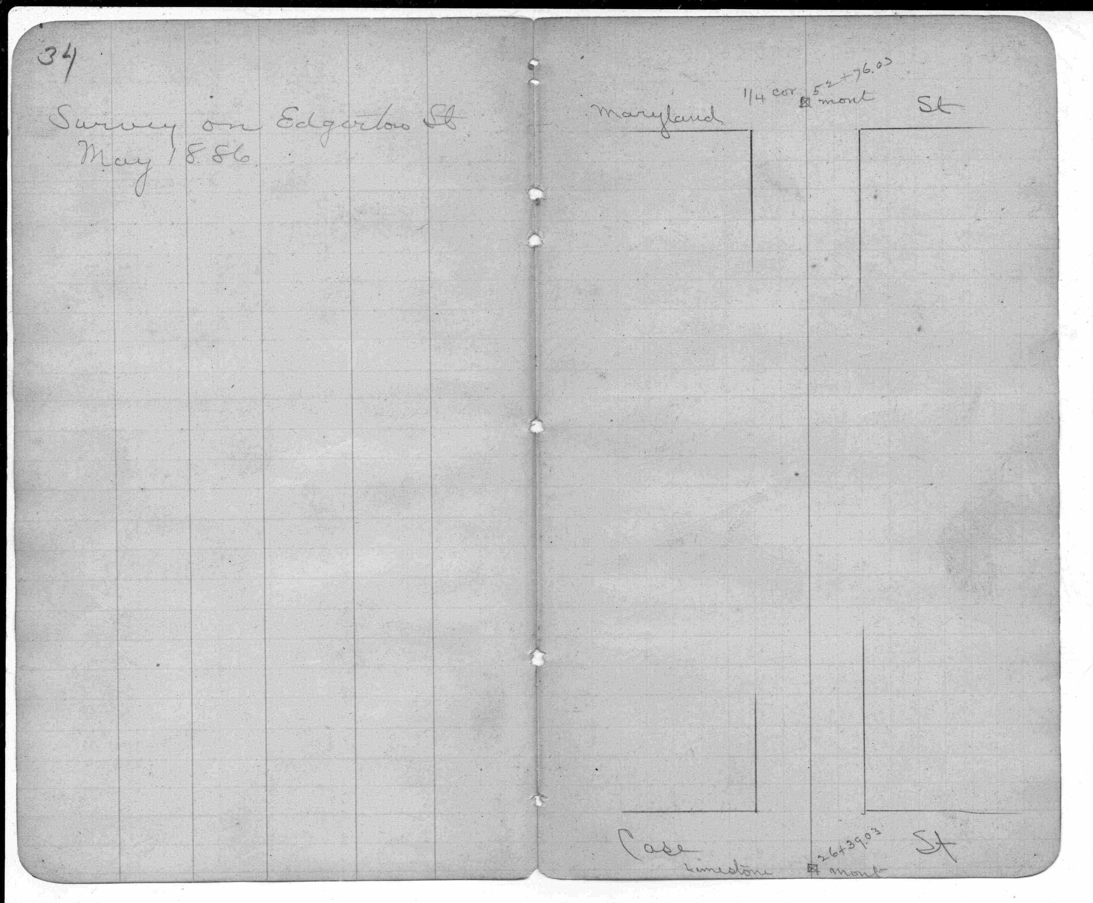
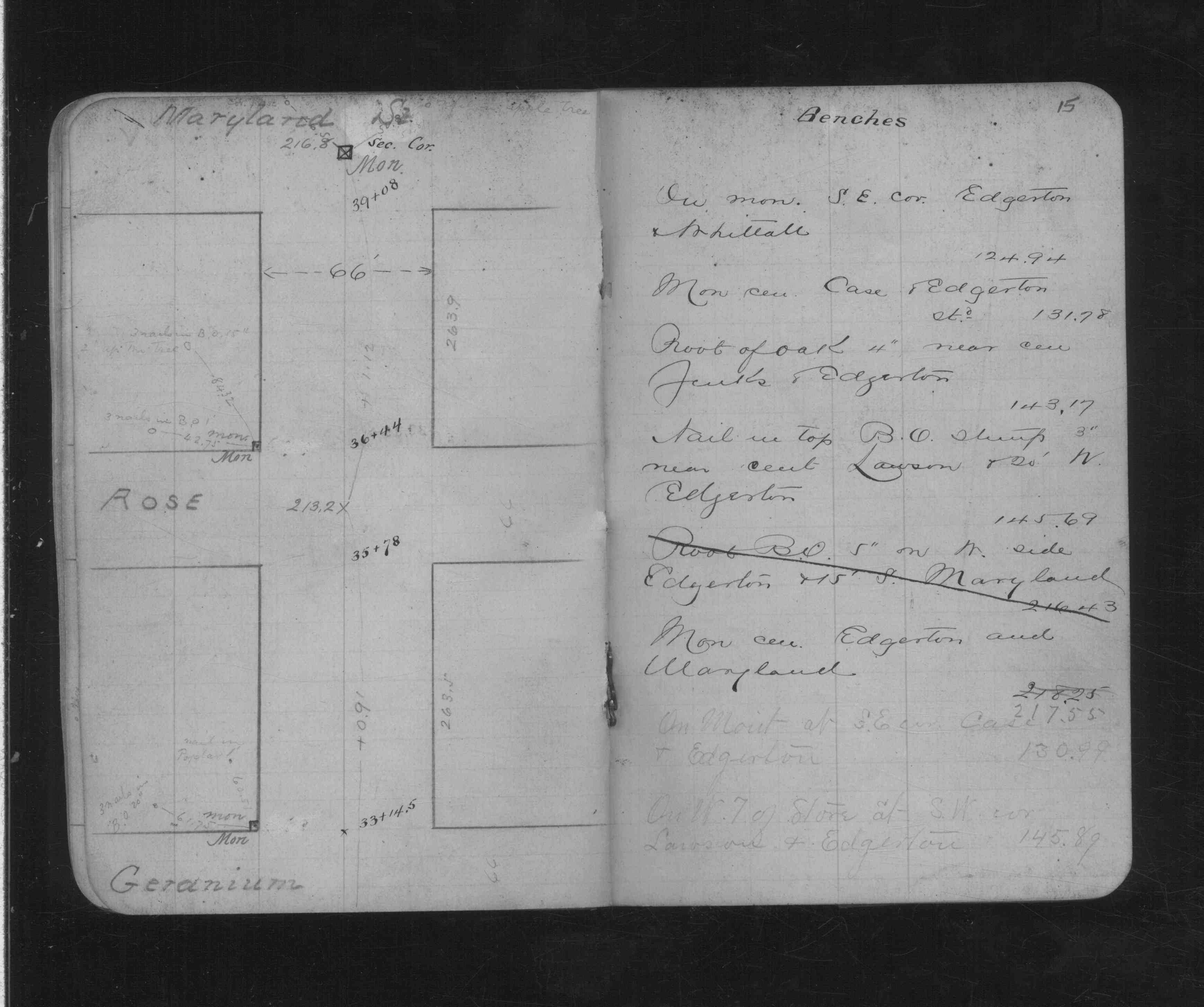
| 1/1/1887 | (Unknown date Jan __, 1887 ) Elev 217.55 ft on monument. See CS 179 p.15 |
| 1/1/1887 | (Unknown date ___ __, 1887 ) Monument reset by Chas Hunt after grading Edgerton St |
| 11/1/1847 | (Unknown date Nov __, 1847 ) Isaac N Higbee deputy surveyor set post. Tied to 2 BTs. See IH p.212-213 2922 |
| 1/1/1800 | (Unknown date ___ __, ____ ) Monument set by Armstrong |
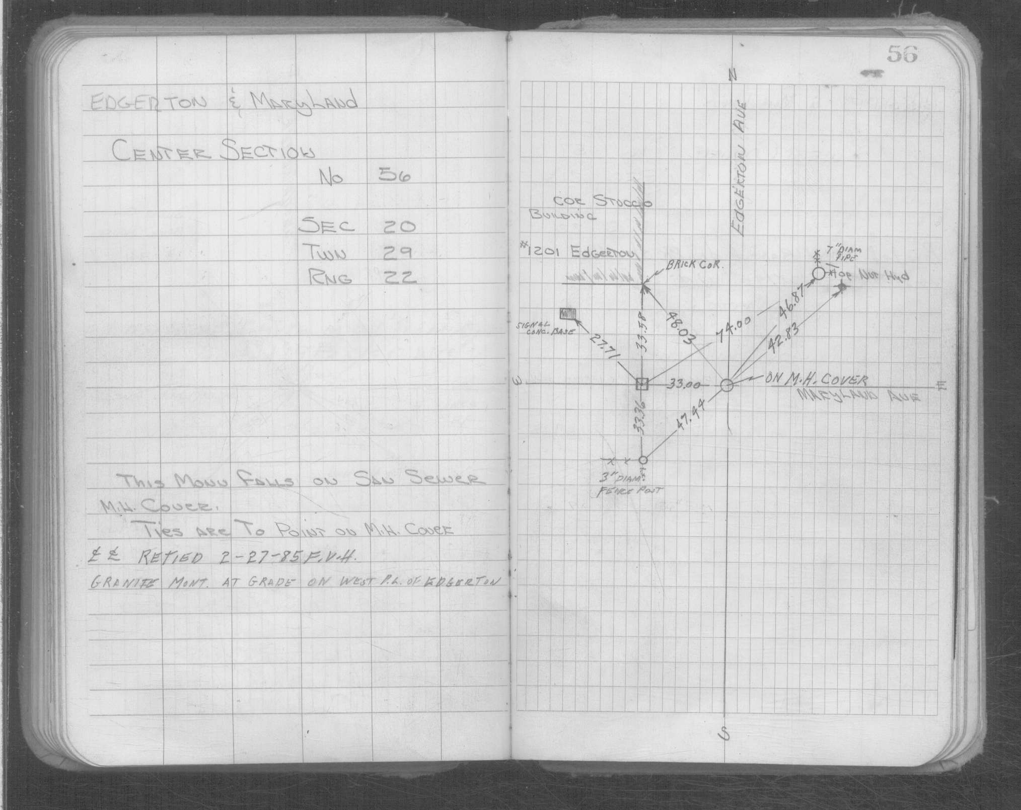
| 1/1/1800 | (Unknown date ___ __, ____ ) Monument falls on saitary MH cover; GM 33.00 ft west on Edgerton P.L. |
Above is NOT an all inclusive history of this point. Please review all the links below.
| PLS NOTES | Field | Cross Section | Sewer | J.B. Irvine | Monument | River Survey |
|---|---|---|---|---|---|---|
| IH p.212-213 | FB 0148p.34 | CS 0179p.15 | ||||
| FB 0209p. 03 ,19 | ||||||
| FB 0293CPYp. 07 ,49 | ||||||
| FB 1361p.21 | ||||||
| FB 1421Ap.21 | ||||||
| FB 1421Ap.28 | ||||||
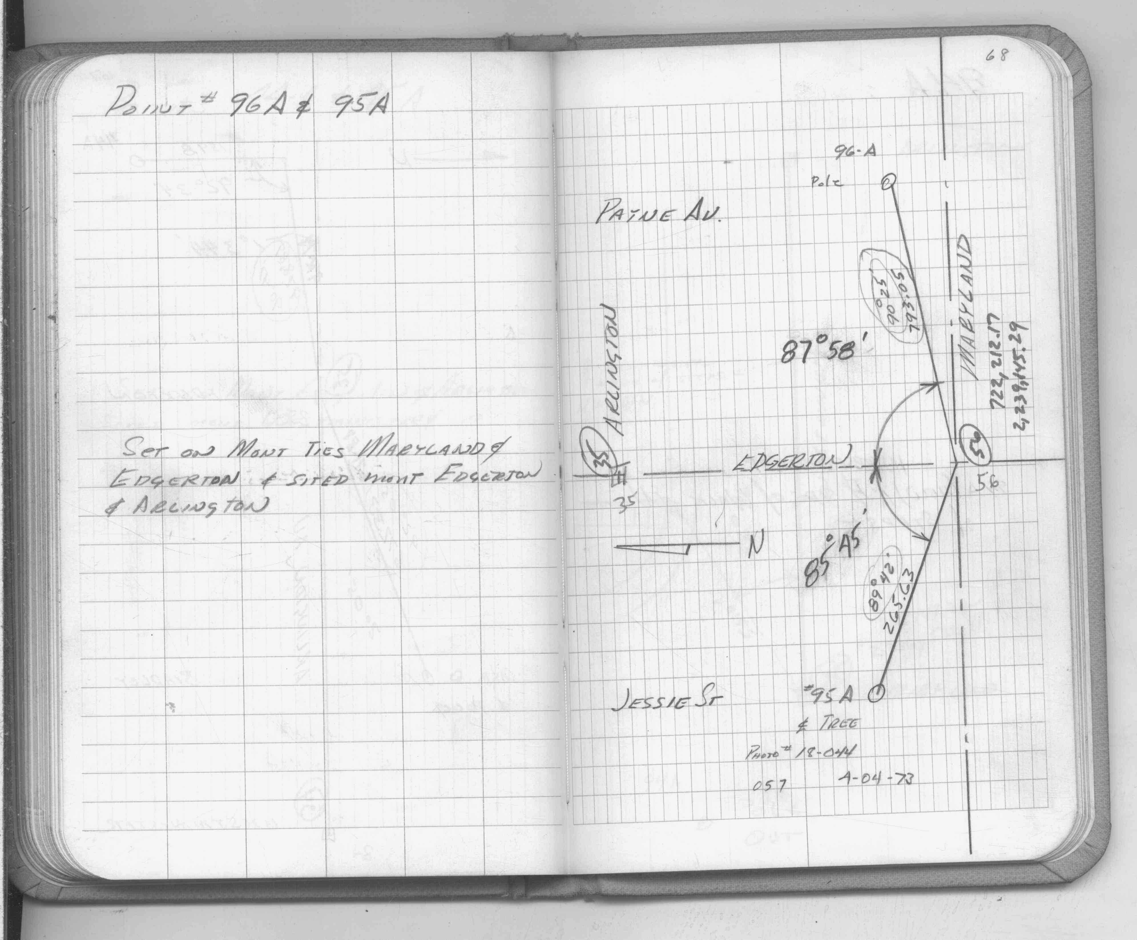
| FB 1549Fp.68 | ||||||
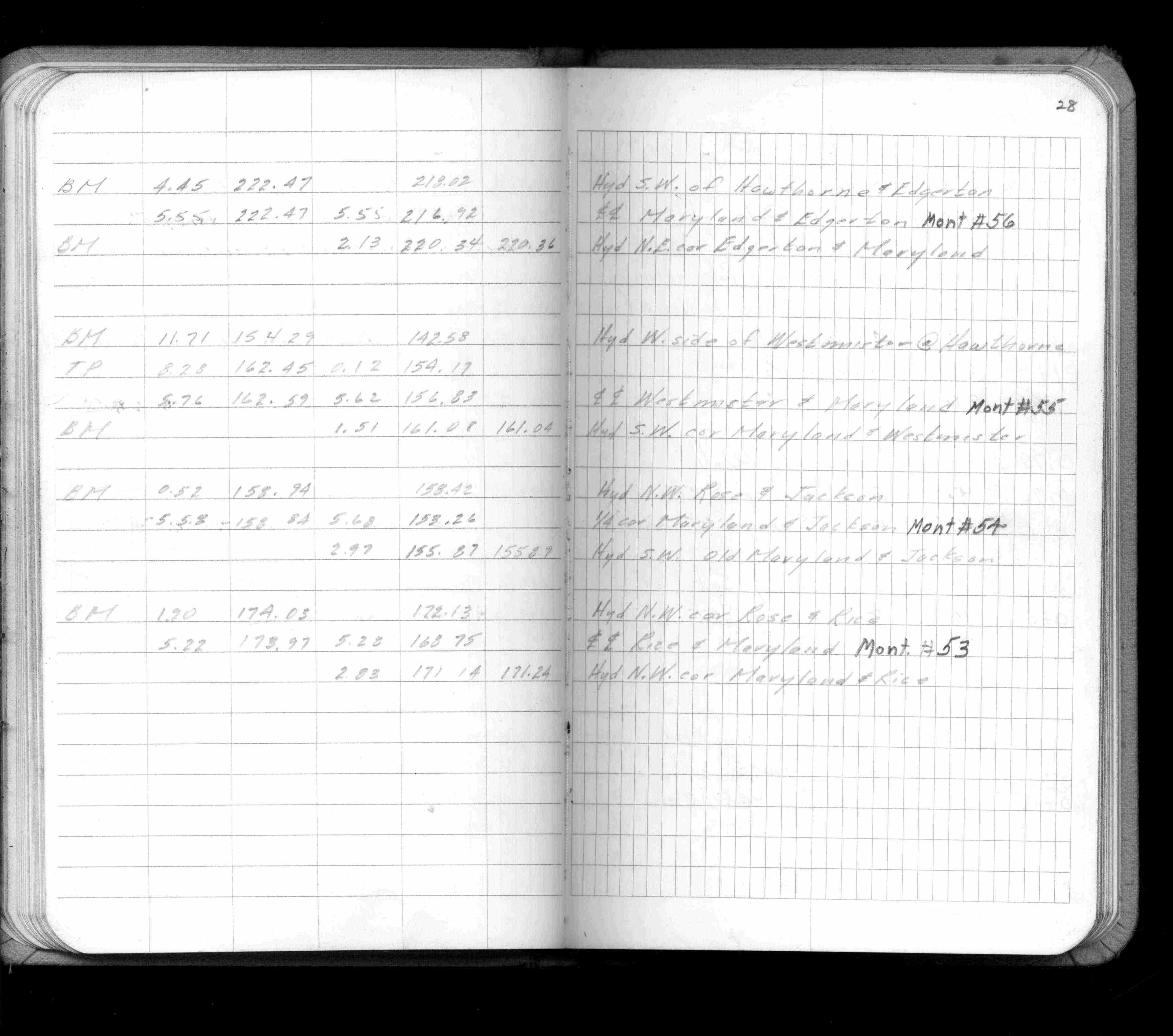
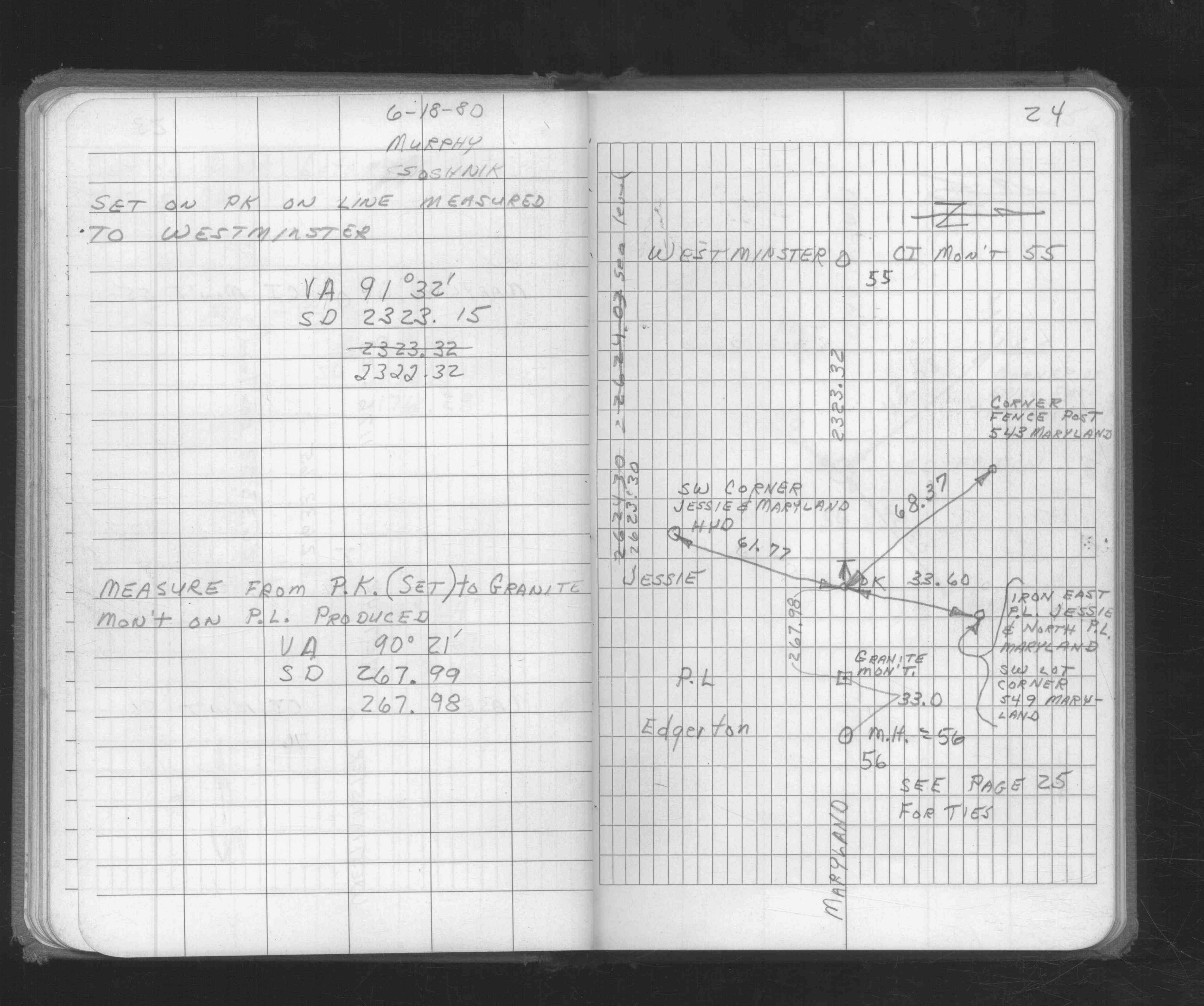
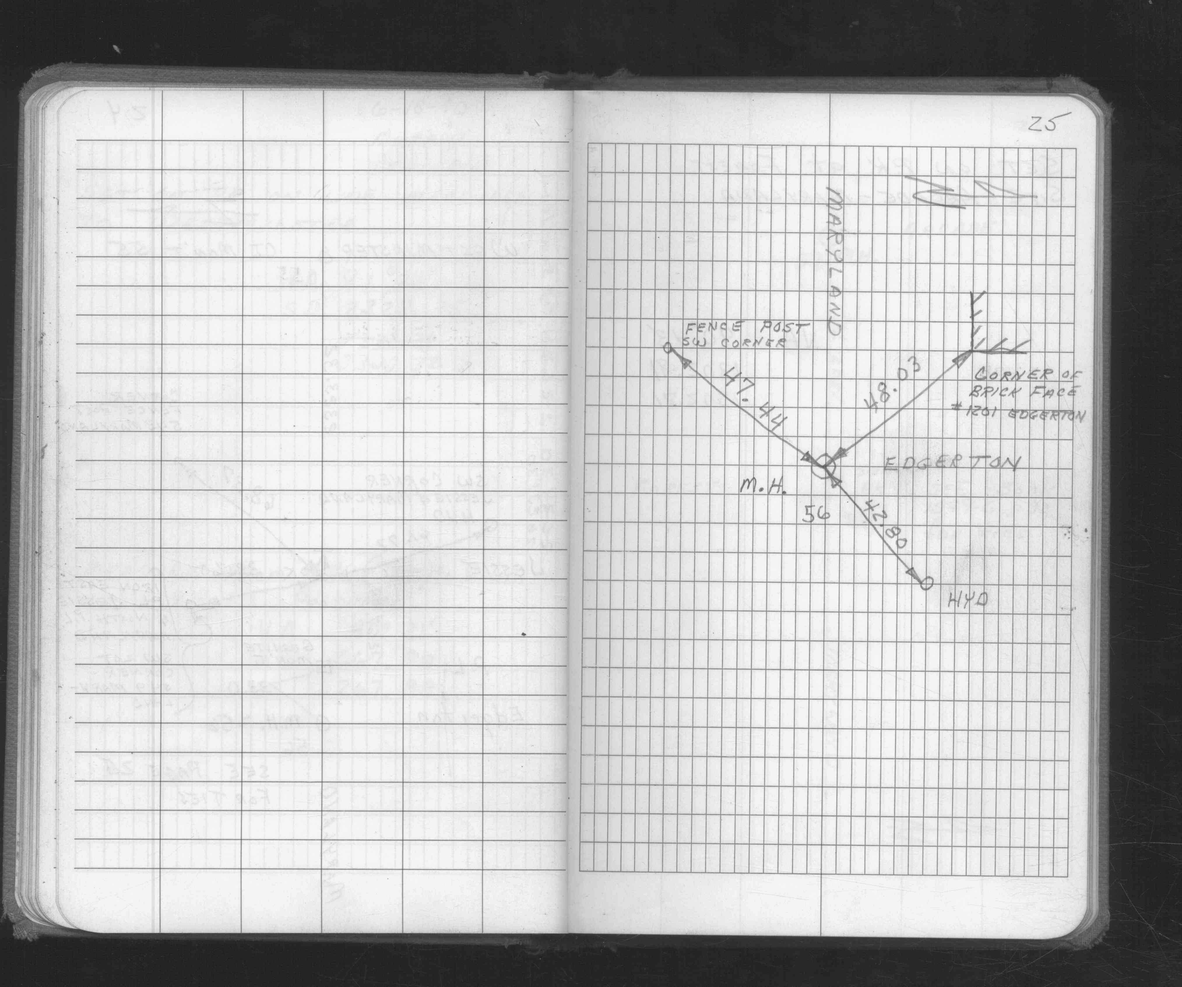
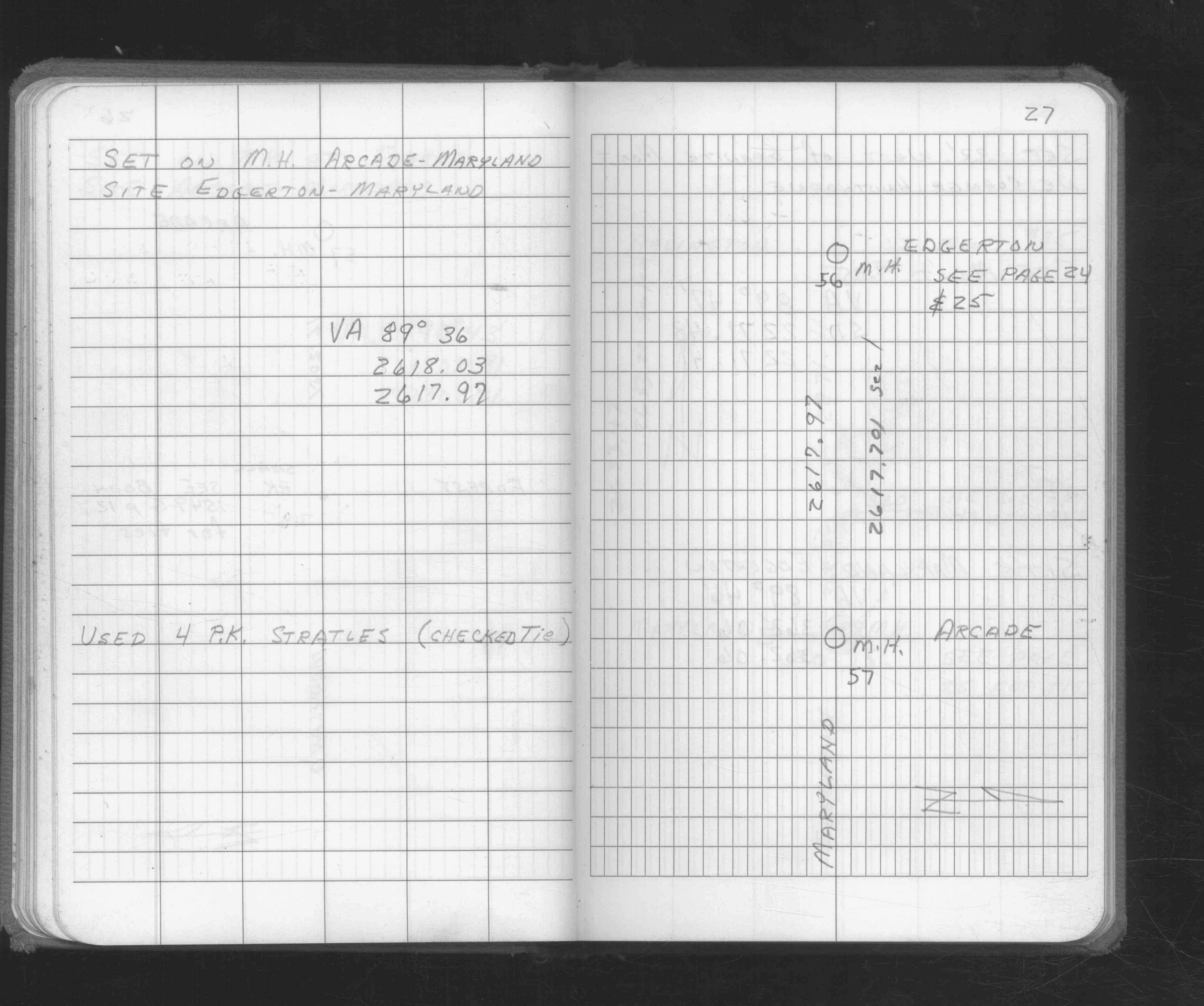
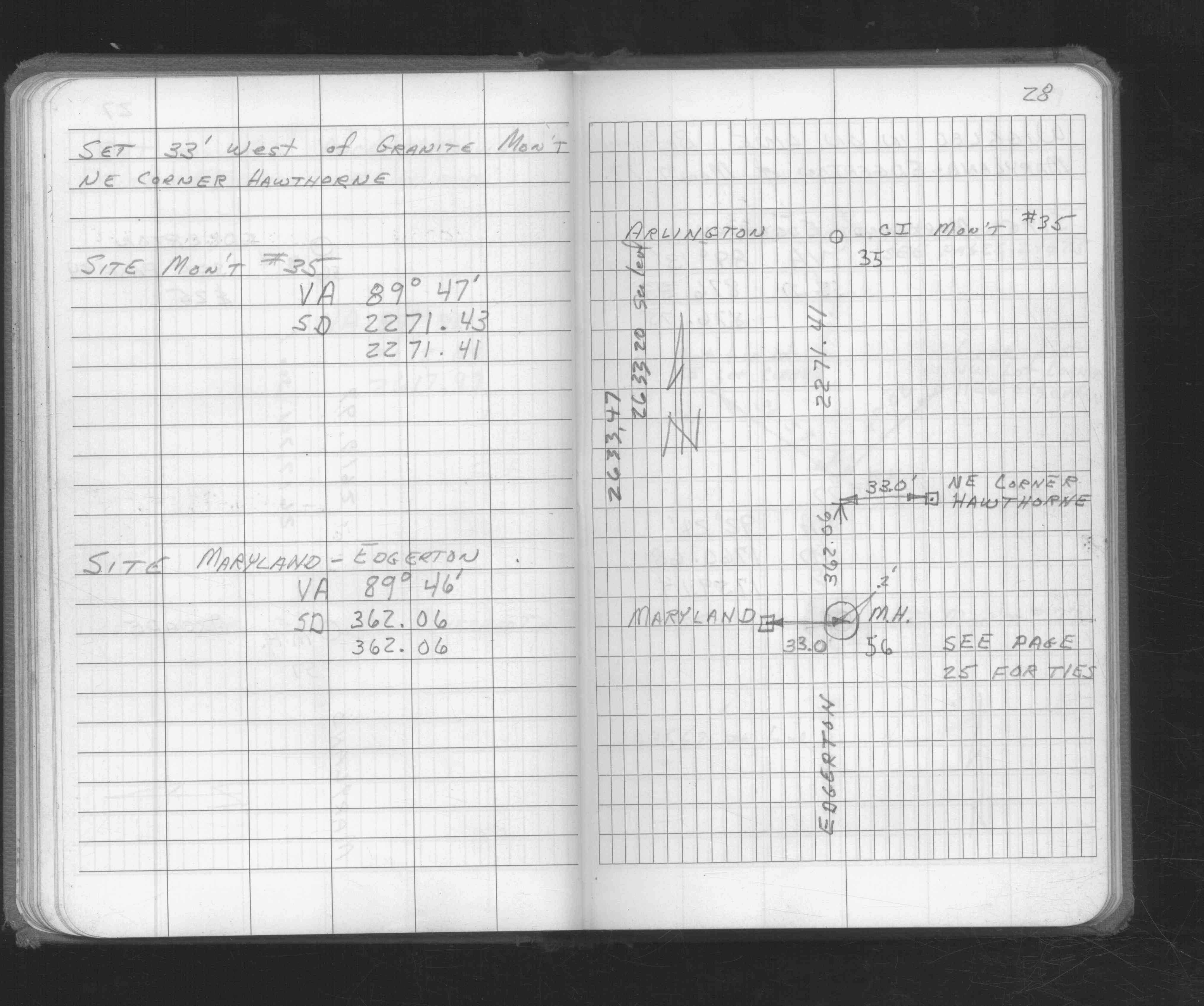
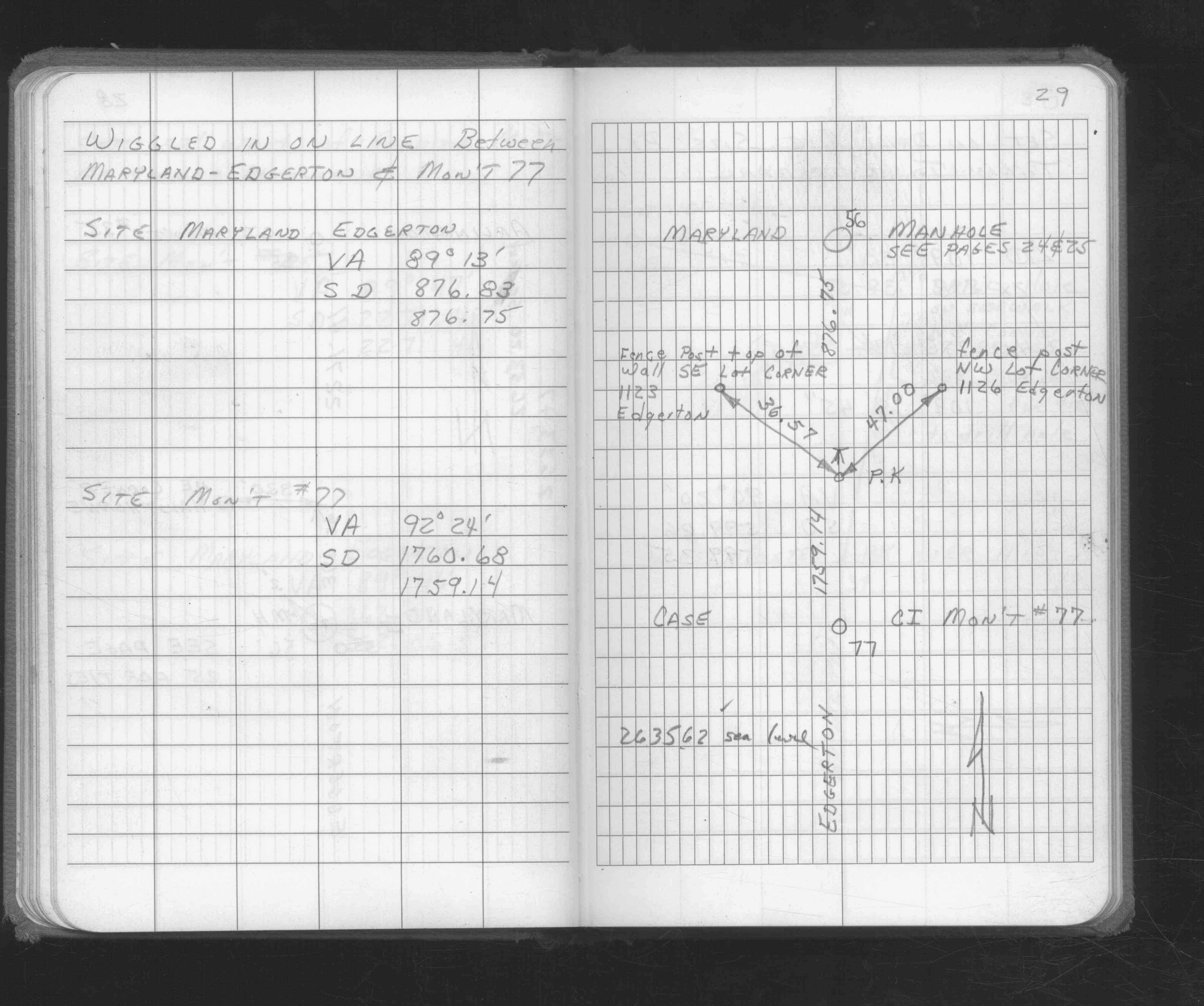
| FB 1676p. 24 ,25 ,27 ,28 ,29 | ||||||
| FB 1689Ap.10 | ||||||
| FB 1689Ap.06 | ||||||
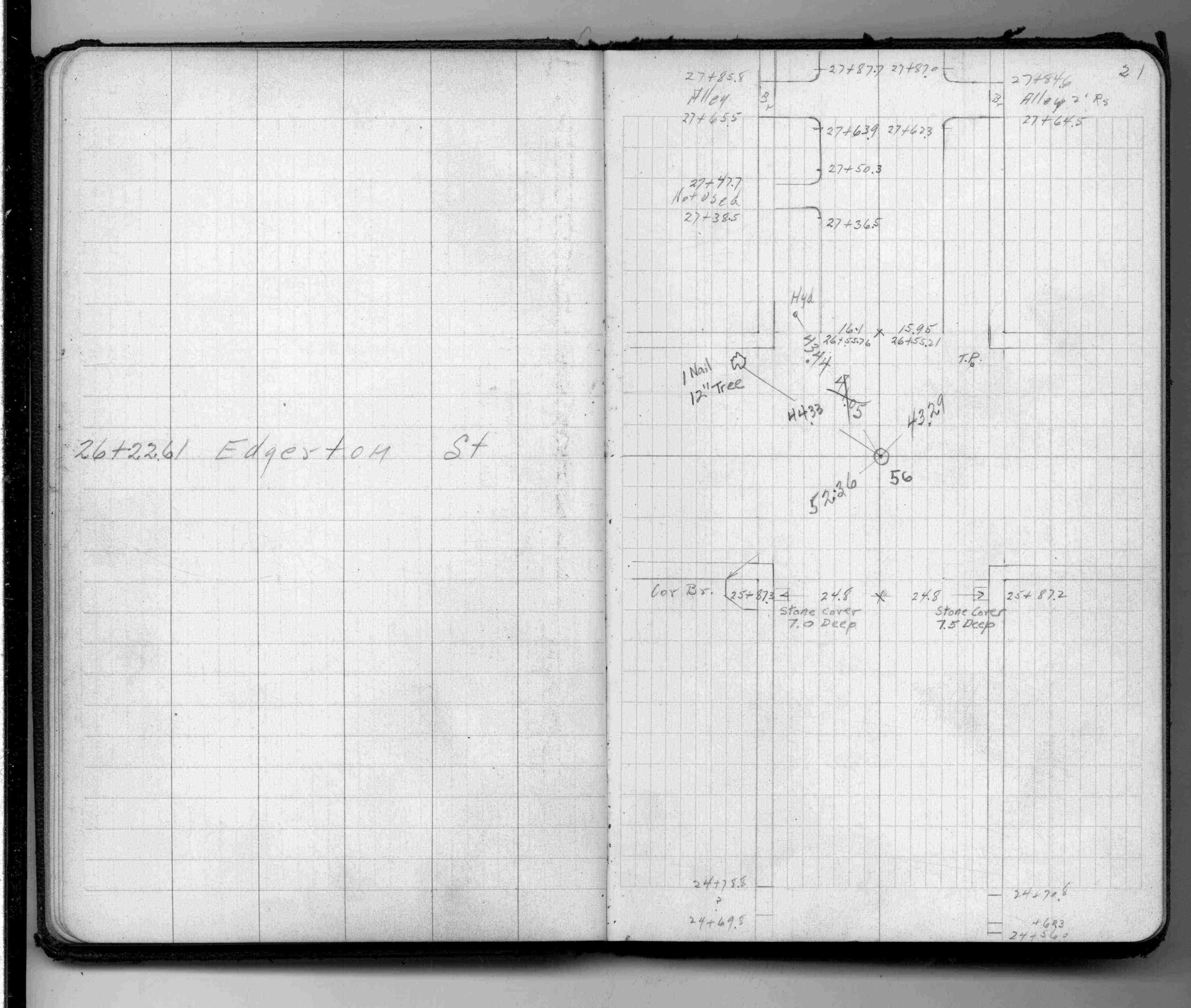
| FB 1736p.45 |
| FILE | SURVEYOR | LIC. NO. | DATE SIGNED | DATE TIED |
|---|---|---|---|---|
| ST_001-078p056.jpg | none | none | none | none |
| FB1676p25.jpg | none | none | none | none |
| 0056-0023-A.dwf | none | none | none | none |