| NAD83 COORDINATES (1986 adj.): |
|---|
| * X= 550728.43 Y= 165305.4 Z= 0 CMP 1/17/1992 |
| 3/31/2000 | Fd CIM 0.20 ft below grade (placed fabric target for 2000 aerial) |
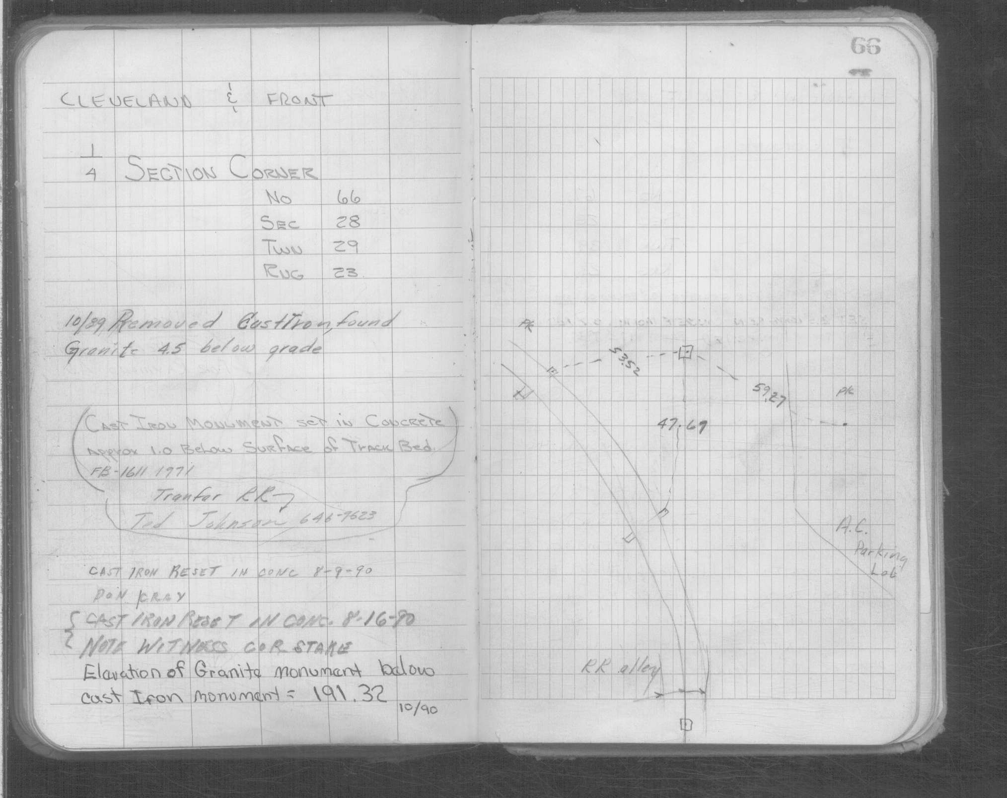
| 10/1/1990 | (Unknown date Oct __, 1990 ) Elev 191.32 ft on GM below CIM. See Yellow Tie Book. |
| 8/16/1990 | Fd CIM in place; placed witness corner guard stake |
| 8/9/1990 | Reset CIM in concrete. See Yellow Tie Book. |
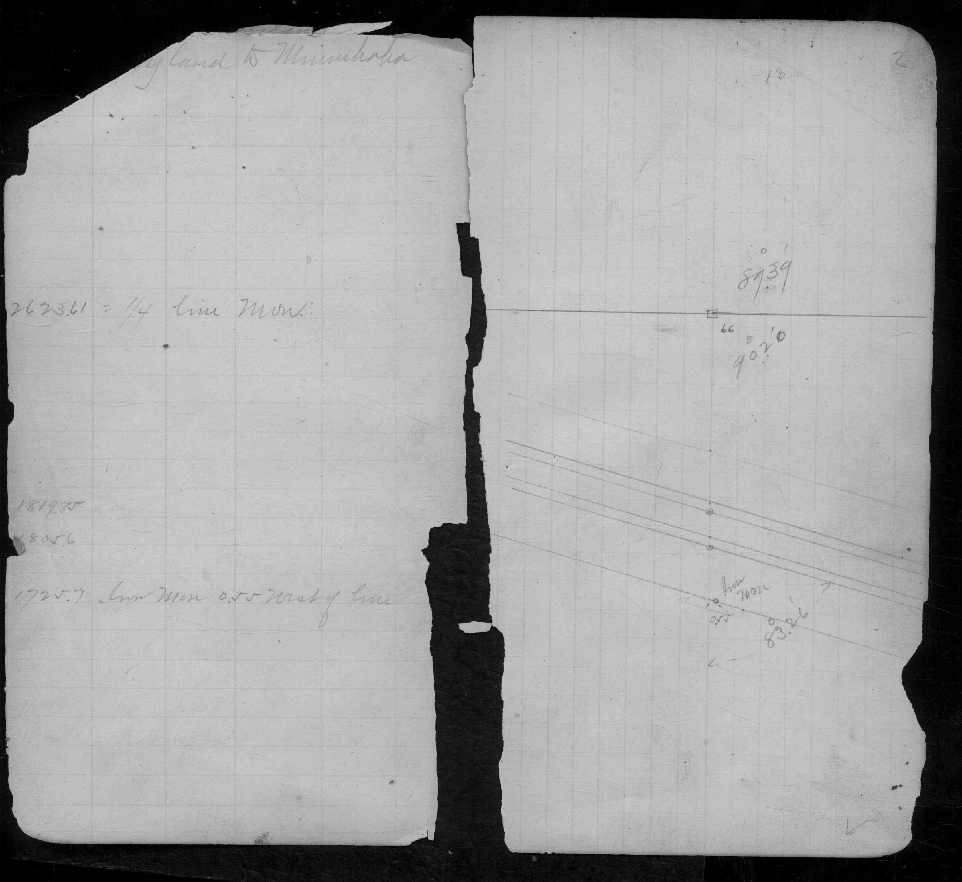
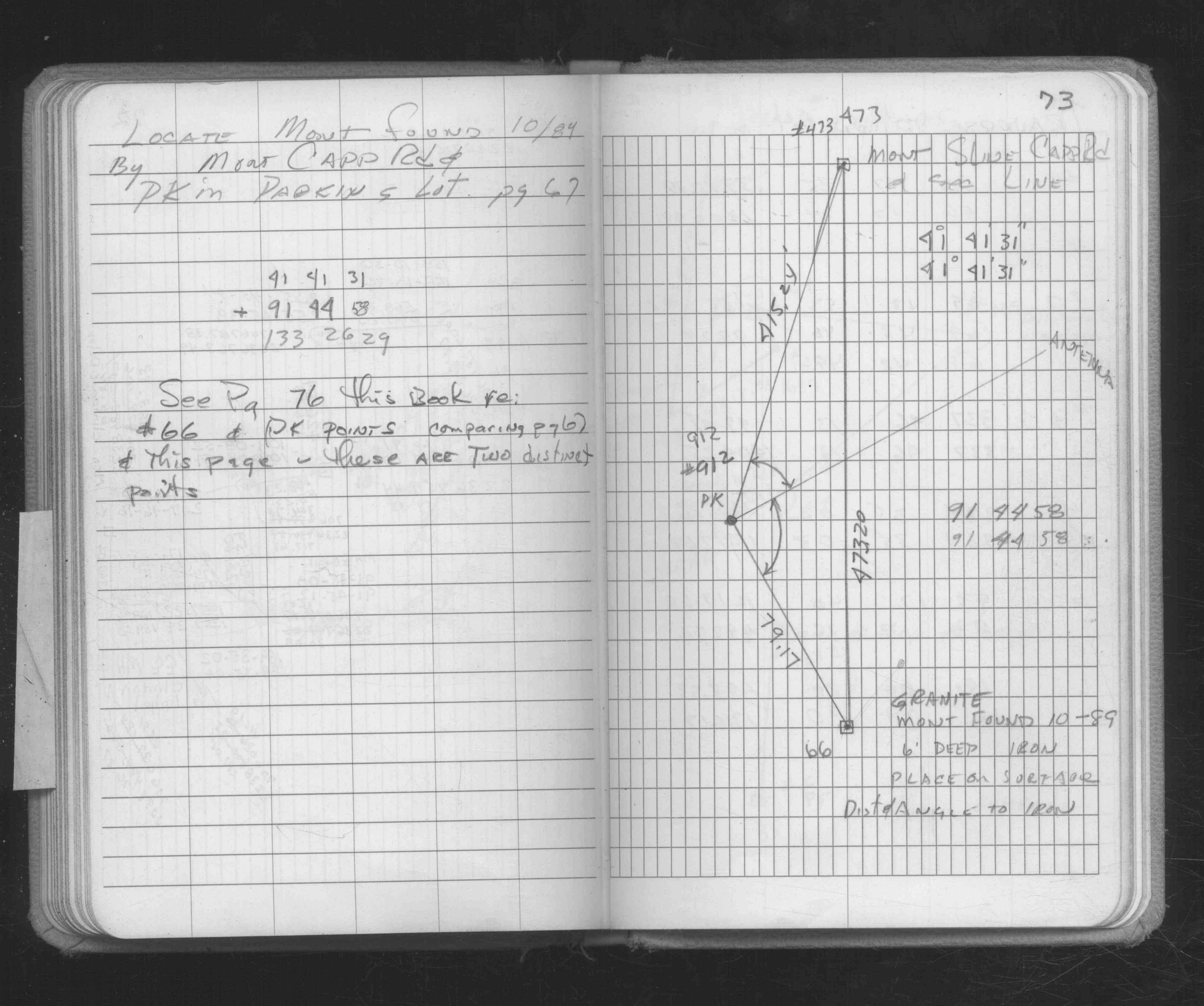
| 10/1/1989 | (Unknown date Oct __, 1989 ) Removed CIM, found GM 4.5 ft below grade. See Yellow Tie Book. |
| 10/1/1989 | (Unknown date Oct __, 1989 ) Fd GM at Elev. 191.32 ft approx 4.5 to 5.0 feet below grade. See Section folder |
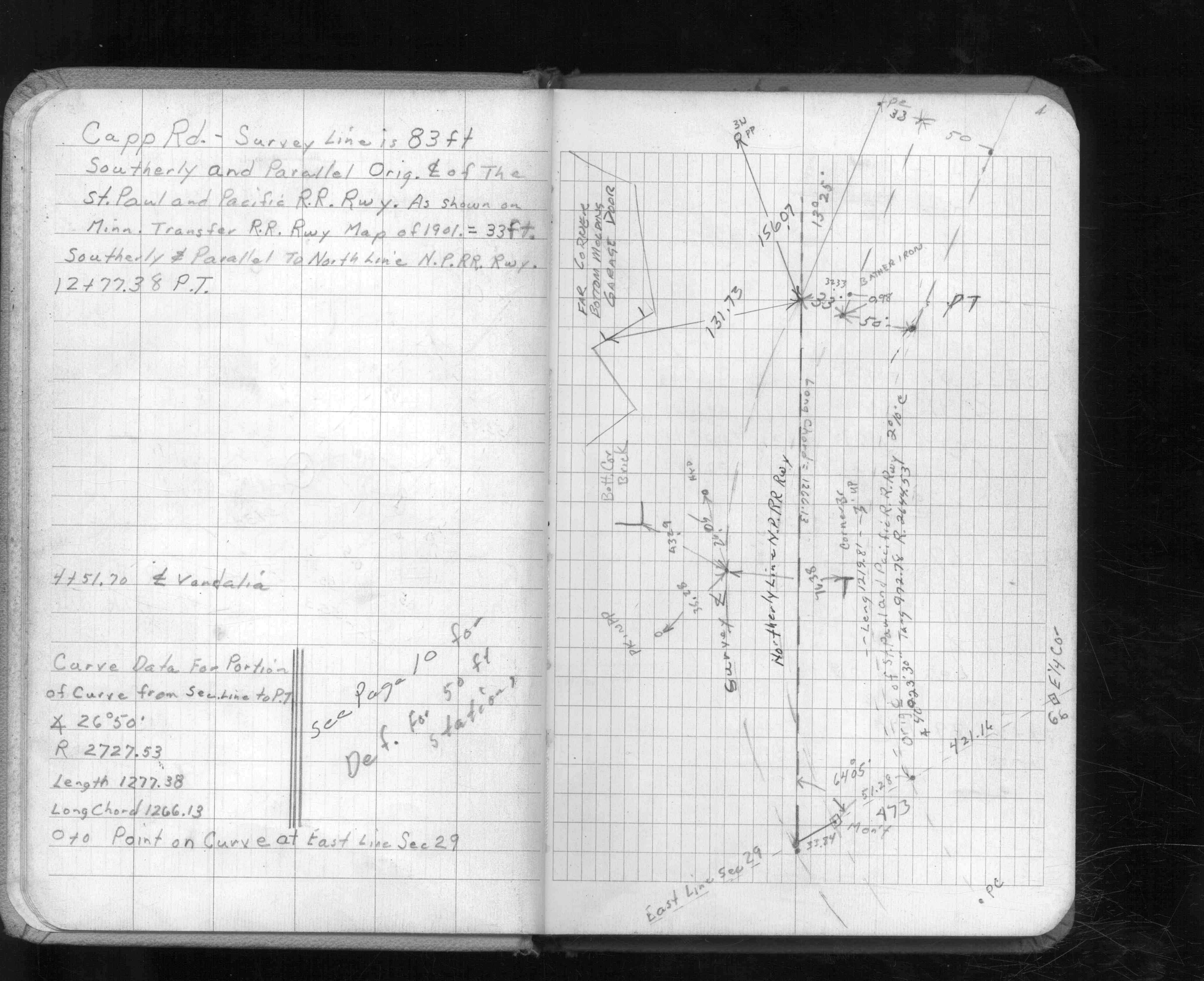
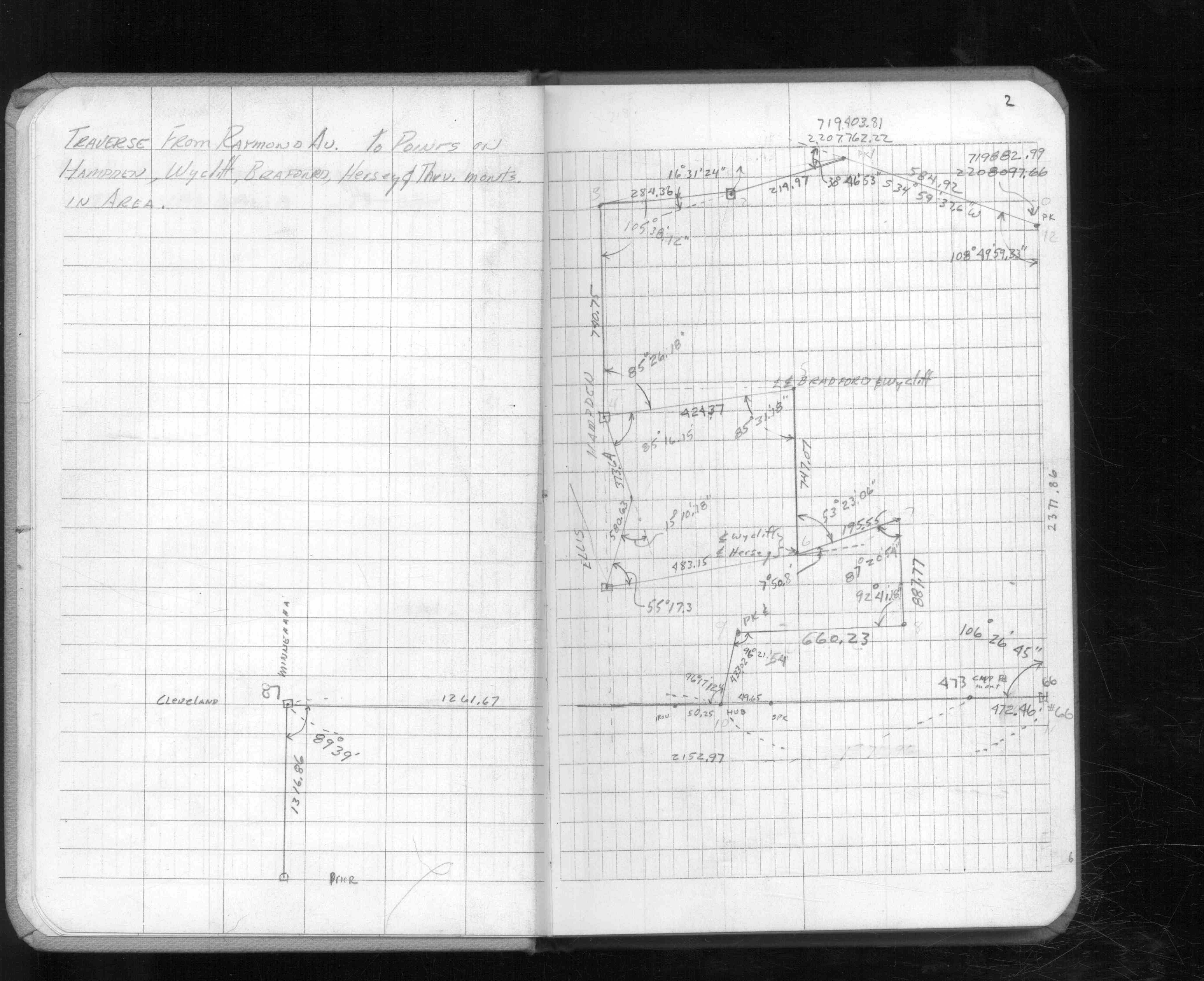
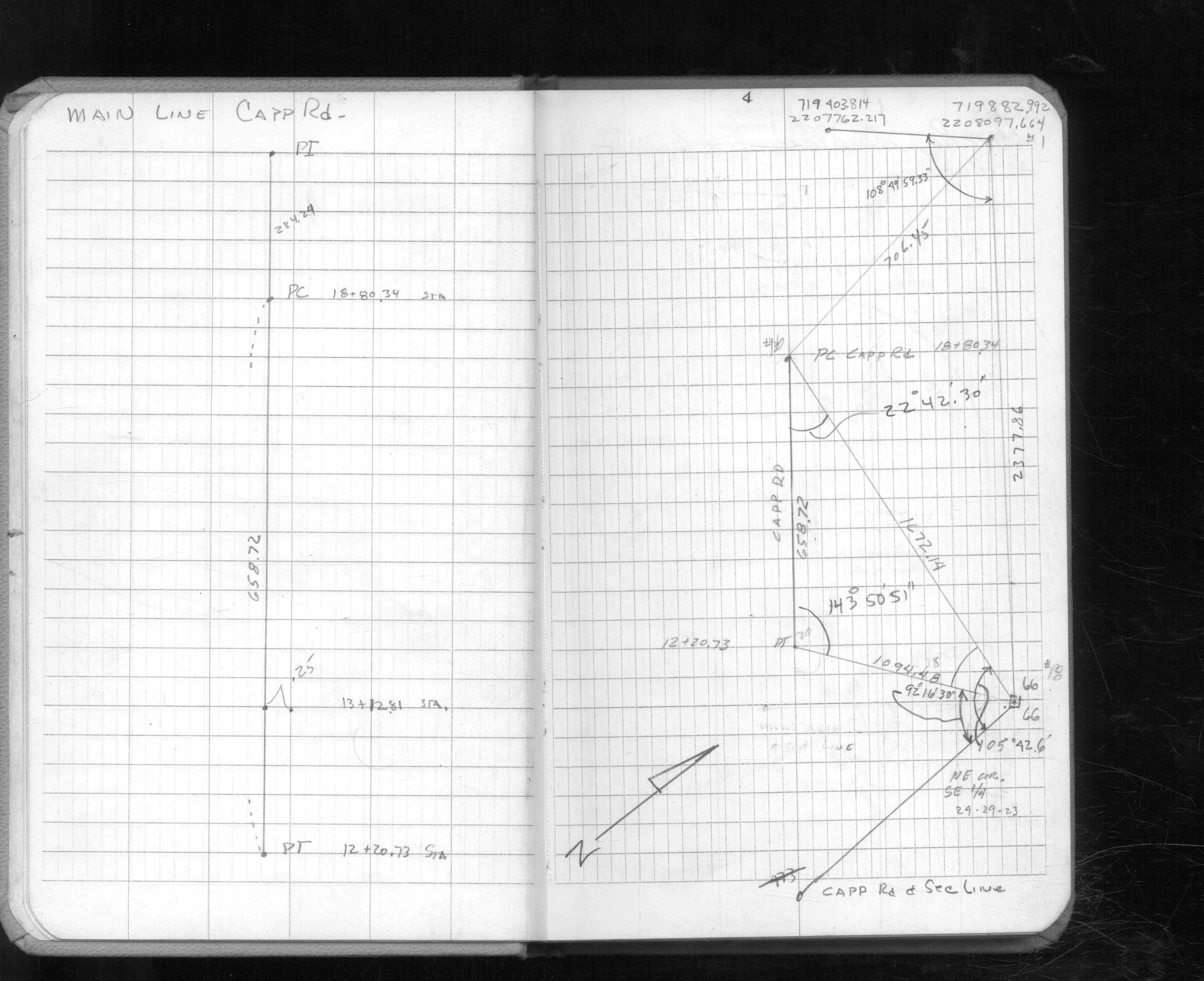
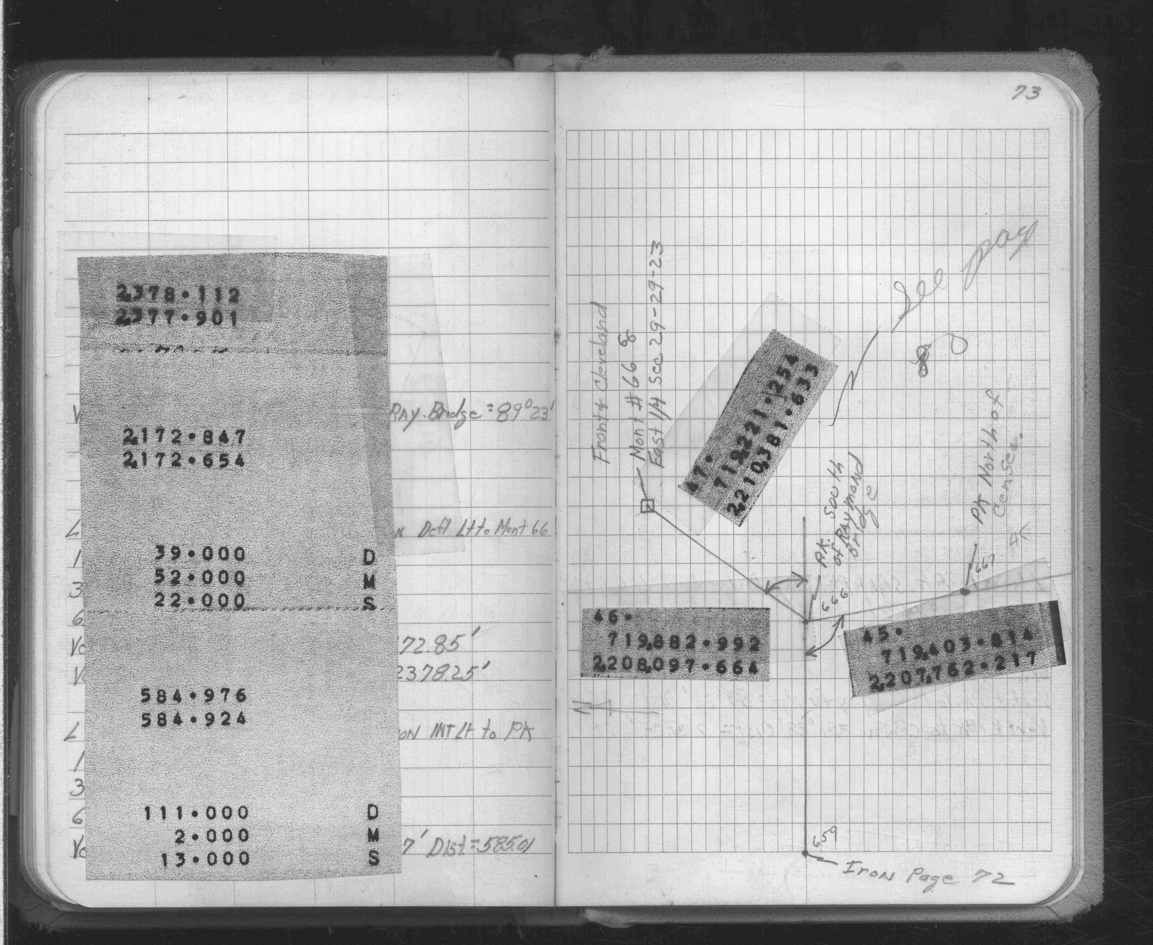
| 3/1/1971 | (Unknown date Mar __, 1971 ) CIM set in concrete approx. 1.0 foot below surface of track bed. |
| 2/11/1934 | Placed ties on the GM 3 ft. below grade. See book MSX 4 p.30 |
| 9/1/1887 | (Unknown date Sep __, 1887 ) Monument set by J H Armstrong |
| 11/1/1847 | (Unknown date Nov __, 1847 ) Corner not set during PLS. Fell in Lake/swamp. WC (see 1321) set S of cor. |
Above is NOT an all inclusive history of this point. Please review all the links below. Yellow Tie Books are 'ST' in the Monument category.
| PLS NOTES | Field | Cross Section | Sewer | J.B. Irvine | Monument | River Survey |
|---|---|---|---|---|---|---|
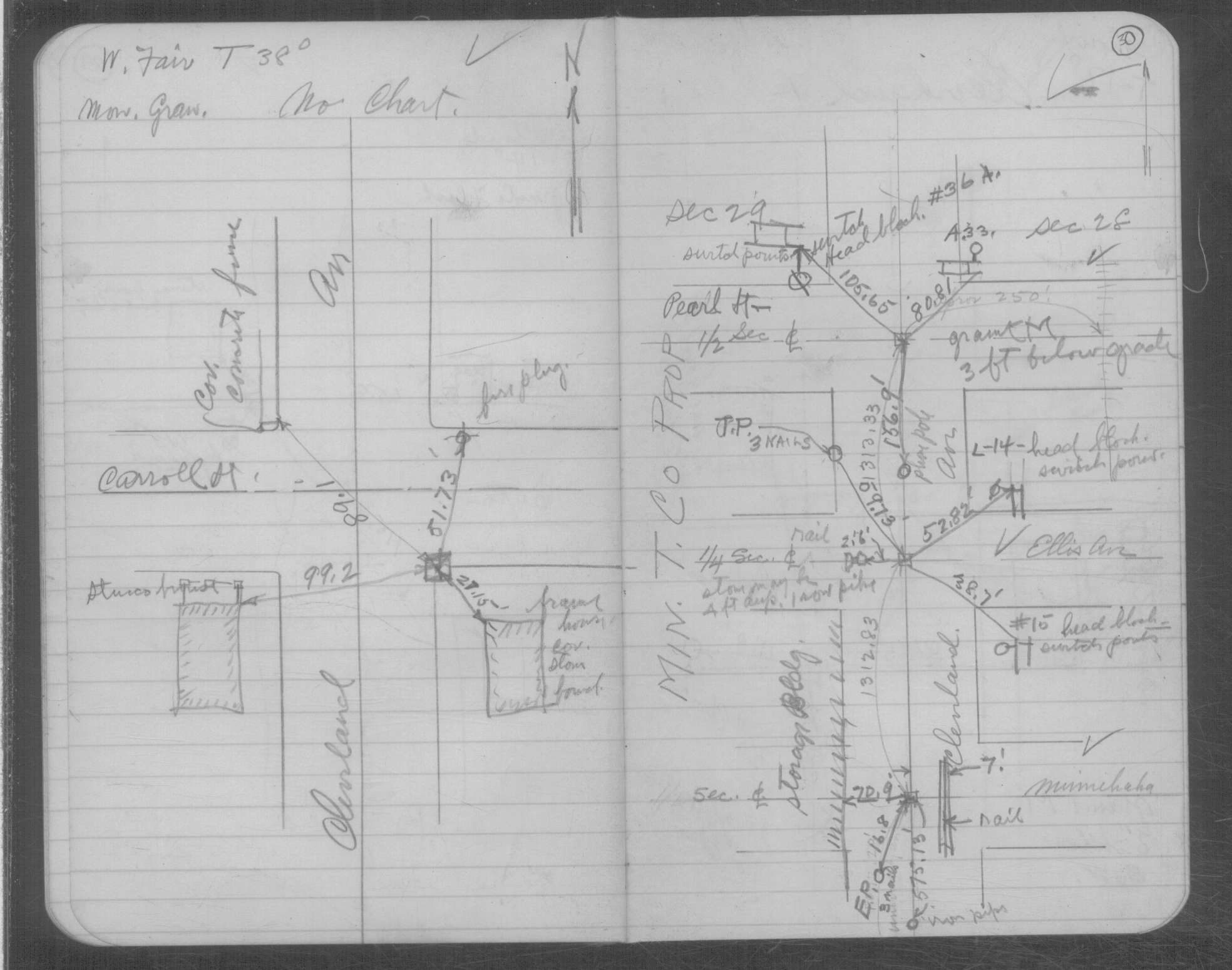
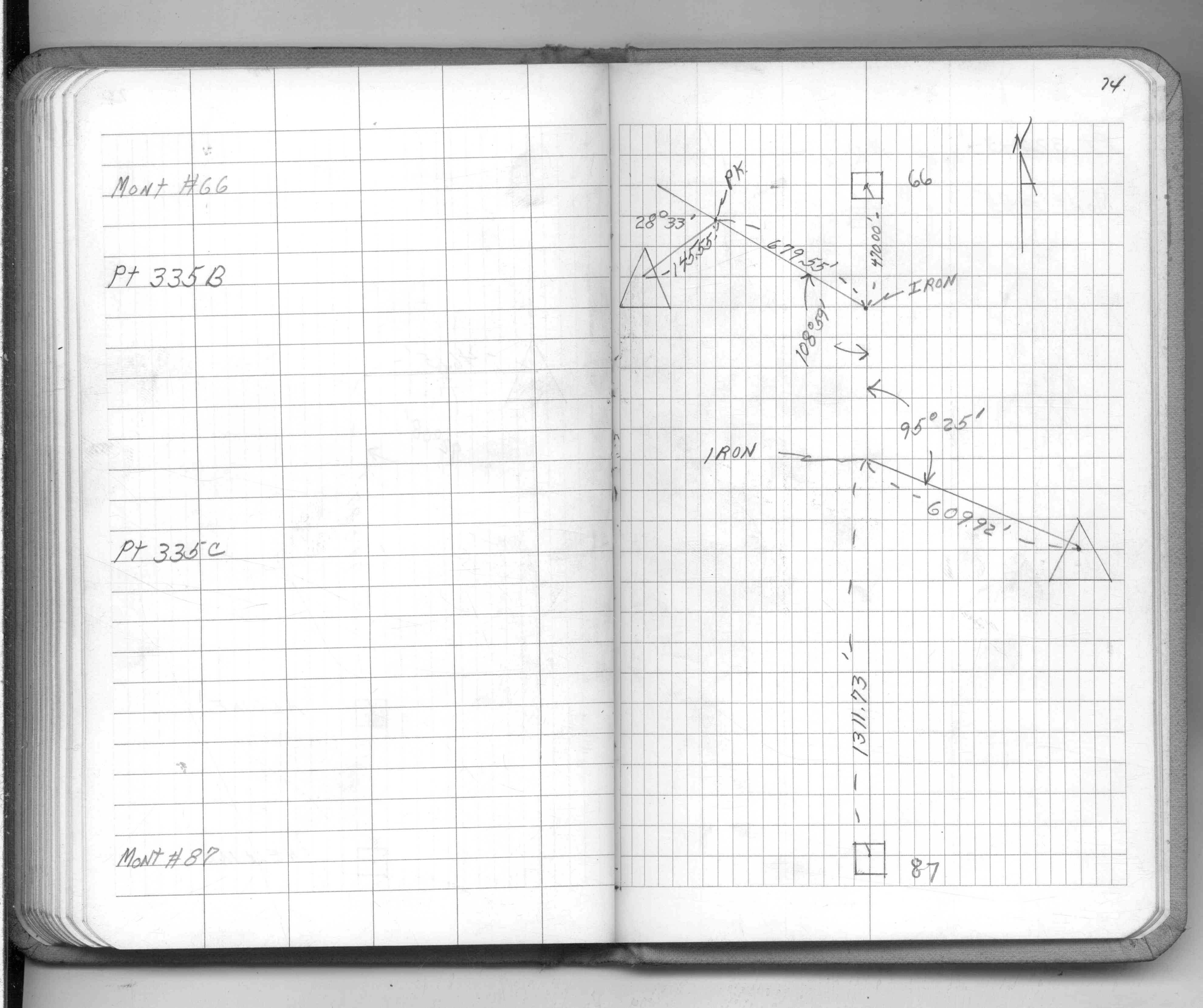
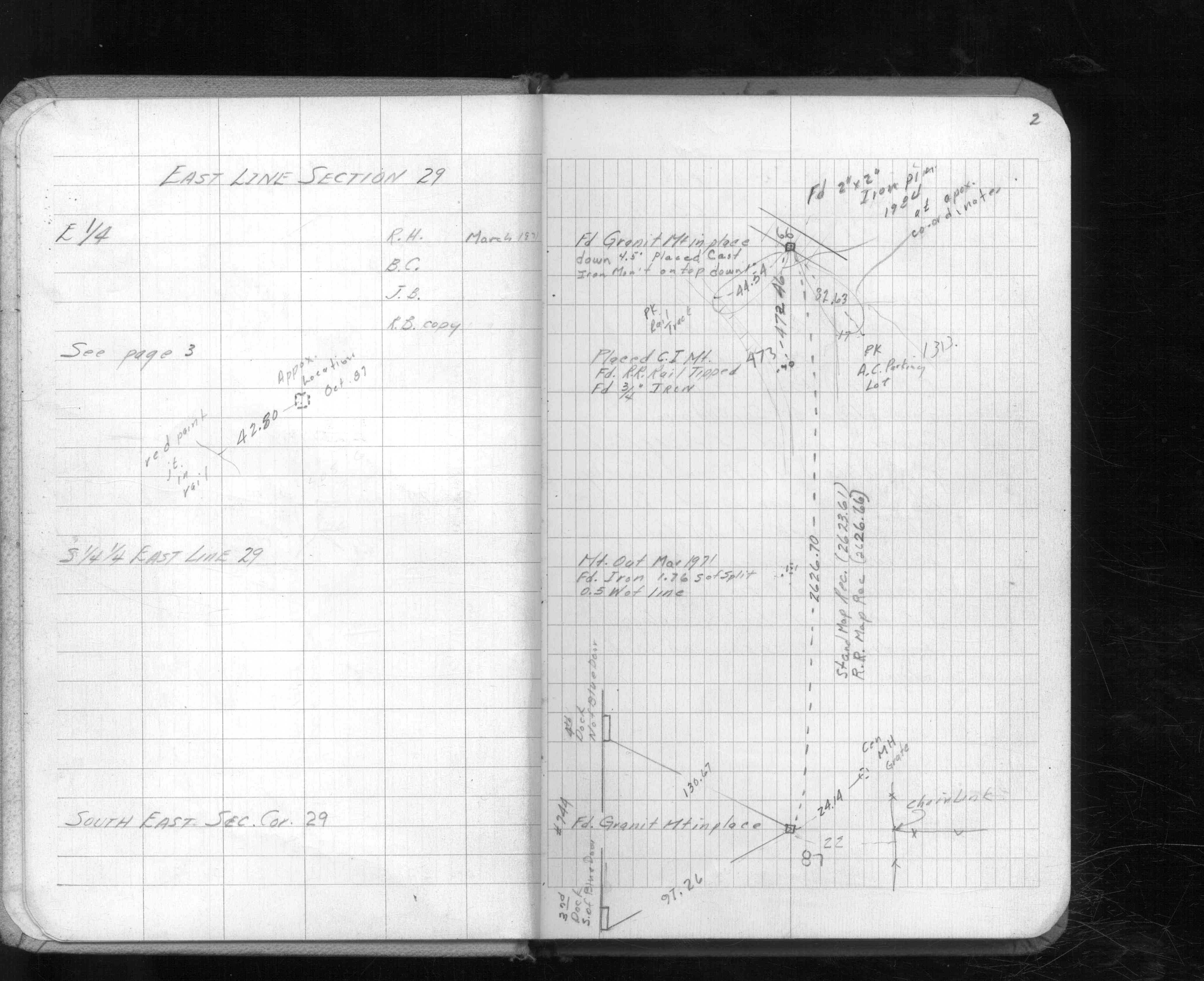
| FB 0216p. 02 ,34 | ST 001-078 p.066 | |||||
| FB 0335CPYp.07 | MSX 0004 p.030 | |||||
| FB 1549Cp.74 | ||||||
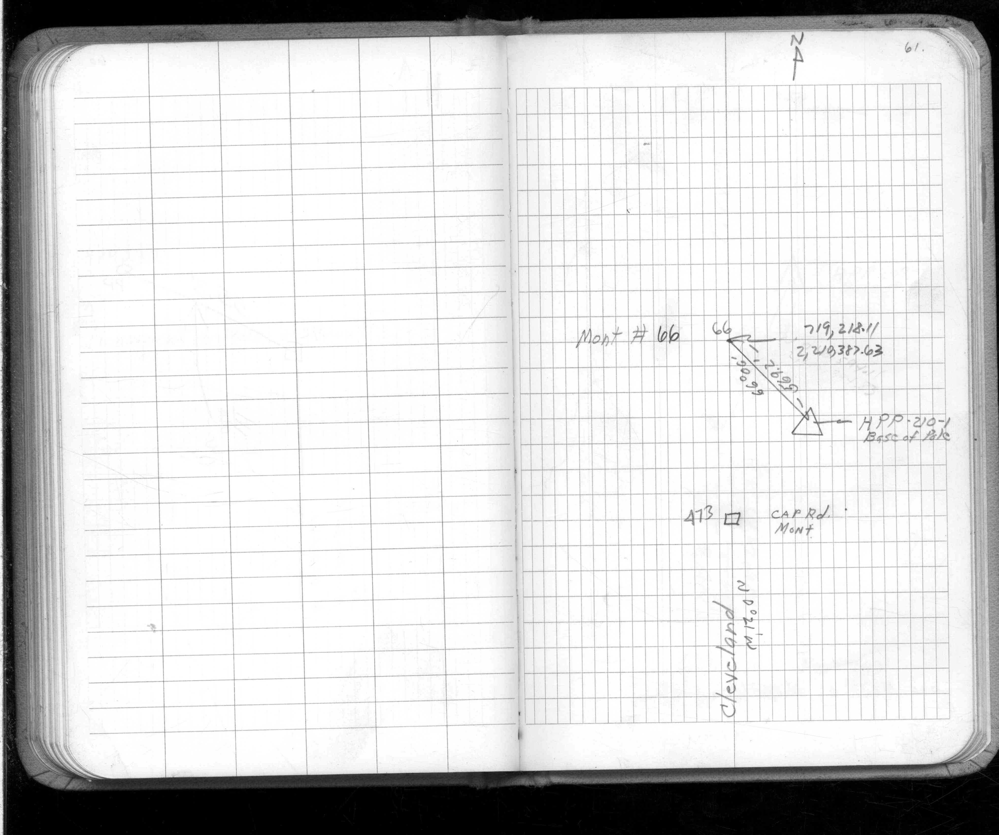
| FB 1549D2p.61 | ||||||
| FB 1611p. 02 ,04 | ||||||
| FB 1611Ap. 02 ,04 ,17 | ||||||
| FB 1634Ap.73 | ||||||
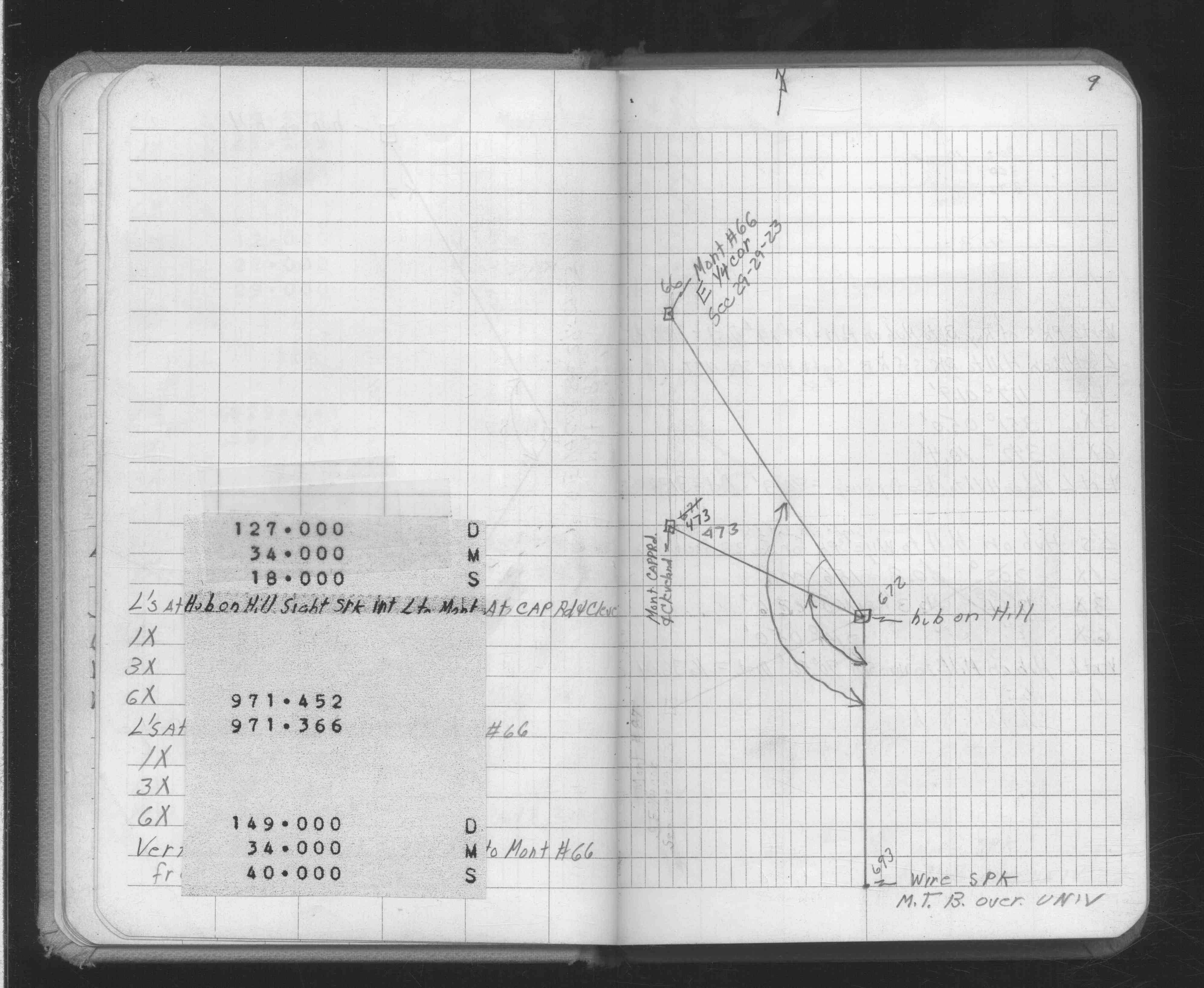
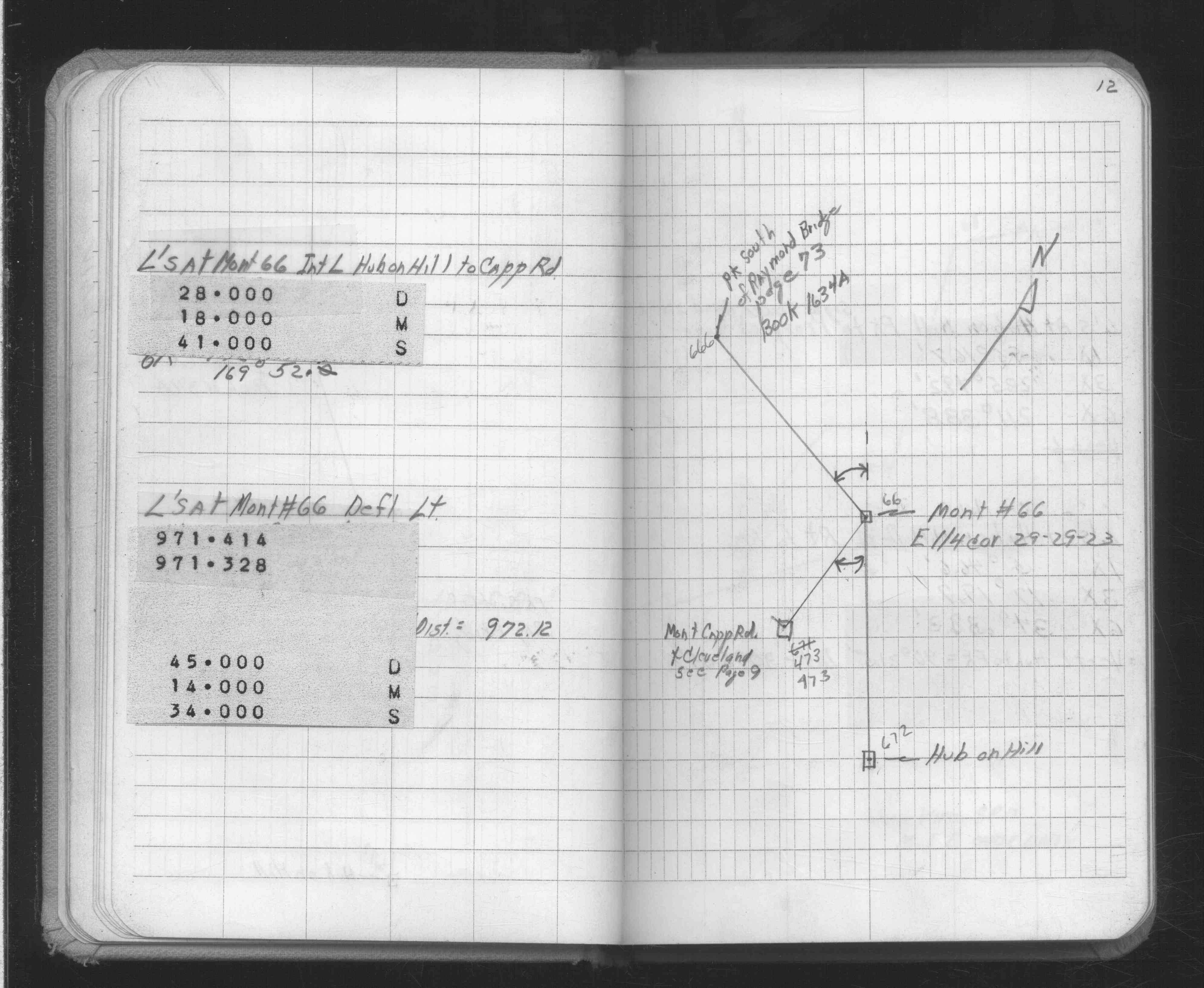
| FB 1634Bp. 09 ,12 | ||||||
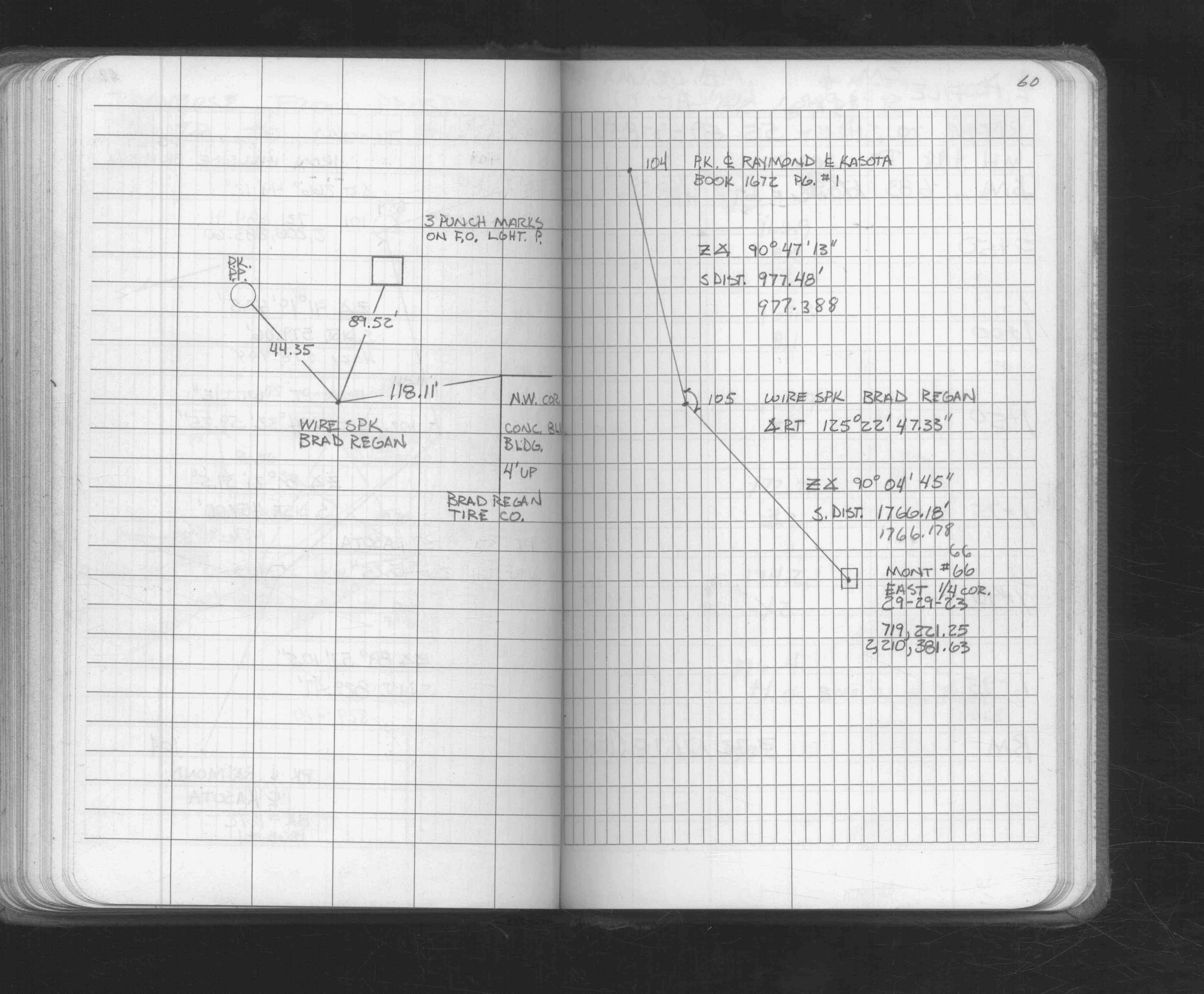
| FB 1672p.60 | ||||||
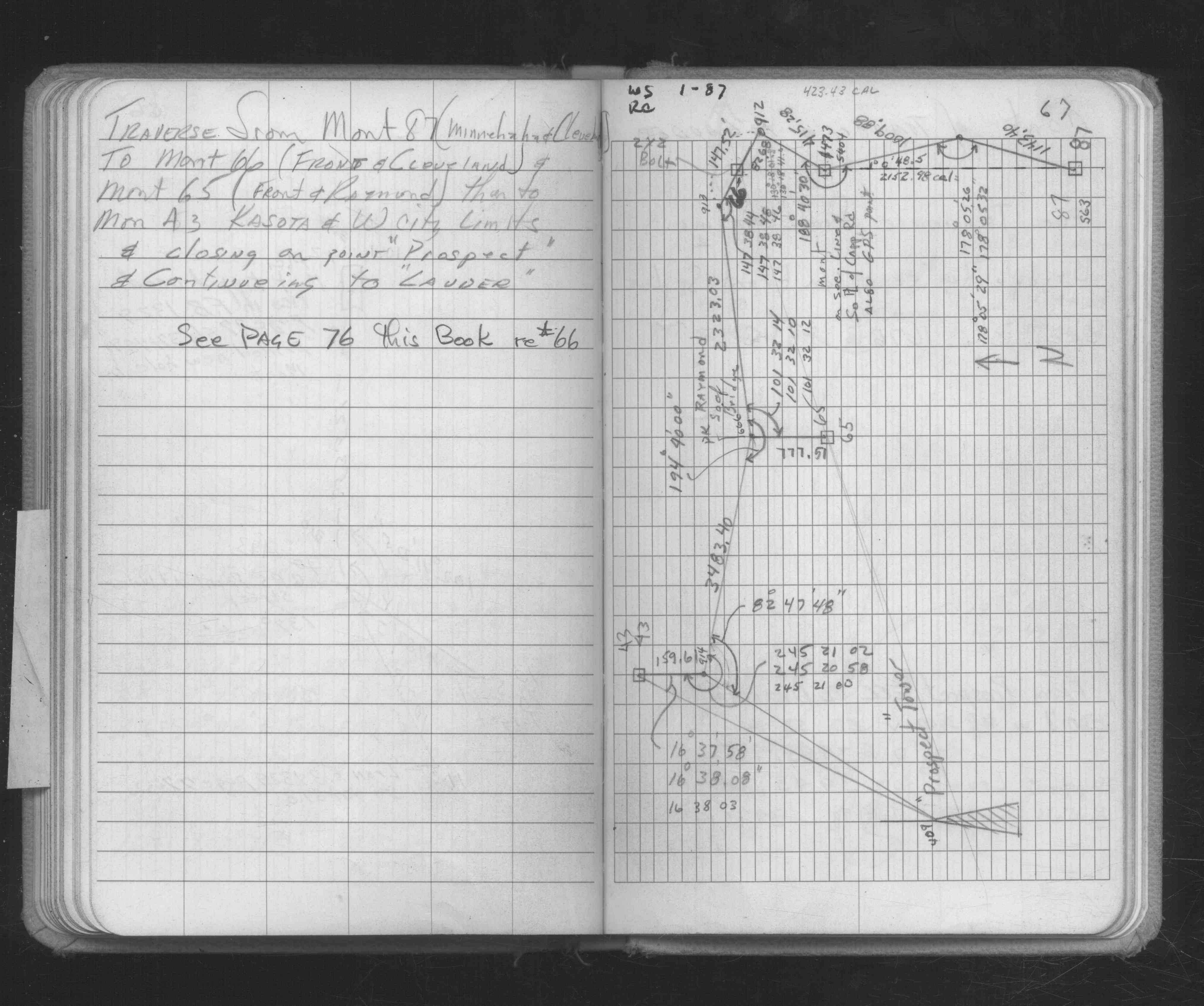
| FB 1686p. 67 ,73 | ||||||
| FB 1708Ap.33 |
| FILE | SURVEYOR | LIC. NO. | DATE SIGNED | DATE TIED |
|---|---|---|---|---|
| ST_001-078p066.jpg | none | none | none | none |
| 0066-1051-A.dwf | none | none | none | none |