| NAD83 COORDINATES (1986 adj.): |
|---|
| * X= 558627.25 Y= 165362 Z= 0 LSQ 12/6/1991 S FLT |
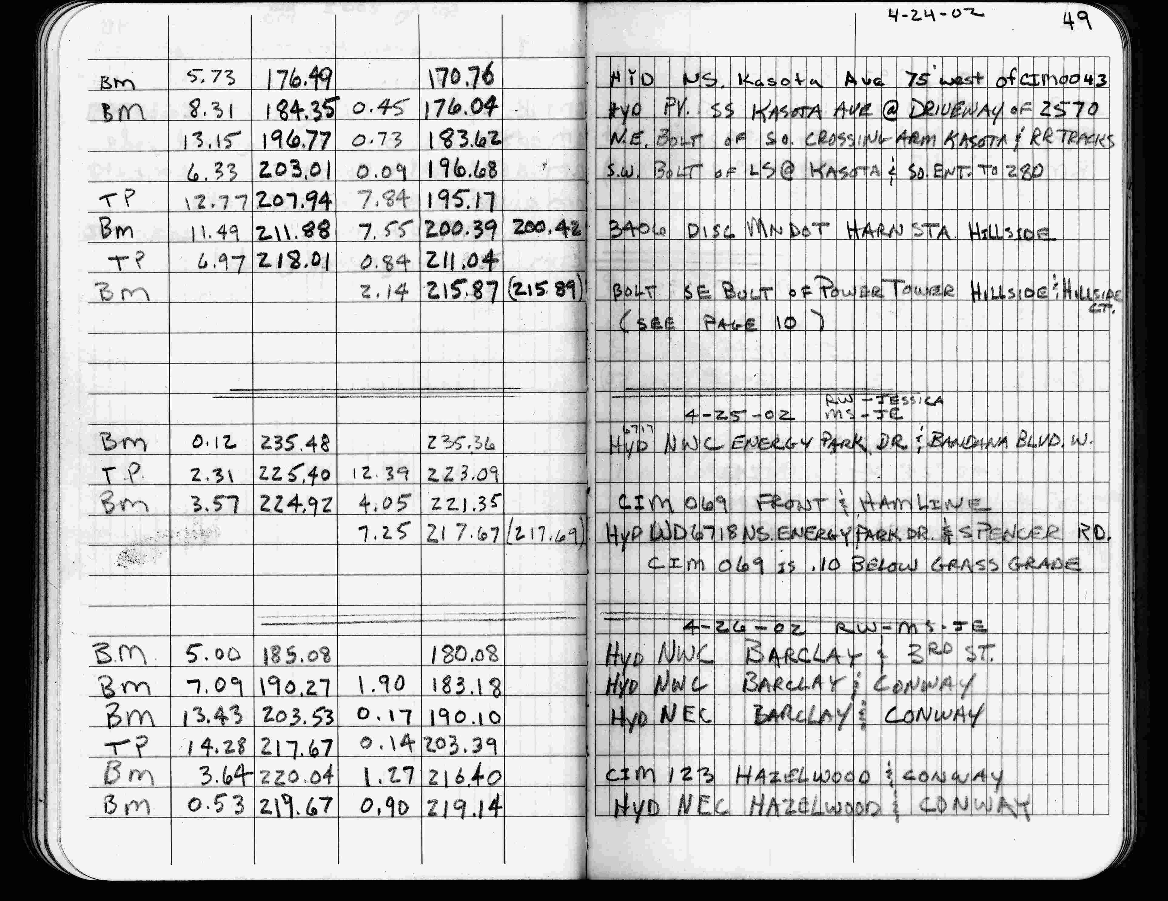
| 4/25/2002 | Elev 221.35 ft on CIM 0.10 below grass surface. See FB 1736 p.49 |
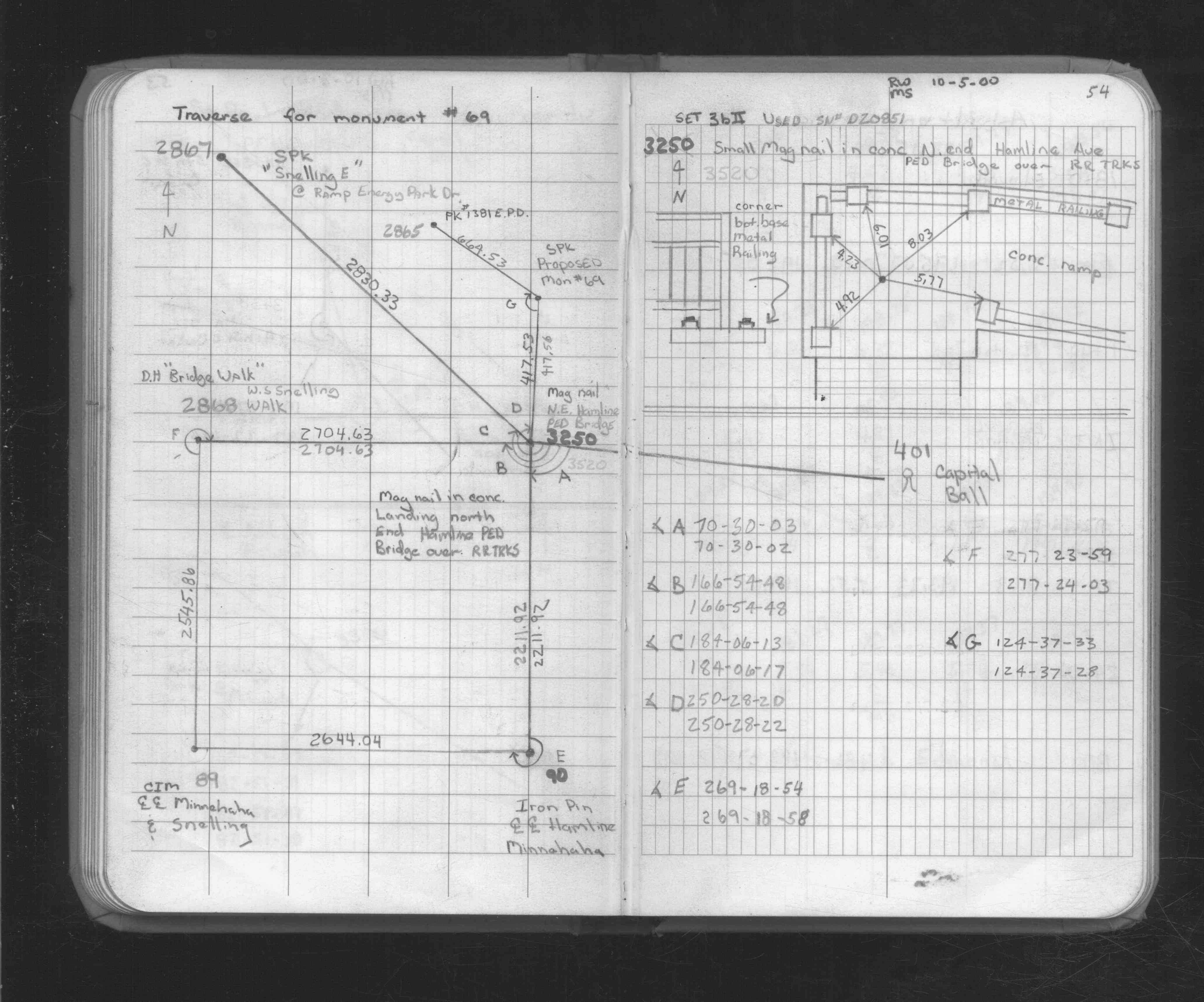
| 10/6/2000 | Set CIM 0.1 below grass grade by coordinates. See CofL 0069-xxxx-A |
| 1/1/1996 | (Unknown date ___ __, 1996 ) Concrete monument out, ties no longer good |
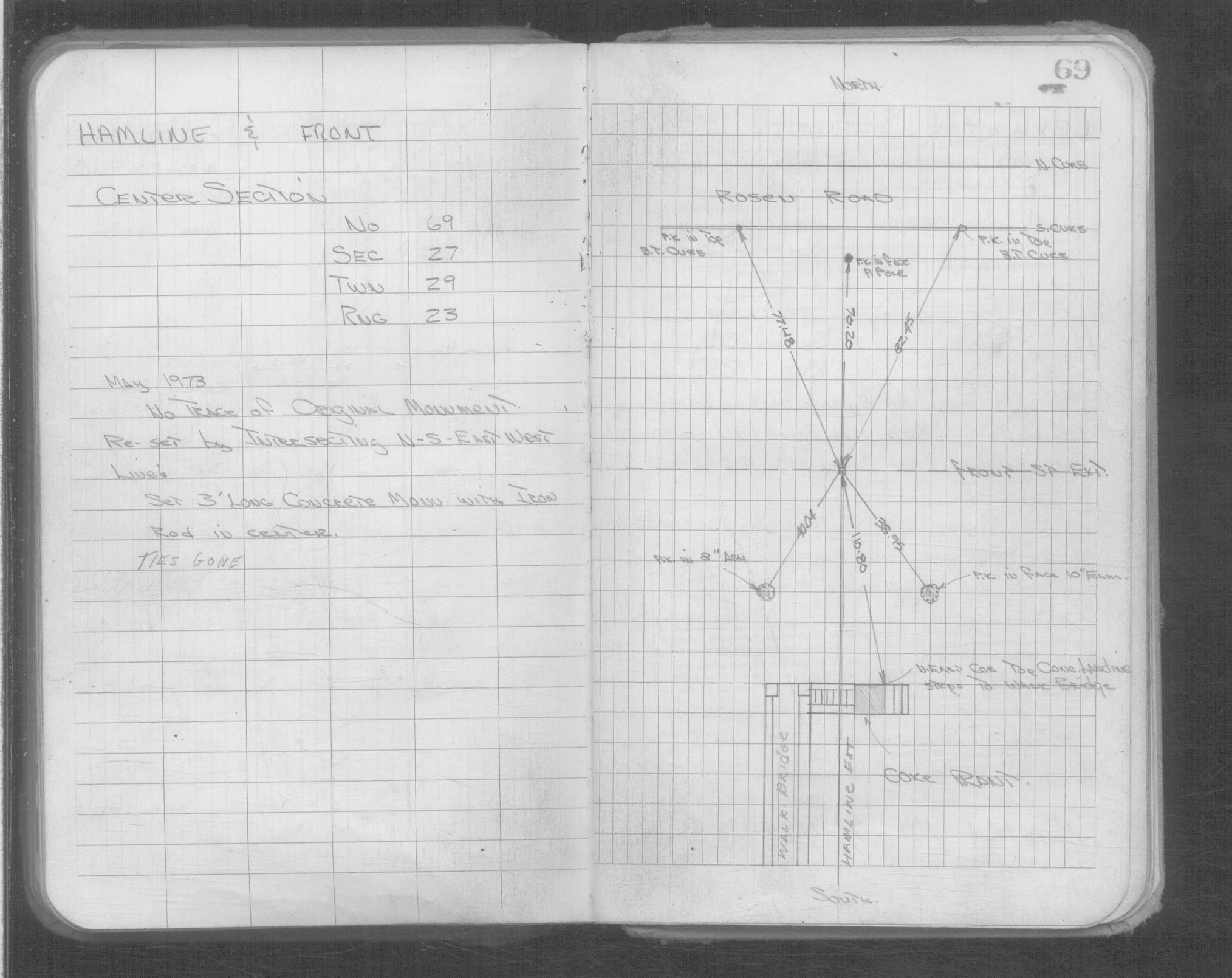
| 5/1/1973 | (Unknown date May __, 1973 ) Concrete monument 3 ft long with iron rod in center |
| 3/1/1891 | (Unknown date Mar __, 1891 ) Placed ties. See FB 345 p.4 |
| 1/1/1800 | (Unknown date ___ __, ____ ) Monument set by J H Armstrong |
Above is NOT an all inclusive history of this point. Please review all the links below.
| PLS NOTES | Field | Cross Section | Sewer | J.B. Irvine | Monument | River Survey |
|---|---|---|---|---|---|---|
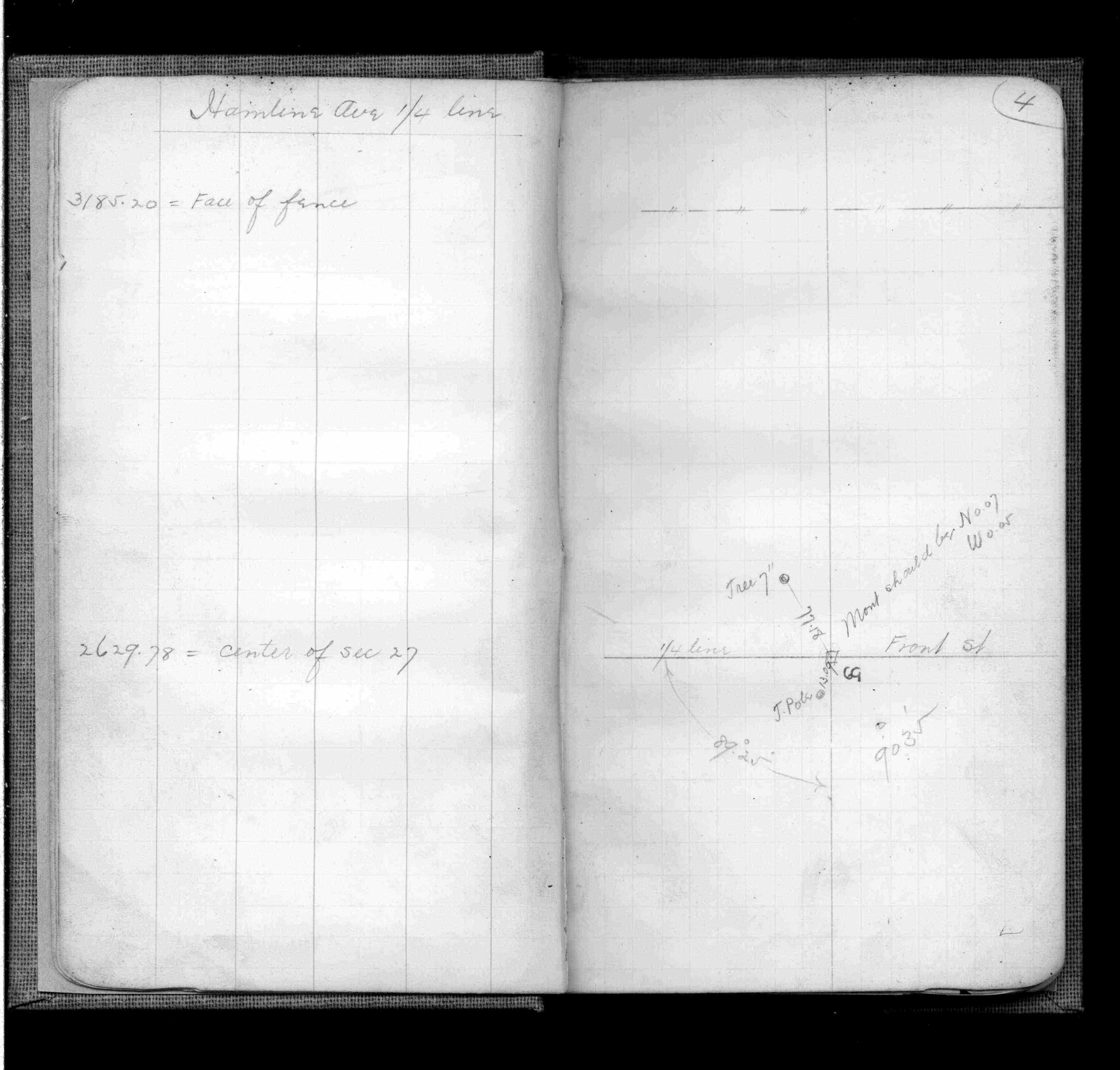
| FB 0345p.04 | ||||||
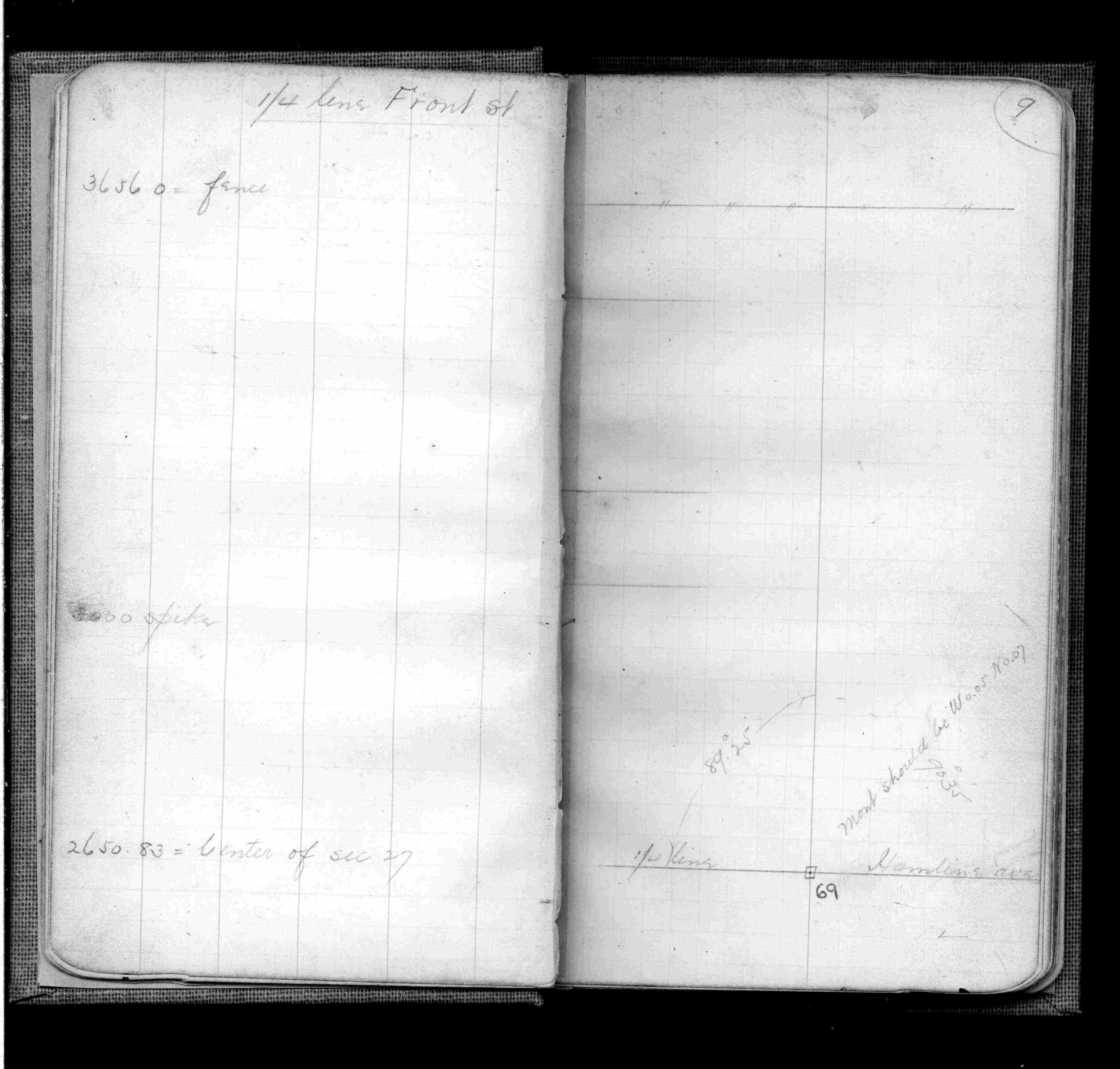
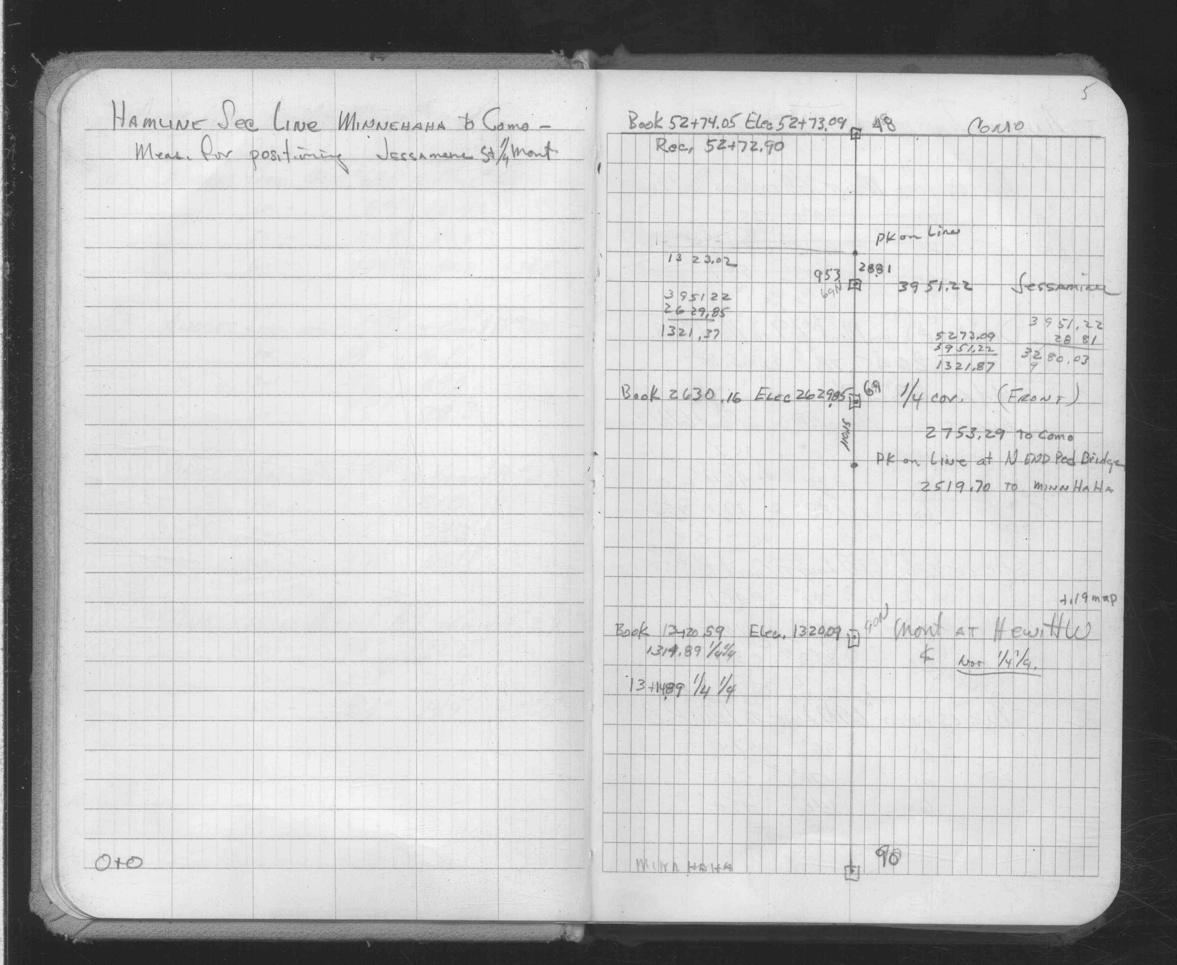
| FB 0345p. 04 ,09 | ||||||
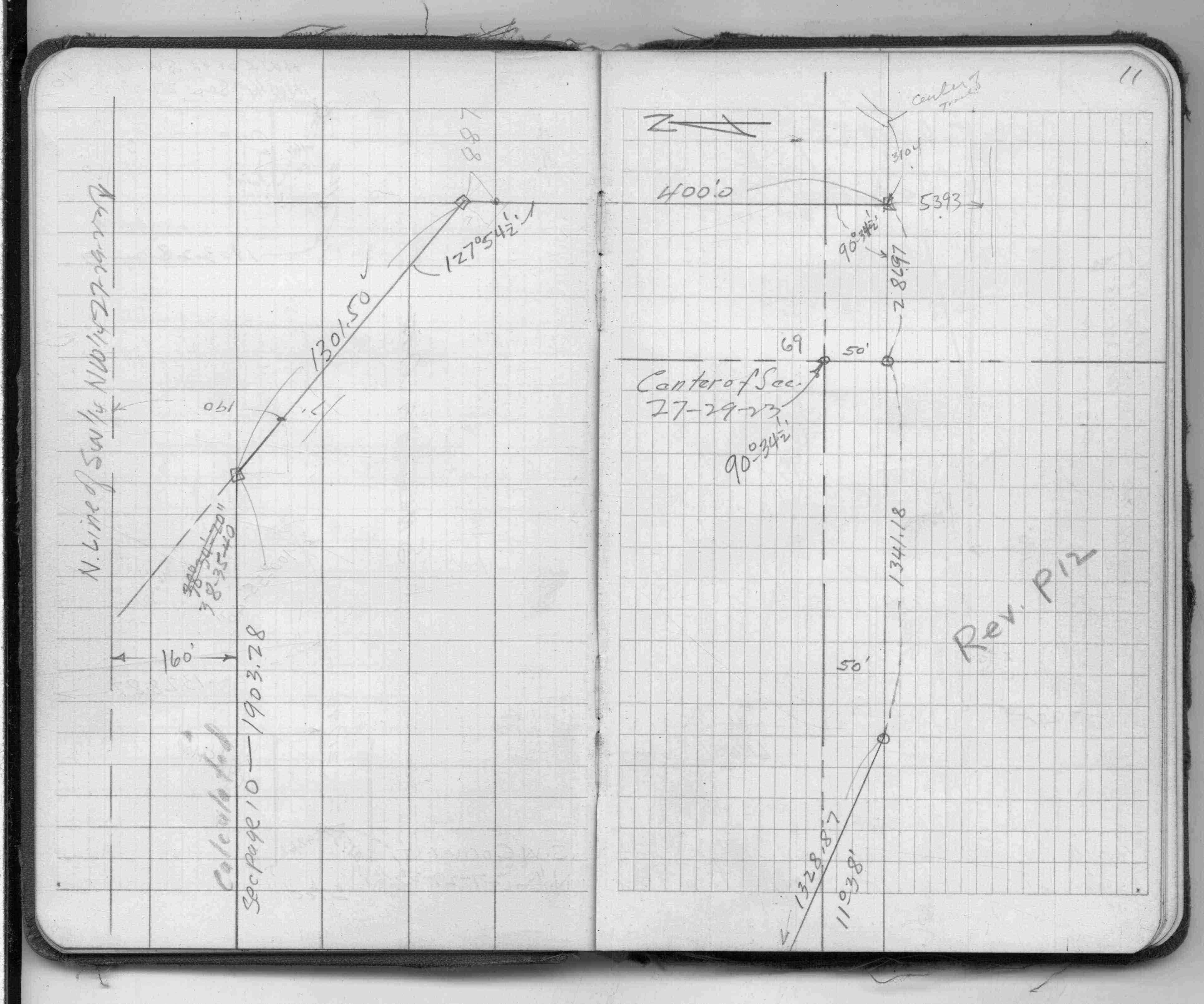
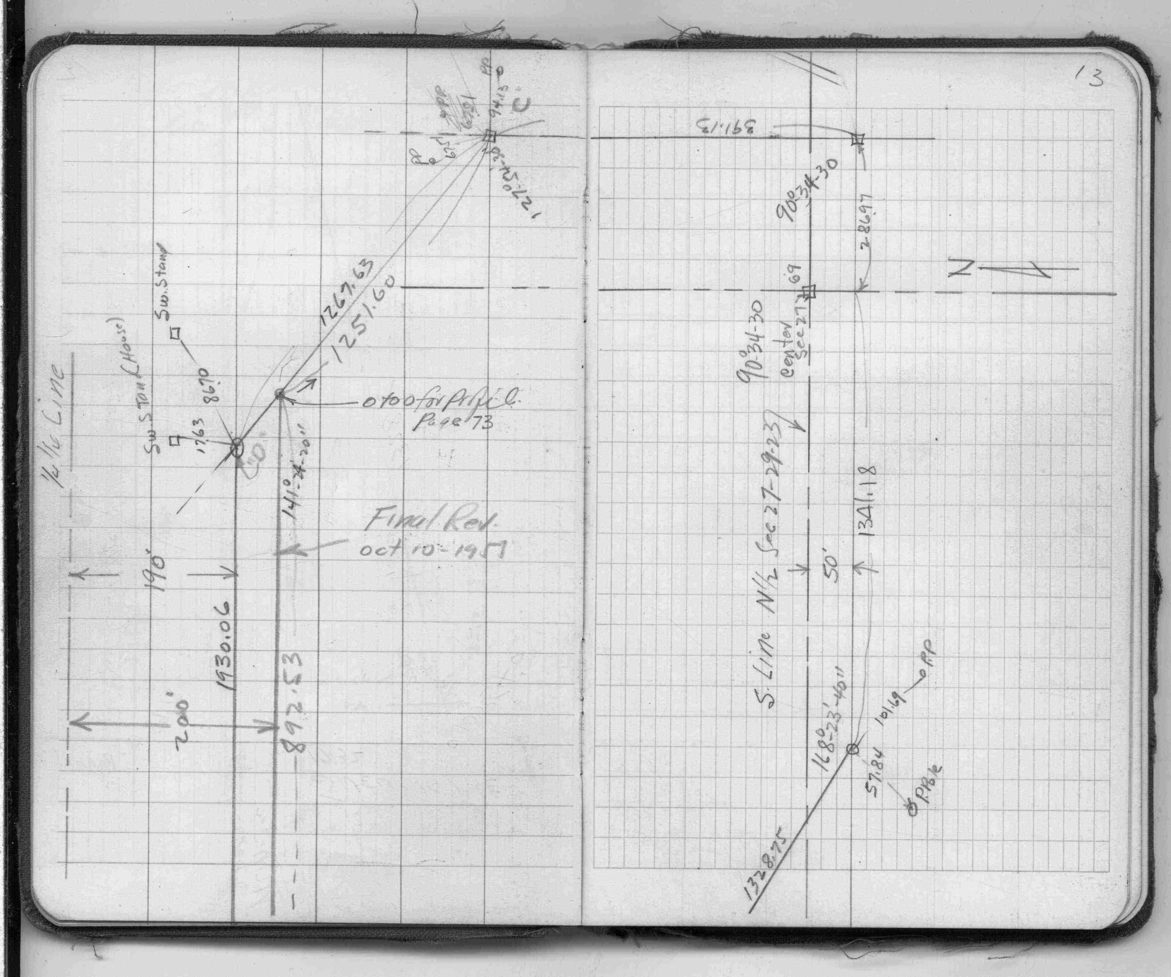
| FB 1465p. 02 ,11 ,13 | ||||||
| FB 1549Gp. 74 ,75 ,76 | ||||||
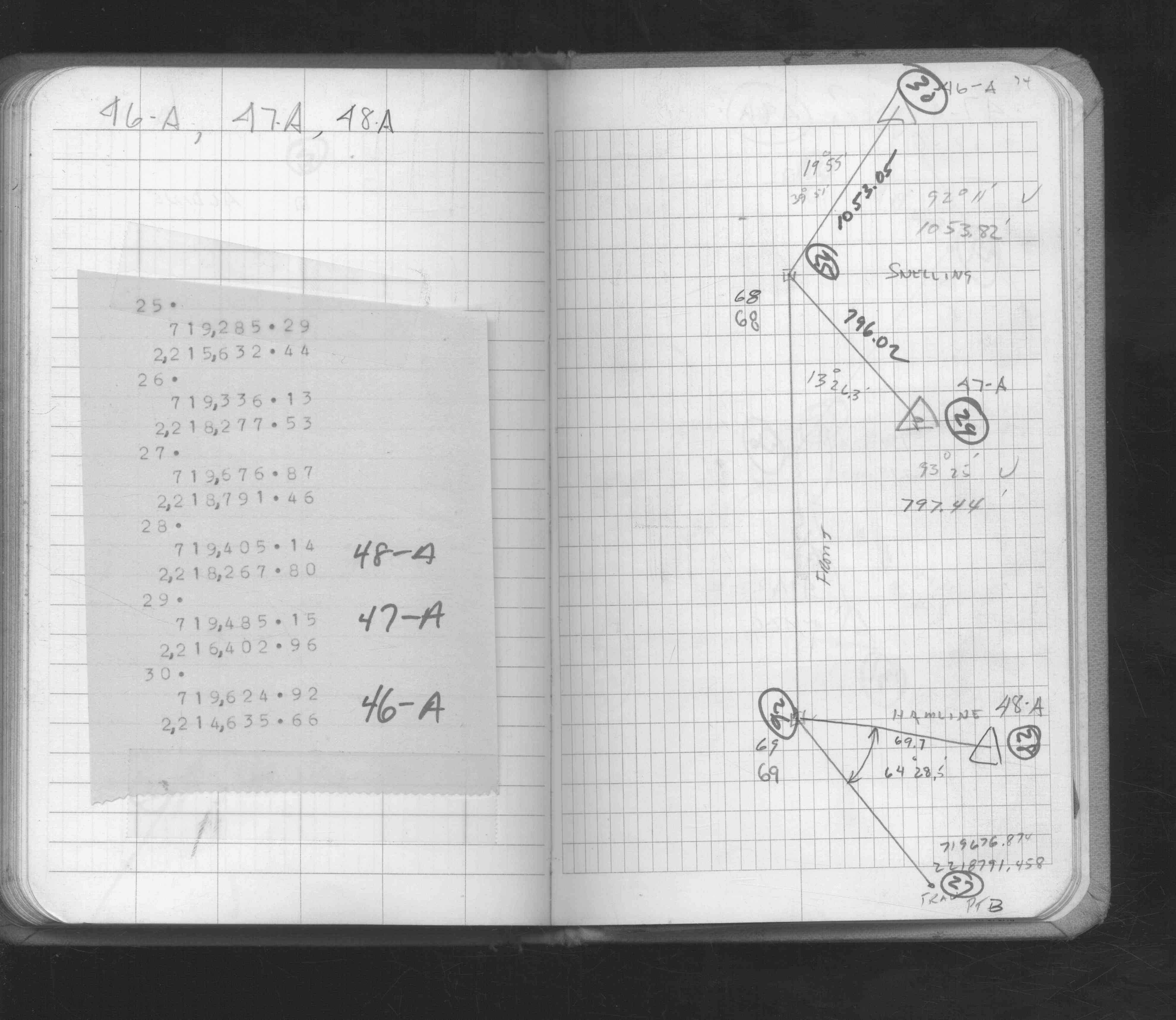
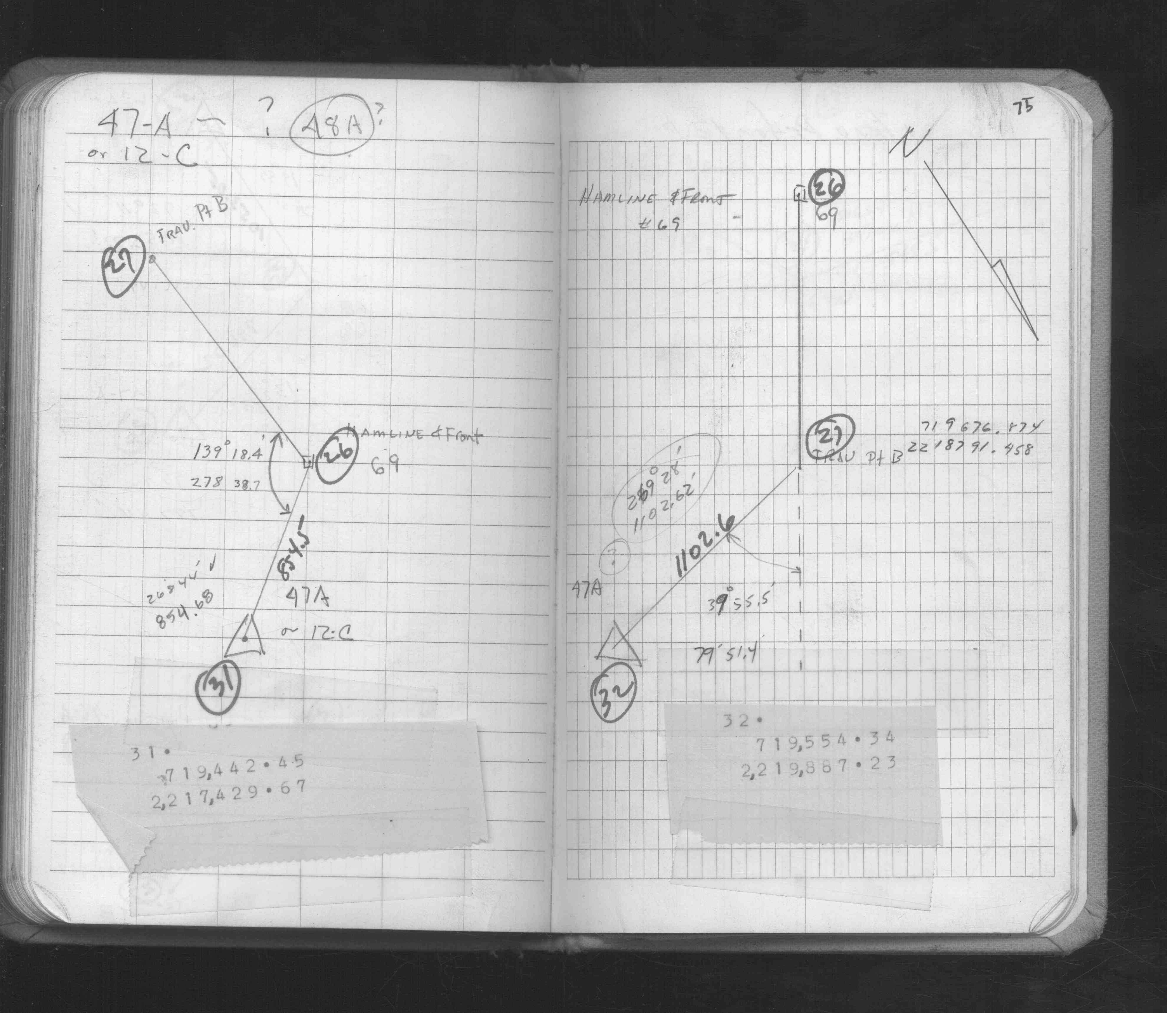
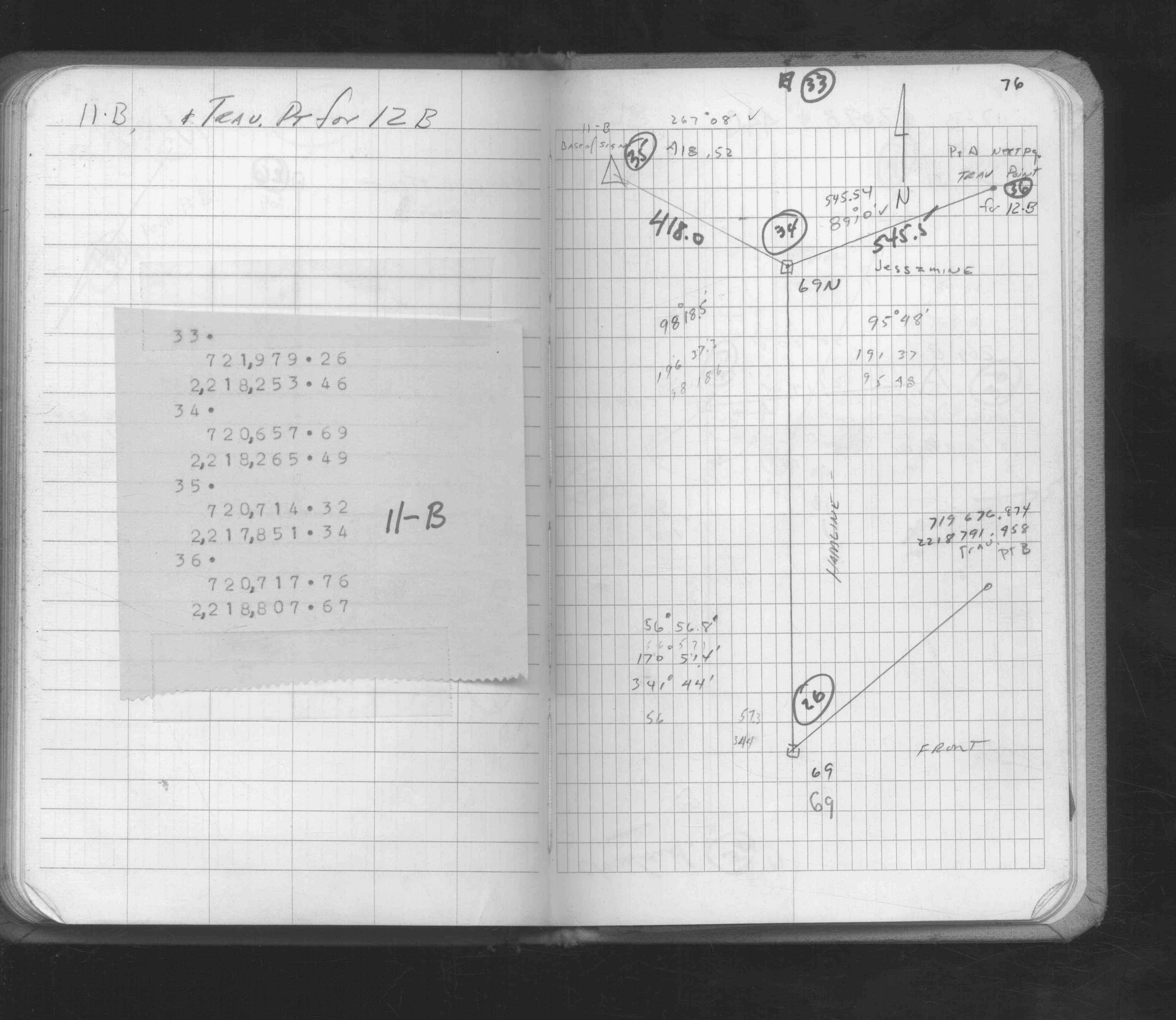
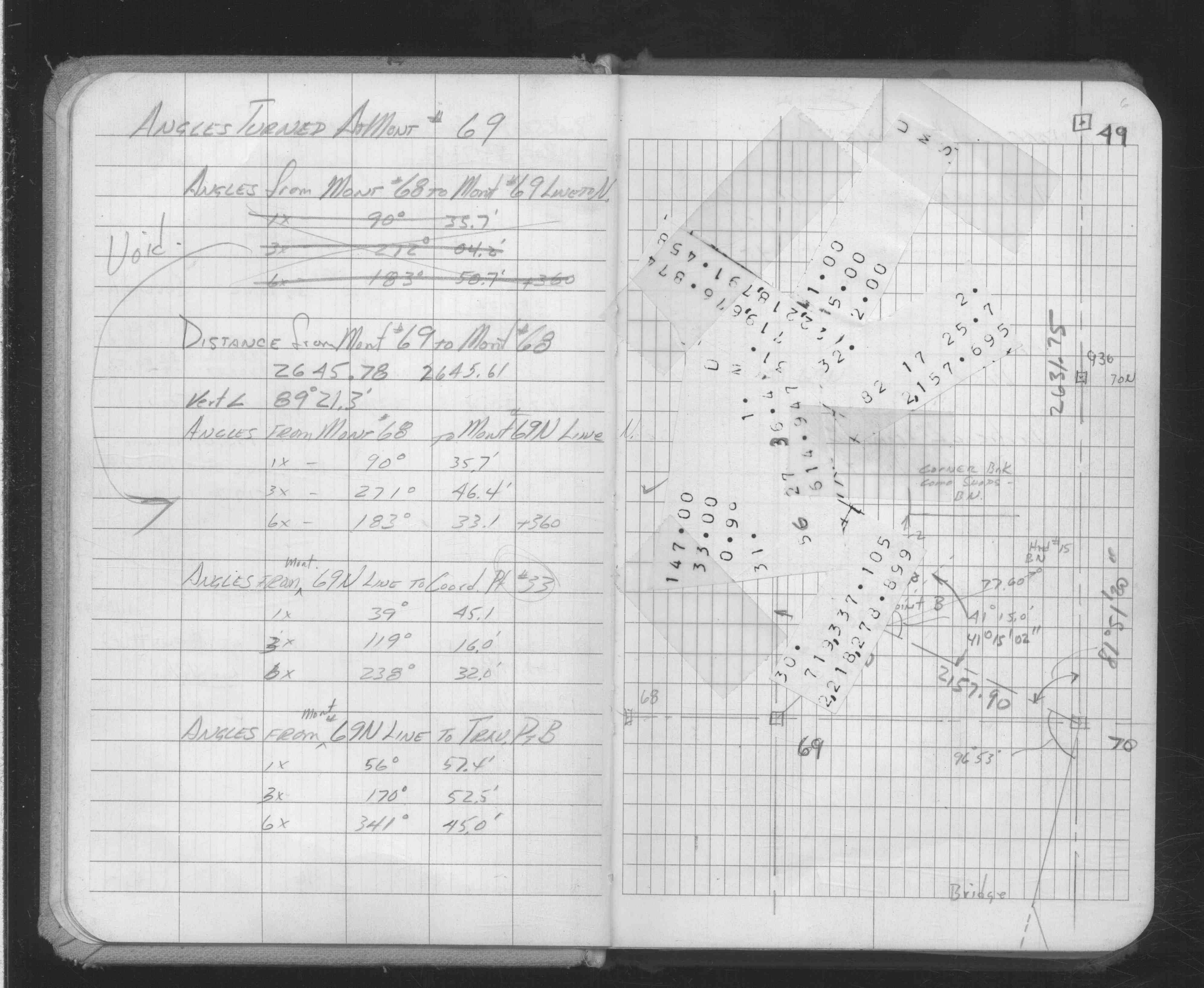
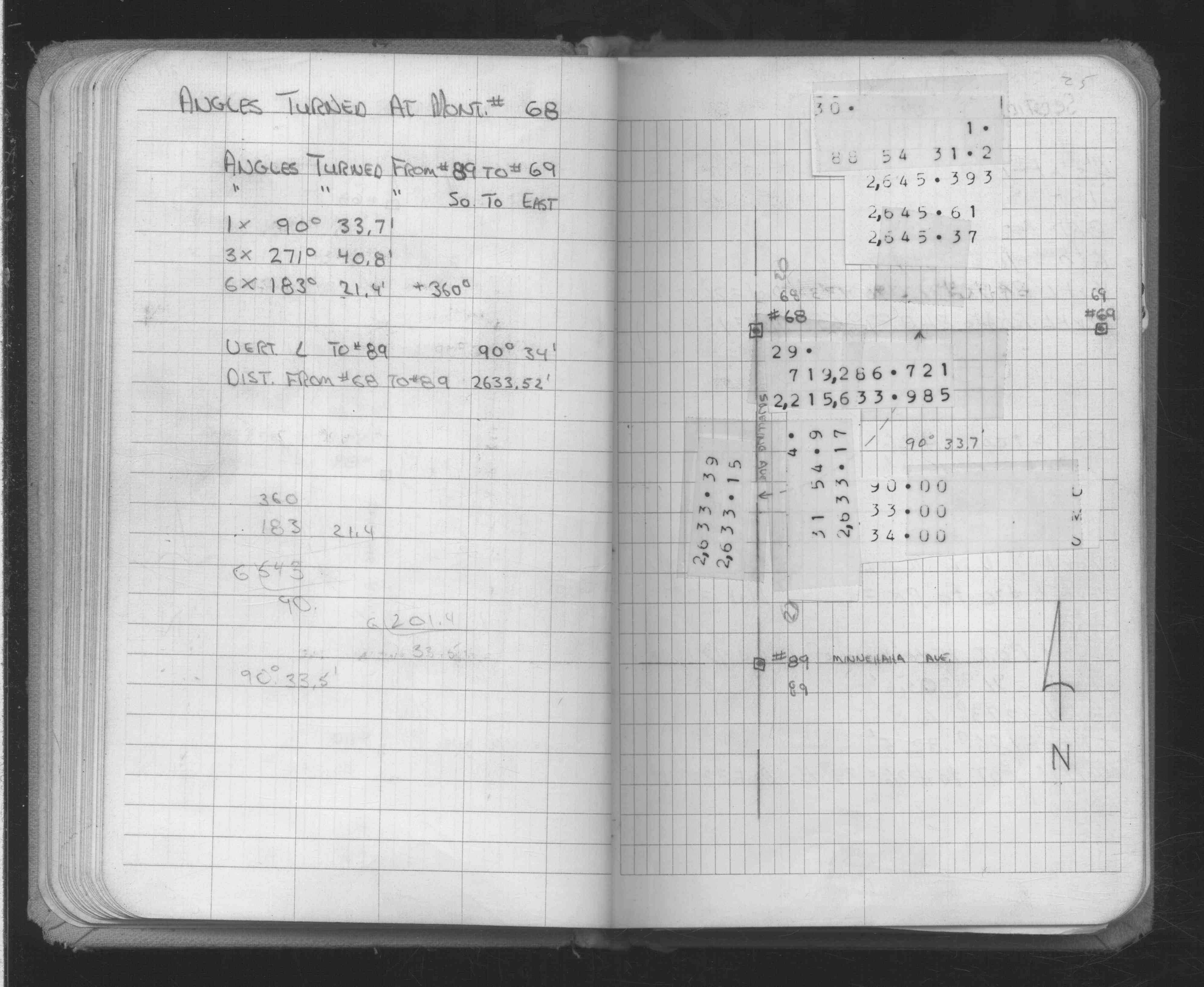
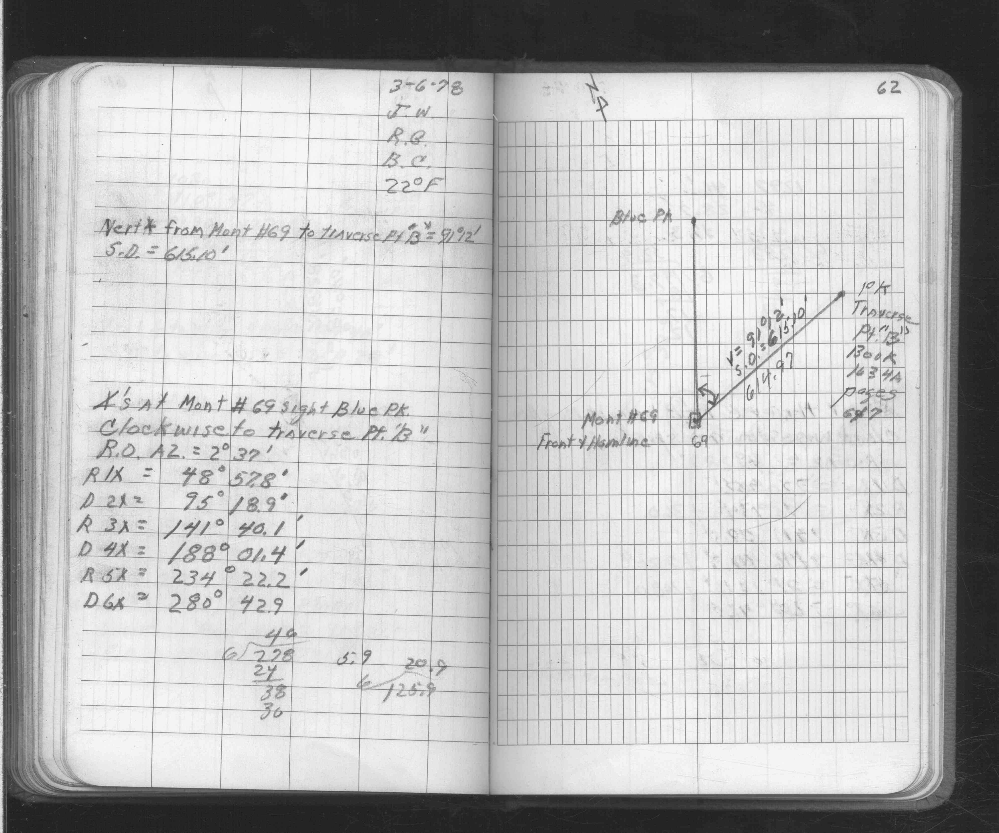
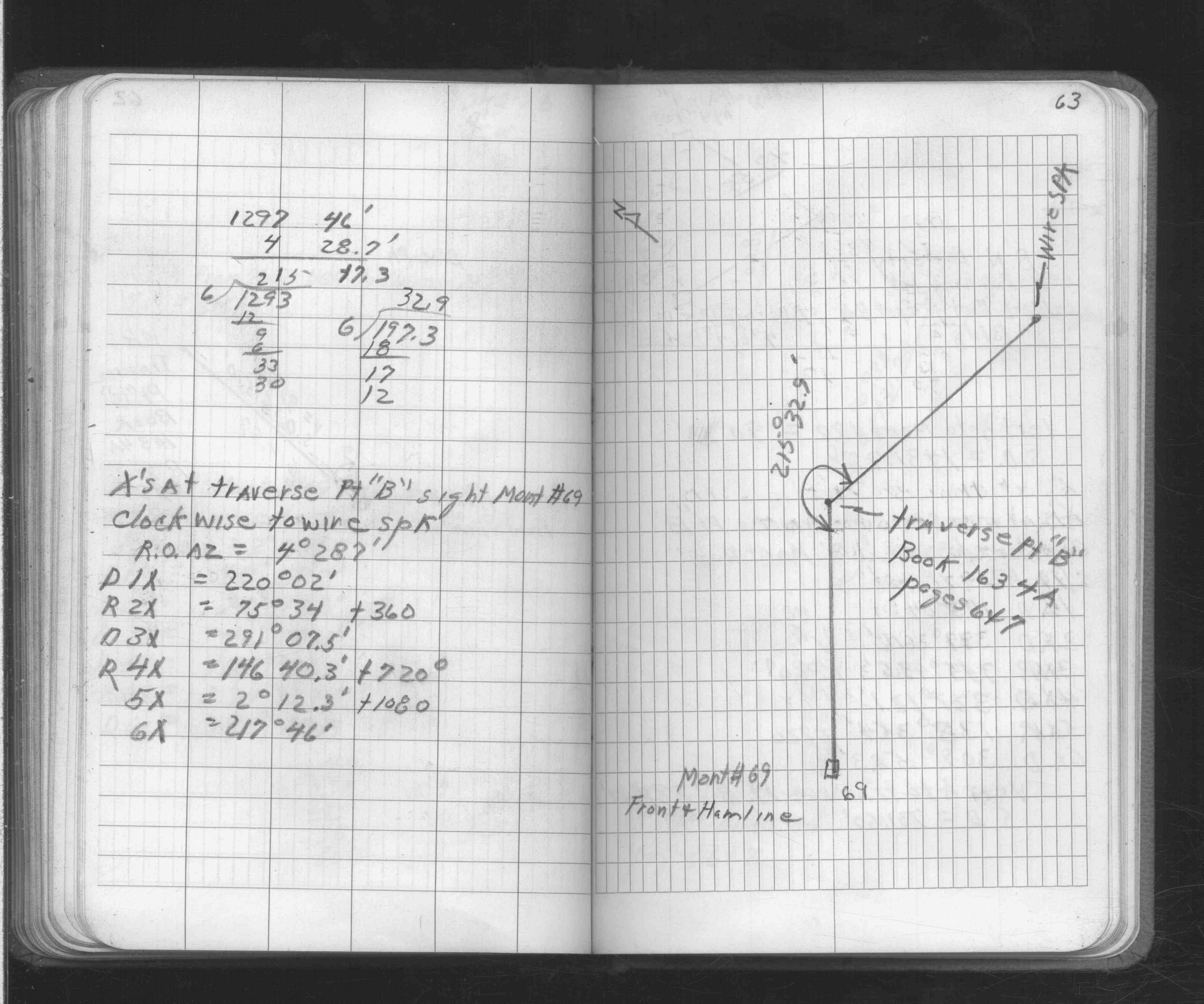
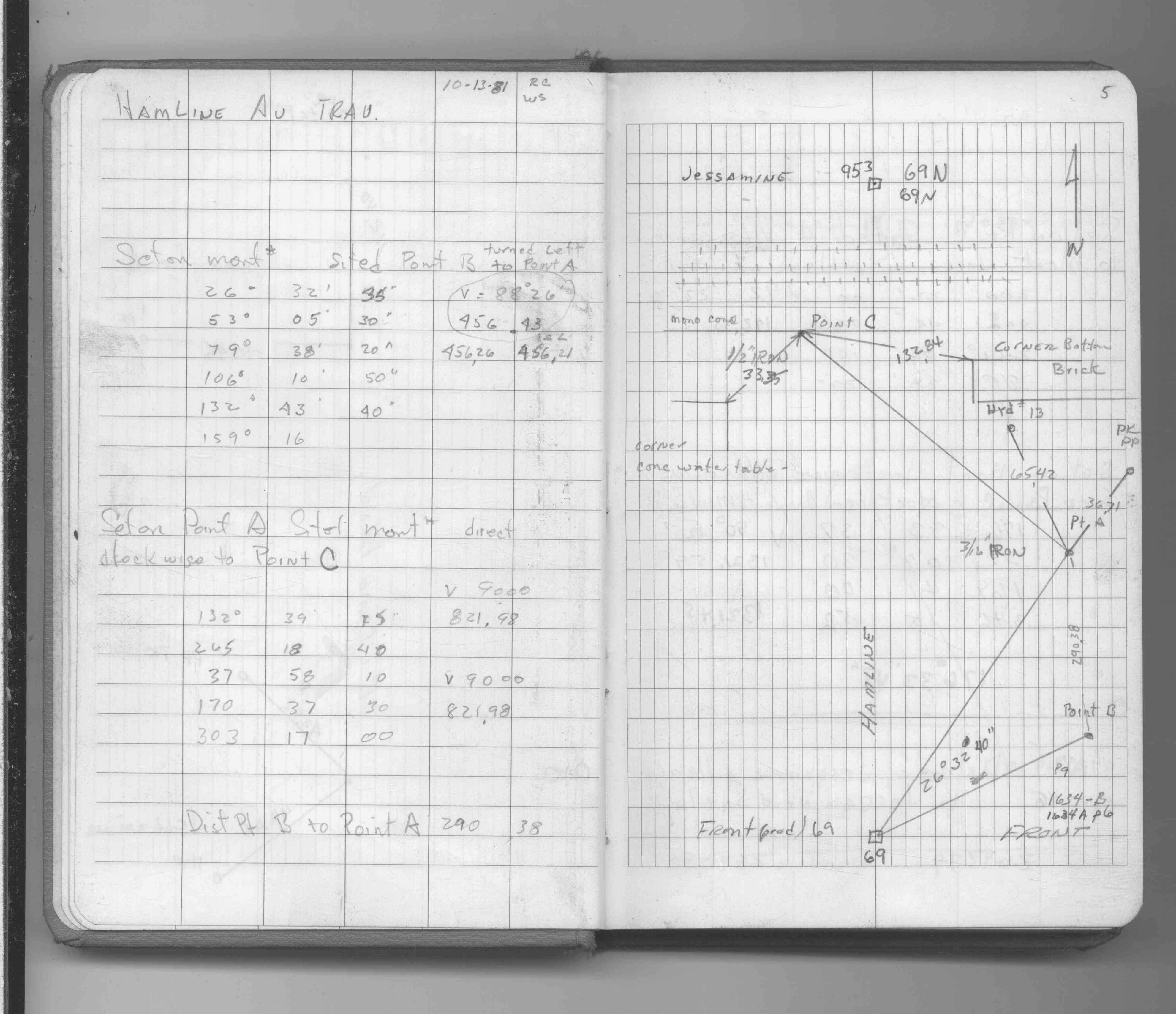
| FB 1634Ap. 01 ,05 ,06 ,25 | ||||||
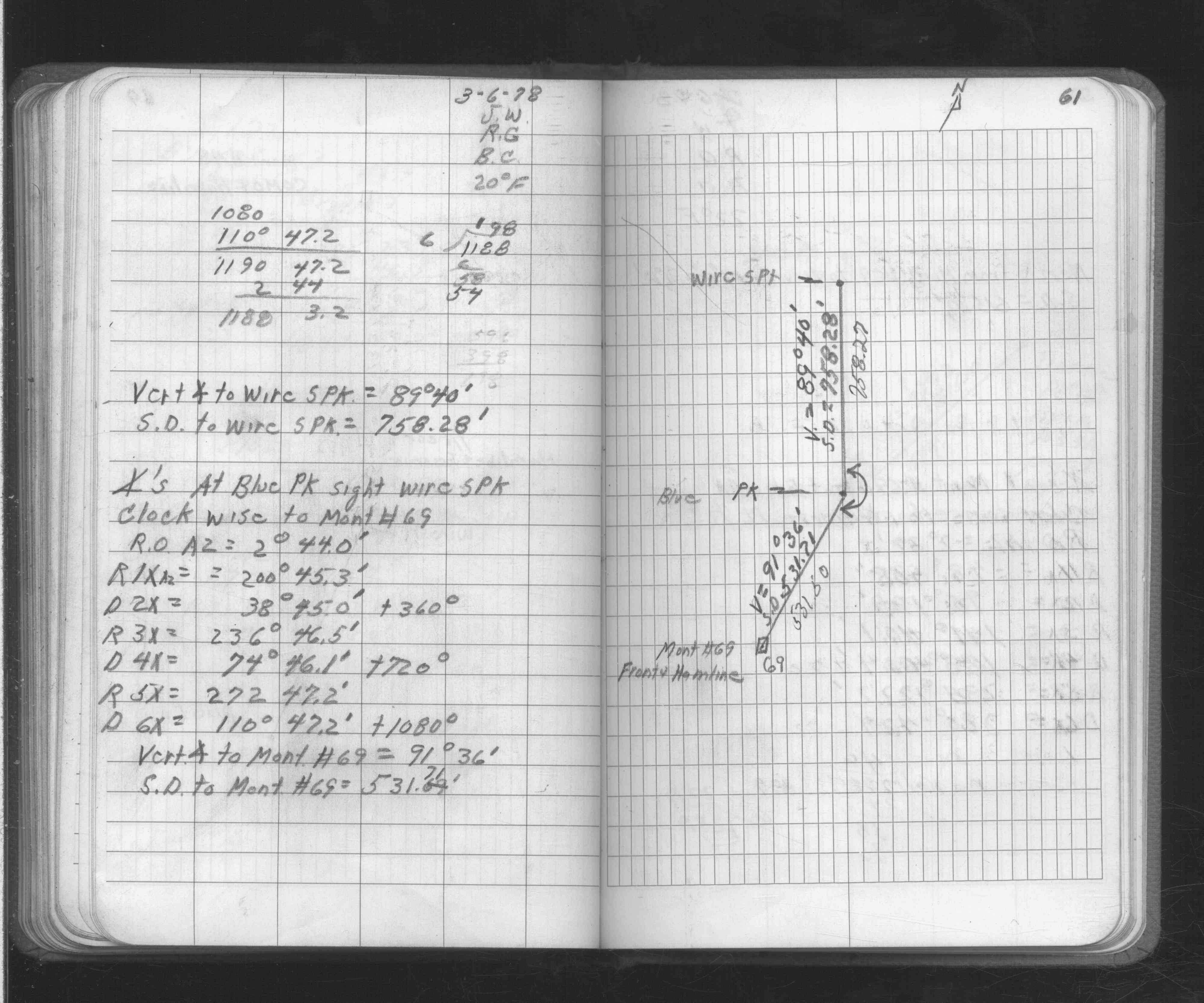
| FB 1671p. 61 ,62 ,63 | ||||||
| FB 1690p.05 | ||||||
| FB 1734Ap.54 | ||||||
| FB 1736p.49 |
| FILE | SURVEYOR | LIC. NO. | DATE SIGNED | DATE TIED |
|---|---|---|---|---|
| 0069-0666-A.tif | Jeffery L. Grosso | 13144 | October 9, 2000 | October 6, 2000 |
| ST_001-078p069.jpg | none | none | none | none |
| 0069-0666-A.dwf | none | none | none | none |