| NAD83 COORDINATES (1986 adj.): |
|---|
| * X= 571790.05 Y= 165428.92 Z= 0 LSQ 12/6/1991 S FLT |
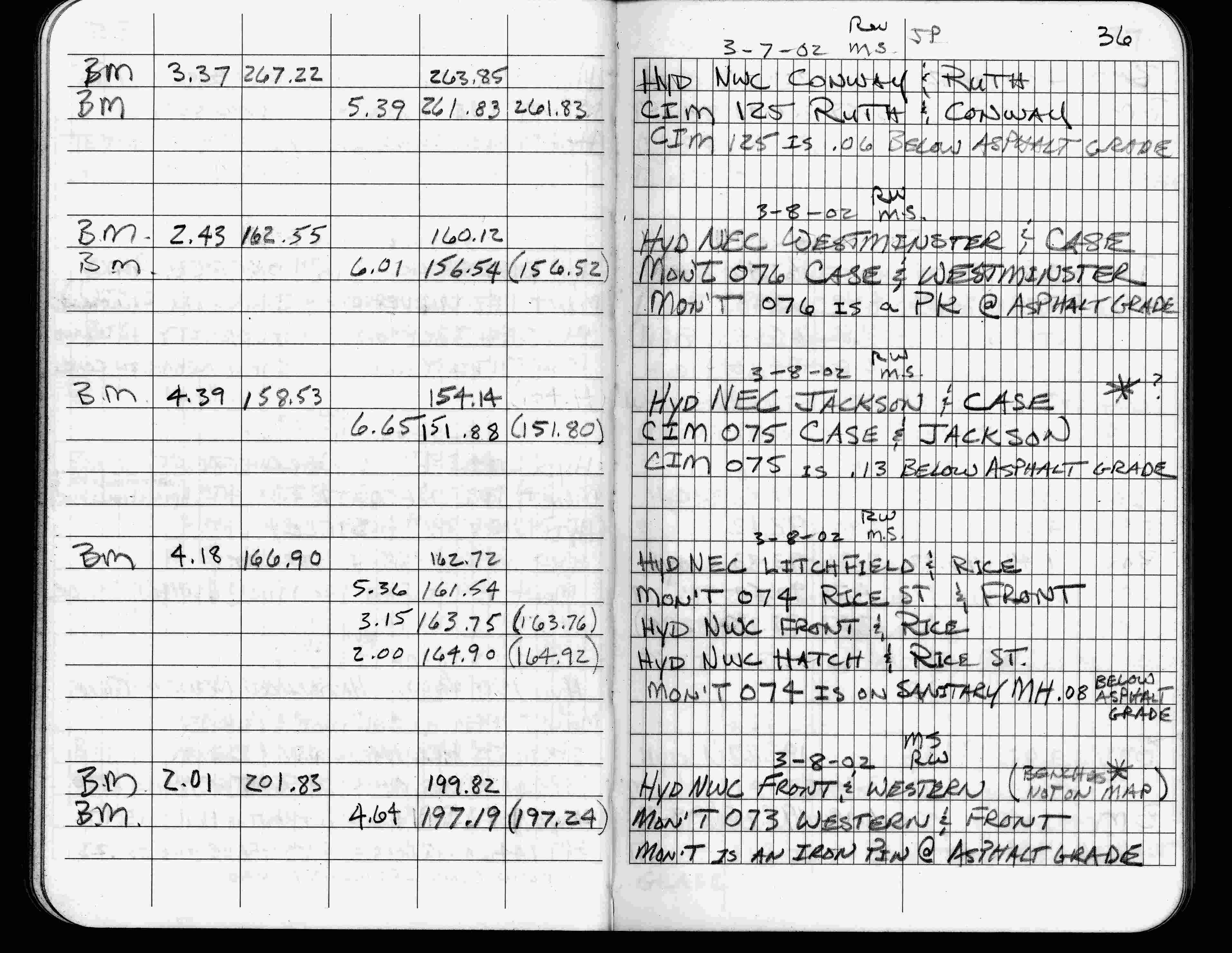
| 3/8/2002 | Elev 161.54 ft on MH 0.08 ft below asphalt surface. See FB 1736 p.36 |
| 3/17/2000 | Paint mark on MH, placed 4-2 ft straddles (marked for painting target for 2000 aerial) |
| 3/26/1997 | Elev 161.64 ft on ?. See acorddat/1997/p1157/p1157.sdr Digital-Unadj |
| 9/21/1995 | (marked MH for painting target for 1995 aerial) |
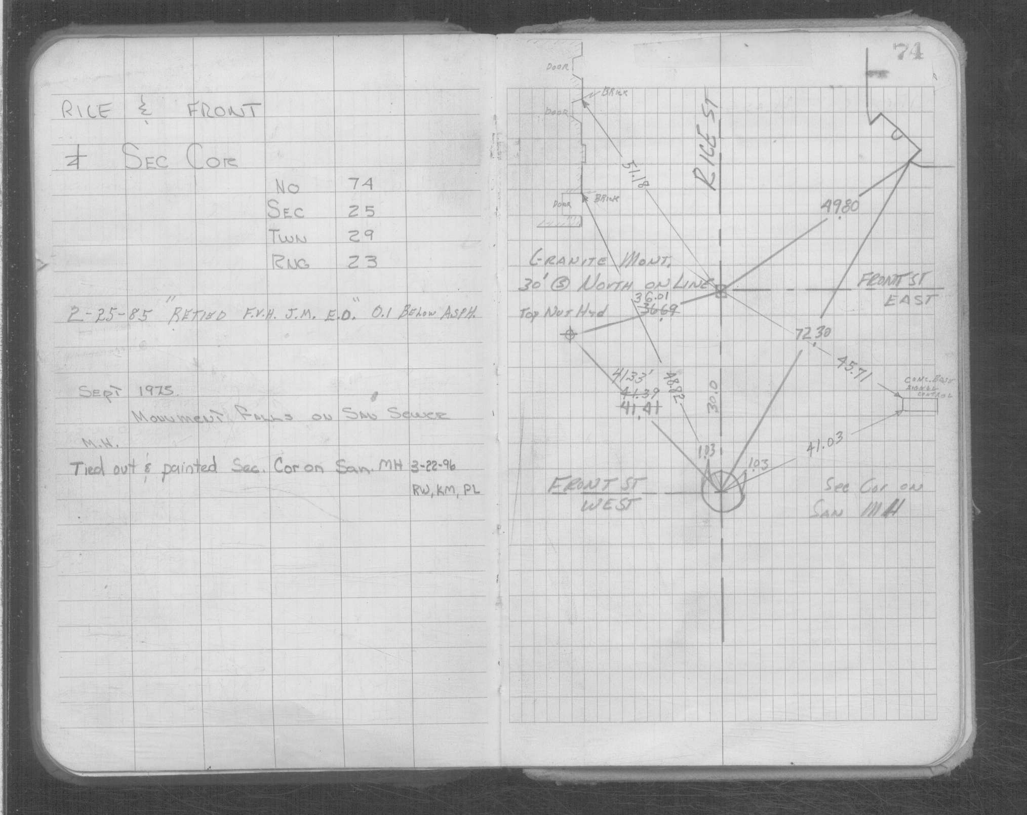
| 8/1/1991 | Placed ties on corner which falls on MH, also placed ties on GM WC 30 ft north. See CofL 0074-0039-A |
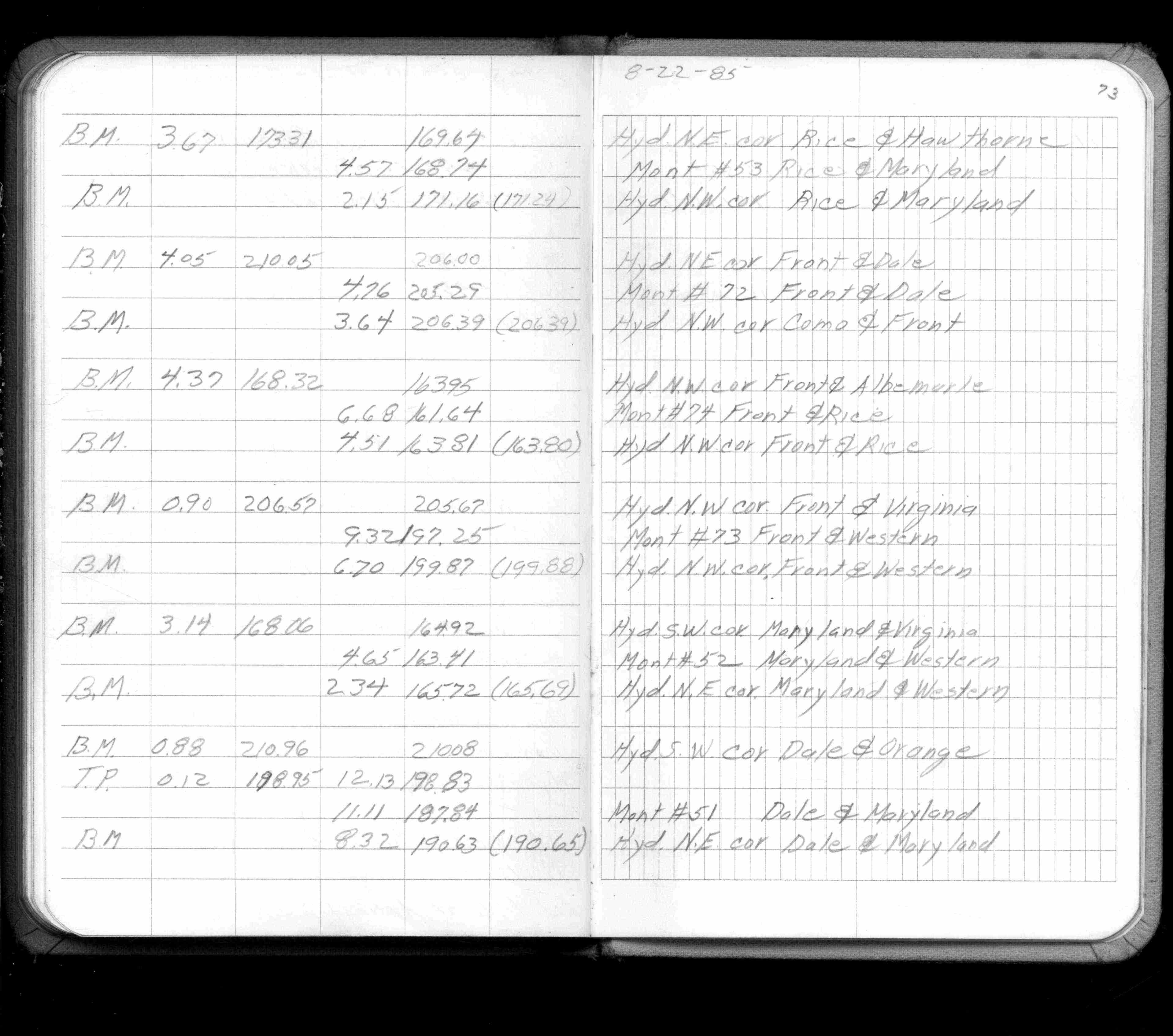
| 8/1/1985 | (Unknown date Aug __, 1985 ) Elev 161.64 ft on ?. See FB 1421A p.73 |
| 9/1/1975 | (Unknown date Sep __, 1975 ) Monument falls on sanitary sewer MH |
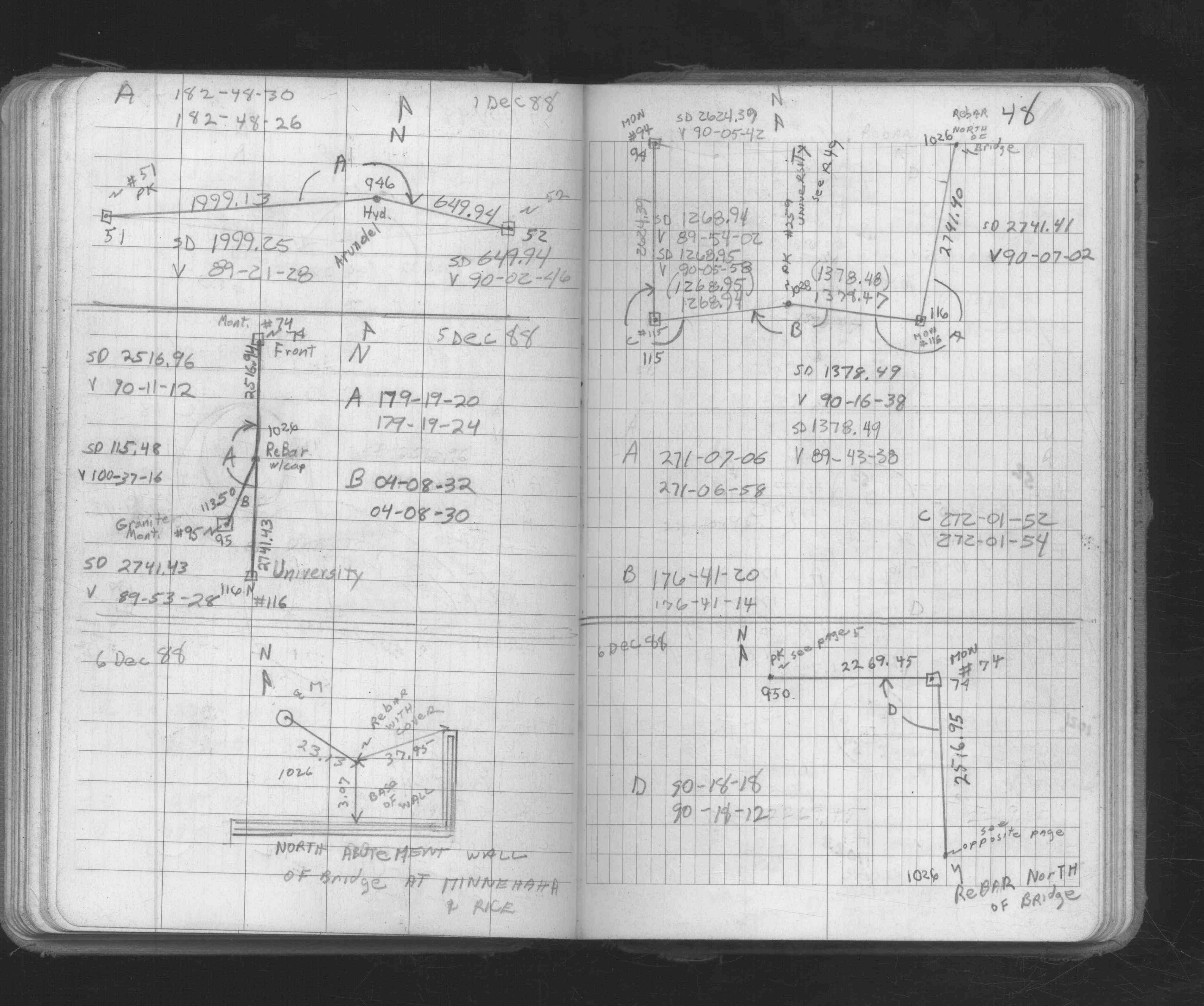
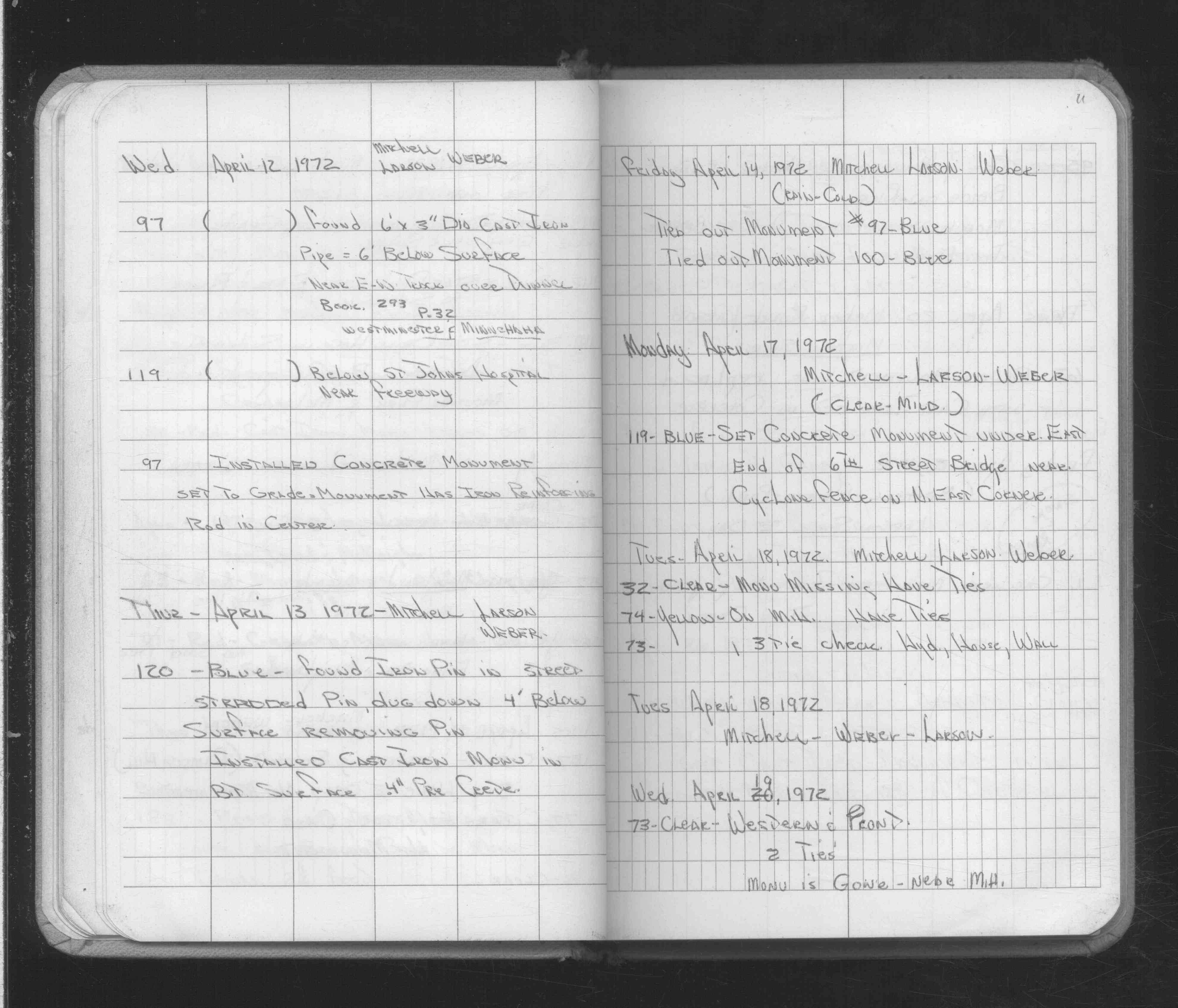
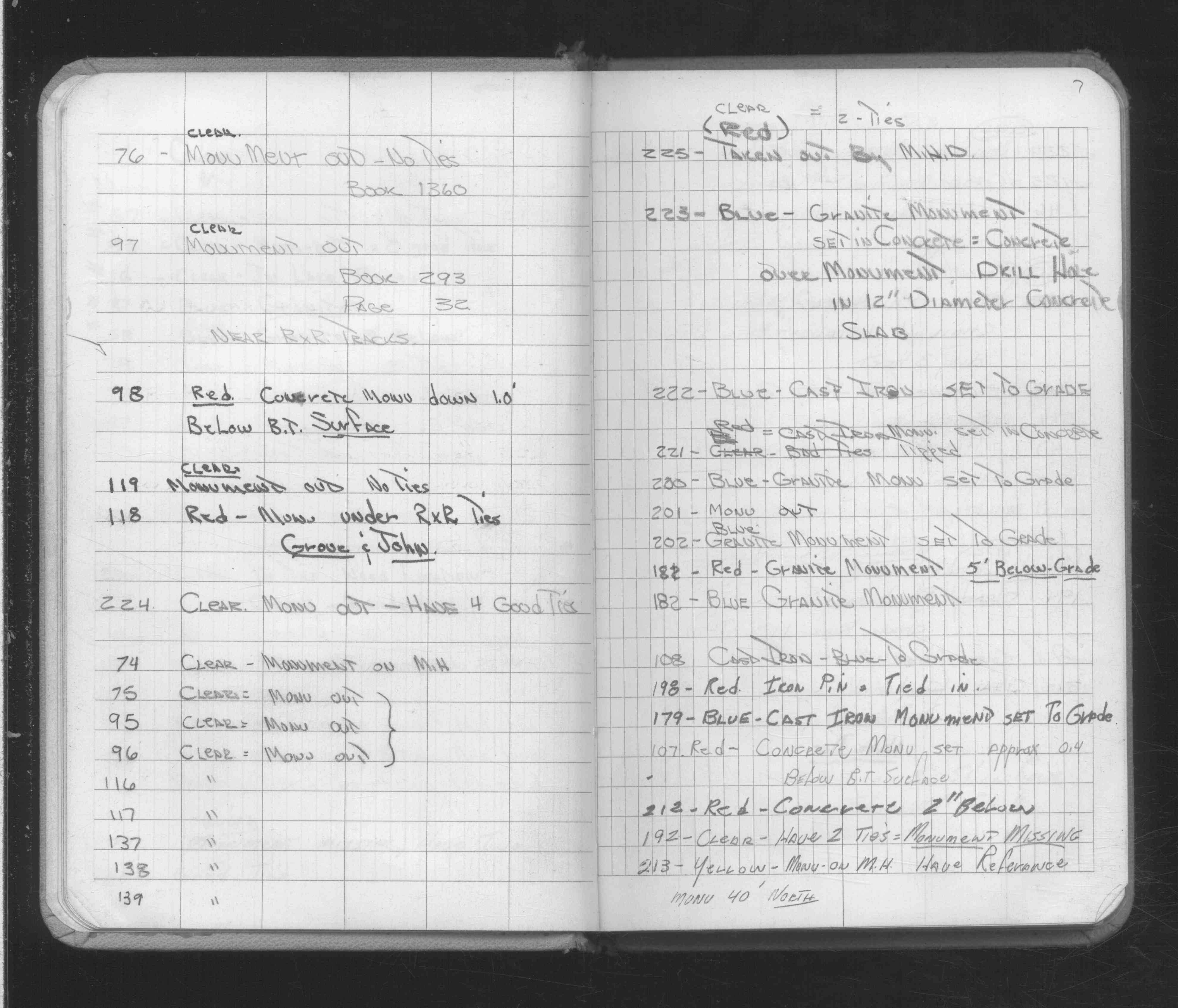
| 4/18/1972 | Monument falls on MH, have ties. See FB 1689A p.11 |
| 2/16/1972 | Monument falls on MH. See FB 1689A p.7 |
| 1/1/1890 | (Unknown date ___ __, 1890 ) The plat of DORE'S ADD recorded 10-21-1890 shows an inplace GM. |
| 10/8/1847 | James M Marsh deputy surveyor set post. Tied to 2 BTs. See JM p.076-077 border |
Above is NOT an all inclusive history of this point. Please review all the links below.
| PLS NOTES | Field | Cross Section | Sewer | J.B. Irvine | Monument | River Survey |
|---|---|---|---|---|---|---|
| JM p.076-077 | FB 0300CPYp.20 | |||||
| FB 0301p.10 | ||||||
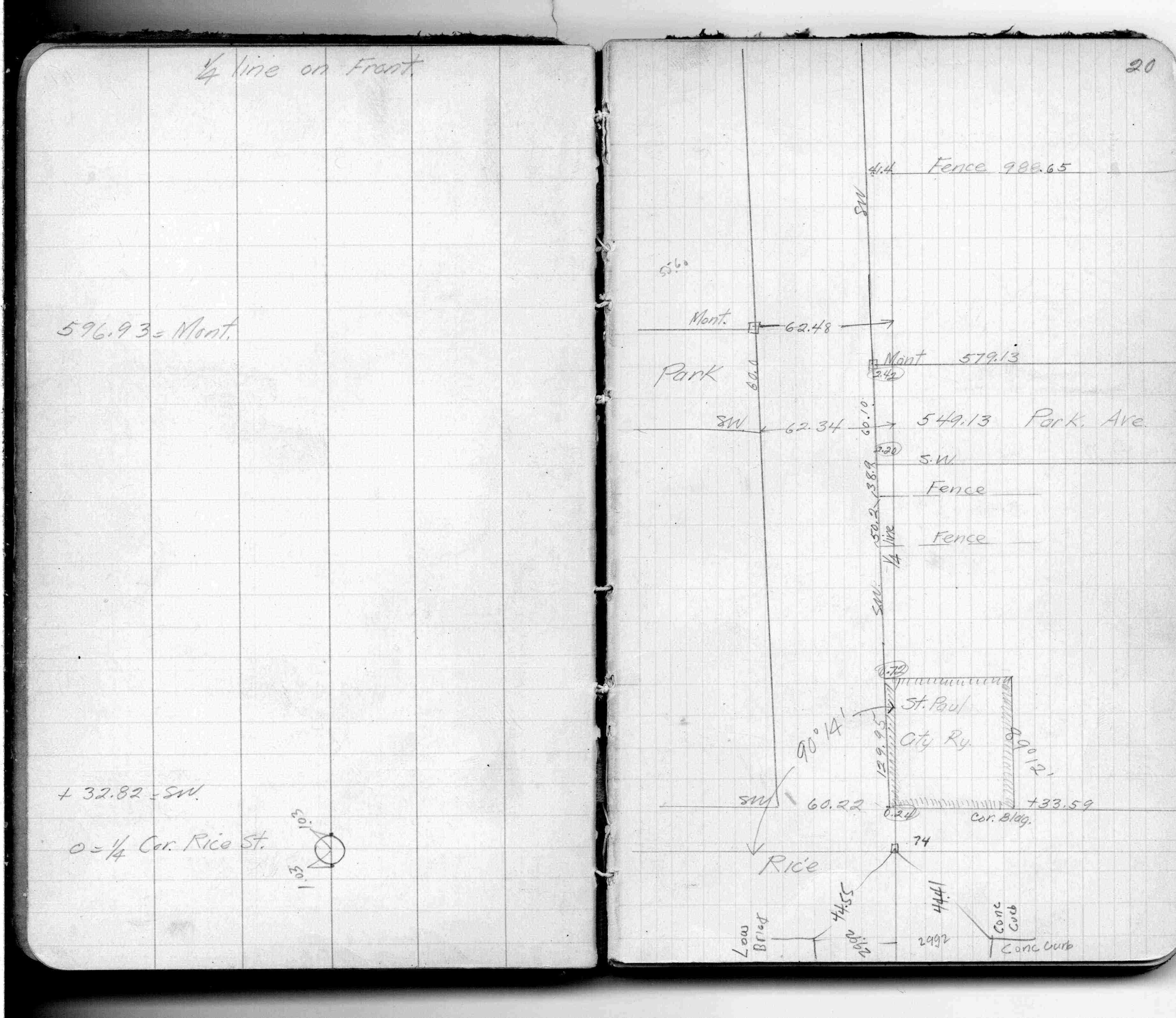
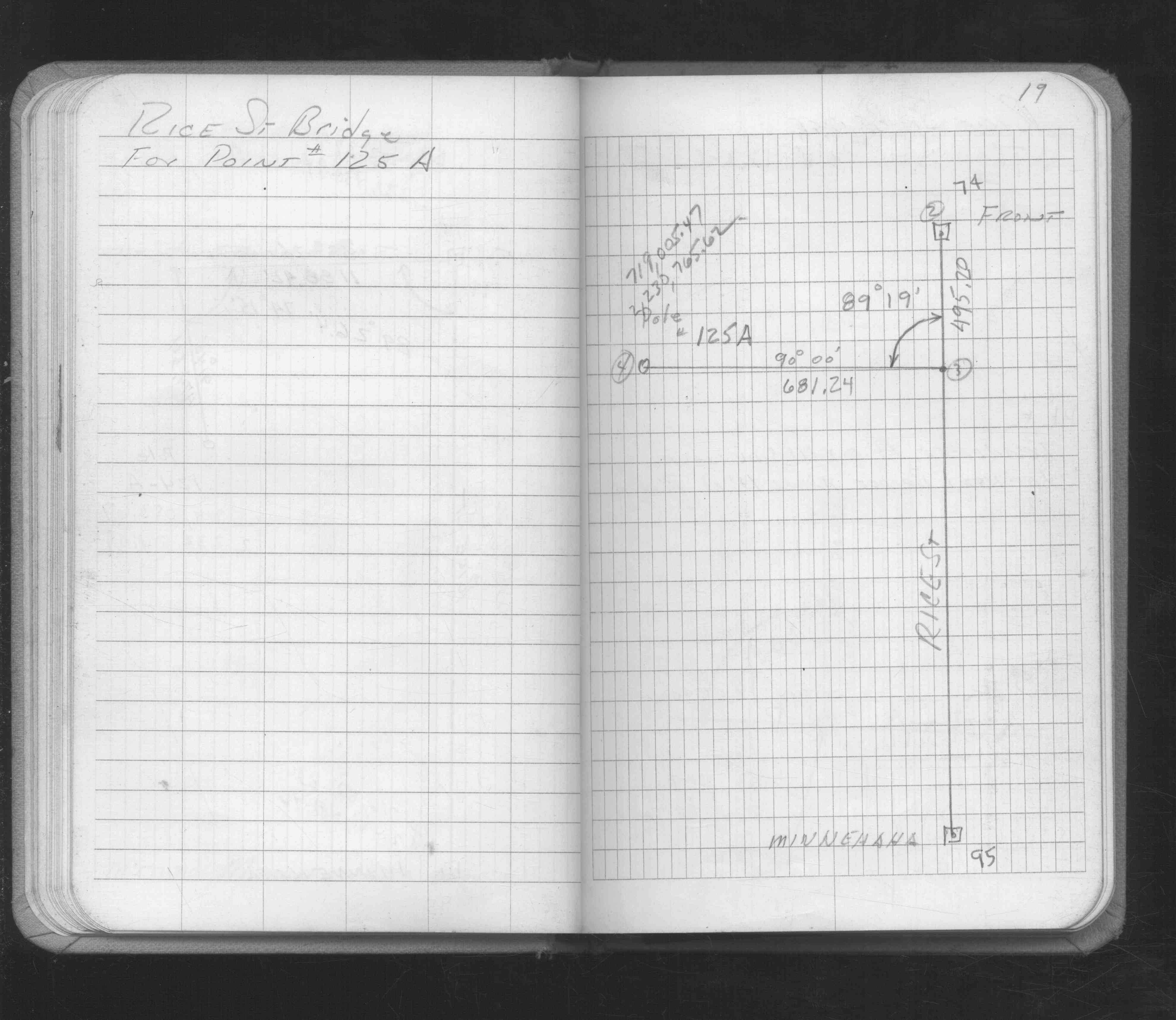
| FB 1421Ap.73 | ||||||
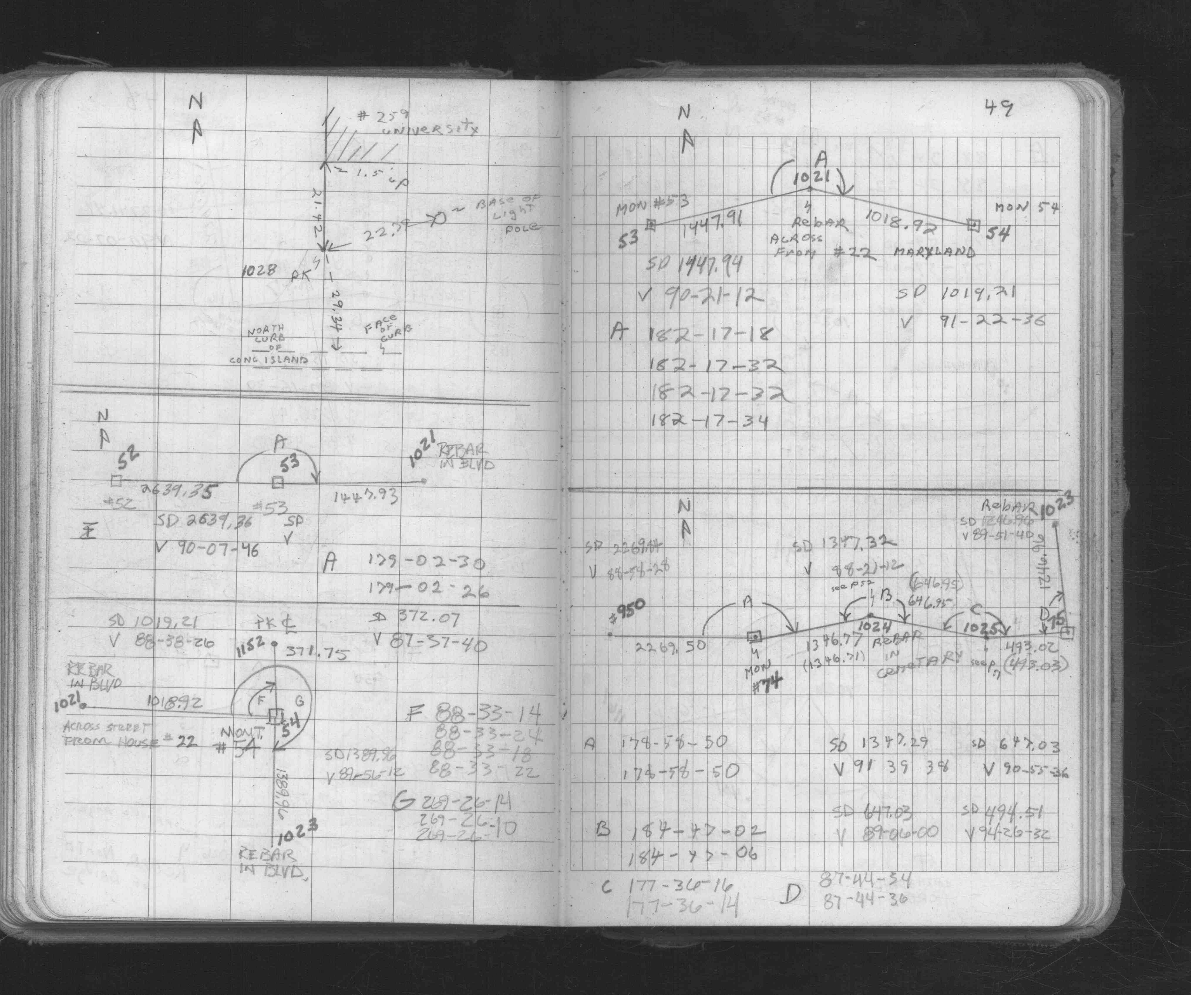
| FB 1549Gp. 18 ,19 ,20 ,22 | ||||||
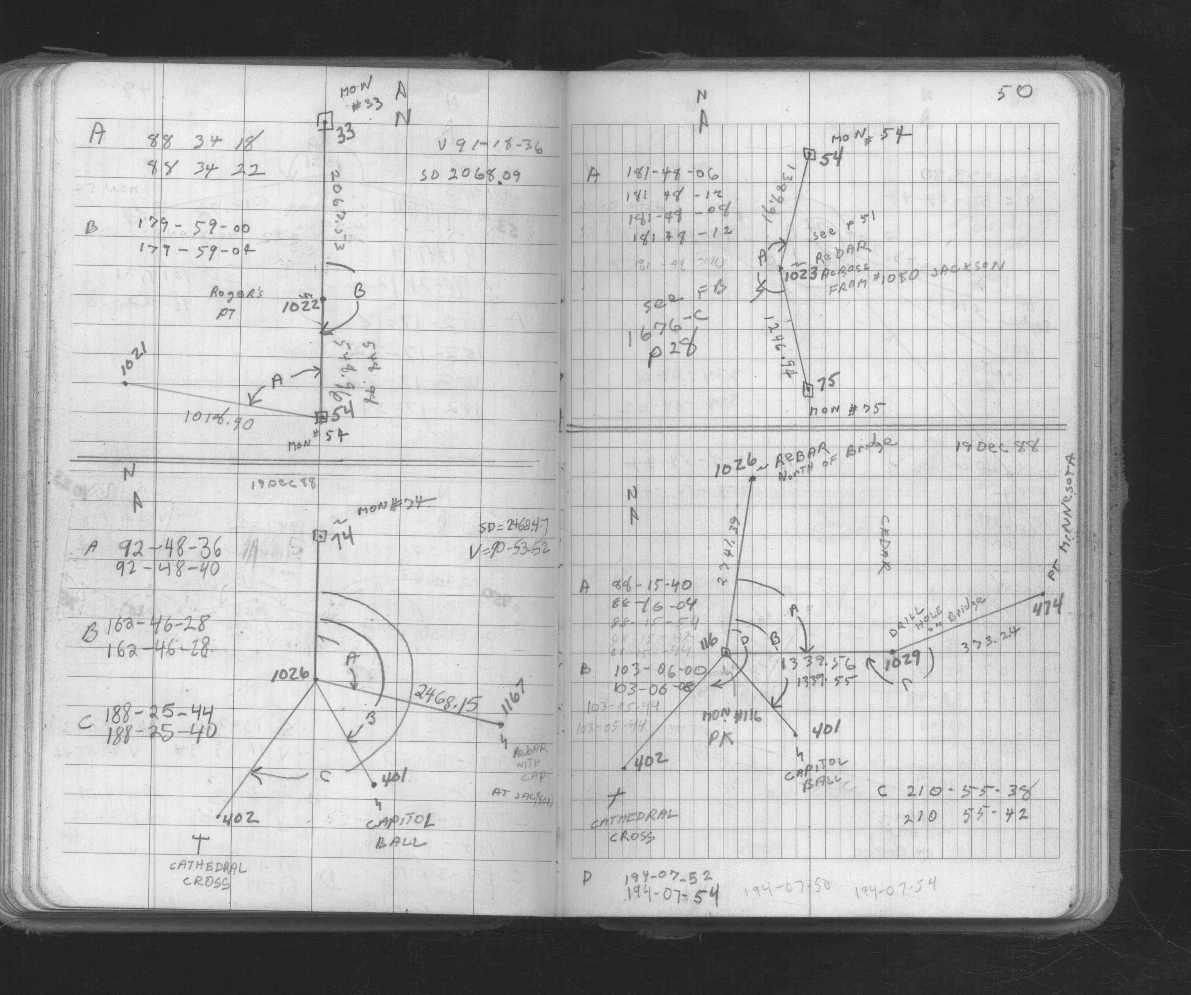
| FB 1673Ap. 05 ,48 ,49 ,50 | ||||||
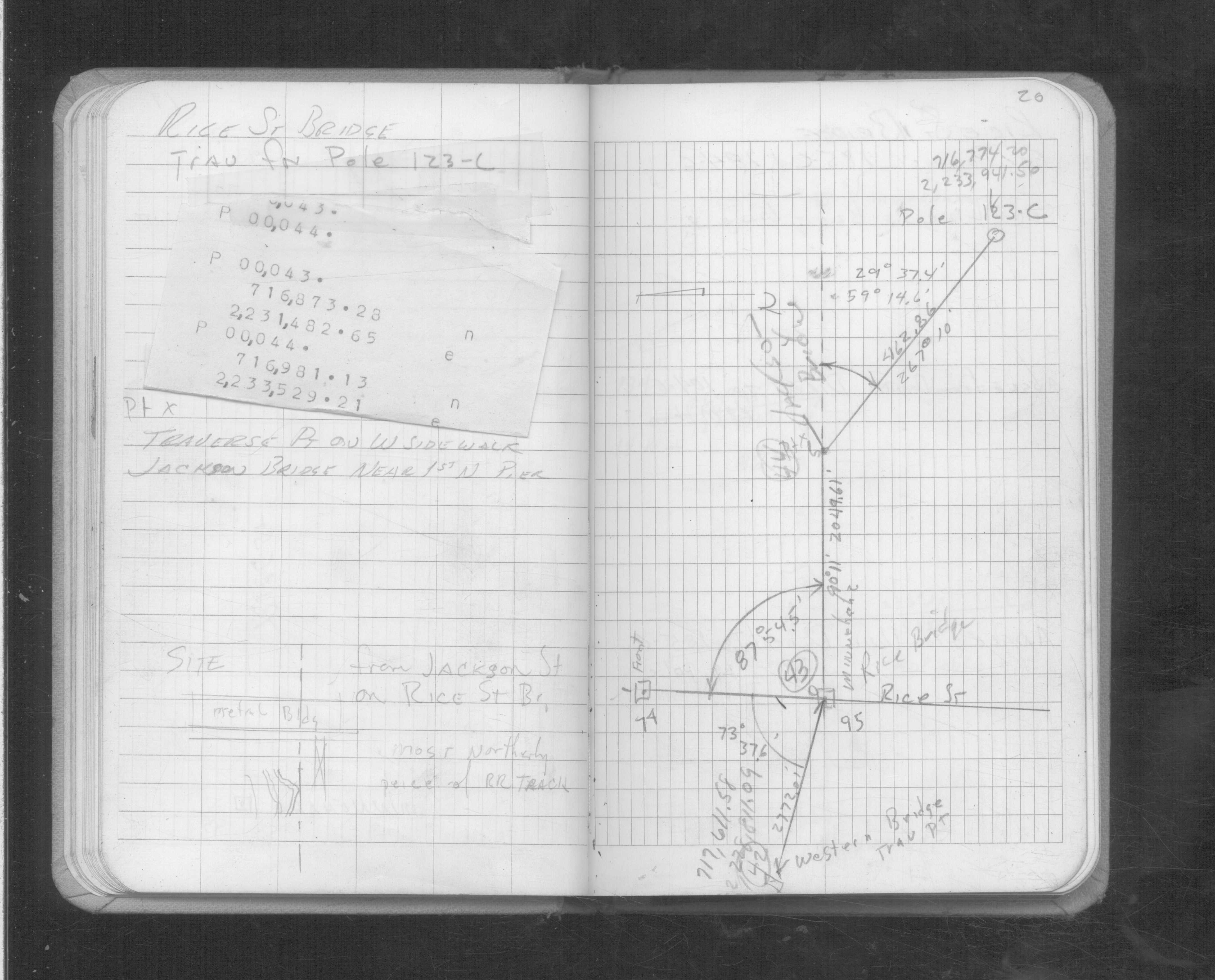
| FB 1689Ap.11 | ||||||
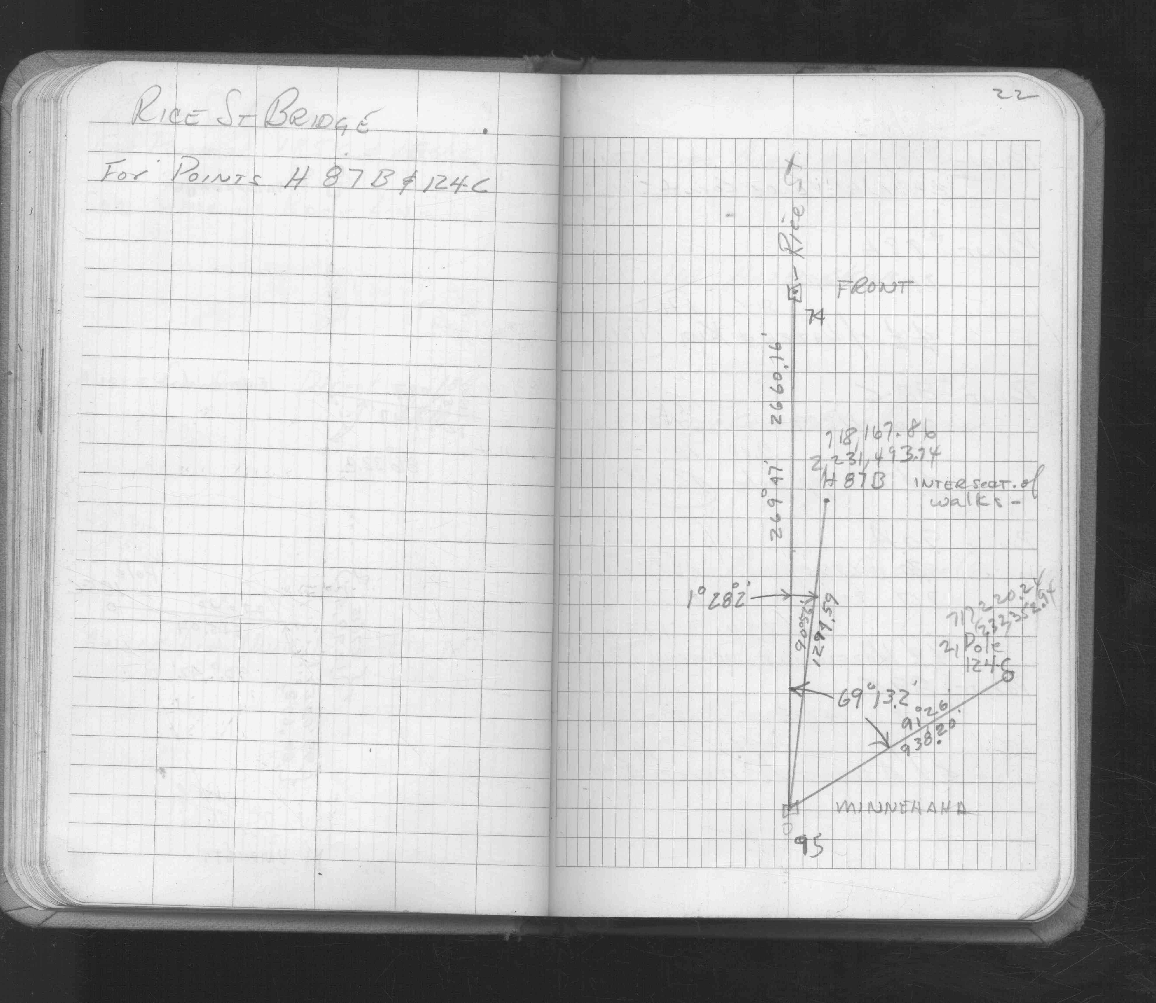
| FB 1689Ap.07 | ||||||
| FB 1736p.36 |
| FILE | SURVEYOR | LIC. NO. | DATE SIGNED | DATE TIED |
|---|---|---|---|---|
| 0074-0039-A.tif | William J. Cutting | 20576 | August 5, 1991 | August 1, 1991 |
| ST_001-078p074.jpg | none | none | none | none |
| ST_001-078p074.jpg | none | none | none | none |
| 0074-0039-A.dwf | none | none | none | none |
| 0074-0039-A.dwf | none | none | none | none |
| FILE | PHOTO DATE | COMMENTS |
|---|---|---|
| 0074-0039-2.jpg | September 3, 2004 | Close up of monument. |
| 0074-0039-1.jpg | September 3, 2004 | Close up of monument. |