| NAD83 COORDINATES (1986 adj.): |
|---|
| * X= 574275.22 Y= 165416.44 Z= 0 LSQ 12/6/1991 S FLT |
| 8/4/2014 | CIM located 0.5 feet below asphalt surface by Ramsey County forces, who set a new 4 3/8 inch CIM to street grade above existing CIM. Ties placed. |
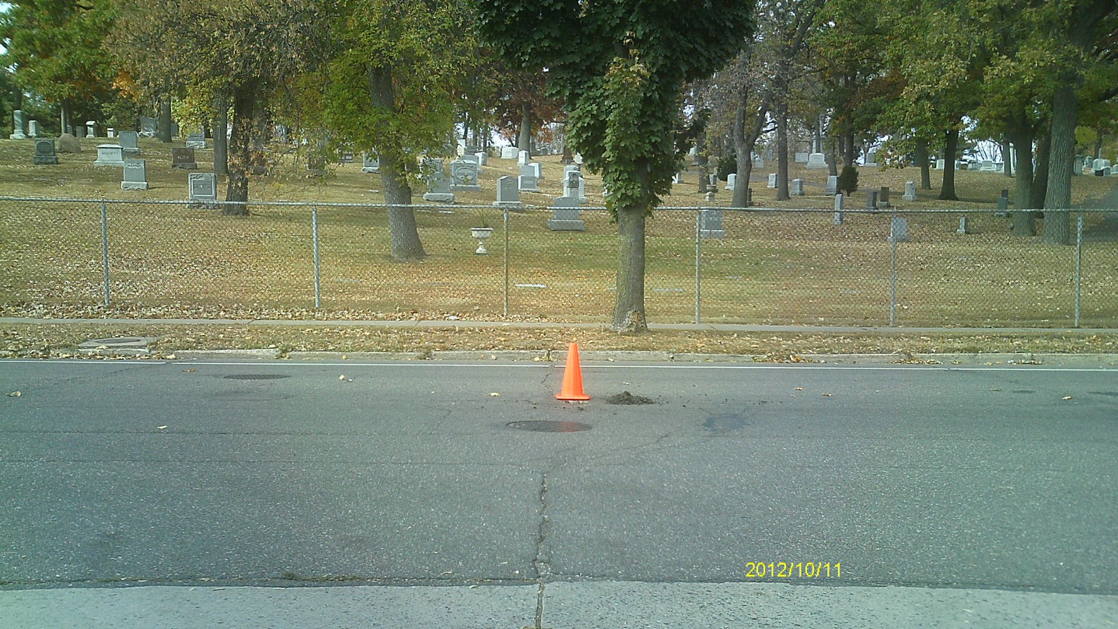
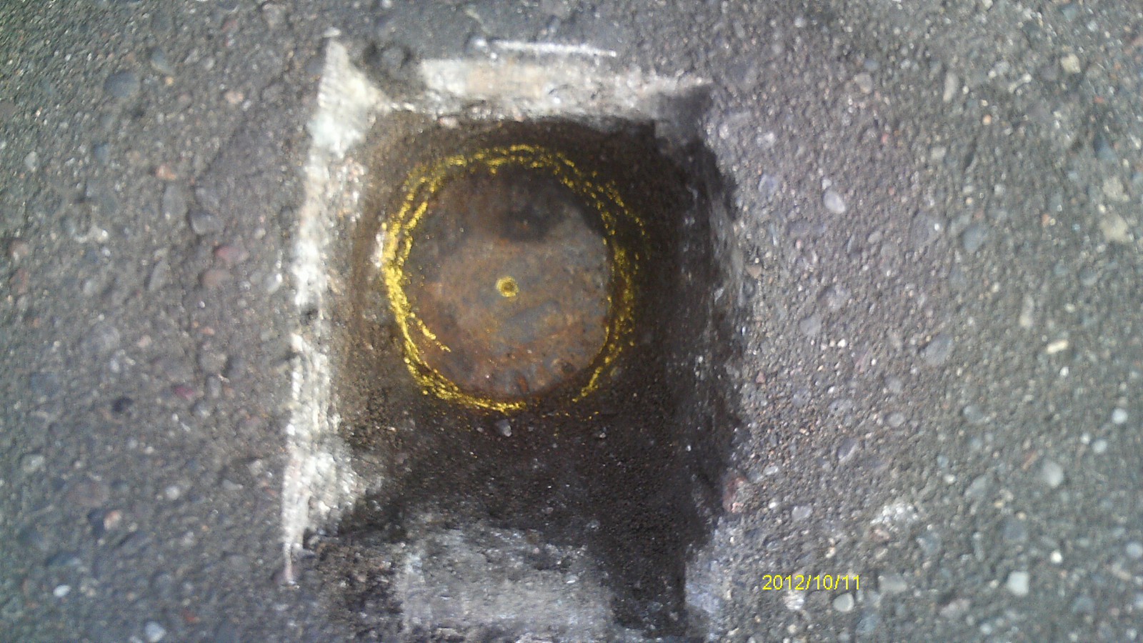
| 10/11/2012 | Found CIM 0.35 ft below street grade. Photos taken. |
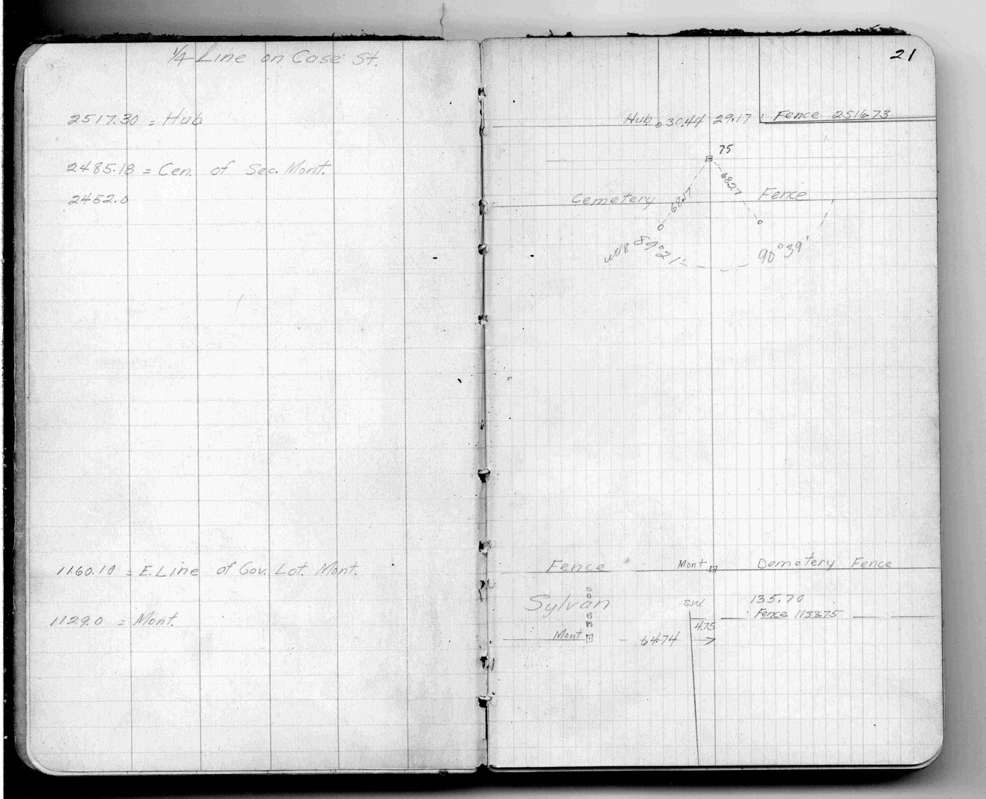
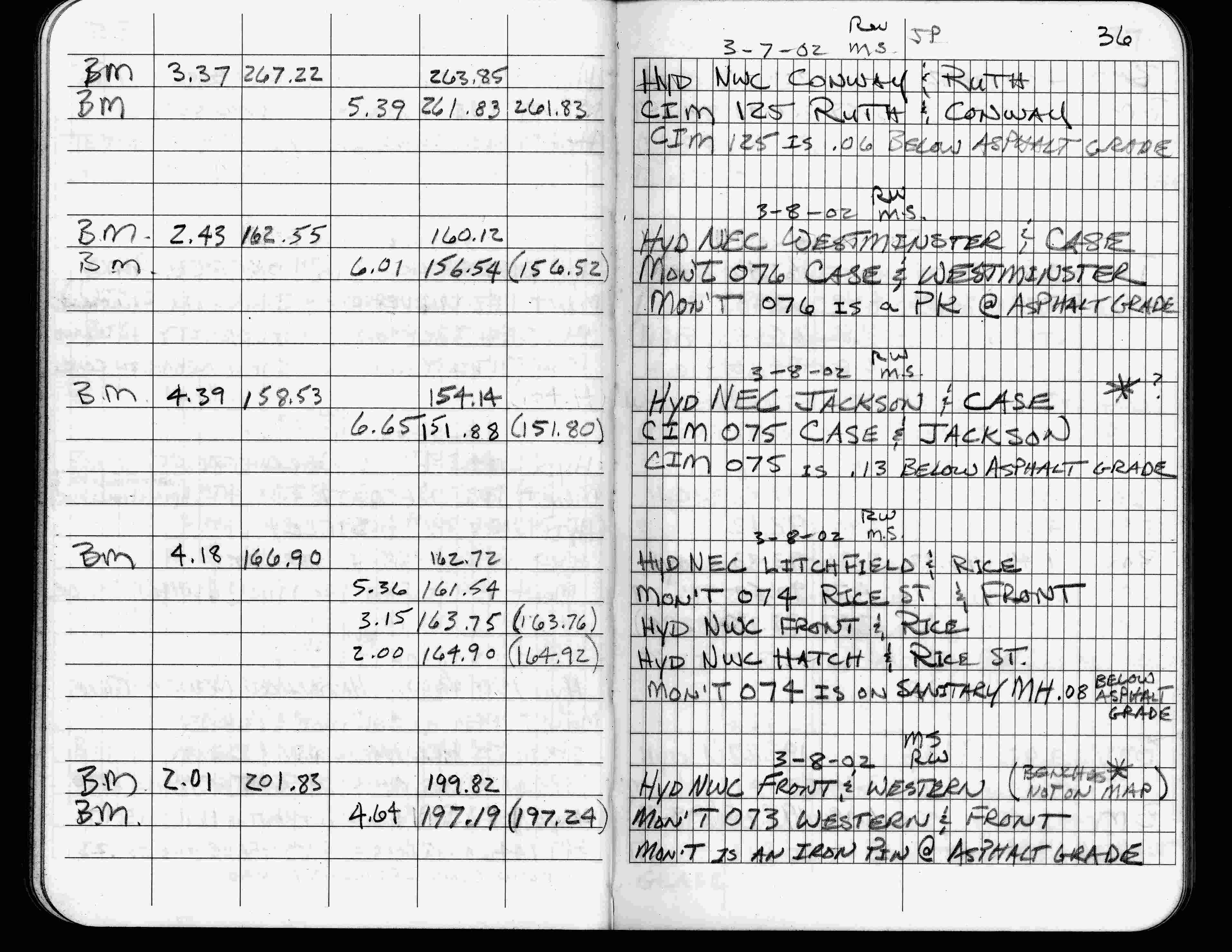
| 3/8/2002 | Elev 151.88 ft on CIM 0.13 ft below asphalt surface. See FB 1736 p.36 |
| 3/17/2000 | Fd CIM 0.10 ft below asphalt at concrete base grade (marked for painting target for 2000 target) |
| 3/26/1997 | Elev 151.80 ft on CIM. See acorddat/1997/1997/p1157/p1157.sdr Digital-Unadj |
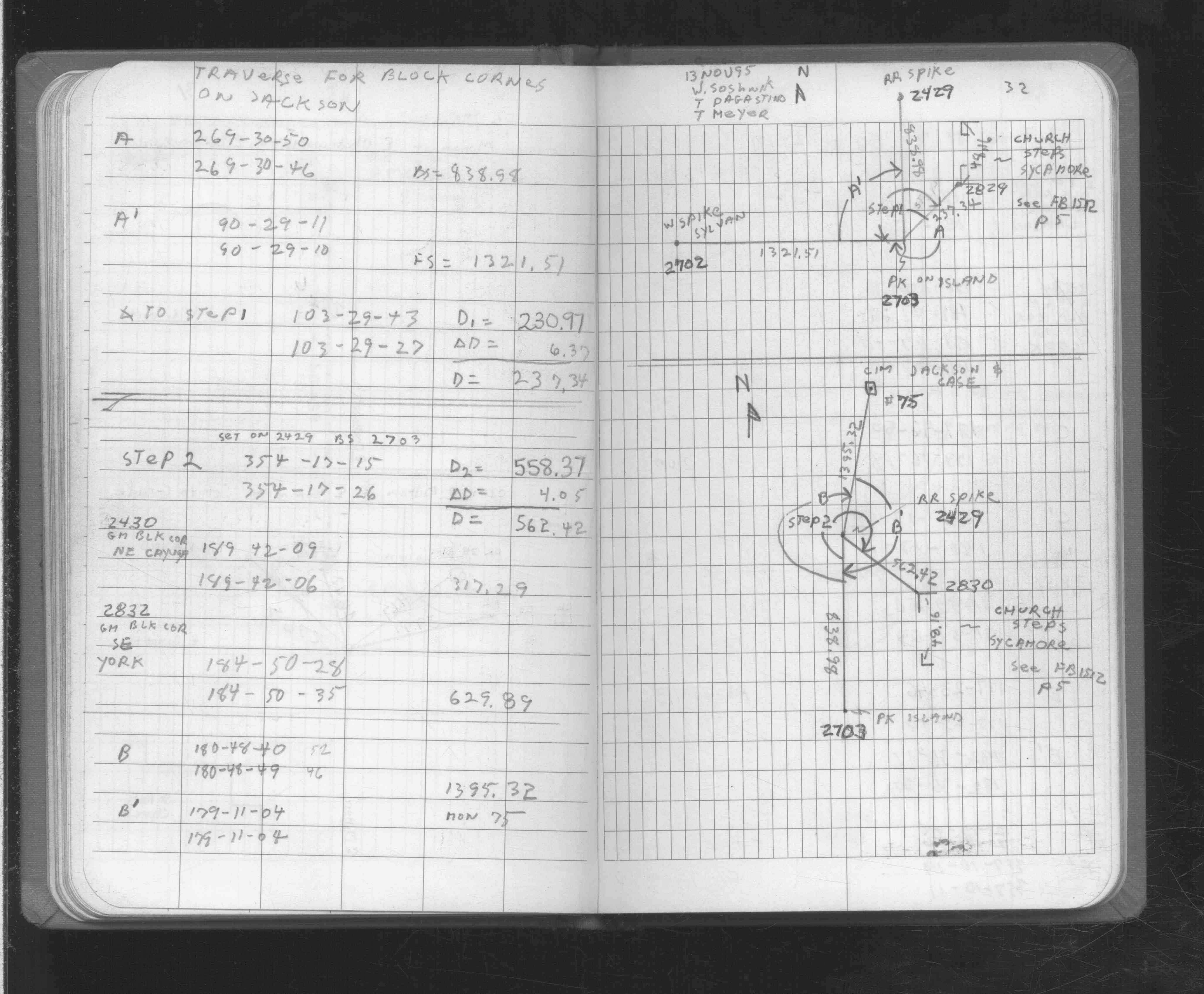
| 11/1/1995 | (Unknown date Nov __, 1995 ) Used CIM for traverse control. See FB 1725 p.33 |
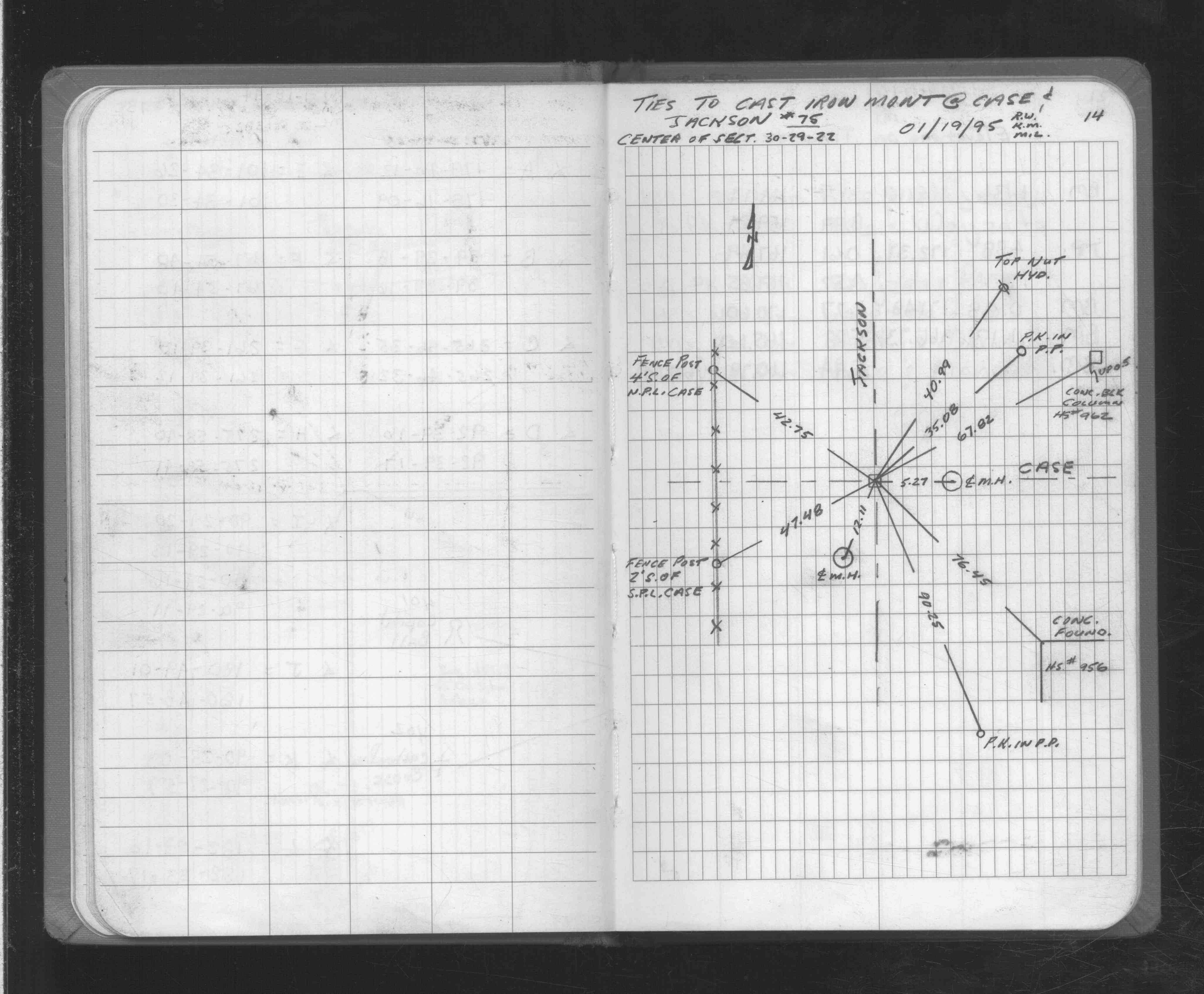
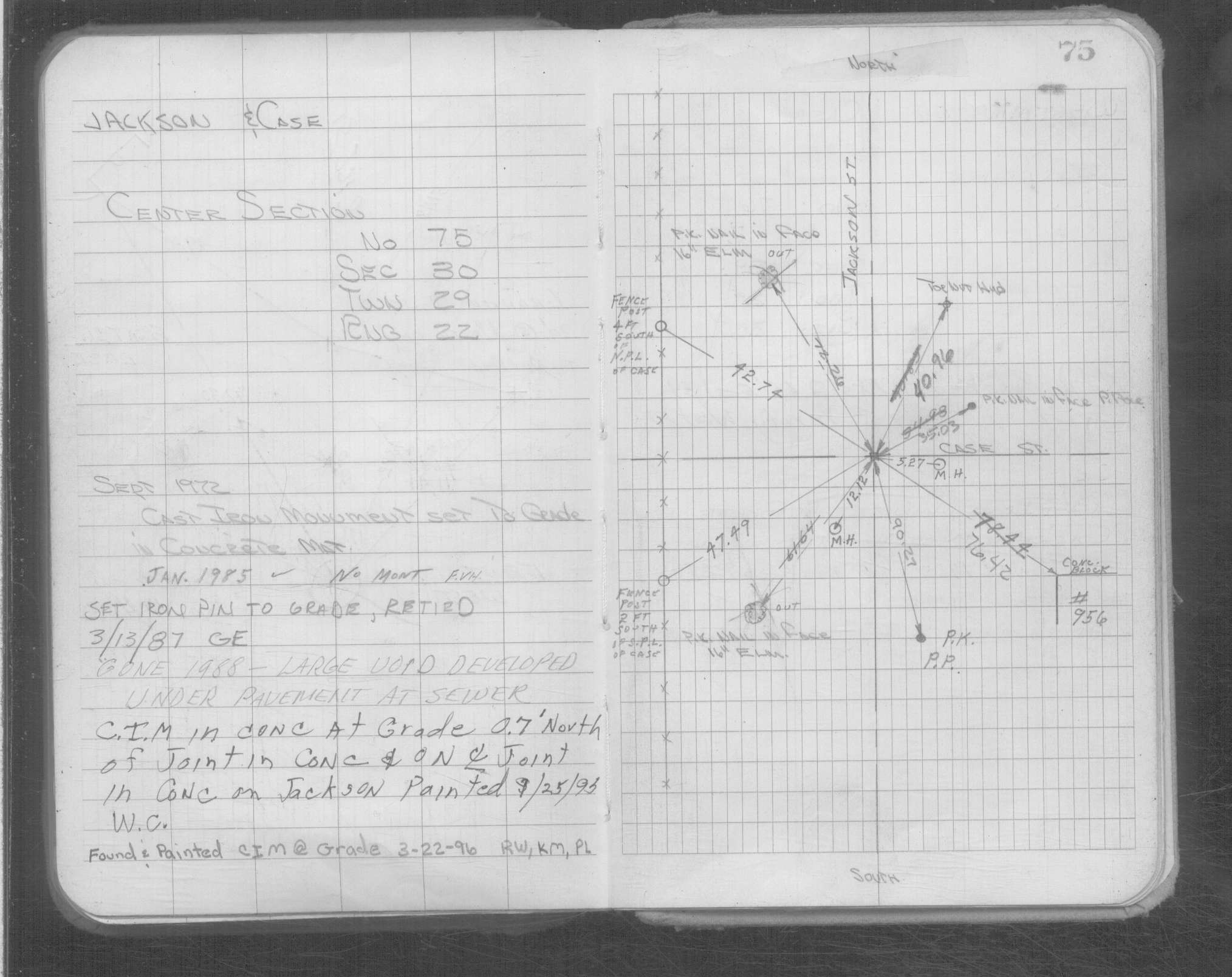
| 1/19/1995 | Placed ties on CIM. See FB 1725 p.14 also 0075-1685-B |
| 10/14/1992 | Recovered iron pin, placed ties & replaced iron pin with CIM. See CofL 0075-1685-A |
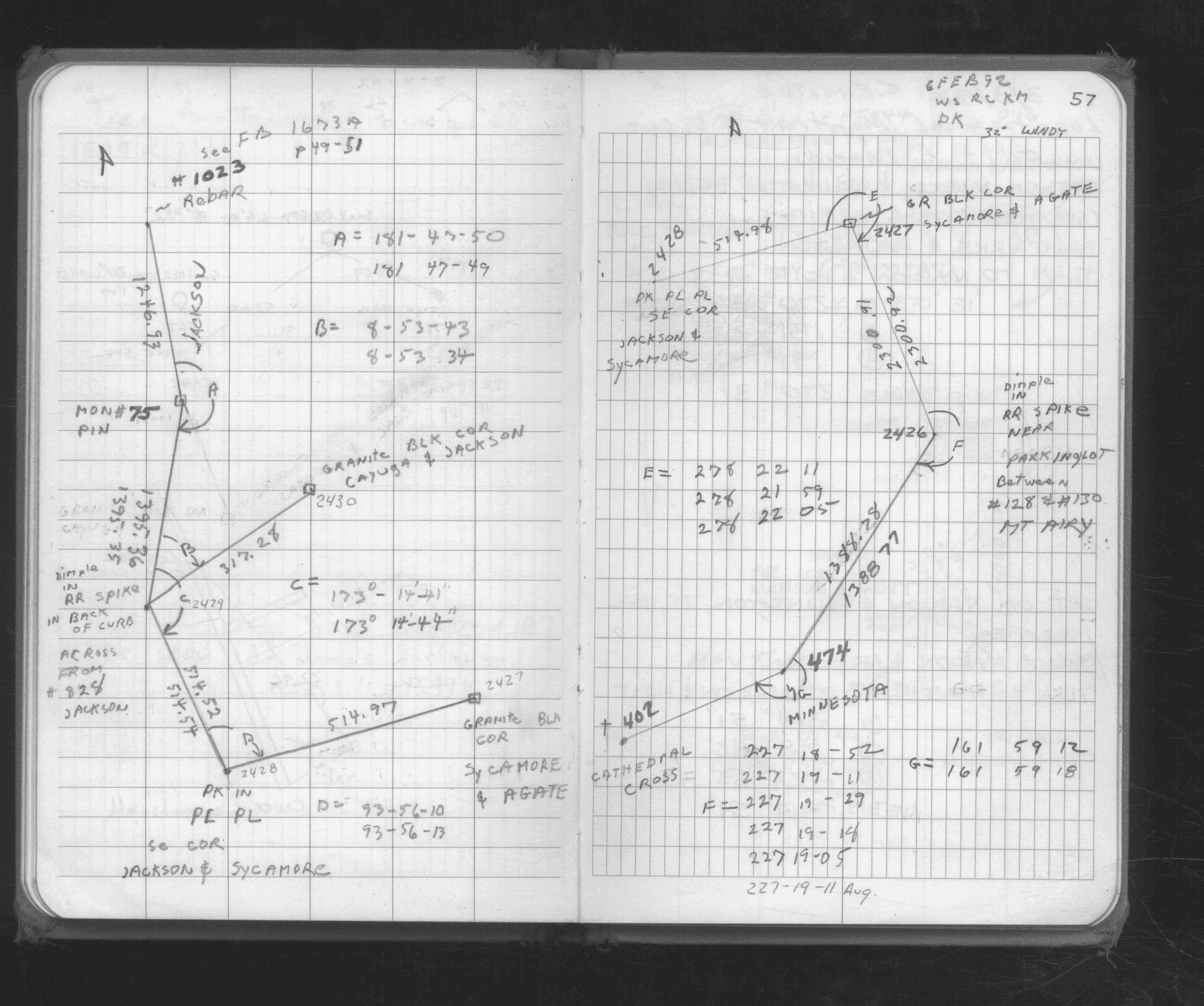
| 2/6/1992 | Used pin for traverse control. See FB 1676D p.57 |
| 1/1/1988 | (Unknown date ___ __, 1988 ) No monument, large void developed under pavement at sewer |
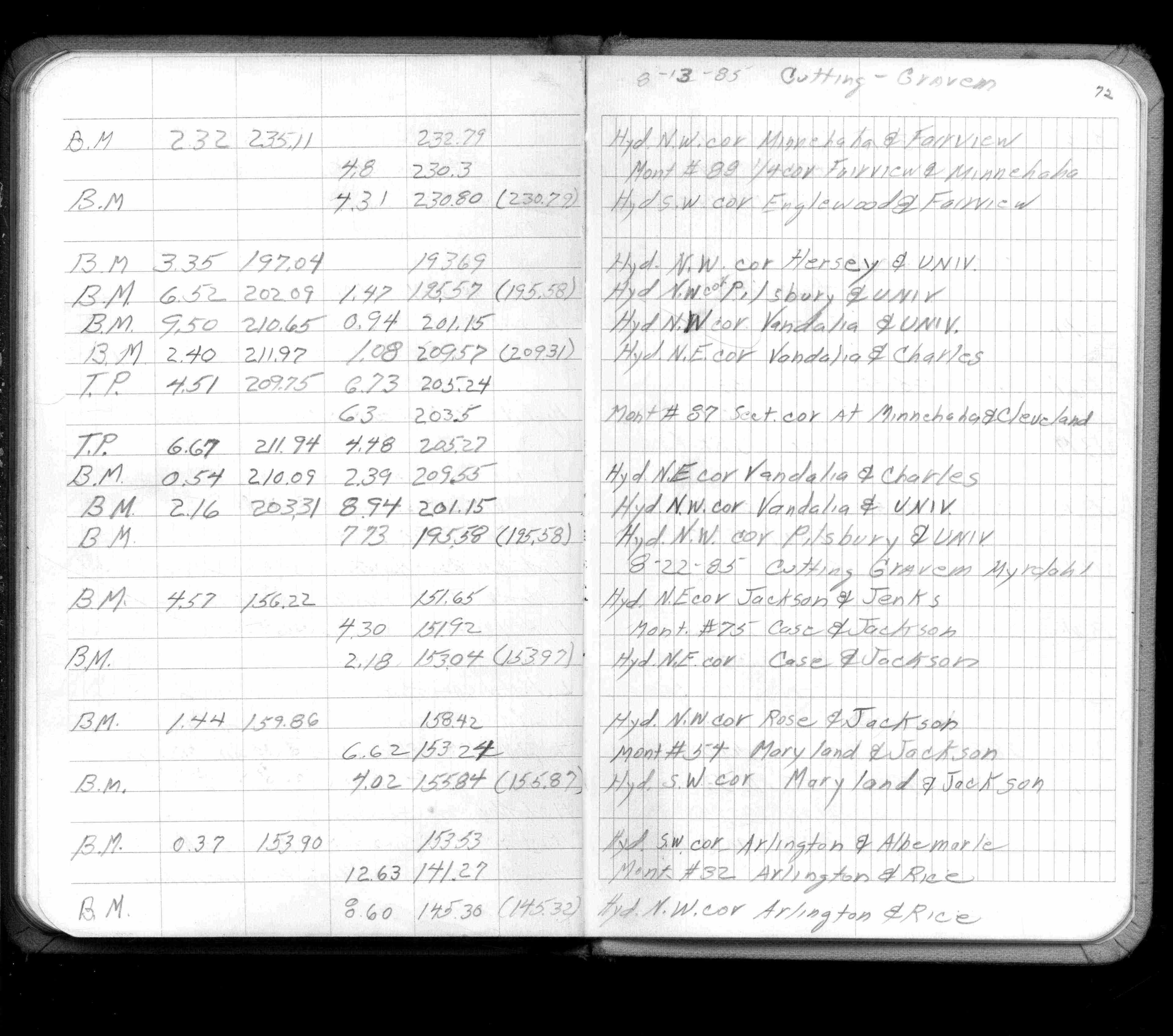
| 8/1/1985 | (Unknown date Aug __, 1985 ) Elev 151.92 ft on ?. See FB 1421A p.72 |
| 2/16/1972 | Monument out. See FB 1689A p.7 |
| 12/1/1959 | (Unknown date Dec __, 1959 ) Placed ties on PK. See FB 1512 p.15 |
| 1/1/1895 | (Unknown date ___ __, 1895 ) The plat of Oakland Cemetery shows a GM inplace. |
| 12/1/1889 | (Unknown date Dec __, 1889 ) Monument set by J H Armstrong |
Above is NOT an all inclusive history of this point. Please review all the links below.
| PLS NOTES | Field | Cross Section | Sewer | J.B. Irvine | Monument | River Survey |
|---|---|---|---|---|---|---|
| FB 0300CPYp.21 | ||||||
| FB 1421Ap.72 | ||||||
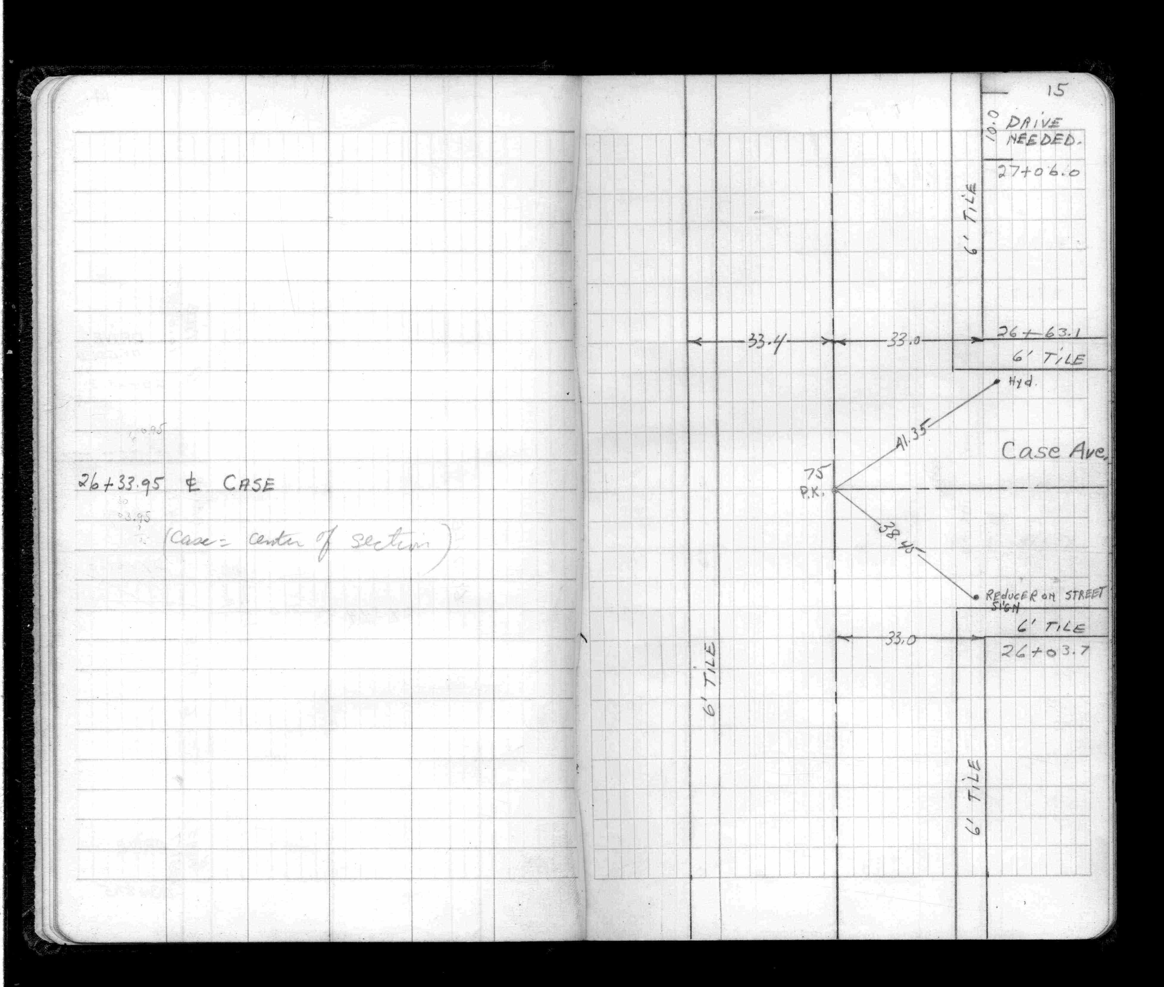
| FB 1512p.15 | ||||||
| FB 1512p.15 | ||||||
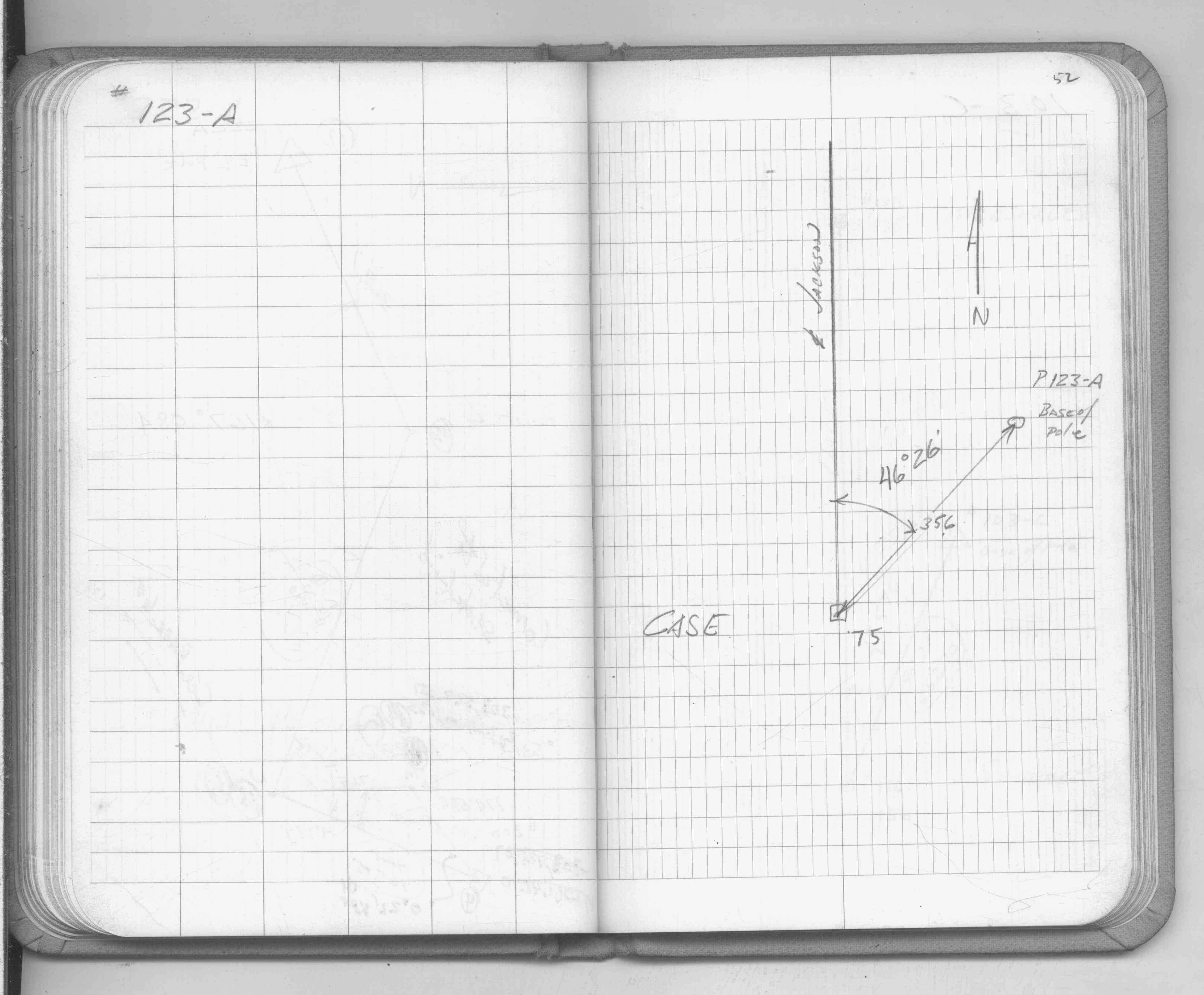
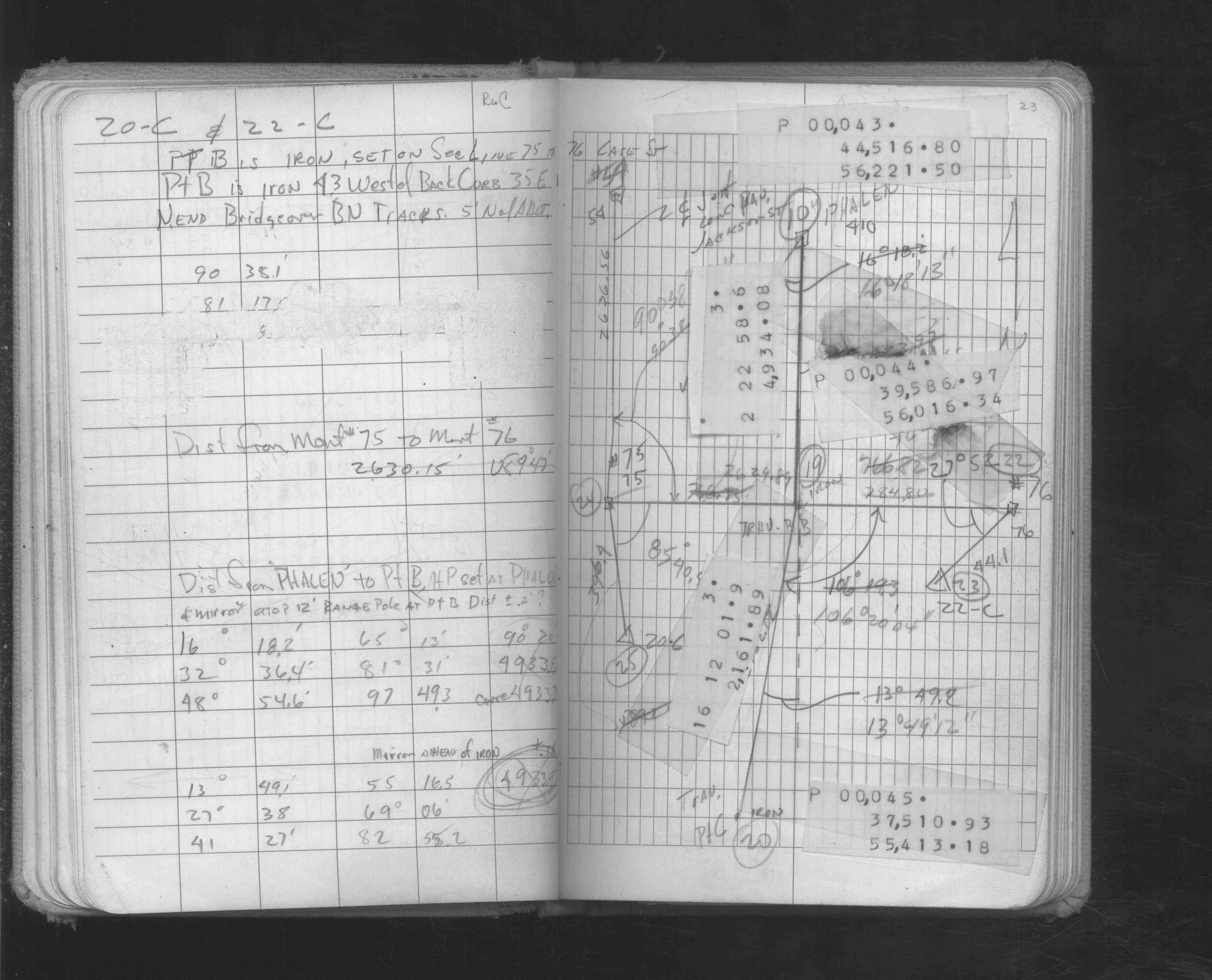
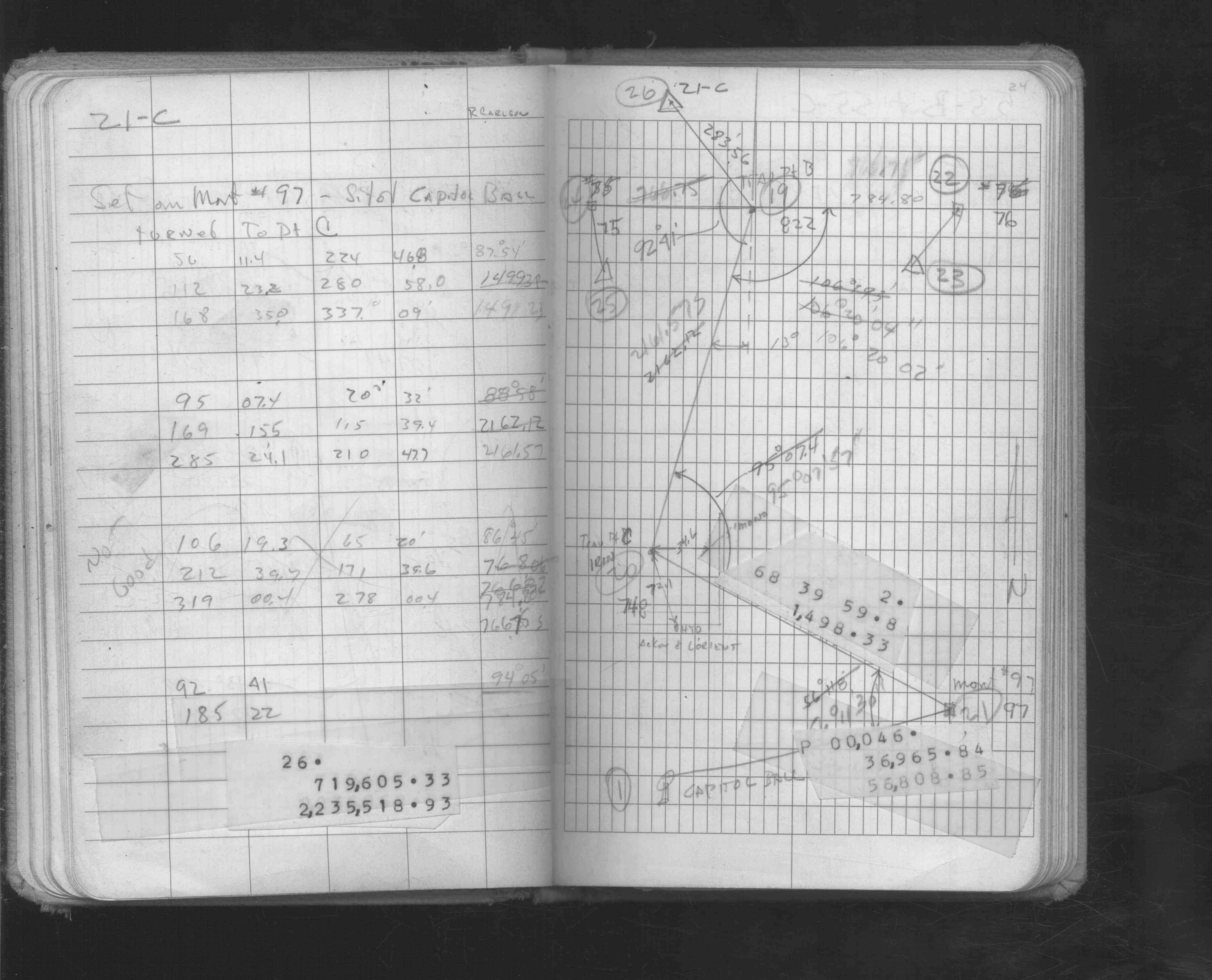
| FB 1549Fp. 52 ,54 | ||||||
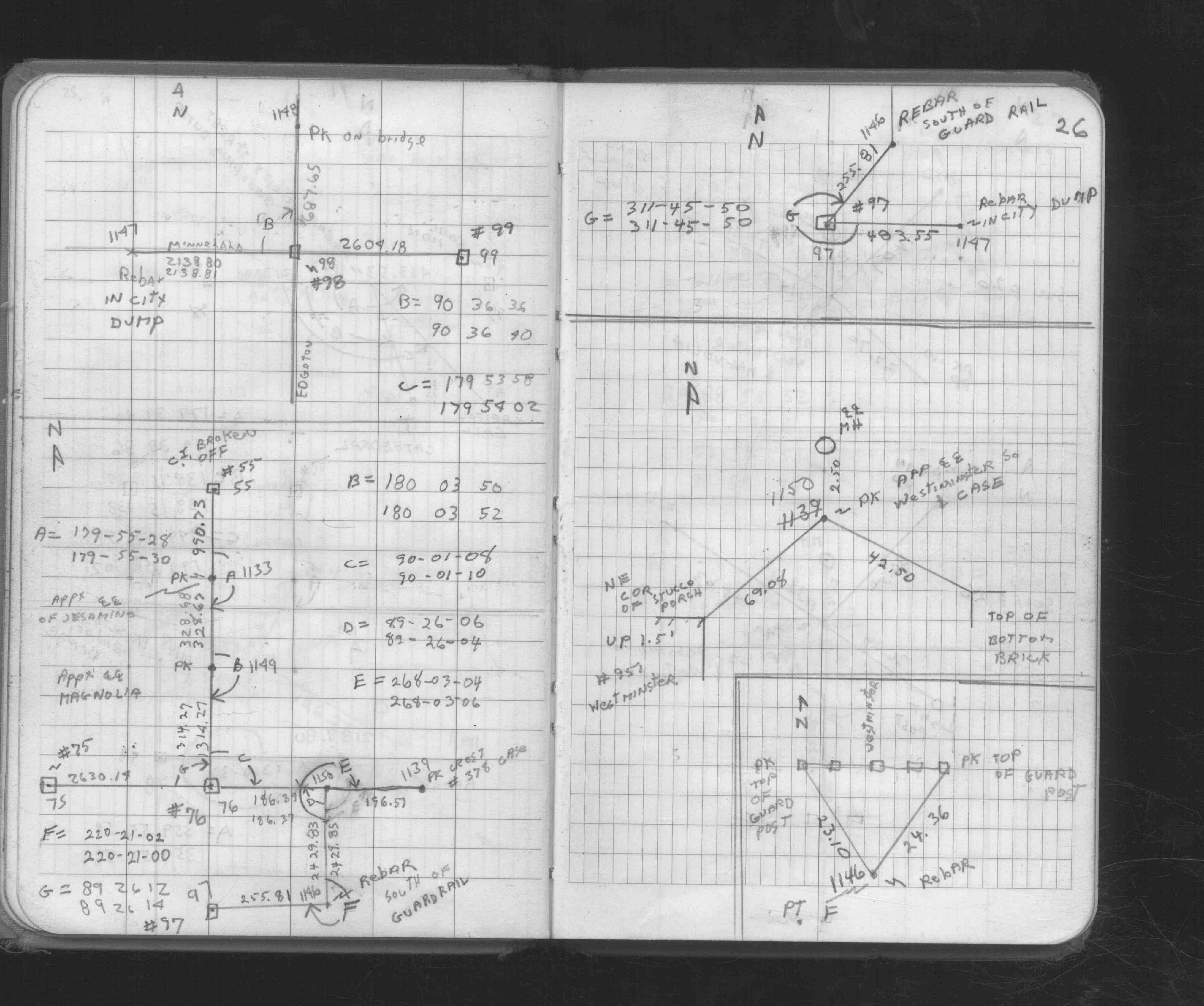
| FB 1549Ip. 23 ,24 | ||||||
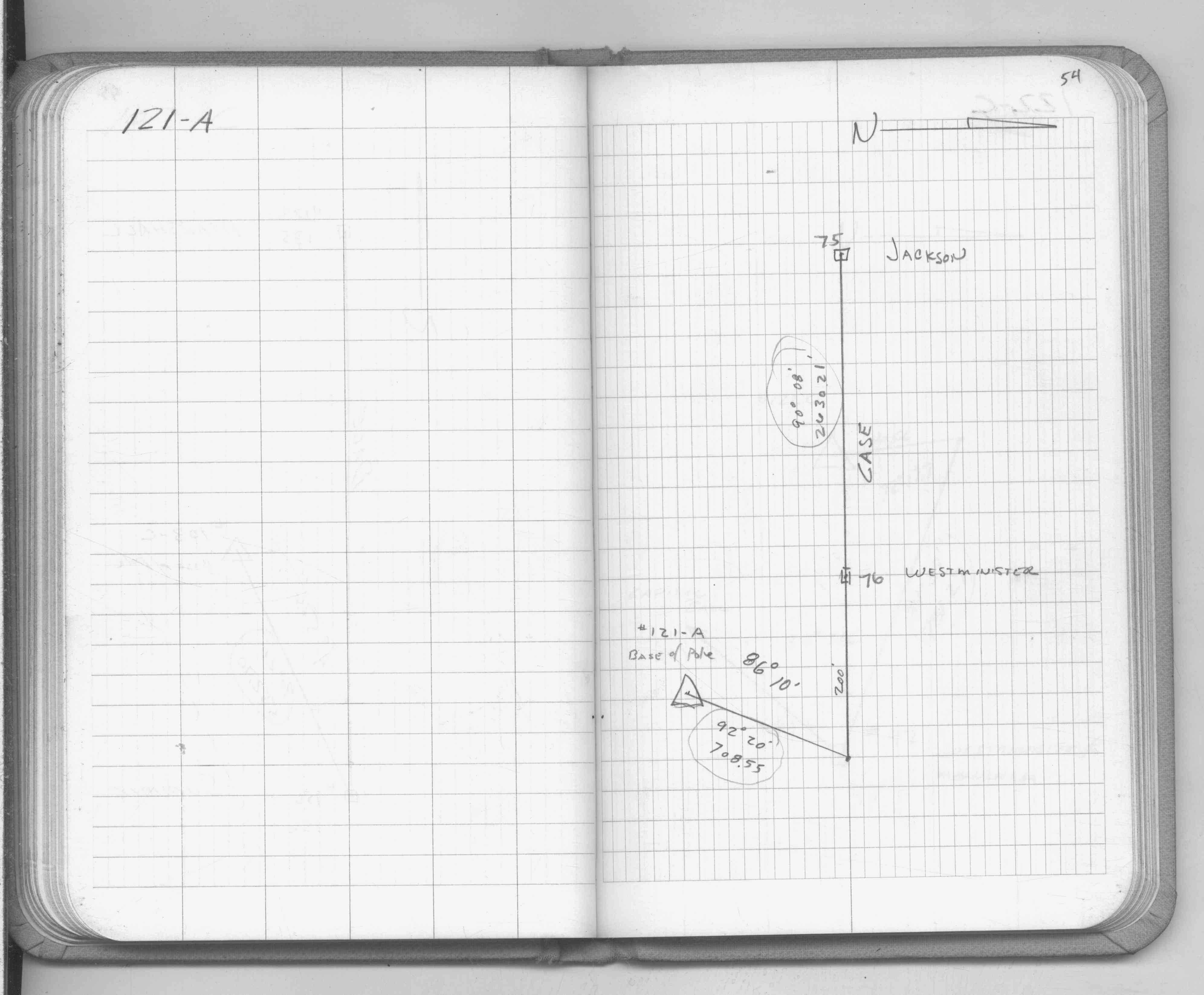
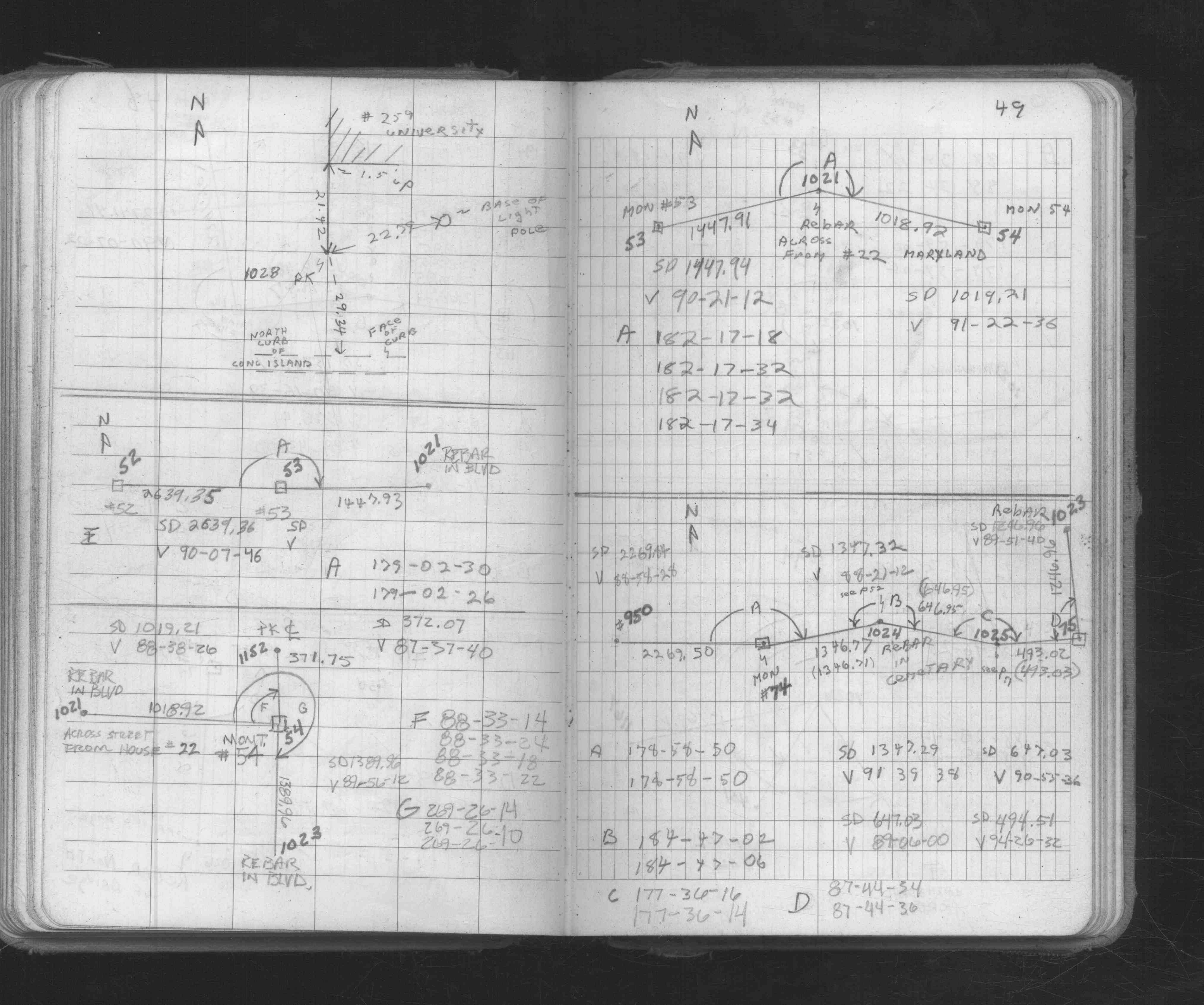
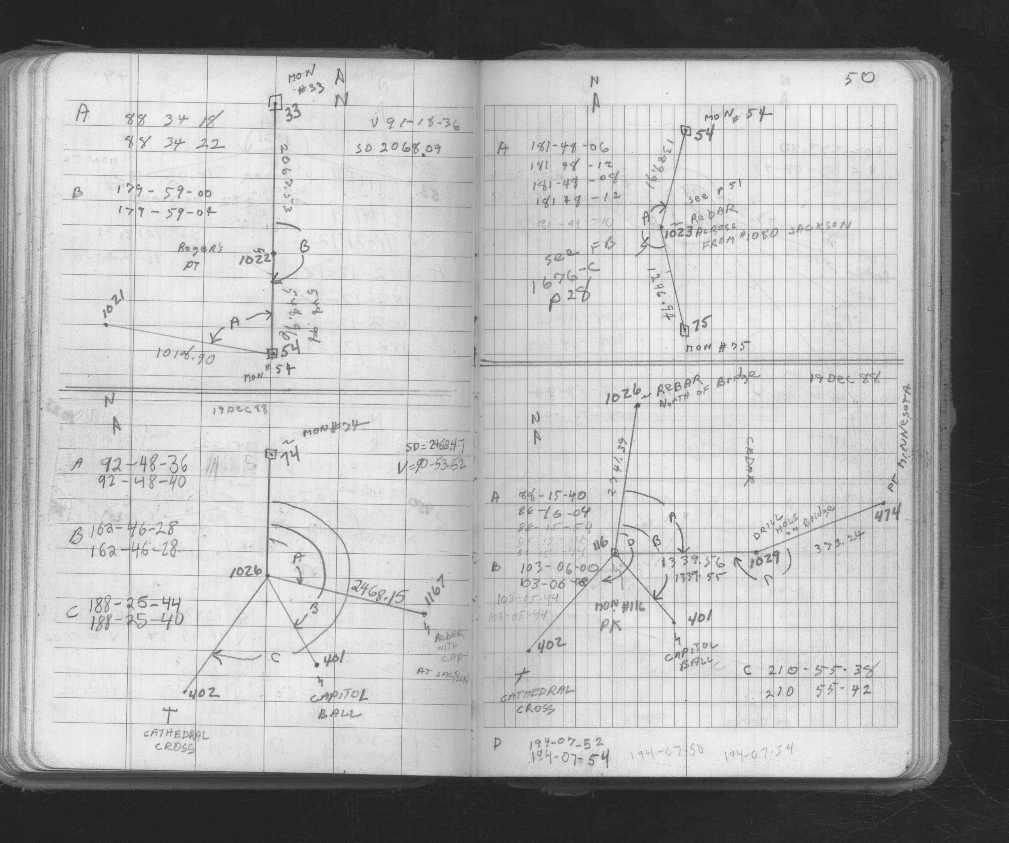
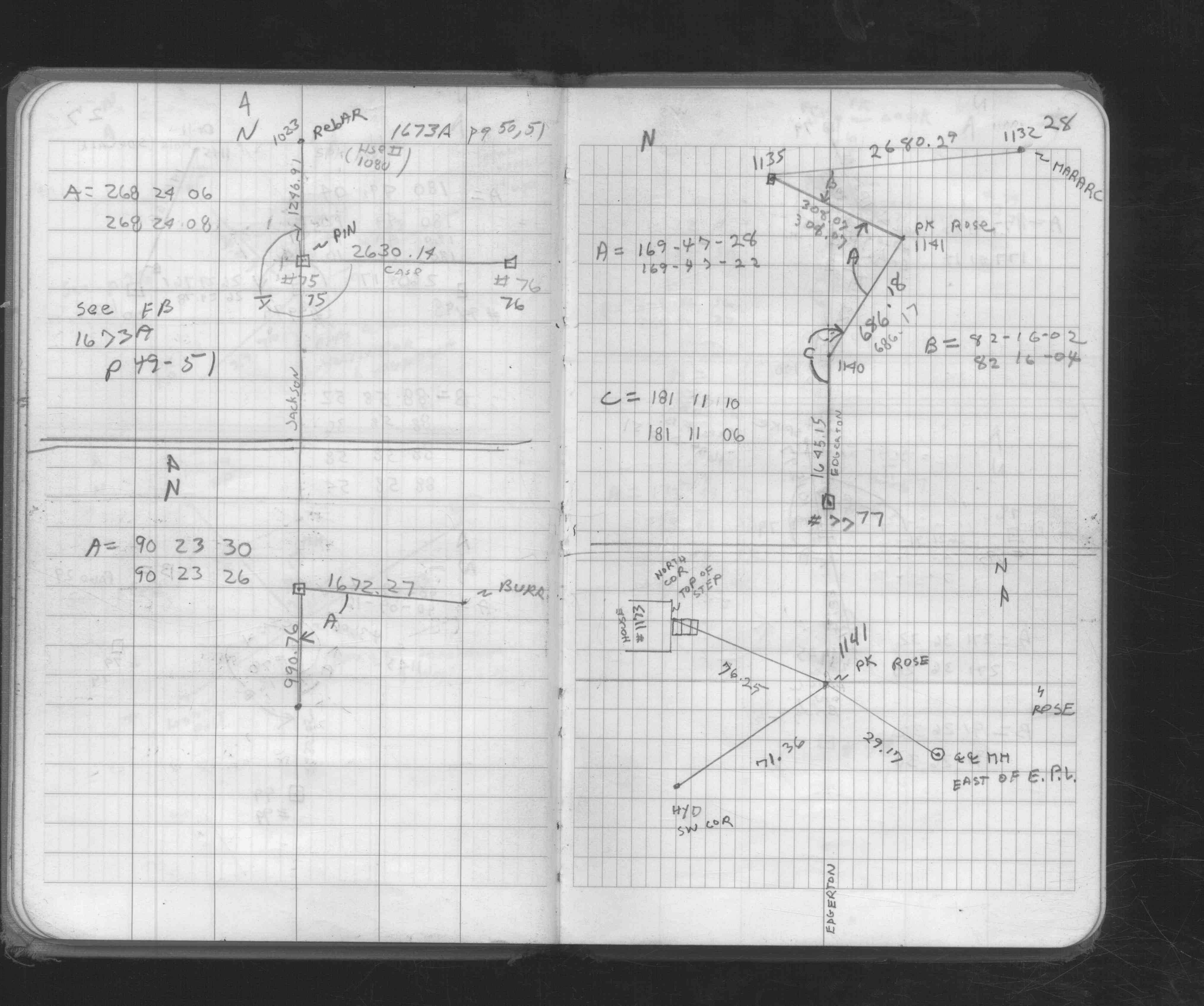
| FB 1673Ap. 49 ,50 | ||||||
| FB 1676Cp. 17 ,26 ,28 | ||||||
| FB 1676Dp.57 | ||||||
| FB 1689Ap.07 | ||||||
| FB 1725p.14 | ||||||
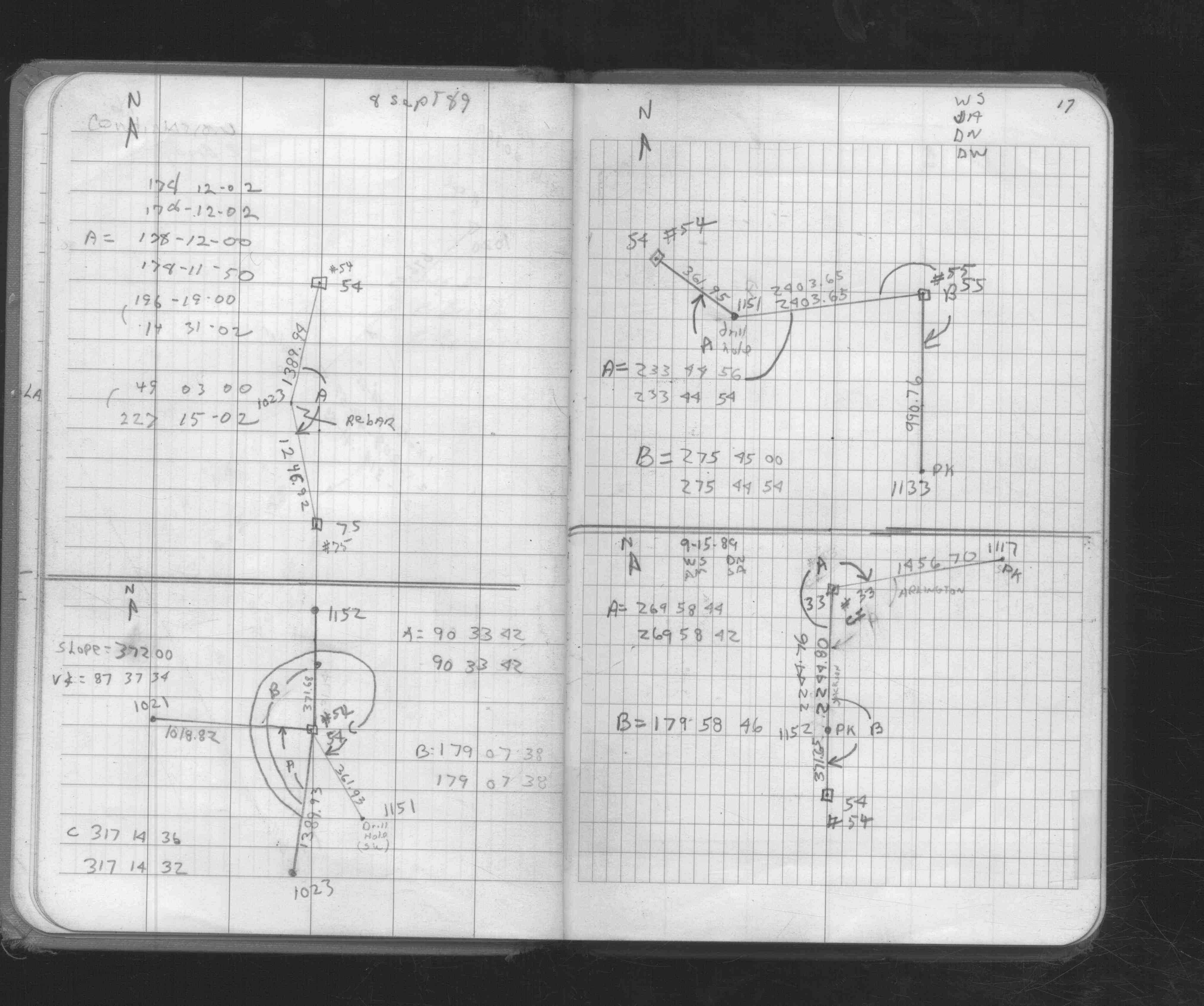
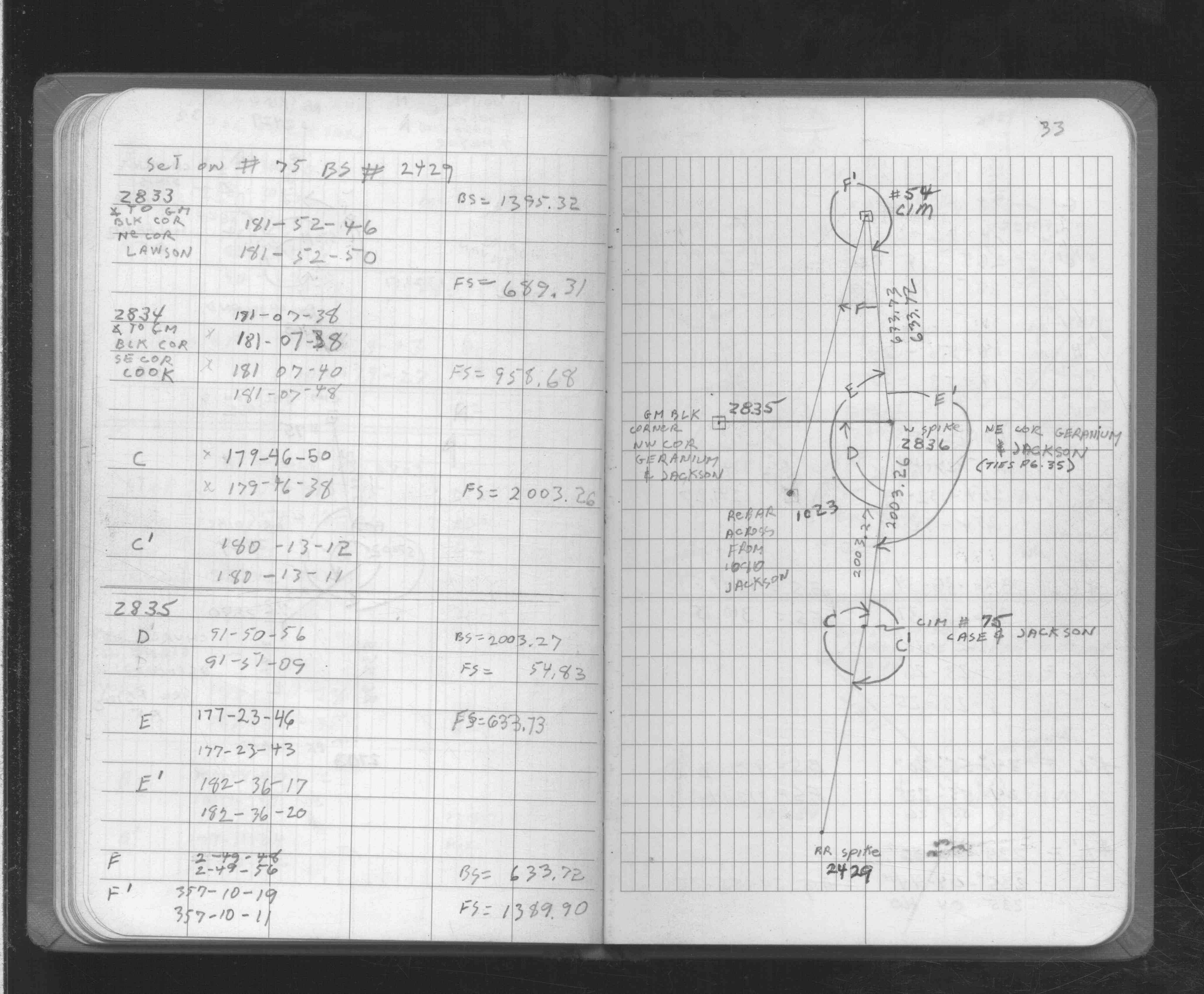
| FB 1725p. 14 ,32 ,33 | ||||||
| FB 1725p.33 | ||||||
| FB 1736p.36 |
| FILE | SURVEYOR | LIC. NO. | DATE SIGNED | DATE TIED |
|---|---|---|---|---|
| 0075-1685-B.pdf | Daniel D. Baar | 45816 | December 12, 2014 | August 4, 2014 |
| 0075-1685-B.tif | none | none | none | January 19, 1995 |
| 0075-1685-A.tif | William J. Cutting | 20576 | October 16, 1992 | October 14, 1992 |
| ST_001-078p075.jpg | none | none | none | none |
| 0075-1685-A.dwf | none | none | none | none |
| FILE | PHOTO DATE | COMMENTS |
|---|---|---|
| 0075-1685-5.jpg | October 11, 2012 | Looking west towards Oakland Cemetery. |
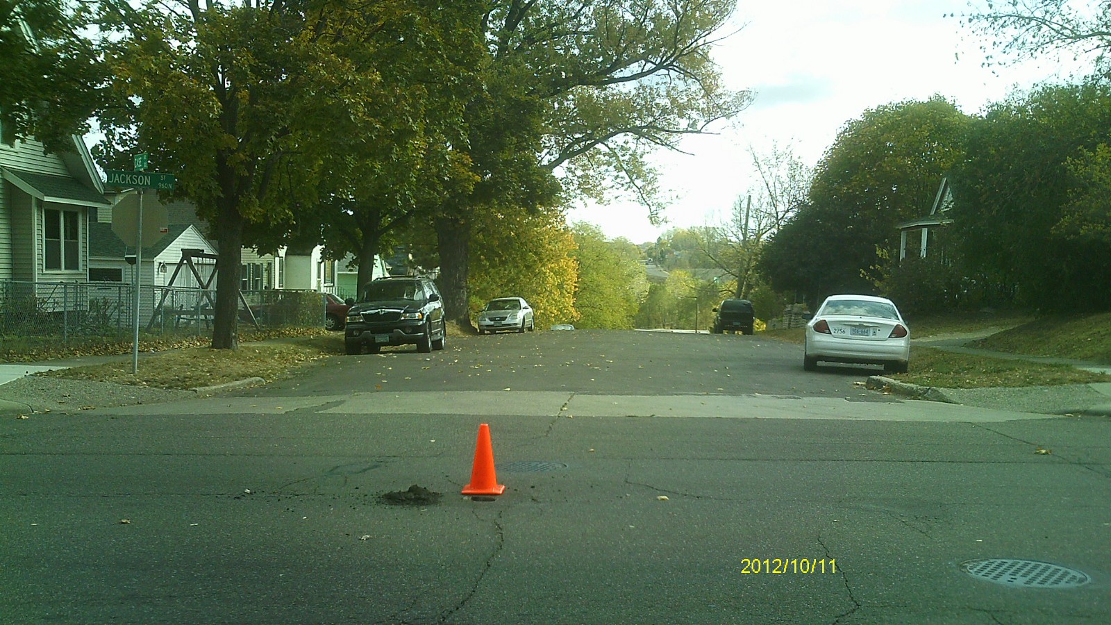
| 0075-1685-4.jpg | October 11, 2012 | Looking south along Jackson St. |
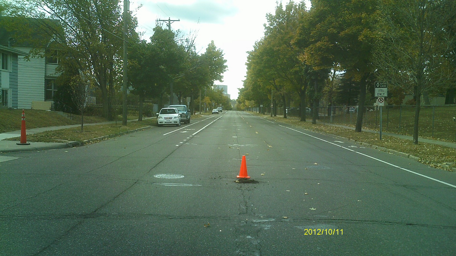
| 0075-1685-3.jpg | October 11, 2012 | Looking east along Case Ave. |
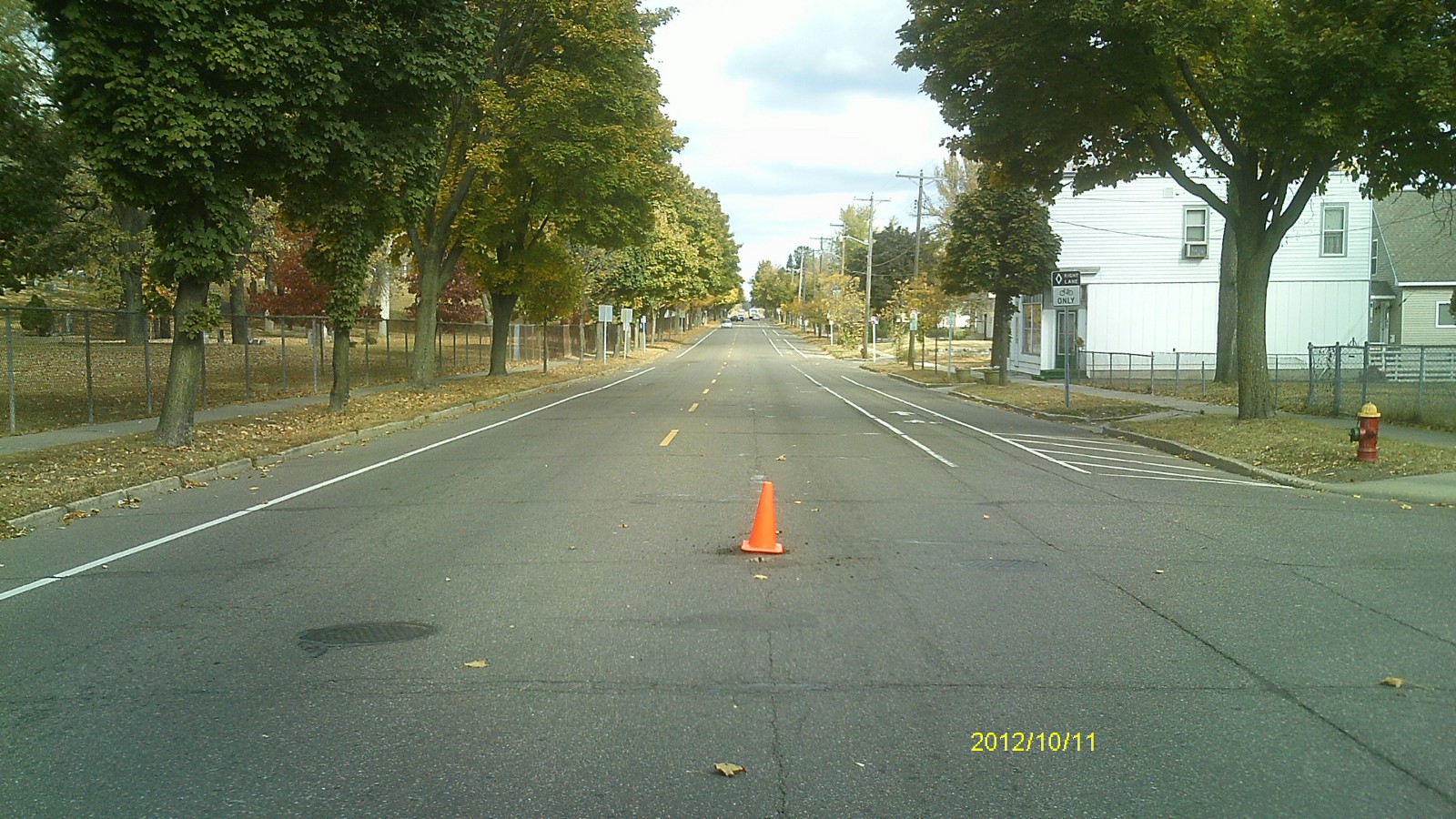
| 0075-1685-2.jpg | October 11, 2012 | Looking north along Jackson St. |
| 0075-1685-1.jpg | October 11, 2012 | Close up of monument. |