| NAD83 COORDINATES (1986 adj.): |
|---|
| * X= 576905.29 Y= 165402.71 Z= 0 LSQ 12/6/1991 S FLT |
| X= 576905.26 Y= 165402.71 Z= 0 9/22/2003 RTK-VRS |
| 7/21/2011 | Aluminum Cap over a 3/4" PIN tied by MnDot See CofL 0076-0043-C.pdf |
| 4/15/2004 | Placed a CIM to asphalt grade and placed ties. See CofL 0076-0043-B |
| 9/22/2003 | Coordinate position established by GPS RTK-VRS on pk nail. |
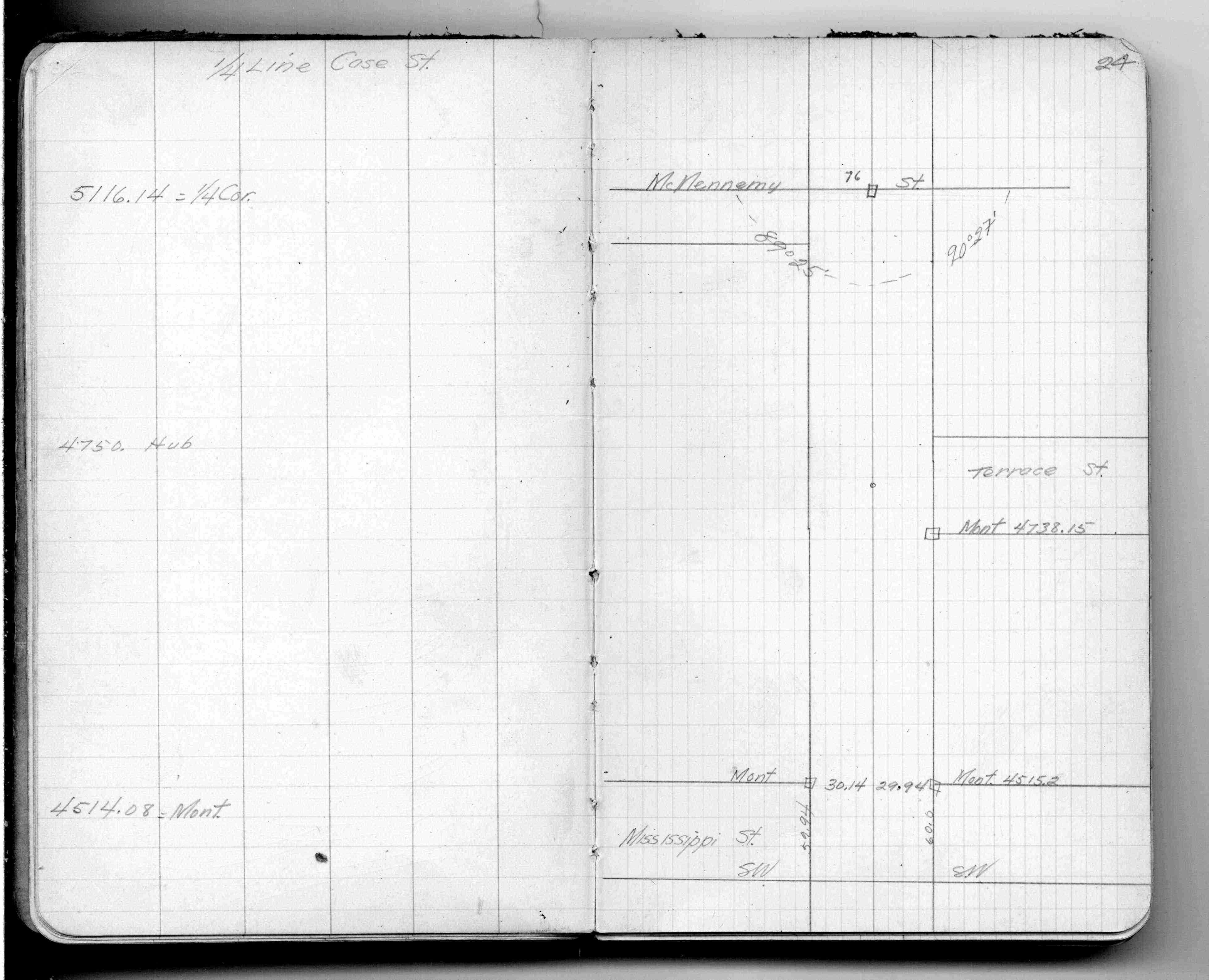
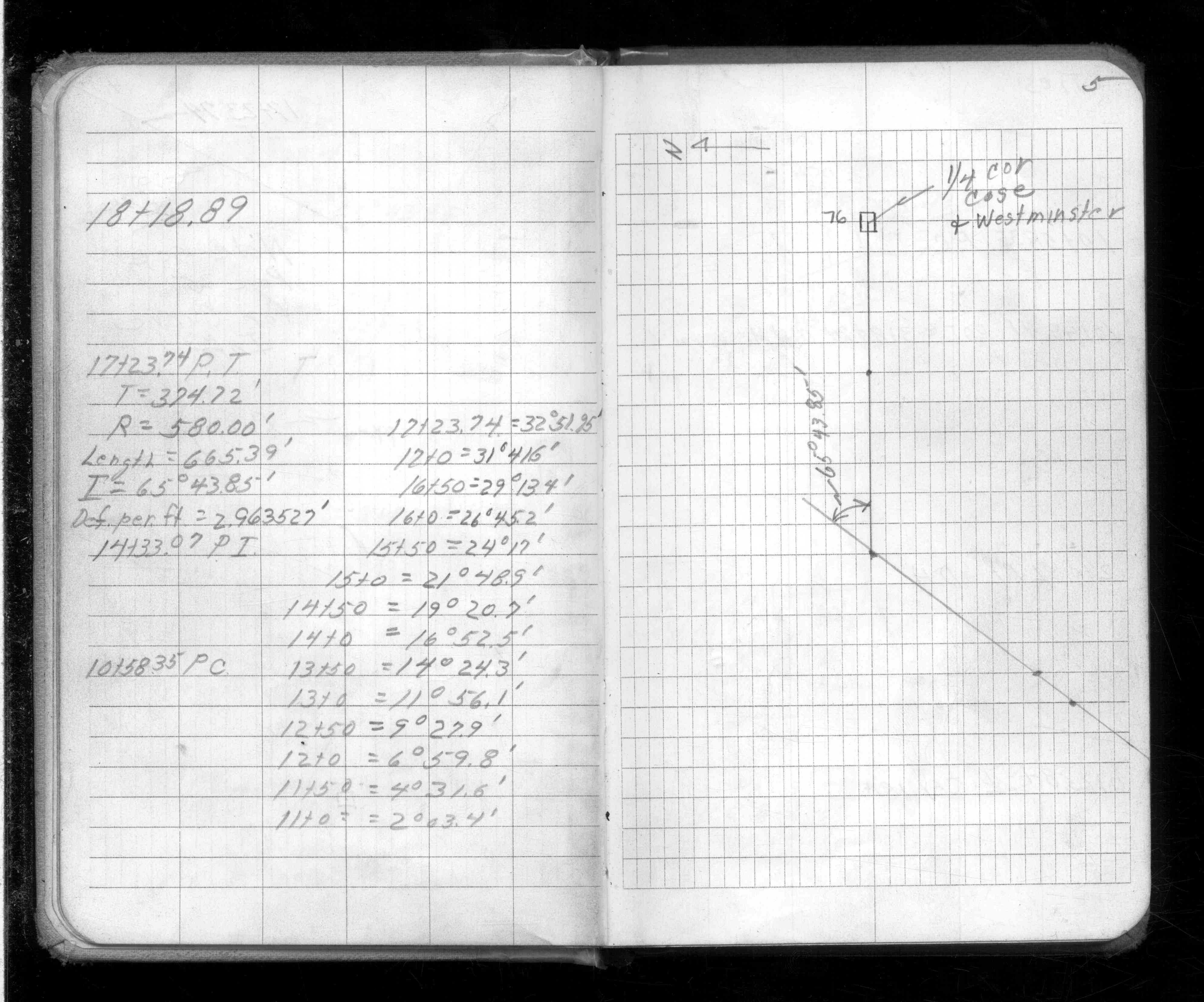
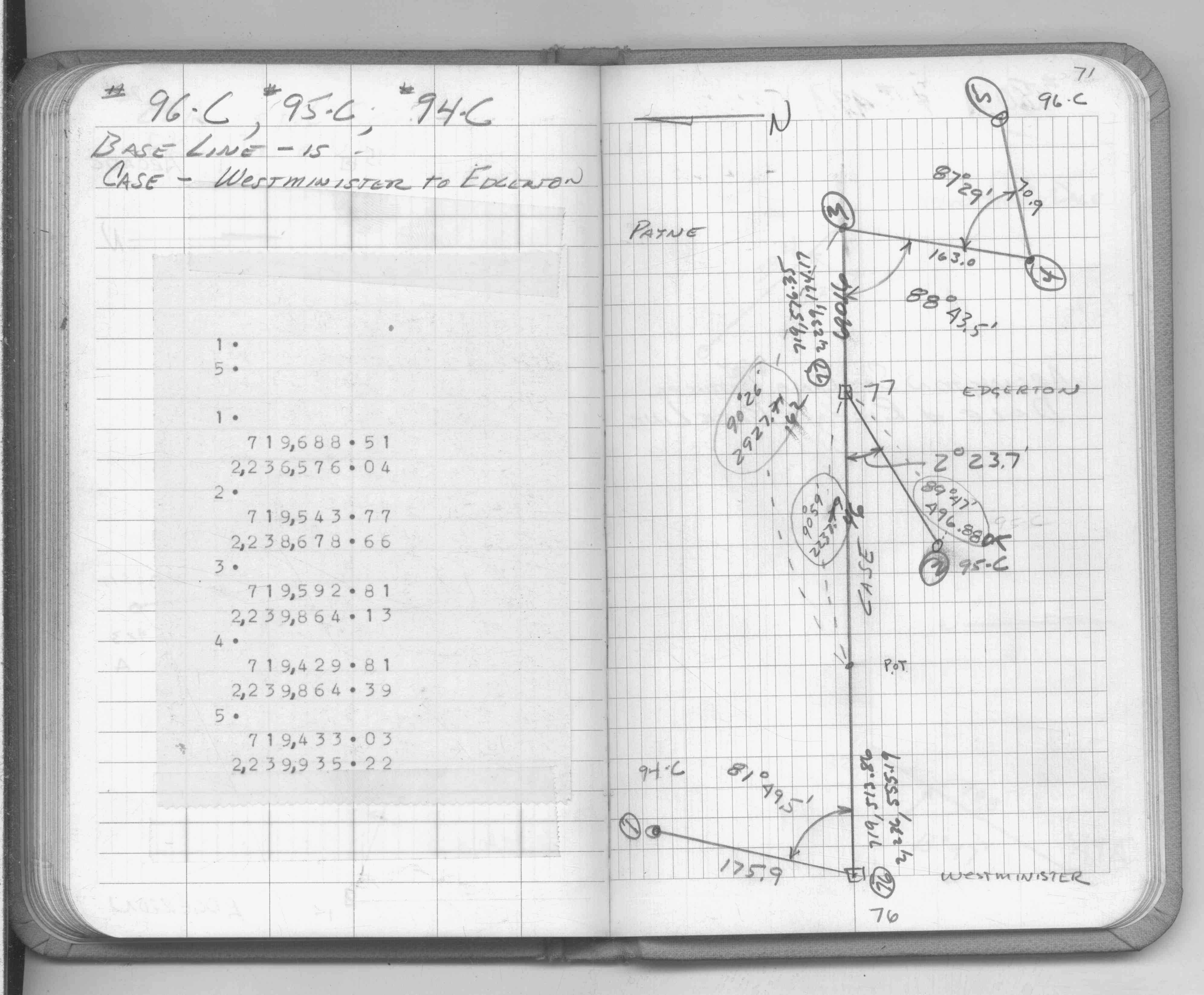
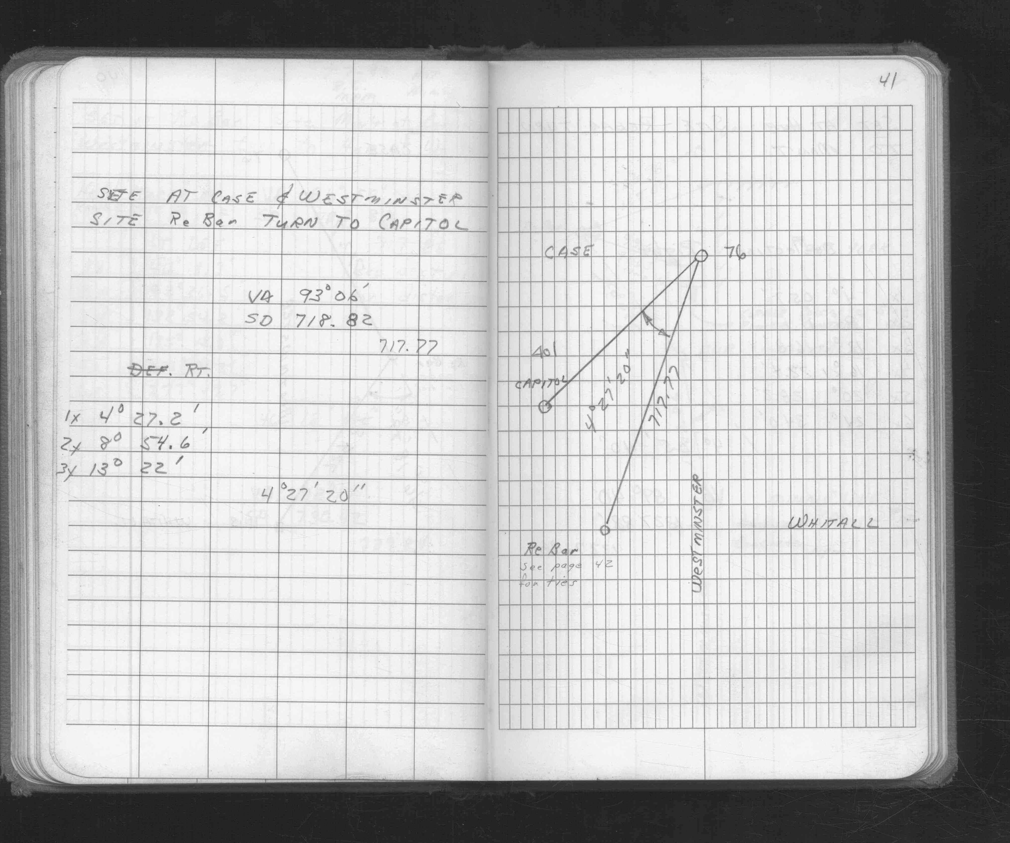
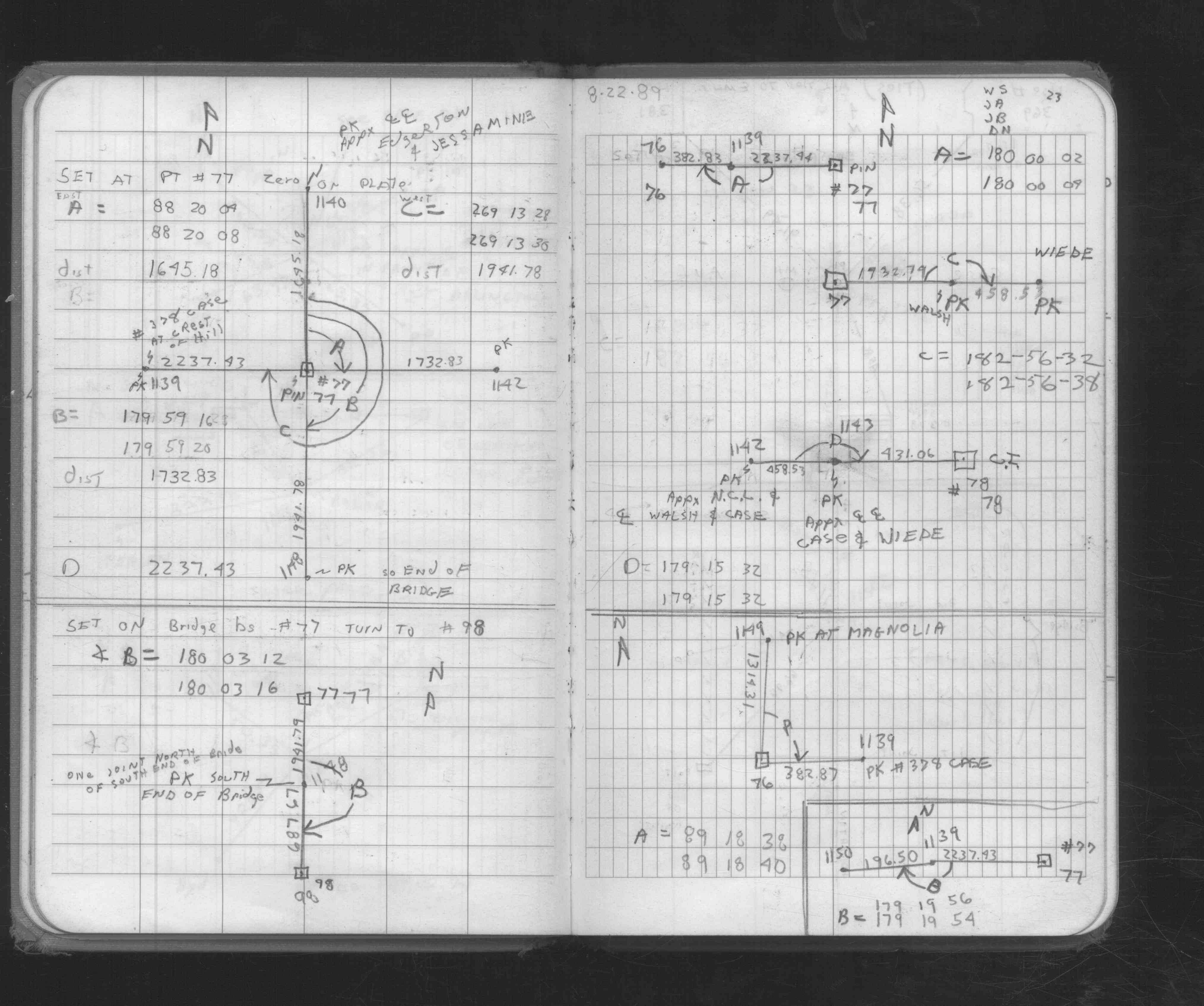
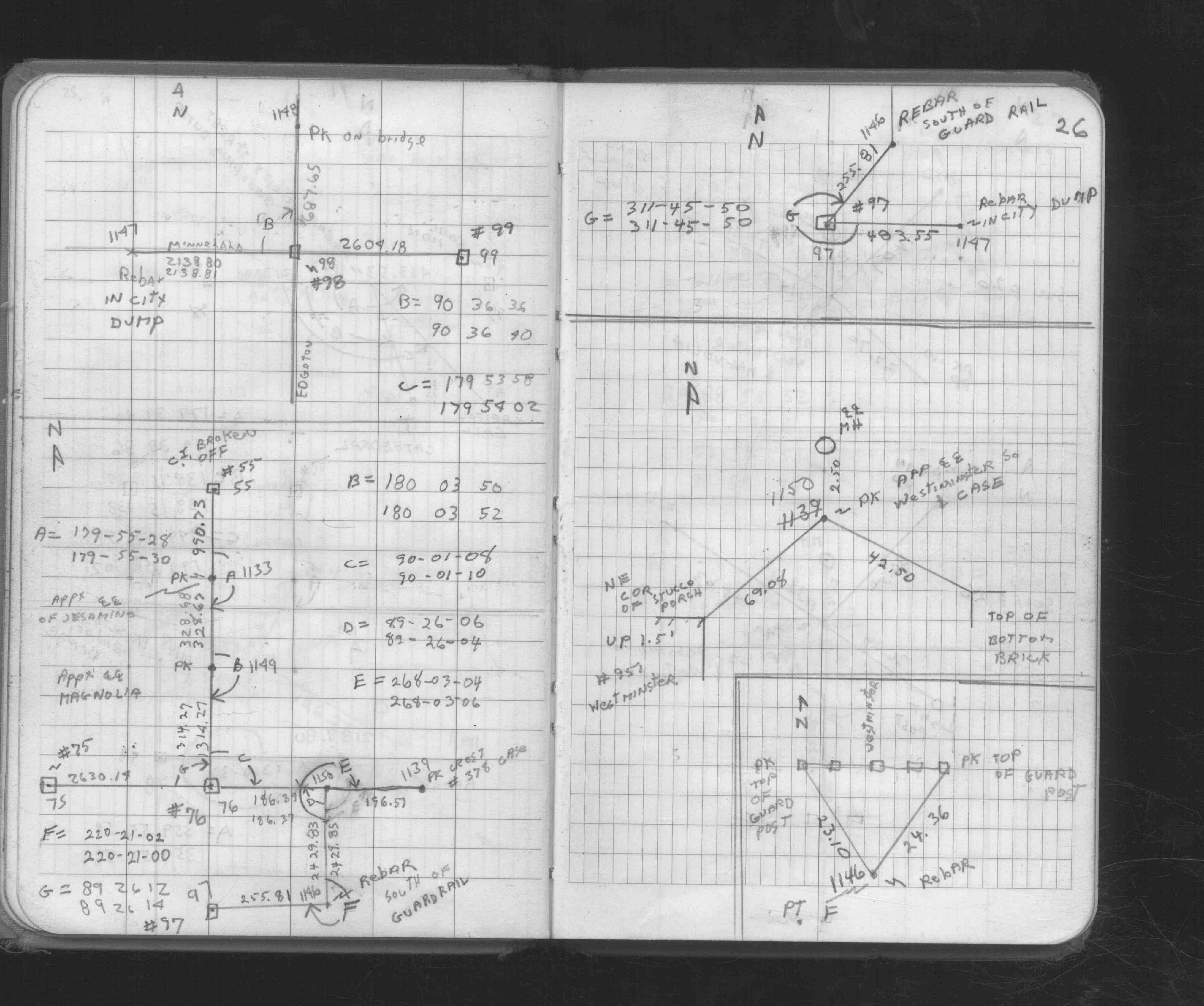
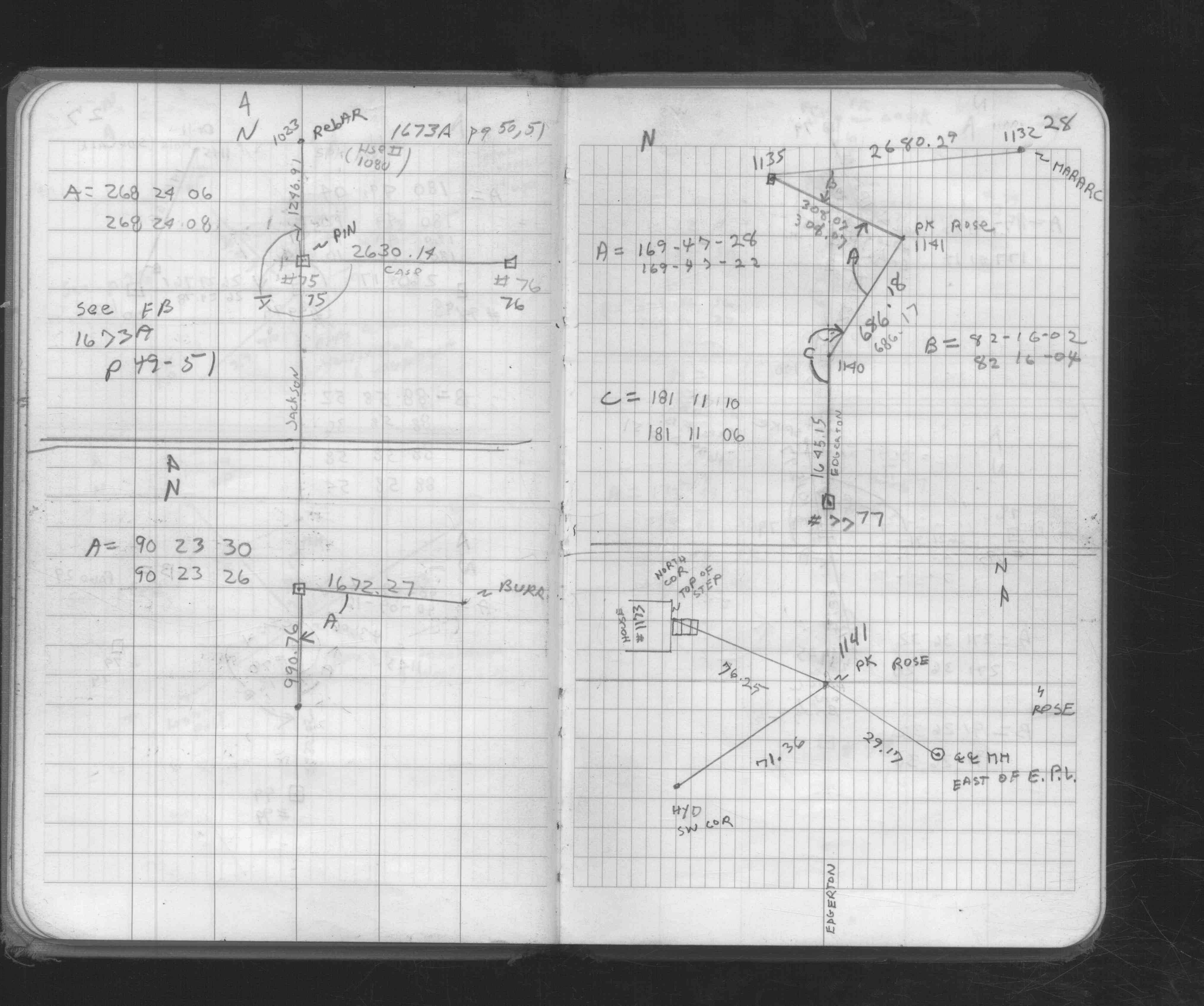
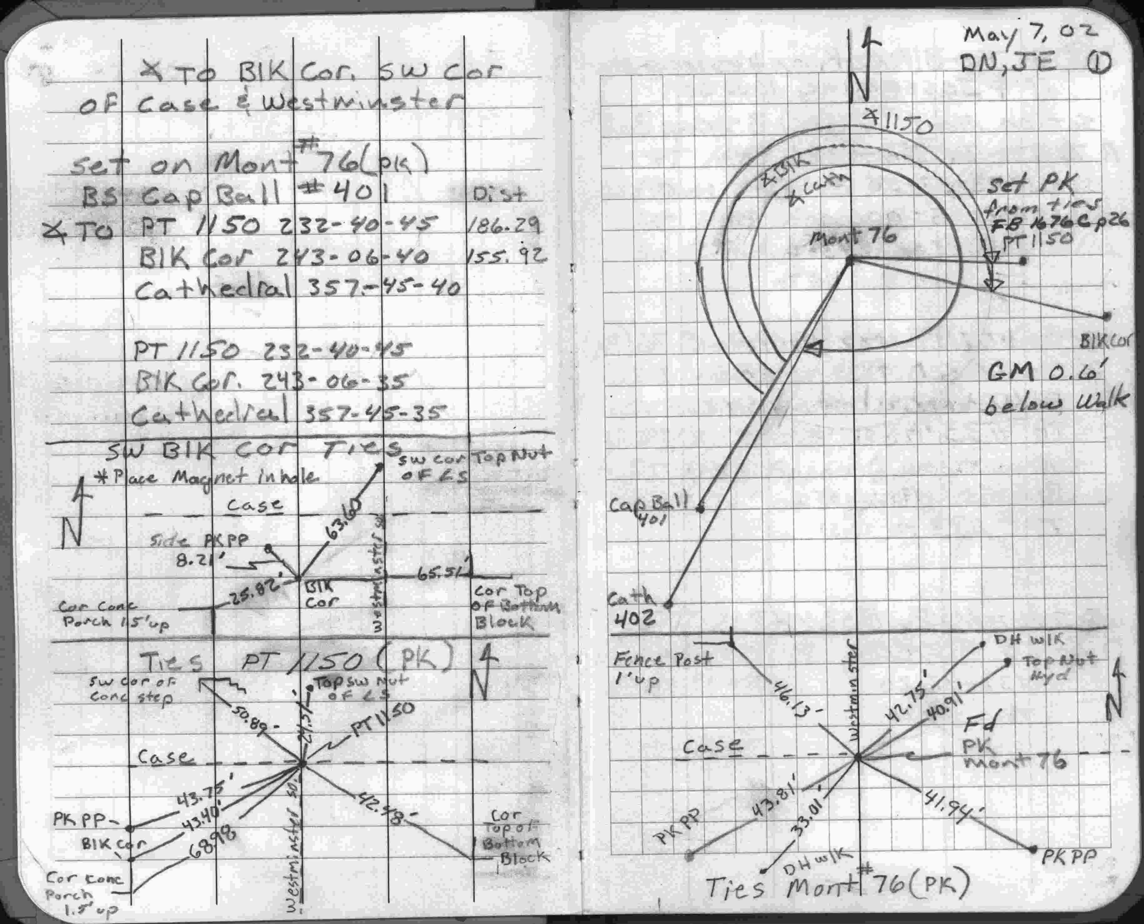
| 5/7/2002 | Placed ties on pk nail. See FB 1738 p.1 |
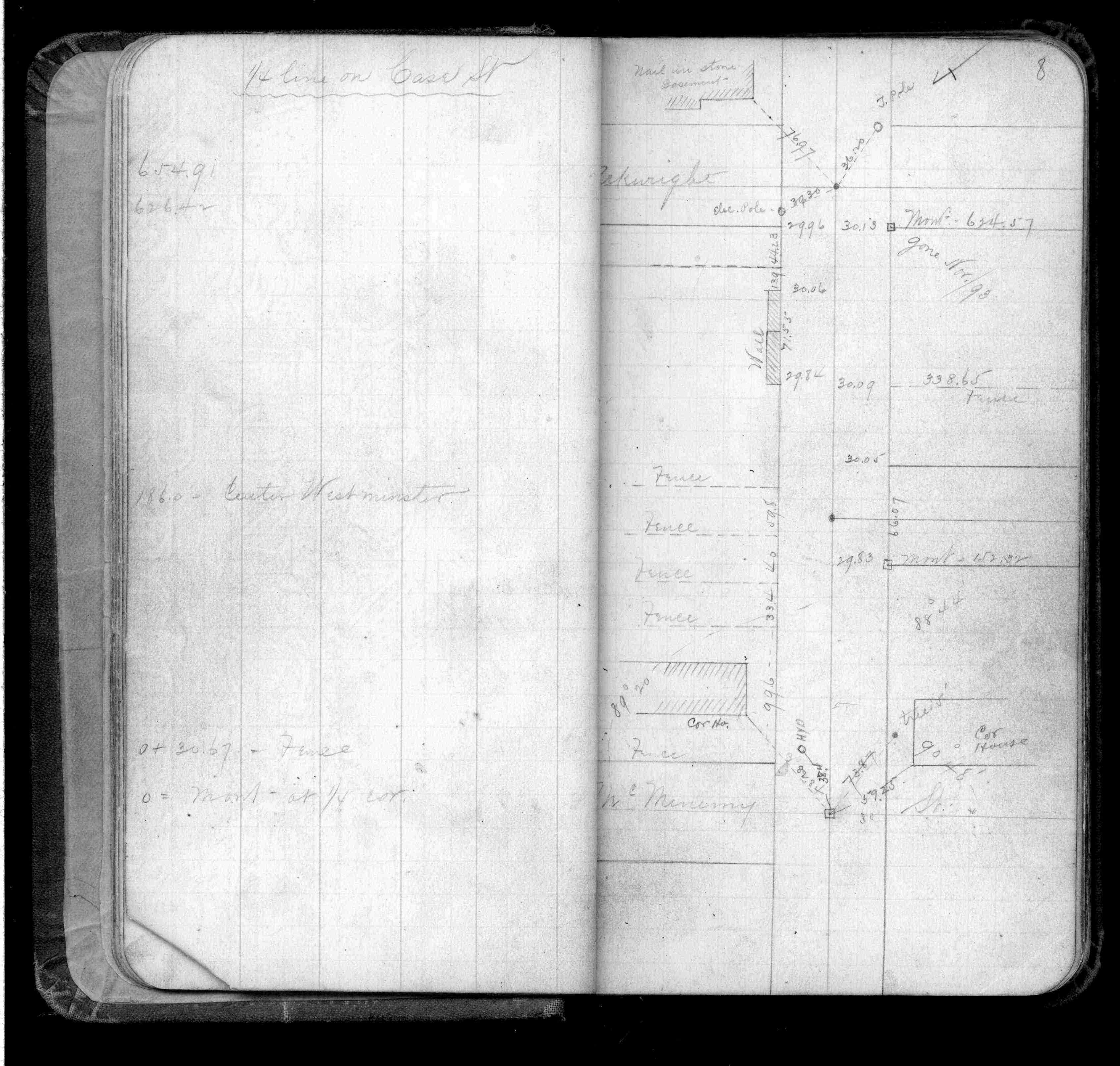
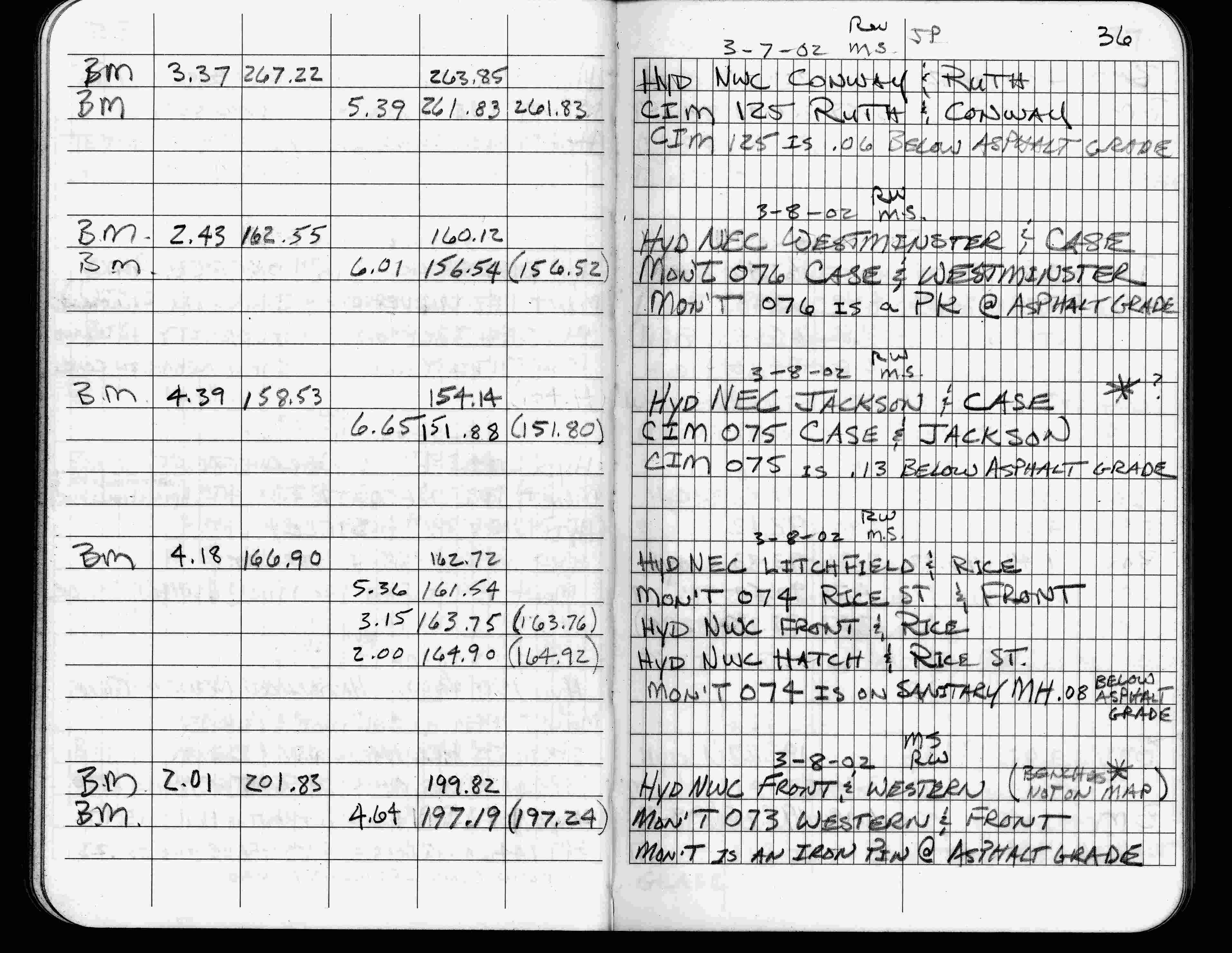
| 3/8/2002 | Elev 156.54 ft on pk nail at asphalt surface. See FB 1736 p.36 |
| 3/17/2000 | Set pk nail from ties (marked for painting target for 2000 aerial) |
| 5/24/1999 | Recovered 8 penny nail & placed transit ties. See CofL 0076-0043-A |
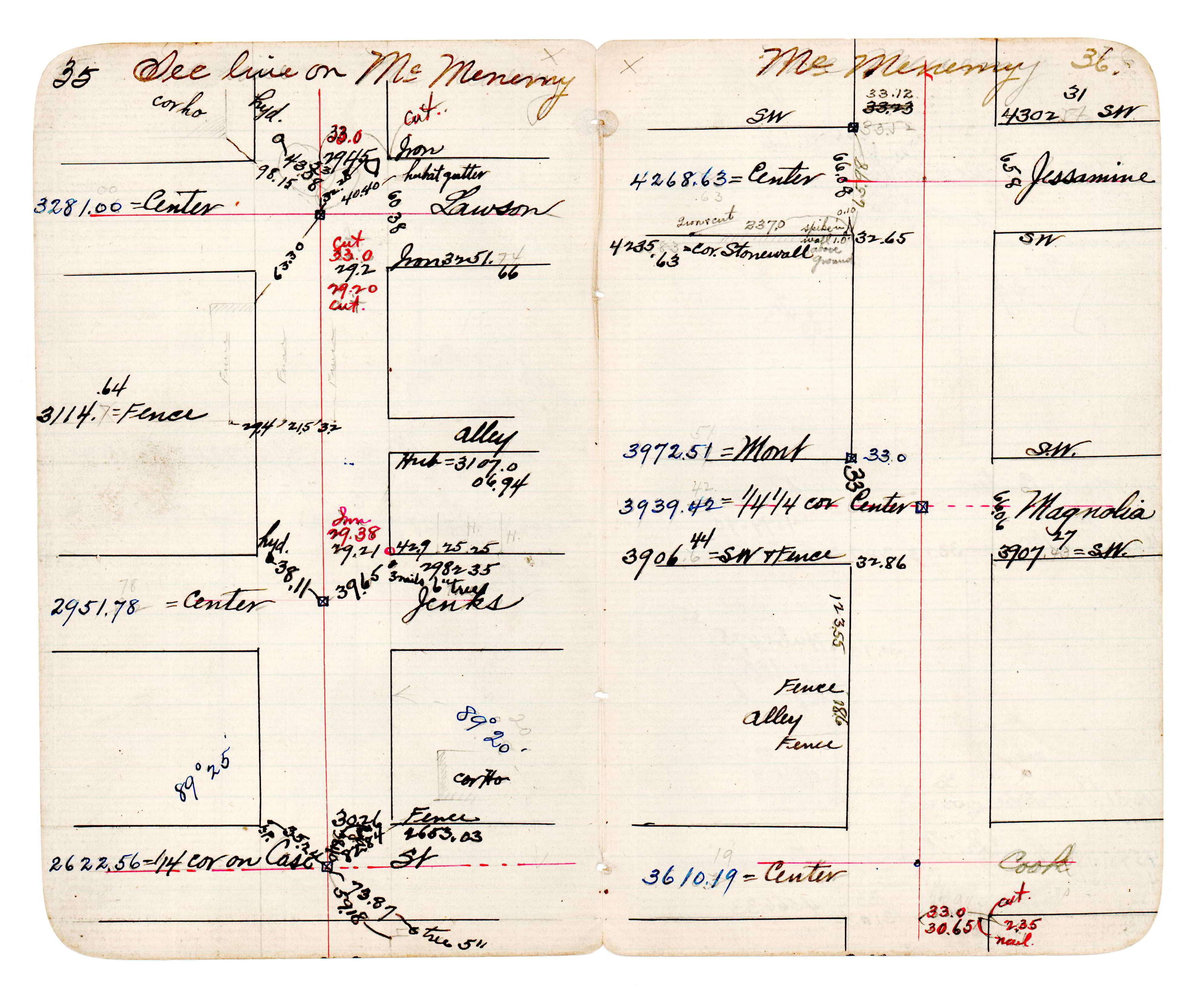
| 3/22/1996 | Rick Woessner found 2 PK nails. See Yellow Tie Book. |
| 2/20/1996 | Elev 156.52 ft on pk CLCL. See 97adj.pts, 1996/sycamore-case.org/sycamore-case.sdr (loop 041 047) Digital-Adj |
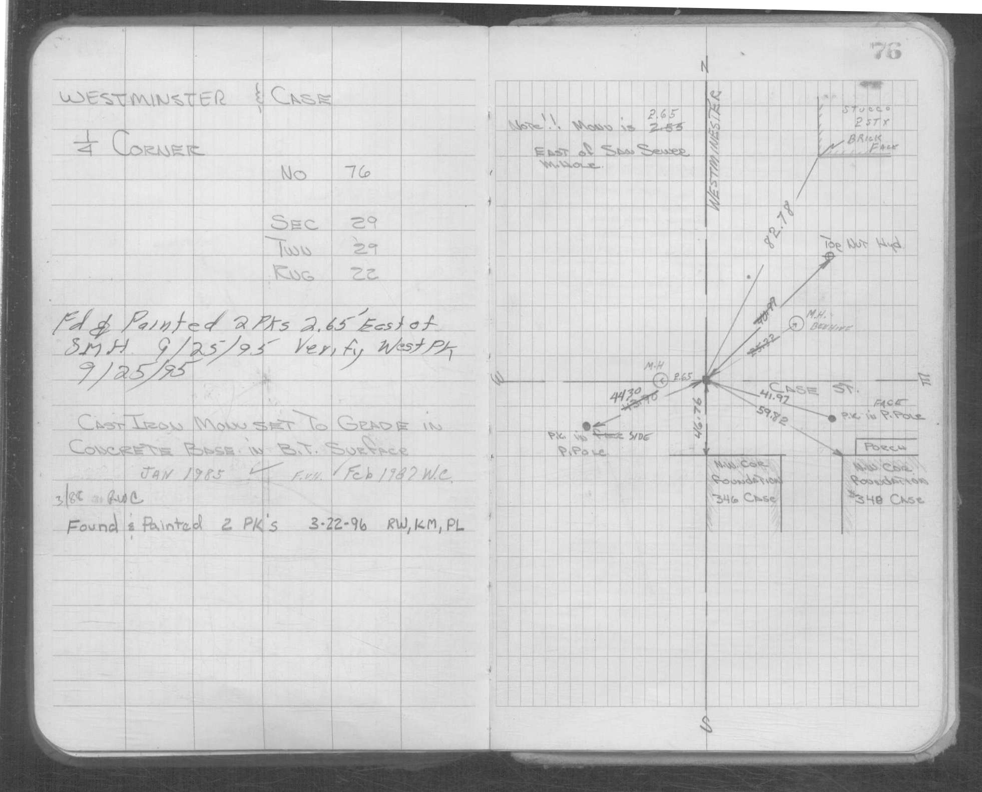
| 9/25/1995 | Fd 2 PK nails 2.65 east of SMH. Verified west PK. See Yellow Tie Book. |
| 3/1/1988 | (Unknown date Mar __, 1988 ) CIM set to grade in concrete base w/bituminous surface. |
| 2/1/1987 | (Unknown date Feb __, 1987 ) William Cutting checked ties. See Yellow Tie Book. |
| 1/1/1985 | (Unknown date Jan __, 1985 ) Frank Van Horn checked ties. See Yellow Tie Book. |
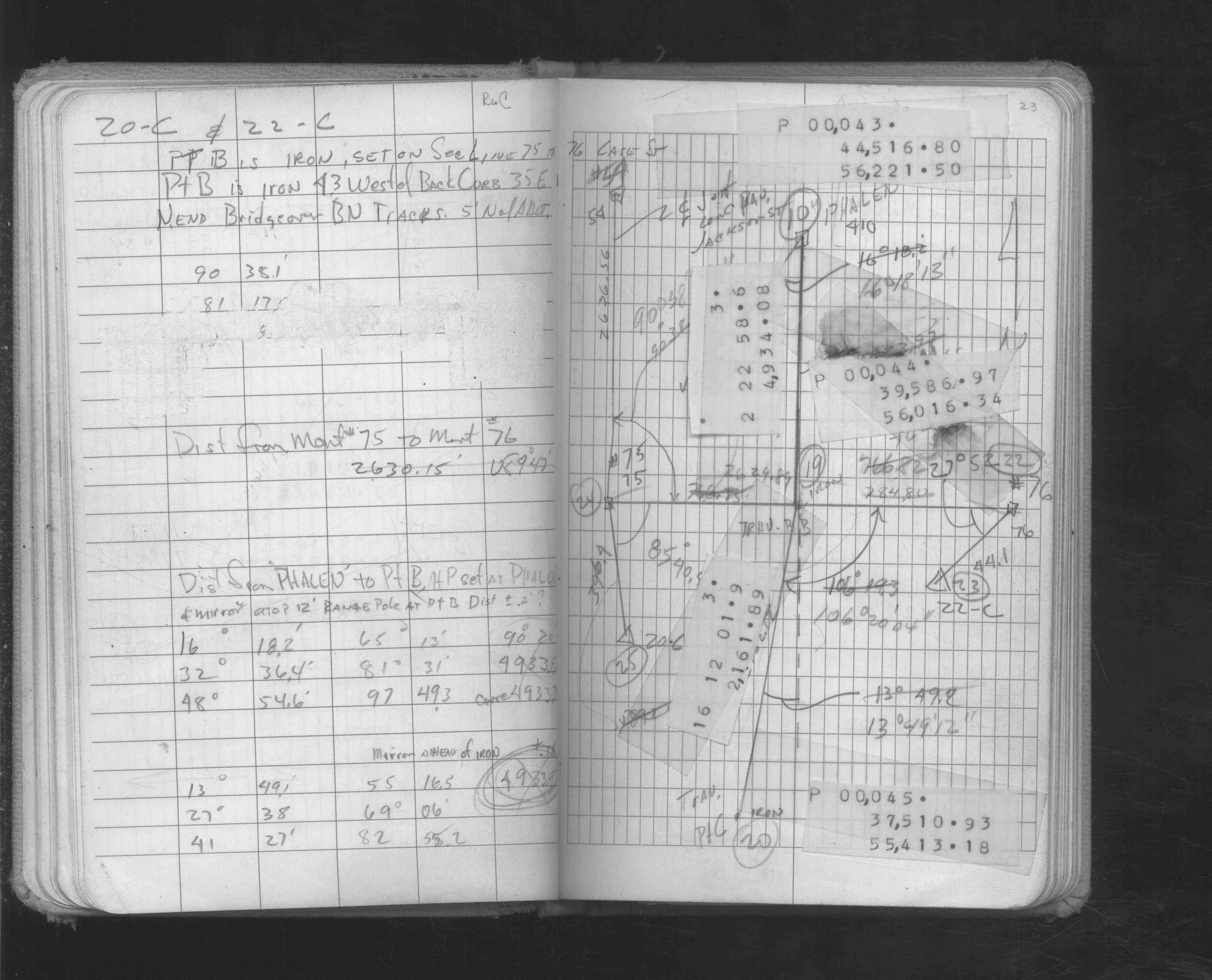
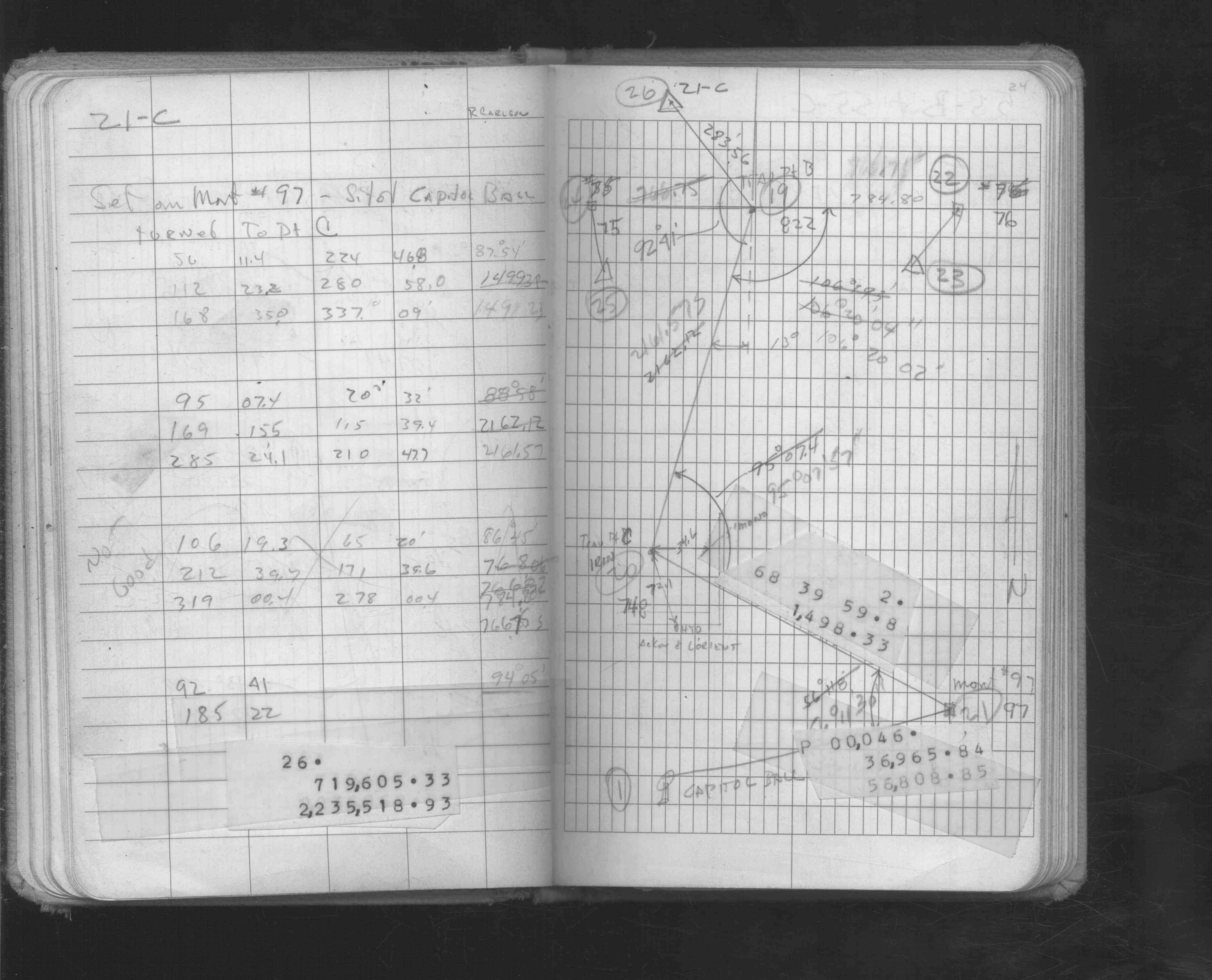
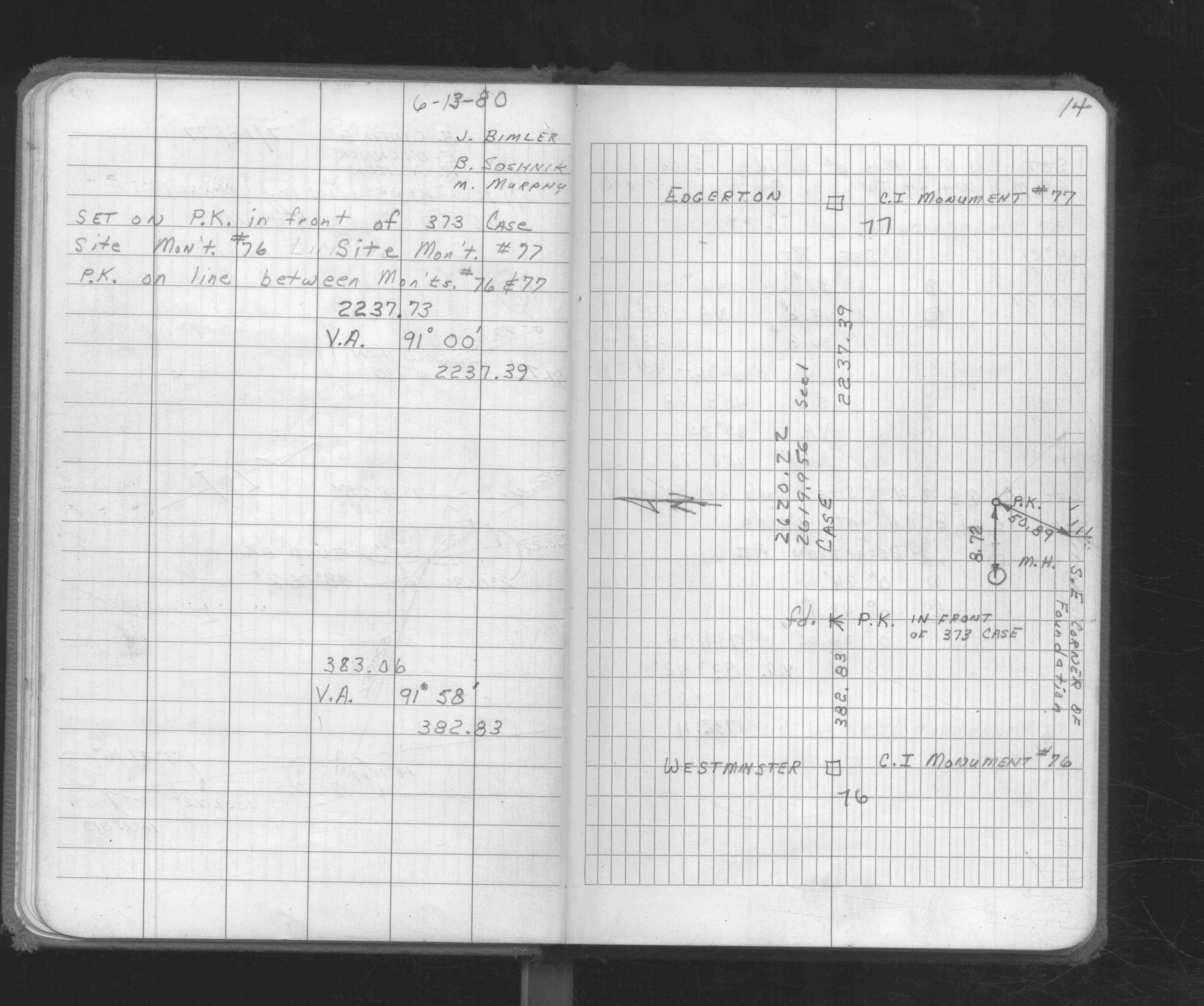
| 6/13/1980 | Fd CIM inplace. See FB 1676 p.14 |
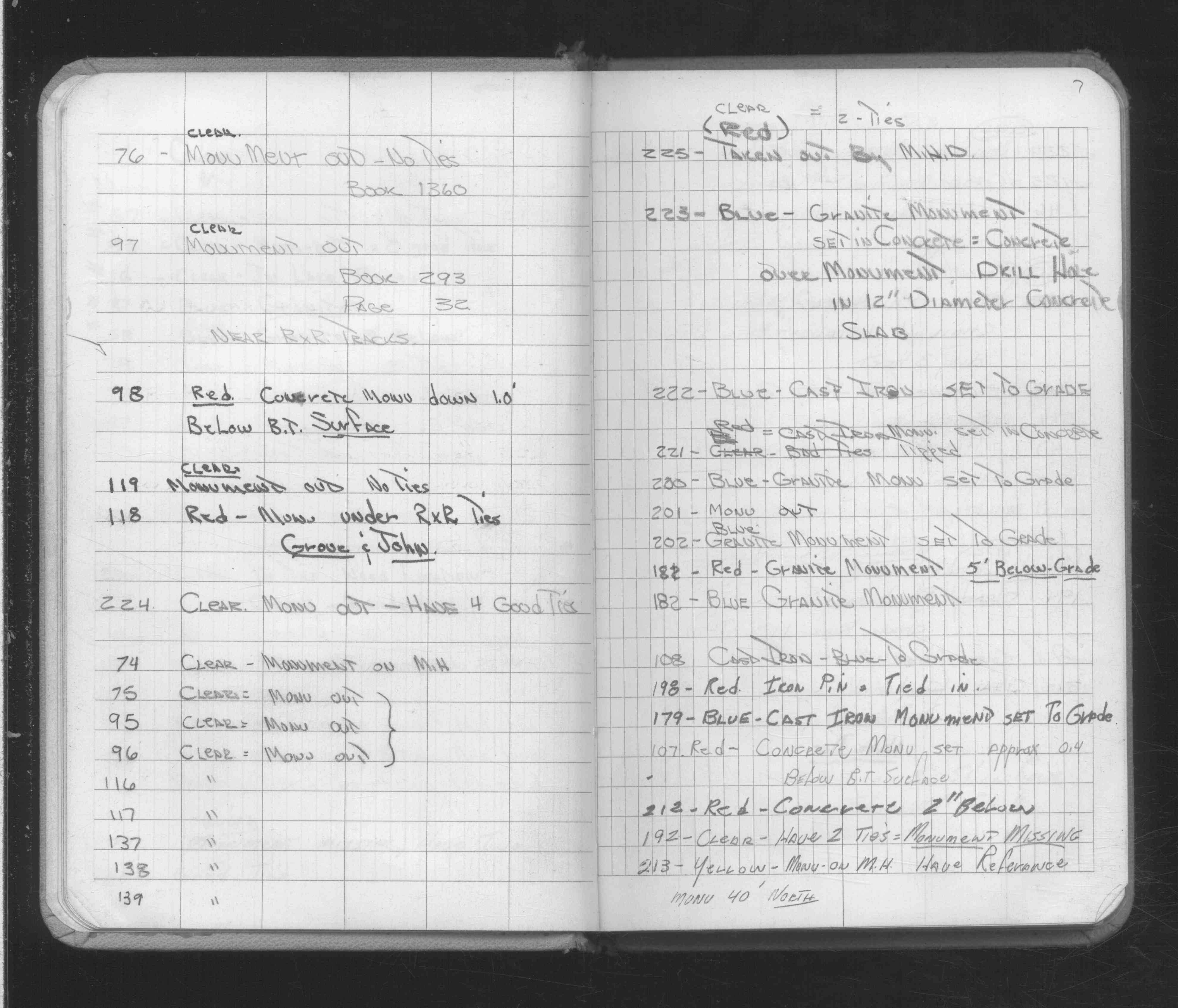
| 2/16/1972 | Monument out, no ties. (FB 1360 p.45) See FB 1689A p.7 |
| 1/1/1972 | (Unknown date Abt __, 1972 ) CIM set to grade in concrete base in Bit surface. See Yellow Tie Book. |
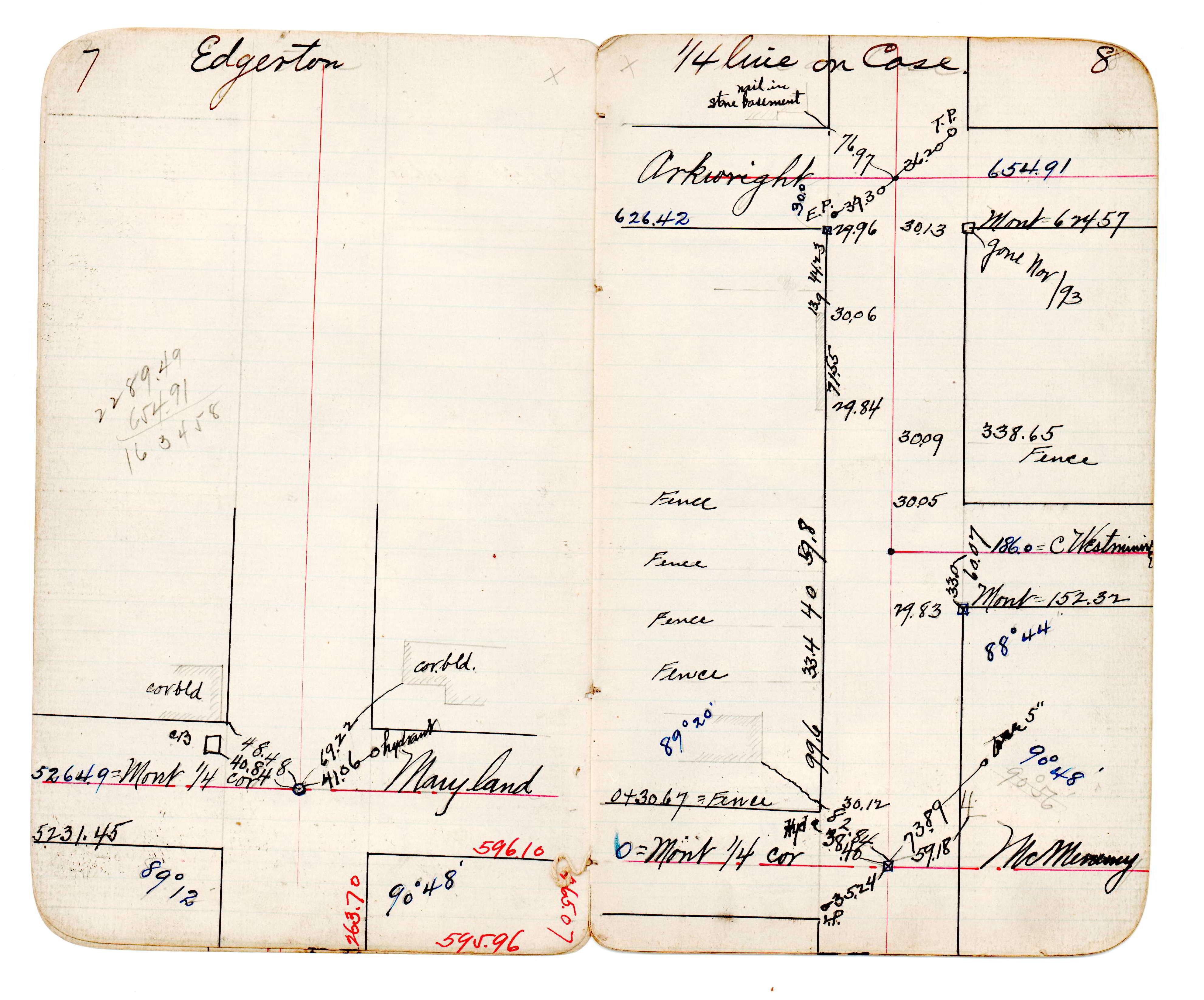
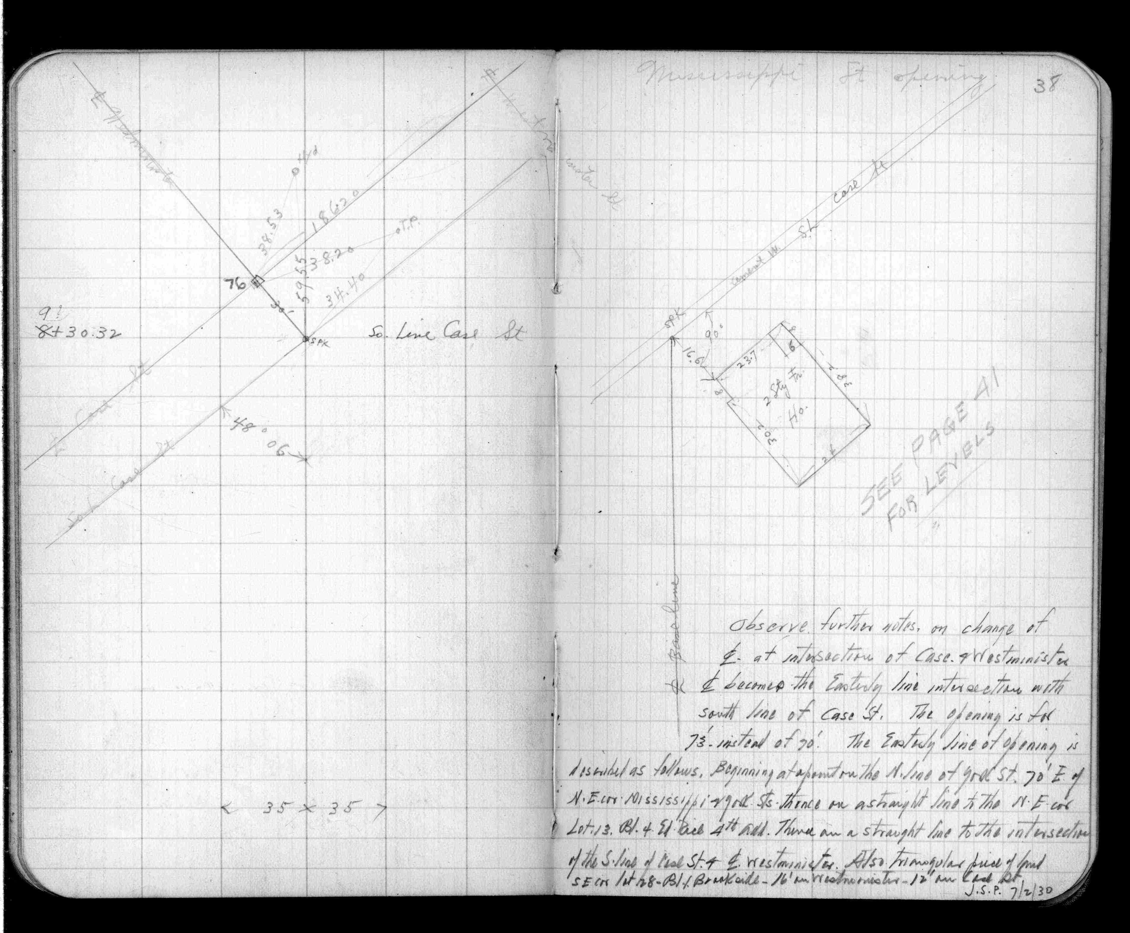
| 11/24/1943 | Placed ties. See FB 1360 p.45 |
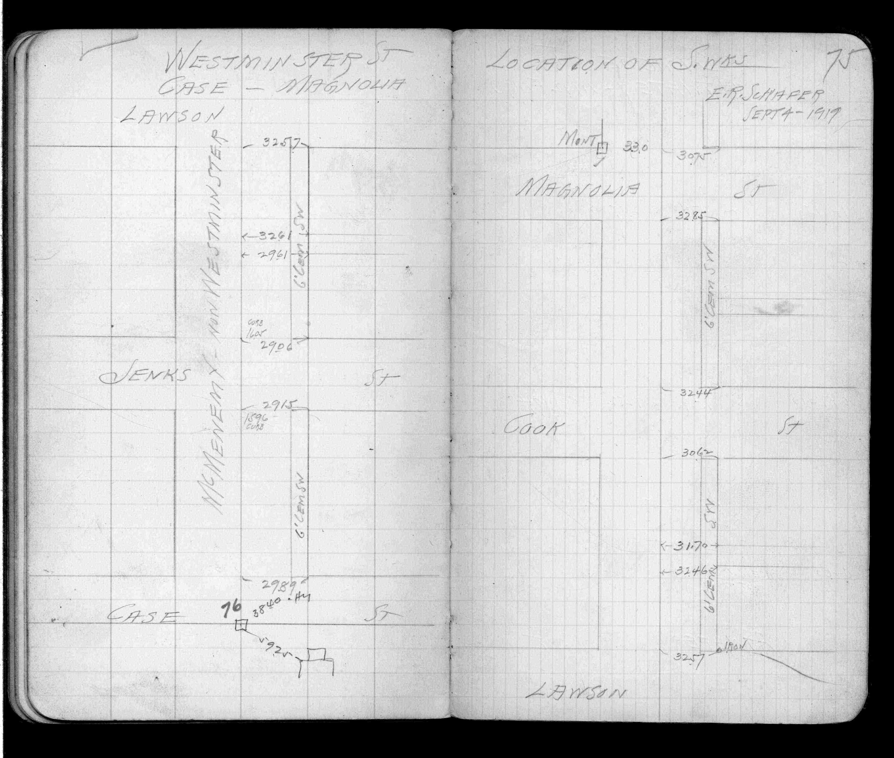
| 9/1/1919 | (Unknown date Sep __, 1919 ) Placed ties. See FB 937 p.75 |
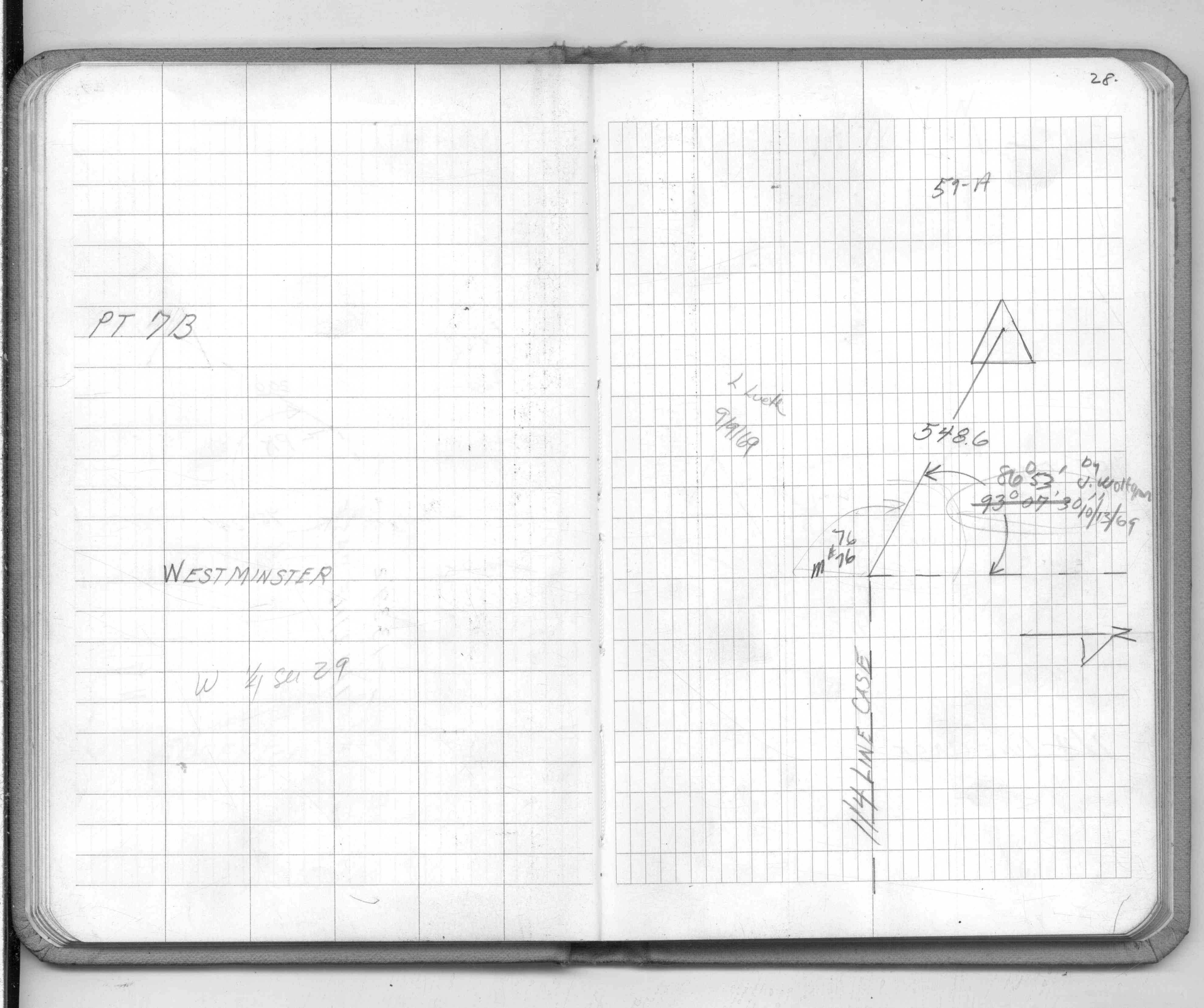
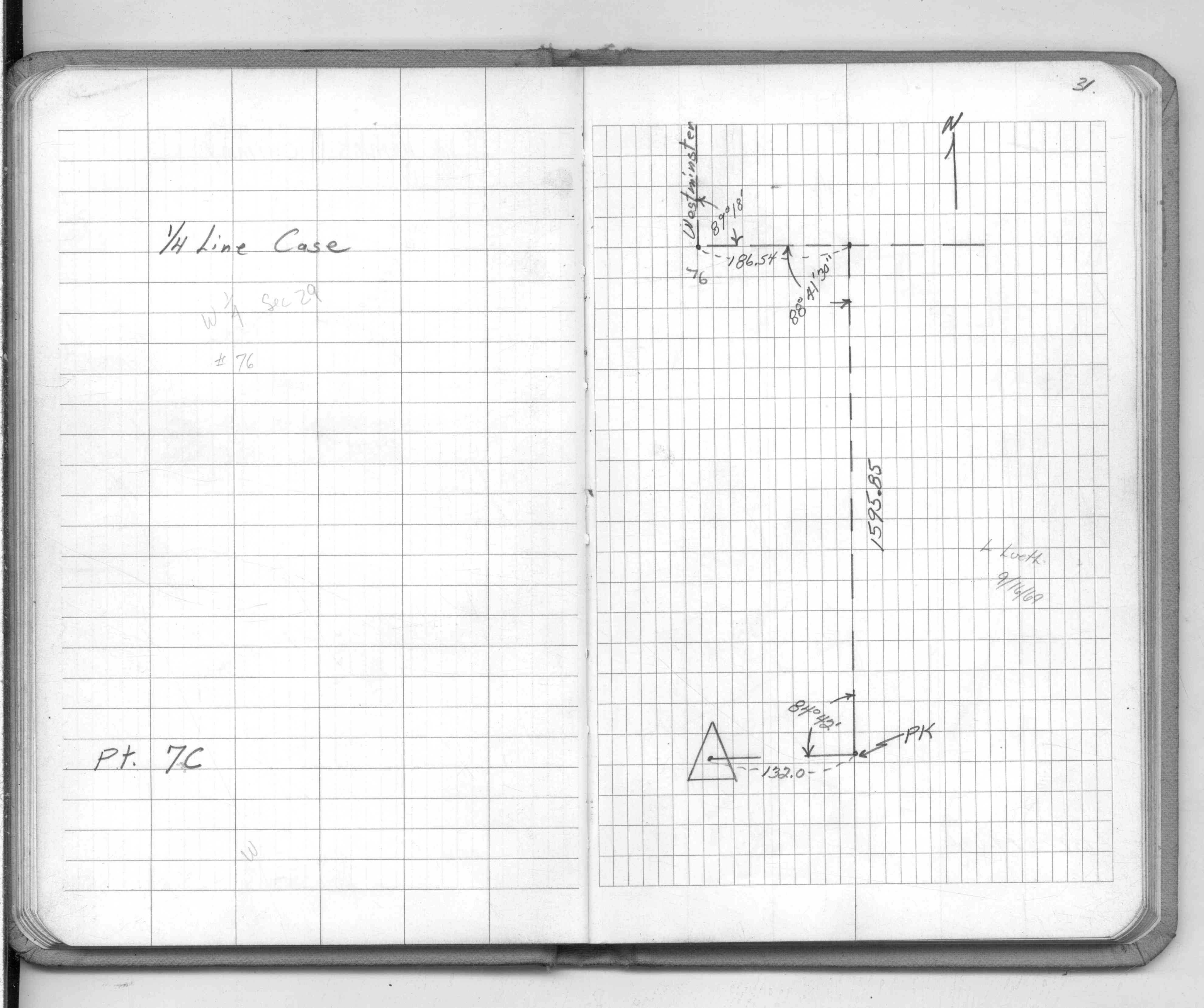
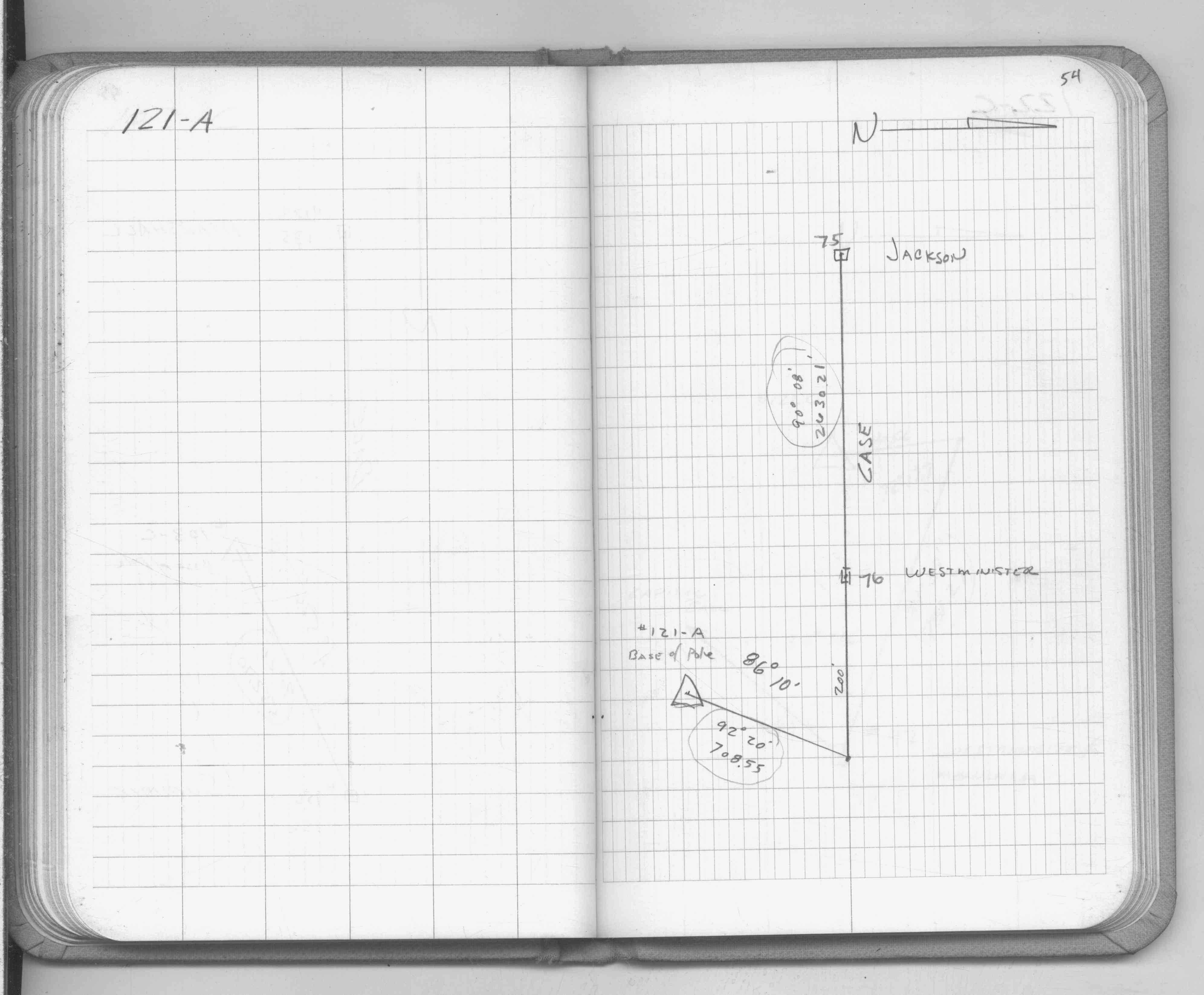
| 1/1/1890 | (Unknown date abt __, 189? ) Located monument by station during the Westminster survey. See JBI 23 p.35-36 |
| 1/1/1890 | (Unknown date abt __, 189? ) J B Irvines survey on 1/4 line on Case. See JBI 23 p.07-08 |
| 7/25/1889 | Monument set at true 1/4 corner by J H Armstrong |
| 1/1/1887 | (Unknown date ___ __, 1887 ) Monument showing center of Case St as grading in 1887 |
| 11/1/1847 | (Unknown date Nov __, 1847 ) Isaac N Higbee deputy surveyor set post. Tied to 2 BTs. See IH p.212-213 2922 |
| 1/1/1800 | (Unknown date ___ __, 18?? ) Elev 156.080 ft on GM. See Old Benches Book, Entry 1897 |
| 1/1/1800 | (Unknown date ___ __, ____ ) Monument 1.0 ft west of 1/4 post, reset by Chas Hunt |
Above is NOT an all inclusive history of this point. Please review all the links below. Yellow Tie Books are 'ST' in the Monument category.
| PLS NOTES | Field | Cross Section | Sewer | J.B. Irvine | Monument | River Survey |
|---|---|---|---|---|---|---|
| IH p.212-213 | FB 0293CPYp. 08 ,35 | JBI 23 p.35-36 | ST 001-078 p.076 | |||
| FB 0300CPYp.24 | JBI 23 p.07-08 | |||||
| FB 0937p.75 | ||||||
| FB 1183p.38 | ||||||
| FB 1360p.45 | ||||||
| FB 1360p.45 | ||||||
| FB 1540Ap.05 | ||||||
| FB 1549Cp. 28 ,31 | ||||||
| FB 1549Fp. 54 ,71 | ||||||
| FB 1549Ip. 23 ,24 ,57 ,58 | ||||||
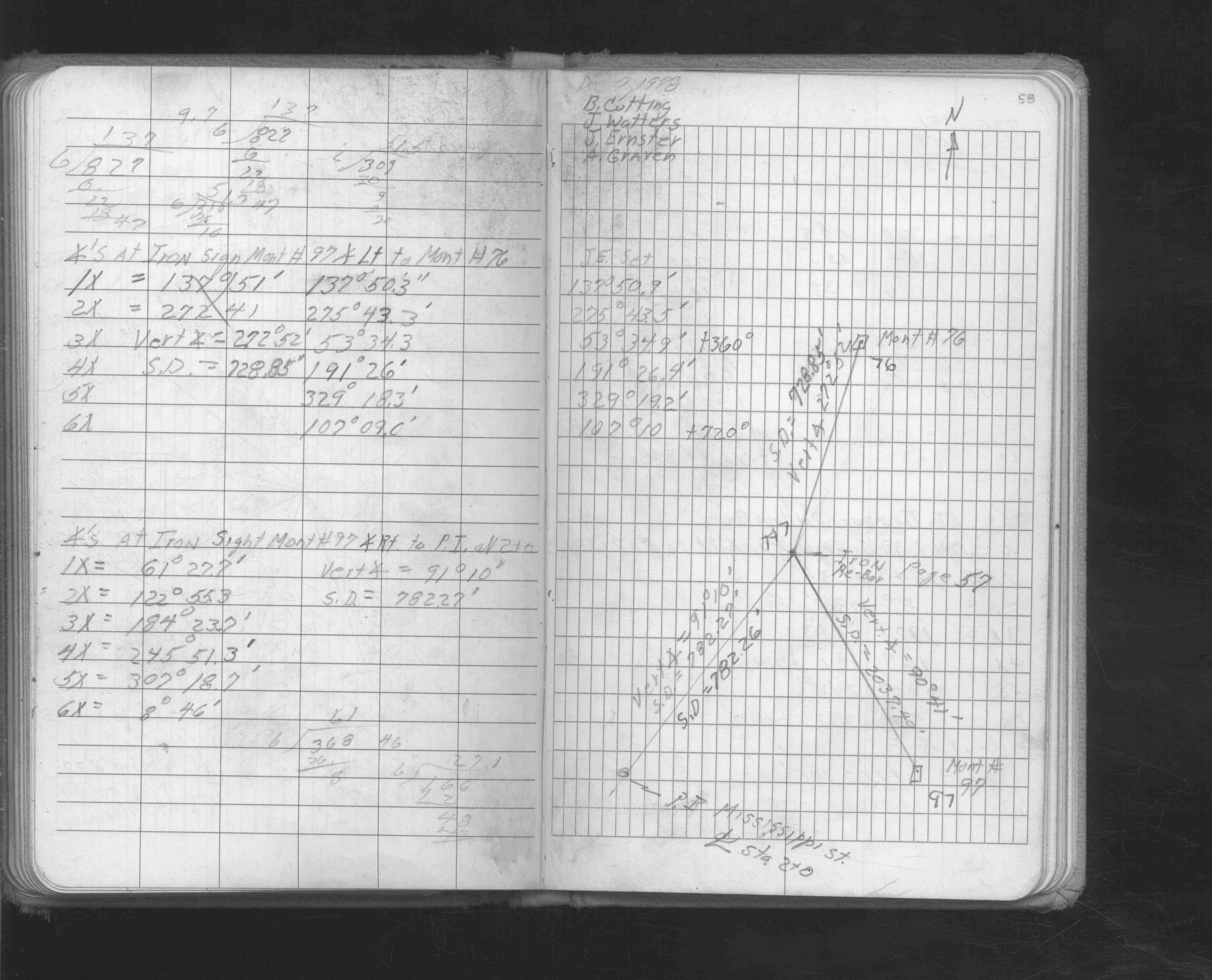
| FB 1676p.14 | ||||||
| FB 1676p. 14 ,23 ,40 ,41 | ||||||
| FB 1676Cp. 23 ,26 ,28 | ||||||
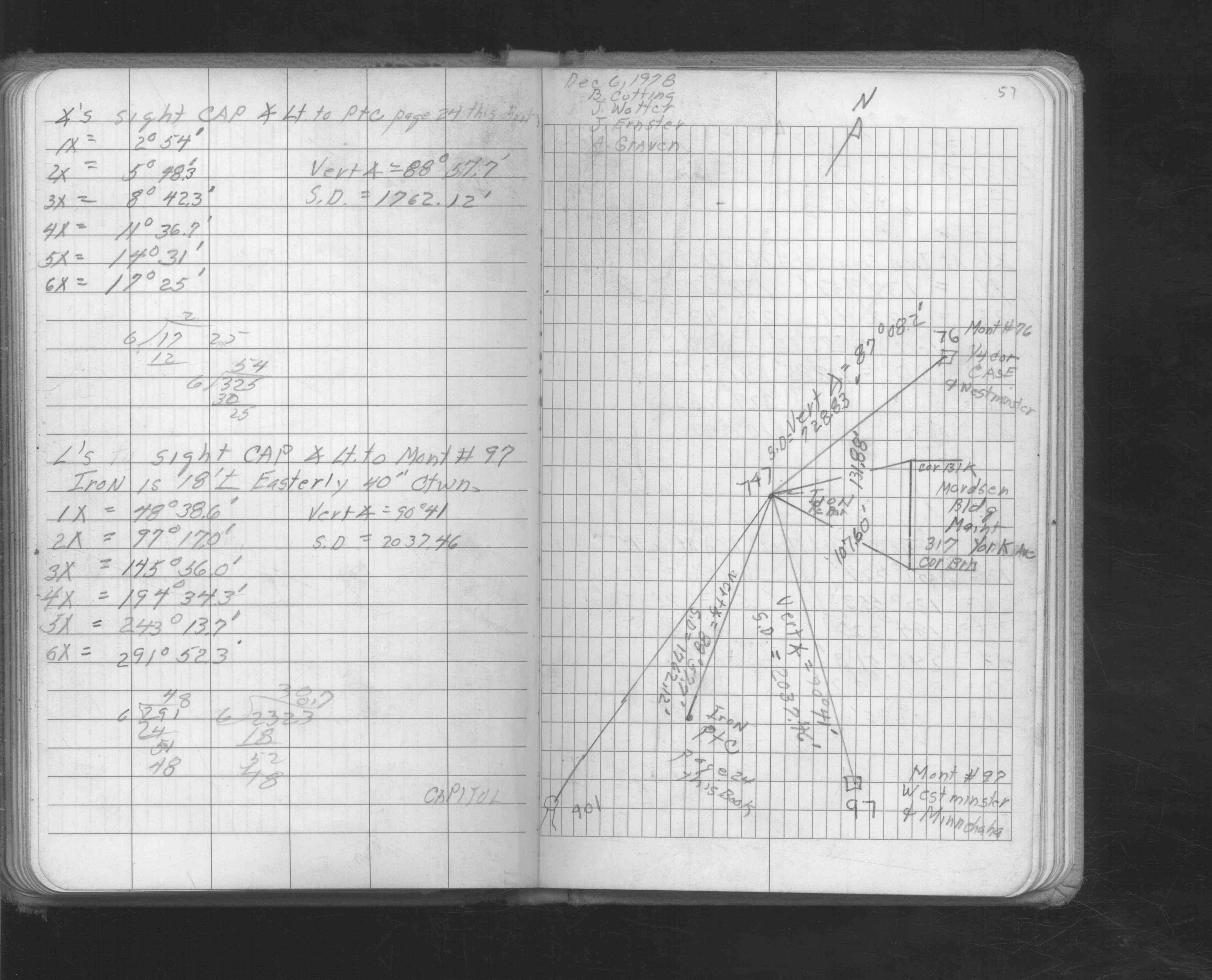
| FB 1689Ap.07 | ||||||
| FB 1736p.36 | ||||||
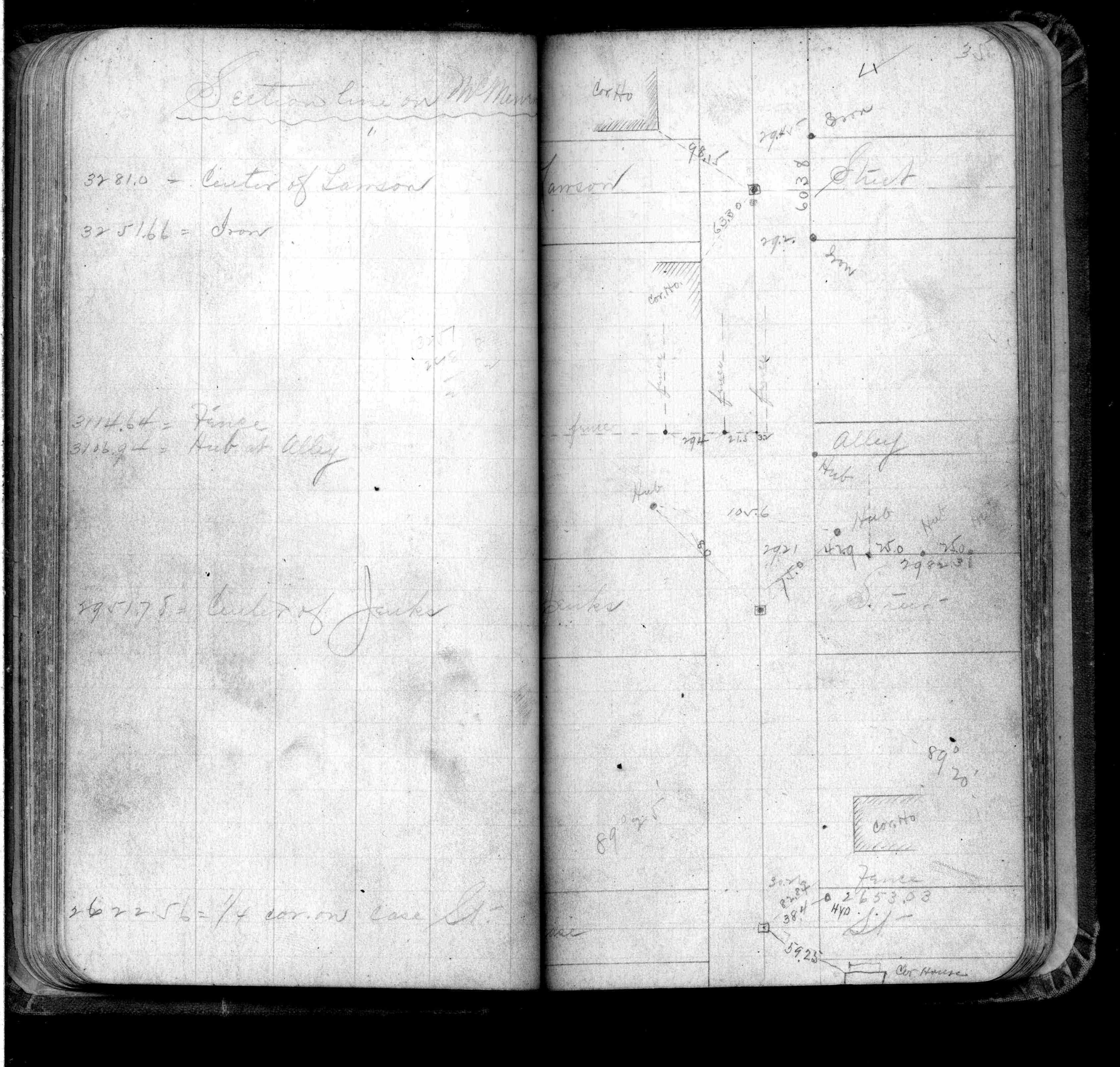
| FB 1738p.01 |
| FILE | SURVEYOR | LIC. NO. | DATE SIGNED | DATE TIED |
|---|---|---|---|---|
| 0076-0043-C.pdf | Matt Wernet | 41888 | February 2, 2012 | July 21, 2011 |
| 0076-0043-B.tif | Michael P. Murphy | 41001 | April 22, 2004 | April 15, 2004 |
| 0076-0043-A.tif | Jeffery L. Grosso | 13144 | May 27, 1999 | May 24, 1999 |
| ST_001-078p076.jpg | none | none | none | none |
| 0076-0043-A.dwf | none | none | none | none |