| NAD83 COORDINATES (1986 adj.): |
|---|
| * X= 582146.54 Y= 165490.74 Z= 0 LSQ 12/6/1991 S FLT |
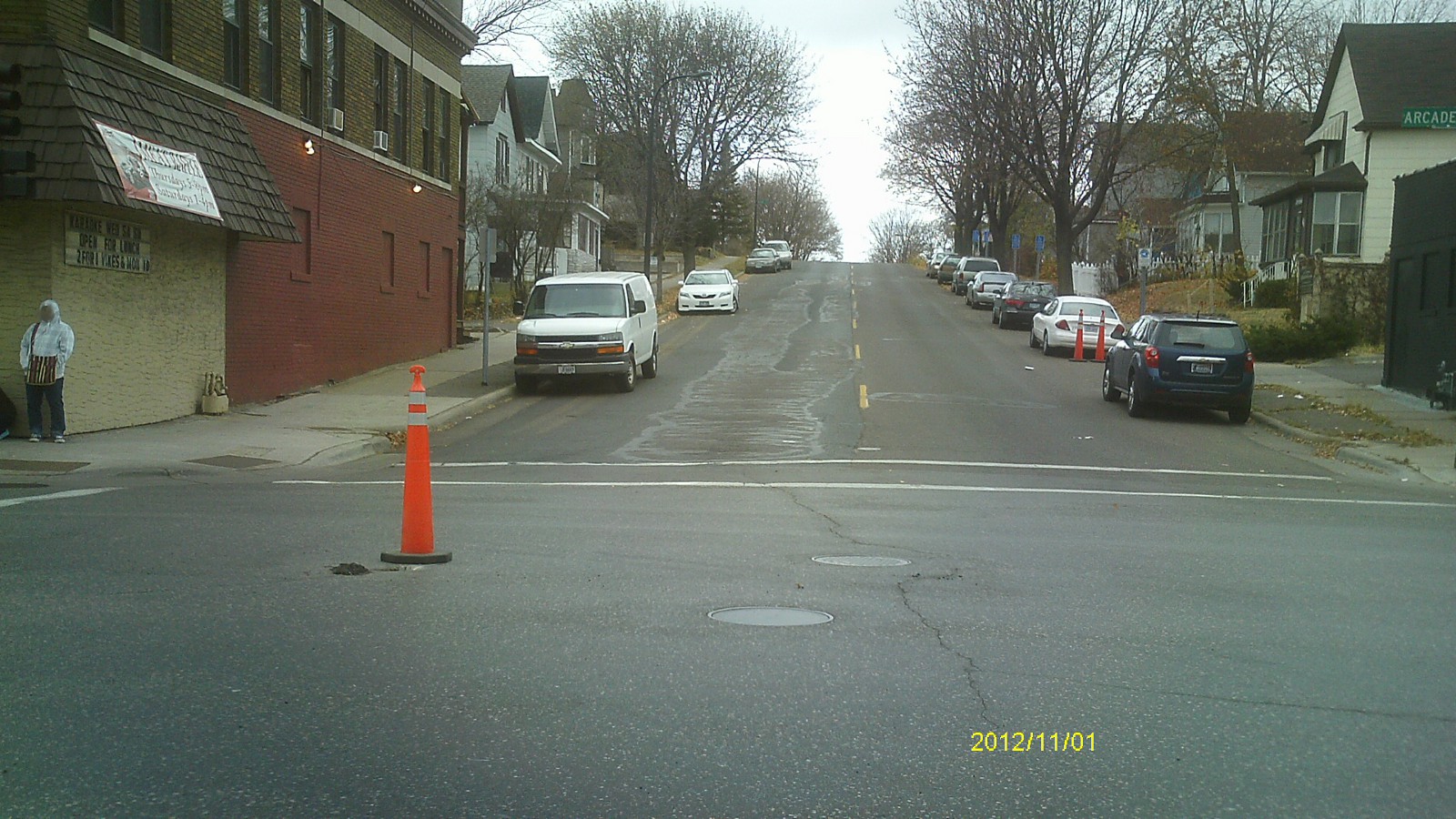
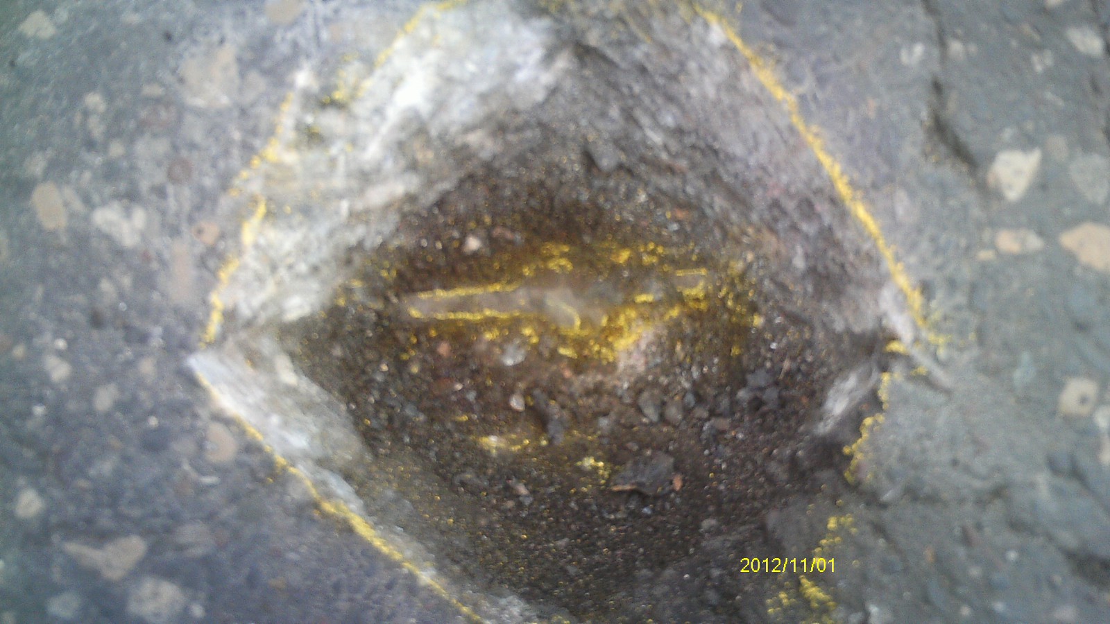
| 11/1/2012 | Found CIM just below street grade; cap has been removed. Photos taken. |
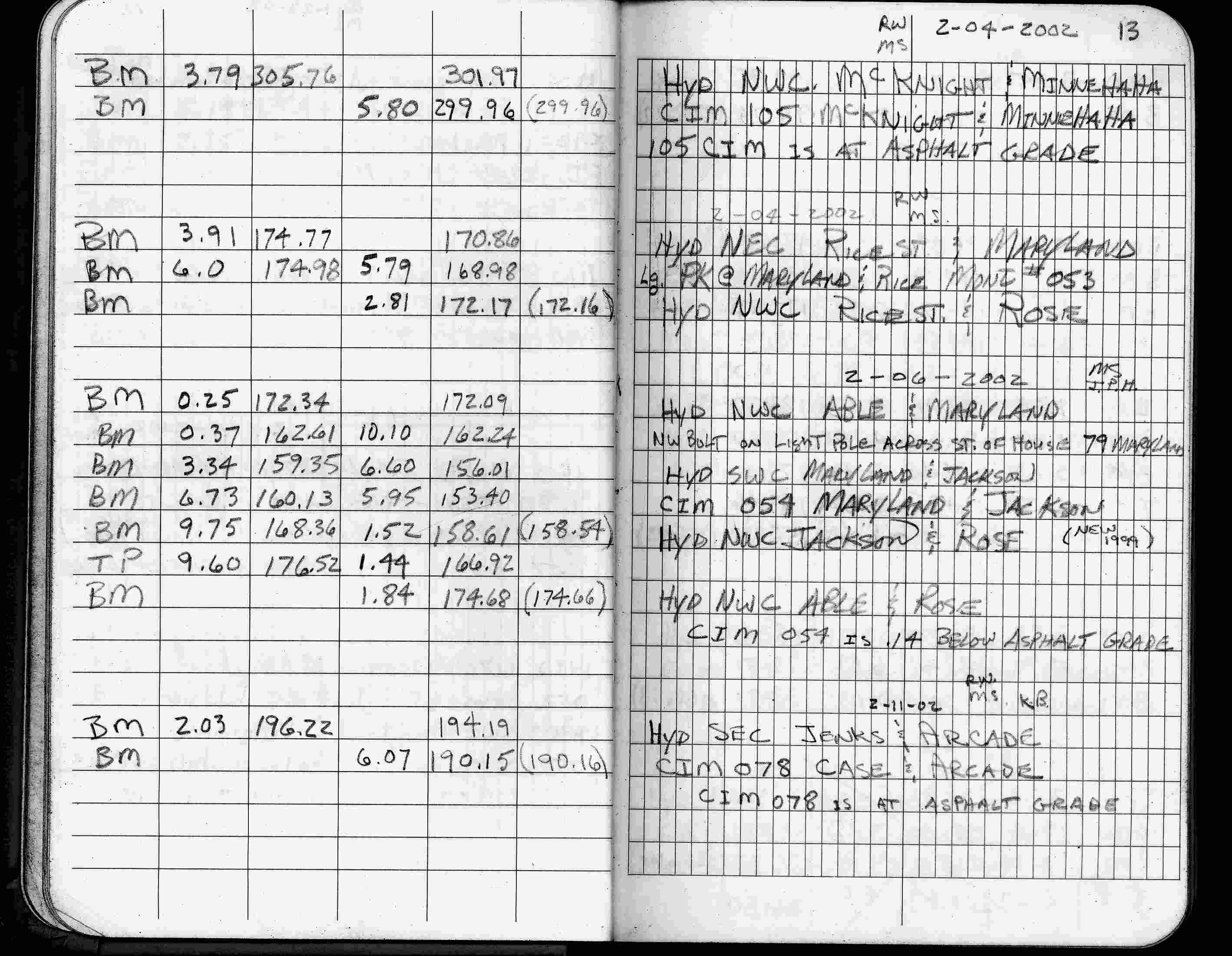
| 2/11/2002 | Elev 190.15 ft on CIM at asphalt surface. See FB 1736 p.13 |
| 3/17/2000 | Fd CIM at grade (marked for painting target for 2000 aerial) |
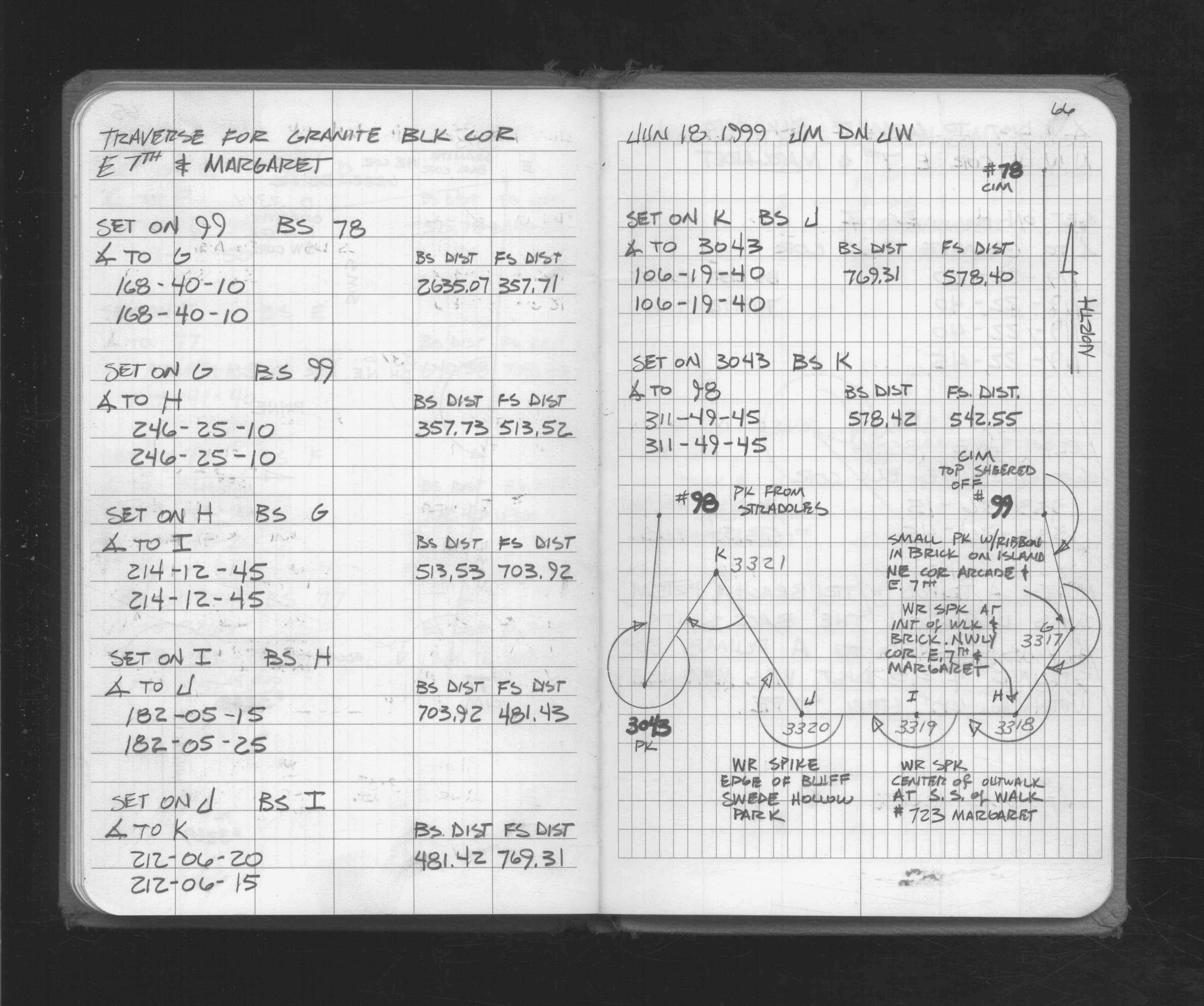
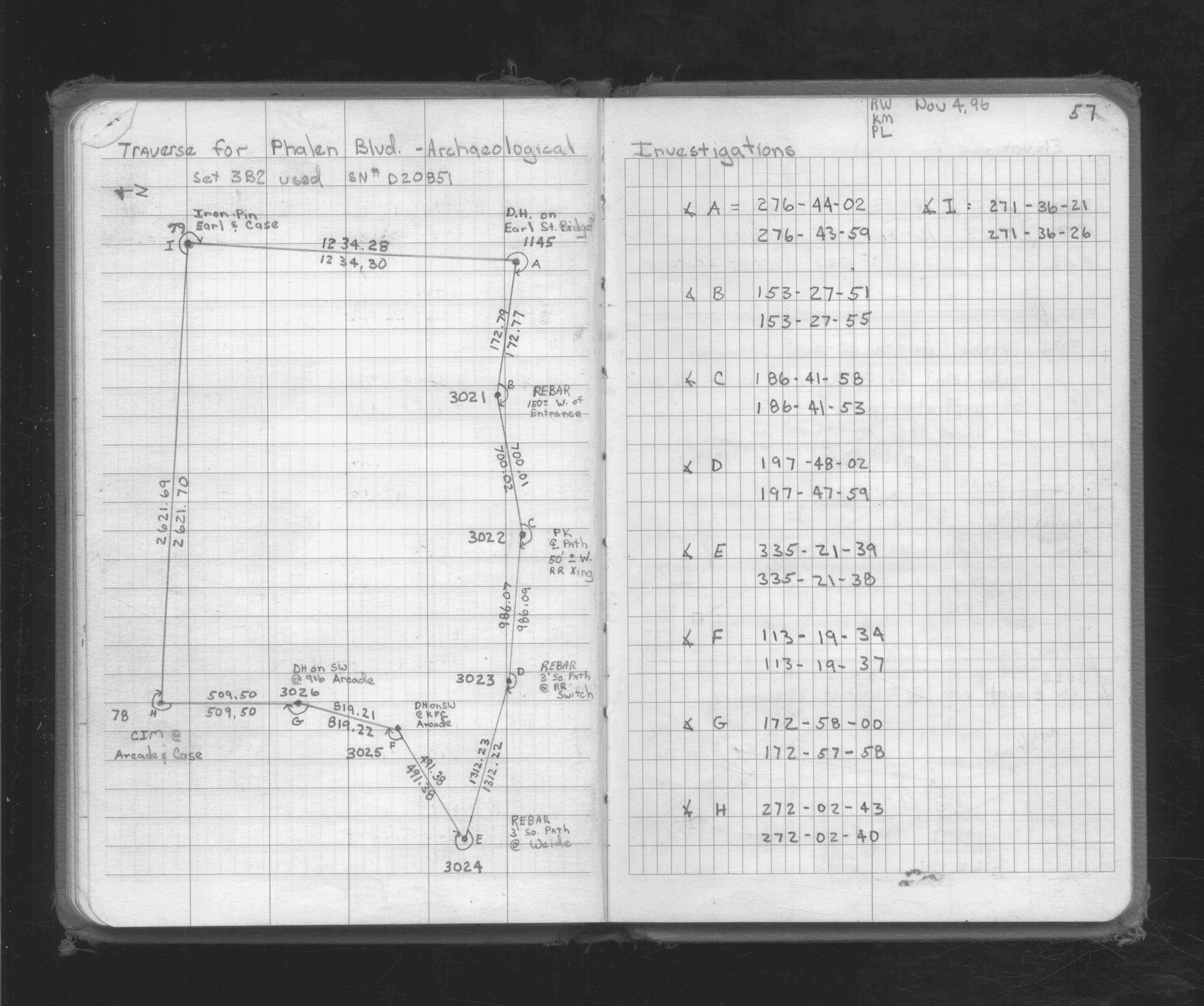
| 6/18/1999 | Used CIM for traverse control. See FB 1716 p.66 |
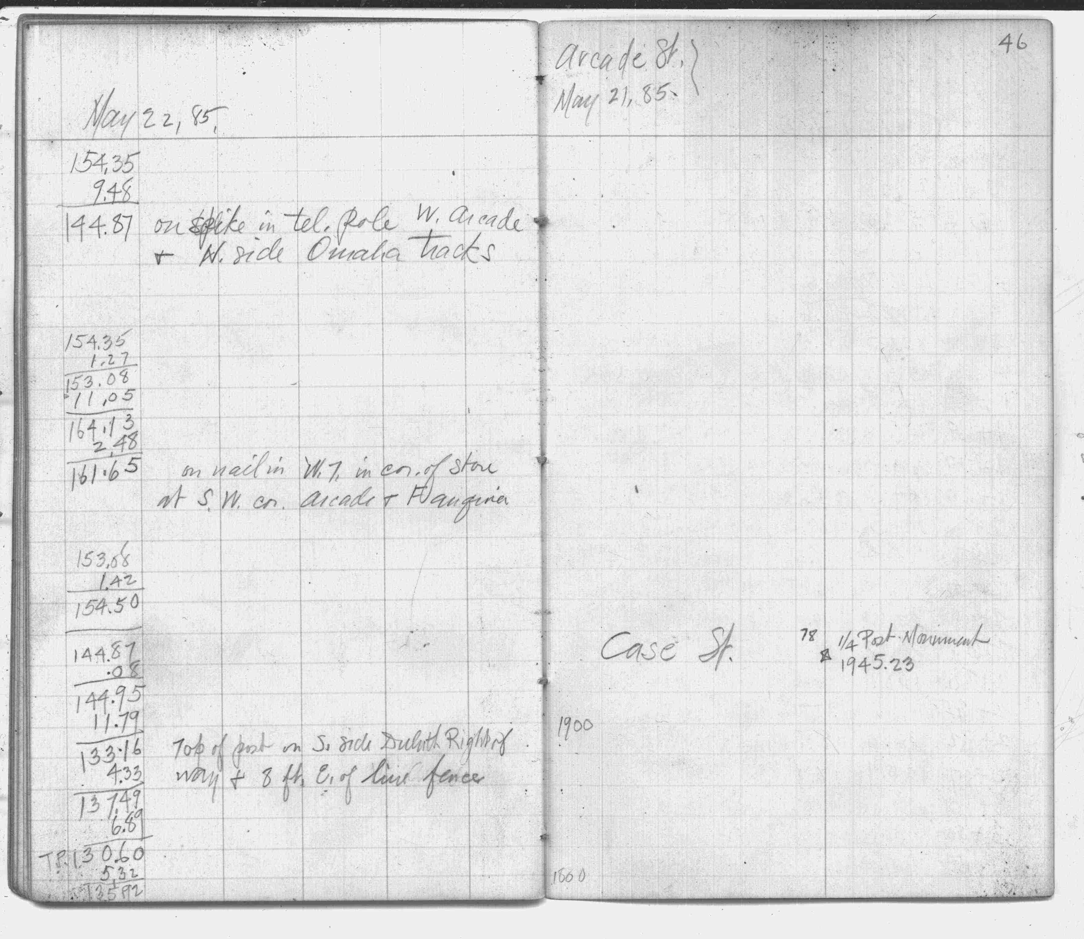
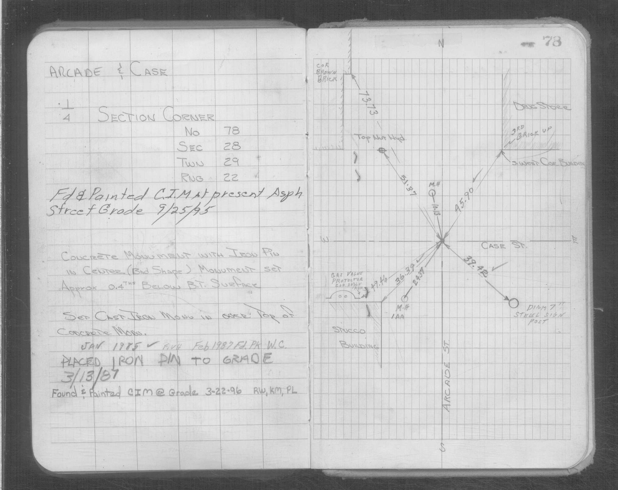
| 5/21/1999 | Fd CIM at grade & placed transit ties. See CofL 0078-0047-B |
| 1/31/1997 | Elev 190.16 ft on CIM. See 97adj.pts, 1997/arcade2.org/bmacrade2.sdr (loop 132) Digital-Adj |
| 10/9/1992 | Fd CIM & placed ties. See CofL 0078-0047-A |
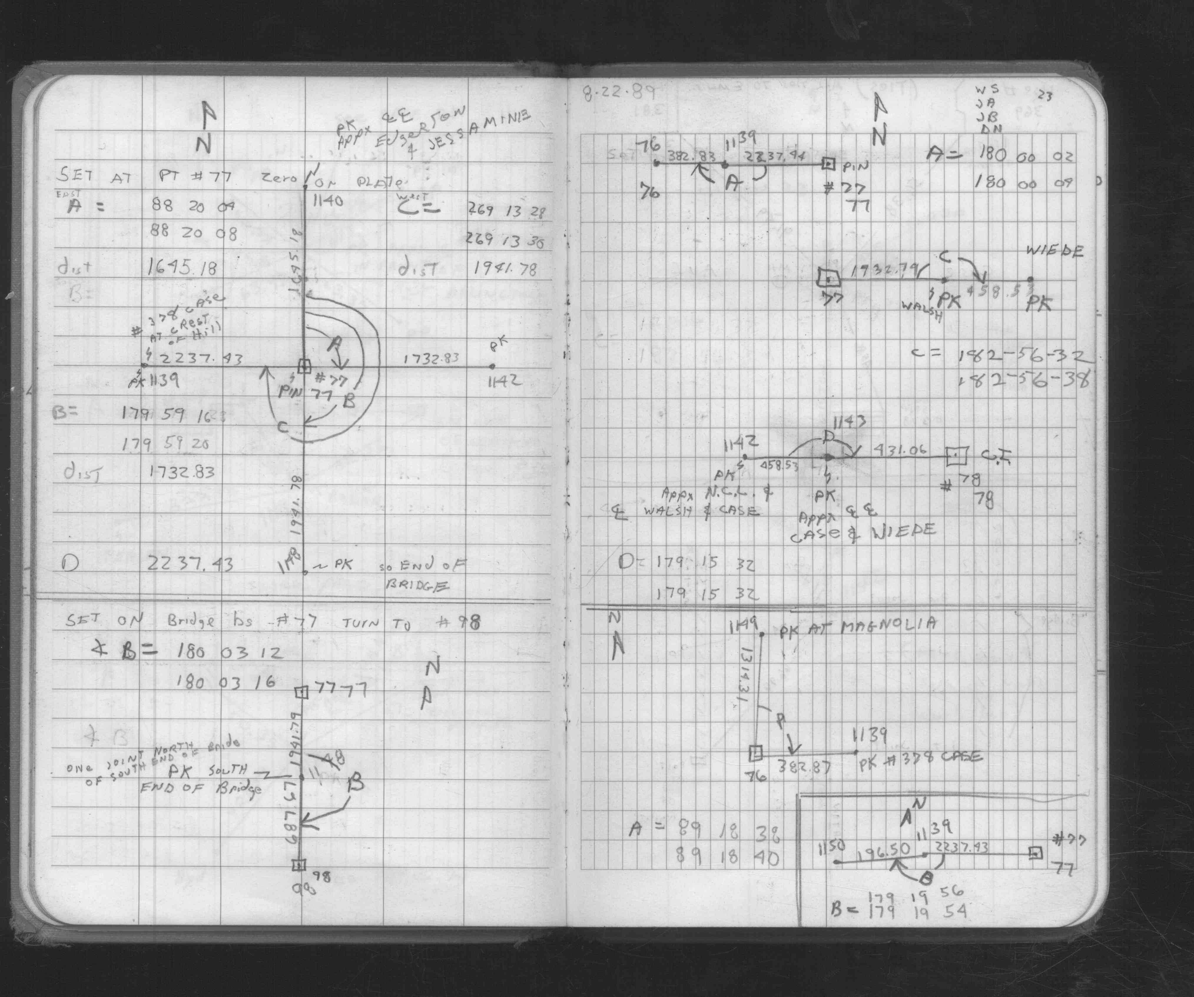
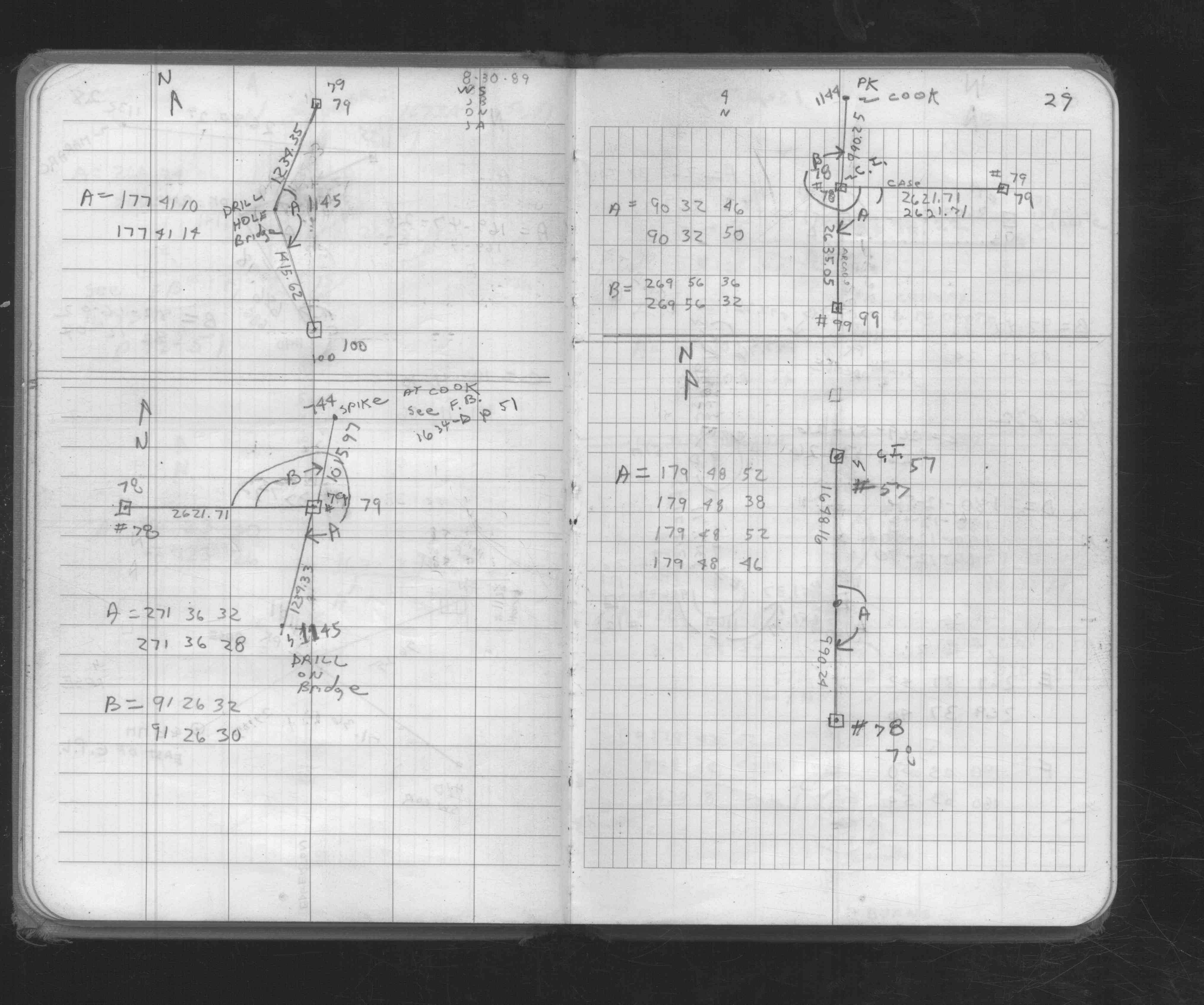
| 8/22/1989 | Fd CIM inplace. See FB 1676C p.23 |
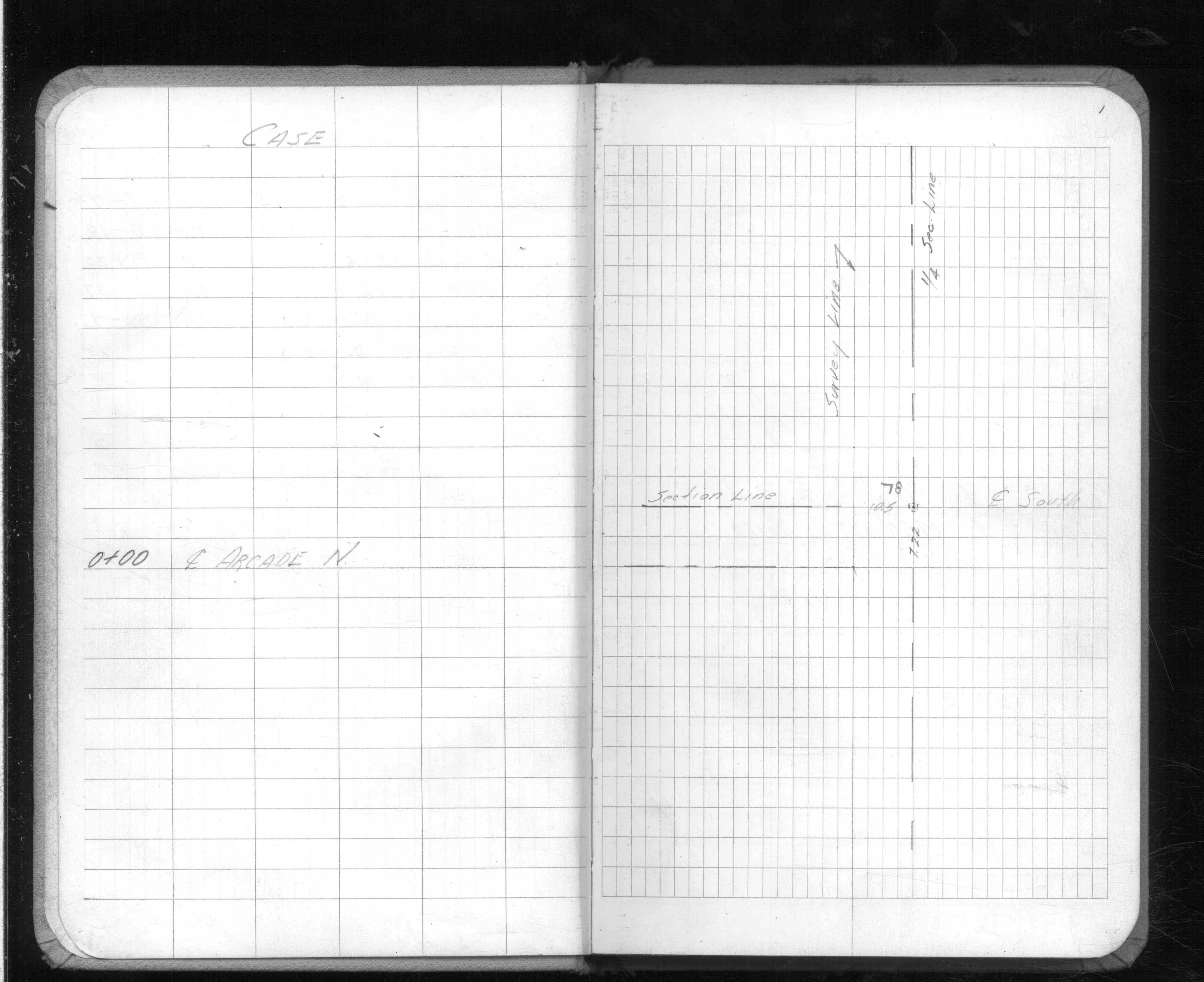
| 3/1/1987 | (Unknown date Mar __, 1987 ) Set iron pin to grade. |
| 6/1/1980 | (Unknown date Jun __, 1980 ) Fd CIM inplace. See FB 1676 p.15,32 |
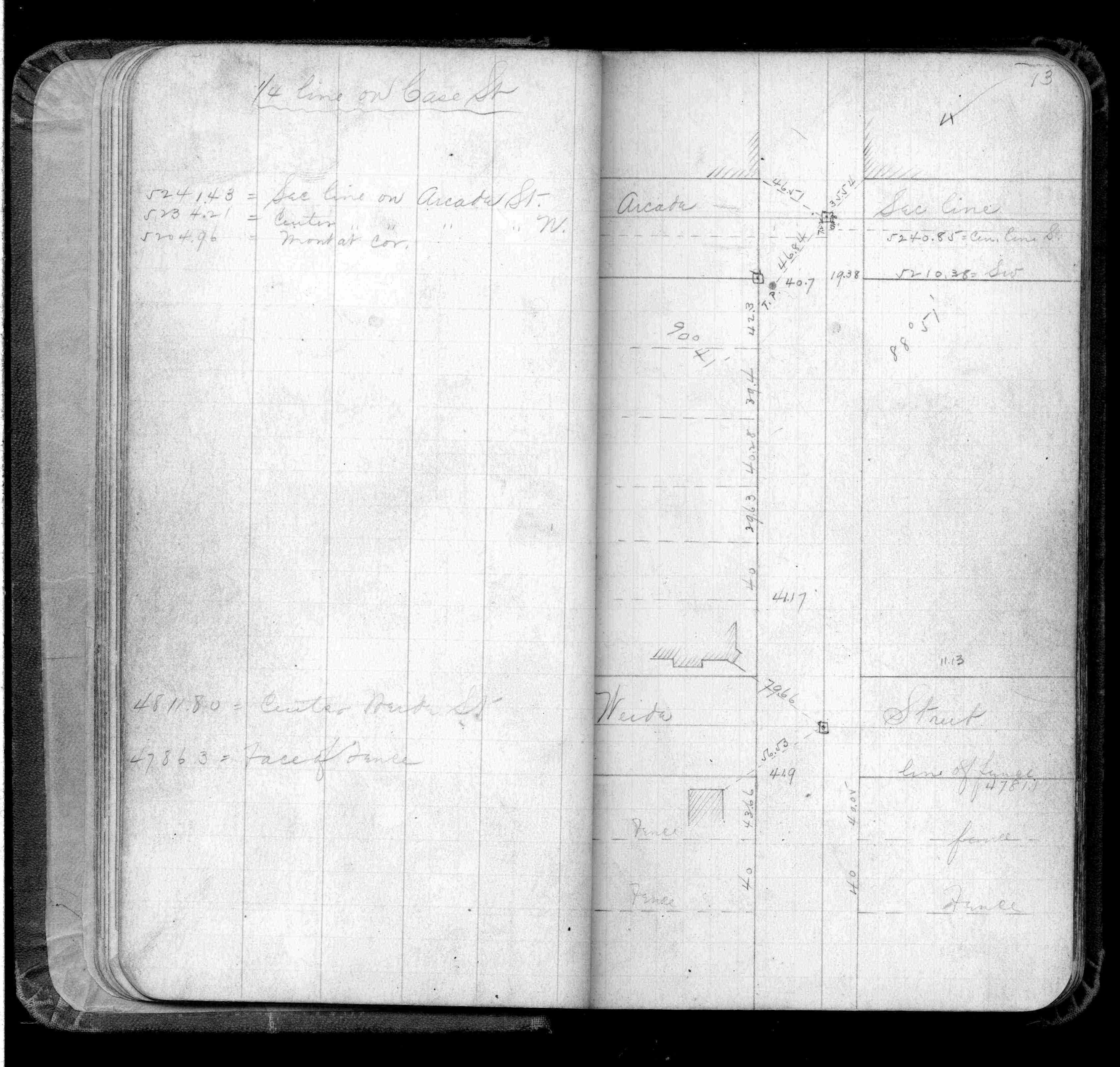
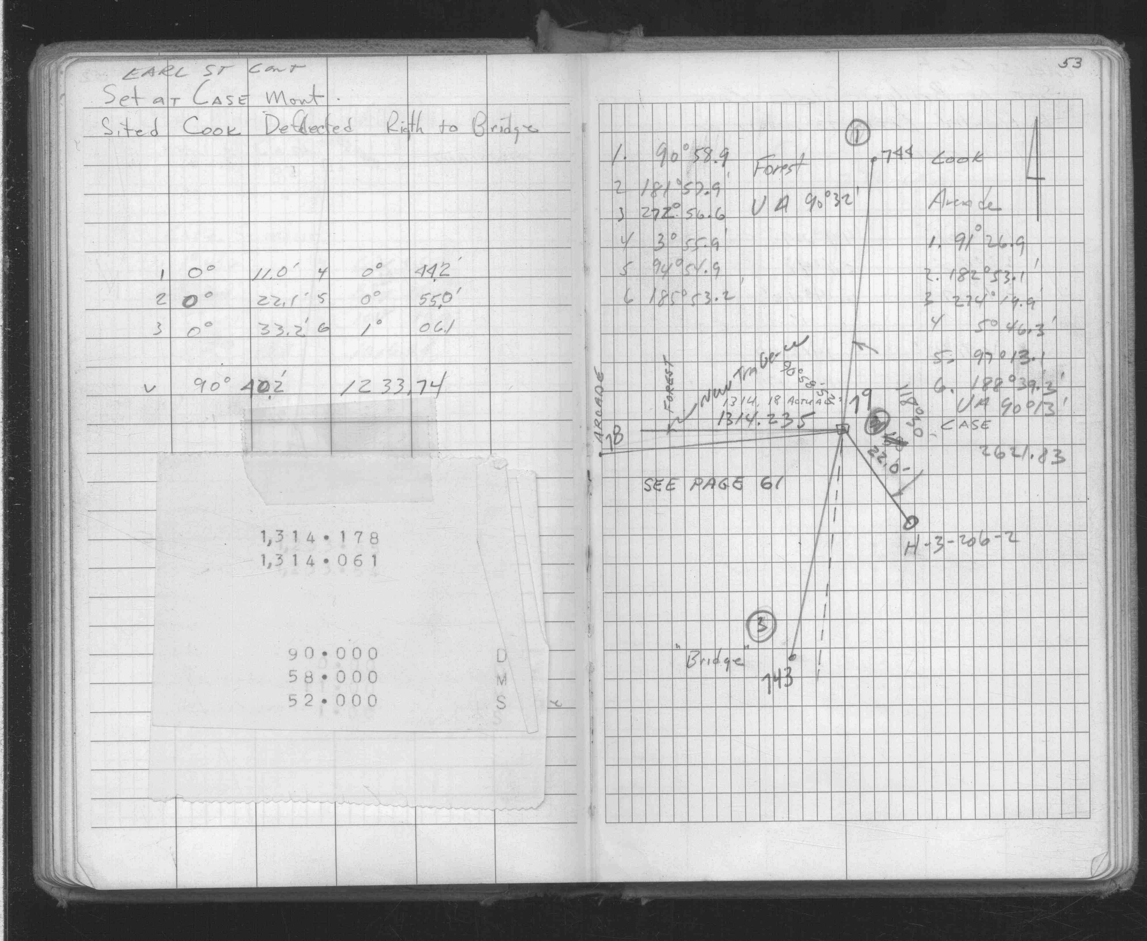
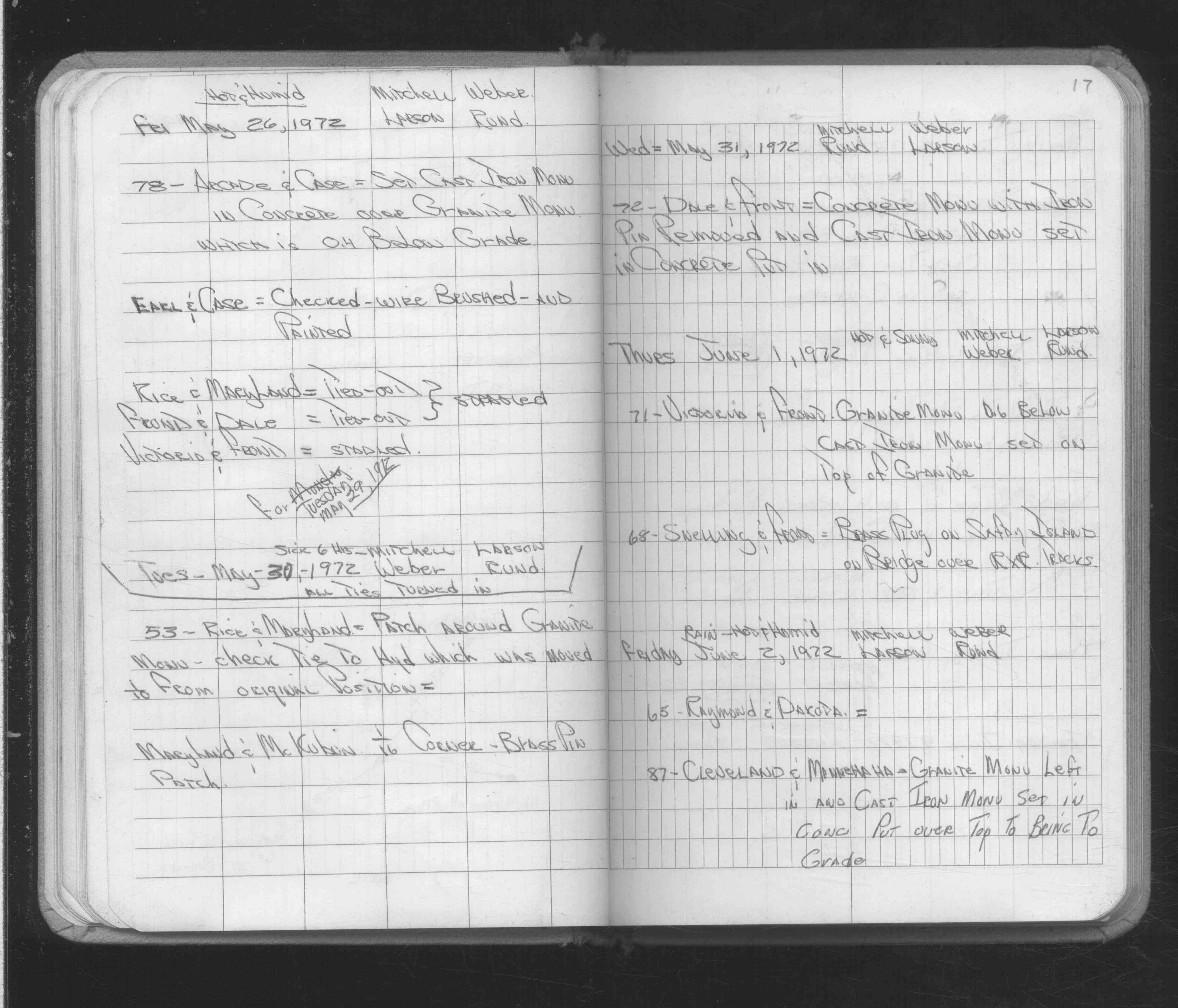
| 5/26/1972 | Set CIM in concrete over GM which is 0.4 ft below grade. See FB 1689A p.17 |
| 2/16/1972 | Fd concrete - iron 0.4 ft below grade. See FB 1689A p.6 |
| 1/1/1895 | (Unknown date Jan __, 1895 ) Monument reset by J B Irvine under the direction of J H Armstrong |
| 3/1/1889 | (Unknown date Mar __, 1889 ) Monument reset & raised by G Saulez |
| 1/1/1887 | (Unknown date ___ __, 1887 ) Monument not disturbed by grading Case St in 1887 Chas Hunt |
| 11/1/1847 | (Unknown date Nov __, 1847 ) Isaac N Higbee deputy surveyor set post. Tied to 2 BTs. See IH p.200-201 2922 |
Above is NOT an all inclusive history of this point. Please review all the links below.
| PLS NOTES | Field | Cross Section | Sewer | J.B. Irvine | Monument | River Survey |
|---|---|---|---|---|---|---|
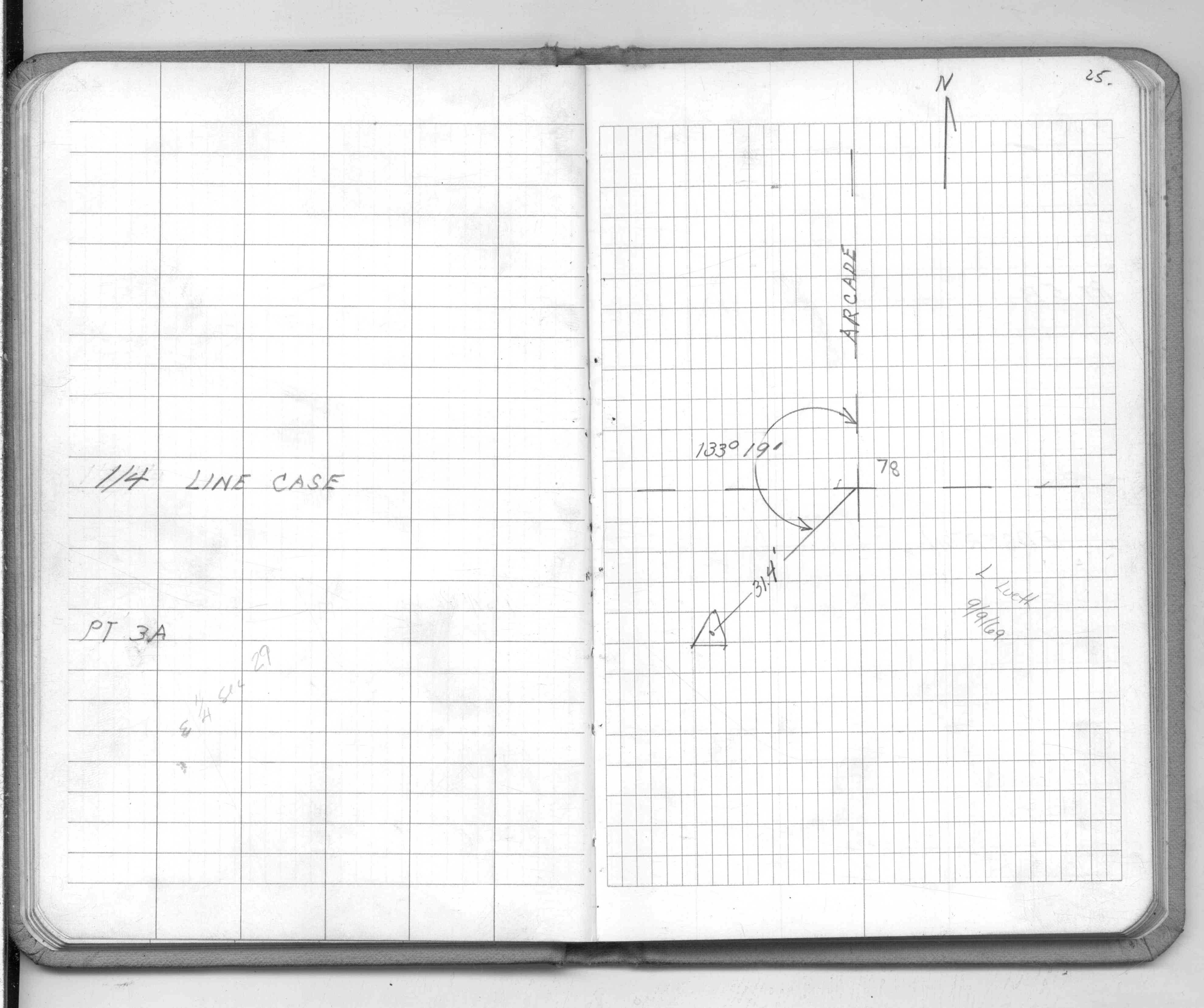
| IH p.200-201 | FB 0111p.46 | |||||
| FB 0293CPYp. 13 ,17 | ||||||
| FB 0298CPYp.23 | ||||||
| FB 1352p.39 | ||||||
| FB 1549Cp.25 | ||||||
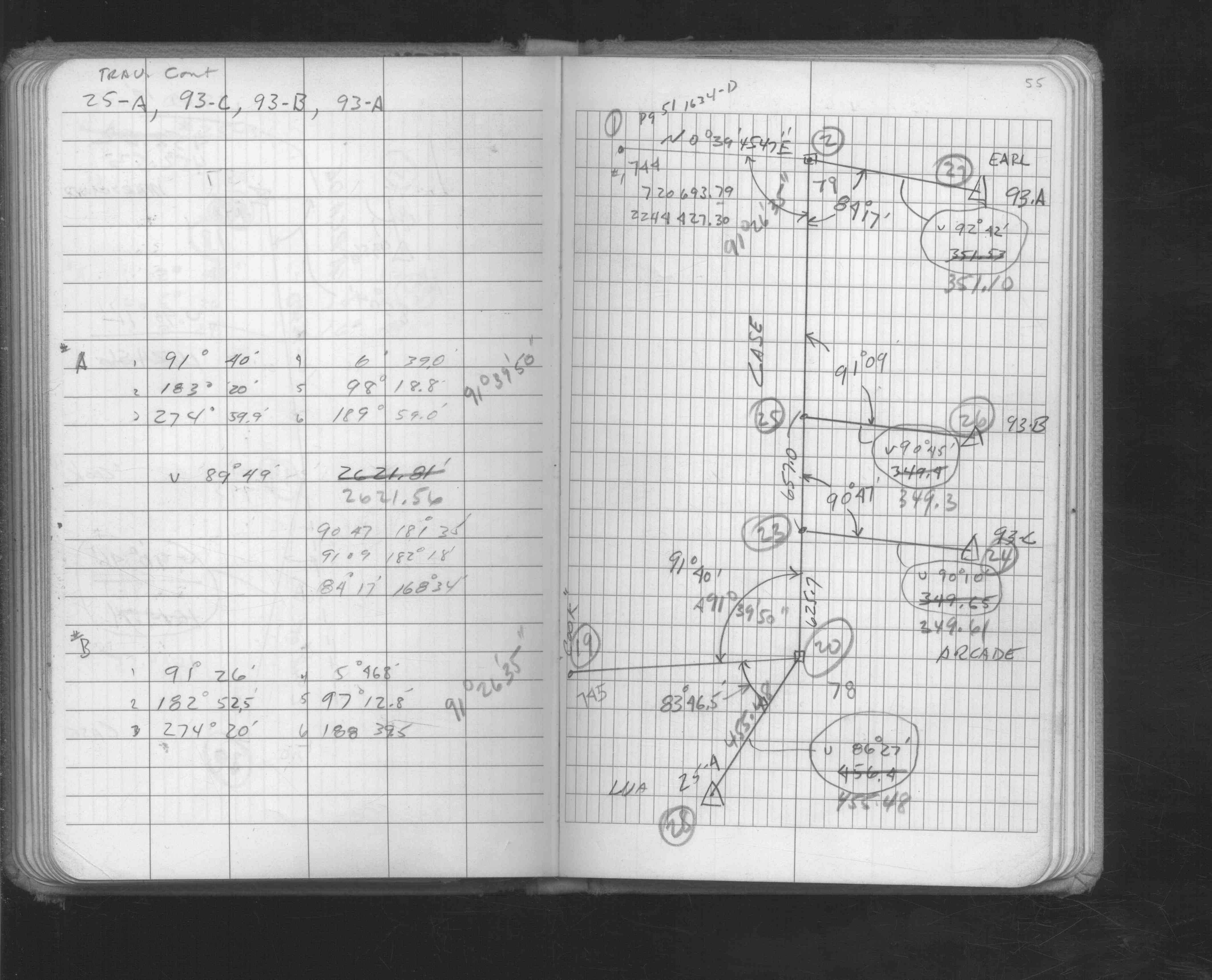
| FB 1549Ip. 54 ,55 | ||||||
| FB 1597p.01 | ||||||
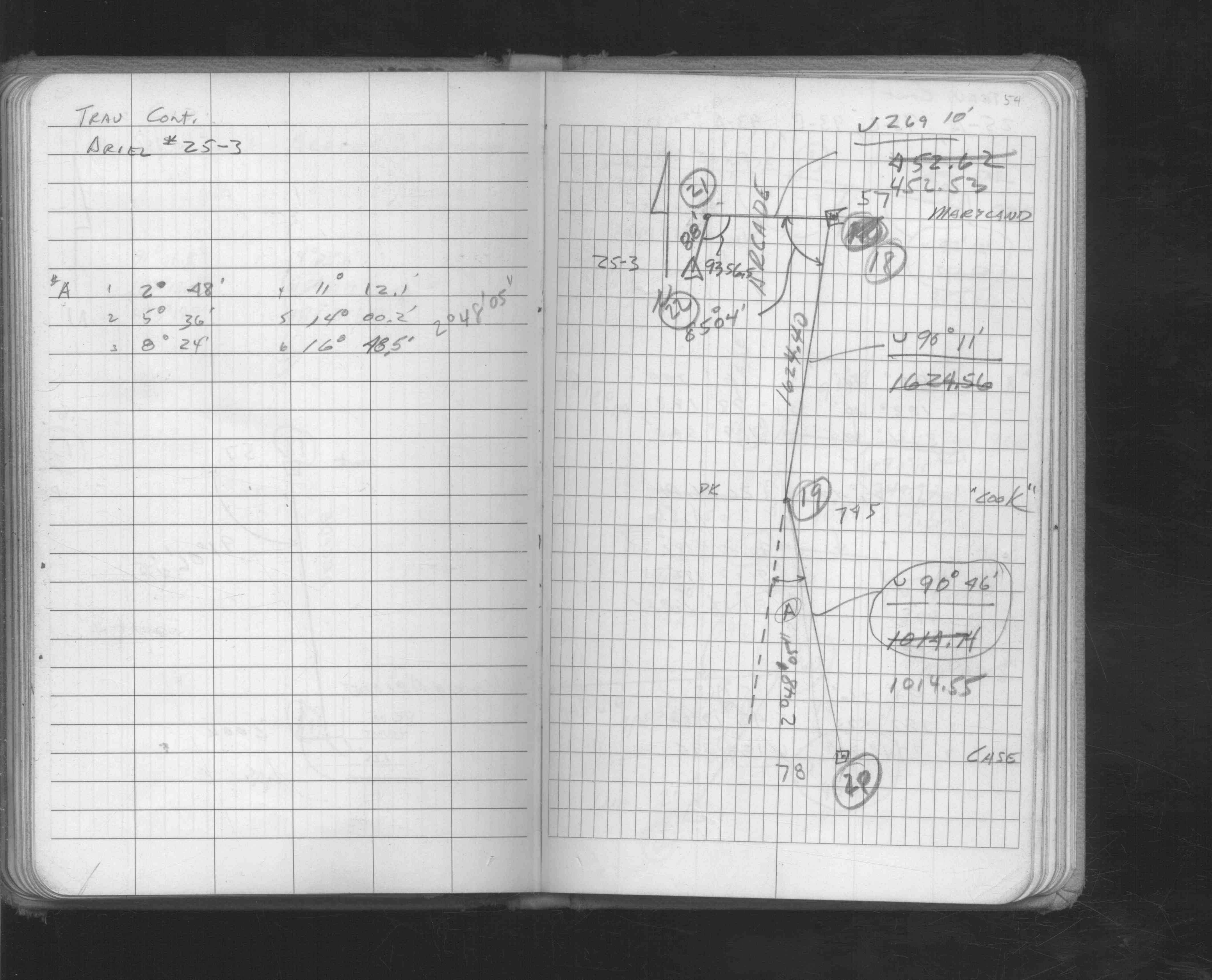
| FB 1634Dp. 53 ,62 ,63 | ||||||
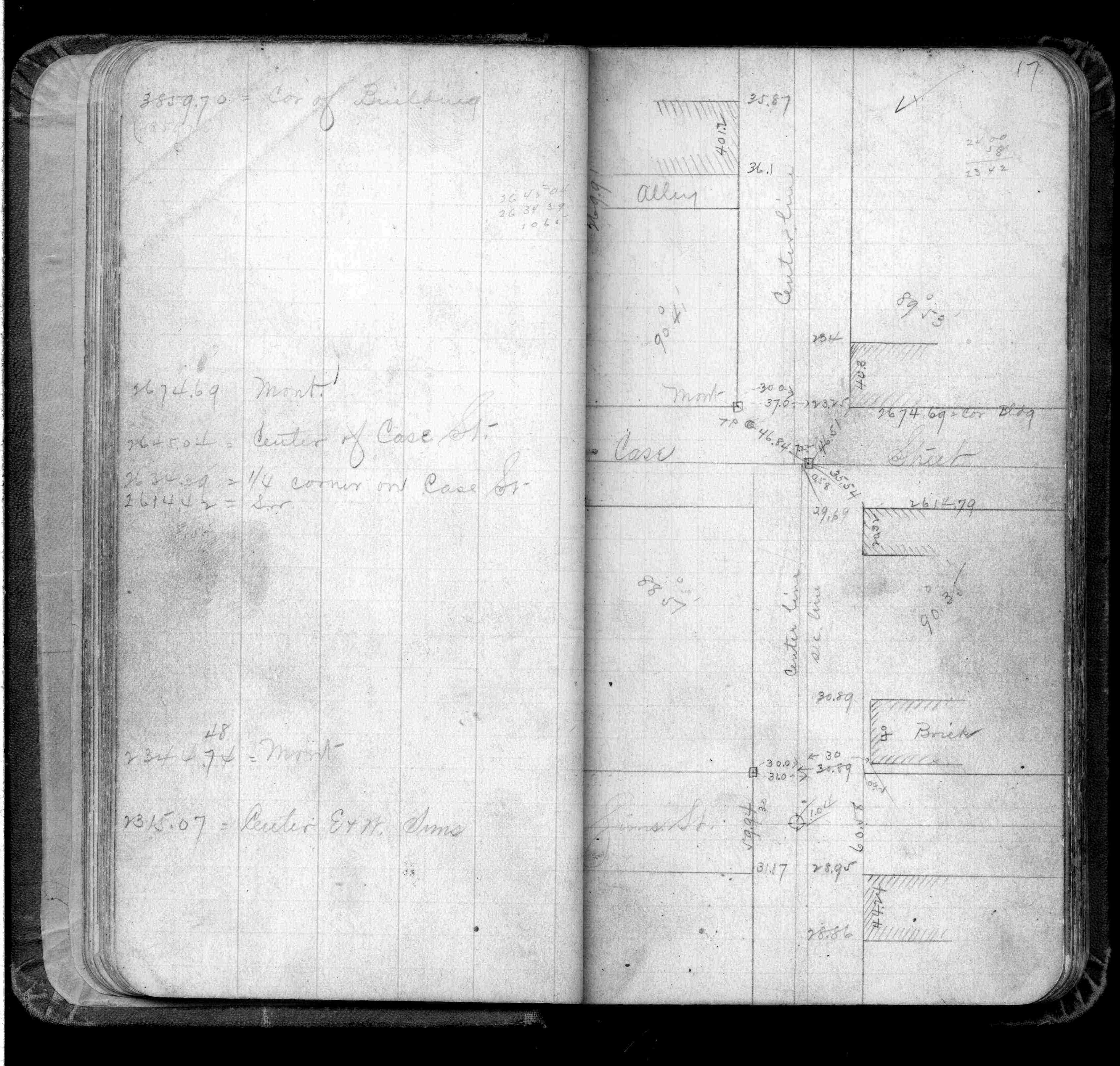
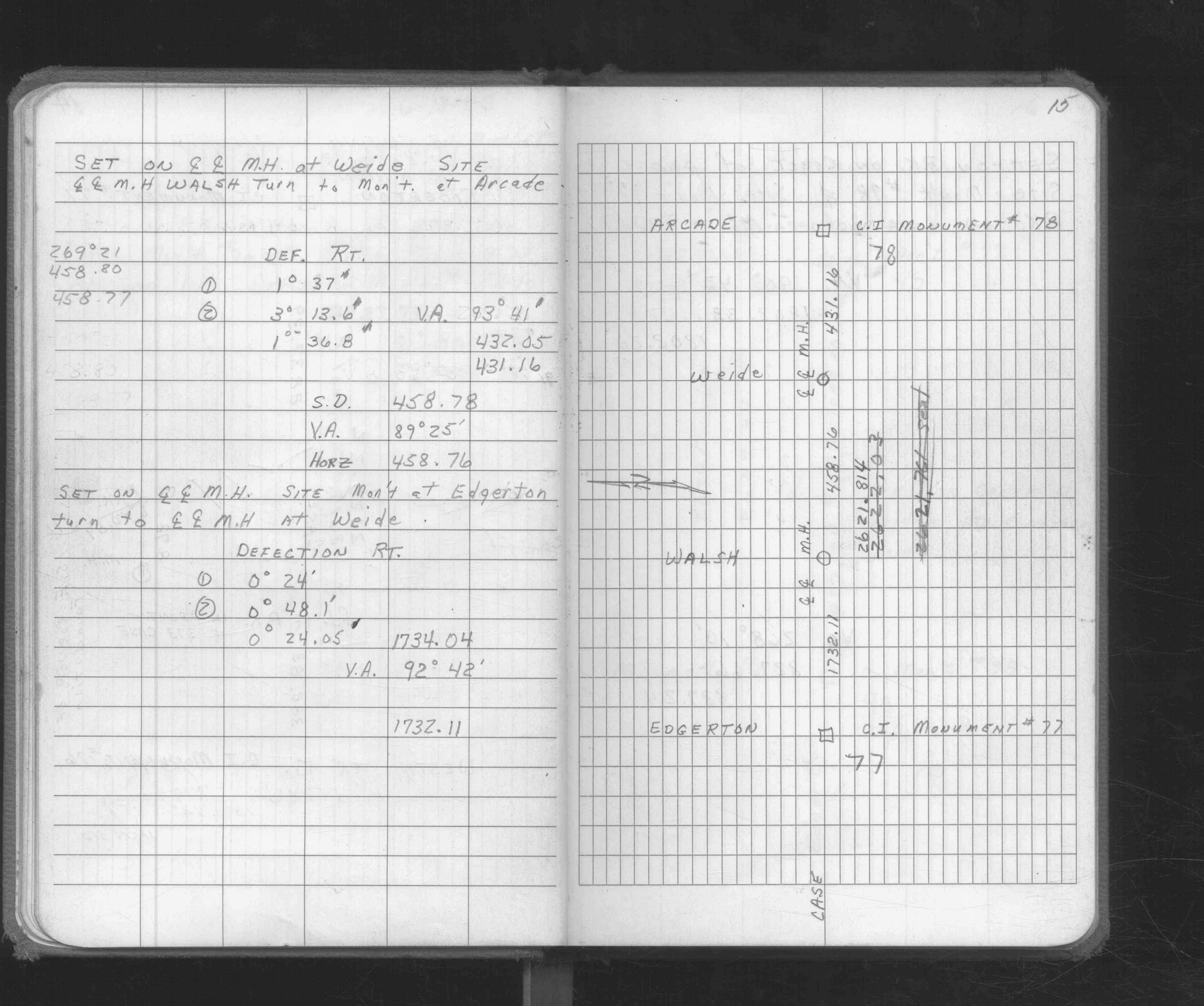
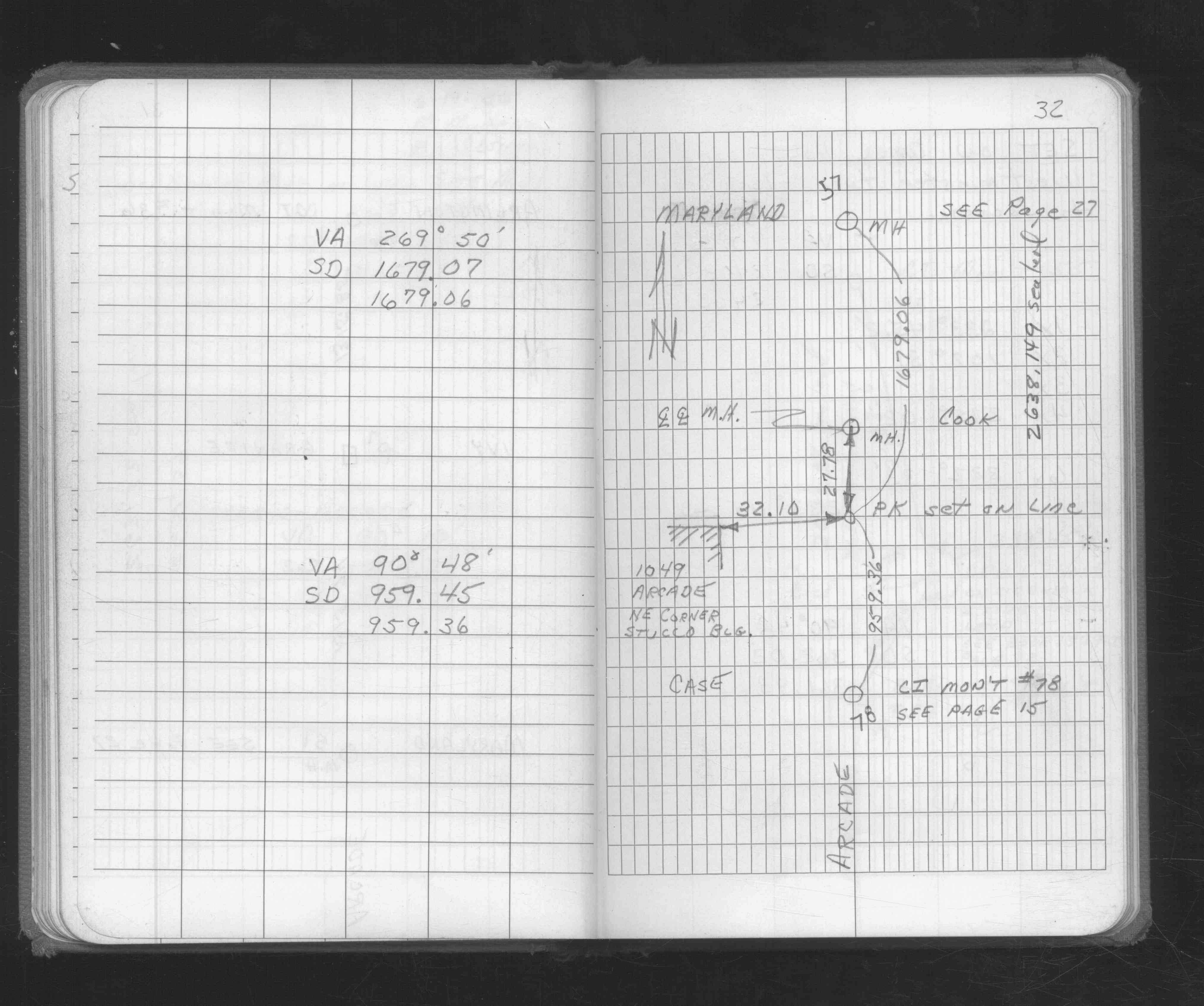
| FB 1676p. 15 ,32 | ||||||
| FB 1676p. 15 ,32 | ||||||
| FB 1676Cp.23 | ||||||
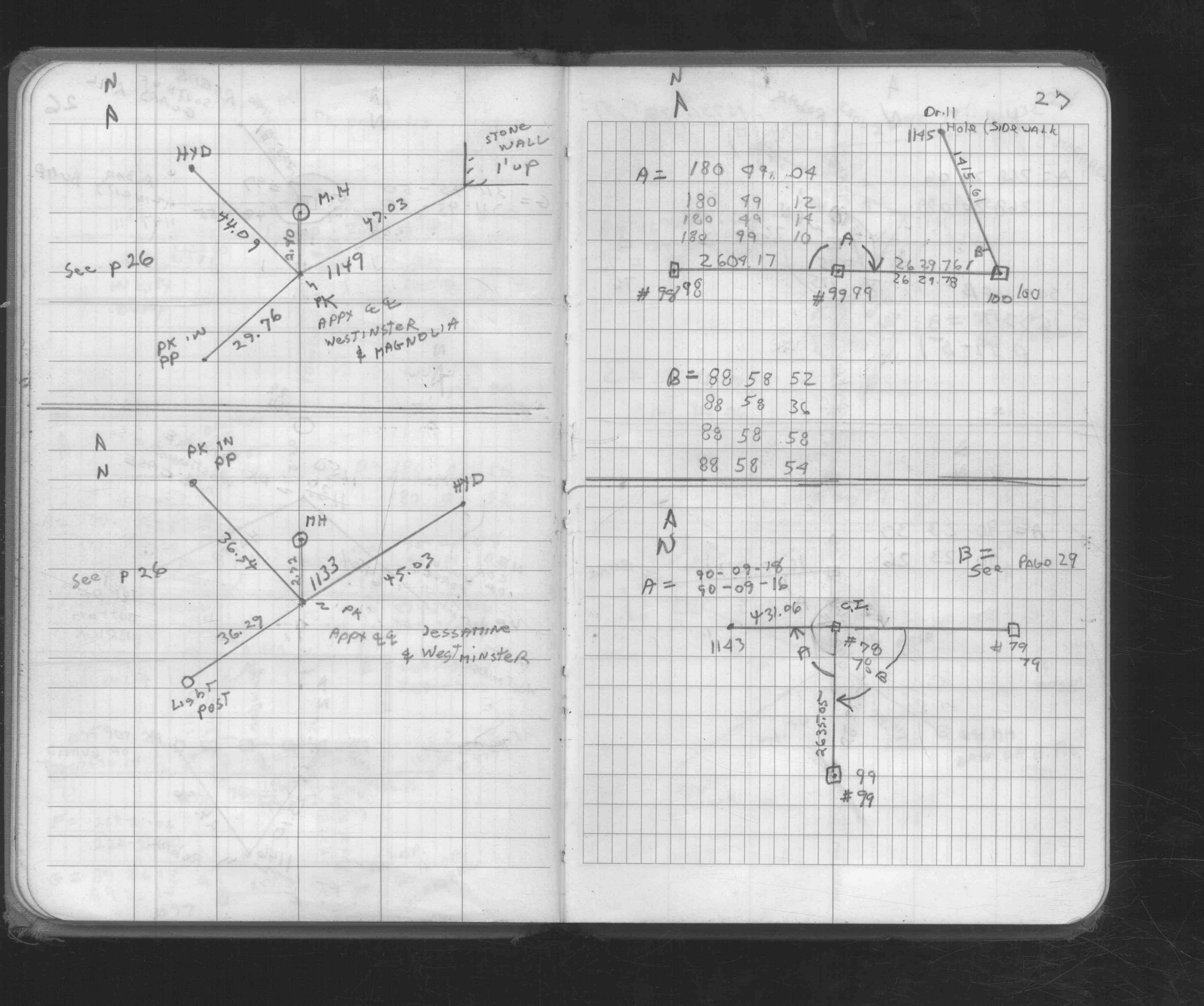
| FB 1676Cp. 23 ,27 ,29 | ||||||
| FB 1689Ap.17 | ||||||
| FB 1689Ap.06 | ||||||
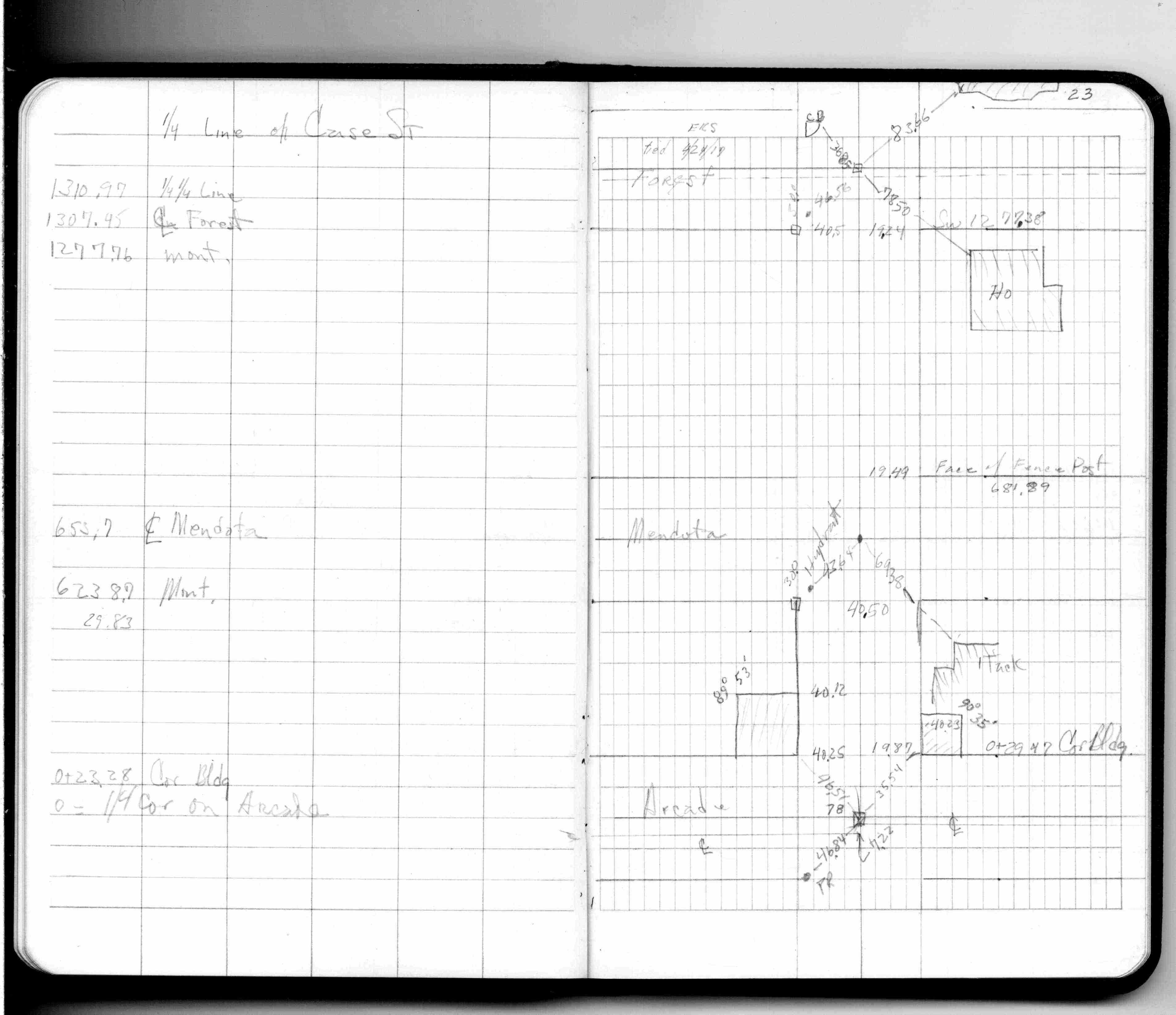
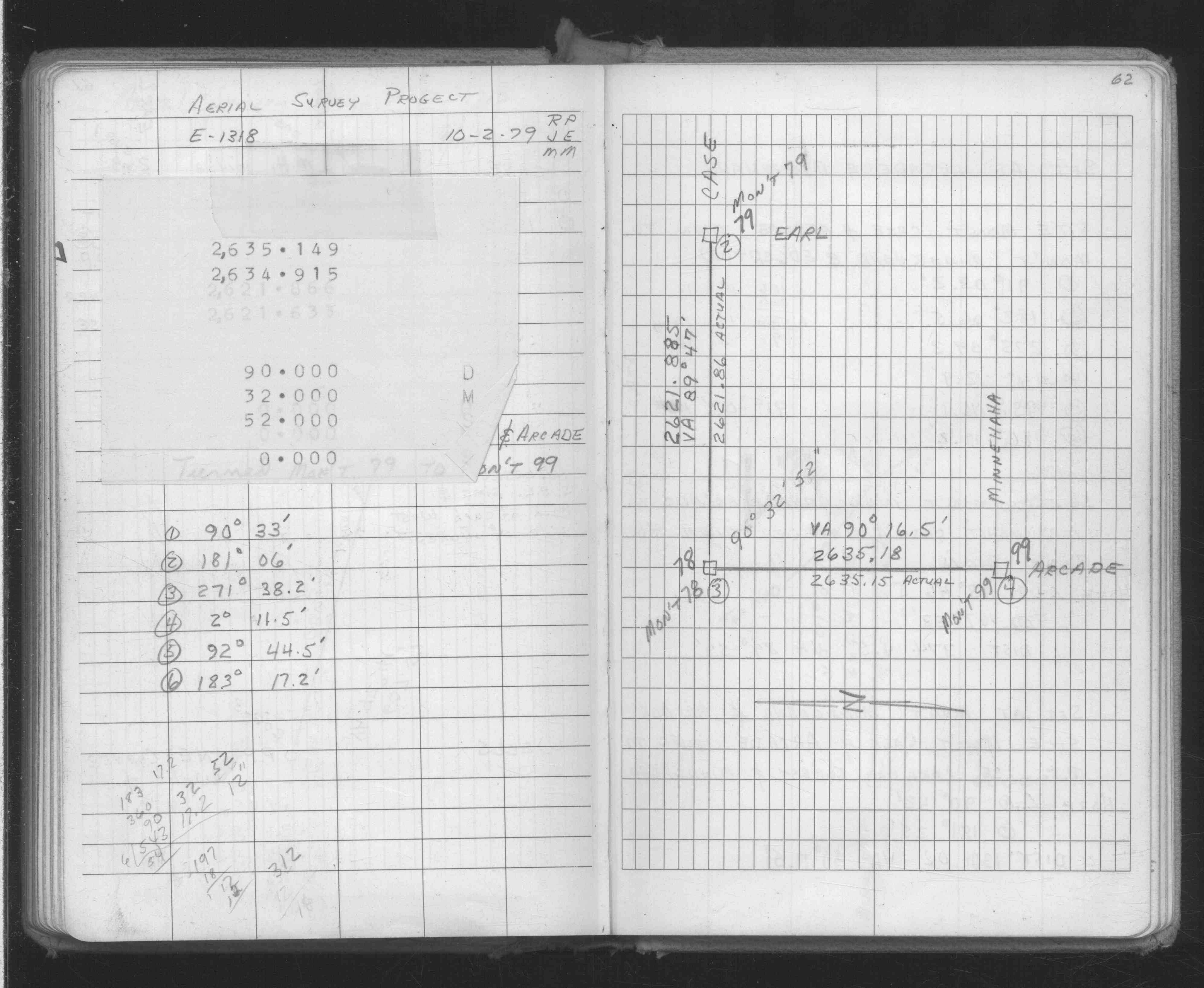
| FB 1716p.66 | ||||||
| FB 1716p.66 | ||||||
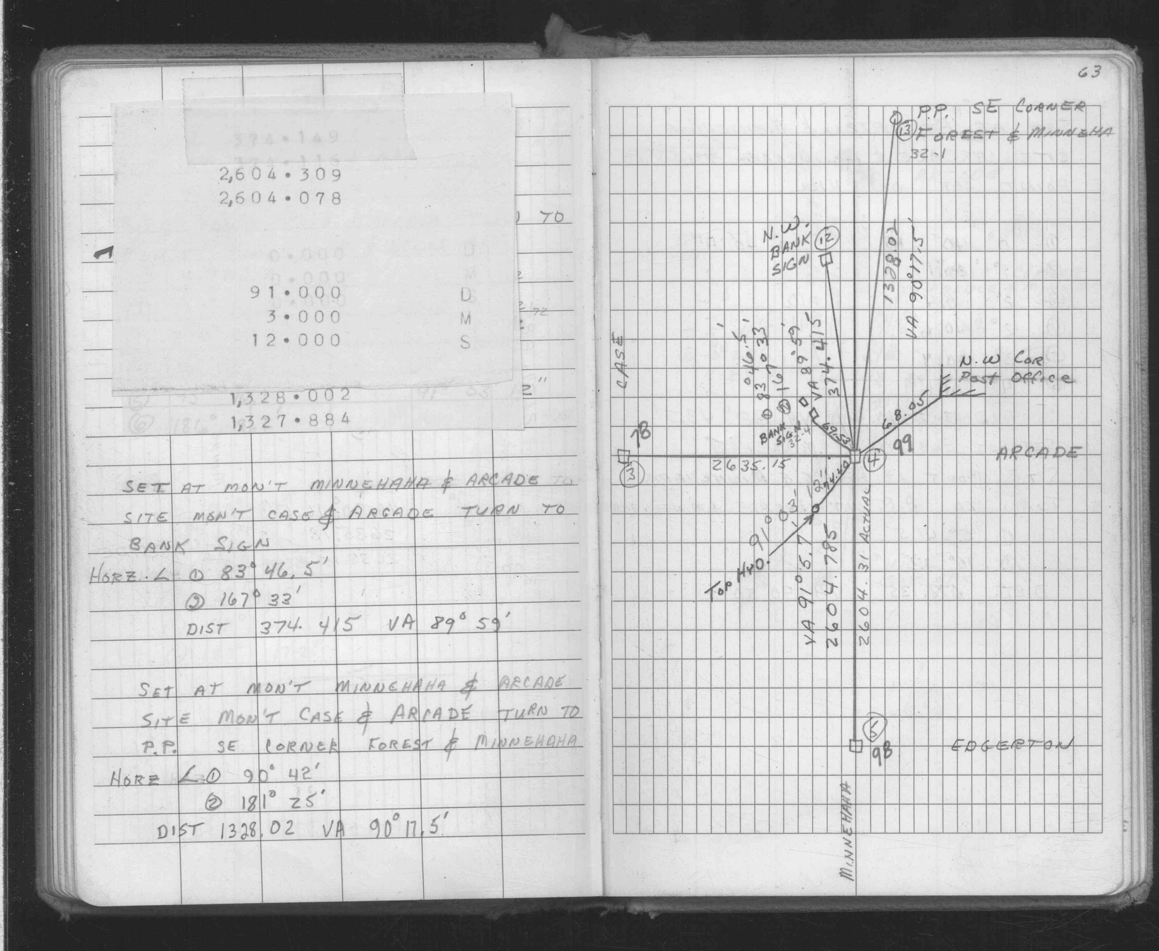
| FB 1719Ap.57 | ||||||
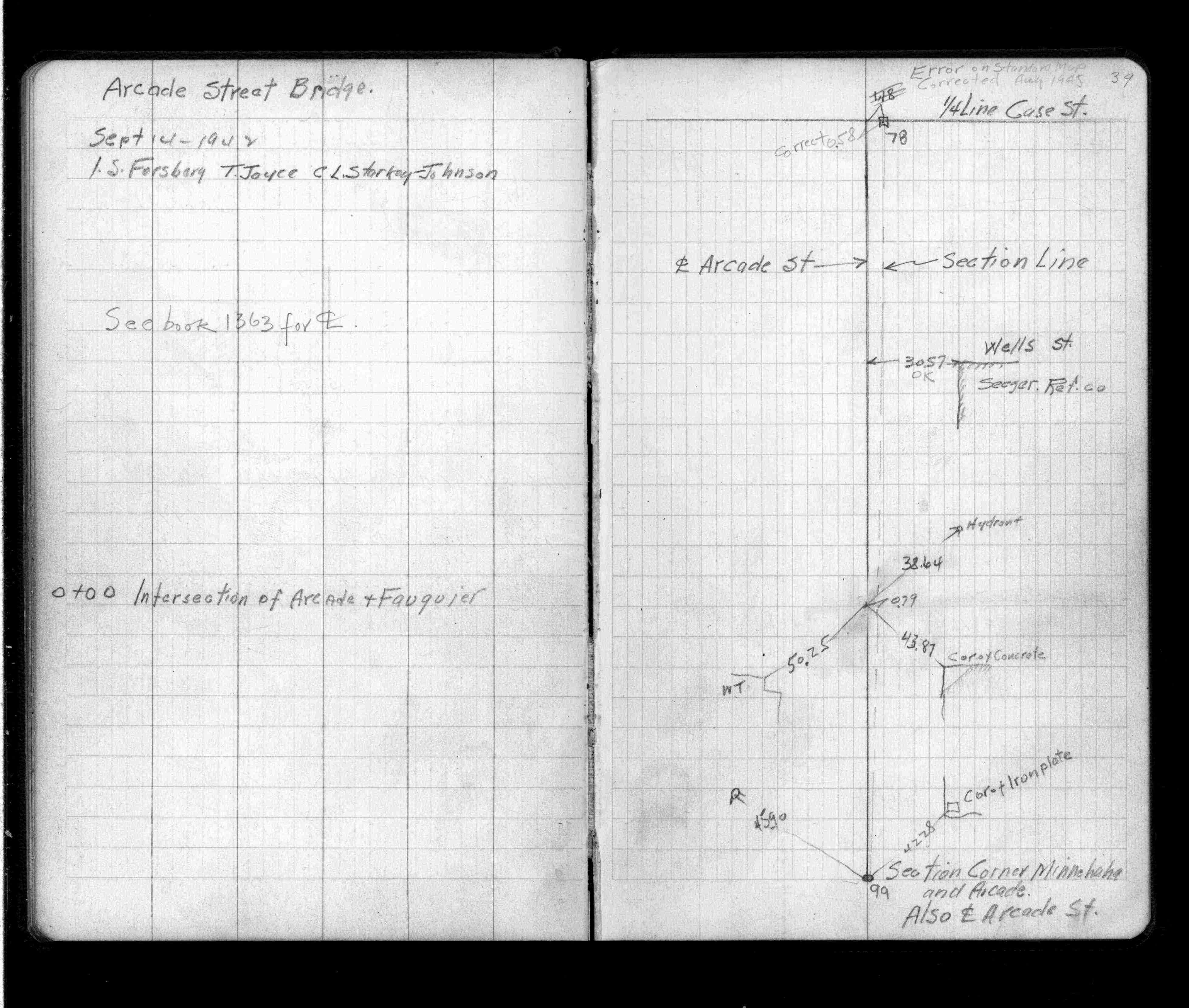
| FB 1736p.13 |
| FILE | SURVEYOR | LIC. NO. | DATE SIGNED | DATE TIED |
|---|---|---|---|---|
| 0078-0047-B.tif | Jeffery L. Grosso | 13144 | May 27, 1999 | May 21, 1999 |
| 0078-0047-A.tif | William J. Cutting | 20576 | October 19, 1992 | October 19, 1992 |
| ST_001-078p078.jpg | none | none | none | none |
| 0078-0047-A.dwf | none | none | none | none |
| FILE | PHOTO DATE | COMMENTS |
|---|---|---|
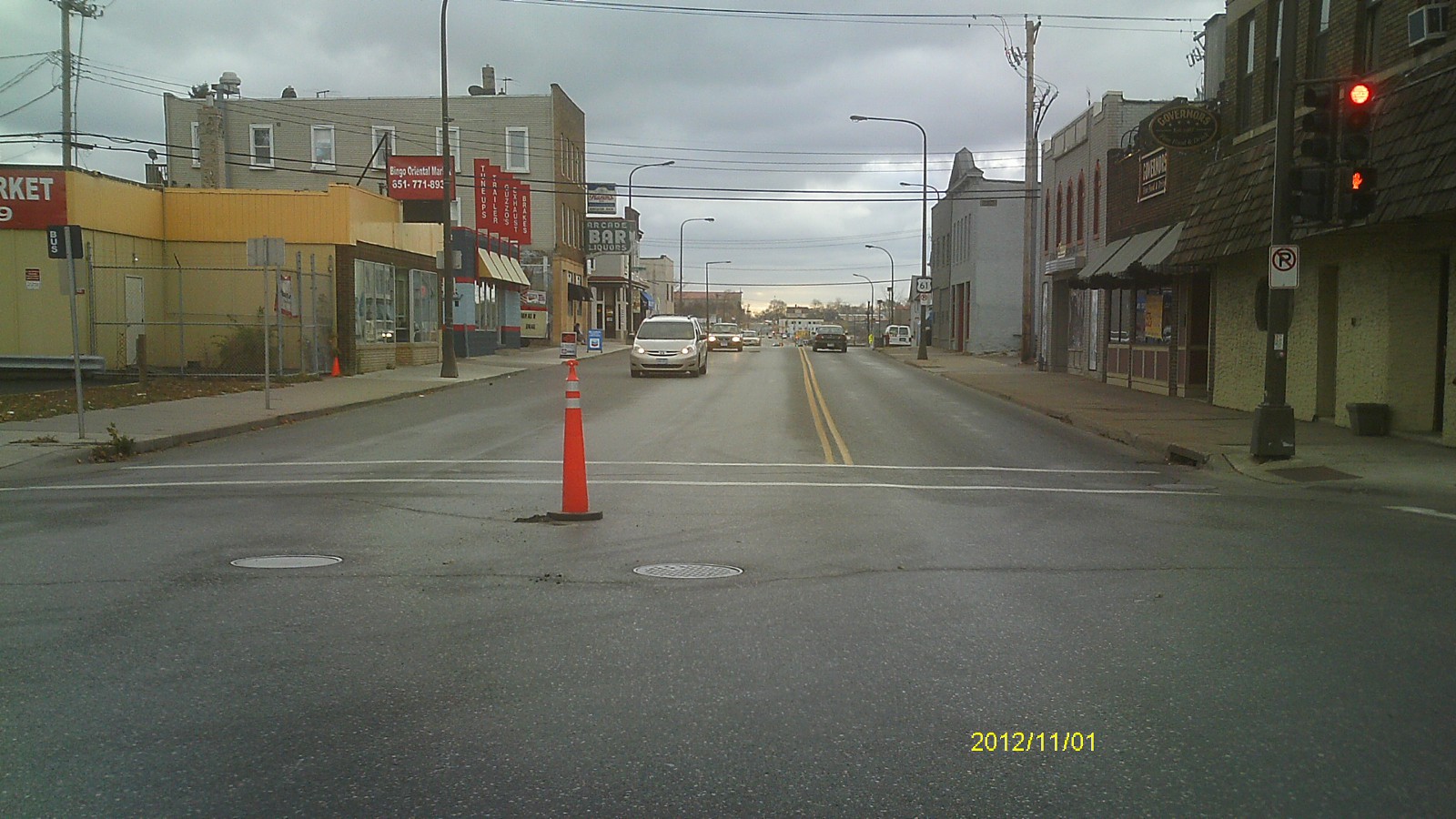
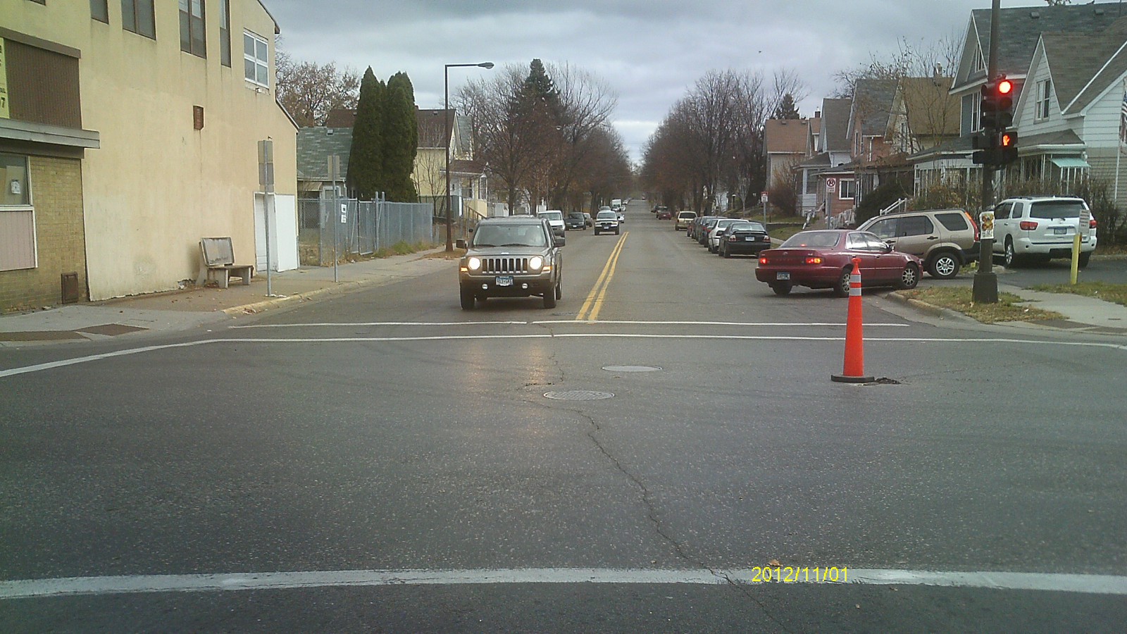
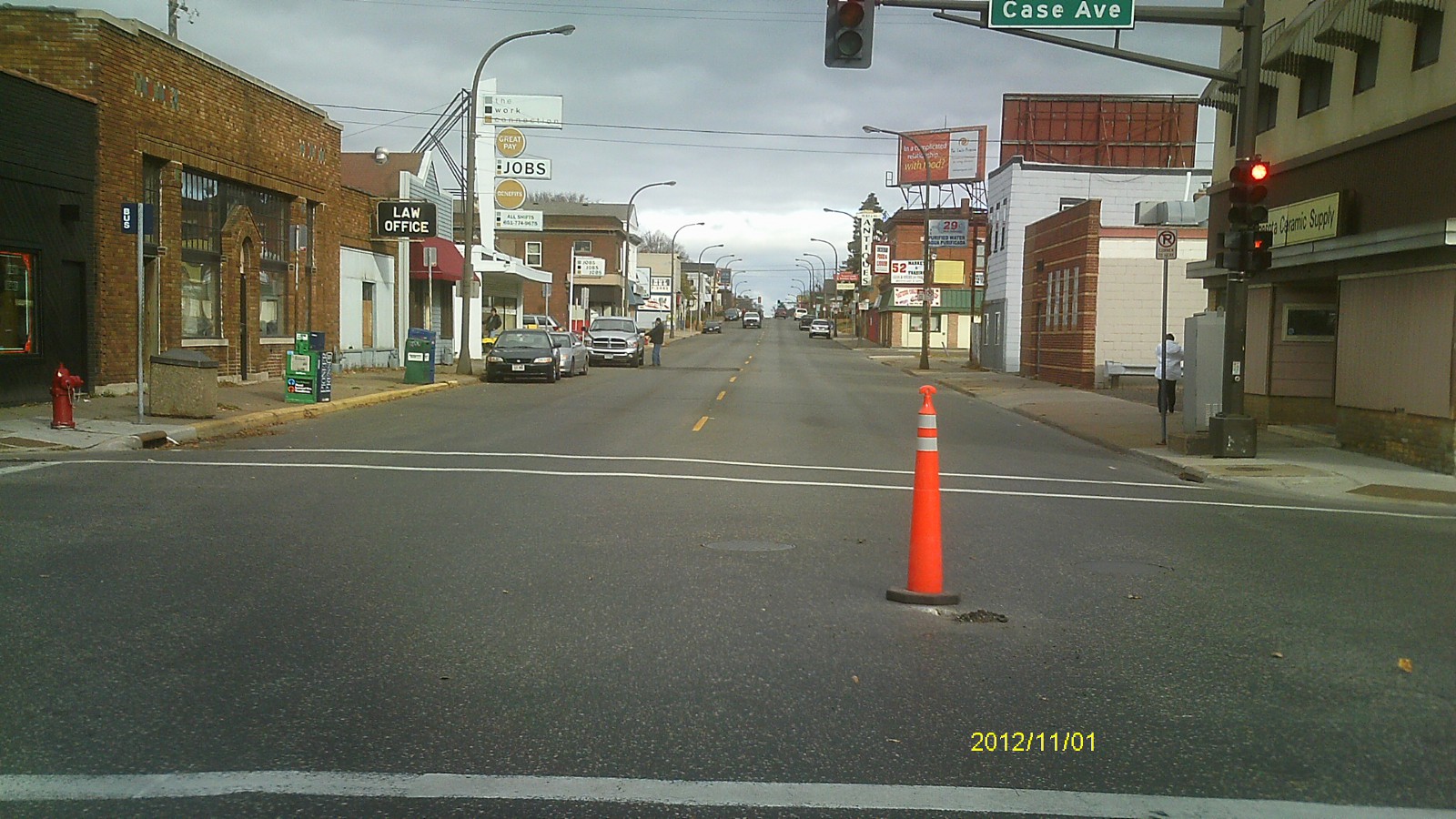
| 0078-0047-5.jpg | November 1, 2012 | Looking west along Case Ave. |
| 0078-0047-4.jpg | November 1, 2012 | Looking south along Arcade St. |
| 0078-0047-3.jpg | November 1, 2012 | Looking east along Case Ave. |
| 0078-0047-2.jpg | November 1, 2012 | Looking north along Arcade St. |
| 0078-0047-1.jpg | November 1, 2012 | Close up of remaining monument. |