| NAD83 COORDINATES (1986 adj.): |
|---|
| * X= 590033.83 Y= 165530.91 Z= 0 LSQ 12/6/1991 S FLT |
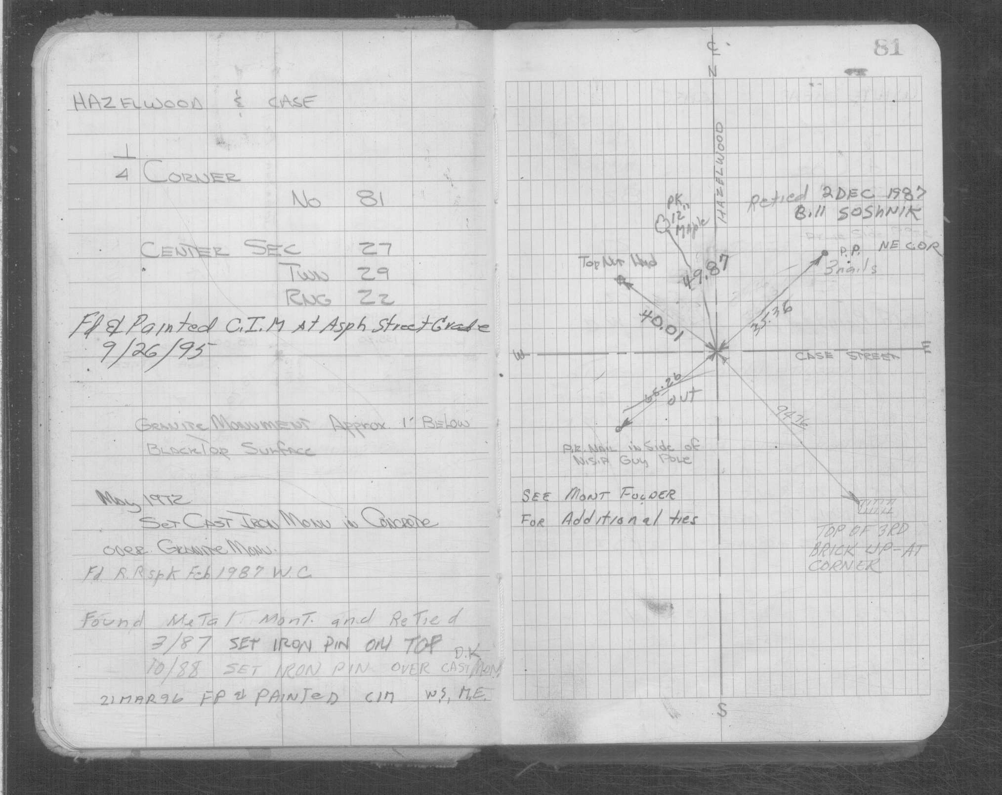
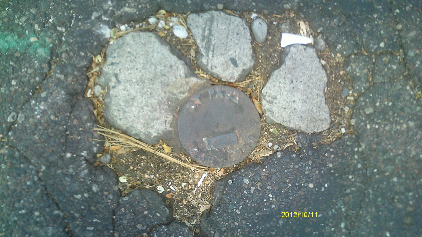
| 10/11/2012 | Found CIM at street grade in broken up concrete patch. Photos taken. |
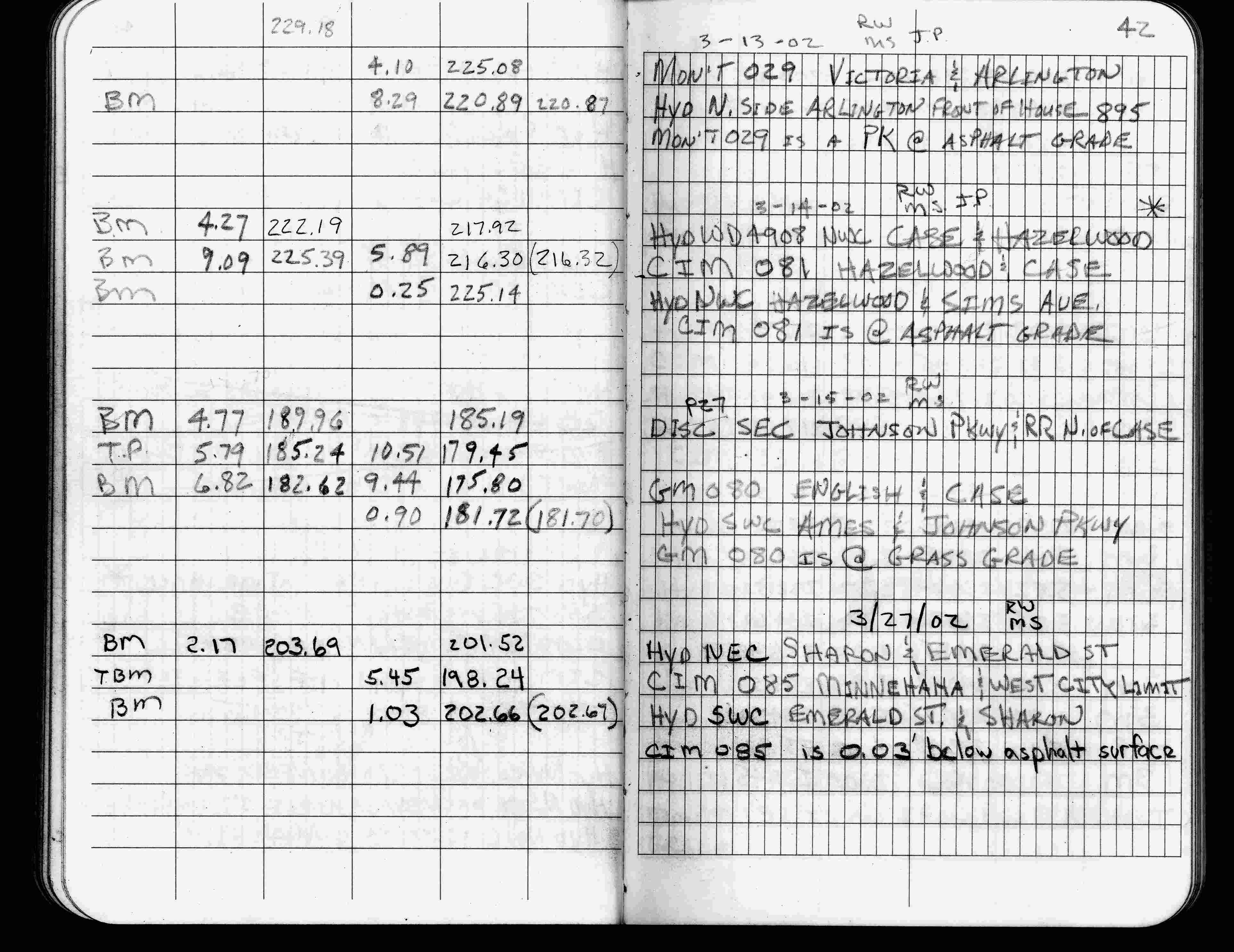
| 3/14/2002 | Elev 216.30 ft on CIM at asphalt surface. See FB 1736 p.42 |
| 3/17/2000 | Fd CIM at grade (marked for painting target for 2000 aerial) |
| 4/14/1997 | Used CIM for traverse control. See FB 1549L p.25 |
| 3/26/1997 | Elev 216.32 ft on CIM. See acorddat/1997/p1157/p1157.sdr Digital-Unadj |
| 10/1/1992 | Set CIM. See CofL 0081-1019-A |
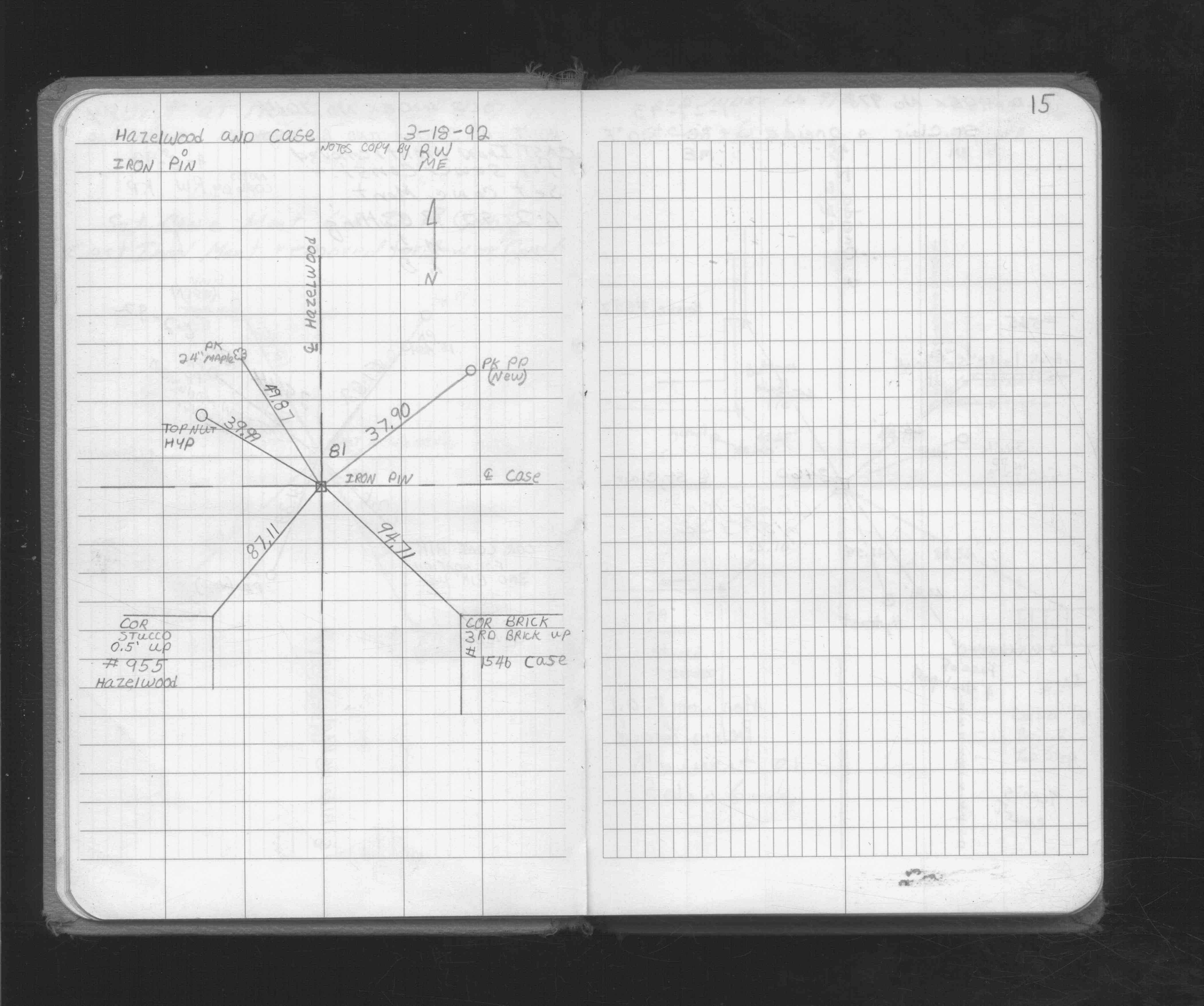
| 3/18/1992 | Tied iron pin. See FB 1716 p.15 |
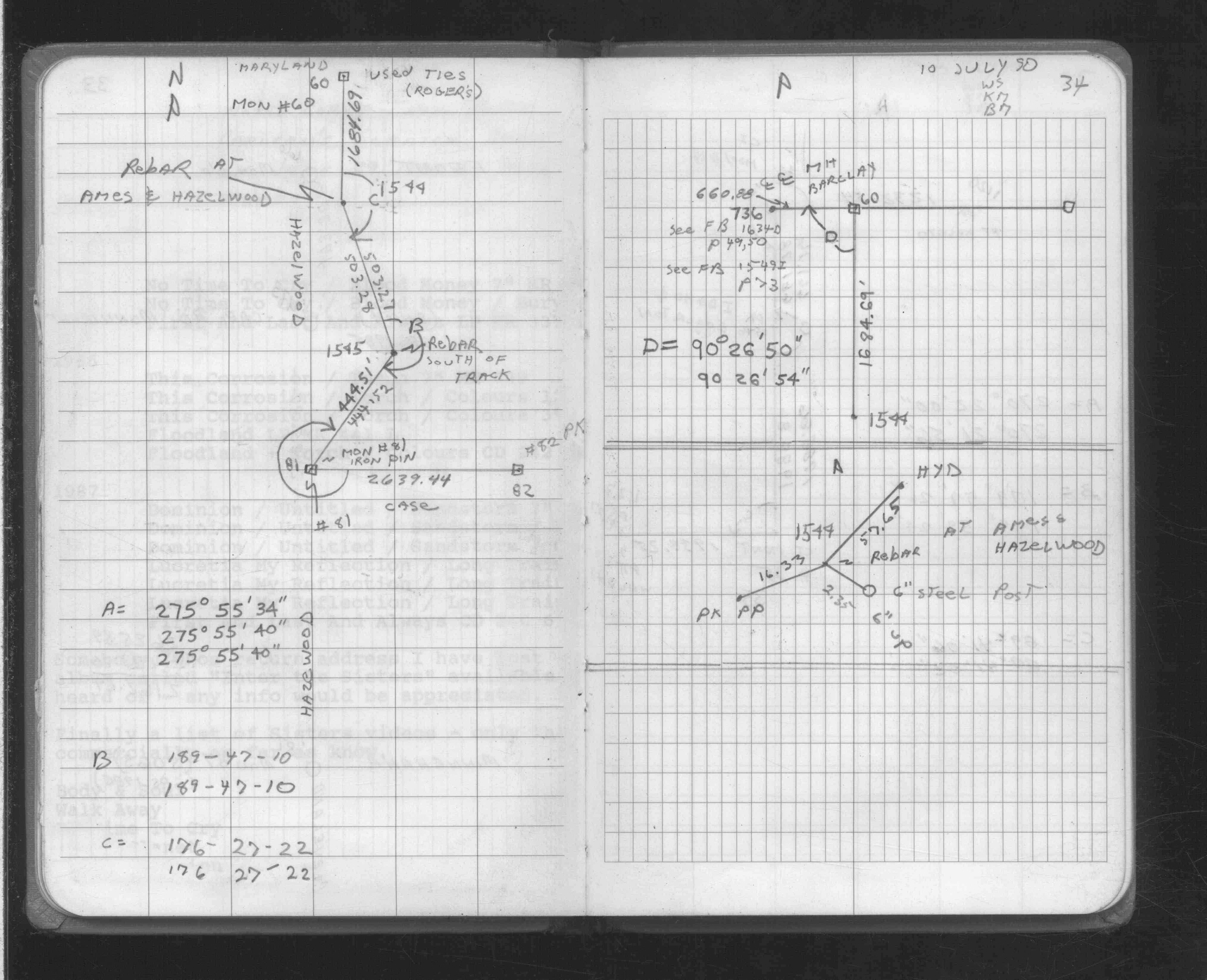
| 7/10/1990 | Traversed through iron pin. See FB 1708A p.34 |
| 10/1/1988 | (Unknown date Oct __, 1988 ) Iron pin set over CIM. |
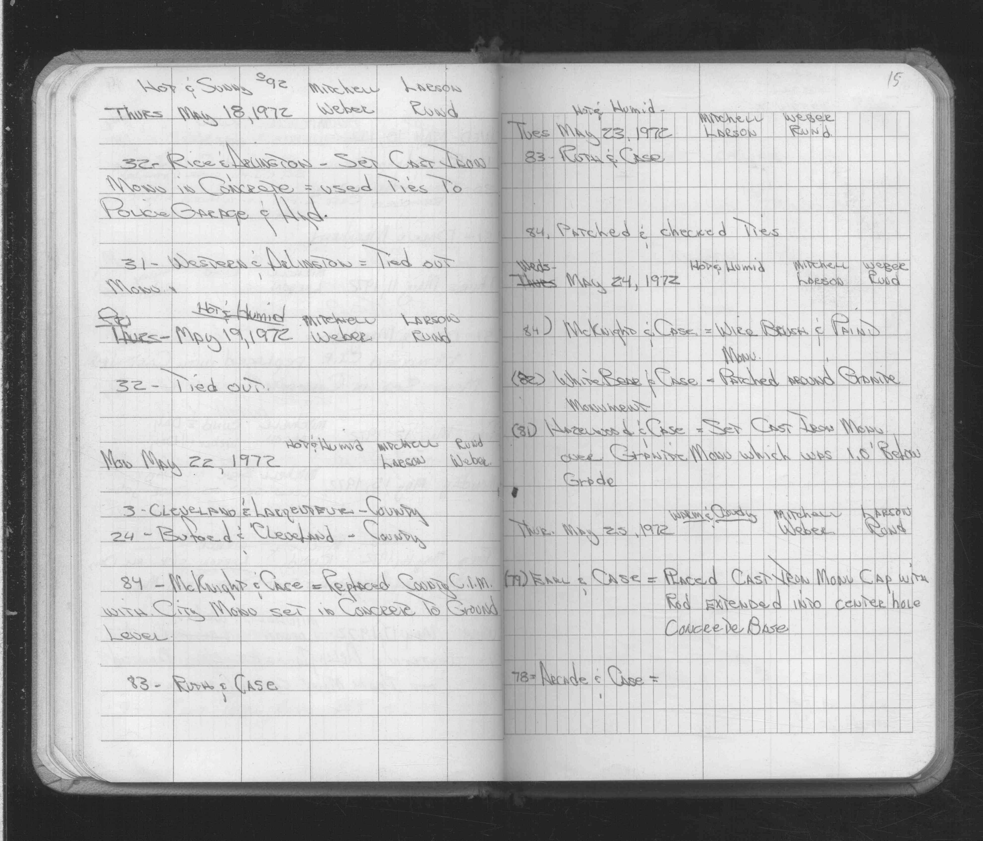
| 5/24/1972 | Fd GM 1.0 ft below grade, set CIM over GM. See FB 1689A p.15 |
| 12/11/1950 | Placed ties on the monument. See CS 2894 p.3 |
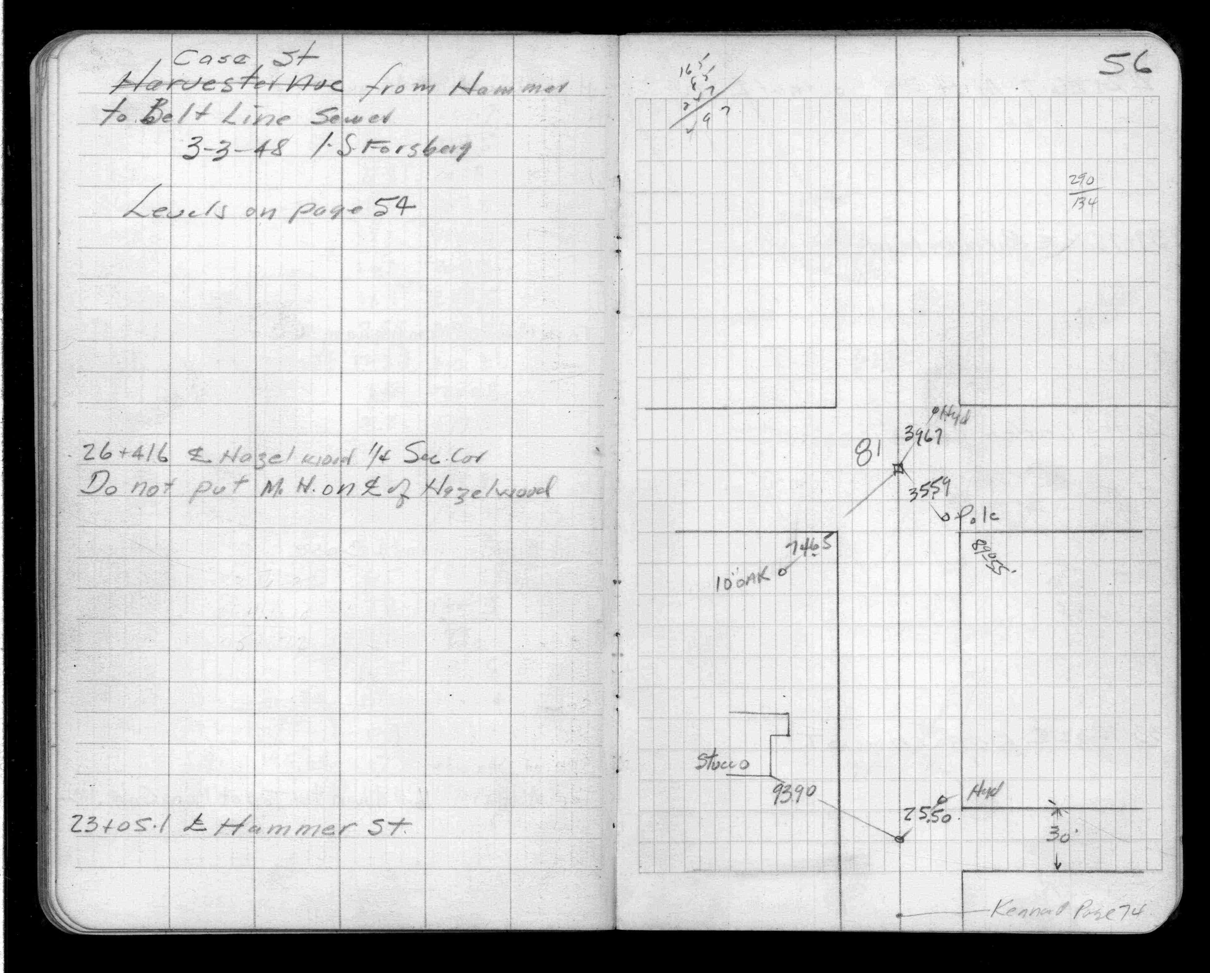
| 3/1/1948 | (Unknown date Mar __, 1948 ) Placed ties. See FB 1382 p.56 |
| 1/1/1887 | (Unknown date ___ __, 1887 ) Plat of Brokmeier's Subd of Lots 6 & 7 Block 1 Cruickshank's Garden Lots shows a GM inplace. |
| 6/1/1874 | (Unknown date Jun __, 1874 ) Plat of Ames' Out Lots shows a GM inplace. |
| 1/1/1800 | (Unknown date ___ __, ____ ) See Old Index Book, Entry 1013 |
Above is NOT an all inclusive history of this point. Please review all the links below.
| PLS NOTES | Field | Cross Section | Sewer | J.B. Irvine | Monument | River Survey |
|---|---|---|---|---|---|---|
| FB 0206p.08 | CS 2894p.03 | |||||
| FB 0341p. 03 ,14 ,30 | ||||||
| FB 1382p.56 | ||||||
| FB 1382p.56 | ||||||
| FB 1455p.03 | ||||||
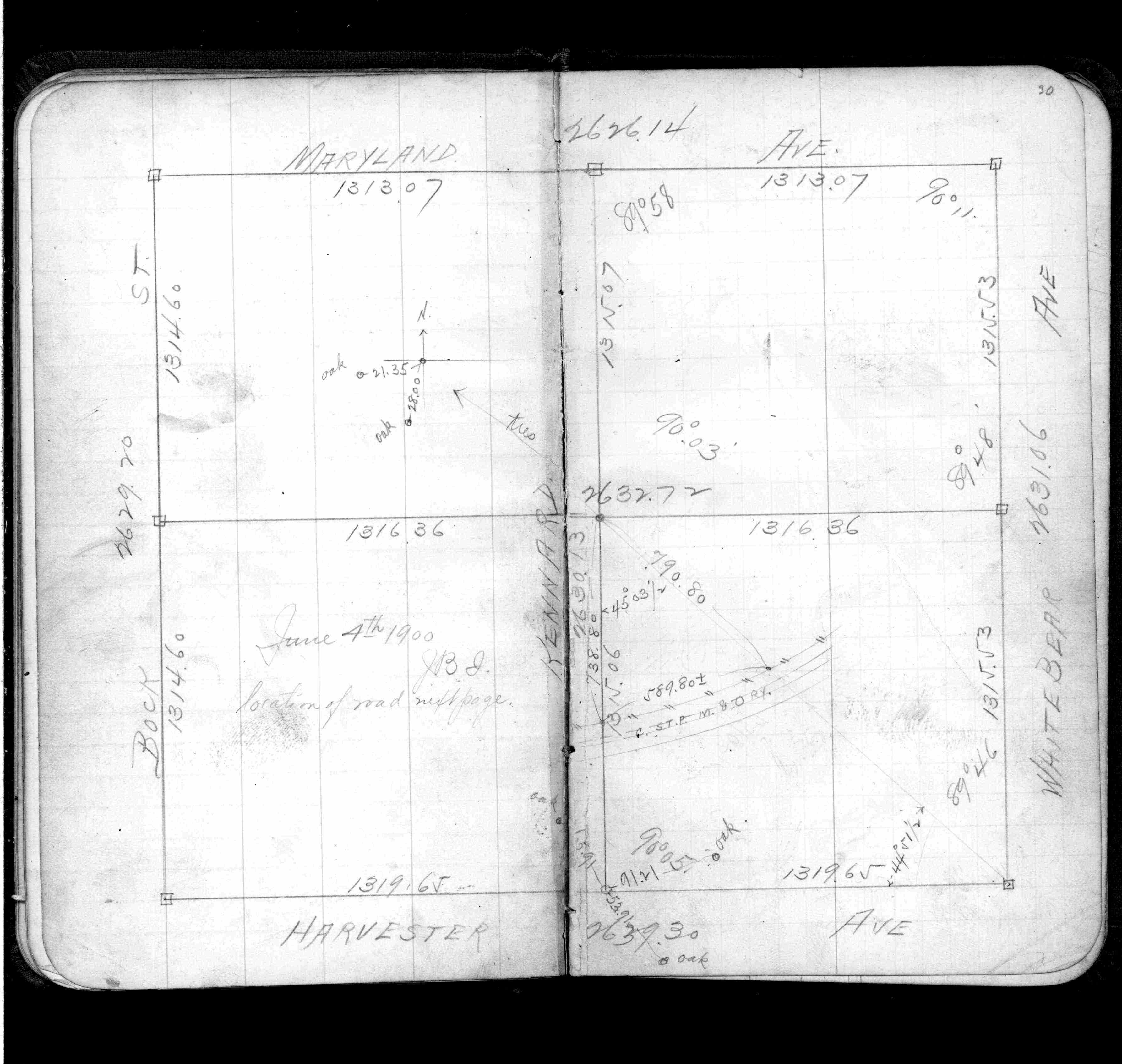
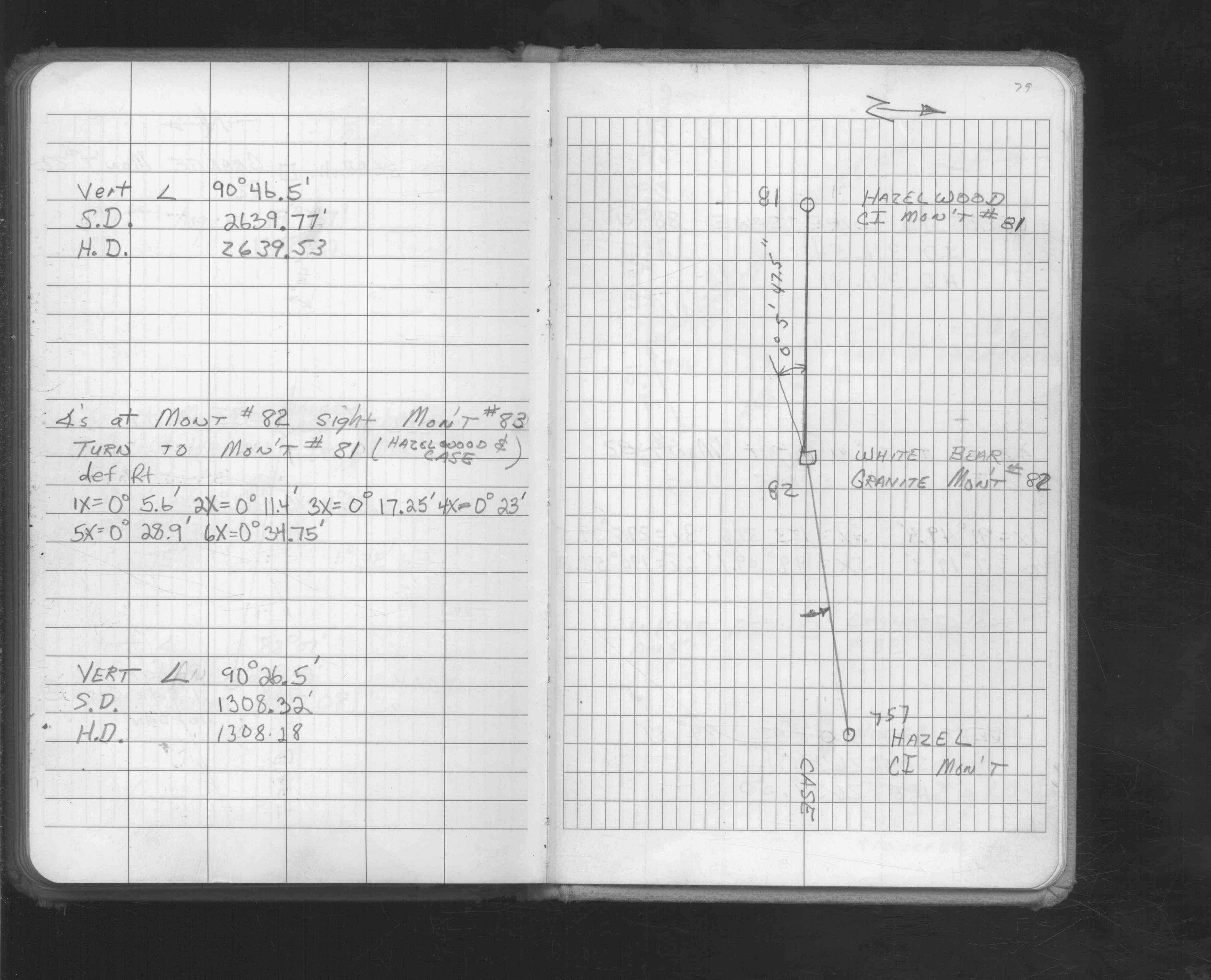
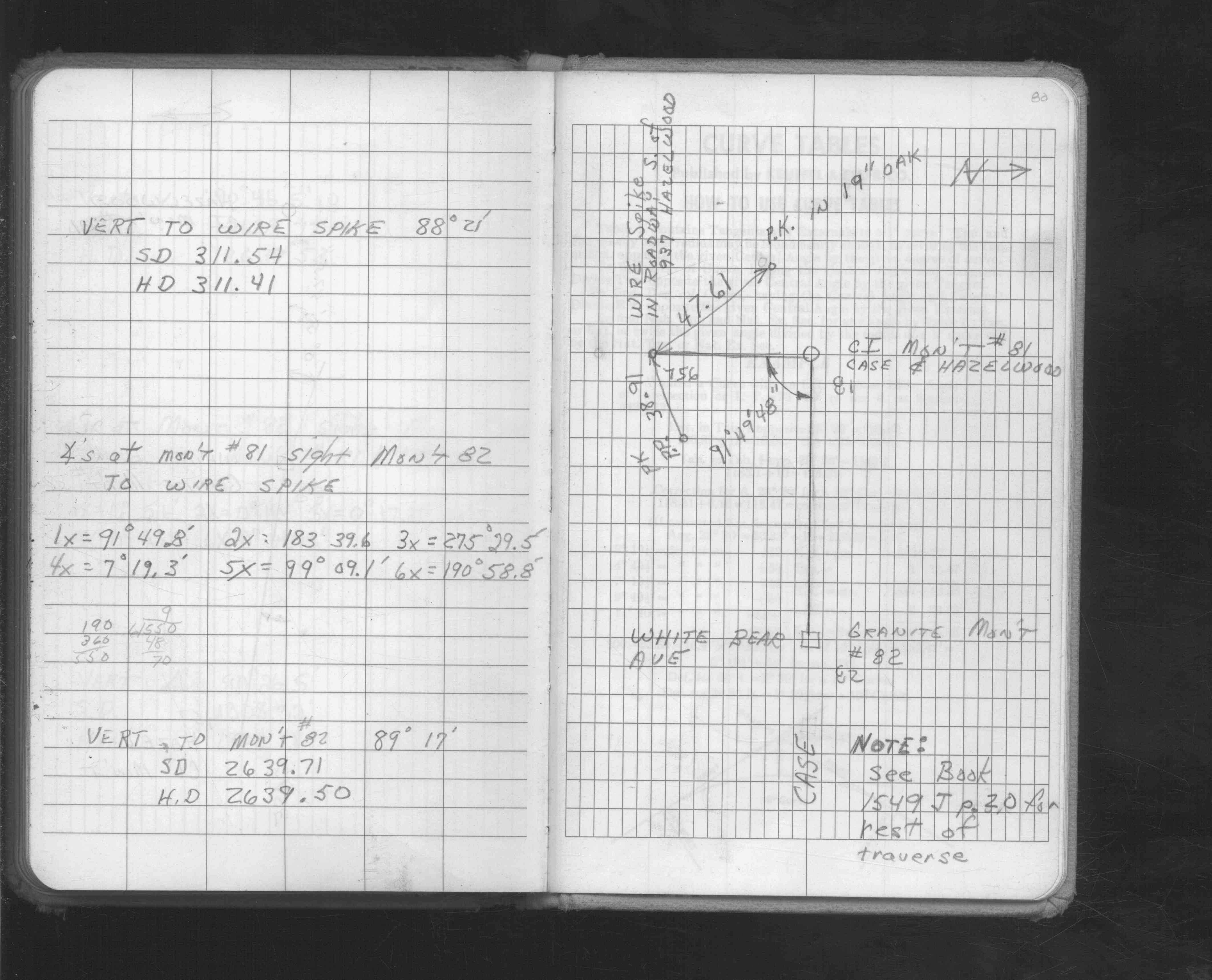
| FB 1549Ip. 79 ,80 | ||||||
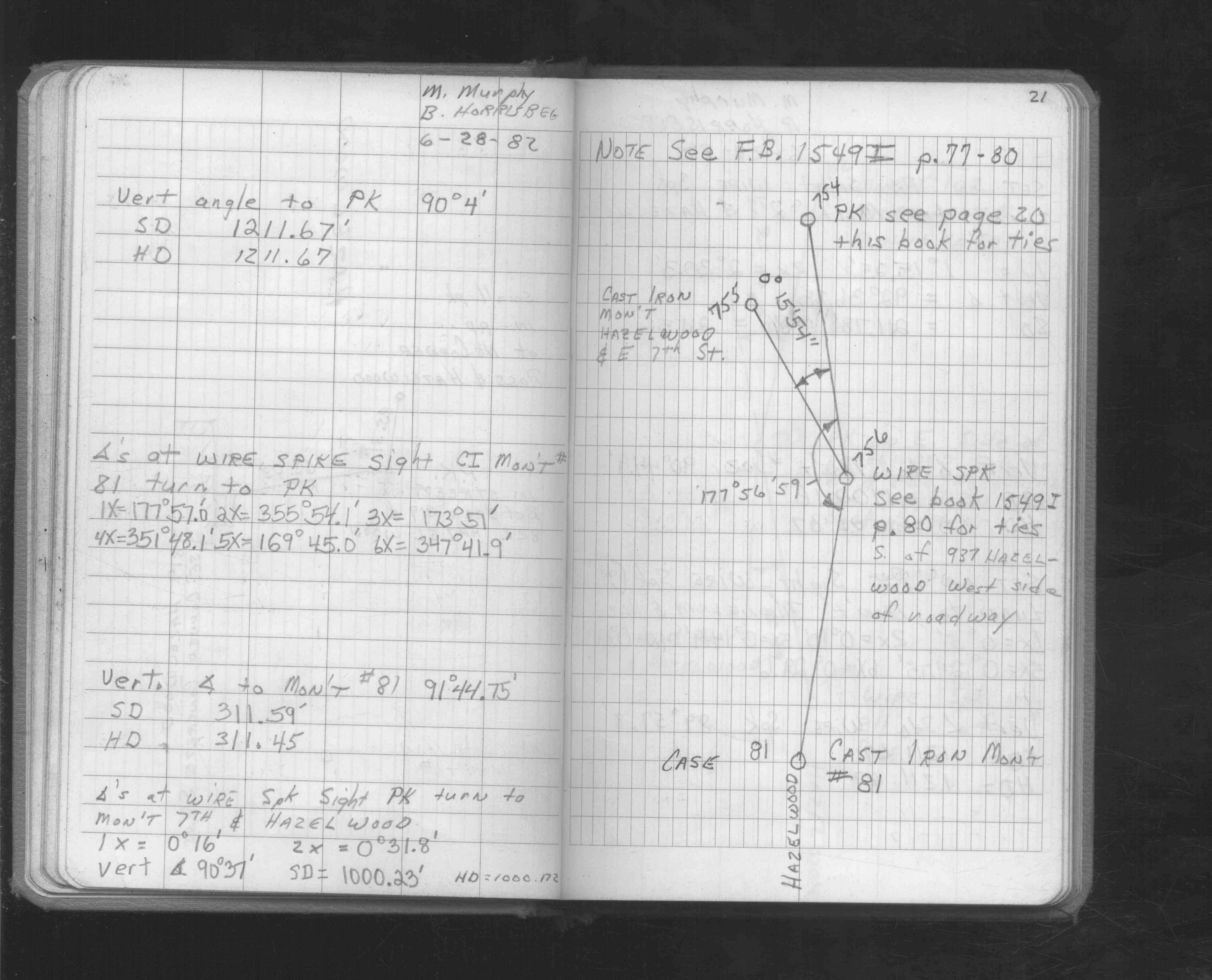
| FB 1549Jp.21 | ||||||
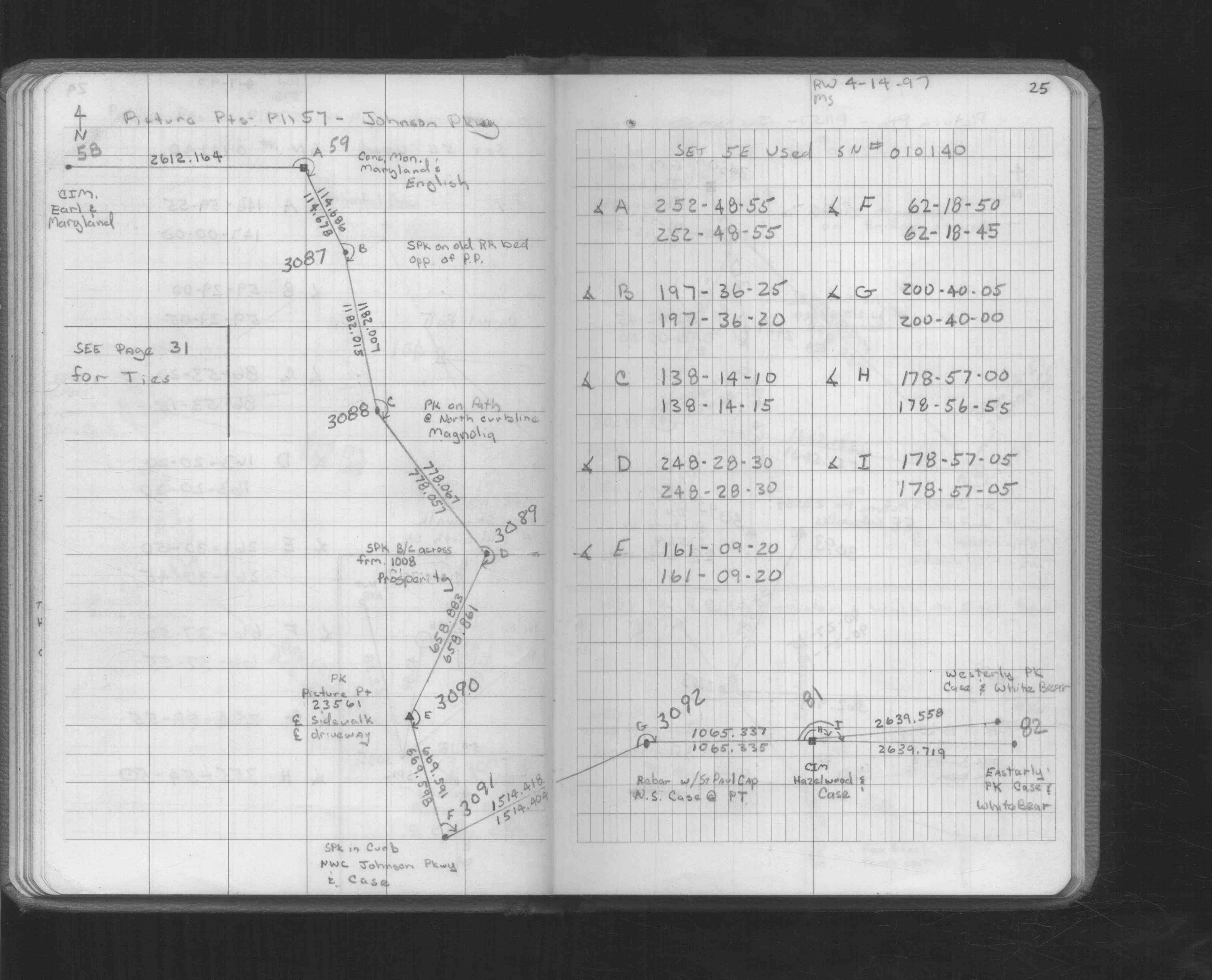
| FB 1549Lp.25 | ||||||
| FB 1676Cp.05 | ||||||
| FB 1689Ap.15 | ||||||
| FB 1708Ap.34 | ||||||
| FB 1716p.15 | ||||||
| FB 1716p.15 | ||||||
| FB 1736p.42 |
| FILE | SURVEYOR | LIC. NO. | DATE SIGNED | DATE TIED |
|---|---|---|---|---|
| 0081-1019-A.tif | William J. Cutting | 20576 | October 7, 1992 | October 1, 1992 |
| ST_079-156p081.jpg | none | none | none | none |
| 0081-1019-A.dwf | none | none | none | none |
| FILE | PHOTO DATE | COMMENTS |
|---|---|---|
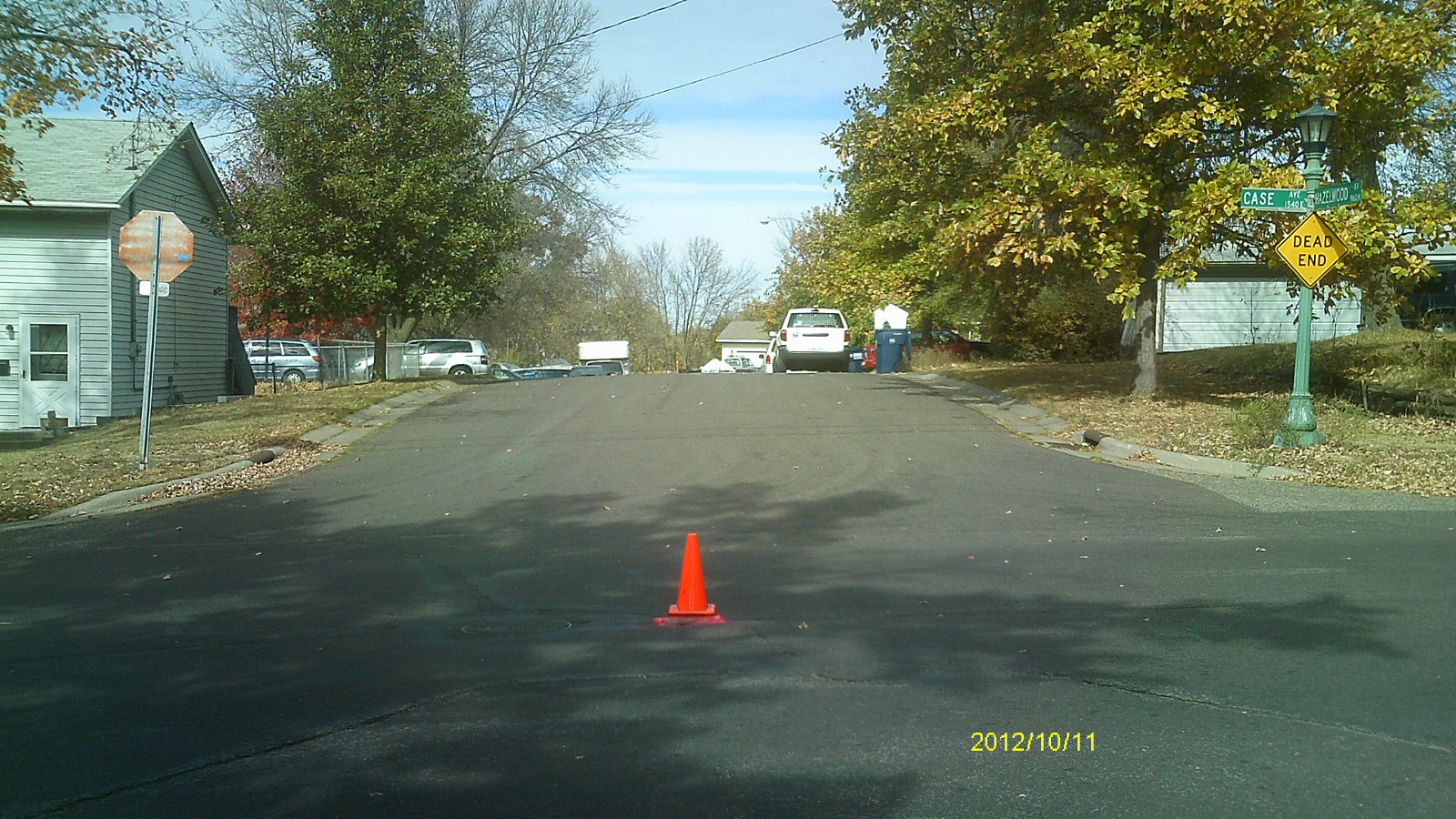
| 0081-1019-5.jpg | October 11, 2012 | Looking west along Case Ave. |
| 0081-1019-4.jpg | October 11, 2012 | Looking south along Hazelwood St. |
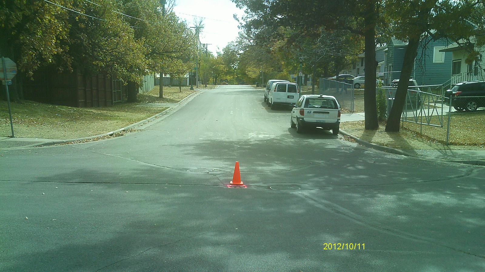
| 0081-1019-3.jpg | October 11, 2012 | Looking east along Case Ave. |
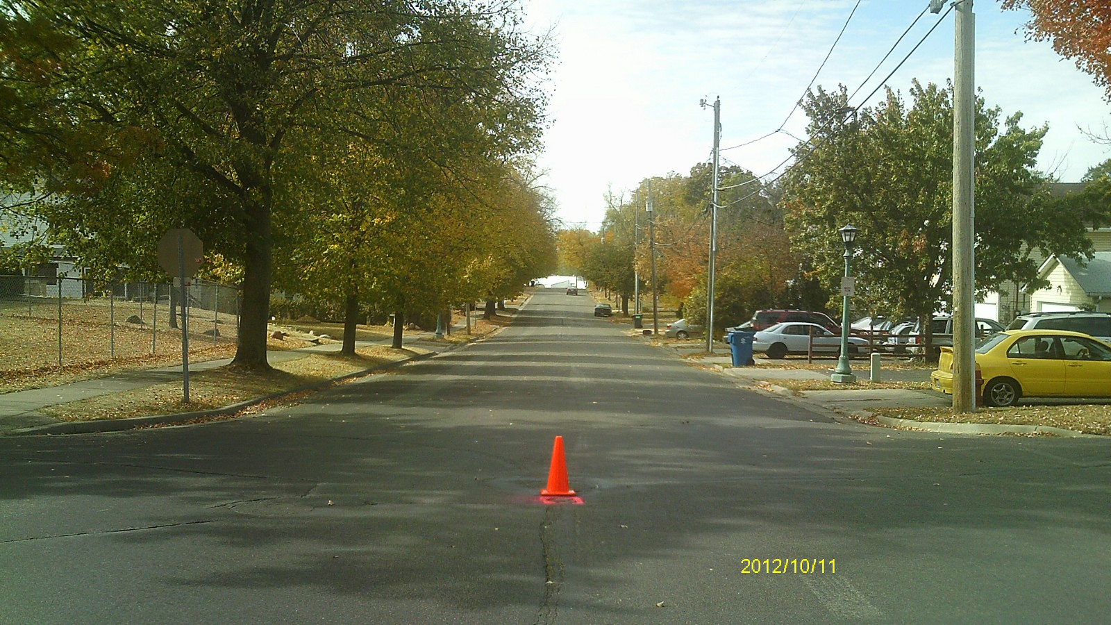
| 0081-1019-2.jpg | October 11, 2012 | Looking north along Hazelwood St. |
| 0081-1019-1.jpg | October 11, 2012 | Close up of monument. |