| NAD83 COORDINATES (1986 adj.): |
|---|
| * X= 548088.3 Y= 162665.04 Z= 0 LSQ 12/6/1991 S FIX |
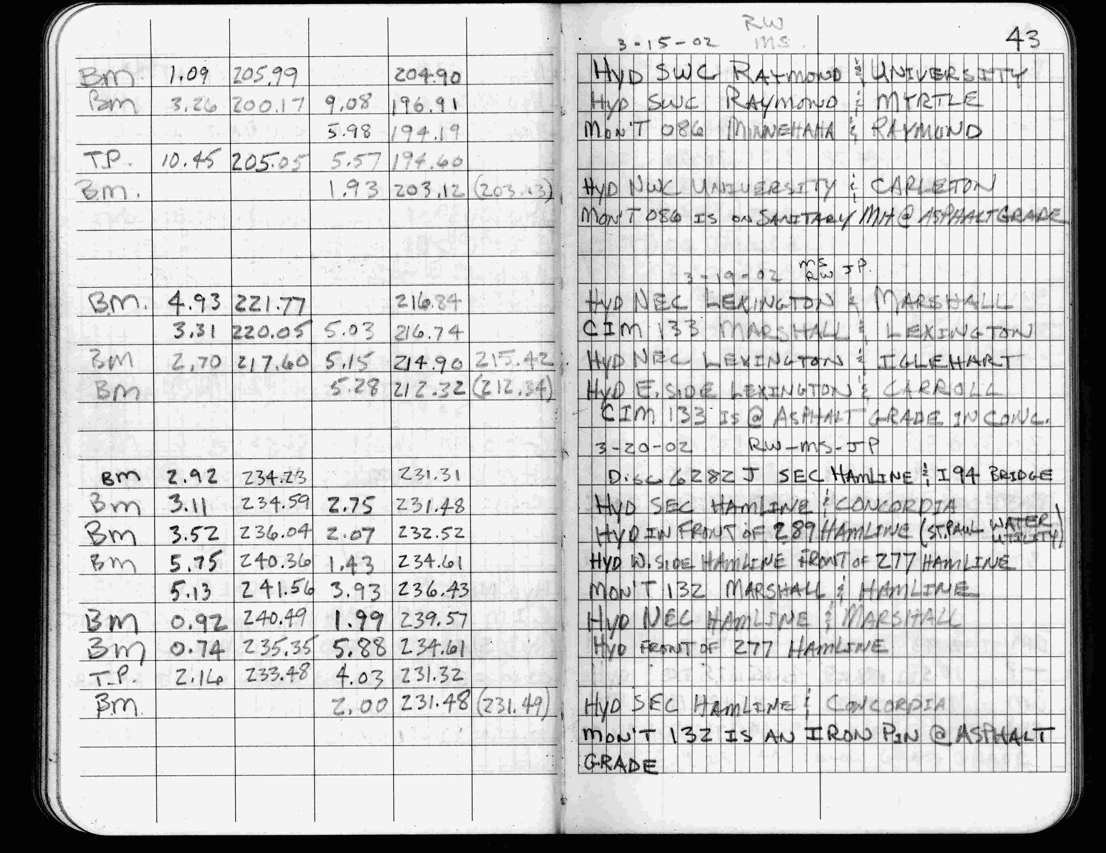
| 3/15/2002 | Elev 194.19 ft on sanitary MH at asphalt surface. See FB 1736 p.43 |
| 3/1/2000 | (Unknown date Mar __, 2000 ) Falls on MH (not marked for painting target for 2000 aerial) |
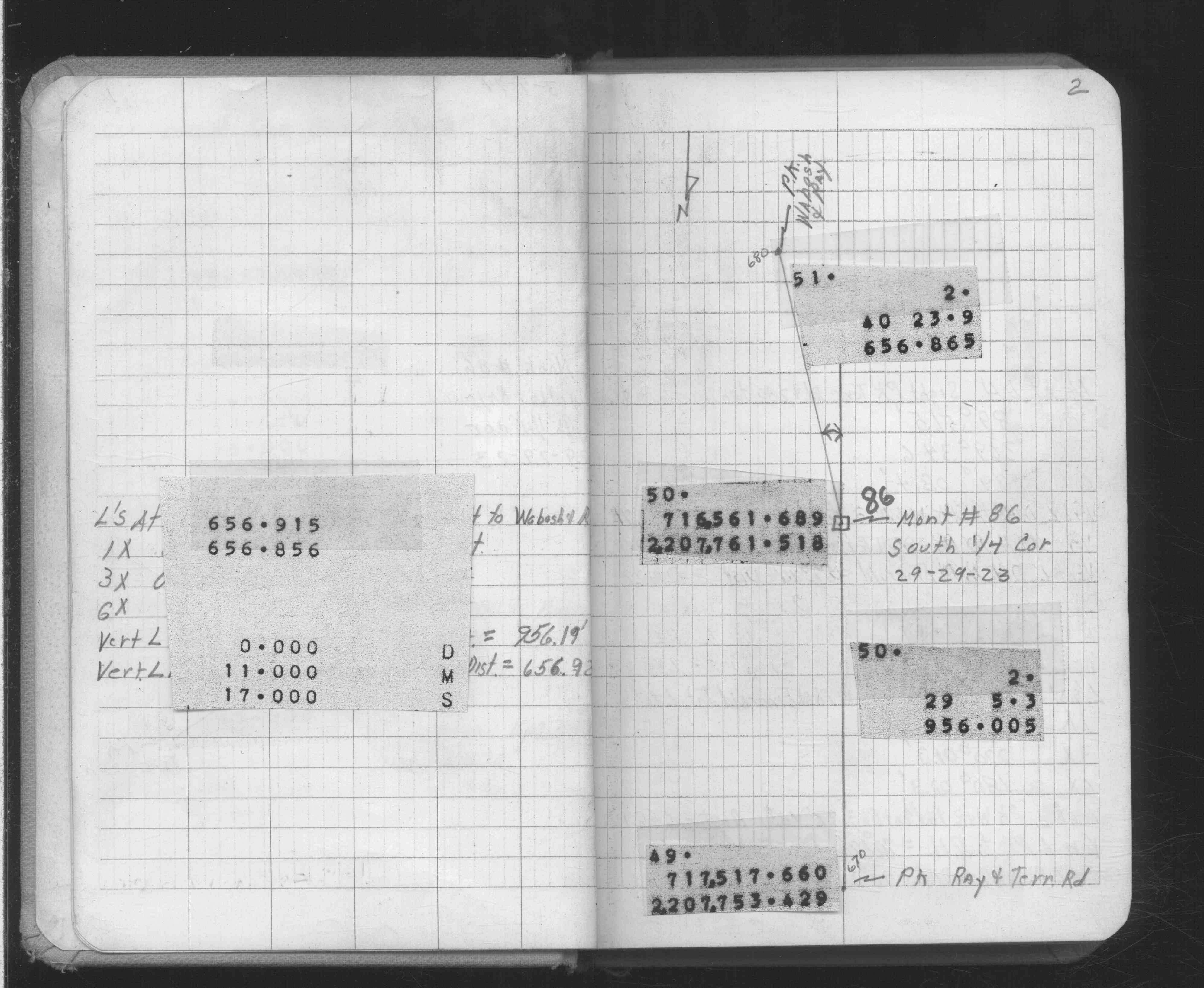
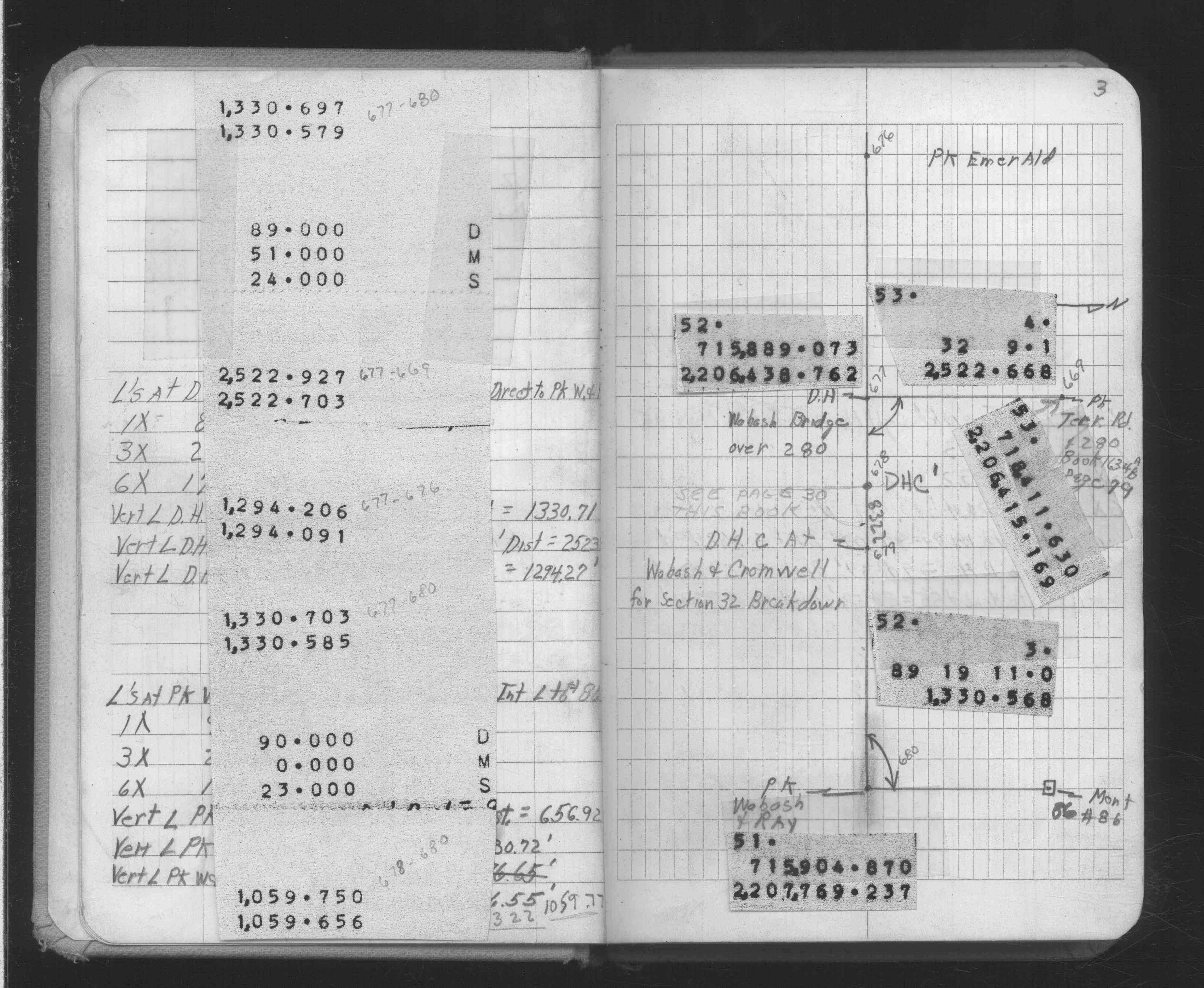
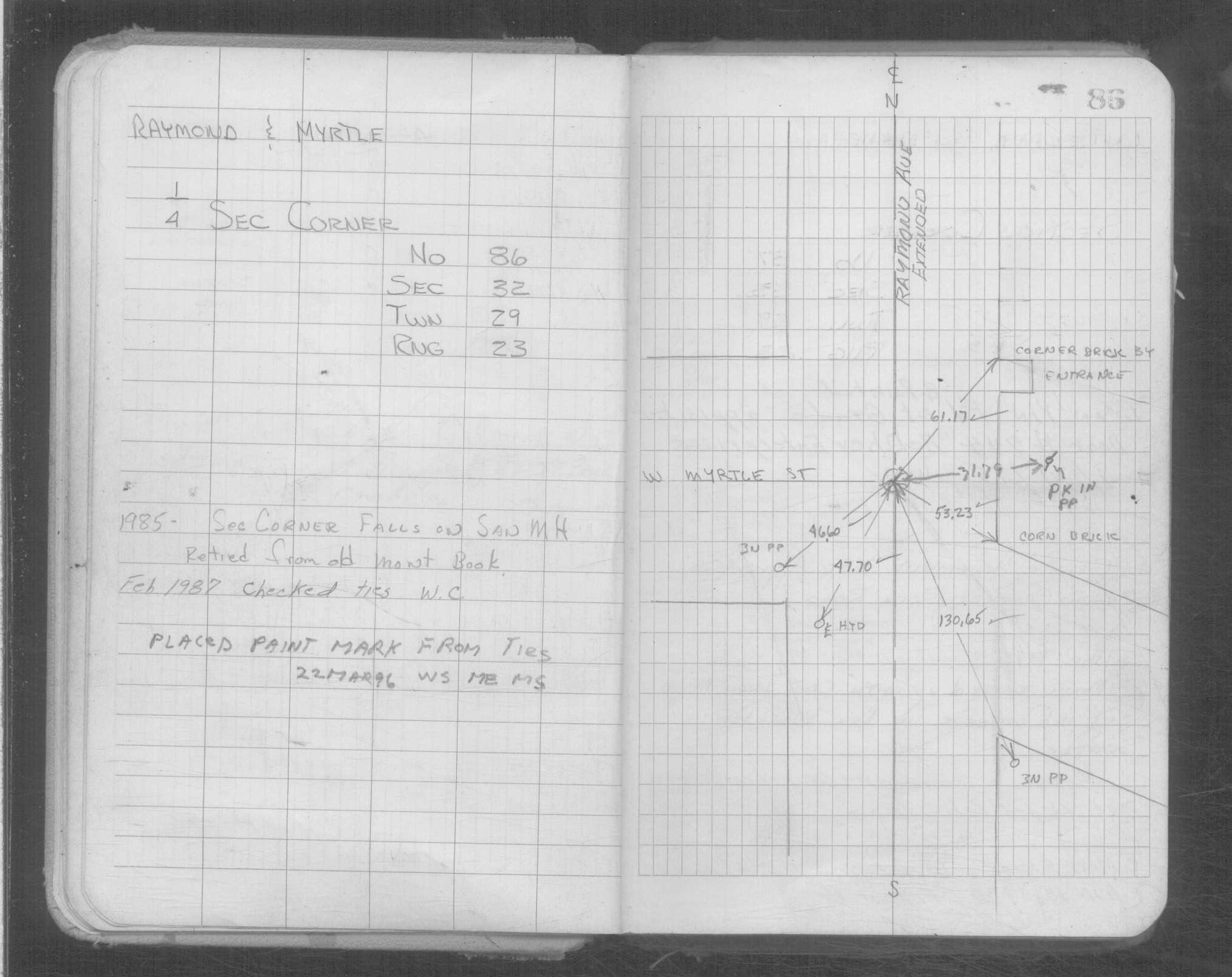
| 2/1/1987 | (Unknown date Feb __, 1987 ) Quarter corner falls on sanitary MH |
| 1/1/1985 | (Unknown date ___ __,1985 ) Historic, one time only GPS survey = S047 |
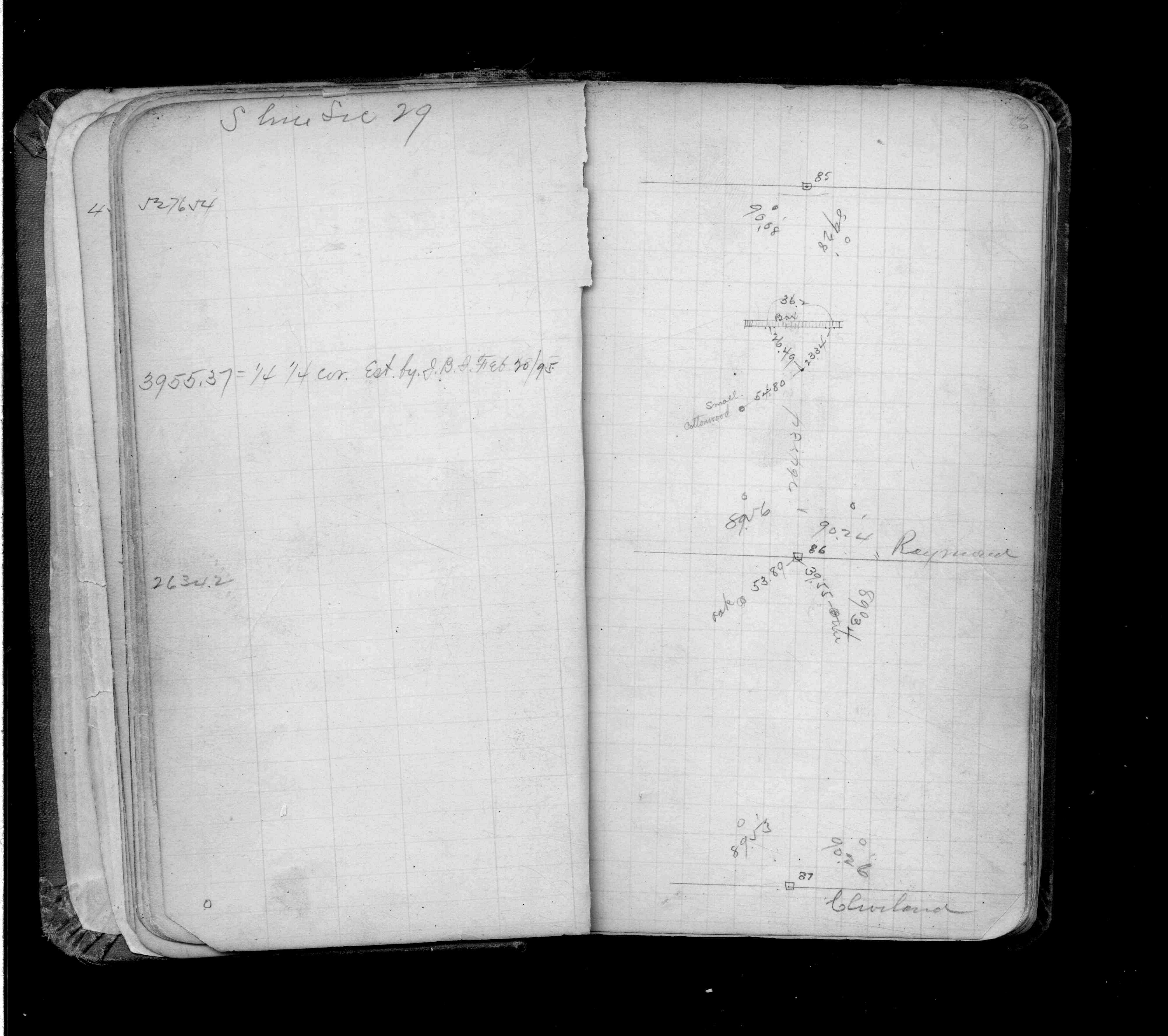
| 9/1/1887 | (Unknown date Sep __, 1887 ) Monument set by J H Armstrong. See Old Index Book, Entry 1055 |
| 11/1/1847 | (Unknown date Nov __, 1847 ) Isaac N Higbee deputy surveyor set post. Tied to 2 BTs. See IH p.112-113 2923 |
Above is NOT an all inclusive history of this point. Please review all the links below.
| PLS NOTES | Field | Cross Section | Sewer | J.B. Irvine | Monument | River Survey |
|---|---|---|---|---|---|---|
| IH p.112-113 | FB 0216p.26 | |||||
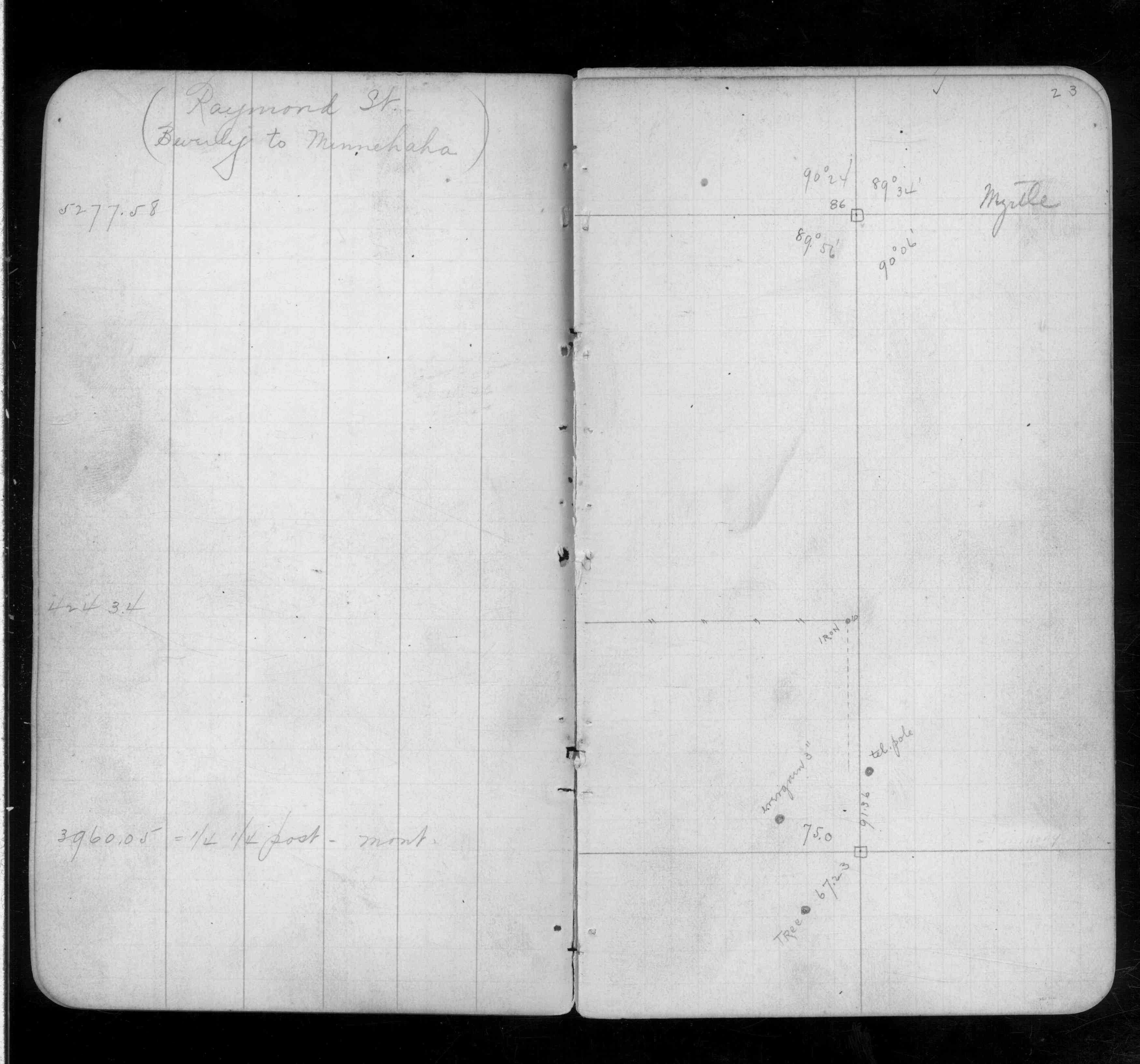
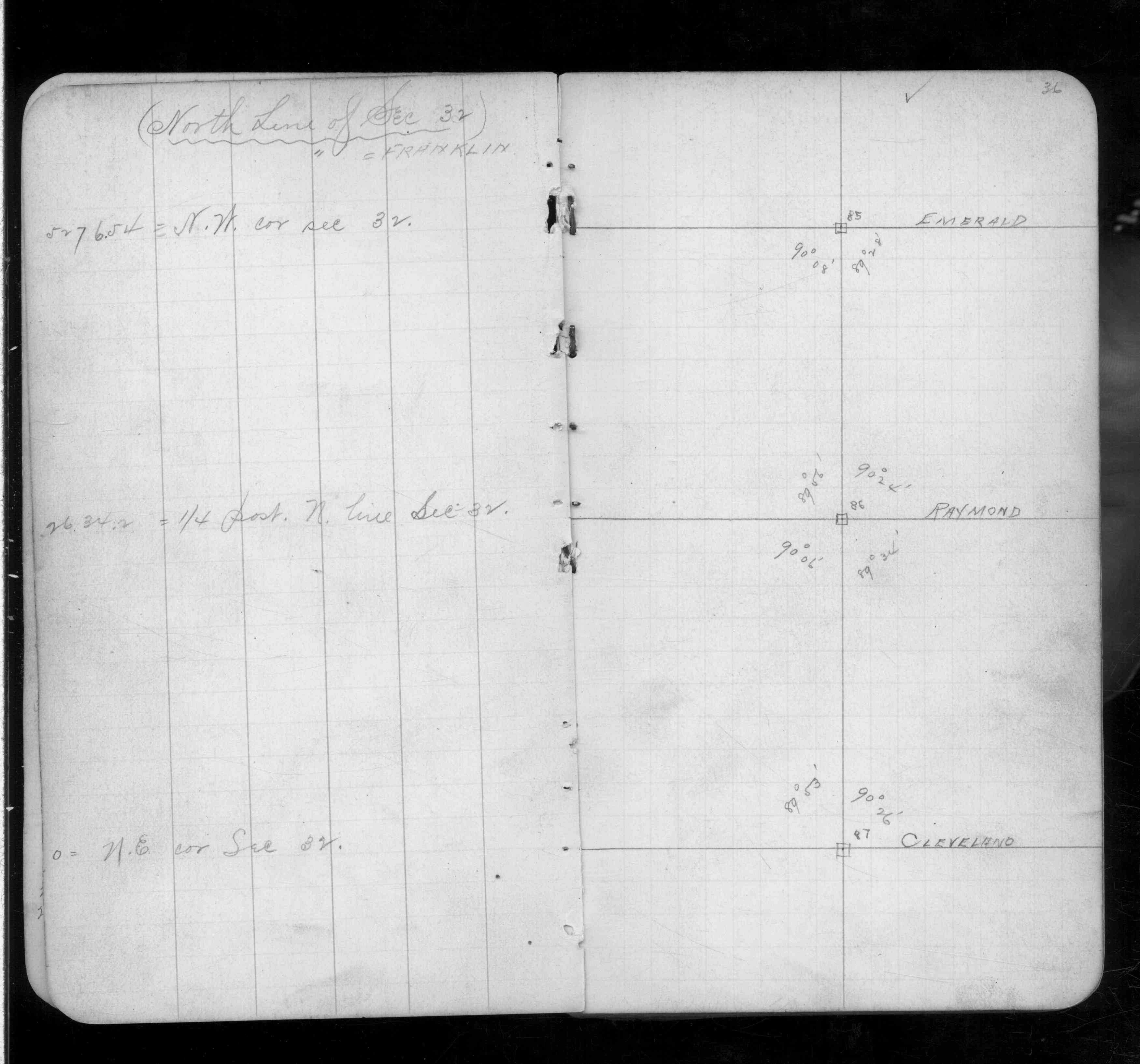
| FB 0218p. 23 ,36 | ||||||
| FB 1549Cp. 06 ,45 ,46 ,71 | ||||||
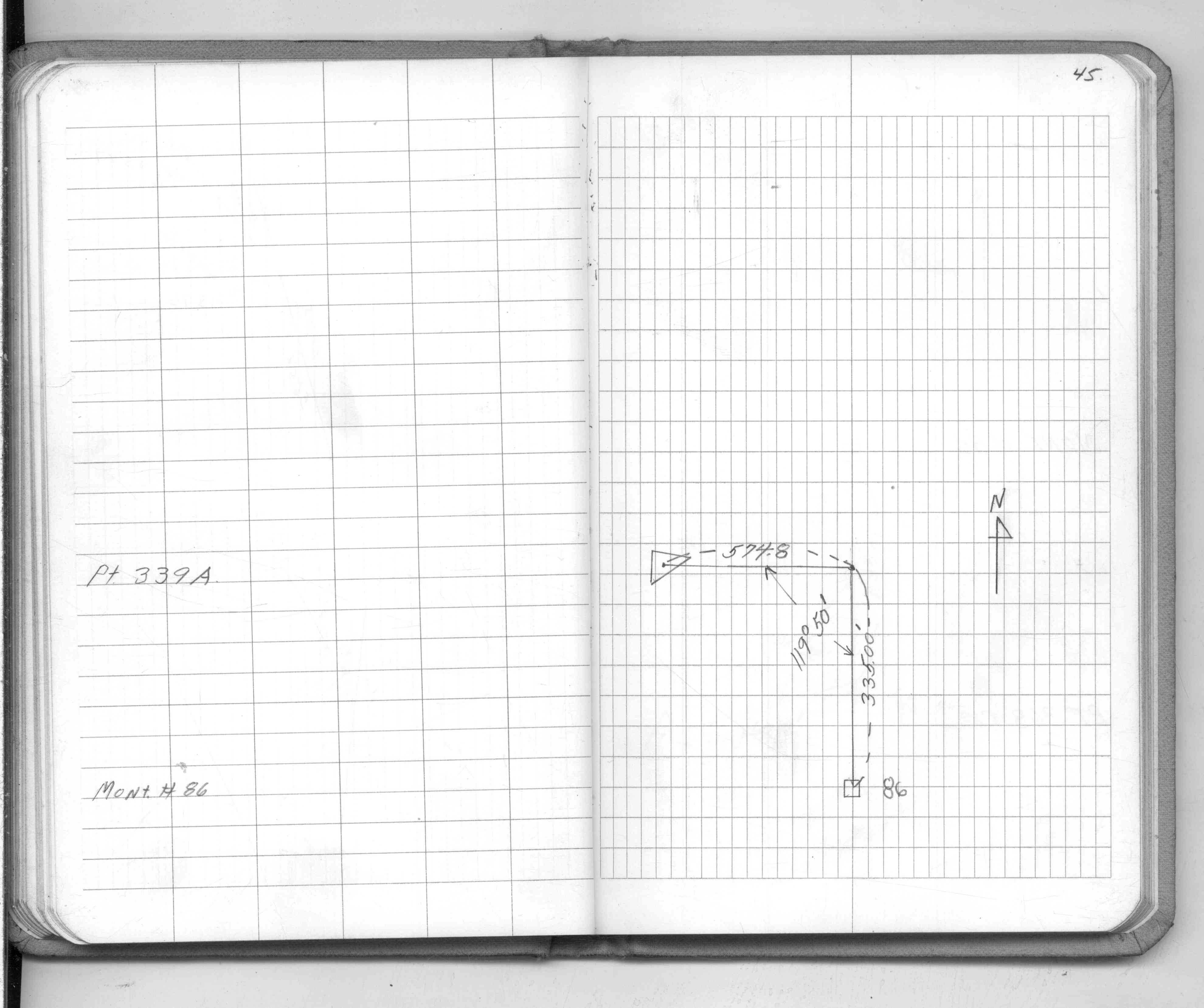
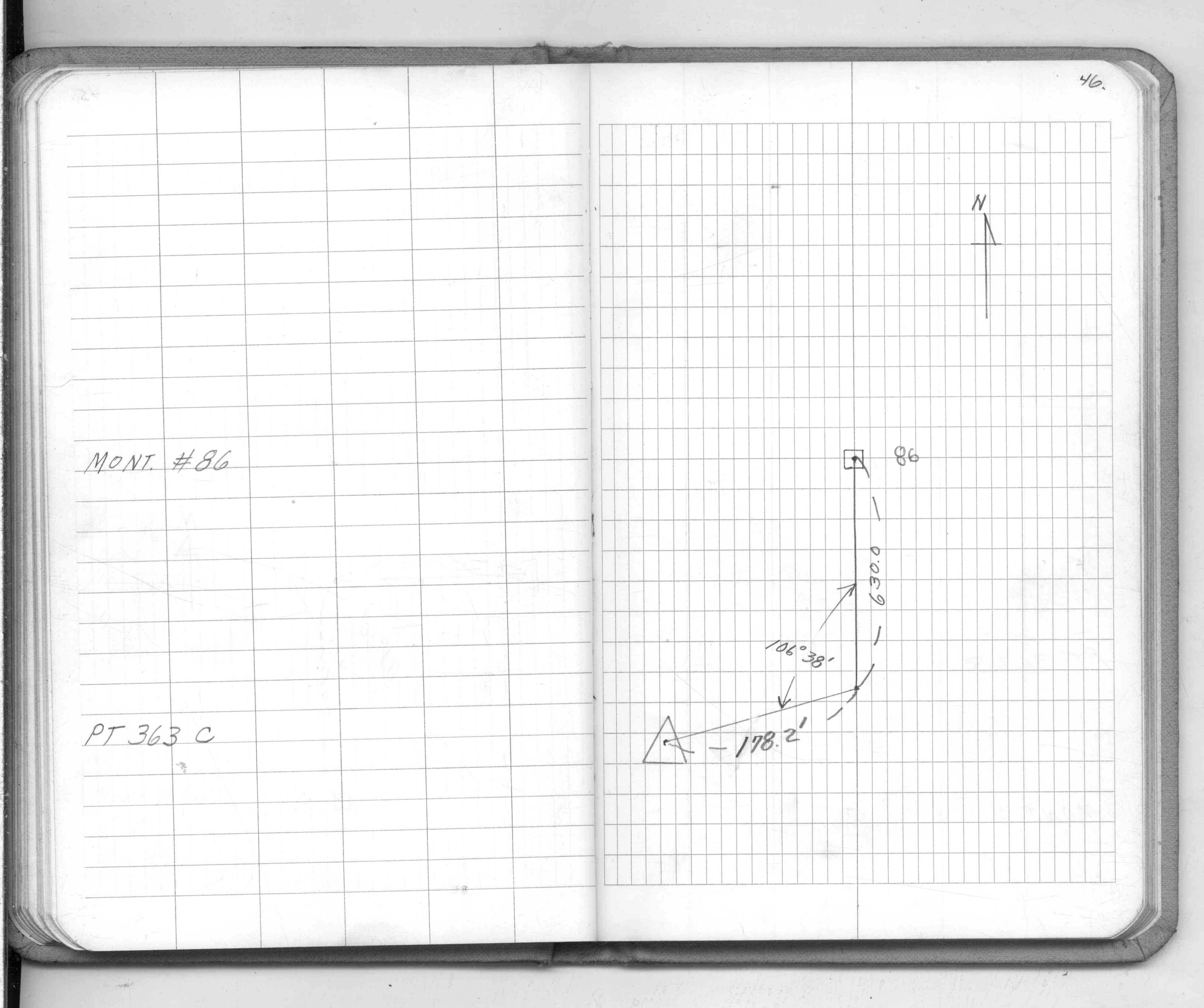
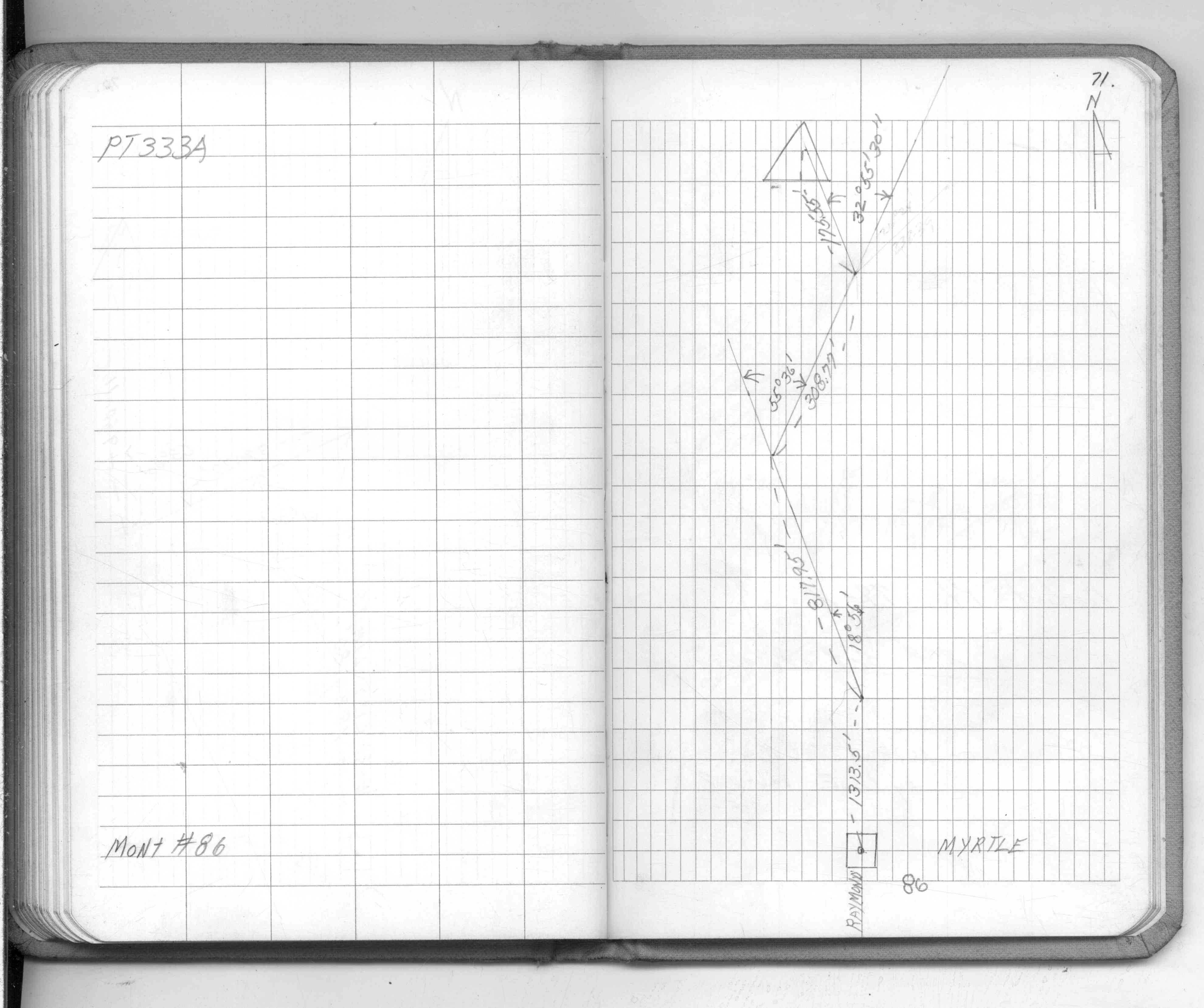
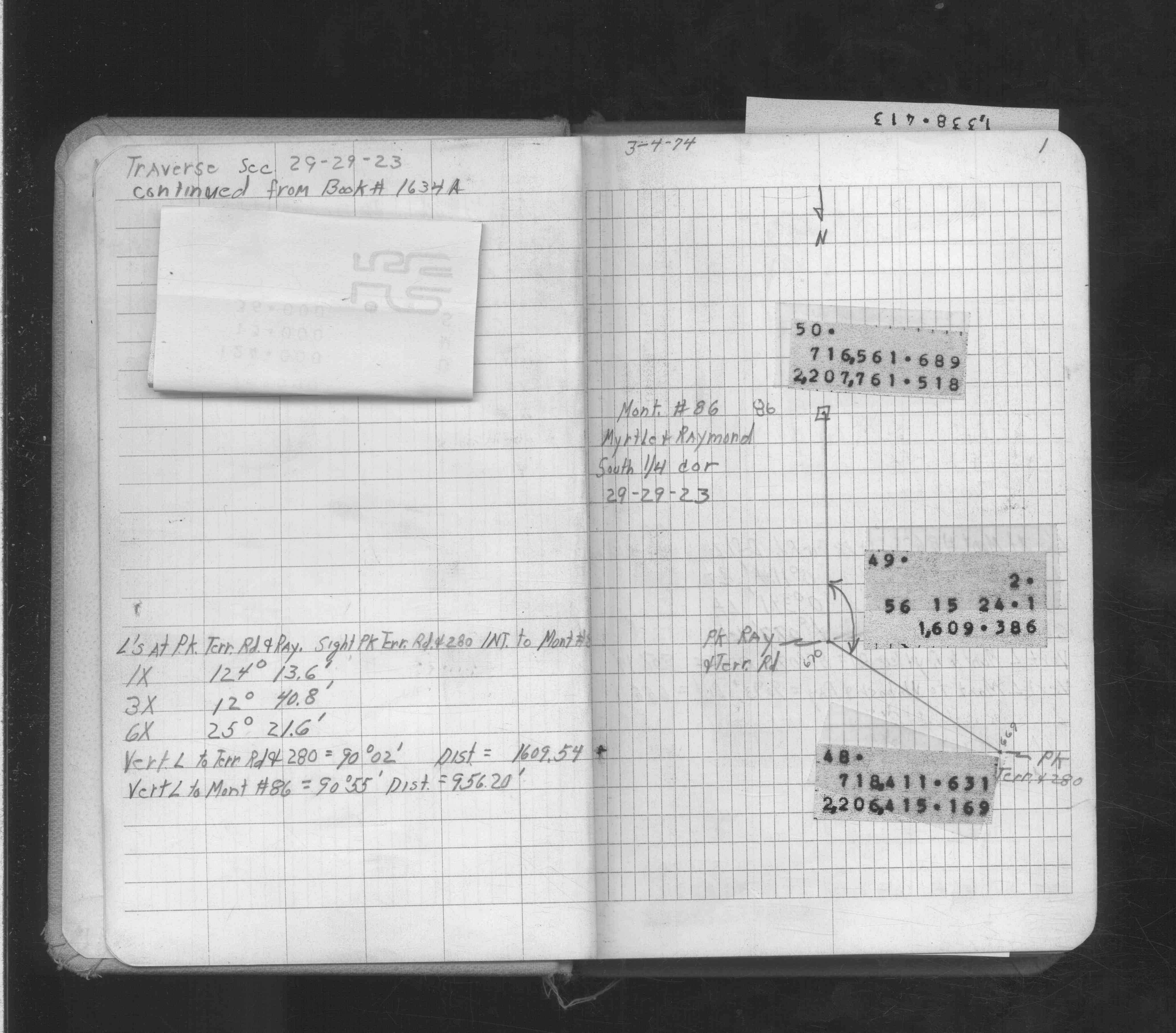
| FB 1634Bp. 01 ,02 ,03 | ||||||
| FB 1736p.43 |
| FILE | SURVEYOR | LIC. NO. | DATE SIGNED | DATE TIED |
|---|---|---|---|---|
| ST_079-156p086.jpg | none | none | none | none |
| 0086-1055-A.dwf | none | none | none | none |