| NAD83 COORDINATES (1986 adj.): |
|---|
| * X= 550722.59 Y= 162679.44 Z= 0 LSQ 12/6/1991 S FIX |
| 12/24/2012 | Dug 0.1 ft into asphalt driveway; Monument not seen, but metal detector indicated that there could be something 0.3-0.4 ft below grade. |
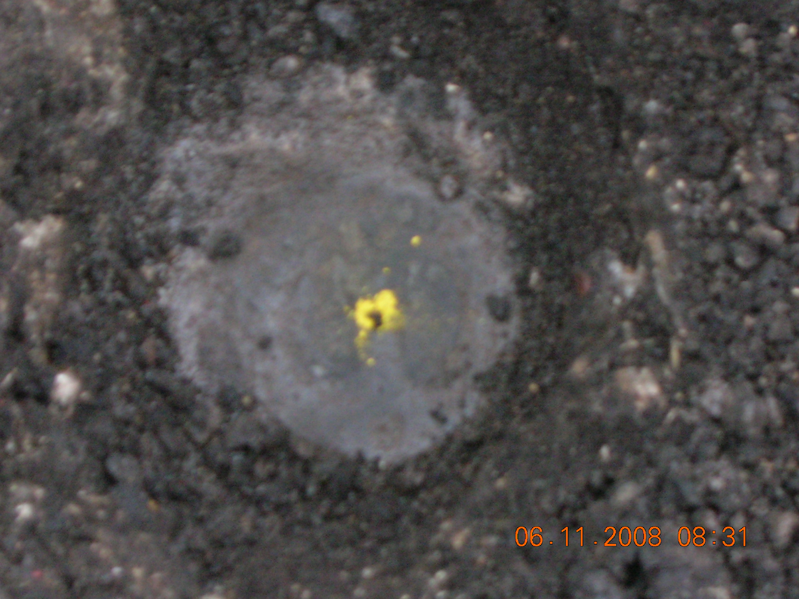
| 6/11/2008 | Photos taken. |
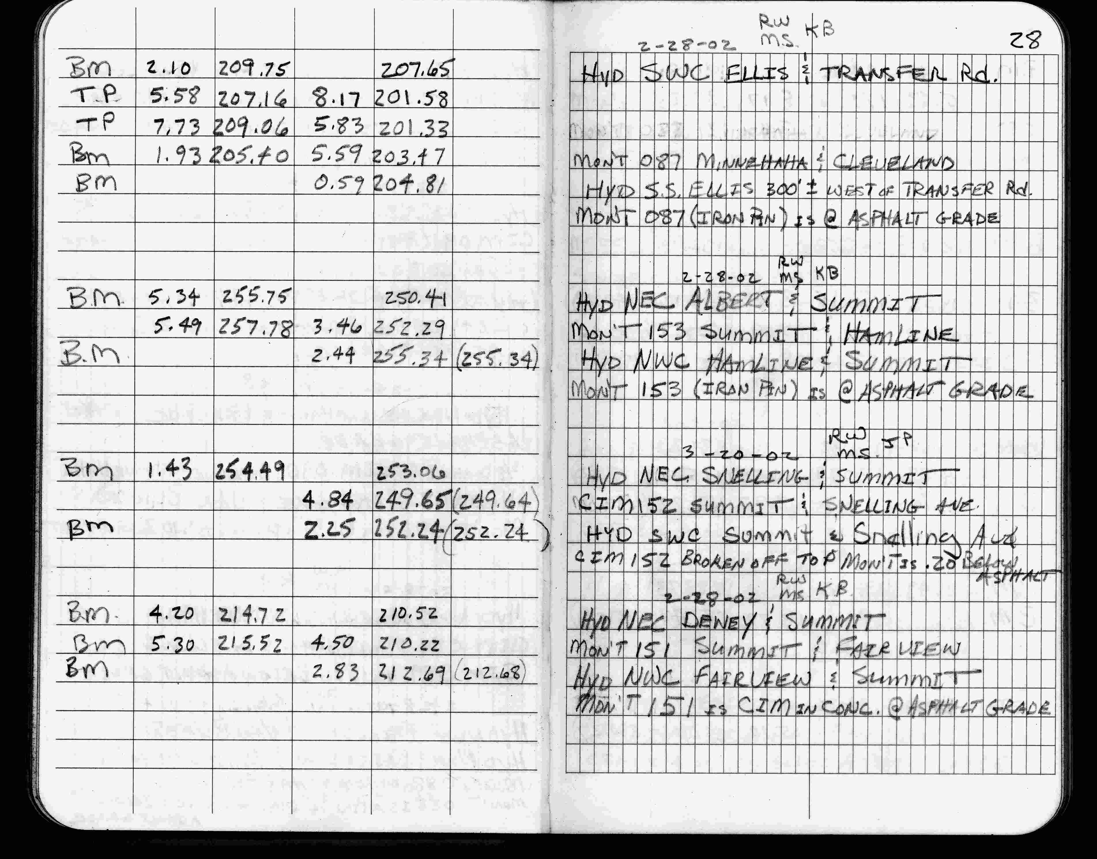
| 2/28/2002 | Elev 203.47 ft on iron pin at asphalt surface. See FB 1736 p.28 |
| 3/1/2000 | (Unknown date Mar __, 2000 ) Fd CIM (marked for painting target for 2000 aerial) |
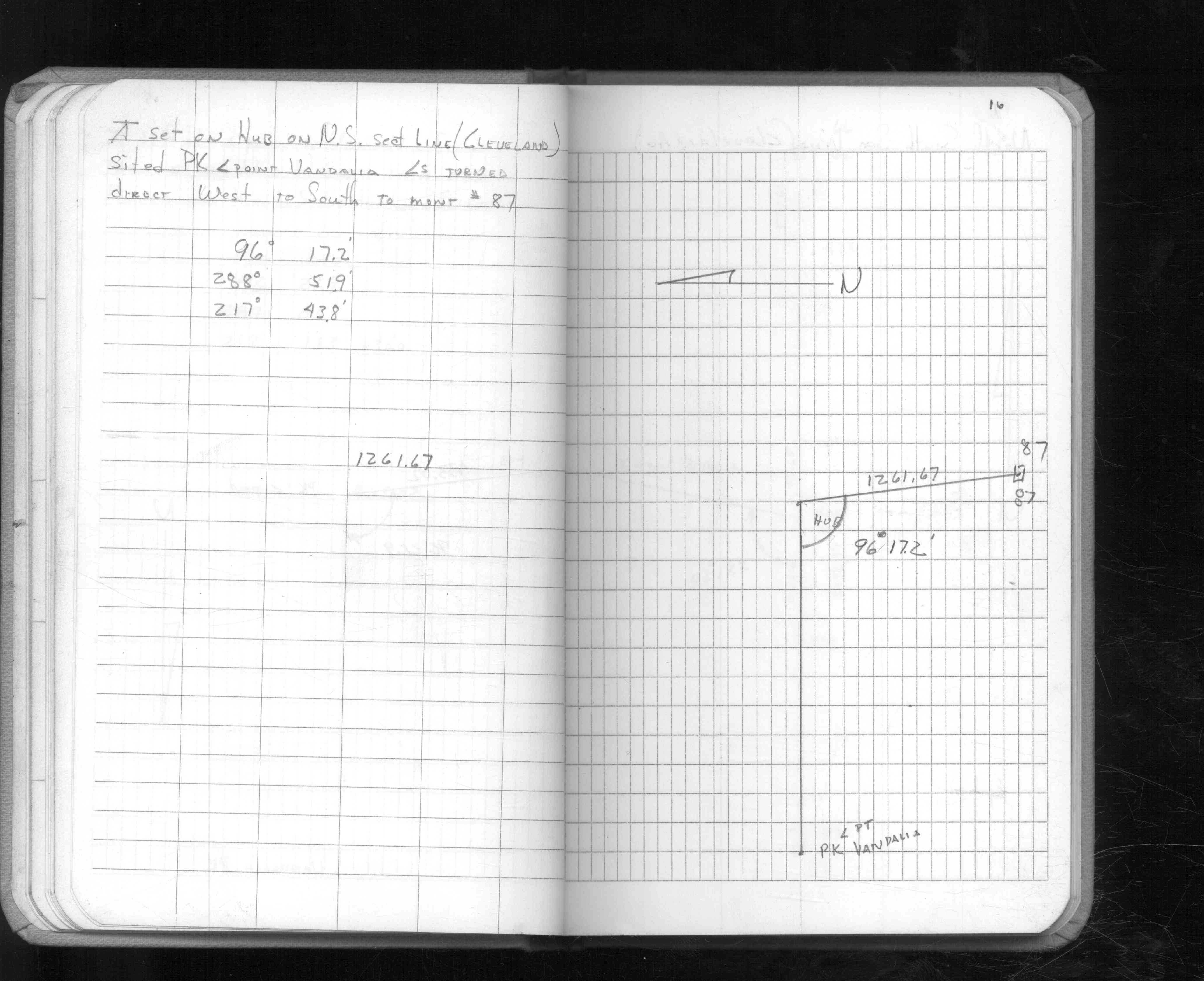
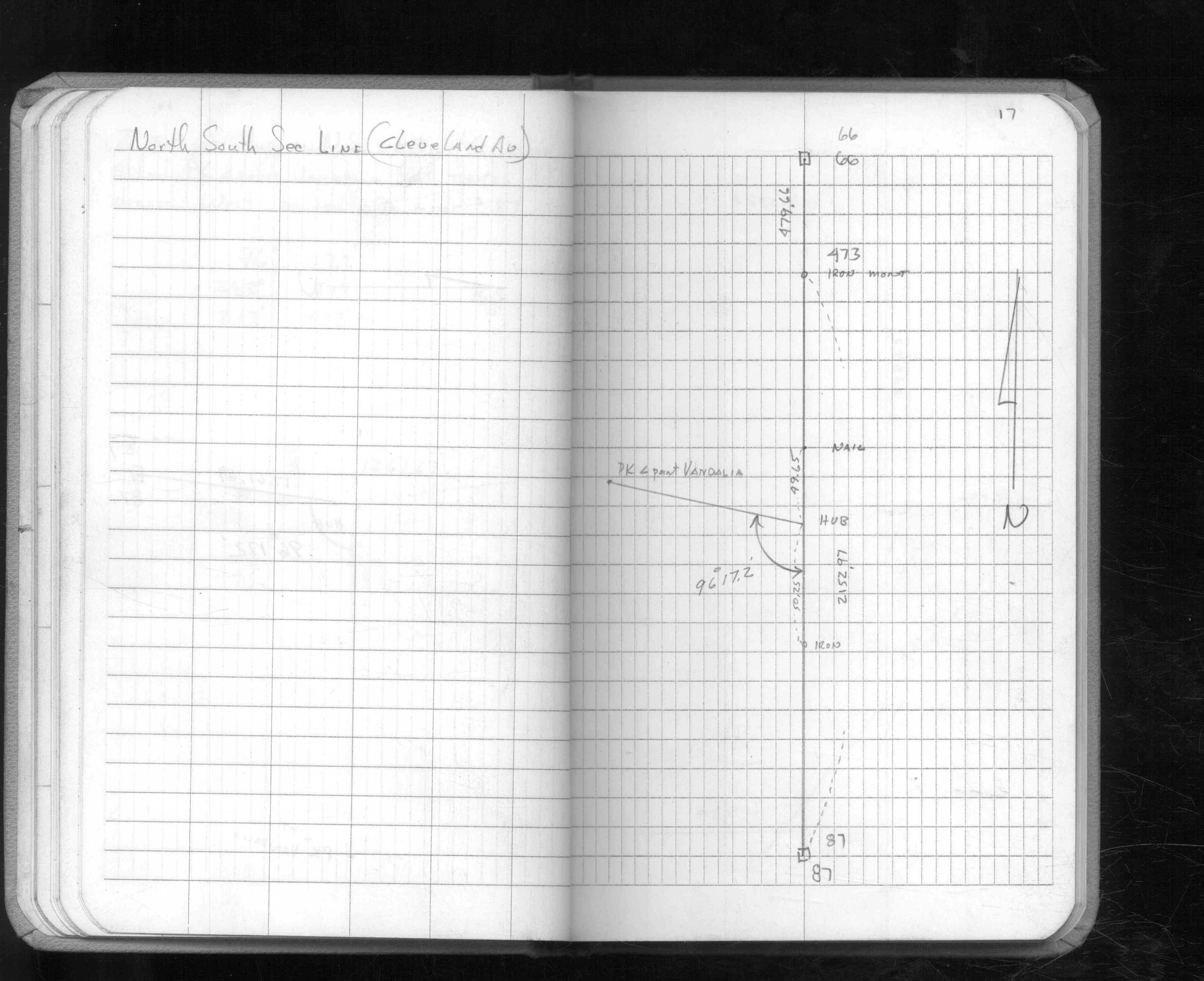
| 3/28/1996 | Fd Iron pin (marked for target) |
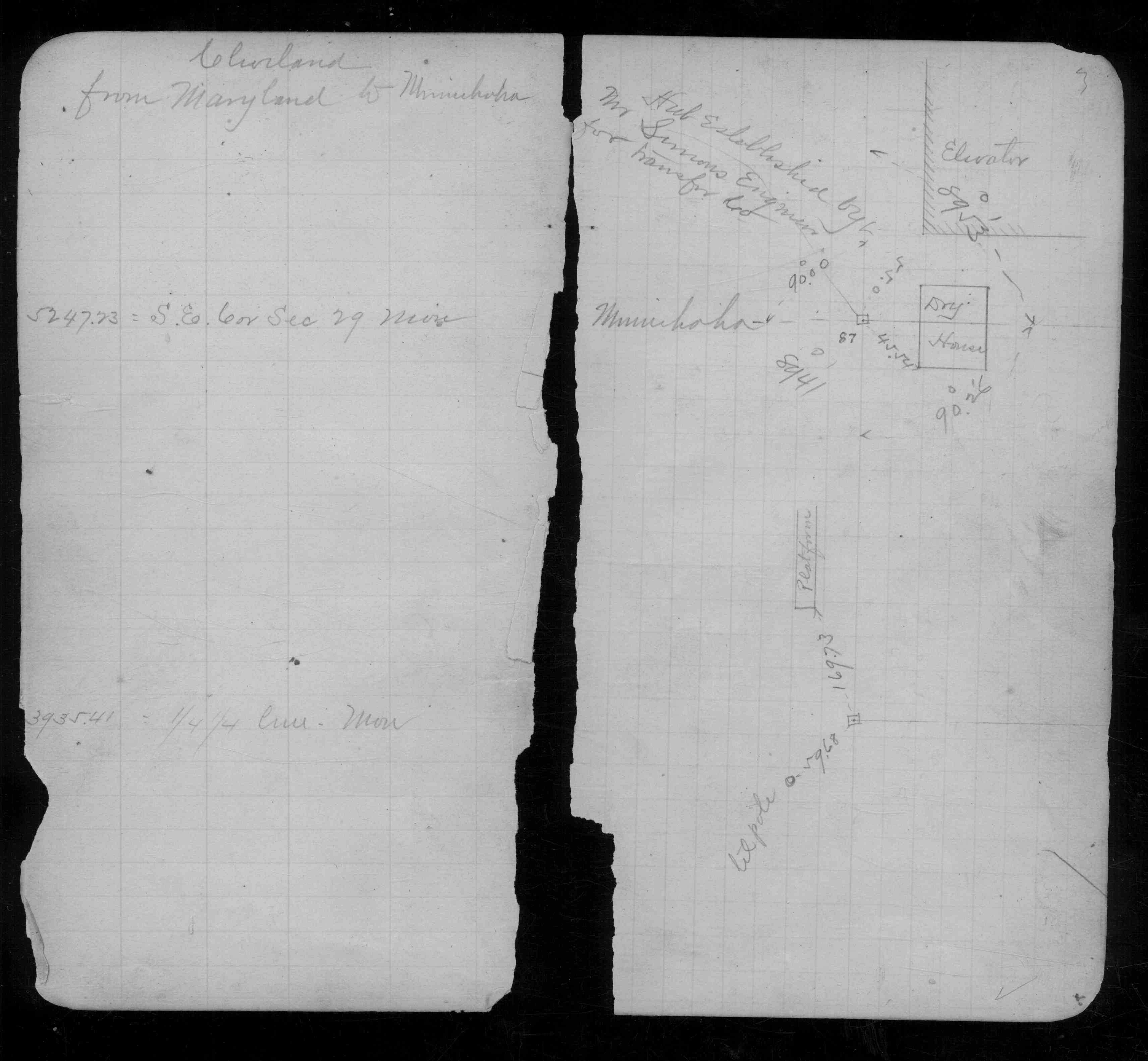
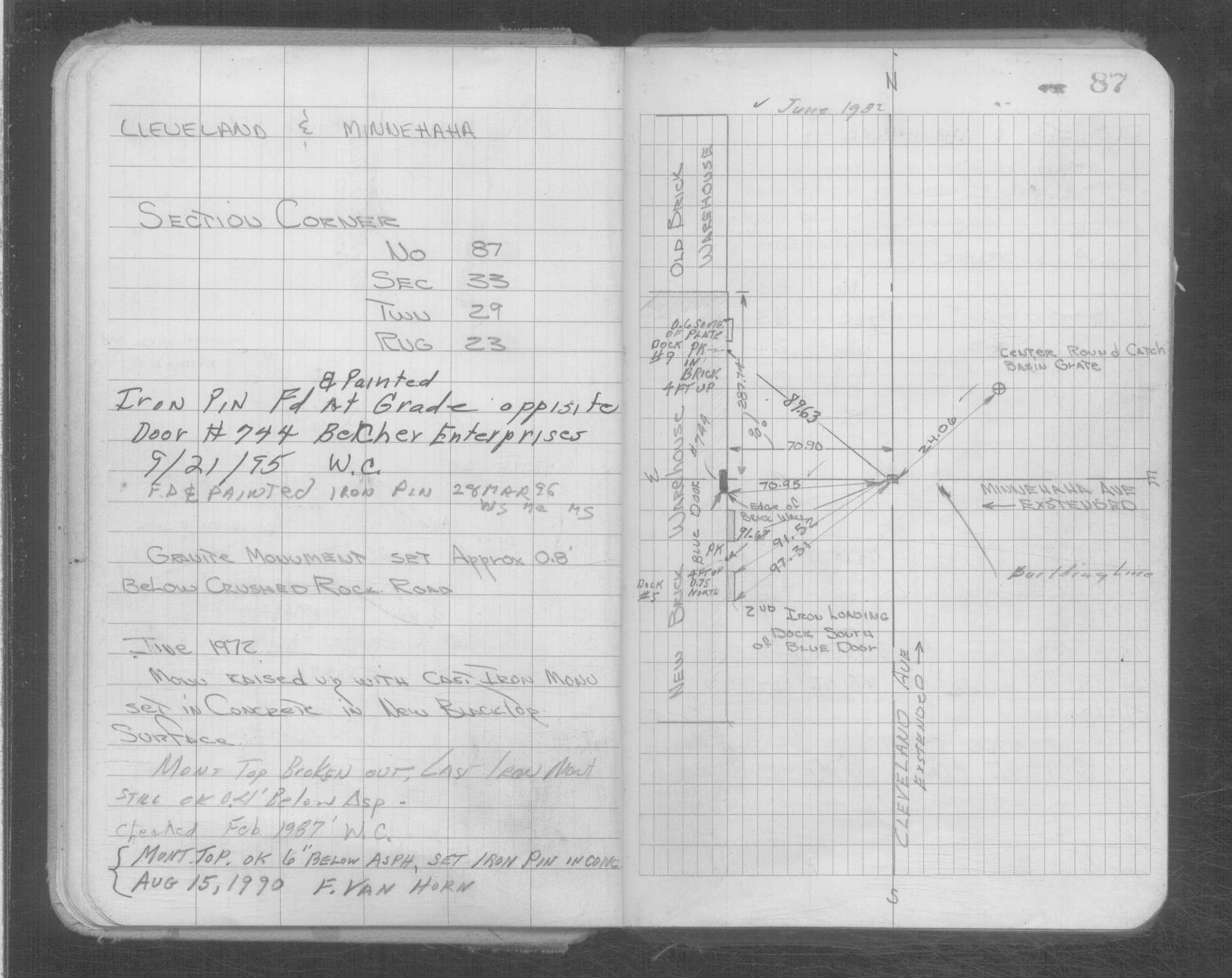
| 9/21/1995 | Fd Iron pin at grade oppisite door #744 Belcher Enterprises (marked for target for 1995 aerial) |
| 8/15/1990 | Iron pin set to grade in concrete over CIM 0.5 ft below asphalt. See Yellow Tie Book. |
| 2/1/1987 | (Unknown date Feb __, 1987 ) Monument top broken out, CIM still OK 0.4 ft below asphalt. See Yellow Tie Book. |
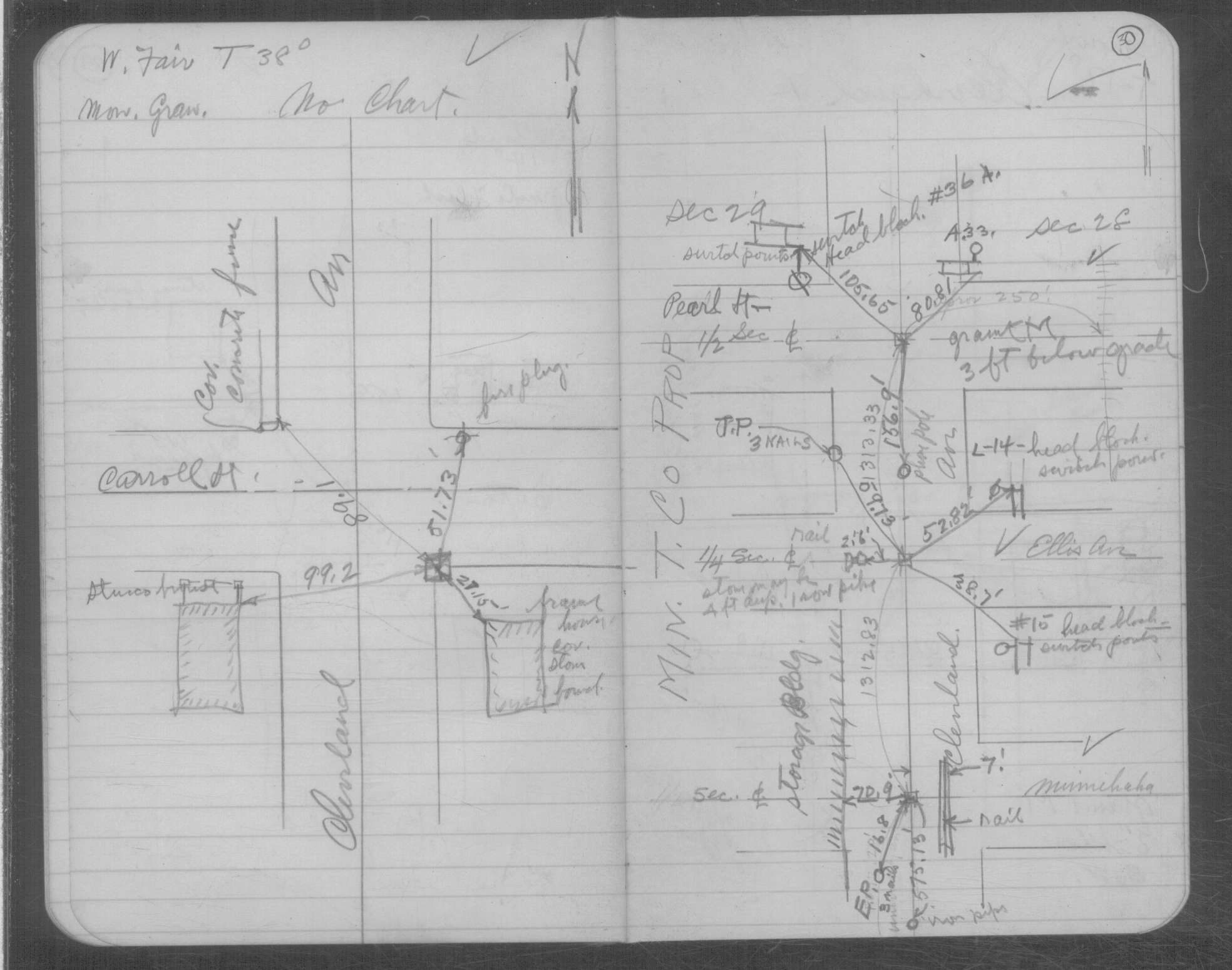
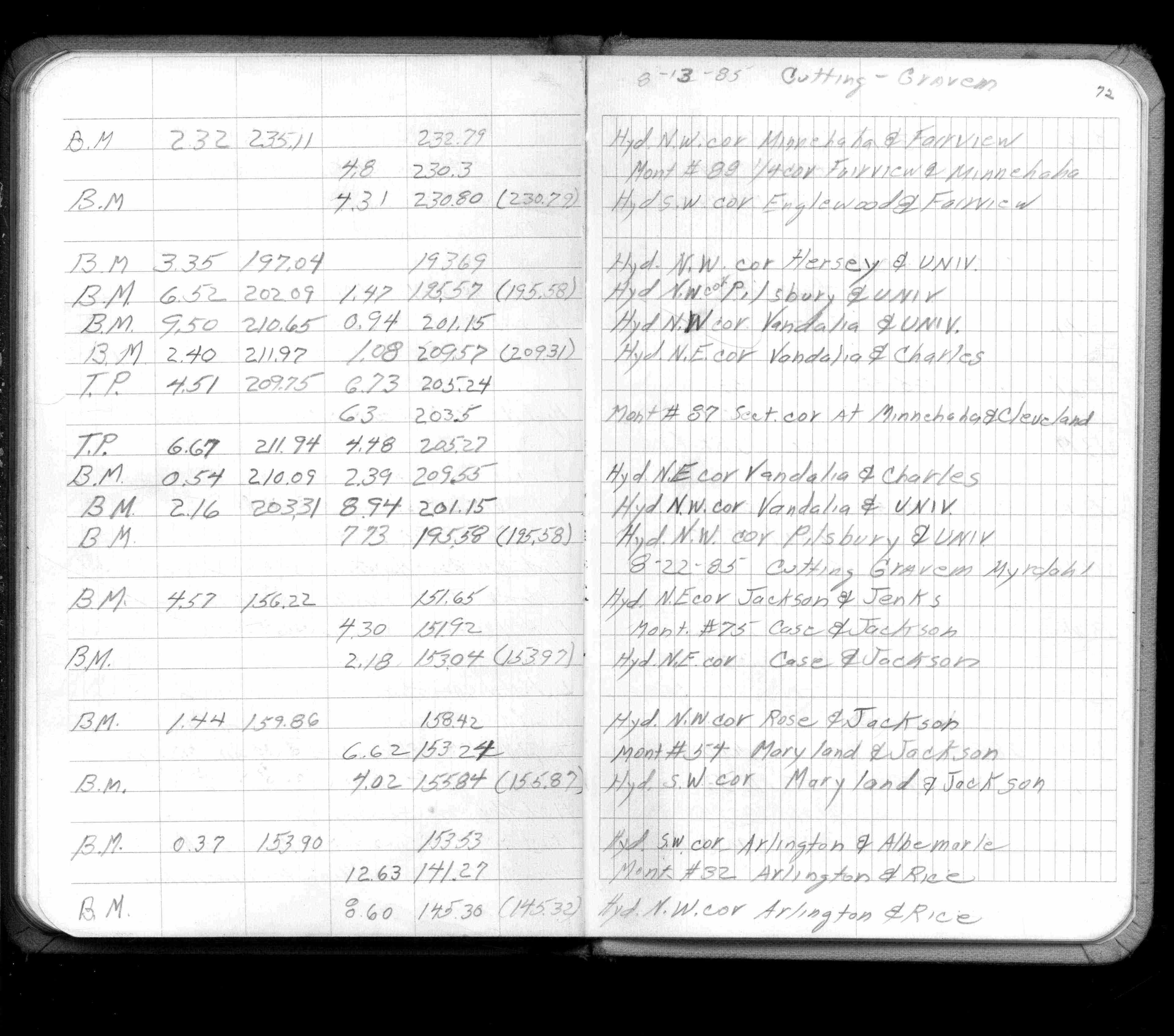
| 8/1/1985 | (Unknown date Aug __, 1985 ) Elev 203.5- ft on ?. See FB 1421A p.72 |
| 1/1/1985 | (Unknown date ___ __,1985 ) Historic, one time only GPS survey = S063 |
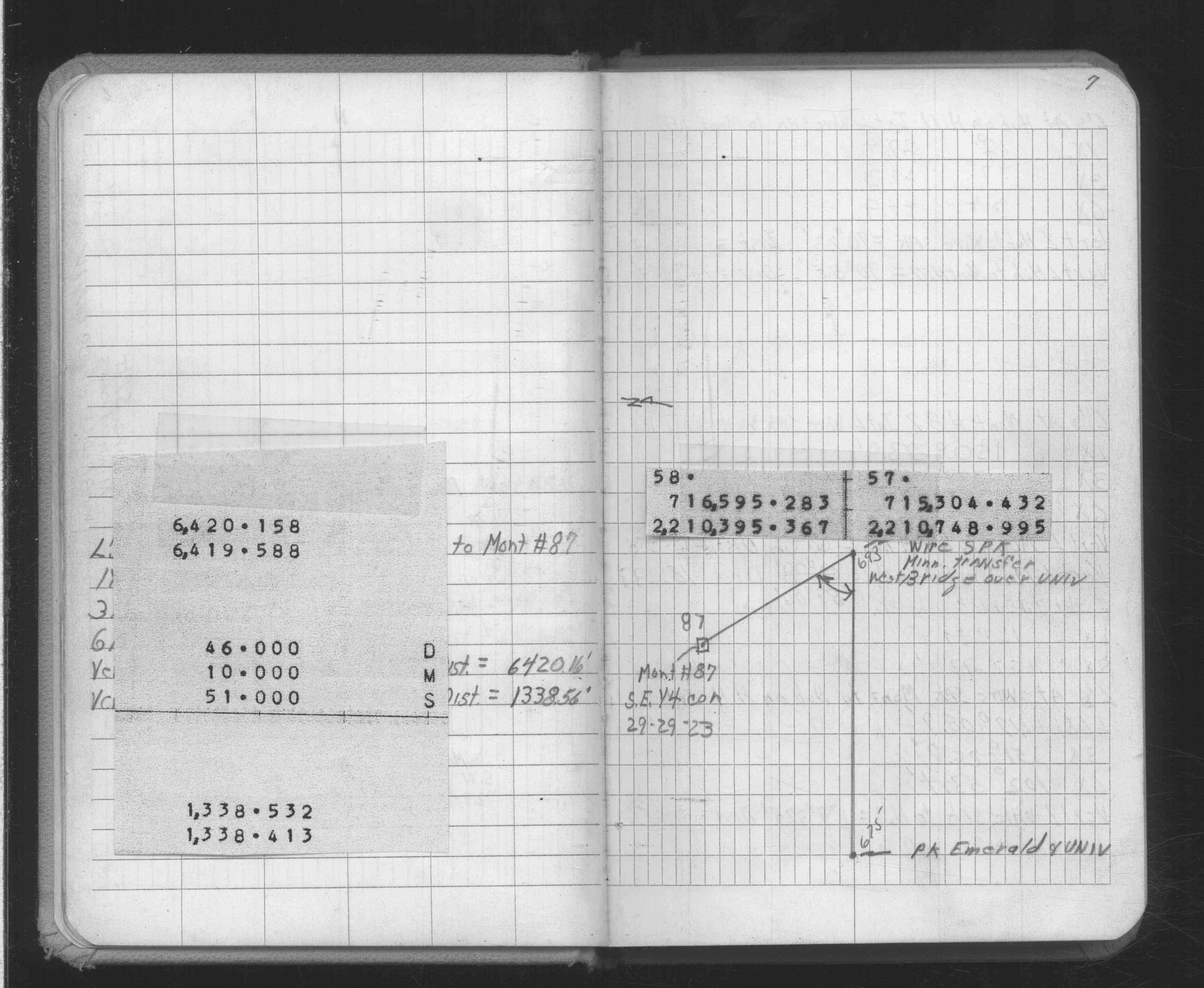
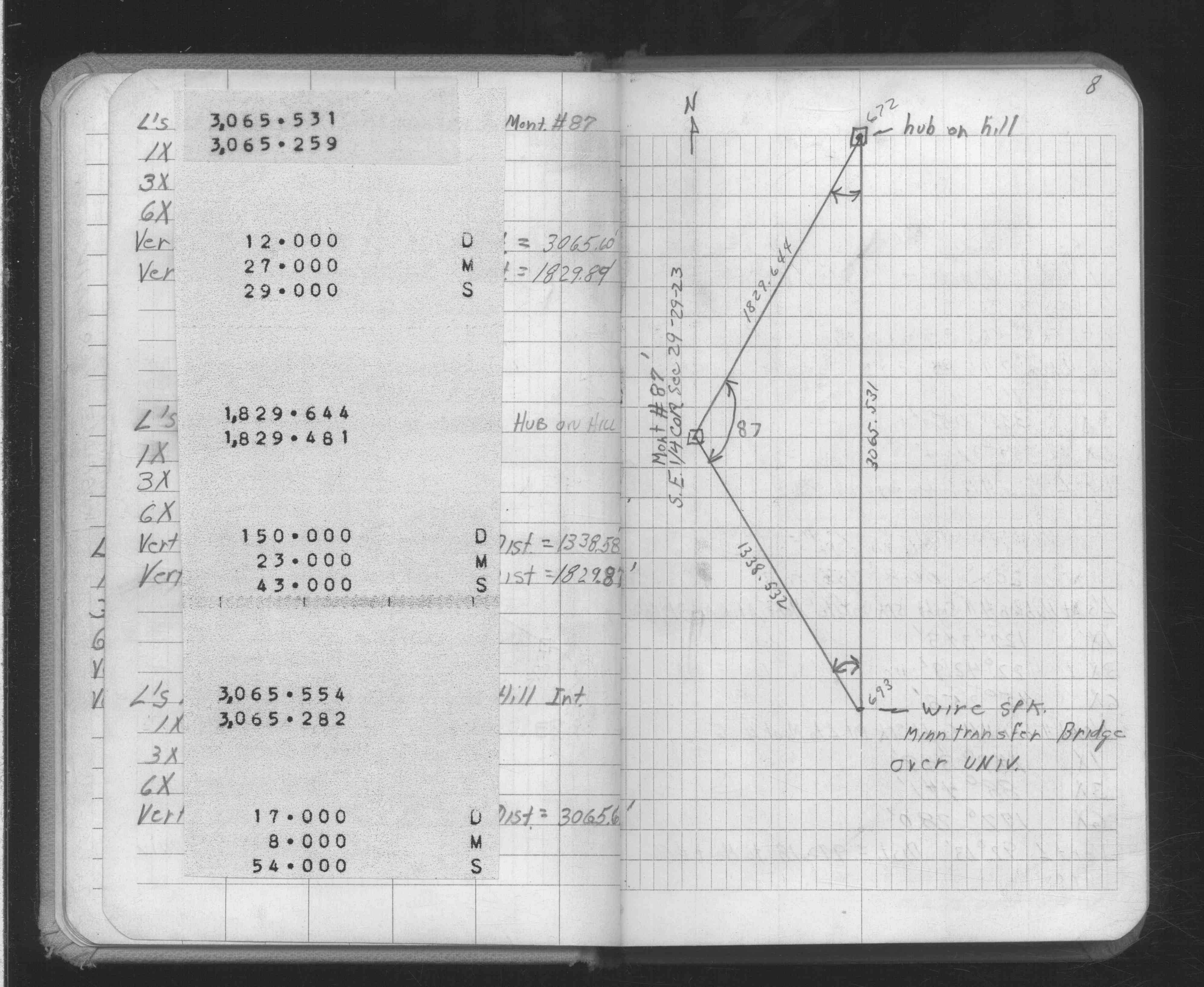
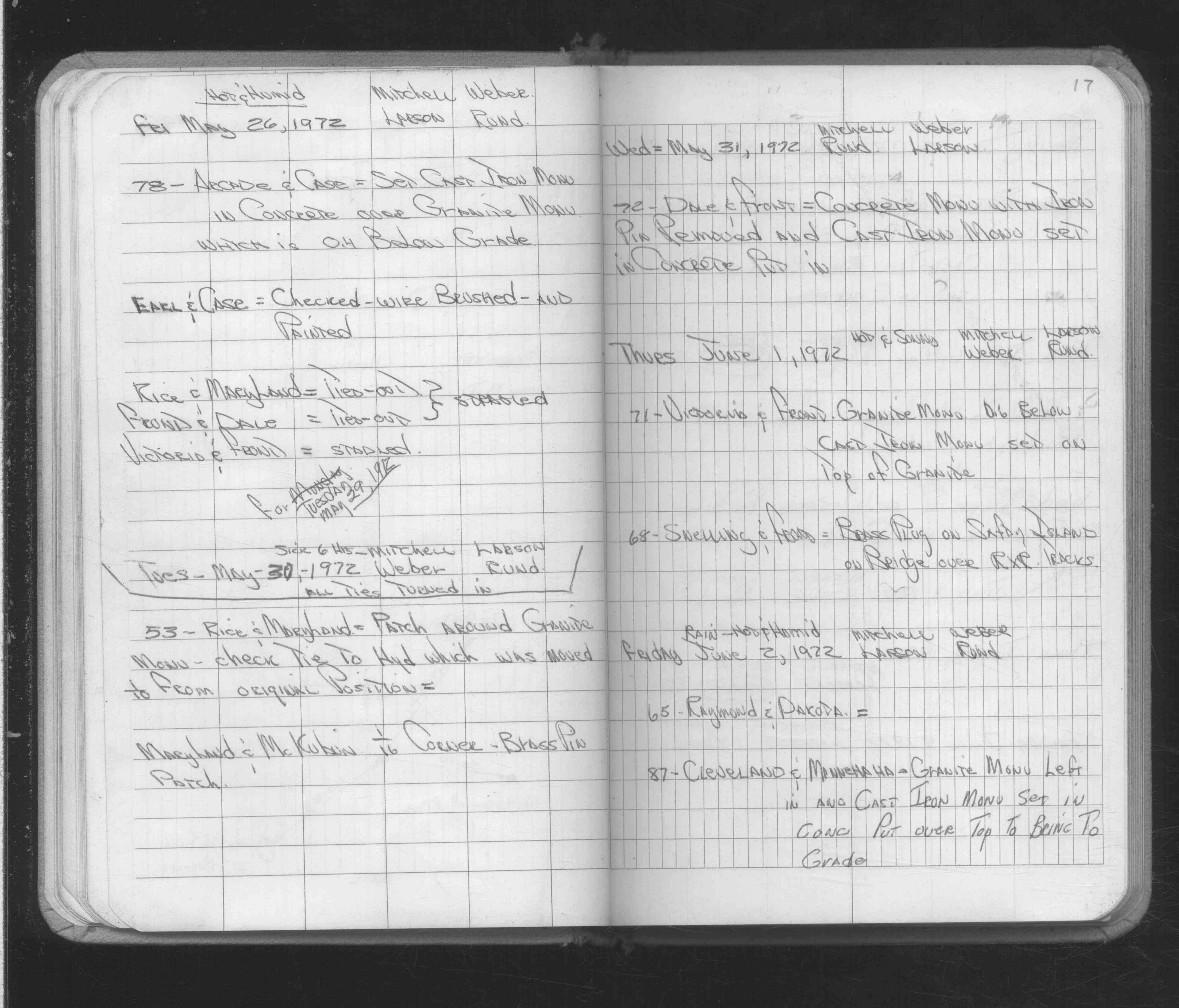
| 6/2/1972 | Fd GM, set CIM over GM in concrete in new blacktop surface. See Yellow Tie Book & See FB 1689A p.17 |
| 2/16/1972 | Fd GM 0.8 ft below crused rock road. See Yellow Tie Book & See FB 1689A p.6 |
| 3/1/1971 | (Unknown date Mar __, 1971 ) Fd GM and placed ties. See FB 1611 p.2 |
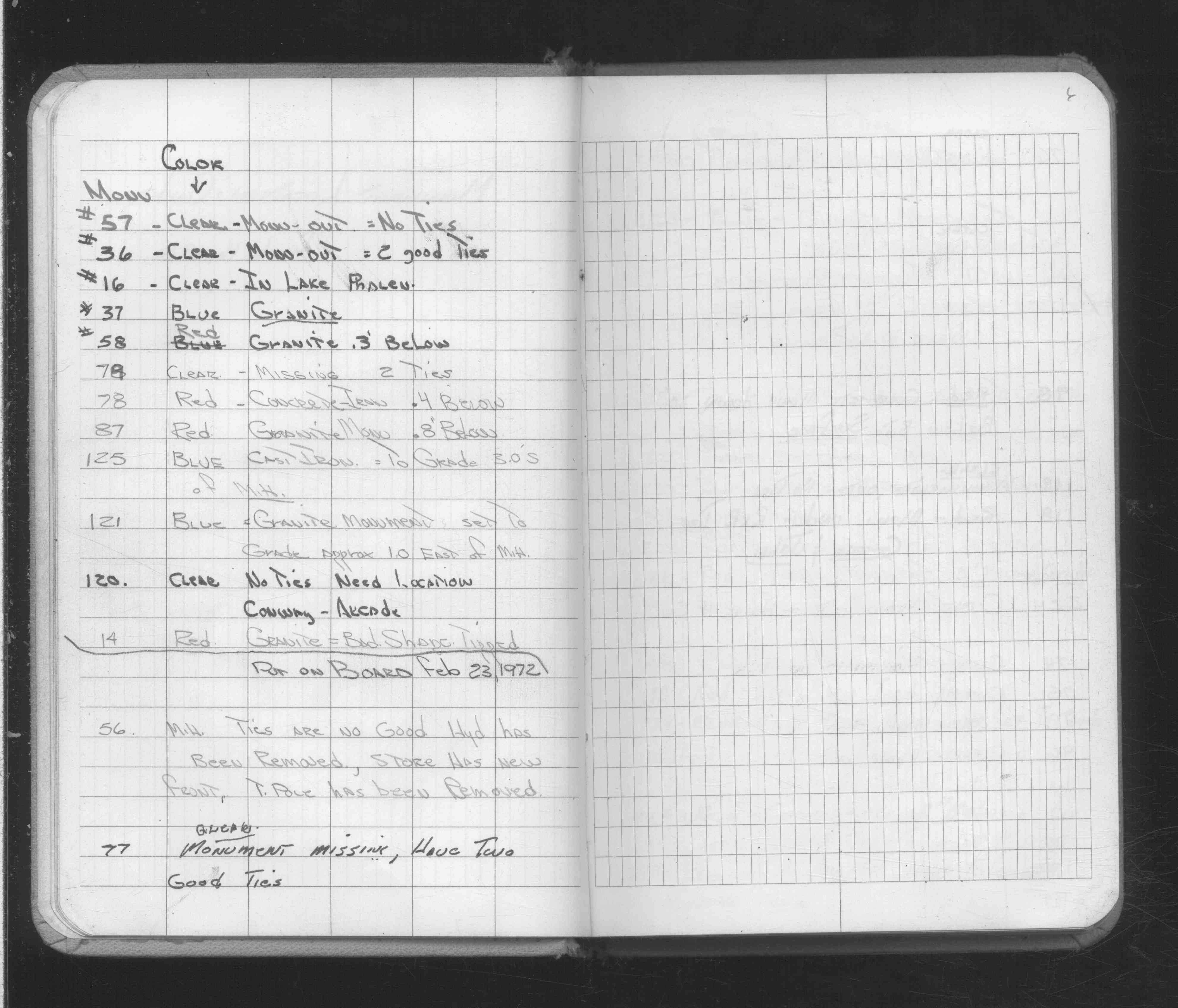
| 2/11/1934 | Placed ties on the monument. See book MSX 4 p.30 |
| 9/1/1887 | (Unknown date Sep __, 1887 ) Monument set by J H Armstrong. See Old Index Book, Entry 1049 |
| 11/1/1847 | (Unknown date Nov __, 1847 ) Isaac N Higbee deputy surveyor set post. Tied to 2 BTs. See IH p.102-103 2923 |
Above is NOT an all inclusive history of this point. Please review all the links below. Yellow Tie Books are 'ST' in the Monument category.
| PLS NOTES | Field | Cross Section | Sewer | J.B. Irvine | Monument | River Survey |
|---|---|---|---|---|---|---|
| IH p.102-103 | FB 0216p. 03 ,26 | ST 079-156 p.087 | ||||
| FB 0218p.36 | MSX 0004 p.030 | |||||
| FB 0335CPYp.21 | ||||||
| FB 0358p.26 | ||||||
| FB 1421Ap.72 | ||||||
| FB 1549Cp.74 | ||||||
| FB 1549Gp.77 | ||||||
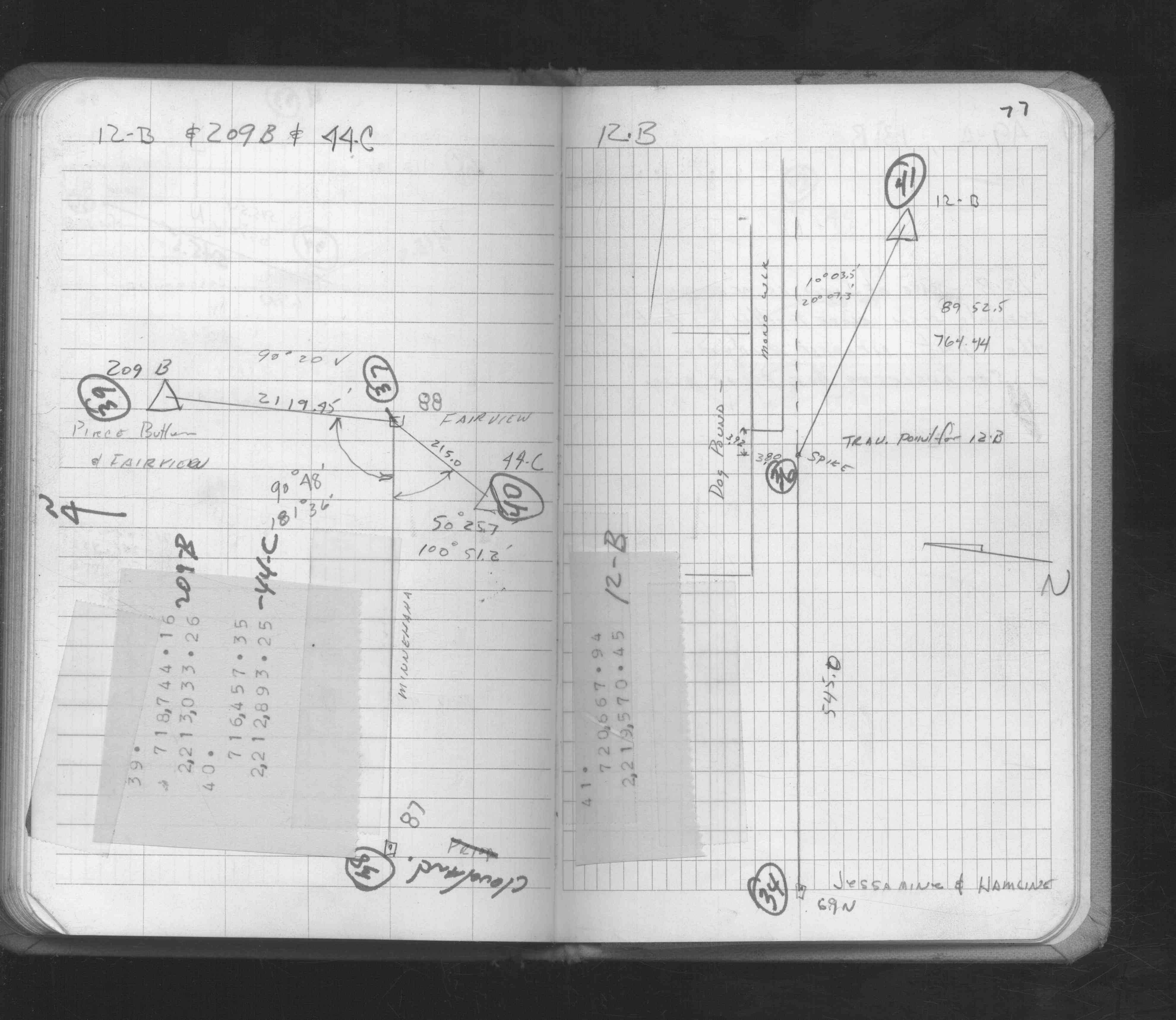
| FB 1611p. 01 ,02 | ||||||
| FB 1611p.02 | ||||||
| FB 1611Ap. 02 ,16 ,17 | ||||||
| FB 1634Bp. 07 ,08 ,23 | ||||||
| FB 1676Bp.46 | ||||||
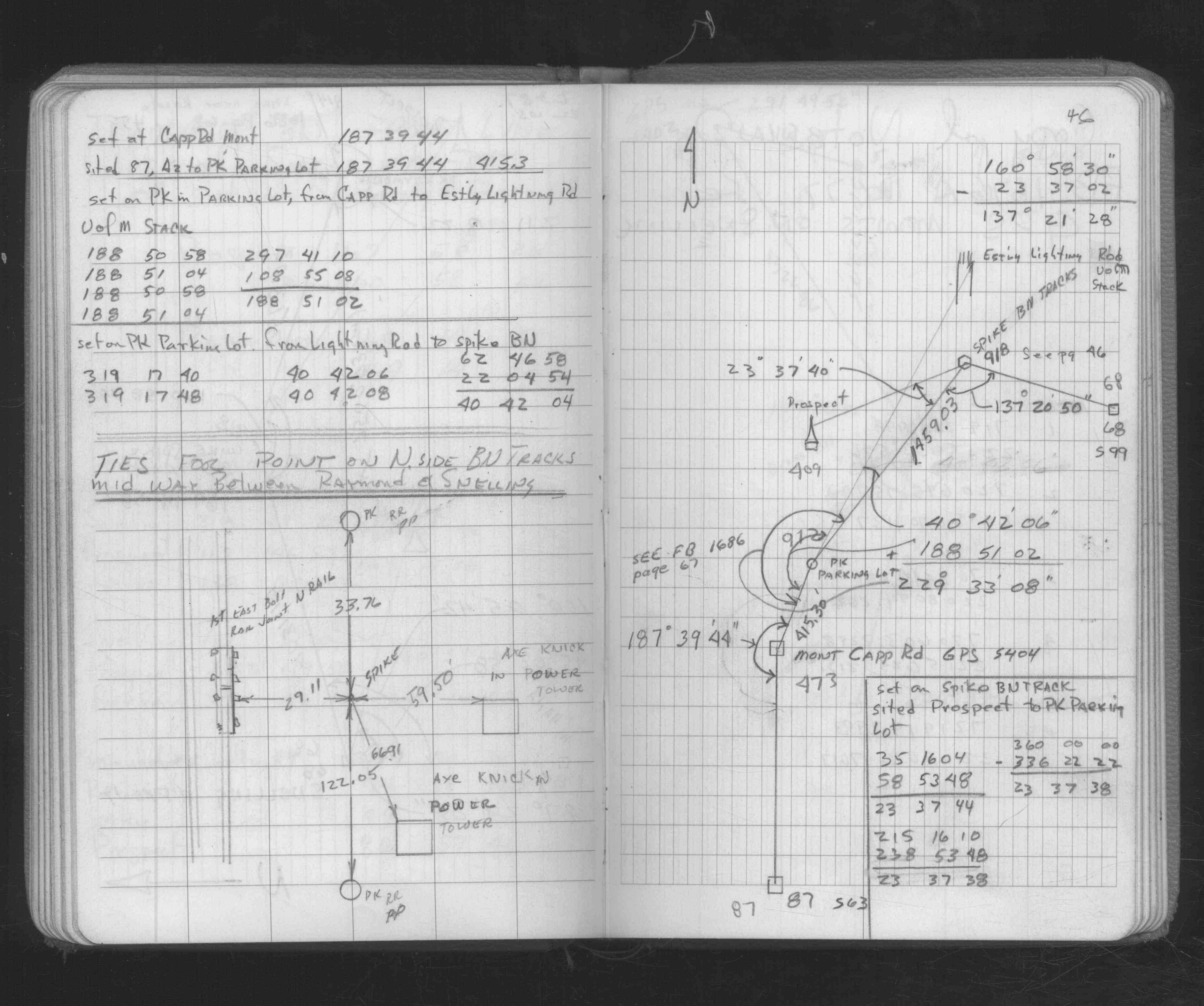
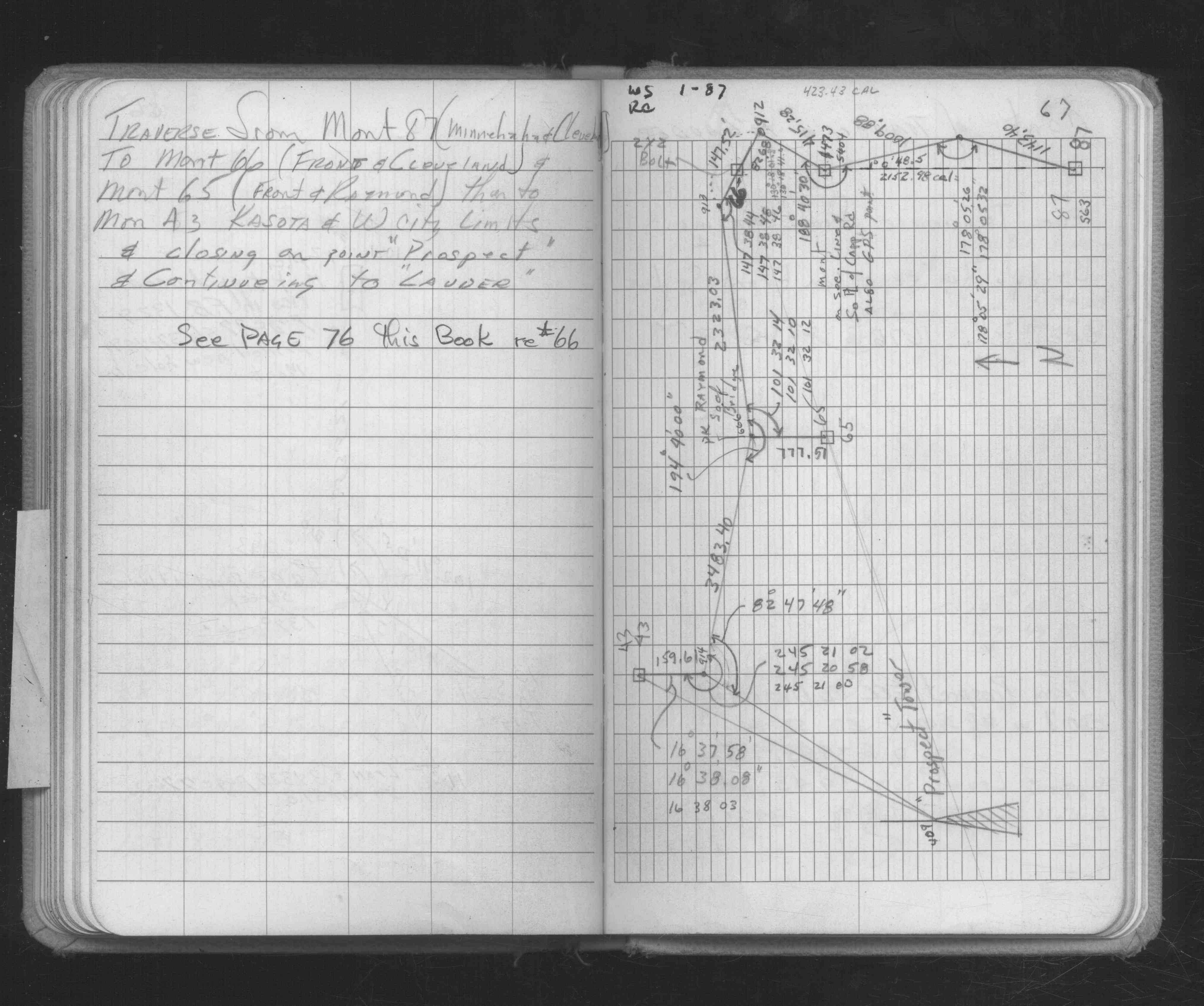
| FB 1686p.67 | ||||||
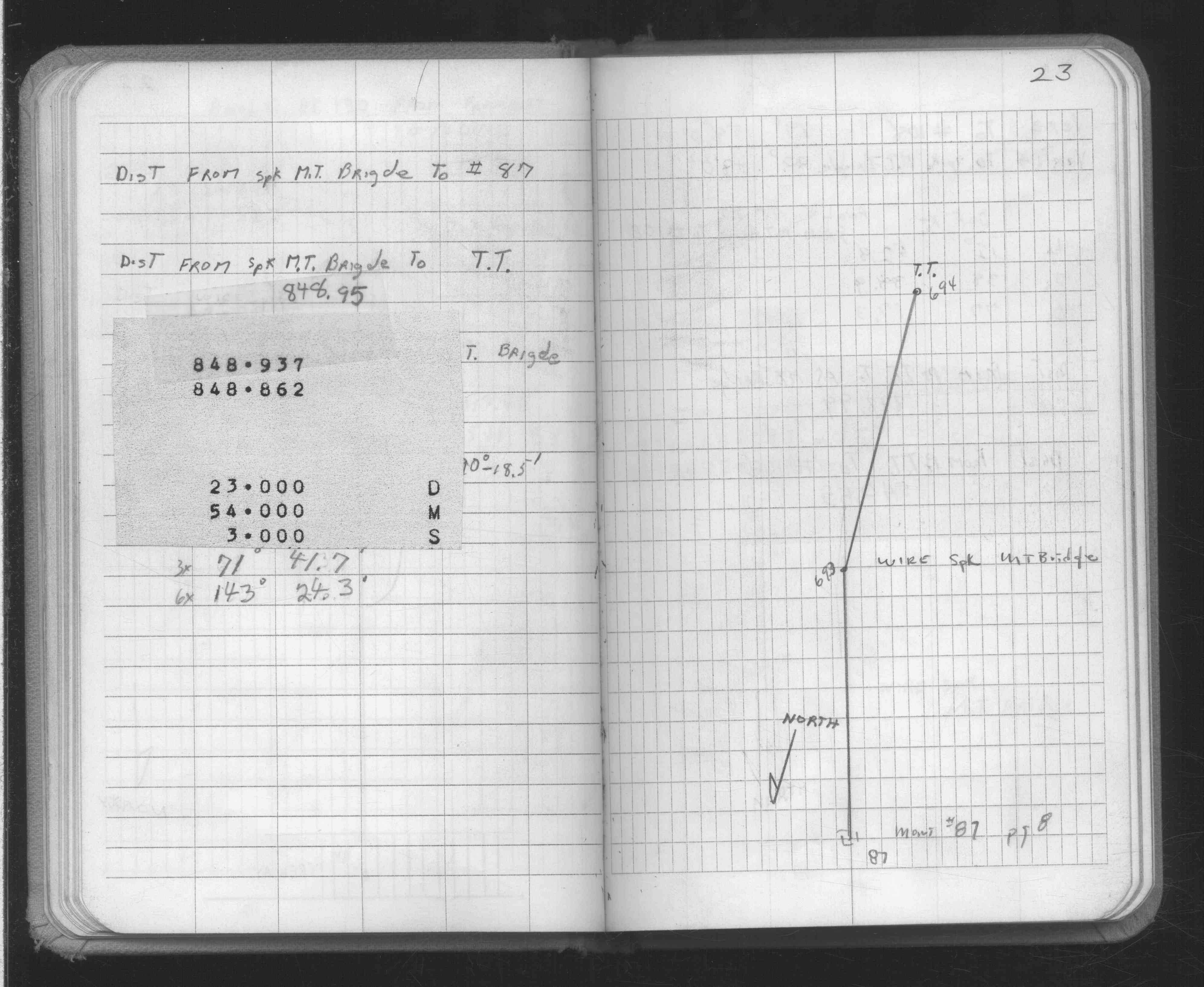
| FB 1689Ap.17 | ||||||
| FB 1689Ap.06 | ||||||
| FB 1708Ap.33 | ||||||
| FB 1736p.28 |
| FILE | SURVEYOR | LIC. NO. | DATE SIGNED | DATE TIED |
|---|---|---|---|---|
| ST_079-156p087.jpg | none | none | none | none |
| 0087-1049-A.dwf | none | none | none | none |
| FILE | PHOTO DATE | COMMENTS |
|---|---|---|
| 0087-1049-1.jpg | June 11, 2008 | Close-up of CIM slightly below street grade. |