| NAD83 COORDINATES (1986 adj.): |
|---|
| * X= 569167.76 Y= 162771.63 Z= 0 LSQ 12/6/1991 S FLT |
| X= 569167.72 Y= 162771.62 Z= 860.8 11/15/2005 RTK-VRS |
| X= 569167.71 Y= 162771.63 Z= 860.8 3/15/2006 RTK-VRS |
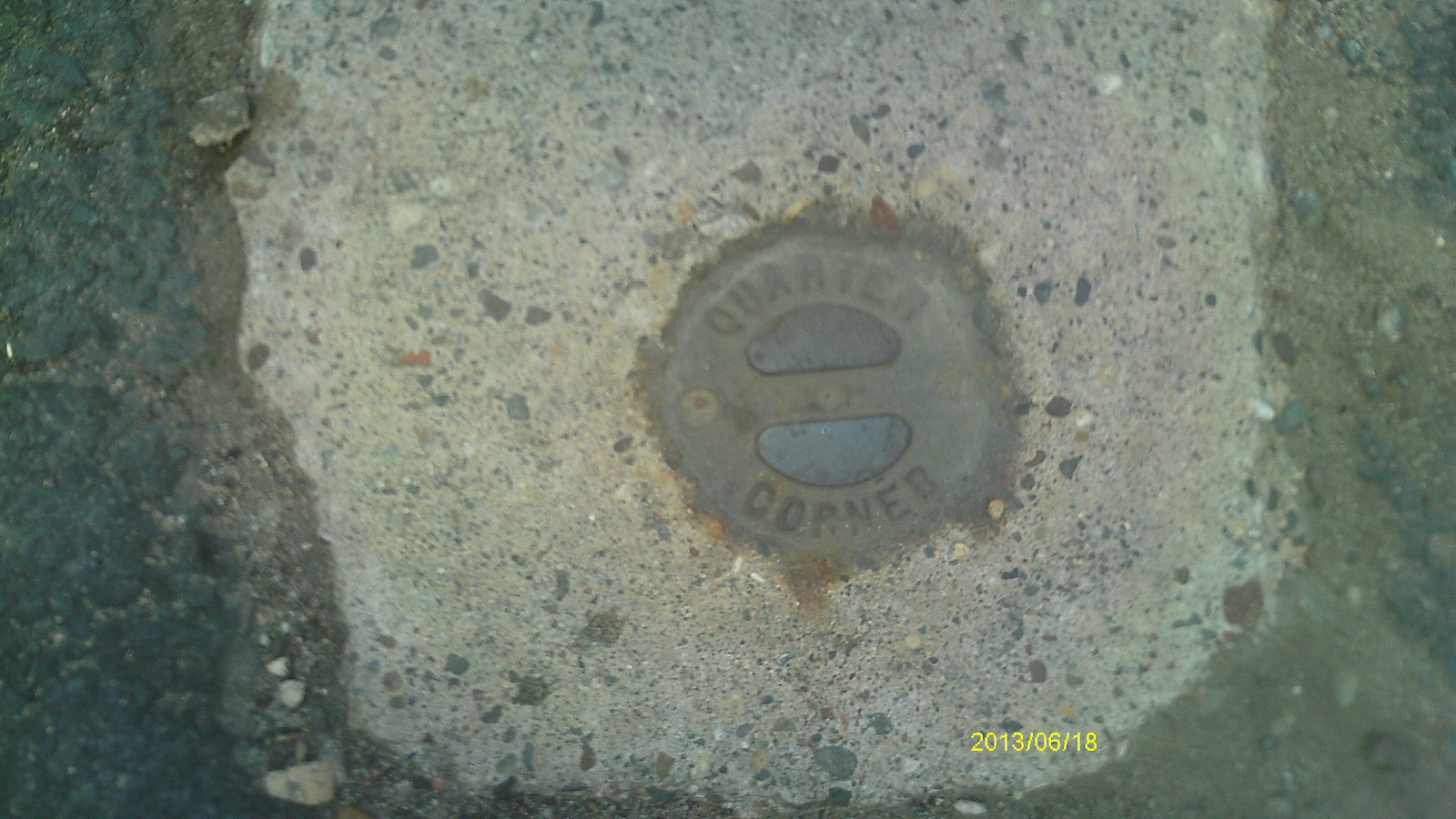
| 6/18/2013 | Found CIM at street grade. Photos taken. |
| 3/15/2006 | Position on CIM established by RTK-VRS GPS. Elev. 860.8 Ft. |
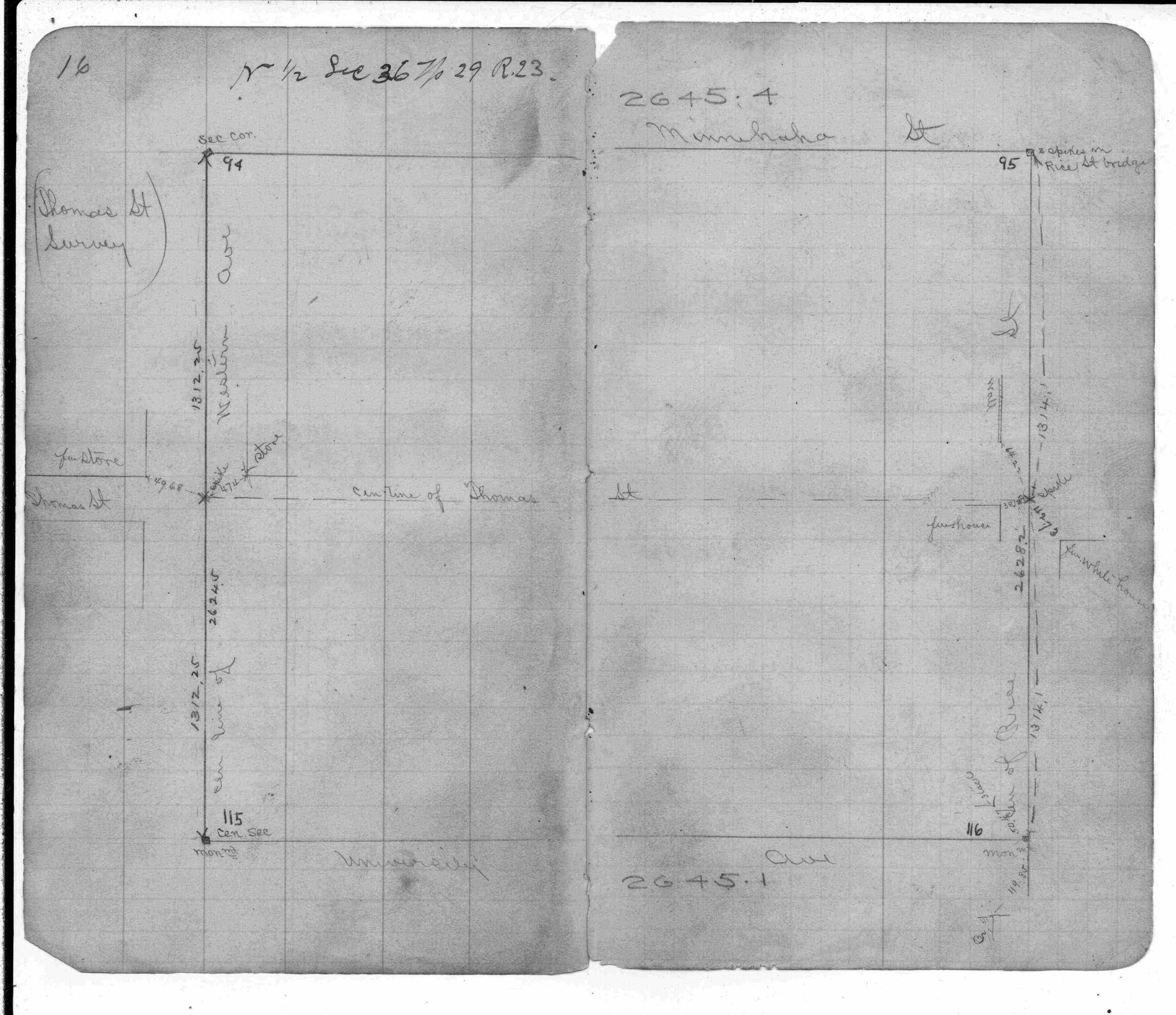
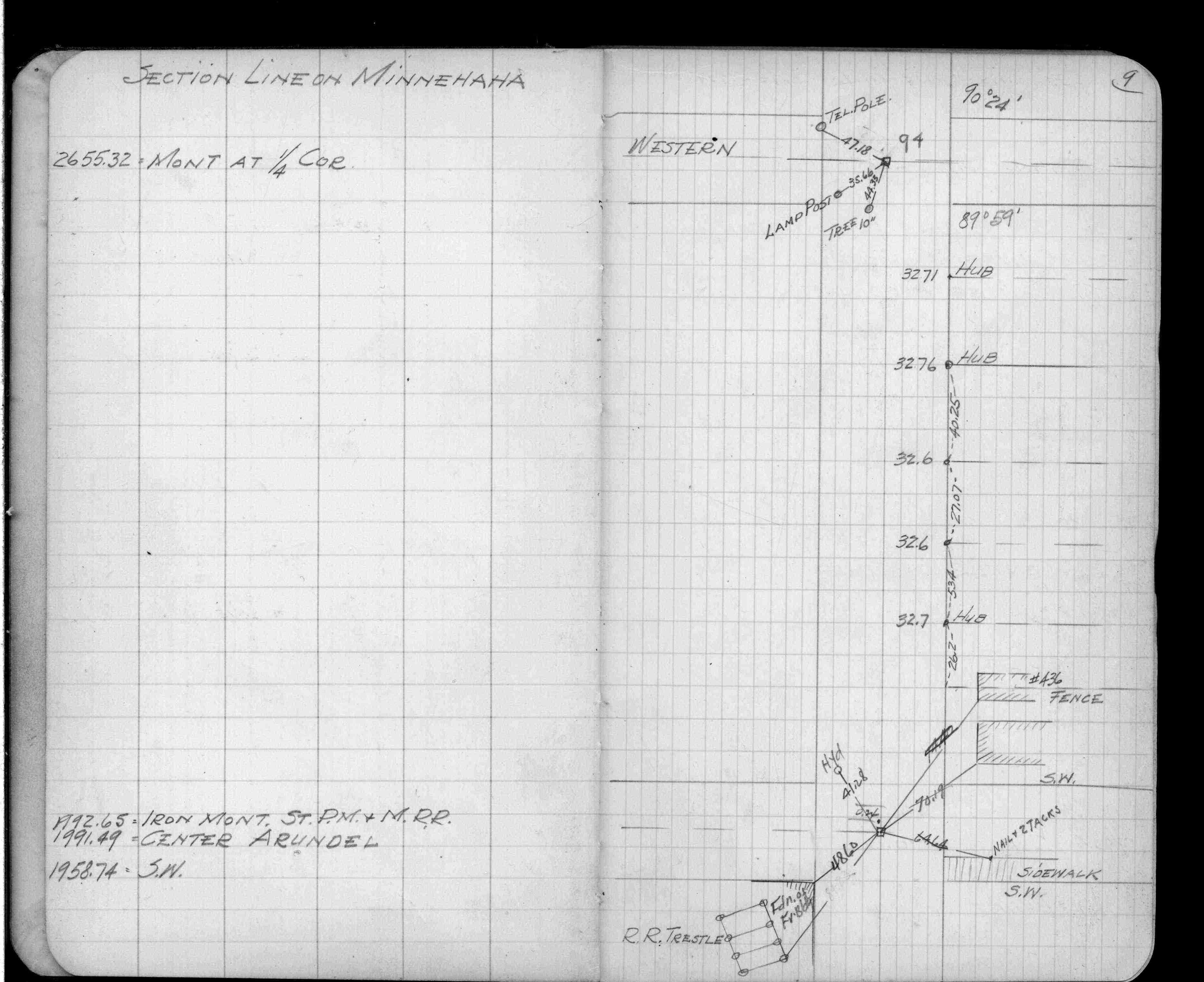
| 9/18/2004 | Fd Iron pin 7/8" dia. over broken CIM. Placed straddles to set CIM labeled "QUARTER CORNER" at same position. See CofL 0094-0059-A |
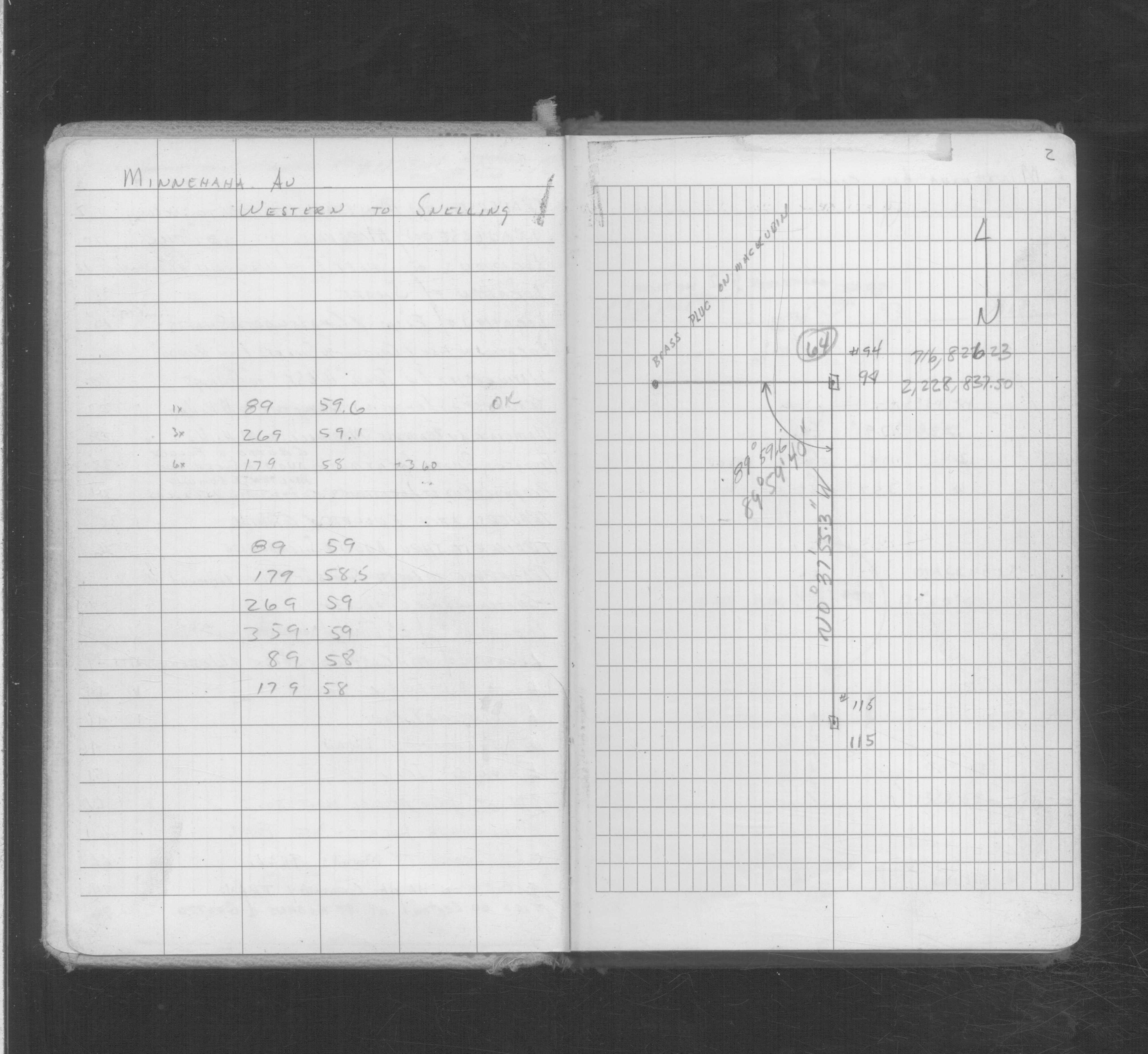
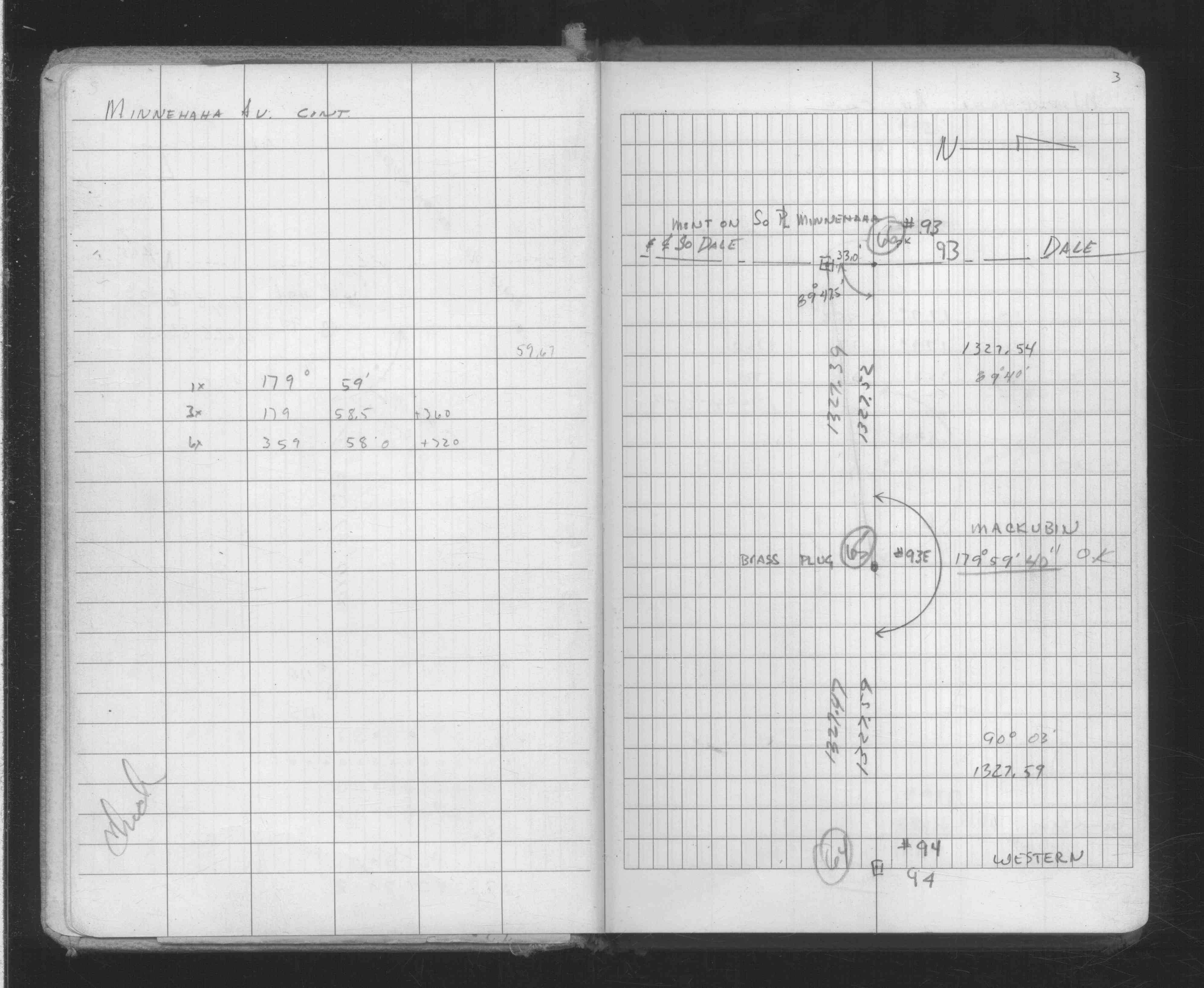
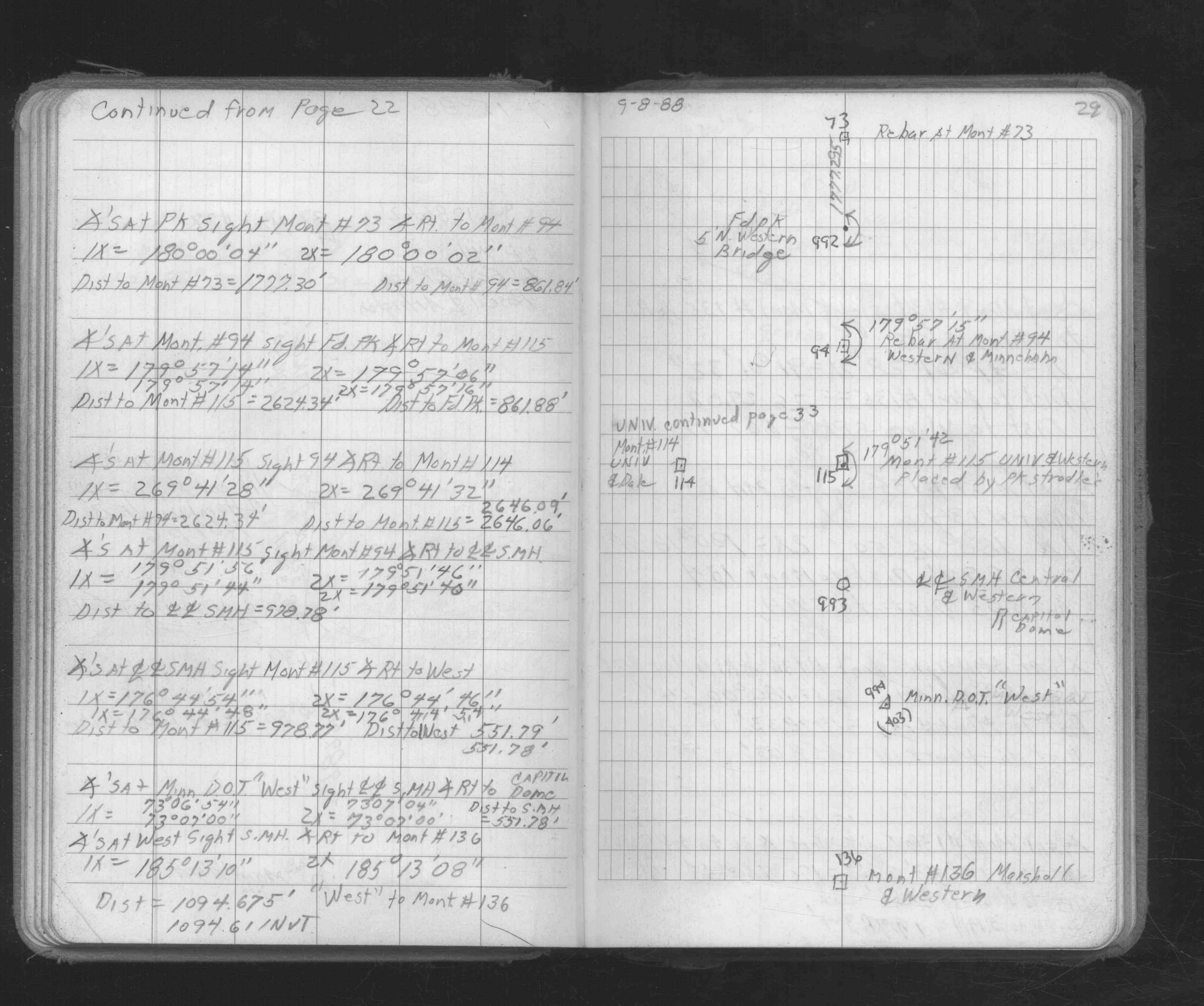
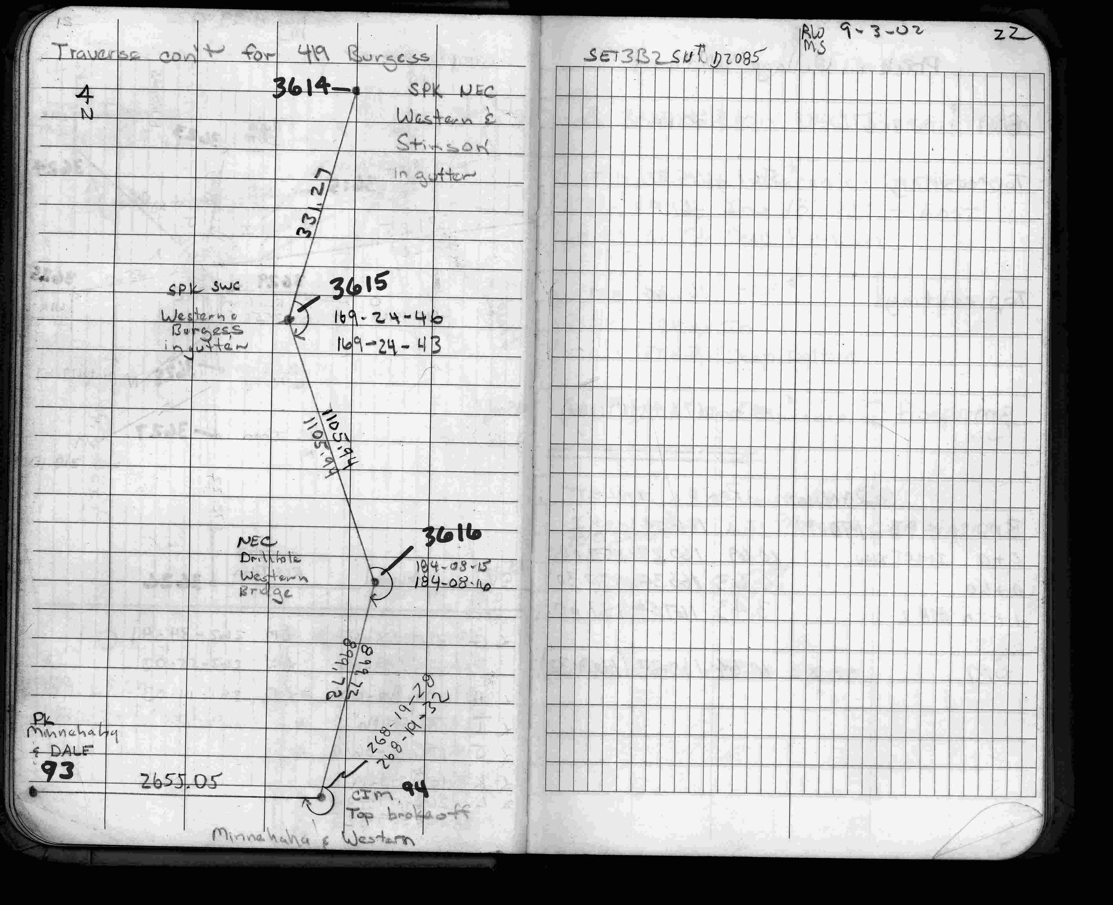
| 8/29/2002 | Used CIM (top broken off) for traverse control. See FB 1735 p.22 |
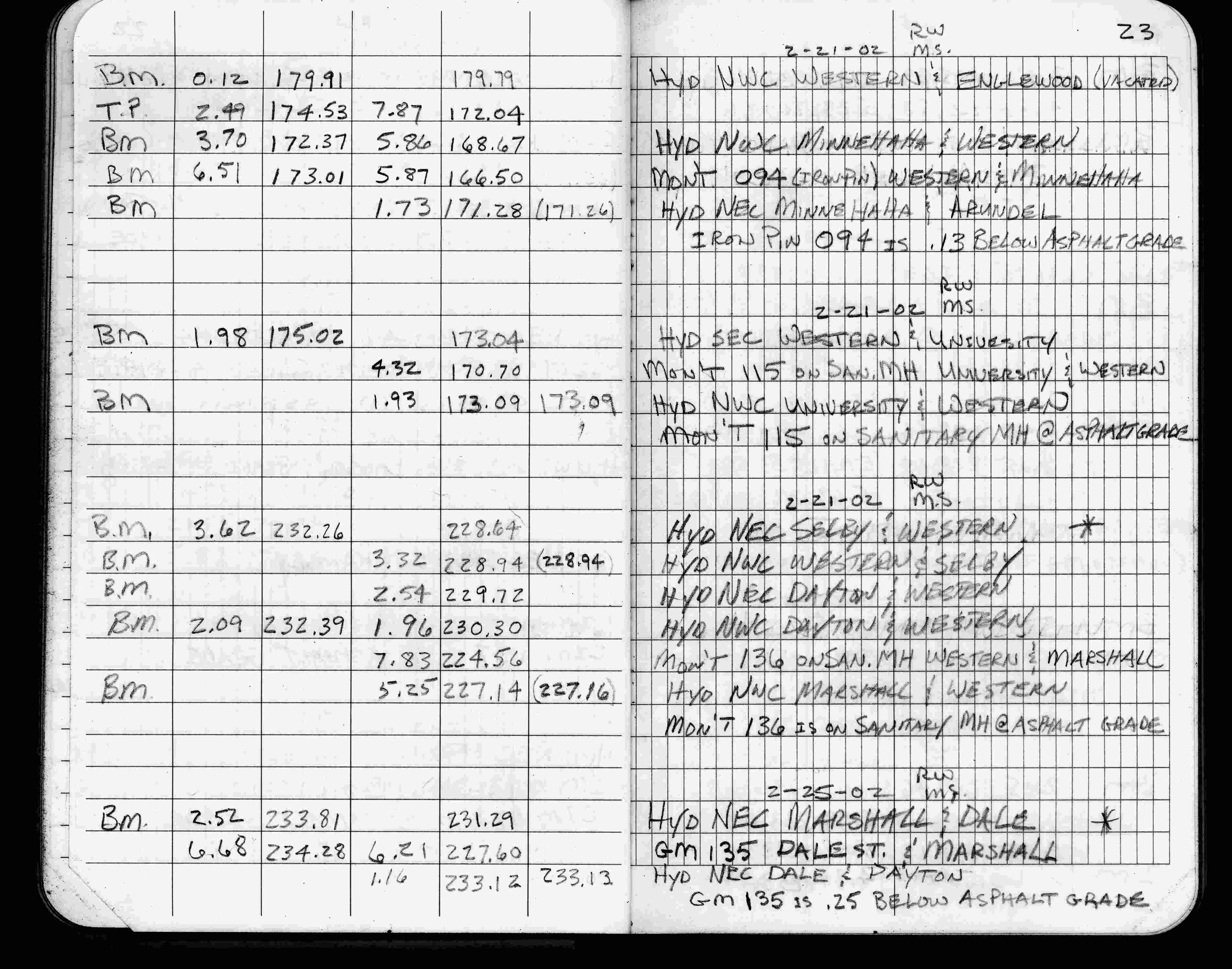
| 2/21/2002 | Elev 166.50 ft on iron pin 0.13 ft below asphalt surface. See FB 1736 p.23 |
| 3/1/2000 | (Unknown date Mar __, 2000 ) Fd PIN 0.20 ft below grade placed 4-2 ft straddles (marked for painting target for 2000 aerial) |
| 9/21/1995 | Fd steel pin 3.0' N of center of MH (marked for painting target for 1995 aerial) |
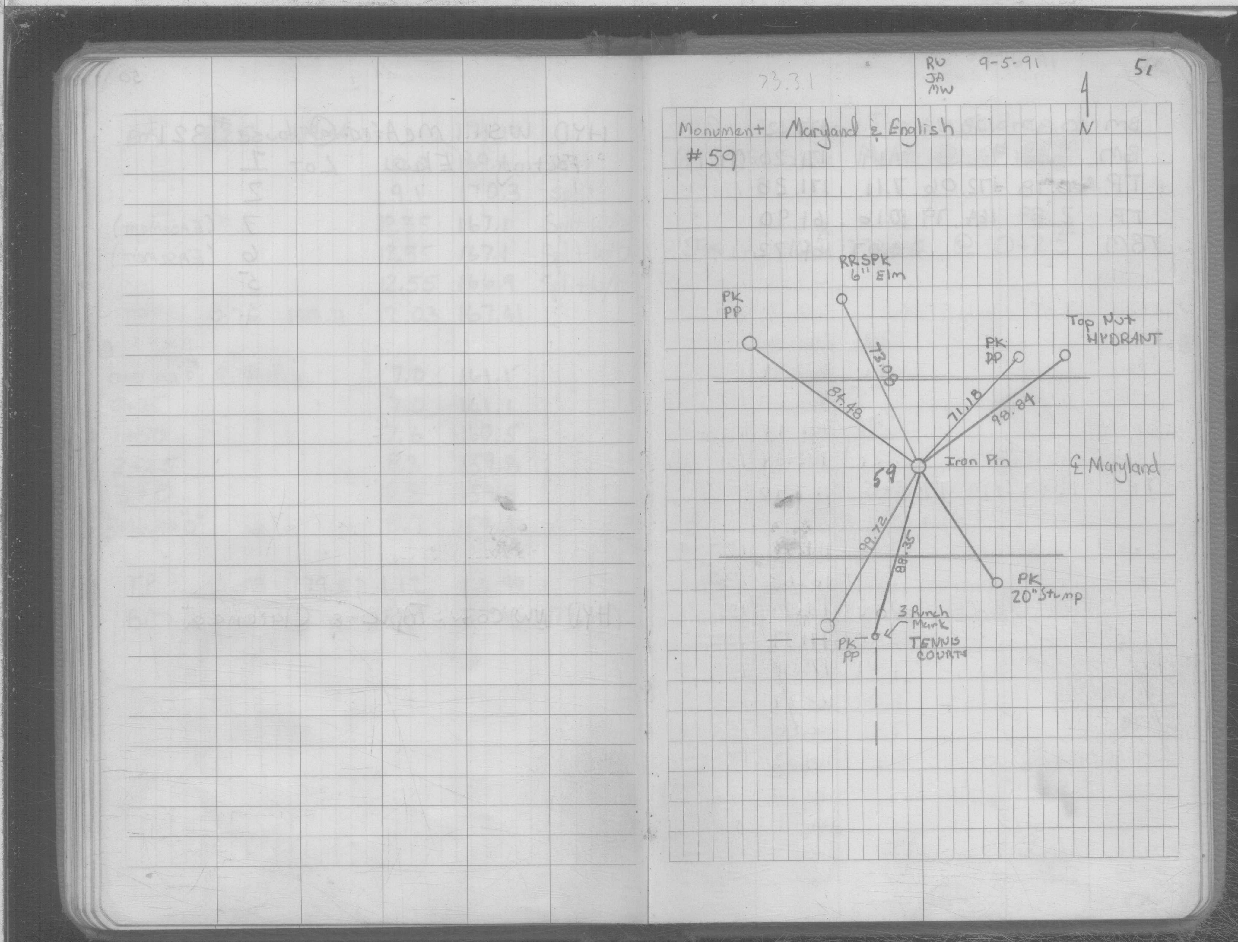
| 9/5/1991 | Fd iron pin, placed ties. See SB 634C p.51 |
| 3/1/1987 | (Unknown date Mar __, 1987 ) Fd Iron pin 7/8" dia. to grade. |
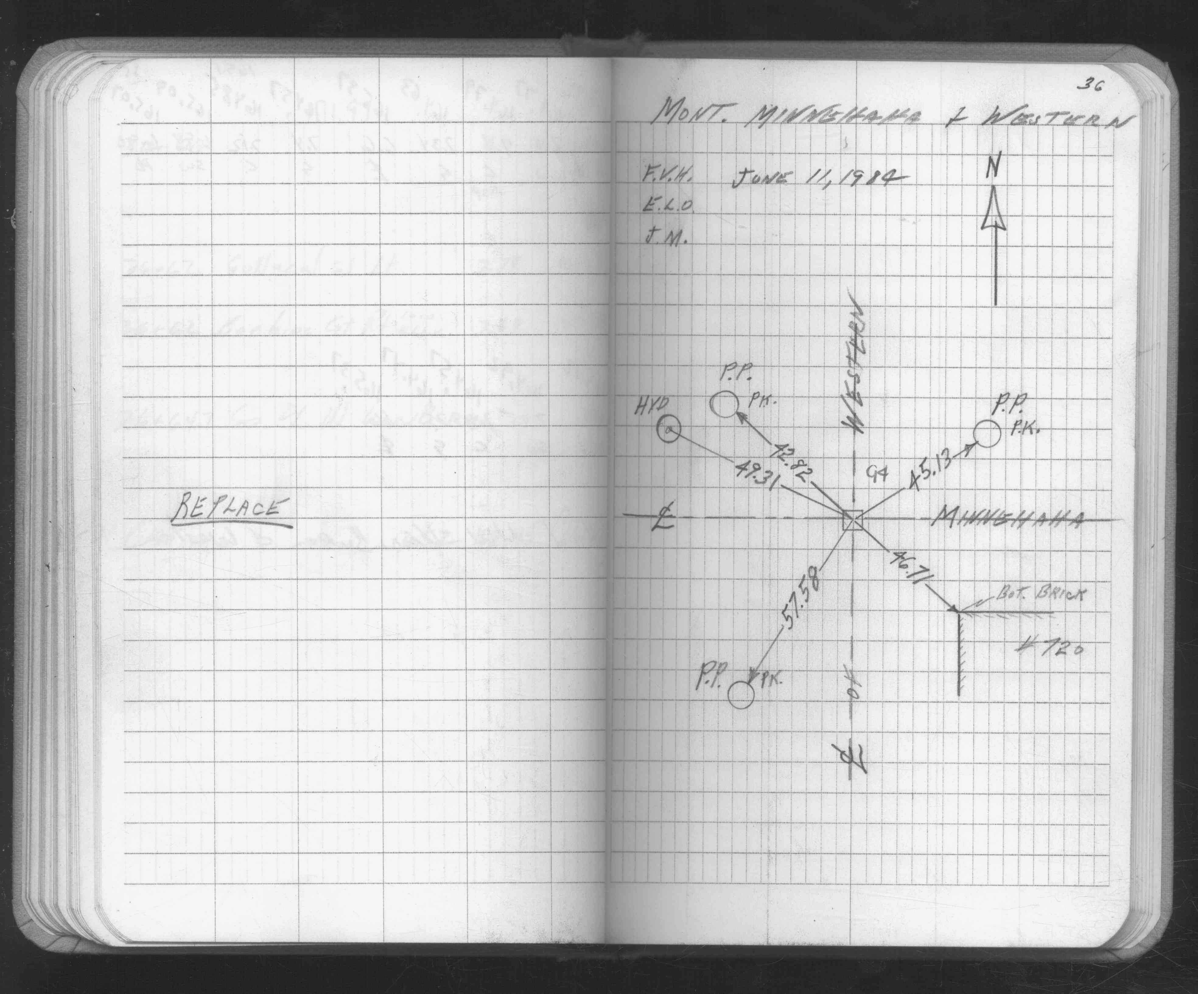
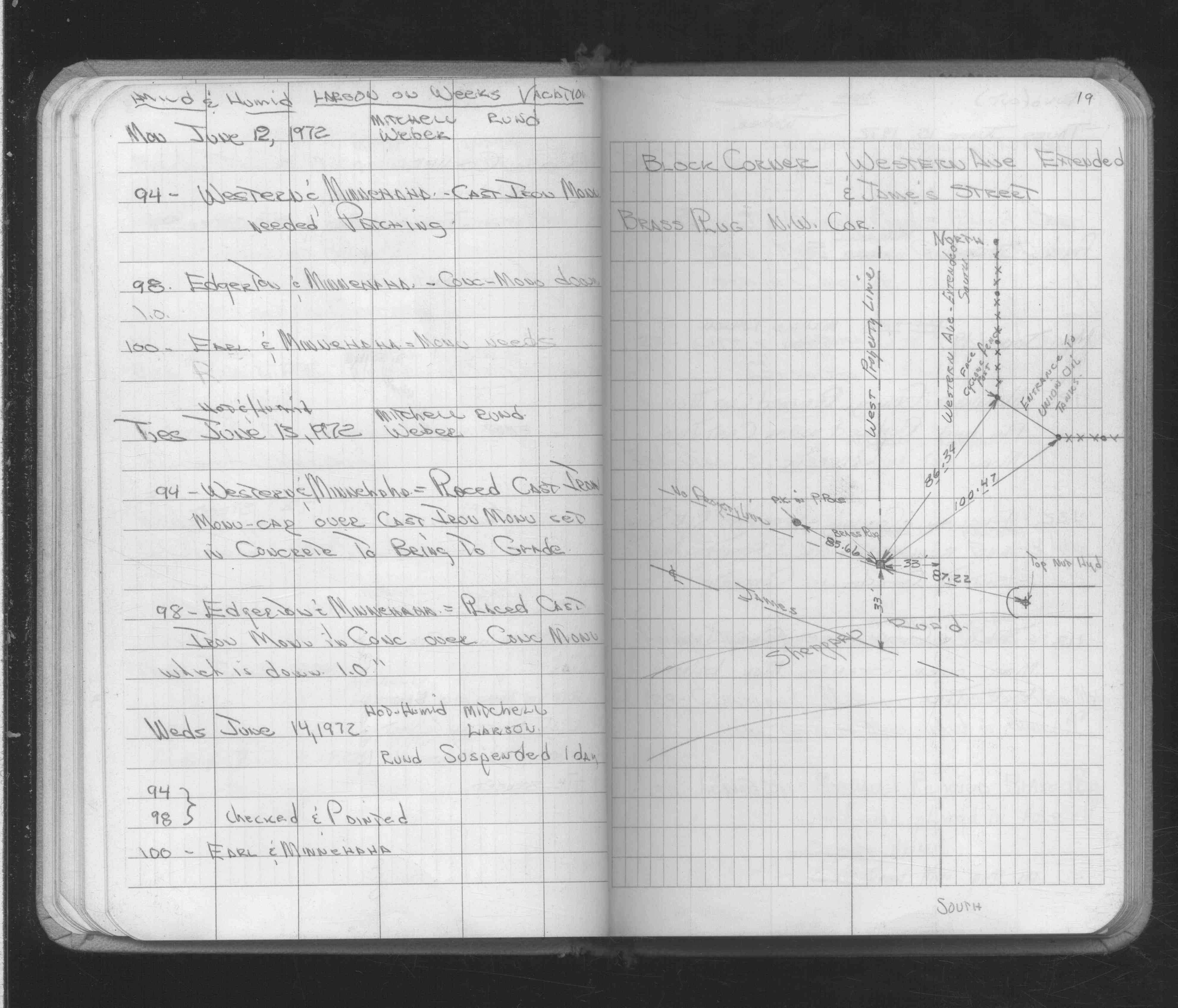
| 6/13/1972 | Set CIM cap in concrete over CIM to bring to grade. See FB 1689A p.19 |
| 11/1/1847 | (Unknown date Nov __, 1847 ) Isaac N Higbee deputy surveyor set post. Tied to 1 BT. See IH p.070-071 2923 |
| 1/1/1800 | (Unknown date ___ __, ____ ) Monument set by D L Curtice when City Engineer. |
Above is NOT an all inclusive history of this point. Please review all the links below.
| PLS NOTES | Field | Cross Section | Sewer | J.B. Irvine | Monument | River Survey |
|---|---|---|---|---|---|---|
| IH p.070-071 | FB 0148p.16 | SB 0634Cp.51 | ||||
| FB 0158p. 13 ,17 | ||||||
| FB 0276CPYp. 09 ,28 | ||||||
| FB 0301p.05 | ||||||
| FB 1523p.03 | ||||||
| FB 1549Gp. 16 ,17 ,61 ,62 | ||||||
| FB 1549Ip.17 | ||||||
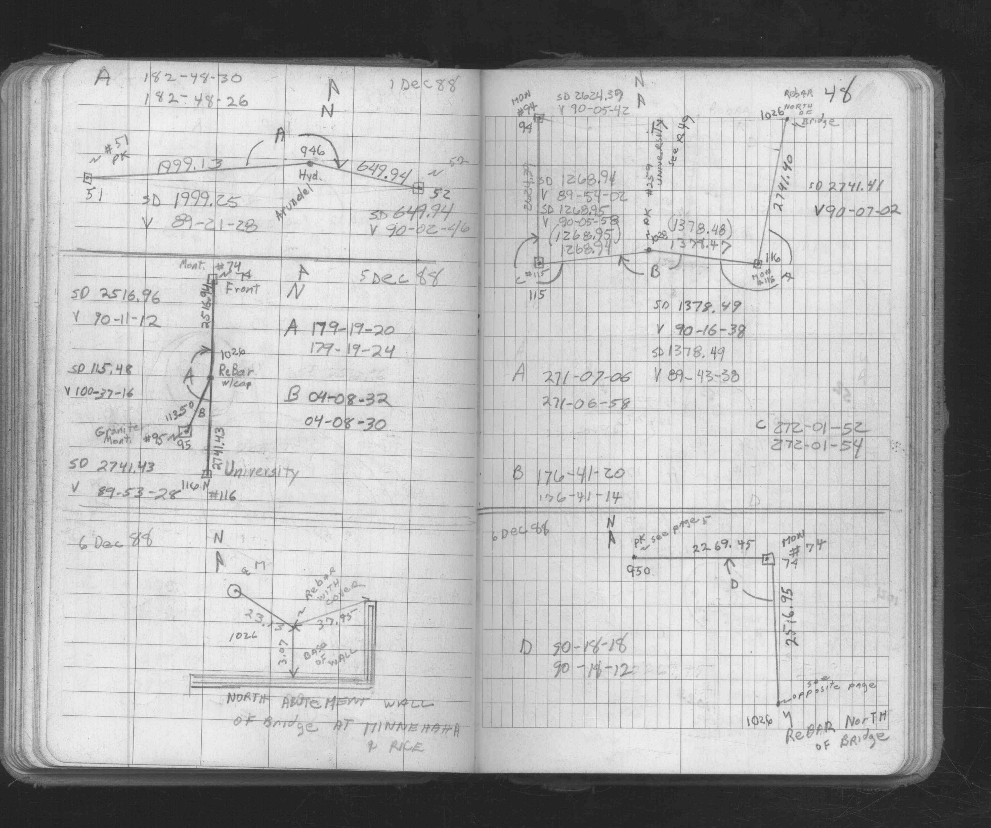
| FB 1634Ap. 17 ,18 ,19 | ||||||
| FB 1634Bp. 03 ,39 | ||||||
| FB 1634Dp. 02 ,03 | ||||||
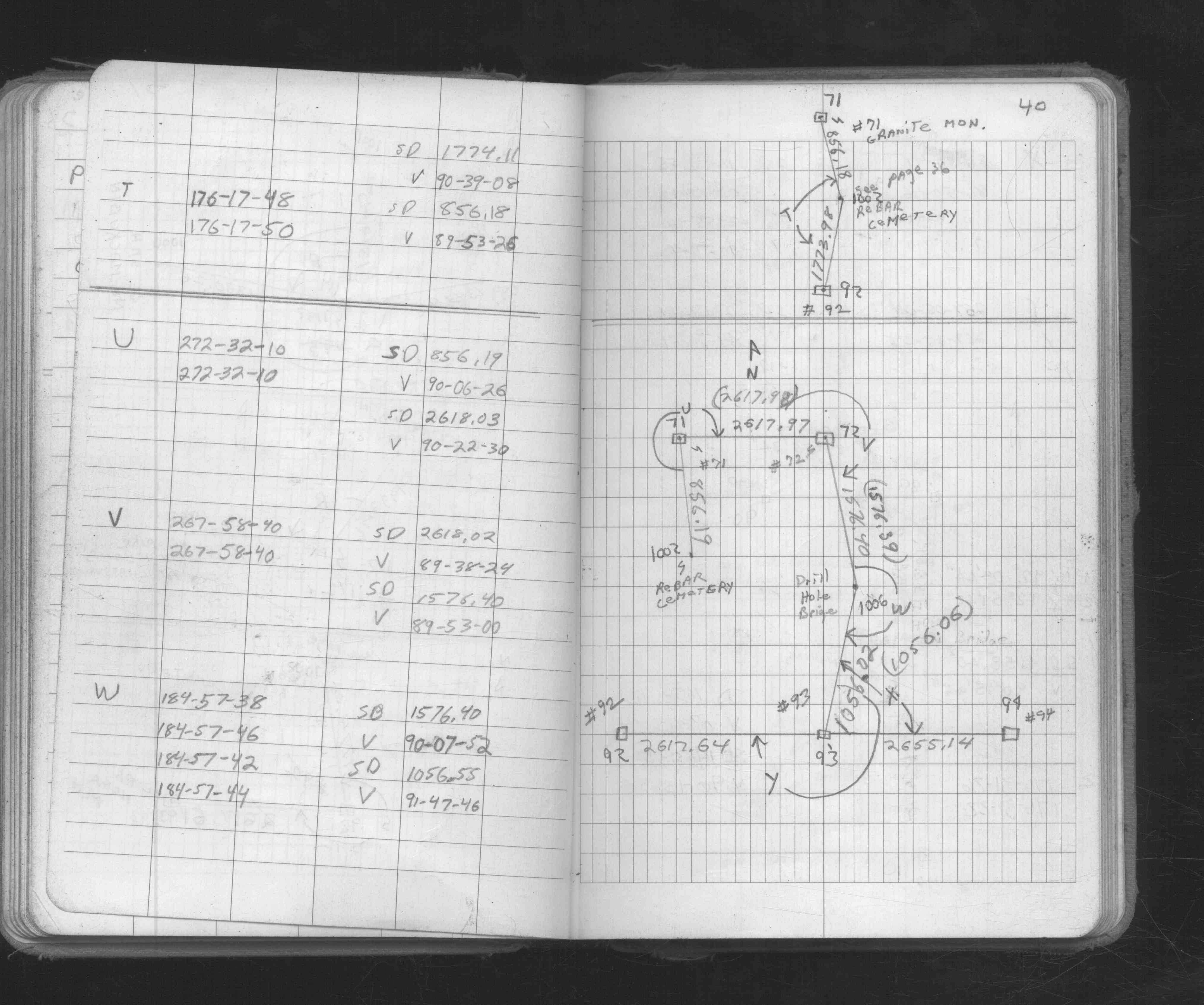
| FB 1651p.36 | ||||||
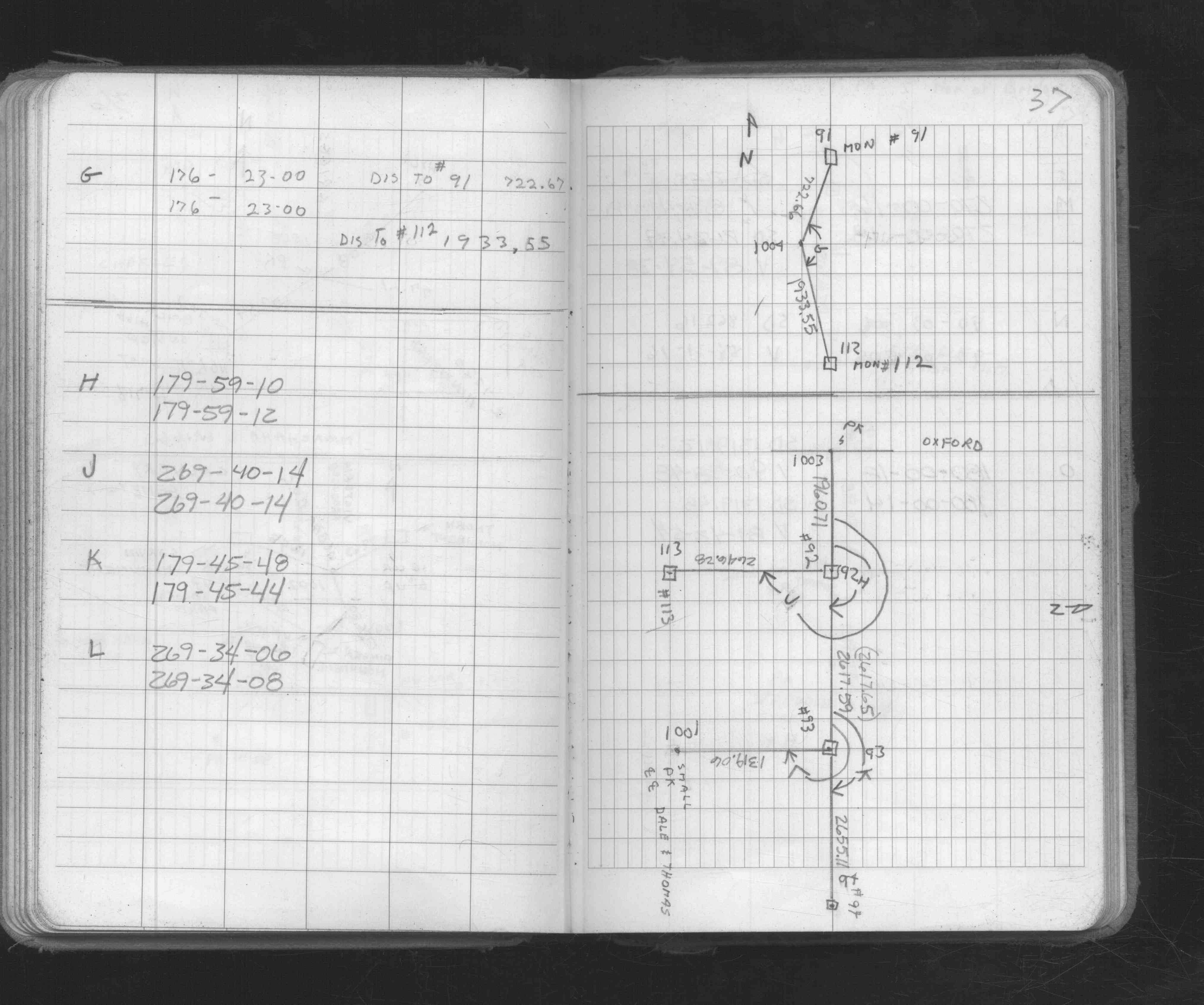
| FB 1673Ap. 29 ,33 ,37 ,38 ,40 ,48 | ||||||
| FB 1689Ap.19 | ||||||
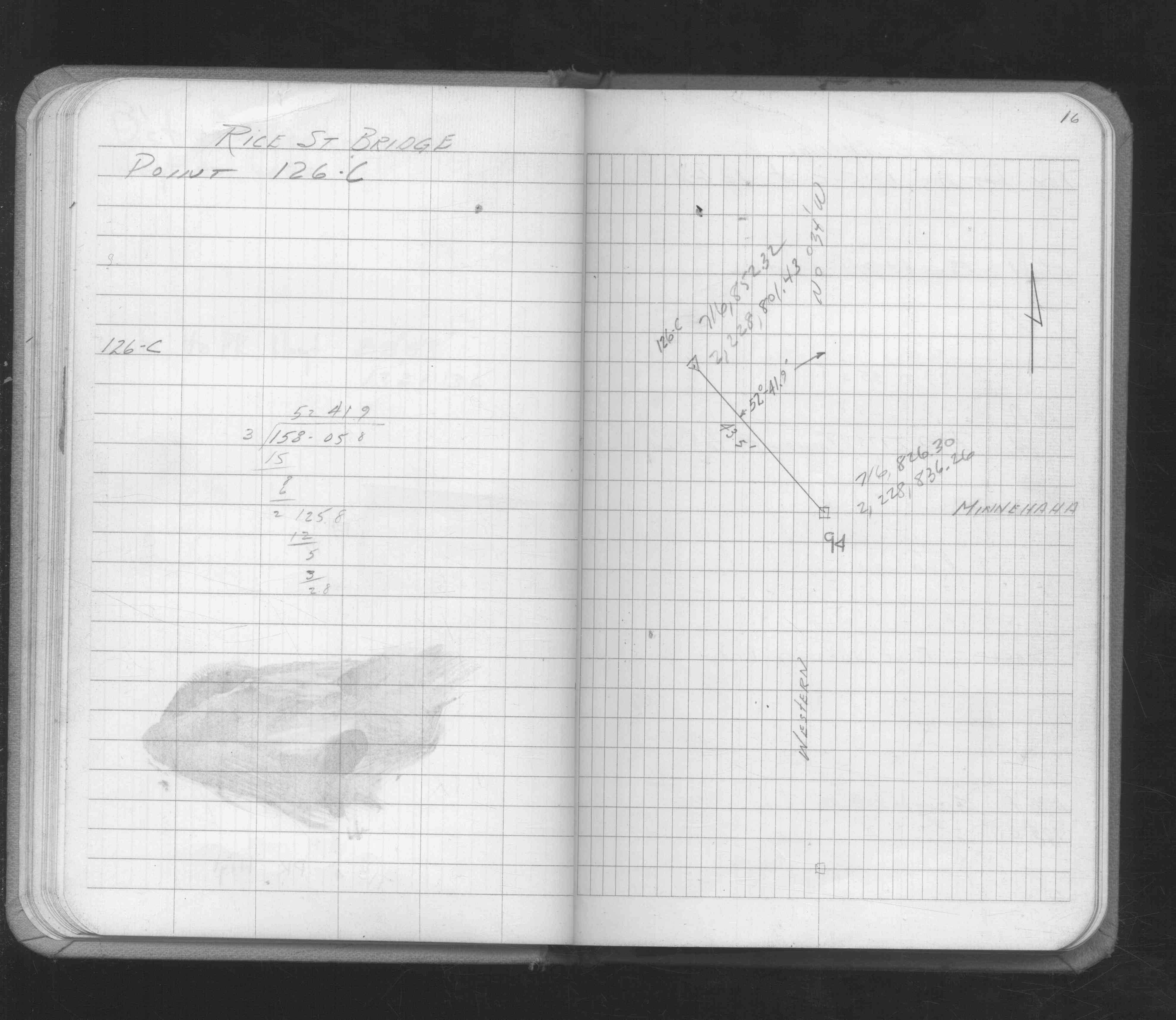
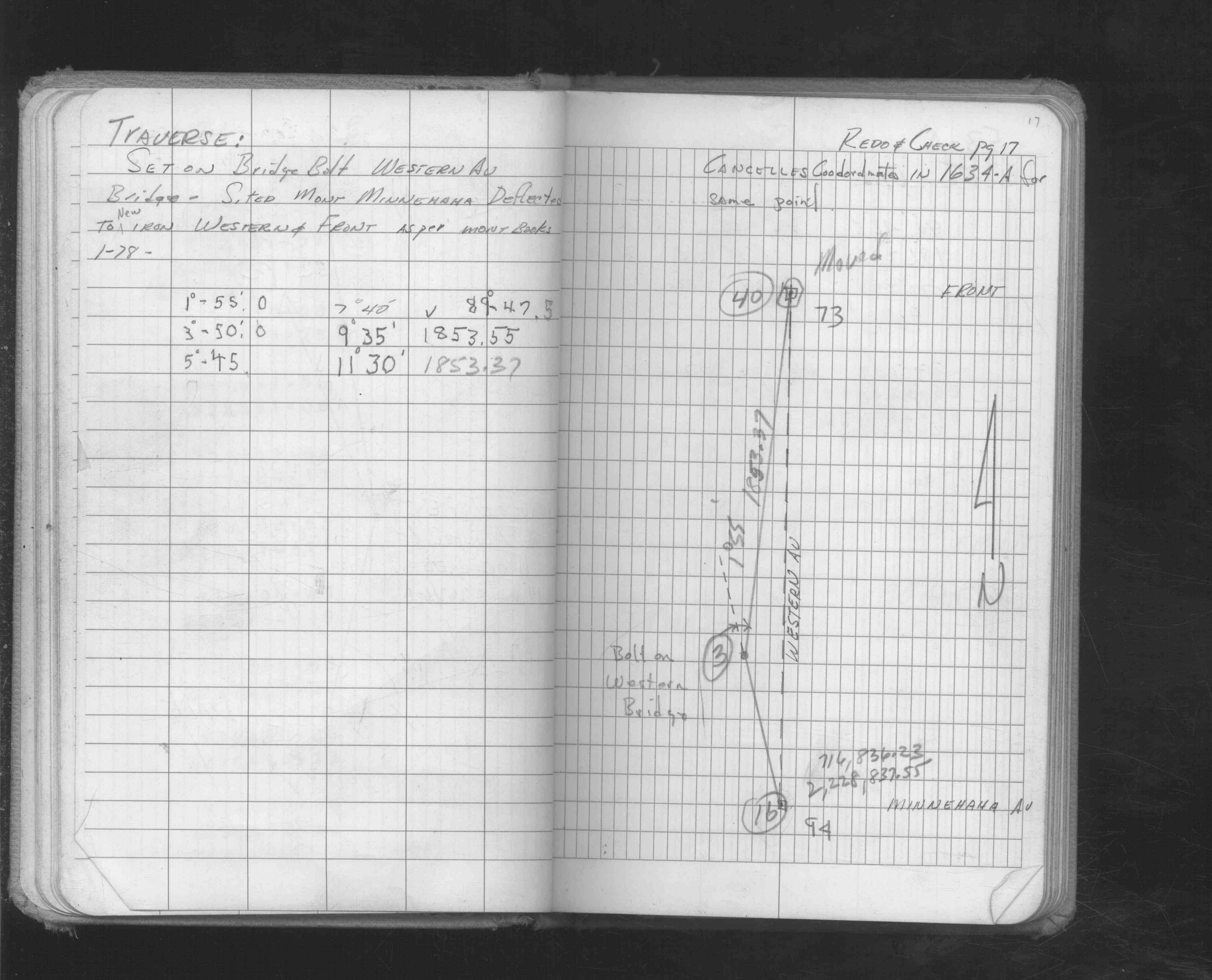
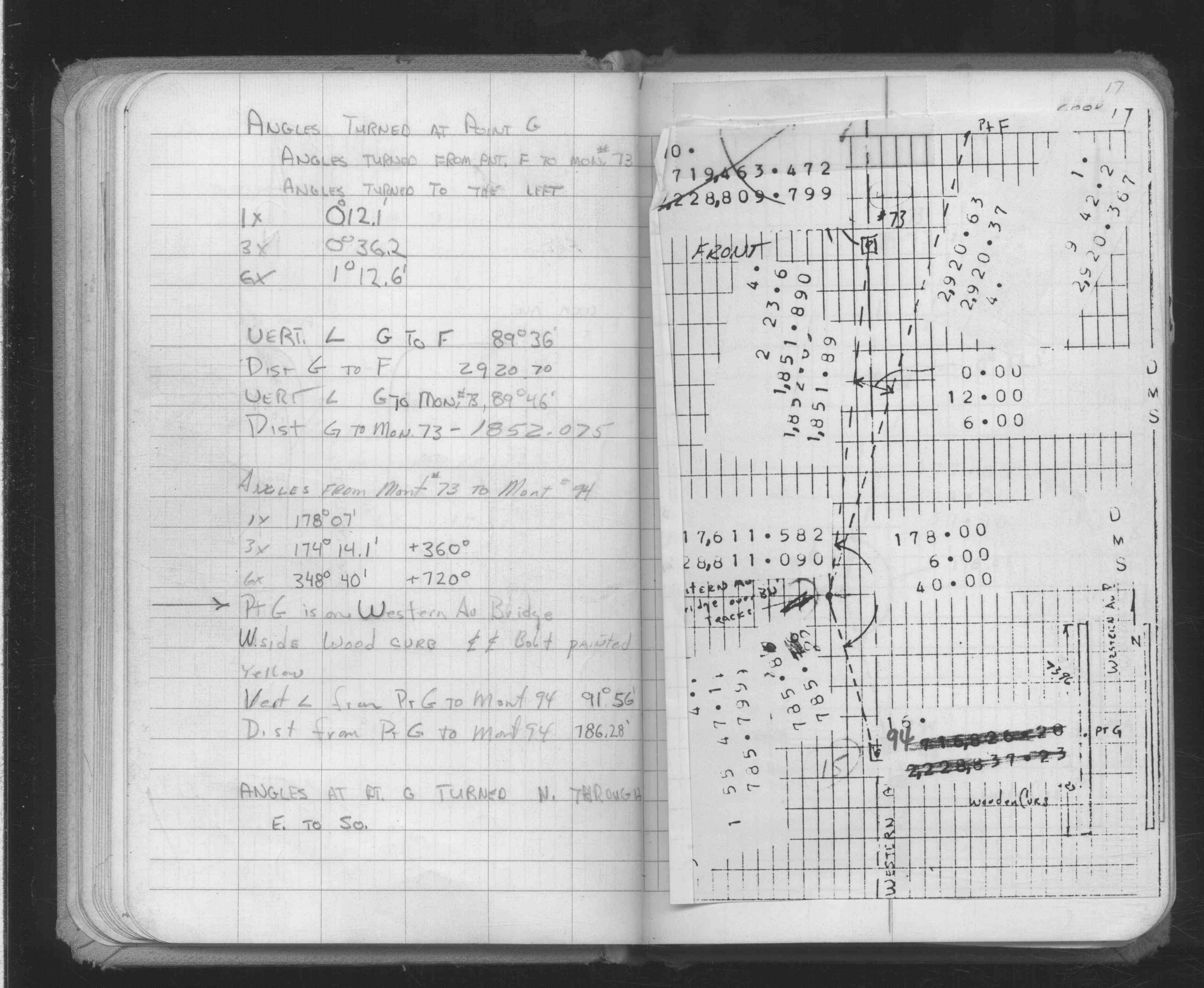
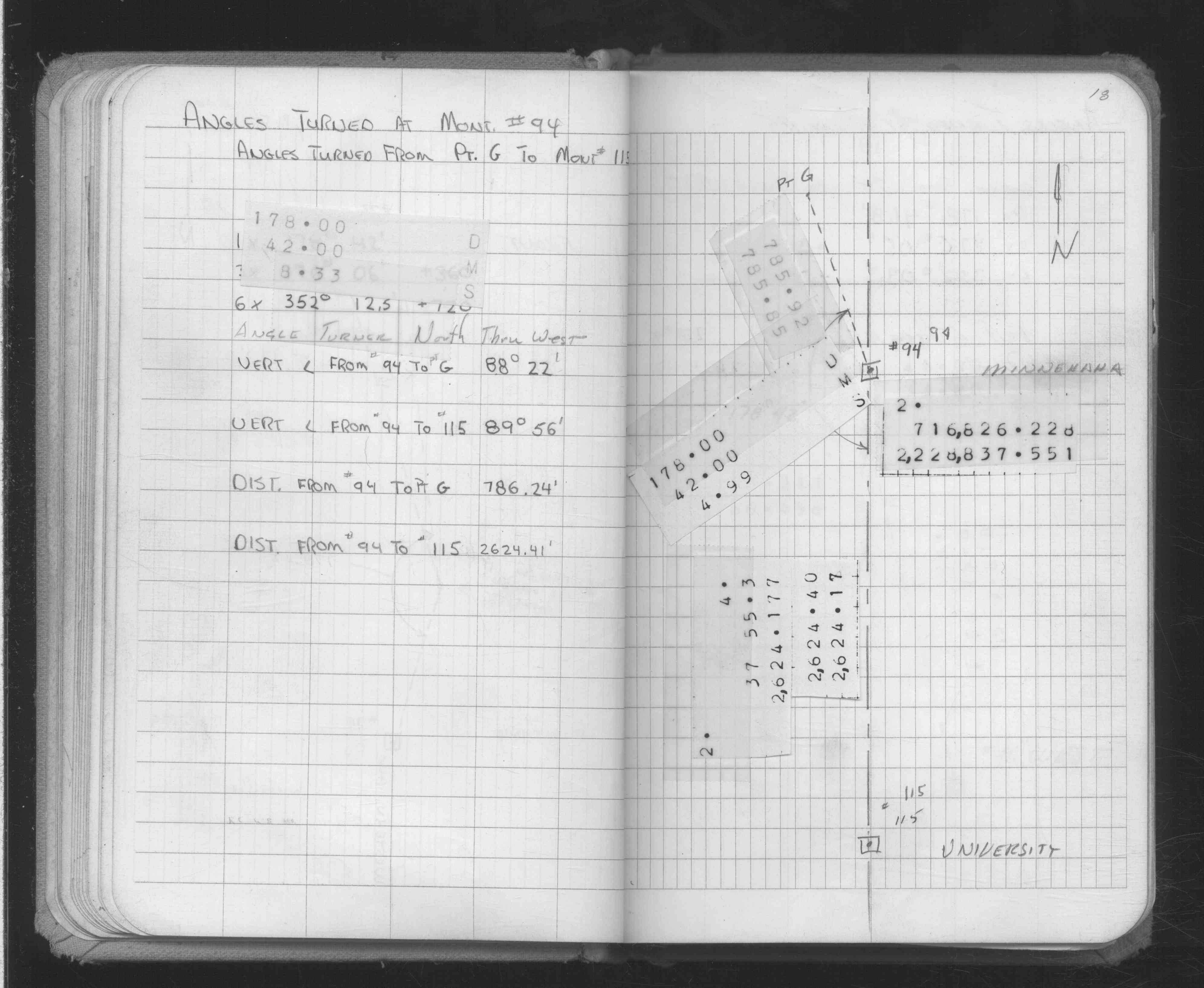
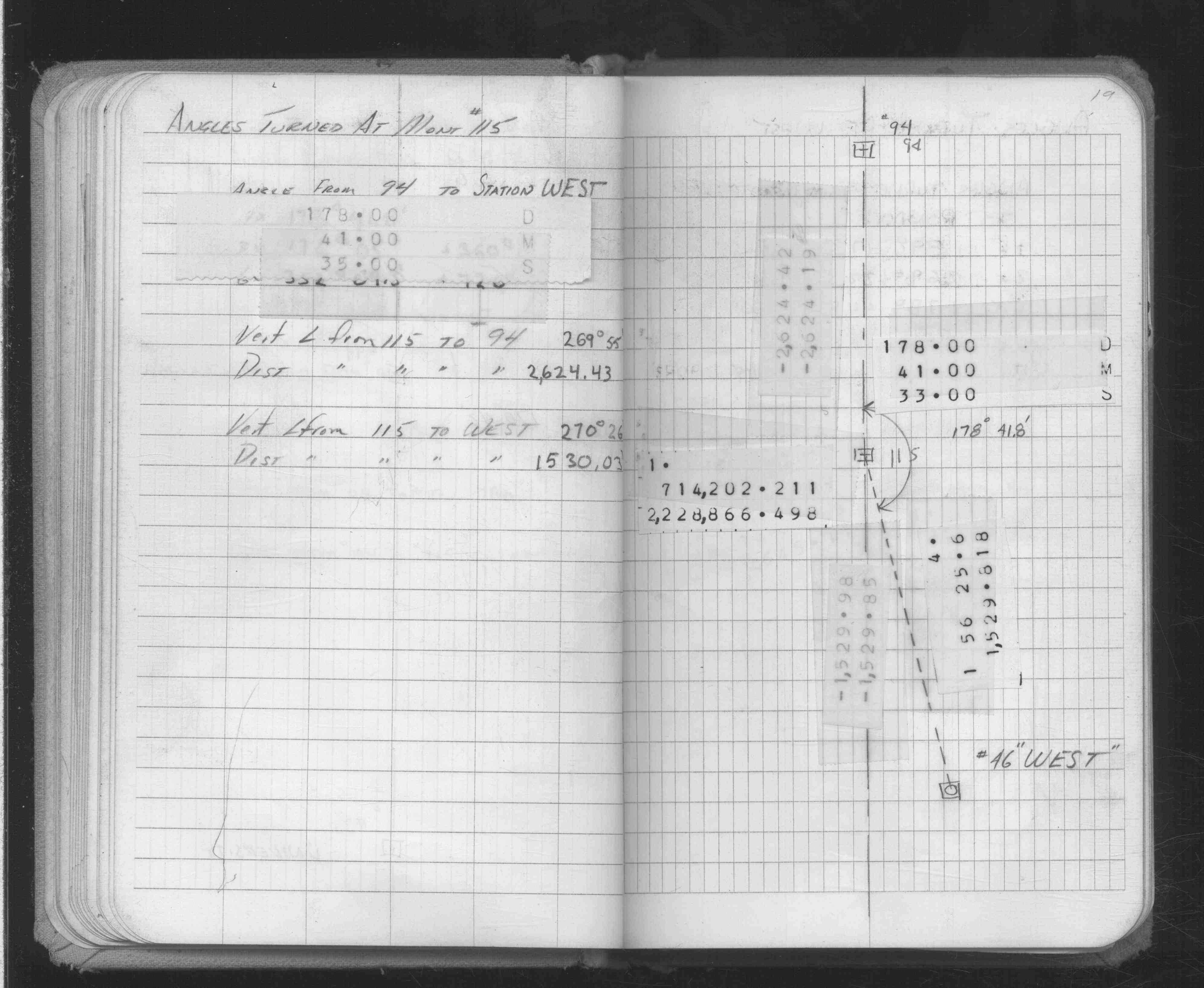
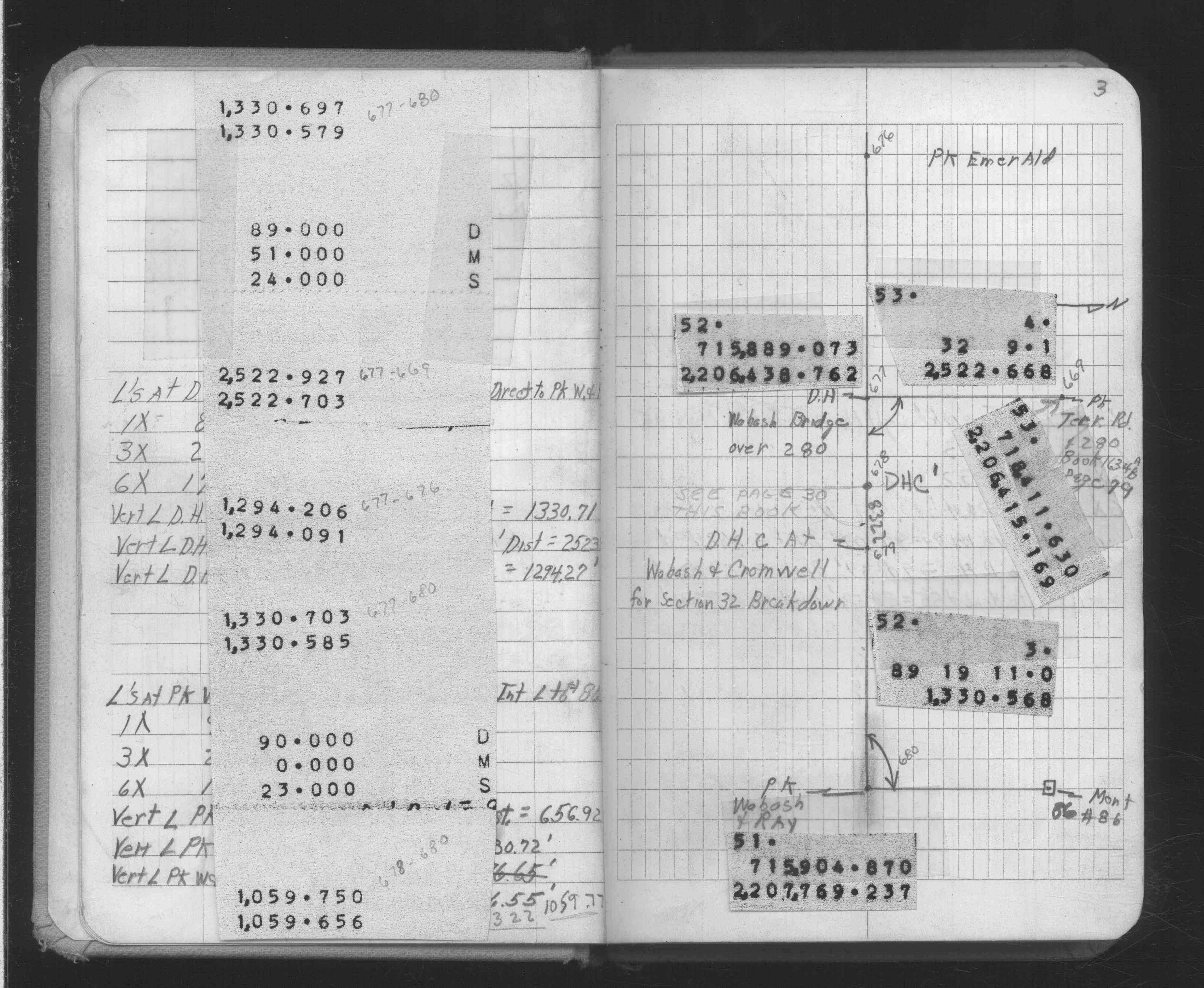
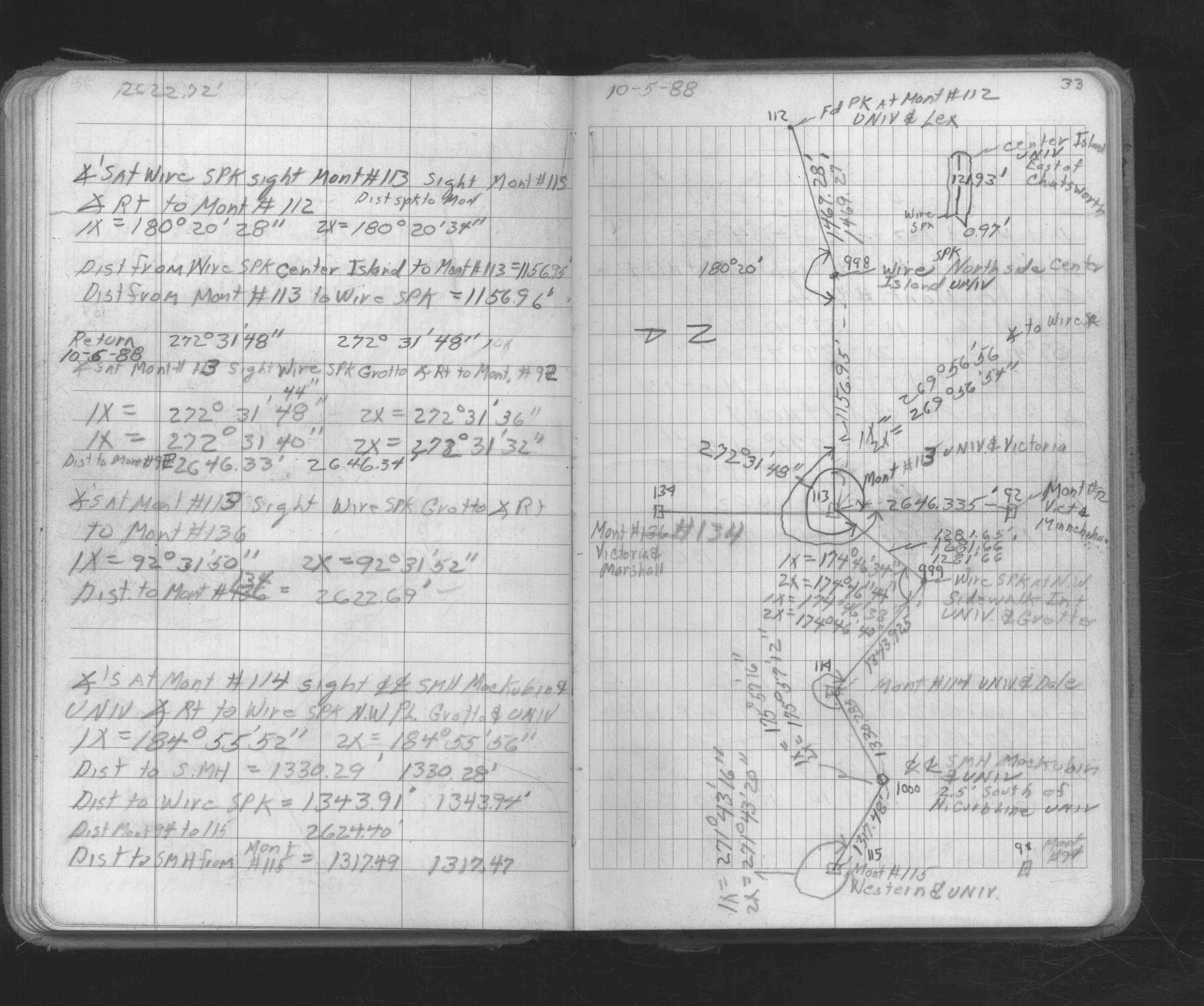
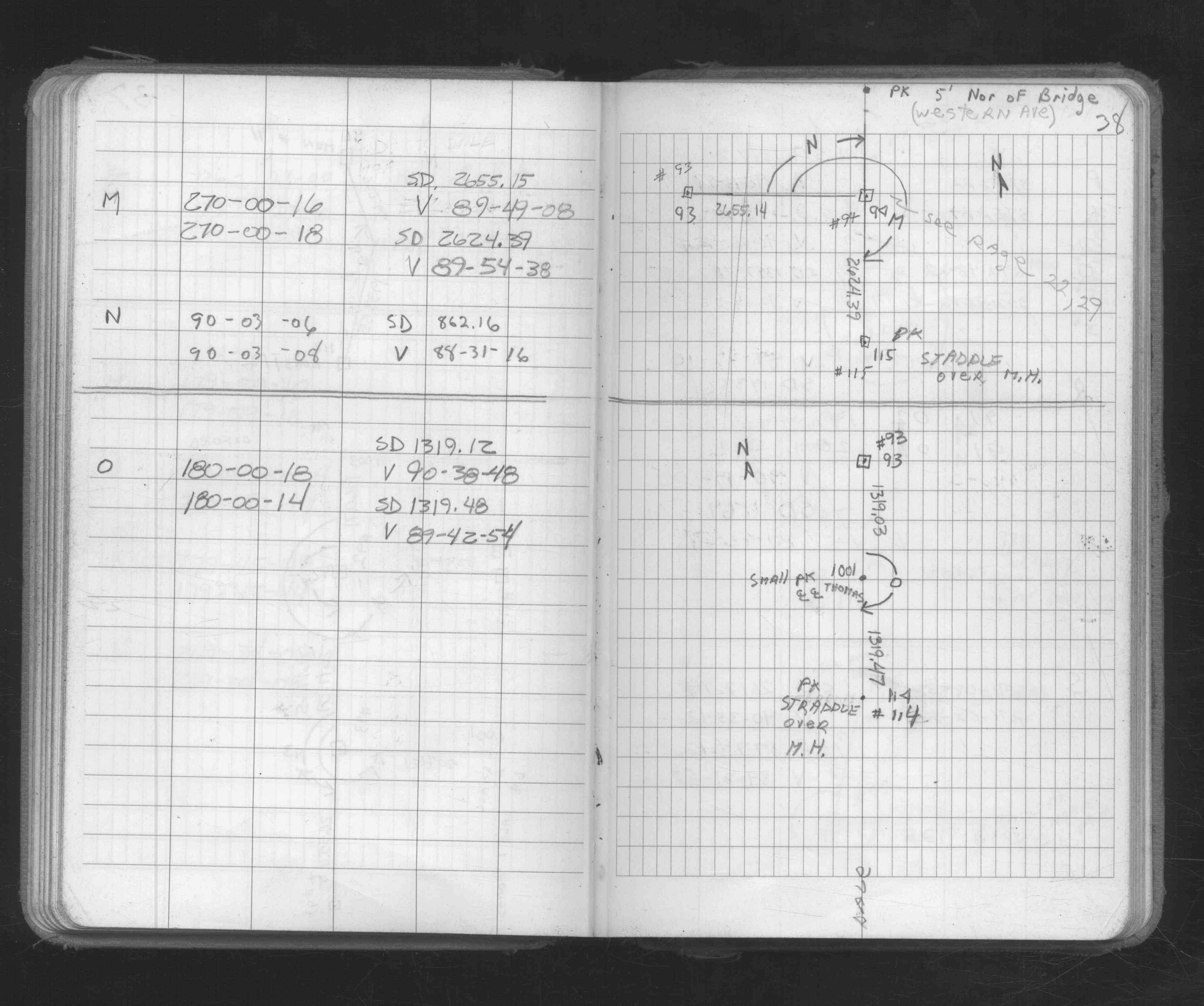
| FB 1735p.22 | ||||||
| FB 1735p.22 | ||||||
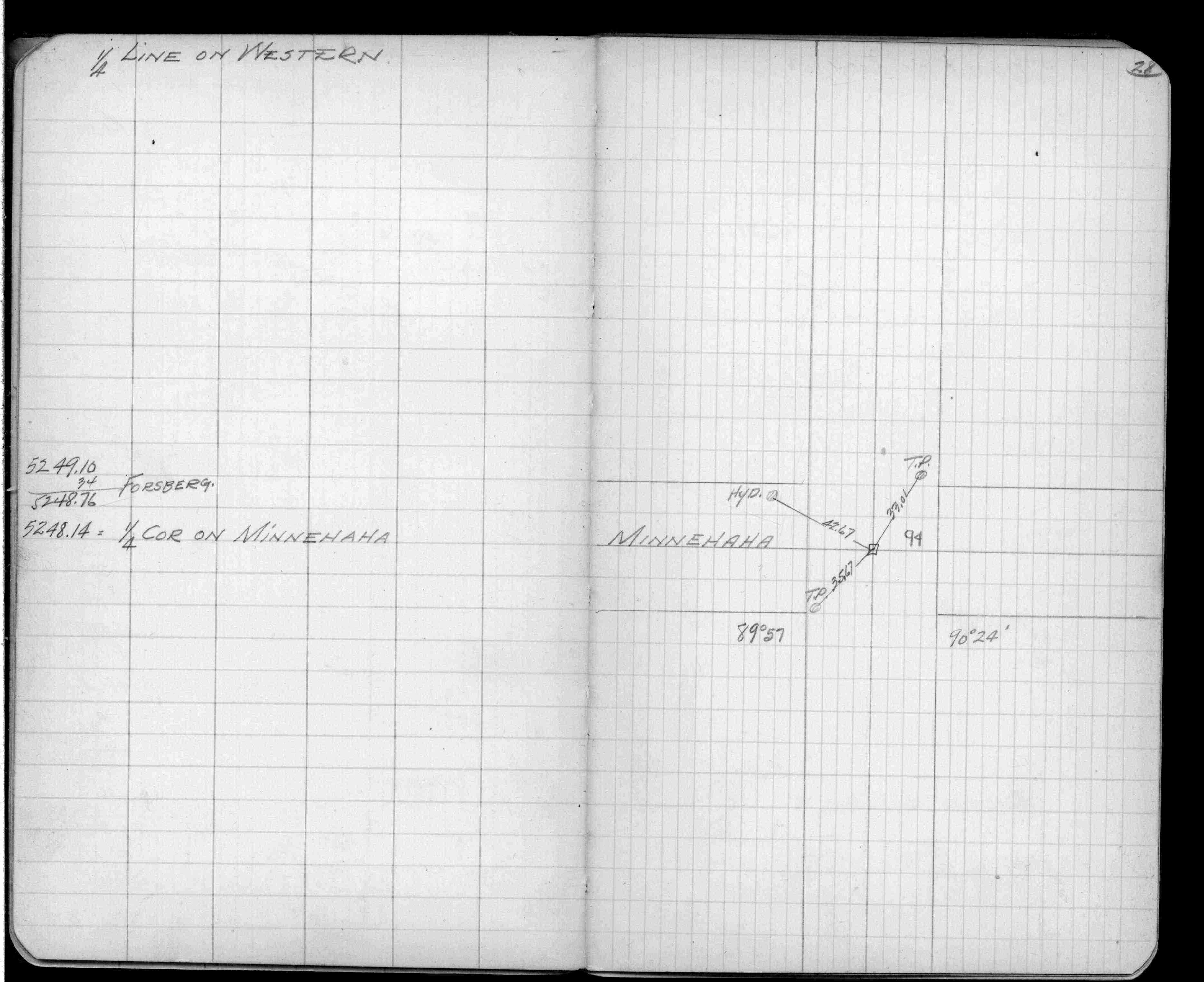
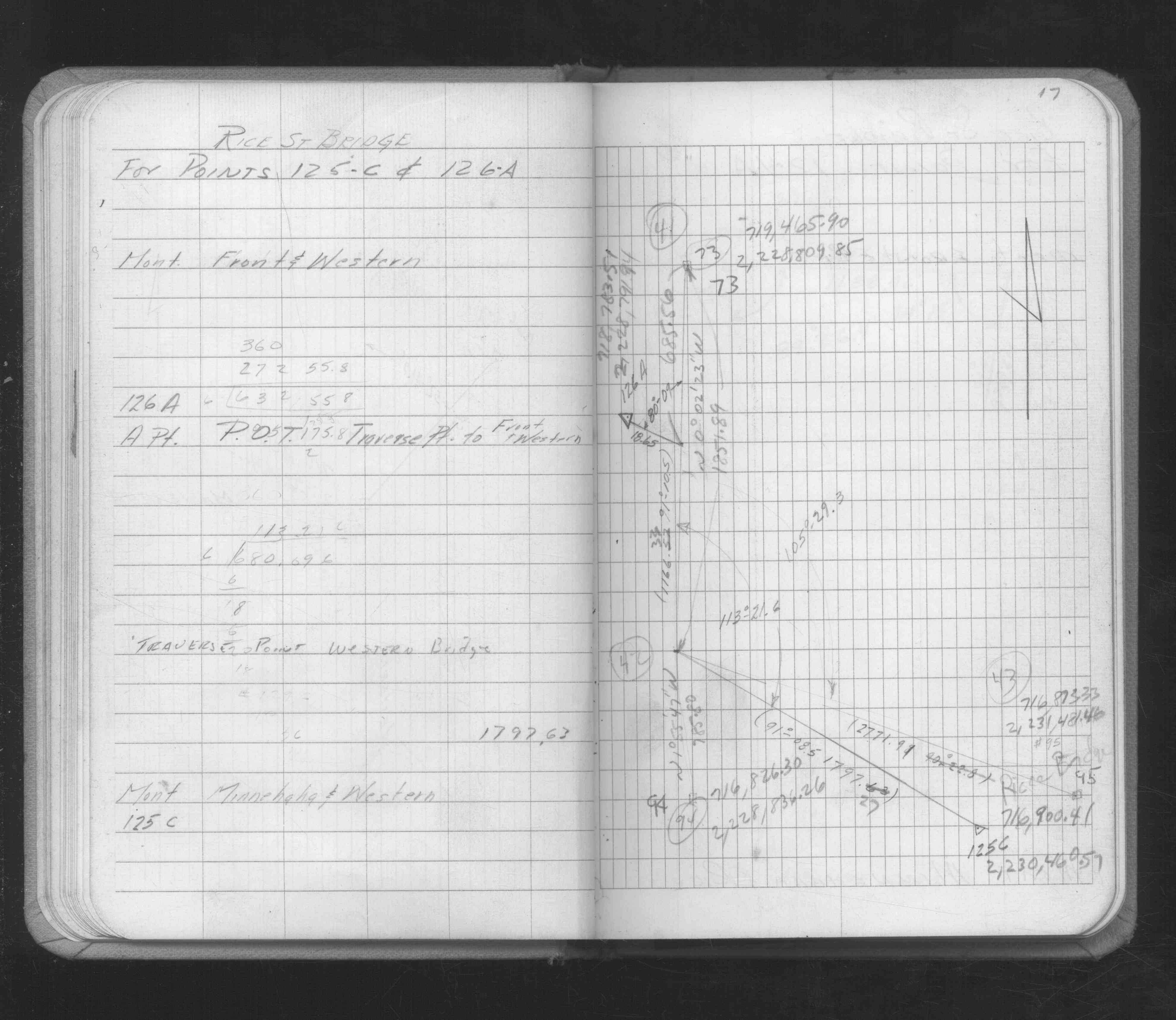
| FB 1736p.23 |
| FILE | SURVEYOR | LIC. NO. | DATE SIGNED | DATE TIED |
|---|---|---|---|---|
| 0094-0059-A.tif | Michael P. Murphy | 41001 | September 22, 2004 | September 18, 2004 |
| ST_079-156p094.jpg | none | none | none | none |
| 0094-0059-A.dwf | none | none | none | none |
| FILE | PHOTO DATE | COMMENTS |
|---|---|---|
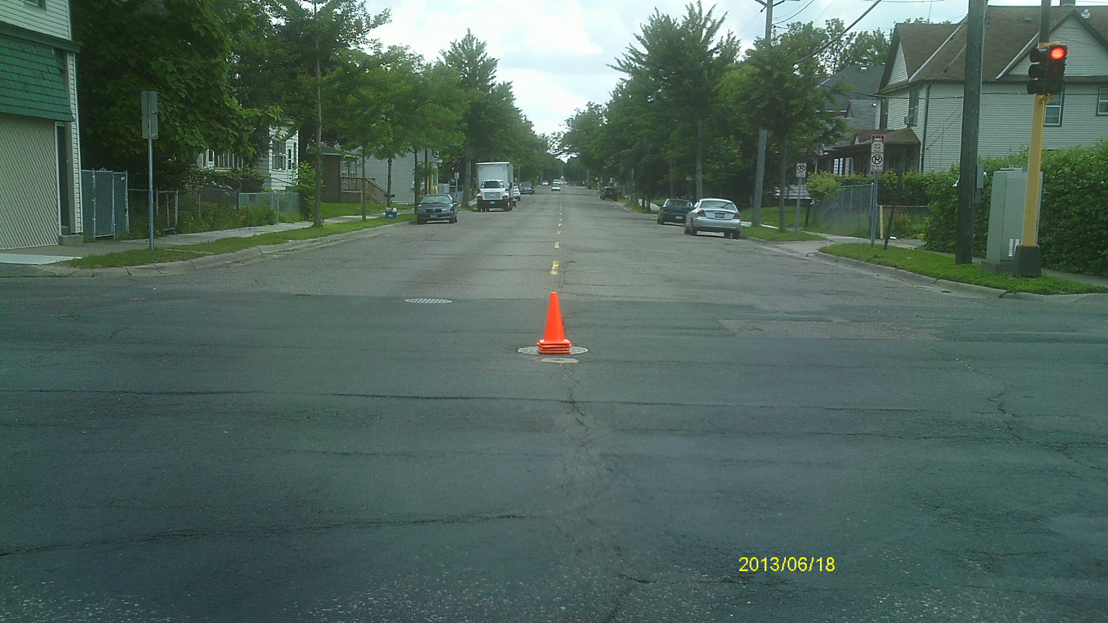
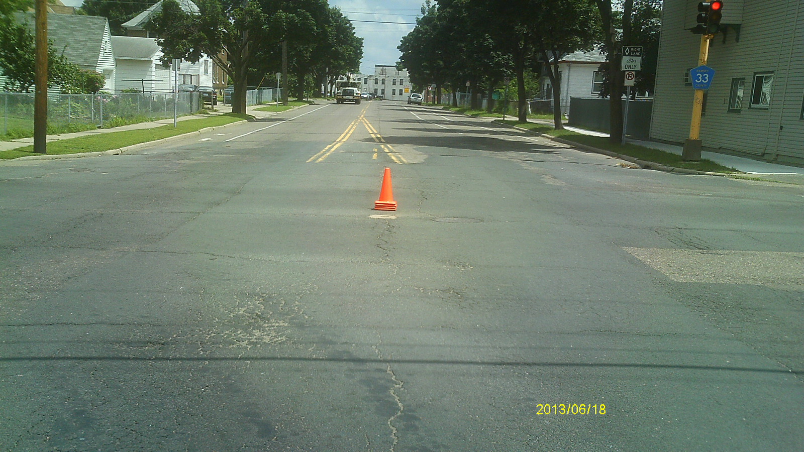
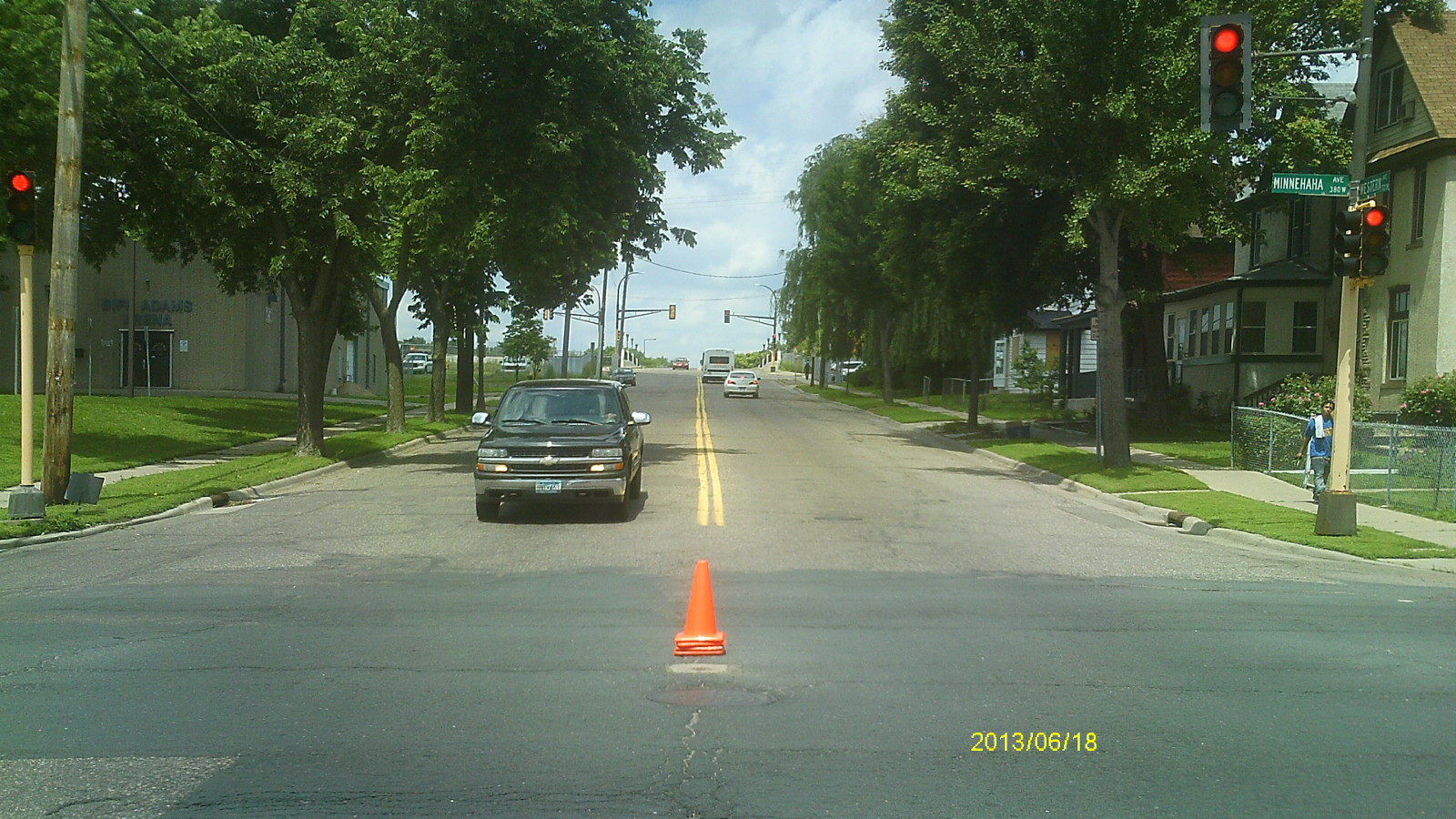
| 0094-0059-5.jpg | June 18, 2013 | Looking west along Minnehaha Ave. |
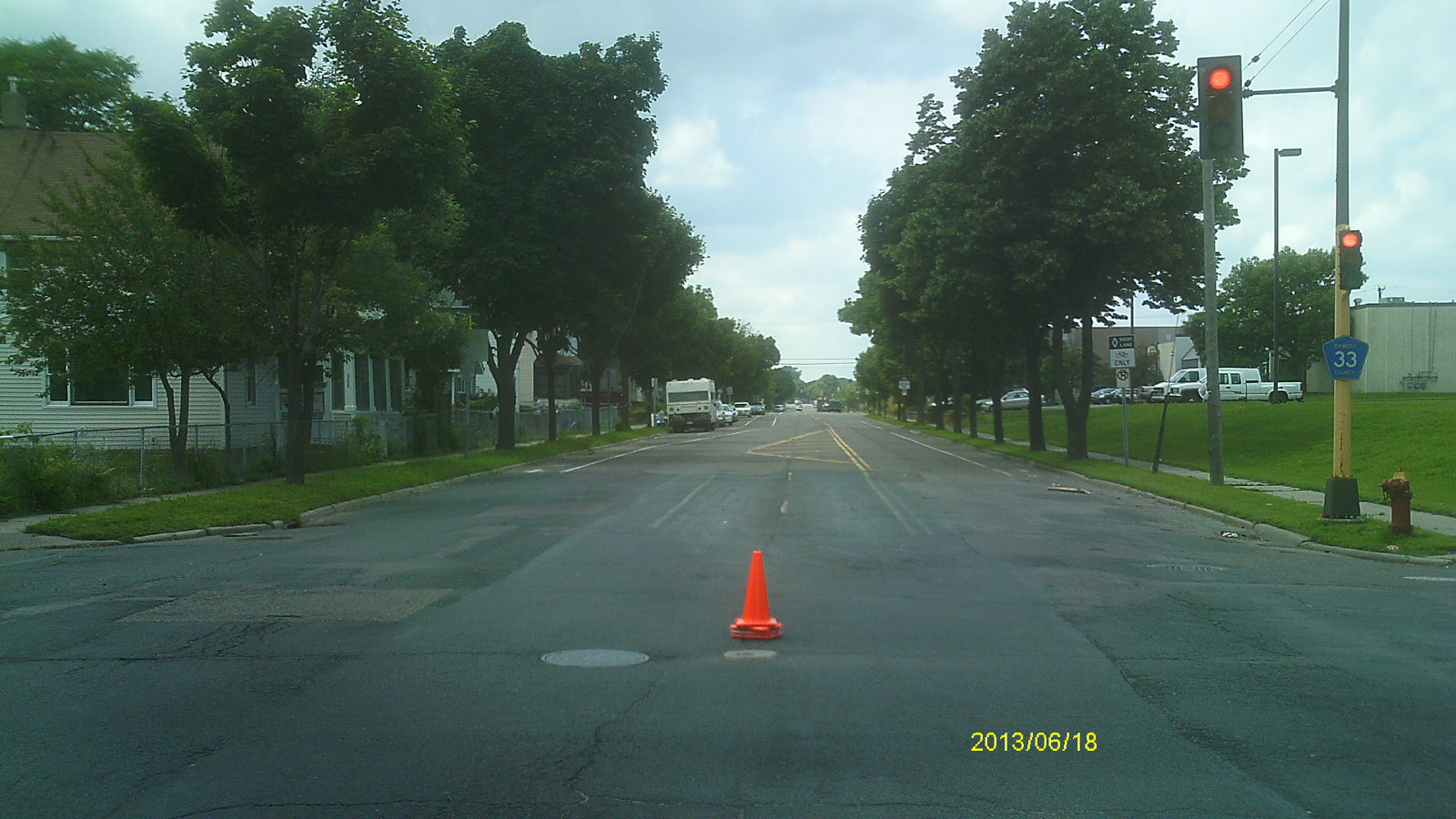
| 0094-0059-4.jpg | June 18, 2013 | Looking south along Western Ave. |
| 0094-0059-3.jpg | June 18, 2013 | Looking east along Minnehaha Ave. |
| 0094-0059-2.jpg | June 18, 2013 | Looking north along Western Ave. |
| 0094-0059-1.jpg | June 18, 2013 | Close up of monument. |