| NAD83 COORDINATES (1986 adj.): |
|---|
| * X= 584766.95 Y= 162857.21 Z= 0 LSQ 12/6/1991 S FLT |
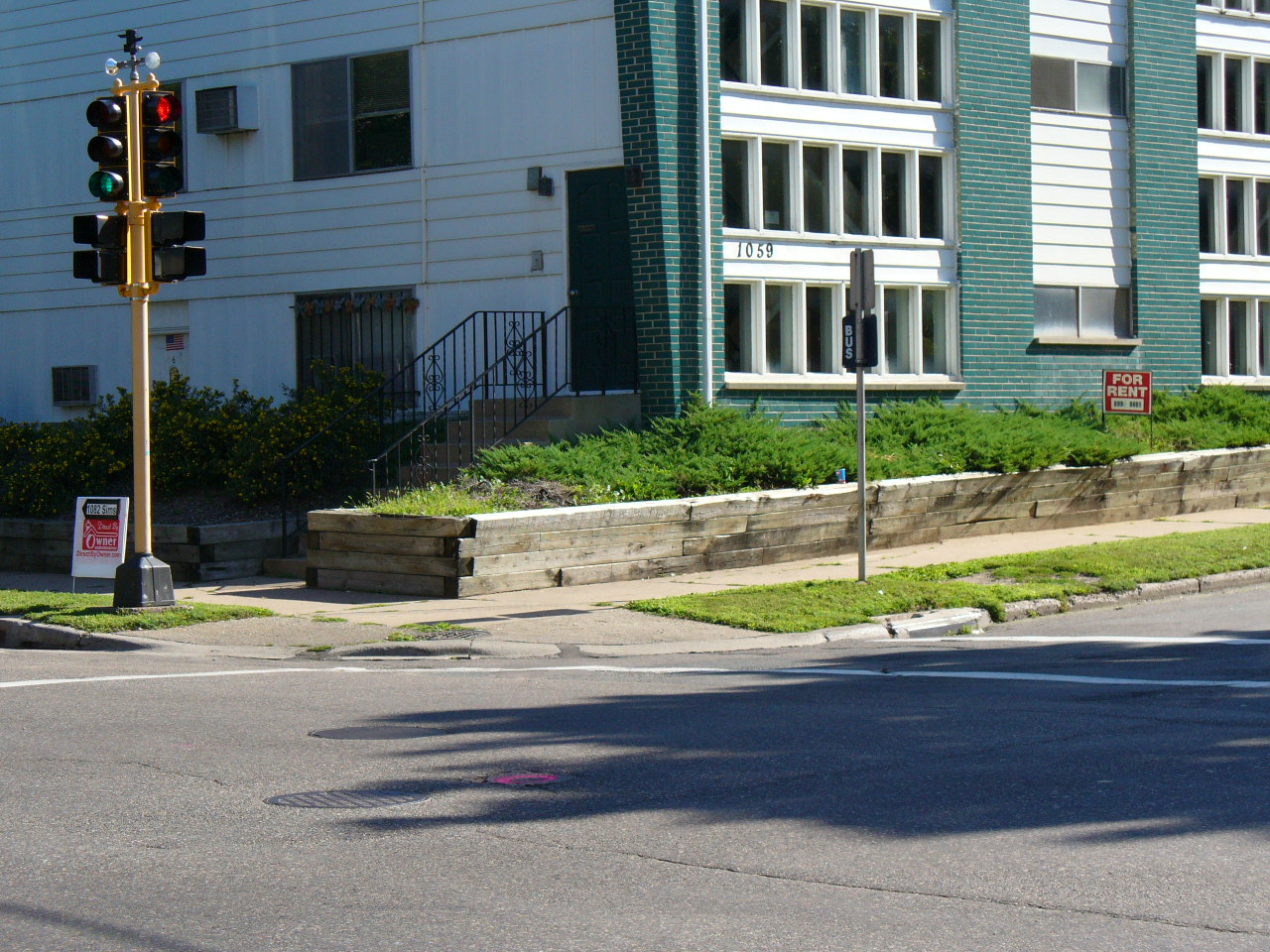
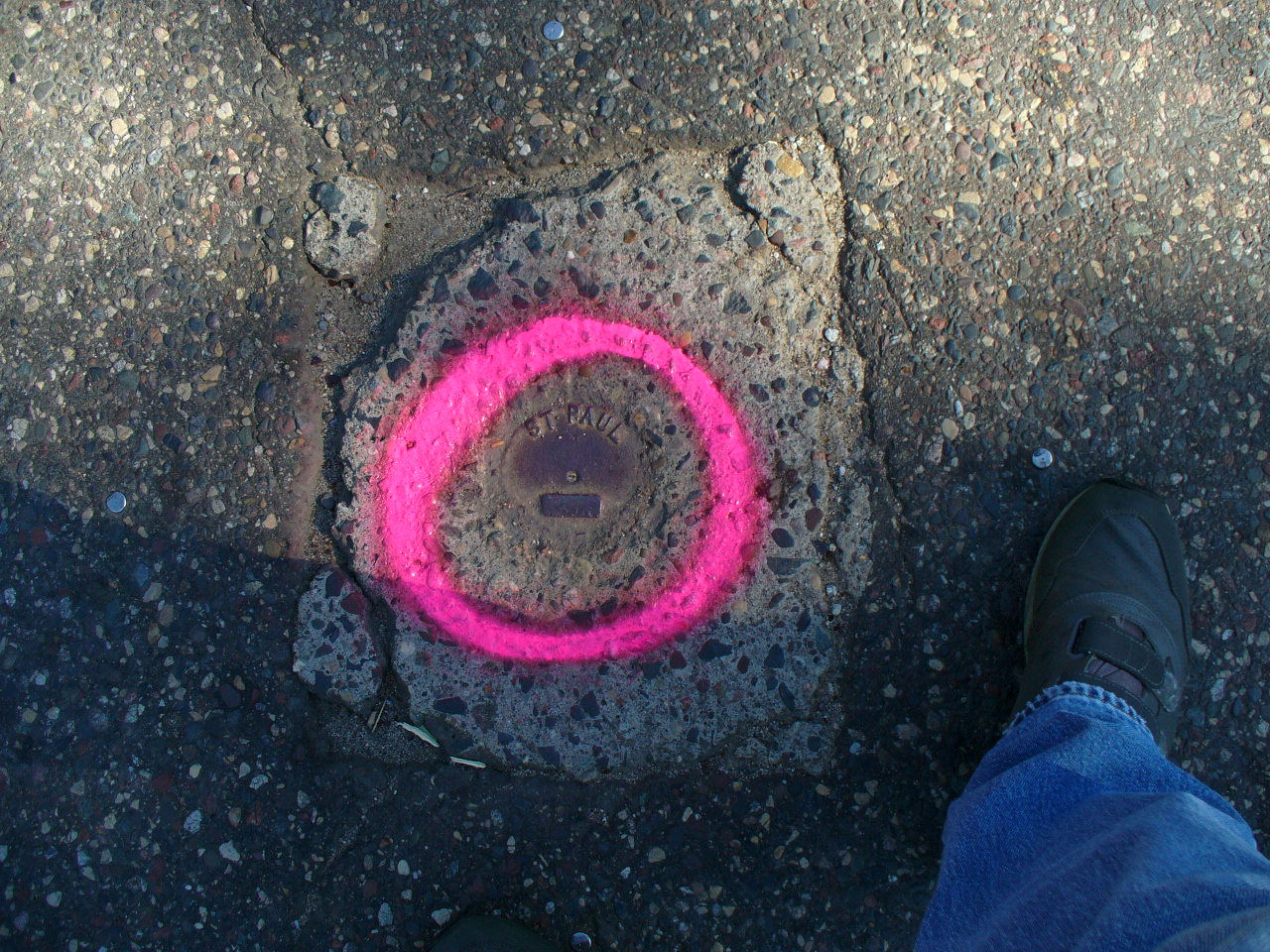
| 7/11/2012 | Found and painted monument at location. |
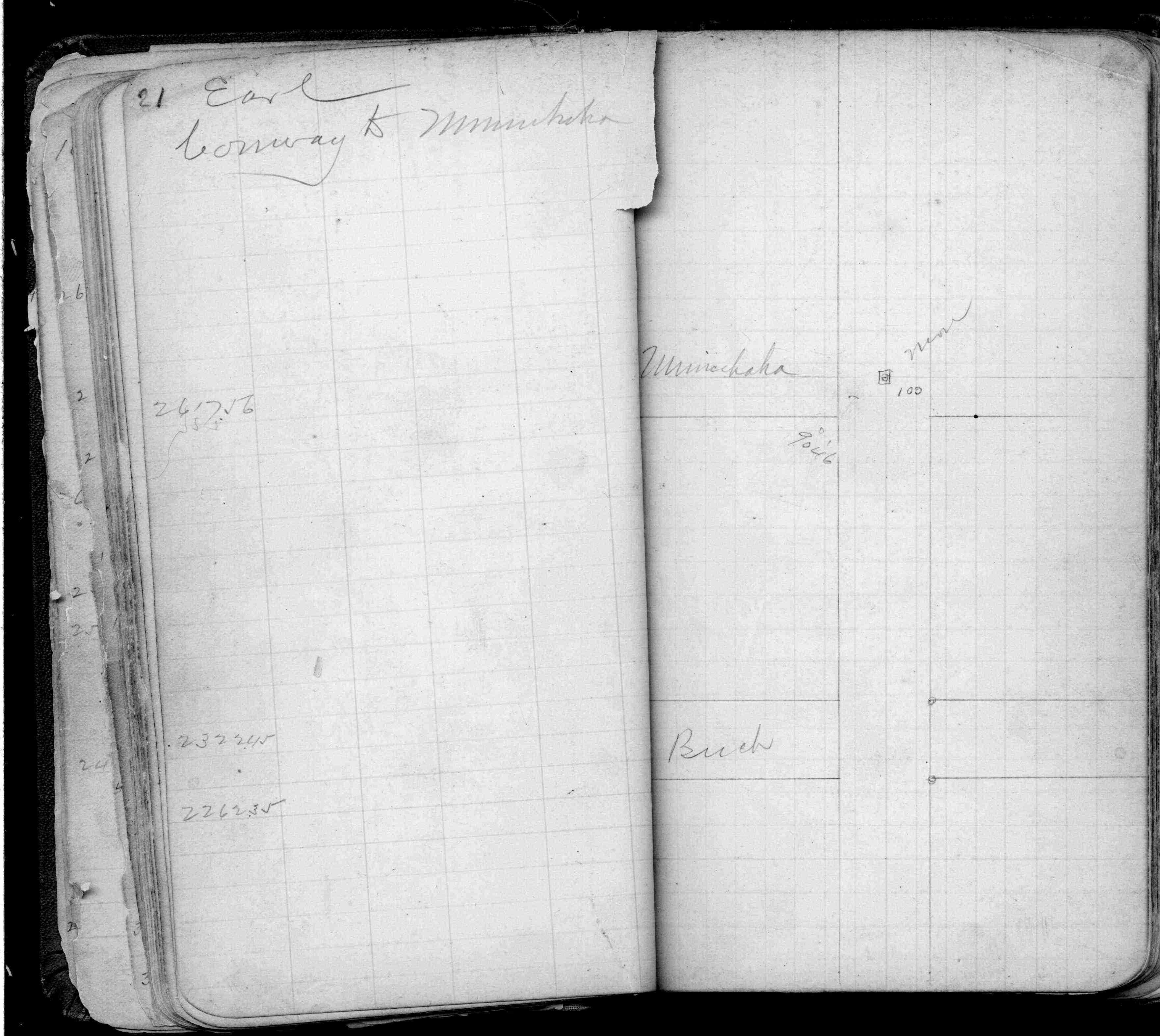
| 8/15/2005 | Fd CIM marked "ST PAUL" set in concrete to grade. Four 1 ft straddles still inplace. Photos taken. |
| 11/2/2002 | Removed broken CIM. Set new CIM 0.03 ft below asphalt street grade. See CofL 0100-0071-B |
| 11/2/2002 | Fd broken CIM 0.2 ft below street grade & four 1 ft straddles. See CofL 0100-0071-B |
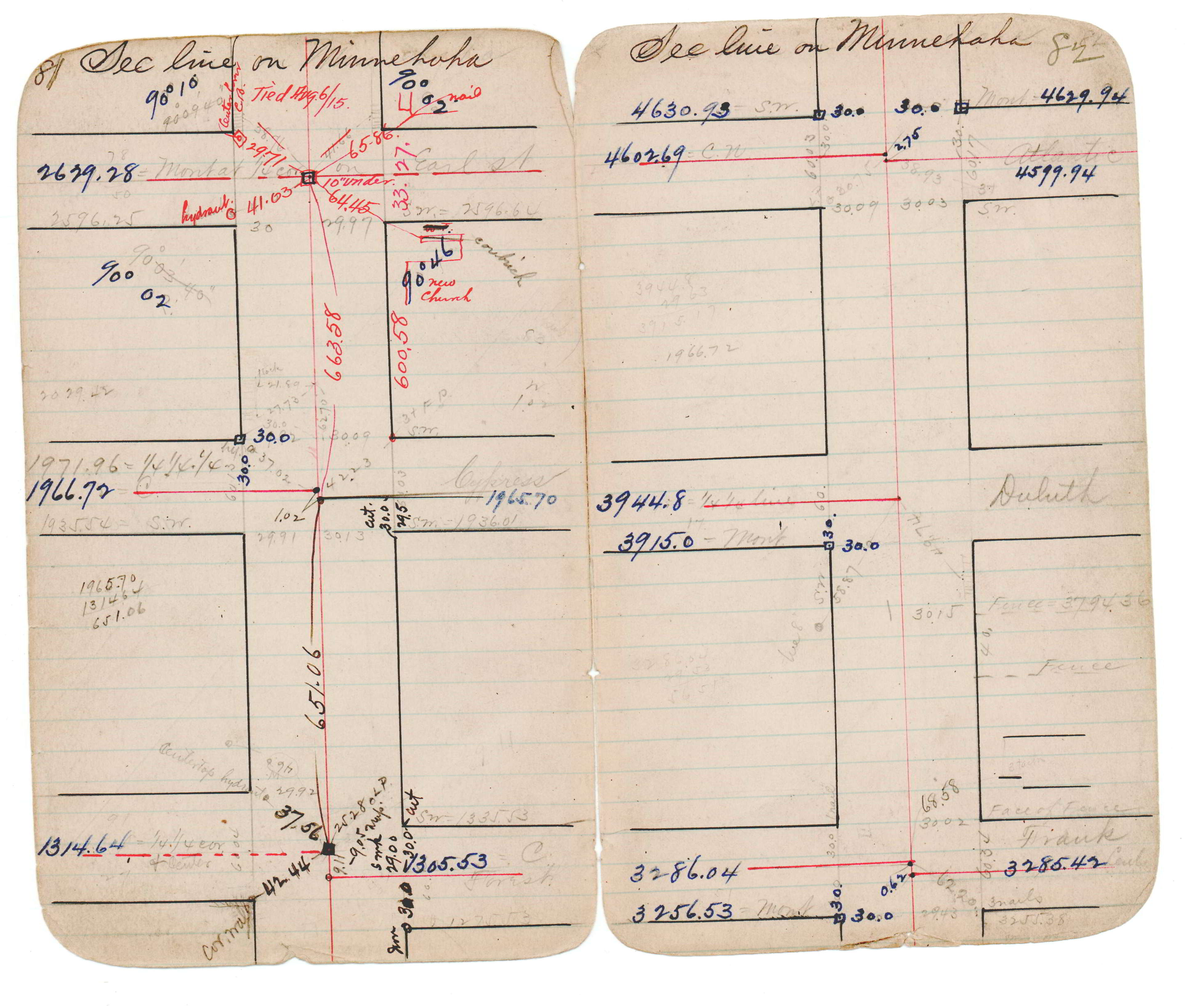
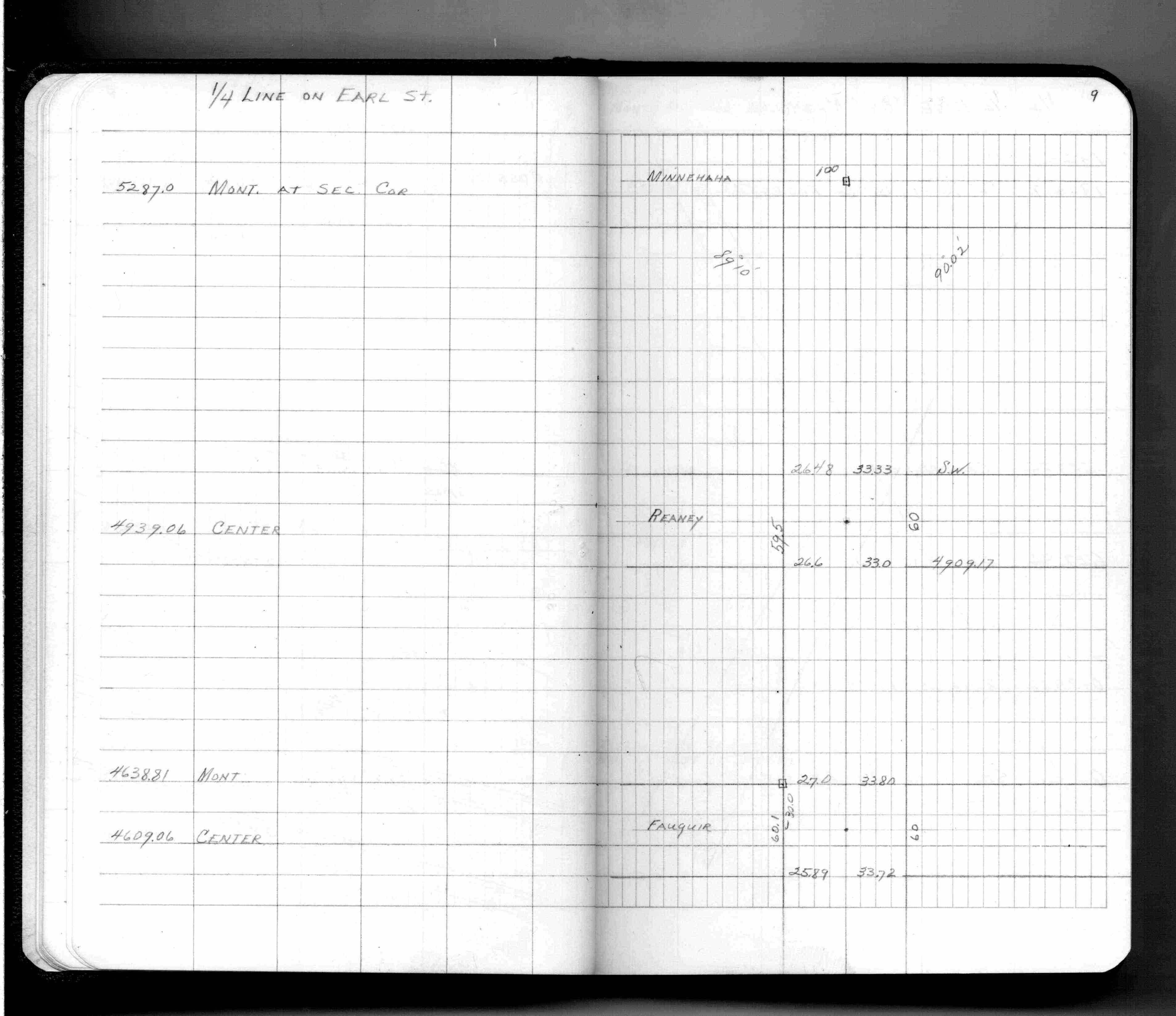
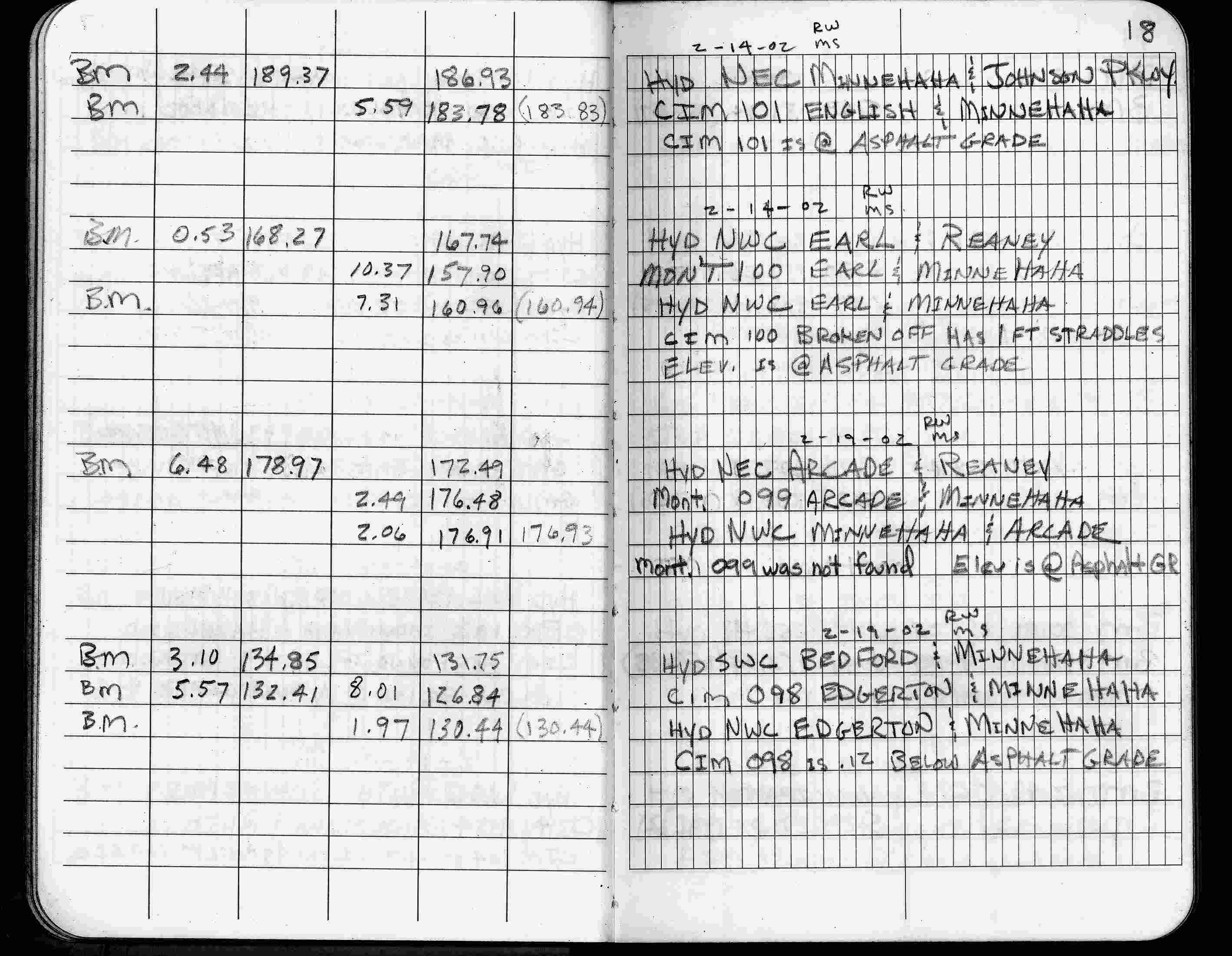
| 2/14/2002 | Elev 157.90 ft on CIM with broken top at asphalt surface, fd 1 ft straddles. See FB 1736 p.18 |
| 3/17/2000 | Fd CIM with top broken off, placed 1 ft straddles (marked for painting target for 2000 aerial) |
| 3/26/1997 | Elev 157.89 ft on CIM. See acorddat/1997/p1157/p1157.sdr Digital-Unadj |
| 7/30/1991 | Recovered CIM & placed ties. See CofL 0100-0071-A |
| 3/1/1987 | (Unknown date Mar __, 1987 ) Fd CIM in concrete 0.1 ft below grade. |
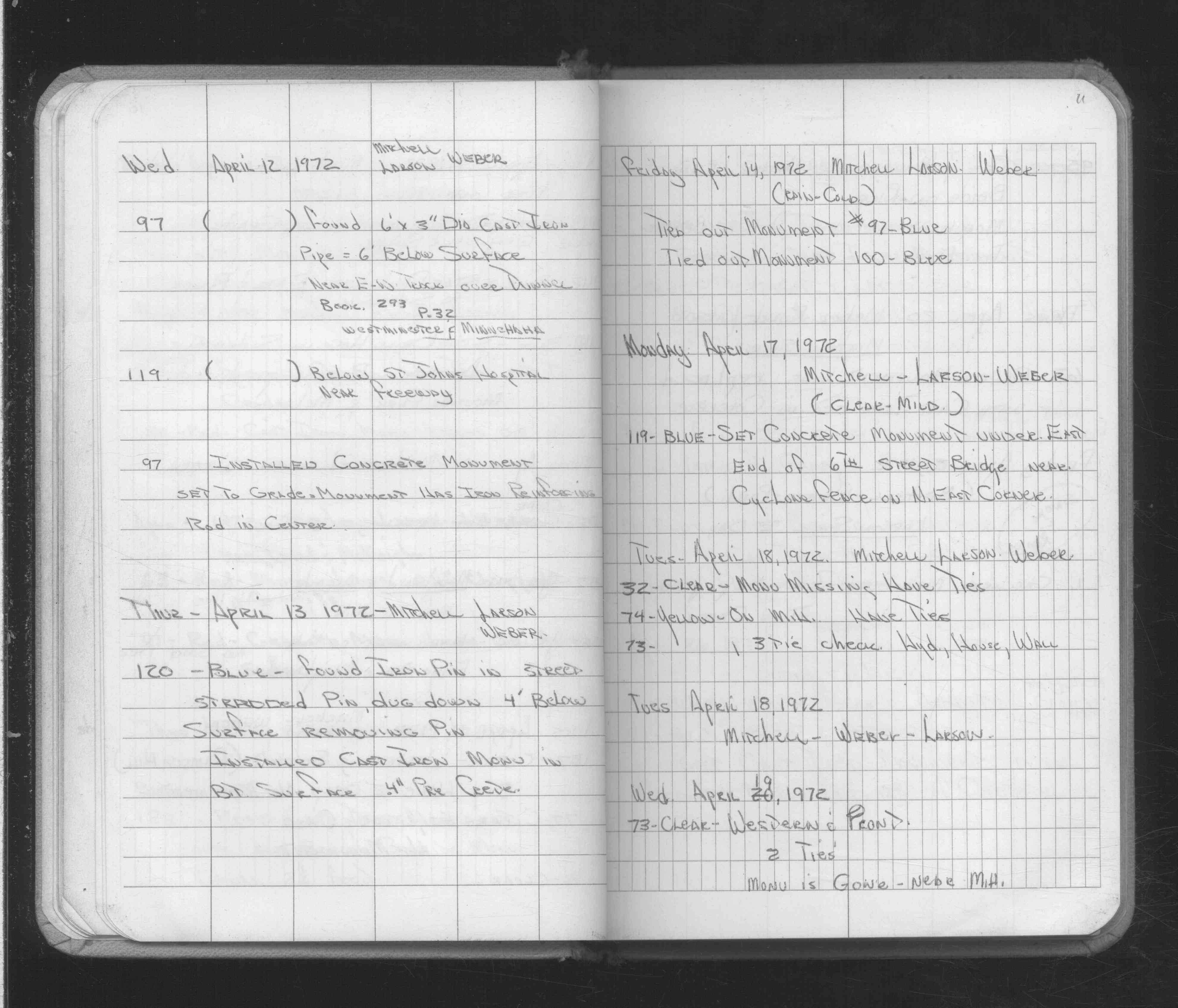
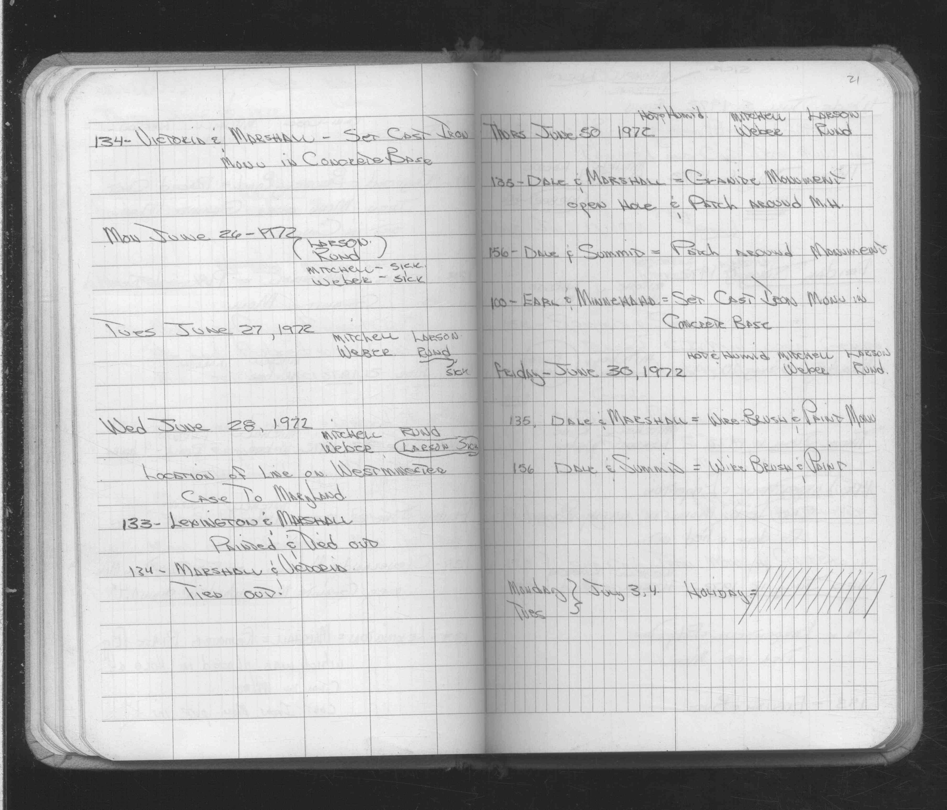
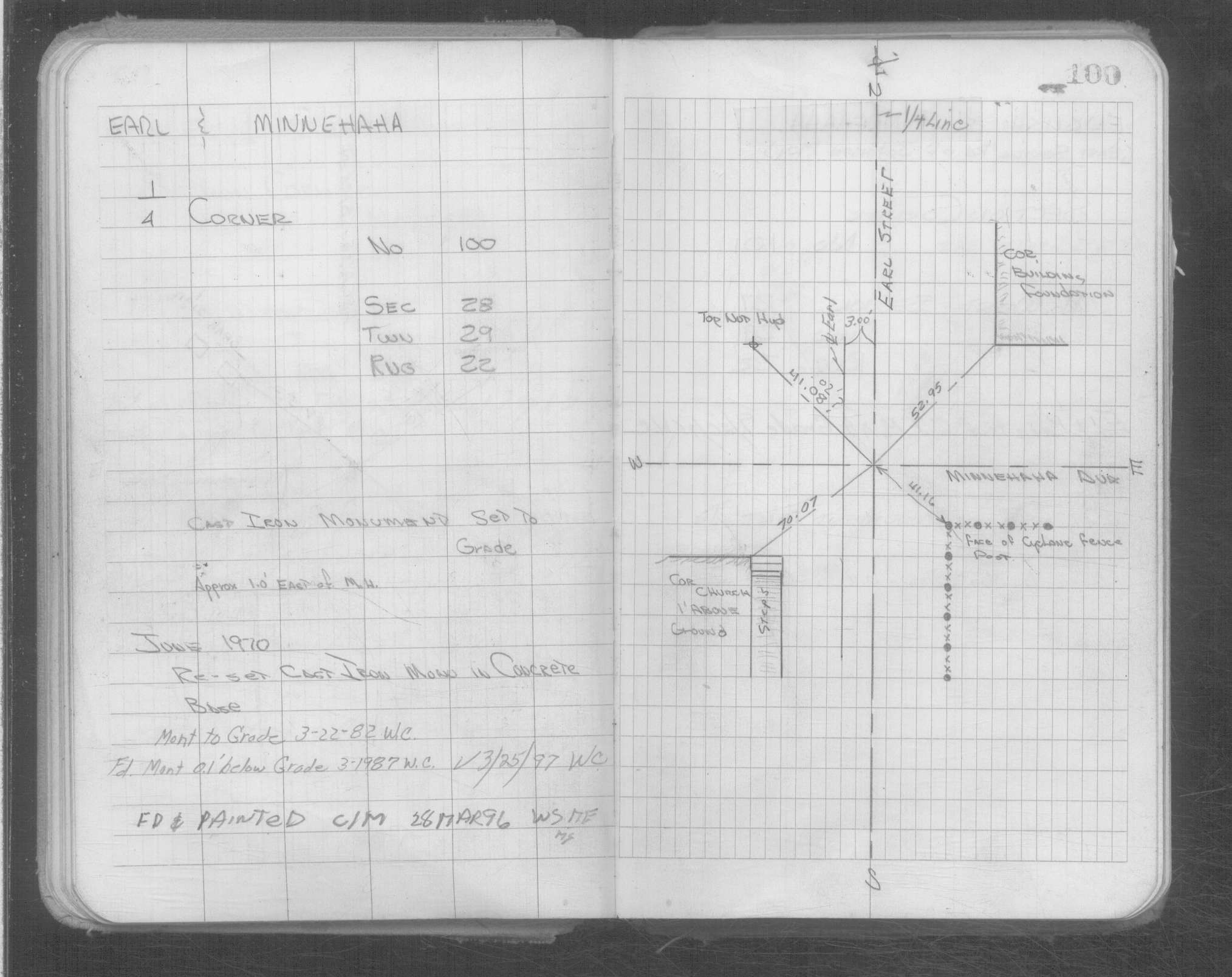
| 6/30/1972 | Set CIM in concrete base. See FB 1689A p.21 |
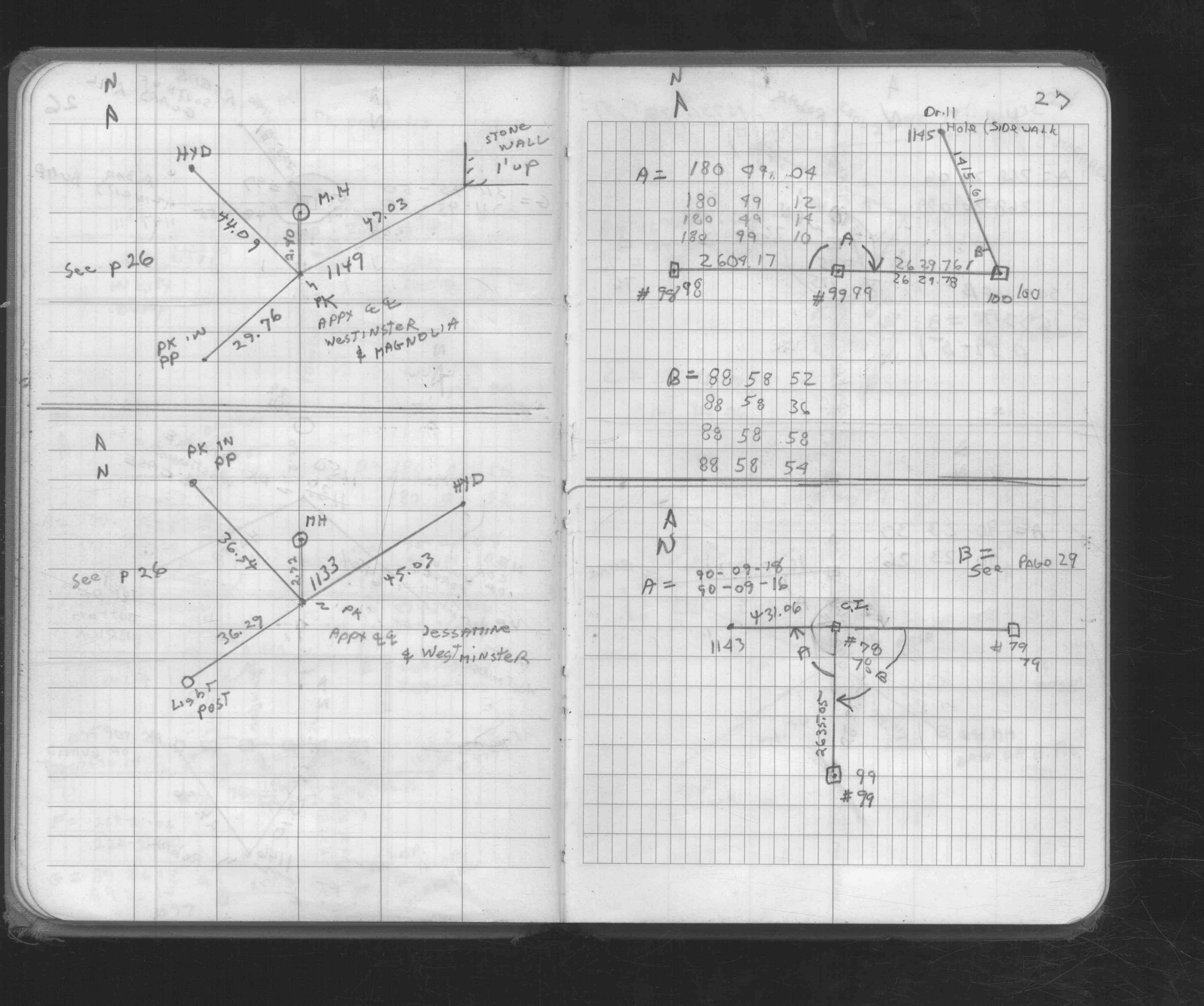
| 4/14/1972 | Placed ties. See FB 1689A p.11 |
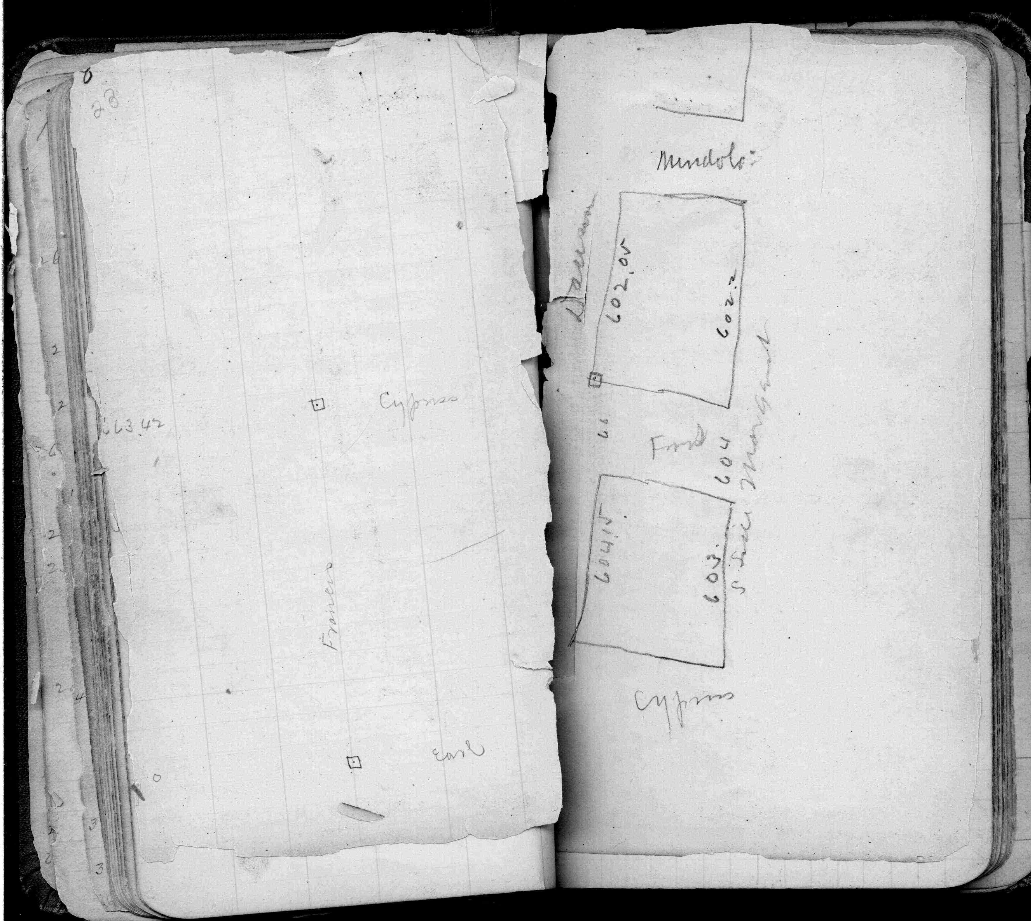
| 2/1/1923 | (Unknown date Feb __, 1923 ) Placed ties. See FB 1055 p.14 |
| 1/1/1895 | (Unknown date Jan __, 1895 ) Monument OK - J H Armstrong |
| 1/25/1890 | Tied in by Chas Hunt |
| 1/1/1887 | (Unknown date Jan __, 1887 ) Note - January 1887 Minnehaha St grades to correspond with the stakes in Terry's Add |
| 1/1/1887 | (Unknown date ___ __, 1887 ) Monument not disturbed by grading Minnehaha St in 1887 - Chas Hunt |
| 3/1/1877 | (Unknown date Mar __, 1877 ) 1/4 post put in from both stumps. |
| 11/1/1847 | (Unknown date Nov __, 1847 ) Isaac N Higbee deputy surveyor set post. Tied to 2 BTs. See IH p.198-199 2922 |
| 1/1/1800 | (Unknown date ___ __, ____ ) See JBI 12 p.81-82 |
| 1/1/1800 | (Unknown date ___ __, ____ ) Note this point comes 1.6 E and 1.3 S of 1/4 post according to stakes in Terry's Add |
Above is NOT an all inclusive history of this point. Please review all the links below.
| PLS NOTES | Field | Cross Section | Sewer | J.B. Irvine | Monument | River Survey |
|---|---|---|---|---|---|---|
| IH p.198-199 | FB 0197p. 21 ,23 | JBI 12 p.81-82 | ||||
| FB 0206p.30 | ||||||
| FB 0298CPYp. 09 ,28 | ||||||
| FB 0348p.17 | ||||||
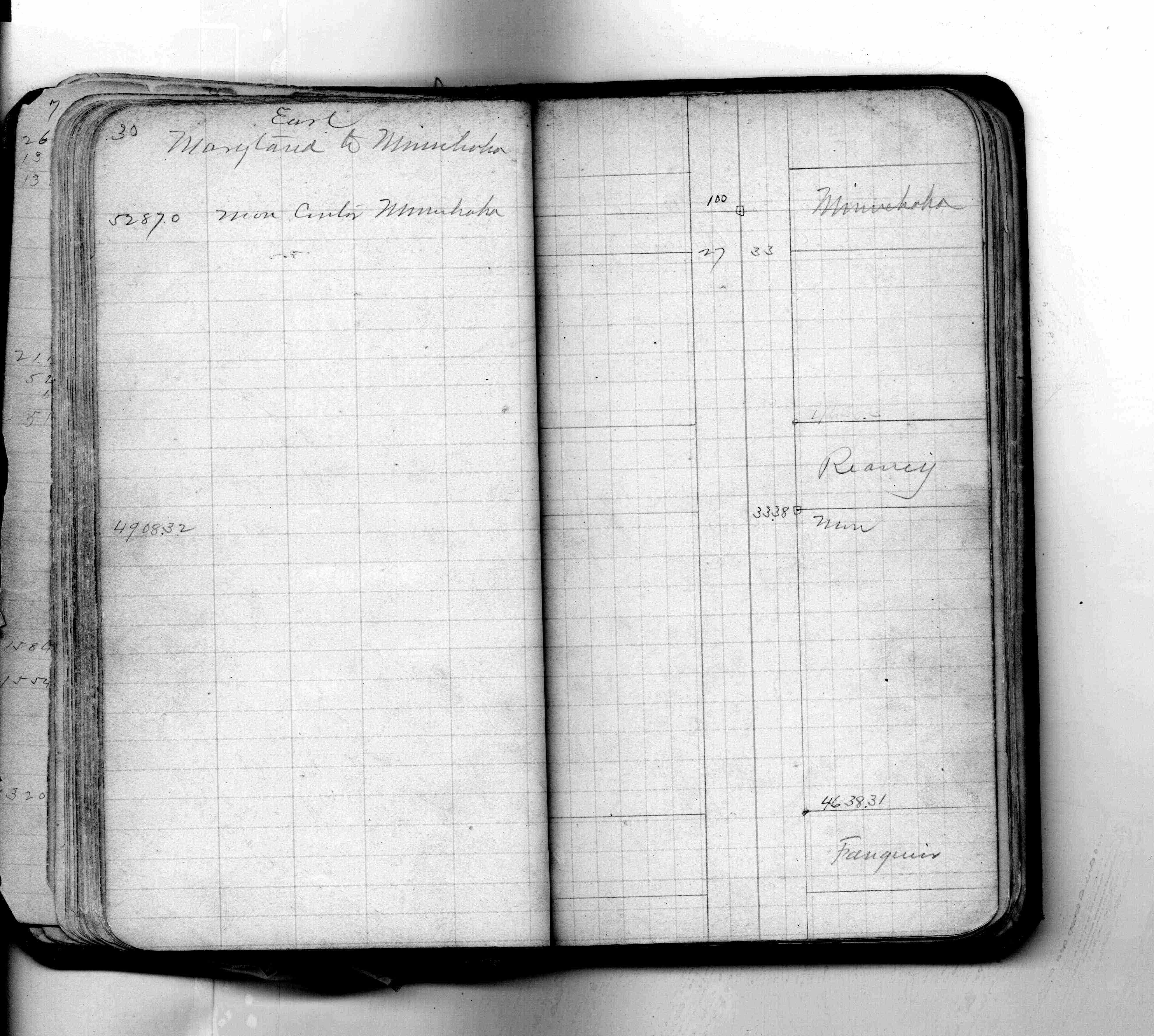
| FB 1055p.14 | ||||||
| FB 1055p.14 | ||||||
| FB 1549Cp.38 | ||||||
| FB 1634Bp.60 | ||||||
| FB 1634Dp. 54 ,55 ,56 | ||||||
| FB 1676Cp. 27 ,29 ,30 | ||||||
| FB 1689Ap.11 | ||||||
| FB 1689Ap.21 | ||||||
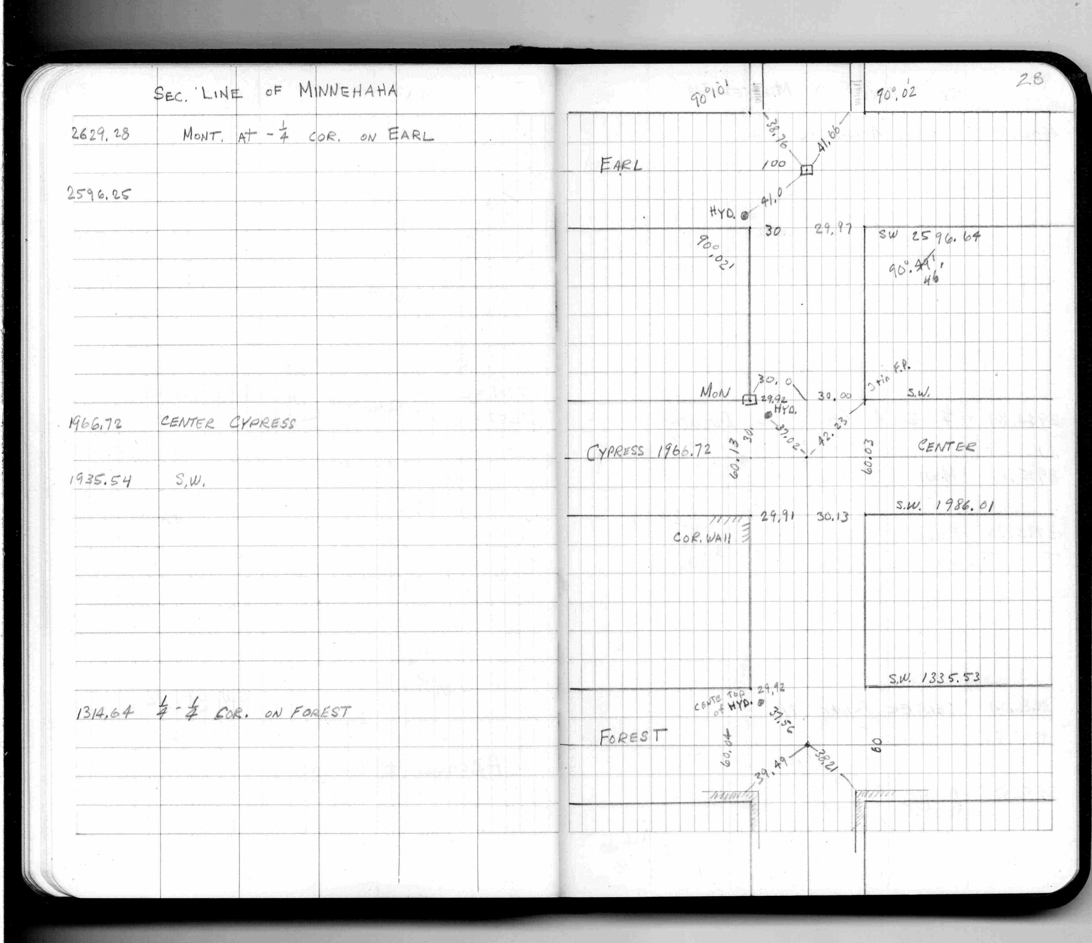
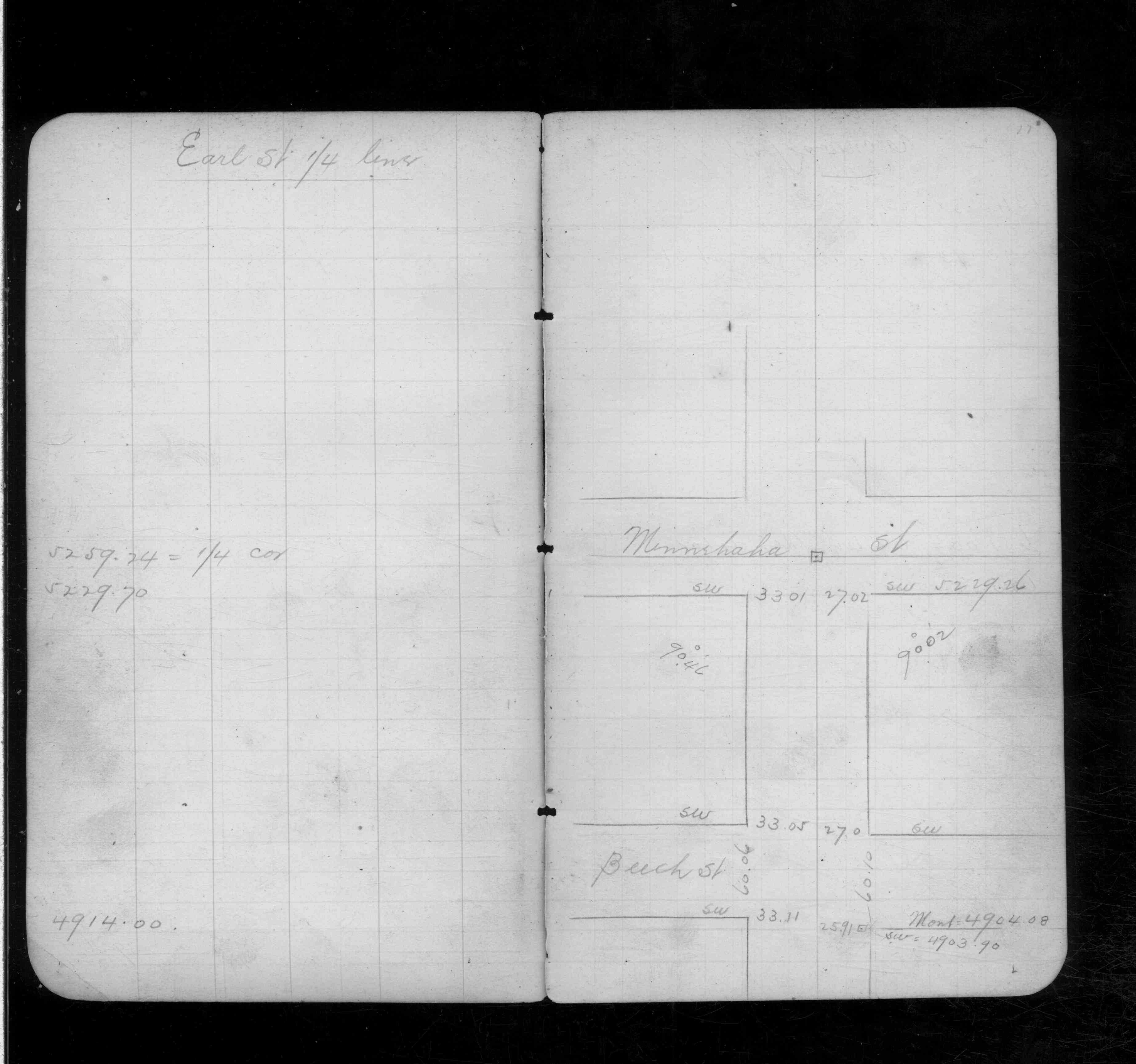
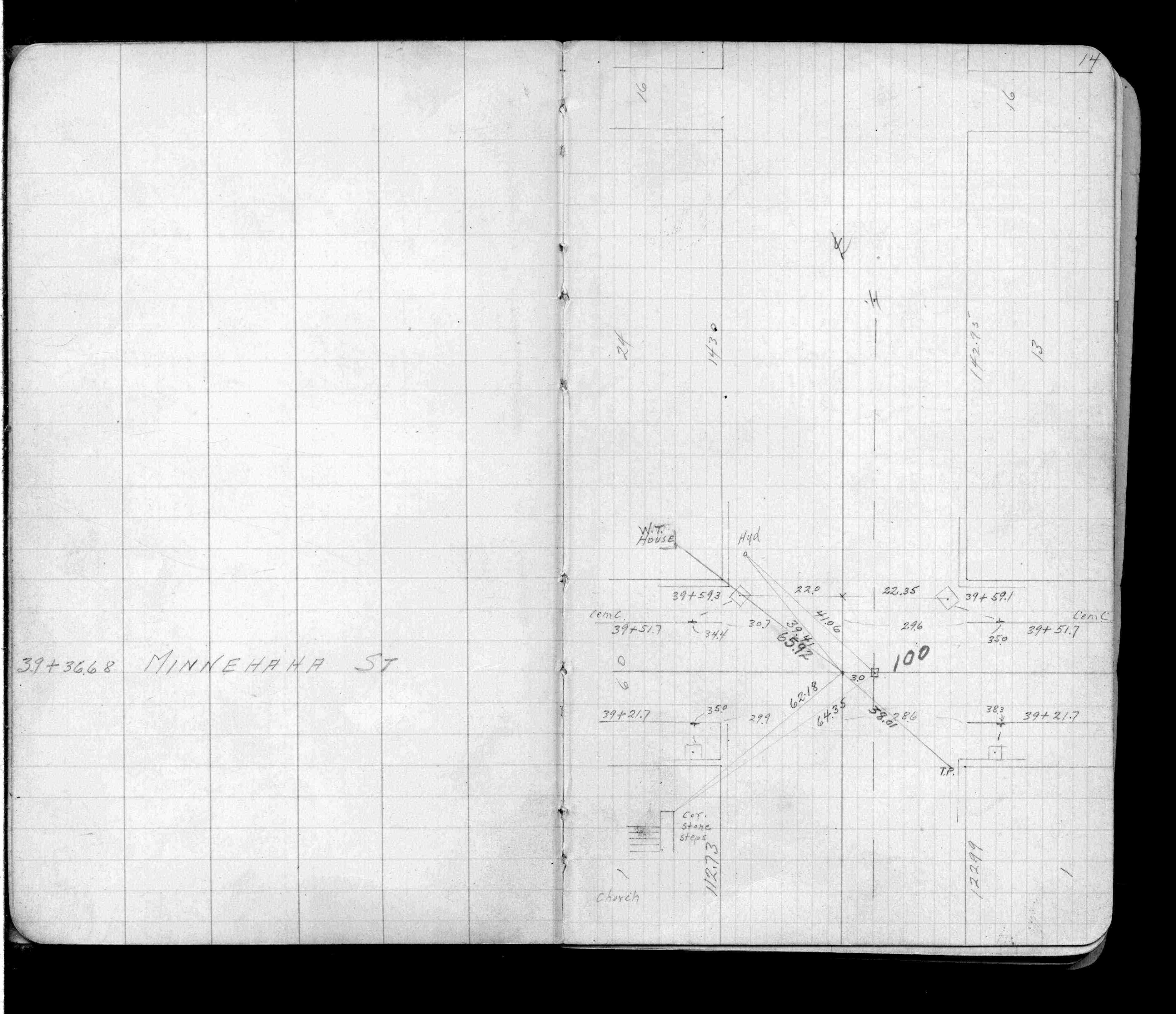
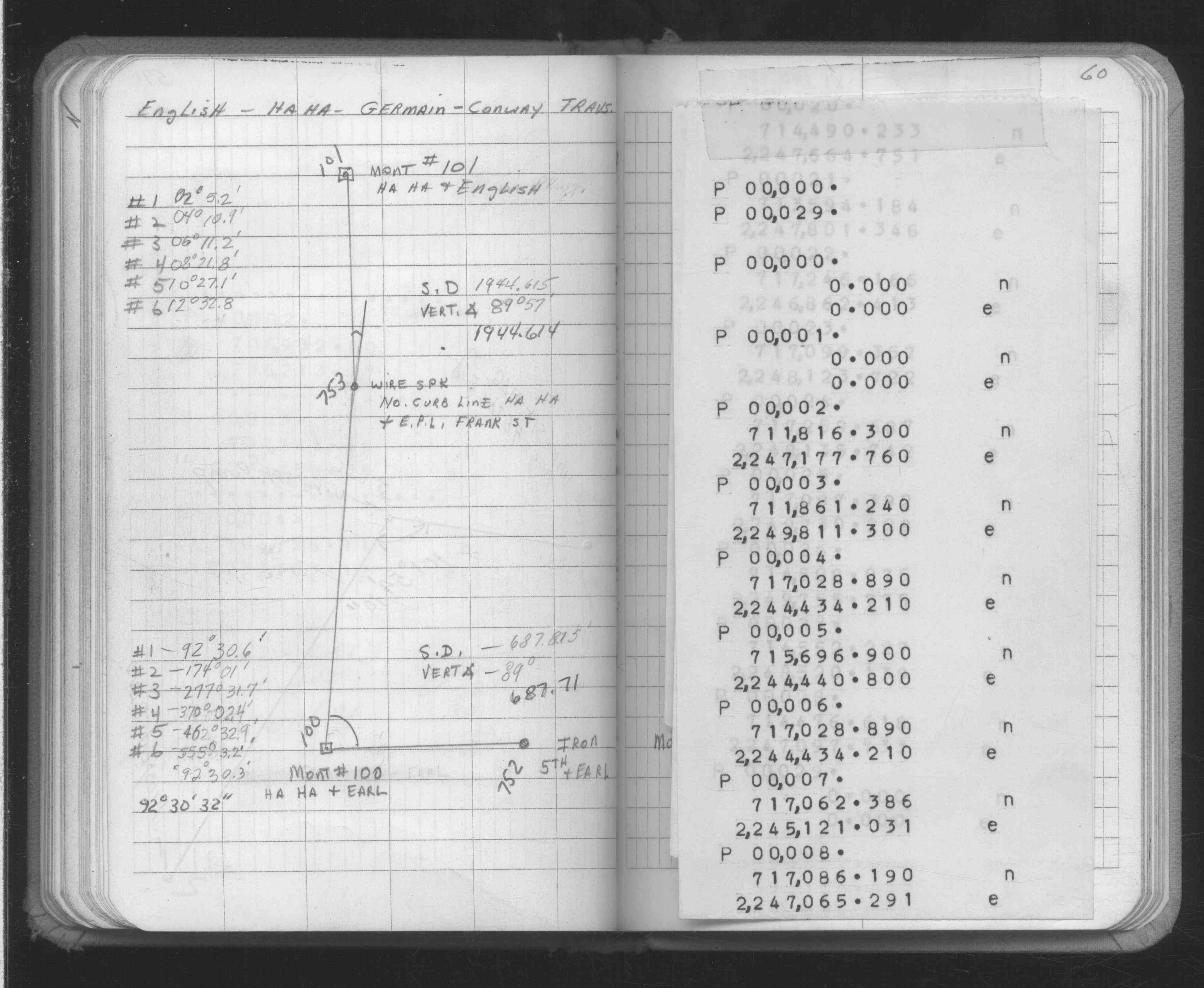
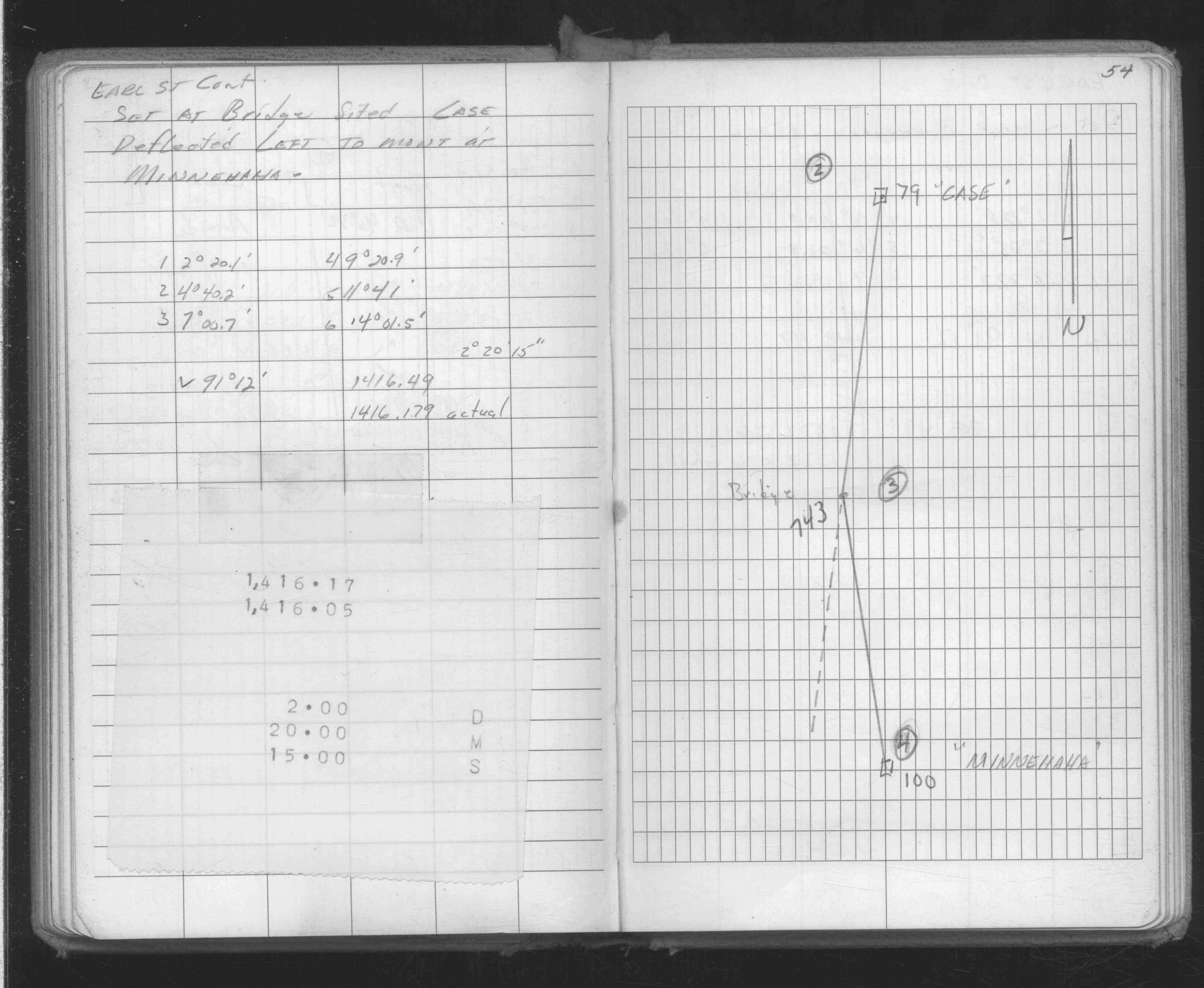
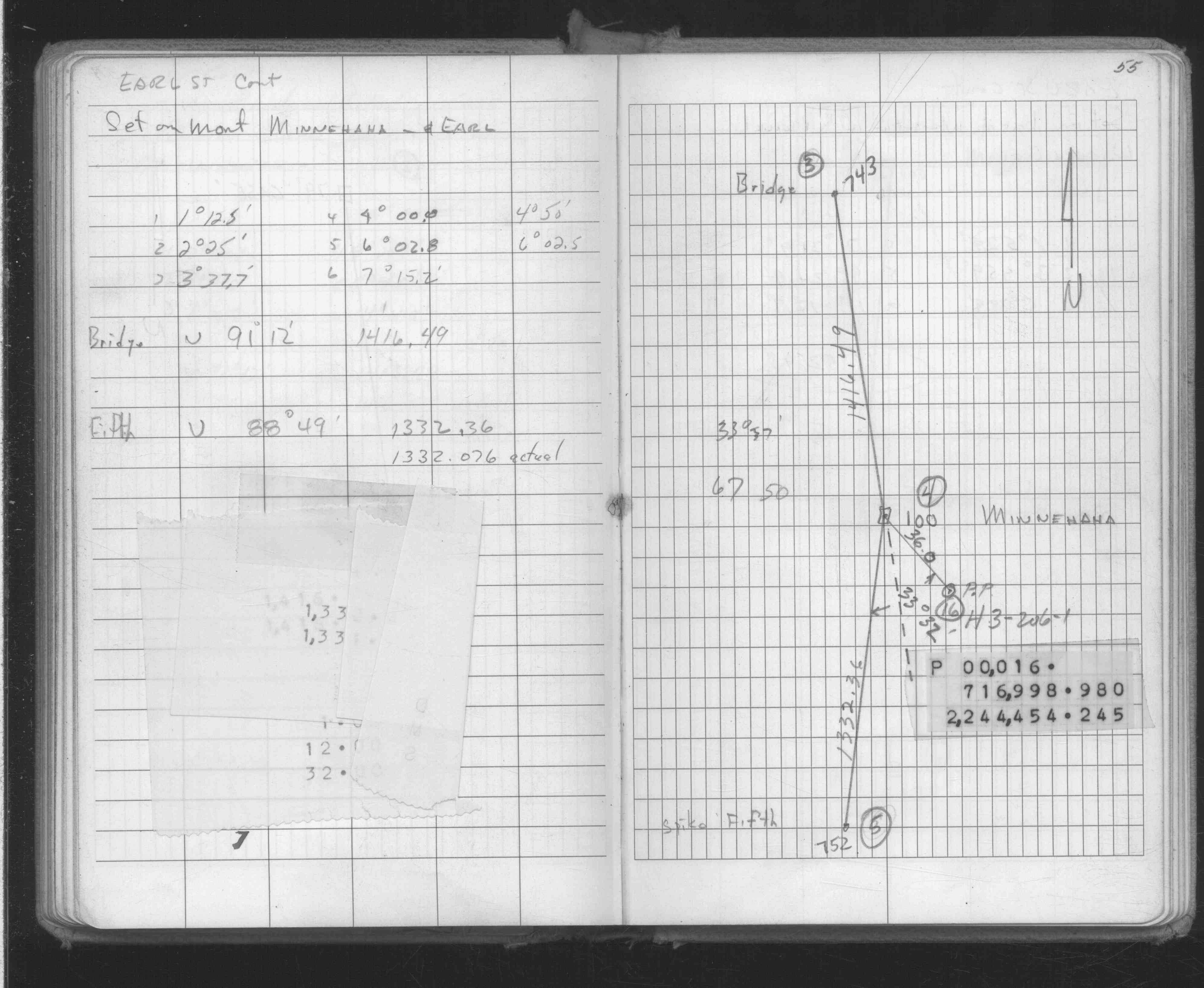
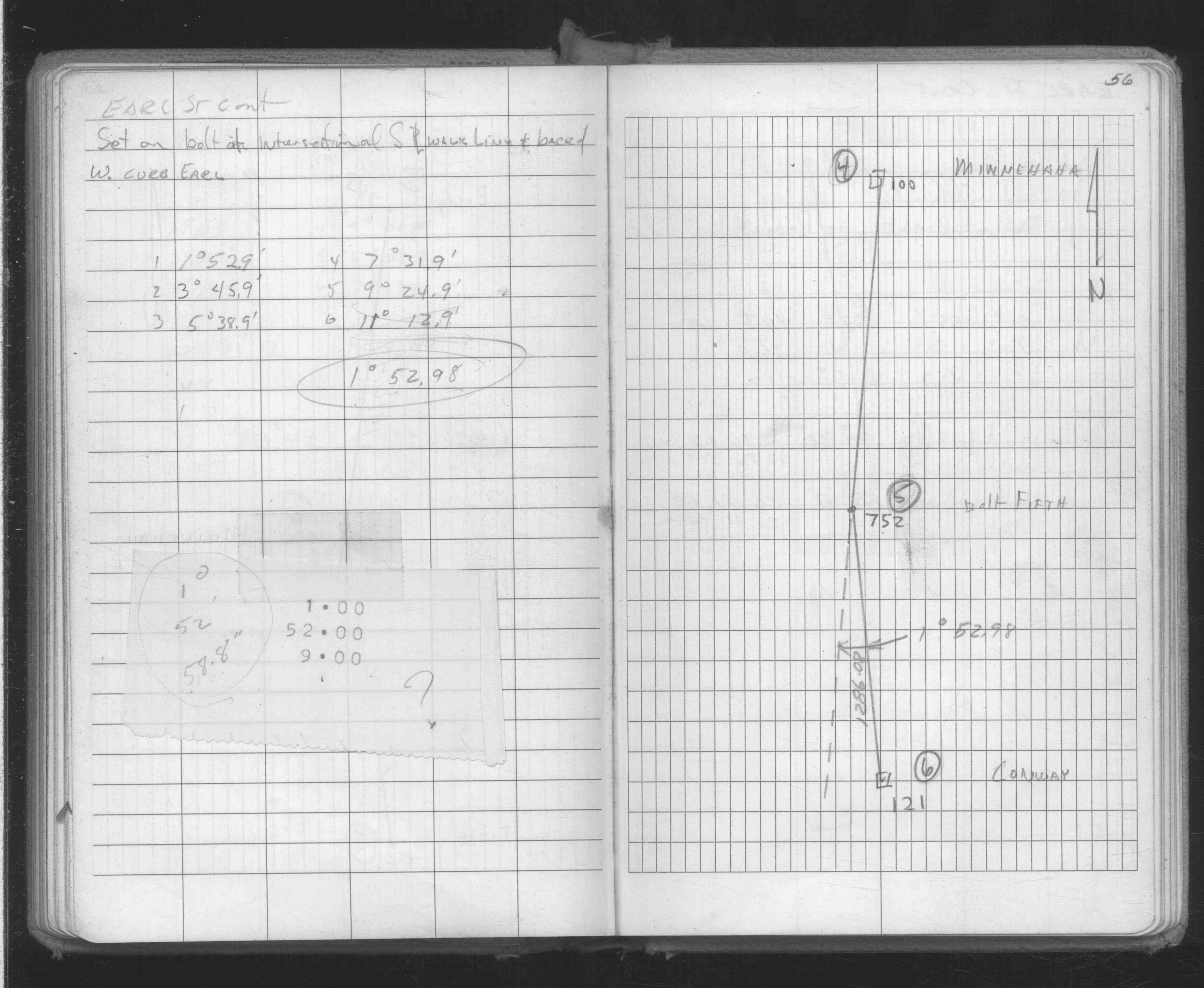
| FB 1736p.18 |
| FILE | SURVEYOR | LIC. NO. | DATE SIGNED | DATE TIED |
|---|---|---|---|---|
| 0100-0071-B.tif | Jeffery L. Grosso | 13144 | November 12, 2002 | November 2, 2002 |
| 0100-0071-A.tif | William J. Cutting | 20576 | August 7, 1991 | July 30, 1991 |
| ST_079-156p100.jpg | none | none | none | none |
| 0100-0071-A.dwf | none | none | none | none |
| FILE | PHOTO DATE | COMMENTS |
|---|---|---|
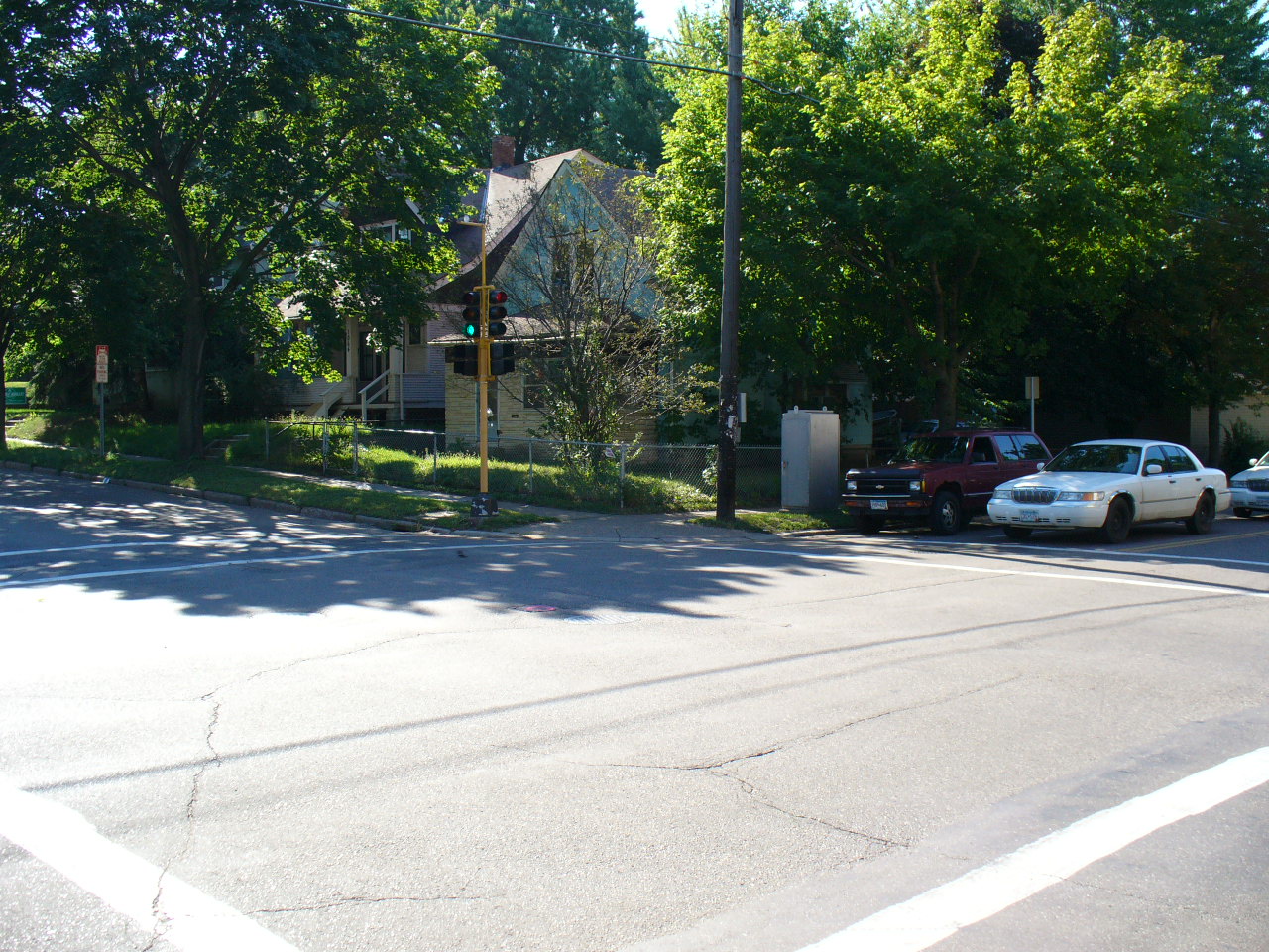
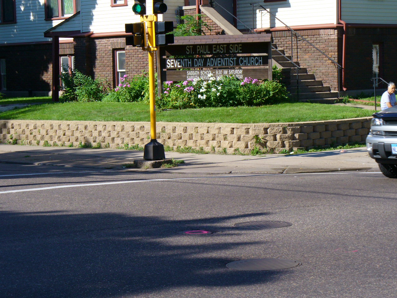
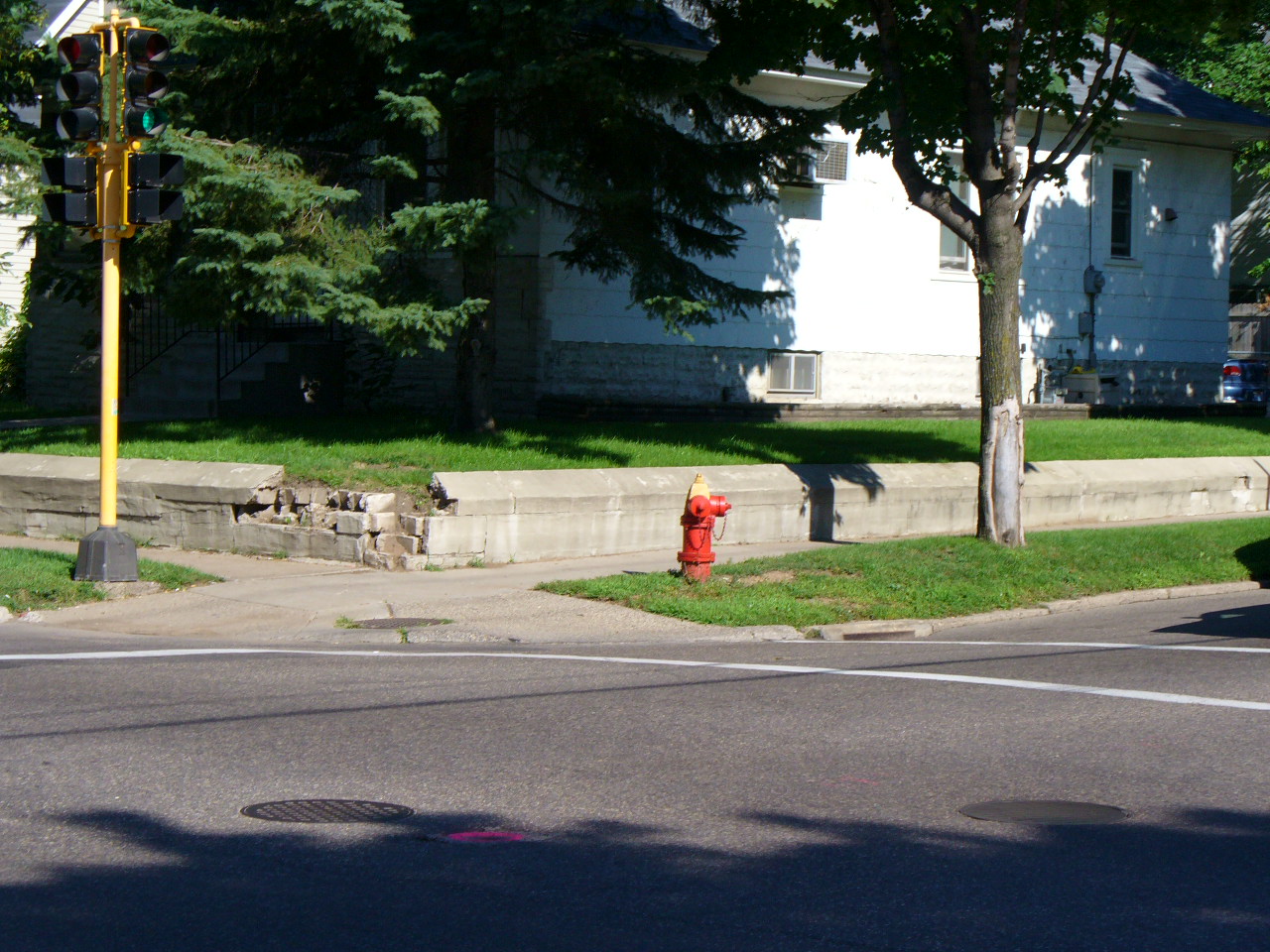
| 0100-0071-9.jpg | August 15, 2005 | Looking northeast, monument painted red in bottom center of photo. |
| 0100-0071-8.jpg | August 15, 2005 | Looking southeast, monument painted red in center of photo (in shadow of tree). |
| 0100-0071-7.jpg | August 15, 2005 | Looking southwest, monument painted red in bottom center of photo. |
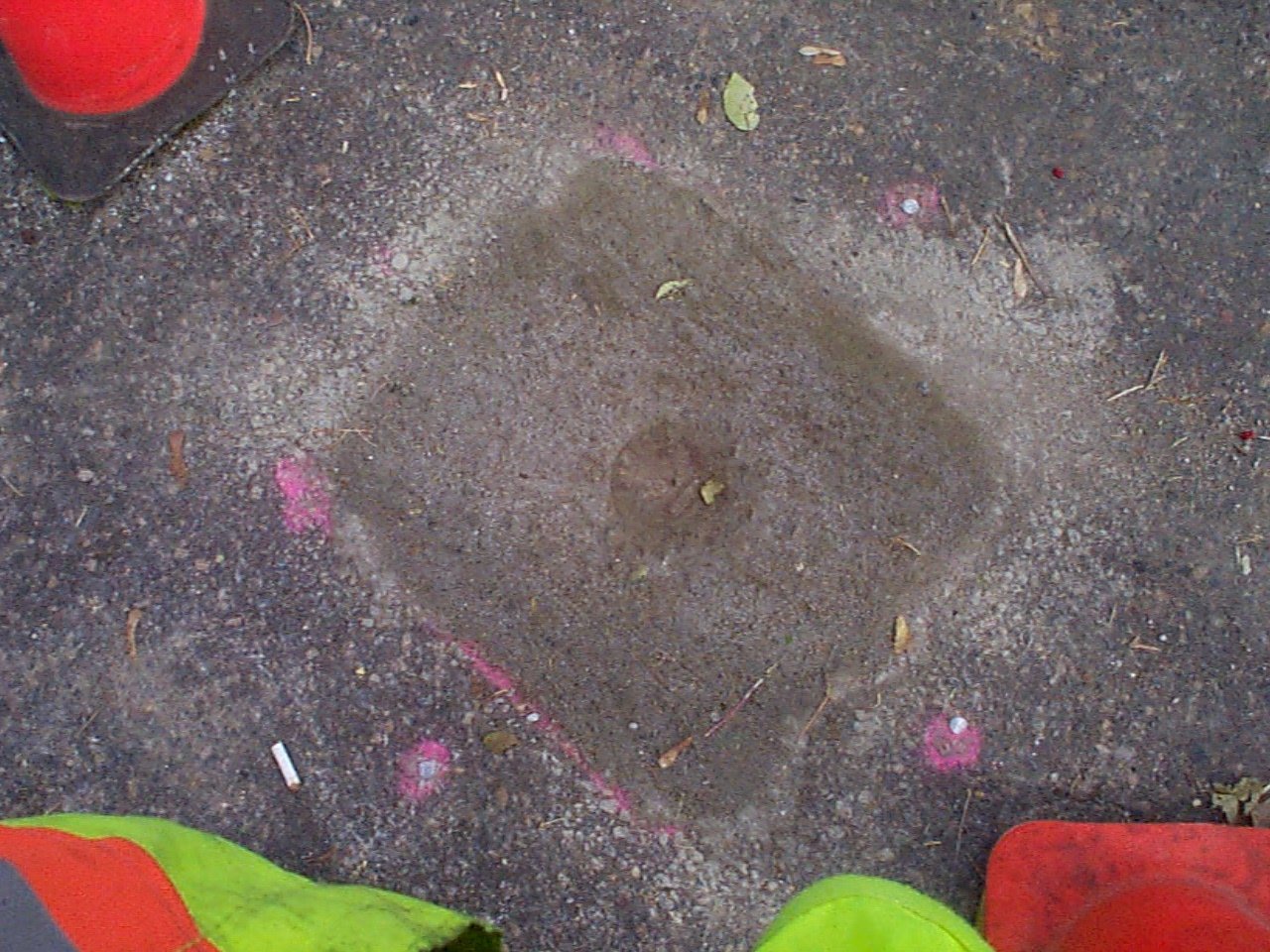
| 0100-0071-6.jpg | August 15, 2005 | Close up of CIM marked 'ST PAUL' set on November 2, 2002 with 4 -1 foot straddles. |
| 0100-0071-10.jpg | August 15, 2005 | Looking northwest, monument painted red in center of photo. |
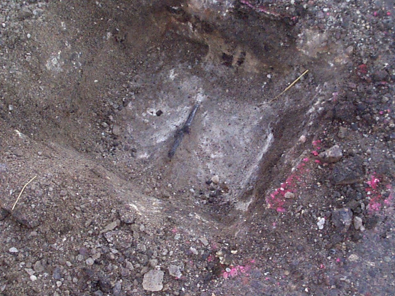
| 0100-0071-5.jpg | November 2, 2002 | Close up of CIM set on November 2, 2002 |
| 0100-0071-5.jpg | November 2, 2002 | Close up of CIM set on November 2, 2002 |
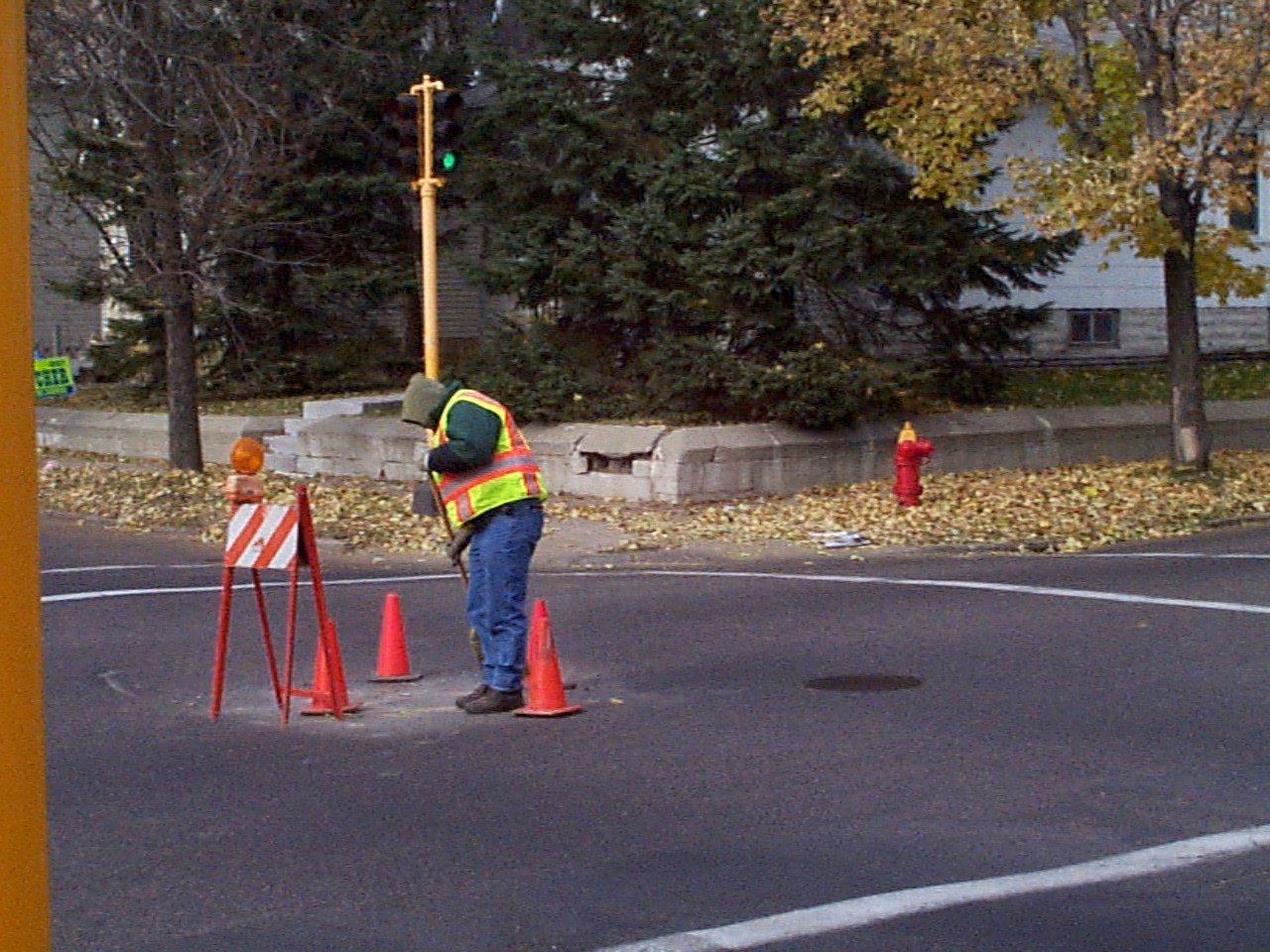
| 0100-0071-4.jpg | November 2, 2002 | Looking northwest towards tie points. |
| 0100-0071-4.jpg | November 2, 2002 | Looking northwest towards tie points. |
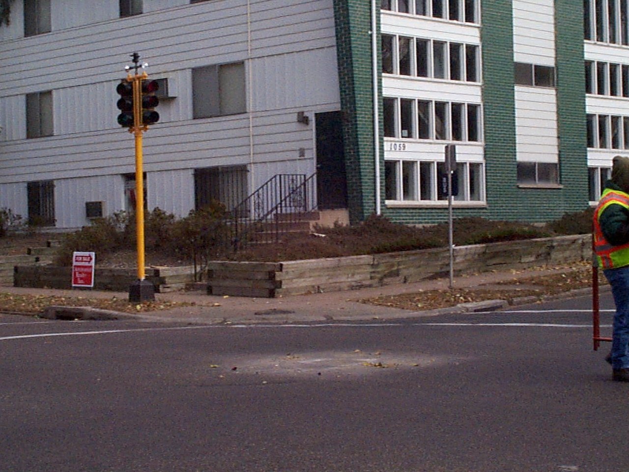
| 0100-0071-3.jpg | November 2, 2002 | Looking northeast towards tie points. |
| 0100-0071-3.jpg | November 2, 2002 | Looking northeast towards tie points. |
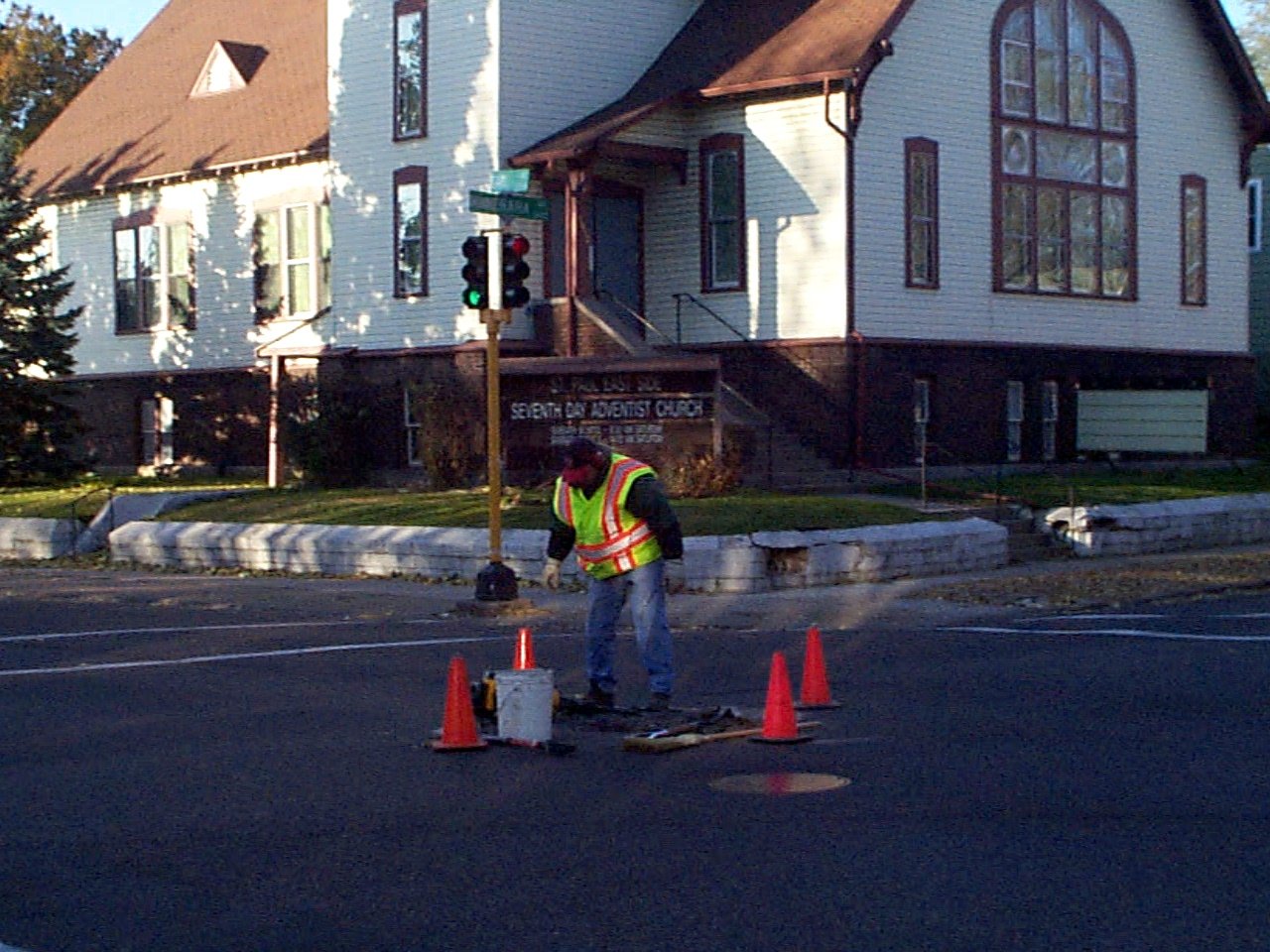
| 0100-0071-2.jpg | November 2, 2002 | Looking southwest towards tie points. |
| 0100-0071-2.jpg | November 2, 2002 | Looking southwest towards tie points. |
| 0100-0071-1.jpg | November 2, 2002 | Close up of broken CIM, which was removed. |
| 0100-0071-1.jpg | November 2, 2002 | Close up of broken CIM, which was removed. |