| NAD83 COORDINATES (1986 adj.): |
|---|
| * X= 592675.3 Y= 162908.16 Z= 0 LSQ 12/6/1991 S FIX |
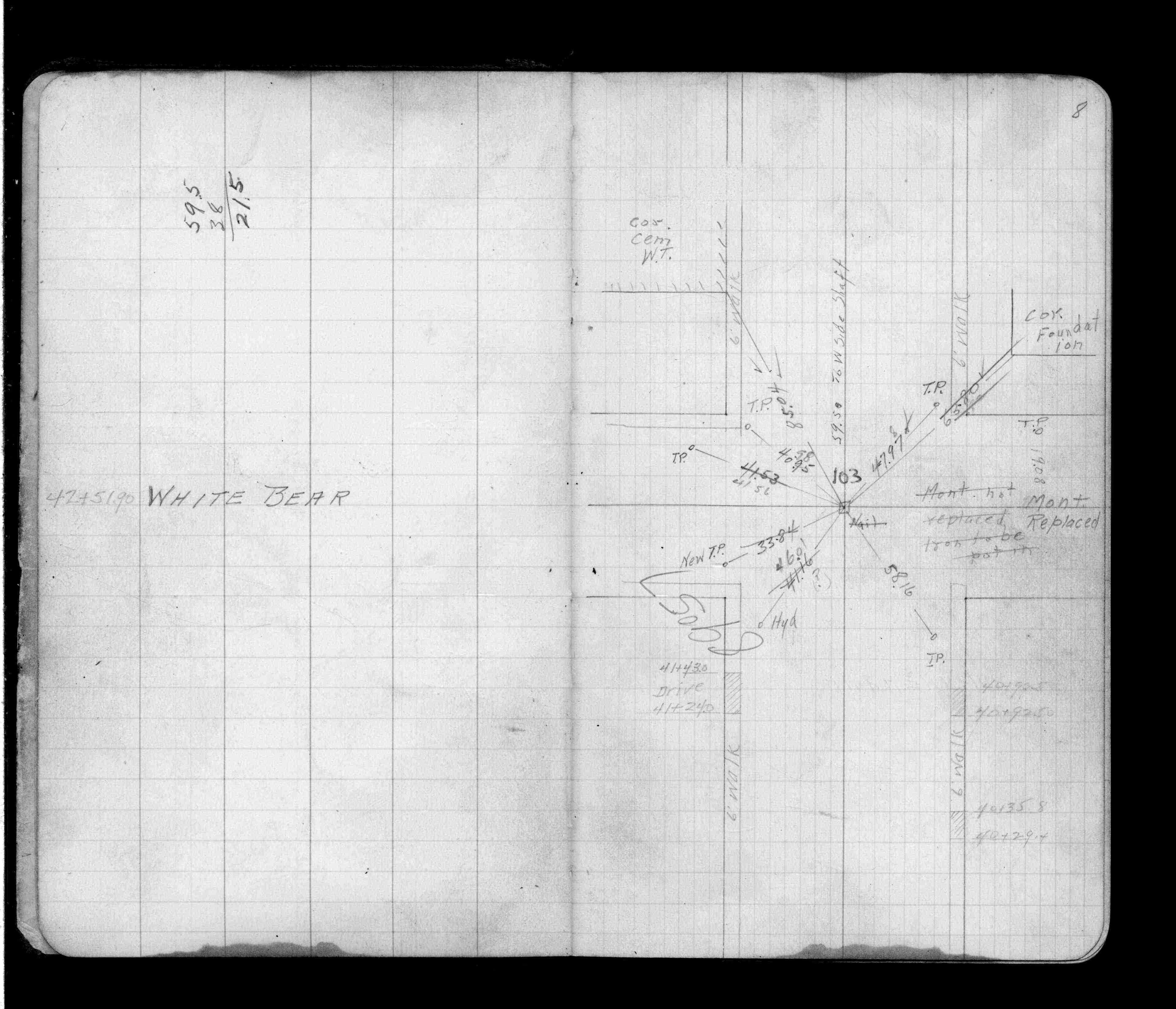
| 8/11/2006 | Ramsey County Surveyors Office set CIM 8" below grade inside a cast iron MH. See CofL 0103-1879-B |
| 6/3/2006 | Photos taken. |
| 6/3/2006 | Fd GM 0.3 ft below grade & placed ties. See CofL 0103-1879-A |
| 6/2/2006 | Ramsey County Surveyors Office placed transit ties on GM. County is reconstructing this intersection. |
| 6/13/2002 | Fd GM below milled surface. County will overlay with 1.5" of asphalt. |
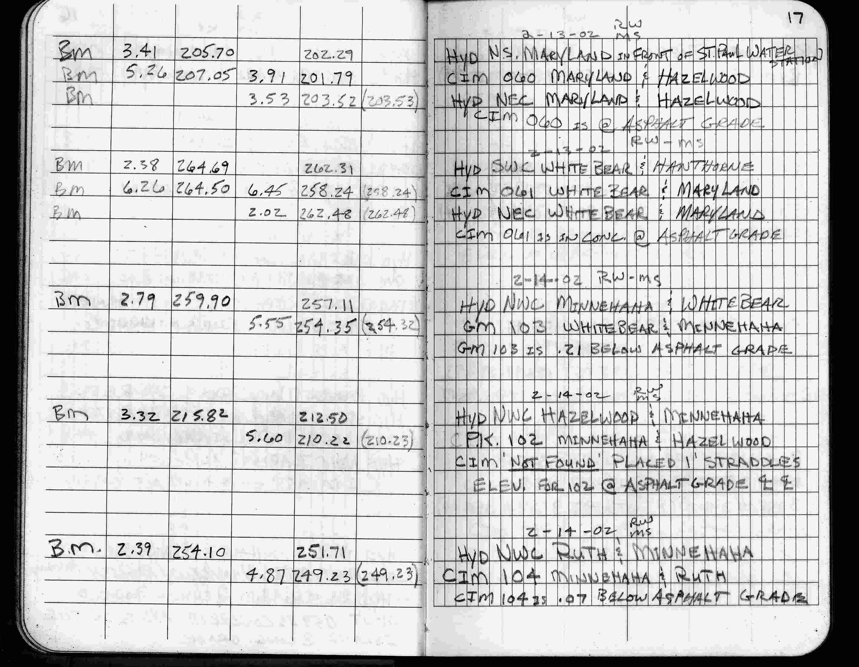
| 2/14/2002 | Elev 254.35 ft on GM 0.21 ft below asphalt surface. See FB 1736 p.17 |
| 3/17/2000 | Fd paint mark placed 2 ft straddles (marked for painting target for 2000 aerial) |
| 1/21/1997 | Elev 254.32 ft on GM. See 97adj.pts, 1997/ruth-minne.org/bmruth2.sdr (loop 129) Digital-Adj |
| 6/15/1995 | Fd GM 0.20 feet below grade. |
| 11/24/1989 | Fd CIM and GPS'ed. |
| 11/22/1989 | Fd CIM and GPS'ed. |
| 1/1/1989 | (Unknown date ___ __,1989 ) Historic, one time only GPS survey = S612 |
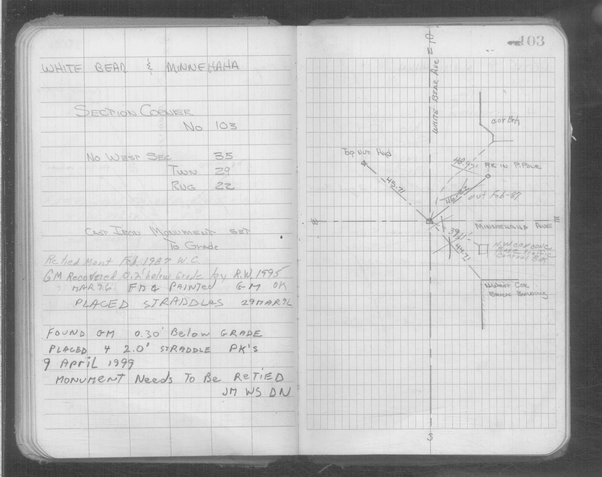
| 2/1/1987 | (Unknown date Feb __, 1987 ) Fd CIM to grade. |
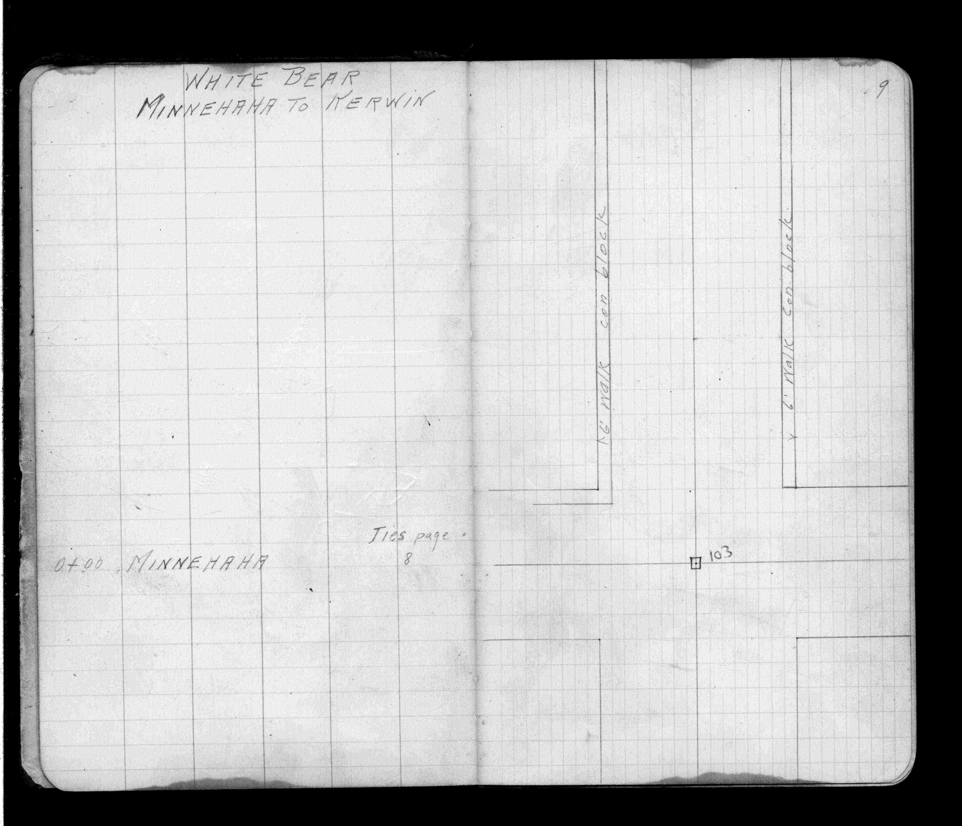
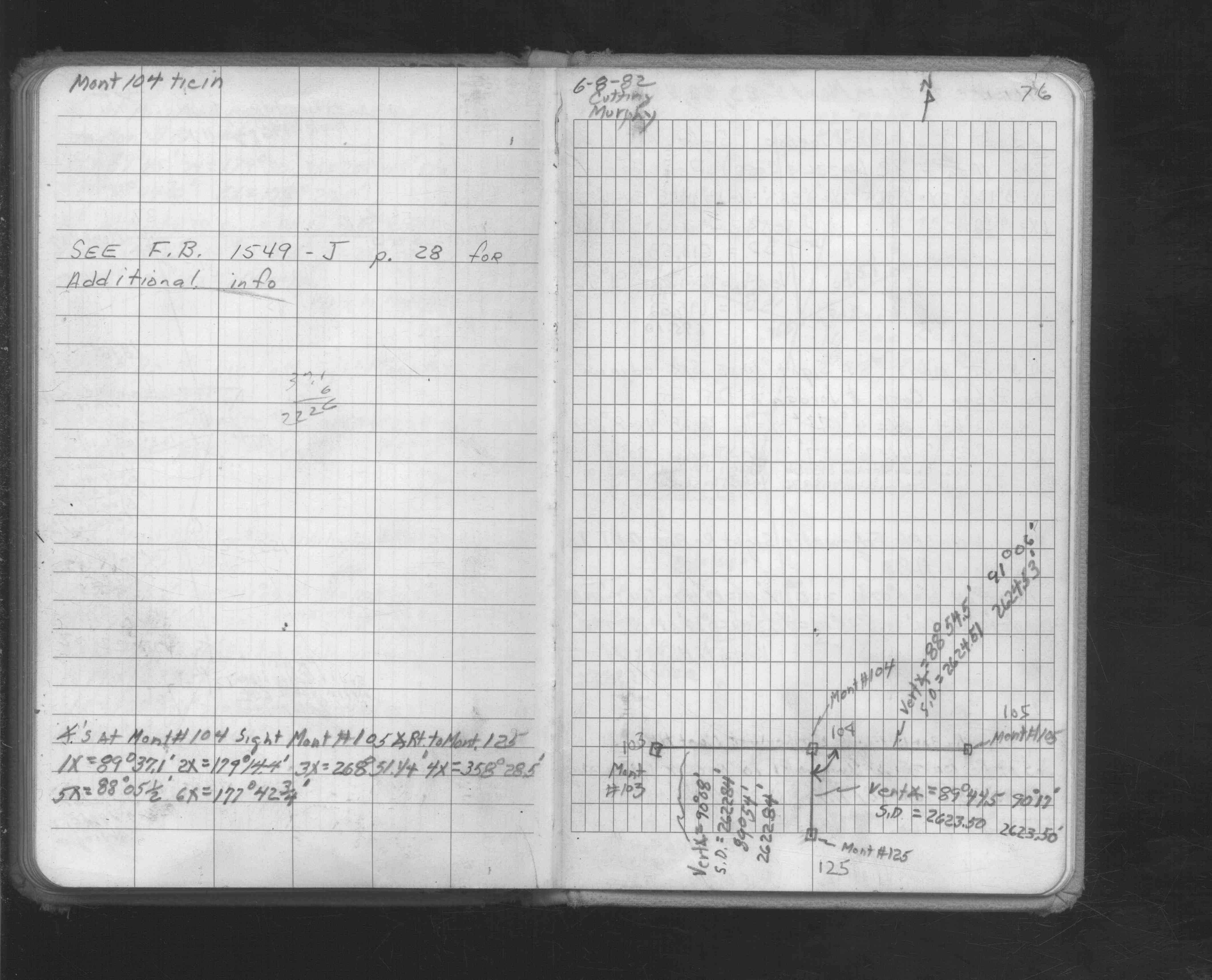
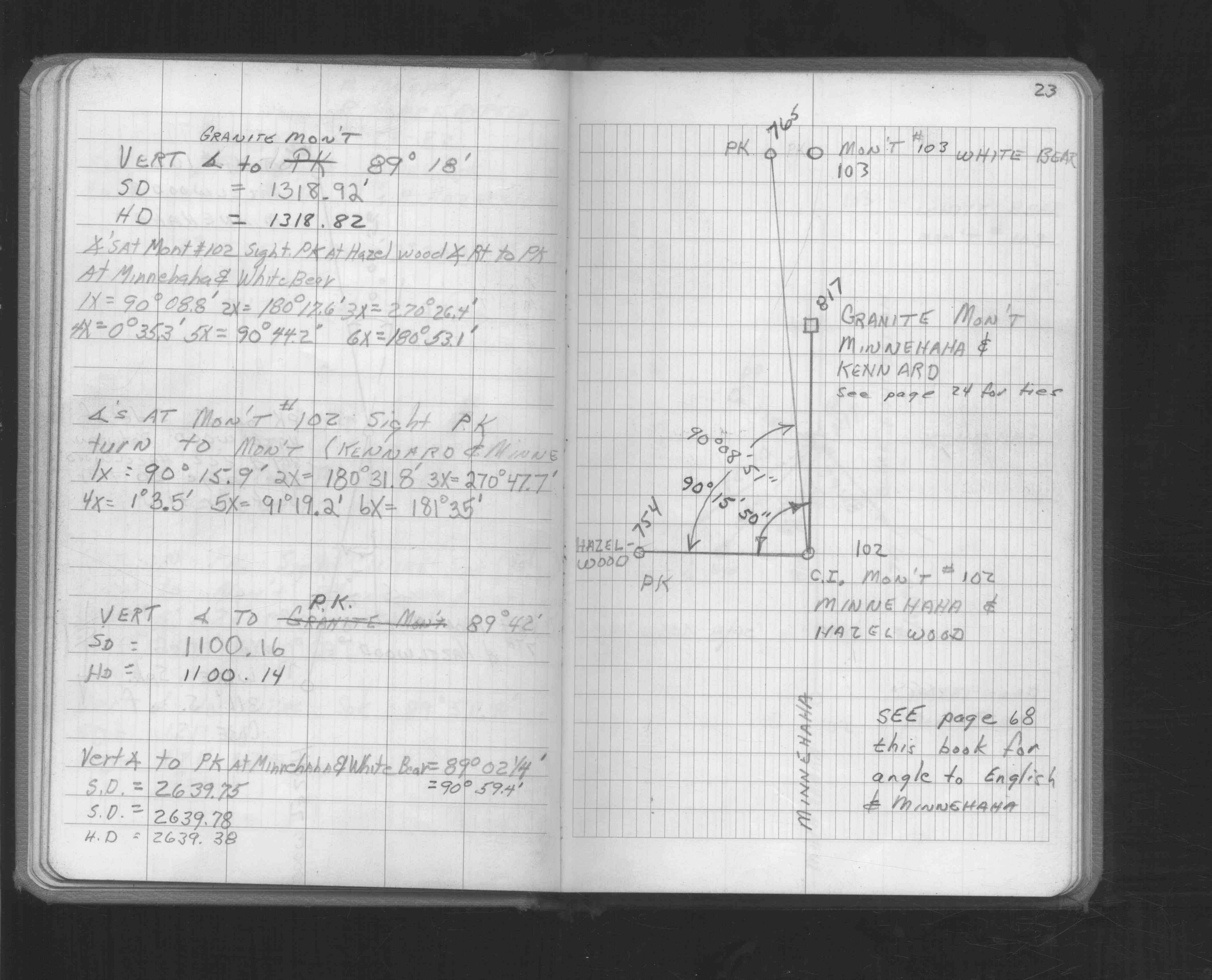
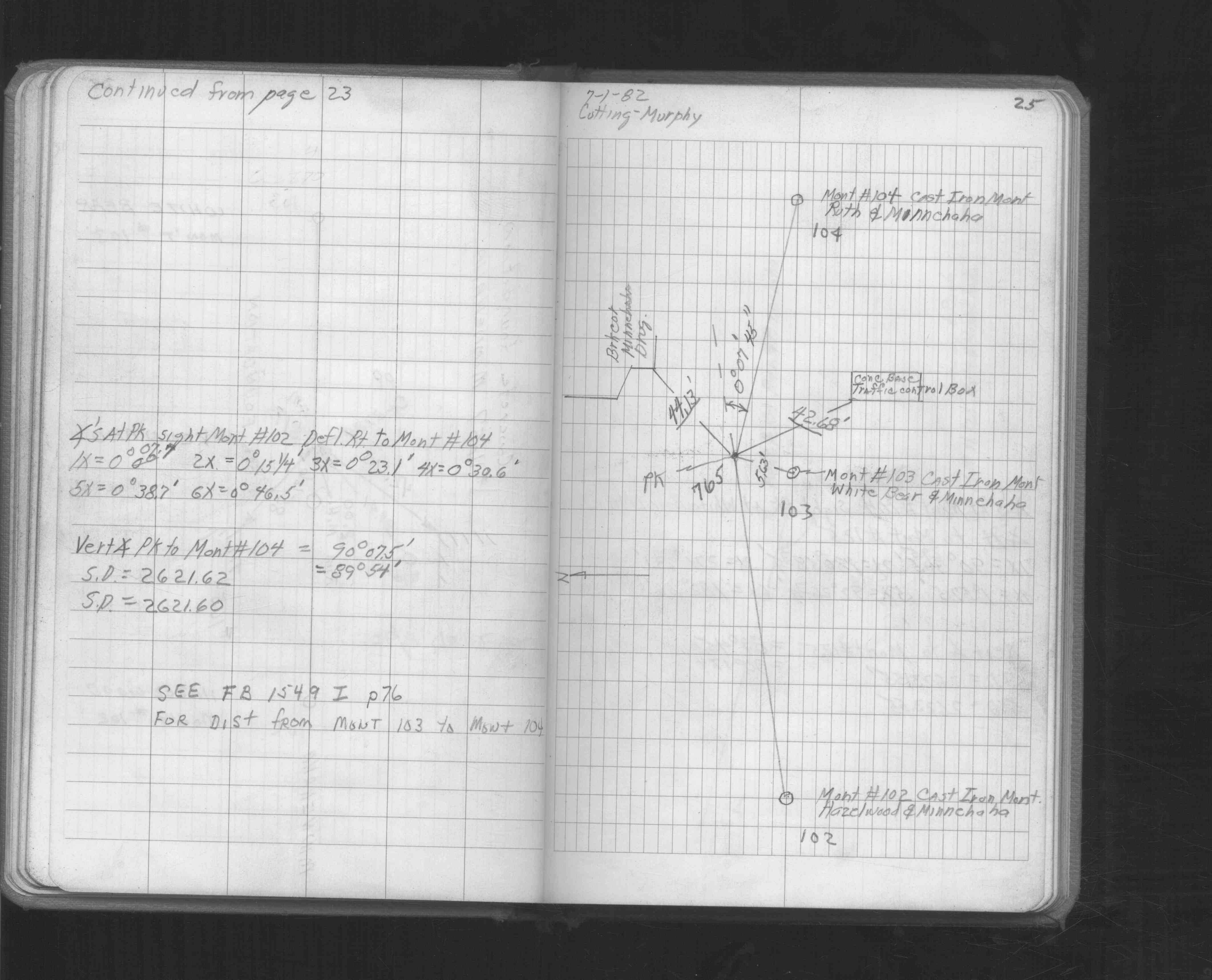
| 7/1/1982 | Fd CIM. See FB 1549J p.25 |
| 3/12/1892 | Monument reset by J B Irvine. |
| 10/24/1890 | Monument set by J H Armstrong. |
| 11/1/1847 | (Unknown date Nov __, 1847 ) Isaac N Higbee deputy surveyor set post. Tied to 2 BTs. See IH p.176-177 2922 |
| 1/1/1800 | (Unknown date ___ __, ____ ) See JBI 13 p.09-10 |
Above is NOT an all inclusive history of this point. Please review all the links below.
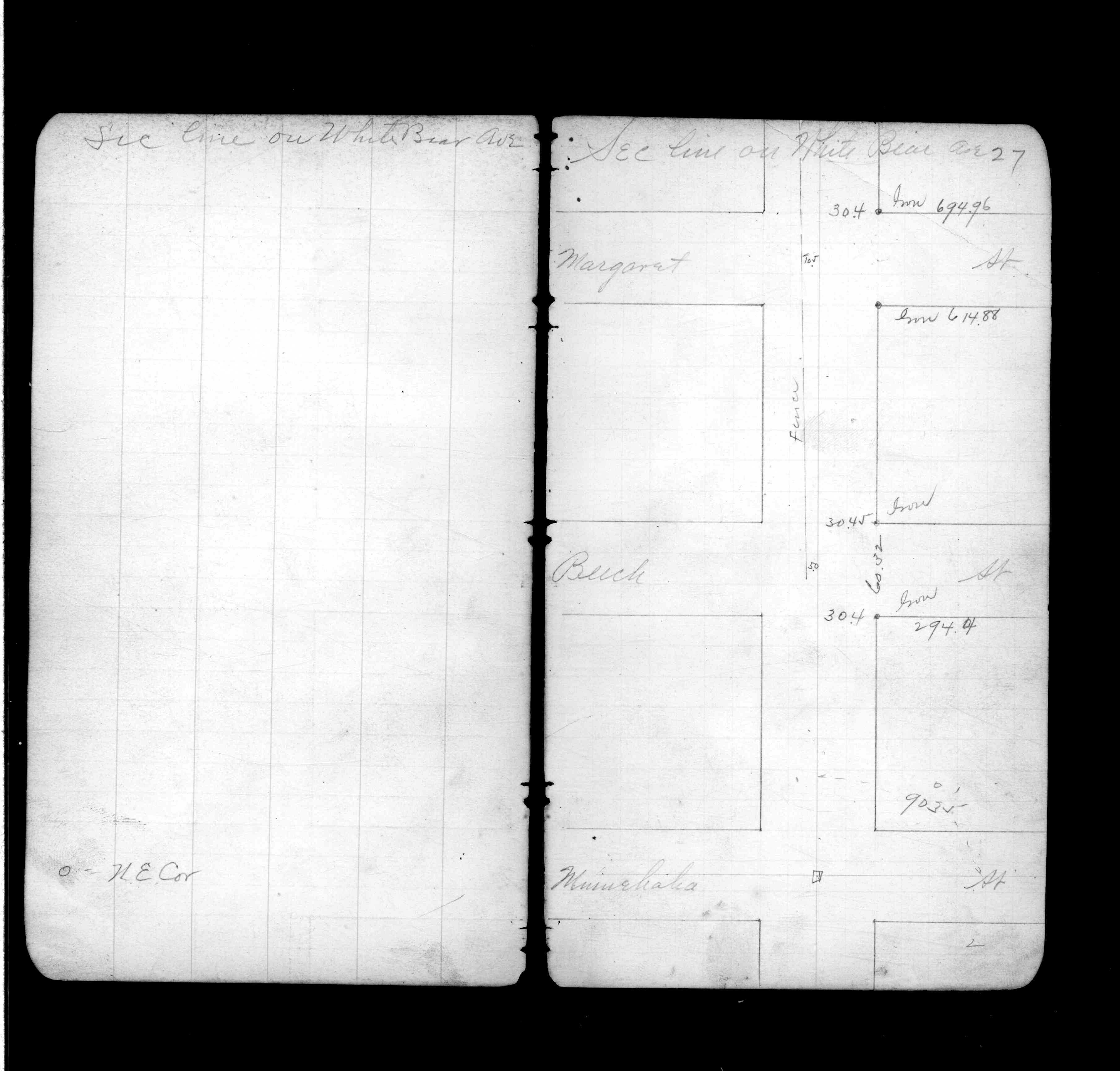
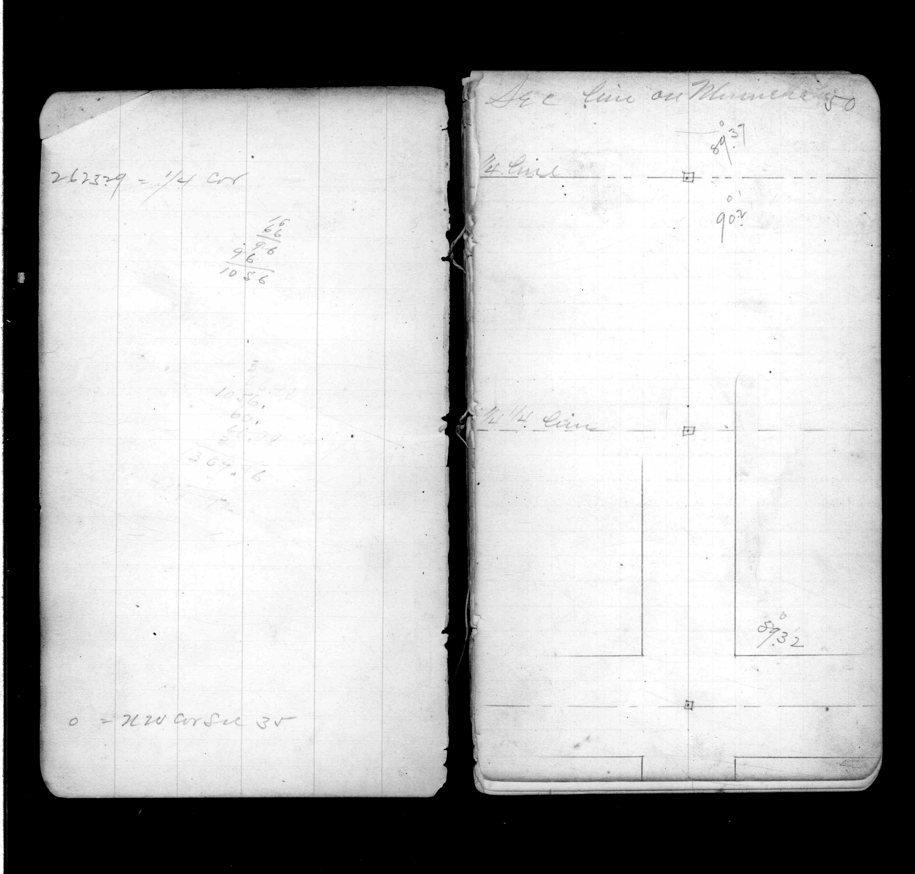
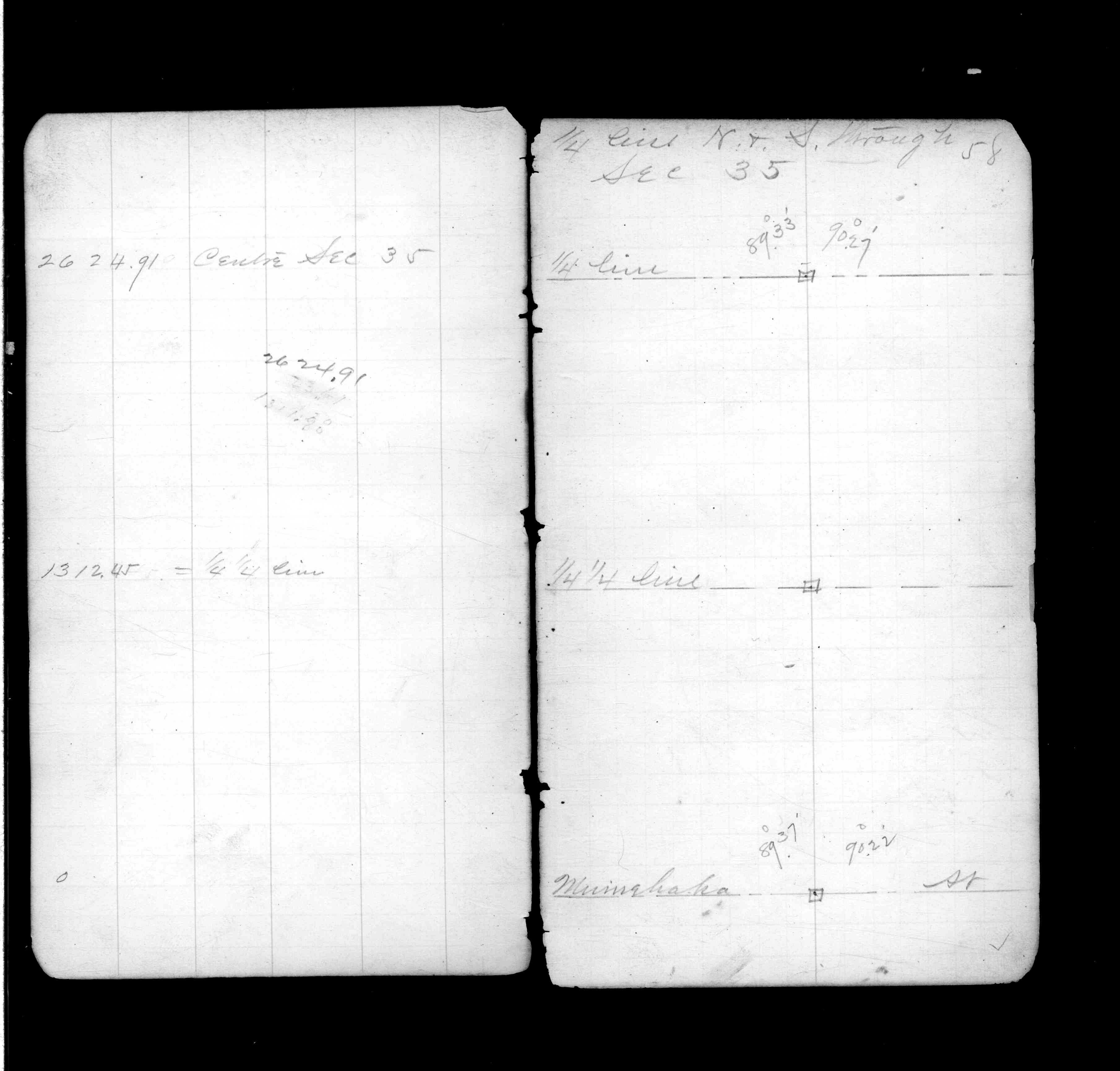
| PLS NOTES | Field | Cross Section | Sewer | J.B. Irvine | Monument | River Survey |
|---|---|---|---|---|---|---|
| IH p.176-177 | FB 0328CPYp. 01 ,15 | JBI 13 p.09-10 | ||||
| FB 0339p. 20 ,27 ,50 ,58 | ||||||
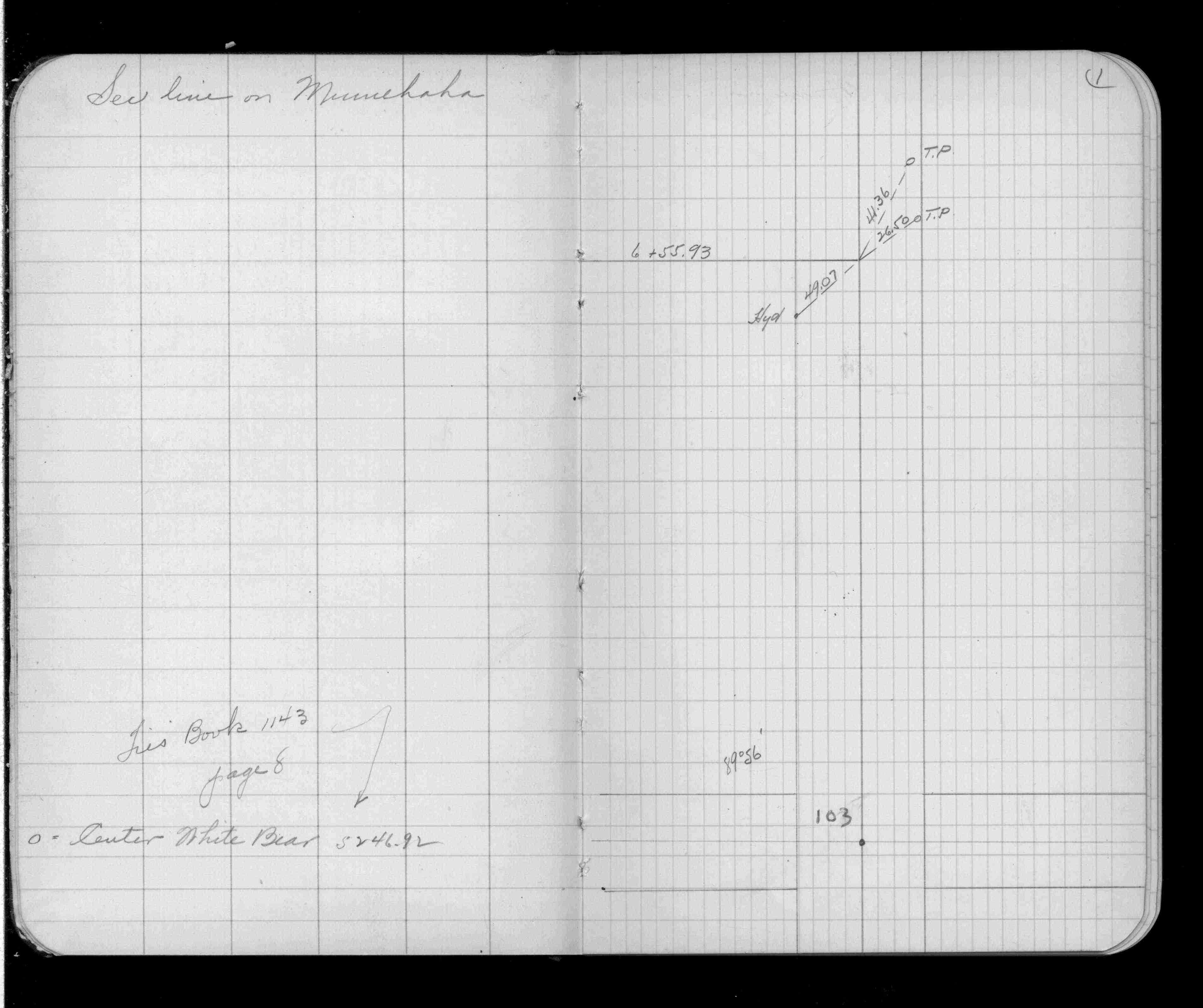
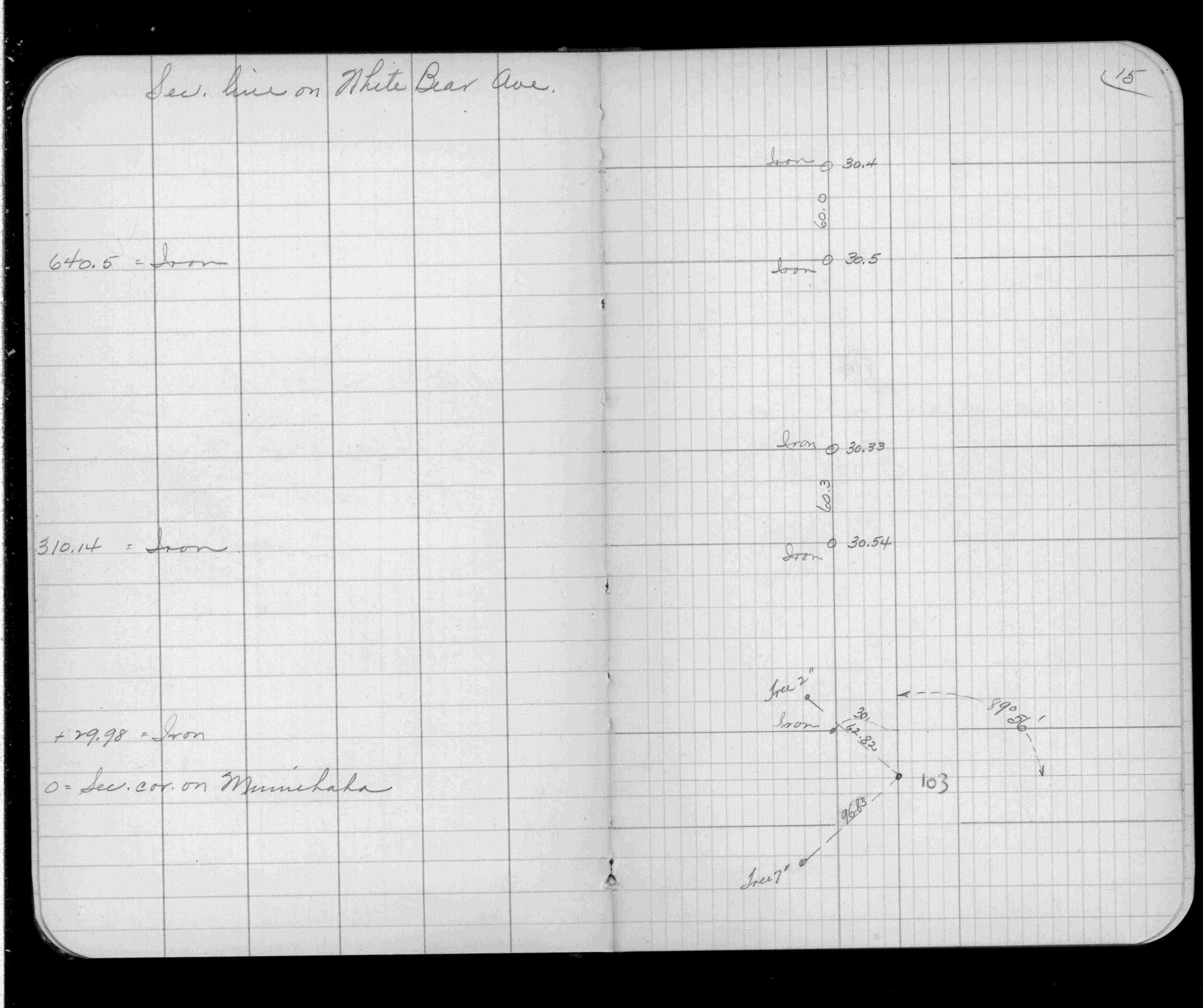
| FB 1143p. 08 ,09 | ||||||
| FB 1448p.01 | ||||||
| FB 1549Ip.76 | ||||||
| FB 1549Jp. 23 ,25 | ||||||
| FB 1549Jp.25 | ||||||
| FB 1736p.17 |
| FILE | SURVEYOR | LIC. NO. | DATE SIGNED | DATE TIED |
|---|---|---|---|---|
| 0103-1879-A.tif | Michael P. Murphy | 41001 | June 6, 2006 | June 3, 2006 |
| 0103-1879-B.tif | none | none | none | June 2, 2006 |
| ST_079-156p103.jpg | none | none | none | none |
| 0103-1879-A.dwf | none | none | none | none |
| FILE | PHOTO DATE | COMMENTS |
|---|---|---|
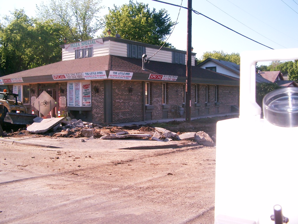
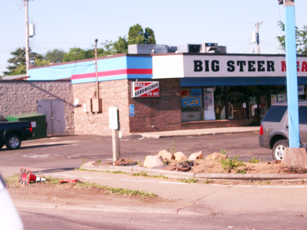
| 0103-1879-8.jpg | June 3, 2006 | Looking Southeast at White Bear Ave. and Minnehaha Ave. |
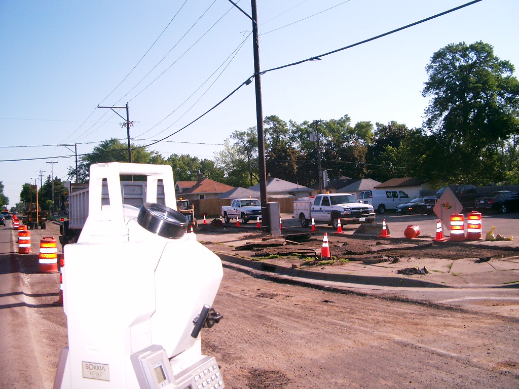
| 0103-1879-6.jpg | June 3, 2006 | Looking Southwest at White Bear Ave. and Minnehaha Ave. |
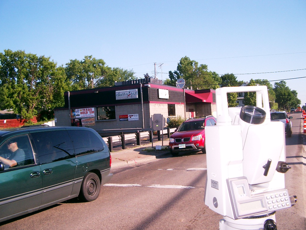
| 0103-1879-4.jpg | June 3, 2006 | Looking Northeasterly at White Bear Ave. and Minnehaha Ave. |
| 0103-1879-3.jpg | June 3, 2006 | Looking Northwesterly at White Bear Ave. and Minnehaha Ave. |
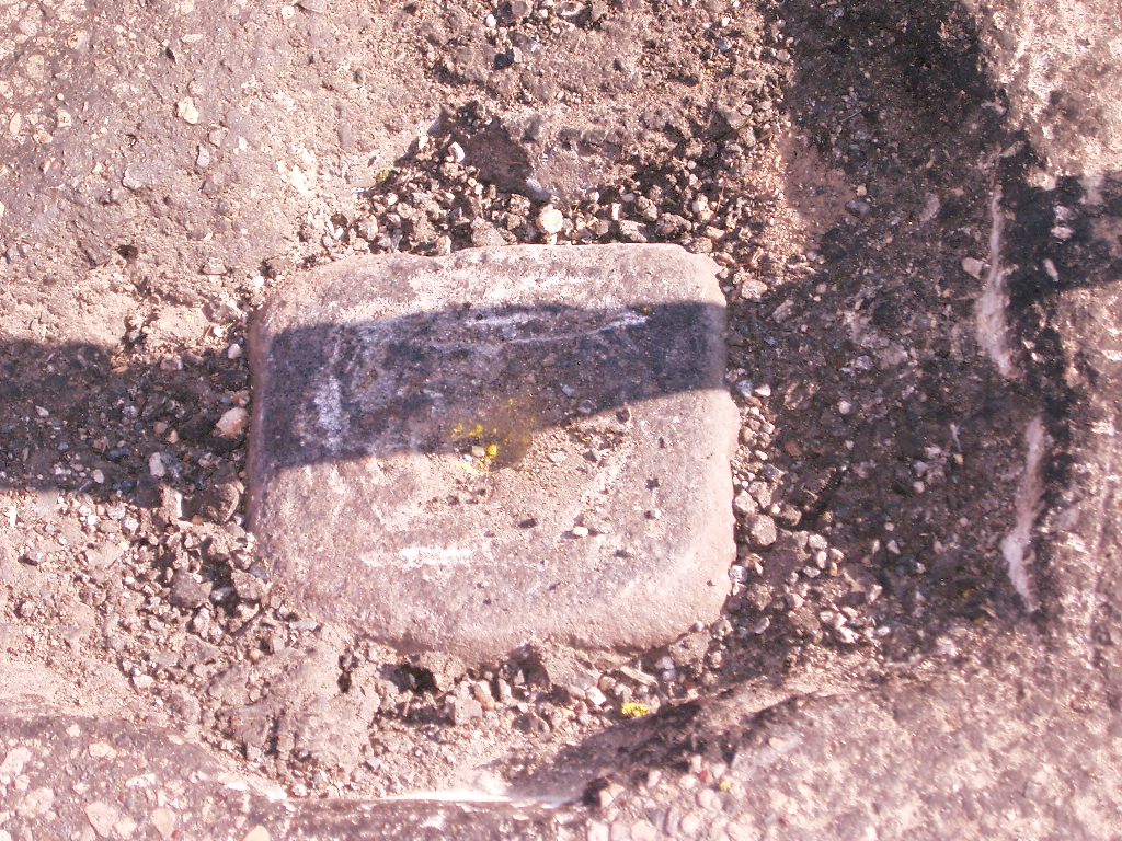
| 0103-1879-2.jpg | June 3, 2006 | Close-up of the granite monument. |