| NAD83 COORDINATES (1986 adj.): |
|---|
| * X= 545453.9 Y= 160016.95 Z= 0 LSQ 12/6/1991 S FIX |
| 10/17/2013 | Found CIM at street grade. |
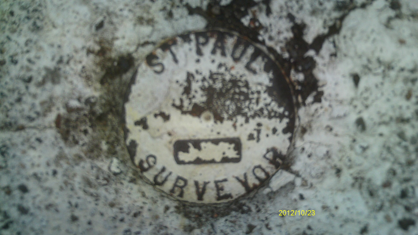
| 10/23/2012 | Found CIM at street grade. Photos taken. |
| 12/6/2001 | Hennepin County Surveyors fd CIM marked "ST PAUL SURVEYOR" at road grade. See CofL 0106-1087-E |
| 3/1/2000 | (Unknown date Mar __, 2000 ) Fd CIM (marked for painting target for 2000 aerial) |
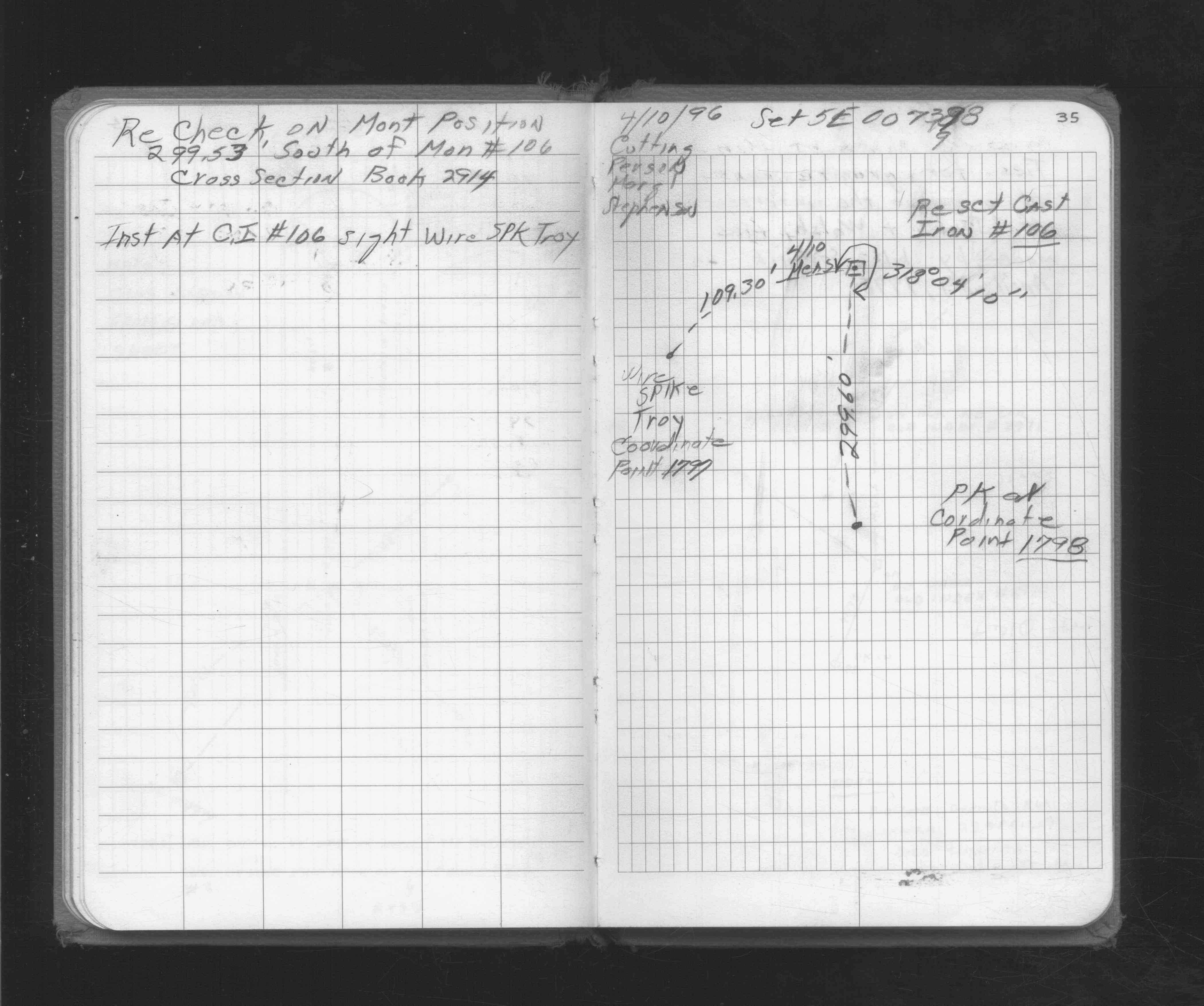
| 3/20/1996 | Fd CIM placed by Gorman Surveying, Inc. on 10/3/1995. See CofL 0106-1087-C |
| 3/1/1996 | (Unknown date Mar __, 1996 ) Ties provided by Gorman Surveying, Inc. See 0106-1087-D |
| 10/3/1995 | Set iron monument in concrete at street grade. See CofL 0106-1087-B |
| 5/4/1995 | Fd GM 0.4 ft below grade, GM removed for street & sewer construction. See CofL 0106-1087-B |
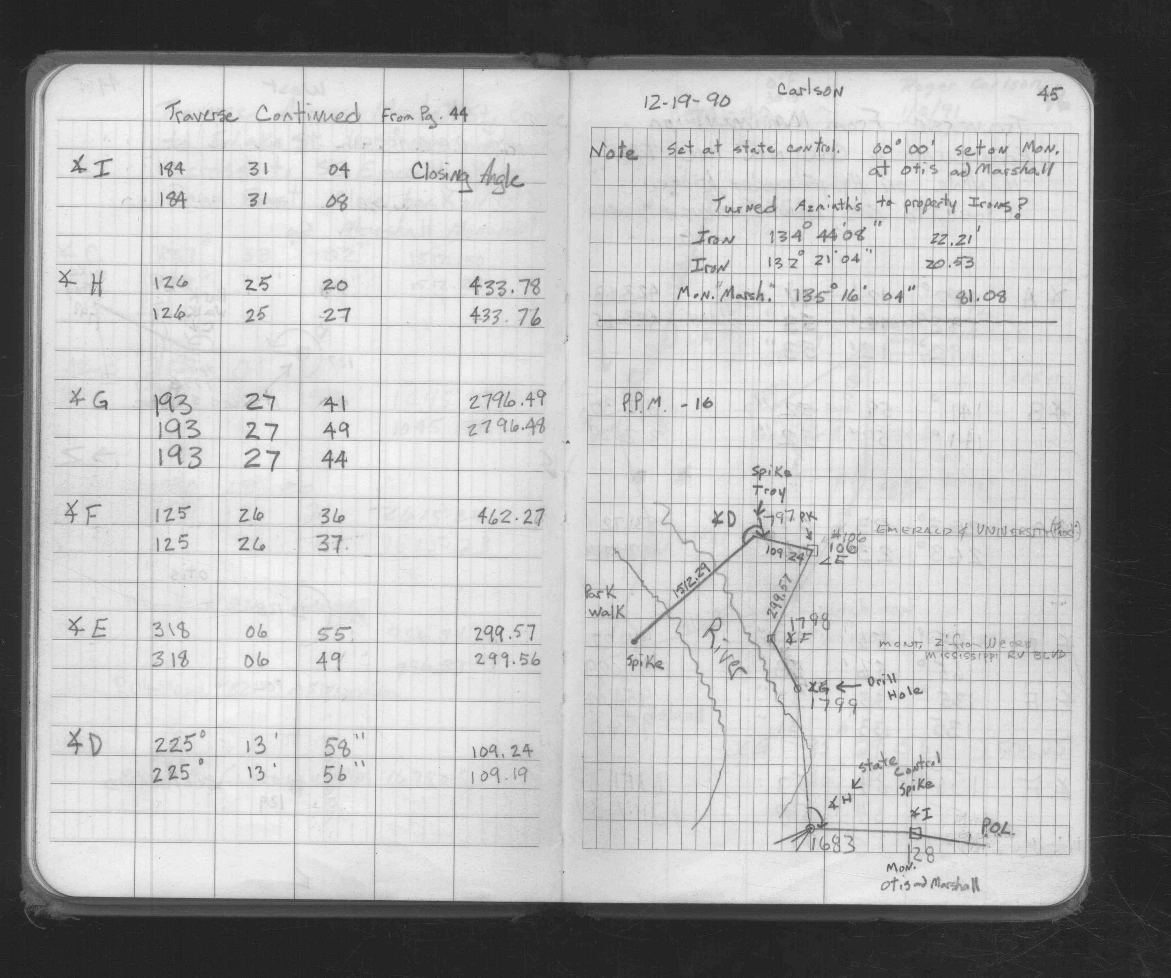
| 10/9/1992 | Fd GM 0.4 ft below grade, placed 5 ft offset straddles & retied GM. See CofL 0106-1087-A, copied from FB 1689 p.54 |
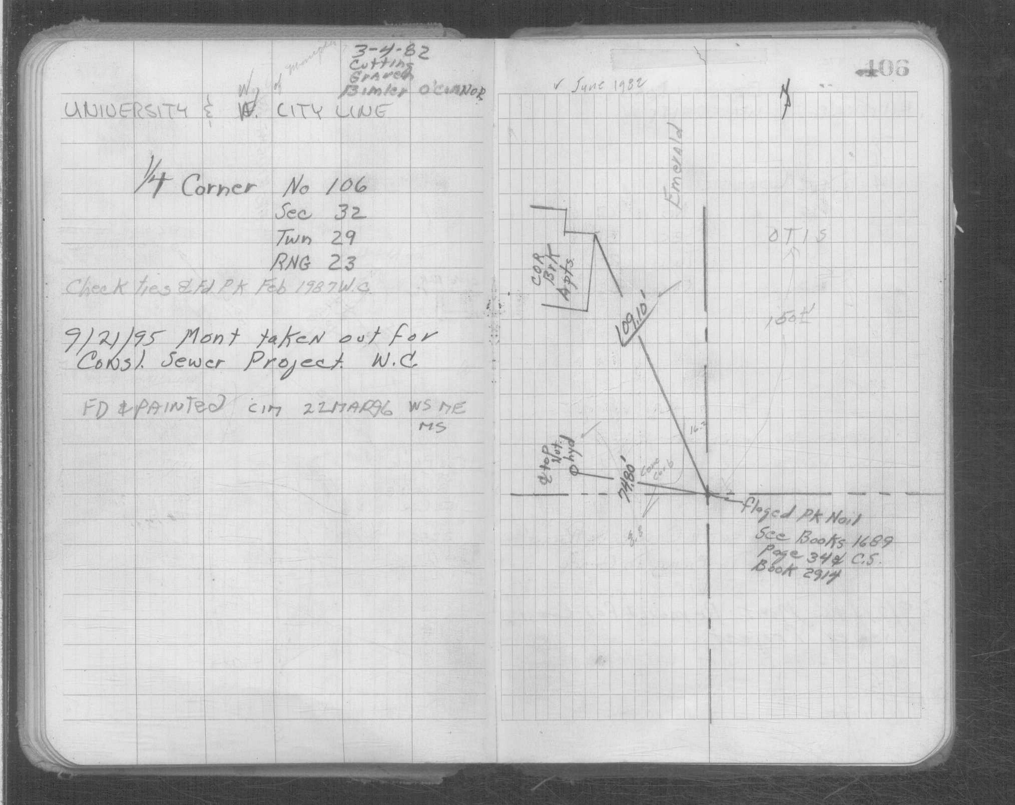
| 2/1/1987 | (Unknown date Feb __, 1987 ) Fd PK nail. |
| 1/1/1985 | (Unknown date ___ __,1985 ) Historic, one time only GPS survey = S037 |
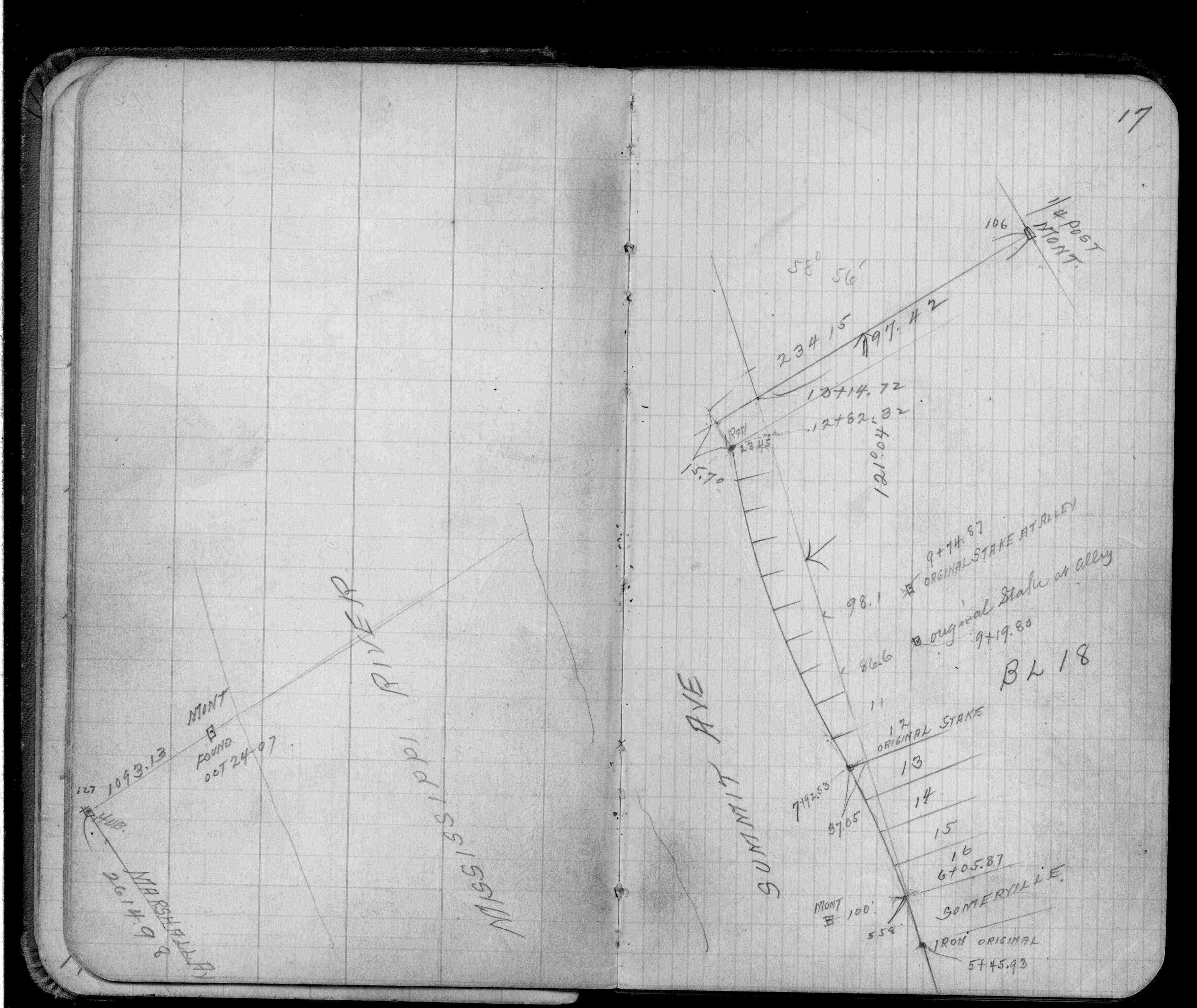
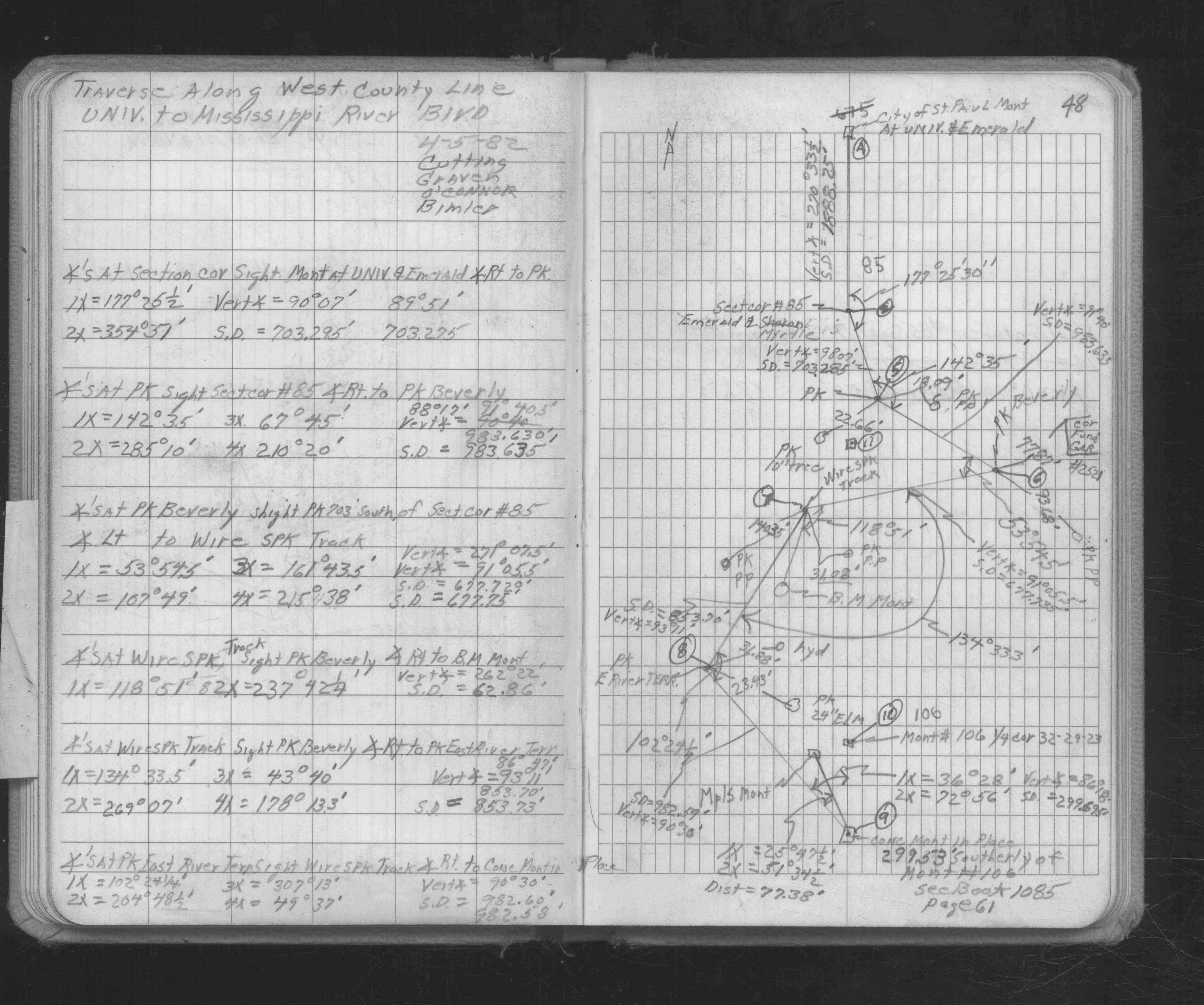
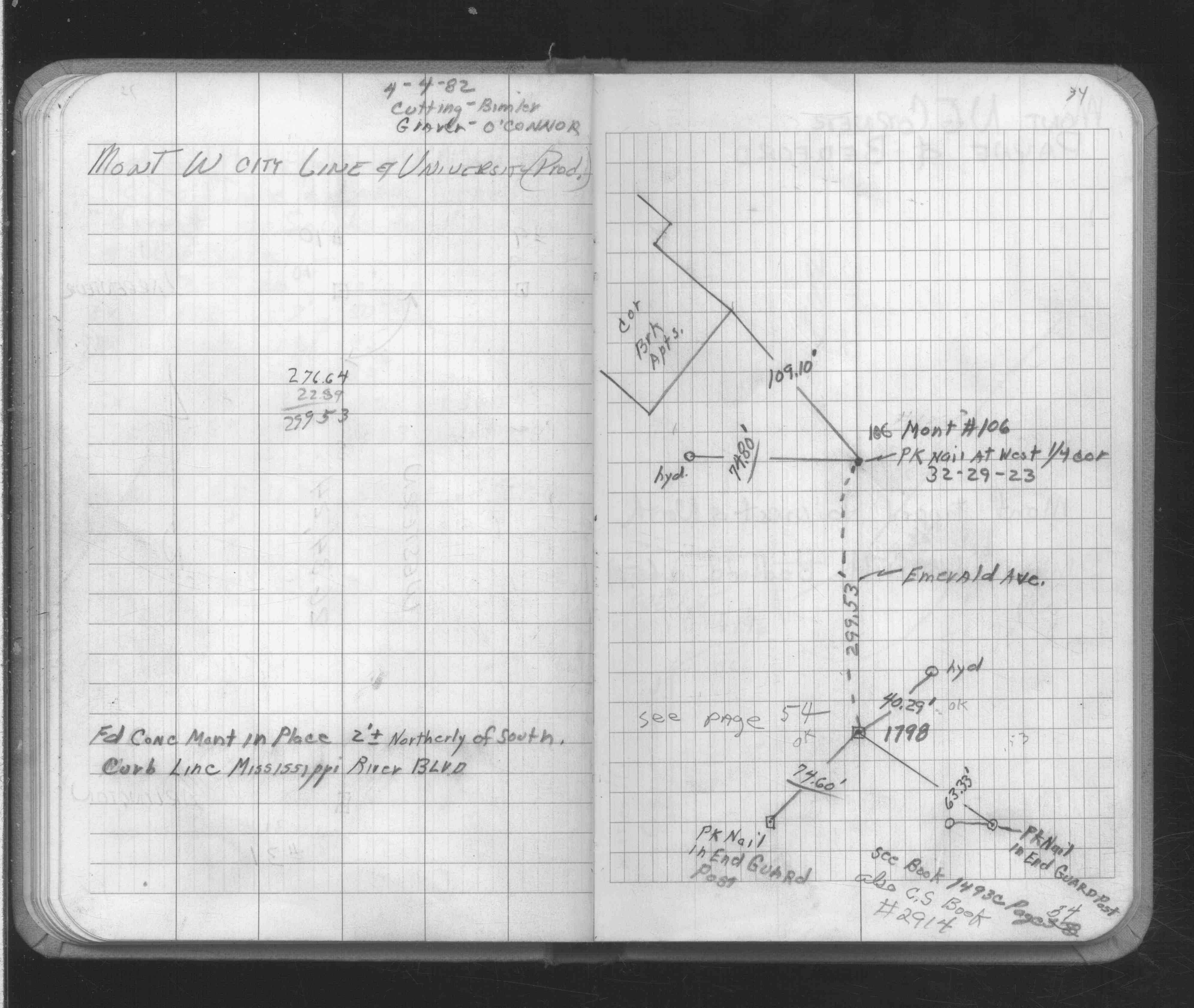
| 4/4/1982 | Placed ties on PK nail. See FB 1689 p.34 |
| 10/1/1887 | (Unknown date Oct __, 1887 ) Monument set by J H Armstrong. |
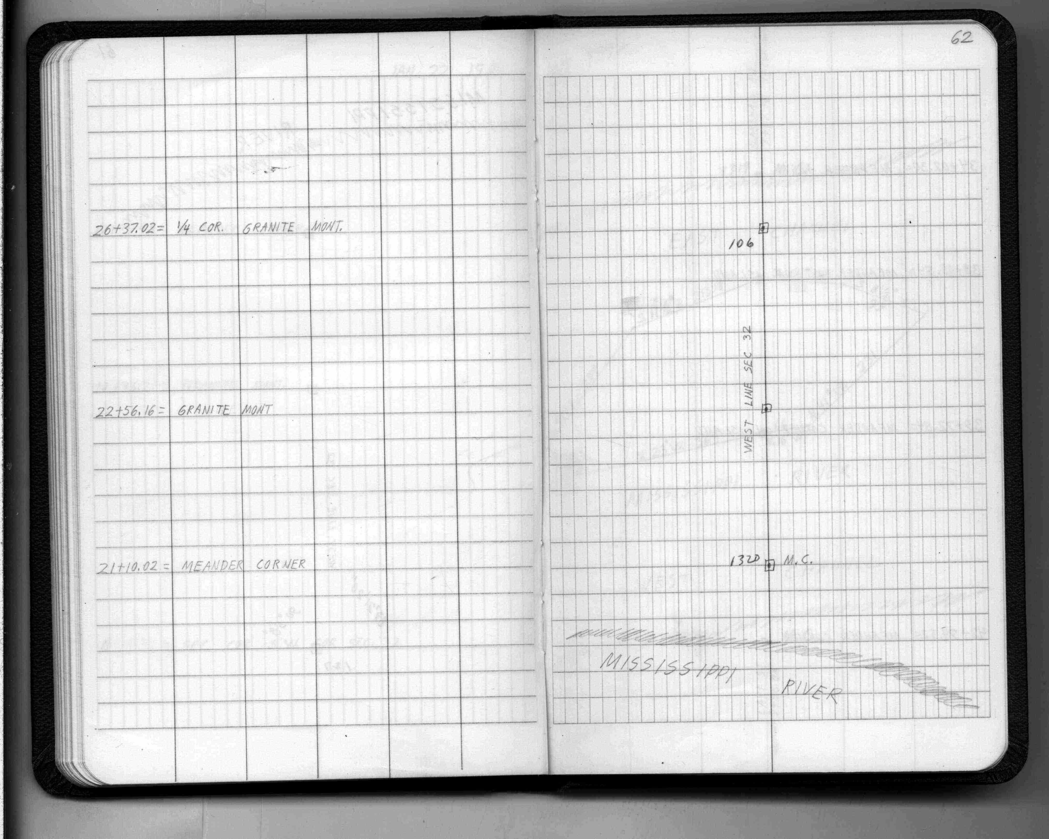
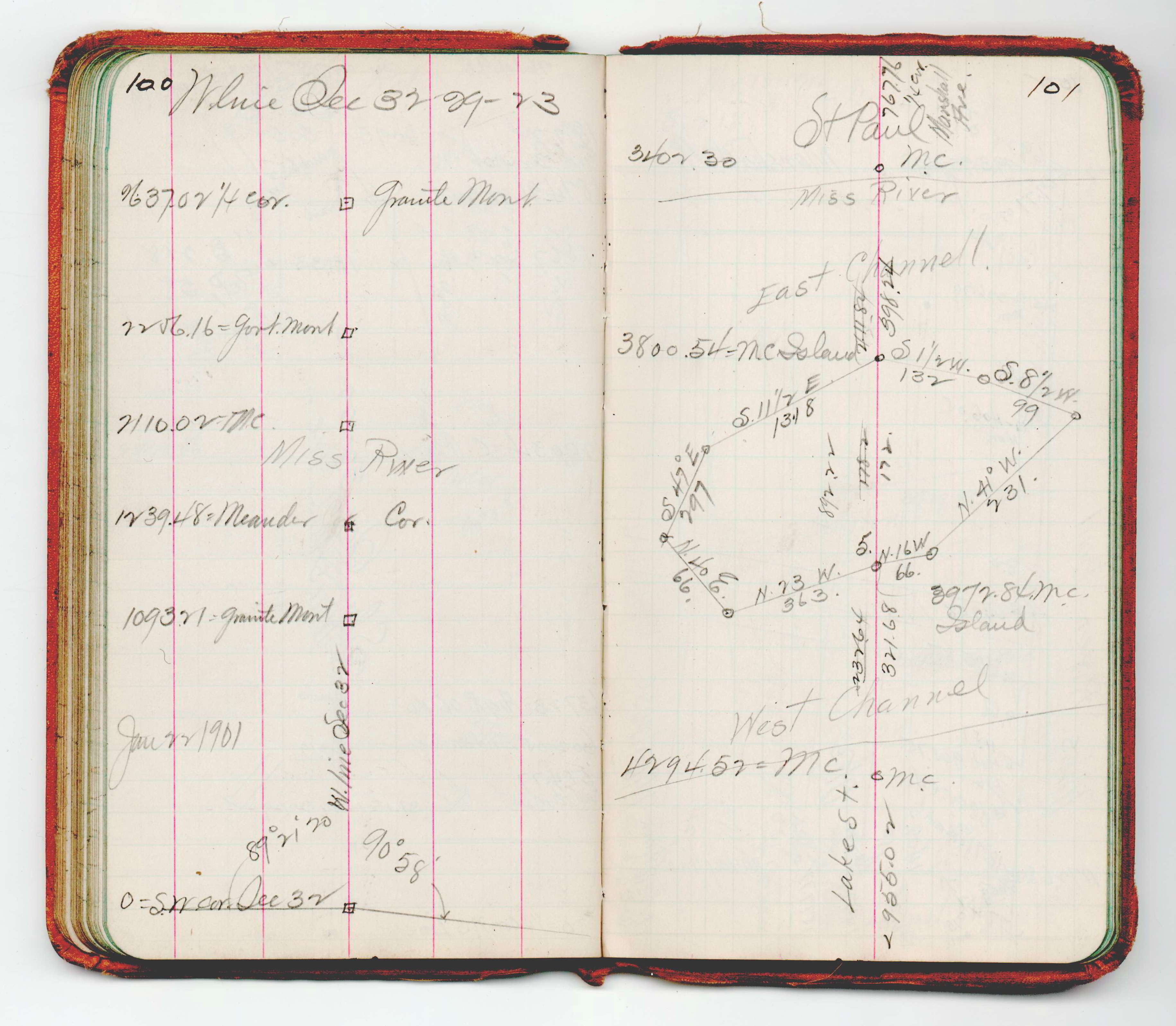
| 11/1/1847 | (Unknown date Nov __, 1847 ) Isaac N Higbee deputy surveyor set post. Tied to 1 BT. See IH p.114-115 2923 |
Above is NOT an all inclusive history of this point. Please review all the links below.
| PLS NOTES | Field | Cross Section | Sewer | J.B. Irvine | Monument | River Survey |
|---|---|---|---|---|---|---|
| IH p.114-115 | FB 0218CPYp.62 | JBI 15 p.100-101 | ||||
| FB 0596p.17 | ||||||
| FB 1676Cp.45 | ||||||
| FB 1686p.48 | ||||||
| FB 1689p.34 | ||||||
| FB 1689p.34 | ||||||
| FB 1716p.35 |
| FILE | SURVEYOR | LIC. NO. | DATE SIGNED | DATE TIED |
|---|---|---|---|---|
| 0106-1087-E.tif | Hennepin County Surveyors Office | none | none | December 6, 2001 |
| 0106-1087-C.tif | Richard C. Person | 23300 | March 21, 1996 | March 20, 1996 |
| 0106-1087-B.tif | Lorne G. Wikstrom | 23905 | April 5, 1996 | October 3, 1995 |
| 0106-1087-A | William J. Cutting | 20576 | October 9, 1992 | October 9, 1992 |
| ST_079-156p106.jpg | none | none | none | none |
| 0106-1087-D.tif | none | none | none | none |
| 0106-1087-A.dwf | none | none | none | none |
| FILE | PHOTO DATE | COMMENTS |
|---|---|---|
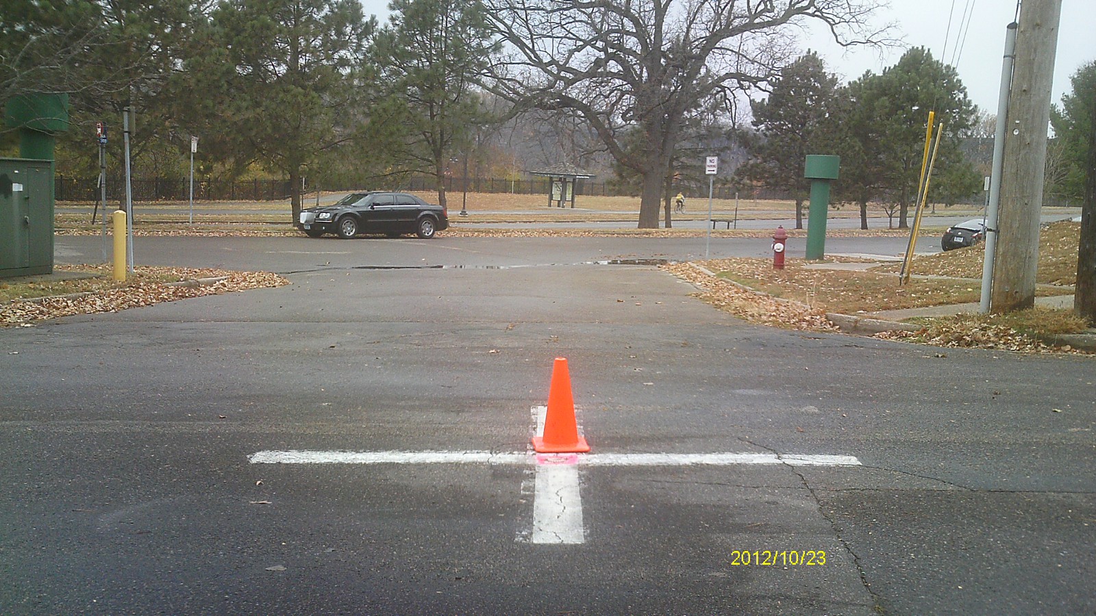
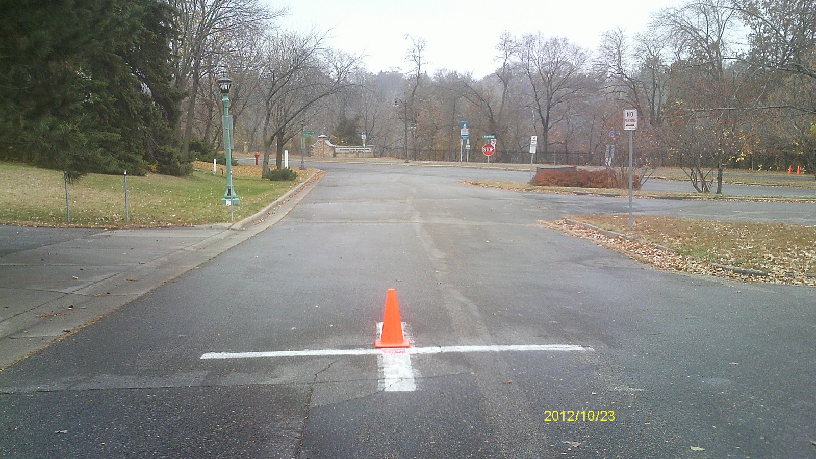
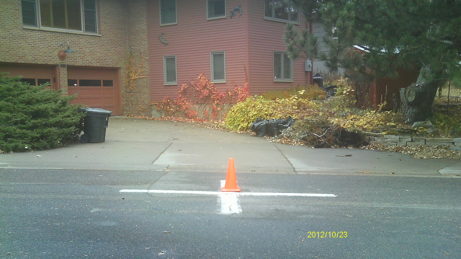
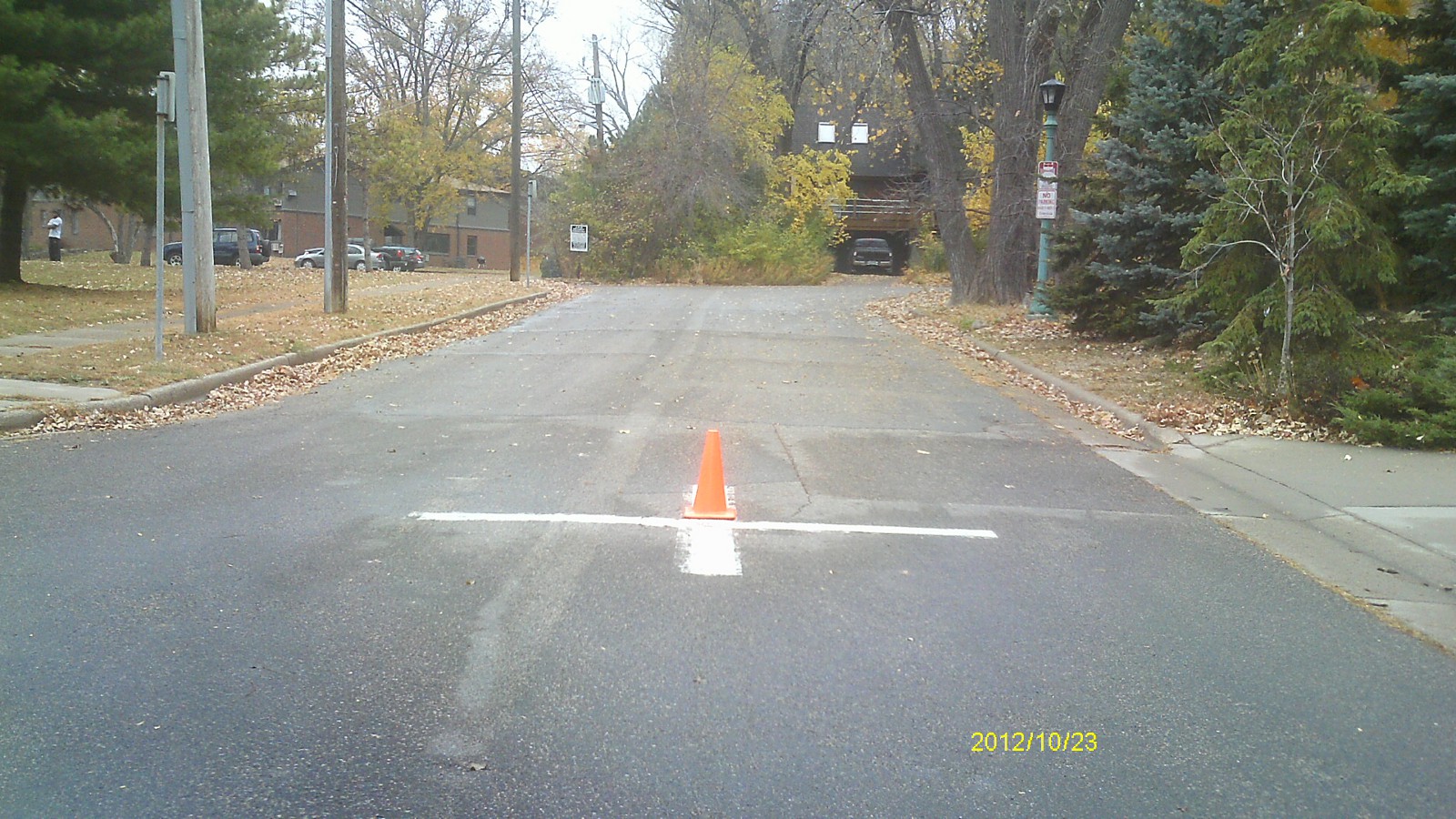
| 0106-1087-5.jpg | October 23, 2012 | Looking west along East River Terrace. |
| 0106-1087-4.jpg | October 23, 2012 | Looking south along Emerald St. |
| 0106-1087-3.jpg | October 23, 2012 | Looking east. |
| 0106-1087-2.jpg | October 23, 2012 | Looking north along Emerald St. |
| 0106-1087-1.jpg | October 23, 2012 | Close up of monument. |