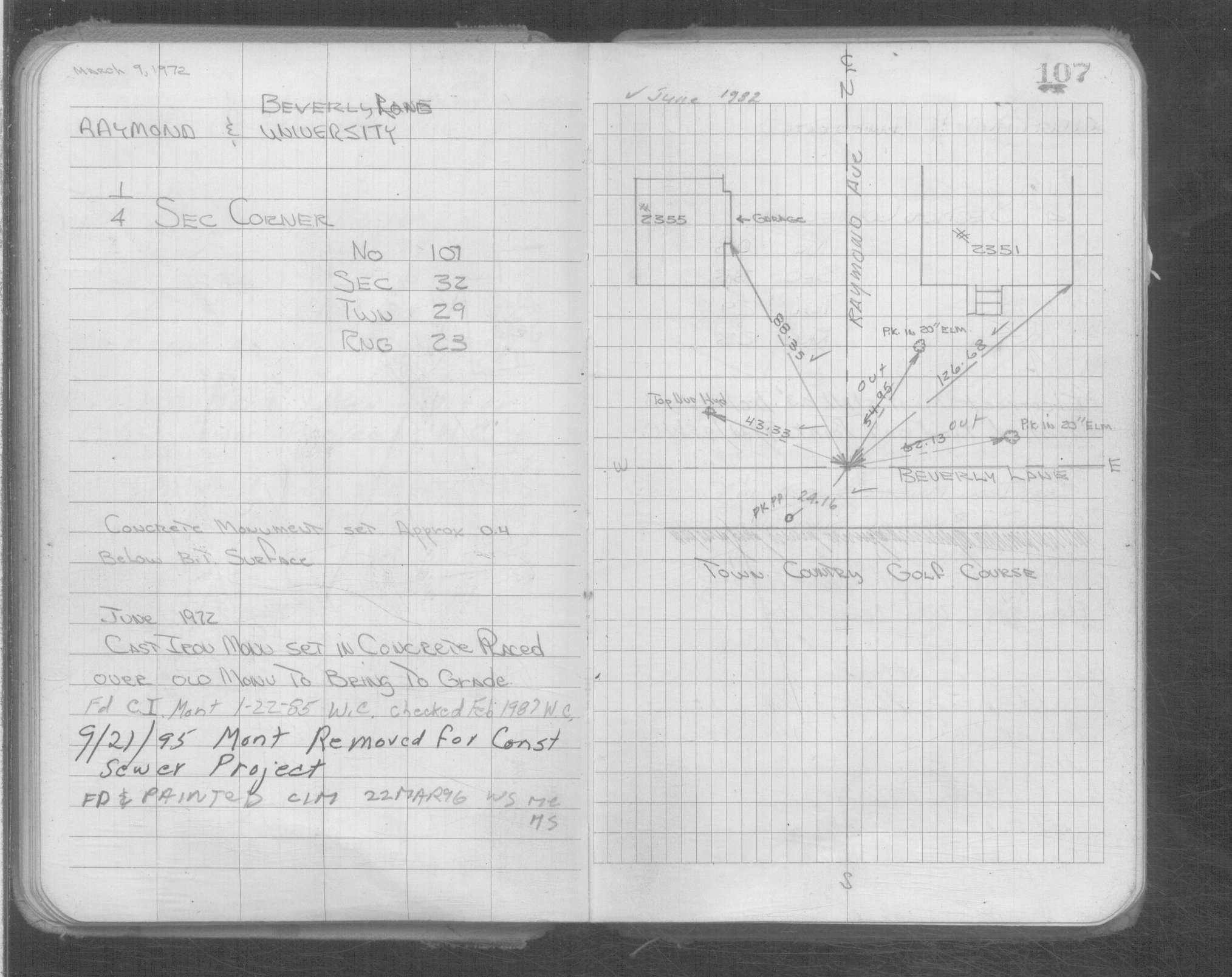
| NAD83 COORDINATES (1986 adj.): |
|---|
| * X= 548099.71 Y= 160029.54 Z= 0 LSQ 12/6/1991 S FLT |
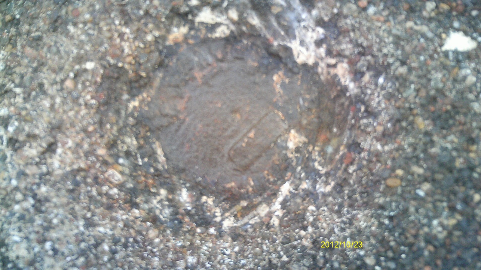
| 10/23/2012 | Found CIM at street grade. Photos taken. |
| 3/1/2000 | (Unknown date Mar __, 2000 ) Fd CIM 0.3 ft below grade, placed 4-2 ft straddles (marked for painting target for 2000 aerial) |
| 9/26/1995 | Set iron monument in concrete to grade. See CofL 0107-1086-A |
| 6/26/1995 | Fd iron monument, placed ties & removed for street & sewer construction. See CofL 0107-1086-A |
| 2/1/1987 | (Unknown date Feb __, 1987 ) Fd CIM. |
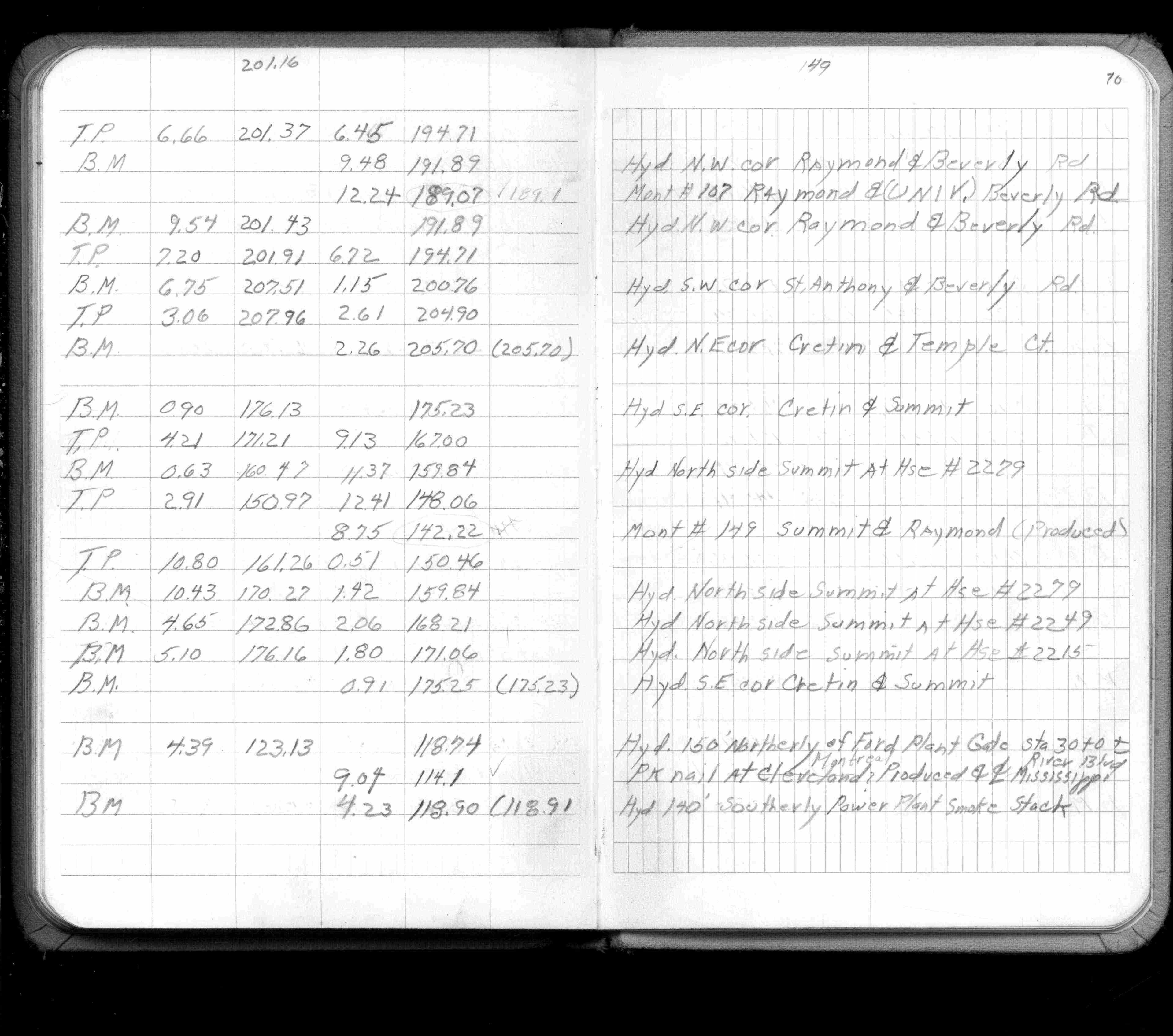
| 2/1/1985 | (Unknown date Feb __, 1985 ) Elev 189.07 ft on ?. See FB 1421A p.70 |
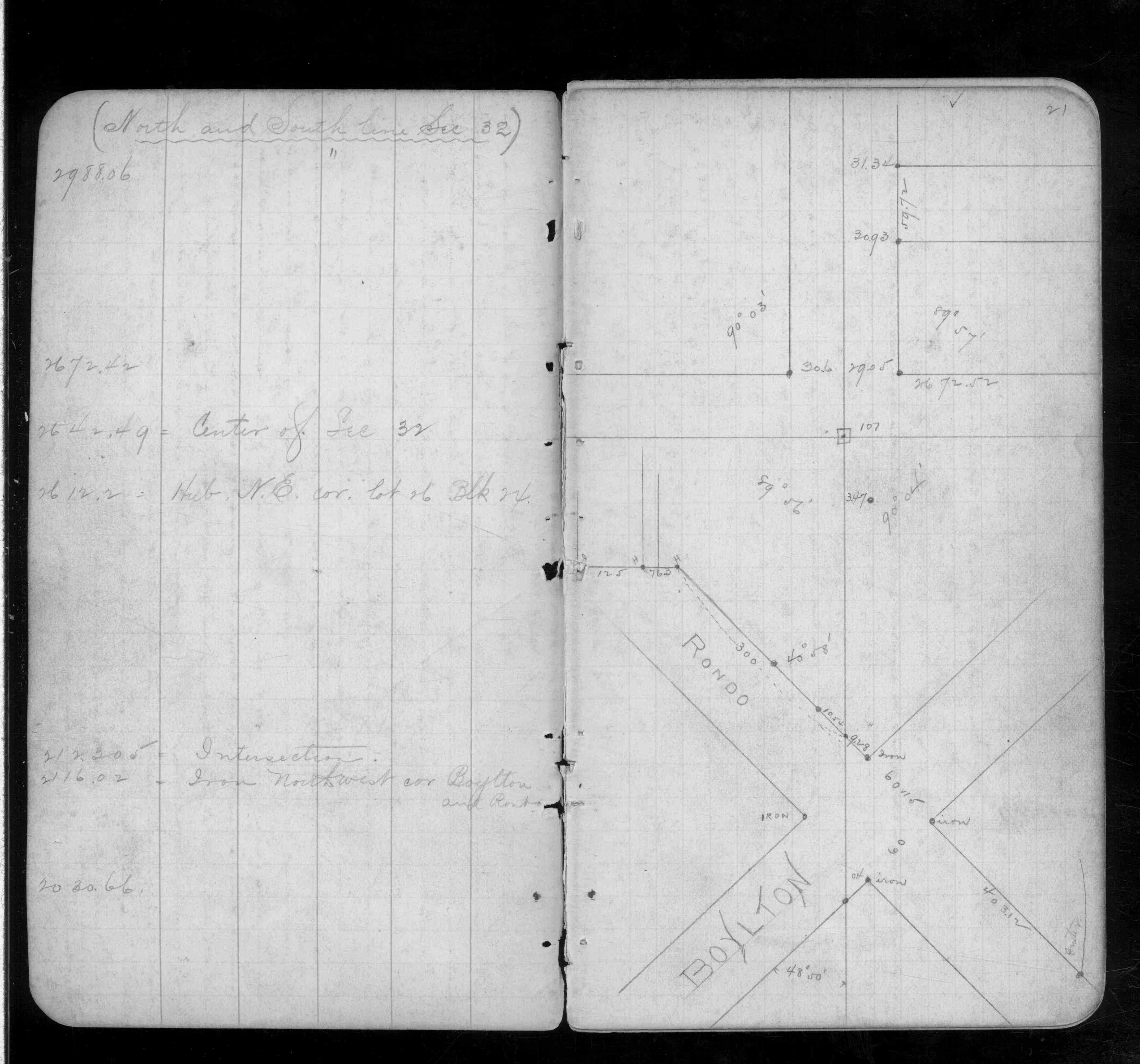
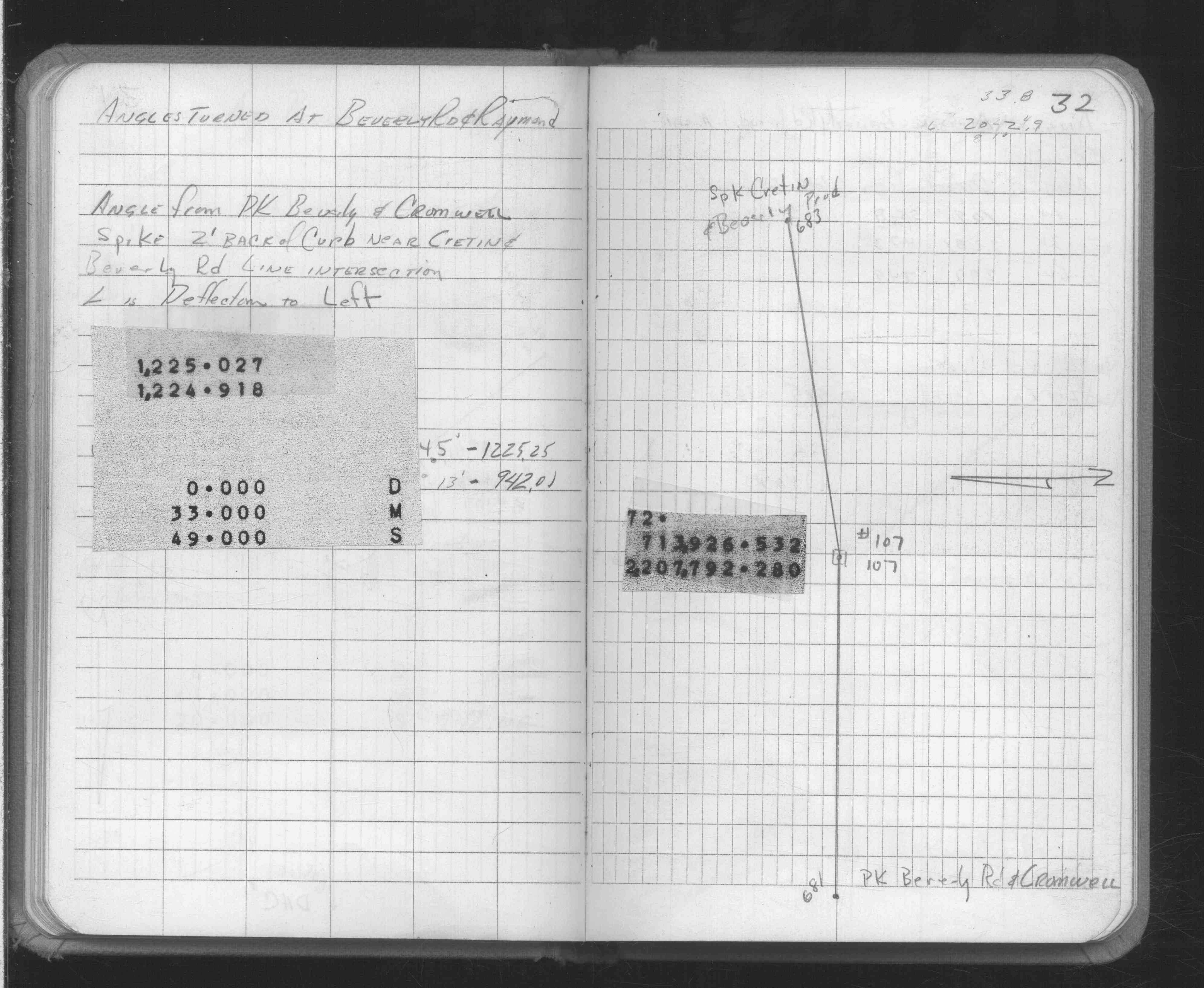
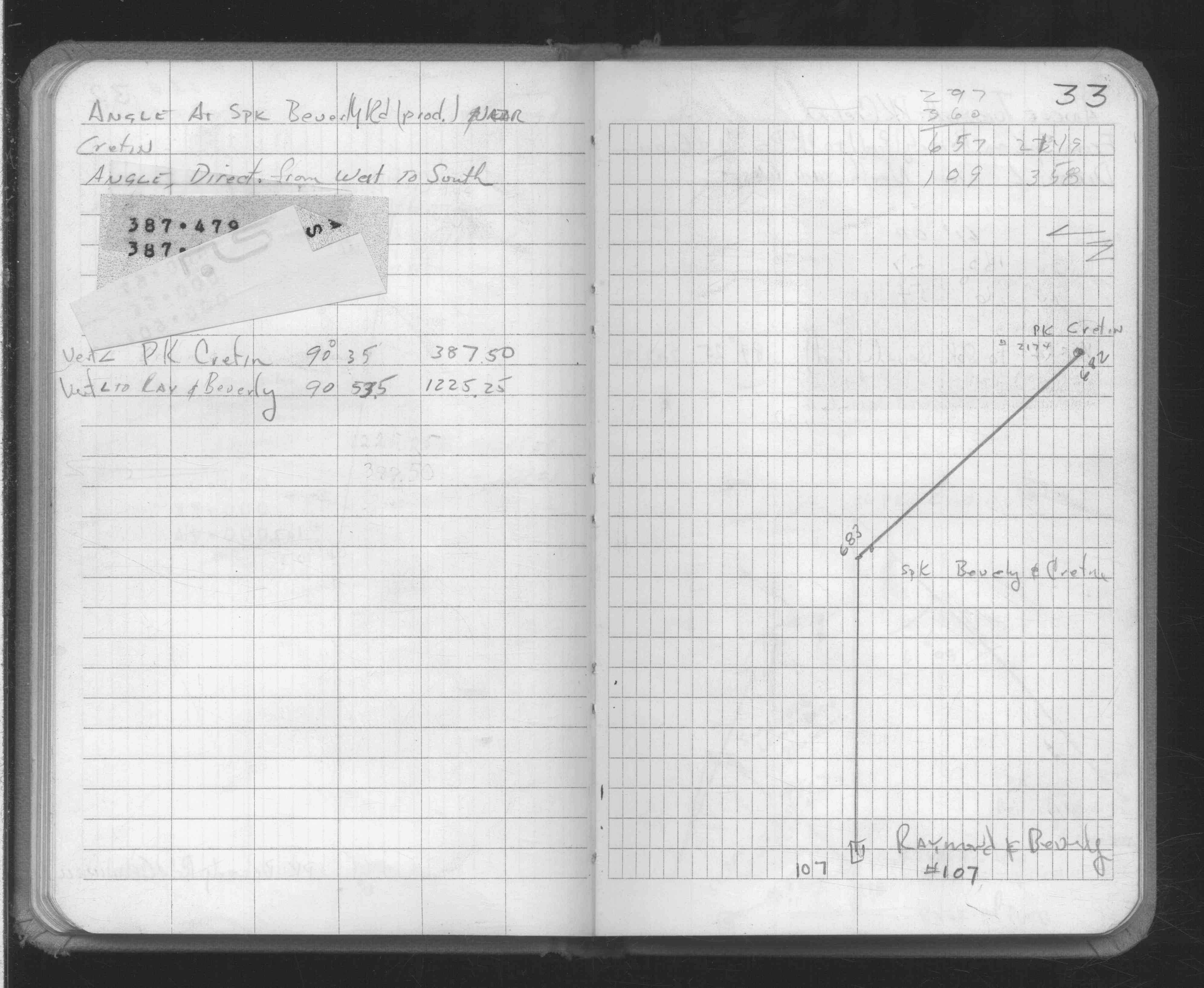
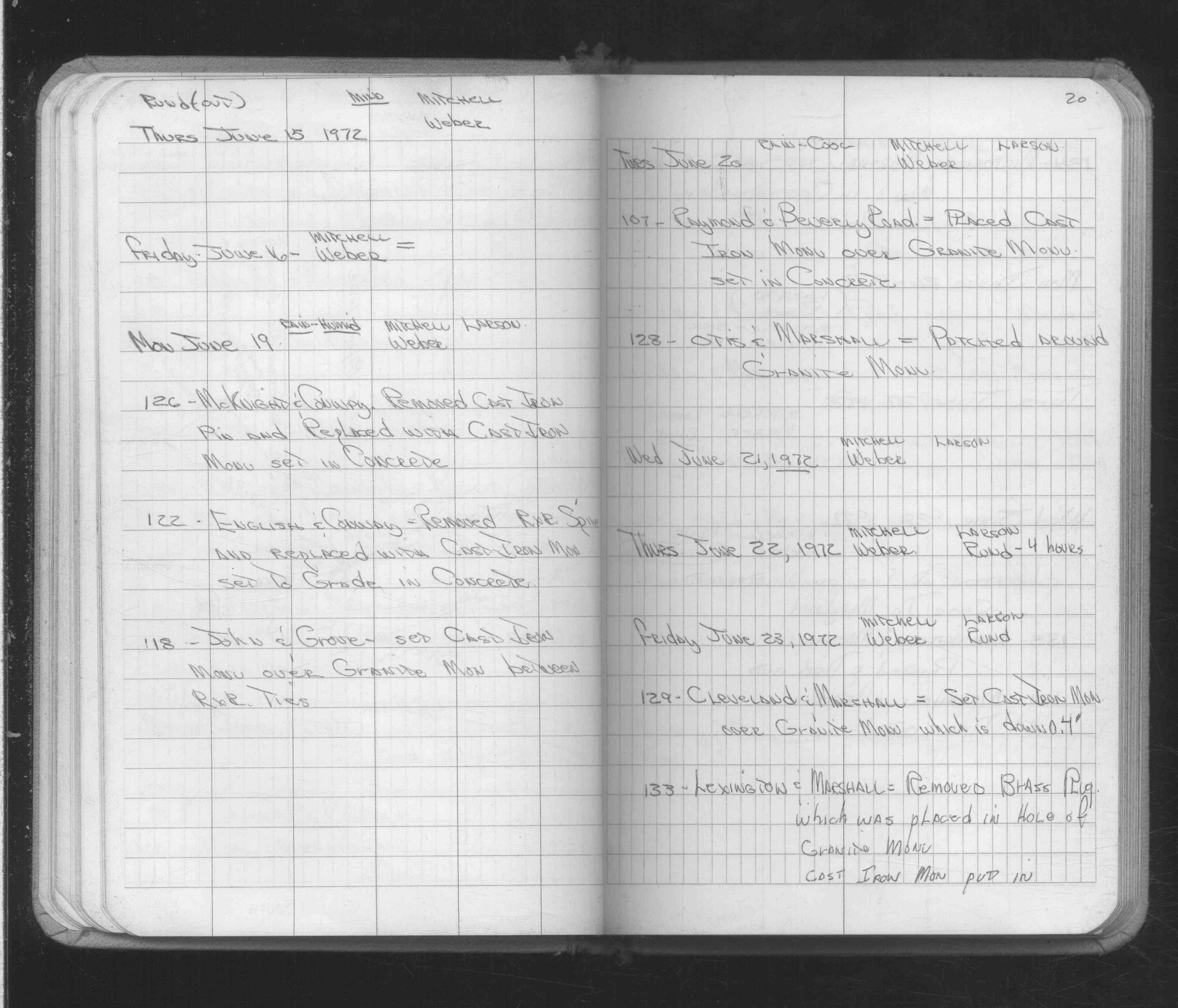
| 6/20/1972 | Fd GM, set CIM over GM. See FB 1689A p.20 |
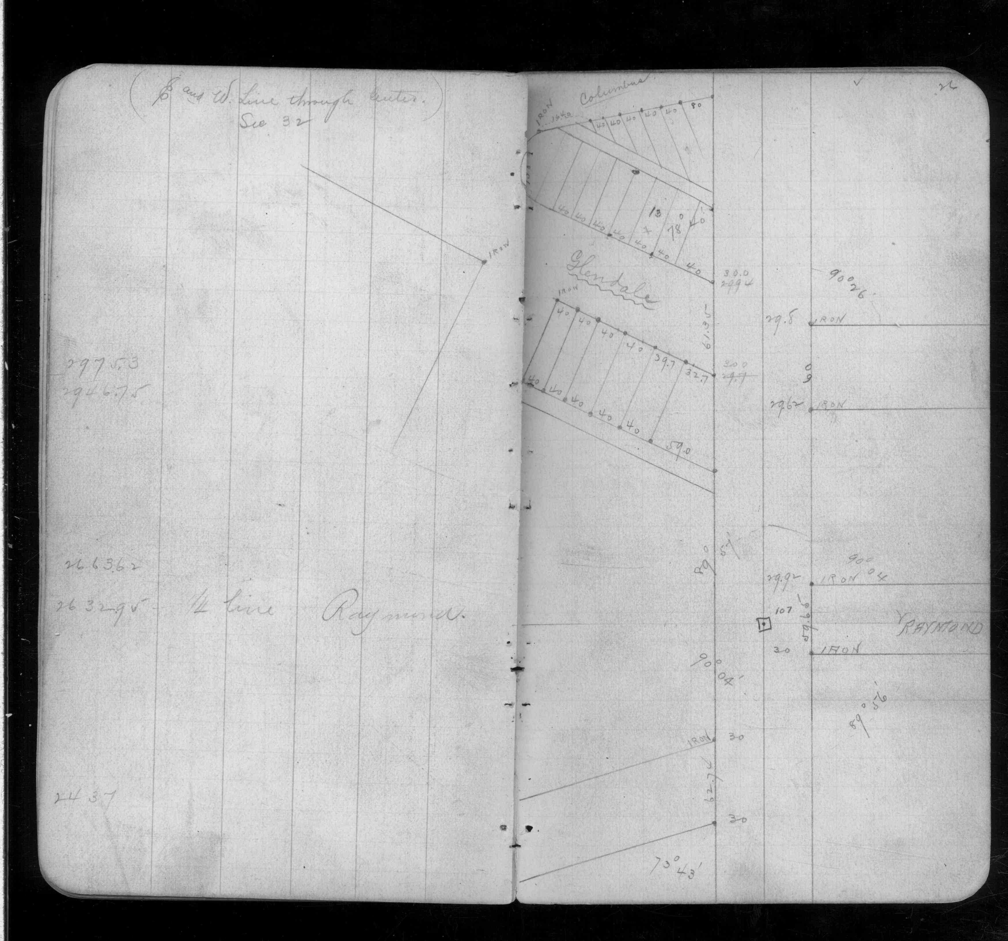
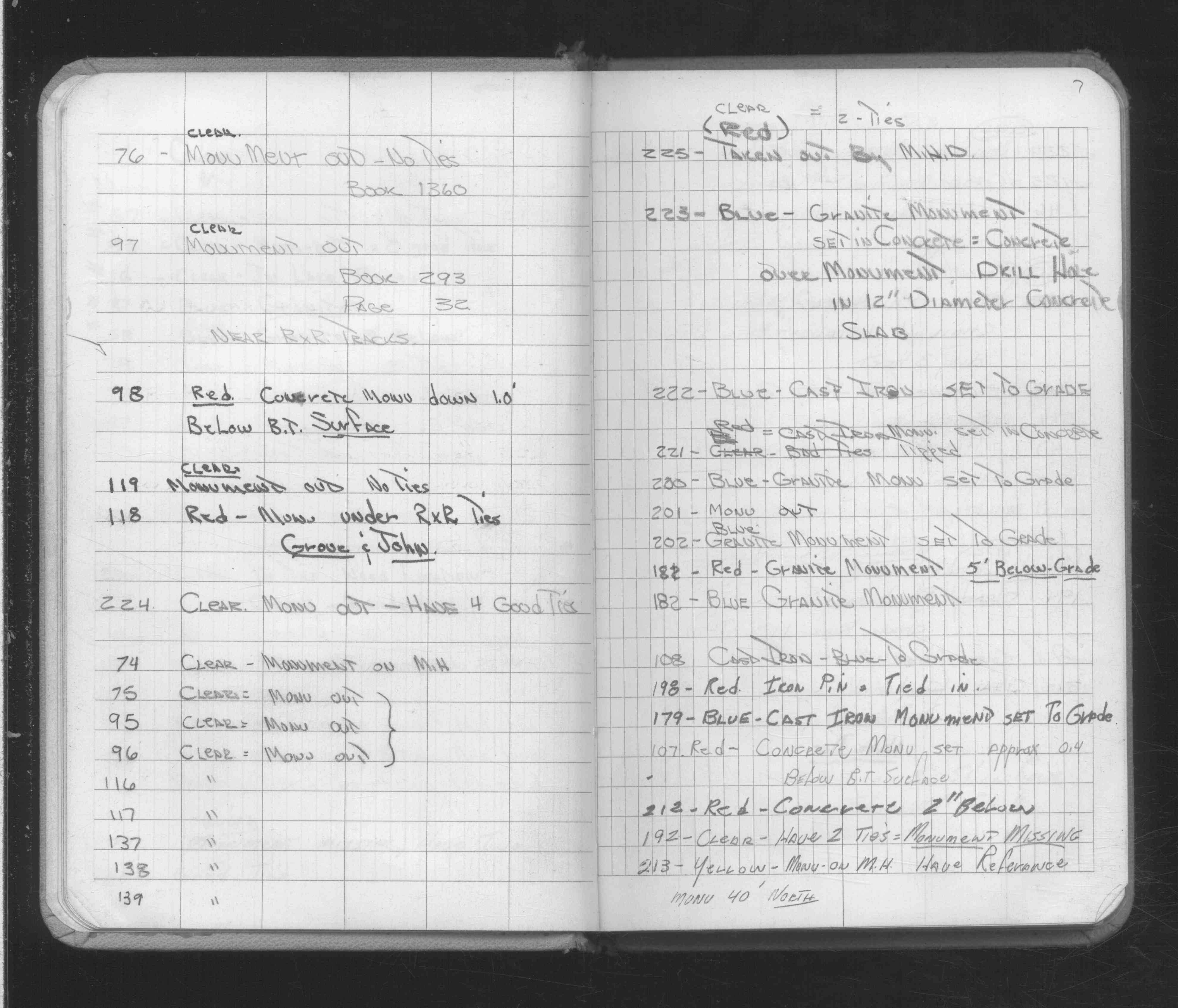
| 2/16/1972 | Fd concrete monument 0.4 ft below bituminous surface. See FB 1689A p.7 |
| 10/1/1887 | (Unknown date Oct __, 1887 ) Monument set by J H Armstrong. |
Above is NOT an all inclusive history of this point. Please review all the links below.
| PLS NOTES | Field | Cross Section | Sewer | J.B. Irvine | Monument | River Survey |
|---|---|---|---|---|---|---|
| FB 0218p. 21 ,26 | ||||||
| FB 1421Ap.70 | ||||||
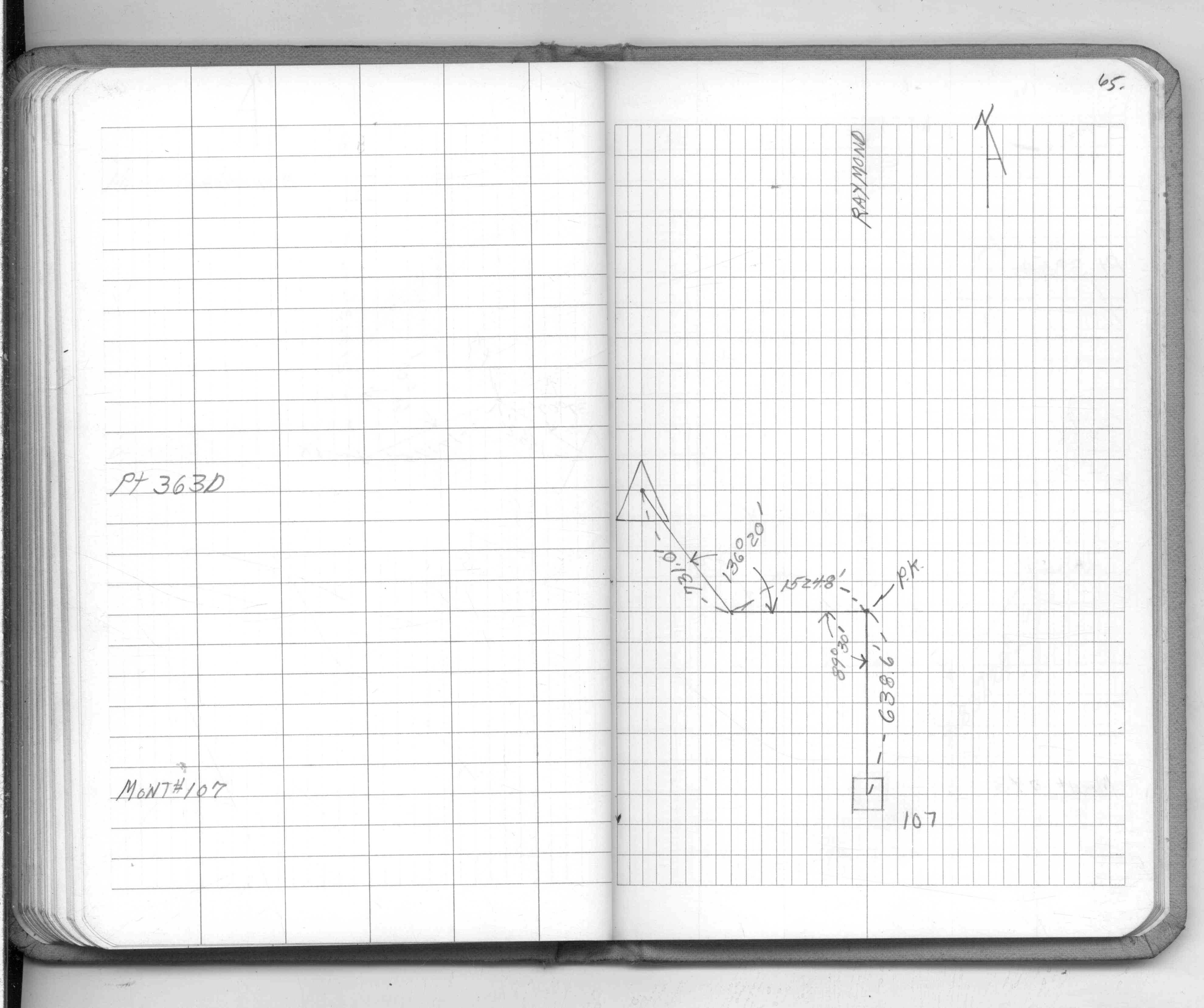
| FB 1549Cp.65 | ||||||
| FB 1634Bp. 32 ,33 | ||||||
| FB 1689Ap.20 | ||||||
| FB 1689Ap.07 |
| FILE | SURVEYOR | LIC. NO. | DATE SIGNED | DATE TIED |
|---|---|---|---|---|
| 0107-1086-A.tif | Lorne G. Wikstrom | 23905 | April 5, 1996 | September 26, 1995 |
| ST_079-156p107.jpg | none | none | none | none |
| 0107-1086-A.dwf | none | none | none | none |
| FILE | PHOTO DATE | COMMENTS |
|---|---|---|
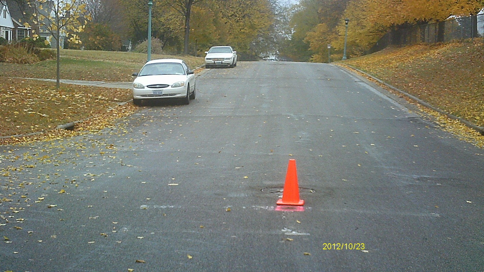
| 0107-1086-5.jpg | October 23, 2012 | Looking west along Beverly Rd. |
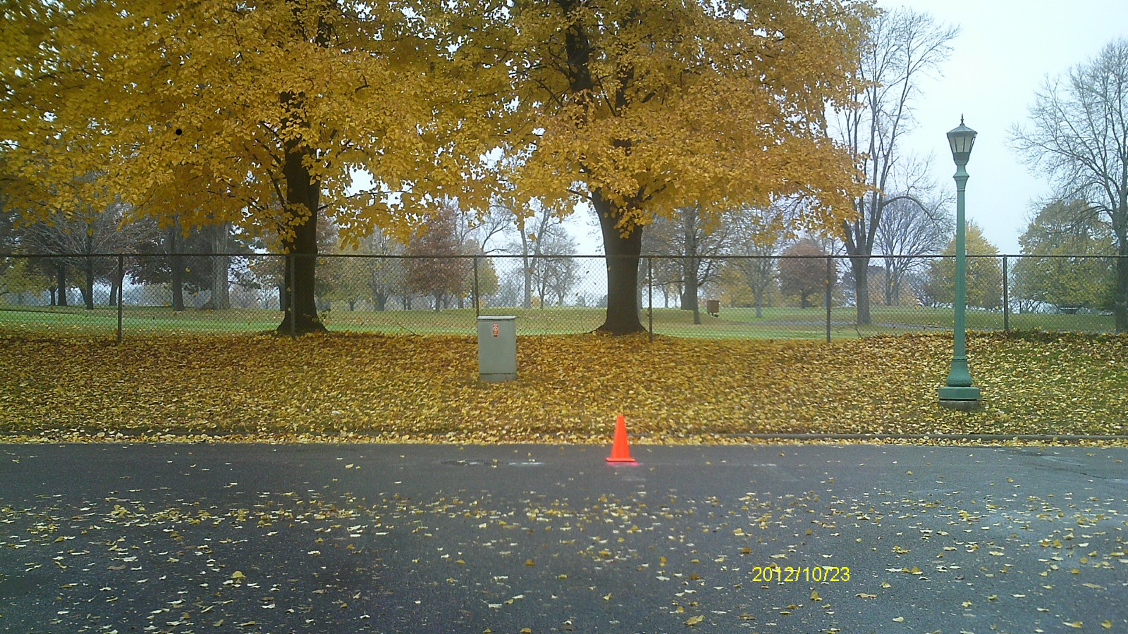
| 0107-1086-4.jpg | October 23, 2012 | Looking south towards golf course. |
| 0107-1086-3.jpg | October 23, 2012 | Looking east along Beverly Rd. |
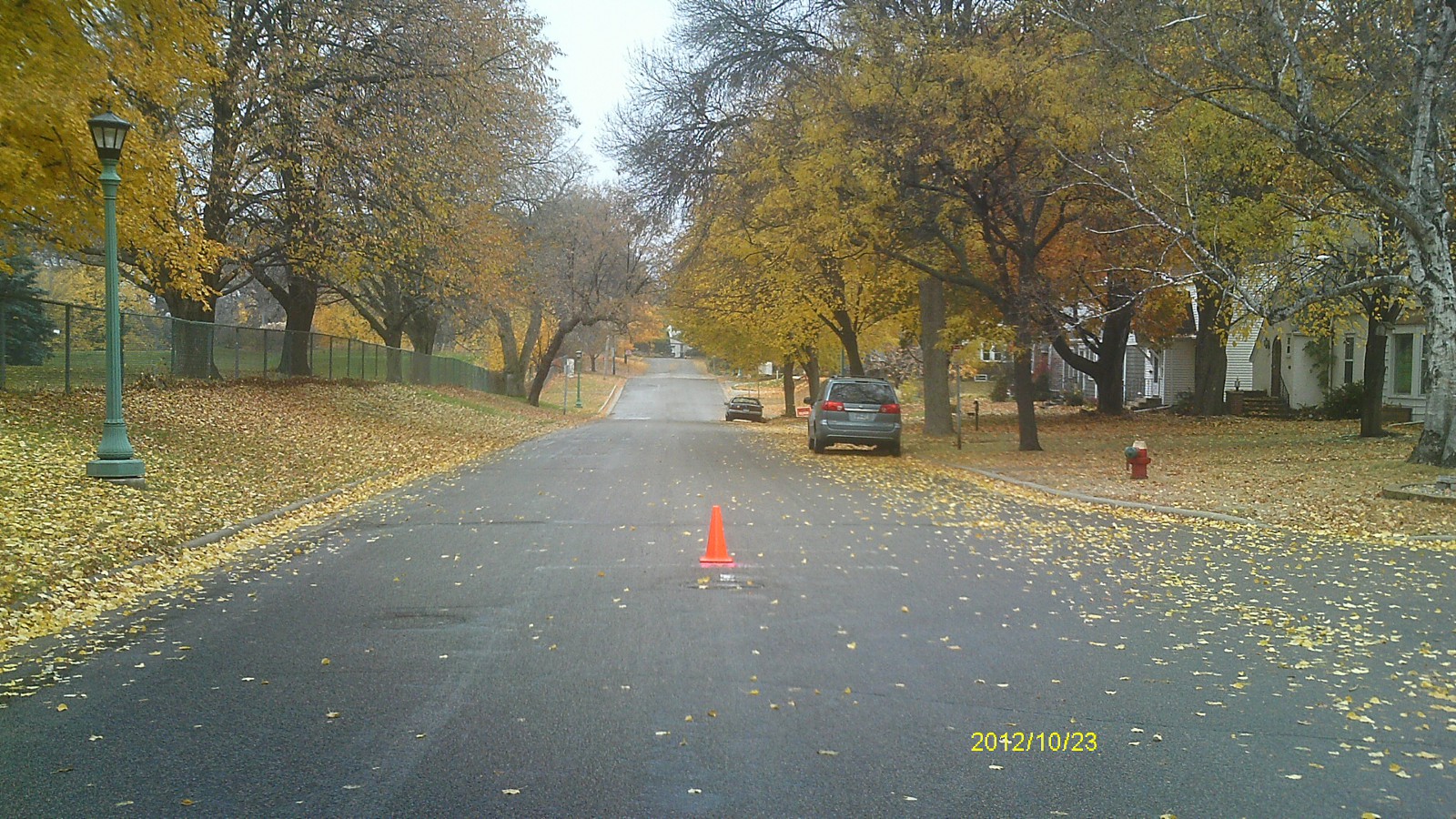
| 0107-1086-2.jpg | October 23, 2012 | Looking north along Raymond Ave. |
| 0107-1086-1.jpg | October 23, 2012 | Close up of monument. |