| NAD83 COORDINATES (1986 adj.): |
|---|
| * X= 571823.17 Y= 160170.67 Z= 0 LSQ 12/6/1991 S FLT |
| X= 571823.24 Y= 160170.76 Z= 868.8 1/11/2005 RTK-VRS |
| X= 571823.25 Y= 160170.77 Z= 868.7 3/15/2006 RTK-VRS |
| 3/15/2006 | Position on GM established by RTK-VRS GPS. Elev. 868.7 Ft. |
| 1/11/2005 | Position on GM established by RTK-VRS GPS. |
| 11/20/2004 | Photos taken after placing the casting. |
| 11/13/2004 | Placed casting over GM. GM 0.44 ft below grade and placed ties. See Cofl 0116-1159-B1 |
| 11/6/2004 | Photos taken before placing the casting. |
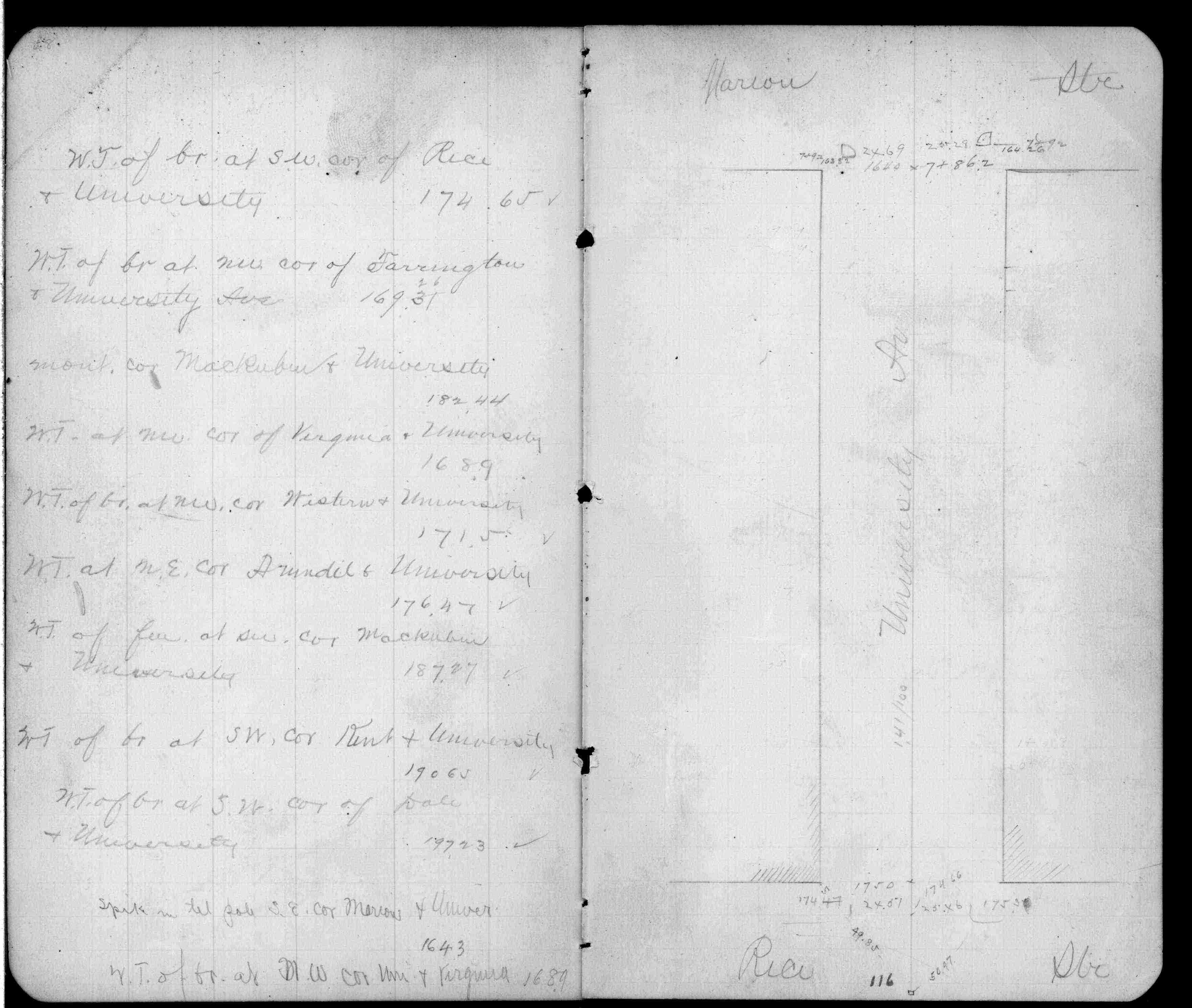
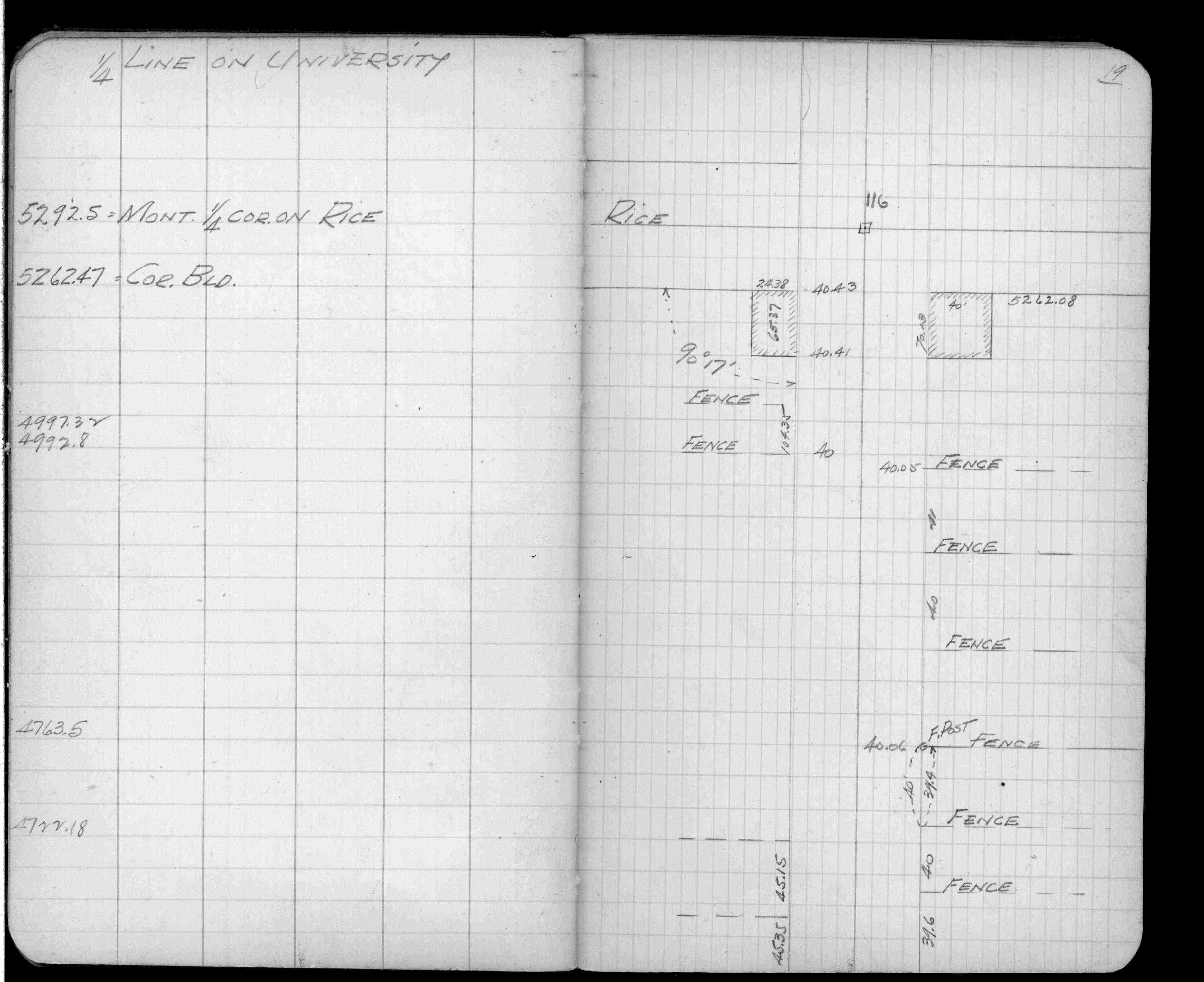
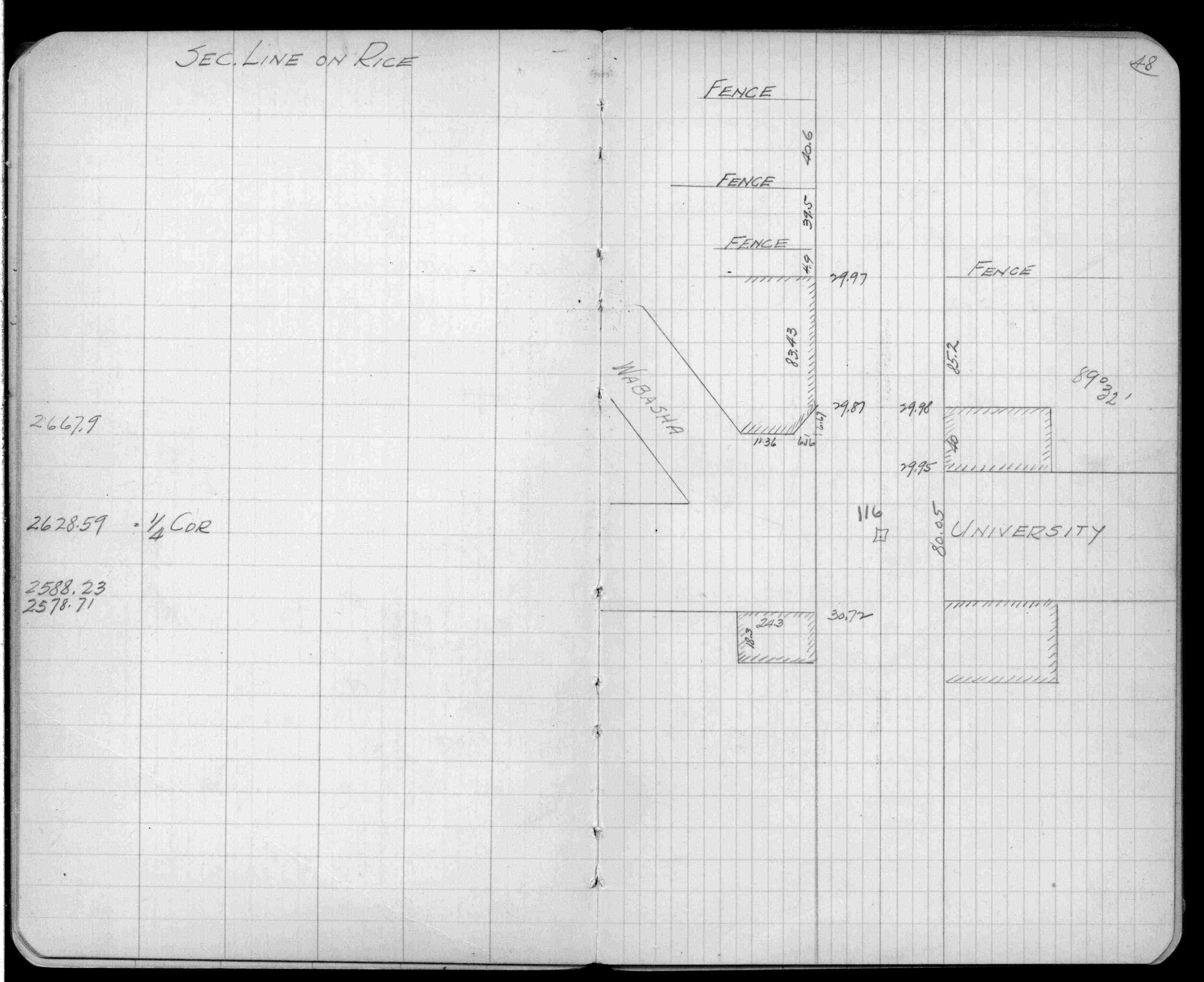
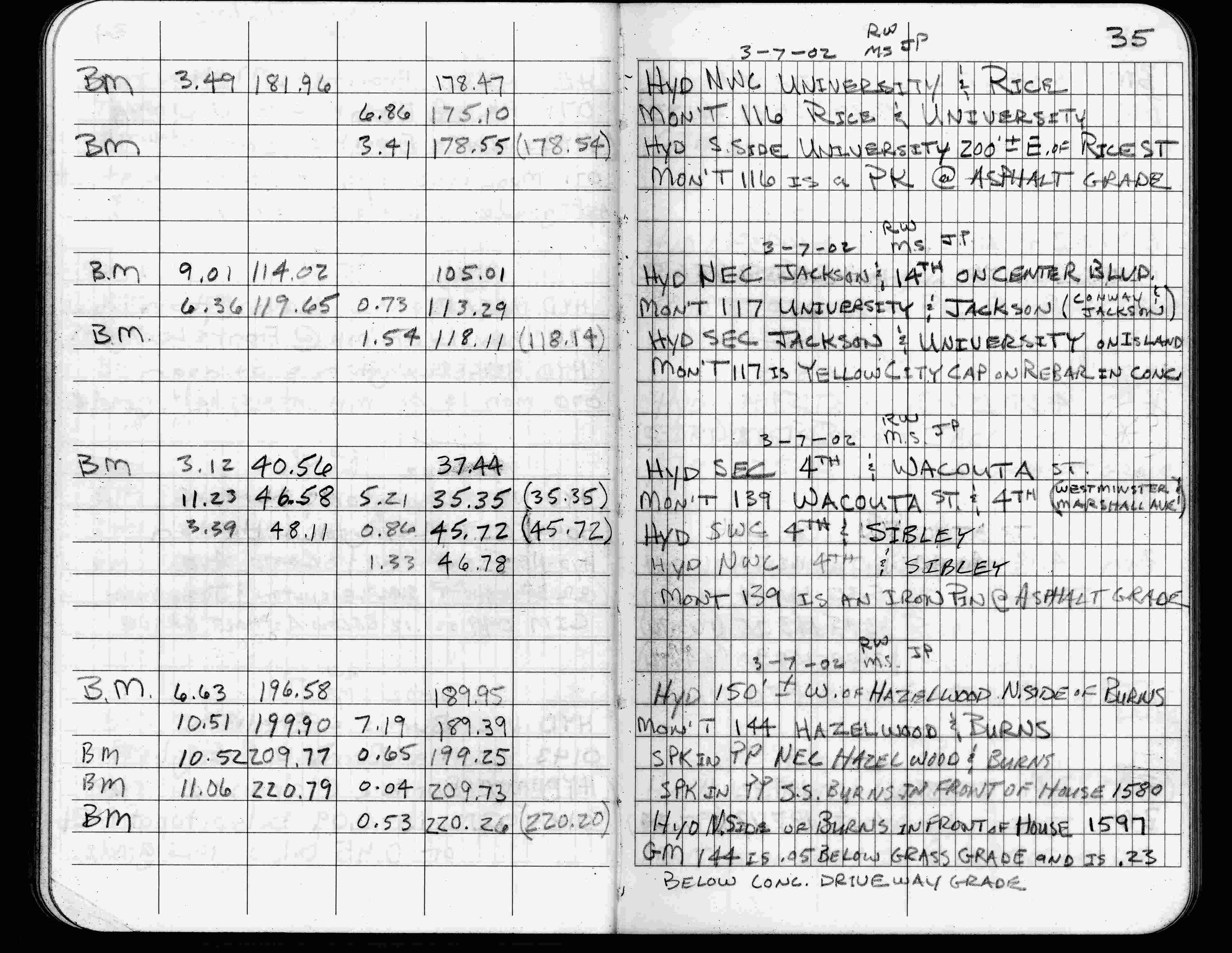
| 3/7/2002 | Elev 175.10 ft on PK nail at asphalt surface. See FB 1736 p.35 |
| 3/1/2000 | (Unknown date Mar __, 2000 ) Placed PK from coordinates (marked for painting target for 2000 aerial) |
| 3/26/1997 | Elev 175.10 ft on pavement. See acorddat/1997/p1157/p1157.sdr Digital-Unadj |
| 3/13/1991 | Fd GM 0.5 ft below asphalt street grade & placed ties. See CofL 0116-1159-A |
| 3/1/1991 | (Unknown date Mar __, 1991 ) Fd GM 0.6 ft below grade. |
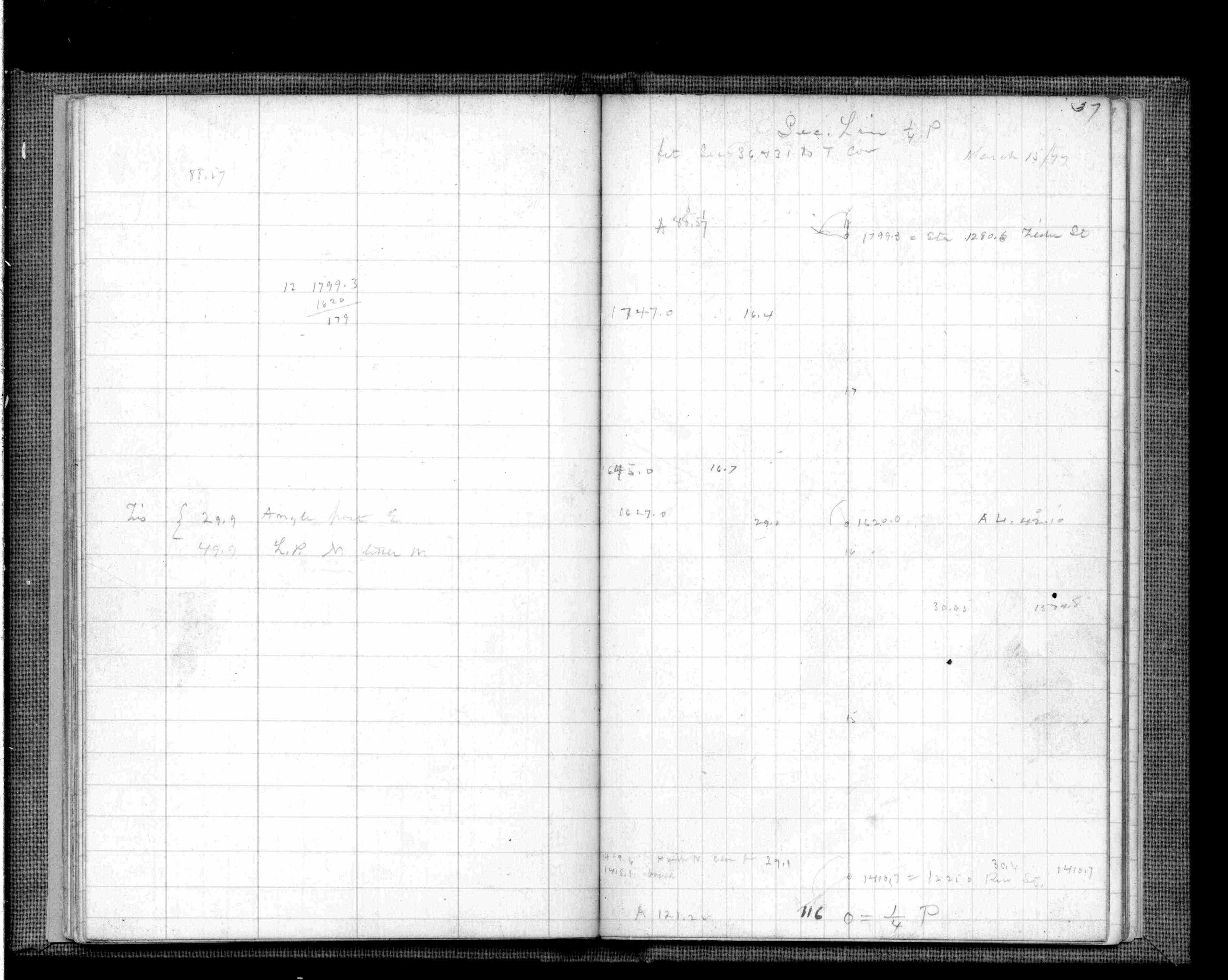
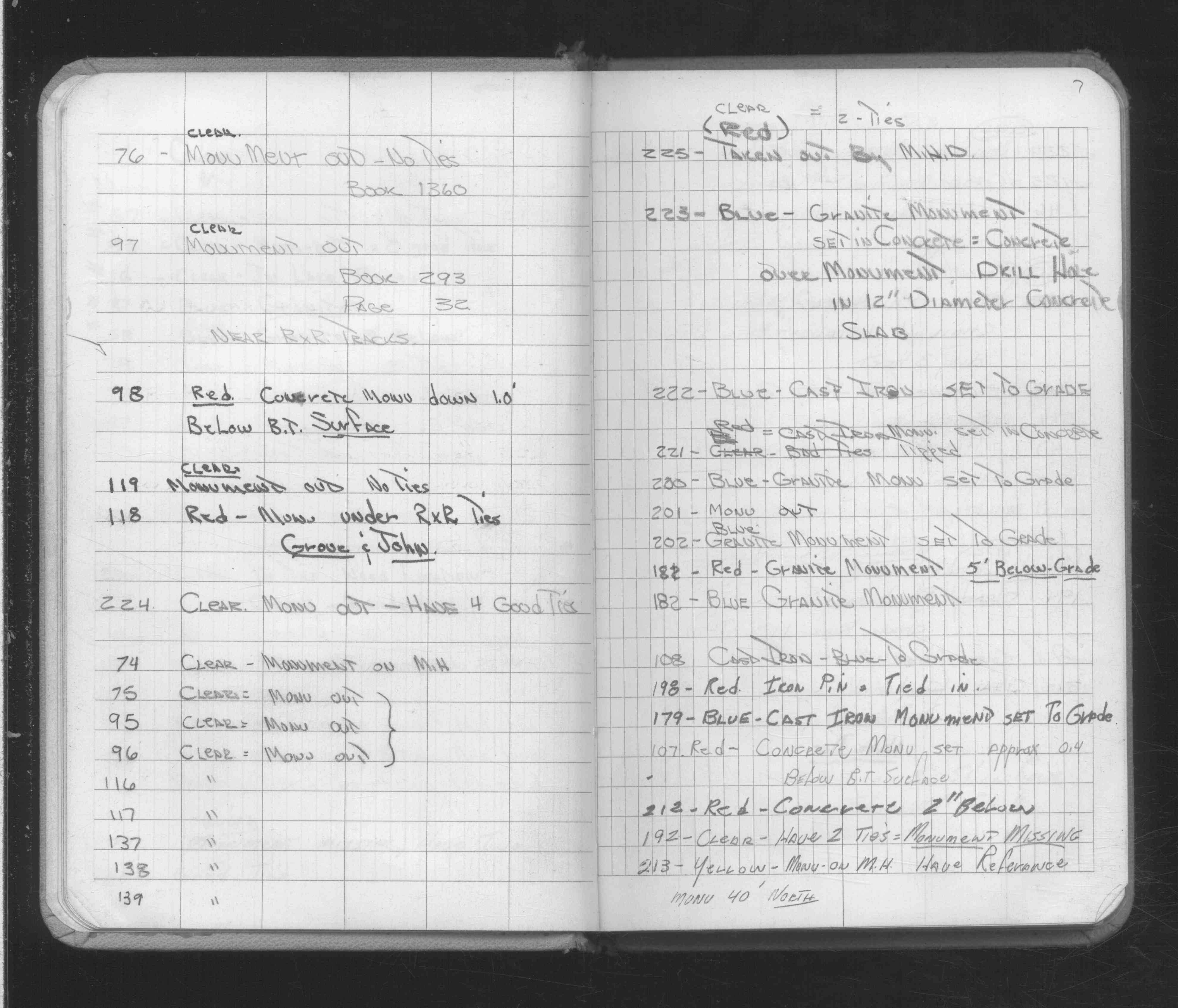
| 2/16/1972 | Monument out. See FB 1689A p.7 |
| 10/8/1847 | James M Marsh deputy surveyor set post. Tied to 2 BTs. See JM p.000-075 border |
Above is NOT an all inclusive history of this point. Please review all the links below.
| PLS NOTES | Field | Cross Section | Sewer | J.B. Irvine | Monument | River Survey |
|---|---|---|---|---|---|---|
| JM p.000-075 | FB 0148p.16 | |||||
| FB 0158p. 16 ,18 | ||||||
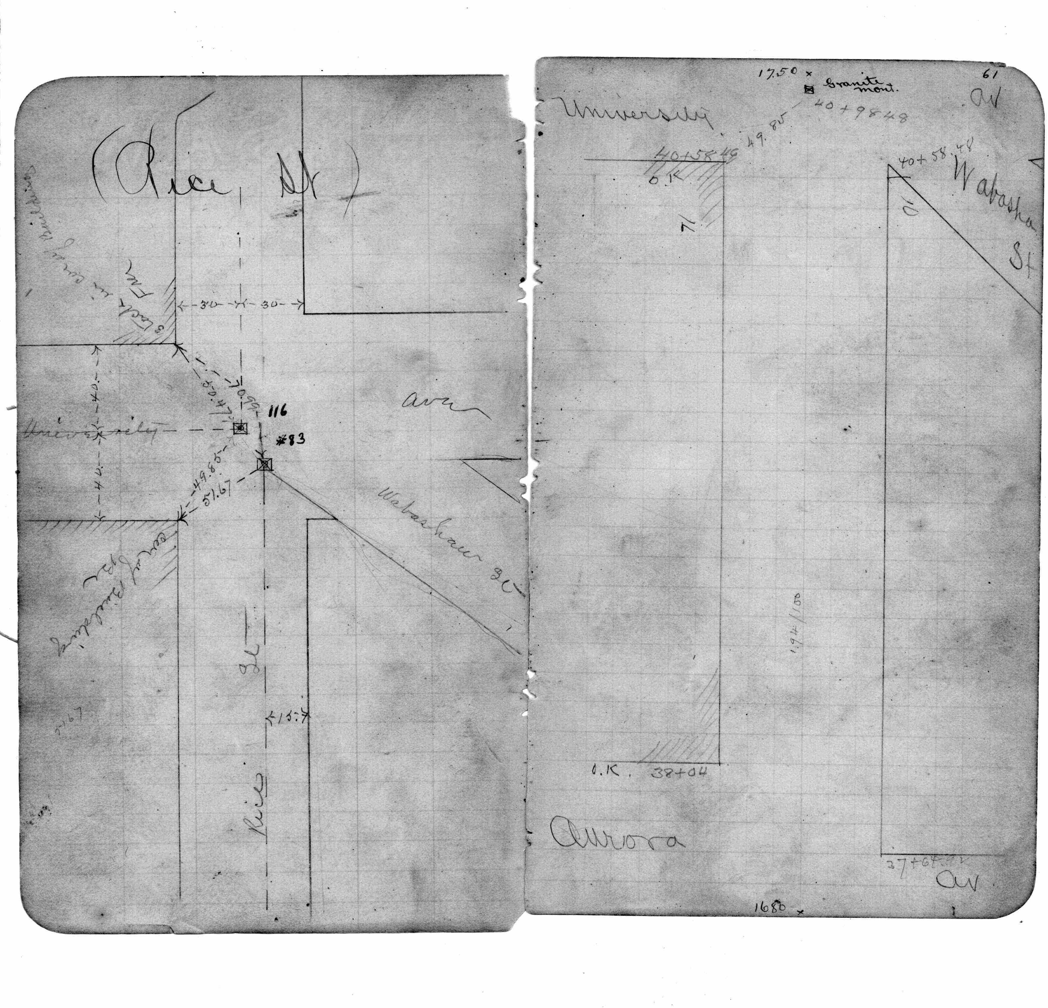
| FB 0202p.61 | ||||||
| FB 0275p.068-069 | ||||||
| FB 0276CPYp. 19 ,48 | ||||||
| FB 0368p.37 | ||||||
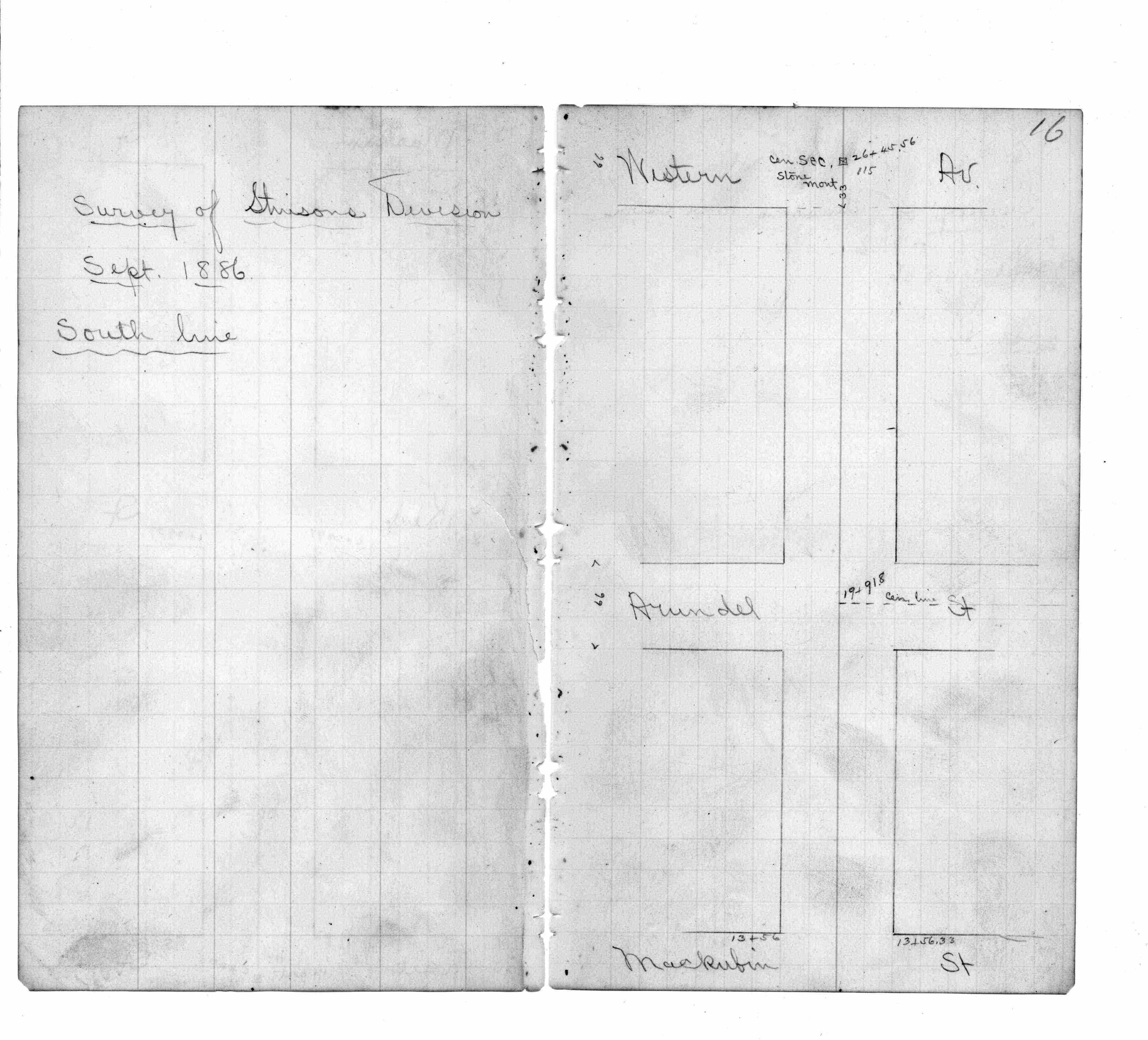
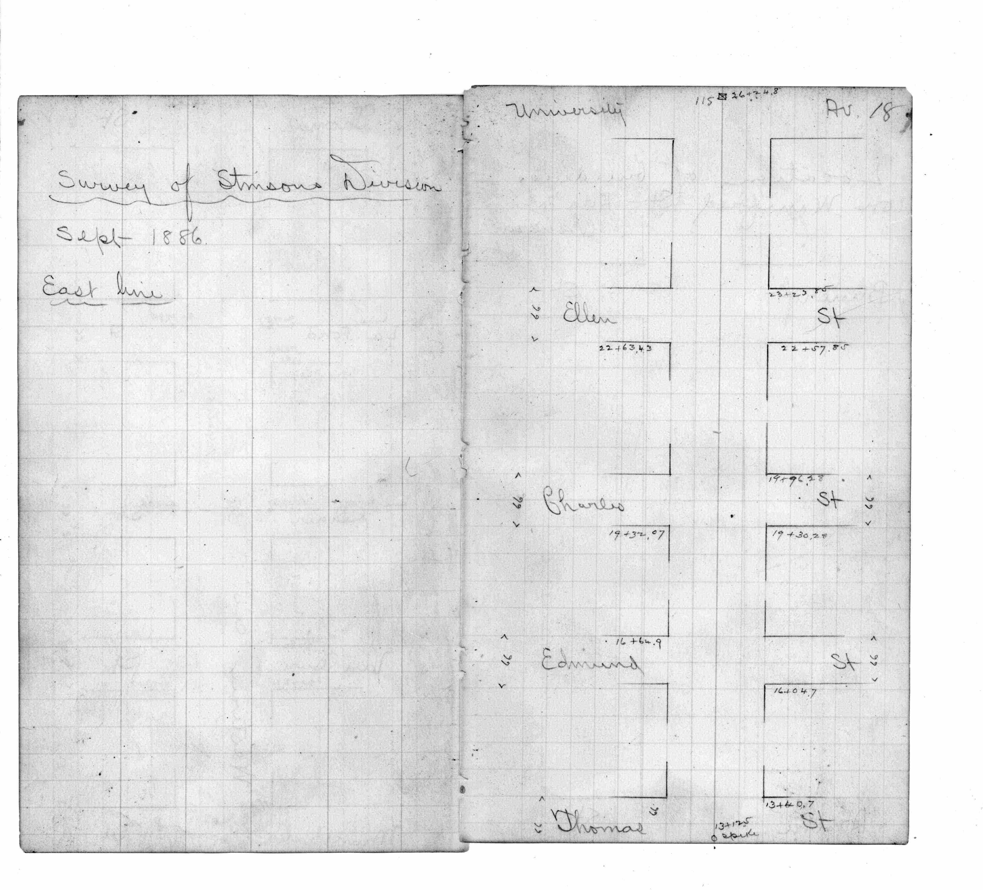
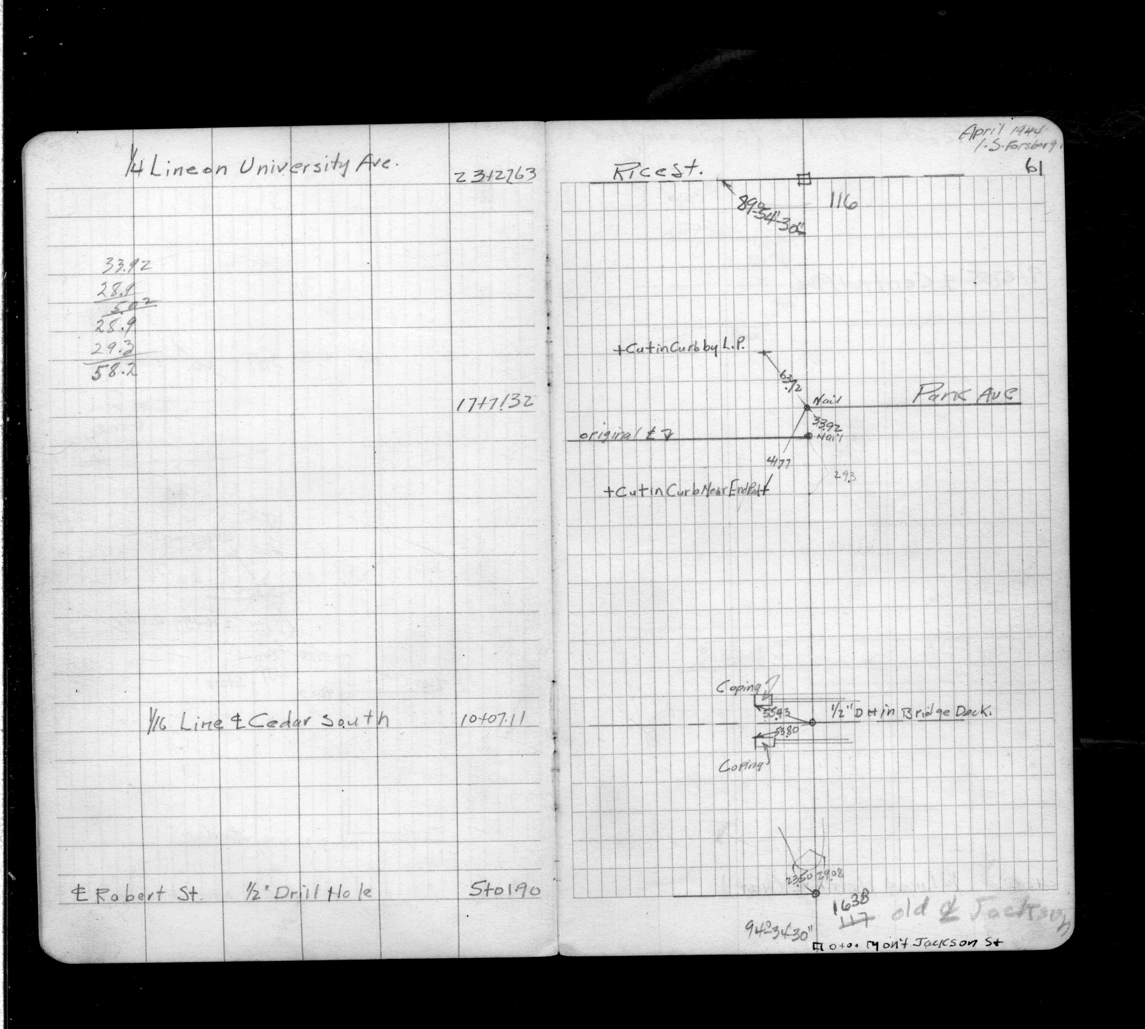
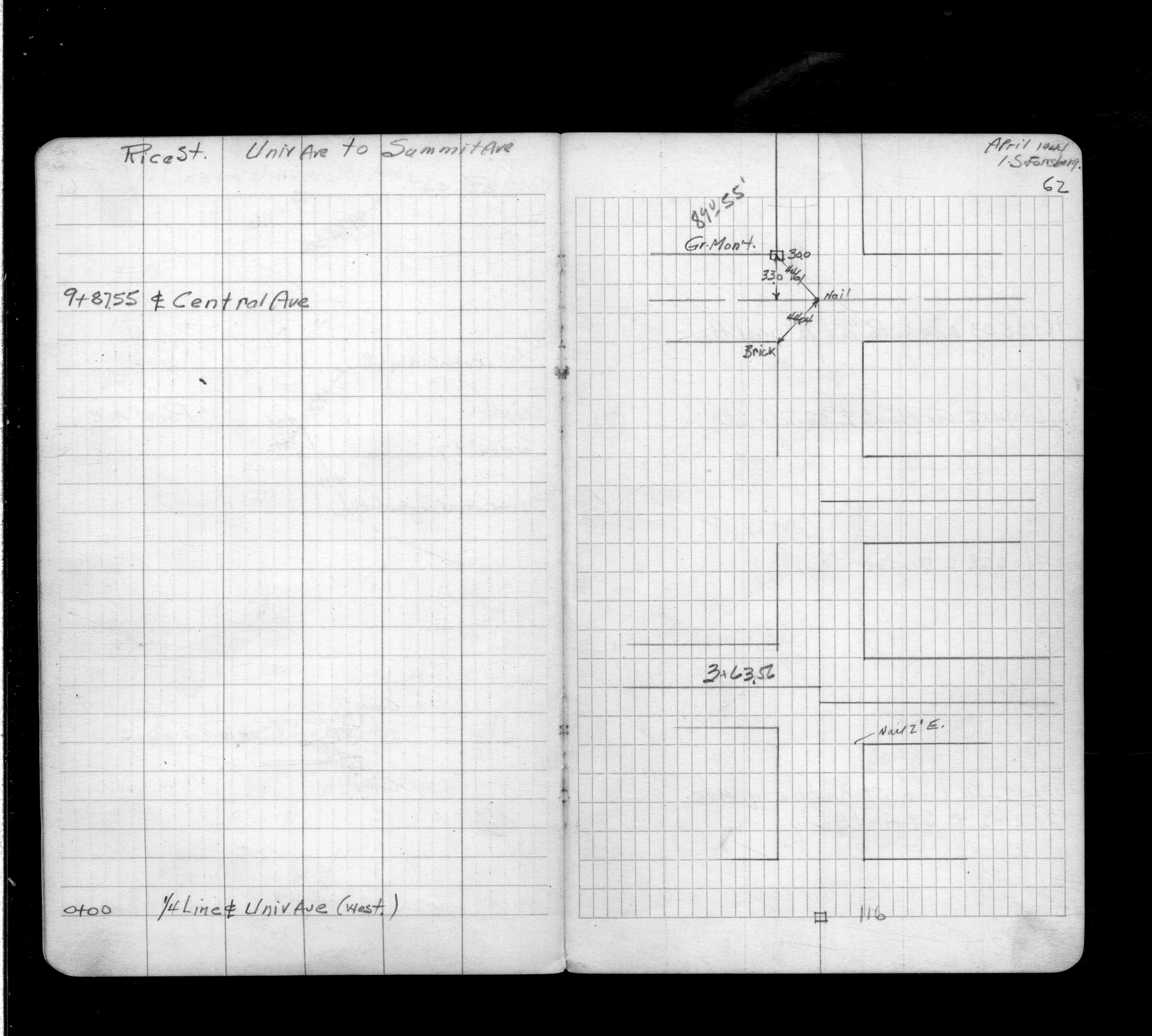
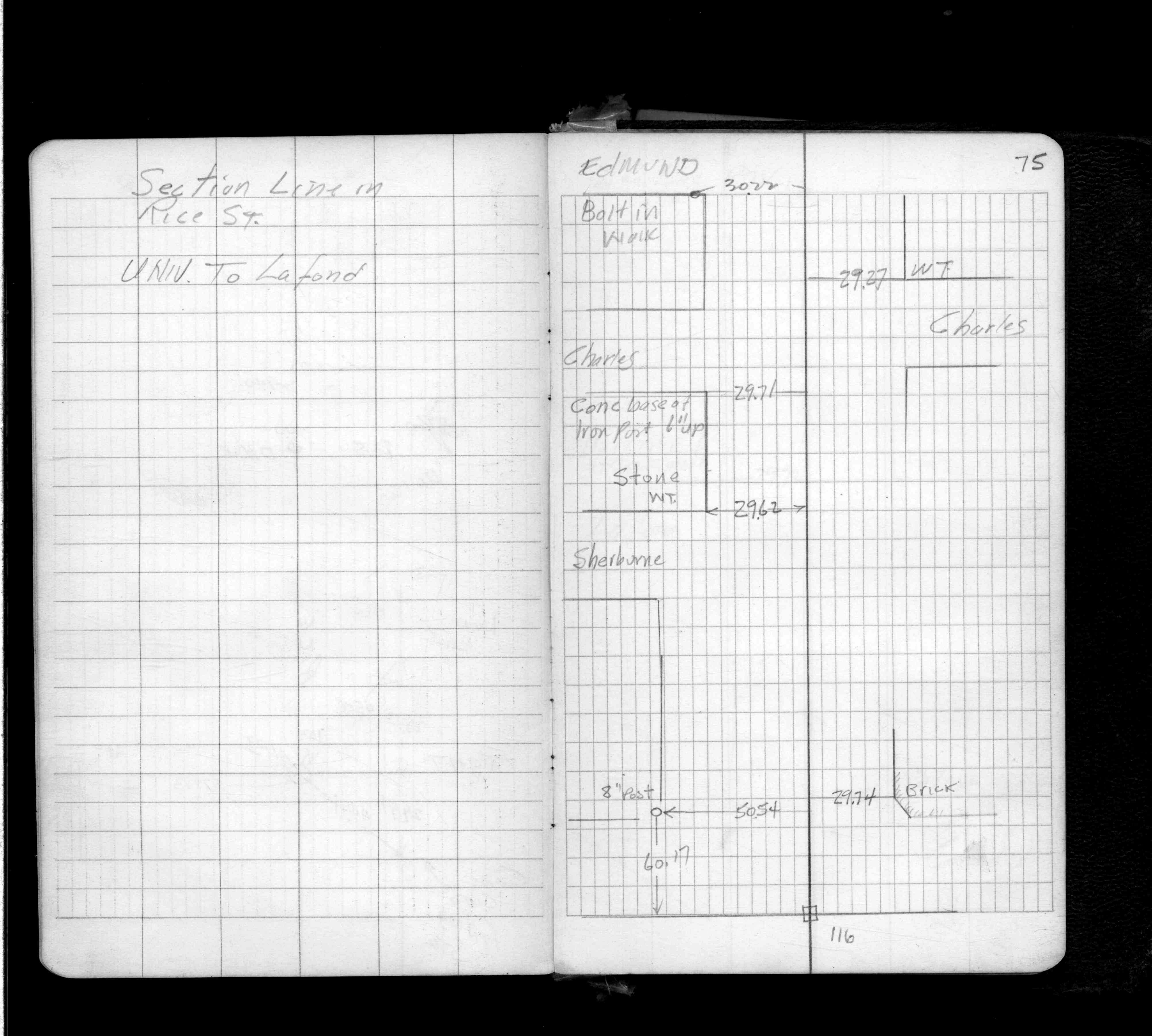
| FB 1360p. 61 ,62 ,75 | ||||||
| FB 1374p.55 | ||||||
| FB 1497p.03 | ||||||
| FB 1549Gp. 21 ,61 | ||||||
| FB 1673Ap. 48 ,50 ,69 | ||||||
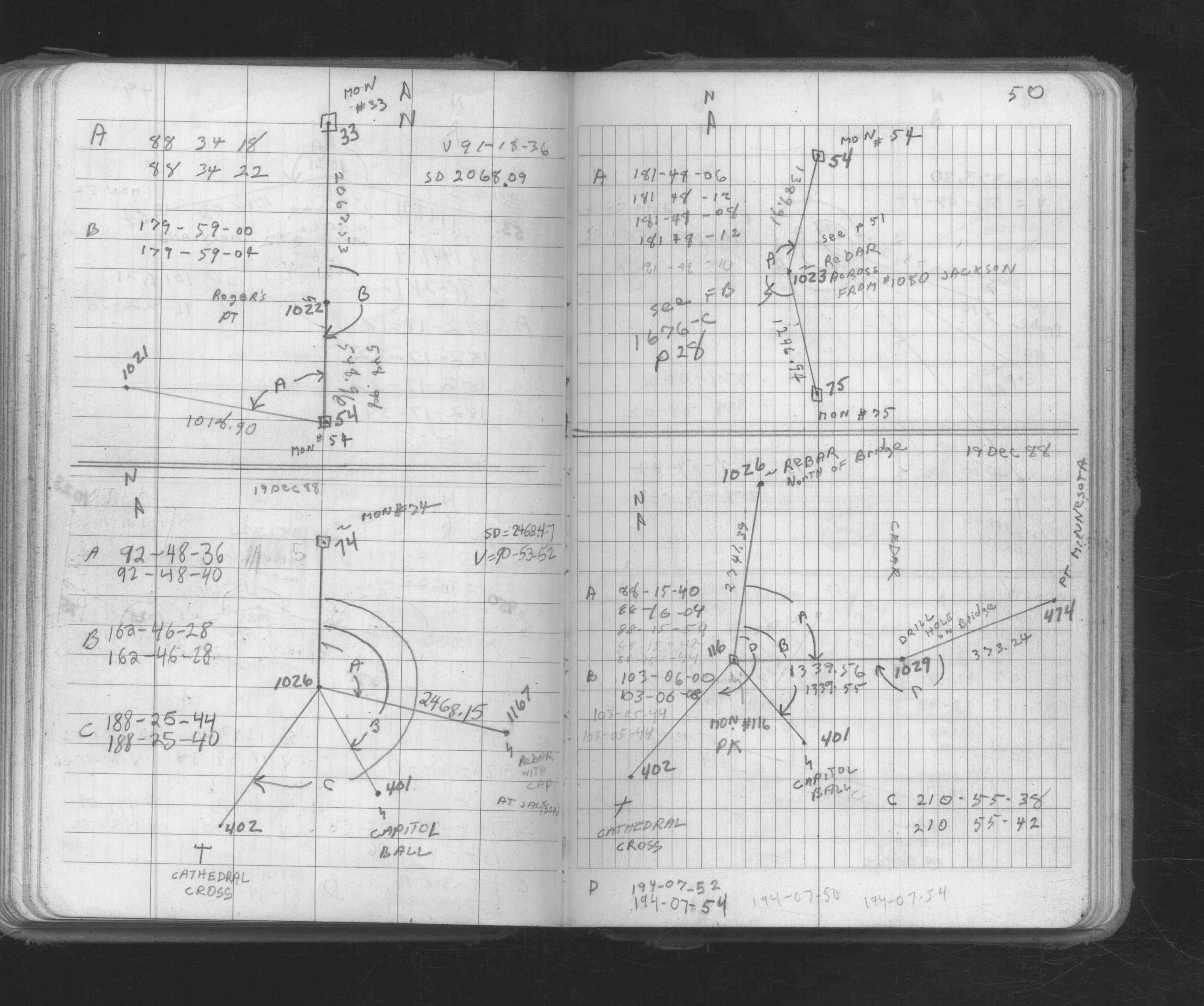
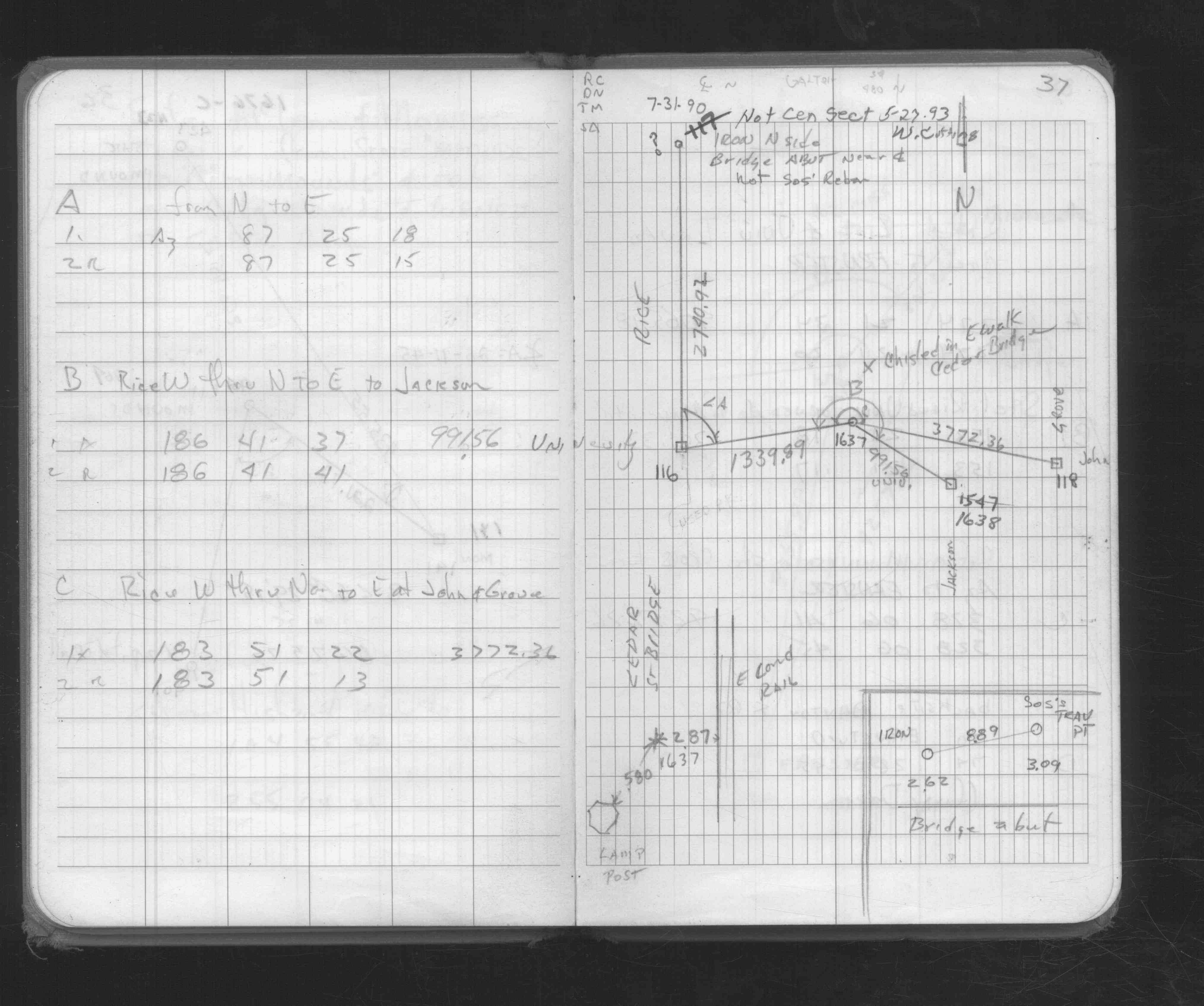
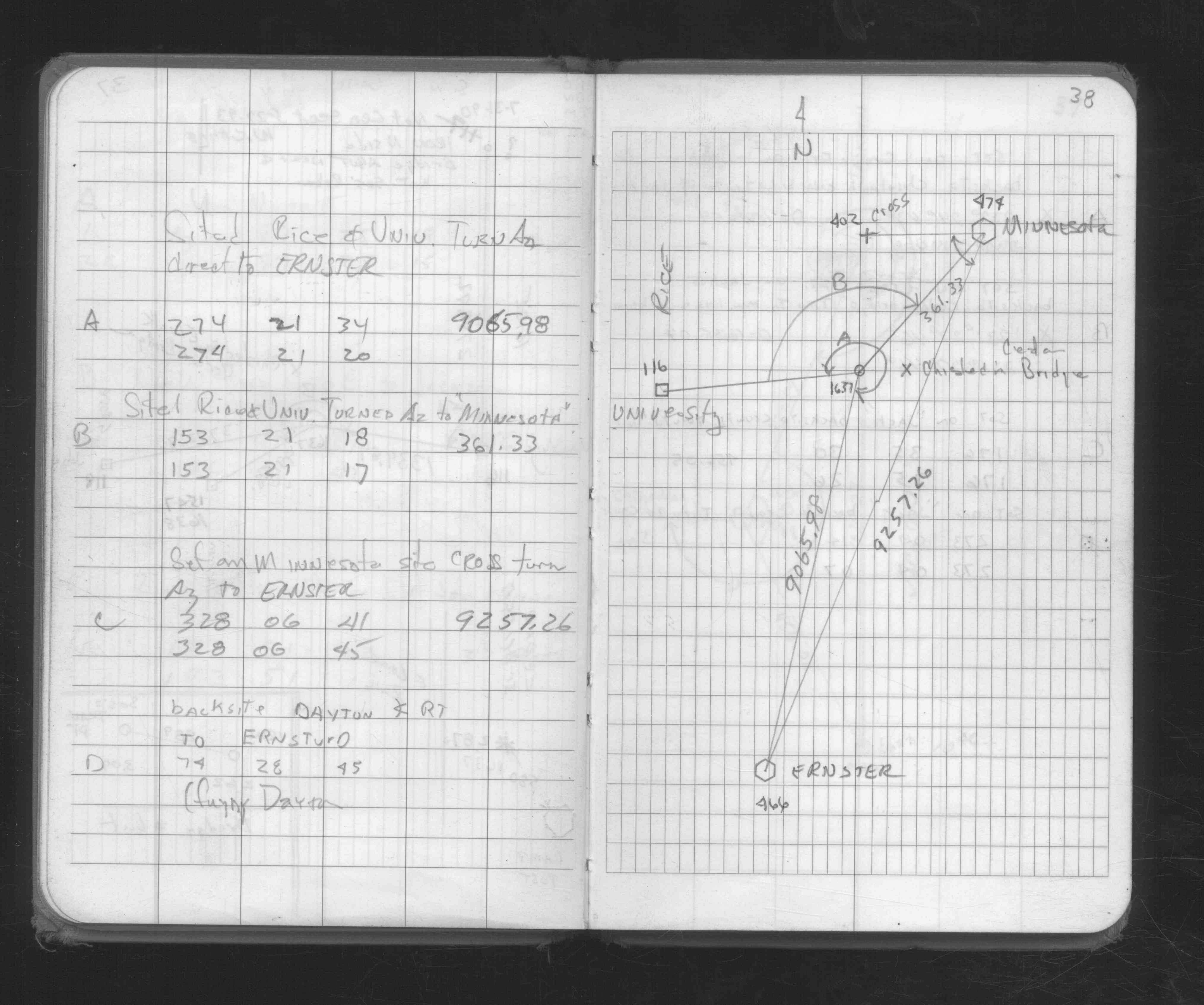
| FB 1676Cp. 37 ,38 | ||||||
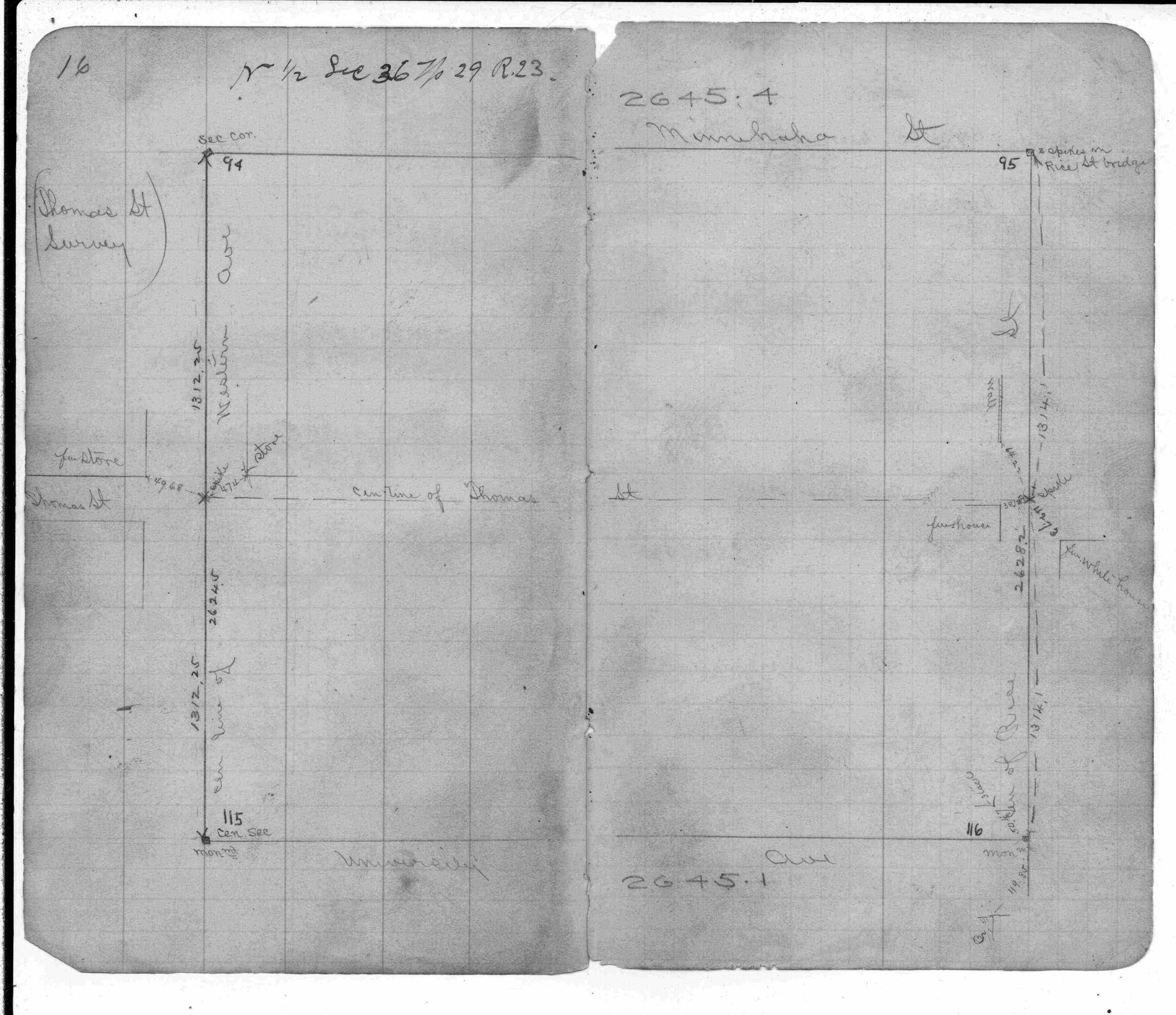
| FB 1689Ap.07 | ||||||
| FB 1736p.35 |
| FILE | SURVEYOR | LIC. NO. | DATE SIGNED | DATE TIED |
|---|---|---|---|---|
| 0116-1159-B2.tif | Michael P. Murphy | 41001 | November 29, 2004 | November 13, 2004 |
| 0116-1159-B1.tif | Michael P. Murphy | 41001 | November 29, 2004 | November 13, 2004 |
| 0116-1159-A.tif | William J. Cutting | 20576 | March 13, 1991 | March 13, 1991 |
| ST_079-156p116.jpg | none | none | none | none |
| 0116-0083-A.dwf | none | none | none | none |
| FILE | PHOTO DATE | COMMENTS |
|---|---|---|
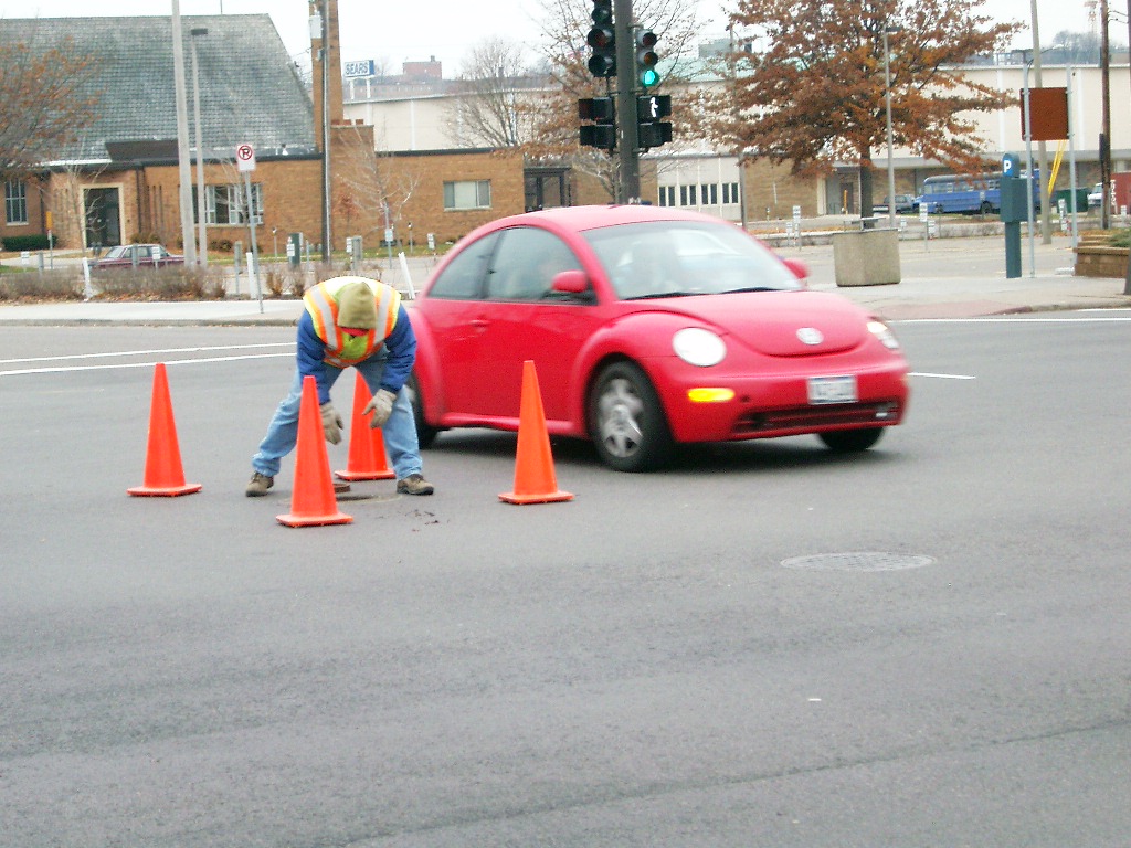
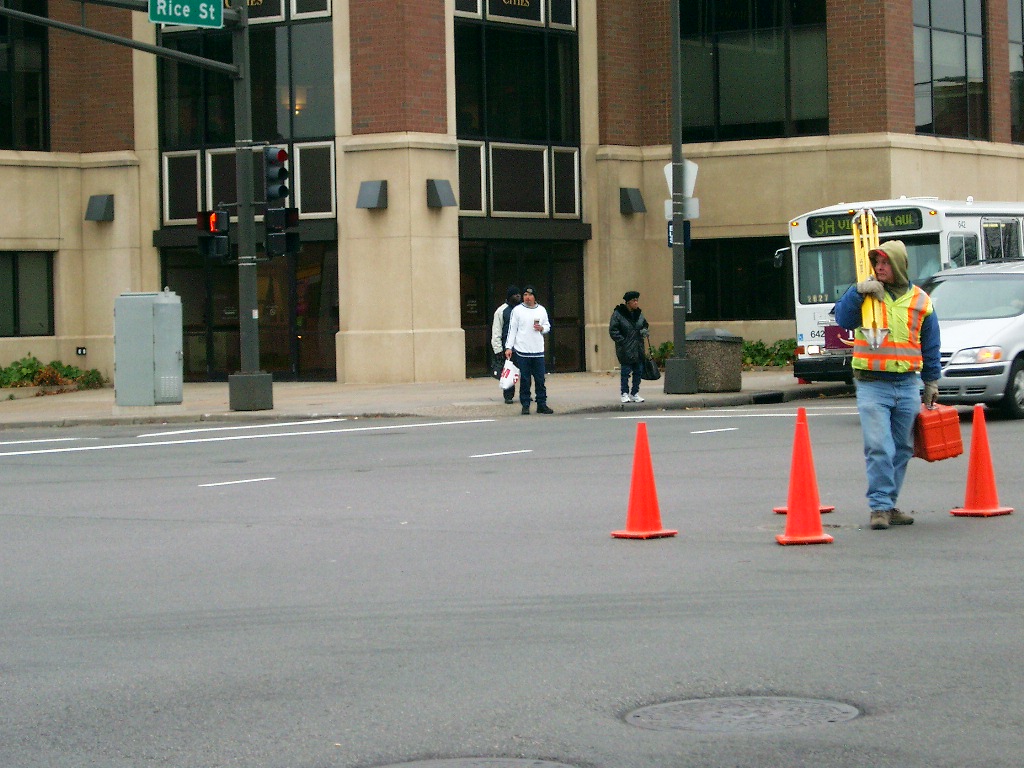
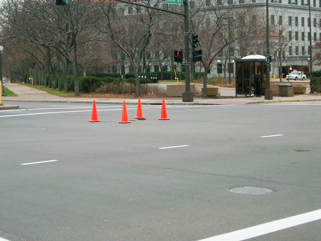
| 0116-1159-9.jpg | November 20, 2004 | Looking Southwesterly from the Northeast corner of Rice St. & University Ave. |
| 0116-1159-8.jpg | November 20, 2004 | Looking Southwesterly from the Southeast corner of Rice St. & University Ave. |
| 0116-1159-7.jpg | November 20, 2004 | Looking Northwesterly from the Southeast corner of Rice St. & University Ave. |
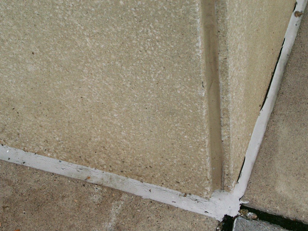
| 0116-1159-6.jpg | November 20, 2004 | Close-up of the granite monument after placing the casting cover. |
| 0116-1159-5.jpg | November 20, 2004 | Close-up of the granite monument after placing the casting cover. |
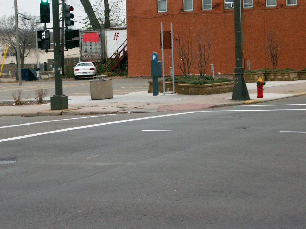
| 0116-1159-18.jpg | November 20, 2004 | Looking Northeast at the traffic signal tie & the light standard tie on the Northeast corner of University Ave. & Rice St. |
| 0116-1159-17.jpg | November 20, 2004 | Close-up of the utility MH tie on the South side of University Ave East of Rice St. |
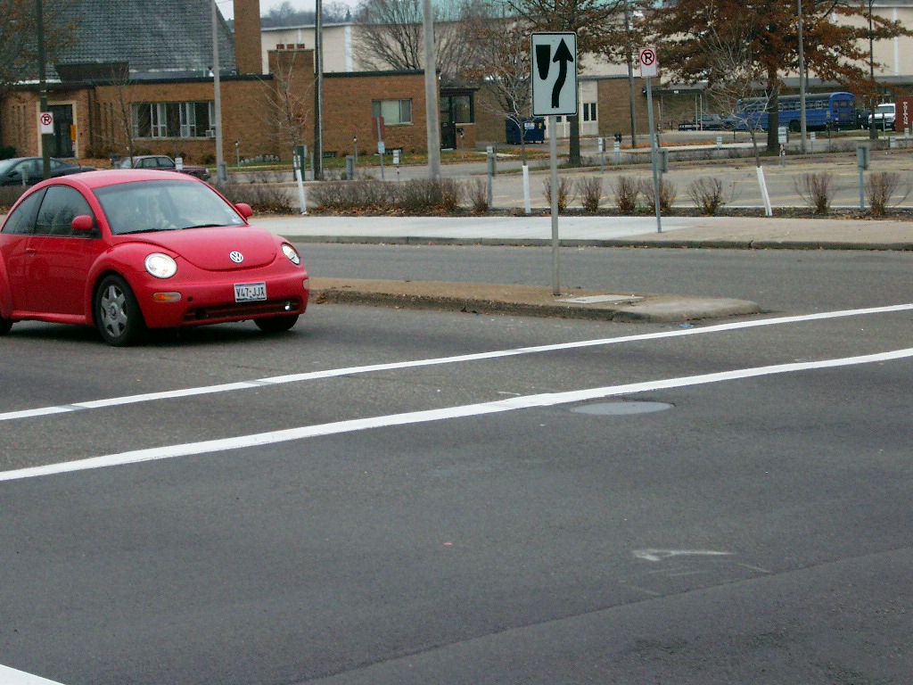
| 0116-1159-16.jpg | November 20, 2004 | Looking East along the South side of University Ave. |
| 0116-1159-15.jpg | November 20, 2004 | Close-up of the PK nail tie in the West island on University Ave. |
| 0116-1159-14.jpg | November 20, 2004 | Looking South along the West side of Rice St. |
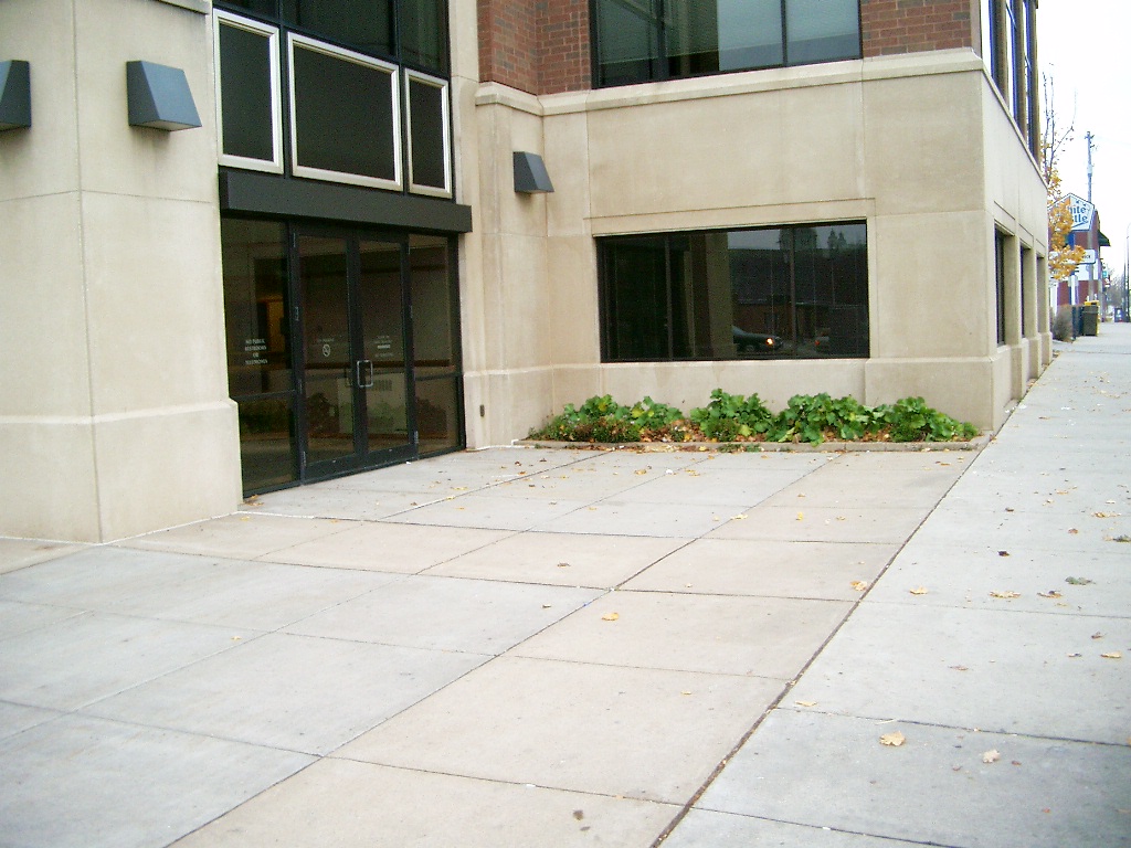
| 0116-1159-12.jpg | November 20, 2004 | Looking Southeasterly from the Northwest corner of Rice St. & University Ave. |
| 0116-1159-11.jpg | November 20, 2004 | Looking at a detail of the corner building ties at the Northwest corner of Rice St. & University Ave. |
| 0116-1159-10.jpg | November 20, 2004 | Looking at the building ties at the Northwest corner of Rice St. & University Ave. |
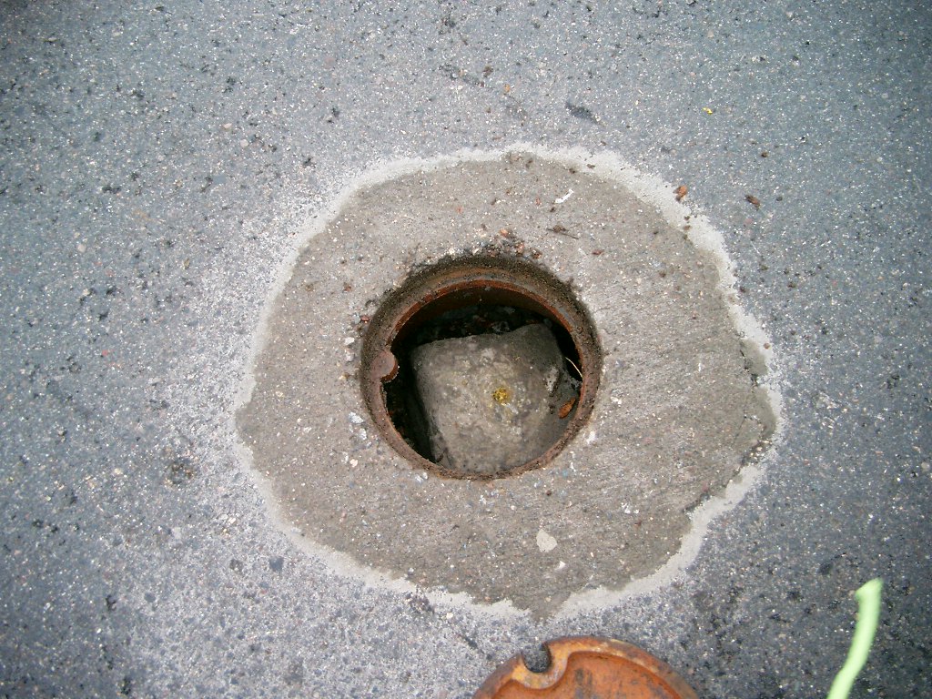
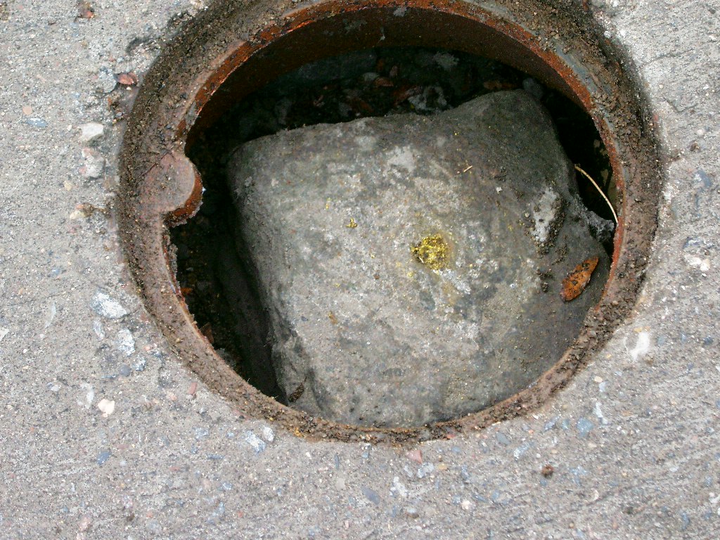
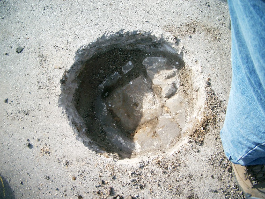
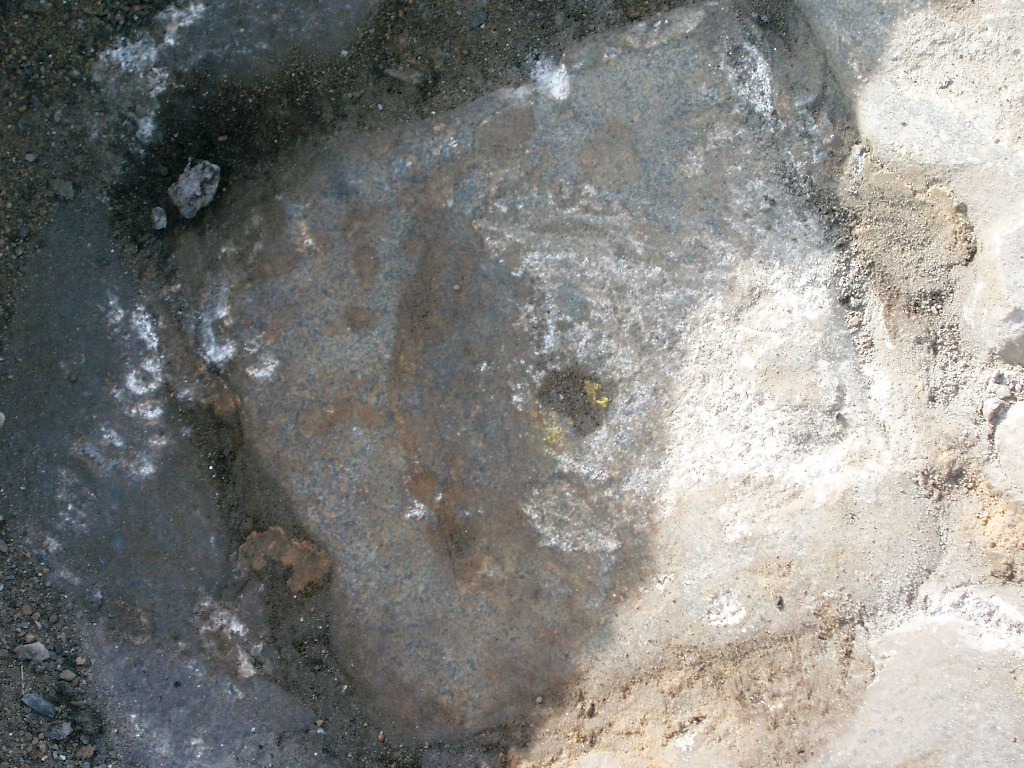
| 0116-1159-2.jpg | November 6, 2004 | Close-up of the granite monument before placing the casting cover. |
| 0116-1159-1.jpg | November 6, 2004 | Close-up of the granite monument before placing the casting cover. |