| NAD83 COORDINATES (1986 adj.): |
|---|
| * X= 584802.6 Y= 160239.64 Z= 0 LSQ 12/6/1991 S FLT |
| X= 584802.715 Y= 160239.619 Z= 891.458 11/21/2012 RTK-VRS |
| 11/21/2012 | Position on GM established using RTK-VRS GPS. Elev 197.36 ft. EDM ties placed using Sokkia Set 5. |
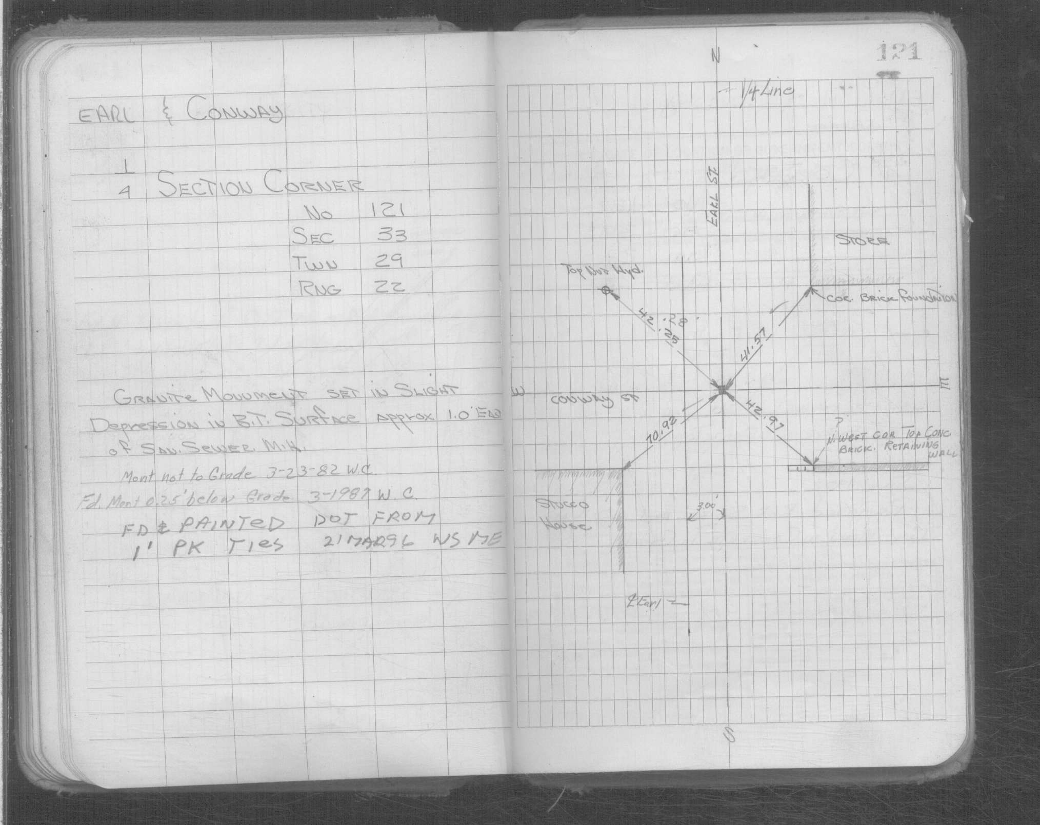
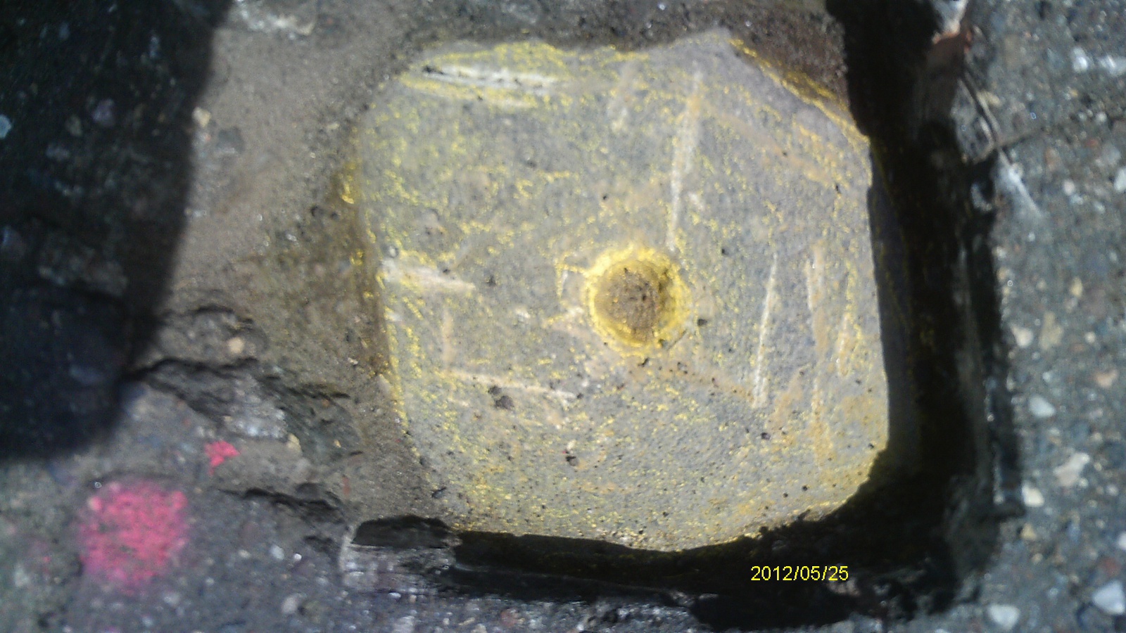
| 5/25/2012 | Found GM 0.2 ft below street grade. Photos taken. |
| 2/27/2008 | Found PK nail at grade. |
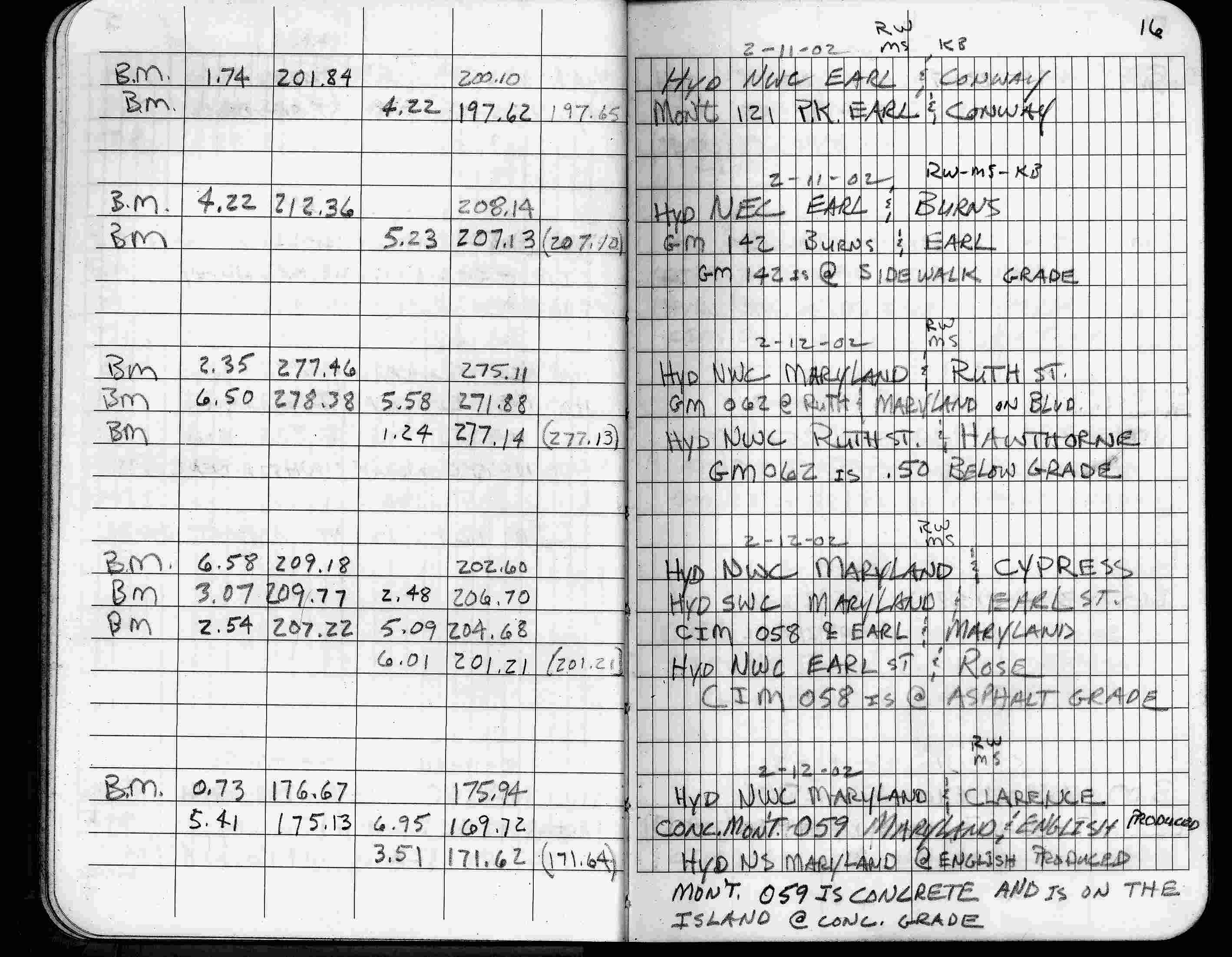
| 2/11/2002 | Elev 197.62 ft on PK nail. See FB 1736 p.16 |
| 3/17/2000 | Found PK nail at grade (marked for painting target for 2000 aerial) |
| 2/14/1996 | Elev 197.65 ft on PK nail CLCL. See 97adj.pts, 1996/bmearl.org/bmearl2.sdr (loop 046a) Digital-Adj |
| 3/1/1987 | (Unknown date Mar __, 1987 ) Fd GM 0.25 ft below grade. See Yellow Tie Book. |
| 2/16/1972 | Fd GM to grade, 1.0 ft east of MH. See FB 1689A p.6 |
| 2/1/1923 | (Unknown date Feb __, 1923 ) Placed ties. See FB 1055 p.5 |
| 1/1/1887 | (Unknown date ___ __, 1887 ) Monument showing center of Conway St as graded in 1887 set by Chas Hunt according to Armstrong's survey |
Above is NOT an all inclusive history of this point. Please review all the links below. Yellow Tie Books are 'ST' in the Monument category.
| PLS NOTES | Field | Cross Section | Sewer | J.B. Irvine | Monument | River Survey |
|---|---|---|---|---|---|---|
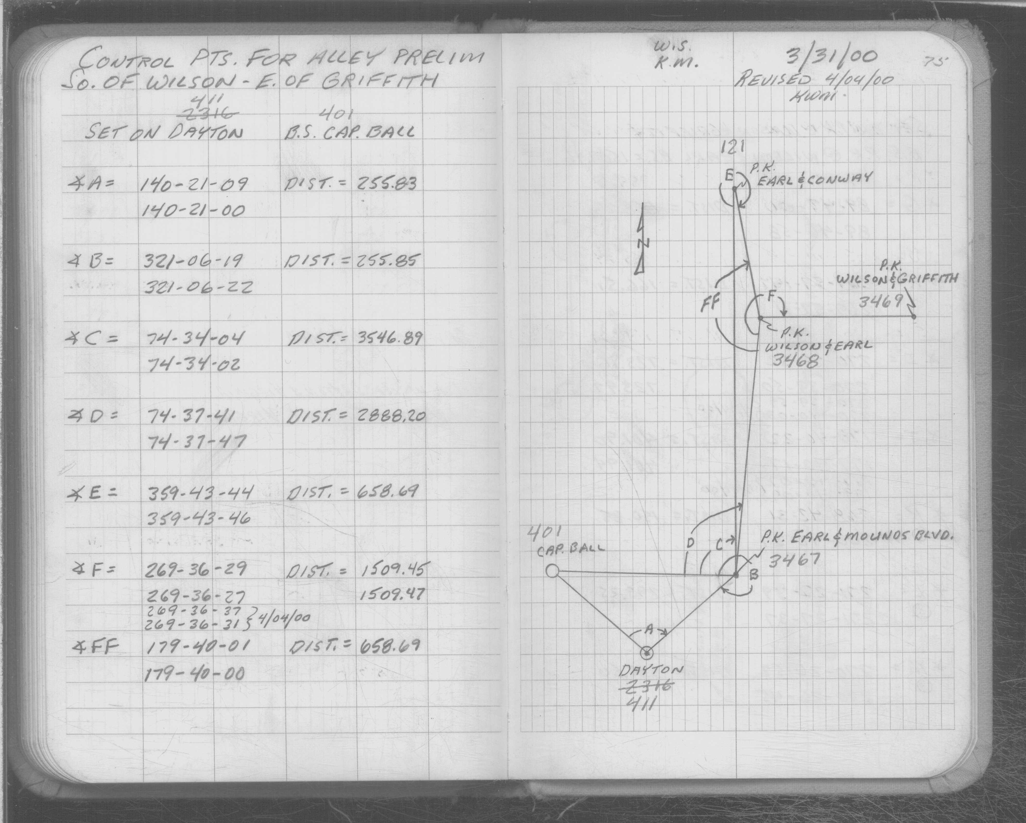
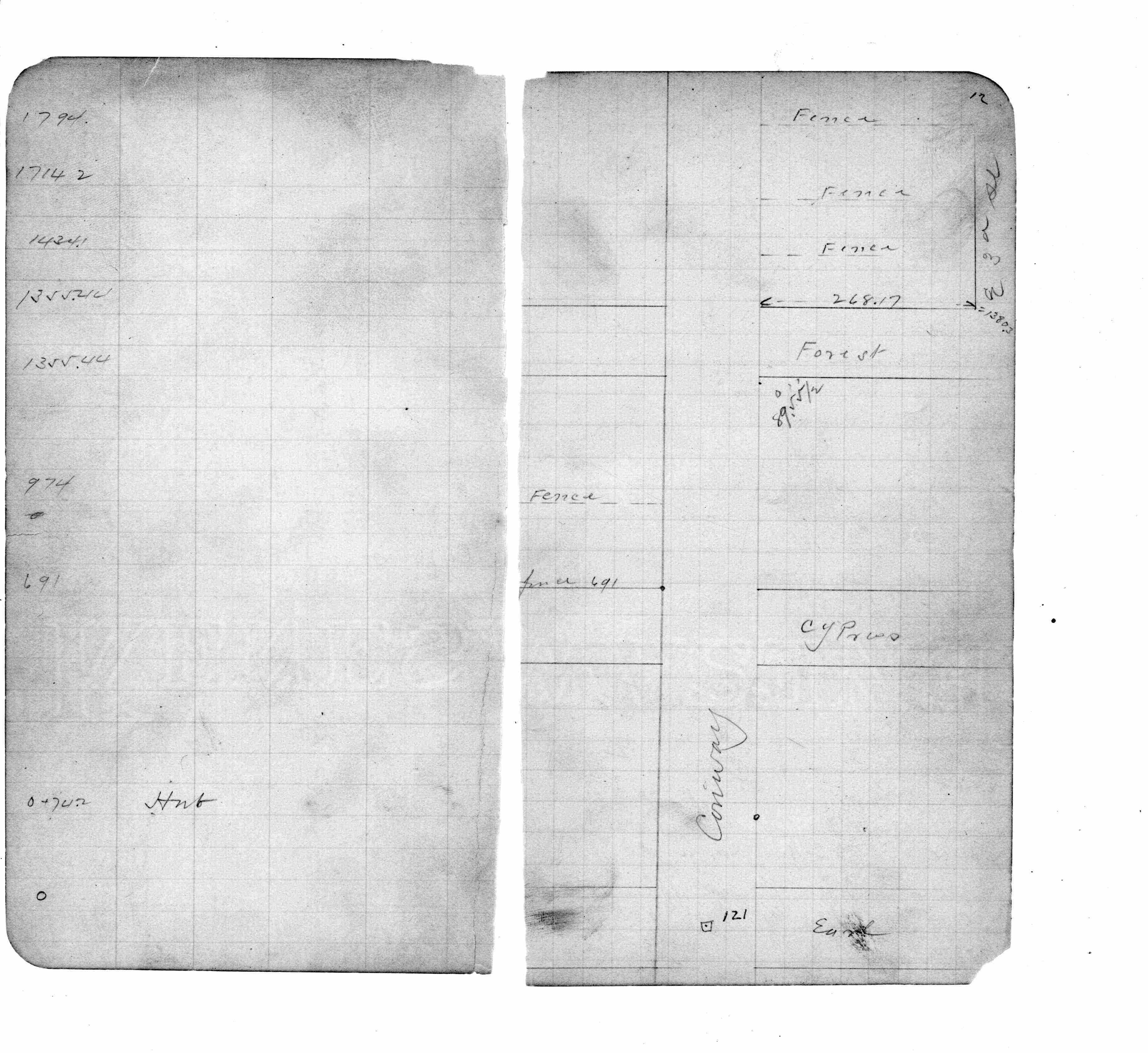
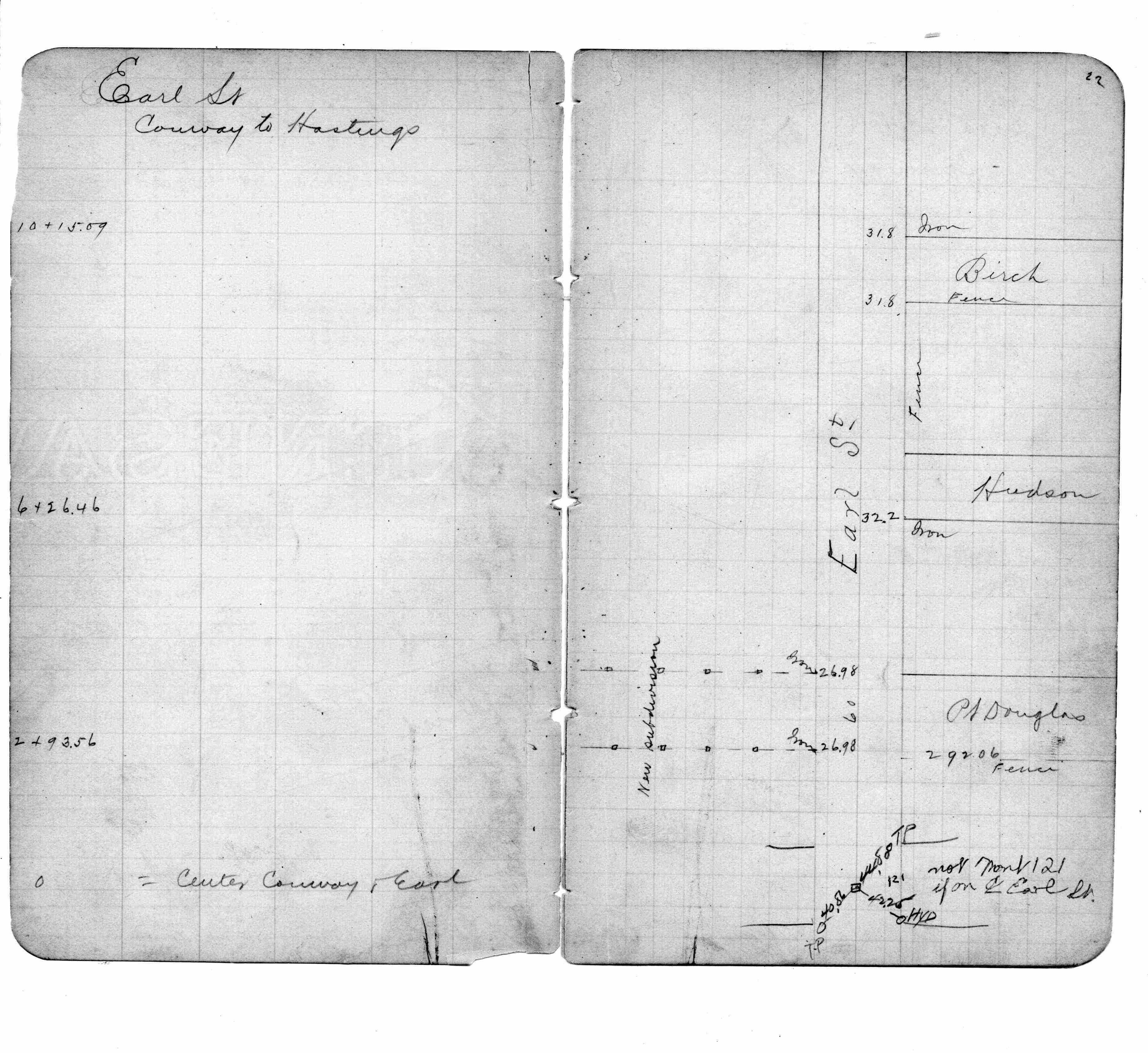
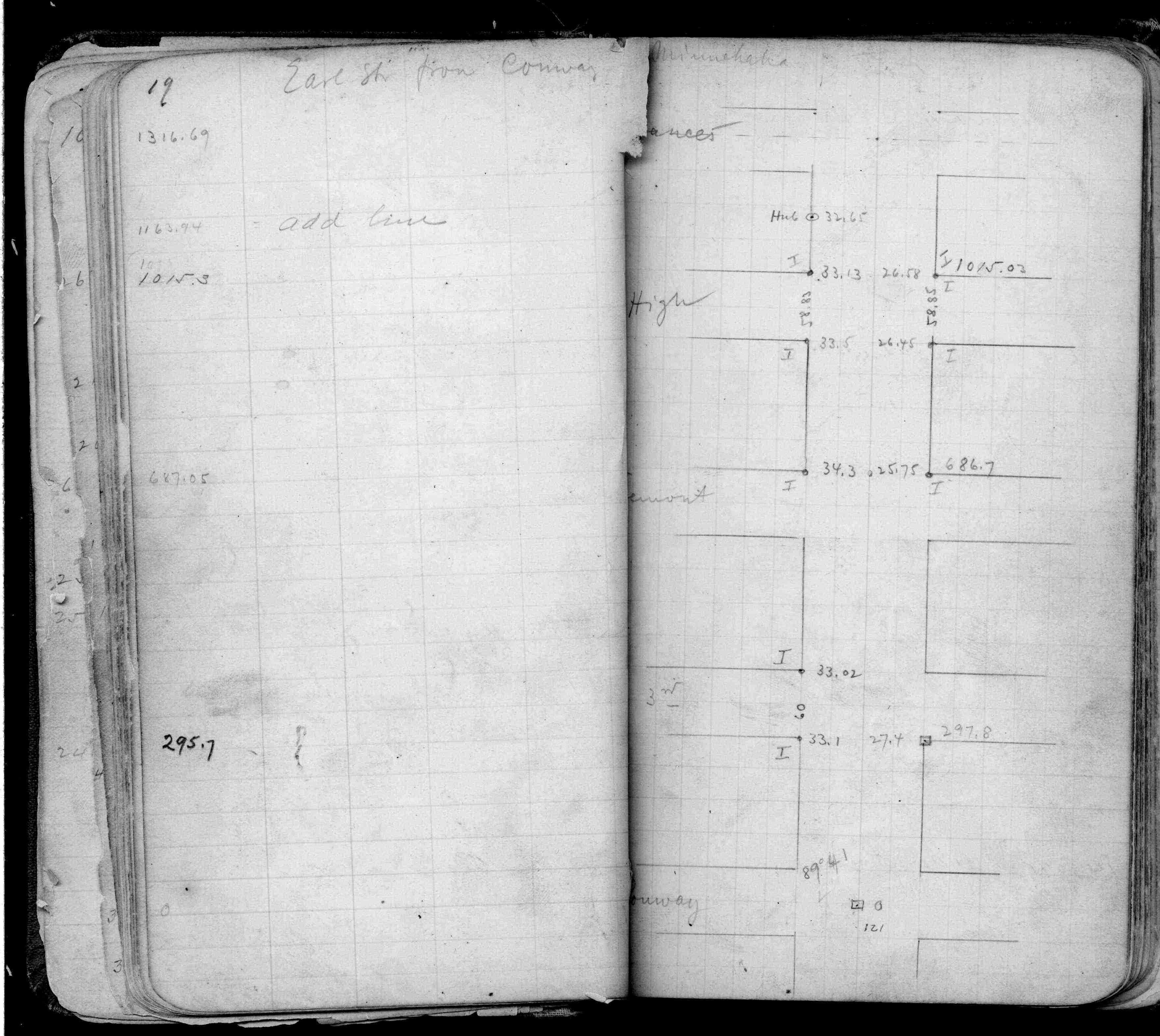
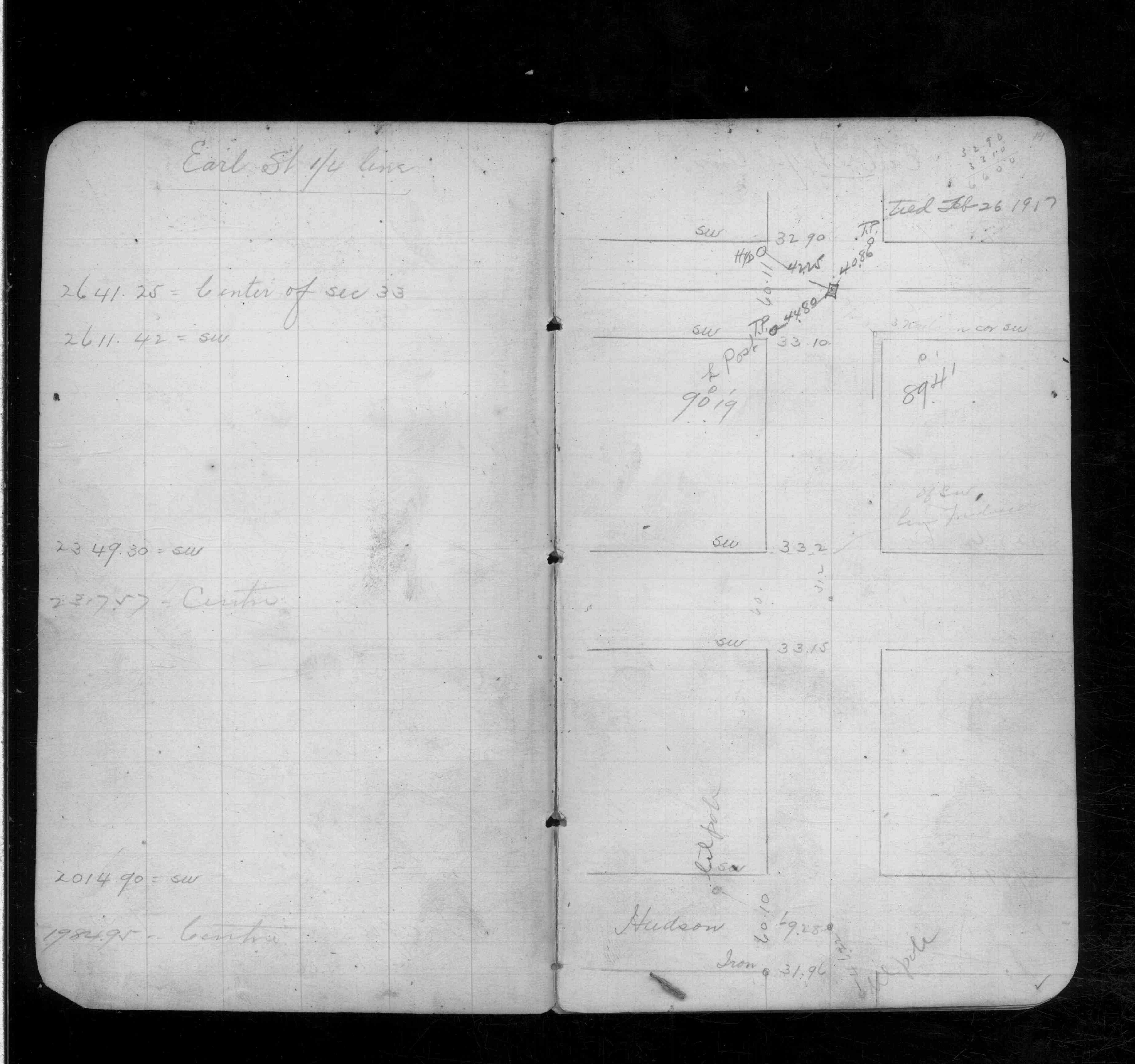
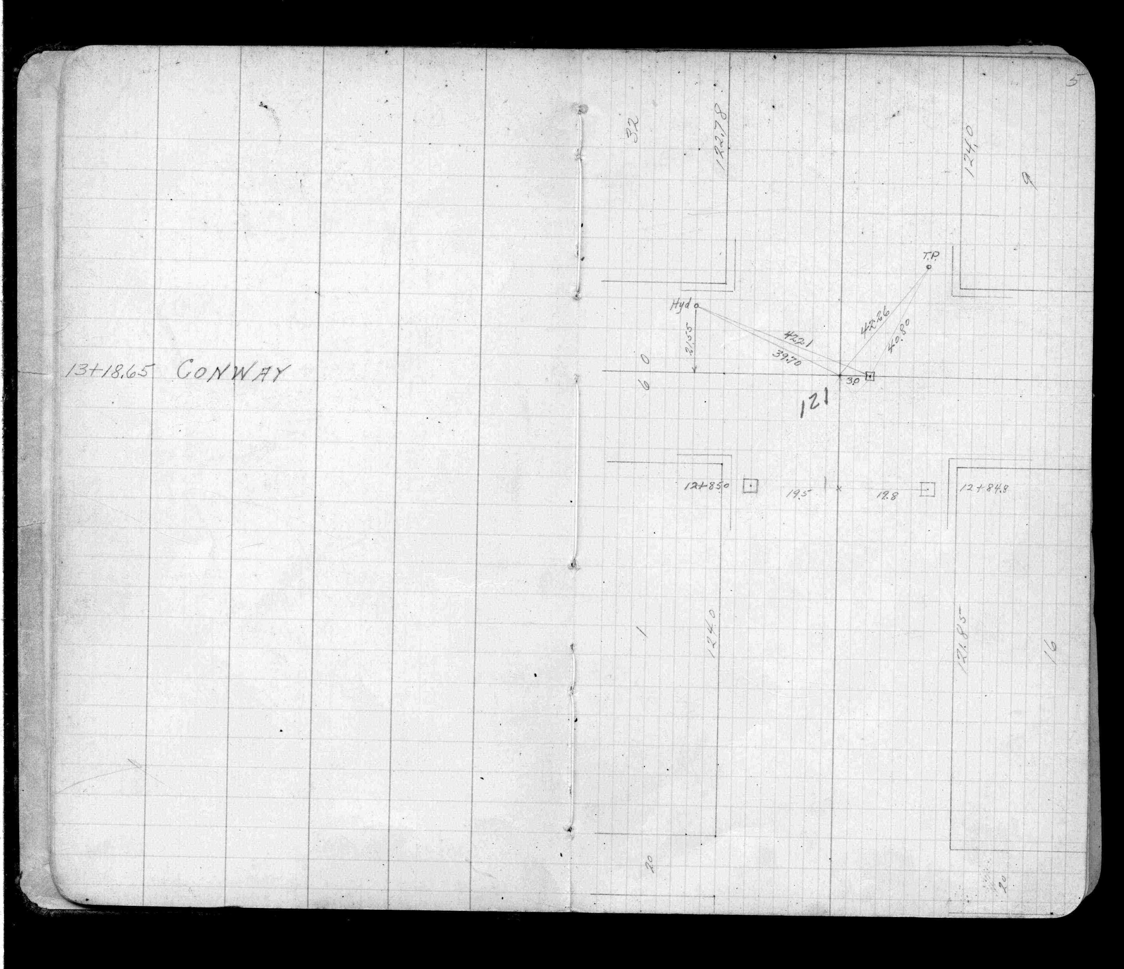
| FB 0170p.25 | SB 0592Bp.75 | ST 079-156 p.121 | ||||
| FB 0193p. 12 ,22 | ||||||
| FB 0197p.19 | ||||||
| FB 0348p.14 | ||||||
| FB 0570p.38 | ||||||
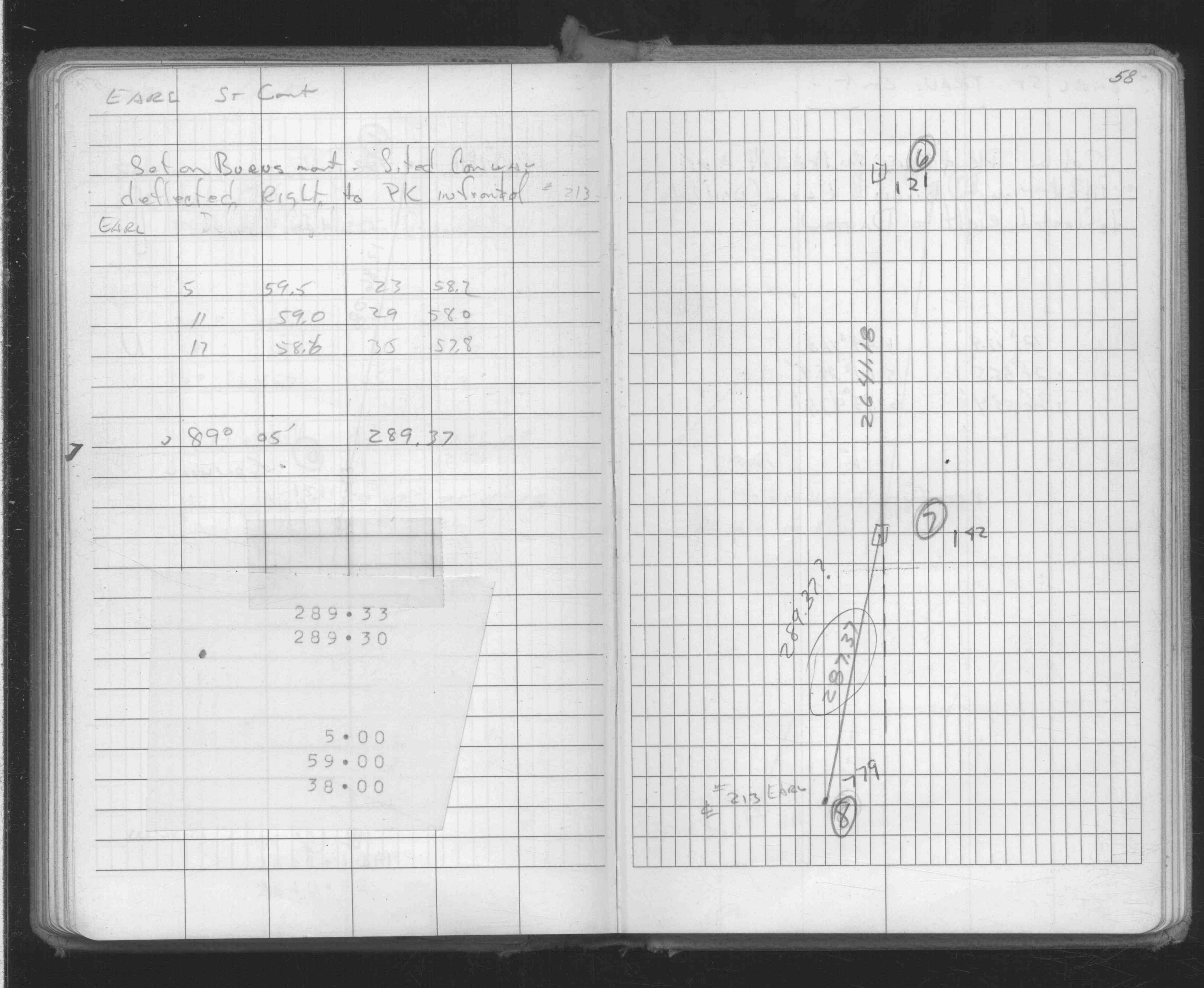
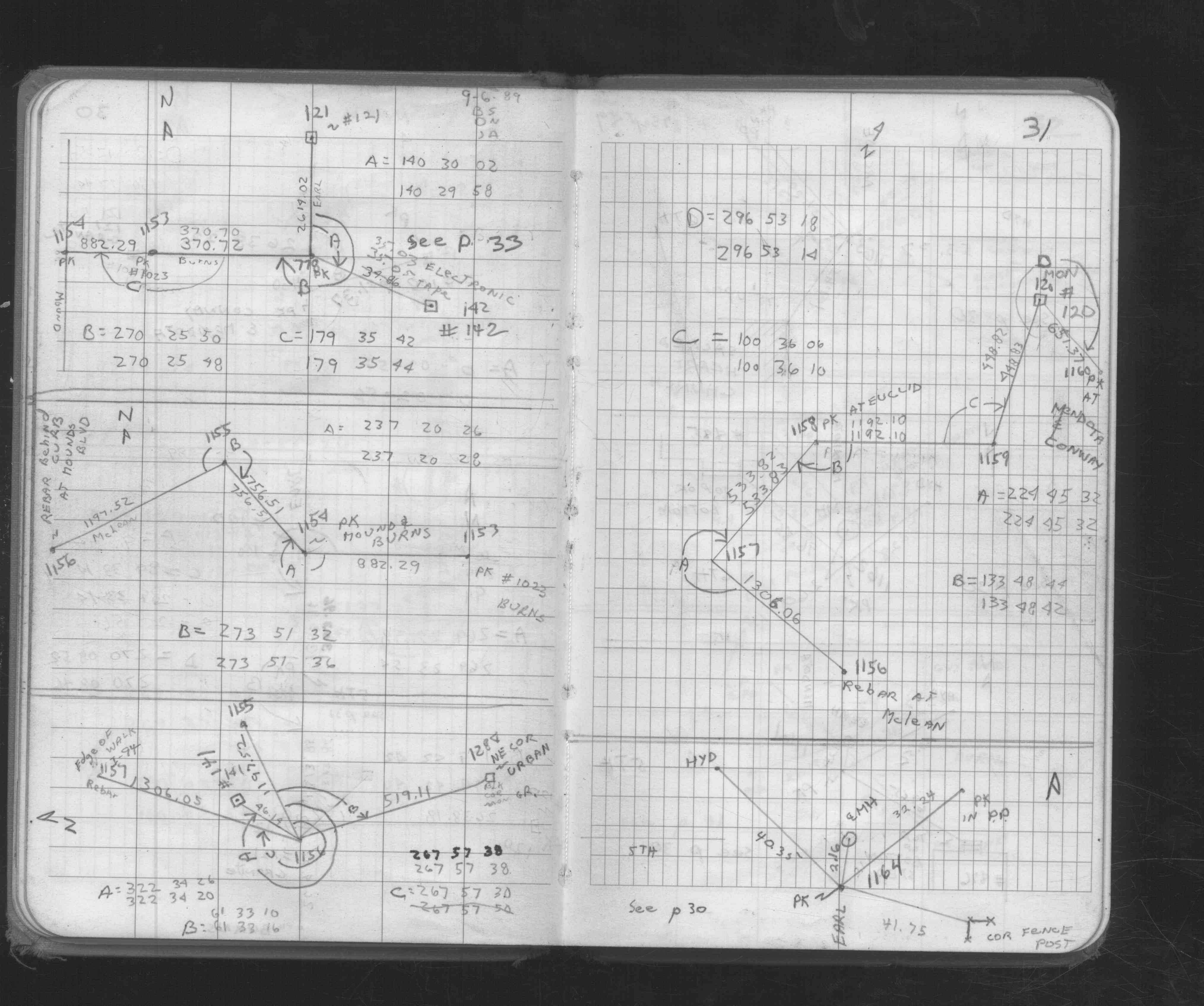
| FB 1055p.05 | ||||||
| FB 1055p.05 | ||||||
| FB 1549Hp. 73 ,76 | ||||||
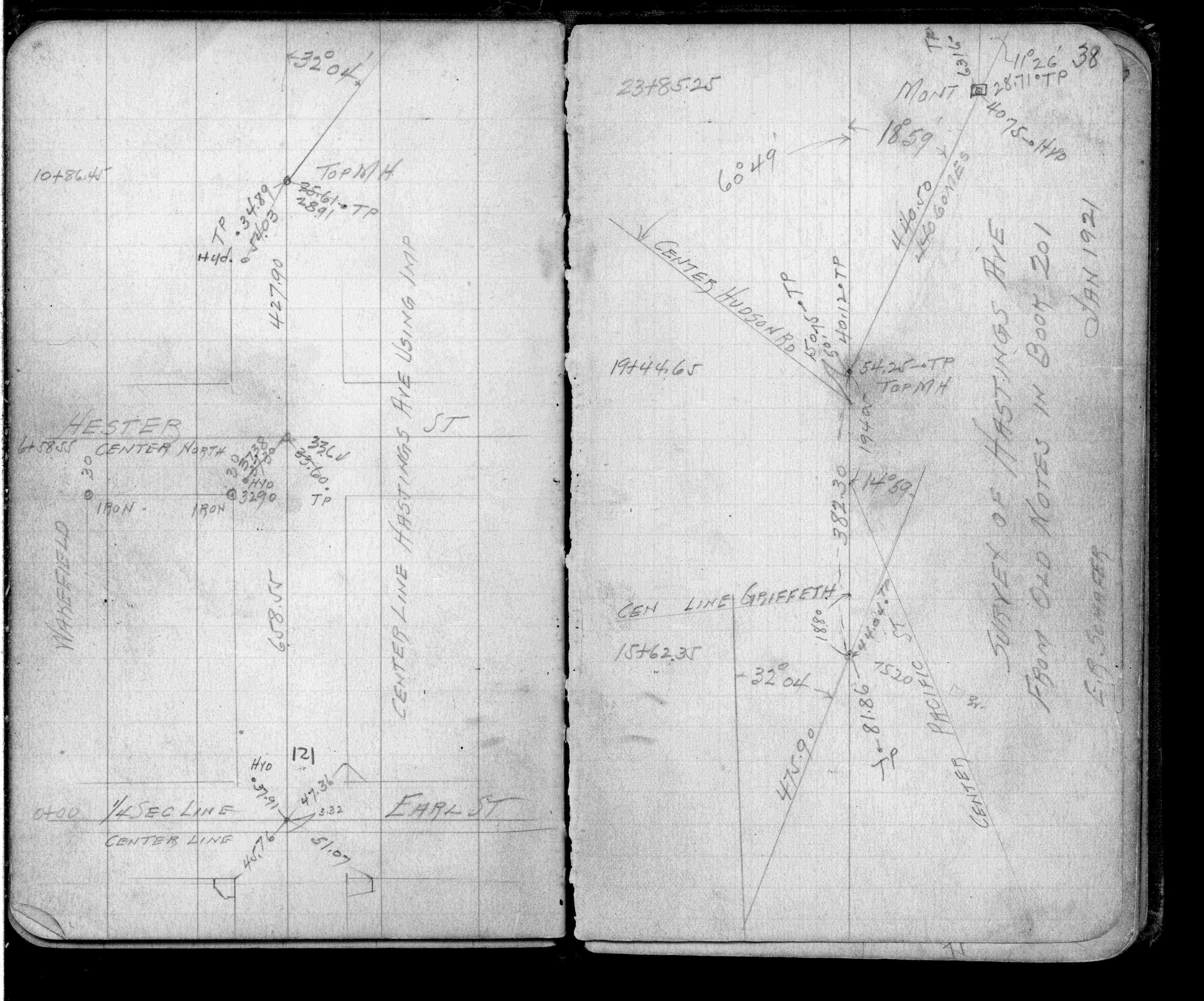
| FB 1634Dp. 56 ,57 ,58 ,66 ,67 | ||||||
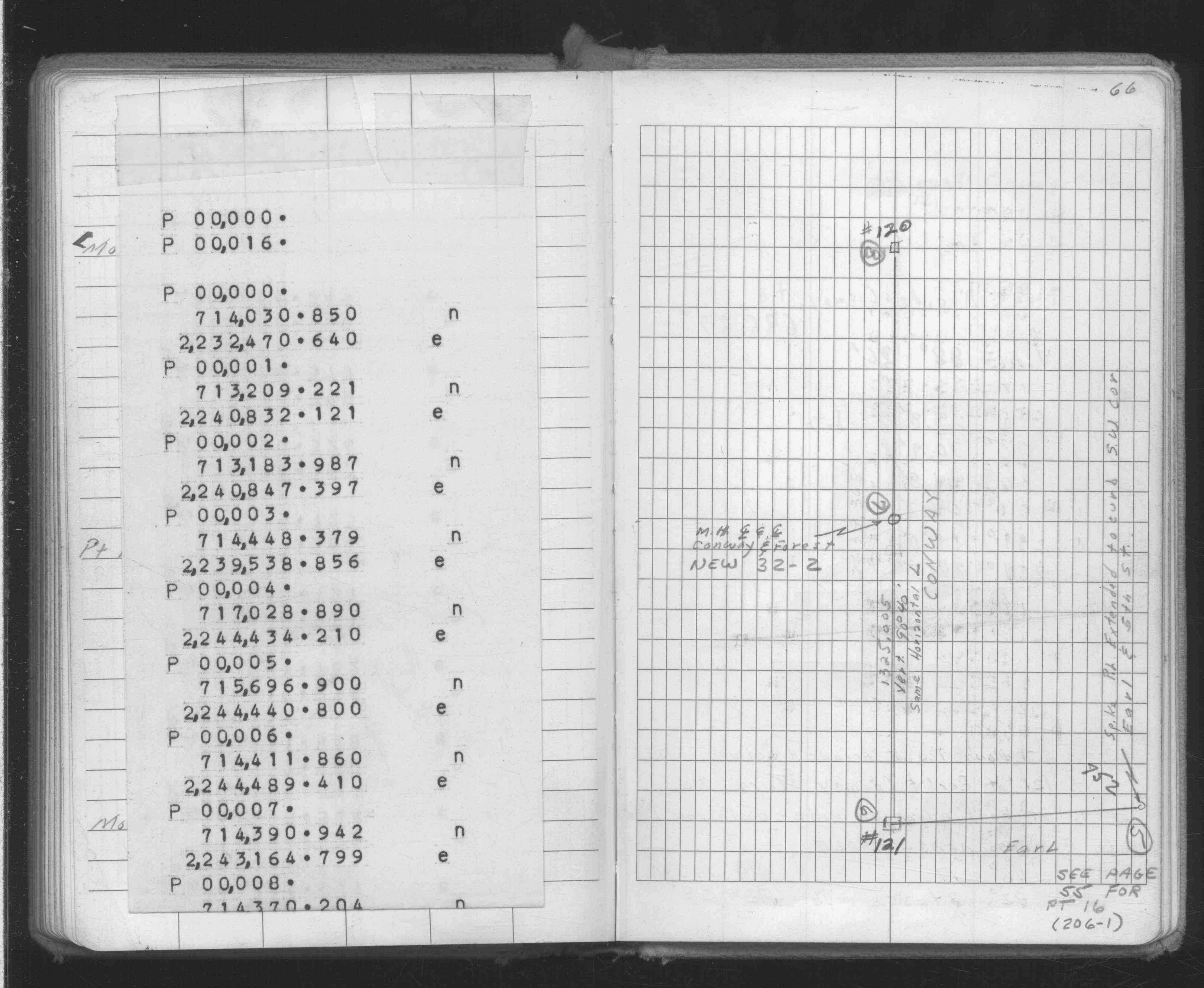
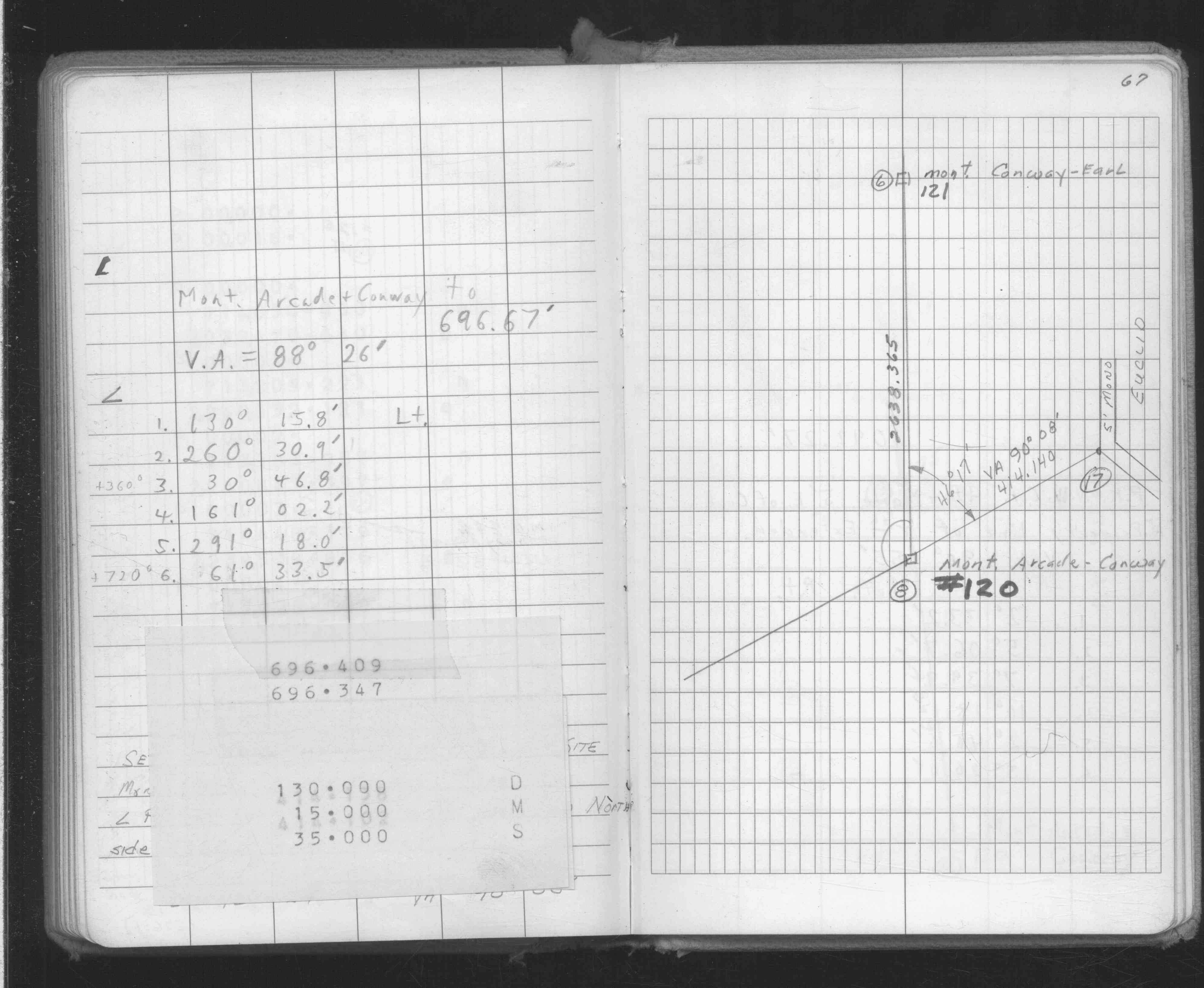
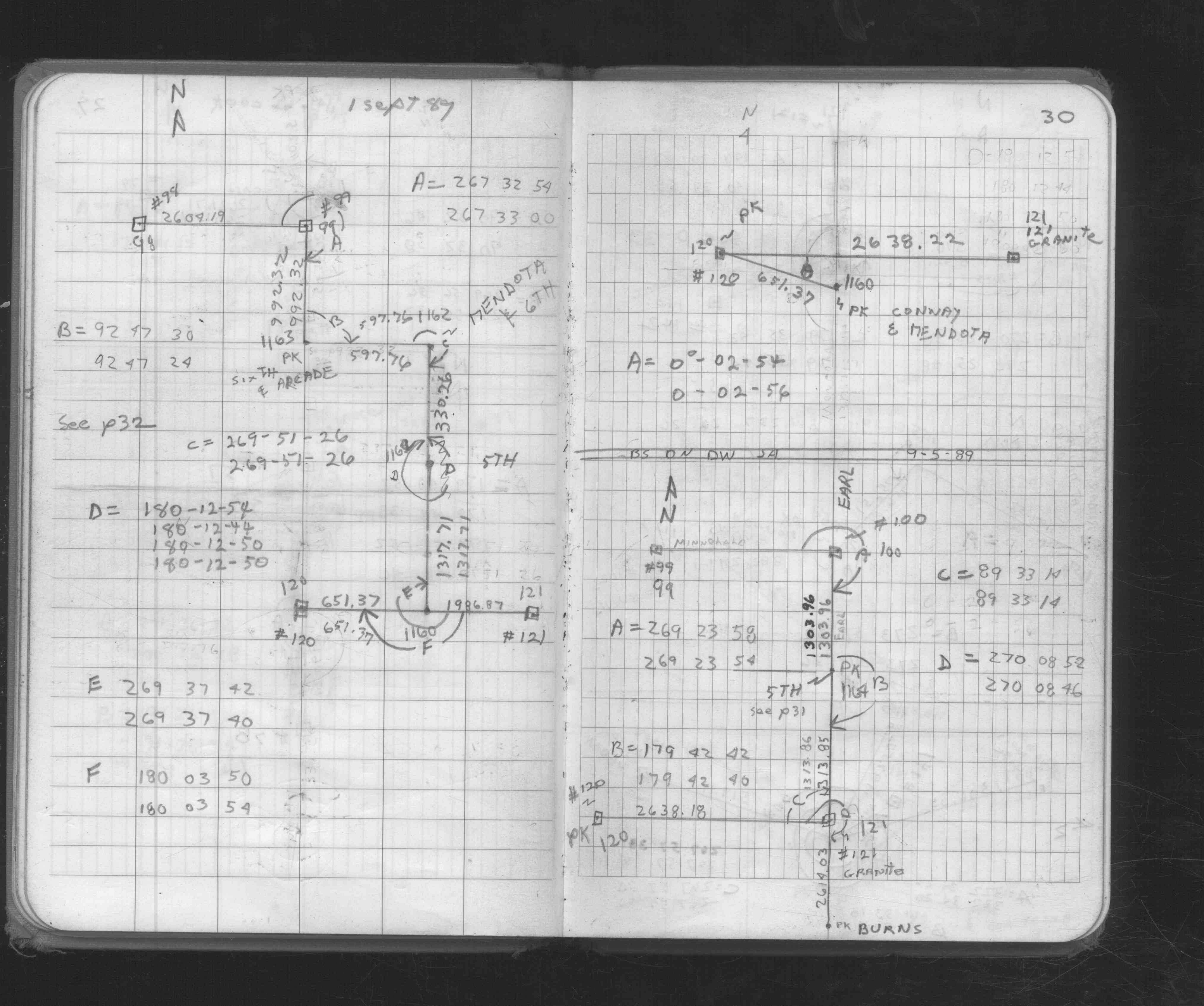
| FB 1676Cp. 30 ,31 | ||||||
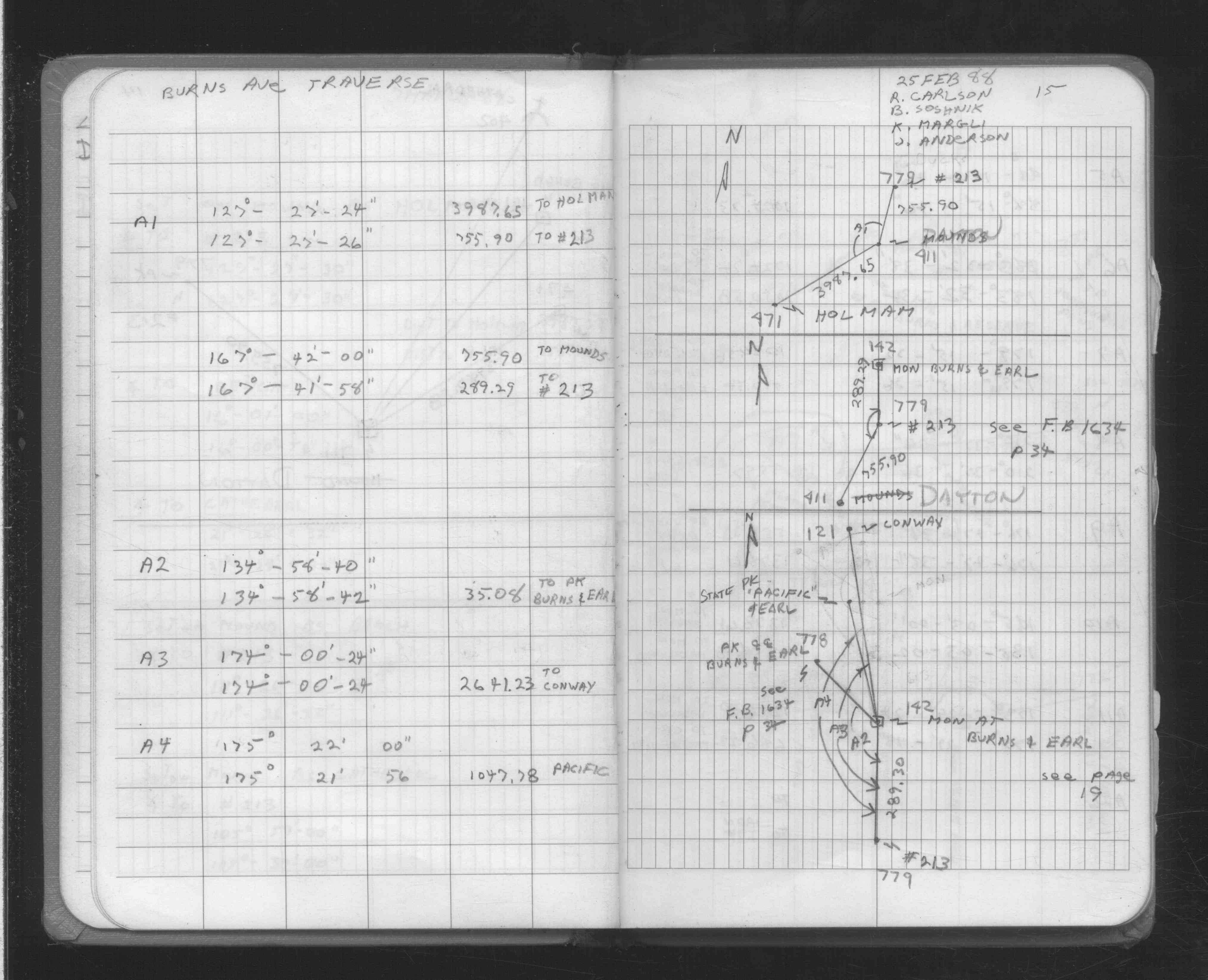
| FB 1689Ap.06 | ||||||
| FB 1708Ap. 15 ,16 | ||||||
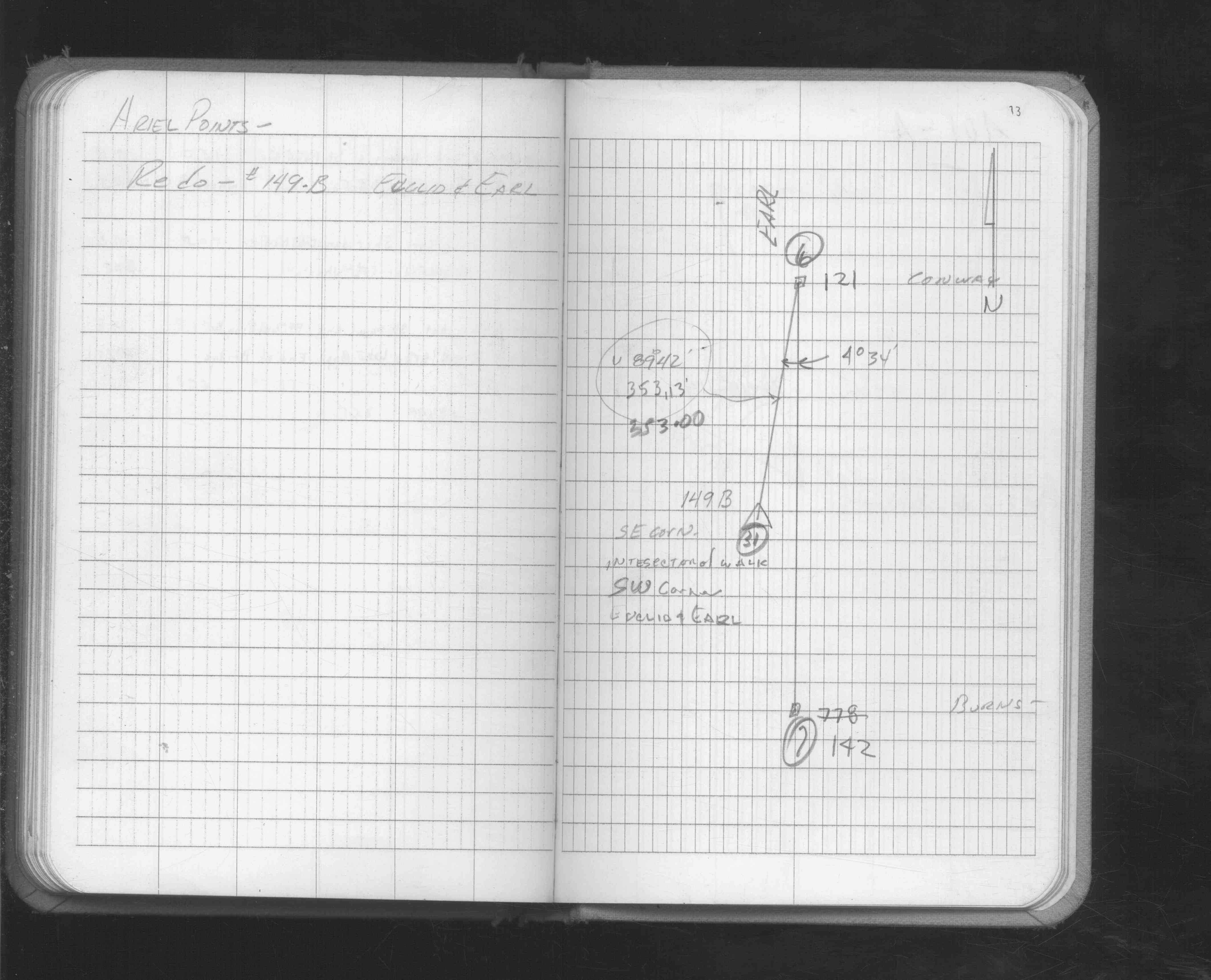
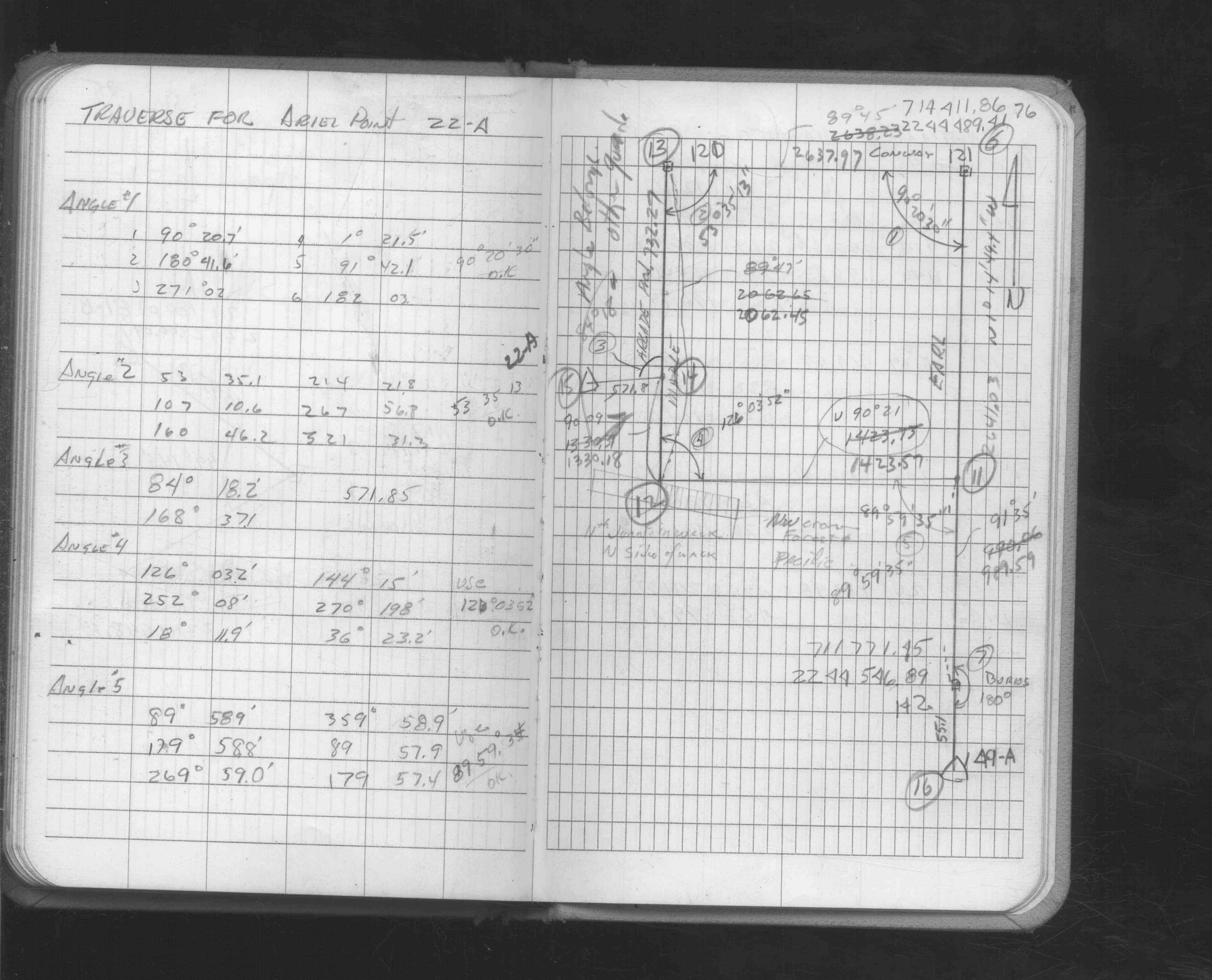
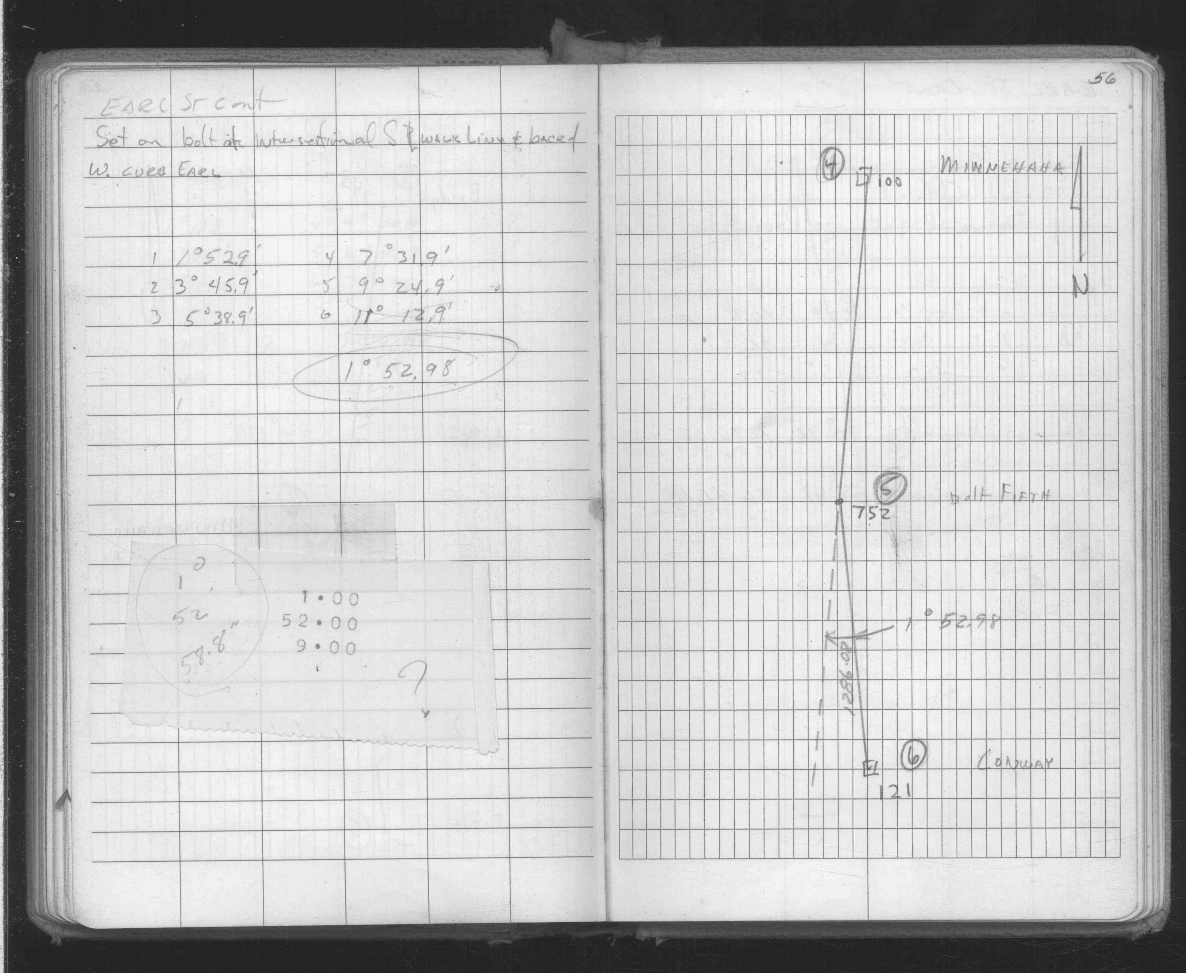
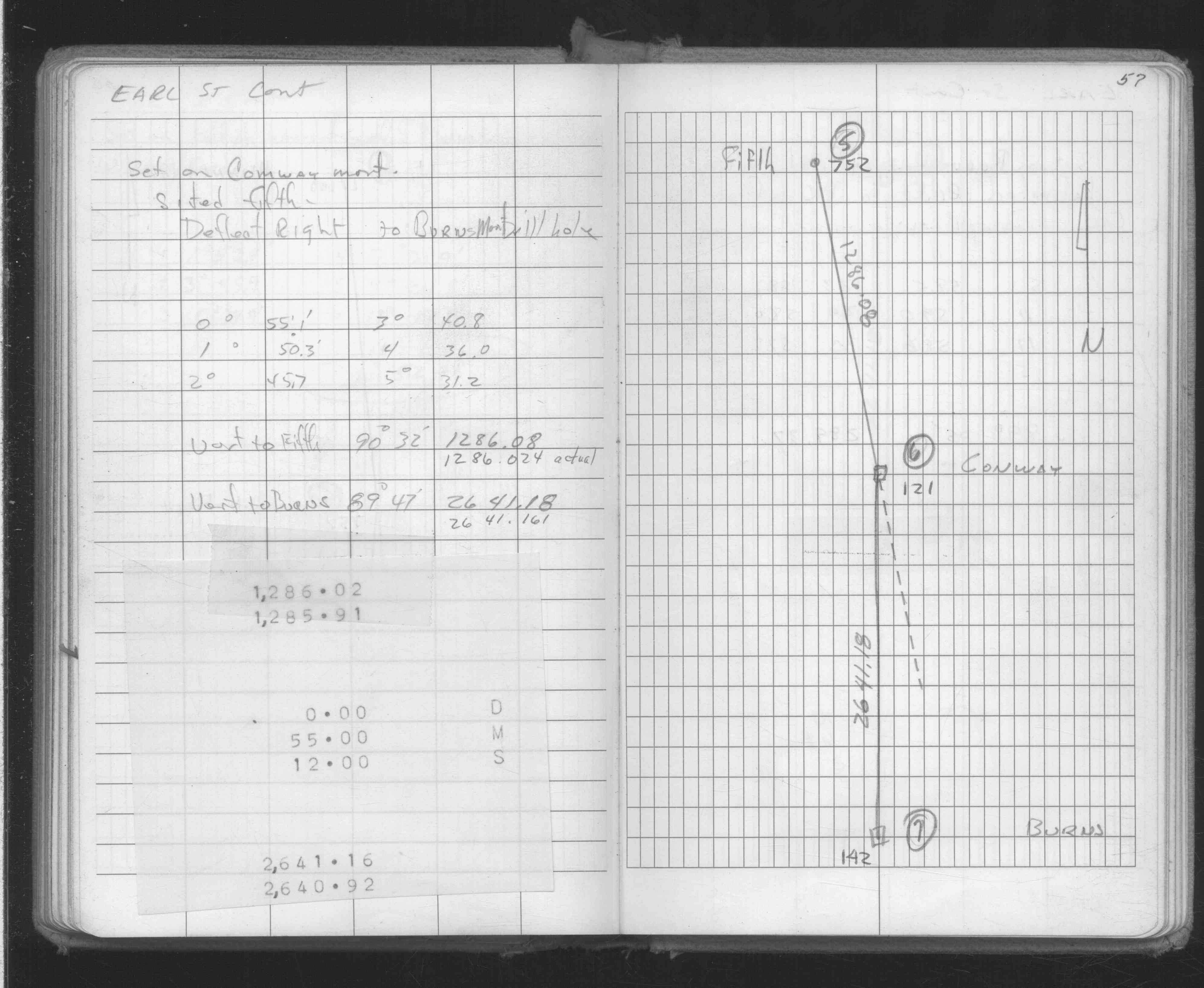
| FB 1736p.16 |
| FILE | SURVEYOR | LIC. NO. | DATE SIGNED | DATE TIED |
|---|---|---|---|---|
| 0121-0093-B.pdf | Samuel D. Gibson | 44880 | December 24, 2012 | November 21, 2012 |
| ST_079-156p121.jpg | none | none | none | none |
| 0121-0093-A.dwf | none | none | none | none |
| FILE | PHOTO DATE | COMMENTS |
|---|---|---|
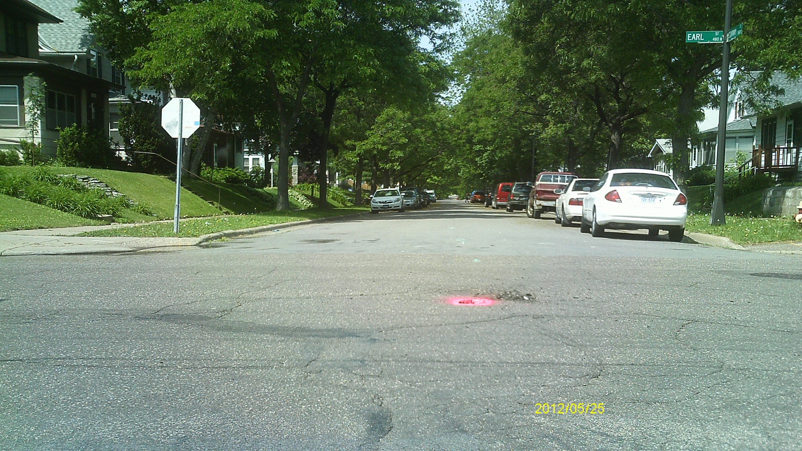
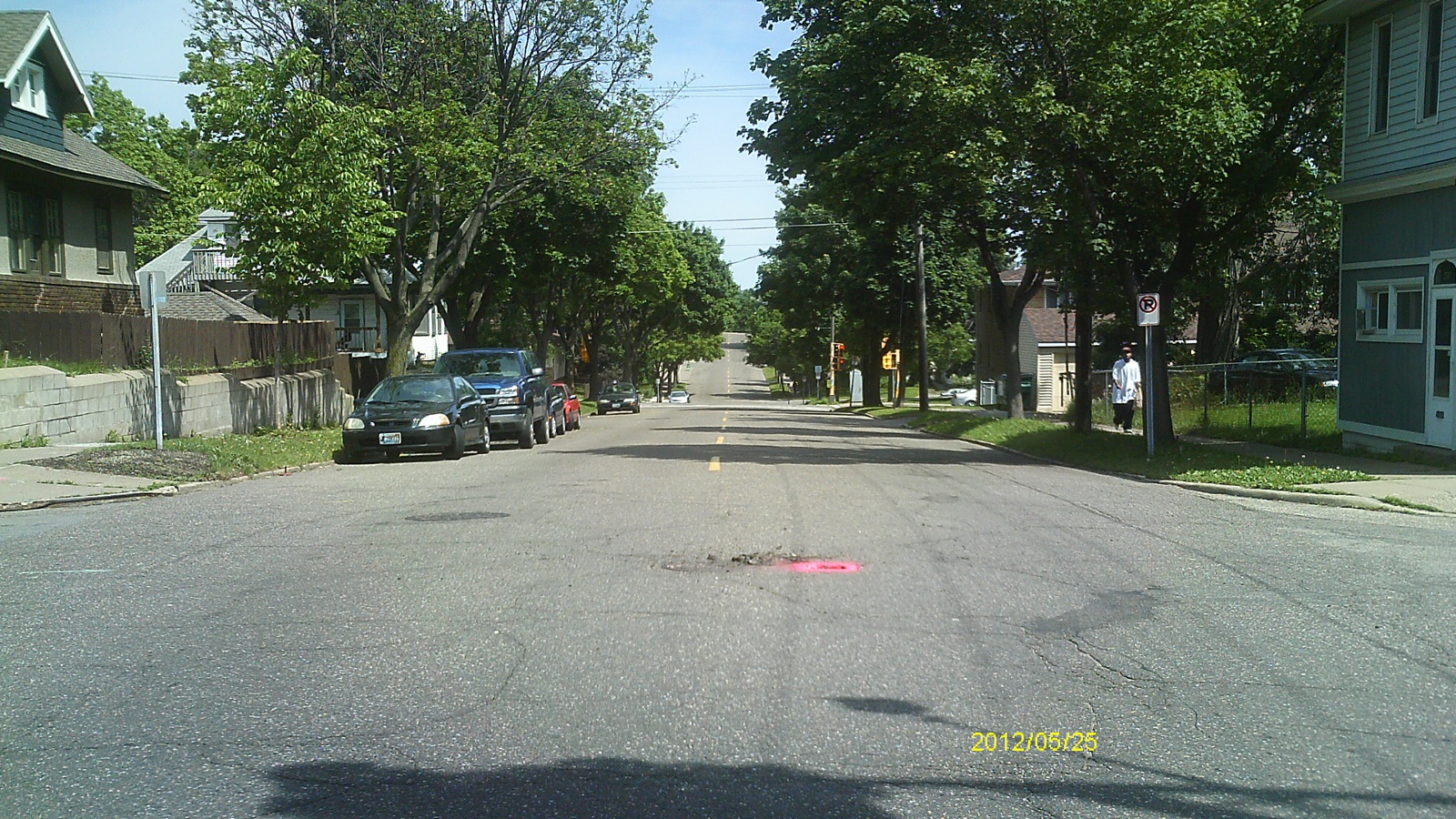
| 0121-0093-5.jpg | May 25, 2012 | Looking west along Conway St. |
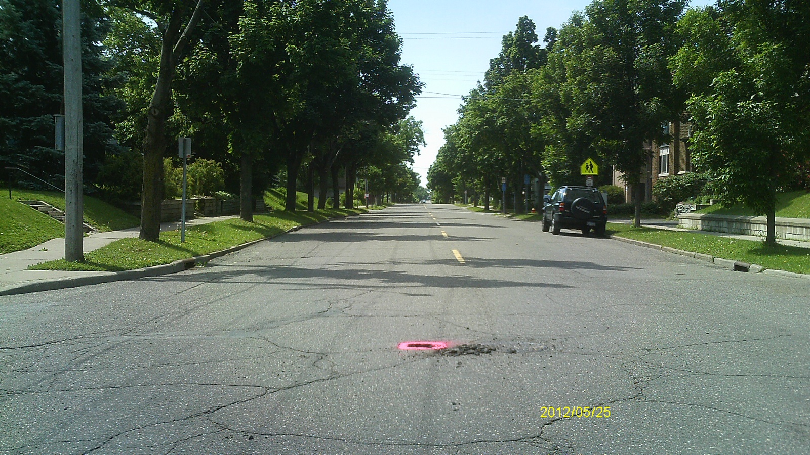
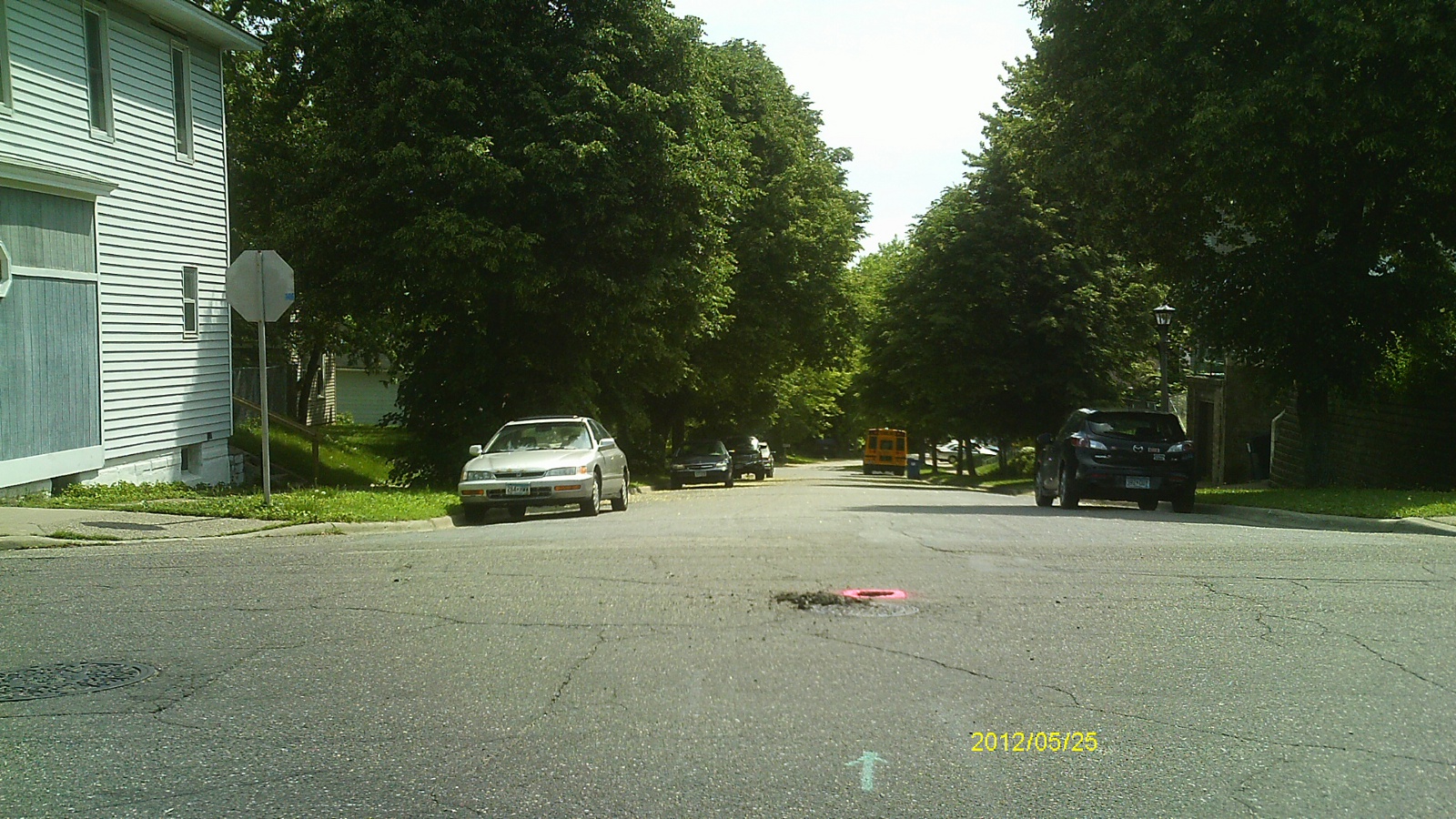
| 0121-0093-4.jpg | May 25, 2012 | Looking south along Earl St. |
| 0121-0093-3.jpg | May 25, 2012 | Looking east along Conway St. |
| 0121-0093-2.jpg | May 25, 2012 | Looking north along Earl St. |
| 0121-0093-1.jpg | May 25, 2012 | Close up of monument. |