| NAD83 COORDINATES (1986 adj.): |
|---|
| * X= 569186.41 Y= 157523.55 Z= 0 LSQ 12/6/1991 S FLT |
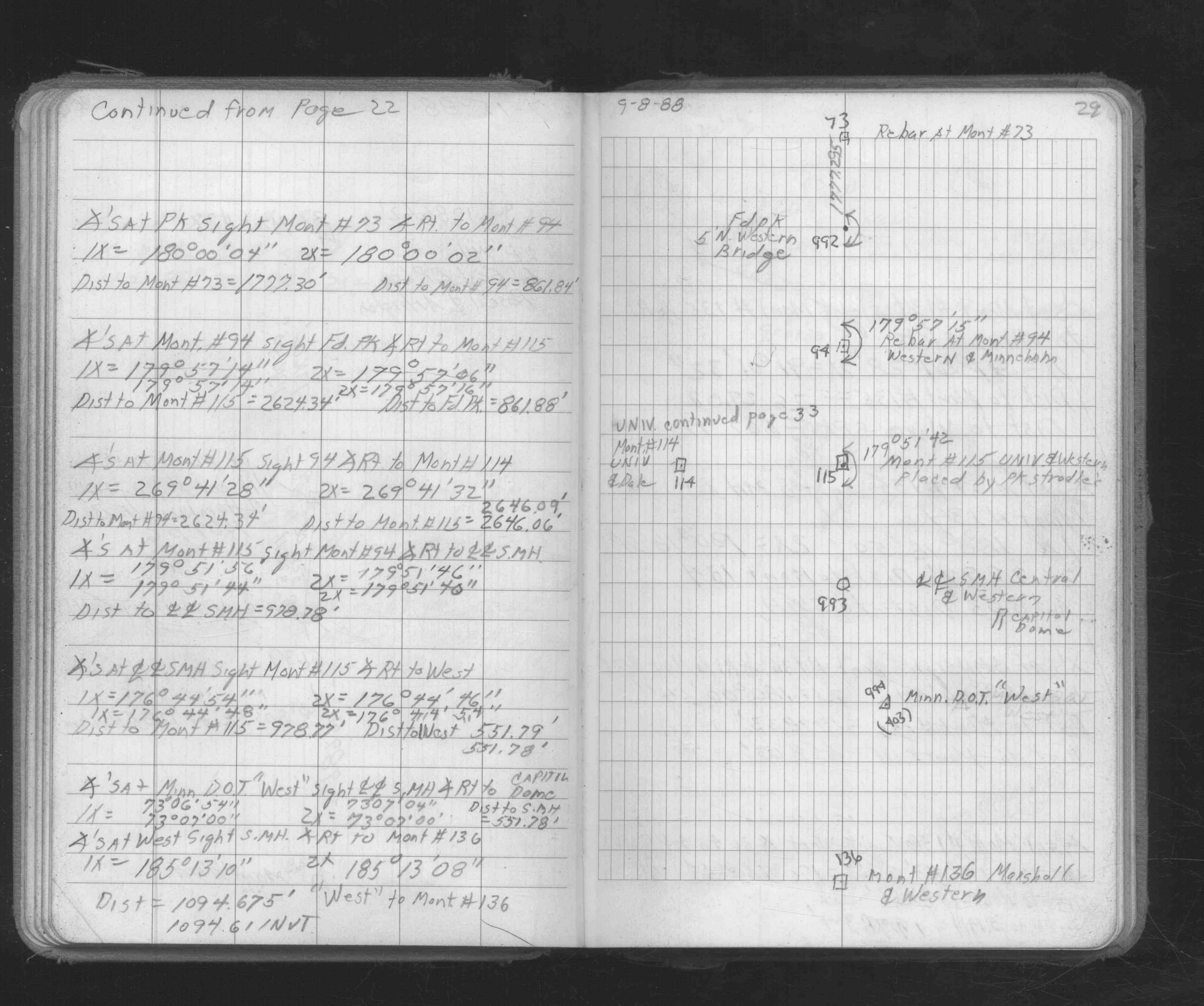
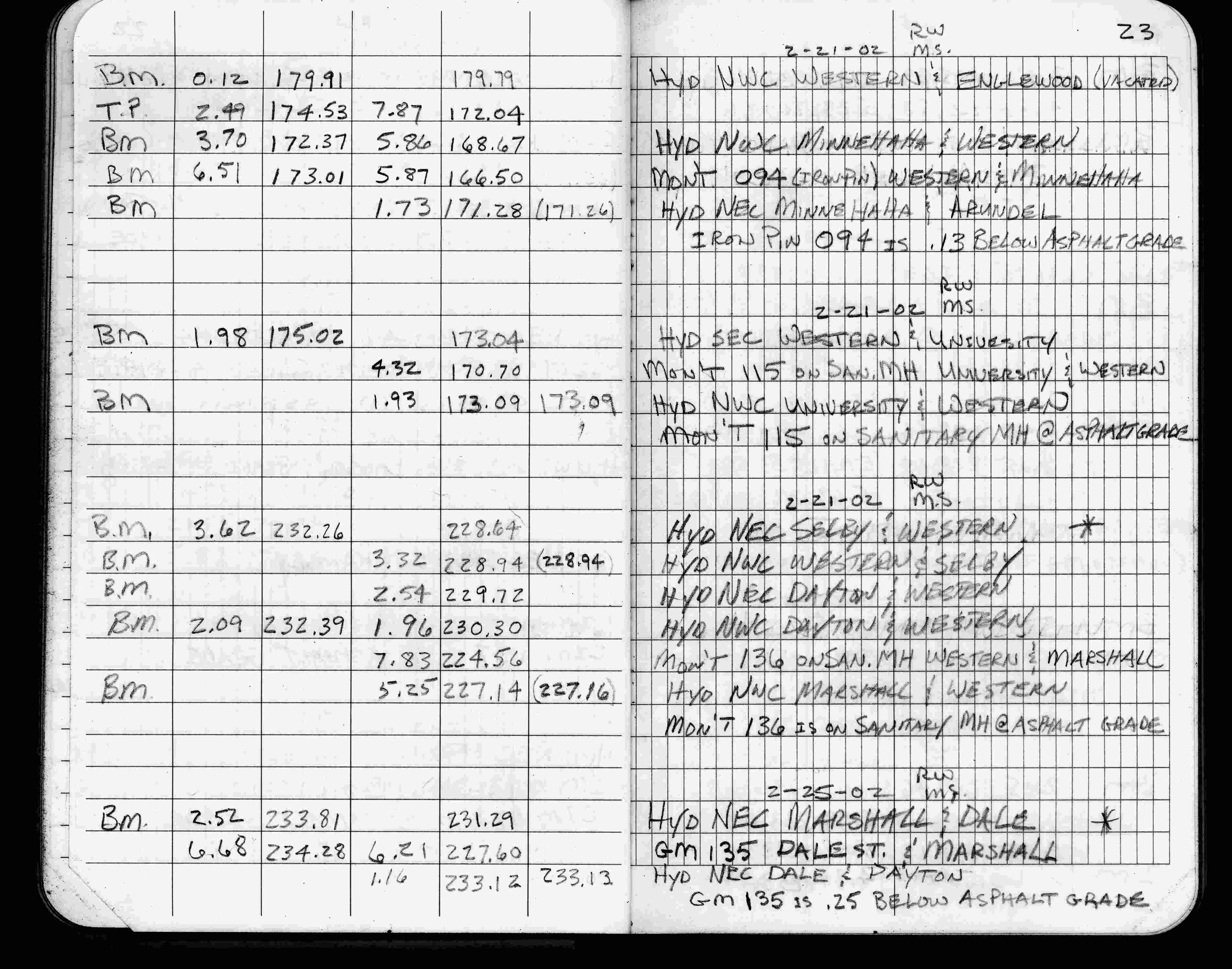
| 2/21/2002 | Elev 224.56 ft on sanitary MH at asphalt surface. See FB 1736 p.23 |
| 3/1/2000 | (Unknown date Mar __, 2000 ) Placed 4-2 ft straddles from hyd & mh ties (marked for painting target for 2000 aerial) |
| 3/1/1987 | (Unknown date Mar __, 1987 ) Monument falls on sanitary sewer MH |
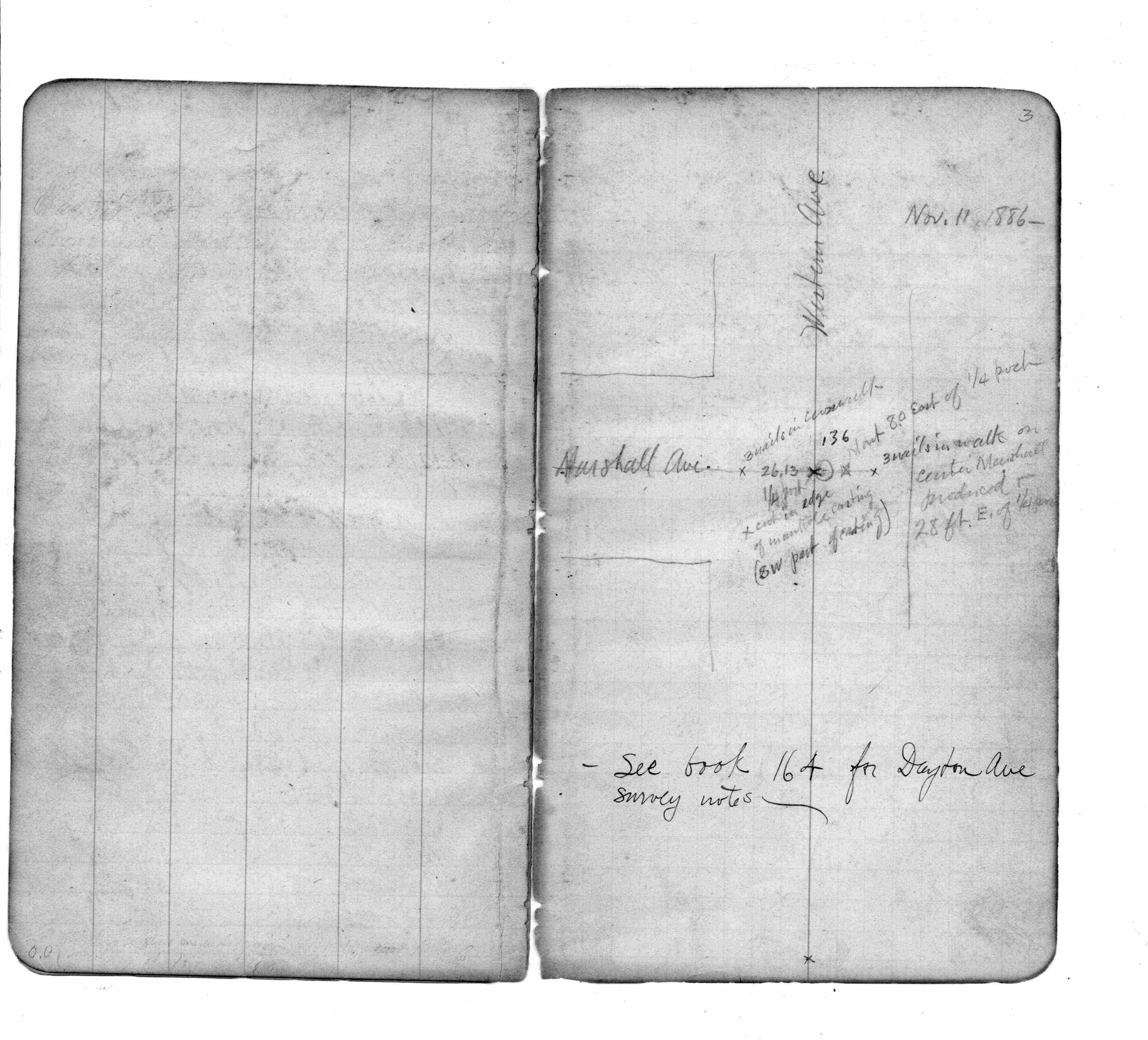
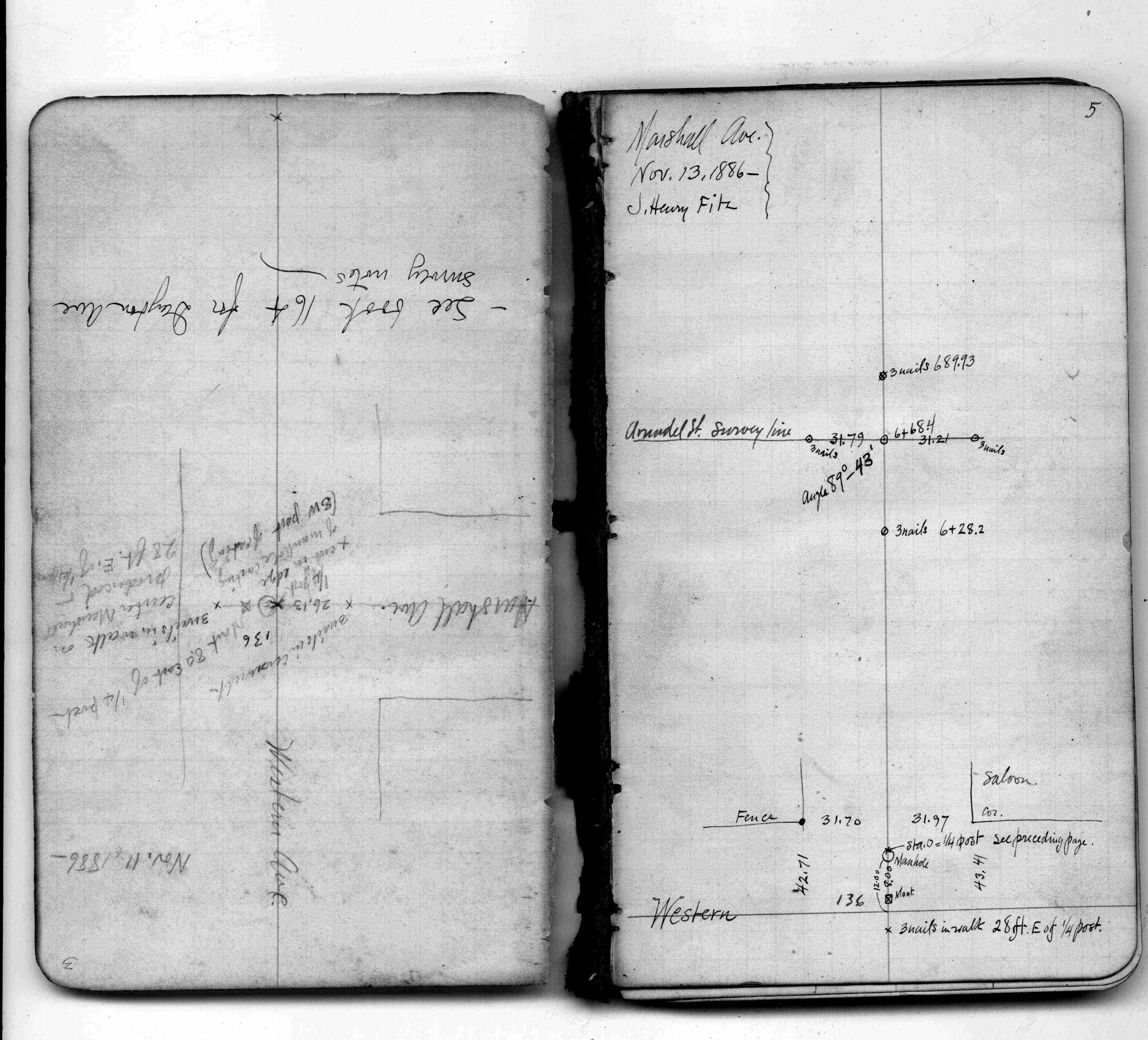
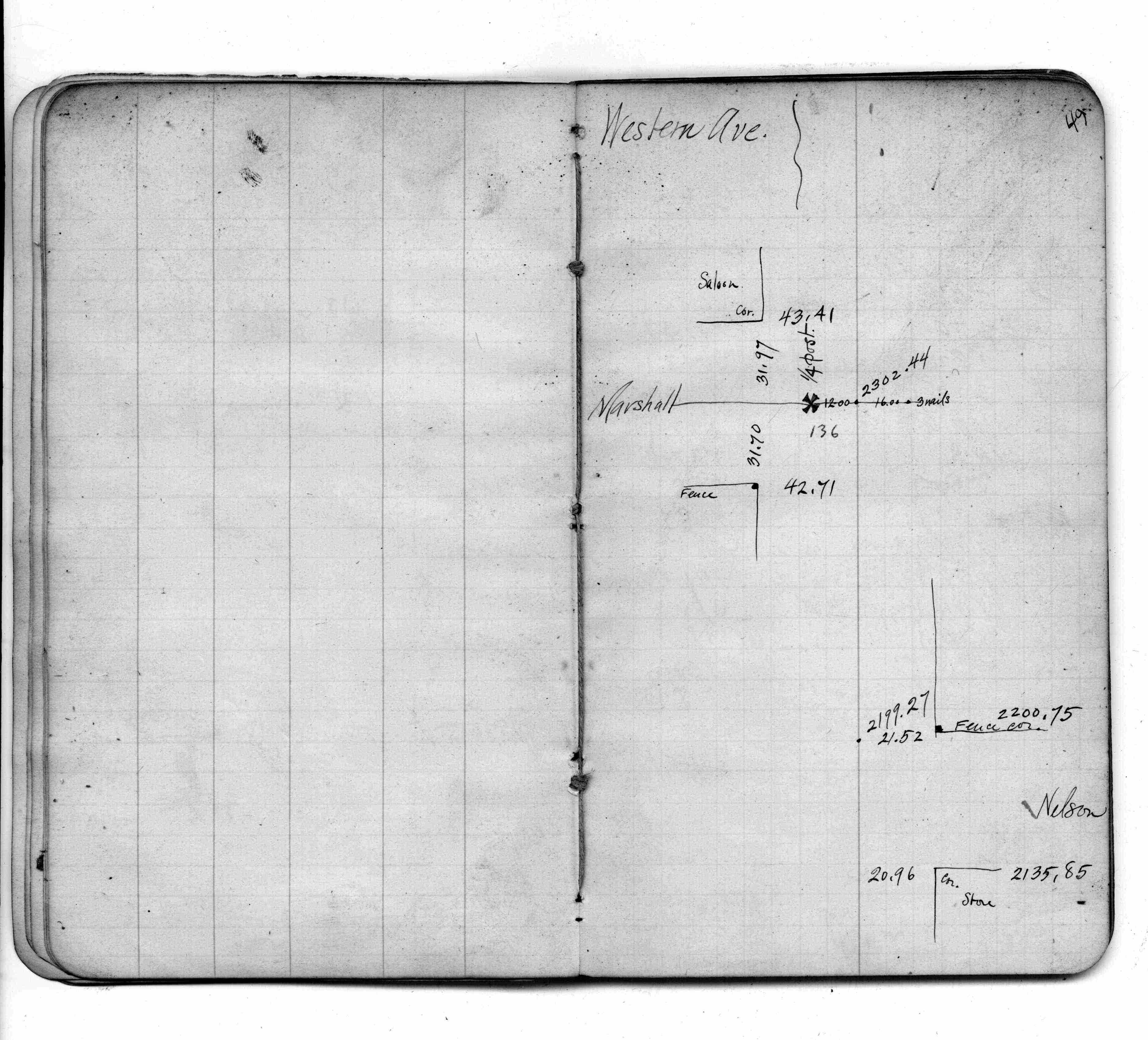
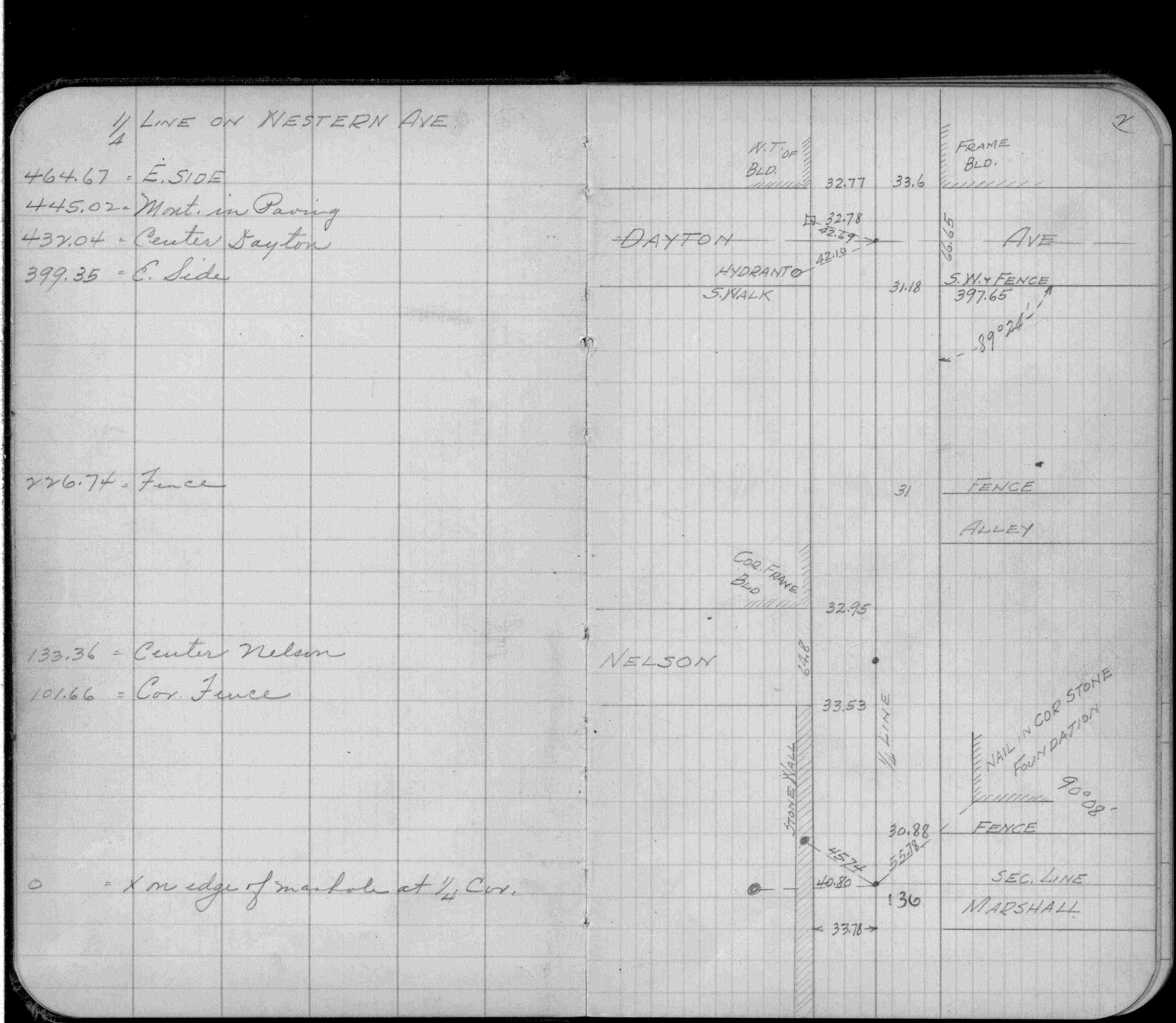
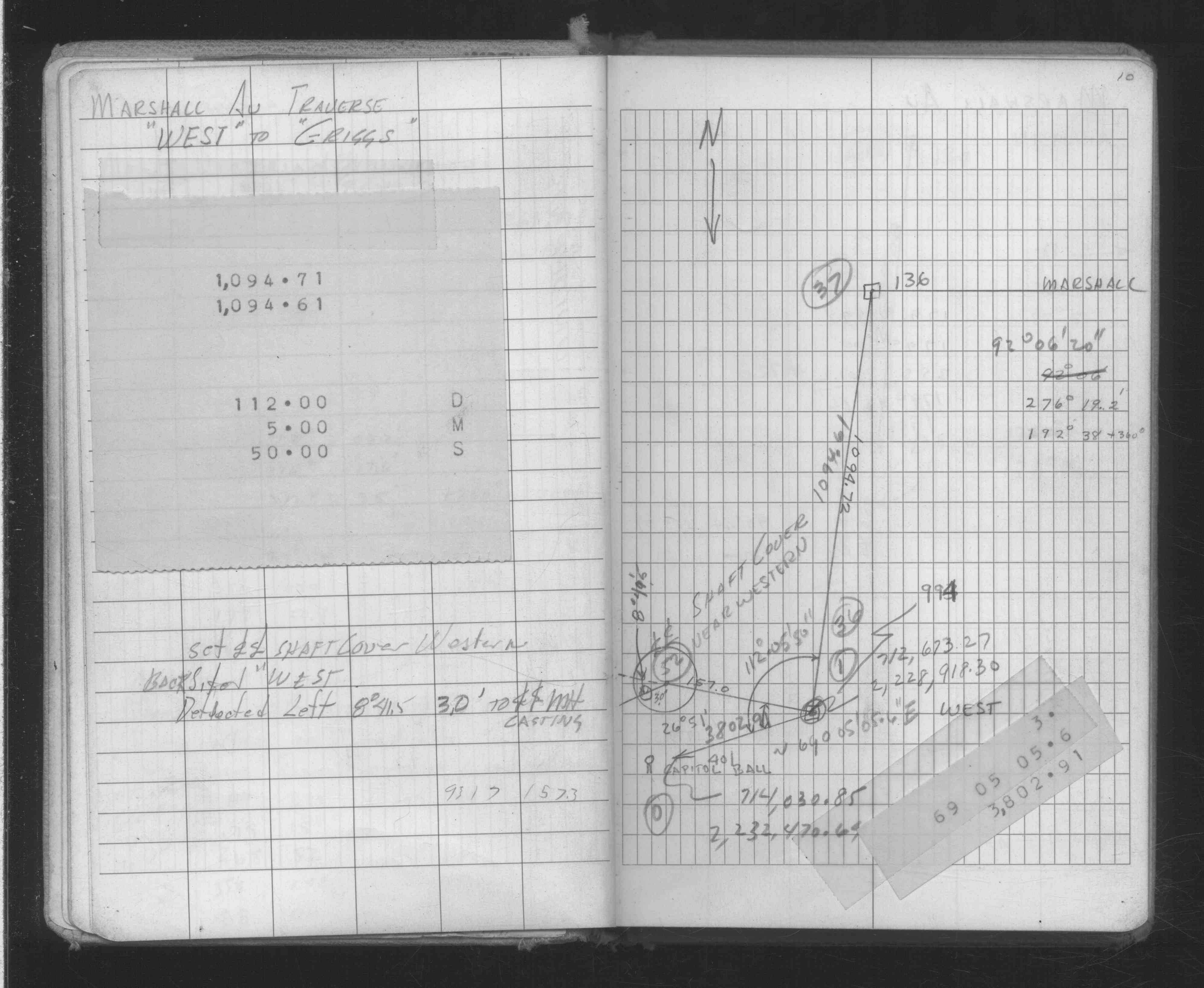
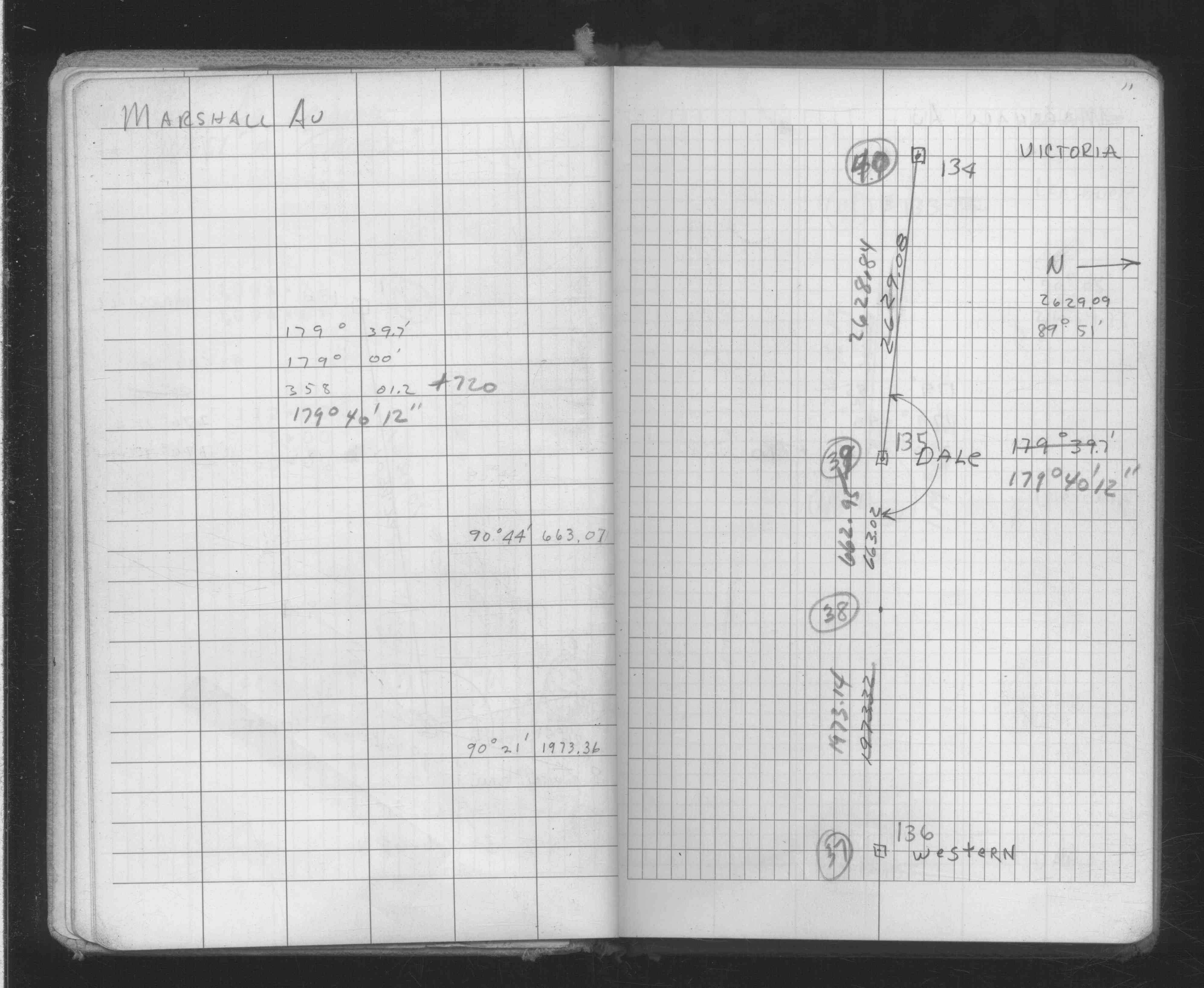
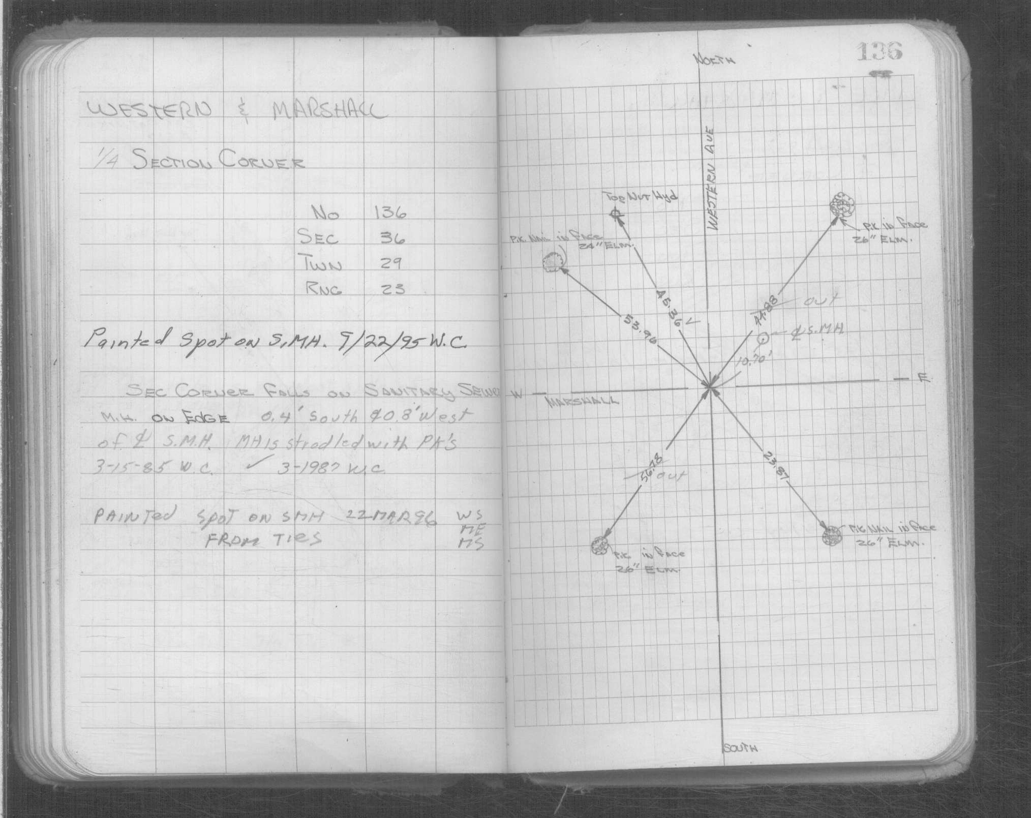
| 10/7/1847 | James M Marsh deputy surveyor set post. Tied to 2 BTs. See JM p.068-069 border |
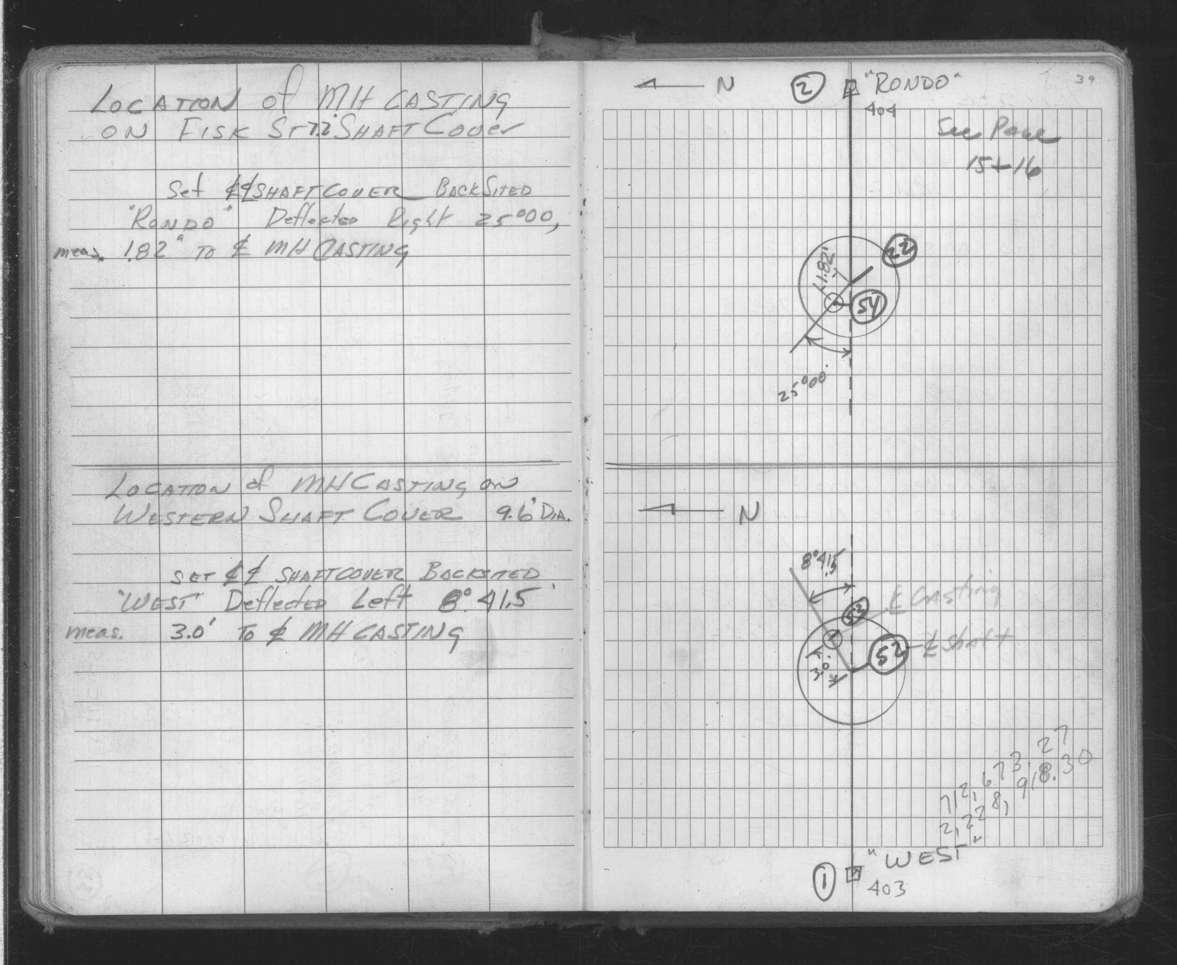
| 1/1/1800 | (Unknown date ___ __, ____ ) Monument is not at actual corner but 8 ft east of corner. Monument falls on MH at Marshall & Western |
| 1/1/1800 | (Unknown date ___ __, ____ ) Monument is 8 ft East of Cor. Correct corner is marked by cross on MH |
Above is NOT an all inclusive history of this point. Please review all the links below.
| PLS NOTES | Field | Cross Section | Sewer | J.B. Irvine | Monument | River Survey |
|---|---|---|---|---|---|---|
| JM p.068-069 | FB 0160p. 002-003 ,004-005 ,048-049 | |||||
| FB 0265p. 02 ,11 | ||||||
| FB 0268p.126 | ||||||
| FB 0276CPYp. 20 ,71 | ||||||
| FB 1549Cp.52 | ||||||
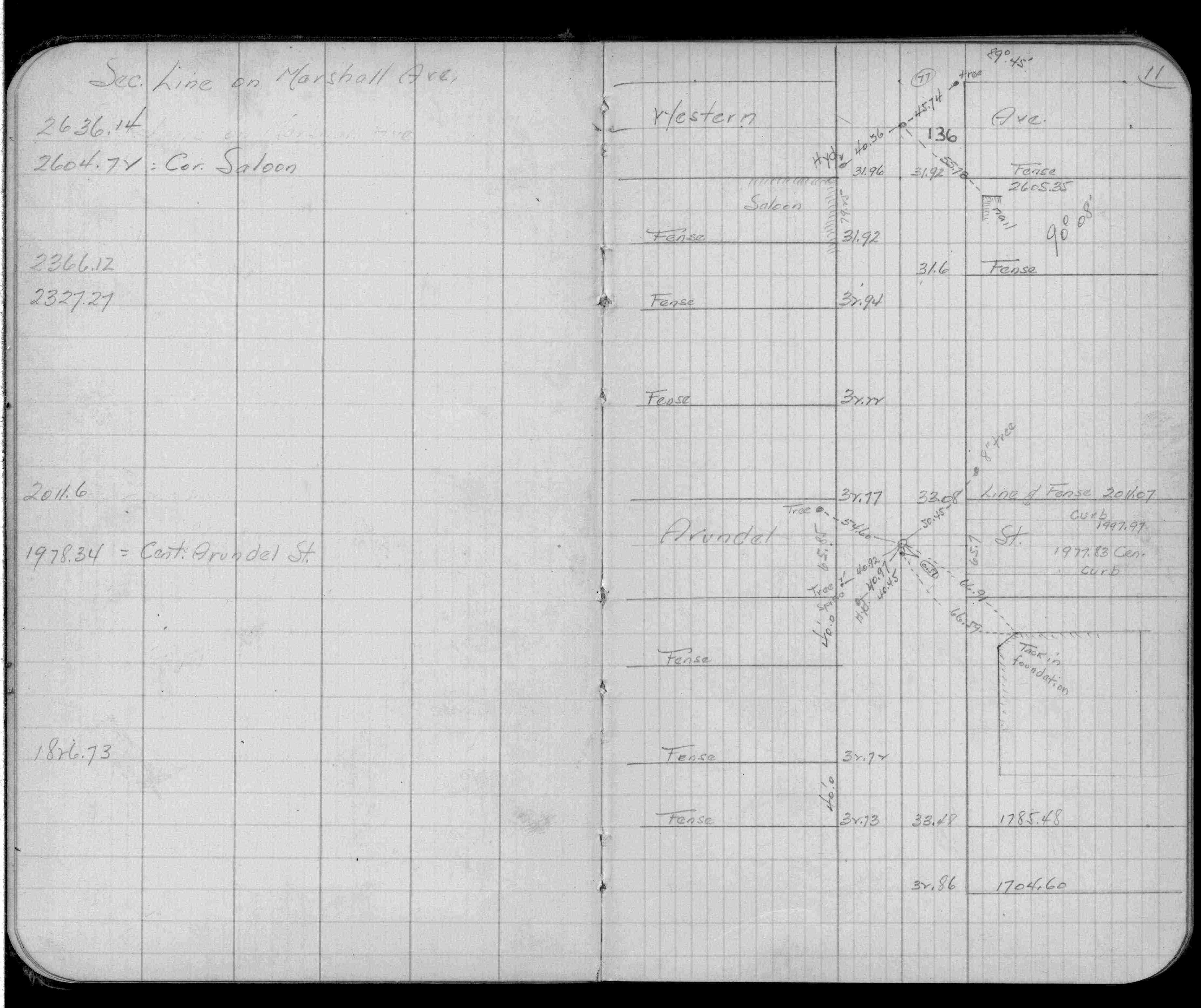
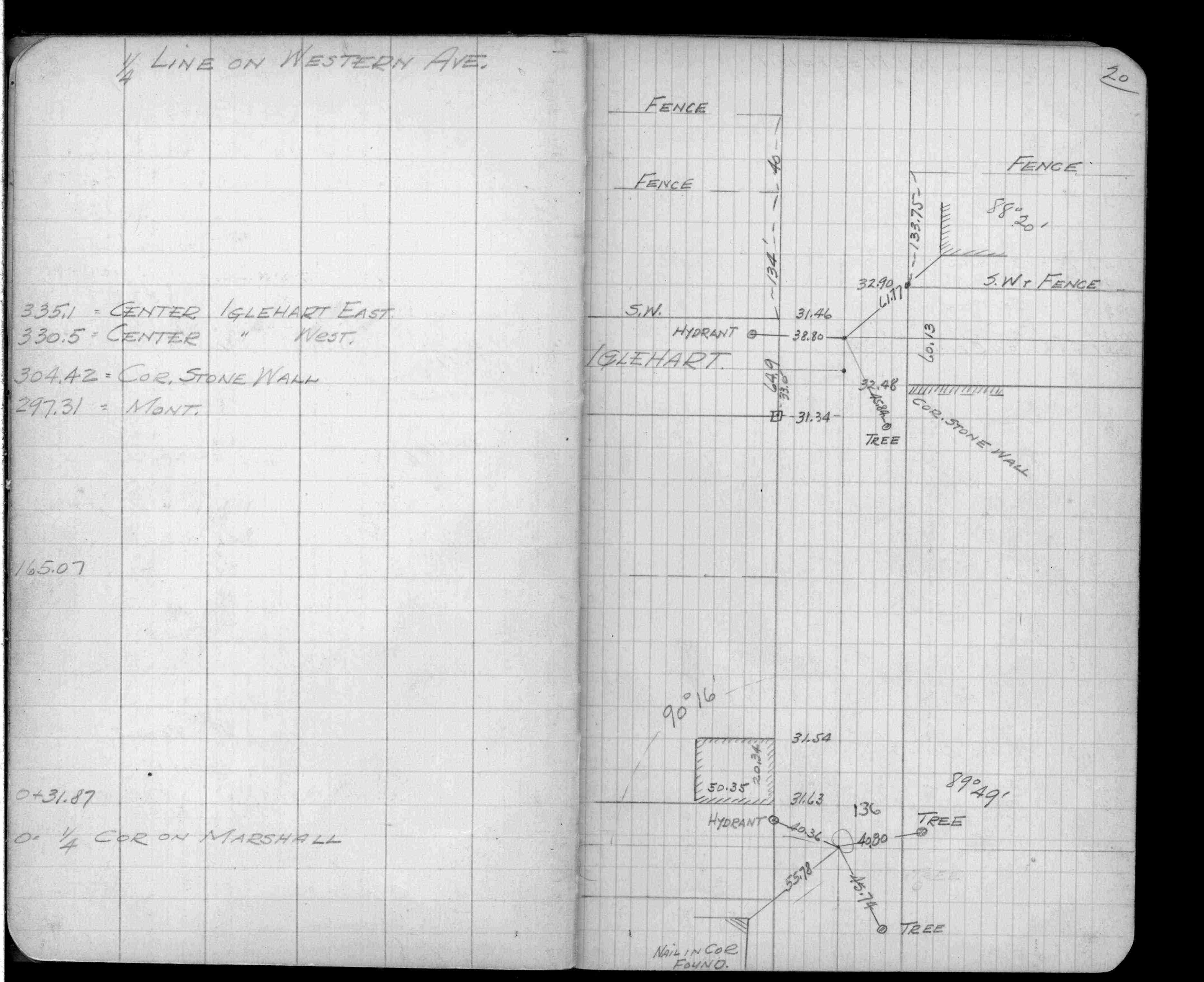
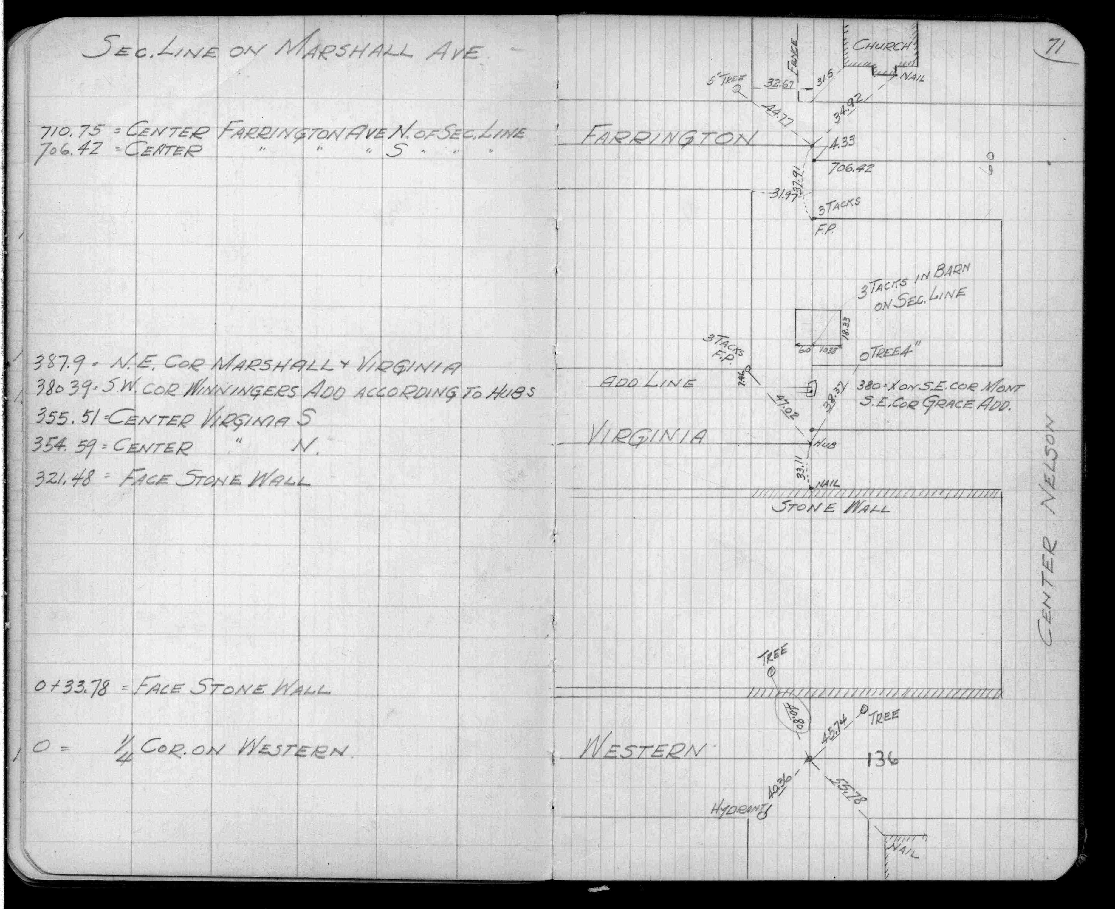
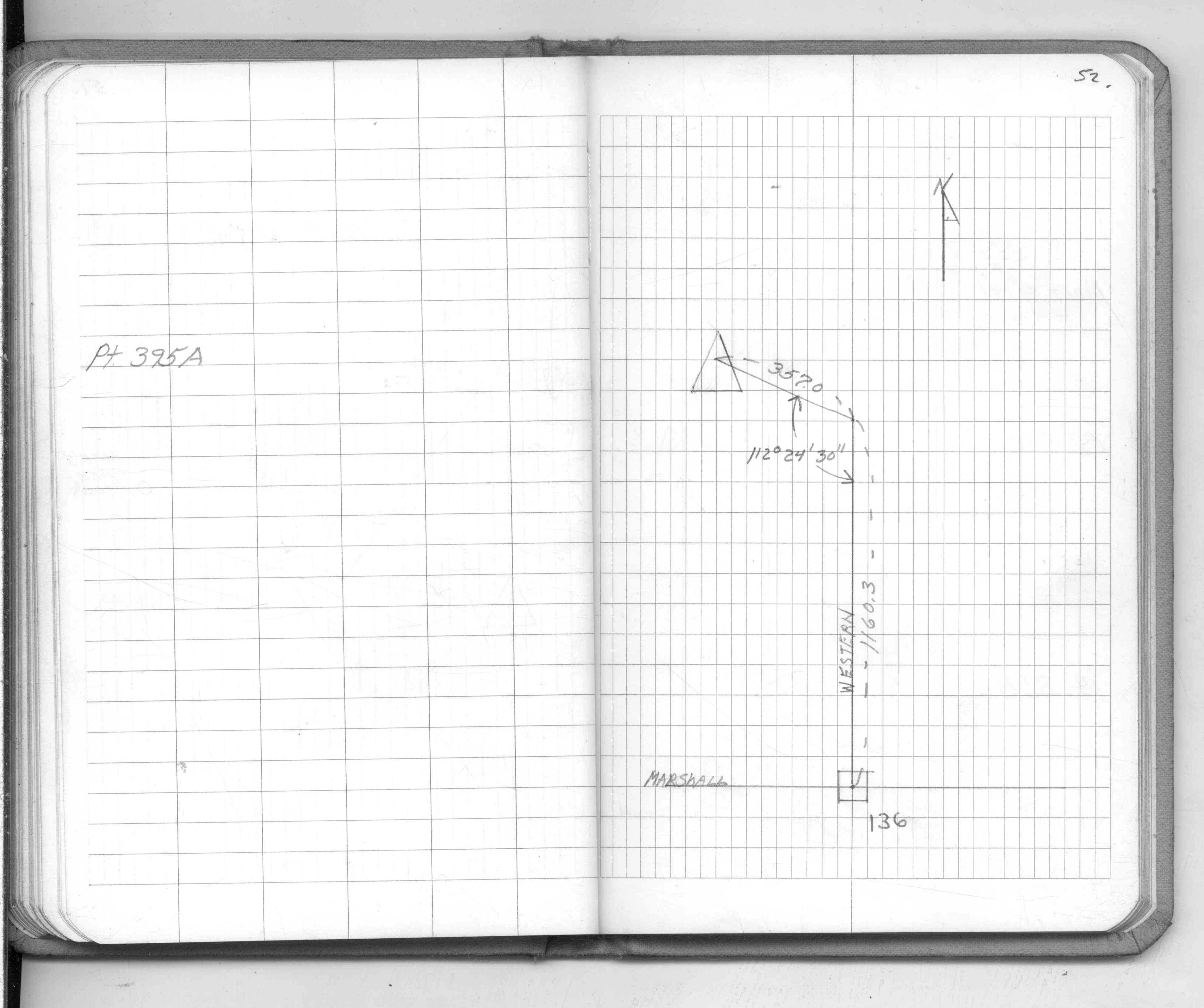
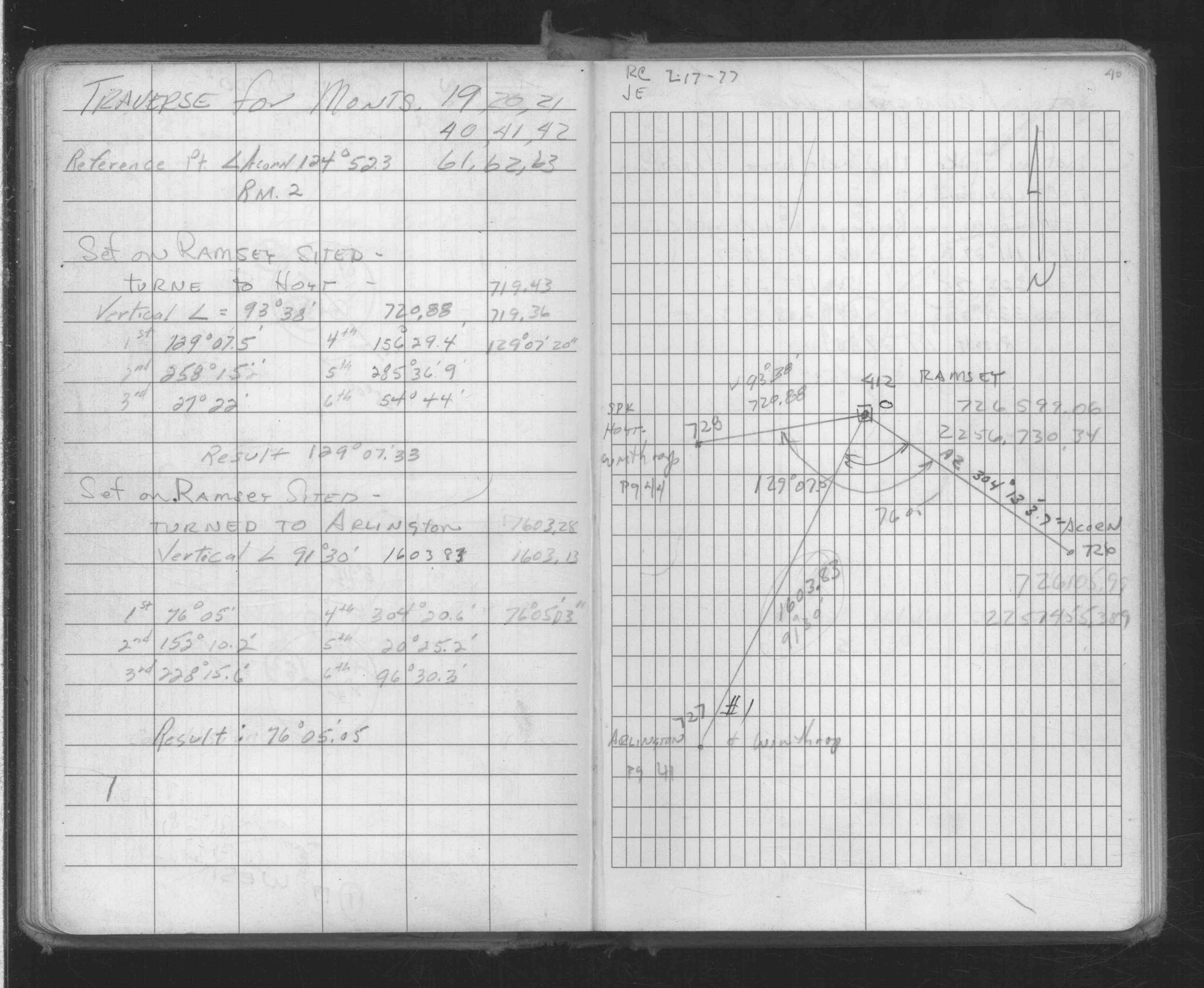
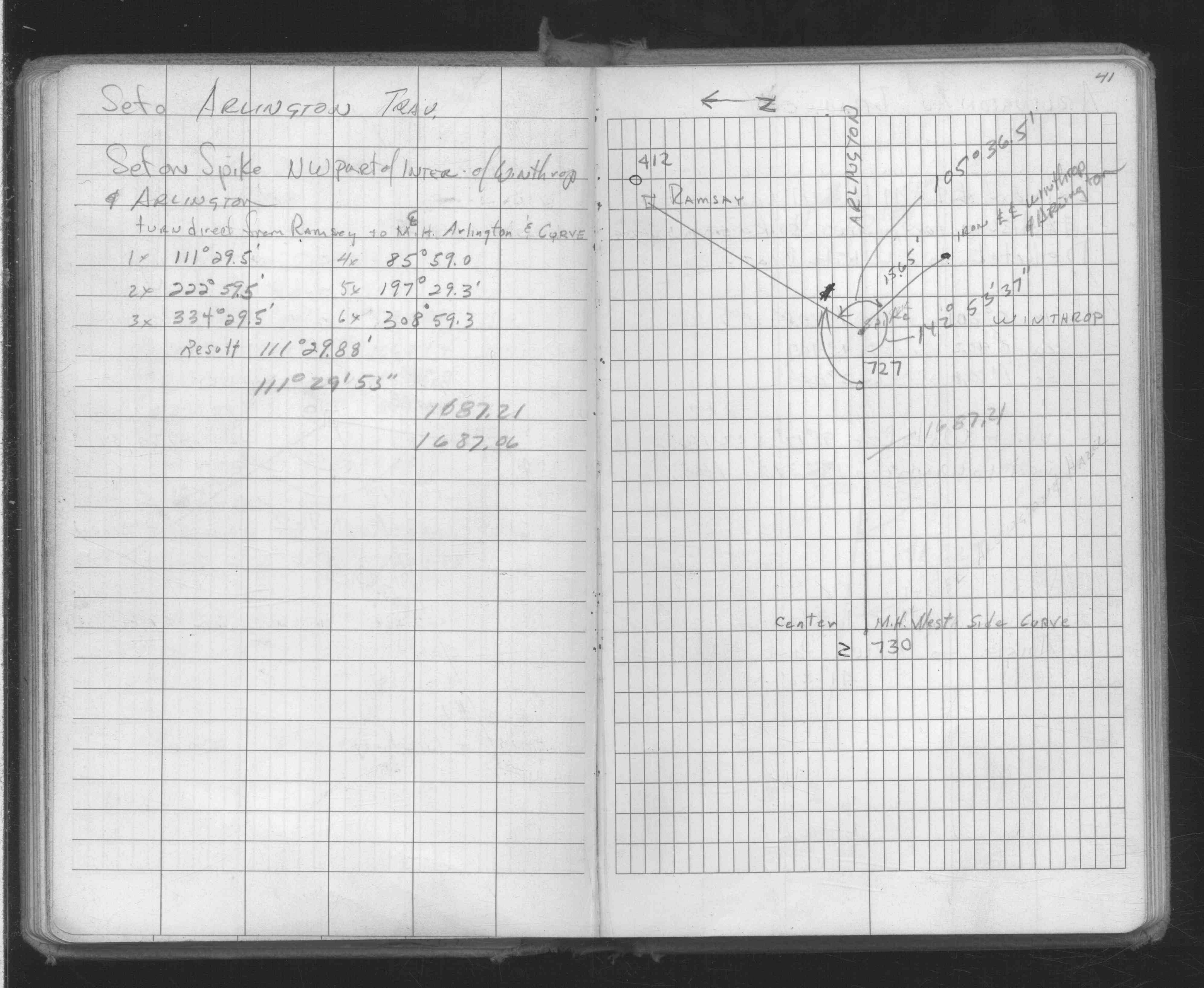
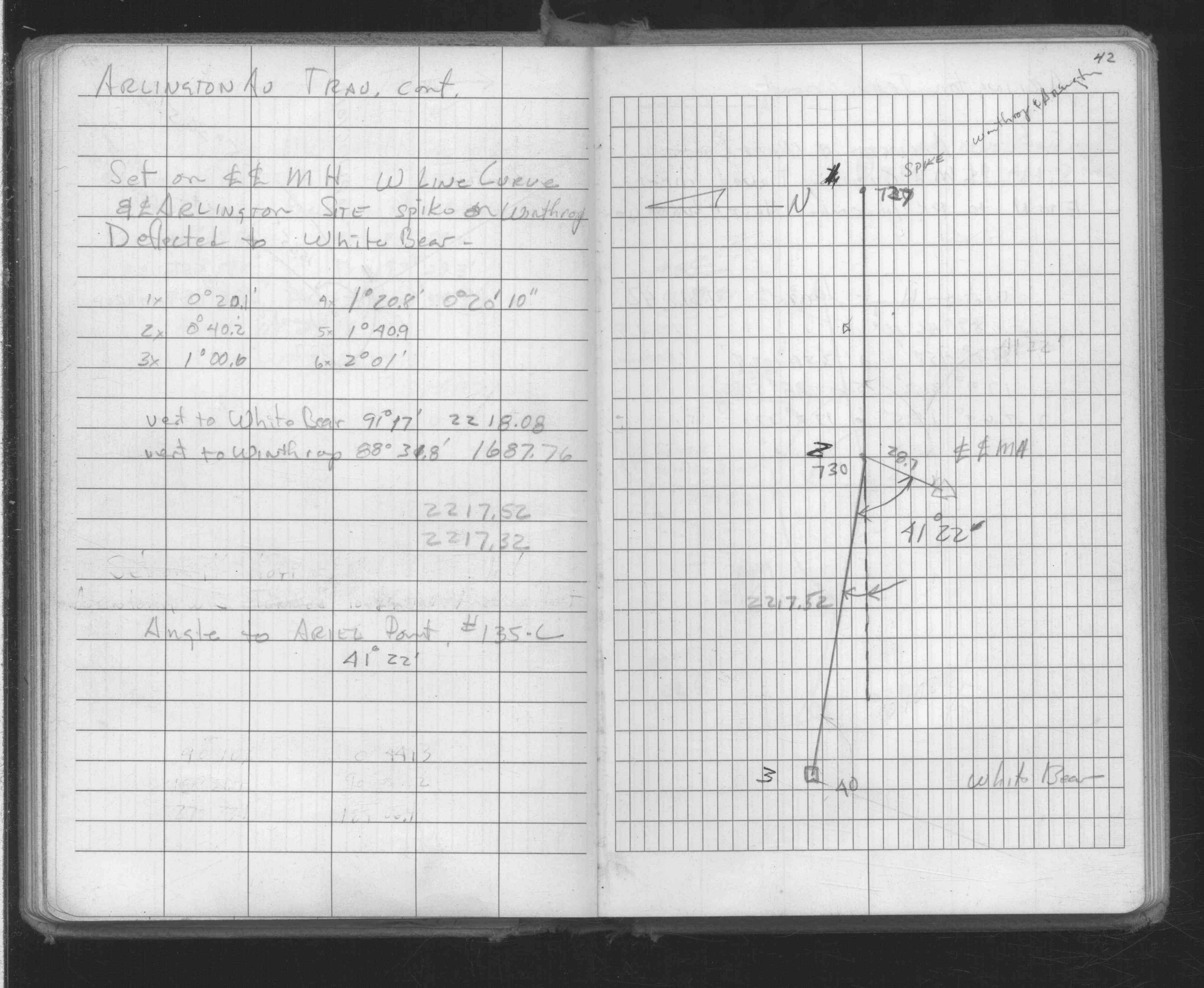
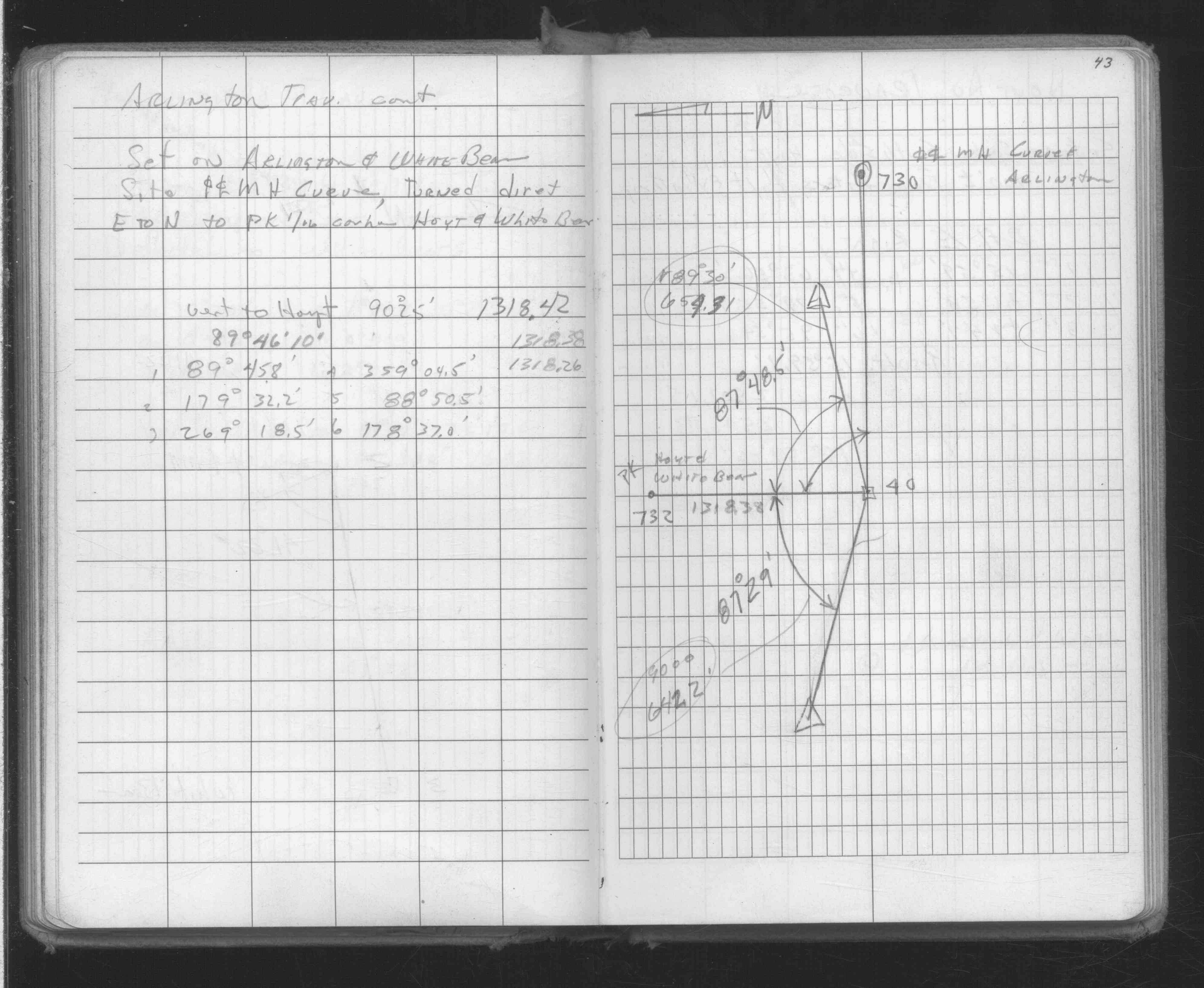
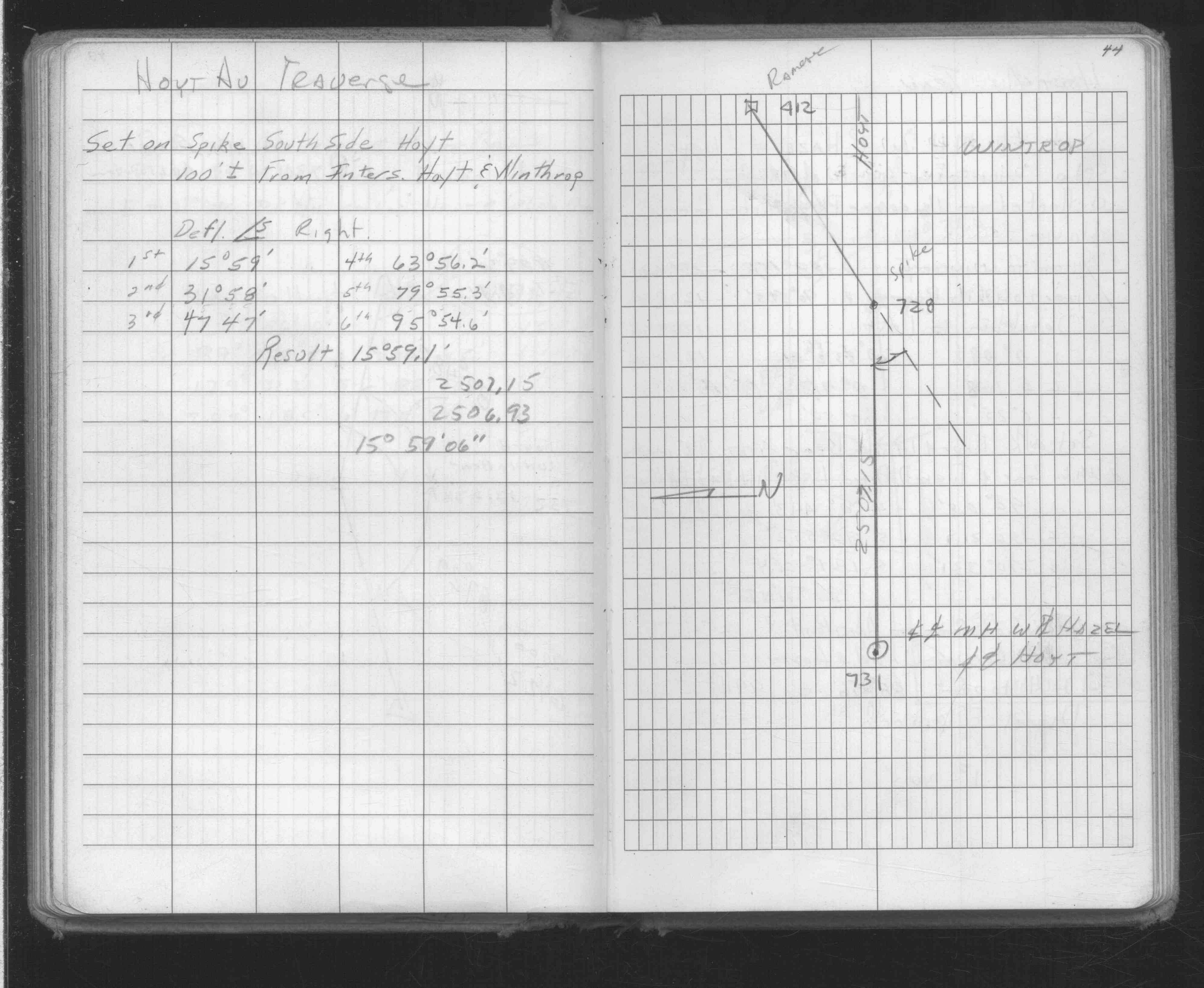
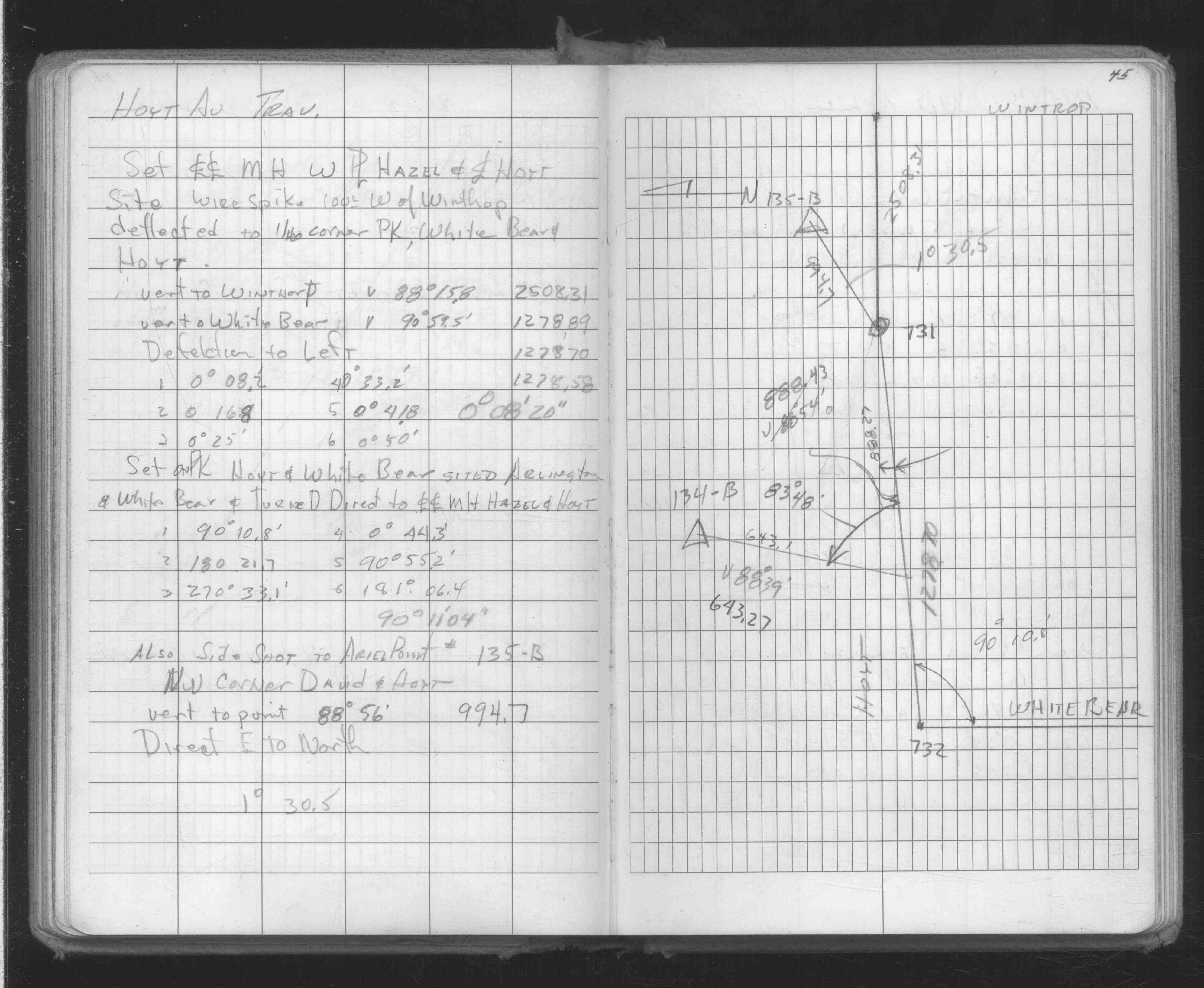
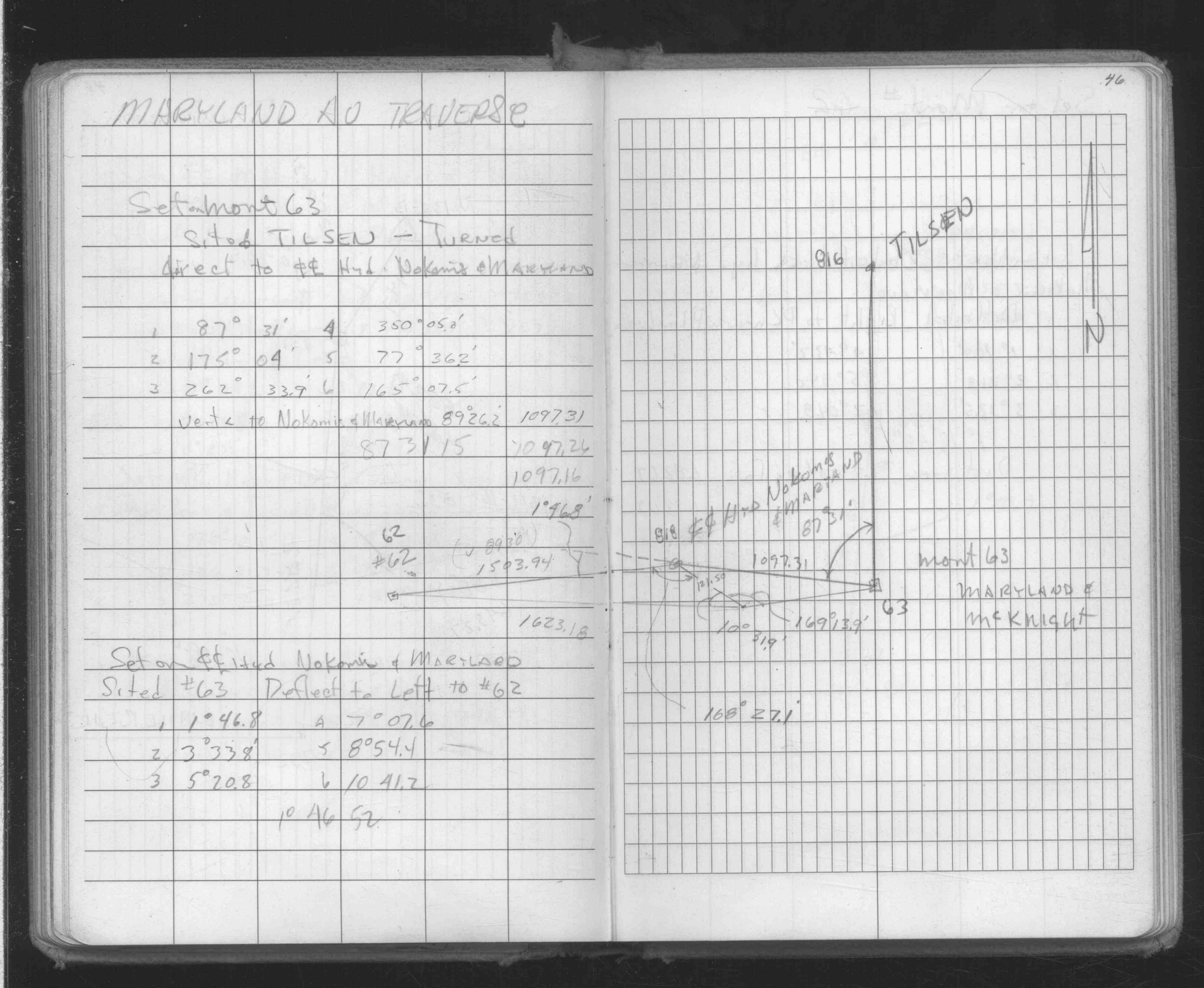
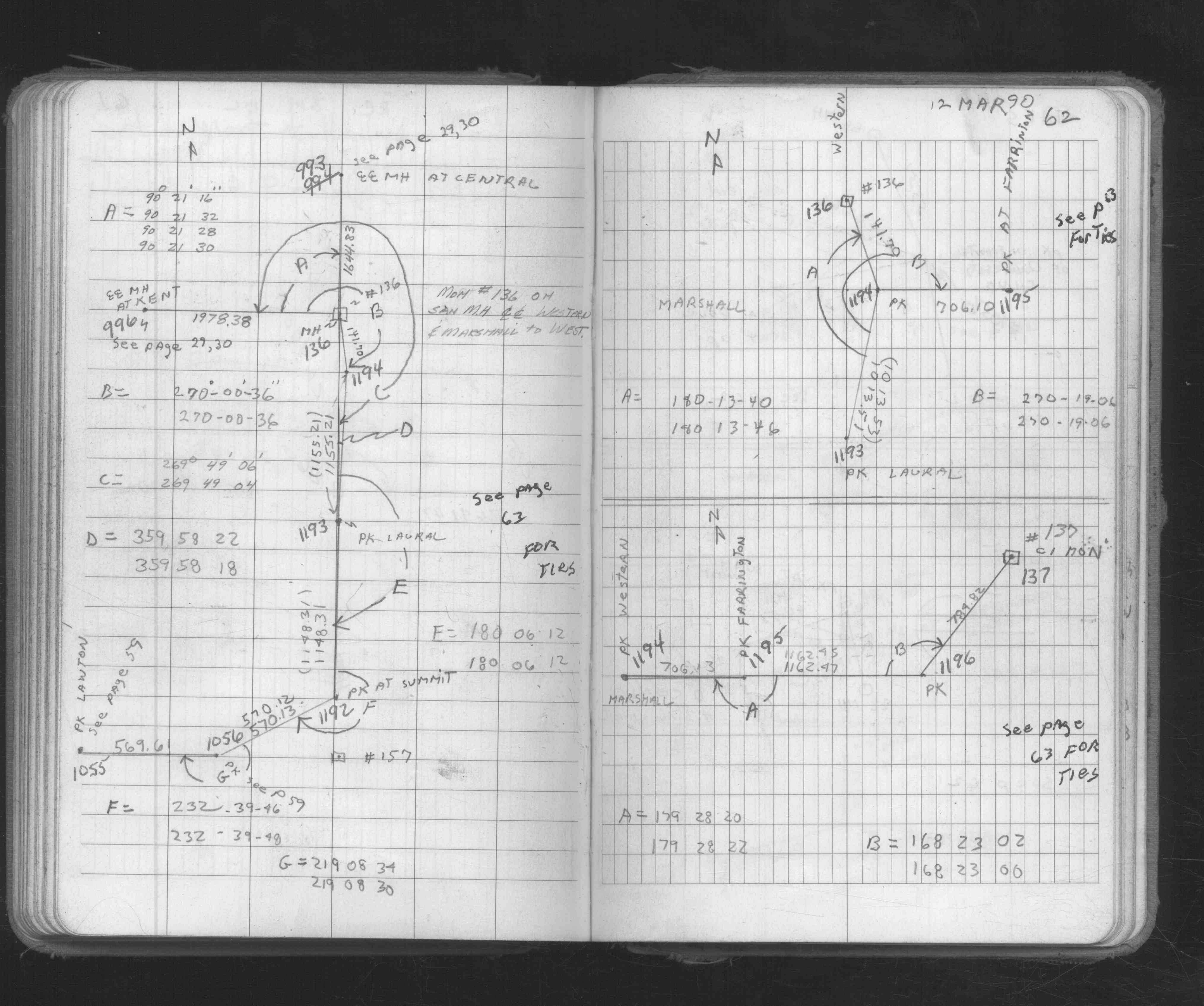
| FB 1634Dp. 10 ,11 ,38 ,39 ,40 ,41 ,42 ,43 ,44 ,45 ,46 | ||||||
| FB 1673Ap. 27 ,29 ,62 | ||||||
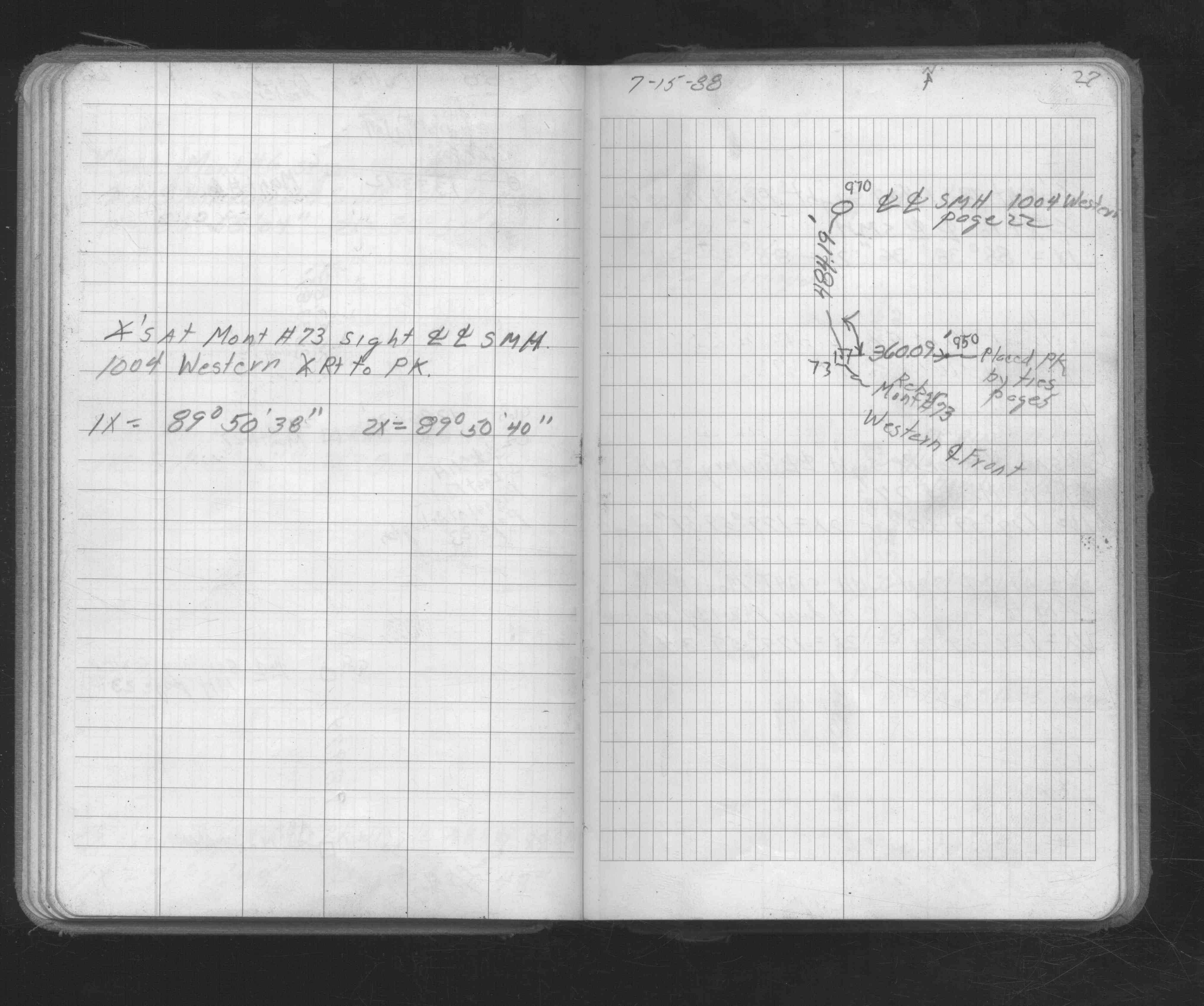
| FB 1736p.23 |
| FILE | SURVEYOR | LIC. NO. | DATE SIGNED | DATE TIED |
|---|---|---|---|---|
| ST_079-156p136.jpg | none | none | none | none |
| 0136-0103-A.dwf | none | none | none | none |