| NAD83 COORDINATES (1986 adj.): |
|---|
| * X= 550742.603 Y= 154907.516 Z= 000.00 LSQ 12/06/1991 S FIX |
| X= 550742.533 Y= 154907.452 Z= 883.2 01/10/2005 RTK-VRS |
| 1/10/2005 | Position on GM established by RTK-VRS GPS. |
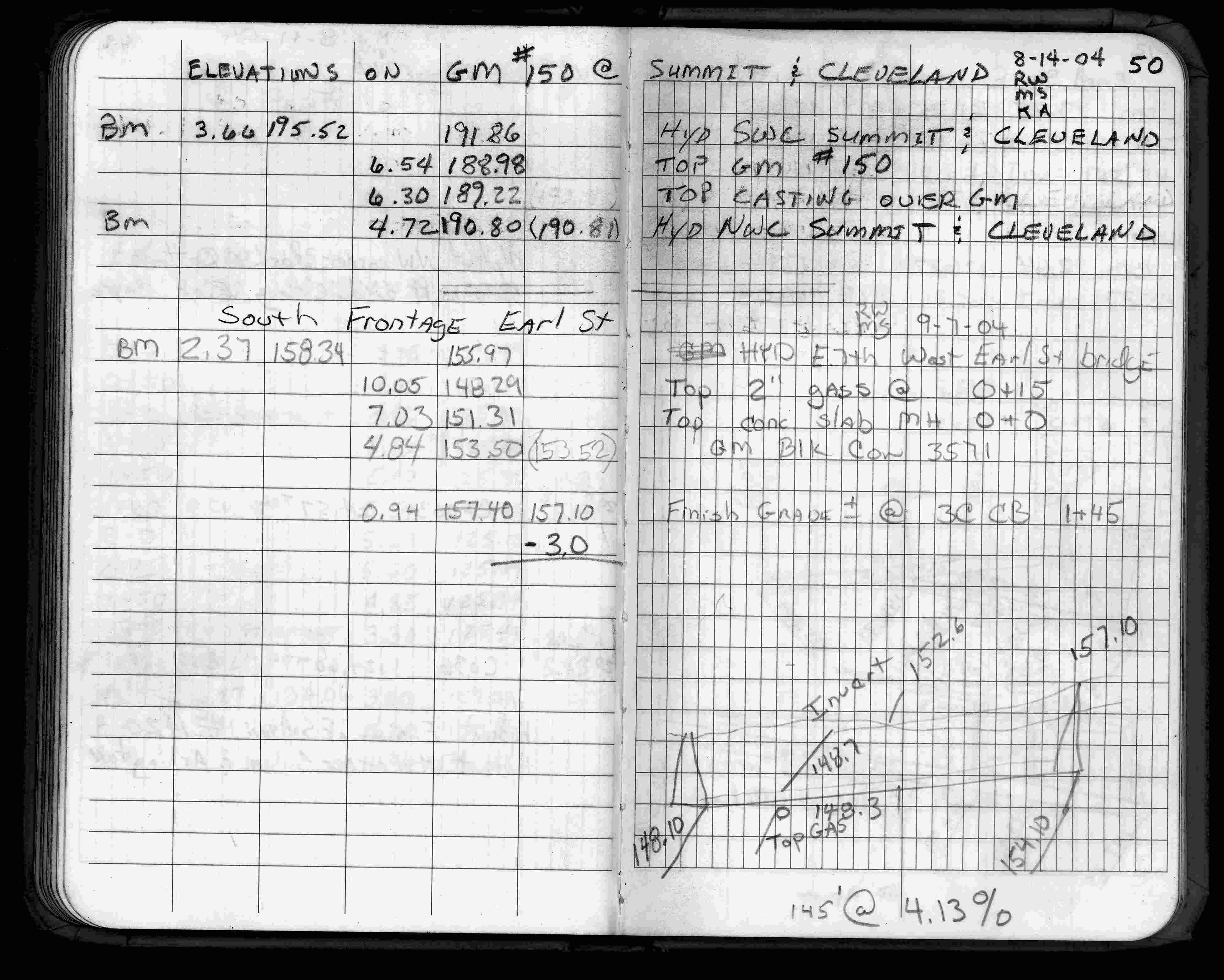
| 8/14/2004 | Placed small MH casting over GM. See CofL 0150-1706-A1 |
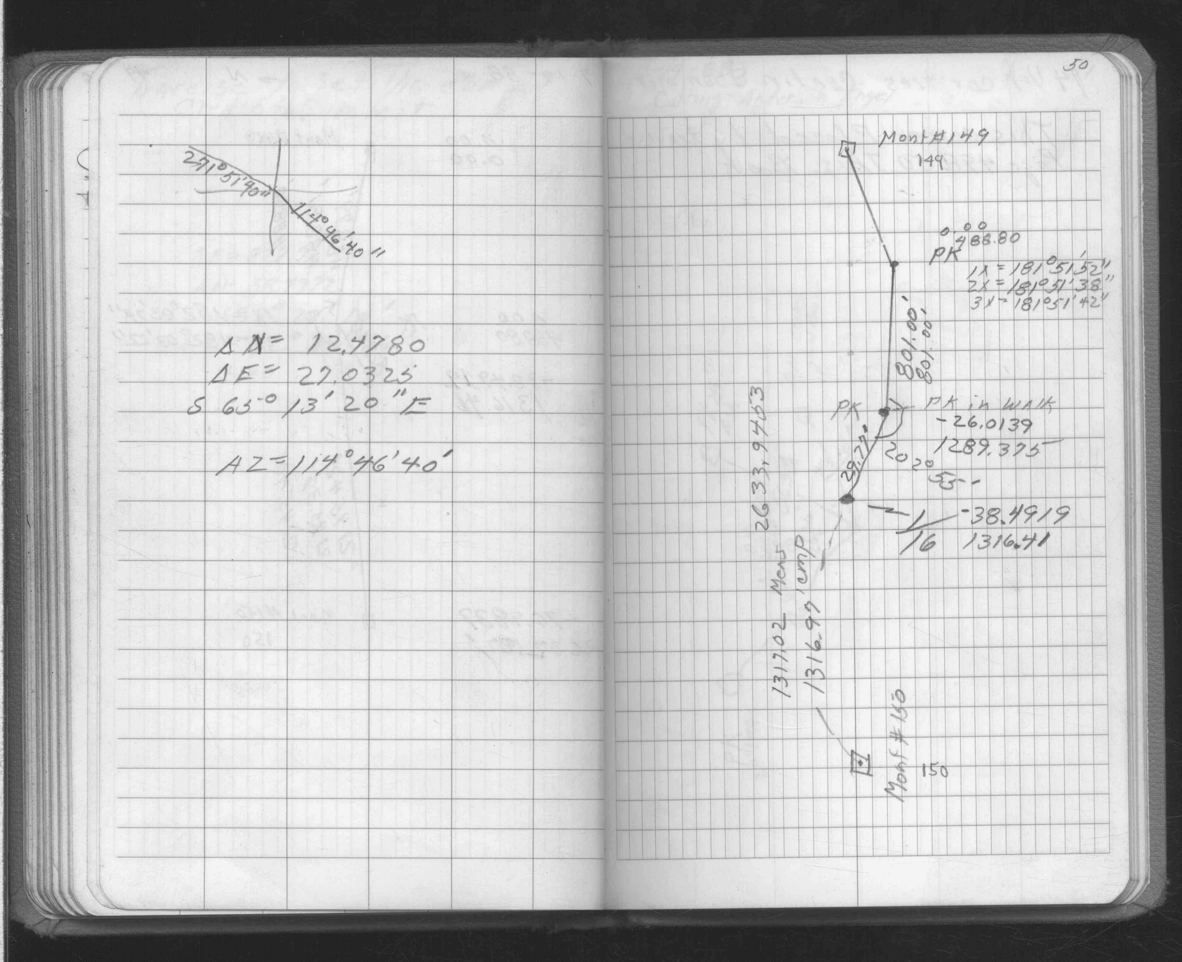
| 8/14/2004 | Elev 188.98 ft on GM and Elev 189.22 ft on casting. See FB 1735 p.50 |
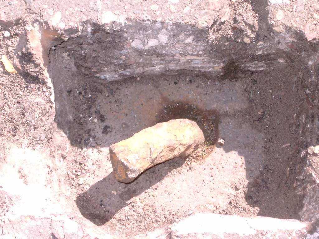
| 8/12/2004 | Fd bent over 1/2" dia pin embeded in GM. GM down 0.25 below street surface. |
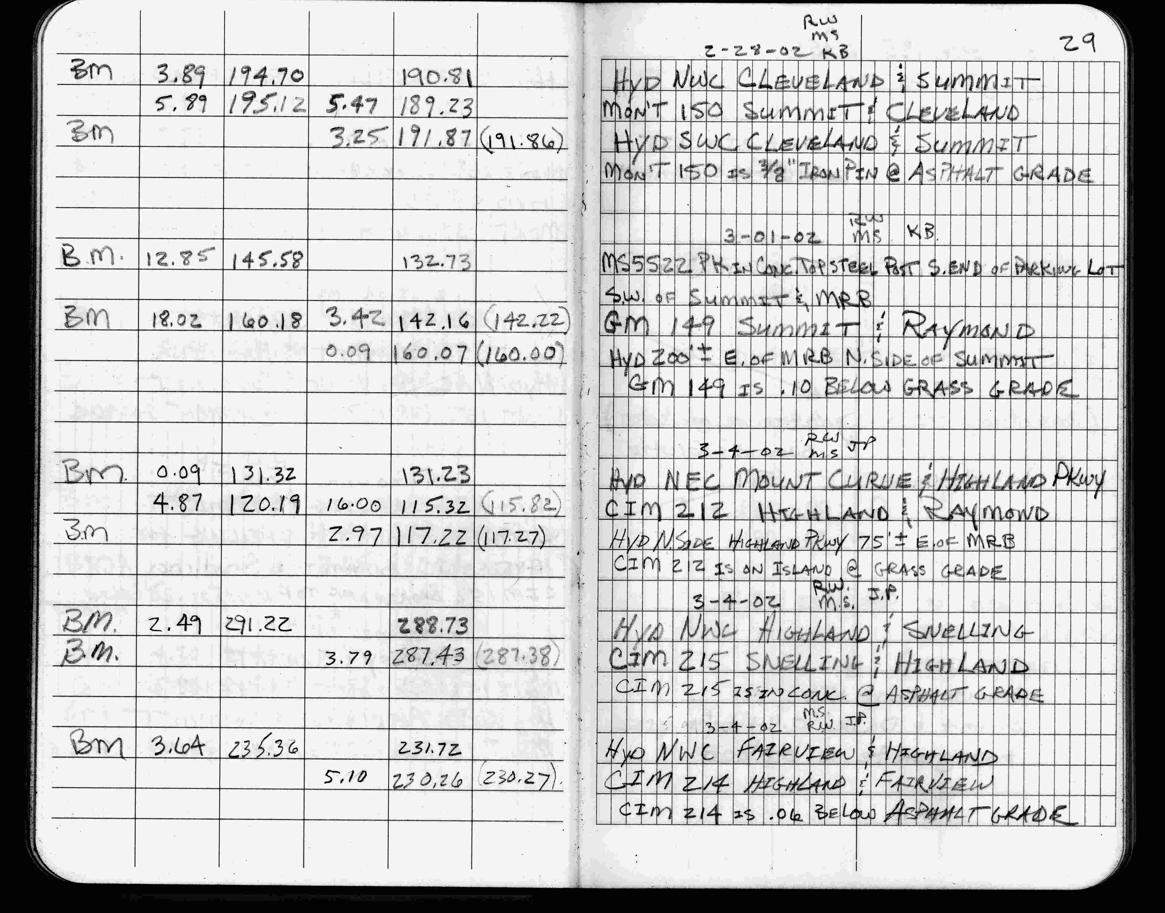
| 2/28/2002 | Elev 189.23 ft on 3/8" dia pin at asphalt surface. See FB 1736 p.29 |
| 3/1/2000 | (Unknown date Mar __, 2000 ) Fd CIM (marked for painting target for 2000 aerial) |
| 9/21/1995 | Fd steel rebar (marked for painting for 1995 aerial) |
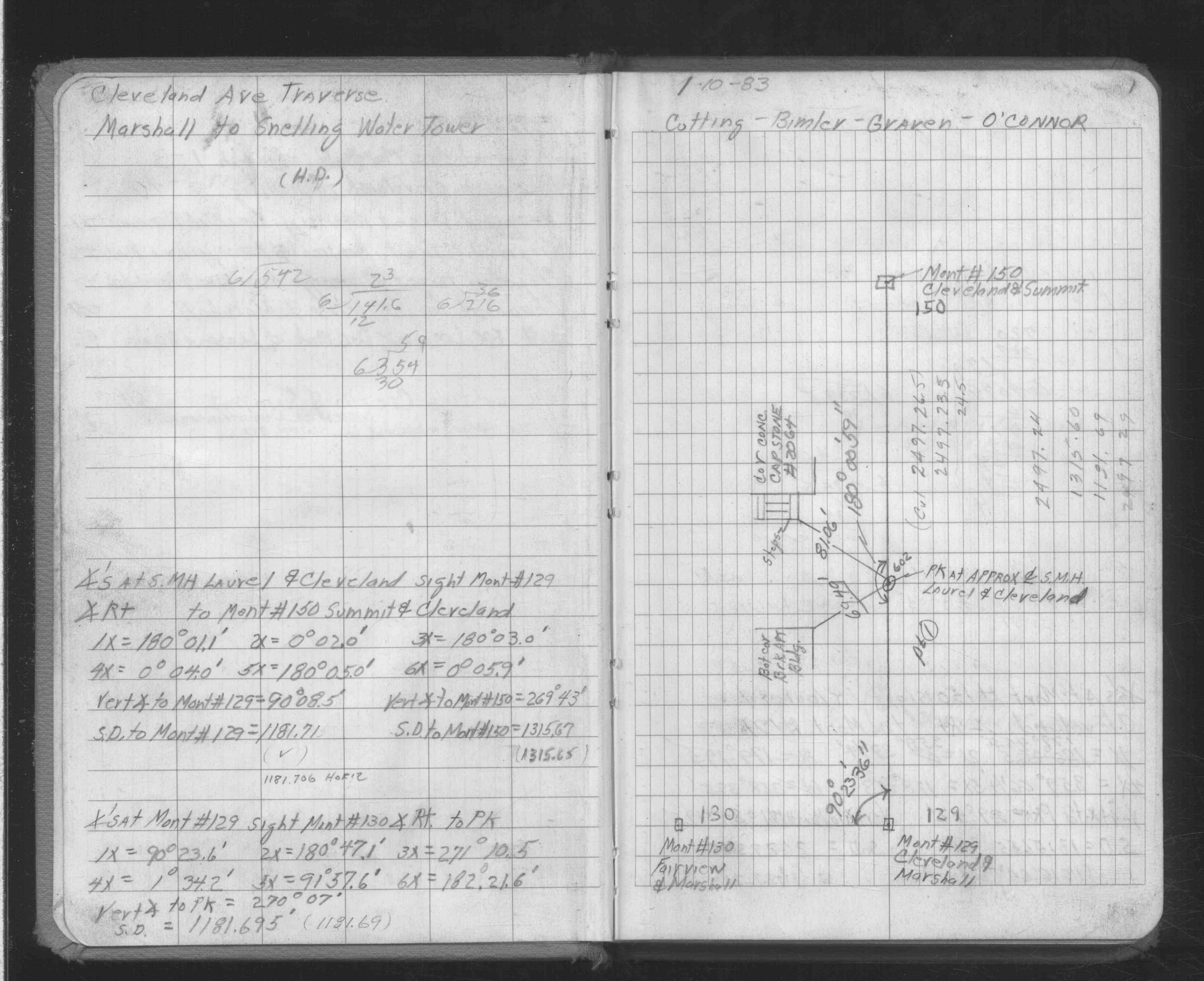
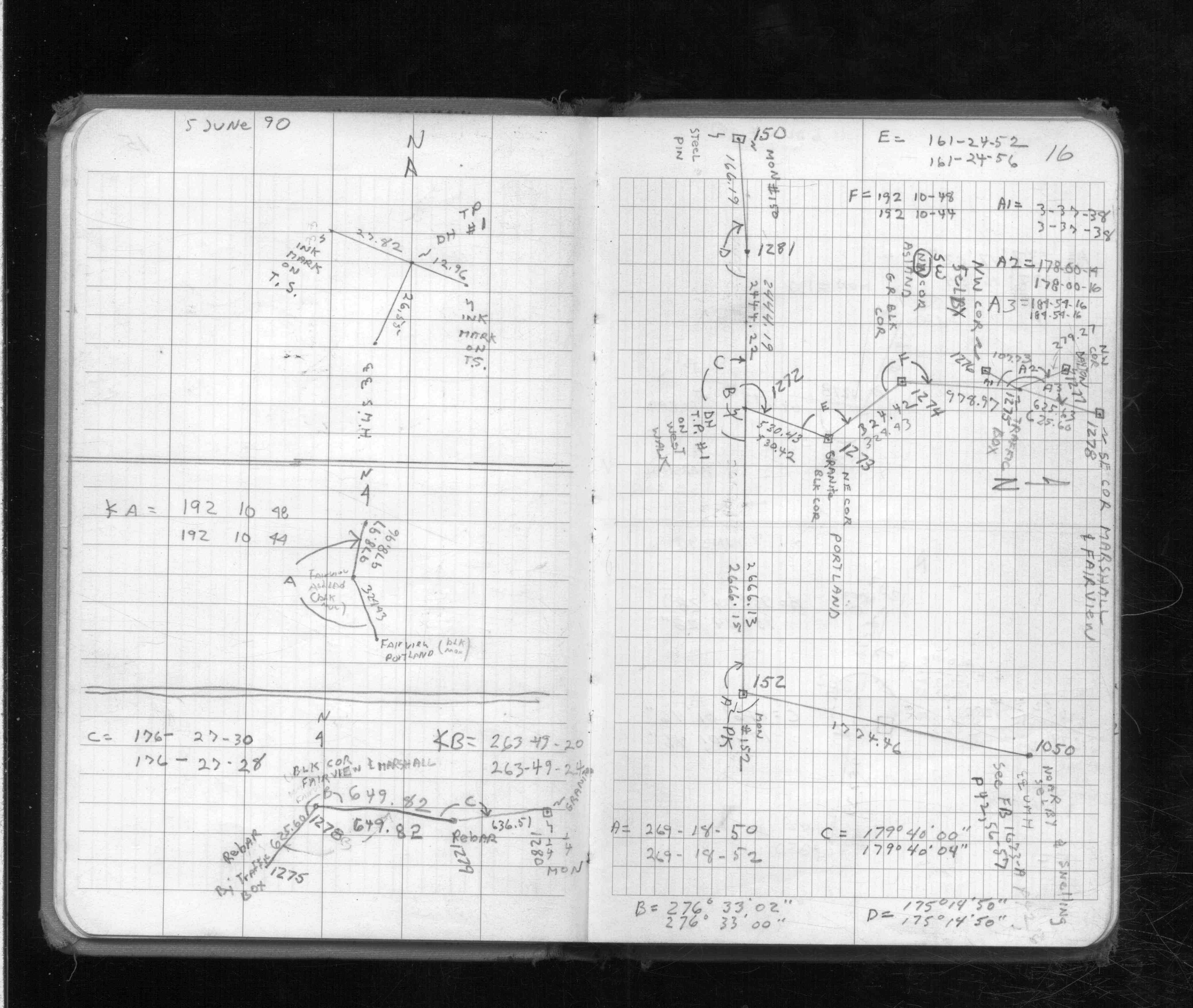
| 6/5/1990 | Located steel pin by traverse. See FB 1713 p.16 |
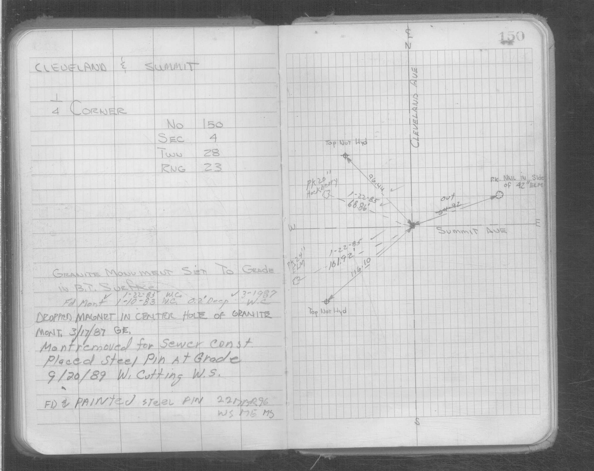
| 9/1/1989 | (Unknown date Sep __, 1989 ) Set steel pin to grade |
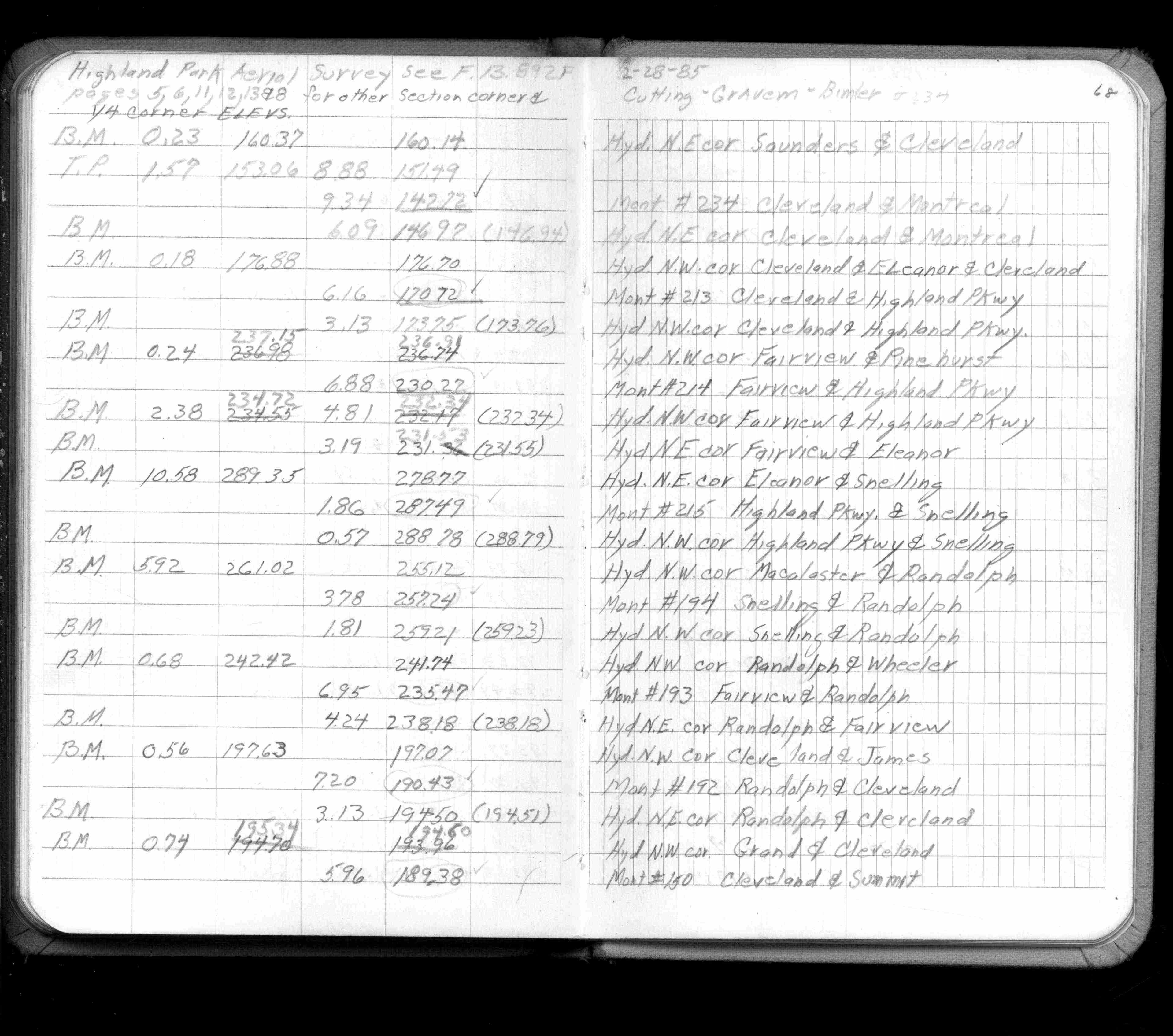
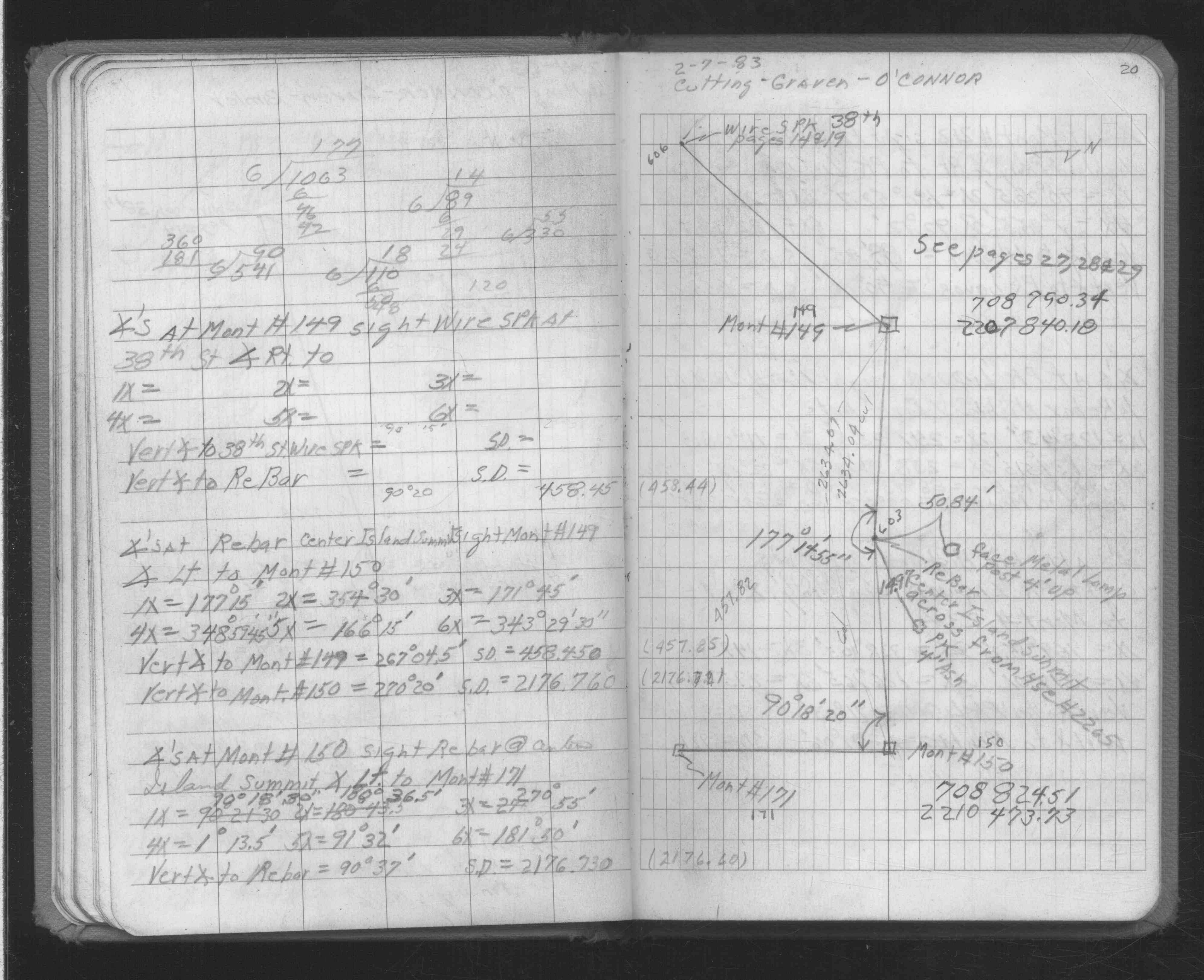
| 2/1/1985 | (Unknown date Feb __, 1985 ) Elev 189.38 ft on ?. See FB 1421A p.68 |
| 1/1/1985 | (Unknown date ___ __,1985 ) Historic, one time only GPS survey = S066 |
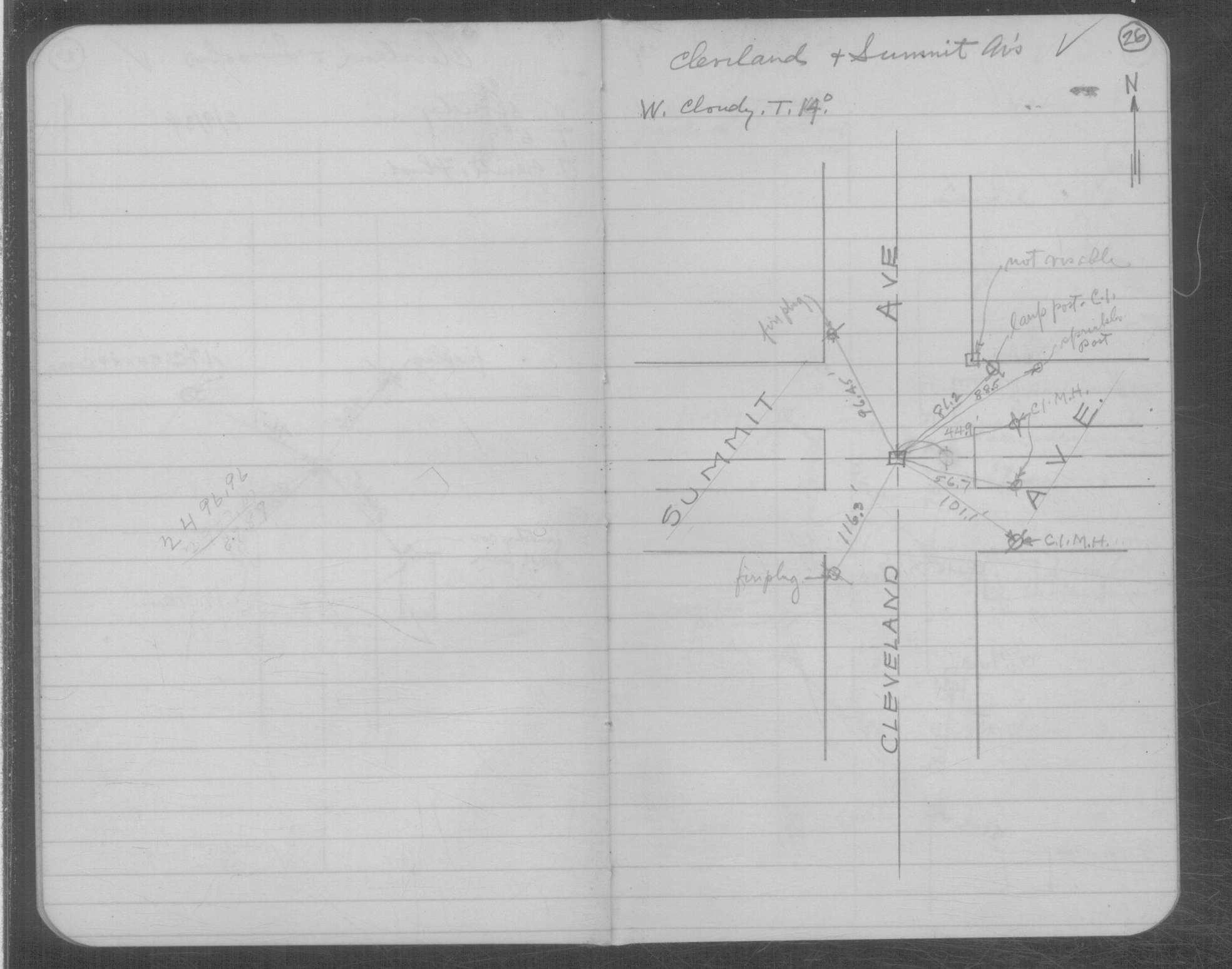
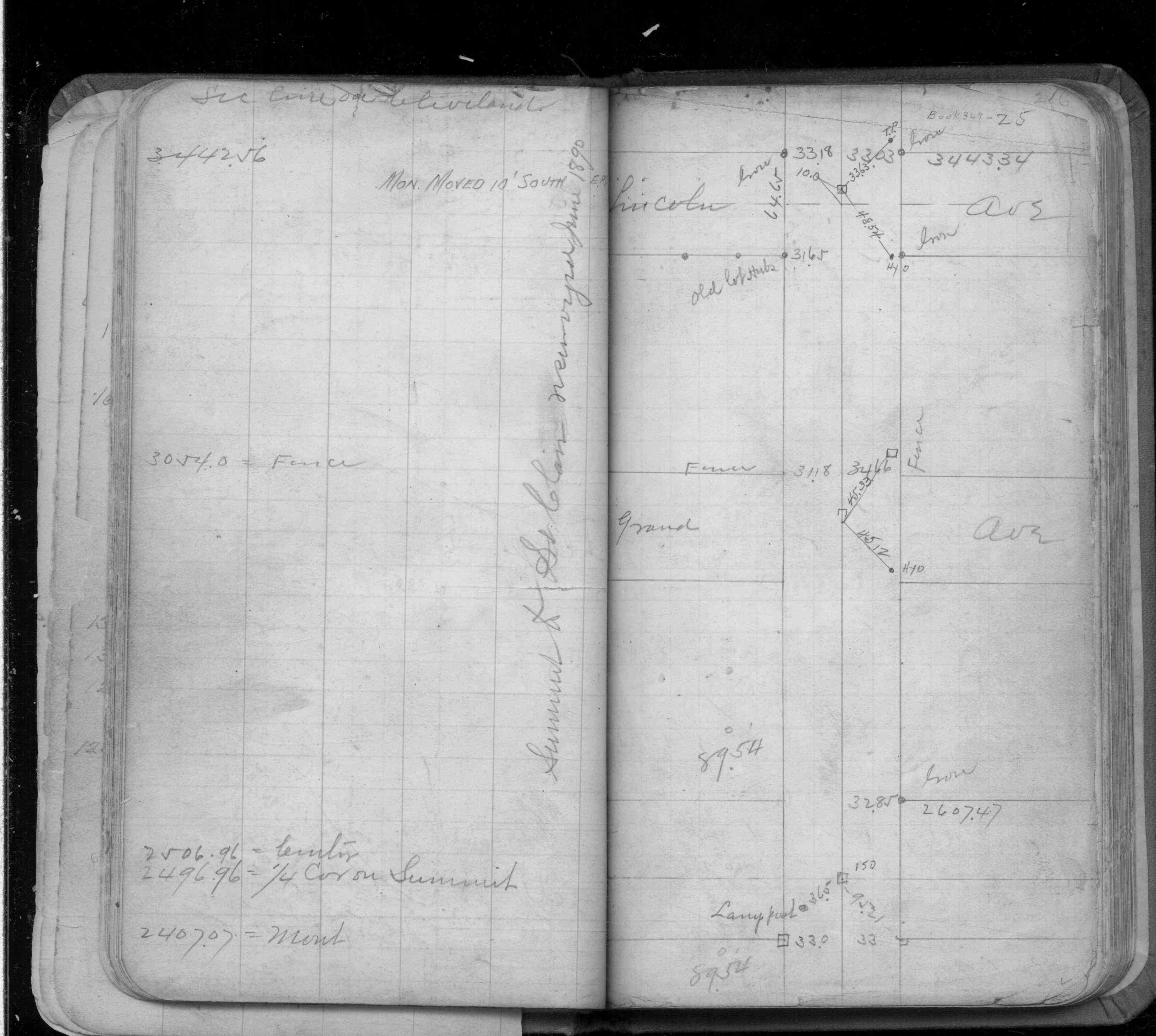
| 2/9/1934 | Placed ties on the mmonument. See book MSX 4 p.26 |
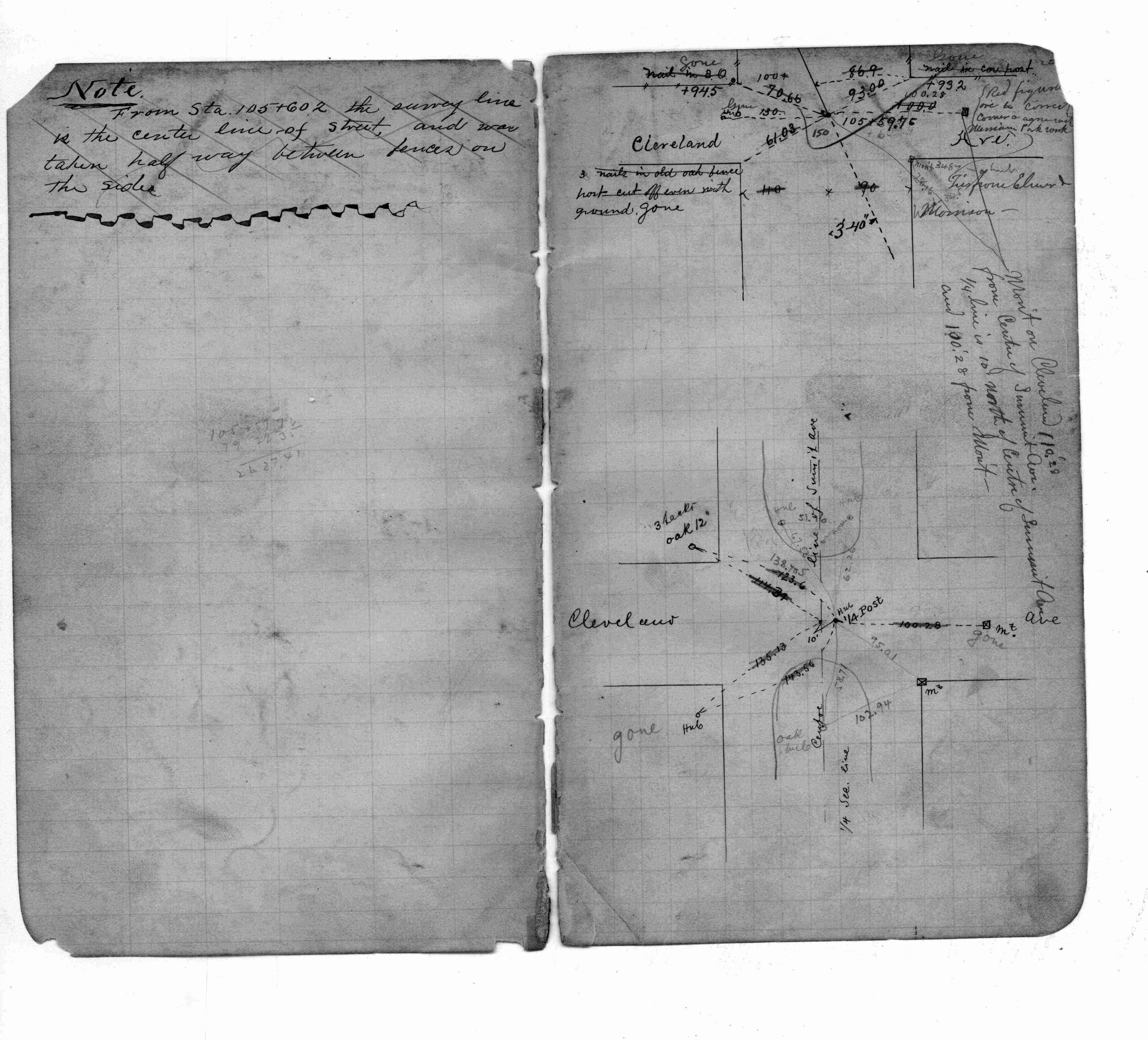
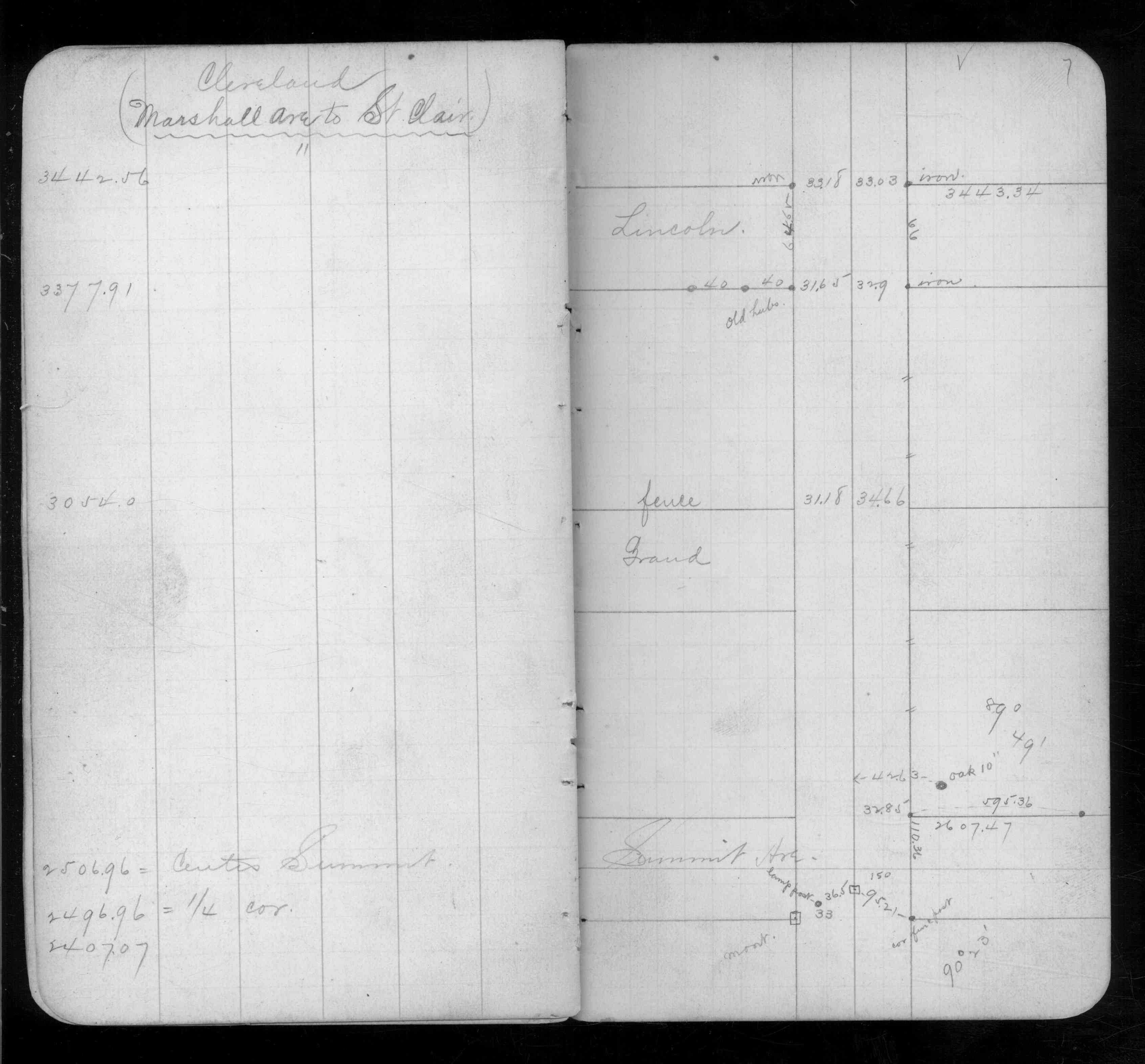
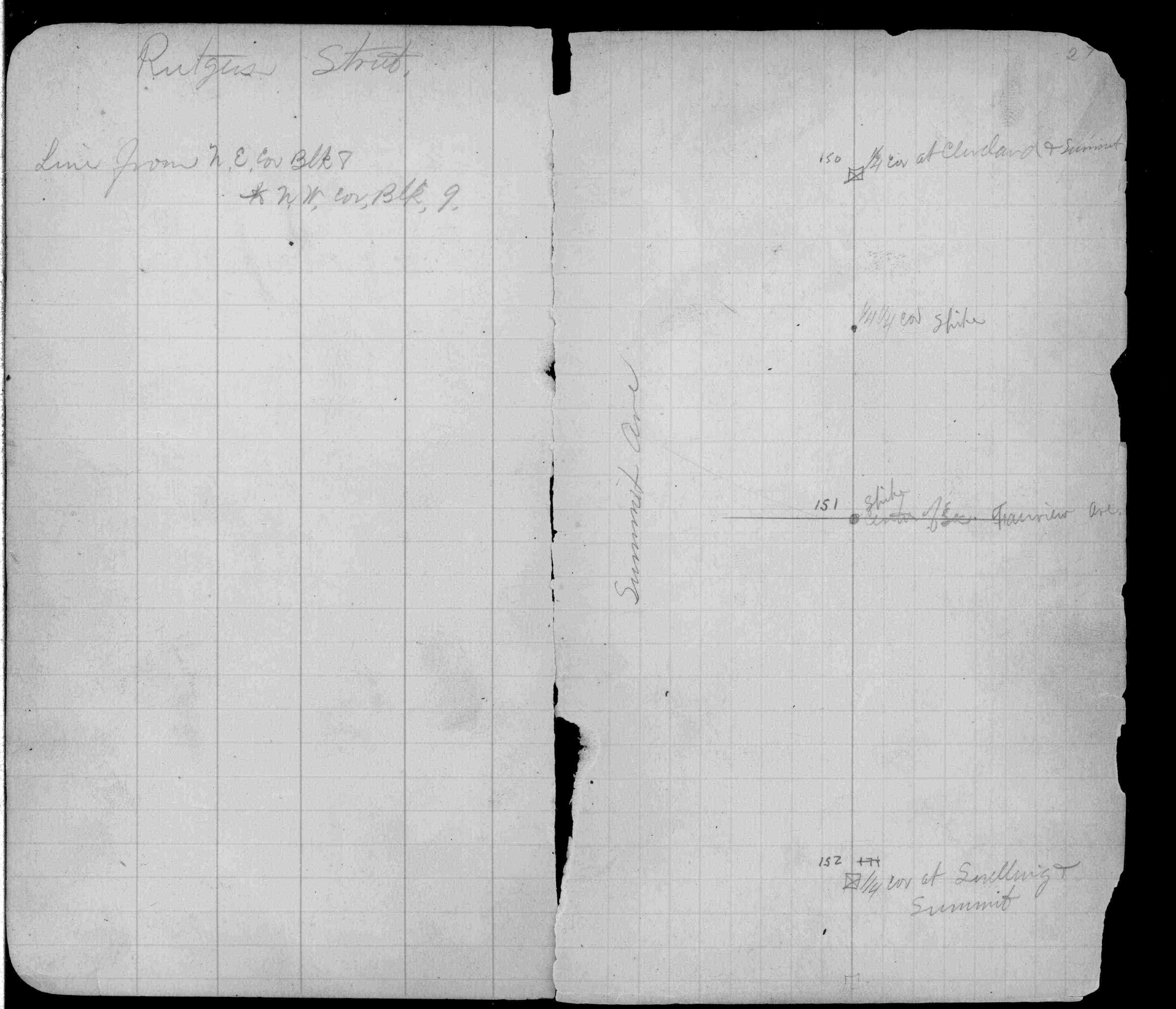
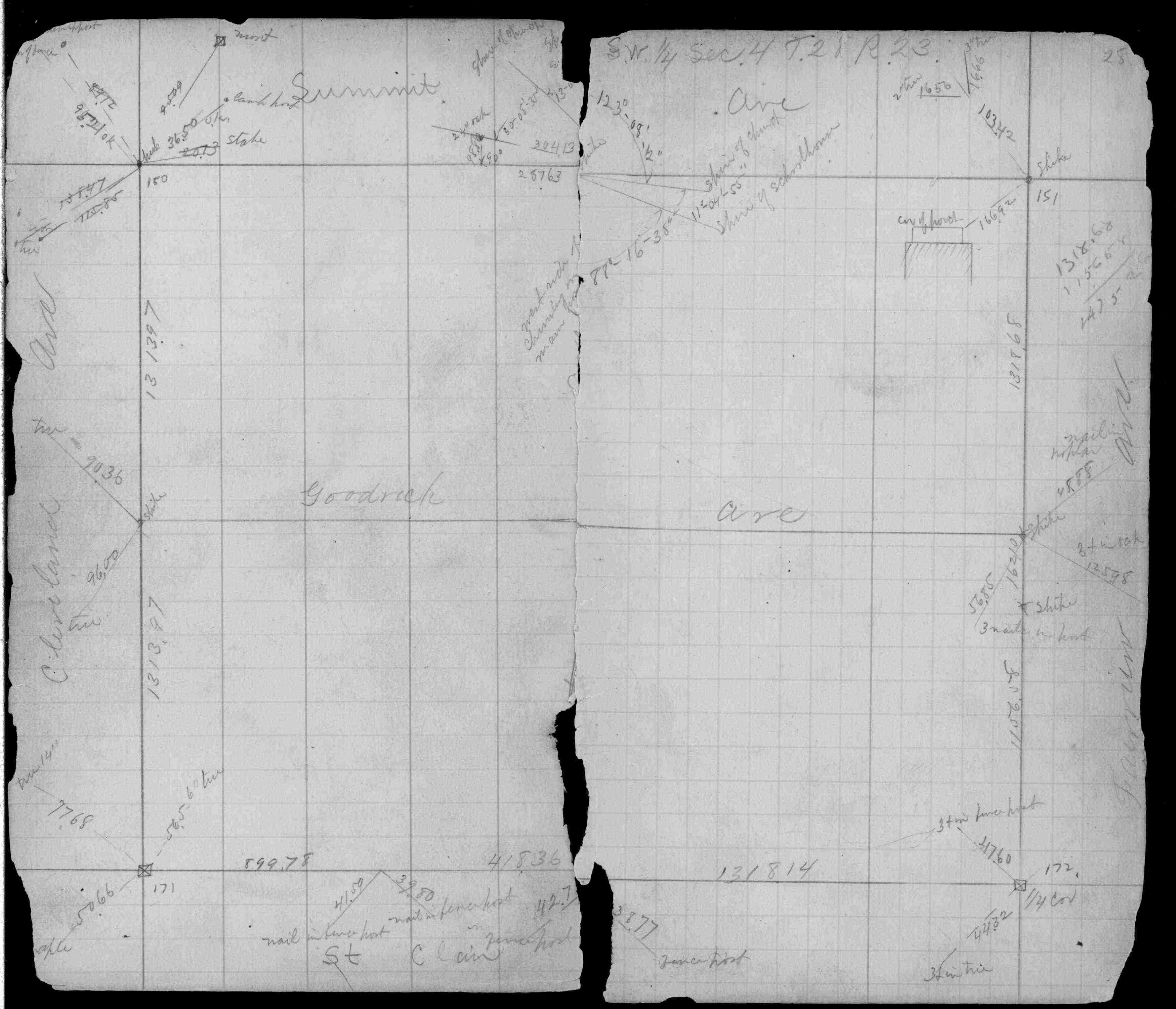
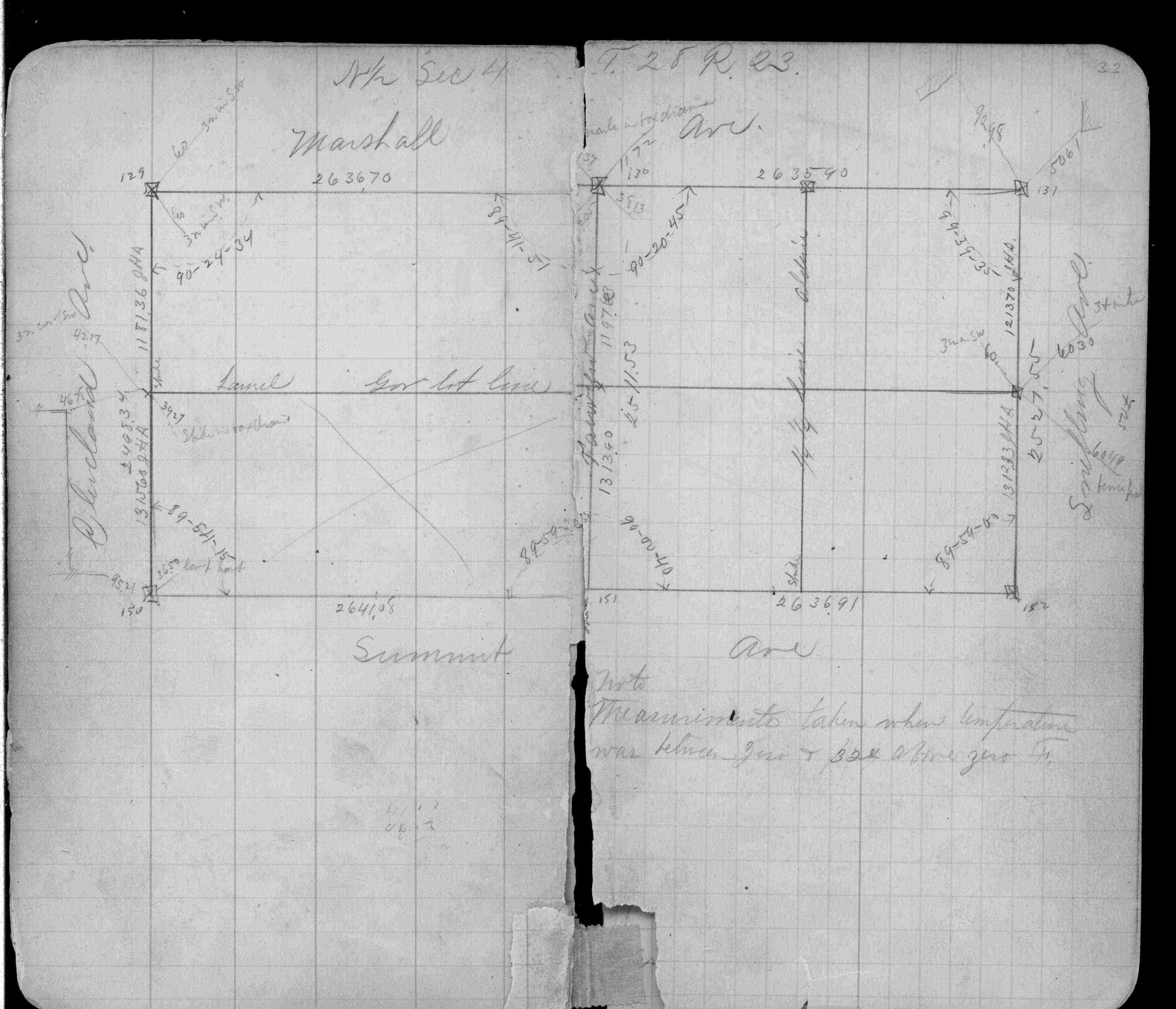
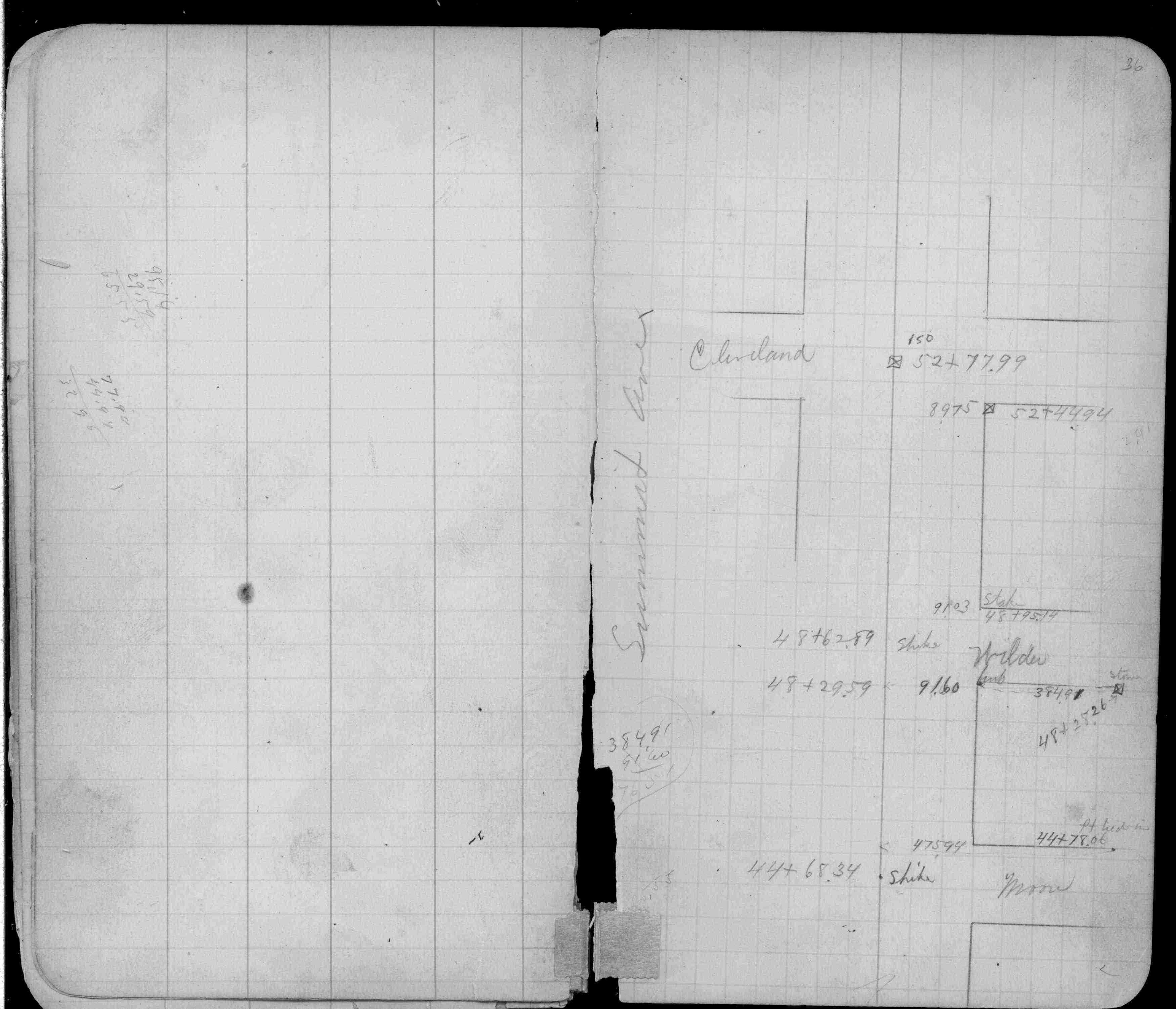
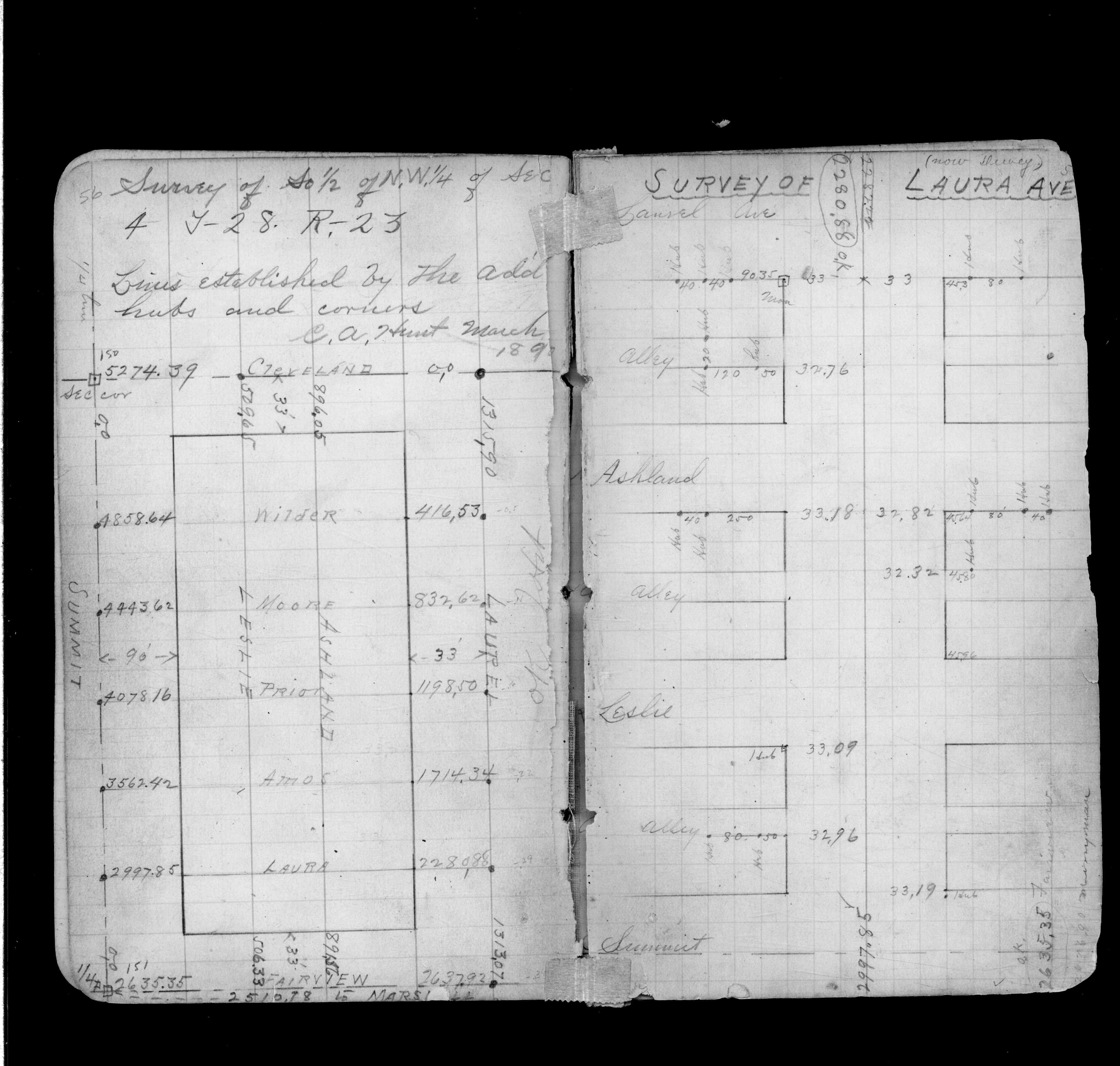
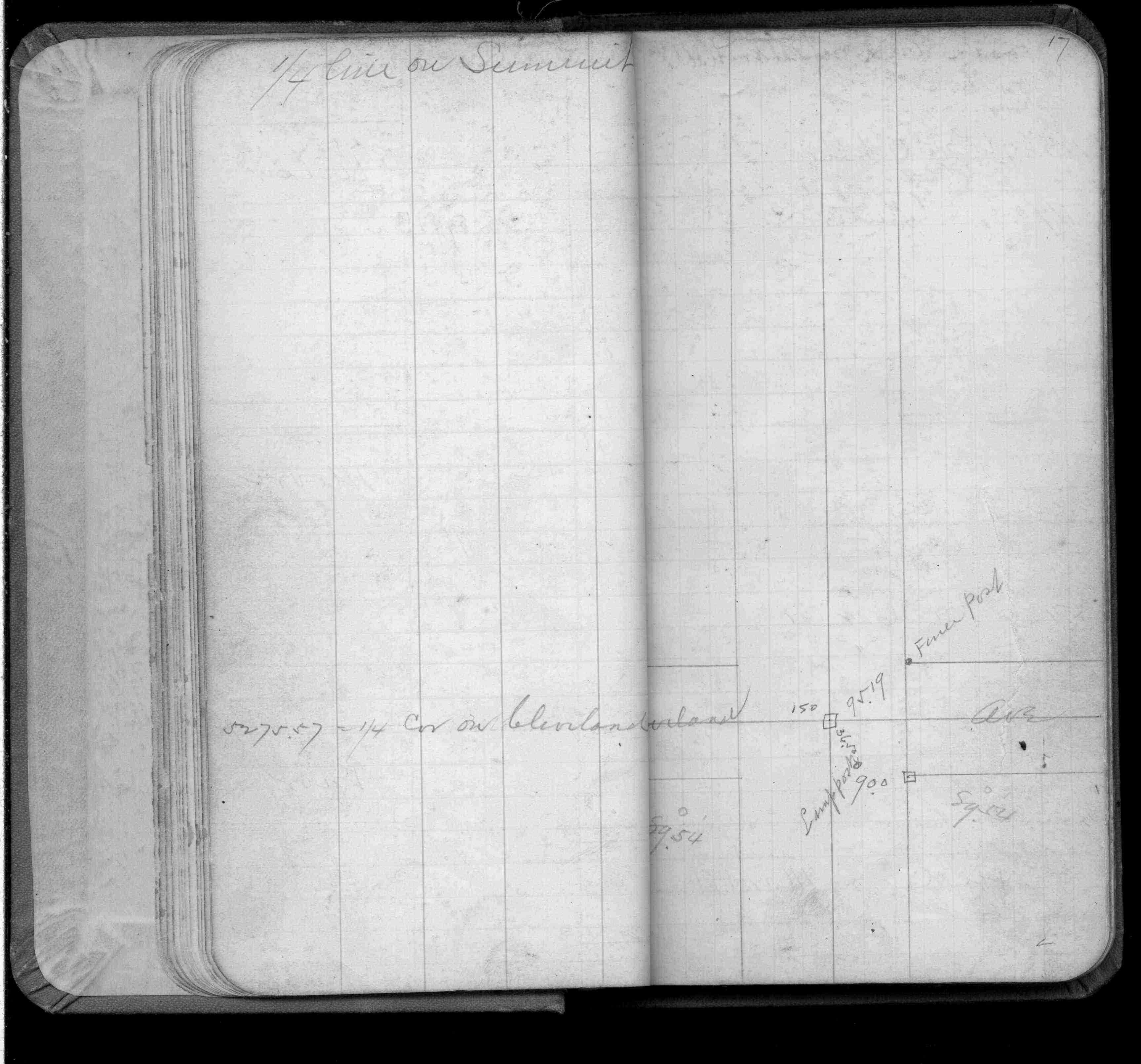
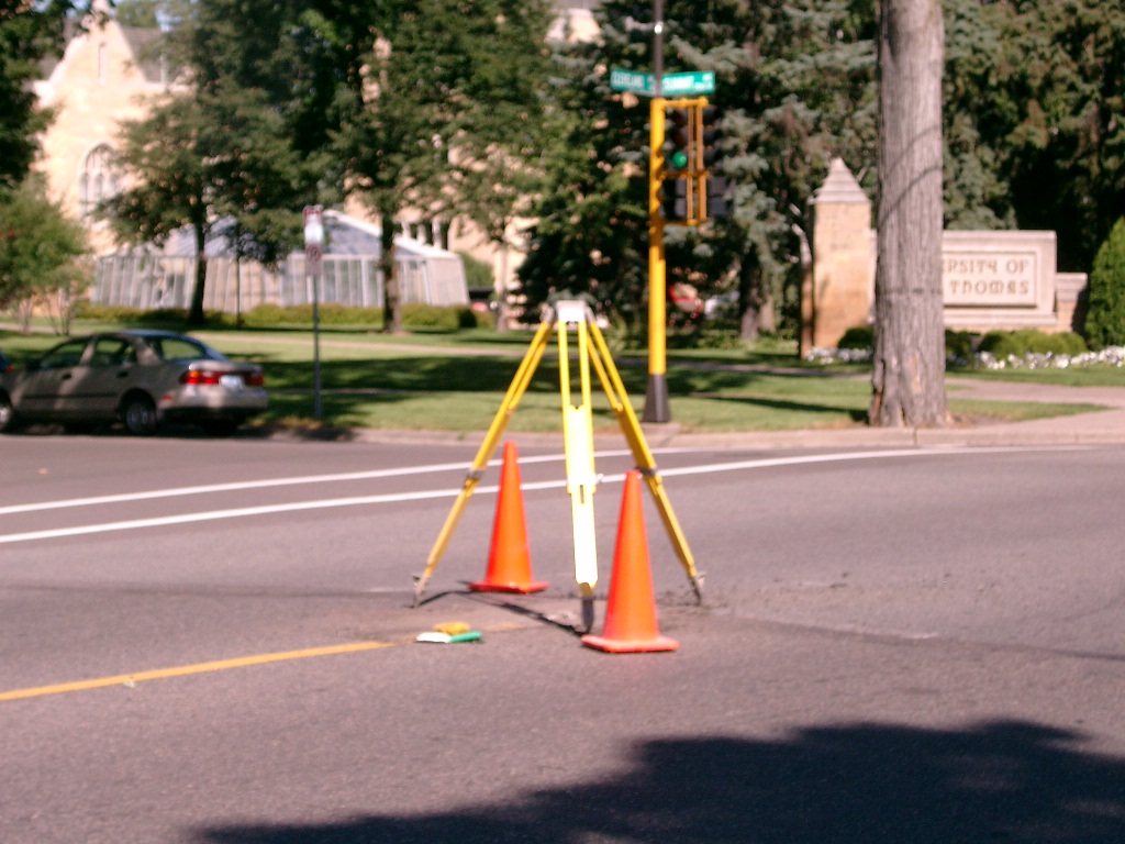
| 1/1/1900 | (Unknown date ___ __, ____ ) Monument set at Cor 1/4 corner Cleveland & Summit Ave |
| 2/3/1890 | Monument reset by J H Armstrong |
| 1/23/1890 | Monument tied in by W C Merryman |
| 10/1/1887 | (Unknown date Oct __, 1887 ) Monument set by J H Armstrong. See Old Index Book, Entry 1706 |
| 10/1/1847 | (Unknown date Oct __, 1847 ) Isaac N Higbee deputy surveyor set post. Tied to 1 BT. See IH p.024-025 2823 |
Above is NOT an all inclusive history of this point. Please review all the links below.
| PLS NOTES | Field | Cross Section | Sewer | J.B. Irvine | Monument | River Survey |
|---|---|---|---|---|---|---|
| IH p.024-025 | FB 0207p.20 | MSX 0004 p.026 | ||||
| FB 0218p.07 | ||||||
| FB 0257p. 27 ,28 ,33 ,36 ,56 | ||||||
| FB 0329p. 17 ,25 | ||||||
| FB 1421Ap.68 | ||||||
| FB 1520p.03 | ||||||
| FB 1694p. 01 ,02 ,03 ,06 ,15 ,20 ,41 ,49 ,50 | ||||||
| FB 1713p.16 | ||||||
| FB 1713p.16 | ||||||
| FB 1735p.50 | ||||||
| FB 1736p.29 |
| FILE | SURVEYOR | LIC. NO. | DATE SIGNED | DATE TIED |
|---|---|---|---|---|
| 0150-1706-A2.tif | Michael P. Murphy | 41001 | August 12, 2004 | August 12, 2004 |
| 0150-1706-A1.tif | Michael P. Murphy | 41001 | August 12, 2004 | August 12, 2004 |
| ST_079-156p150.jpg | none | none | none | none |
| 0150-1706-A.dwf | none | none | none | none |
| FILE | PHOTO DATE | COMMENTS |
|---|---|---|
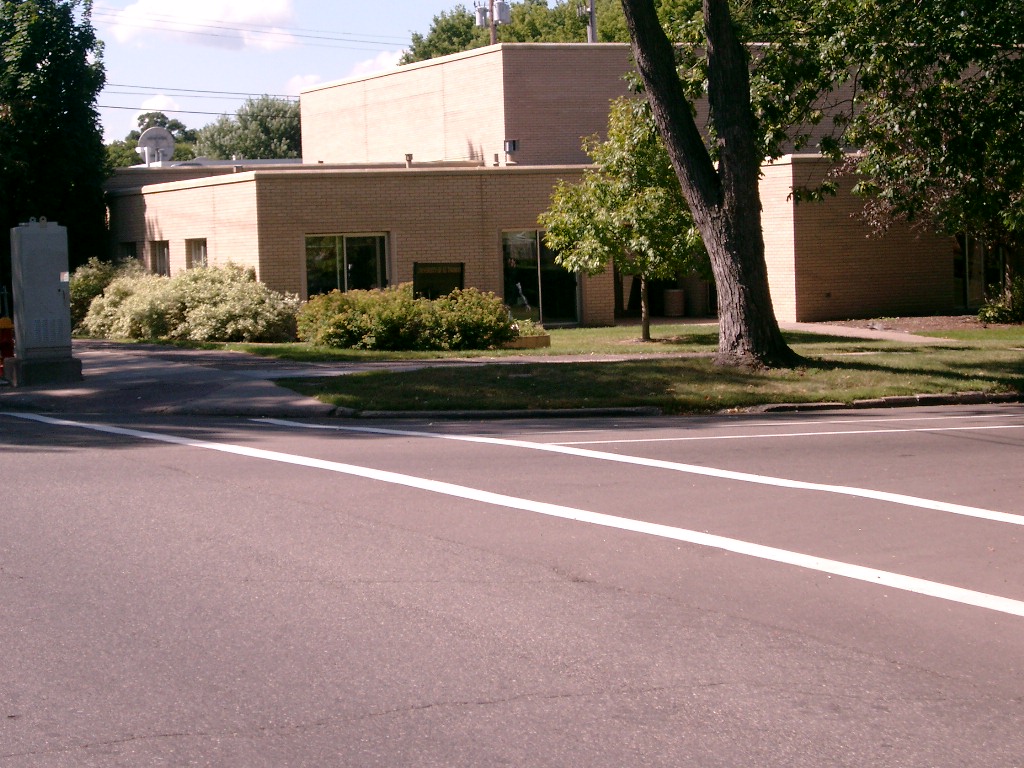
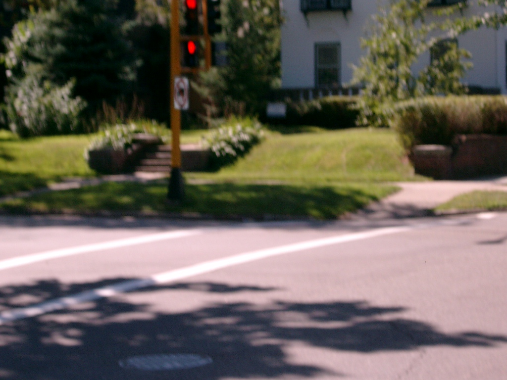
| 0150-1706-9.jpg | August 12, 2004 | Looking Southwesterly. |
| 0150-1706-8.jpg | August 12, 2004 | Looking Southeasterly. |
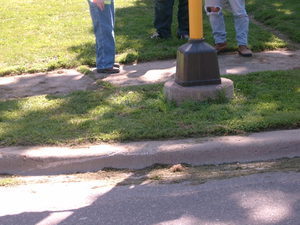
| 0150-1706-7.jpg | August 12, 2004 | Looking at the Southeasterly signal base tie. |
| 0150-1706-2.jpg | August 12, 2004 | Close-up of Granite monument with pin. |
| 0150-1706-1.jpg | August 12, 2004 | Looking Northwesterly. |