| NAD83 COORDINATES (1986 adj.): |
|---|
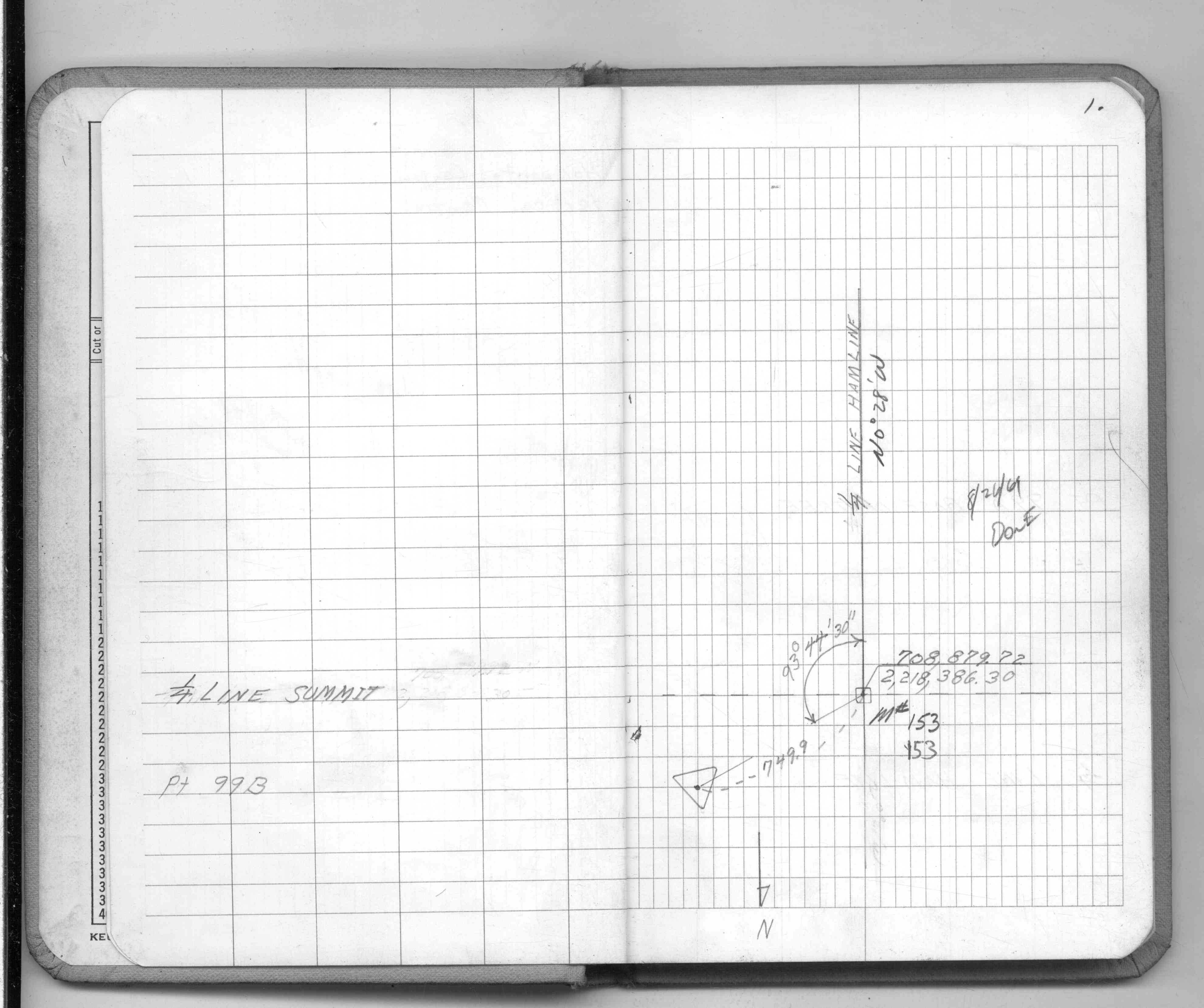
| * X= 558656.723 Y= 154903.164 Z= 000.00 LSQ 12/06/1991 S FLT |
| X= 558656.62 Y= 154903.24 Z= 946.4 10/27/2009 RTK-VRS |
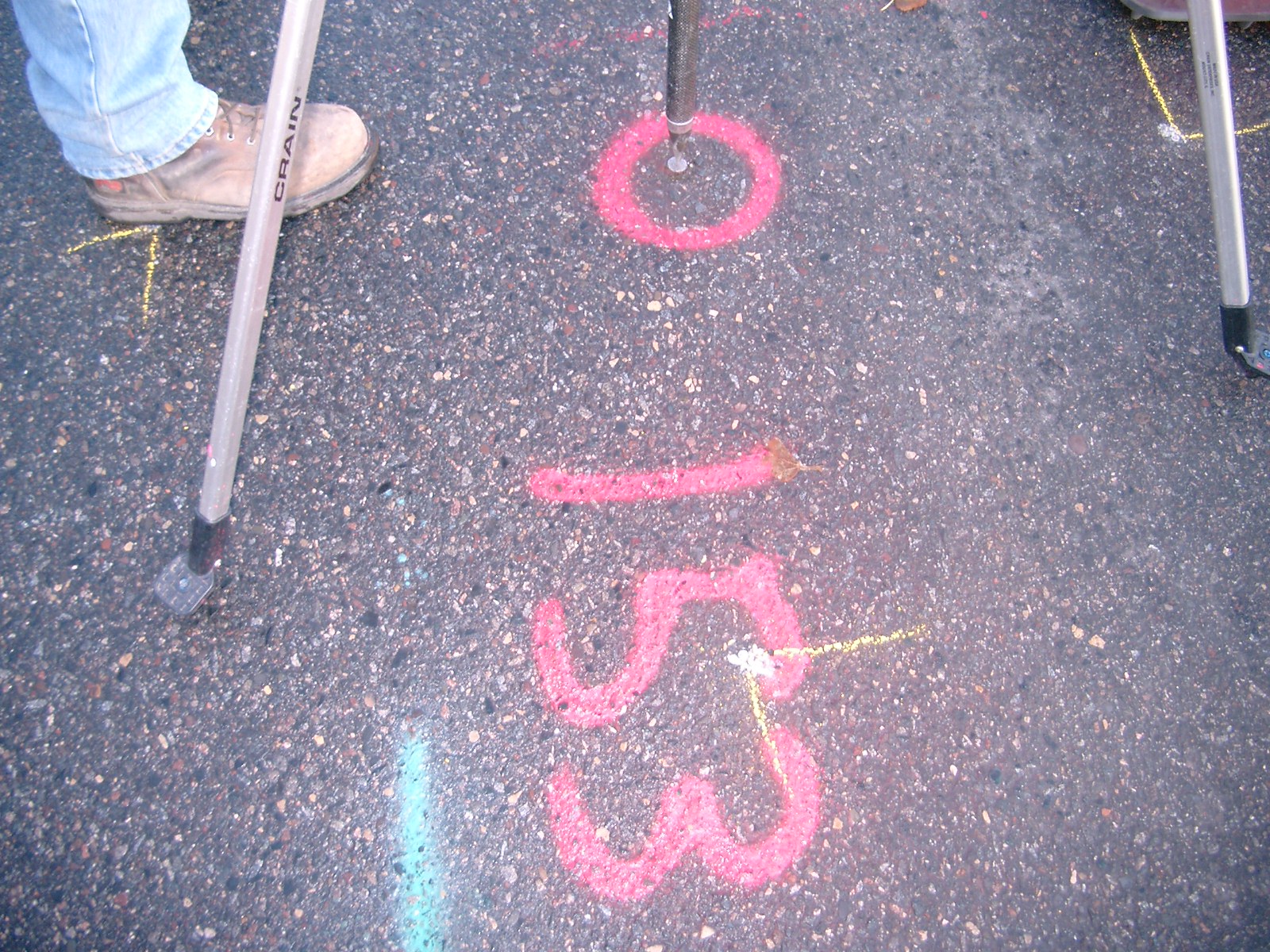
| 11/10/2009 | Placed ties on the CIM. See CofL 0153-1599-A.pdf |
| 11/9/2009 | Photos taken of the CIM. |
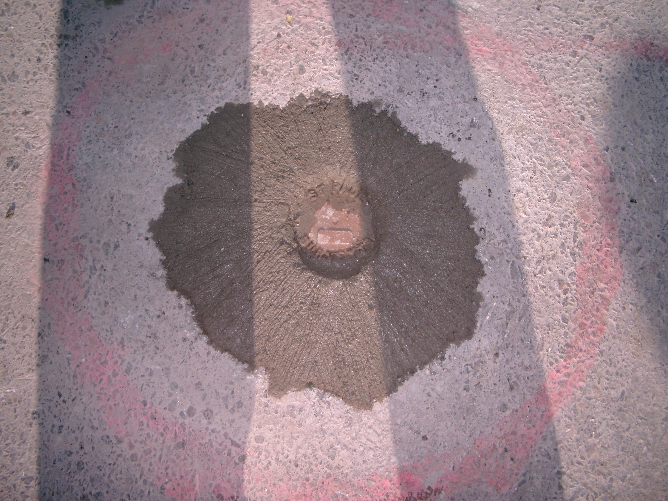
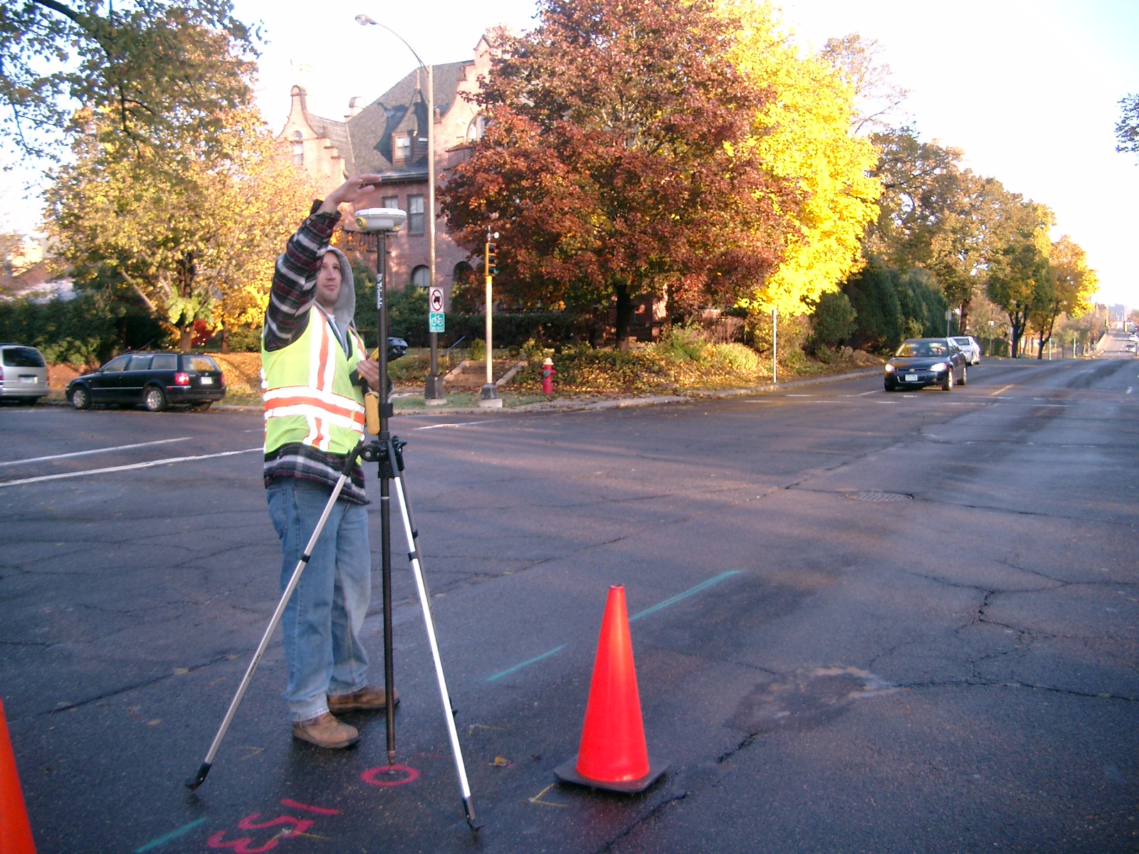
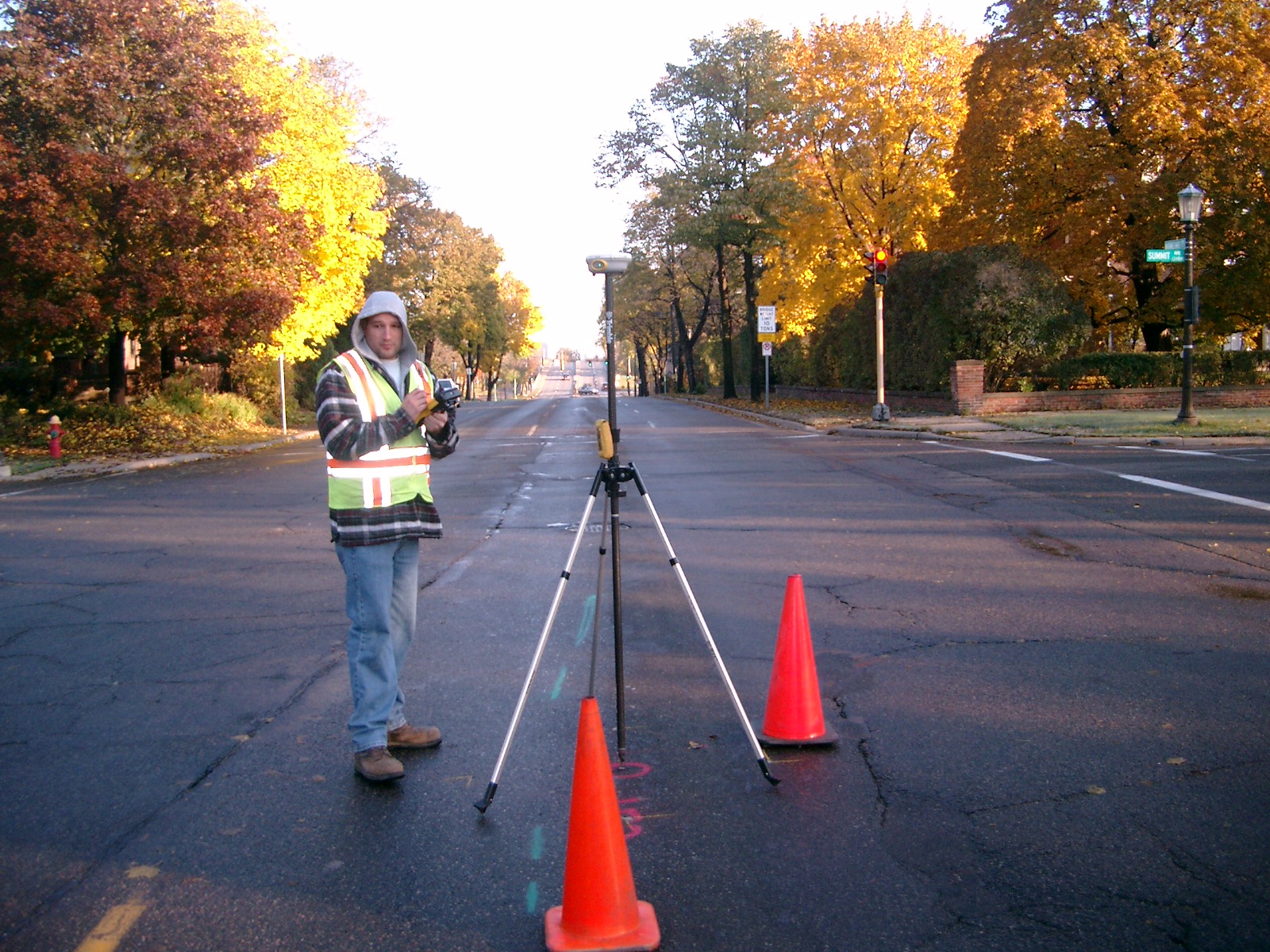
| 10/27/2009 | Iron Pin was replaced with a CIM. Photos taken. Position on CIM established by RTK-VRS GPS. Elev. 946.4 |
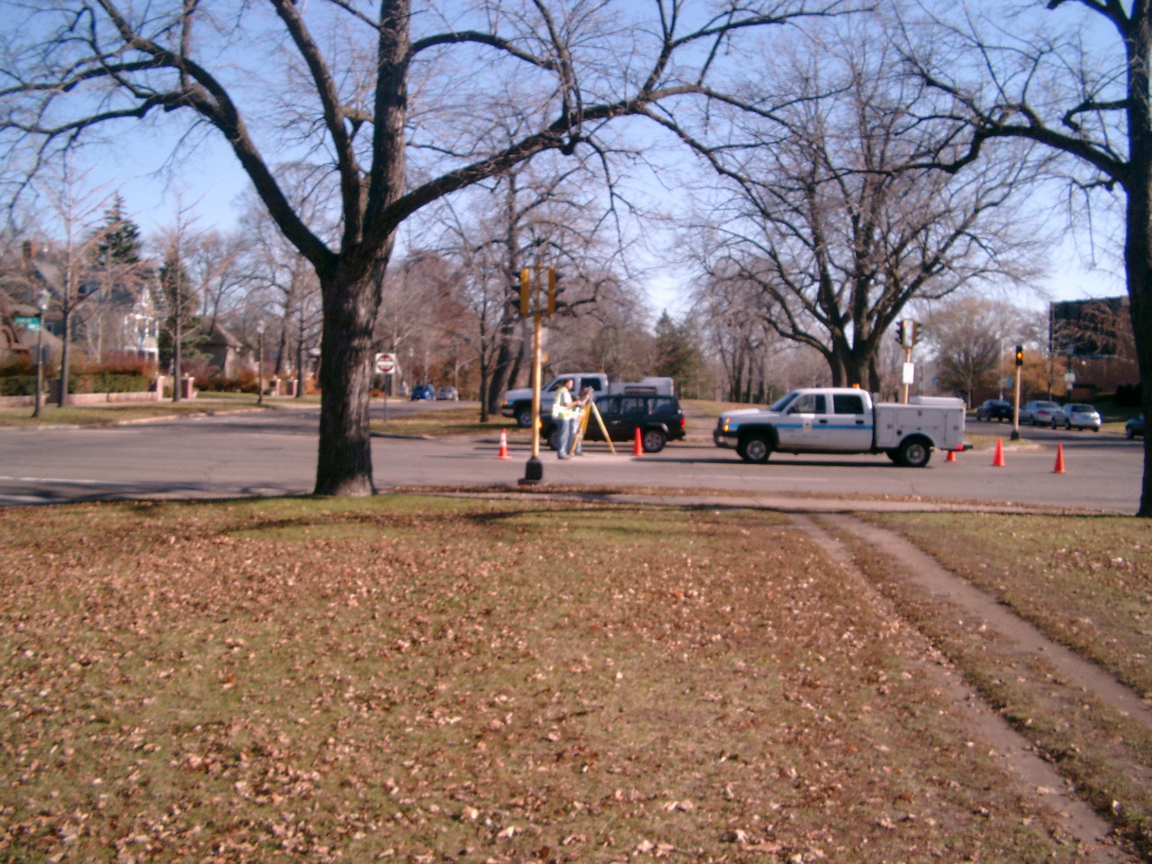
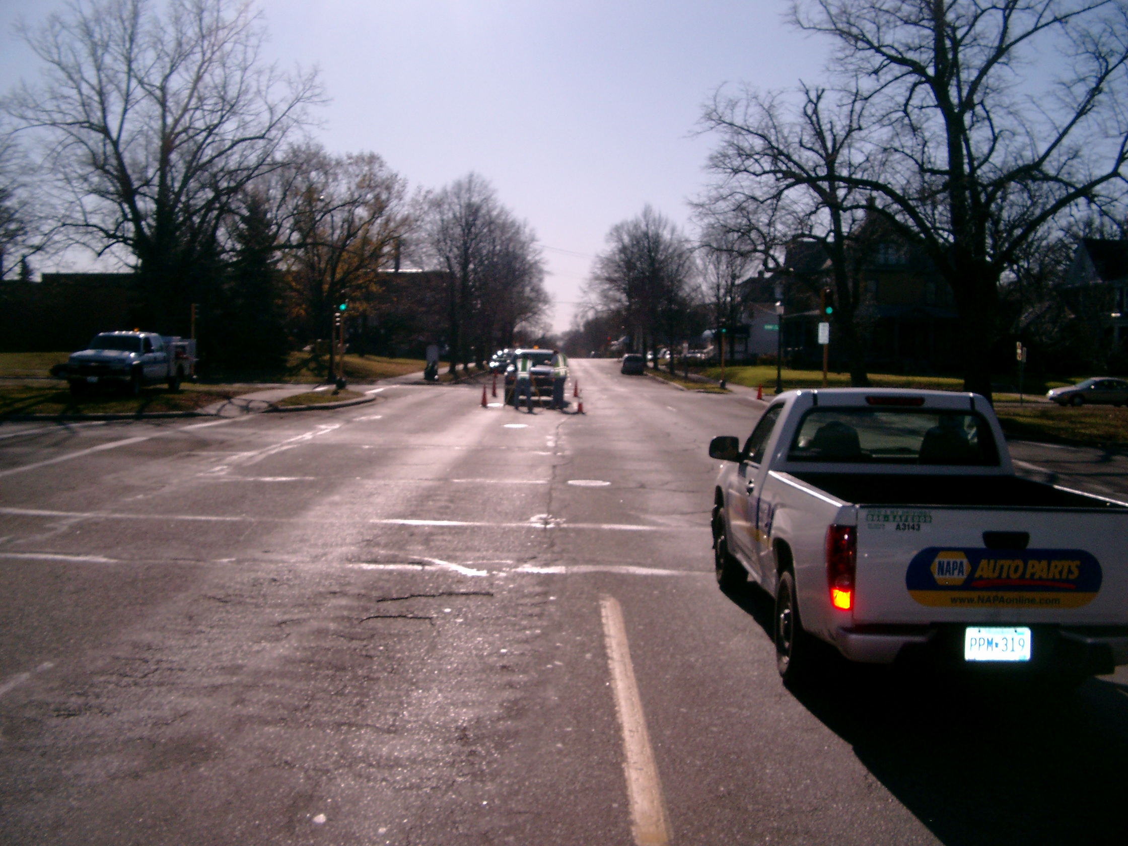
| 10/23/2009 | Photos taken of Iron Pin. |
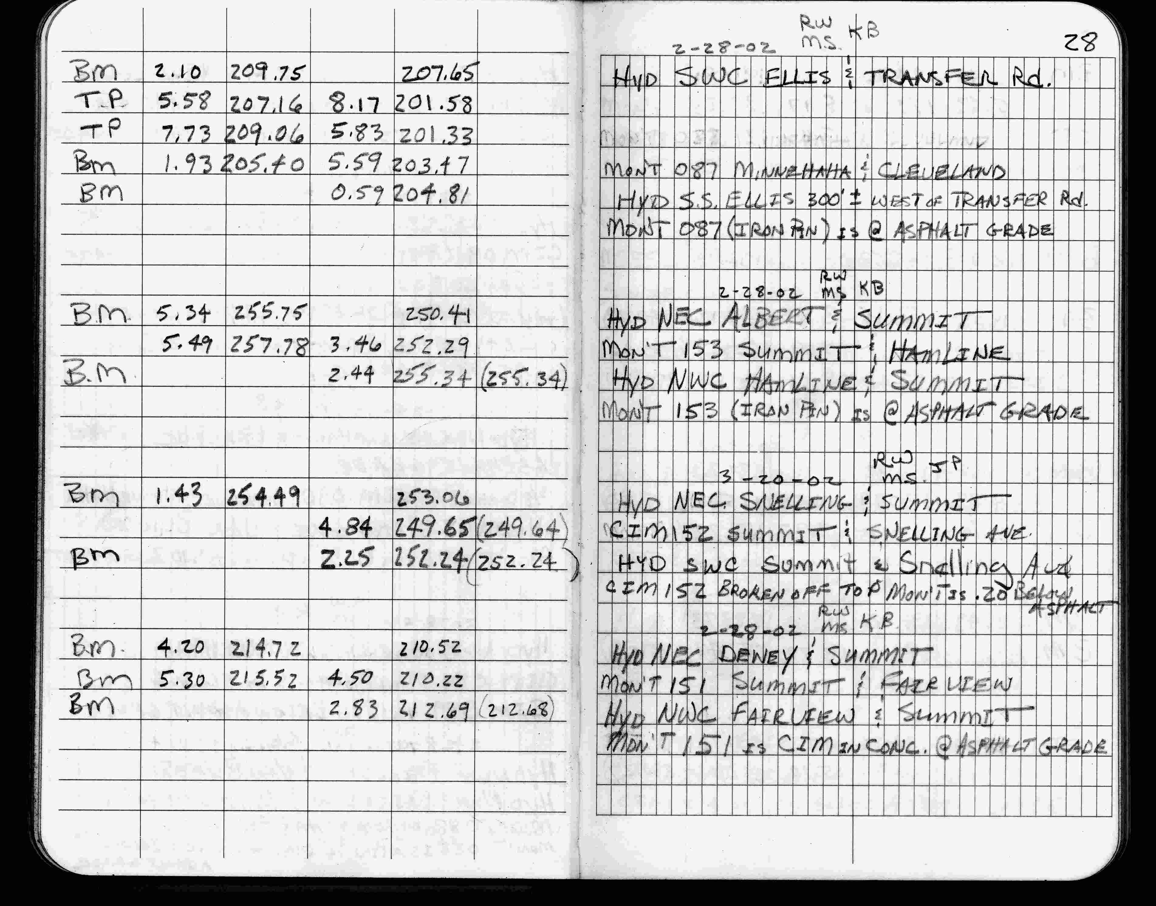
| 2/28/2002 | Elev 252.29 ft on iron pin at asphalt surface. See FB 1736 p.28 |
| 3/1/2000 | (Unknown date Mar __, 2000 ) Fd Pin (marked for painting target for 2000 aerial) |
| 9/21/1995 | Fd steel rebar (marked for painting for 1995 aerial) |
| 9/1/1989 | (Unknown date Sep __, 1989 ) Placed Steel pin to grade |
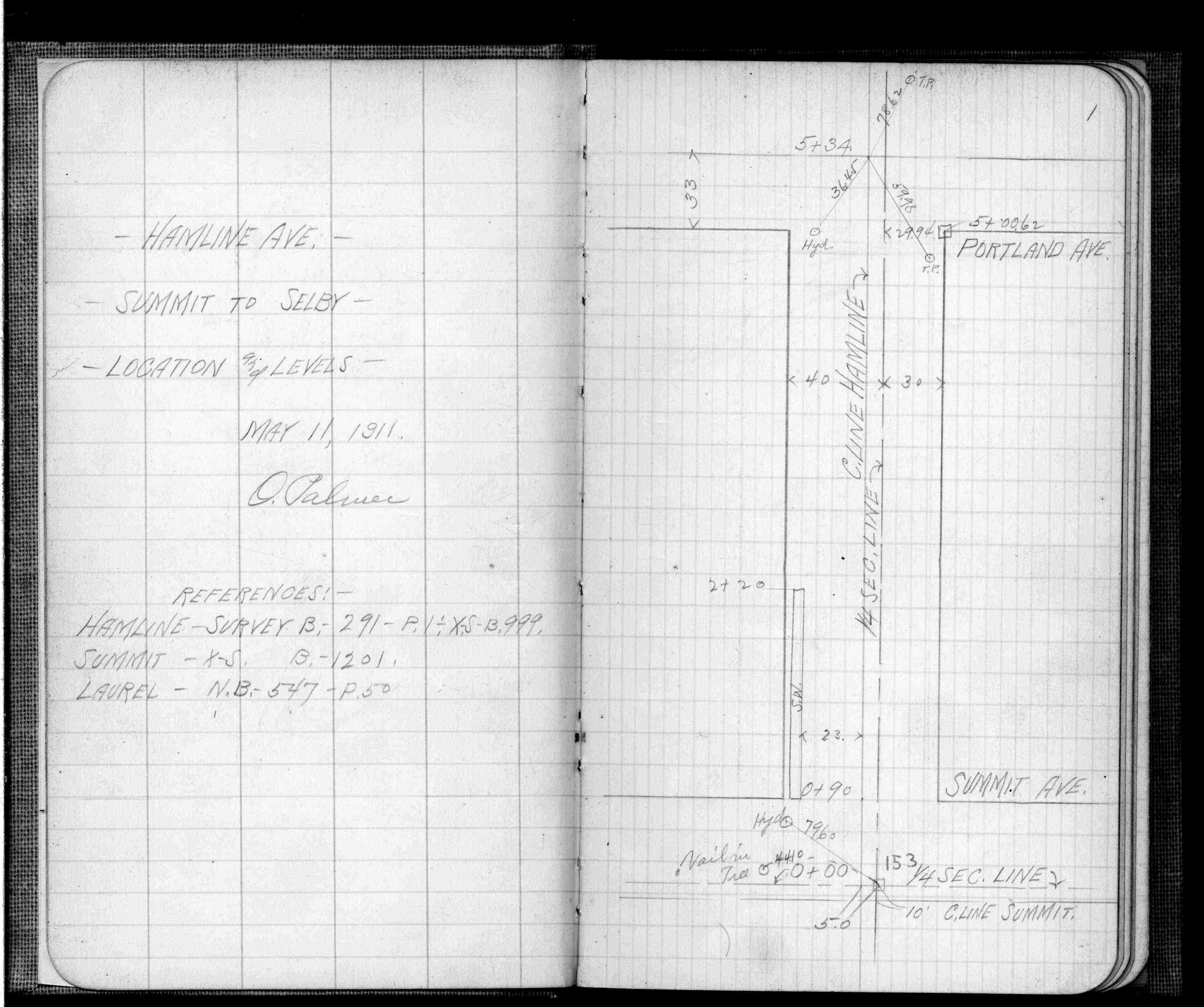
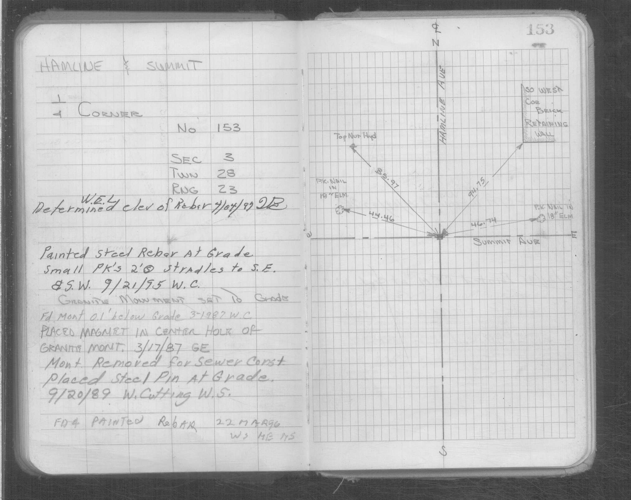
| 7/8/1889 | Monument set by J H Armstrong. See FB 229 p.3,9 |
| 1/1/1800 | (Unknown date ___ __, 18?? ) Elev 251.966 ft on GM. See Old Benches Book, Entry 1291 |
Above is NOT an all inclusive history of this point. Please review all the links below.
| PLS NOTES | Field | Cross Section | Sewer | J.B. Irvine | Monument | River Survey |
|---|---|---|---|---|---|---|
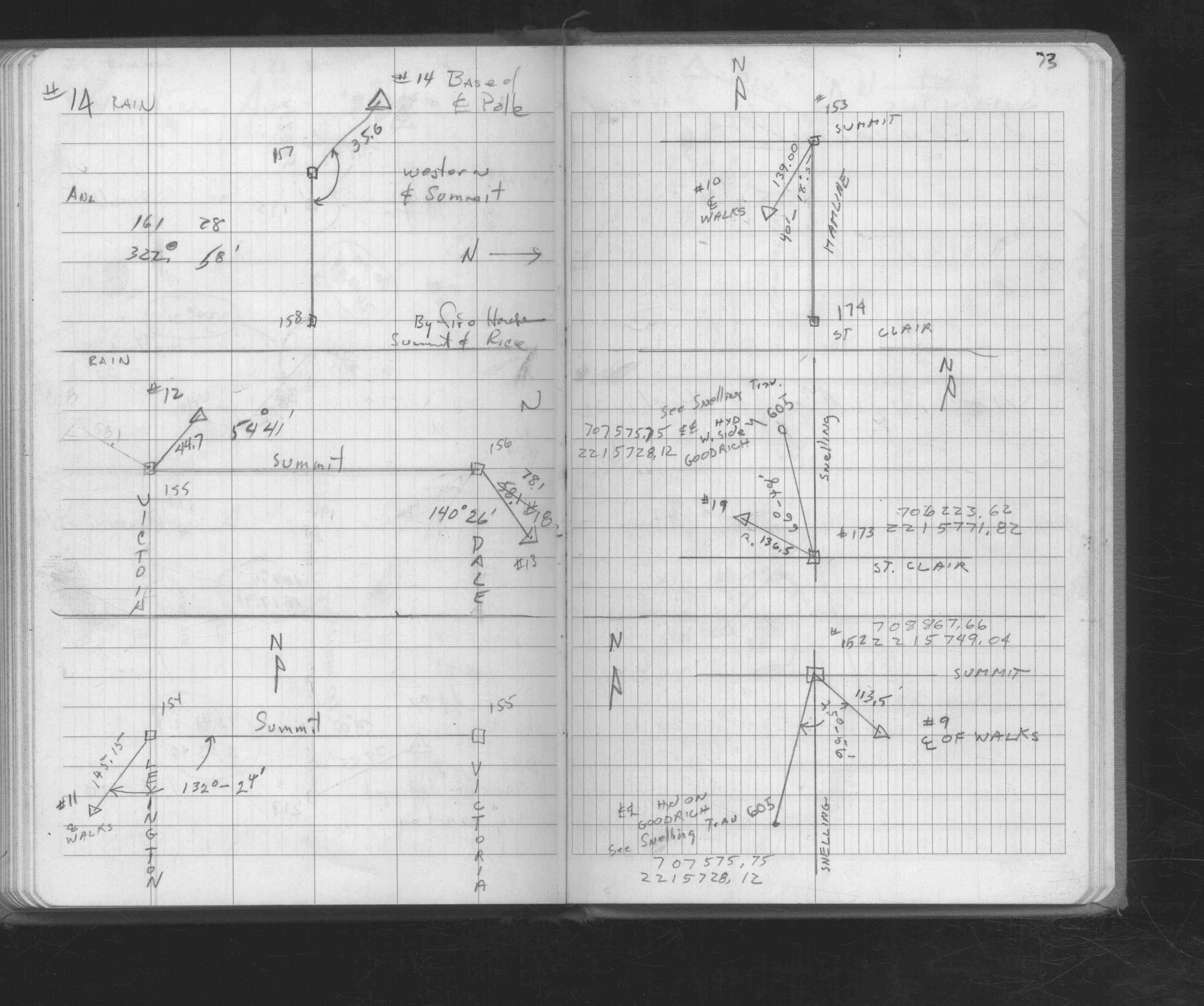
| FB 0207p.06 | ||||||
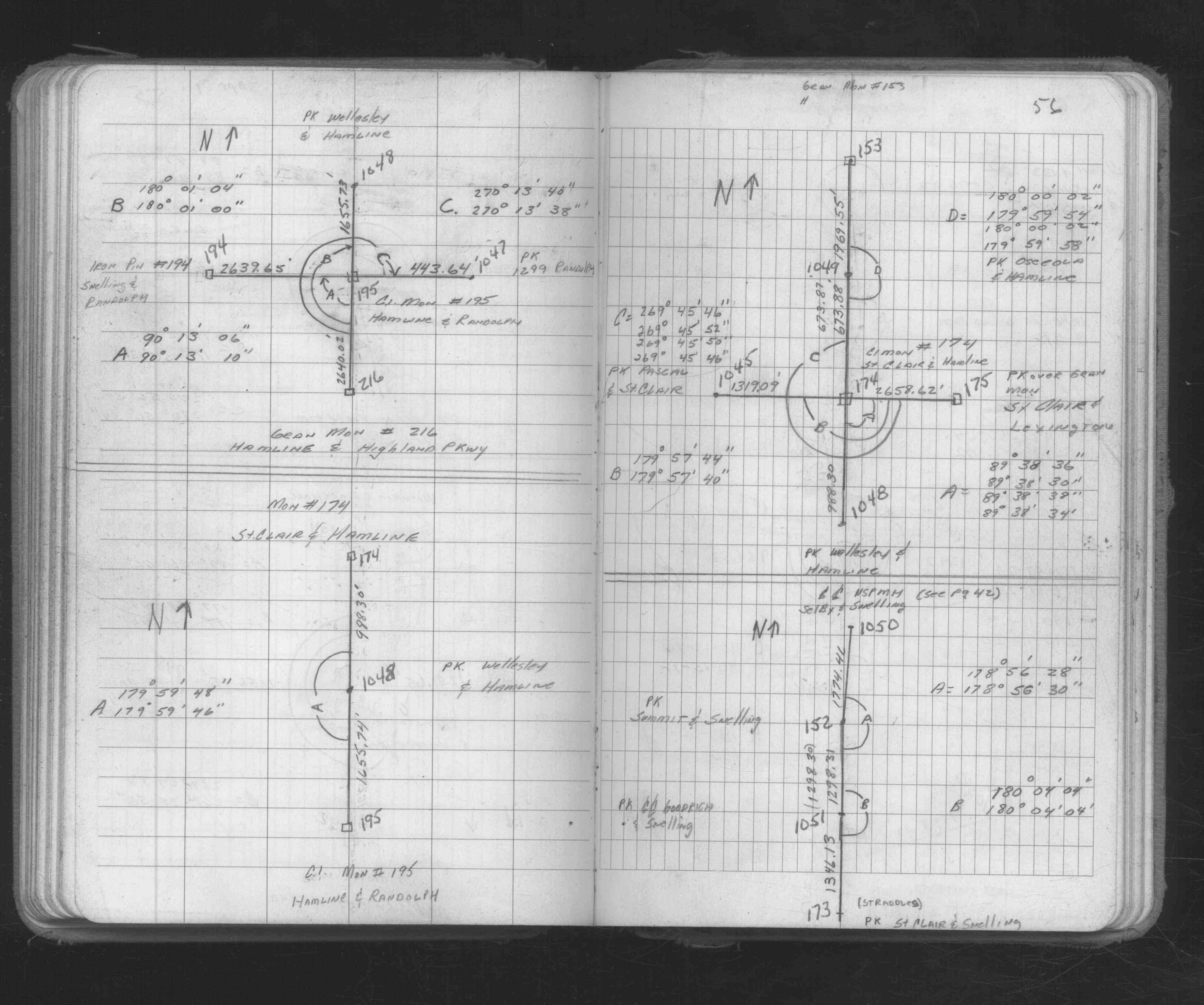
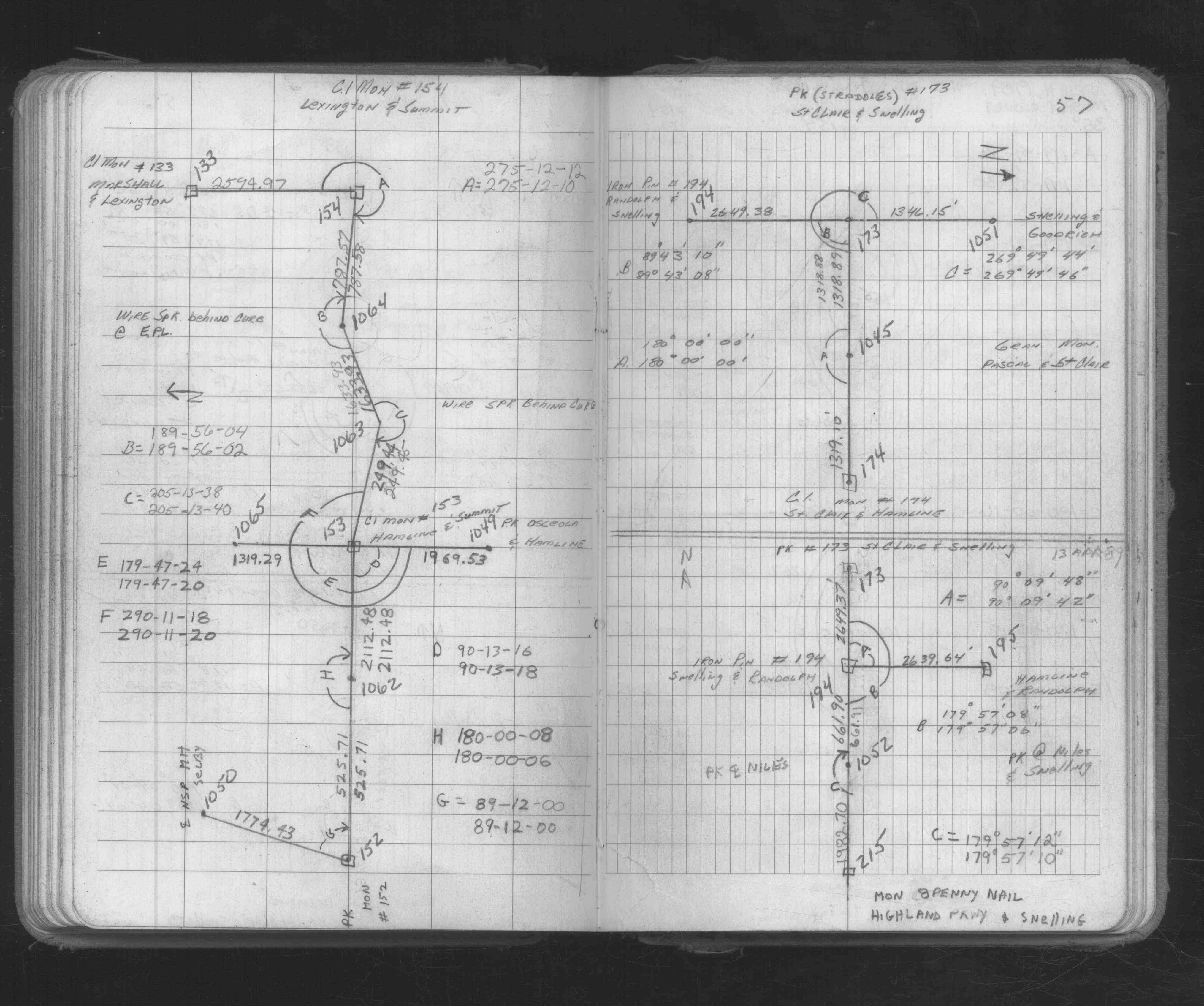
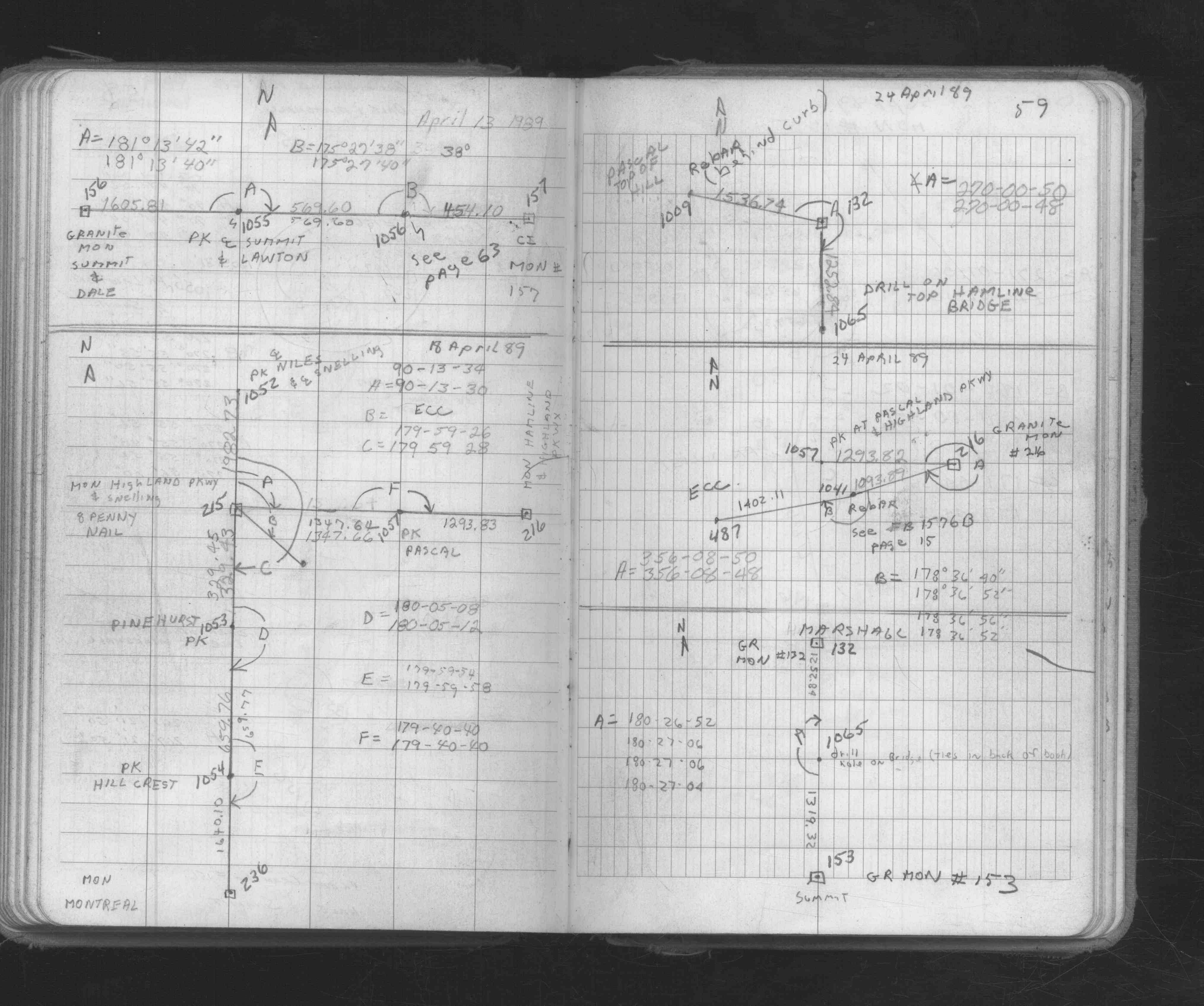
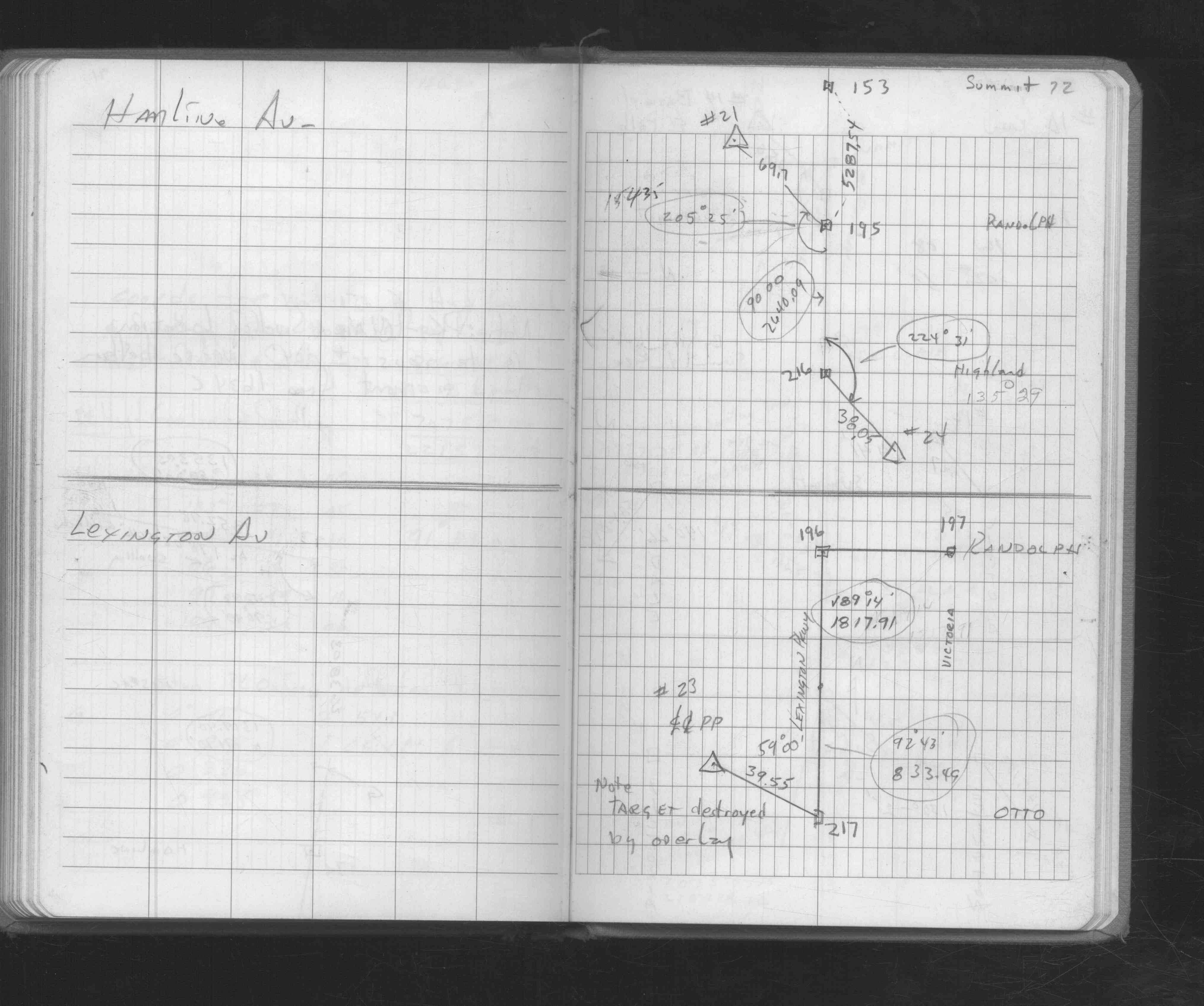
| FB 0229CPYp. 003 ,009 | ||||||
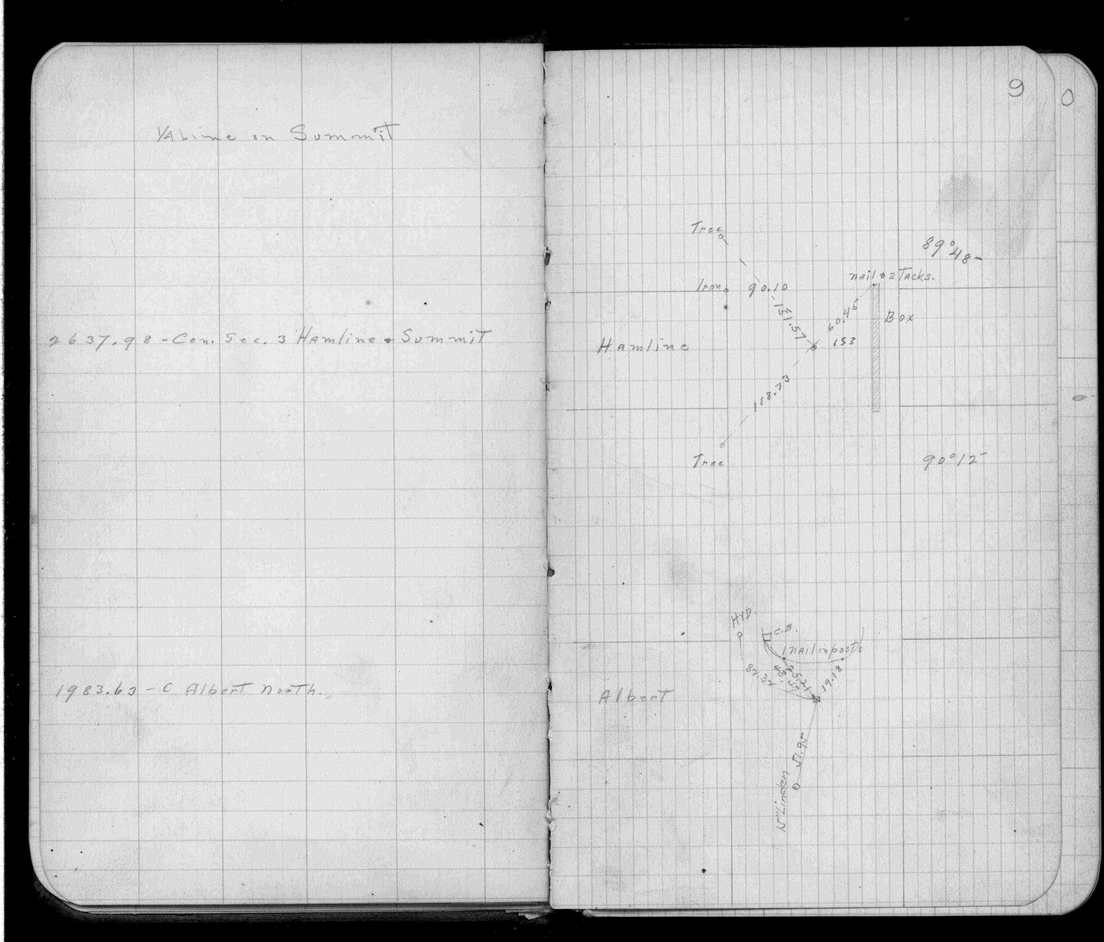
| FB 0291CPYp. 03 ,09 | ||||||
| FB 0336p.19 | ||||||
| FB 0678p.01 | ||||||
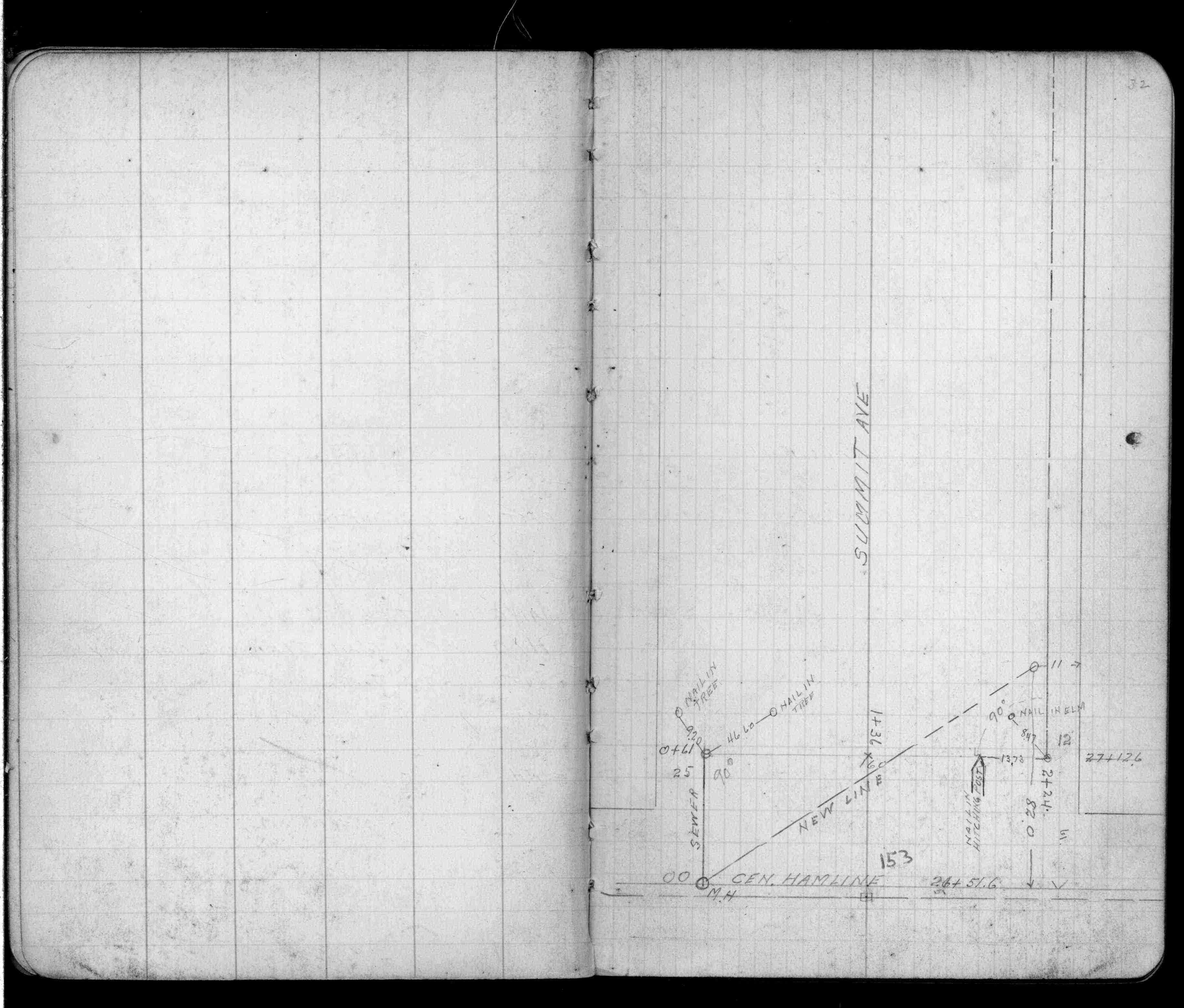
| FB 0893p.32 | ||||||
| FB 1549Cp.01 | ||||||
| FB 1673Ap. 56 ,57 ,59 | ||||||
| FB 1676Ap. 72 ,73 | ||||||
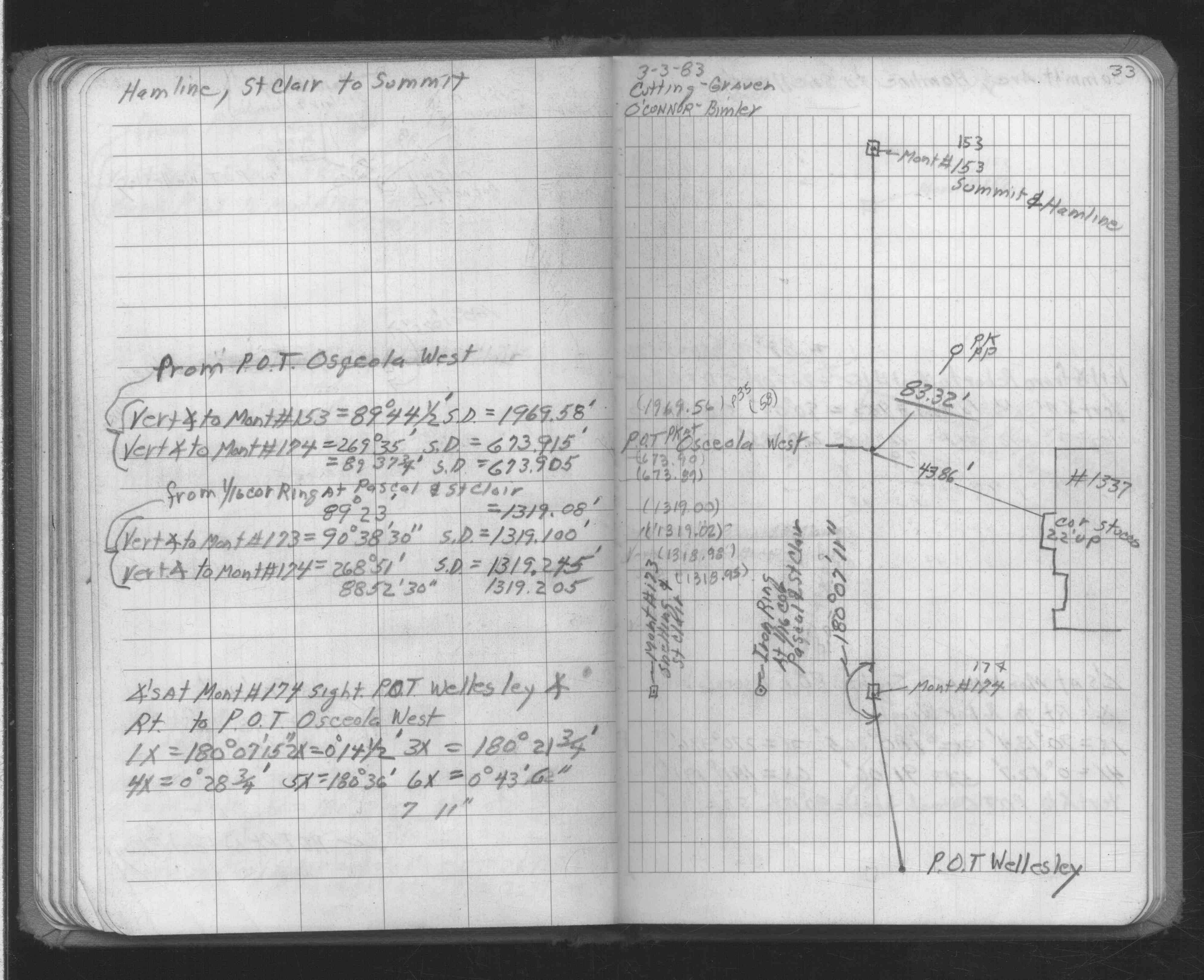
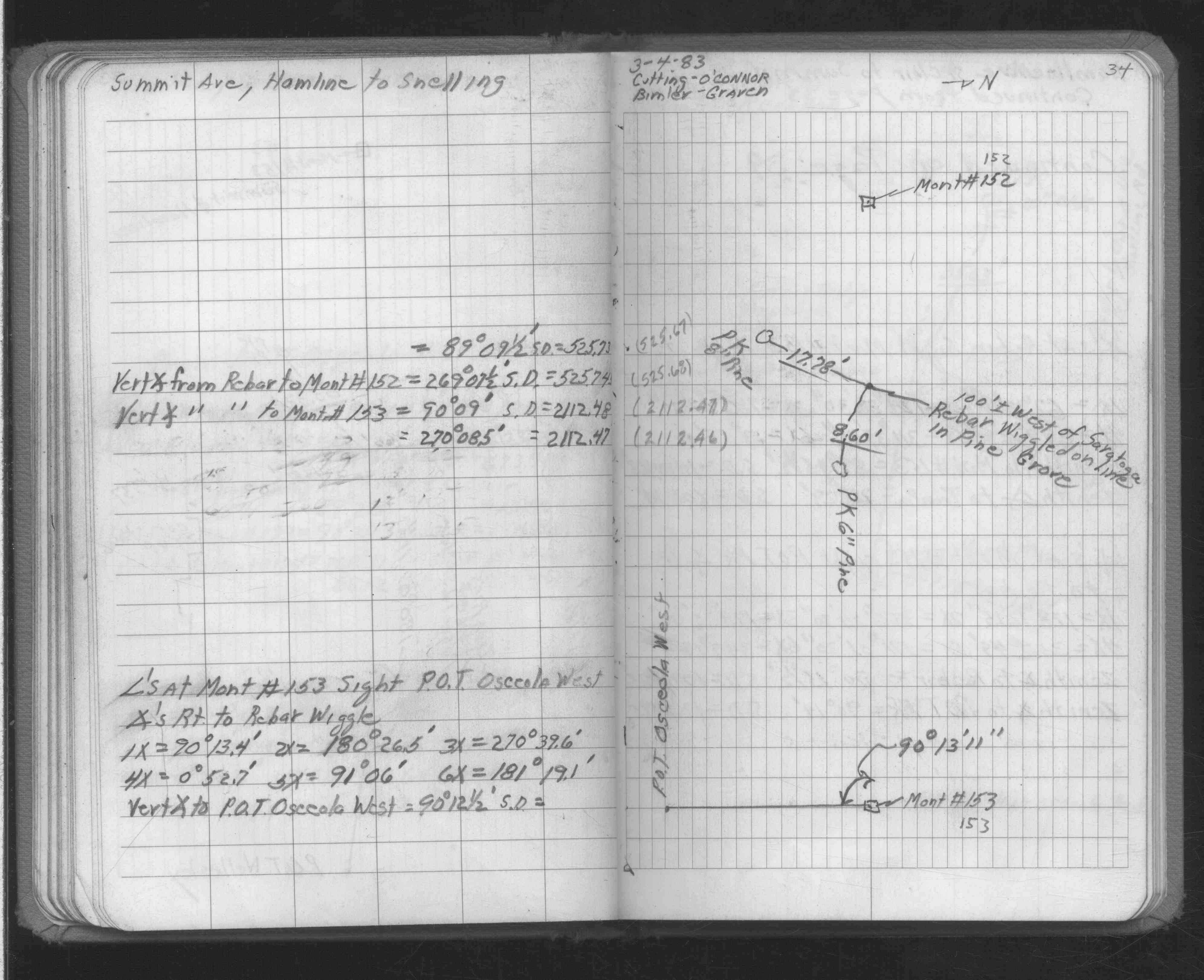
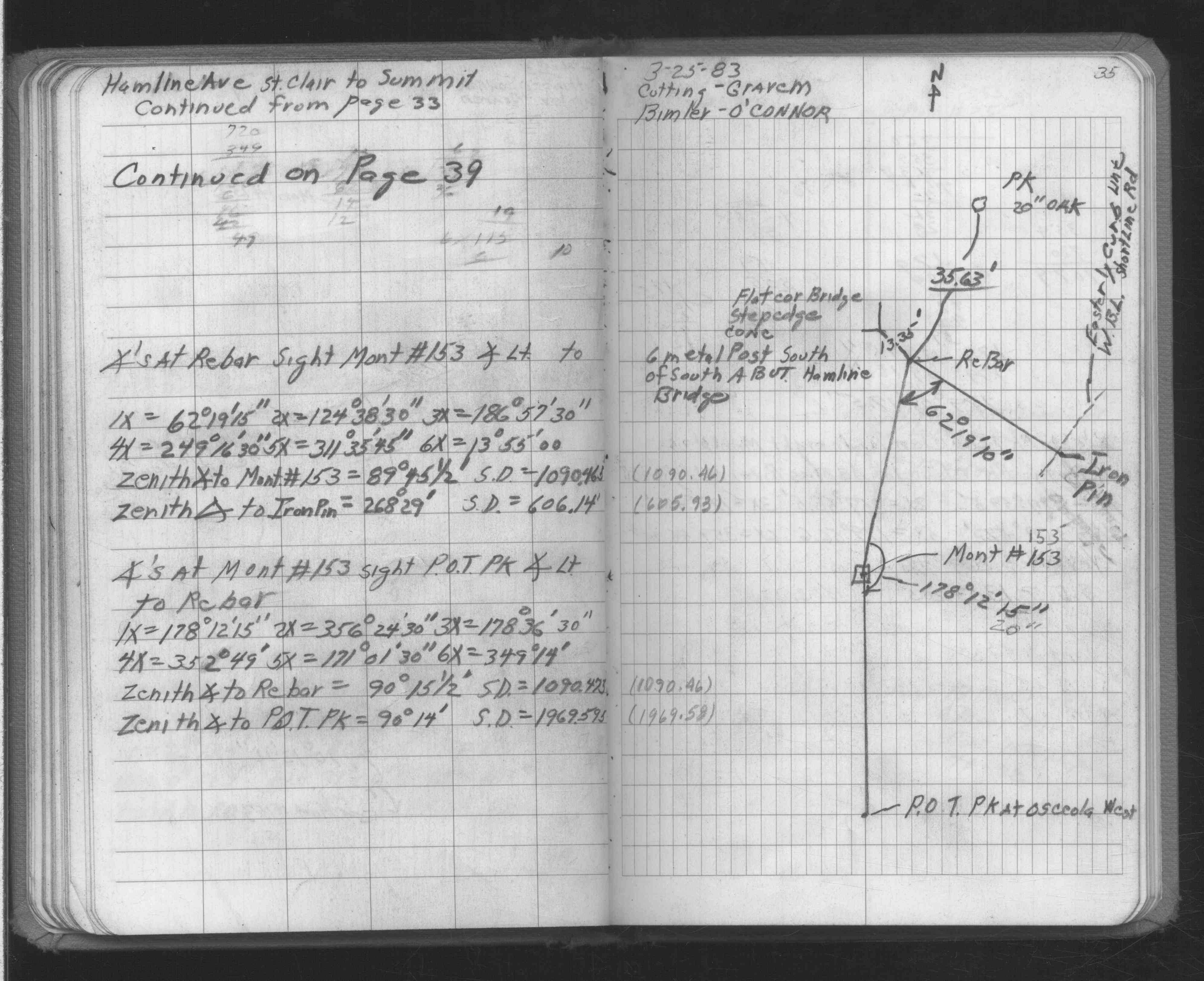
| FB 1694p. 33 ,34 ,35 | ||||||
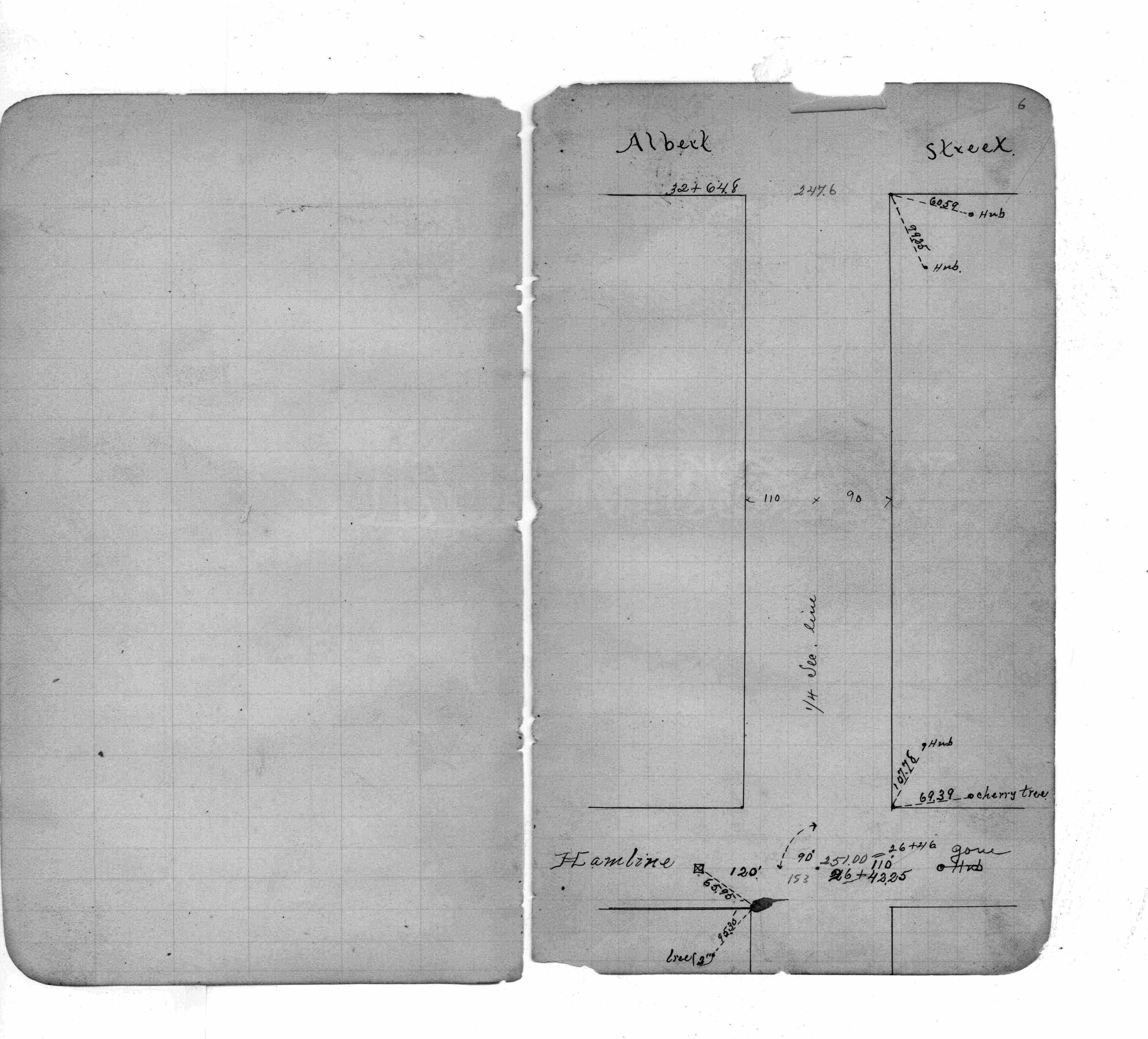
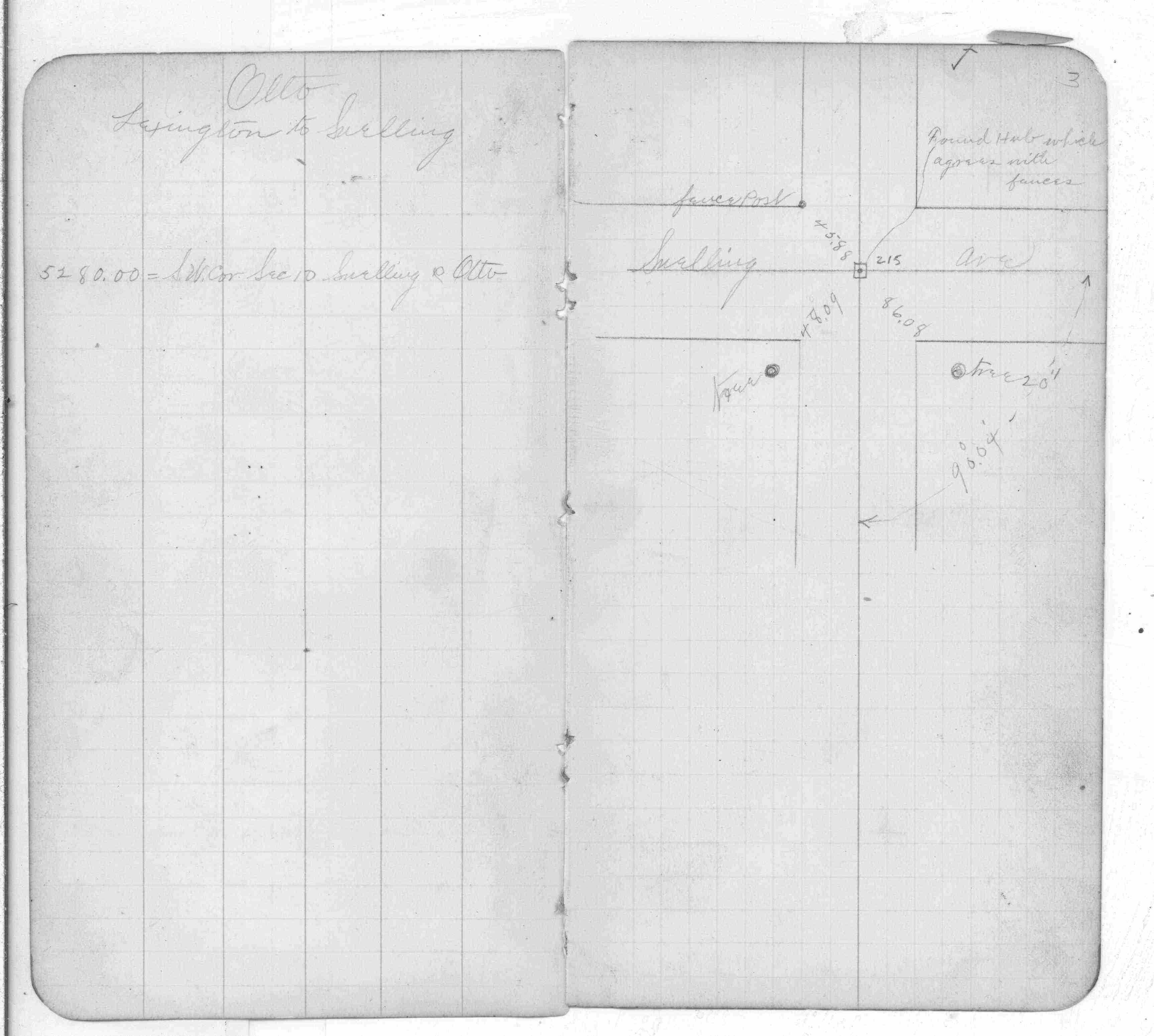
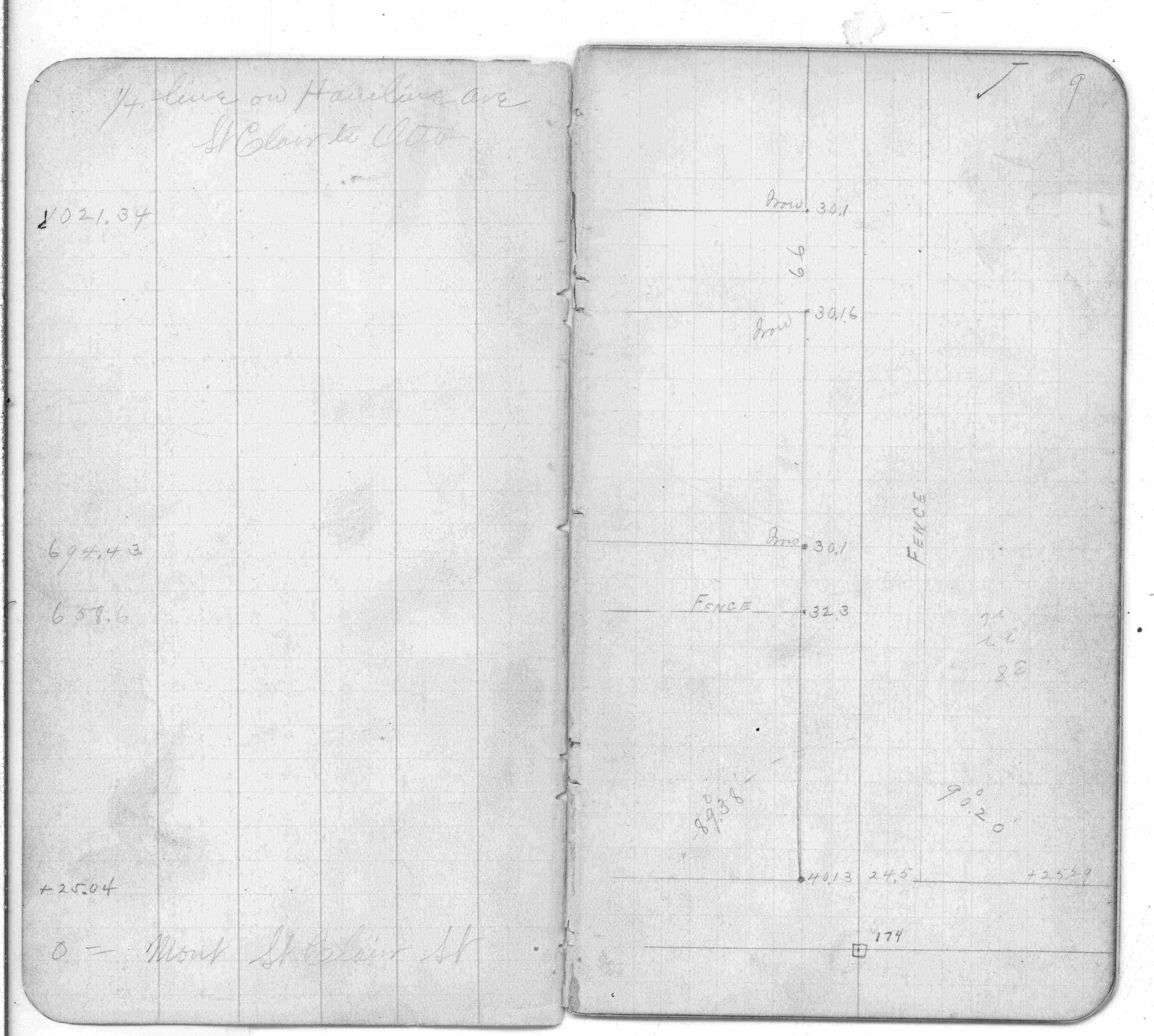
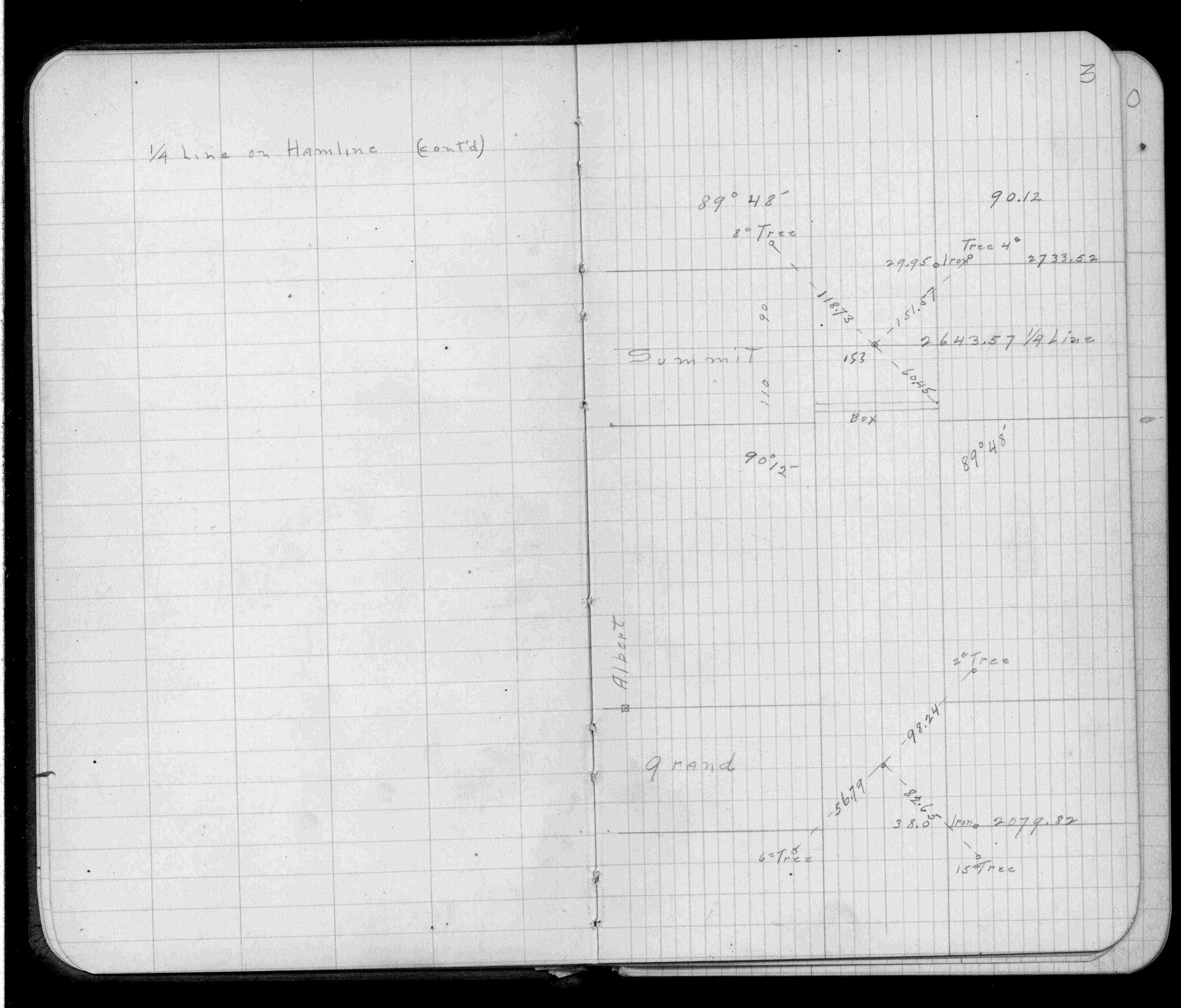
| FB 1736p.28 |
| FILE | SURVEYOR | LIC. NO. | DATE SIGNED | DATE TIED |
|---|---|---|---|---|
| 0153-1599-A.pdf | Samuel D. Gibson | 44880 | February 3, 2010 | November 10, 2009 |
| ST_079-156p153.jpg | none | none | none | none |
| 0153-xxxx-A.dwf | none | none | none | none |
| FILE | PHOTO DATE | COMMENTS |
|---|---|---|
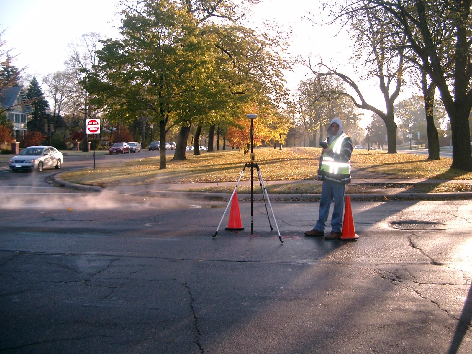
| 0153-1599-16.jpg | November 9, 2009 | Looking West along Summit Ave. |
| 0153-1599-15.jpg | November 9, 2009 | Looking South along Hamline Ave. |
| 0153-1599-14.jpg | November 9, 2009 | looking West along Summit ave. |
| 0153-1599-13.jpg | November 9, 2009 | Looking North along the center of Hamline Ave. |
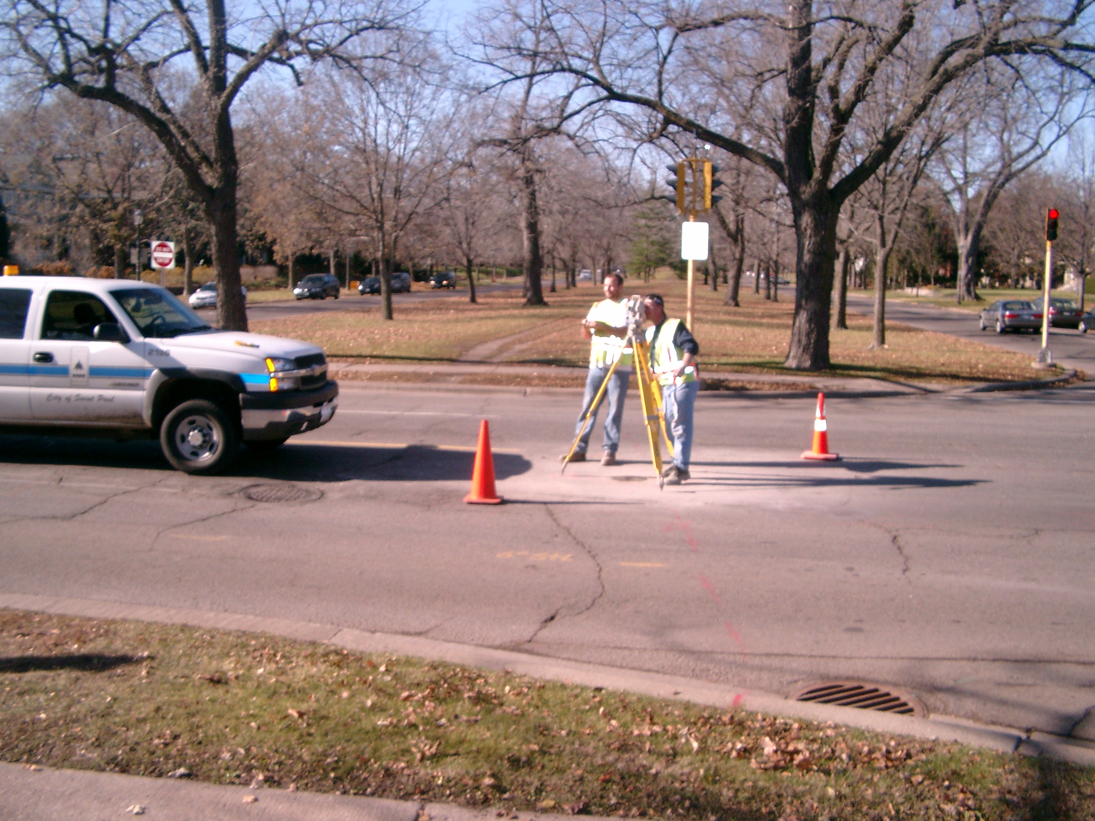
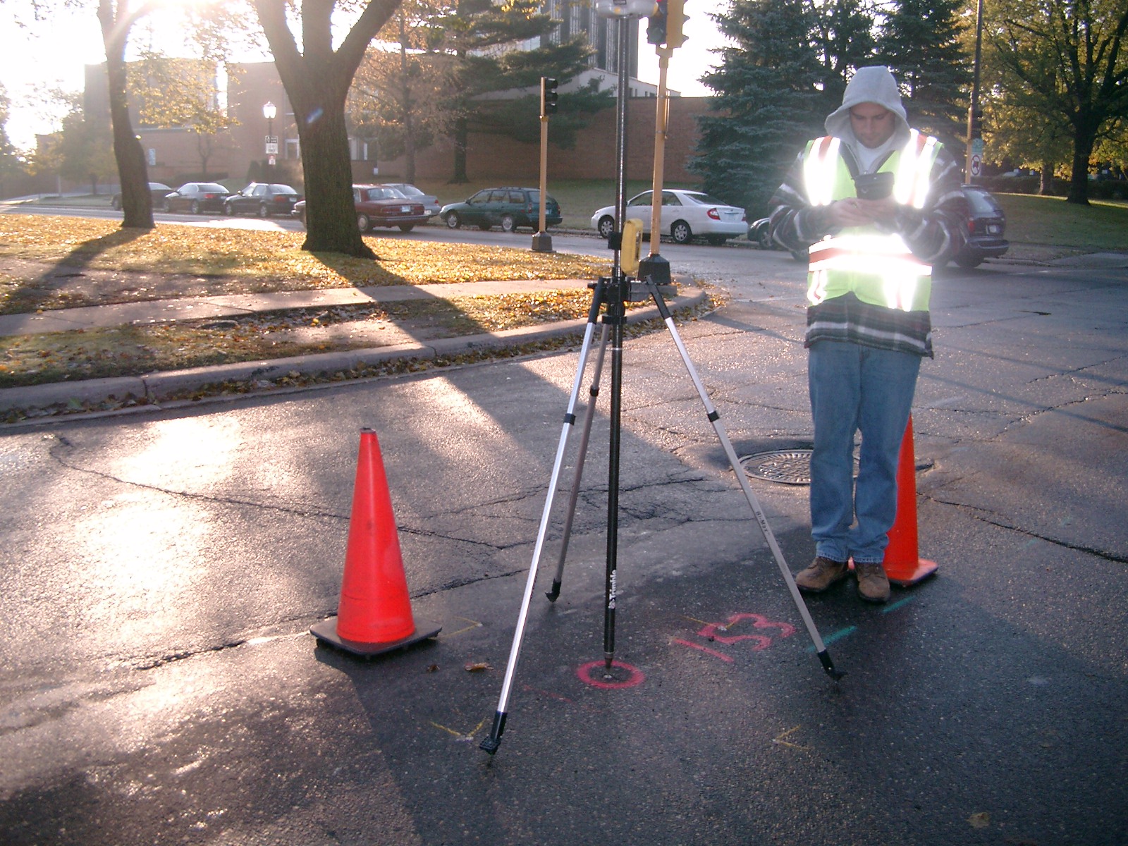
| 0153-1599-12.jpg | November 9, 2009 | Close-up of the CIM |
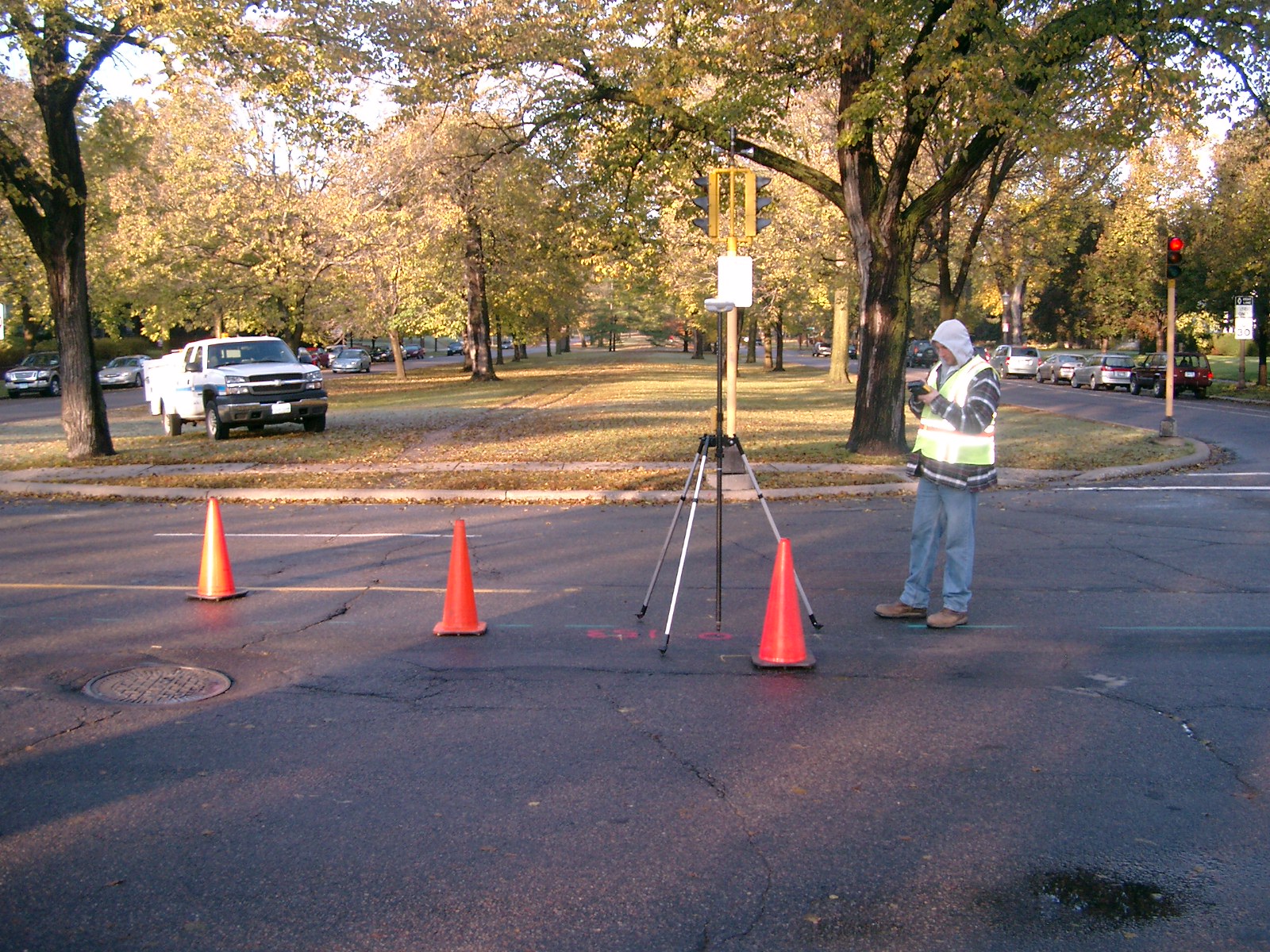
| 0153-1599-9.jpg | October 23, 2009 | Looking Northwest from the center of Hamline Ave. and Summit Ave. |
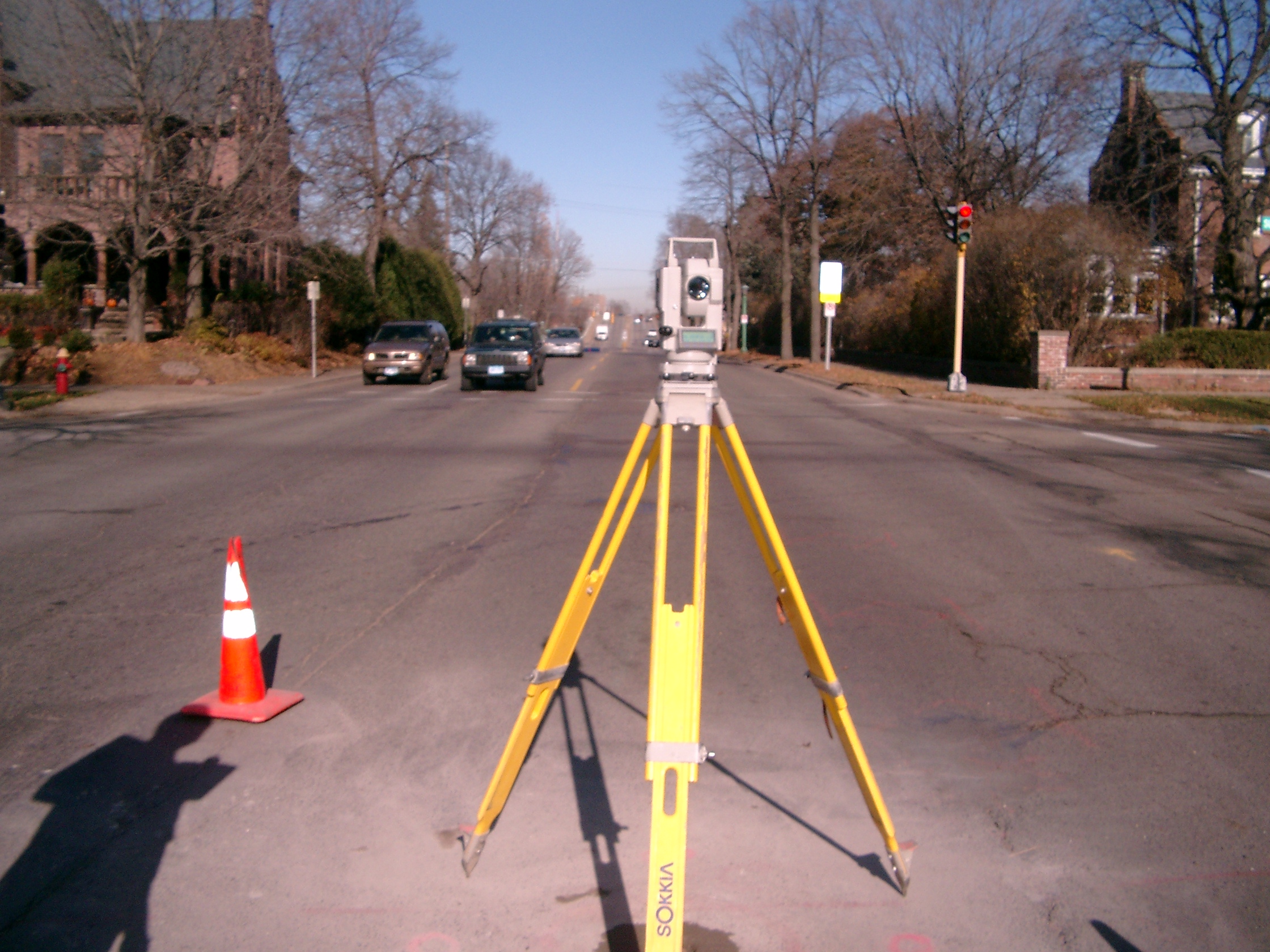
| 0153-1599-7.jpg | October 23, 2009 | Looking West along Summit Ave. |
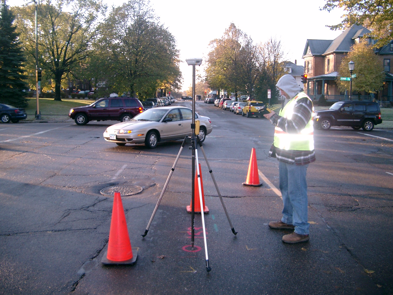
| 0153-1599-6.jpg | October 23, 2009 | Looking South along the center of Hamline Ave. |
| 0153-1599-5.jpg | October 23, 2009 | Looking Southeast from the center of Hamline Ave. and Summit Ave. |
| 0153-1599-4.jpg | October 23, 2009 | Looking East along Summit Ave. |
| 0153-1599-3.jpg | October 23, 2009 | Looking North along the center of Hamline Ave. |
| 0153-1599-1.jpg | October 23, 2009 | Close-up of Iron Pin. |