| NAD83 COORDINATES (1986 adj.): |
|---|
| * X= 563938.143 Y= 154889.388 Z= 000.00 LSQ 12/06/1991 S FLT |
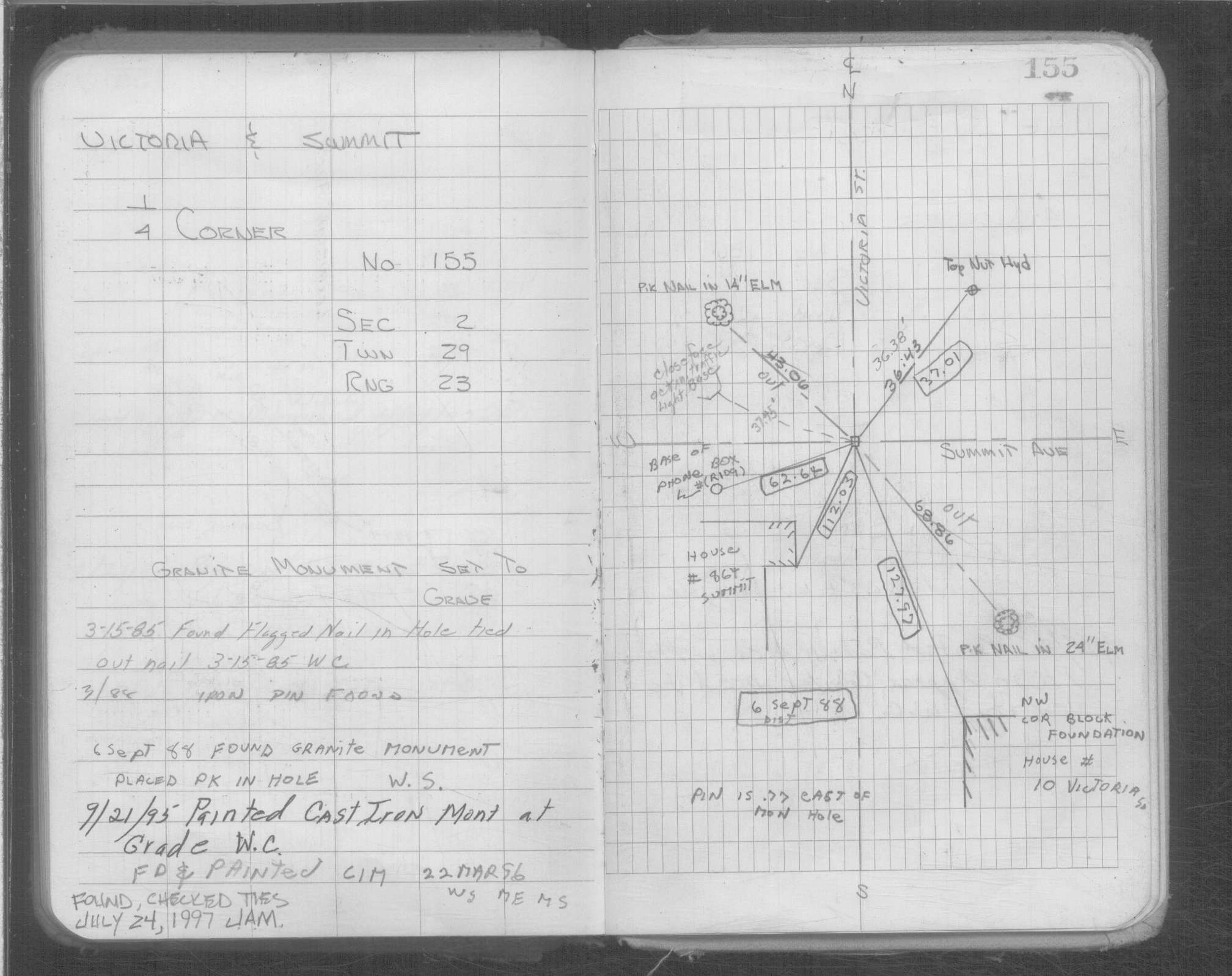
| 9/27/2006 | Fd CIM at grade. |
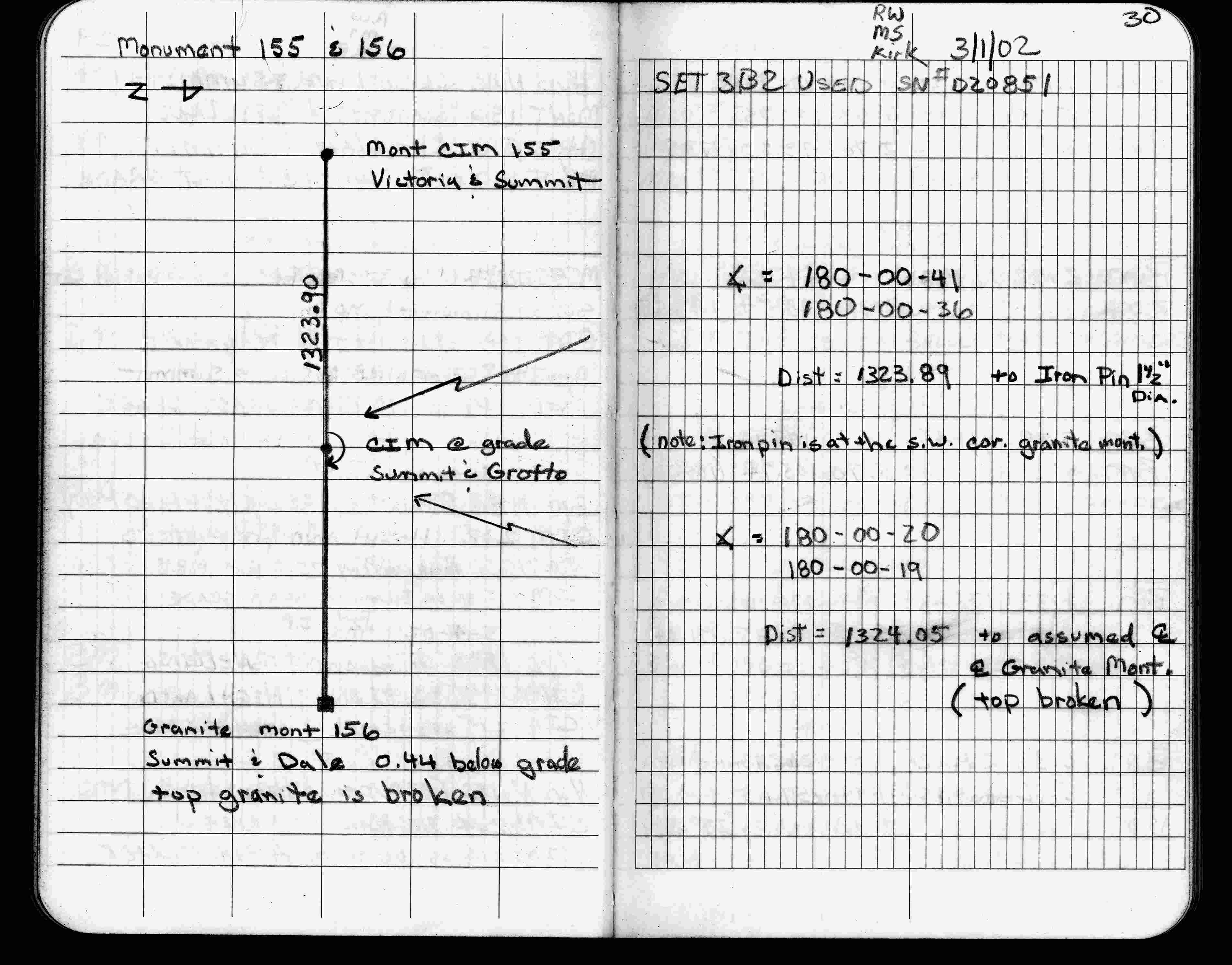
| 3/1/2002 | Fd CIM, See FB 1736 p.30 |
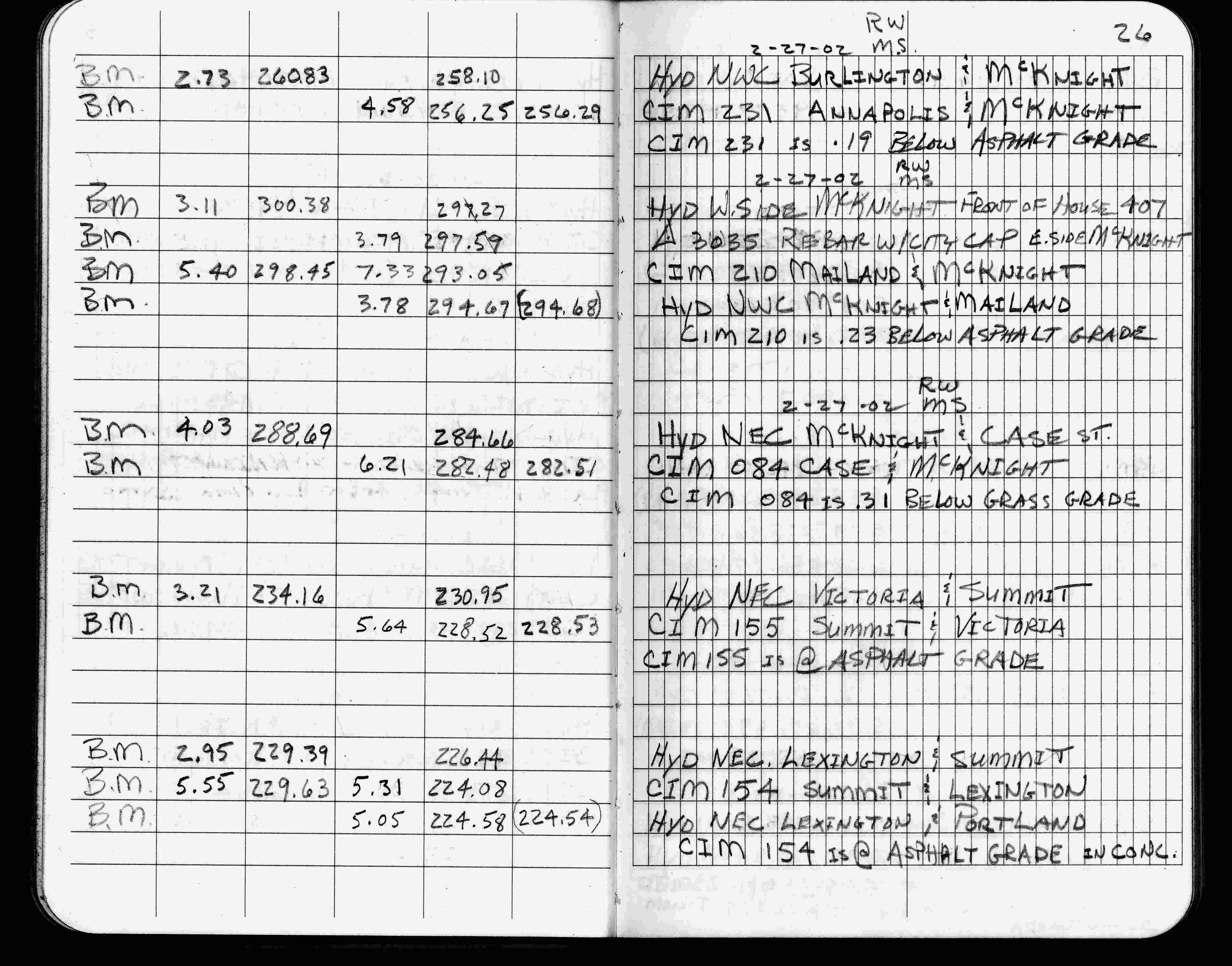
| 2/27/2002 | Elev 228.52 ft on CIM at asphalt surface. See FB 1736 p.26 |
| 3/1/2000 | (Unknown date Mar __, 2000 ) Fd CIM at grade (marked for painting target for 2000 aerial) |
| 1/19/1999 | Elev 228.53 ft on CIM. See 1999/victoria/victoria.sdr (loop 188) Digital-Unadj |
| 9/21/1995 | Fd CIM (marked for painting for 1995 aerial) |
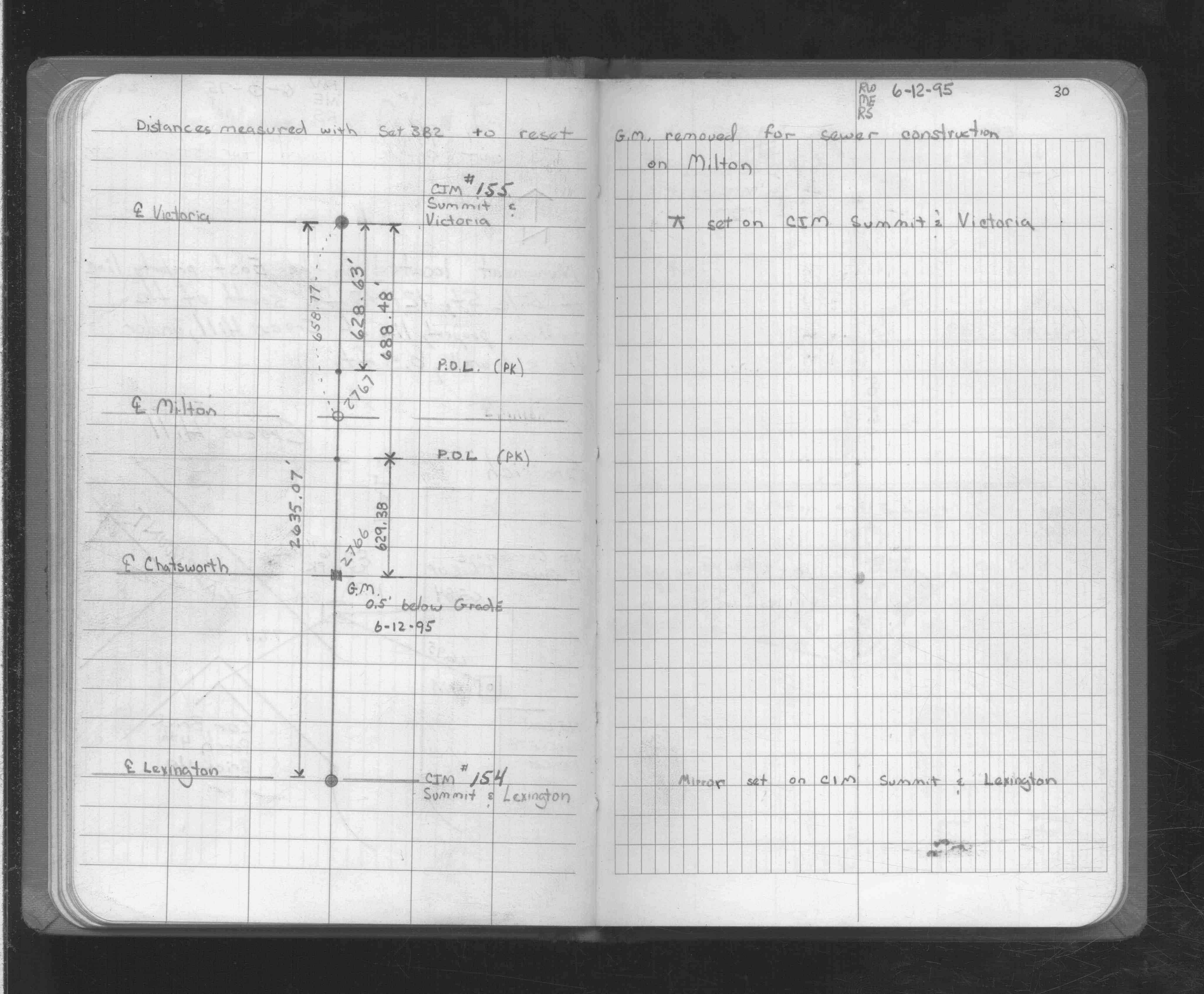
| 6/29/1994 | Set CIM to grade. See CofL 0155-0119-A |
| 6/1/1994 | (Unknown date Jun __, 1994 ) Fd GM, placed ties, removed for sewer work. See CofL 0155-0119-A |
| 9/9/1988 | Fd GM w/pk nail in hole |
| 8/17/1888 | Monument set by J H Armstrong. |
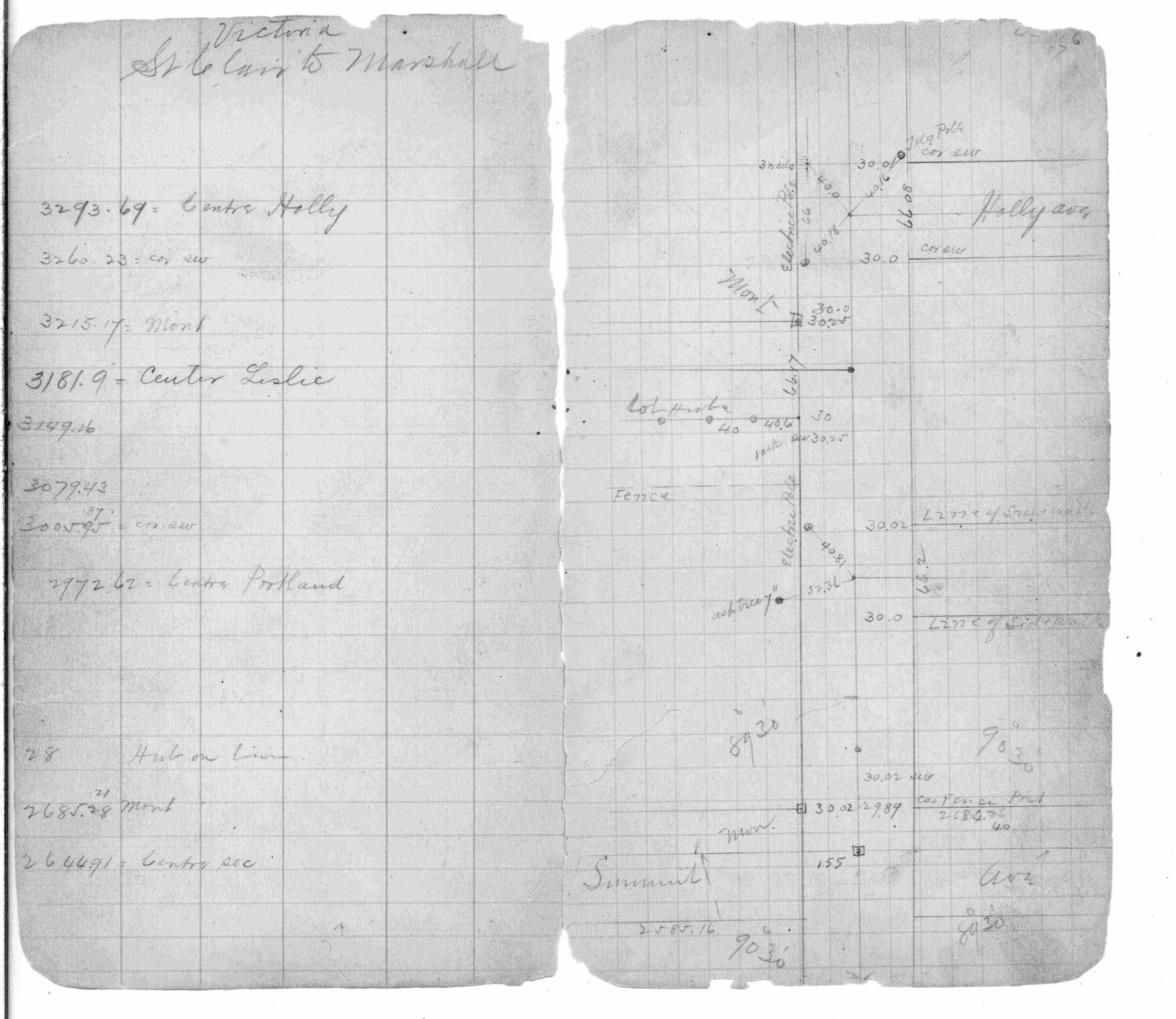
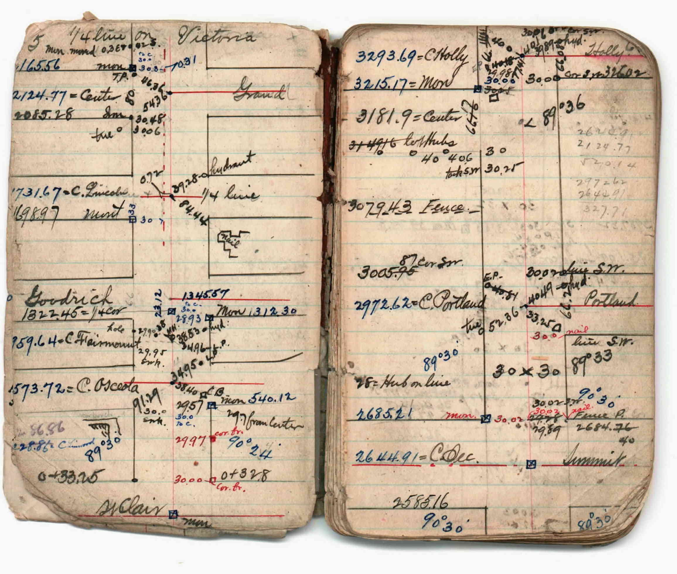
| 1/1/1800 | (Unknown date ___ __, ____ ) Survey on Victoria St from St Clair to Marshall Ave. See JBI 02 p.05-06 |
| 1/1/1800 | (Unknown date ___ __, ____ ) Placed ties. See FB 705 p.52 |
Above is NOT an all inclusive history of this point. Please review all the links below.
| PLS NOTES | Field | Cross Section | Sewer | J.B. Irvine | Monument | River Survey |
|---|---|---|---|---|---|---|
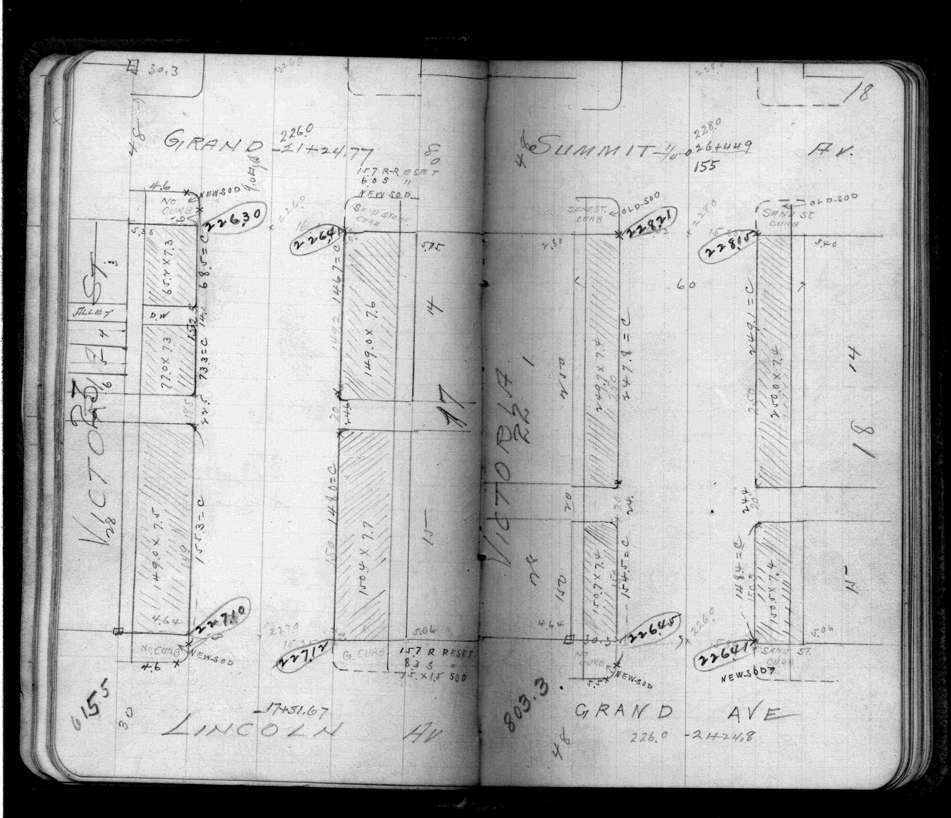
| FB 0220p. 06 ,26 | JBI 02 p.05-06 | |||||
| FB 0485p.18 | ||||||
| FB 0577p.27 | ||||||
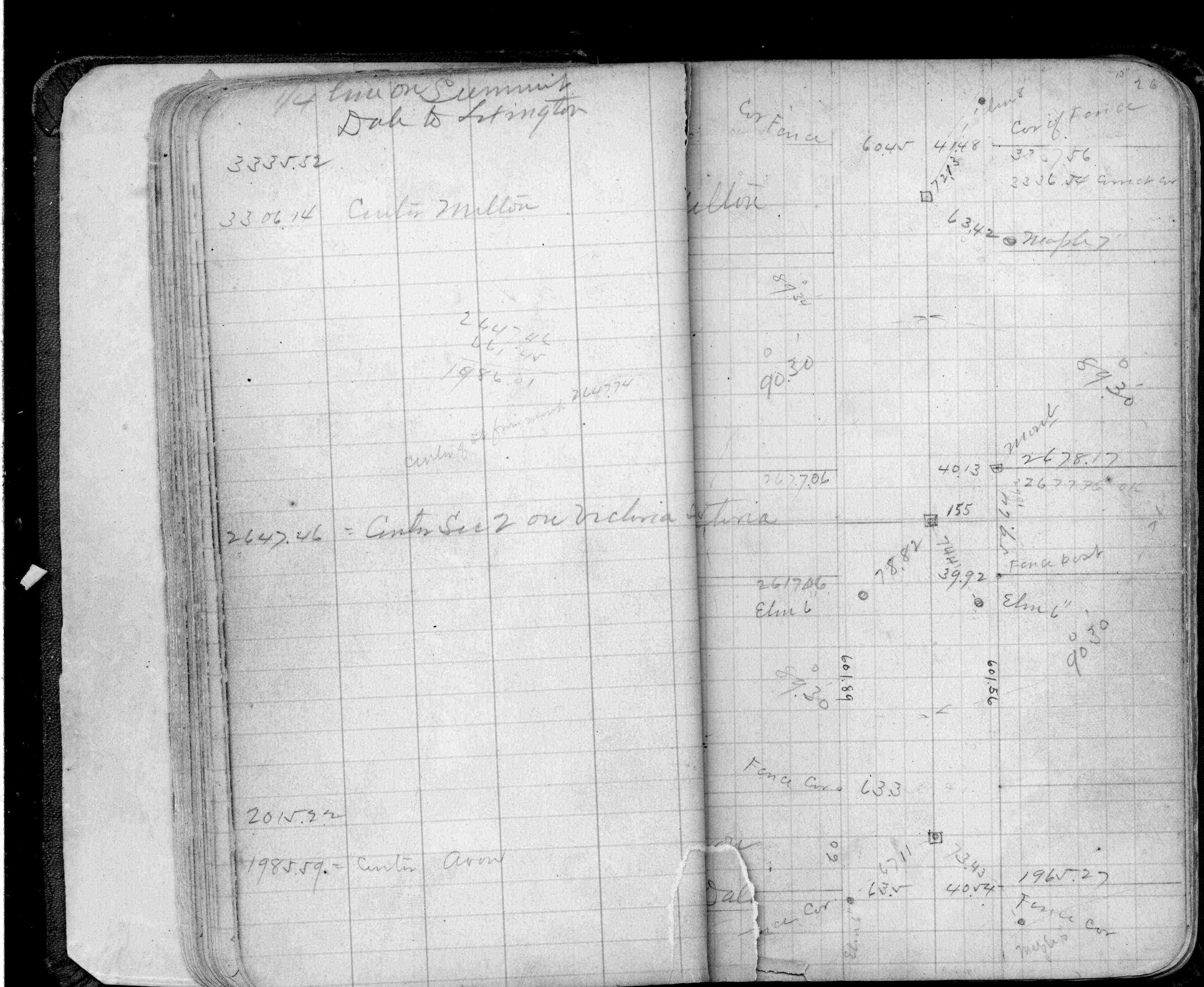
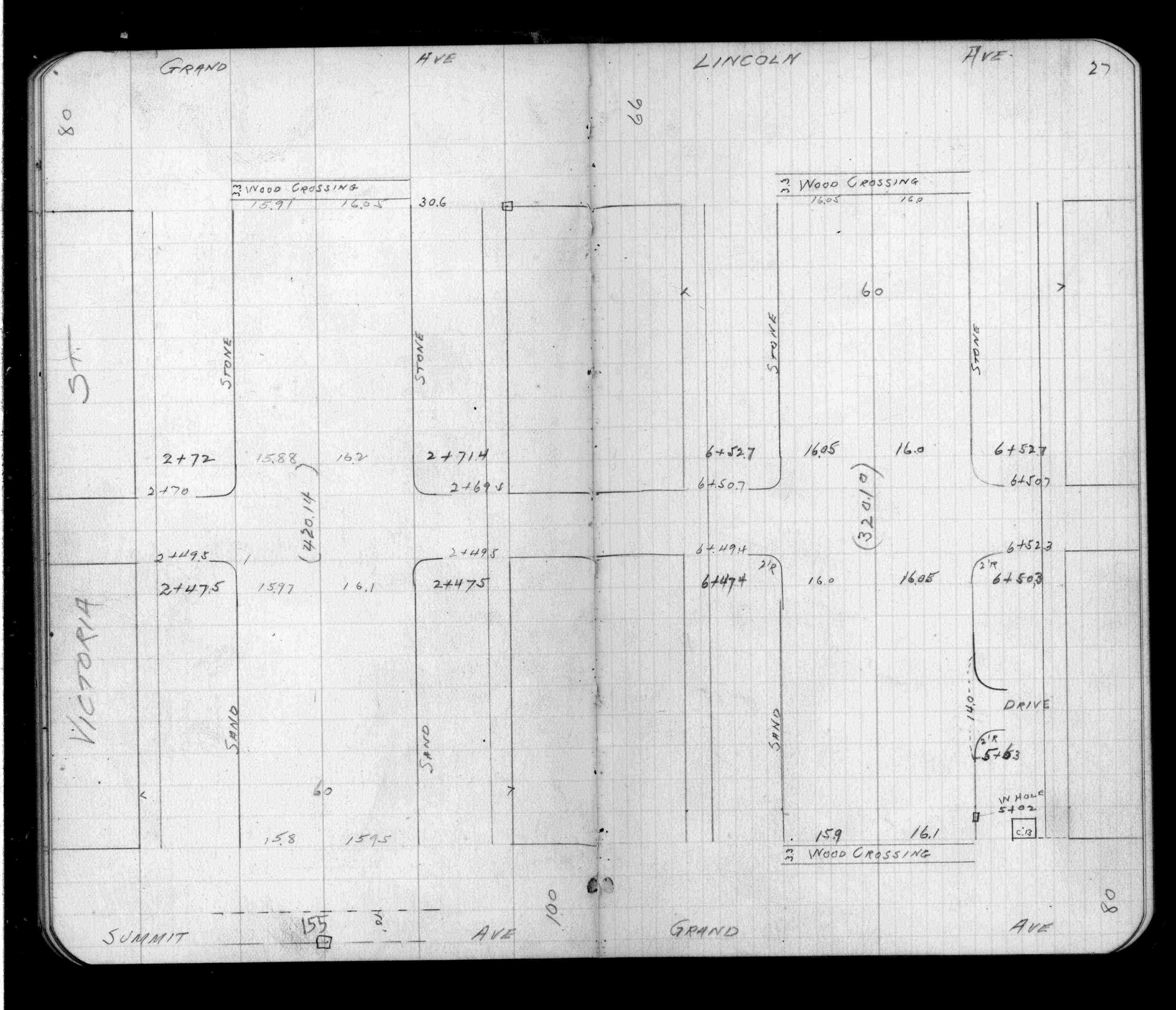
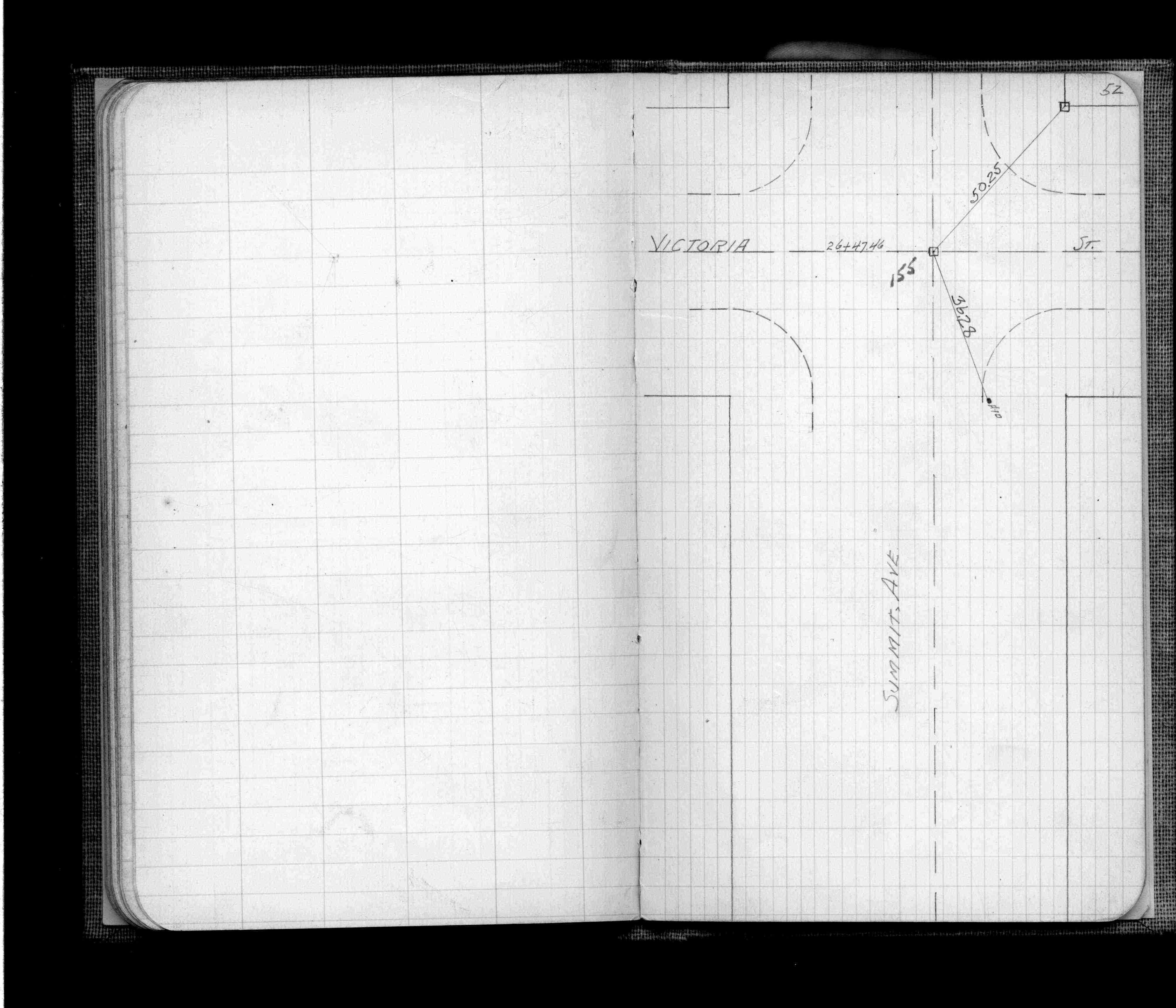
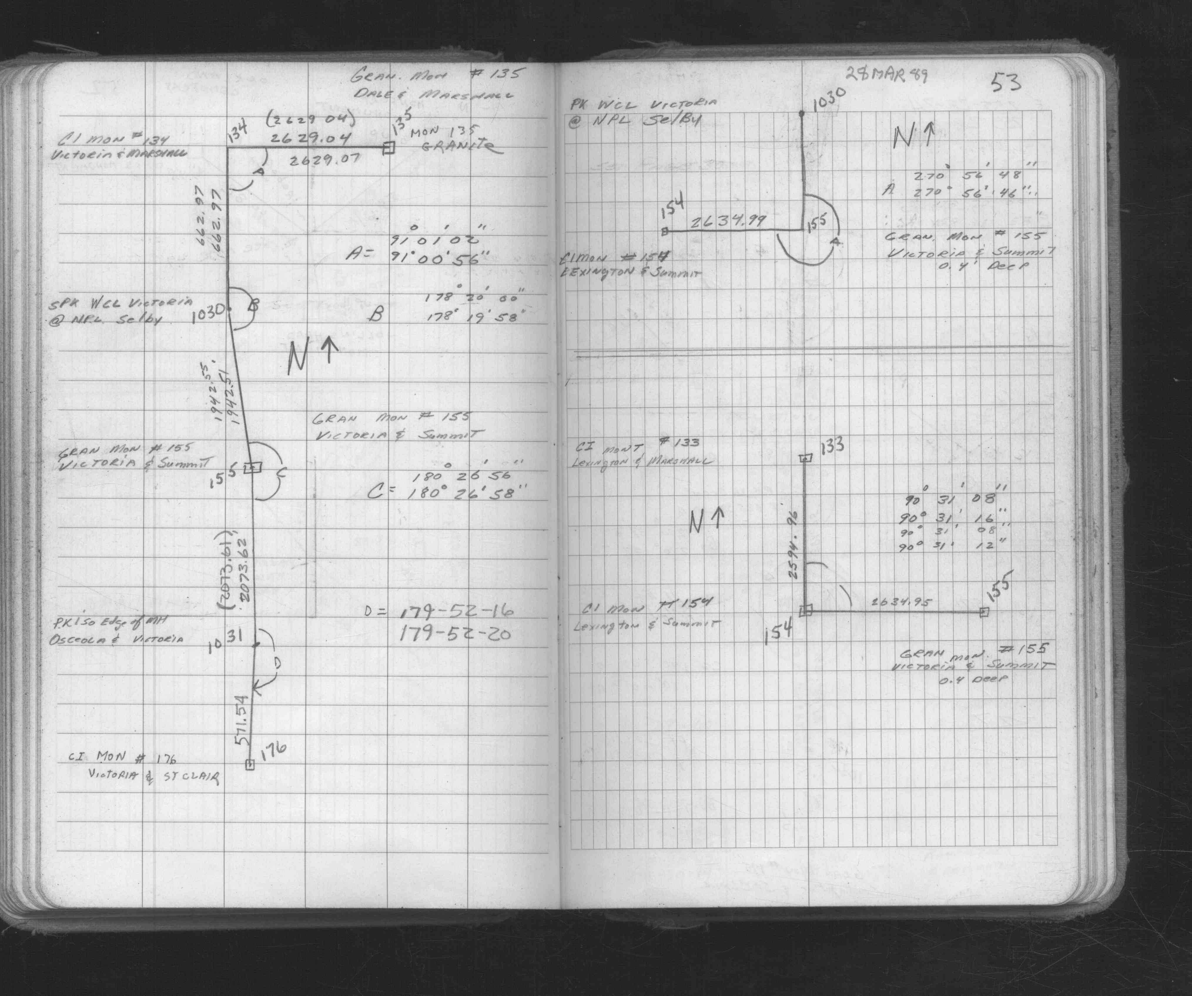
| FB 0705p.52 | ||||||
| FB 0705p.52 | ||||||
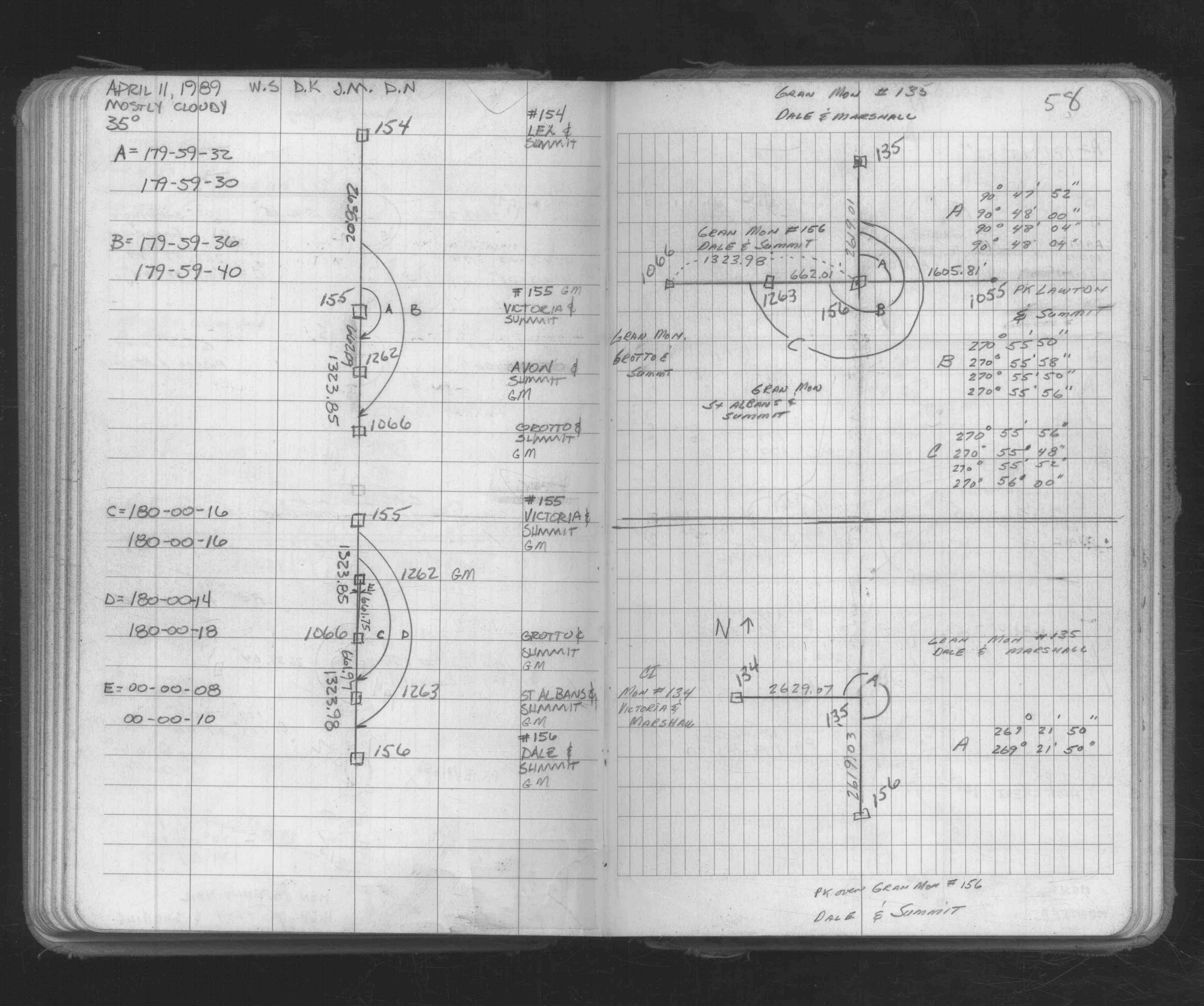
| FB 1549Cp.16 | ||||||
| FB 1592p.40 | ||||||
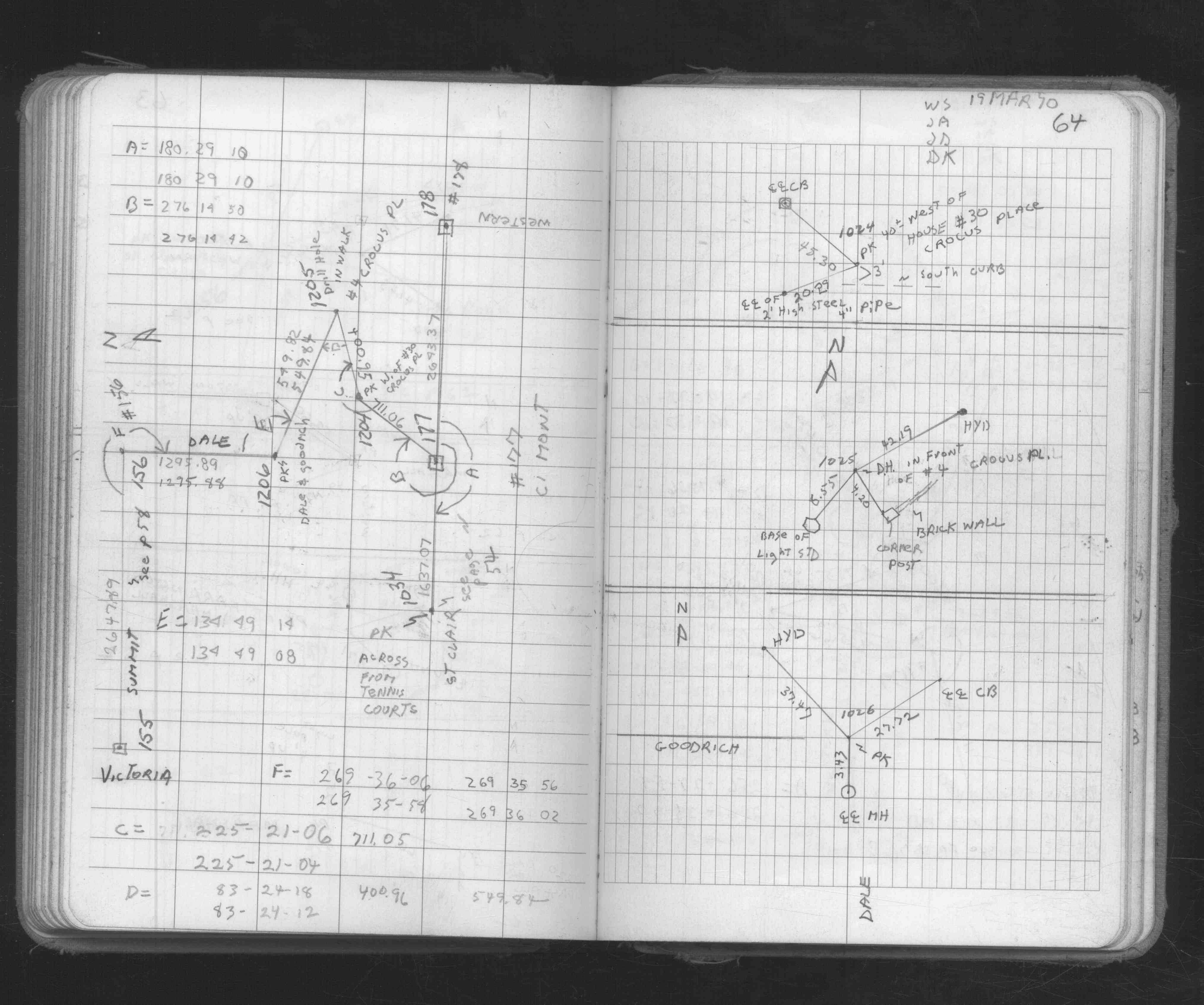
| FB 1673Ap. 53 ,58 ,64 | ||||||
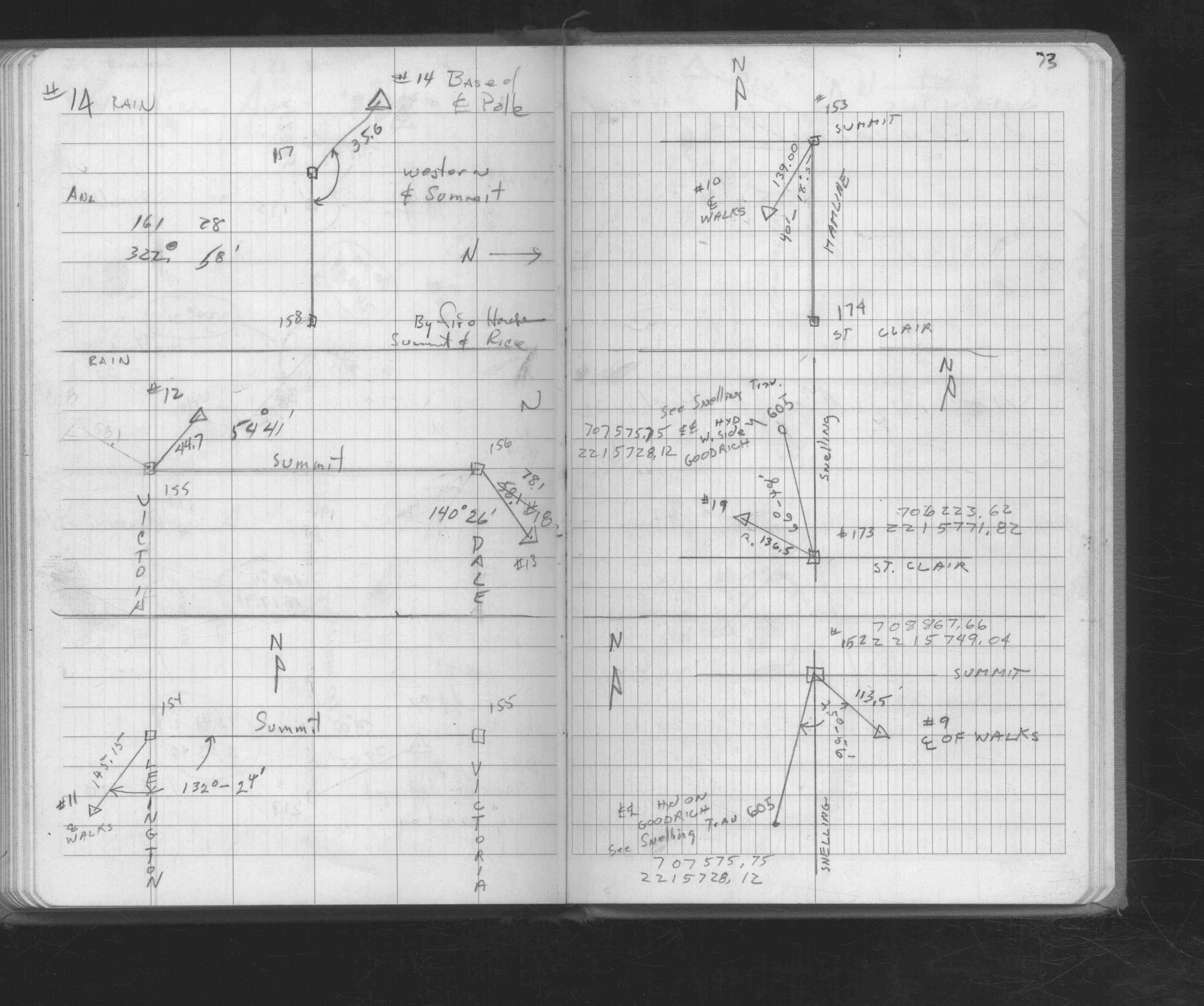
| FB 1676Ap.73 | ||||||
| FB 1725p.30 | ||||||
| FB 1736p.26 | ||||||
| FB 1736p.30 | ||||||
| FB 1736p.30 |
| FILE | SURVEYOR | LIC. NO. | DATE SIGNED | DATE TIED |
|---|---|---|---|---|
| 0155-0119-A.tif | William J. Cutting | 20576 | July 18, 1994 | June 29, 1994 |
| ST_079-156p155.jpg | none | none | none | none |
| 0155-0119-A.dwf | none | none | none | none |