| NAD83 COORDINATES (1986 adj.): |
|---|
| * X= 561317.870 Y= 152251.287 Z= 000.00 LSQ 12/06/1991 S FIX |
| X= 561317.90 Y= 152251.31 Z= 912.50 05/07/2007 RTK-VRS |
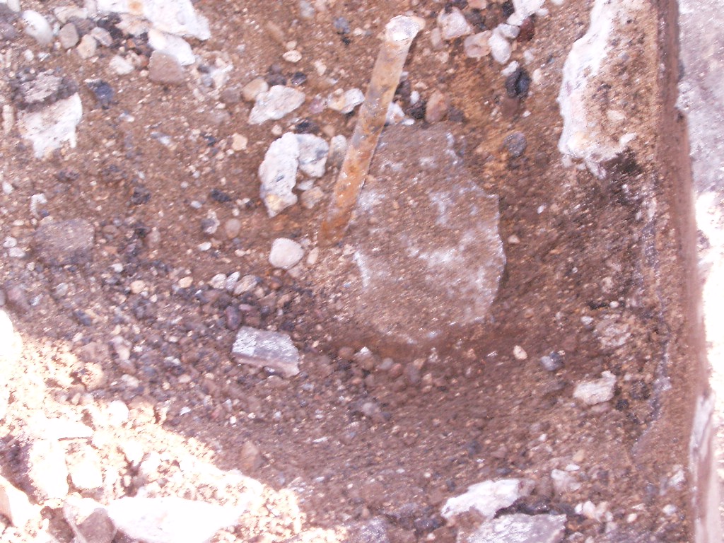
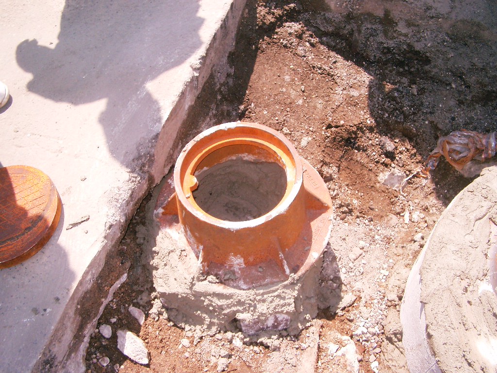
| 6/30/2007 | IRON PIN removed & placed a casting over the GM. Photos taken. |
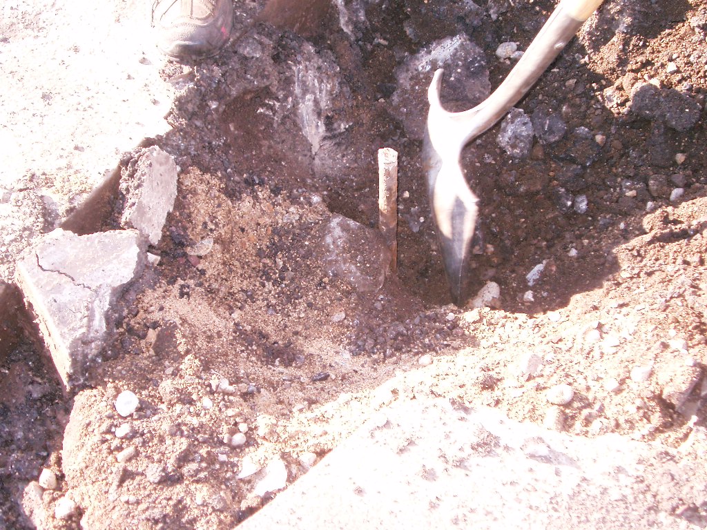
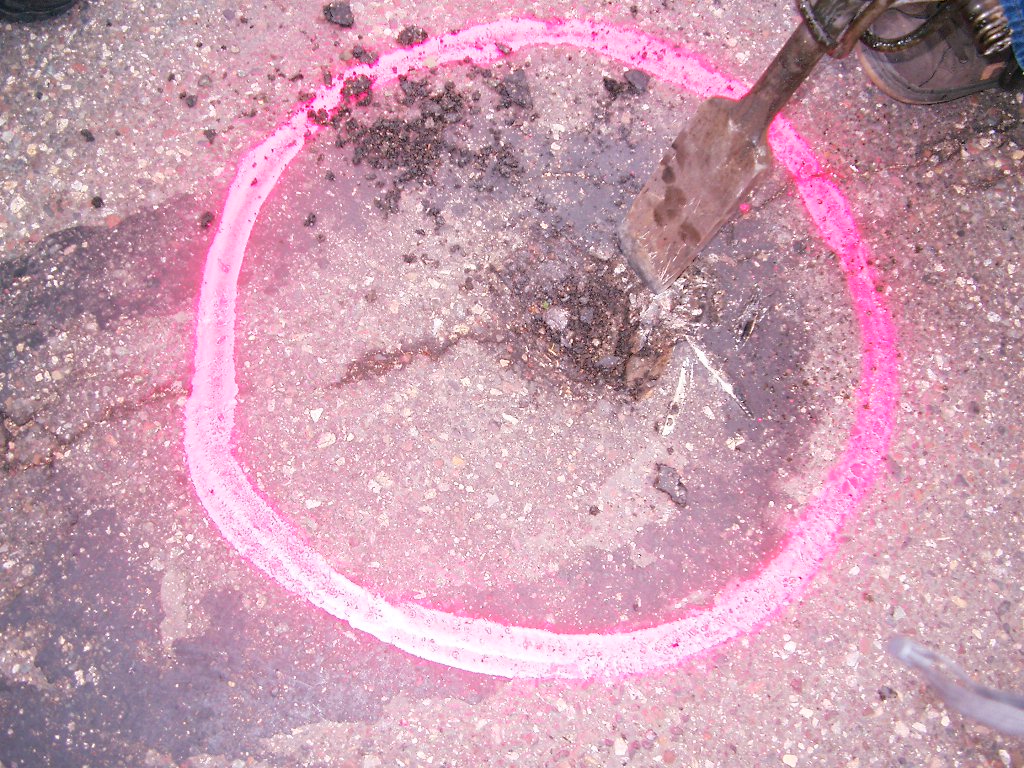
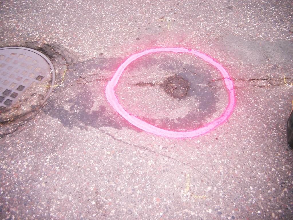
| 5/10/2007 | Fd IRON PIN & dug for GM under the asphalt. Photos taken. |
| 5/7/2007 | Position on IRON PIN established by RTK-VRS GPS Elev 912.5 ft. |
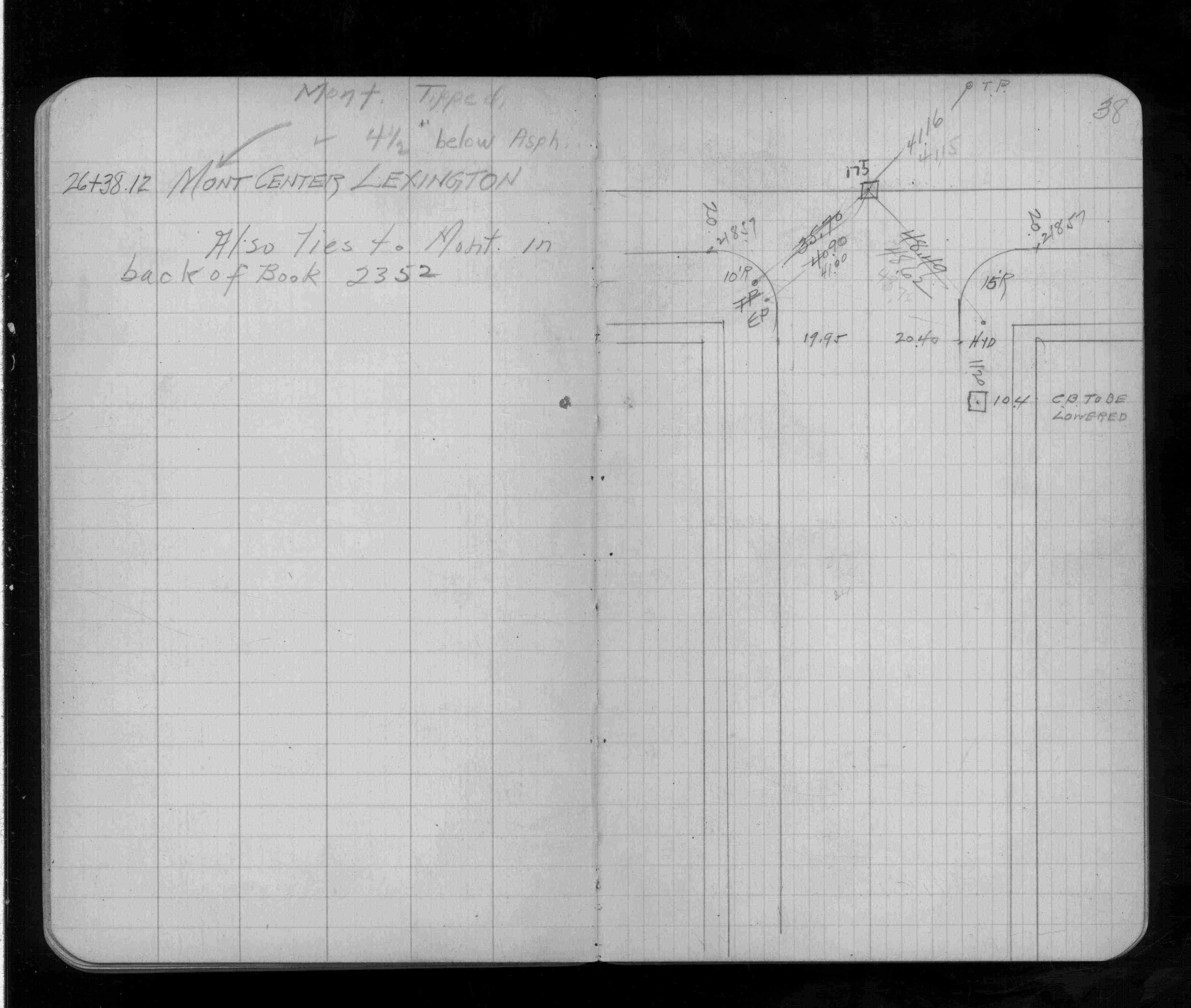
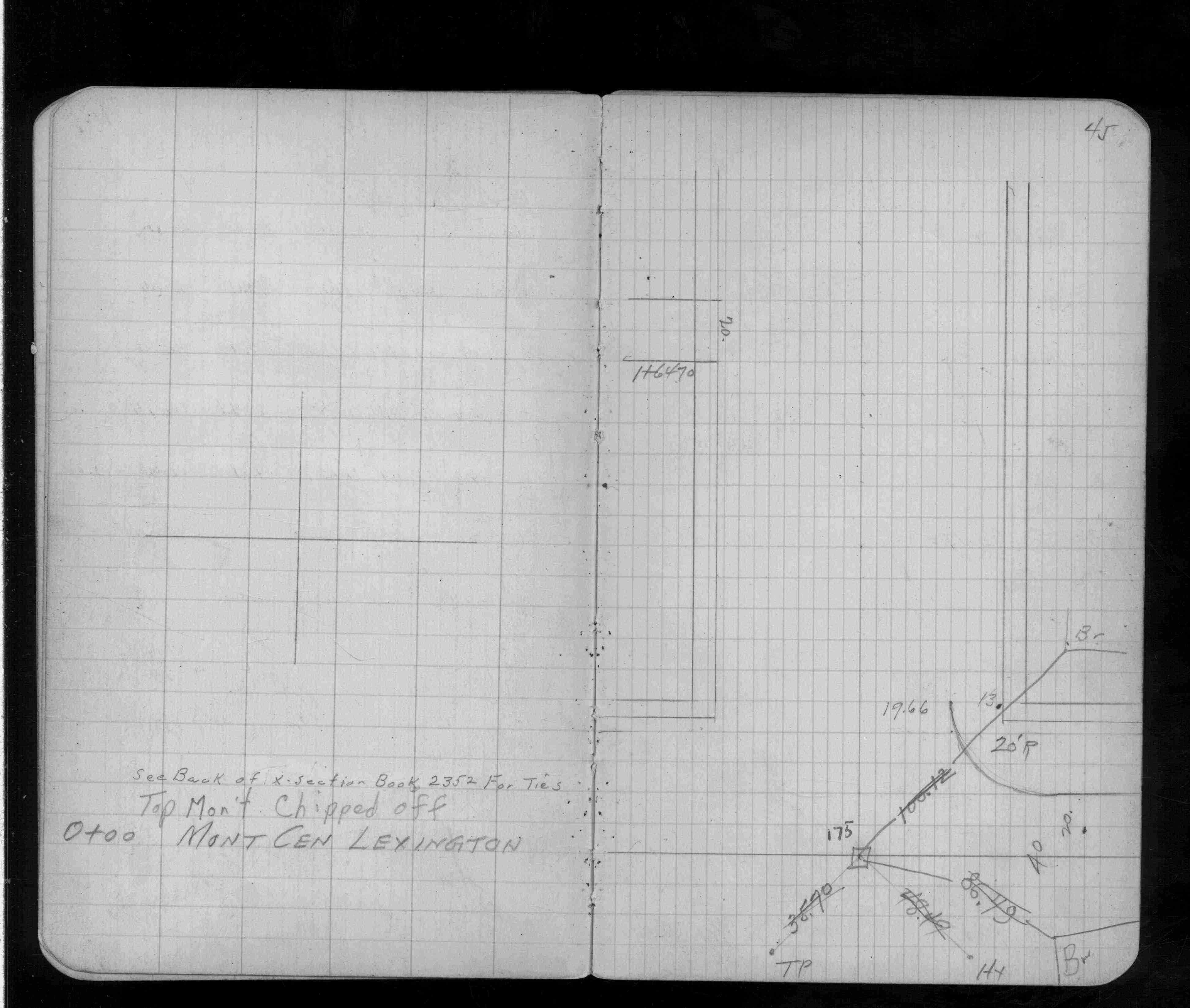
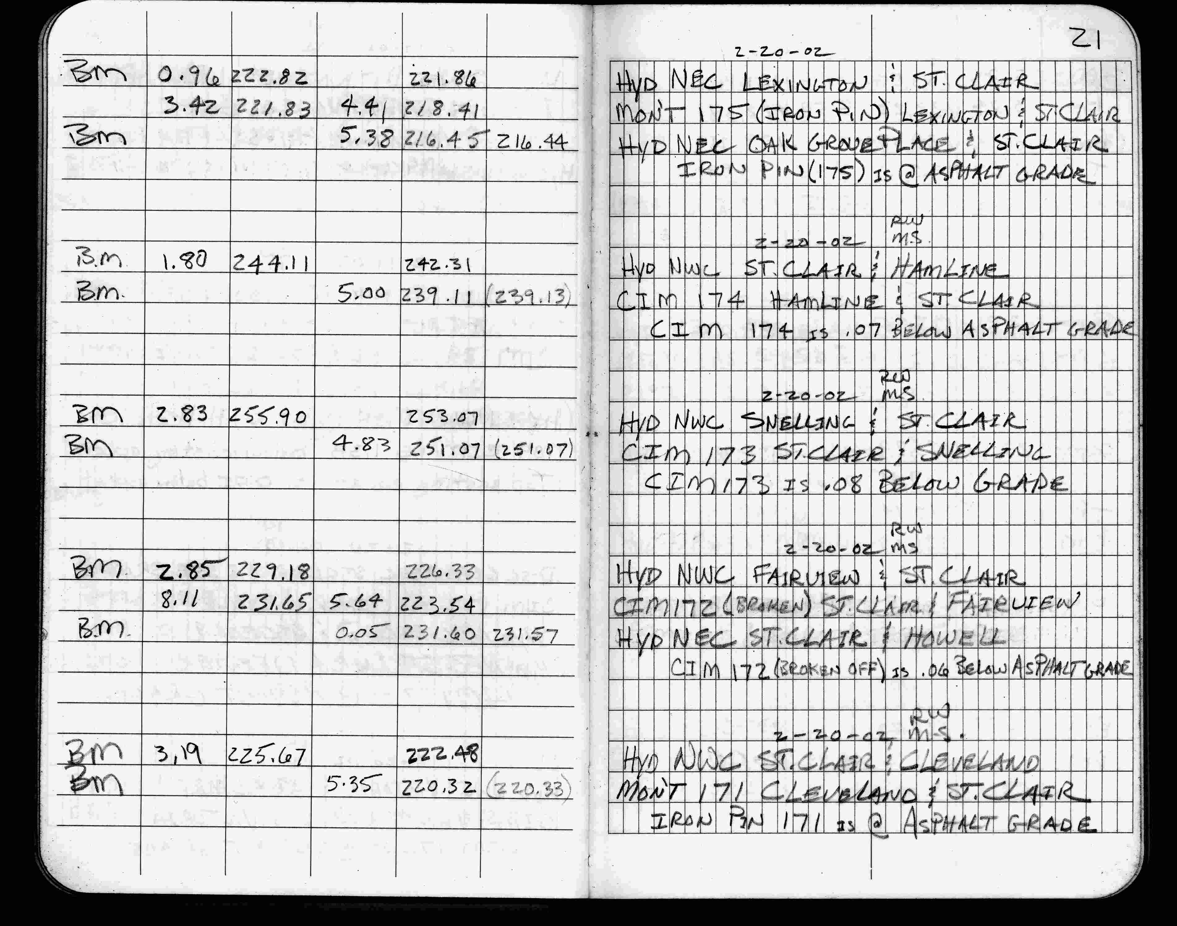
| 2/20/2002 | Elev 218.41 ft on IRON PIN at asphalt surface. See FB 1736 p.21 |
| 3/1/2000 | (Unknown date Mar __, 2000 ) Fd IRON PIN (marked for painting target for 2000 aerial) |
| 4/1/1997 | (Unknown date Apr __, 1997 ) Elev 218.40 ft on Rebar. See FB 1549M p.1 |
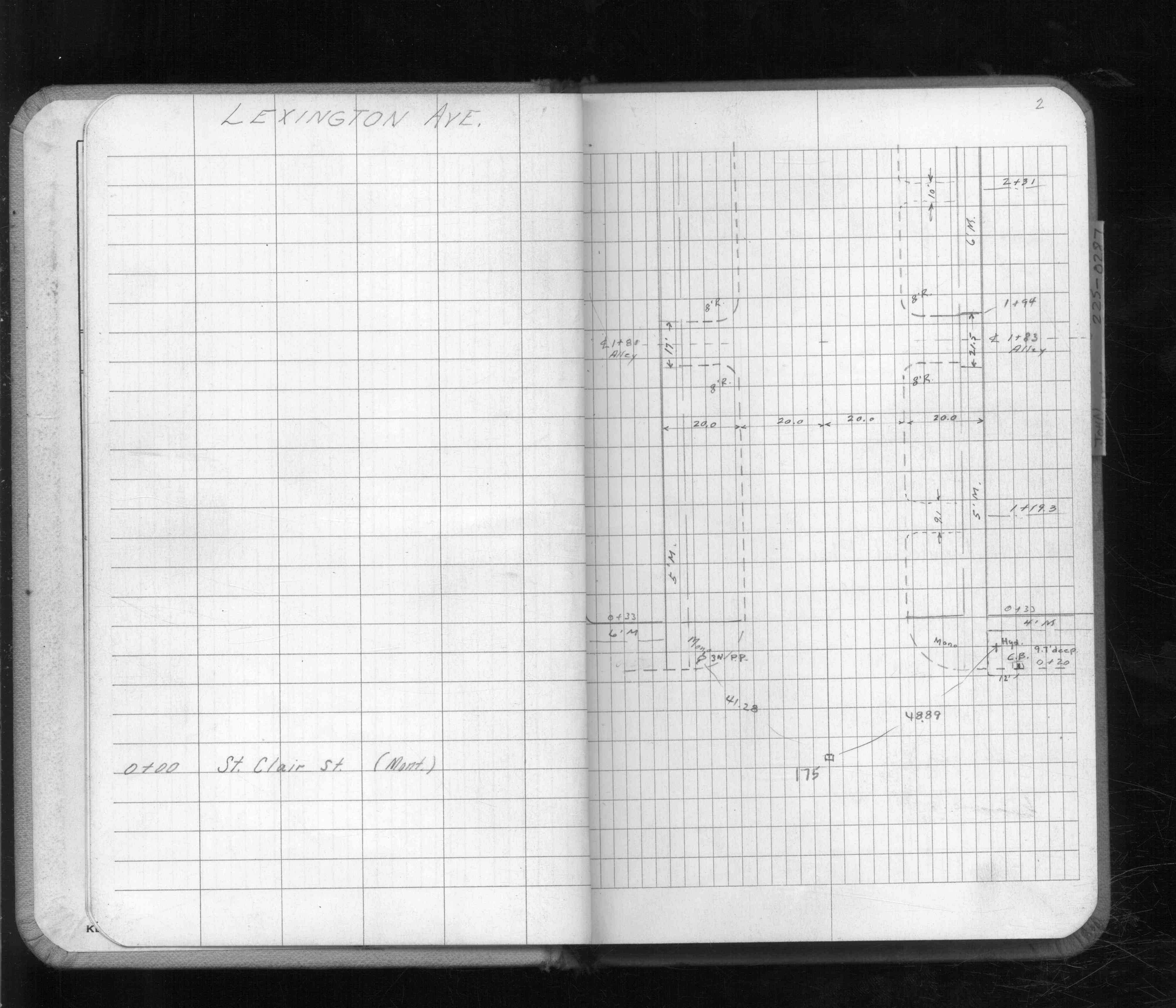
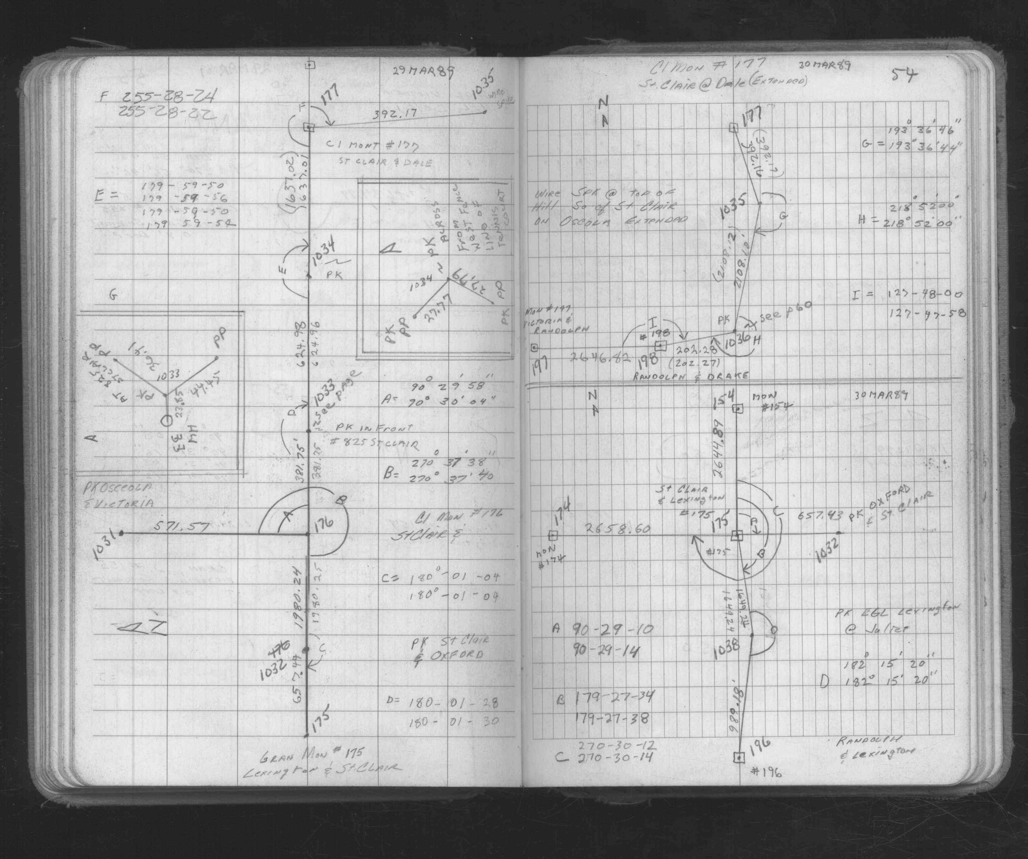
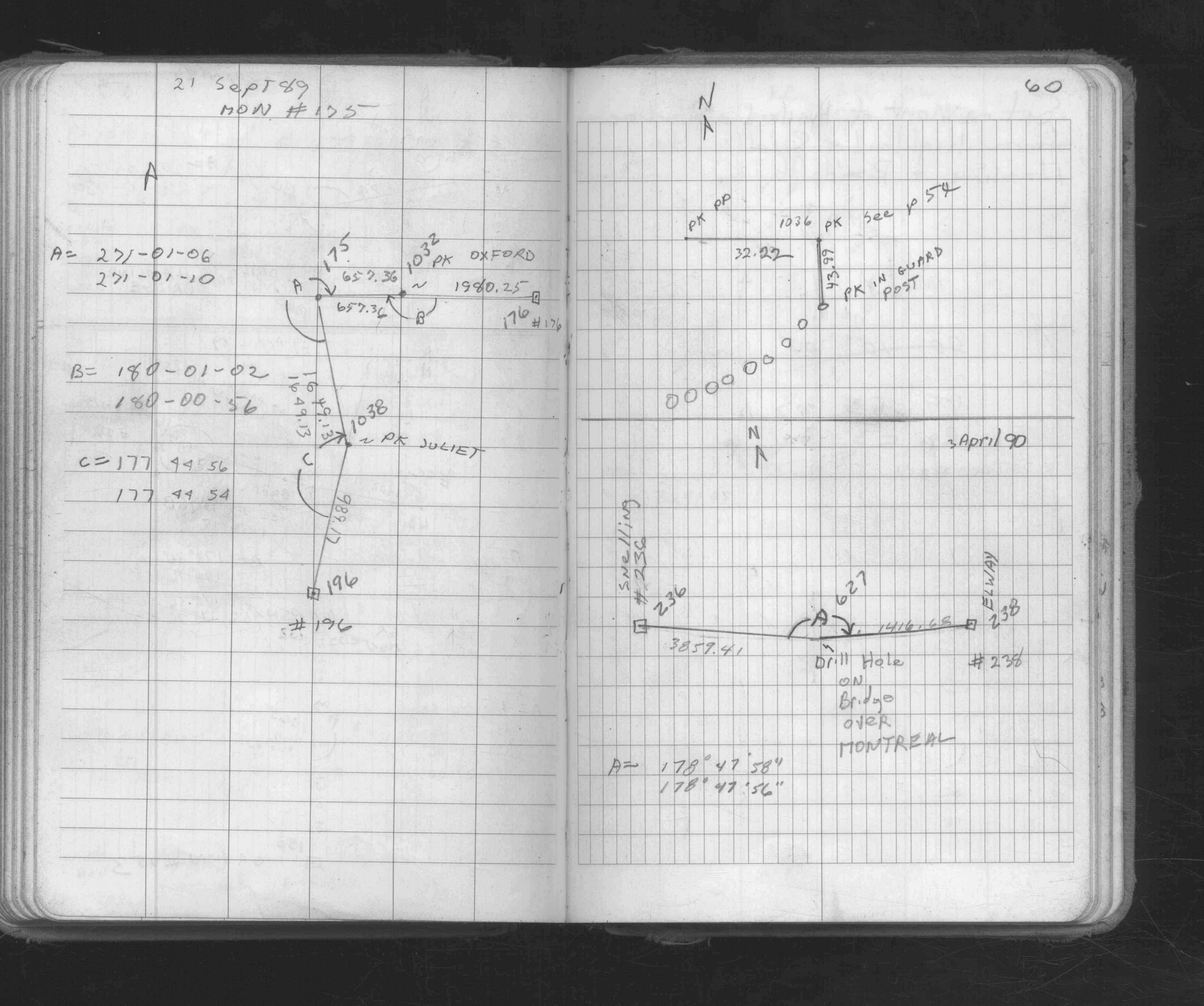
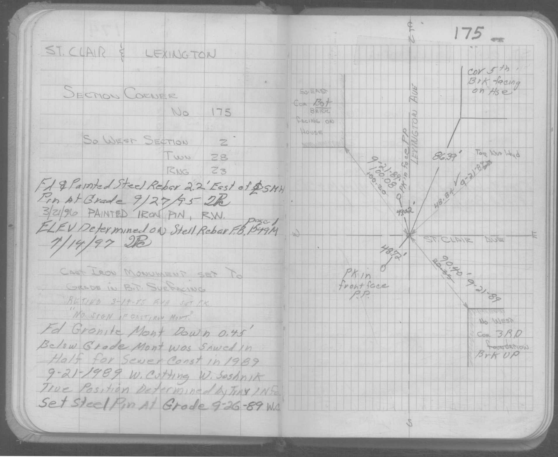
| 9/26/1989 | Placed rebar at pavement grade. See CofL 0175-0131-A |
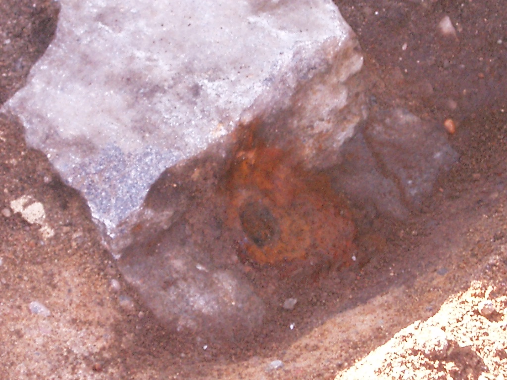
| 9/21/1989 | Fd GM 0.45 ft below pavement grade. See CofL 0175-0131-A |
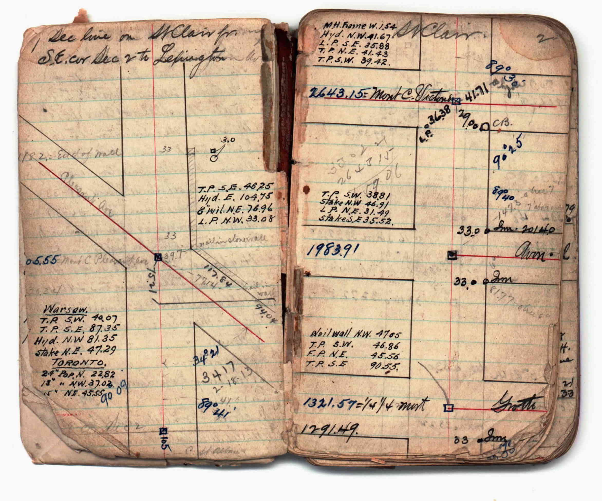
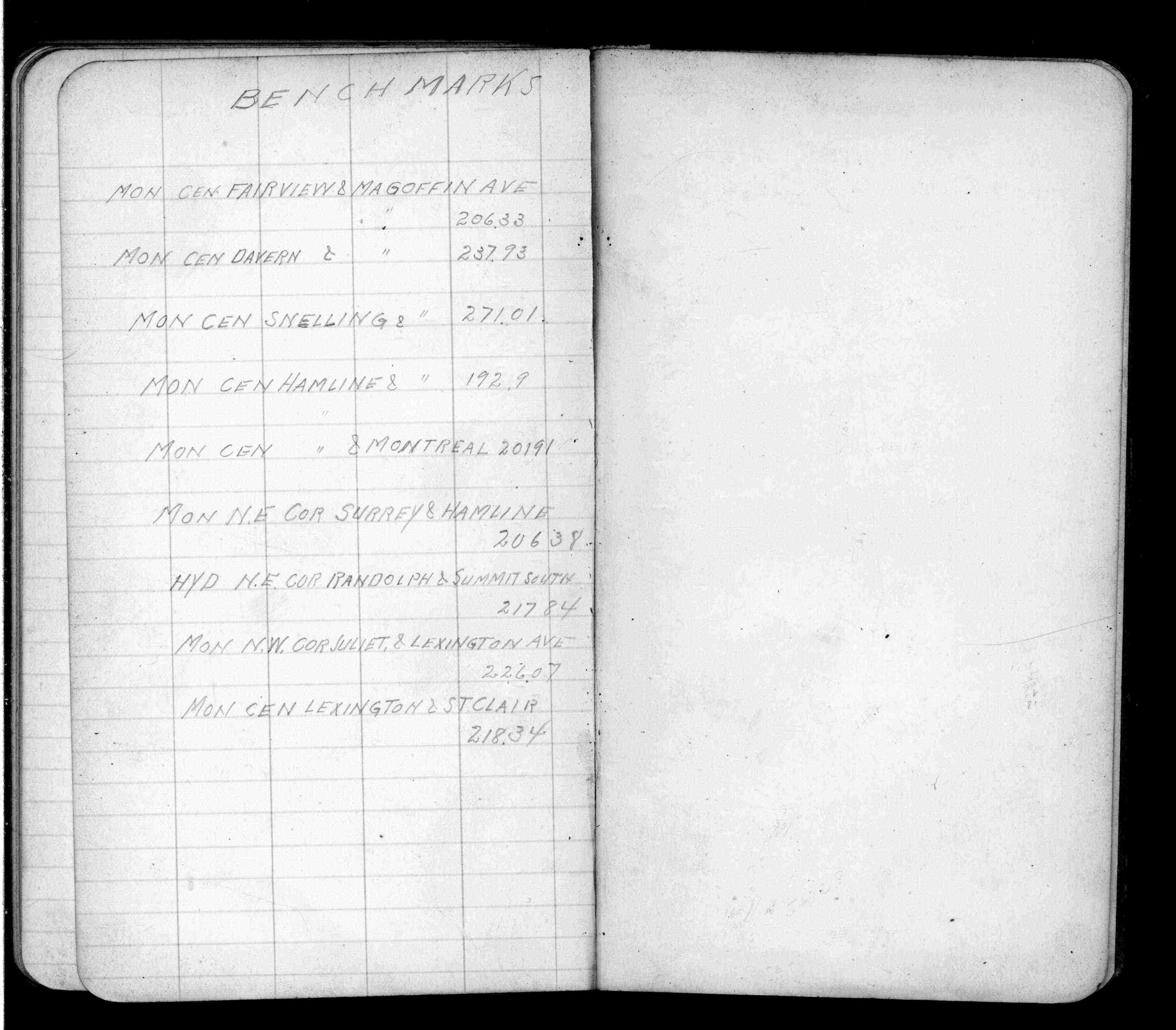
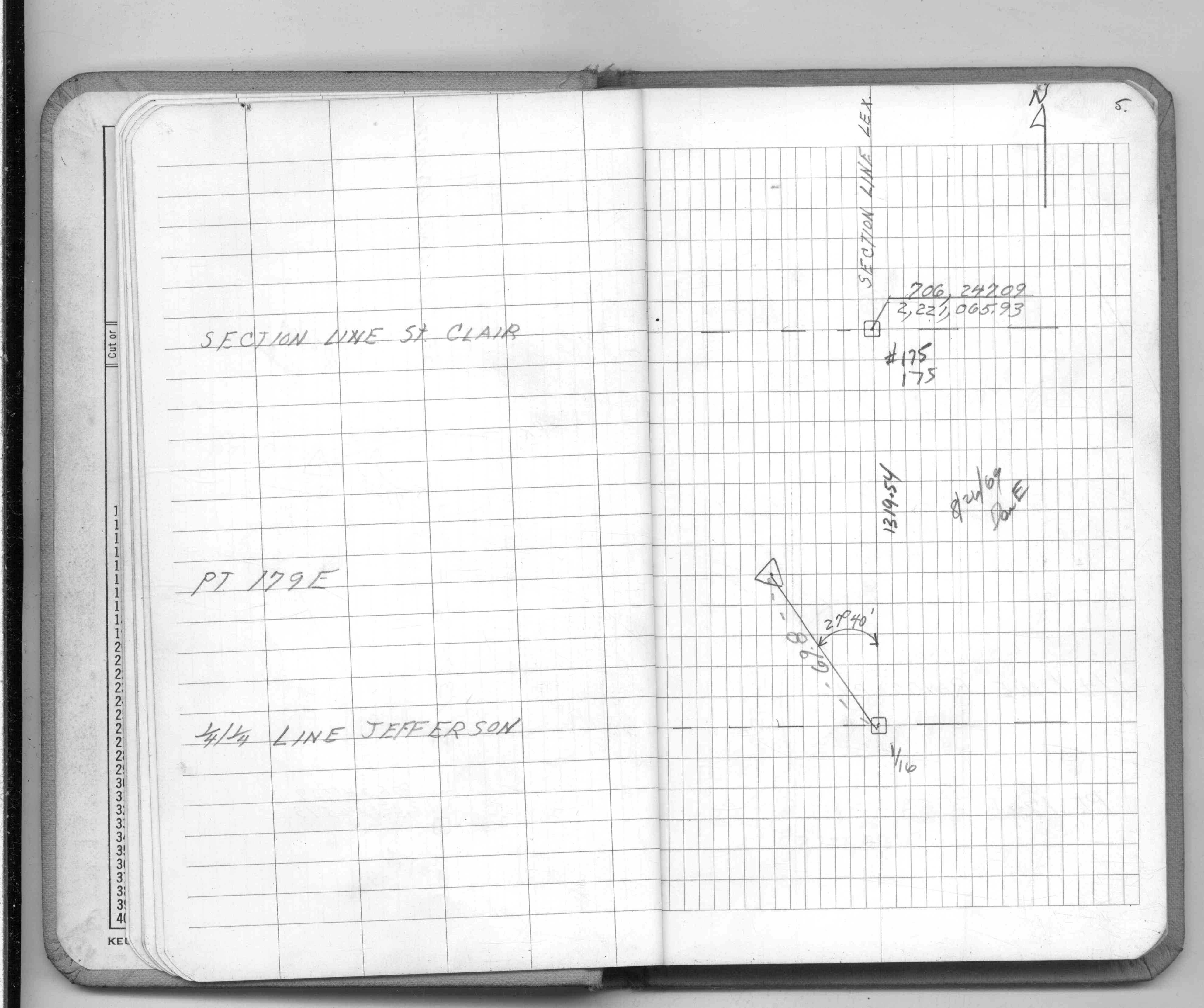
| 1/1/1912 | Recorded elevation of 218.34 on the monument. See FB 675 p.79 |
| 10/1/1847 | (Unknown date Oct __, 1847 ) Isaac N Higbee deputy surveyor set post. Tied to 2 BTs. See IH p.004-005 2823 |
| 1/1/1800 | (Unknown date ___ __, 18?? ) Elev 218.337 ft on GM. See Old Benches Book, Entry 1259 |
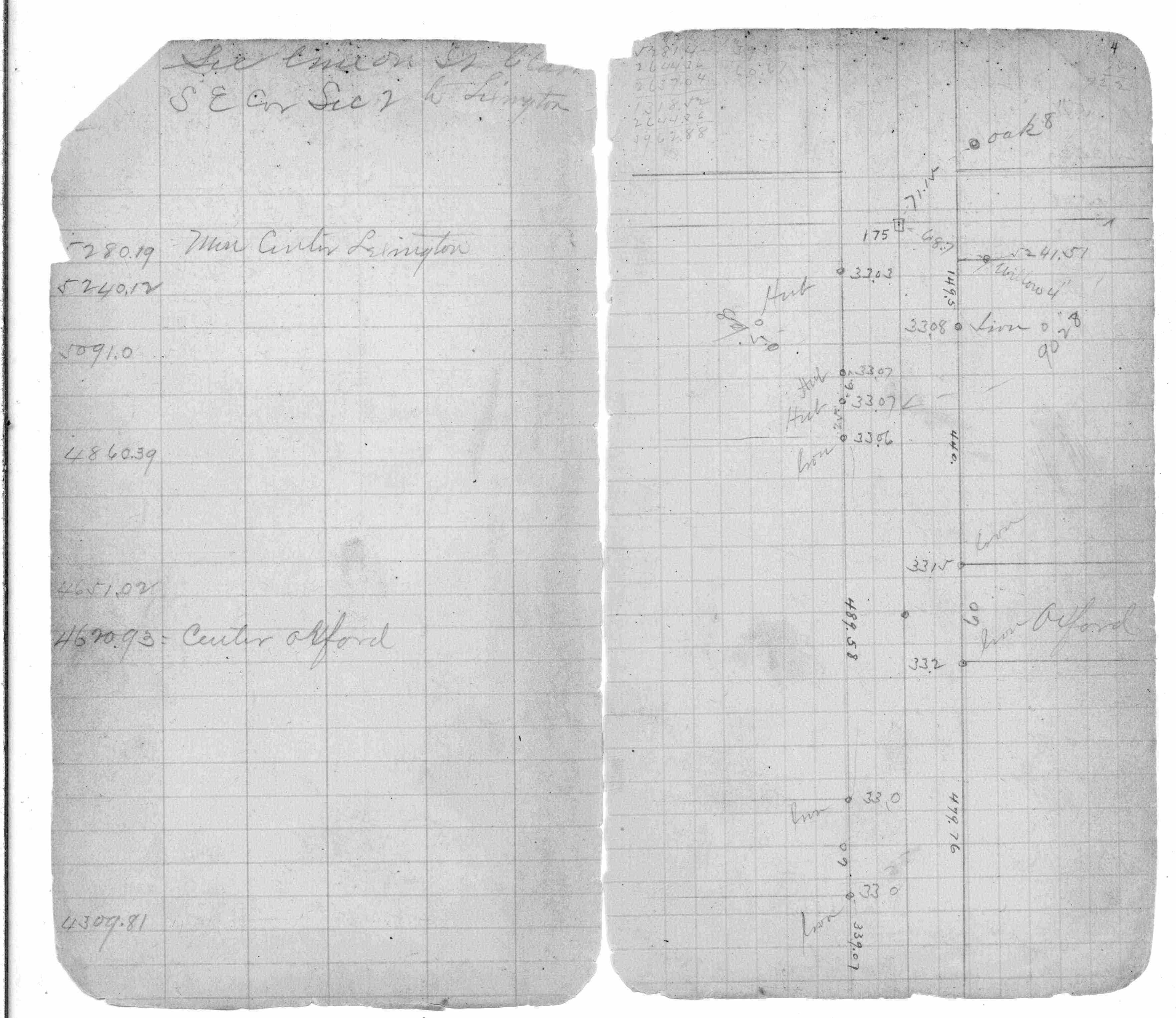
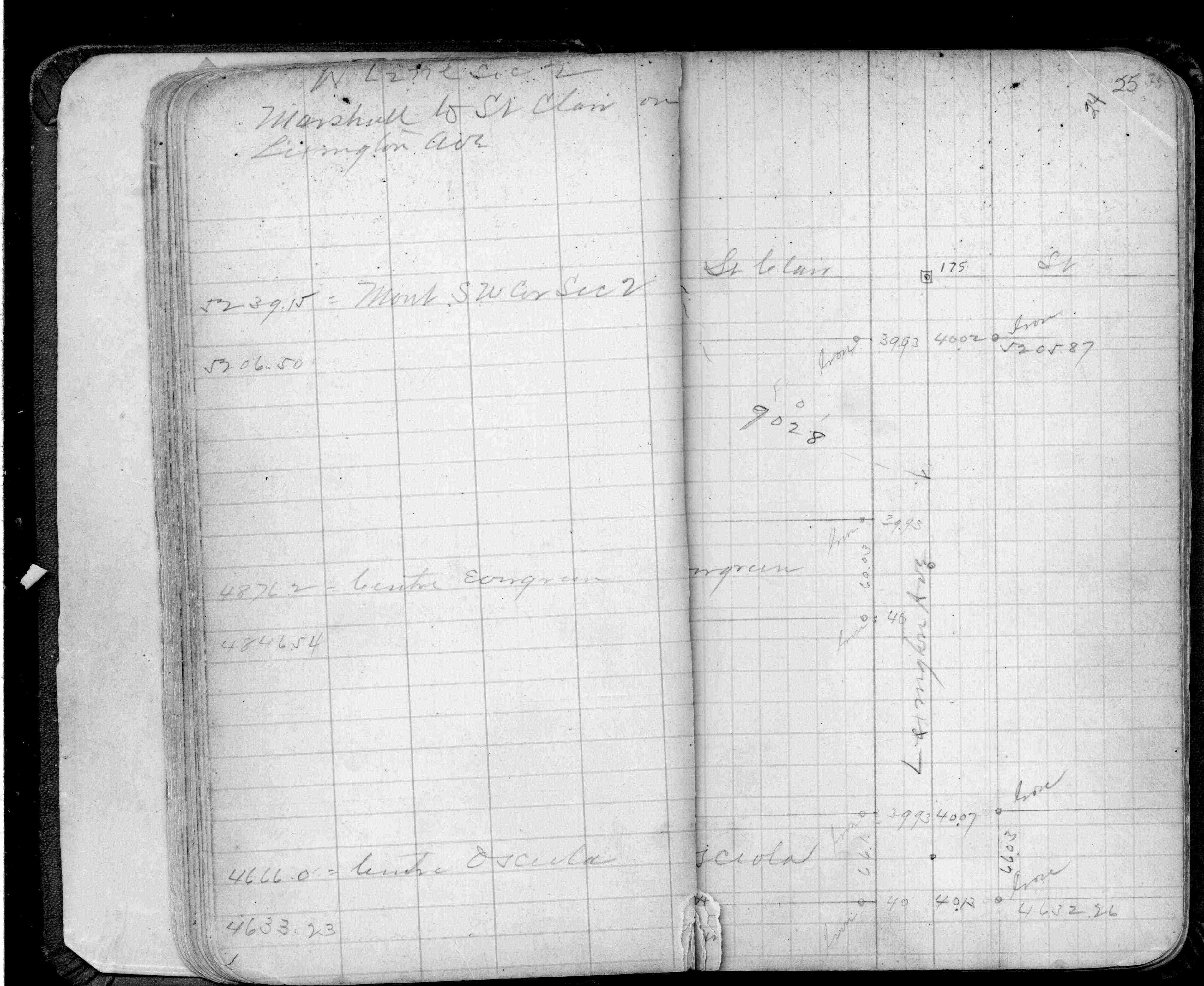
| 1/1/1800 | (Unknown date ___ __, ____ ) Survey on St Clair from Dale St to Lexington Ave. See JBI 02 p.01-02 |
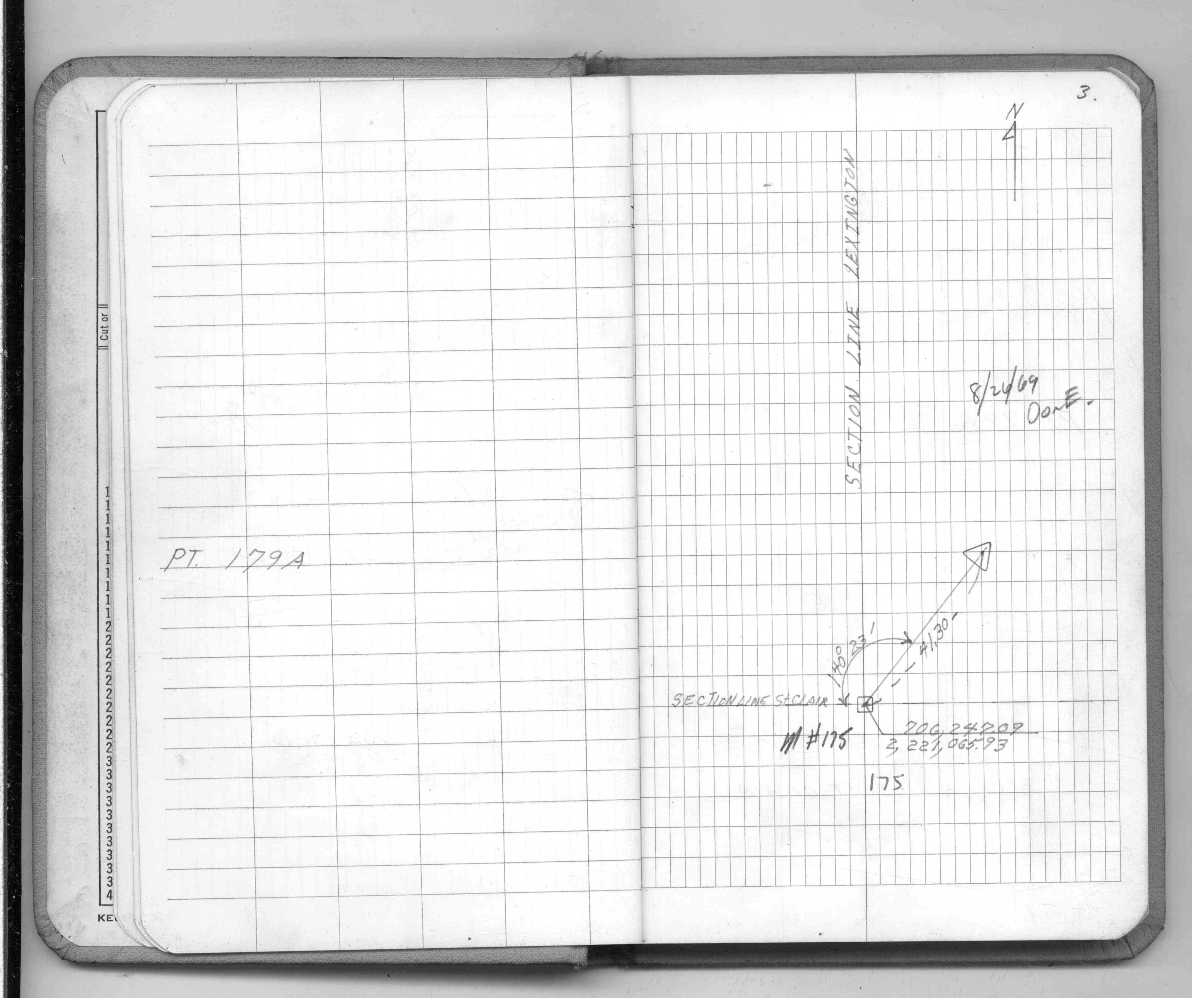
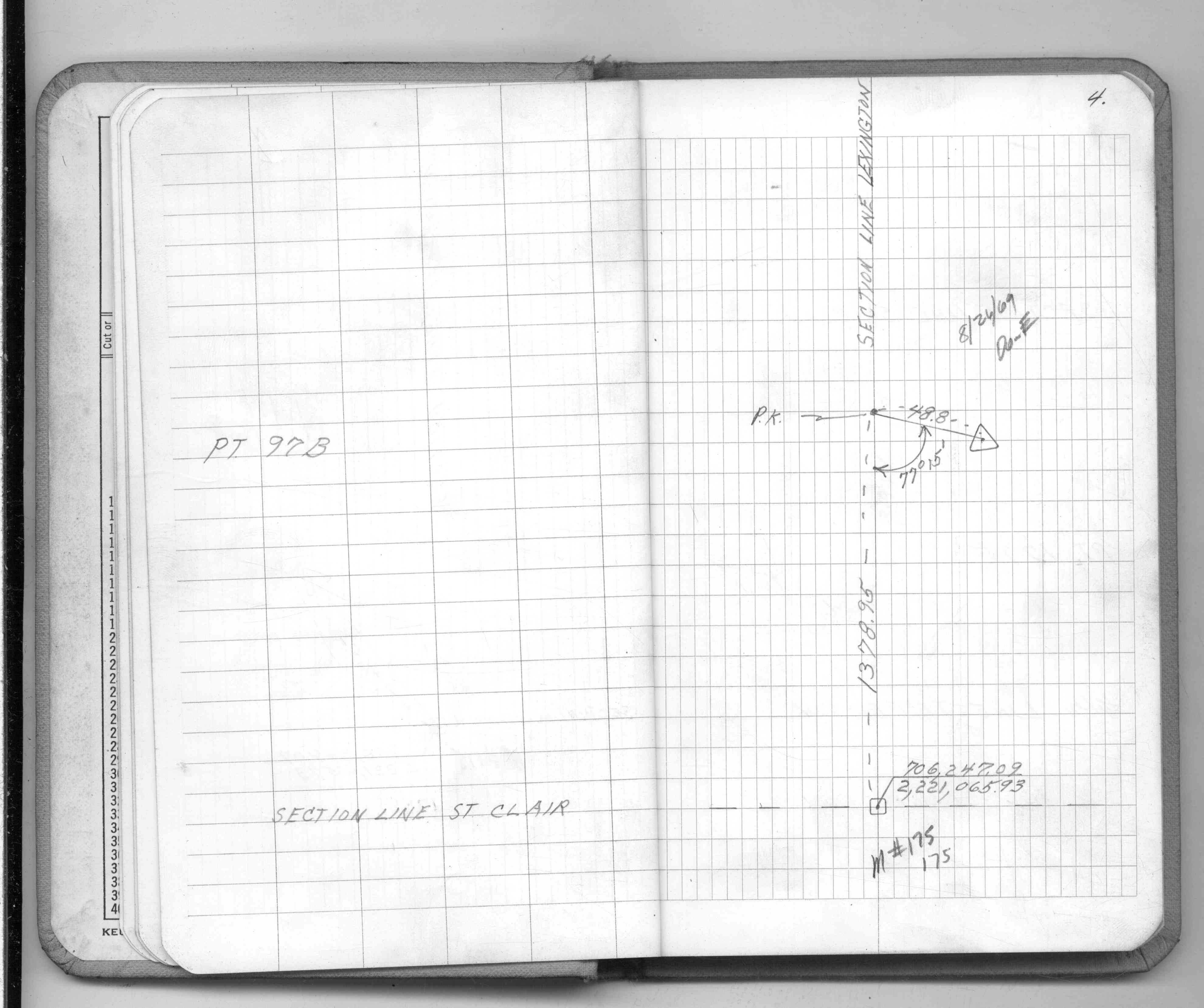
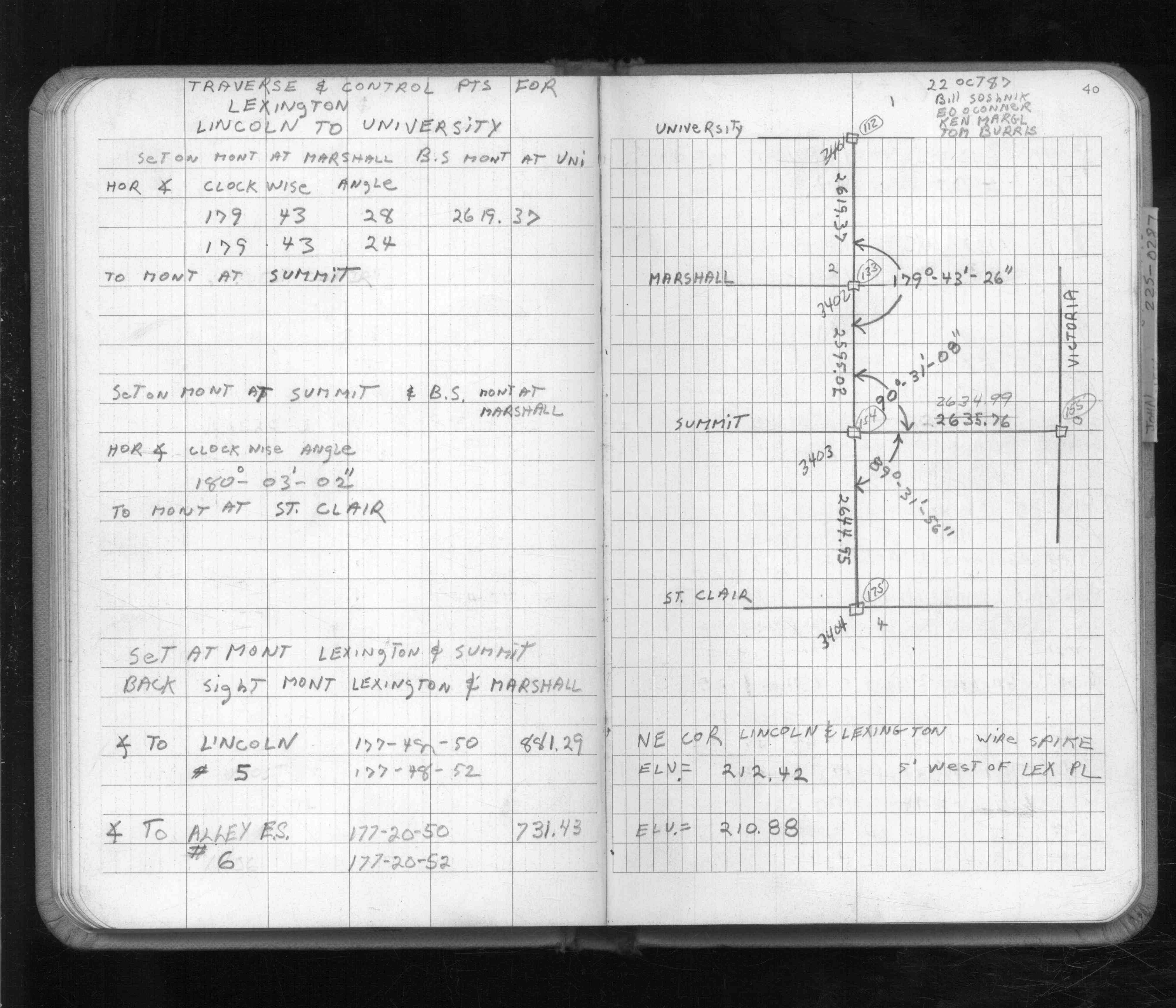
| 1/1/1800 | (Unknown date ___ __, ____ ) Monument set at SW Cor Sec 2-28-23 by J H Armstrong (St Clair & Lexington) |
Above is NOT an all inclusive history of this point. Please review all the links below.
| PLS NOTES | Field | Cross Section | Sewer | J.B. Irvine | Monument | River Survey |
|---|---|---|---|---|---|---|
| IH p.004-005 | FB 0138p.68 | JBI 02 p.01-02 | ||||
| FB 0220p. 04 ,24 | ||||||
| FB 0229CPYp. 15 ,26 | ||||||
| FB 0675p.79 | ||||||
| FB 1241p. 38 ,45 | ||||||
| FB 1549Cp. 03 ,04 ,05 | ||||||
| FB 1549Mp.01 | ||||||
| FB 1592p. 02 ,40 | ||||||
| FB 1673Ap. 54 ,56 ,60 | ||||||
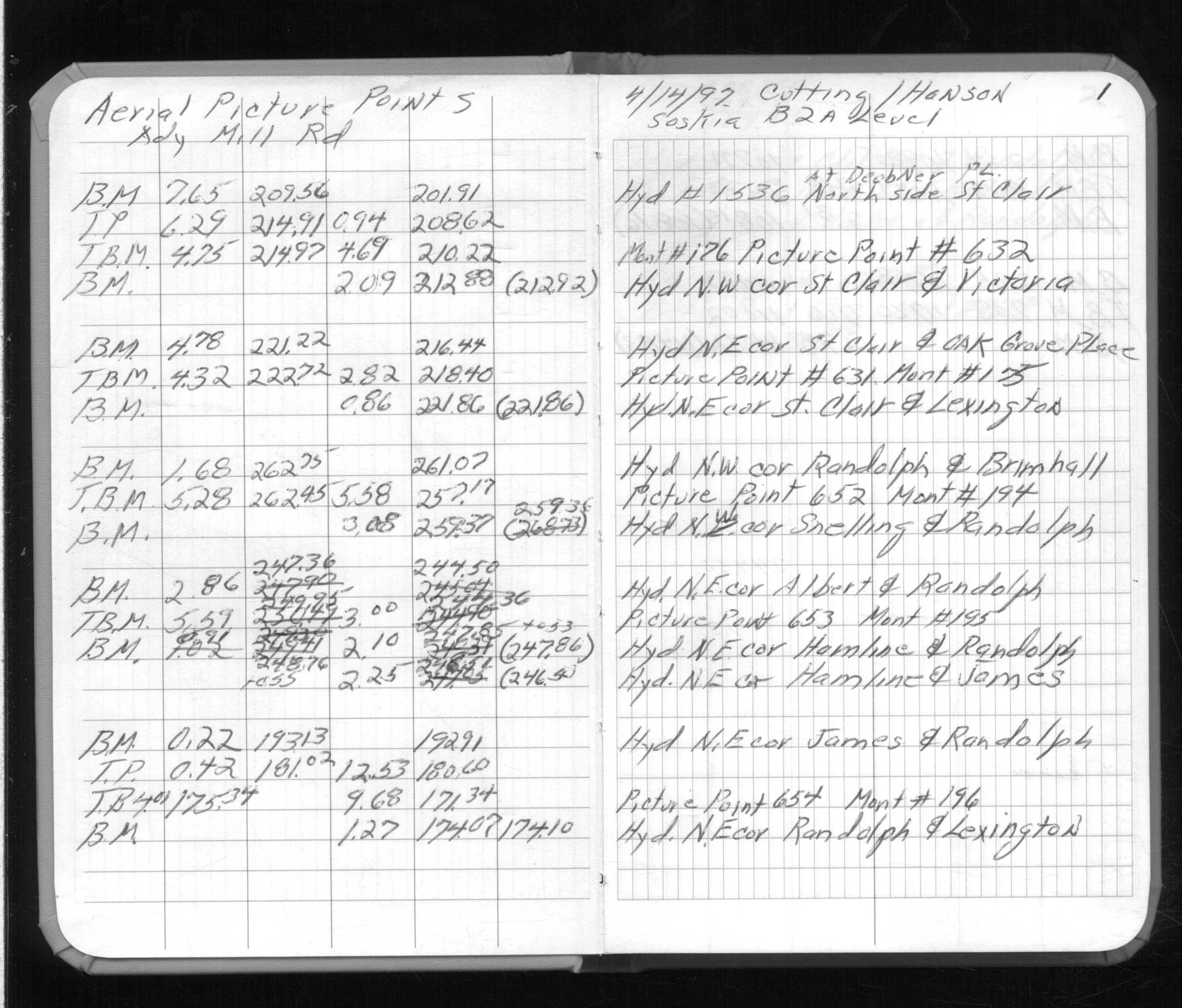
| FB 1736p.21 |
| FILE | SURVEYOR | LIC. NO. | DATE SIGNED | DATE TIED |
|---|---|---|---|---|
| 0175-0131-A.tif | William J. Cutting | 20576 | none | September 26, 1989 |
| ST_157-234p175.jpg | none | none | none | none |
| 0175-0131-A.dwf | none | none | none | none |
| FILE | PHOTO DATE | COMMENTS |
|---|---|---|
| 0175-0131-9.jpg | June 30, 2007 | Close-up of the GM with the PIN removed. |
| 0175-0131-6.jpg | June 30, 2007 | PIN in the GM. |
| 0175-0131-4.jpg | June 30, 2007 | Digging for the GM. |
| 0175-0131-13.jpg | June 30, 2007 | Casting placed over the GM. |
| 0175-0131-2.jpg | May 10, 2007 | Digging for the GM. |
| 0175-0131-1.jpg | May 10, 2007 | Iron PIN near MH. |