| NAD83 COORDINATES (1986 adj.): |
|---|
| * X= 569242.550 Y= 152262.613 Z= 000.00 LSQ 12/06/1991 S FLT |
| X= 569242.56 Y= 152262.74 Z= 779.50 04/16/2008 RTK-VRS |
| 4/16/2008 | Position on CIM established by RTK-VRS GPS. Elevation 779.5 ft. |
| 10/29/2002 | Placed ties on CIM. See CofL 0178-0137-C |
| 10/29/2002 | Photos taken. |
| 10/27/2002 | Set CIM from ties taken on Apr 16, 2002. Hydrant tie did not fit the 3 other ties, therefore tie not used. |
| 10/25/2002 | Fd GM 1.2 ft below grade & tipped approx 0.5 ft west. Left GM as found. See CofL 0178-0137-B |
| 4/16/2002 | Photos taken. |
| 4/16/2002 | Fd GM 1.1 ft below grade inside 6" dia CI pipe, placed ties, left GM as found. See CofL 0178-0137-B |
| 4/15/2002 | Elev 84.42 ft on GM. Fd GM approx 1.0 ft below grade. 6" dia. CI pipe fd over GM. |
| 3/8/2000 | Marked north pk nail for painting target for 2000 aerial |
| 3/8/2000 | Fd 2 PKs, marked north pk, checked ties, retied. See CofL 0178-0137-A |
| 3/1/1987 | (Unknown date Mar __, 1987 ) CIM set 1.0 ft below grade inside CI pipe w/cover |
| 1/1/1886 | (Unknown date ___ __, 1886 ) Tie to Cor of stone bldg taken in 1886 |
| 1/1/1885 | (Unknown date ___ __, 1885 ) Monument set by measuring from #136 by F J McCann |
| 10/1/1847 | (Unknown date Oct __, 1847 ) Isaac N Higbee deputy surveyor set post. Tied to 2 BTs. See IH p.000-001 2823 |
Above is NOT an all inclusive history of this point. Please review all the links below.
| PLS NOTES | Field | Cross Section | Sewer | J.B. Irvine | Monument | River Survey |
|---|---|---|---|---|---|---|
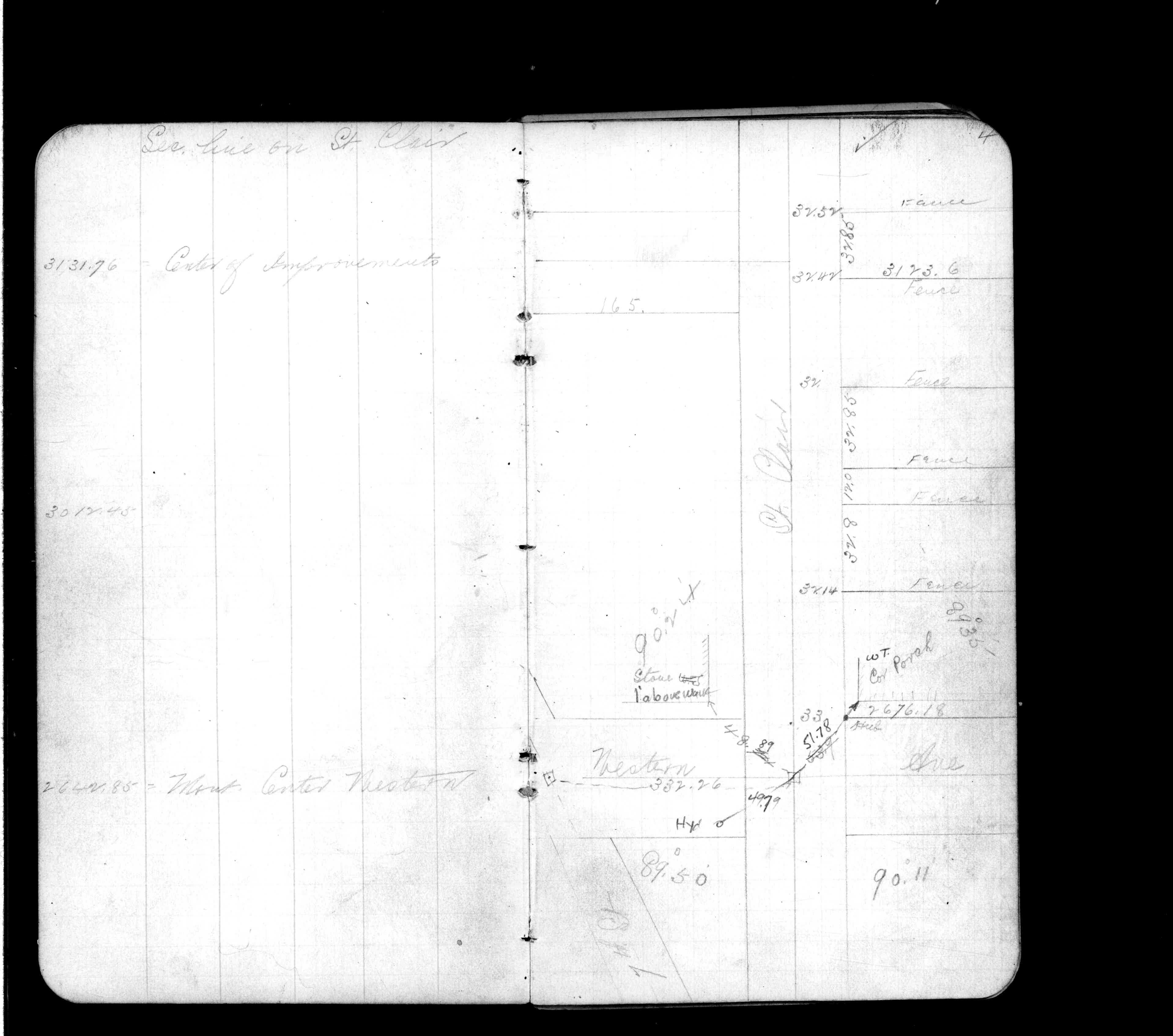
| IH p.000-001 | FB 0187p.54 | |||||
| FB 0263CPYp.04 | ||||||
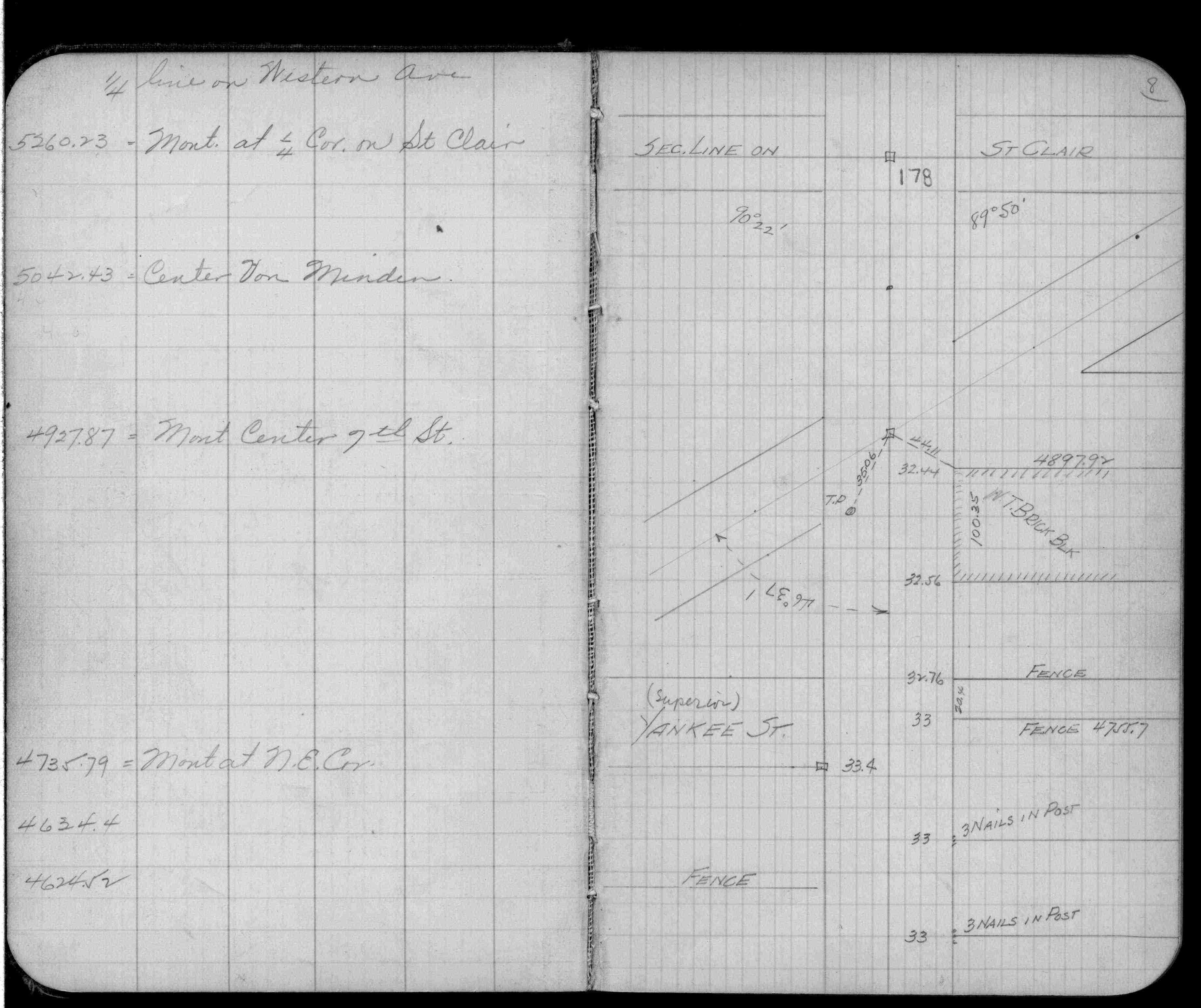
| FB 0265p.08 | ||||||
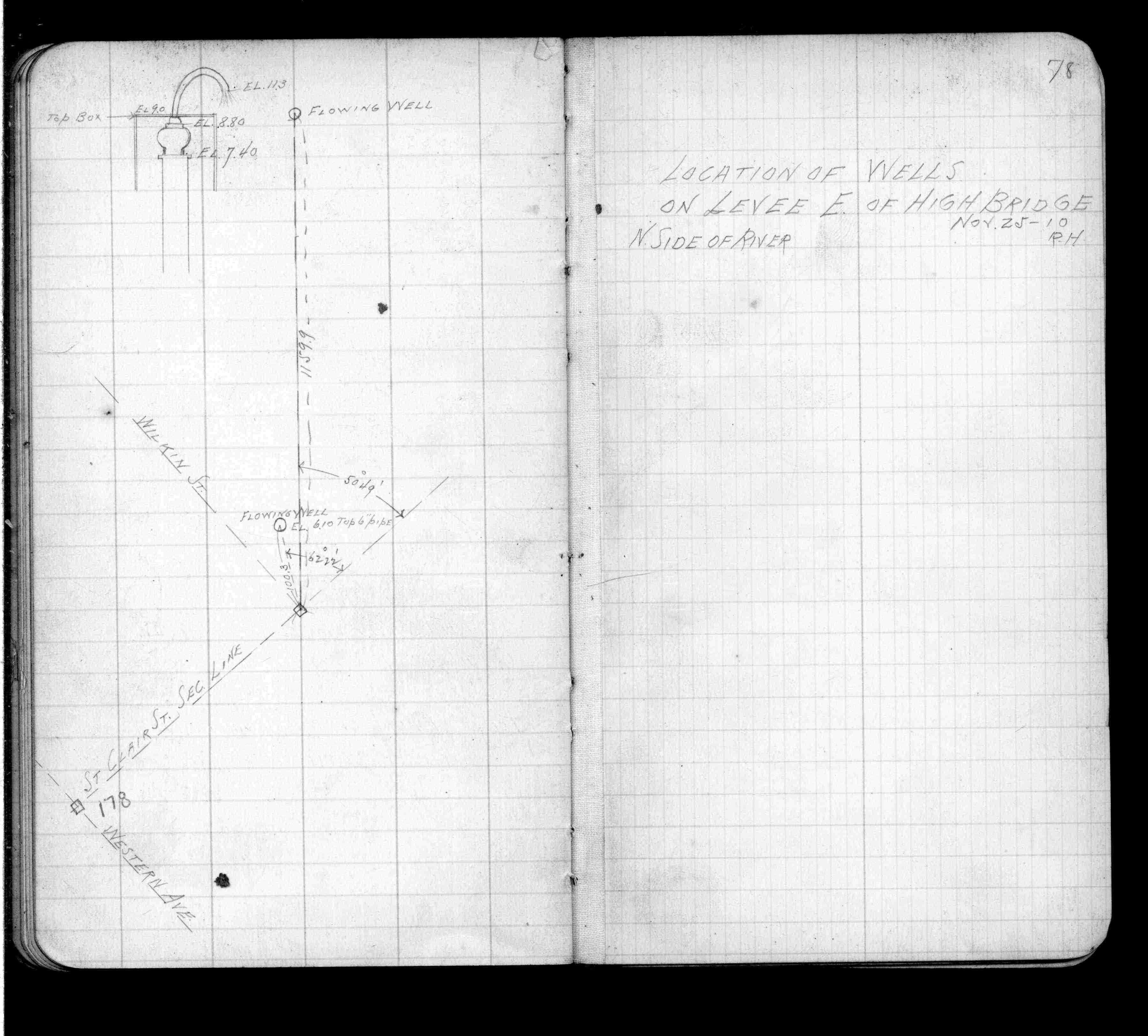
| FB 0660p.78 | ||||||
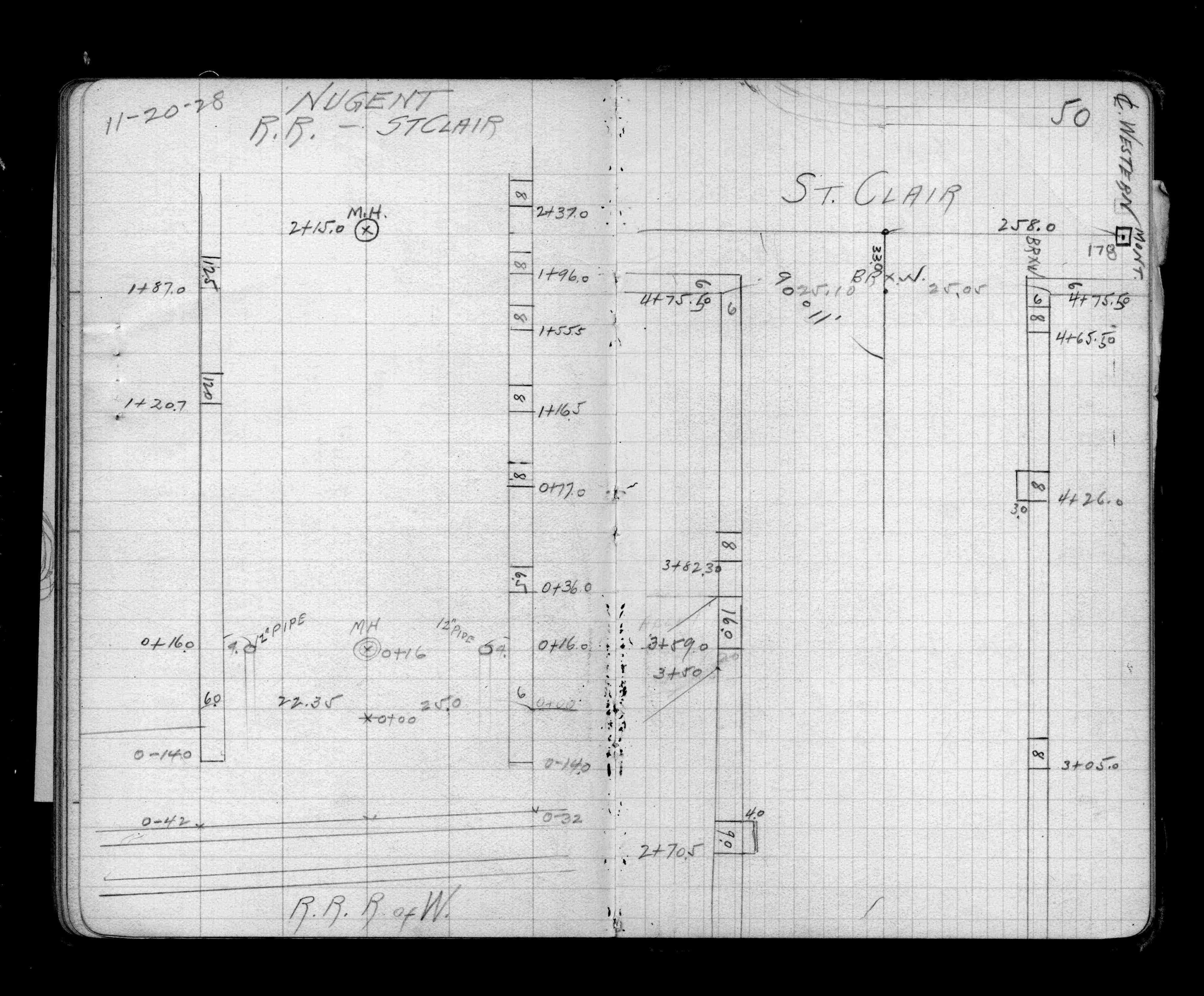
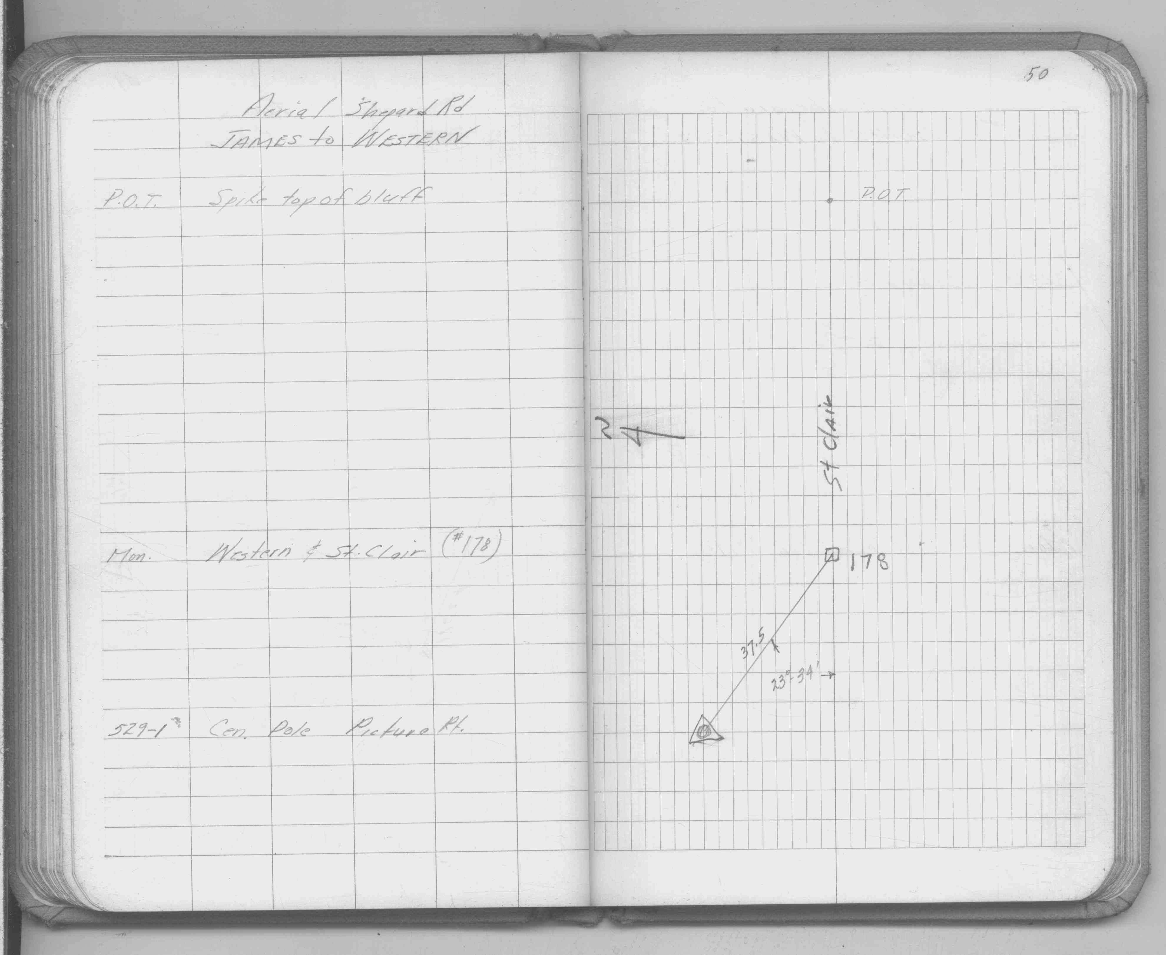
| FB 1226p.50 | ||||||
| FB 1259p. 01 ,02 ,04 | ||||||
| FB 1287Bp.06 | ||||||
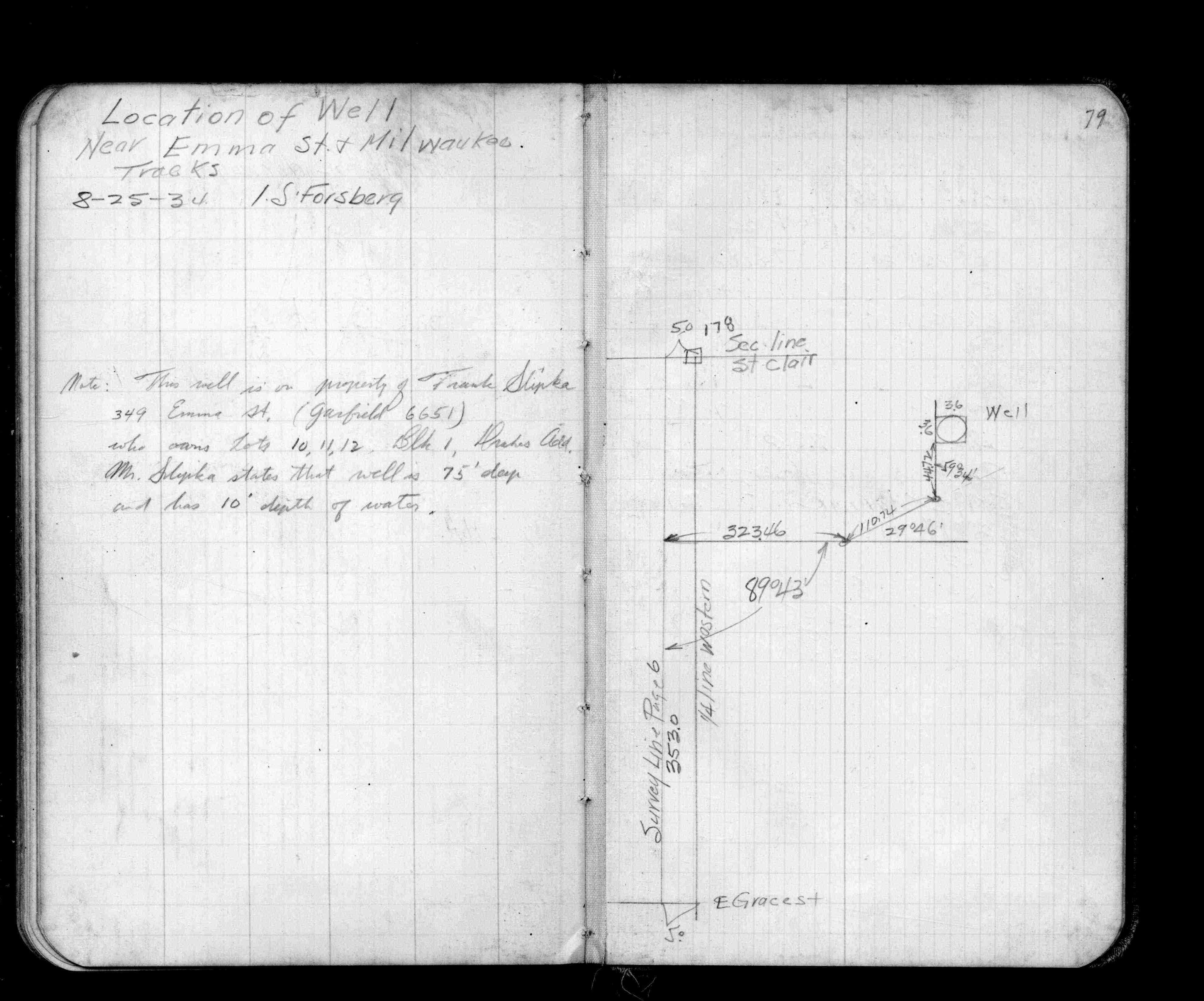
| FB 1296p. 06 ,79 | ||||||
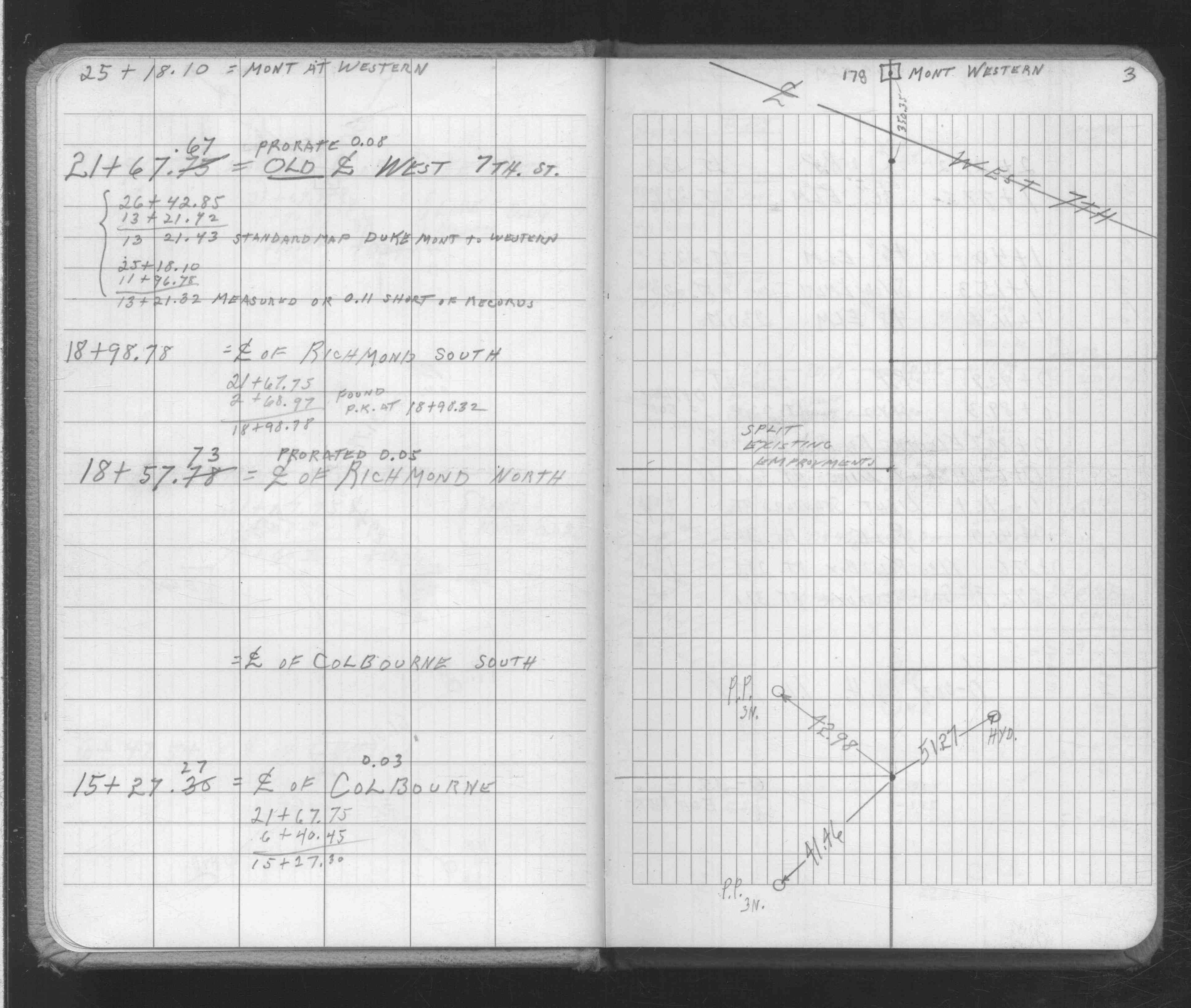
| FB 1549Cp.23 | ||||||
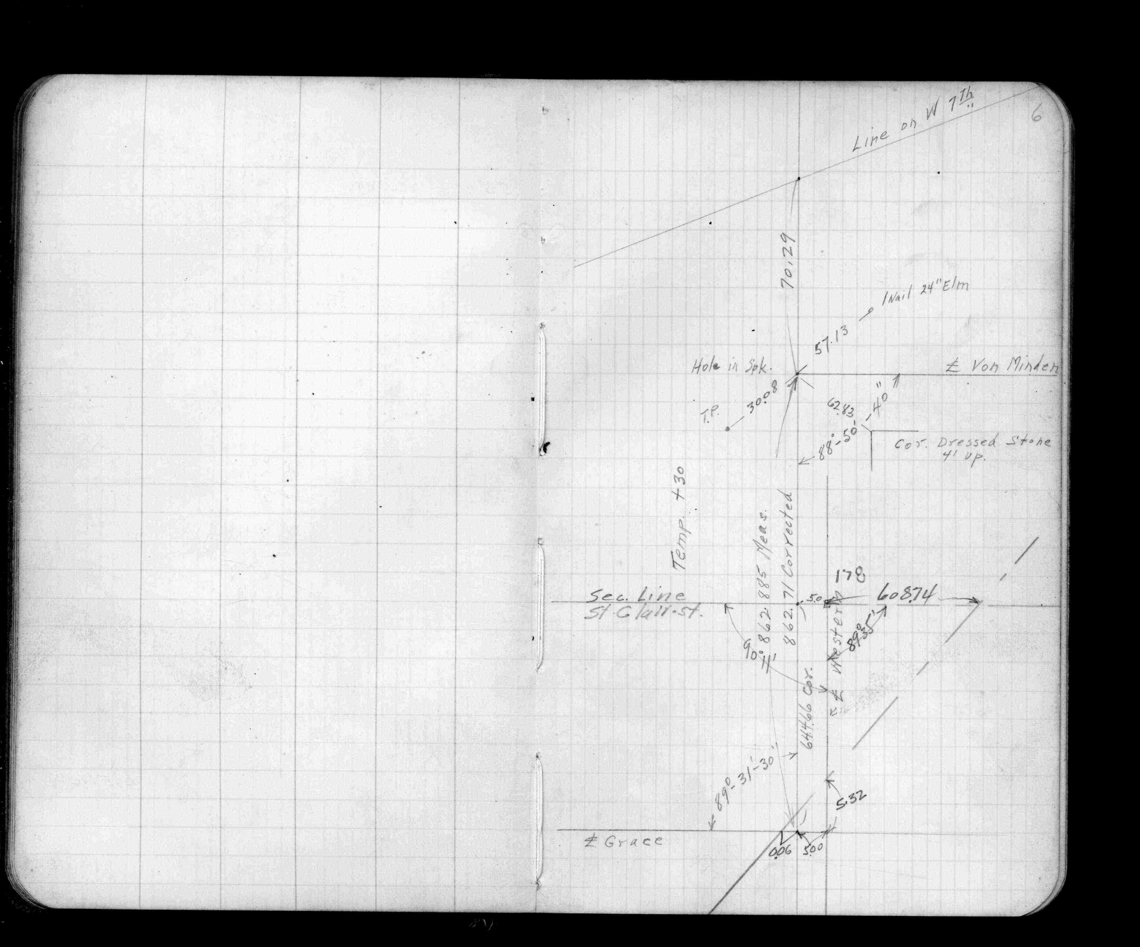
| FB 1549Ep.50 | ||||||
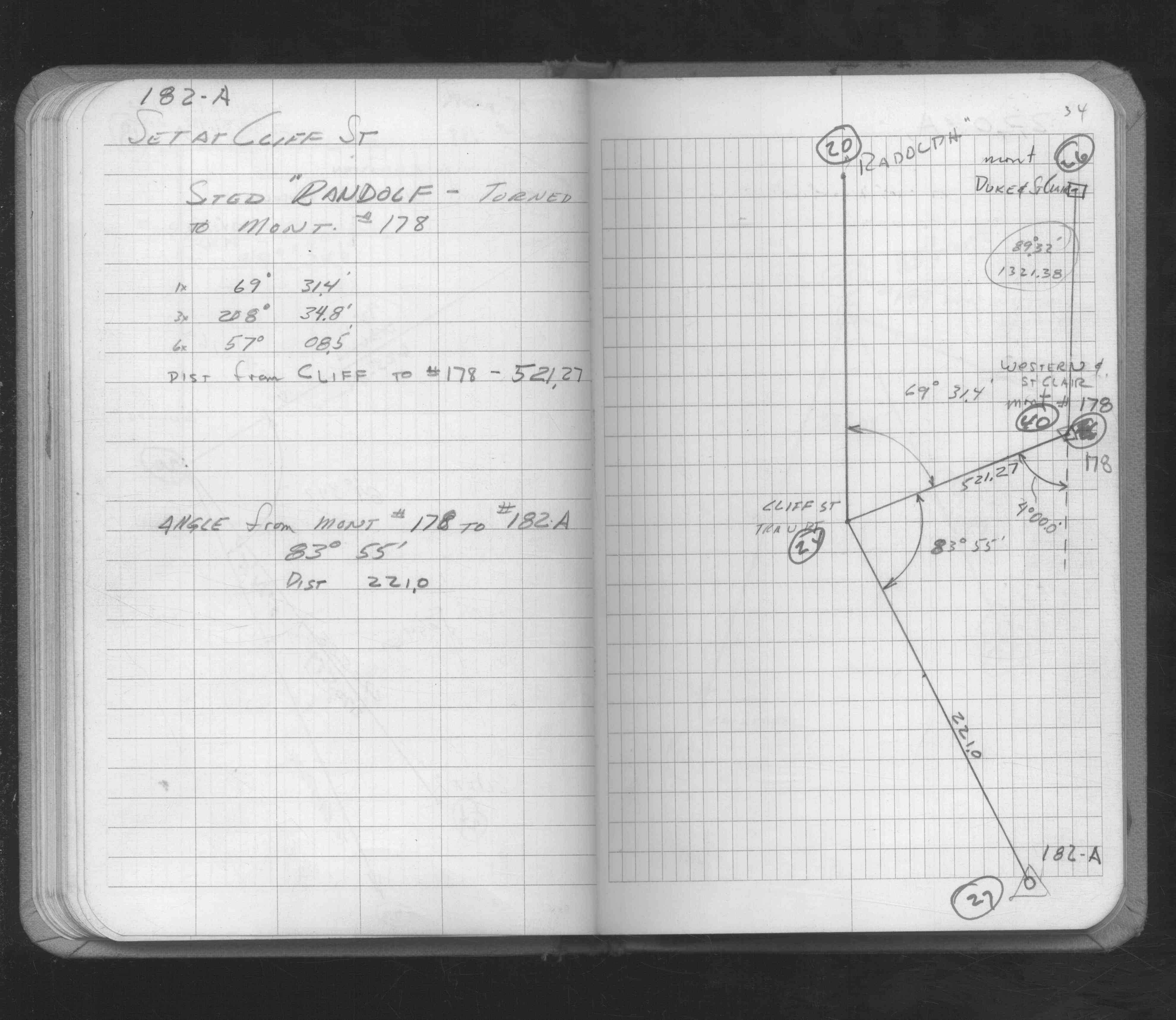
| FB 1549Gp.34 | ||||||
| FB 1654p.03 | ||||||
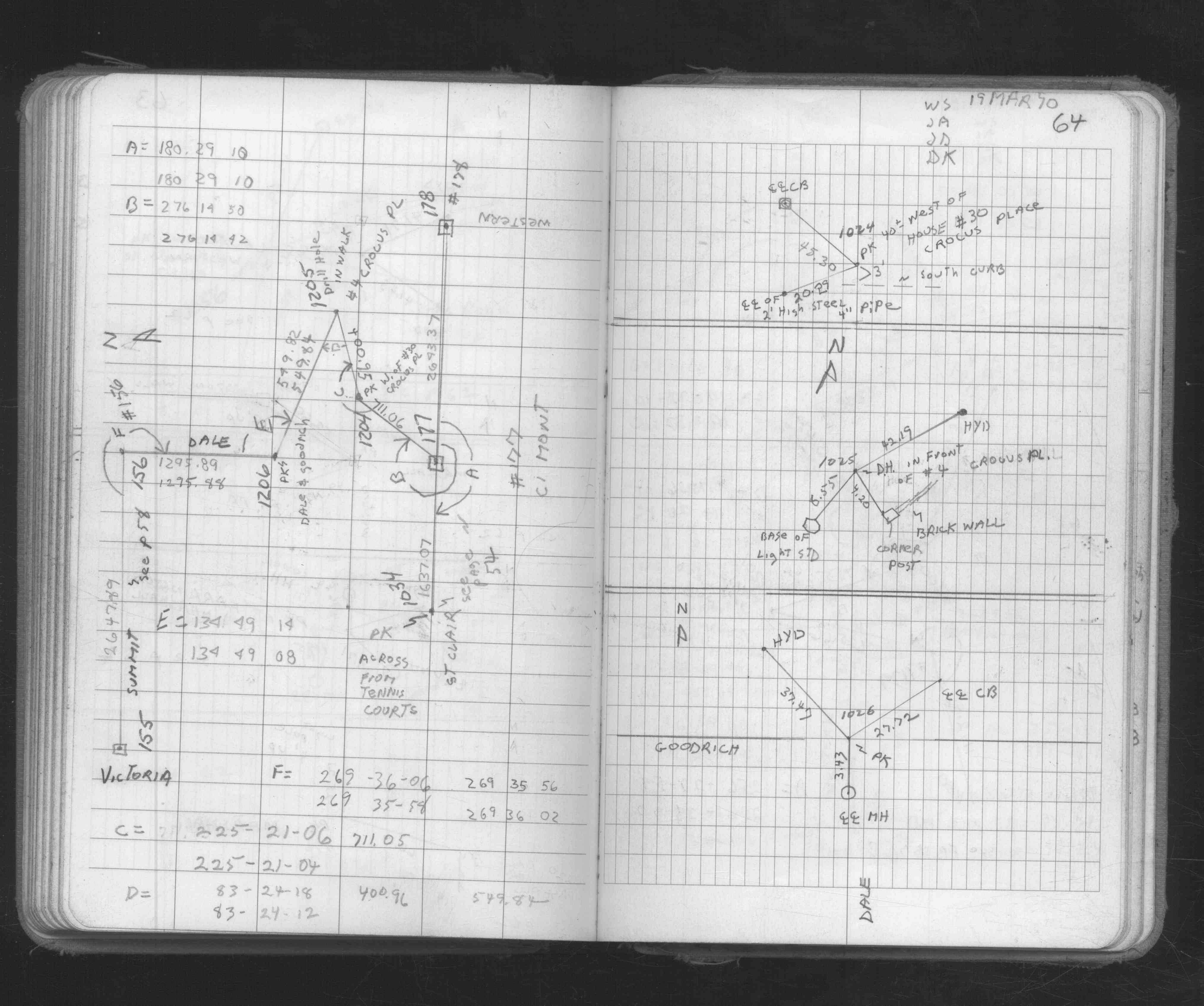
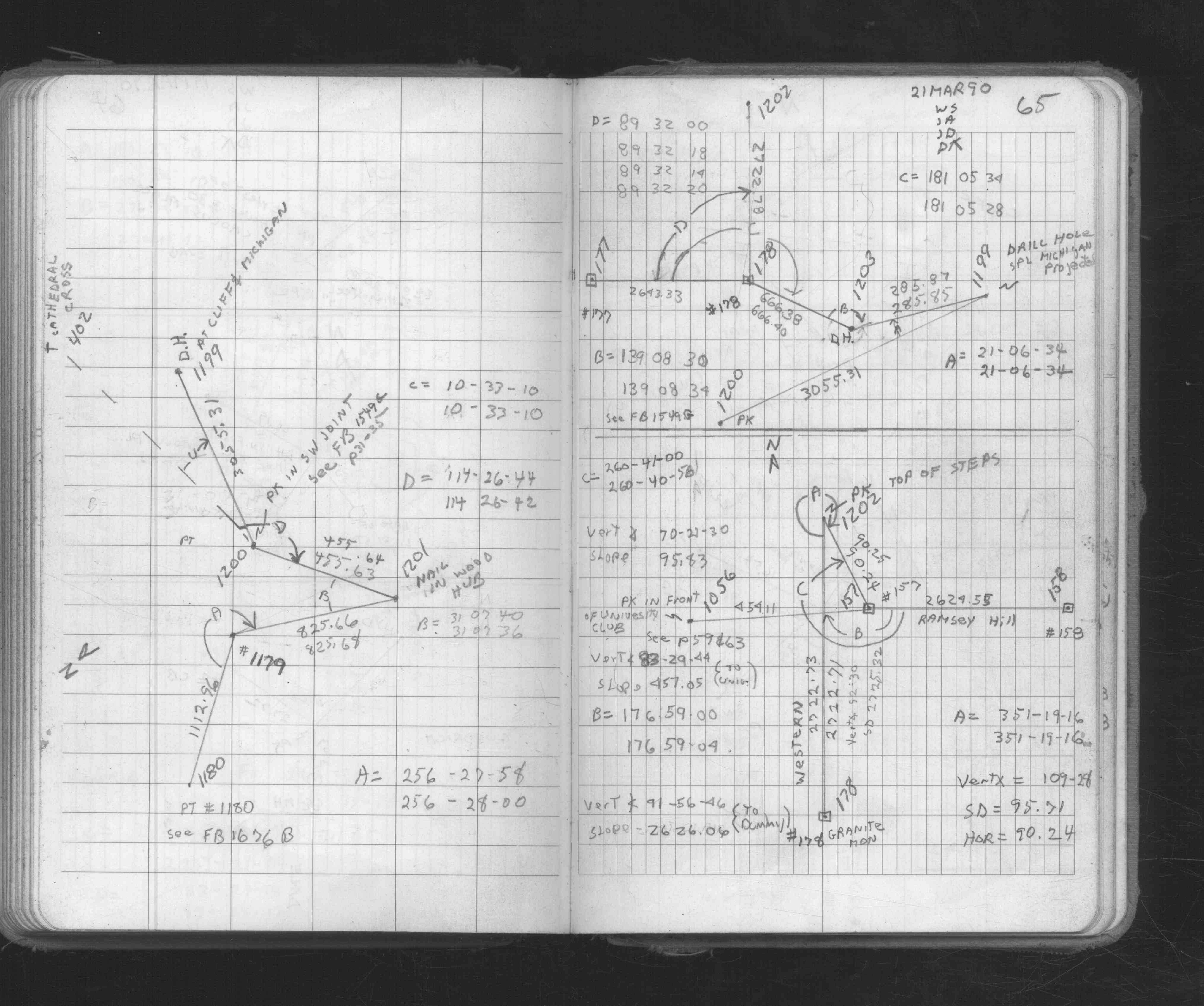
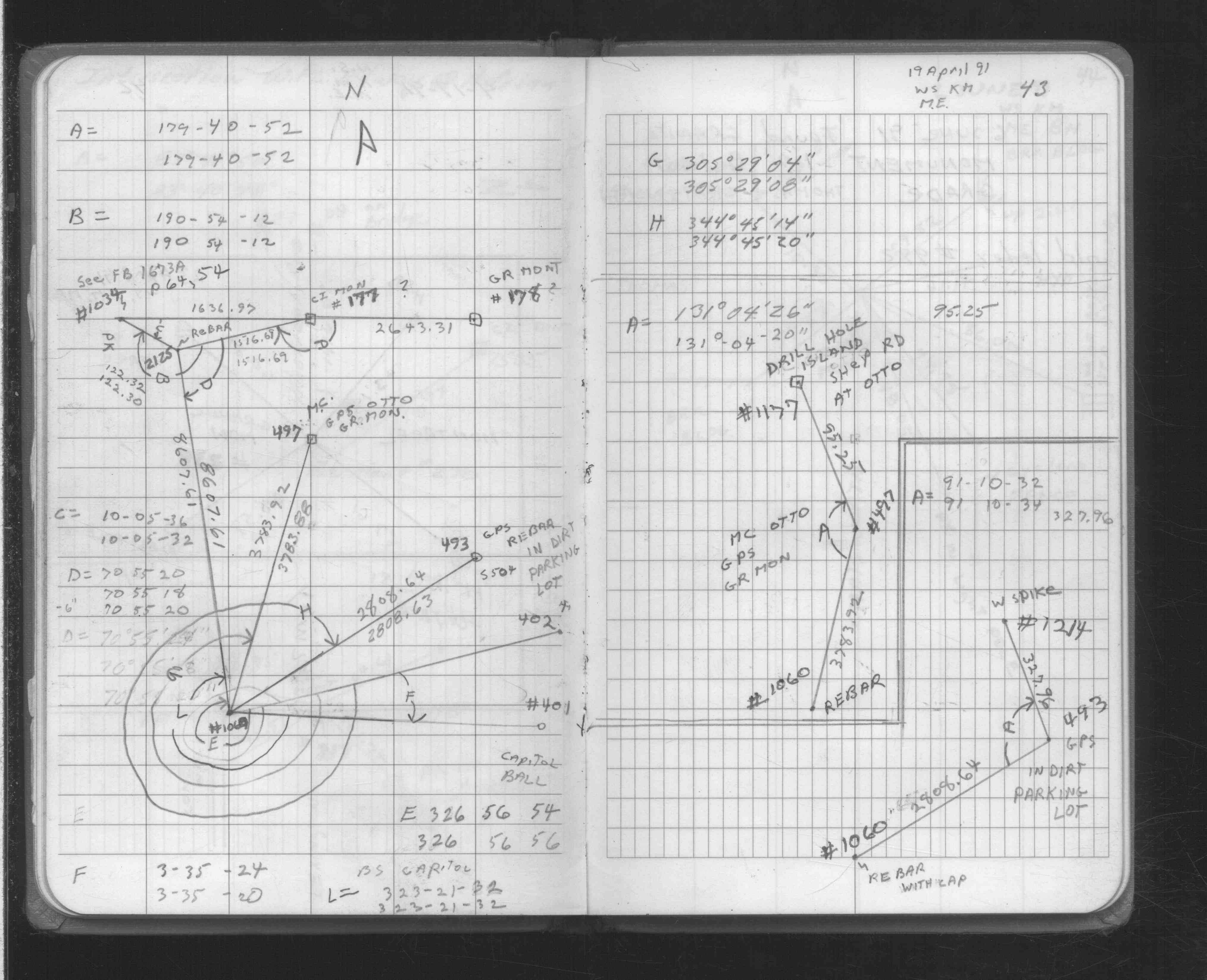
| FB 1673Ap. 64 ,65 | ||||||
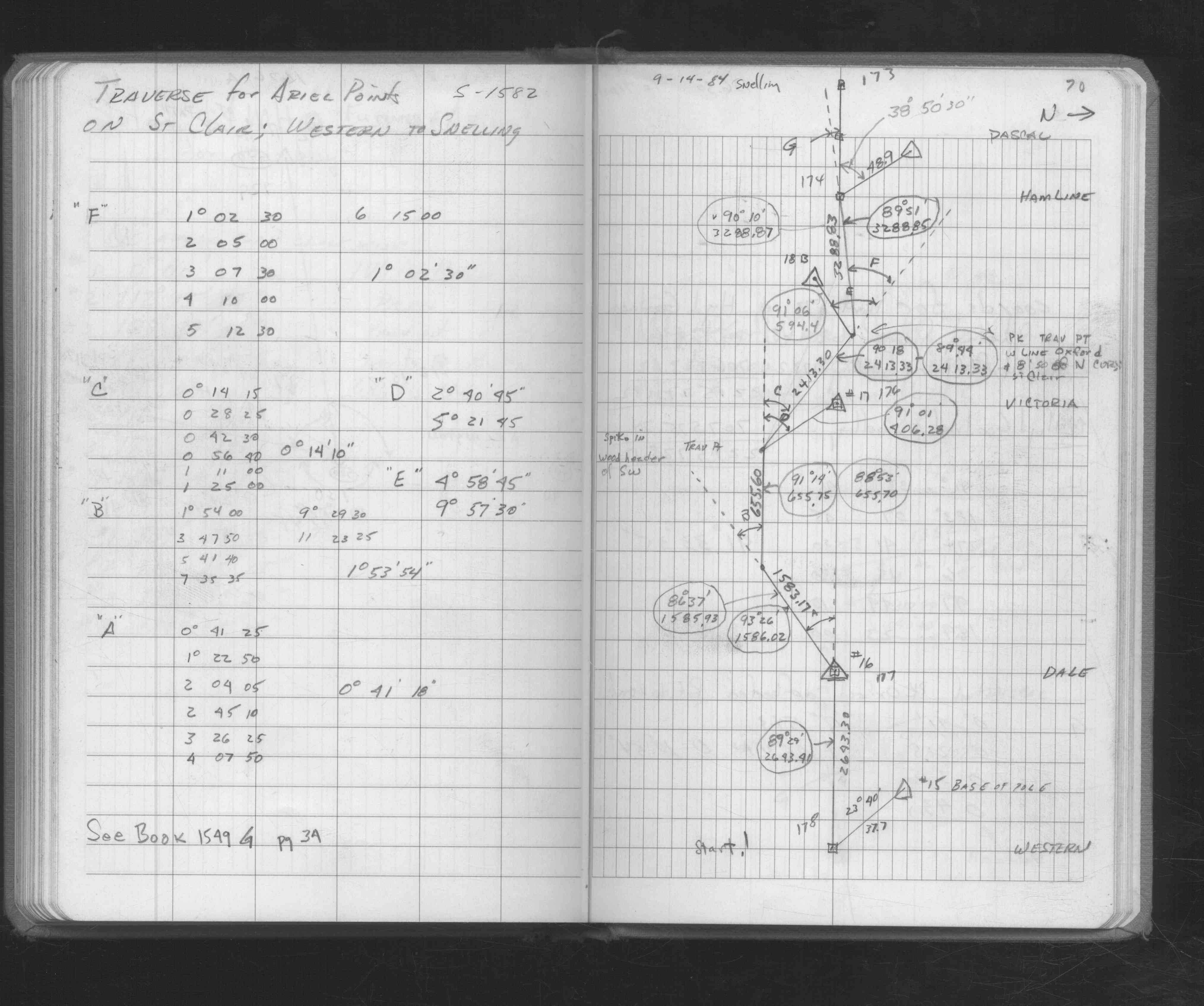
| FB 1676Ap.70 | ||||||
| FB 1708Ap.43 | ||||||
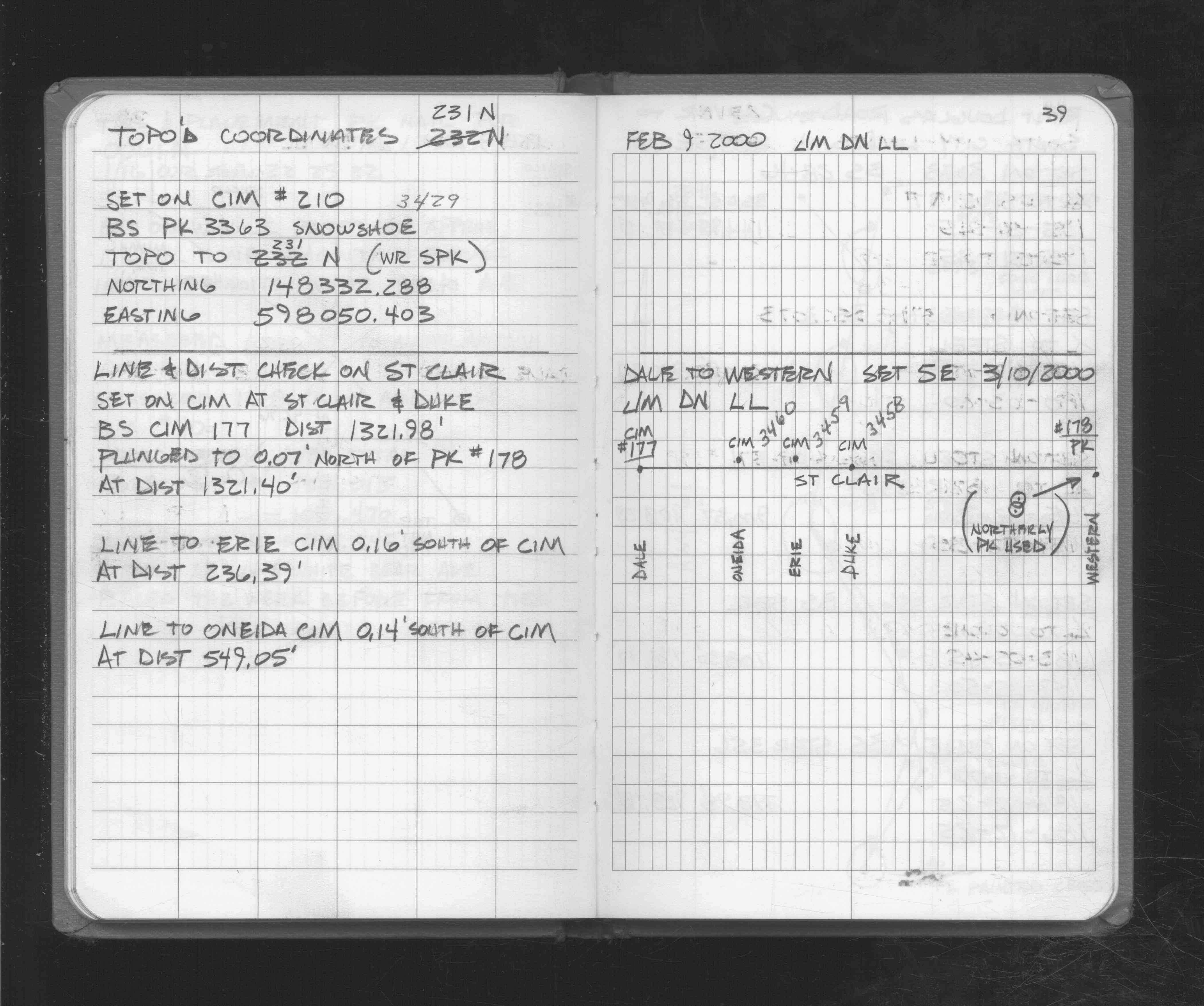
| FB 1721p.39 |
| FILE | SURVEYOR | LIC. NO. | DATE SIGNED | DATE TIED |
|---|---|---|---|---|
| 0178-0137-C.tif | Jeffery L. Grosso | 13144 | November 12, 2002 | October 25, 2002 |
| 0178-0137-B.tif | Jeffery L. Grosso | 13144 | April 17, 2002 | April 16, 2002 |
| 0178-0137-A.tif | Jeffery L. Grosso | 13144 | April 20, 2000 | March 8, 2000 |
| ST_157-234p178.jpg | none | none | none | none |
| 0178-0137-A.dwf | none | none | none | none |
| FILE | PHOTO DATE | COMMENTS |
|---|---|---|
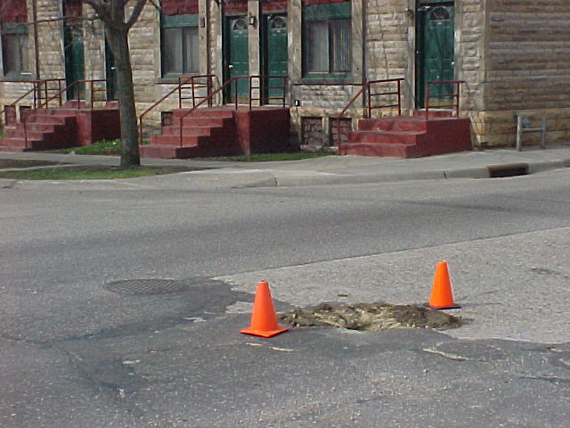
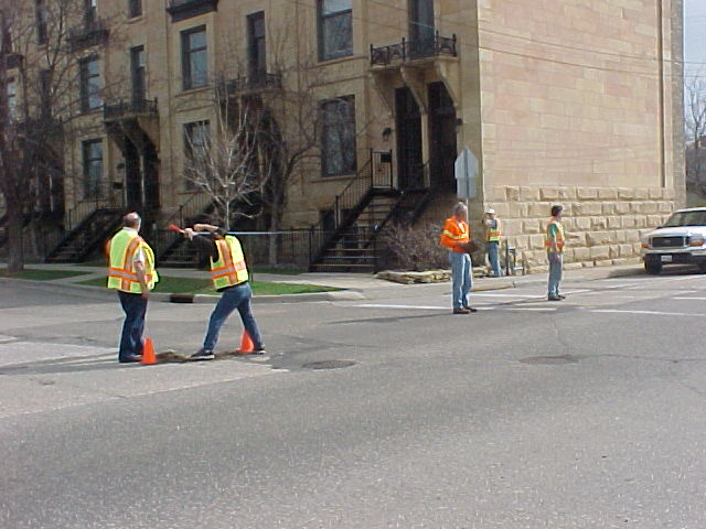
| 0178-0137-9.jpg | October 29, 2002 | CIM set to finish grade (wear course not yet placed). |
| 0178-0137-8.jpg | October 29, 2002 | Tipped GM 1.2 ft below base course, top of monument exposed. |
| 0178-0137-7.jpg | October 29, 2002 | Tipped GM 1.2 ft below base course. |
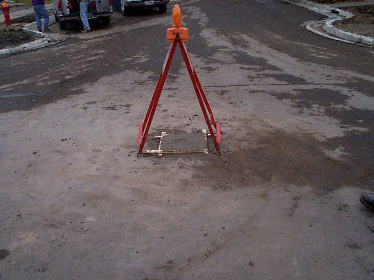
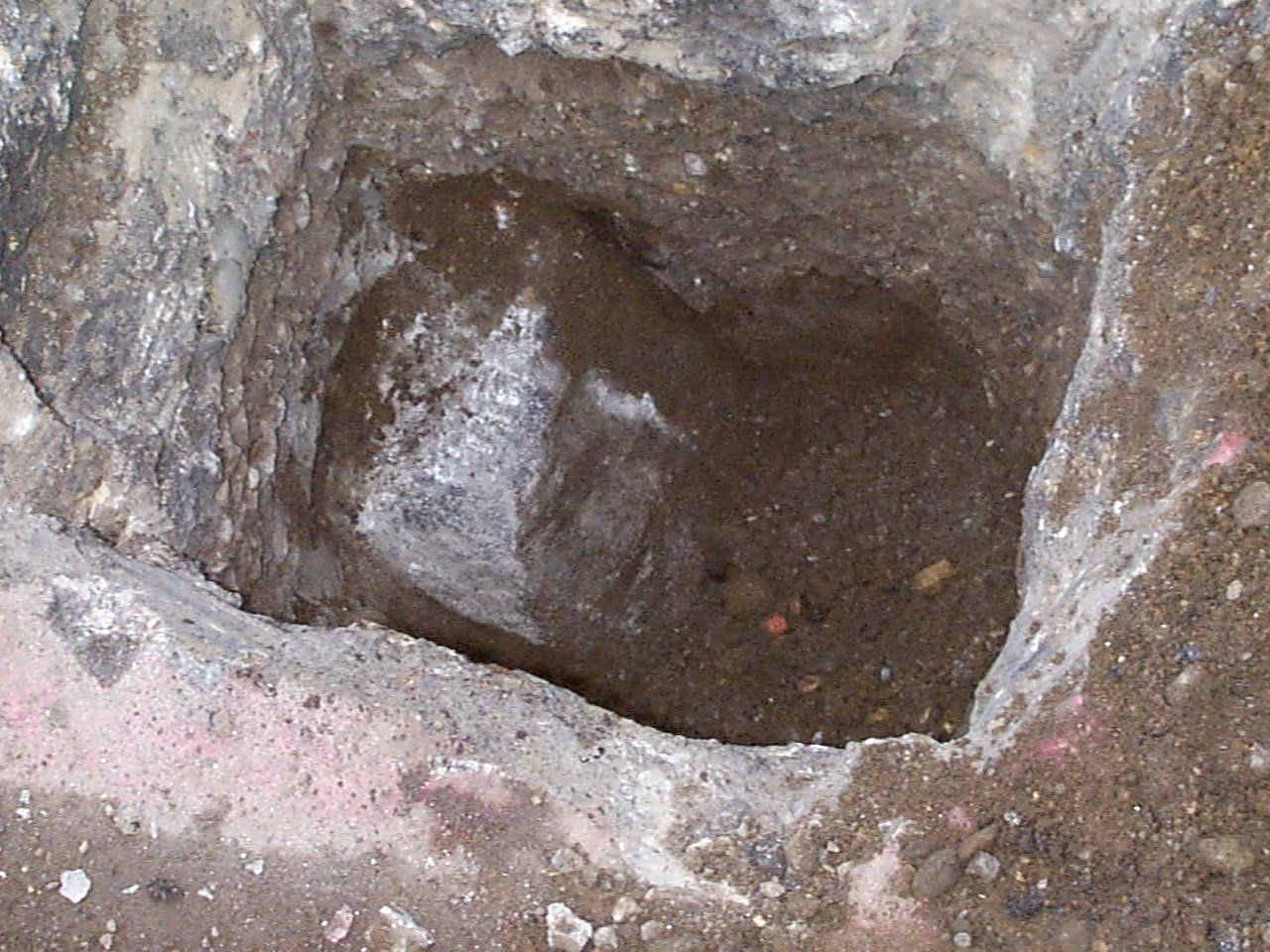
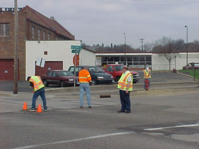
| 0178-0137-6.jpg | April 16, 2002 | Excavation hole looking southwesterly |
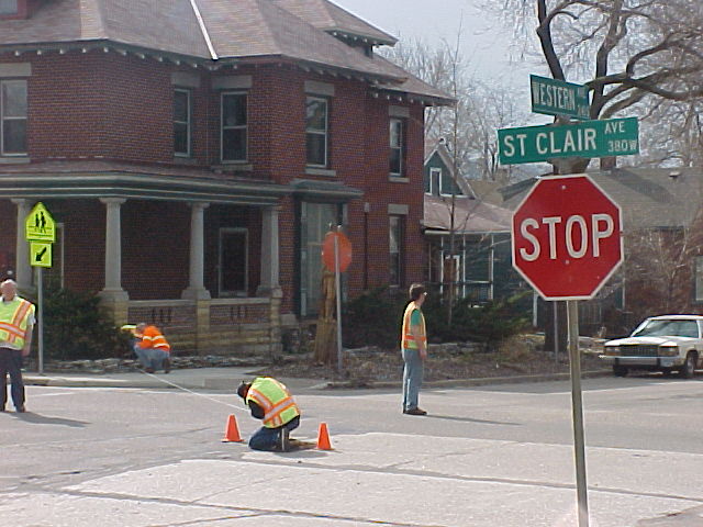
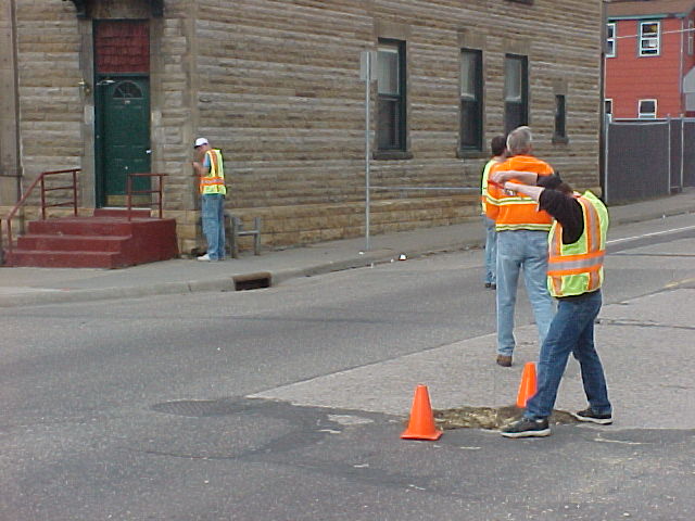
| 0178-0137-5.jpg | April 16, 2002 | Tie on porch corner at SE corner of Western & St Clair |
| 0178-0137-4.jpg | April 16, 2002 | Tie on building corner at SW corner of Western & St Clair |
| 0178-0137-3.jpg | April 16, 2002 | Tie on hydrant at NW corner of Western & St Clair |
| 0178-0137-2.jpg | April 16, 2002 | Tie on building corner at NE corner of Western & St Clair |
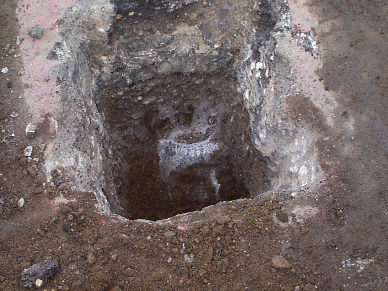
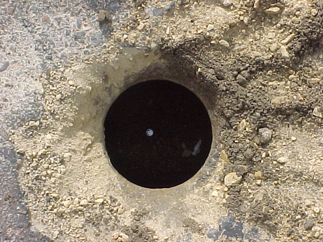
| 0178-0137-1.jpg | April 16, 2002 | Close up of PK nail in hole of GM. |