| NAD83 COORDINATES (1986 adj.): |
|---|
| * X= 561318.649 Y= 149613.391 Z= 000.00 LSQ 12/06/1991 S FLT |
| 2/27/2008 | Fd CIM 0.10 ft below grade. |
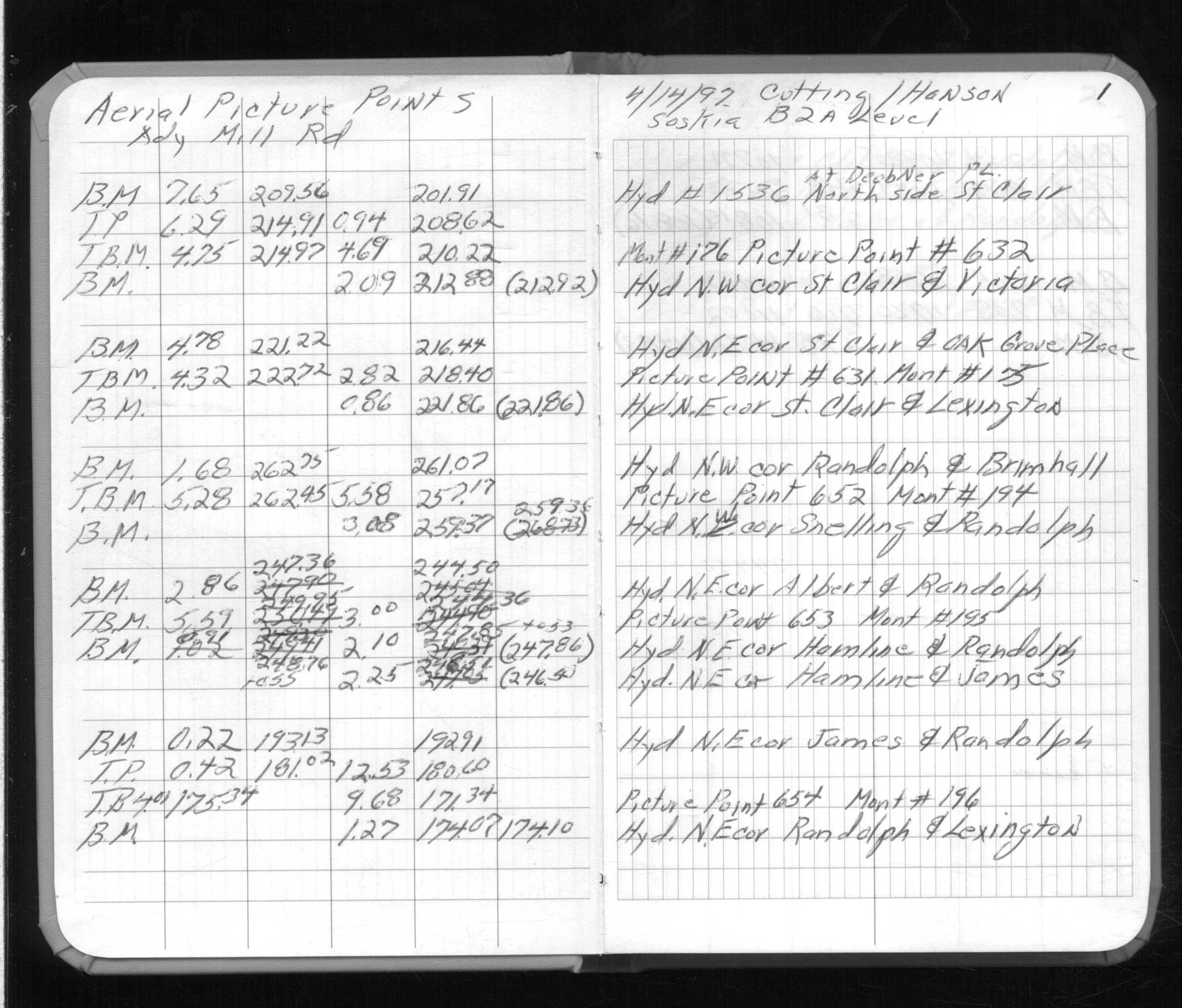
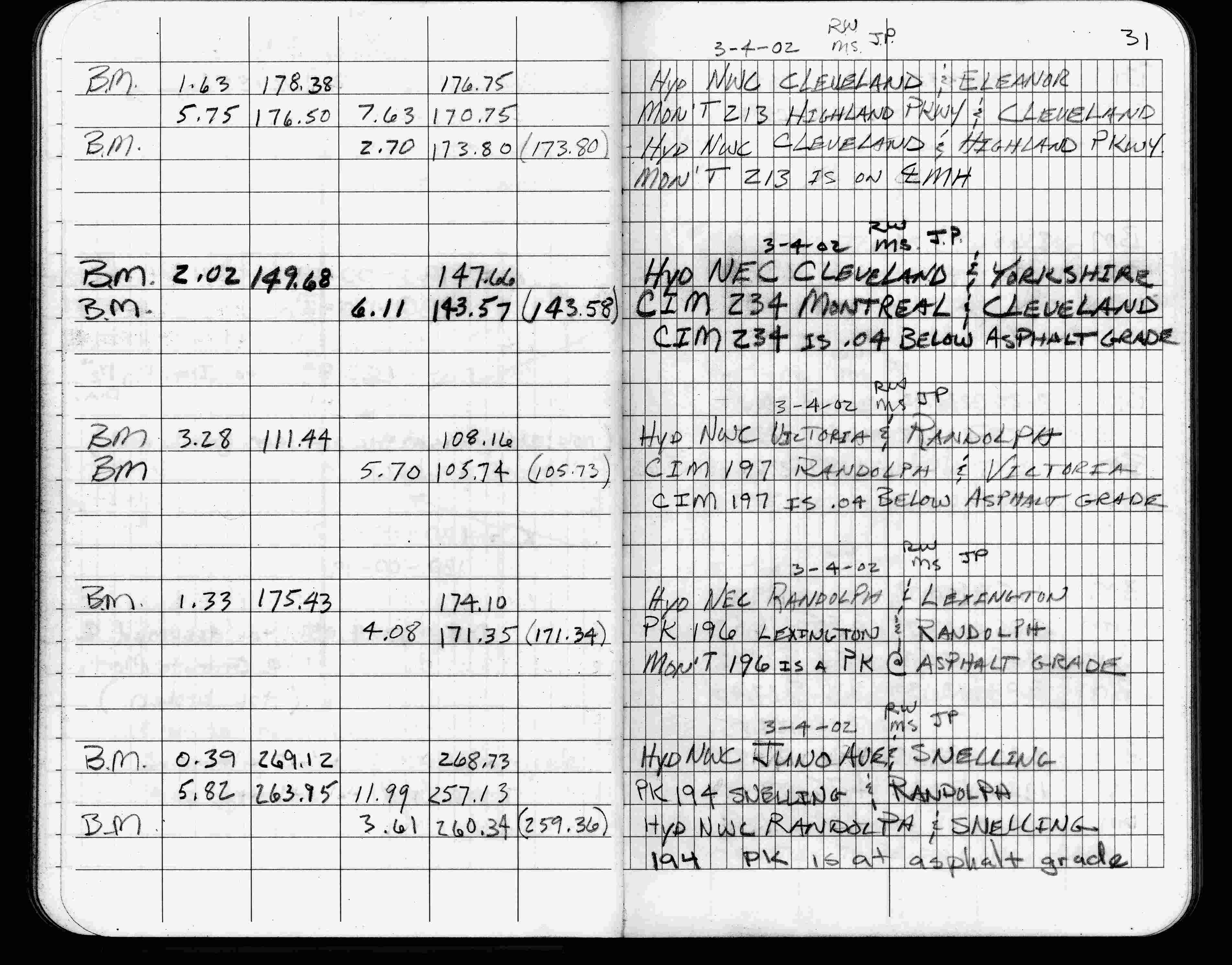
| 3/4/2002 | Elev 171.35 ft on pk nail at asphalt surface. See FB 1736 p.31 |
| 3/1/2000 | (Unknown date Mar __, 2000 ) Fd pk nail (marked for painting target for 2000 aerial) |
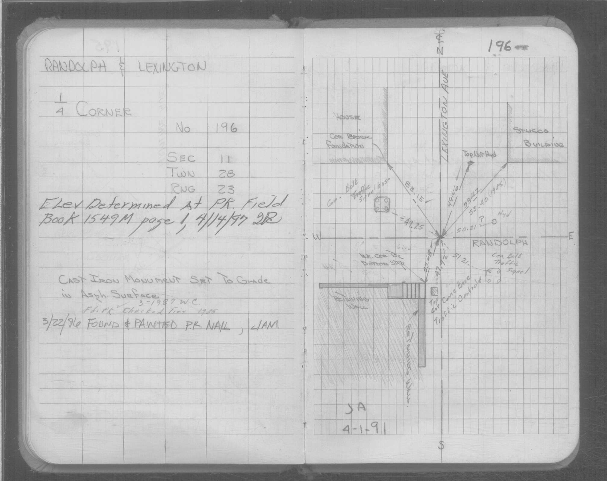
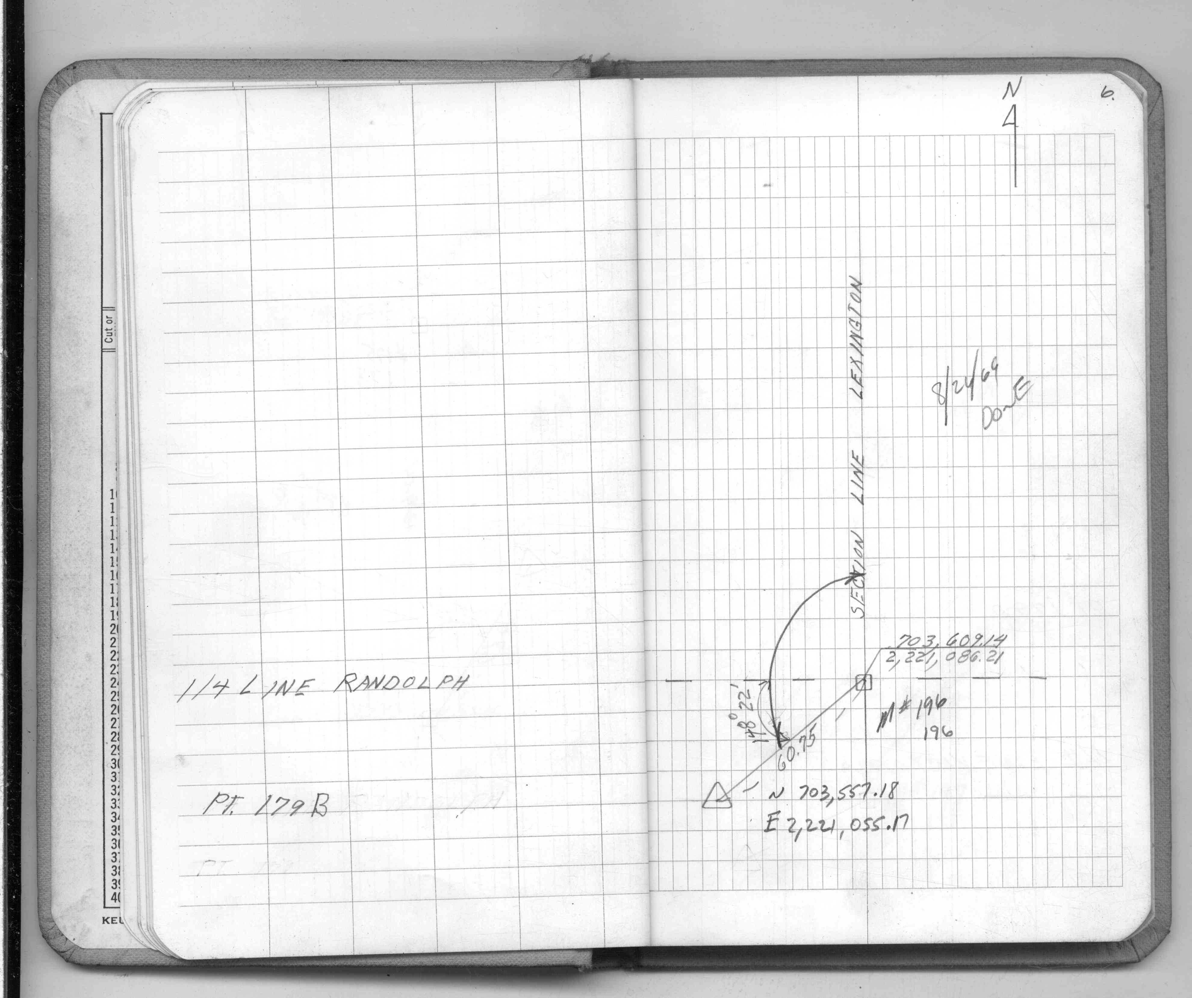
| 4/1/1997 | (Unknown date Apr __, 1997 ) Elev 171.34 ft on PK. See FB 1549M p.1 |
| 4/1/1991 | (Unknown date Apr __, 1991 ) Fd CIM to grade. See Yellow Tie Book. |
| 12/1/1891 | (Unknown date Dec __, 1891 ) Monument lowered by J B Irvine |
| 1/1/1887 | (Unknown date Jan __, 1887 ) Monument at 1/4 corner Ties from Elmer & Morrison set January 1887 |
| 10/1/1847 | (Unknown date Oct __, 1847 ) Isaac N Higbee deputy surveyor set post. Tied to 2 BTs. See IH p.004-005 2823 |
Above is NOT an all inclusive history of this point. Please review all the links below. Yellow Tie Books are 'ST' in the Monument category.
| PLS NOTES | Field | Cross Section | Sewer | J.B. Irvine | Monument | River Survey |
|---|---|---|---|---|---|---|
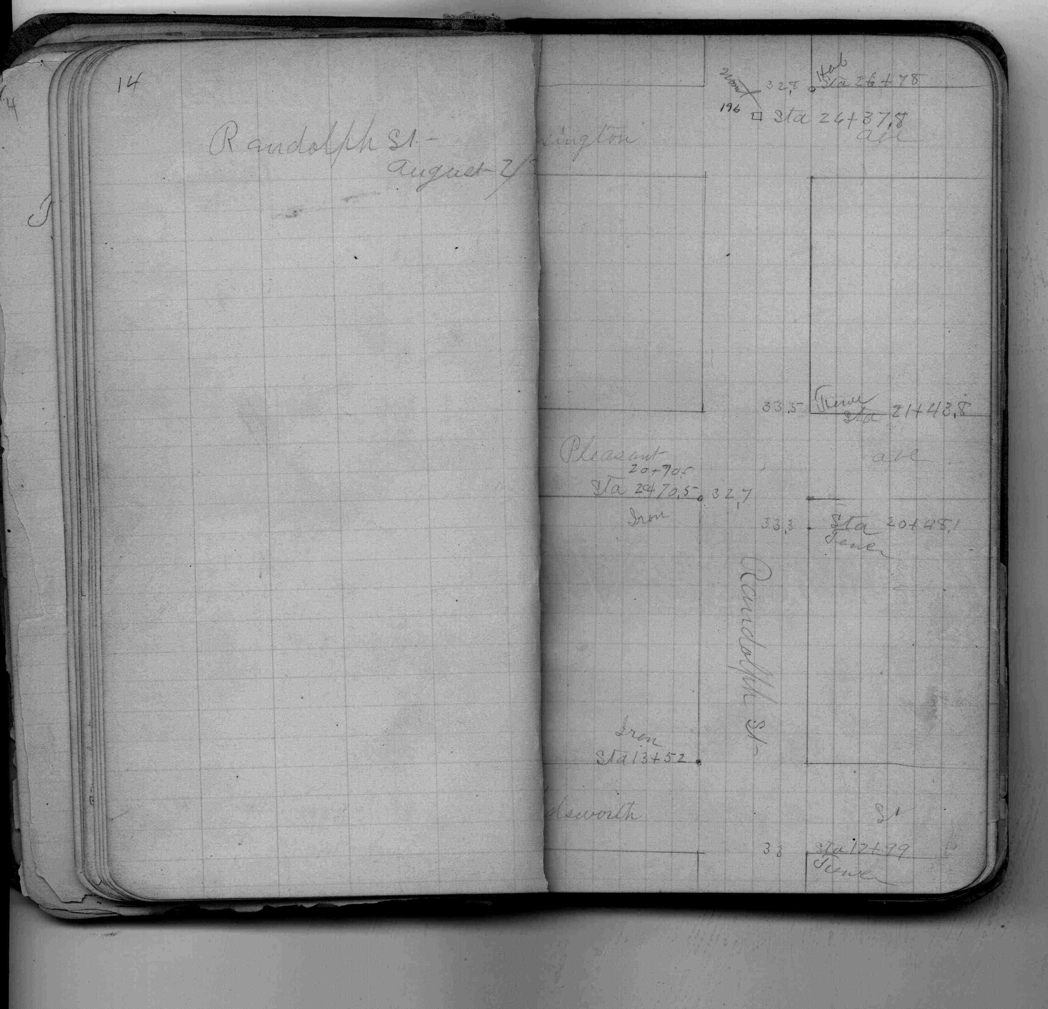
| IH p.004-005 | FB 0201p.14 | SB 0641p.52 | ST 157-234 p.196 | |||
| FB 0229CPYp. 08 ,27 ,28 | ||||||
| FB 0258p.11 | ||||||
| FB 0274p.22 | ||||||
| FB 0297p.12 | ||||||
| FB 1549Cp.06 | ||||||
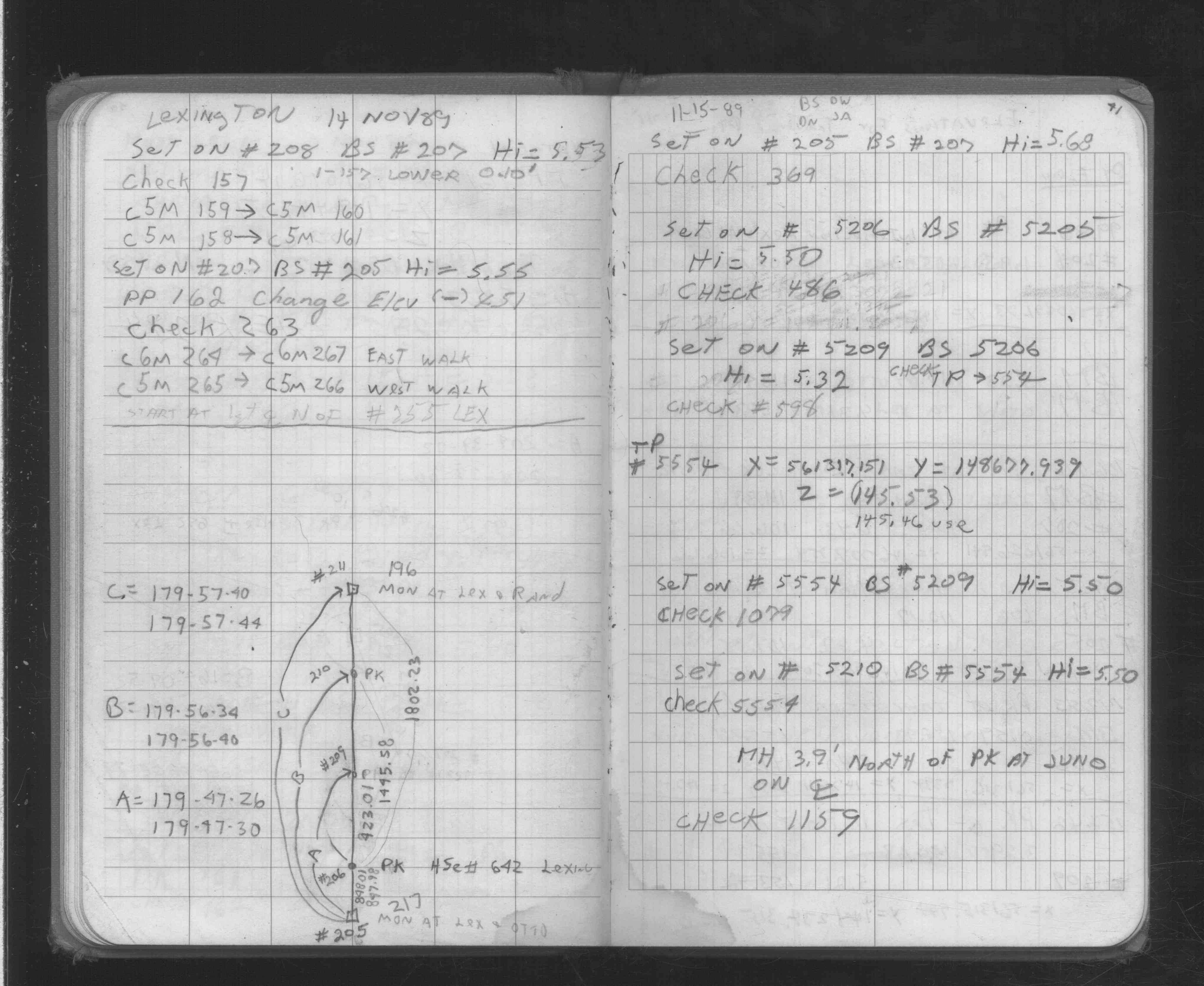
| FB 1549Mp.01 | ||||||
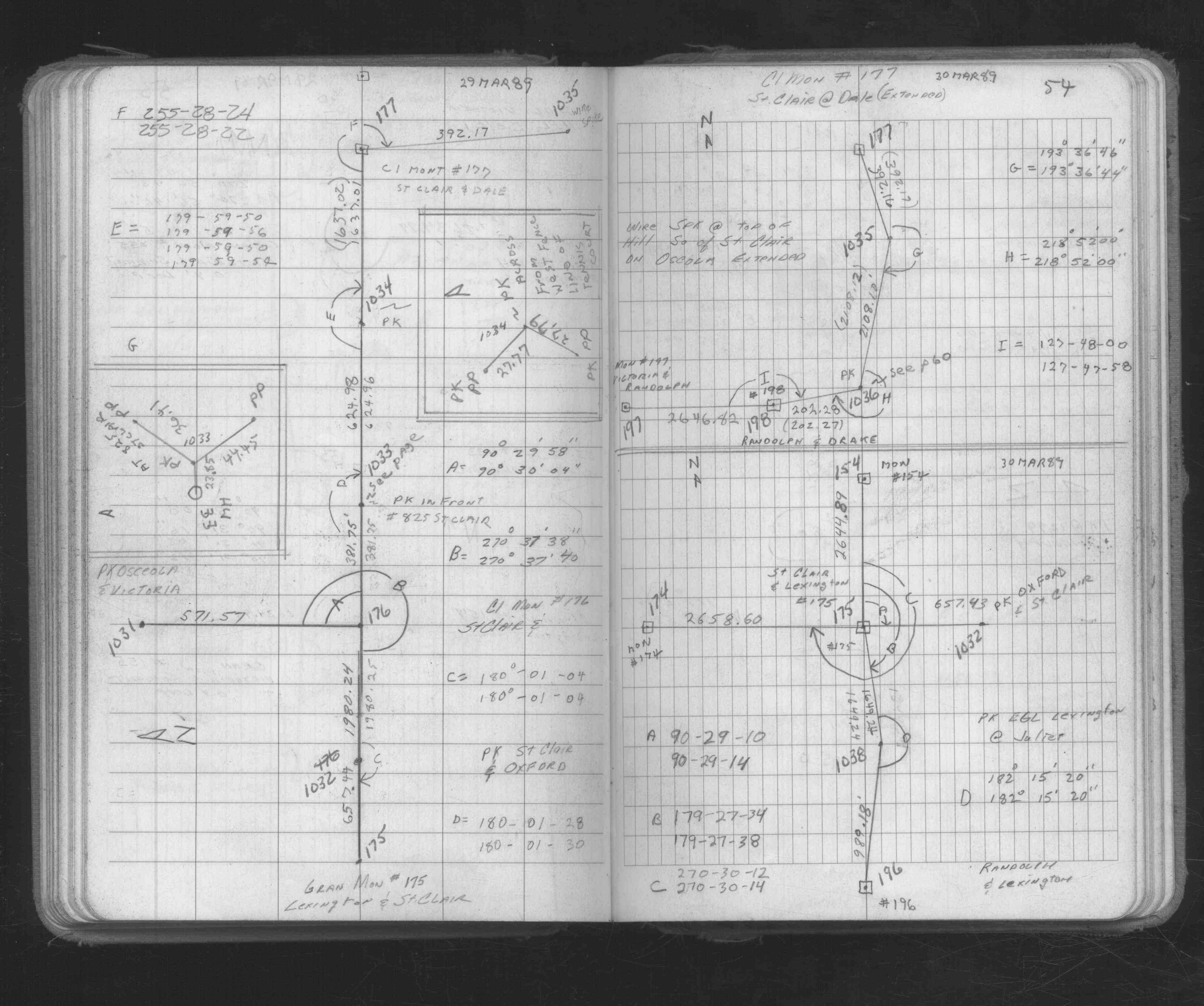
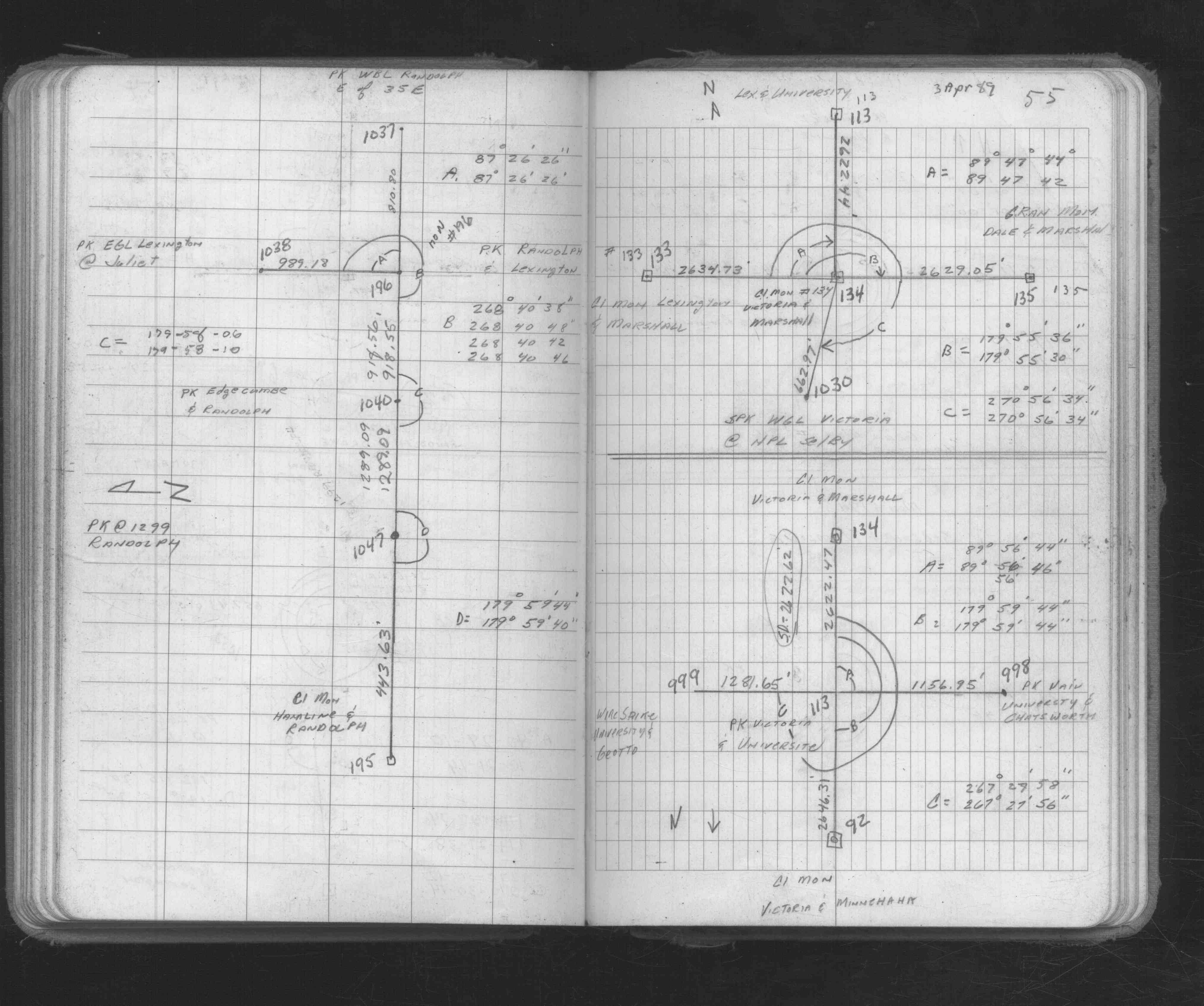
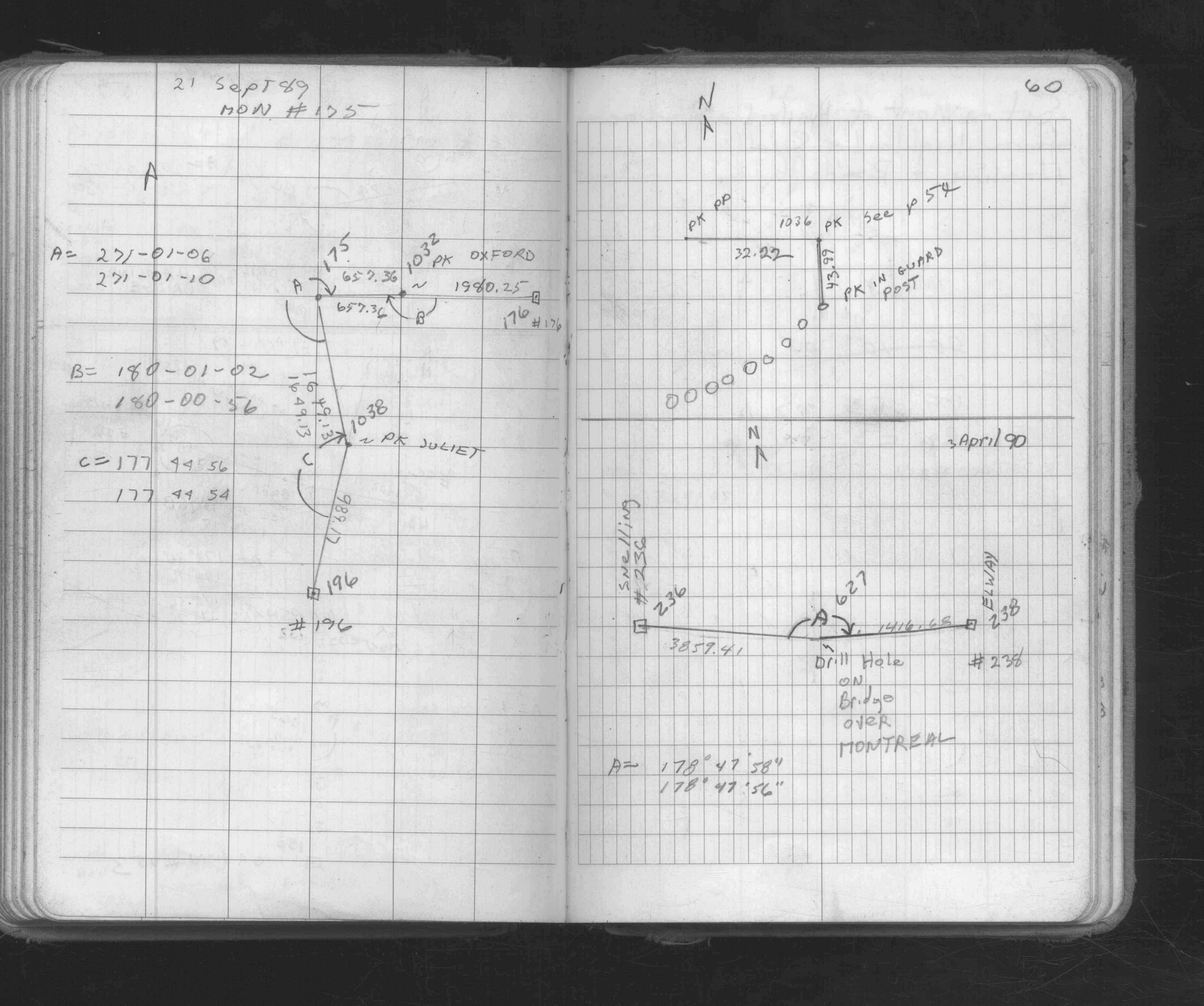
| FB 1673Ap. 54 ,55 ,60 | ||||||
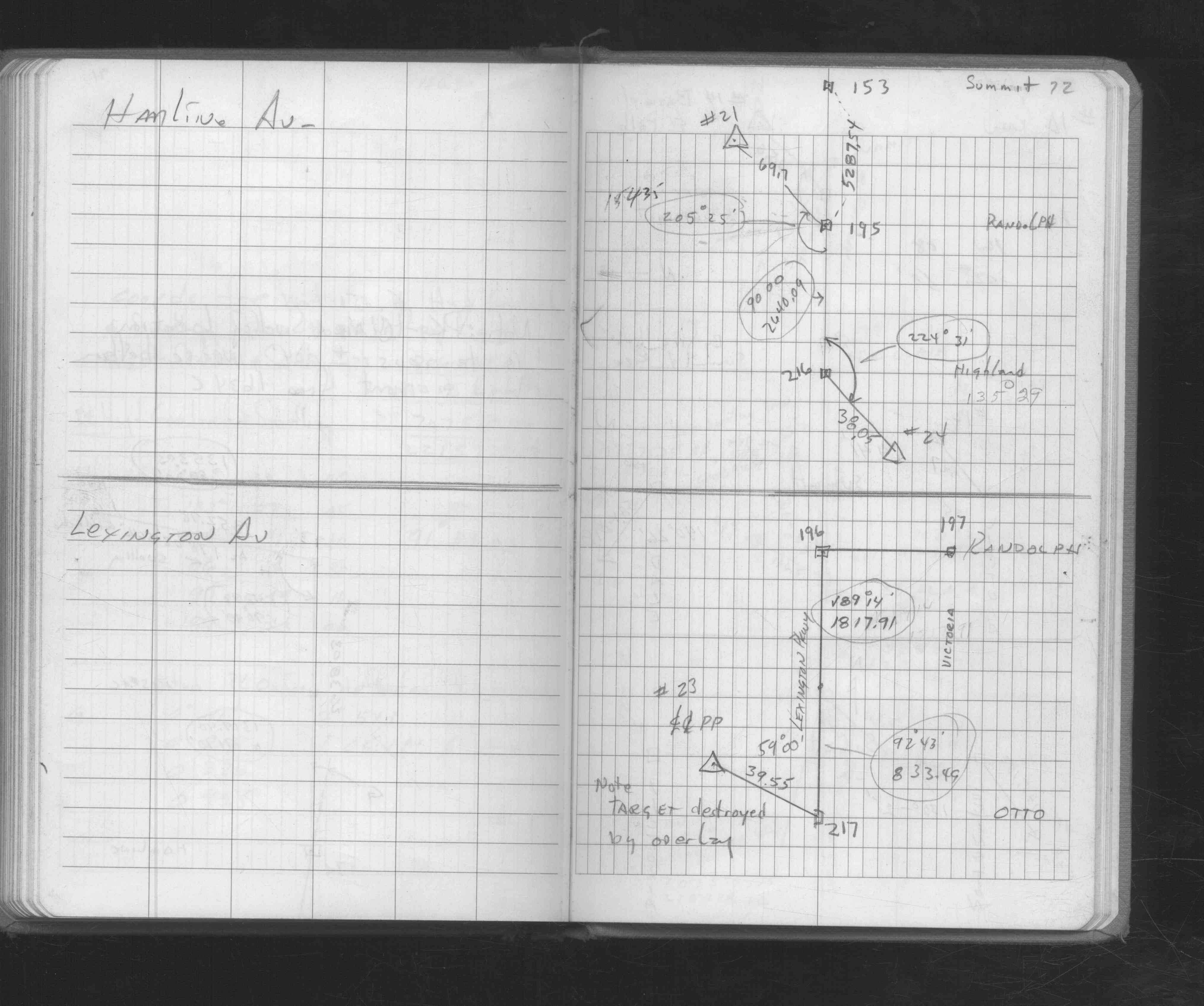
| FB 1676Ap.72 | ||||||
| FB 1704p.41 | ||||||
| FB 1736p.31 |
| FILE | SURVEYOR | LIC. NO. | DATE SIGNED | DATE TIED |
|---|---|---|---|---|
| ST_157-234p196.jpg | none | none | none | none |
| 0196-0151-A.dwf | none | none | none | none |