| NAD83 COORDINATES (1986 adj.): |
|---|
| * X= 595420.516 Y= 149640.880 Z= 000.00 LSQ 12/06/1991 S FLT |
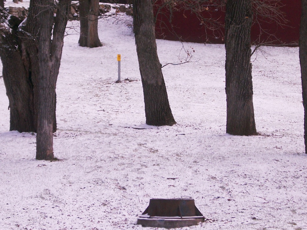
| 4/4/2007 | Placed post with sign 0.7 East of GM. |
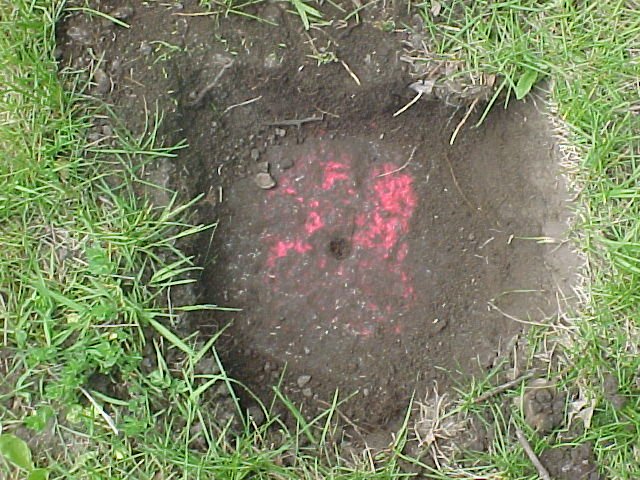
| 9/28/2005 | Fd GM 0.3 ft below grass grade. Placed magnet in hole of GM. |
| 5/18/2000 | Removed fabric target for 2000 aerial |
| 3/1/2000 | (Unknown date Mar __, 2000 ) Fd GM 0.3 ft below grade (placed fabric target for 2000 aerial) |
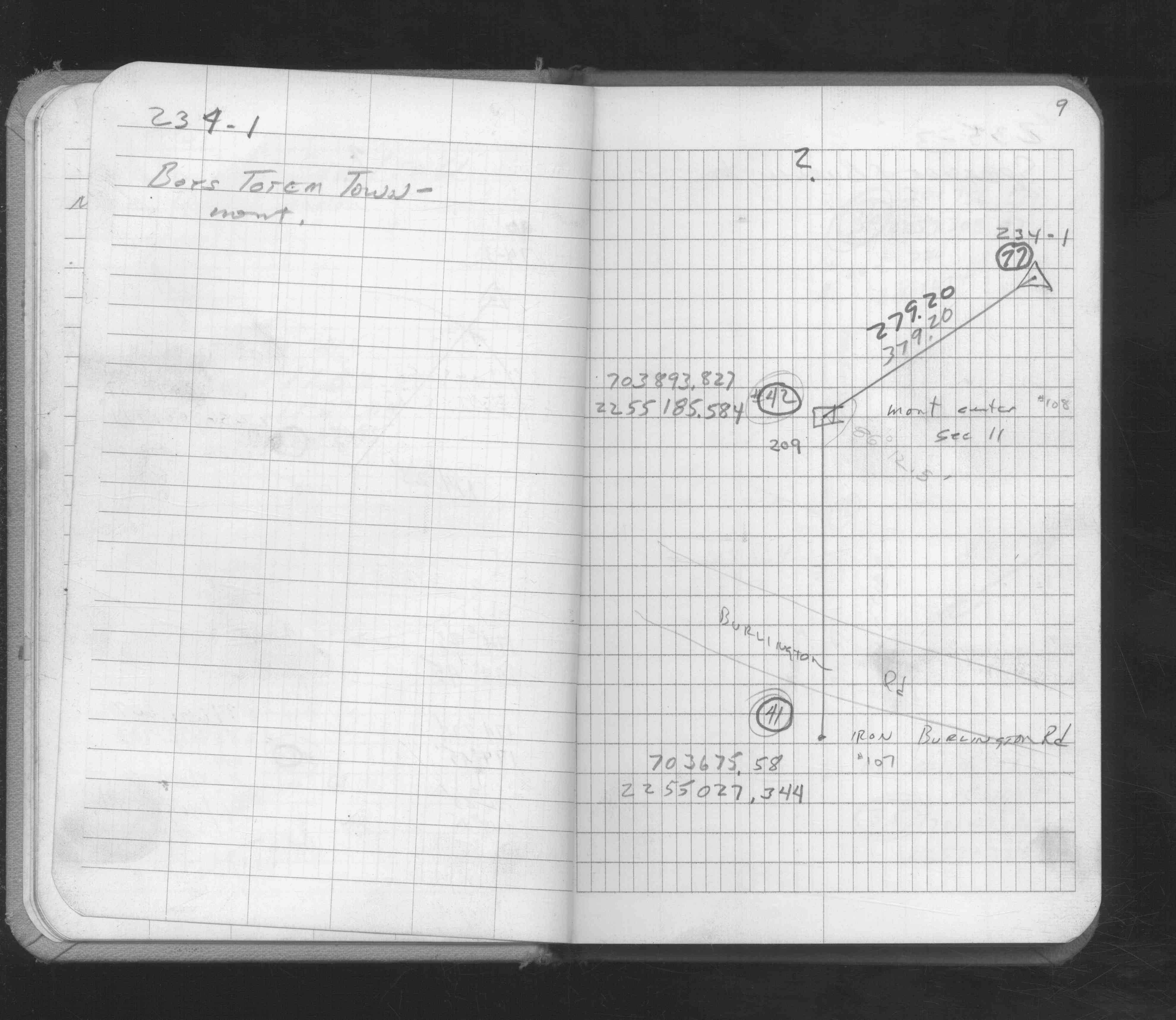
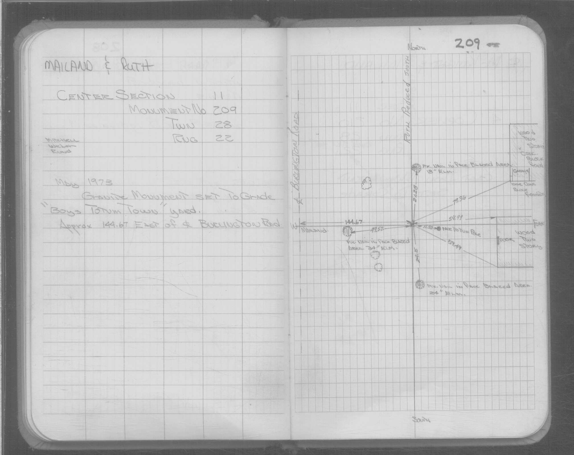
| 5/1/1973 | (Unknown date May __, 1973 ) GM set to grade in "Boys Totum Town" |
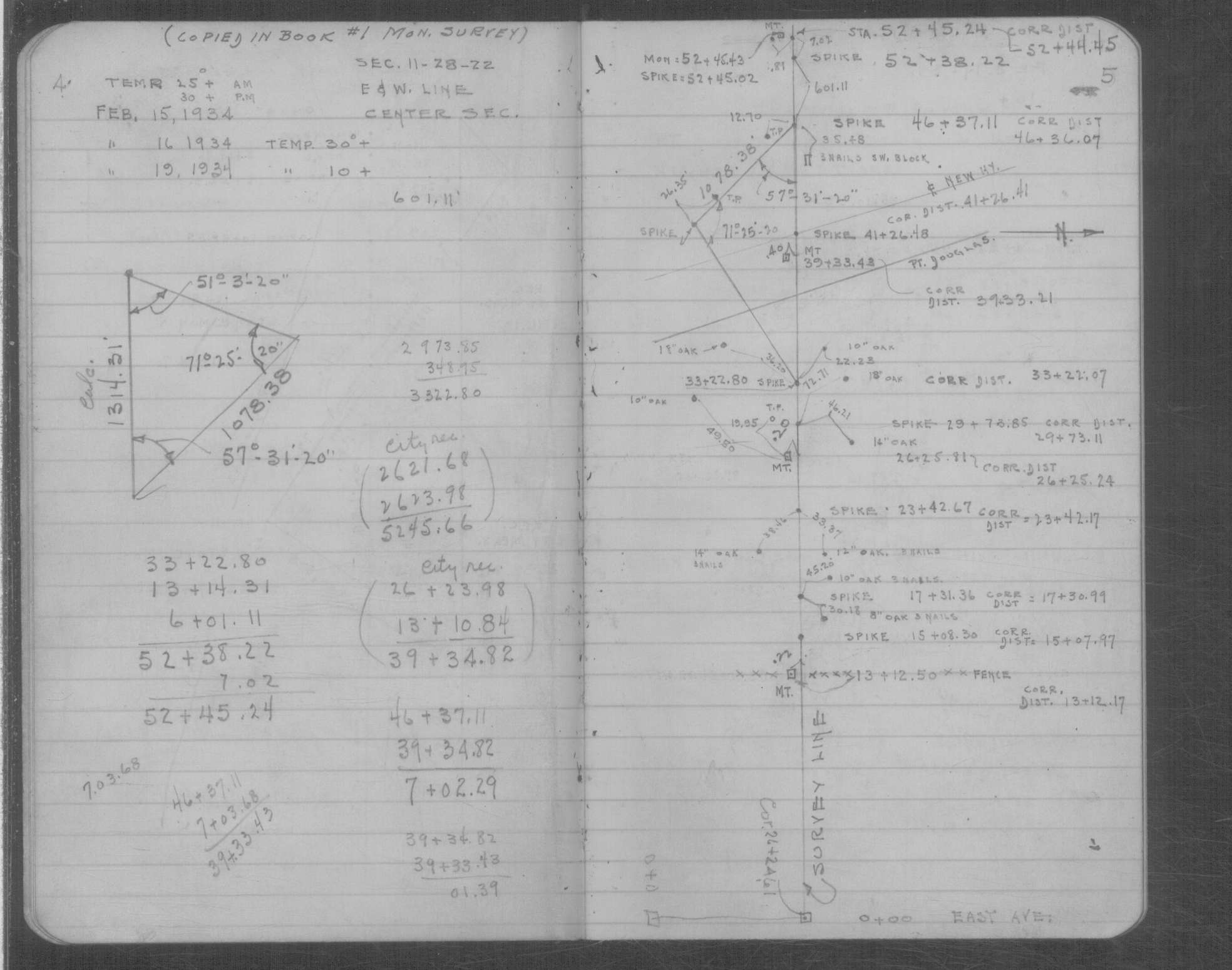
| 2/15/1934 | Location of the monument. See book MSX 5 p.4-5 |
| 4/1/1892 | (Unknown date Apr __, 1892 ) Monument set by J H Armstrong. |
Above is NOT an all inclusive history of this point. Please review all the links below.
| PLS NOTES | Field | Cross Section | Sewer | J.B. Irvine | Monument | River Survey |
|---|---|---|---|---|---|---|
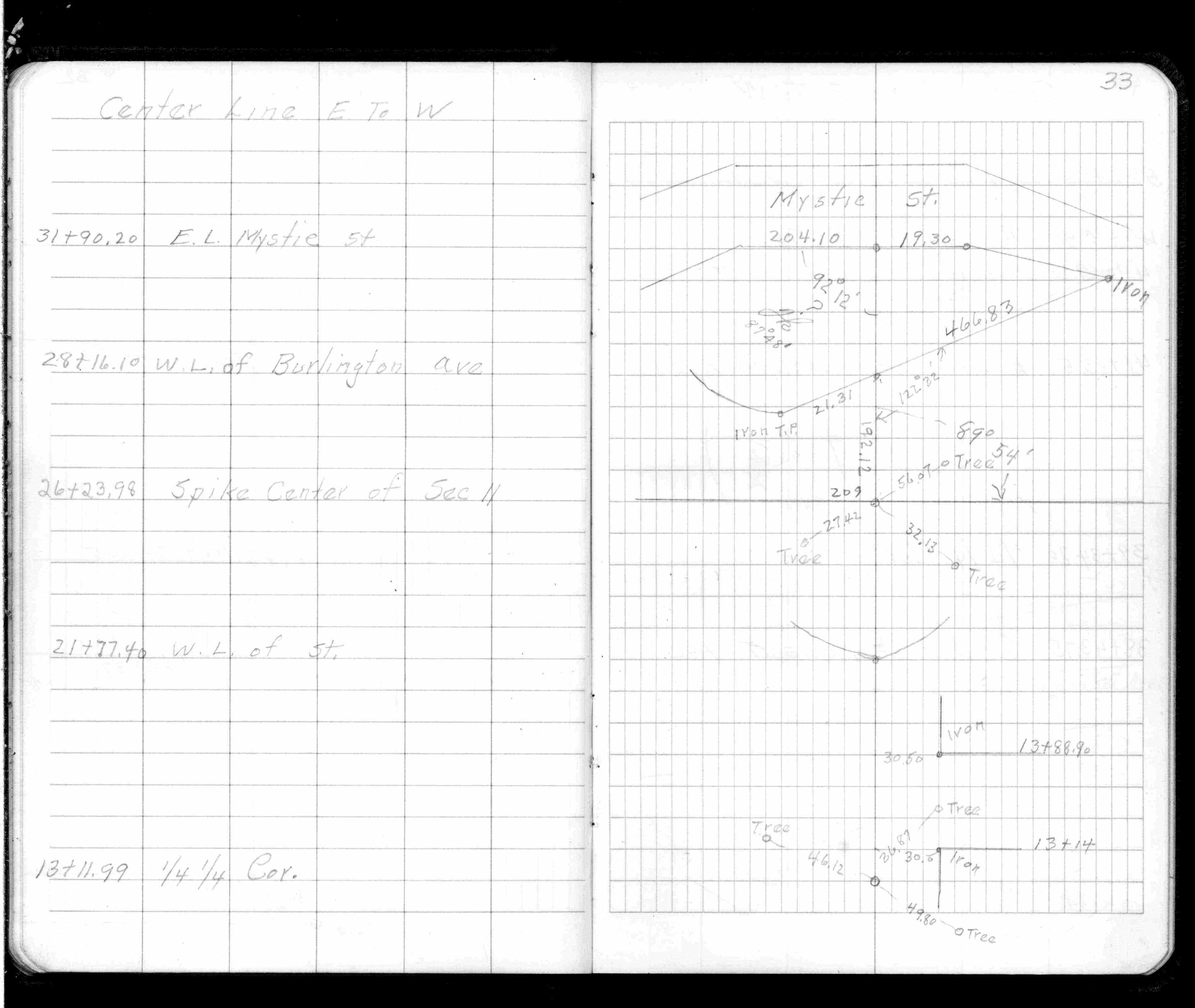
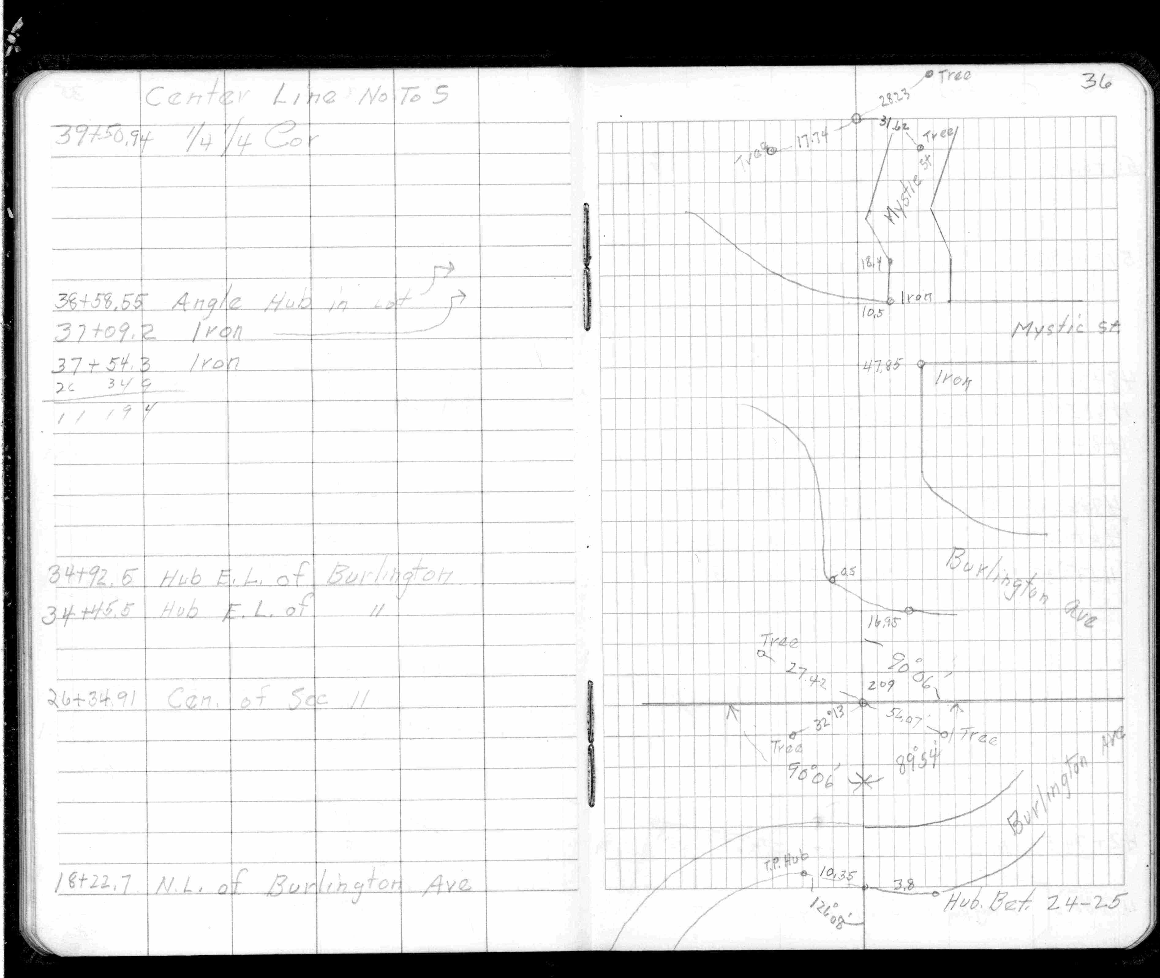
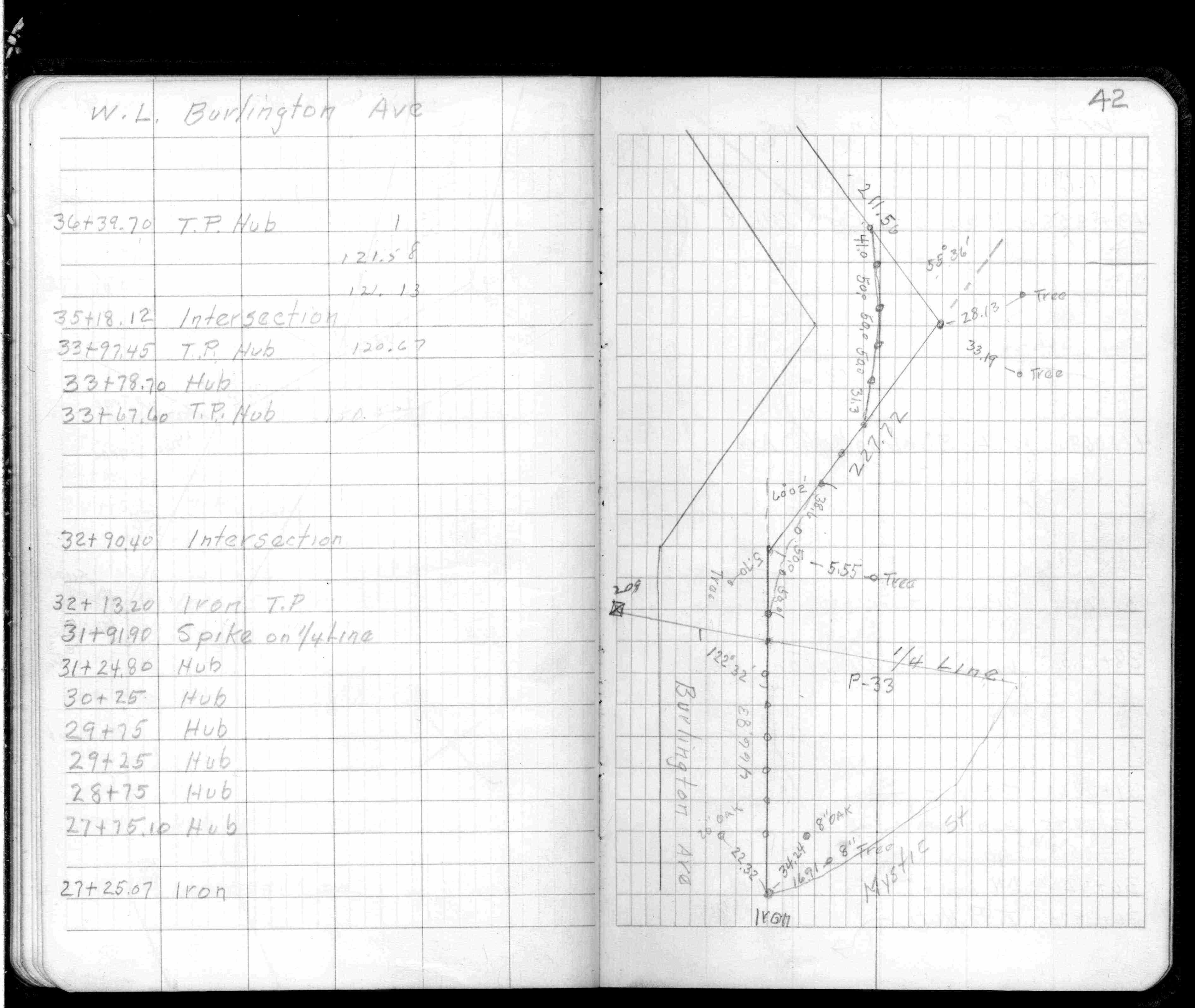
| FB 0355CPYp. 33 ,36 ,42 | MSX 0005 p.004-005 | |||||
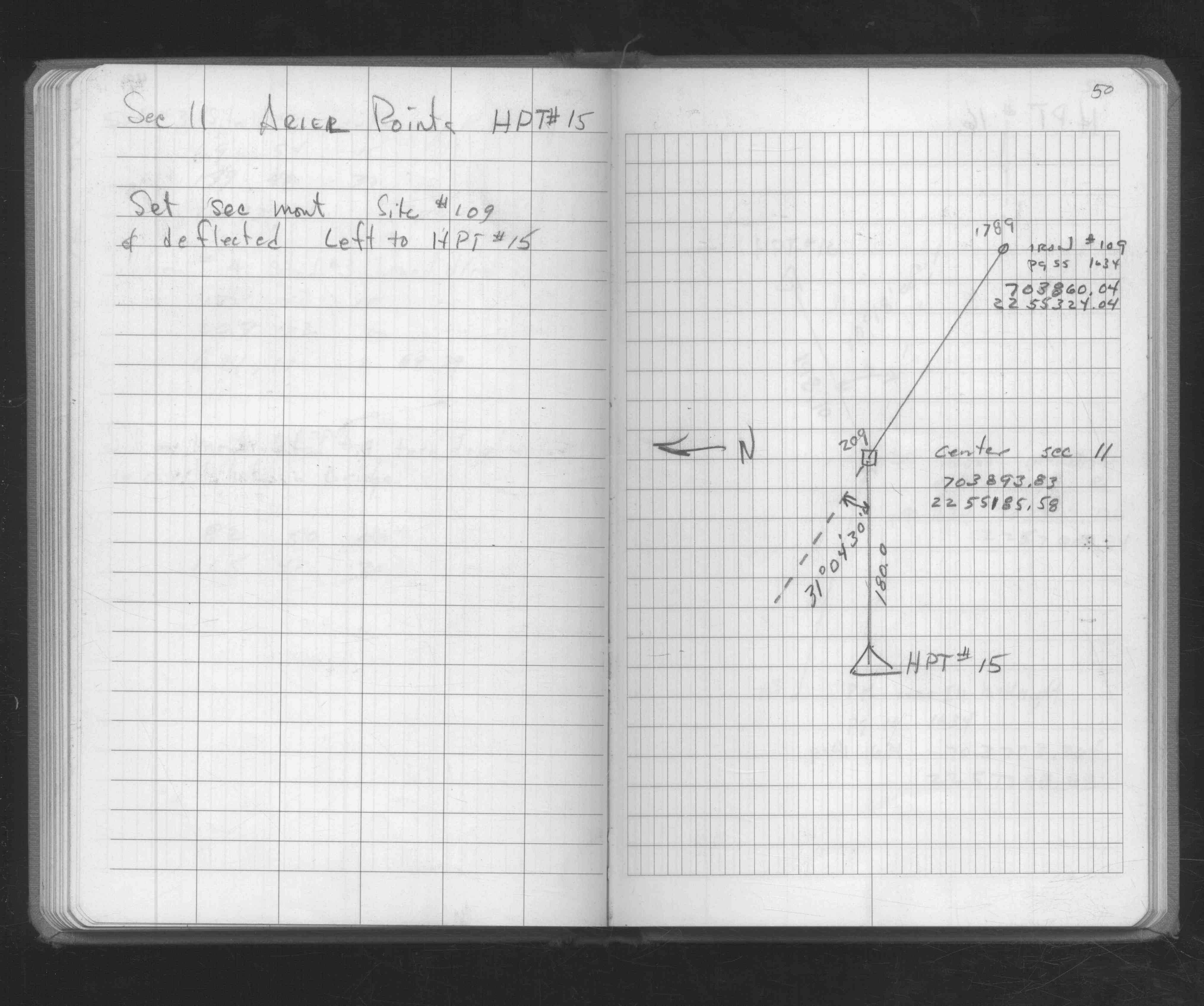
| FB 1549Hp.09 | ||||||
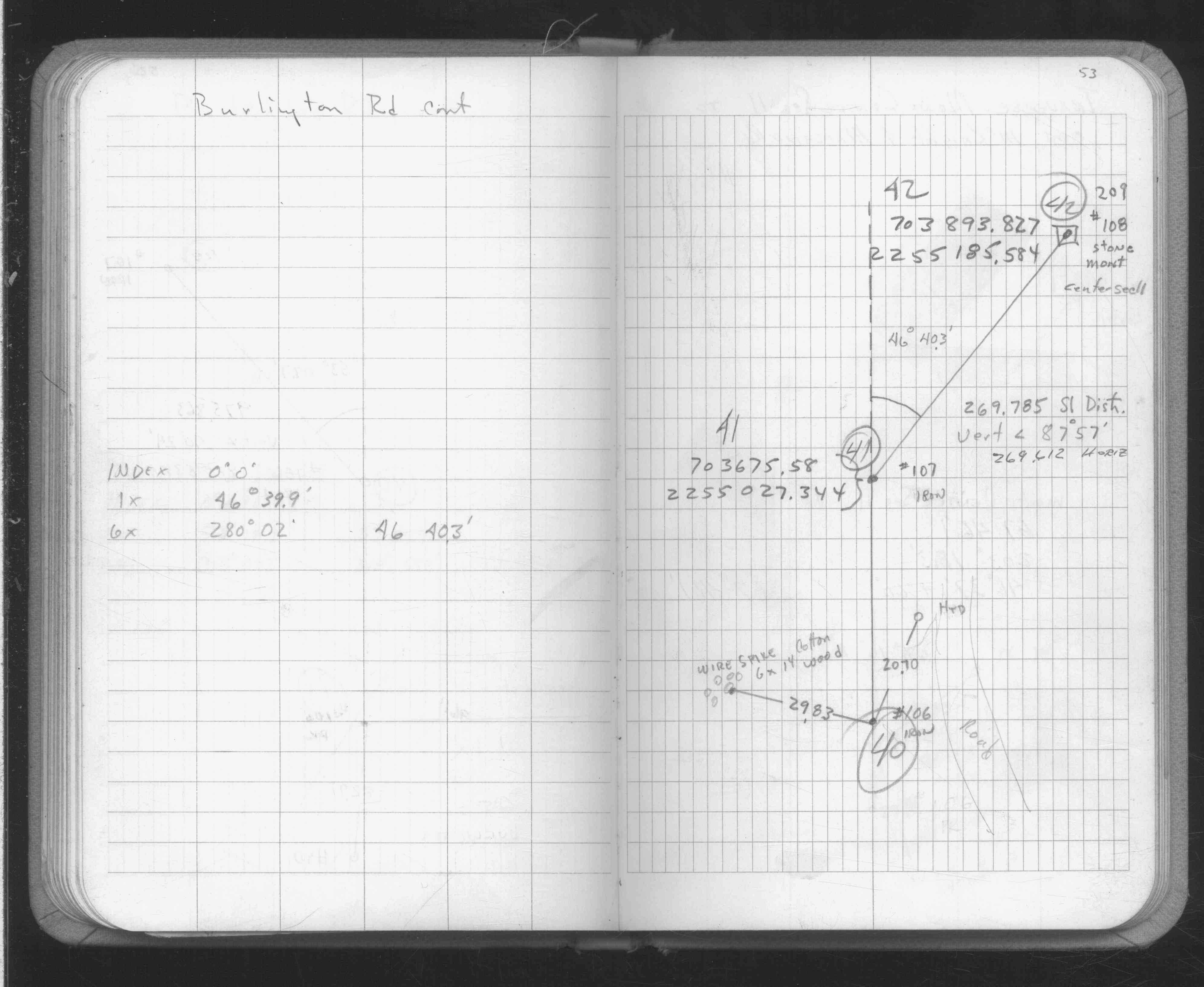
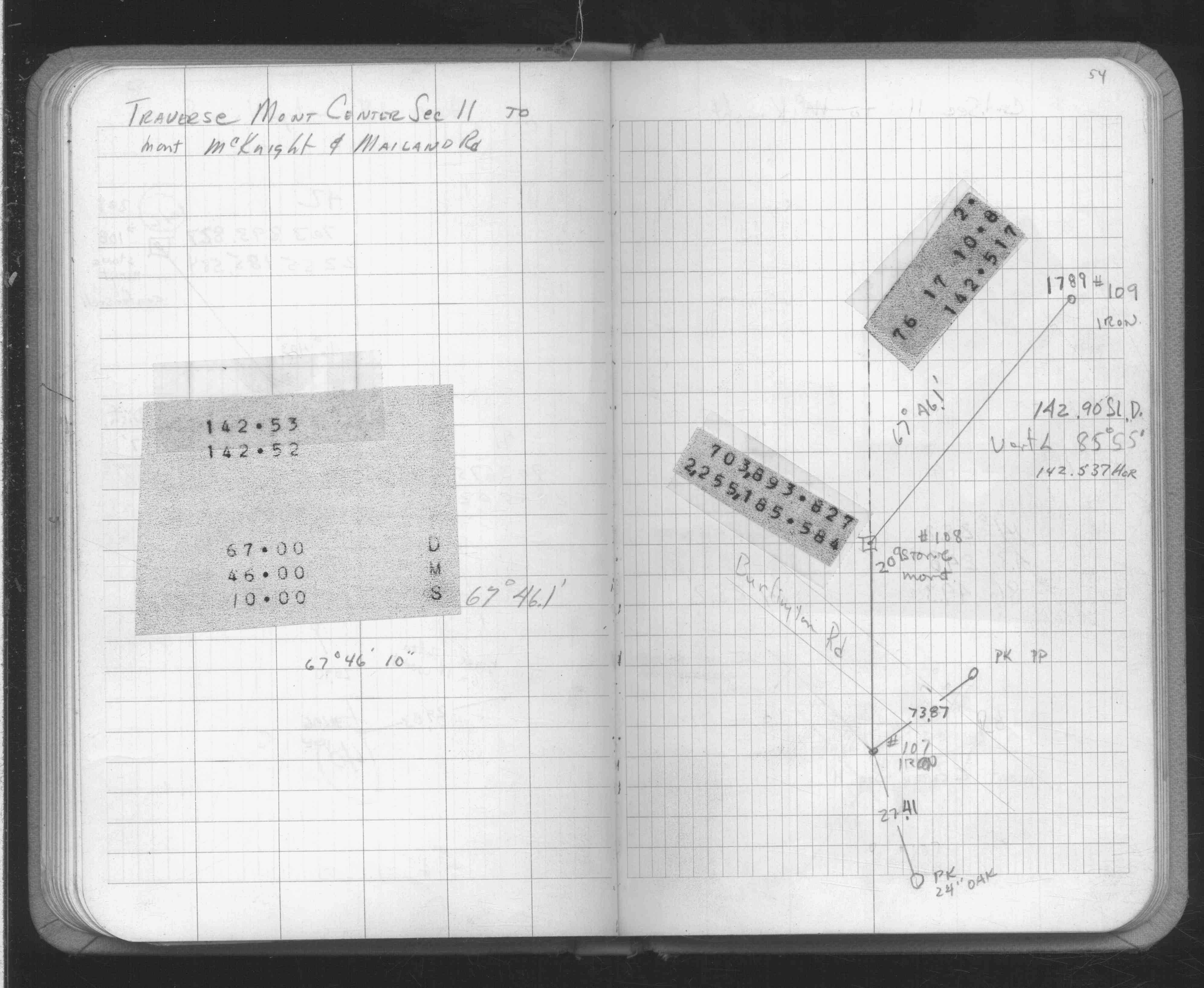
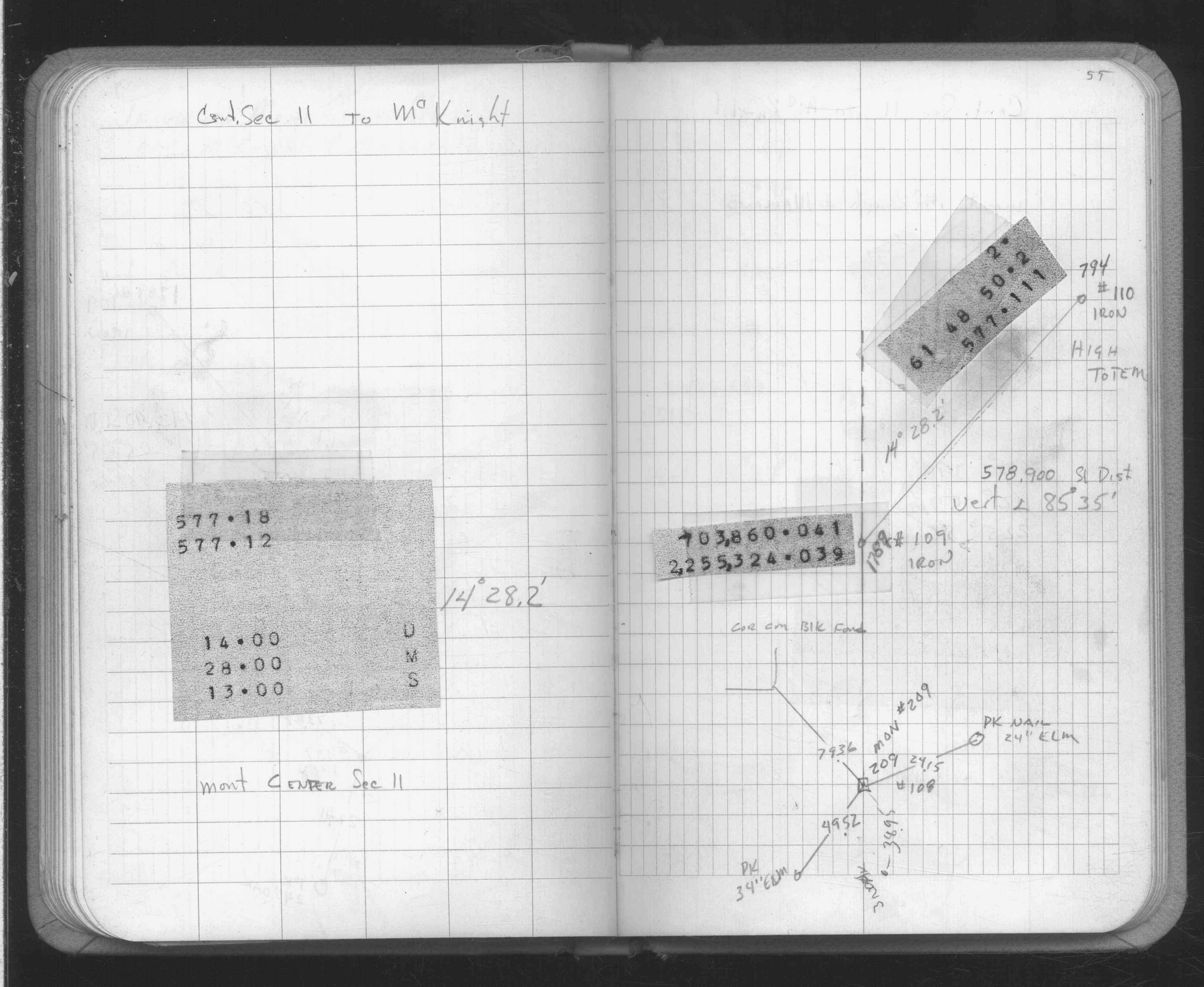
| FB 1634p. 53 ,54 ,55 | ||||||
| FB 1676p.52 | ||||||
| FB 1676Ap.50 |
| FILE | SURVEYOR | LIC. NO. | DATE SIGNED | DATE TIED |
|---|---|---|---|---|
| ST_157-234p209.jpg | none | none | none | none |
| 0209-2577-A.dwf | none | none | none | none |
| FILE | PHOTO DATE | COMMENTS |
|---|---|---|
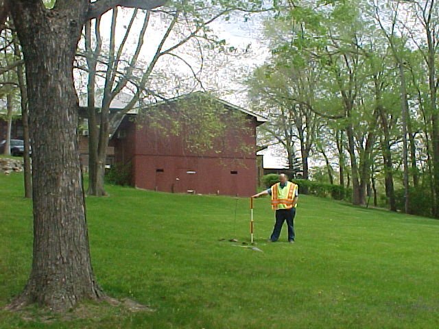
| 0209-2577-6.jpg | April 4, 2007 | Looking easterly towards sign, GM in center of picture. |
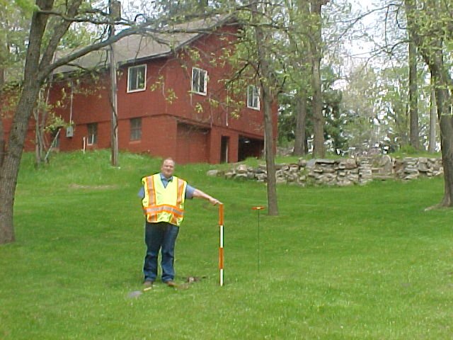
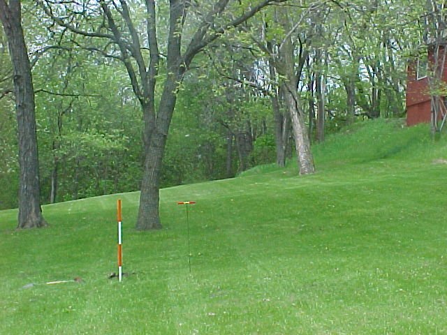
| 0209-2577-5.jpg | May 22, 2002 | Looking northeasterly, GM in forground. |
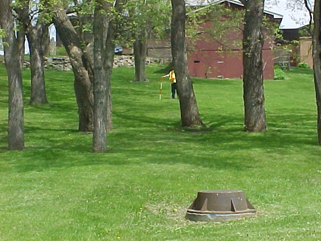
| 0209-2577-4.jpg | May 22, 2002 | Looking east, GM in forground. |
| 0209-2577-3.jpg | May 22, 2002 | Looking north, GM in forground. |
| 0209-2577-2.jpg | May 22, 2002 | Looking easterly, GM in center of picture. |
| 0209-2577-1.jpg | May 22, 2002 | Closeup of GM. |