| NAD83 COORDINATES (1986 adj.): |
|---|
| * X= 571900.326 Y= 147031.200 Z= 000.00 LSQ 12/06/1991 S FIX |
| X= 571900.226 Y= 147031.245 Z= 991.445 11/26/2012 RTK-VRS |
| 11/26/2012 | Position on disc established using RTK-VRS GPS. Elev 297.34 ft. EDM ties placed using Sokkia Set 5. |
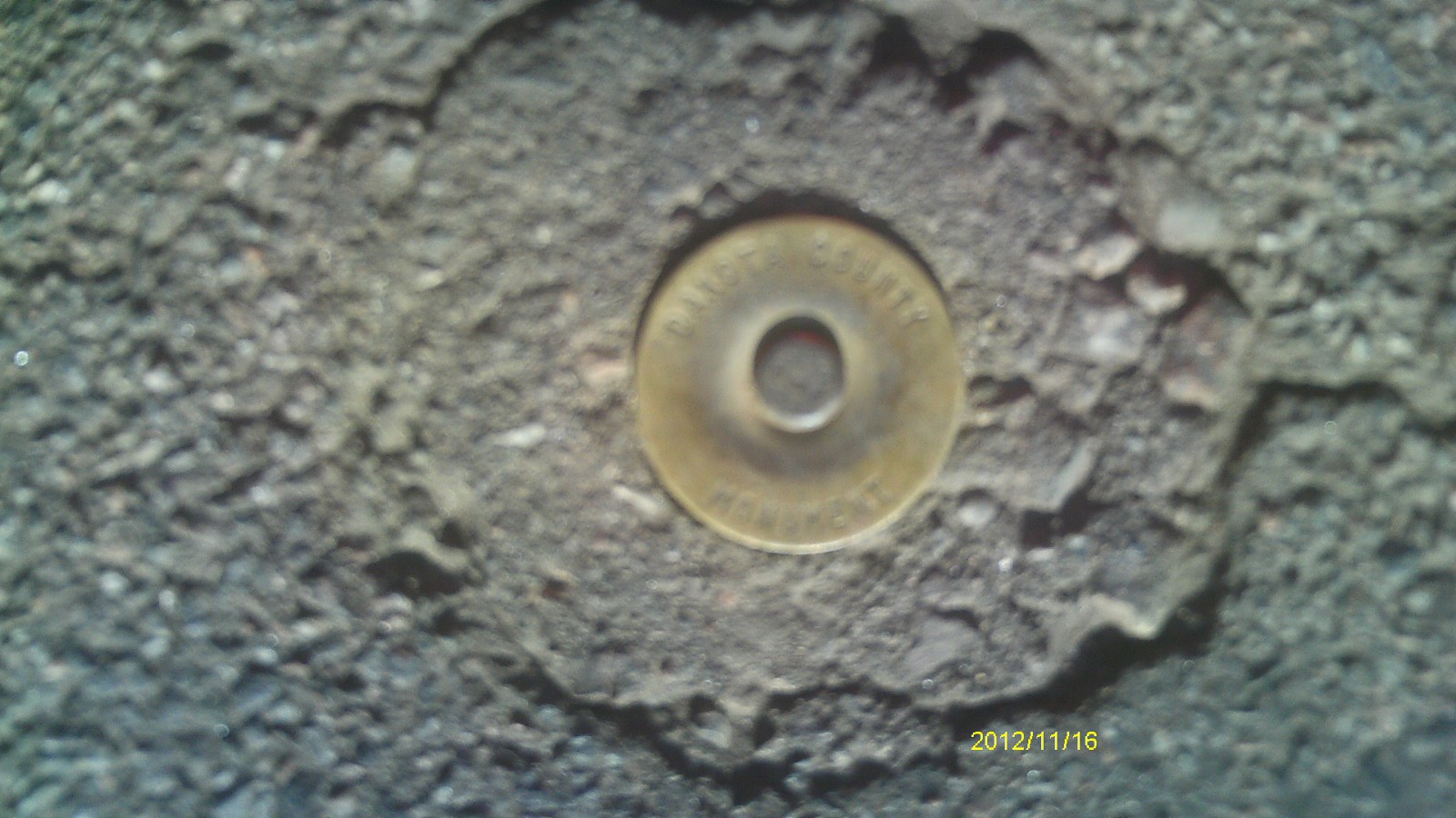
| 11/16/2012 | Found disc stamped "DAKOTA COUNTY MONUMENT" in asphalt patch at location. Unable to determine if CIM remains in place beneath disc, but patch is cap-sized. Photos taken. |
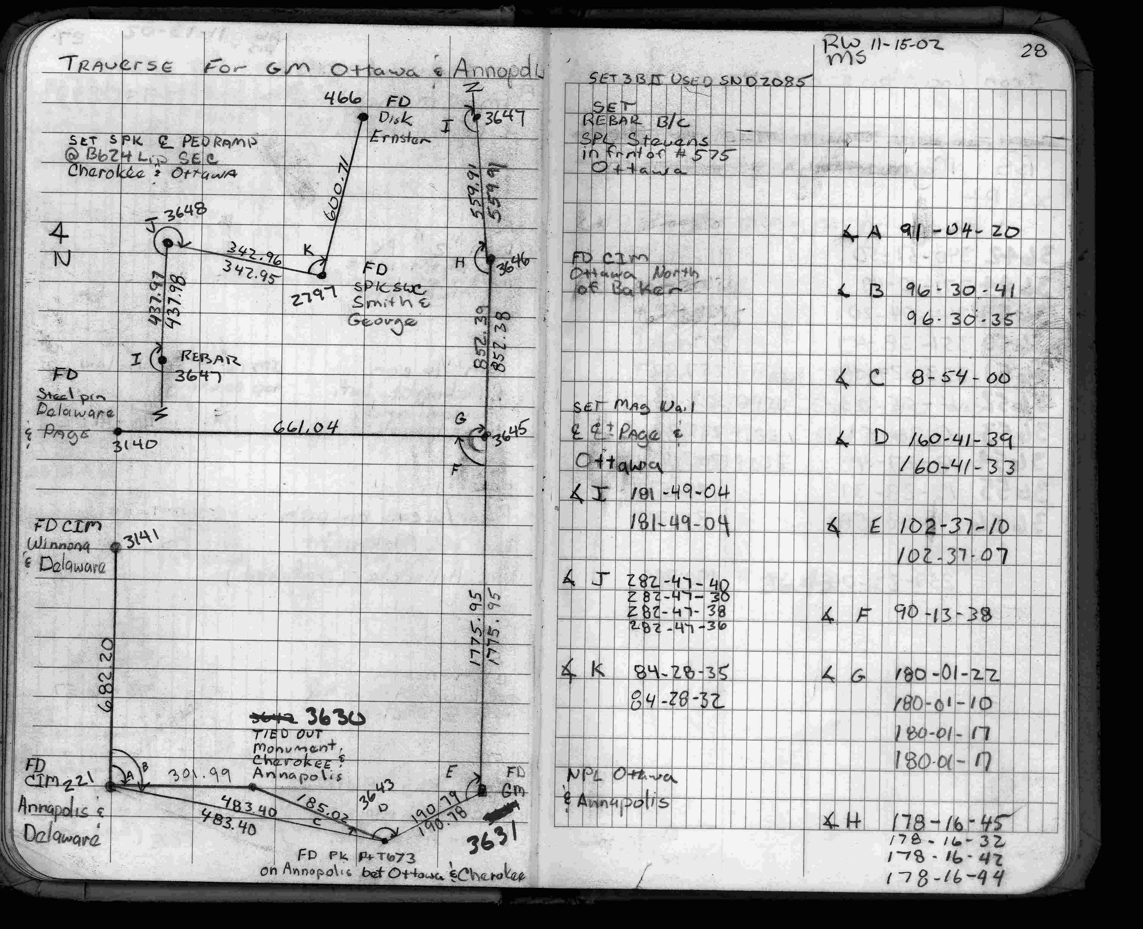
| 11/15/2002 | Used CIM for traverse control. See FB 1735 p.28 |
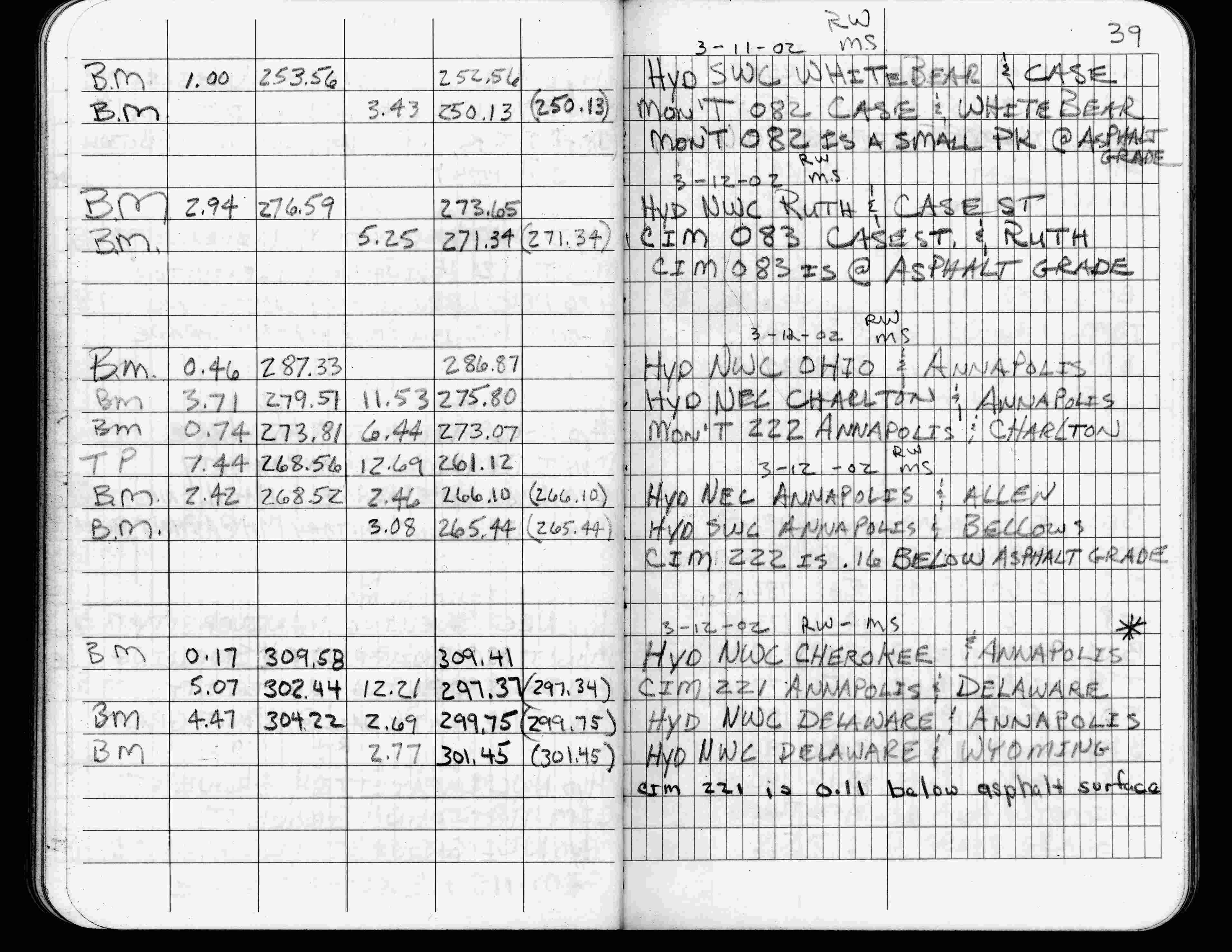
| 3/12/2002 | Elev 297.37 ft on CIM 0.11 ft below asphalt surface. See FB 1736 p.39 |
| 3/1/2000 | (Unknown date Mar __, 2000 ) Fd CIM at grade (marked for painting target for 2000 aerial) |
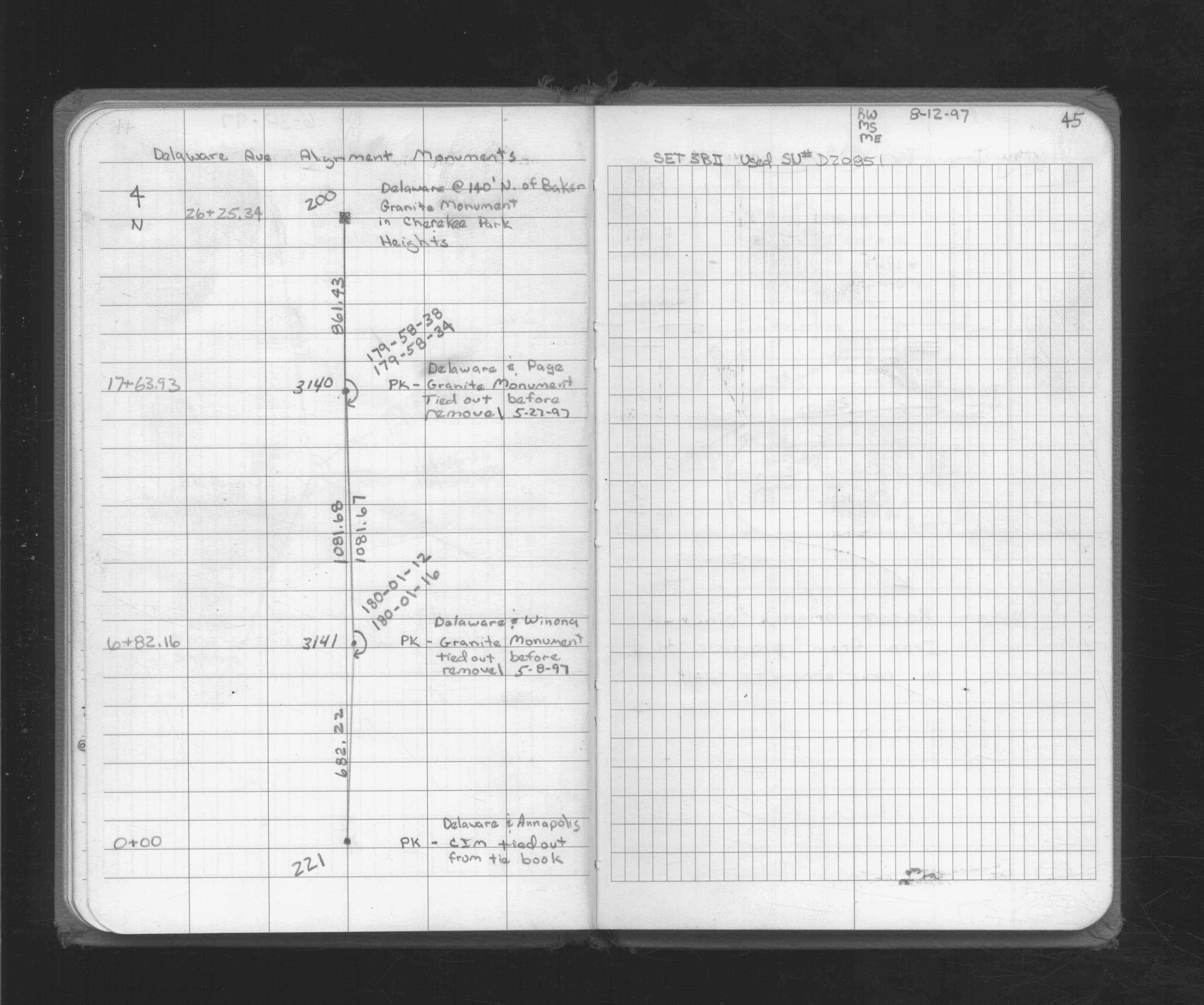
| 9/11/1997 | Set CIM in asphalt at finish grade. See CofL 0221-0175-D |
| 5/14/1997 | Found CIM, placed ties, removed for street construction. See CofL 0221-0175-D |
| 5/5/1997 | CIM at grade removed for street construction |
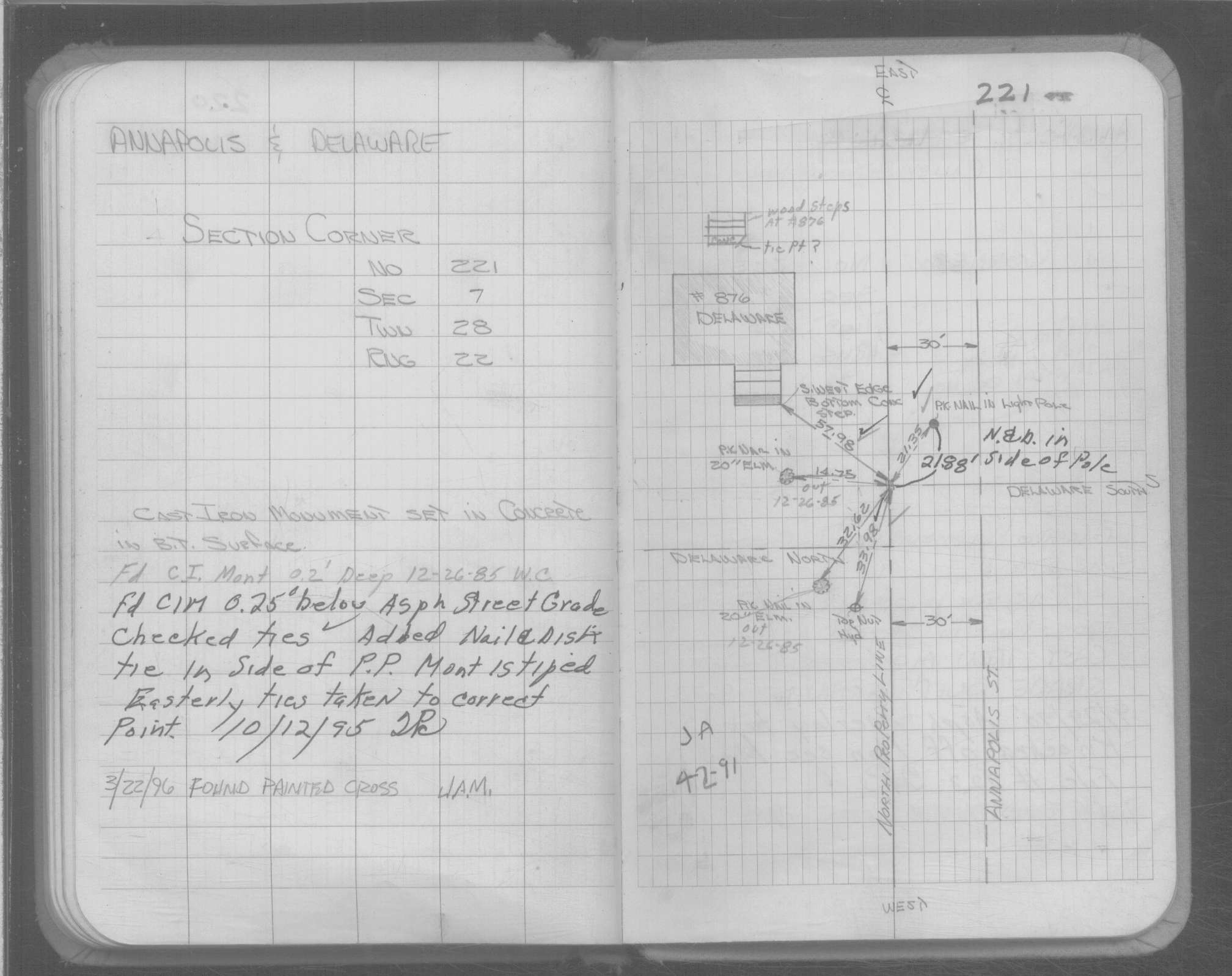
| 10/12/1995 | Fd CIM tipped, 0.25 ft below asphalt street grade, left CIM as found. See CofL 0221-0175-C |
| 10/12/1995 | Fd CIM tipped, 0.25 ft below asphalt street grade, left CIM as found. See CofL 0221-0175-B |
| 4/1/1991 | (Unknown date Apr __, 1991 ) CIM set 0.2 ft below grade. |
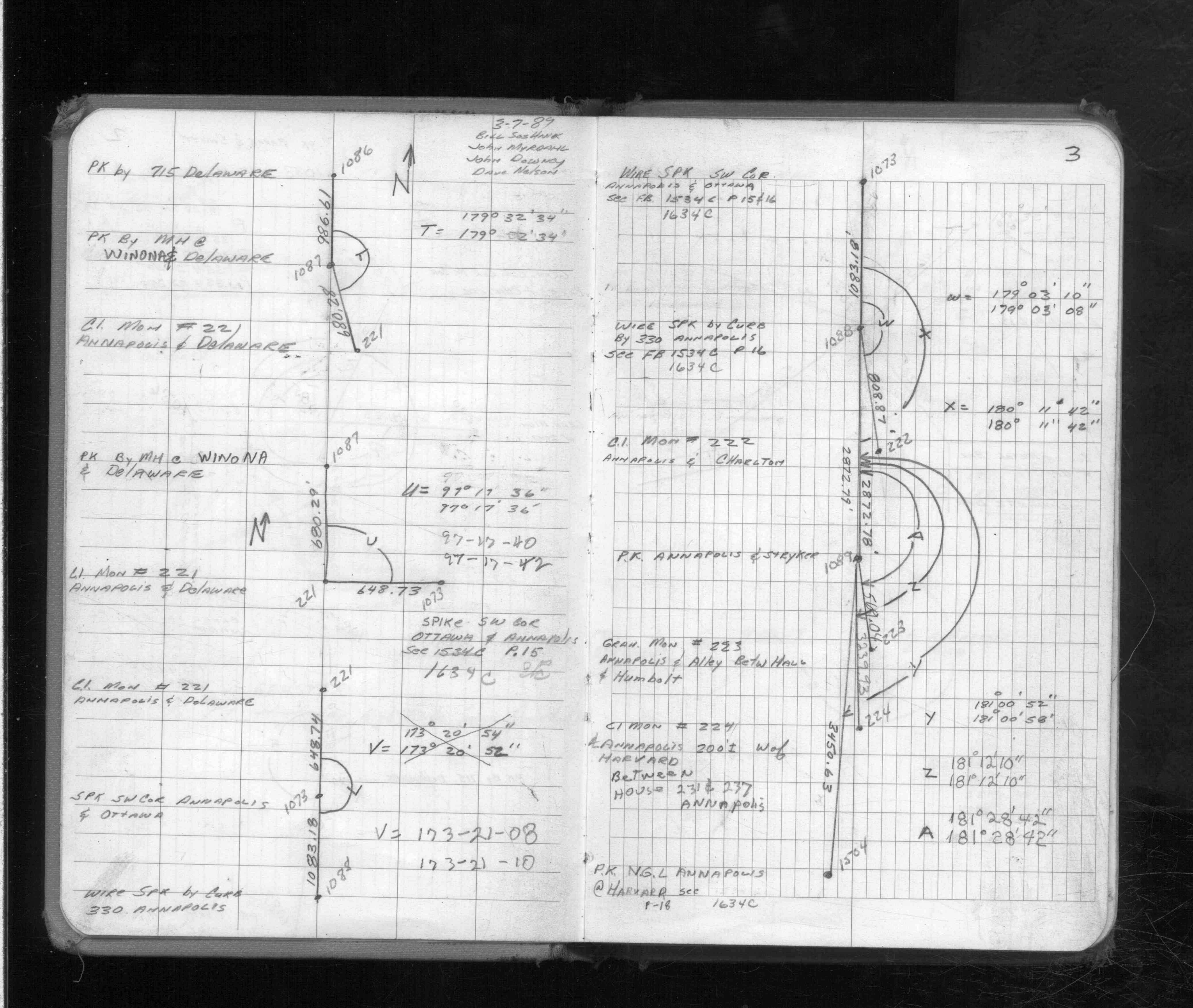
| 3/7/1989 | Traversed through CIM. See FB 1713 p.3 |
| 1/1/1985 | (Unknown date ___ __,1985 ) Historic, one time only GPS survey = S153 |
| 1/23/1984 | Position checked by Dakota County. See CofL 0221-0175-A |
| 11/29/1977 | Fd CIM 2" below grade, placed ties, recovered by Dakota County. See CofL 0221-0175-A |
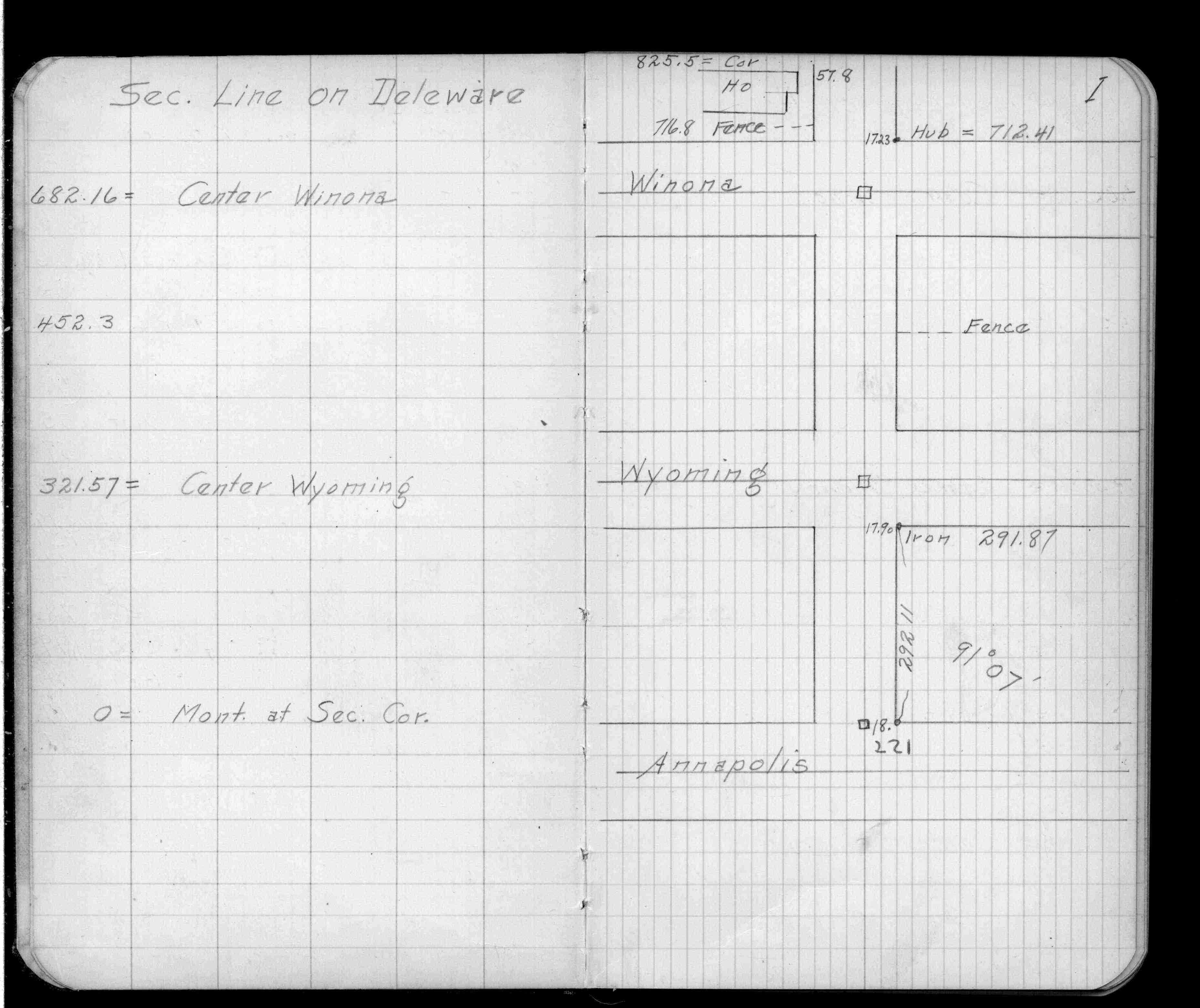
| 2/16/1972 | Fd CIM to grade. See FB 1689A p.7 |
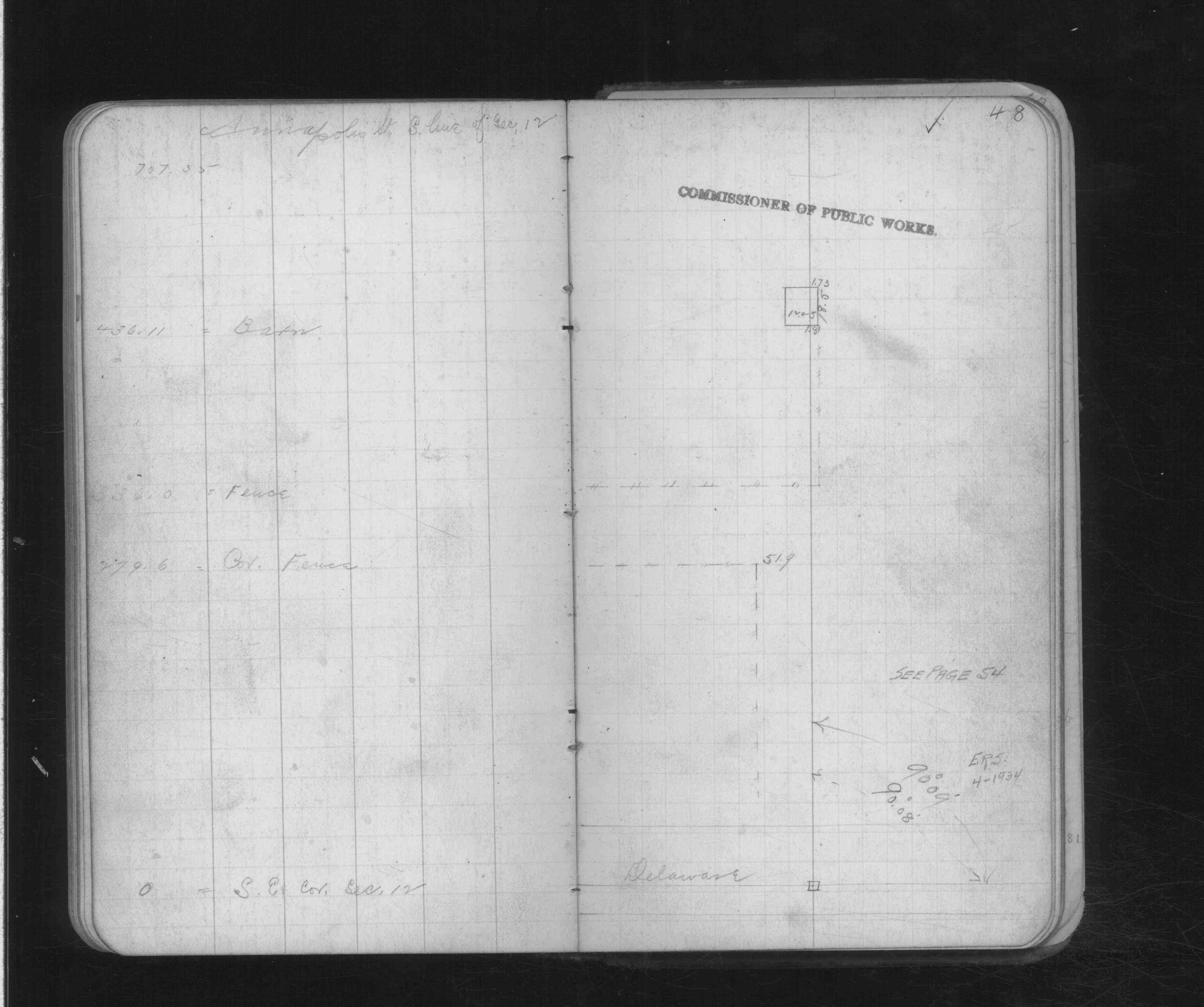
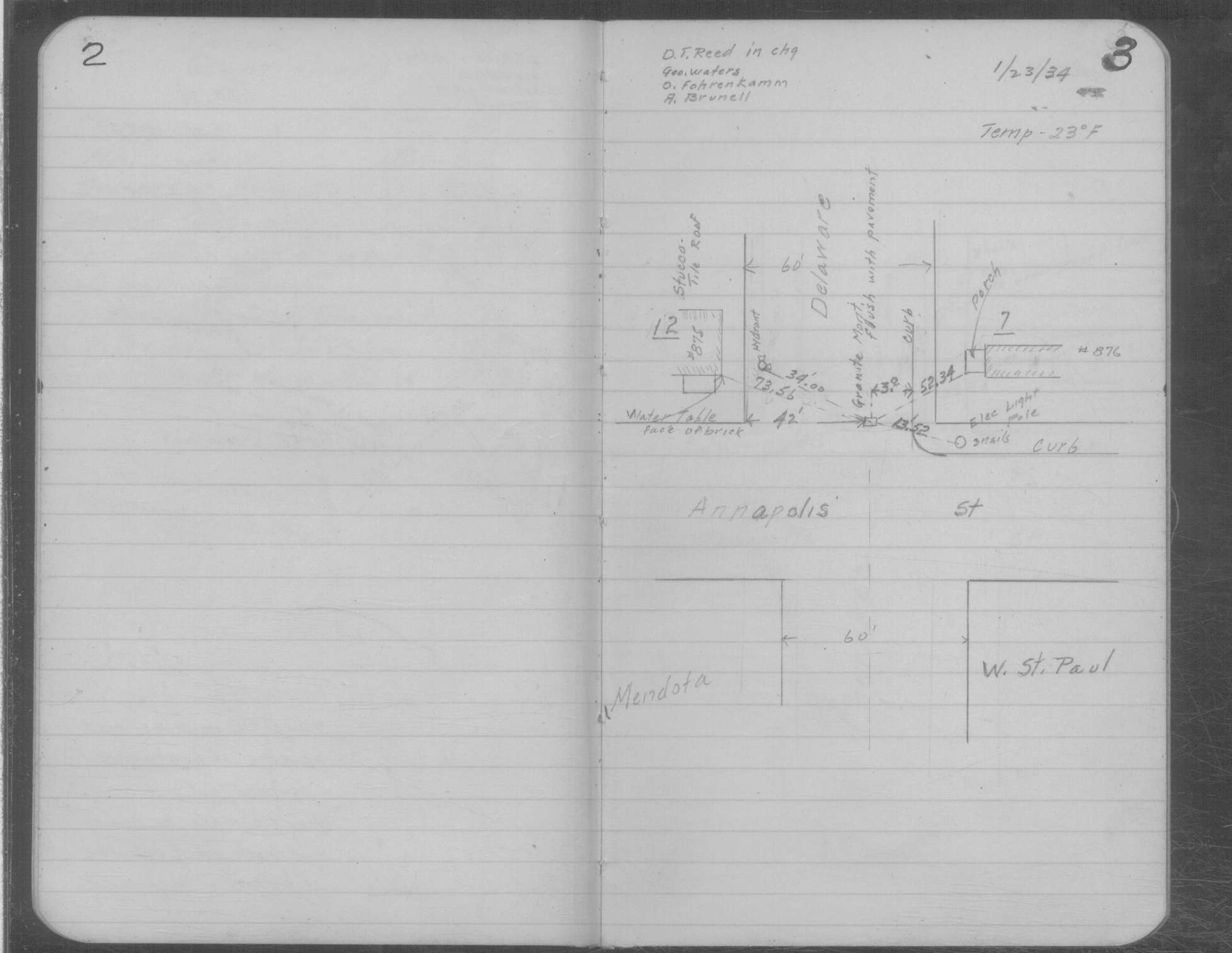
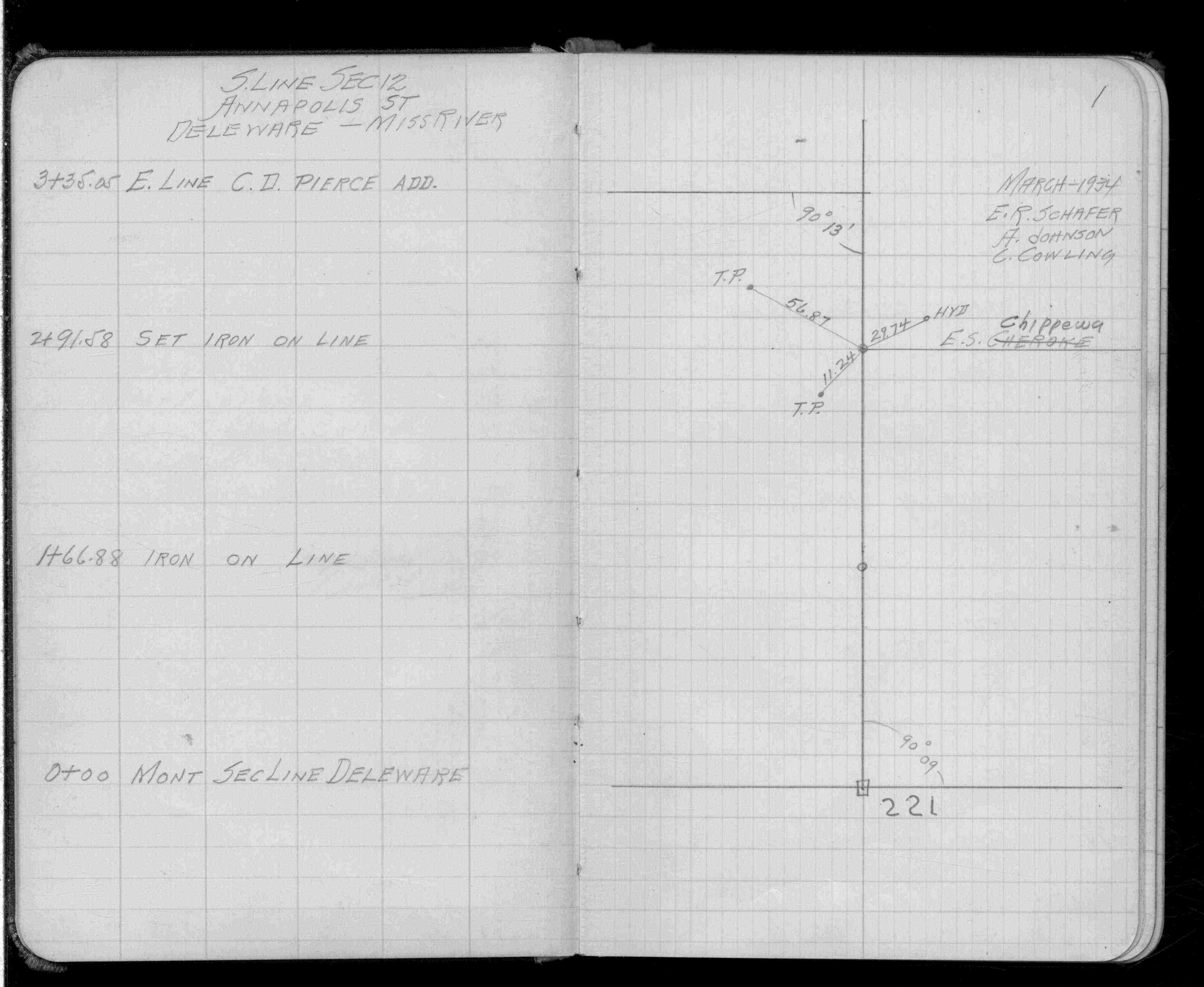
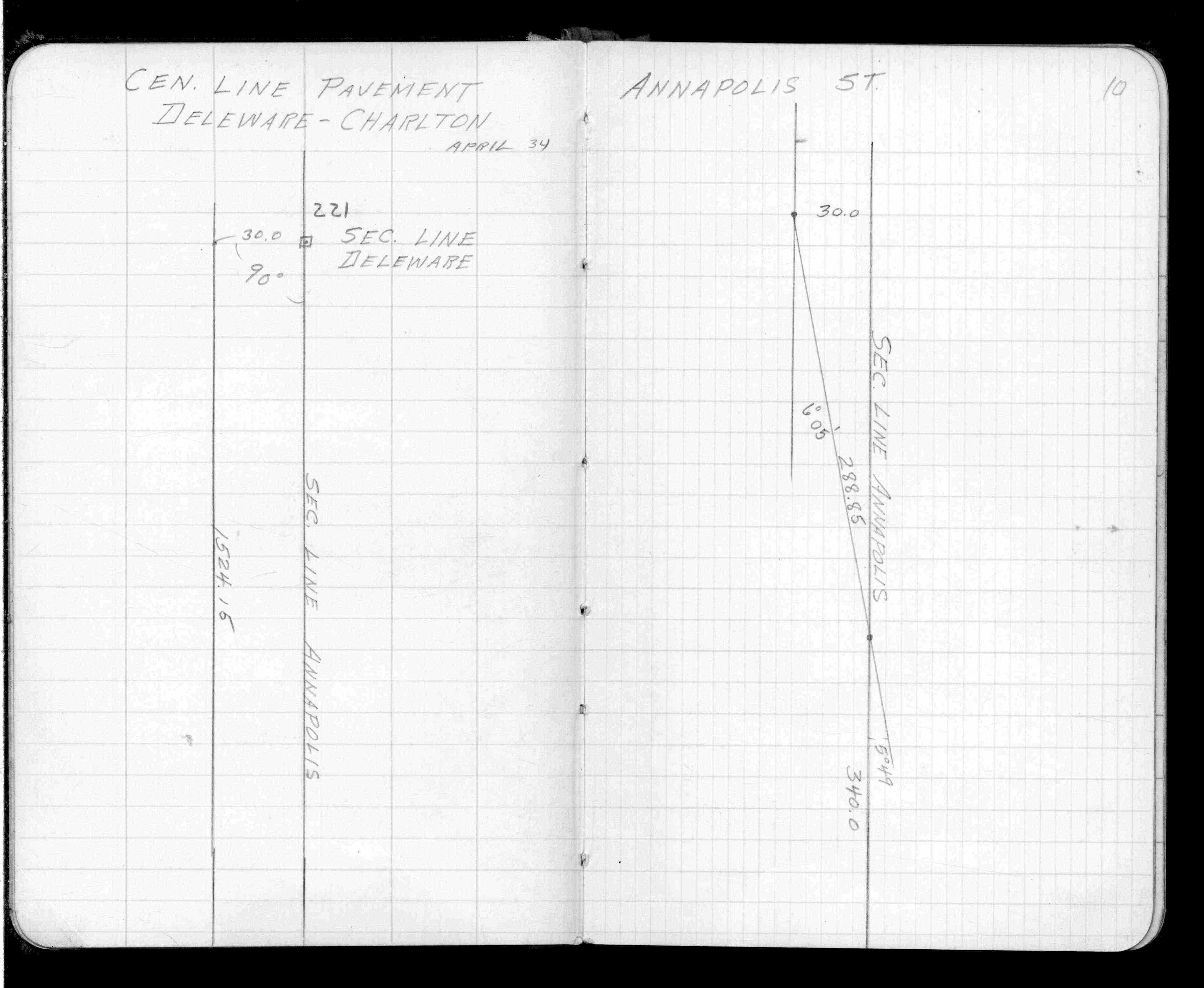
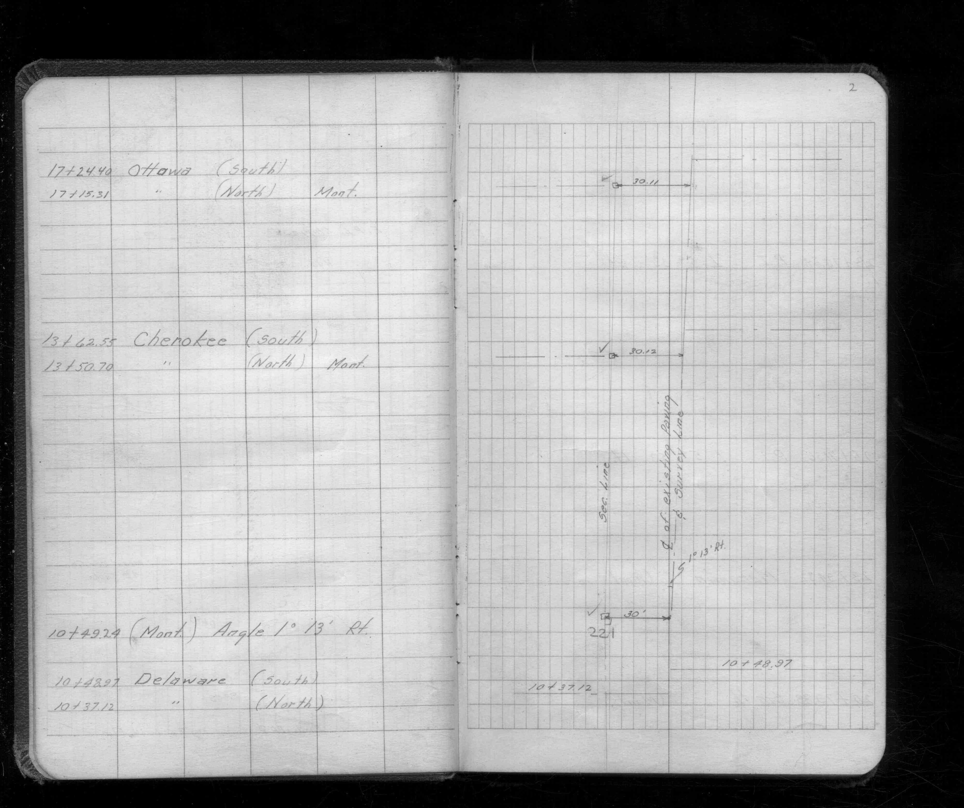
| 1/23/1934 | Placed ties on GM flush with pavement. See MSX 1 p.2-3 |
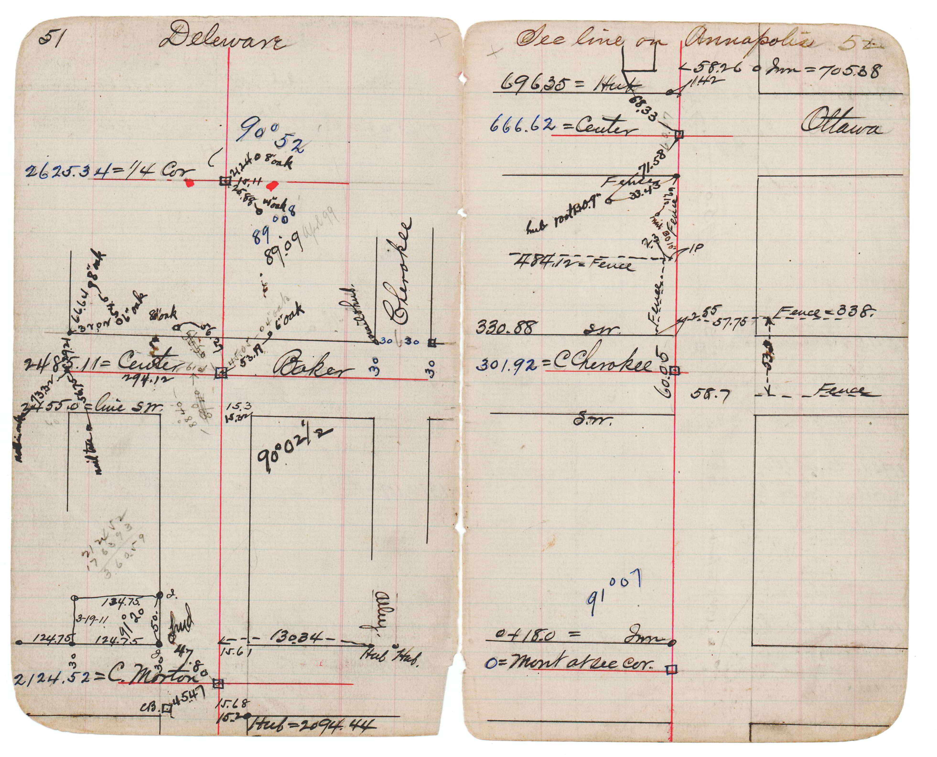
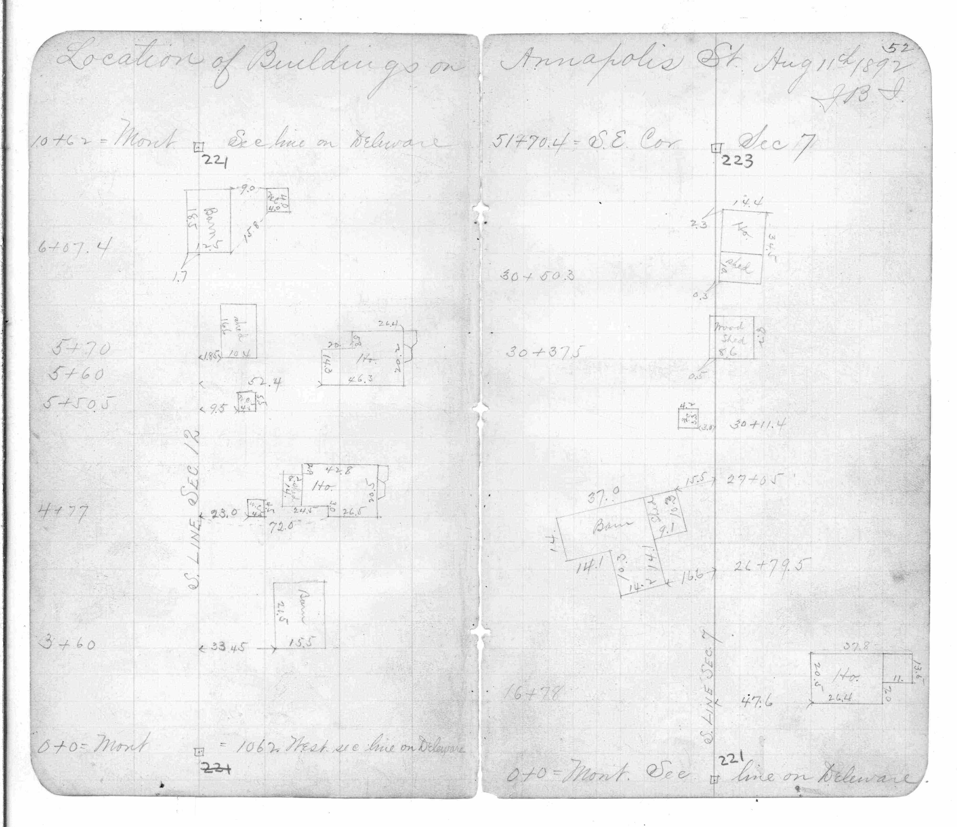
| 1/1/1880 | (Unknown date abt __, 188? ) Monument at Sta 0+00 on Annapolis at west line Sec 7-82-22. See JBI 17 p.51-52 |
| 3/1/1877 | (Unknown date Mar __, 1877 ) Section corner put in from all 3 bearing stumps. See Old Index Book, Entry 175 |
| 7/8/1853 | Jesse T Jarrett deputy surveyor set post. Tied to 3 BTs. See JJ p.026-027 border |
Above is NOT an all inclusive history of this point. Please review all the links below.
| PLS NOTES | Field | Cross Section | Sewer | J.B. Irvine | Monument | River Survey |
|---|---|---|---|---|---|---|
| JJ p.026-027 | FB 0263CPYp.48 | JBI 17 p.51-52 | MSX 0001 p.002-003 | |||
| FB 0286p.75 | ||||||
| FB 0320p. 01 ,05 | ||||||
| FB 0344p.52 | ||||||
| FB 0930p.01 | ||||||
| FB 1082p.33 | ||||||
| FB 1329p.77 | ||||||
| FB 1504p. 01 ,10 | ||||||
| FB 1541p.02 | ||||||
| FB 1549Fp. 49 ,59 | ||||||
| FB 1549Gp. 38 ,40 | ||||||
| FB 1549Hp.59 | ||||||
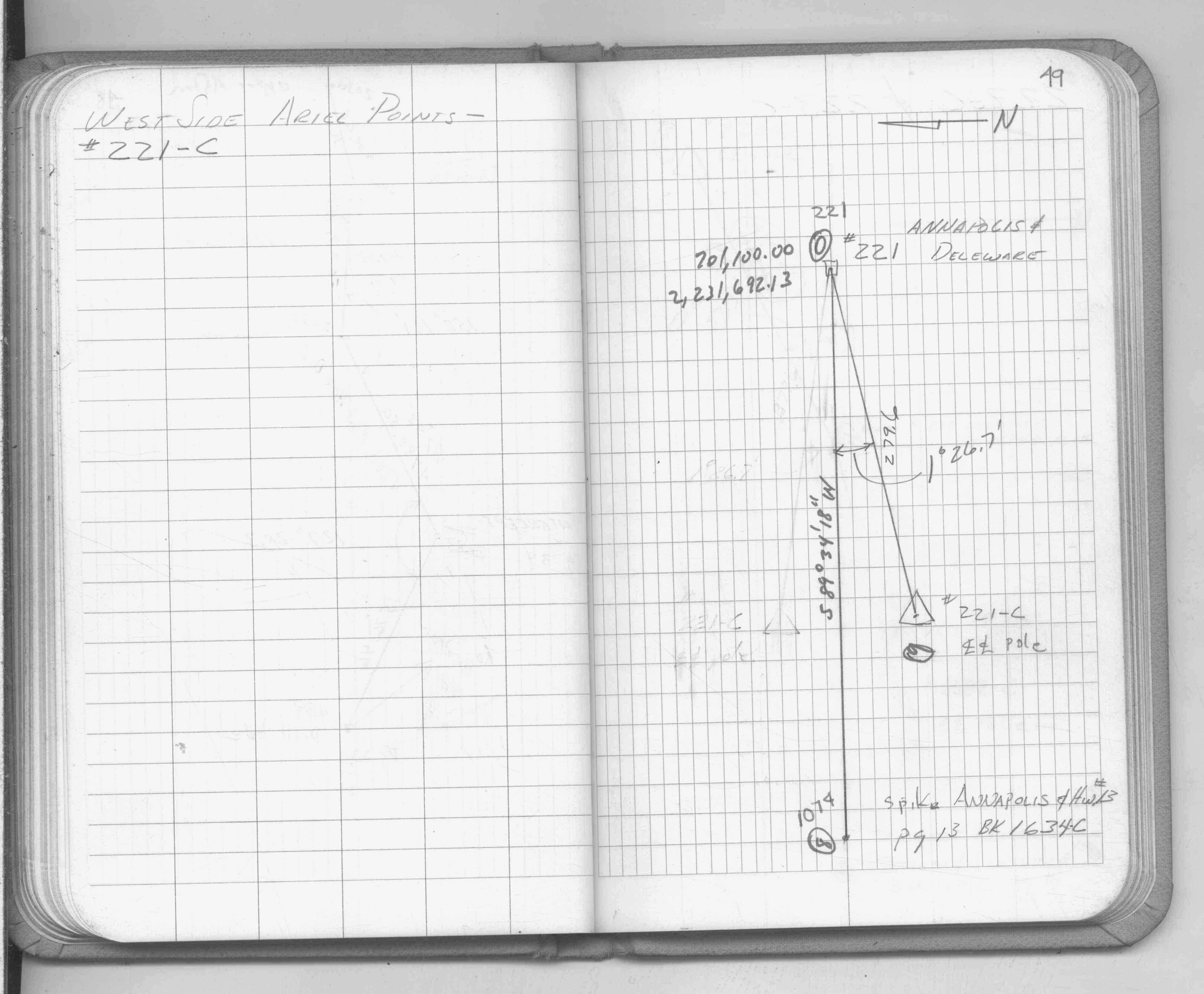
| FB 1634Cp. 12 ,13 ,14 | ||||||
| FB 1673Ap.72 | ||||||
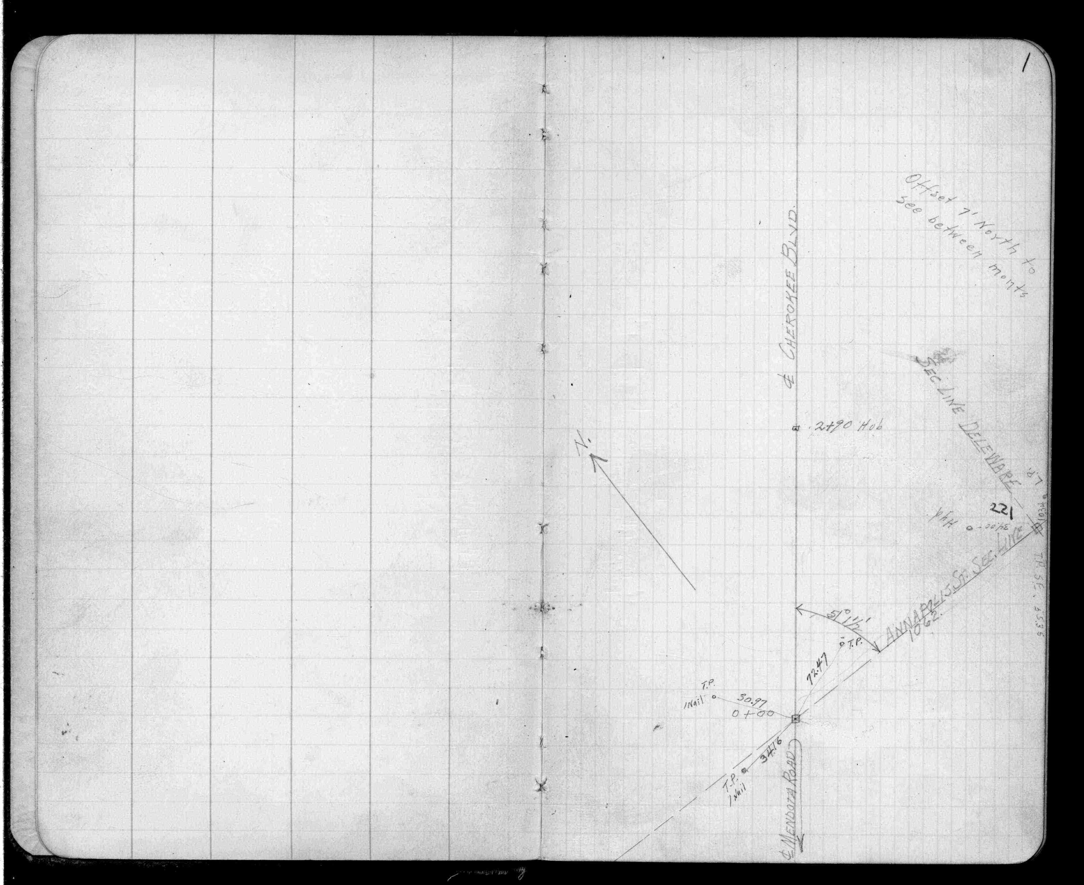
| FB 1689Ap.07 | ||||||
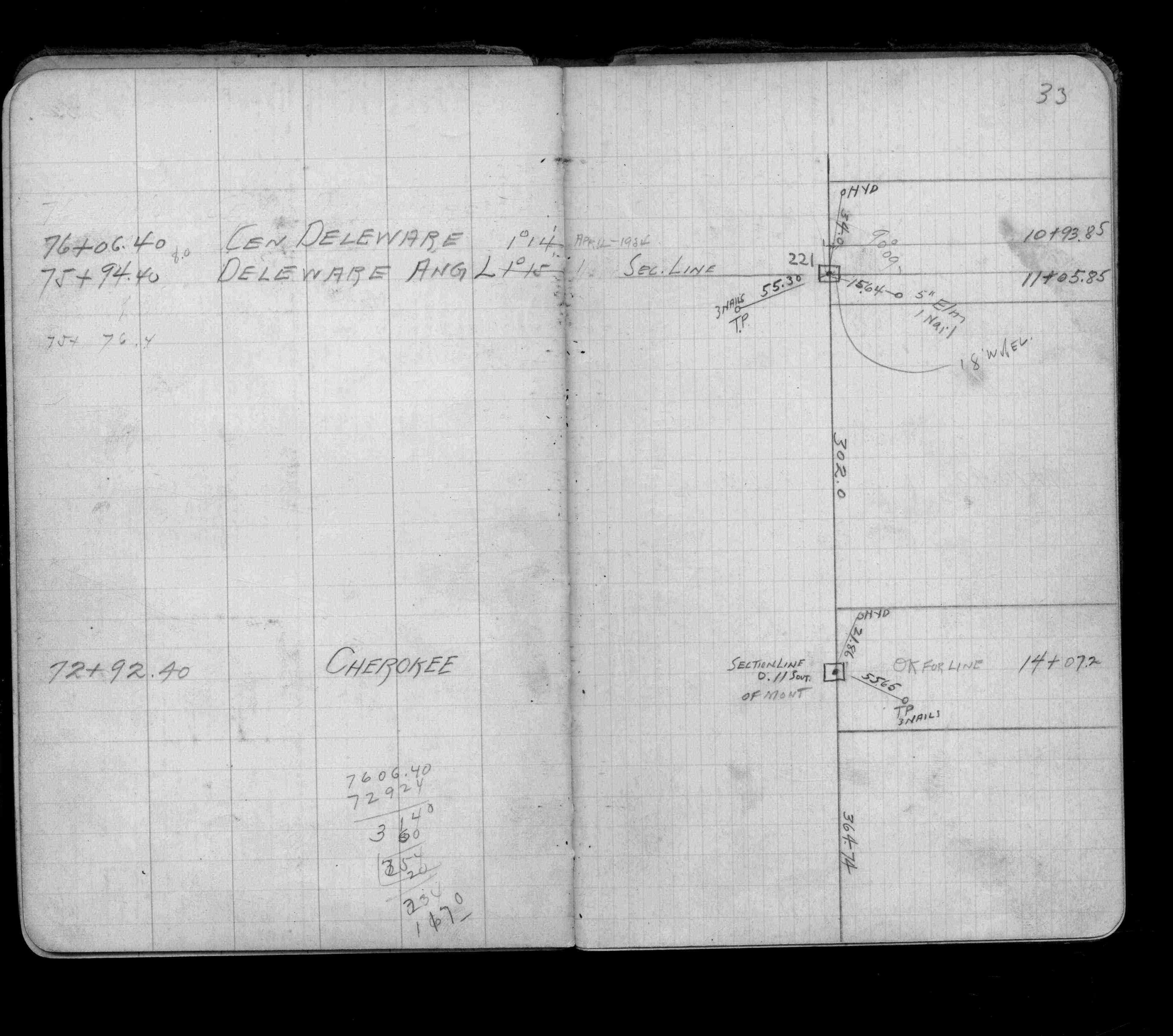
| FB 1713p.03 | ||||||
| FB 1713p.03 | ||||||
| FB 1716p.45 | ||||||
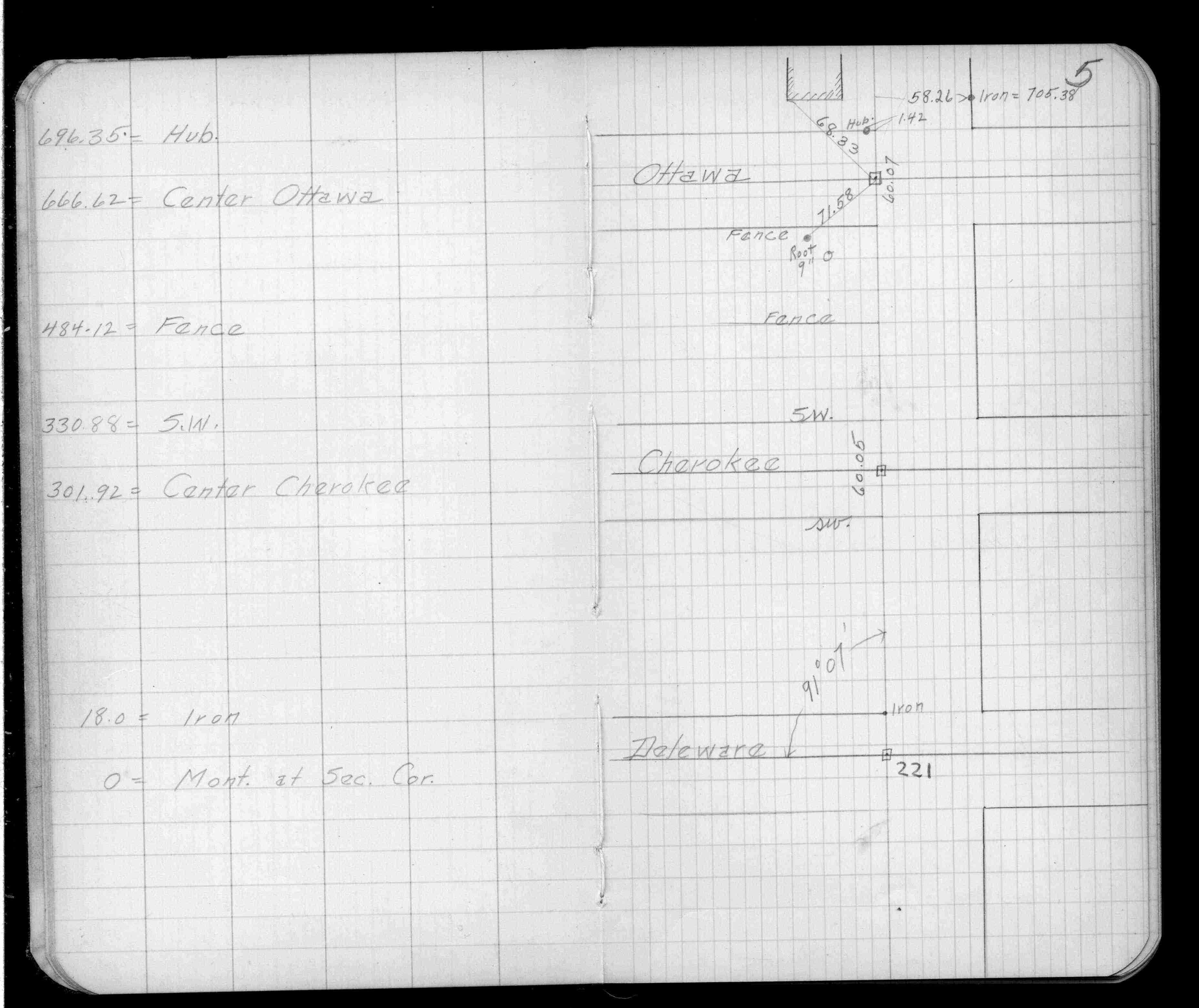
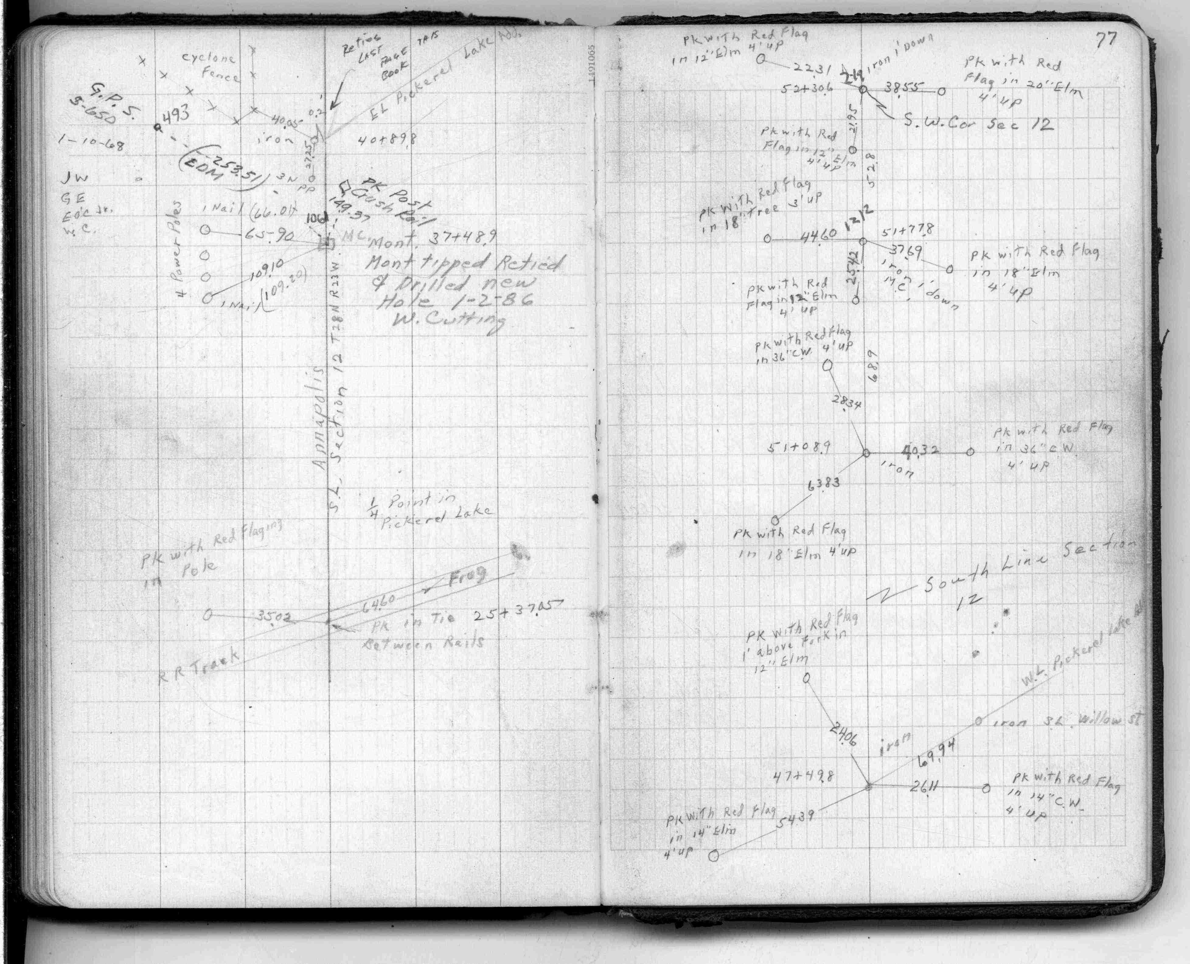
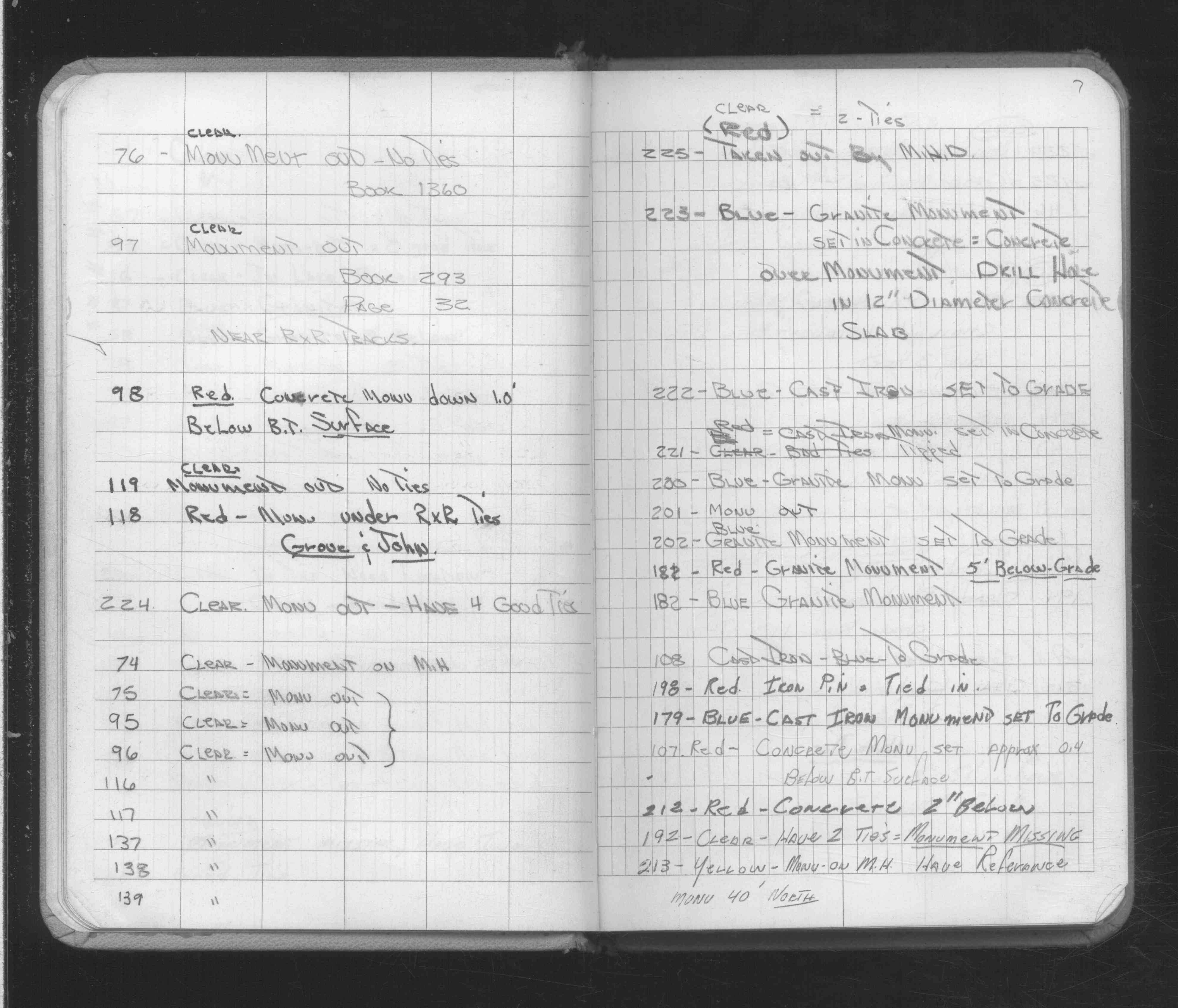
| FB 1735p.28 | ||||||
| FB 1735p.28 | ||||||
| FB 1736p.39 |
| FILE | SURVEYOR | LIC. NO. | DATE SIGNED | DATE TIED |
|---|---|---|---|---|
| 0221-0175-E.pdf | Samuel D. Gibson | 44880 | December 24, 2012 | November 26, 2012 |
| 0221-0175-D.tif | David D. Claypool | 13298 | October 10, 1997 | September 11, 1997 |
| 0221-0175-C.tif | William J. Cutting | 20576 | October 12, 1995 | March 20, 1996 |
| 0221-0175-B.tif | William J. Cutting | 20576 | October 12, 1995 | October 12, 1995 |
| 0221-0175-A.tif | Dakota County Surveyor's Office | none | none | January 1, 1984 |
| ST_157-234p221.jpg | none | none | none | none |
| 0221-0175-A.dwf | none | none | none | none |
| FILE | PHOTO DATE | COMMENTS |
|---|---|---|
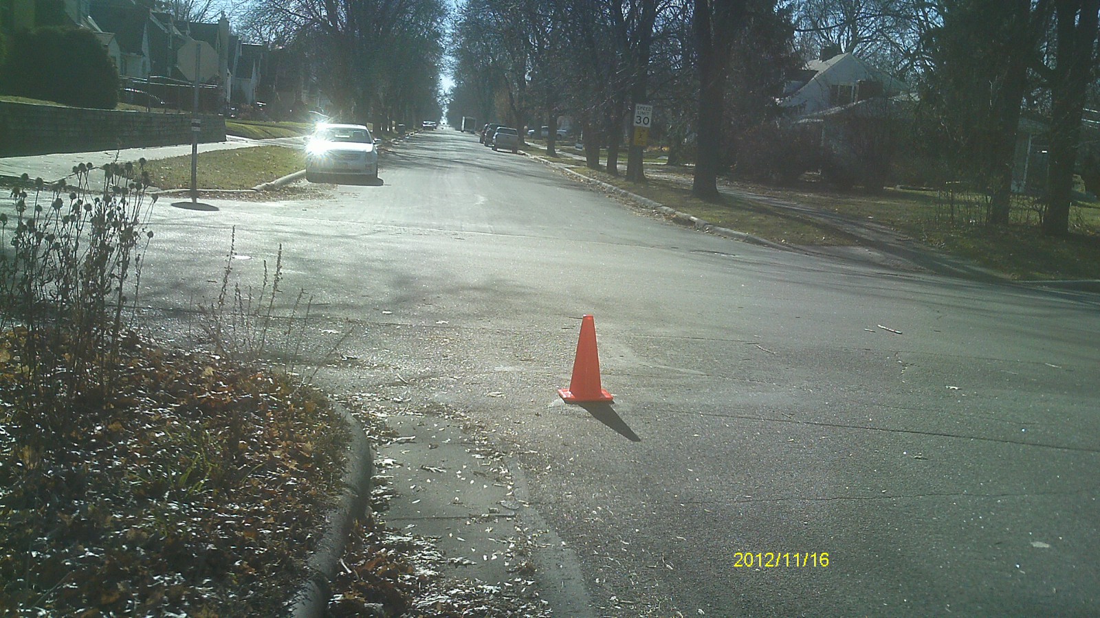
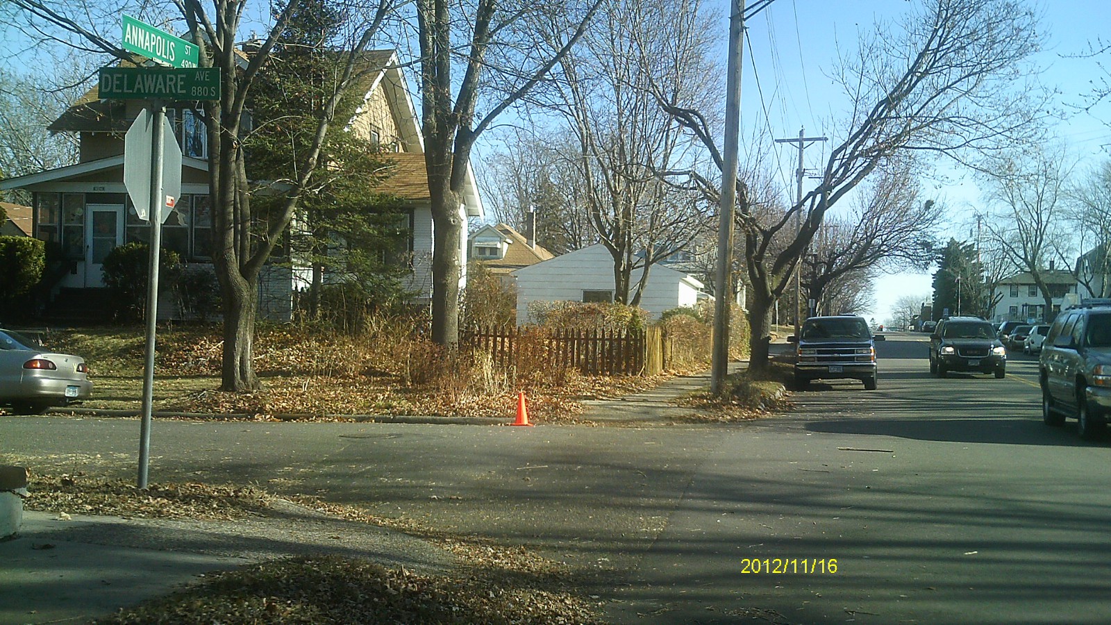
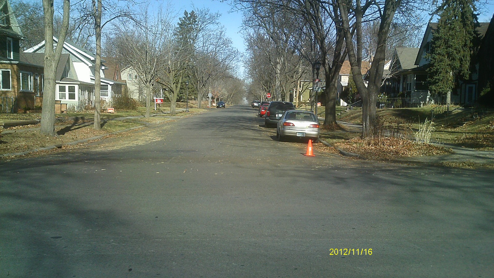
| 0221-0175-5.jpg | November 16, 2012 | Looking west along Annapolis St. |
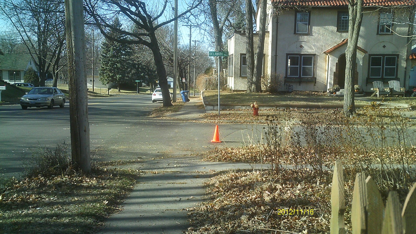
| 0221-0175-4.jpg | November 16, 2012 | Looking south along Delaware Ave. |
| 0221-0175-3.jpg | November 16, 2012 | Looking east along Annapolis St. |
| 0221-0175-2.jpg | November 16, 2012 | Looking north along Delaware Ave. |
| 0221-0175-1.jpg | November 16, 2012 | Close up of monument. |