| NAD83 COORDINATES (1986 adj.): |
|---|
| * X= 582391.883 Y= 146983.709 Z= 000.00 LSQ 12/06/1991 S FIX |
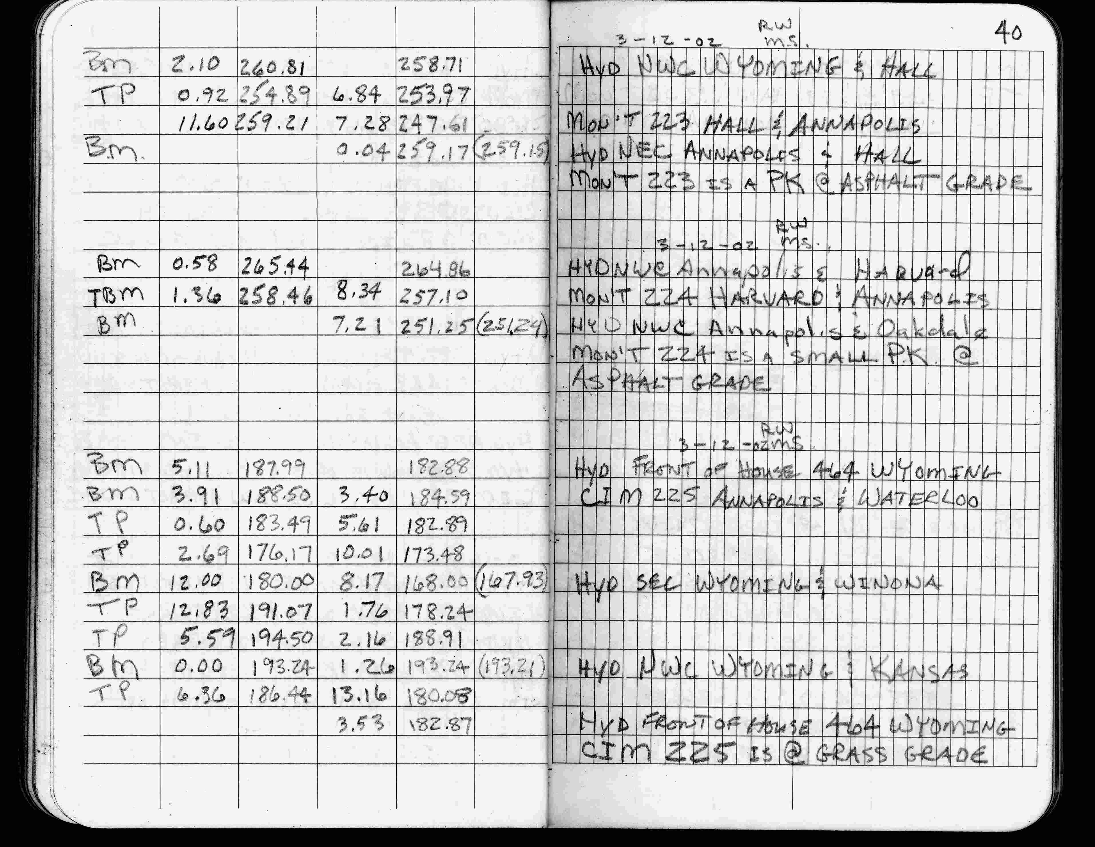
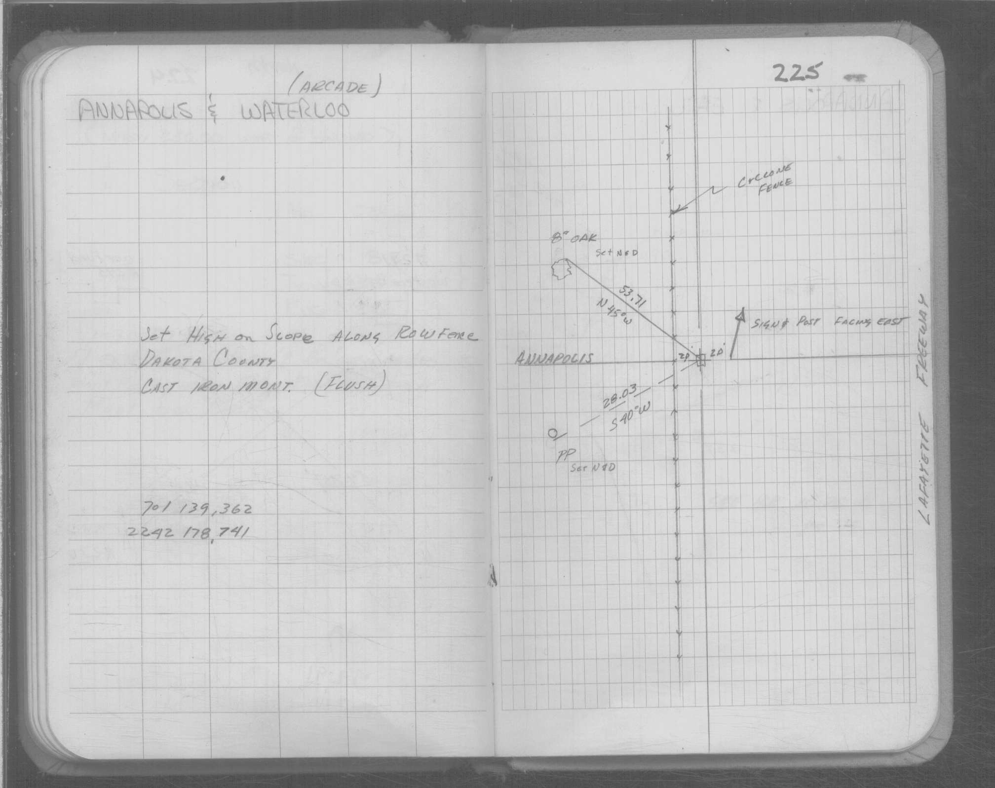
| 3/12/2002 | Elev 184.59 ft on CIM at grass surface. See FB 1736 p.40 |
| 3/1/2000 | (Unknown date Mar __, 2000 ) Fd CIM at grade (placed fabric target for 2000 aerial) |
| 1/1/1989 | (Unknown date ___ __, 1989 ) See FB 1676D p.16 |
| 1/1/1985 | (Unknown date ___ __,1985 ) Historic, one time only GPS survey = S164 |
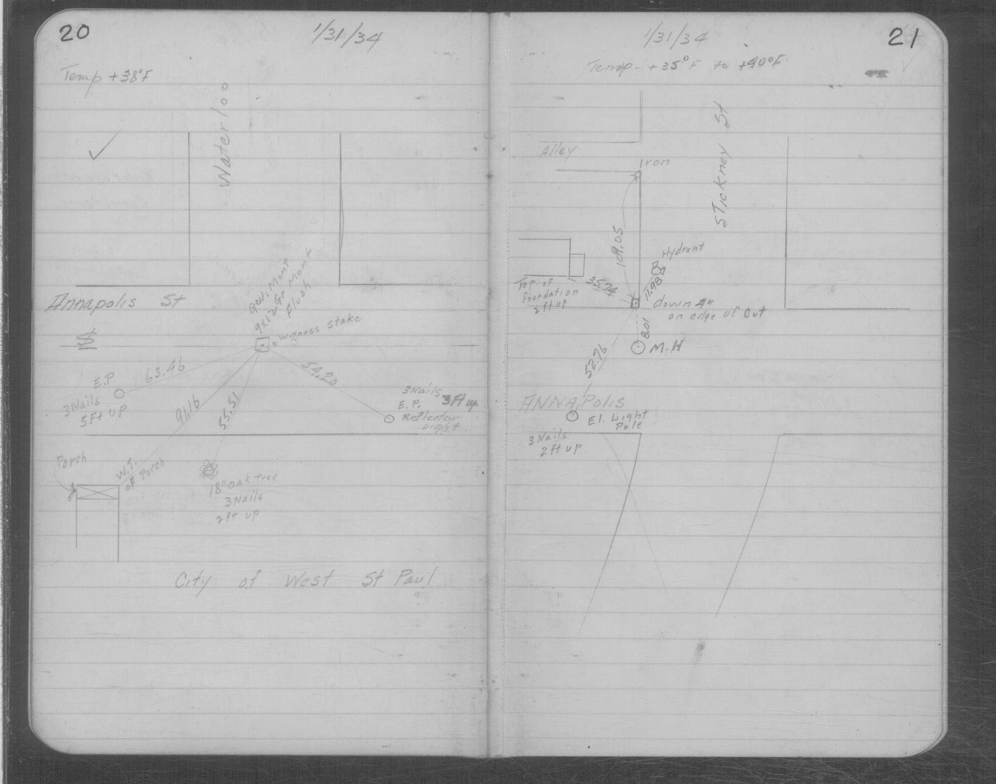
| 1/31/1934 | Placed ties on 9"x12" GM at grade. See MSX 1 p.20-21 |
| 3/1/1880 | (Unknown date Mar __, 1880 ) Monument set to corrected location of corner as shown from notes of D L Curtice |
| 3/1/1877 | (Unknown date Mar __, 1877 ) Bearing stump in. |
| 9/1/1853 | (Unknown date Sep __, 1853 ) Jesse T Jarrett deputy surveyor set post. Tied to 2 BTs. See JJ p.018-019 2822 |
| 1/1/1800 | (Unknown date ___ __, 18?? ) Elev 190.201 ft on GM. See Old Benches Book, Entry 1158 |
| 1/1/1800 | (Unknown date ___ __, ____ ) CIM set high on slope along ROW fence Dakota County |
Above is NOT an all inclusive history of this point. Please review all the links below.
| PLS NOTES | Field | Cross Section | Sewer | J.B. Irvine | Monument | River Survey |
|---|---|---|---|---|---|---|
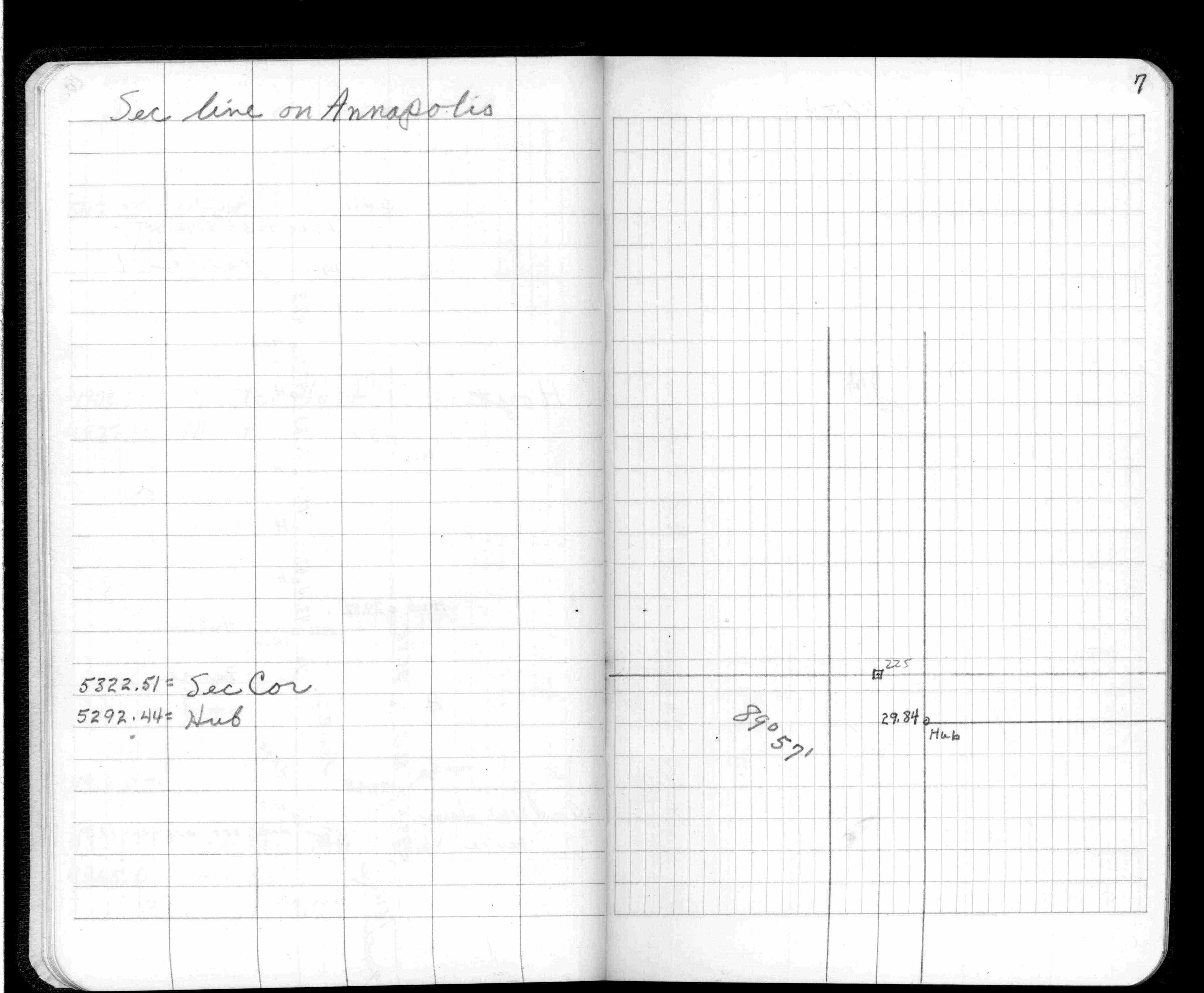
| JJ p.018-019 | FB 0223p.72 | MSX 0001 p.020-021 | ||||
| FB 0321CPYp. 07 ,21 | ||||||
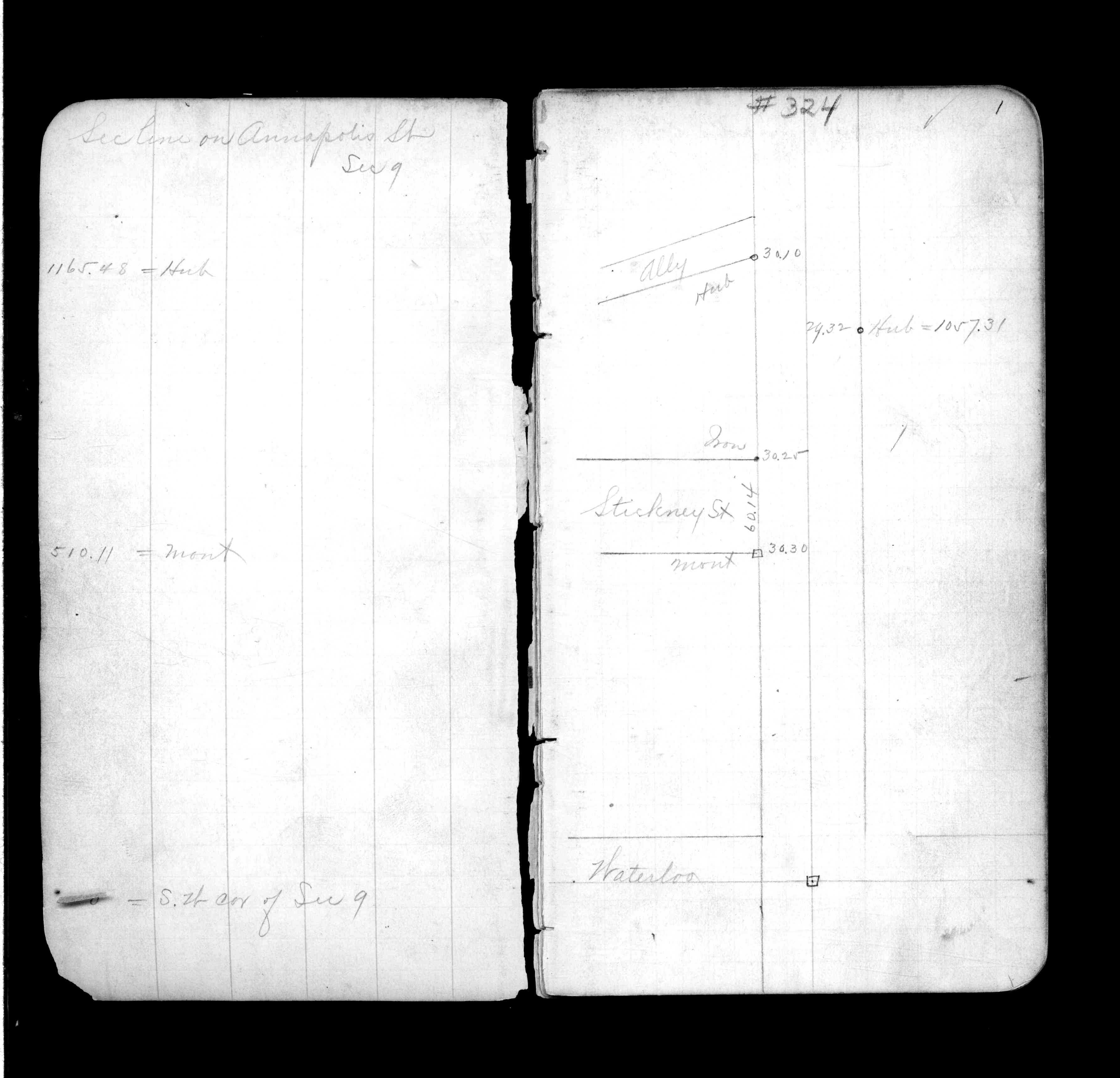
| FB 0324CPYp.01 | ||||||
| FB 1179Ap.39 | ||||||
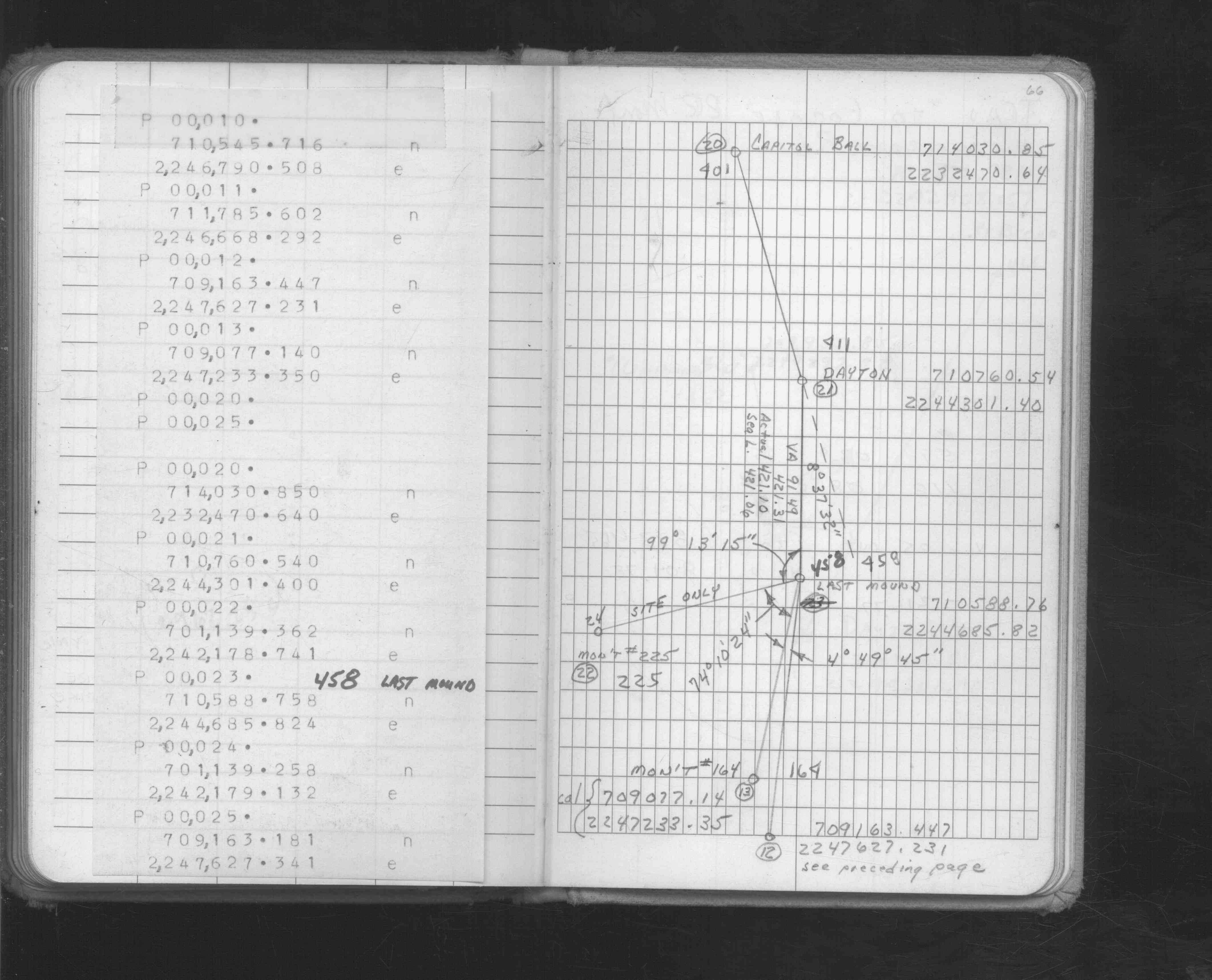
| FB 1549Ip.66 | ||||||
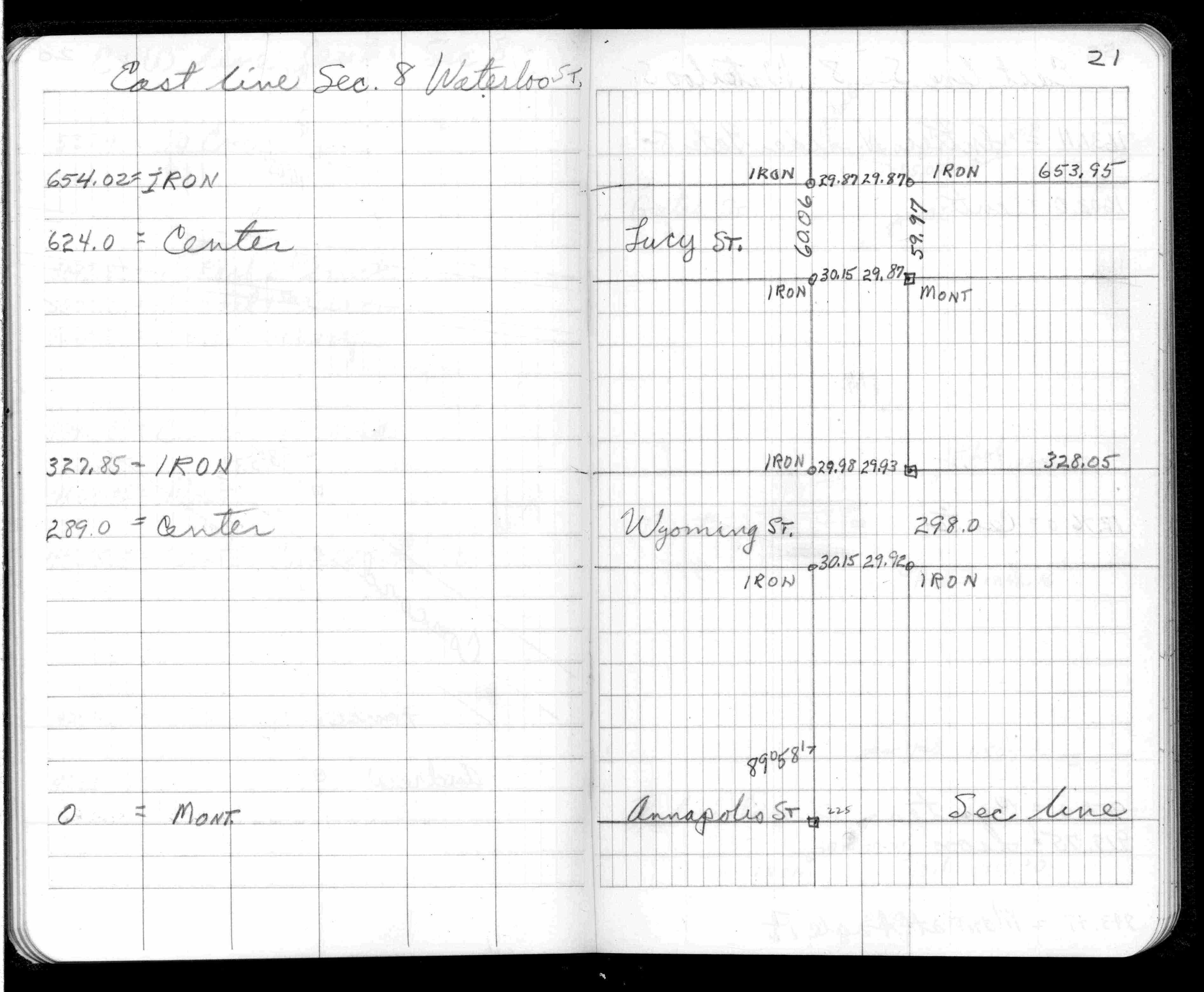
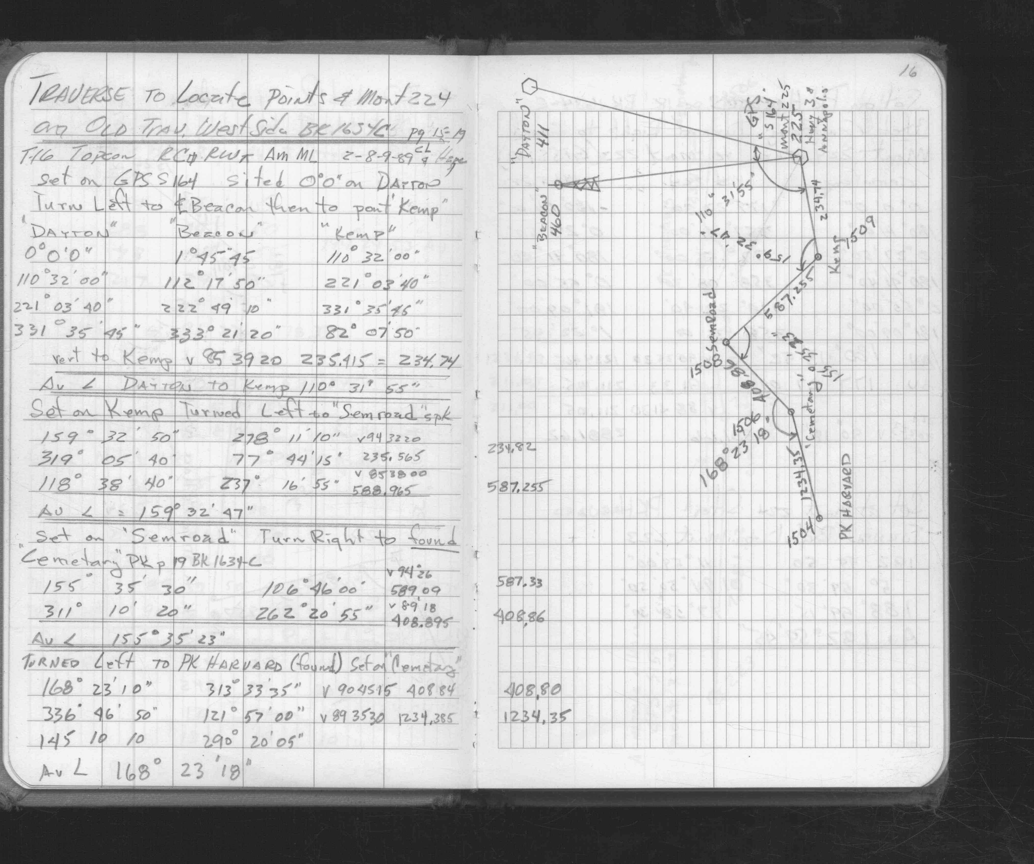
| FB 1676Dp.16 | ||||||
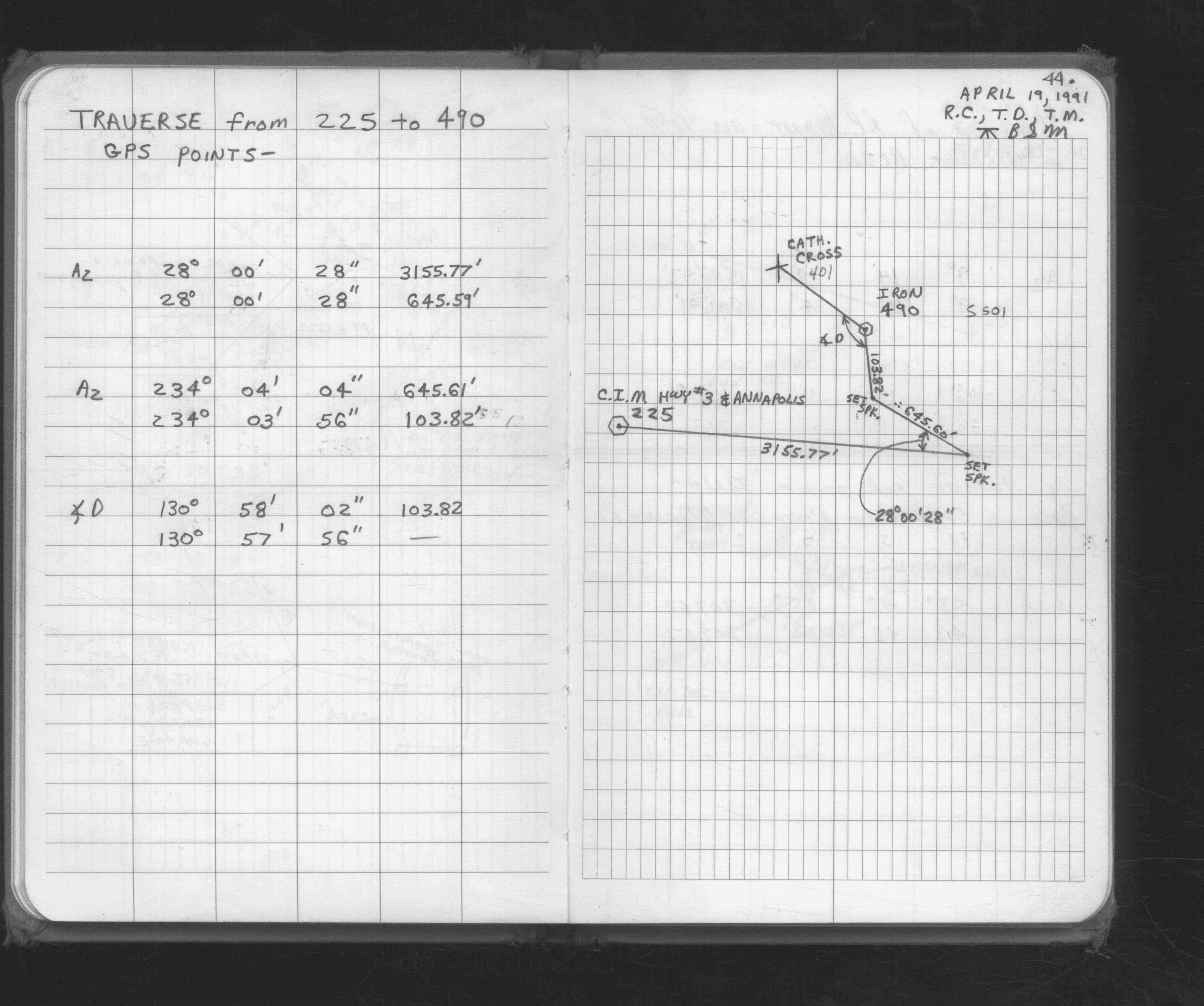
| FB 1676Dp. 16 ,44 | ||||||
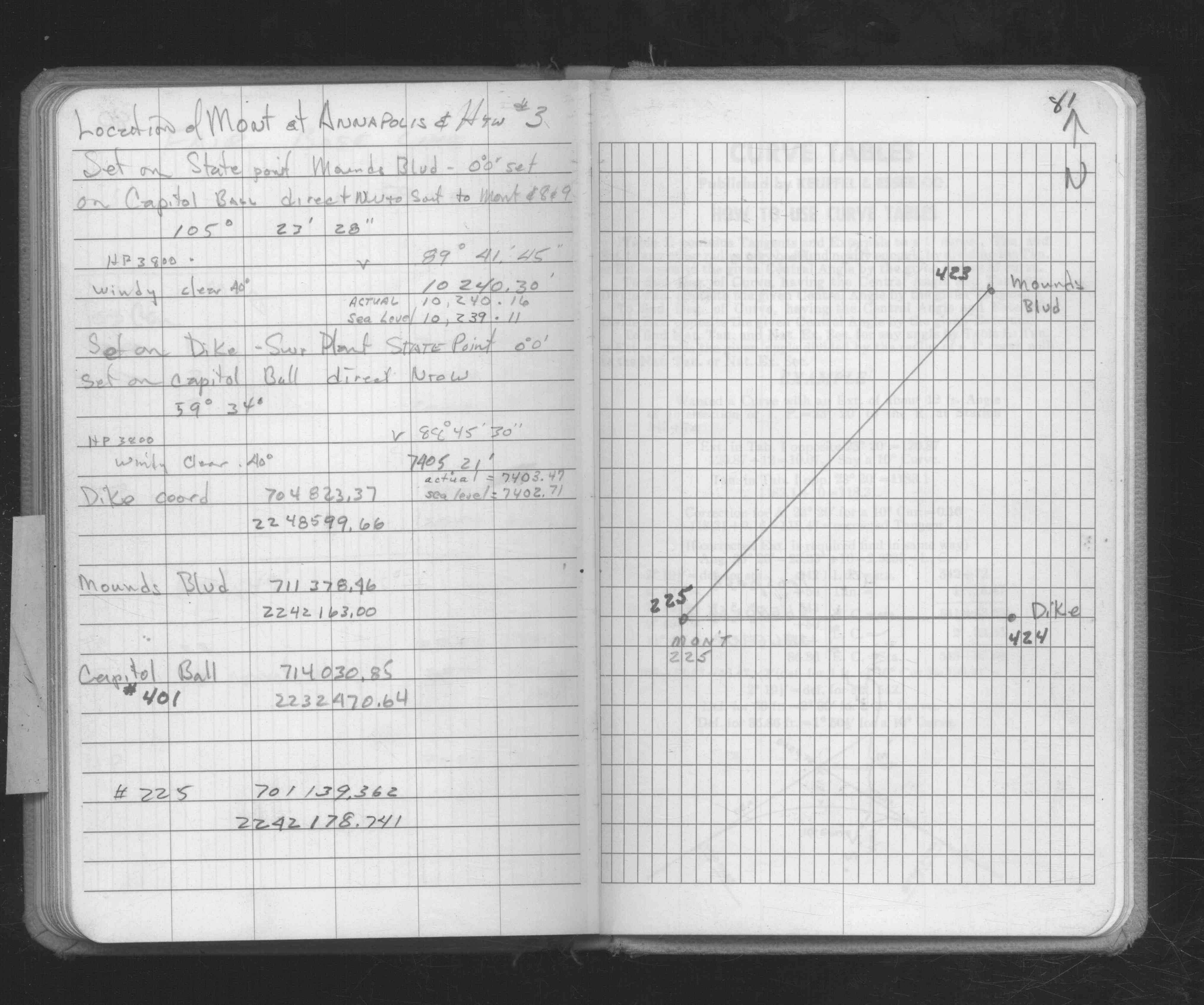
| FB 1686p.81 | ||||||
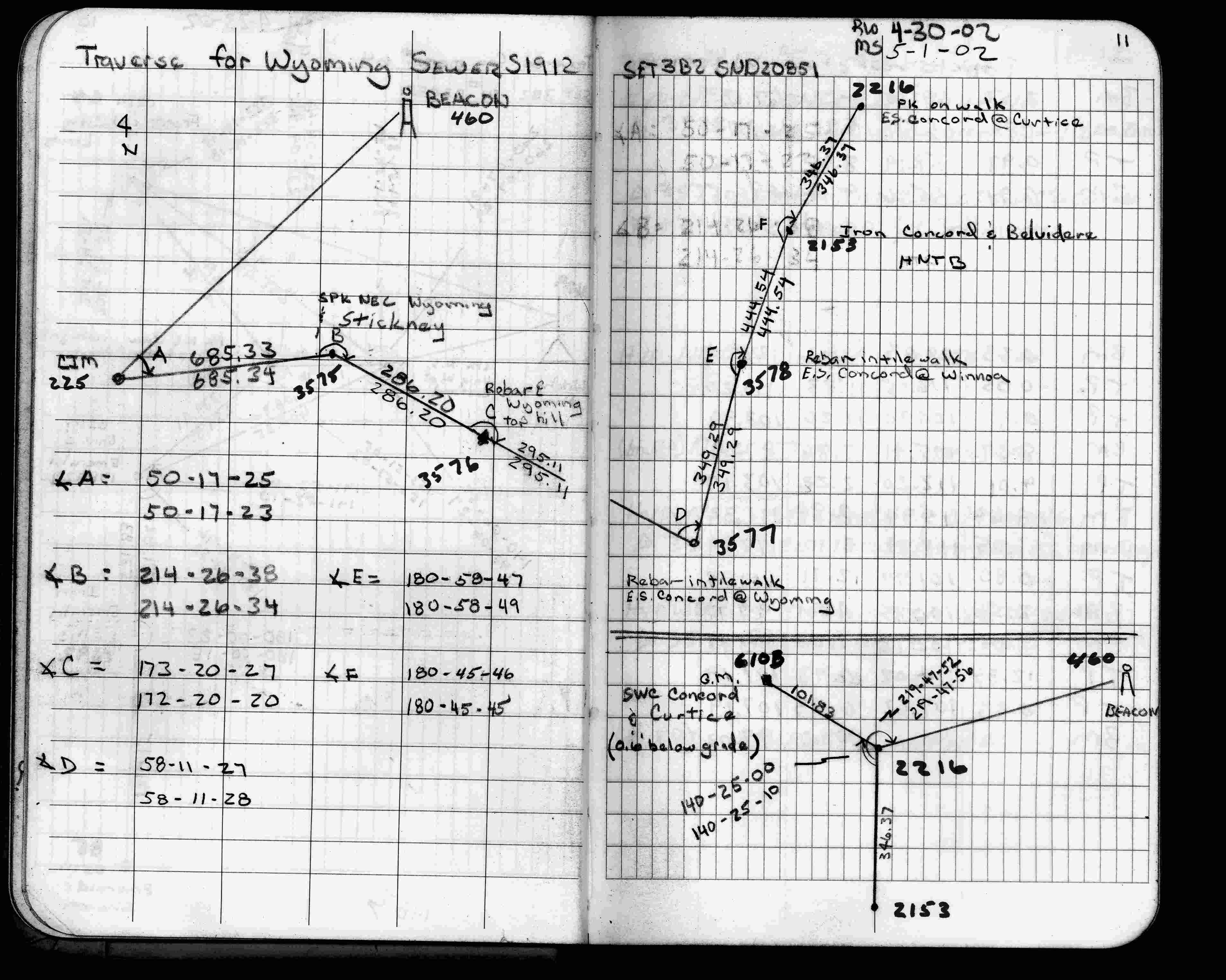
| FB 1735p.11 | ||||||
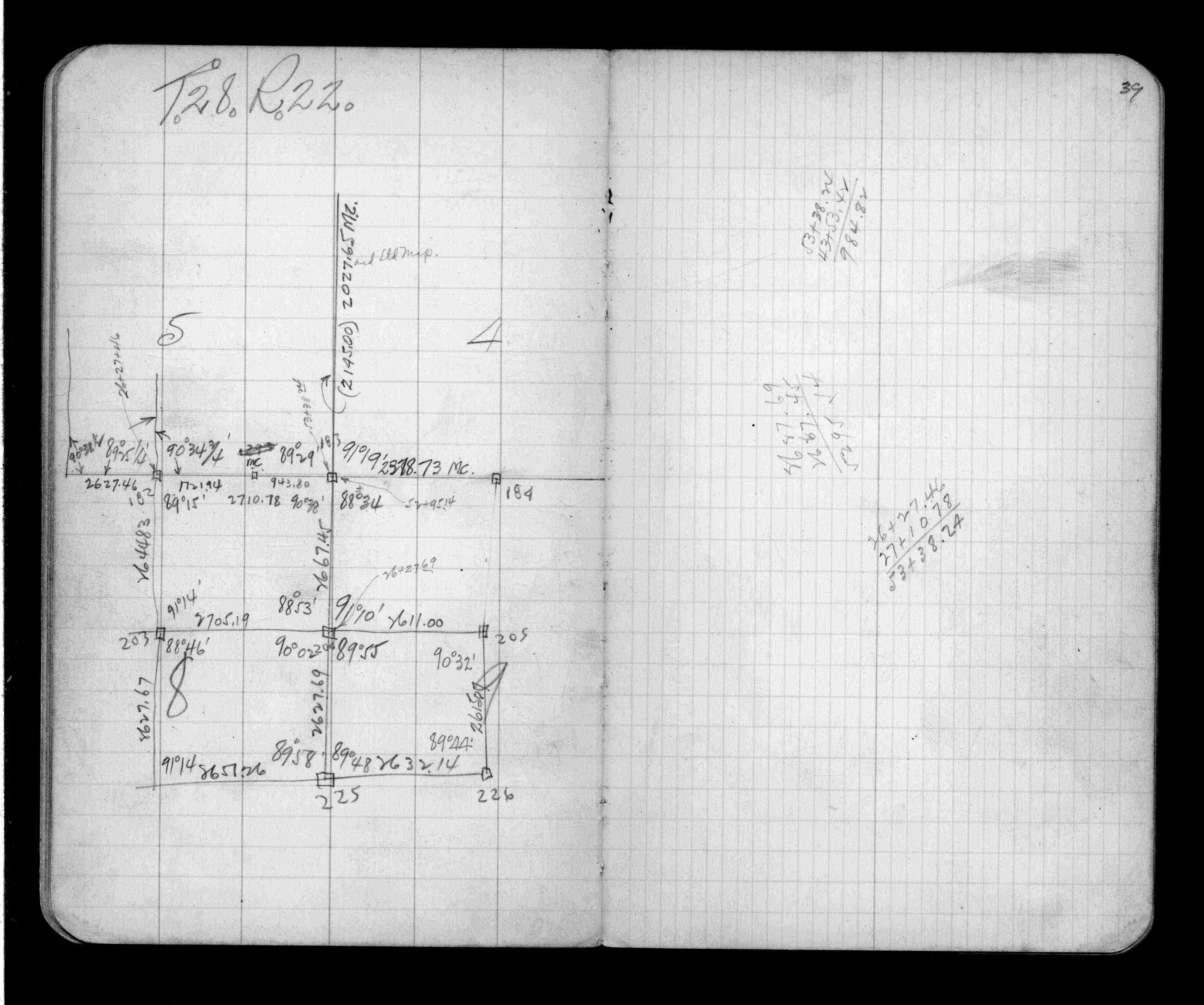
| FB 1736p.40 |
| FILE | SURVEYOR | LIC. NO. | DATE SIGNED | DATE TIED |
|---|---|---|---|---|
| ST_157-234p225.jpg | none | none | none | none |
| 0225-0183-A.dwf | none | none | none | none |