| NAD83 COORDINATES (1986 adj.): |
|---|
| * X= 595428.501 Y= 147009.853 Z= 000.00 LSQ 12/06/1991 S FLT |
| 5/22/2002 | Fd GM at grade. Photos taken by Mike Murphy. |
| 3/1/2000 | (Unknown date Mar __, 2000 ) Fd GM at grade (placed fabric target for 2000 aerial) |
| 4/26/1999 | GM recovered by Mike Murphy |
| 1/1/1900 | (Unknown date ___ __, ____ ) Concrete (GM?) monument set to grade on bank of hill |
| 4/1/1892 | (Unknown date Apr __, 1892 ) Monument set by J H Armstrong. |
| 10/1/1847 | (Unknown date Oct __, 1847 ) Isaac N Higbee deputy surveyor set post. Tied to 2 BTs. See IH p.080-081 2822 |
Above is NOT an all inclusive history of this point. Please review all the links below.
| PLS NOTES | Field | Cross Section | Sewer | J.B. Irvine | Monument | River Survey |
|---|---|---|---|---|---|---|
| IH p.080-081 | FB 0355CPYp. 31 ,37 ,55 | SB 0528Ap.09 | ||||
| FB 0357p.45 | ||||||
| FB 1121p.68 | ||||||
| FB 1549Hp.02 | ||||||
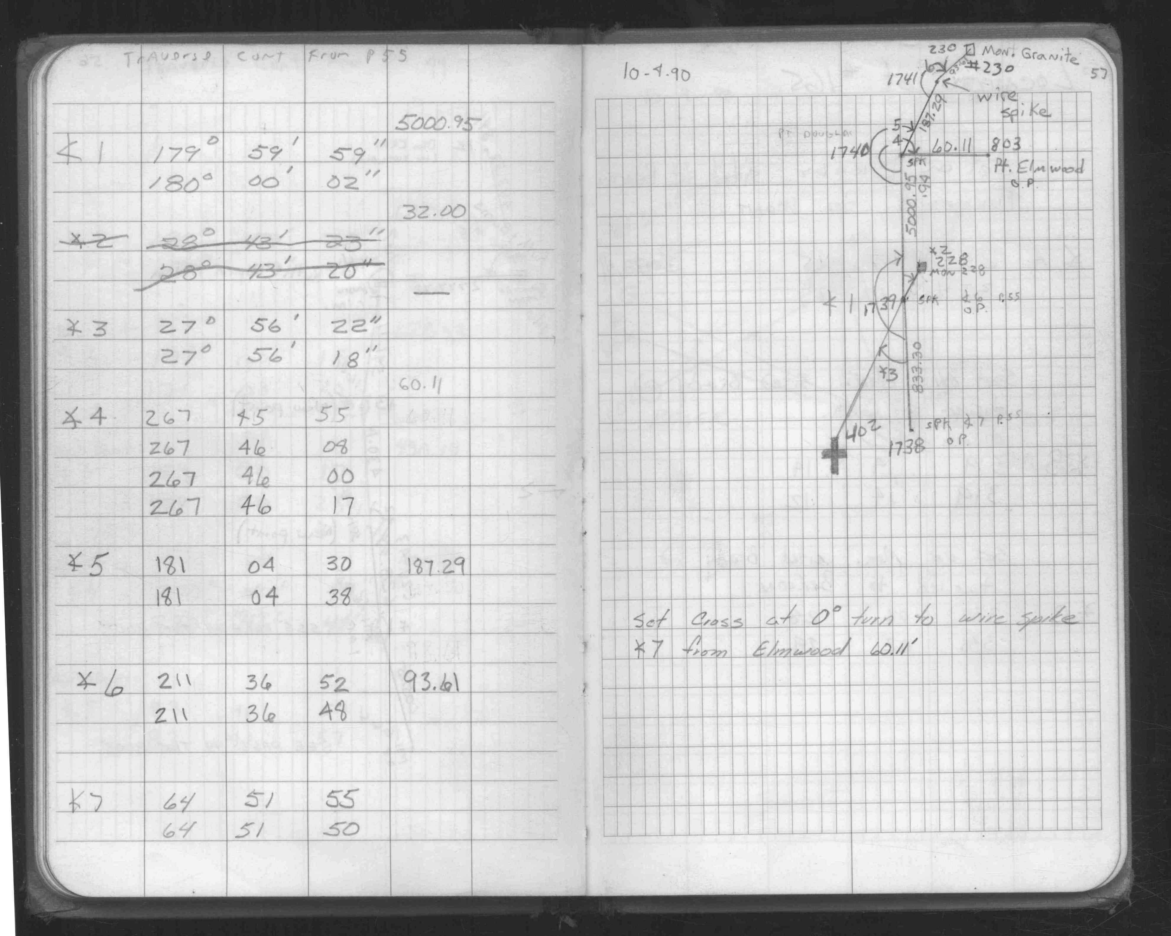
| FB 1549Kp.57 | ||||||
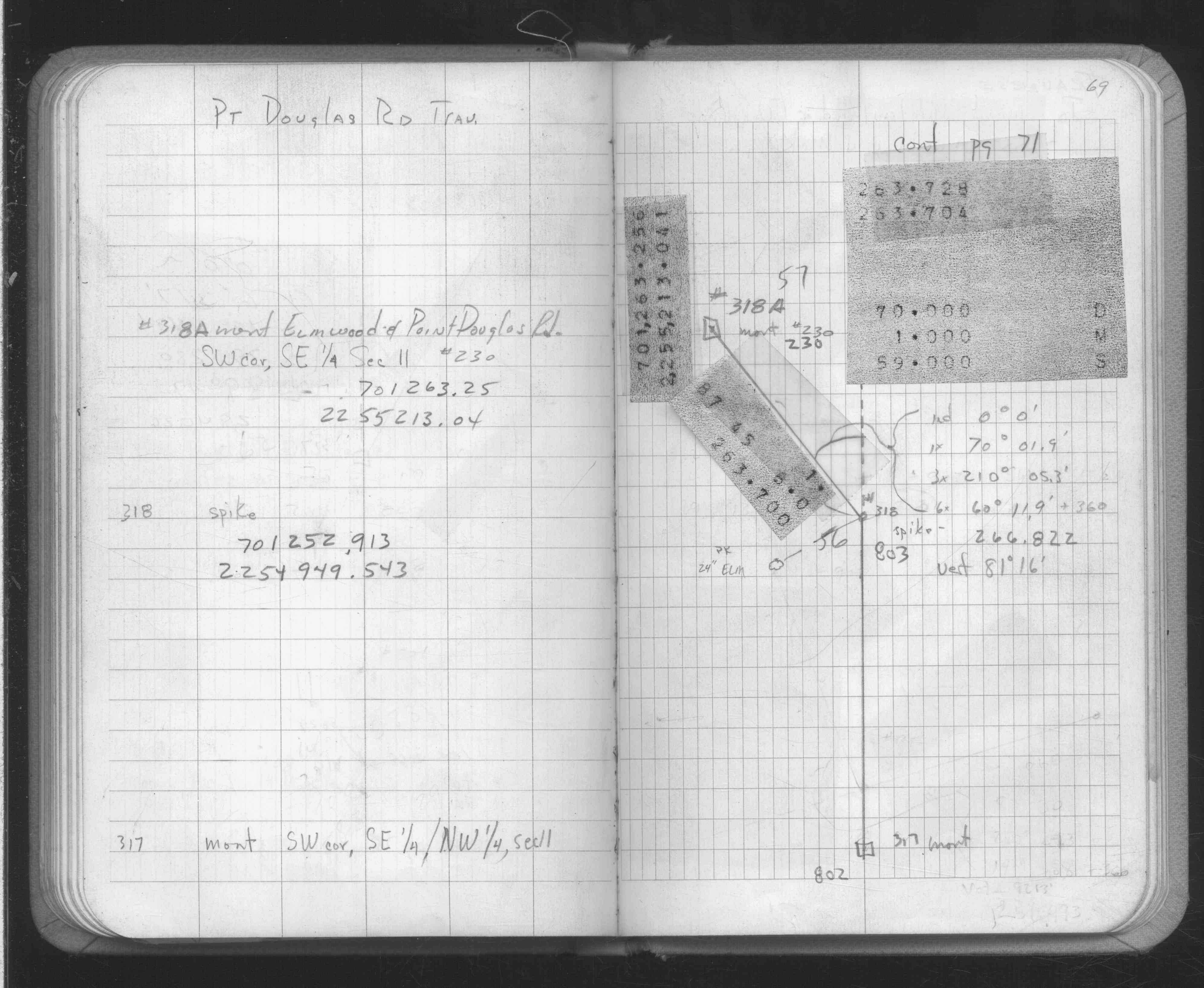
| FB 1634p.69 | ||||||
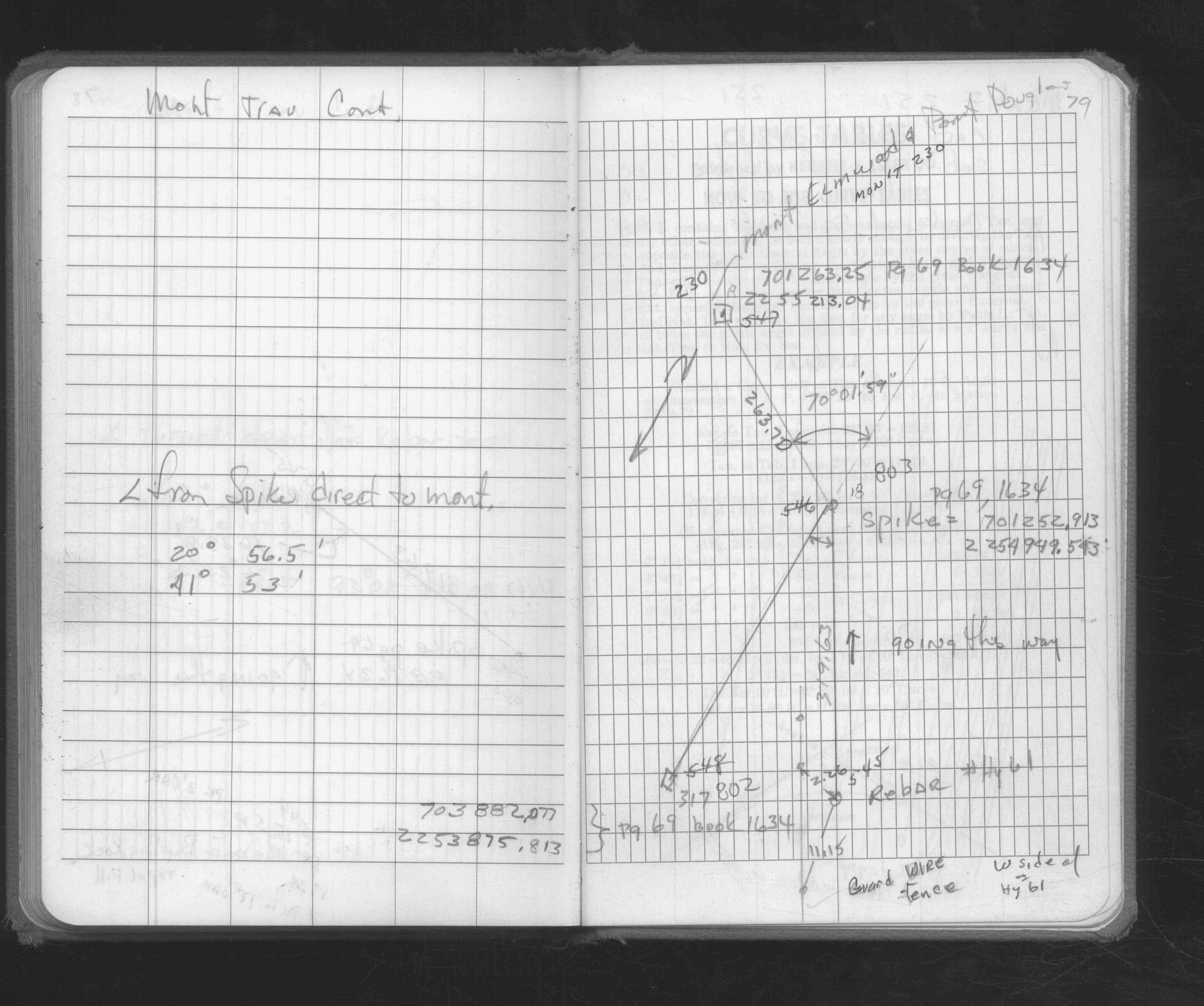
| FB 1676p.79 |
| FILE | SURVEYOR | LIC. NO. | DATE SIGNED | DATE TIED |
|---|---|---|---|---|
| ST_157-234p230.jpg | none | none | none | none |
| 0230-2328-A.dwf | none | none | none | none |
| FILE | PHOTO DATE | COMMENTS |
|---|---|---|
| 0230-2583-5.jpg | March 22, 2004 | Close-up of GM. |
| 0230-2583-4.jpg | March 22, 2004 | Looking easterly towards GM. |
| 0230-2583-3.jpg | May 22, 2002 | Looking easterly towards GM. |
| 0230-2583-2.jpg | May 22, 2002 | Looking easterly towards GM. |
| 0230-2583-1.jpg | May 22, 2002 | Closeup of GM. |