| NAD83 COORDINATES (1986 adj.): |
|---|
| * X= 550768.600 Y= 144332.682 Z= 000.00 LSQ 12/06/1991 S FIX |
| X= 550768.76 Y= 144332.94 Z= 837.70 12/07/2006 RTK-VRS |
| 12/7/2006 | Position on CIM established by GPS RTK-VRS. Elevation 837.7 ft. |
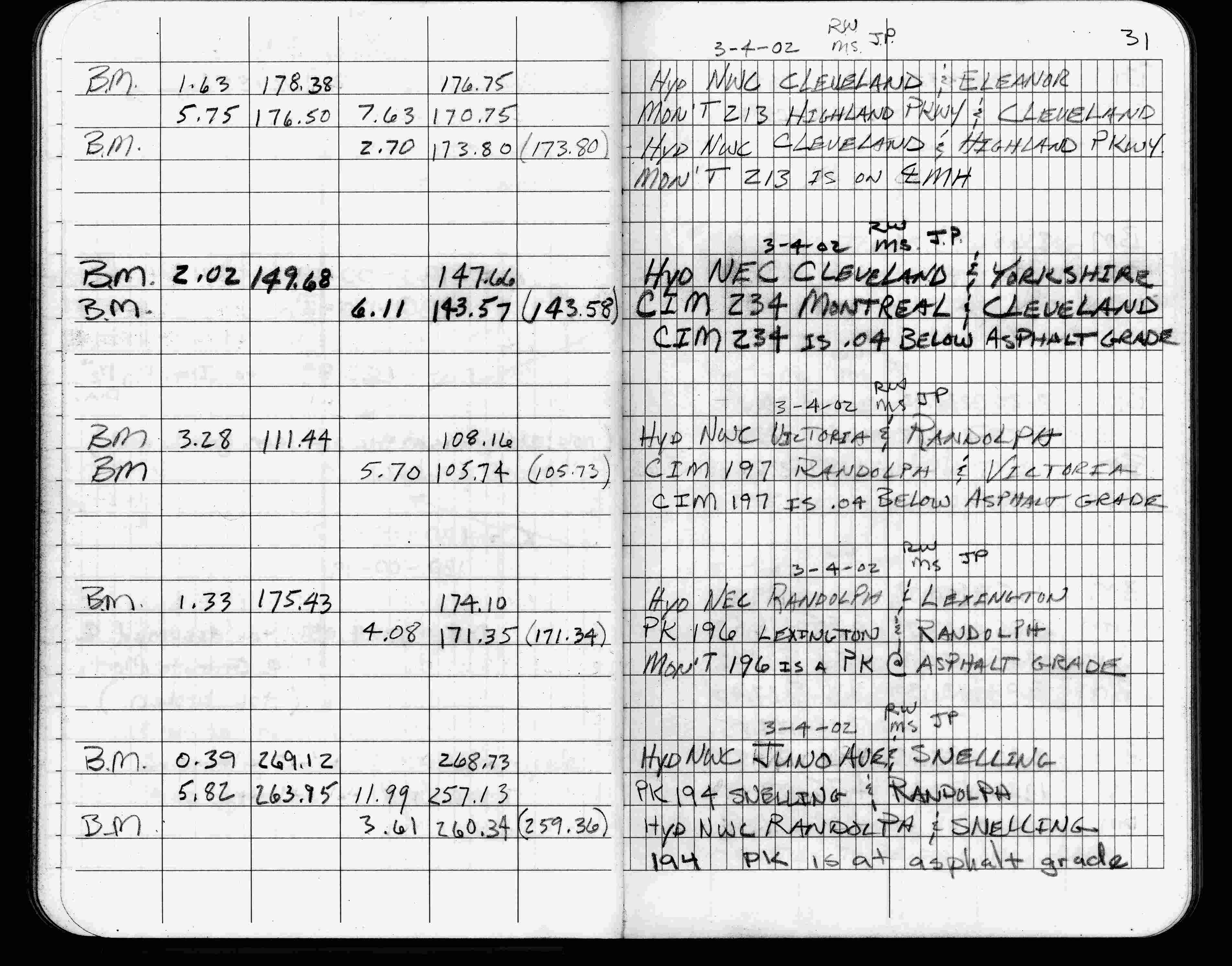
| 3/4/2002 | Elev 143.57 ft on CIM 0.04 ft below asphalt surface. See FB 1736 p.31 |
| 3/1/2000 | (Unknown date Mar __, 2000 ) Fd CIM at grade (marked for painting target for 2000 aerial) |
| 3/5/1997 | Elev 143.58 ft on CIM. See 97adj.pts, 1997/mrb-clev.org/mrb-clev.sdr (loop 154) Digital-Adj |
| 10/19/1995 | Set CIM from ties dated 09/26/1995. See CofL 0234-1285-B |
| 10/14/1995 | Fd 2 ft pk nail straddles, monument has been removed for street construction. See CofL 0234-1285-B |
| 9/26/1995 | Placed 2 ft straddles from ties. See CofL 0234-1285-A |
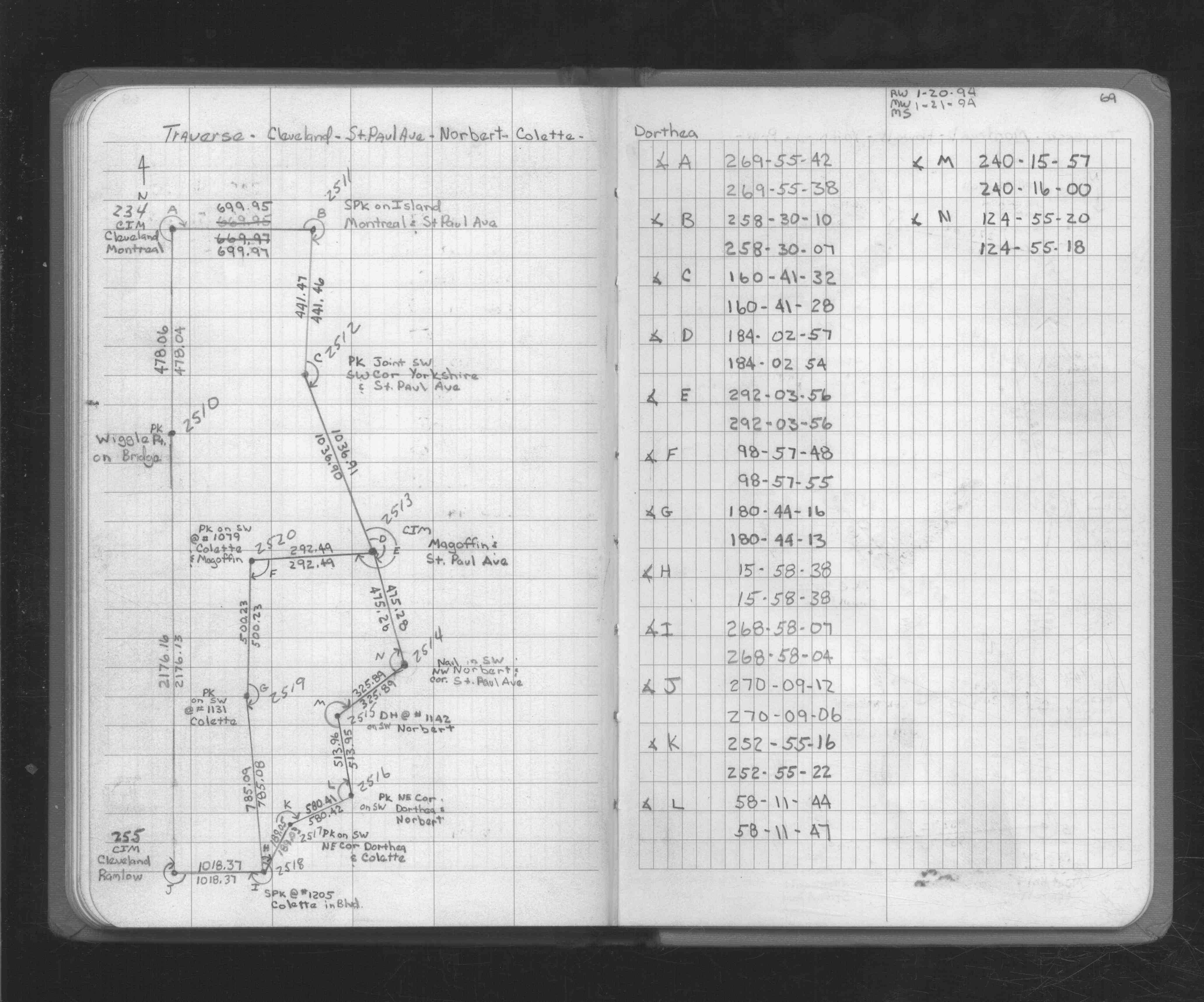
| 1/21/1994 | Used CIM for traverse control. See FB 1726 p.69 |
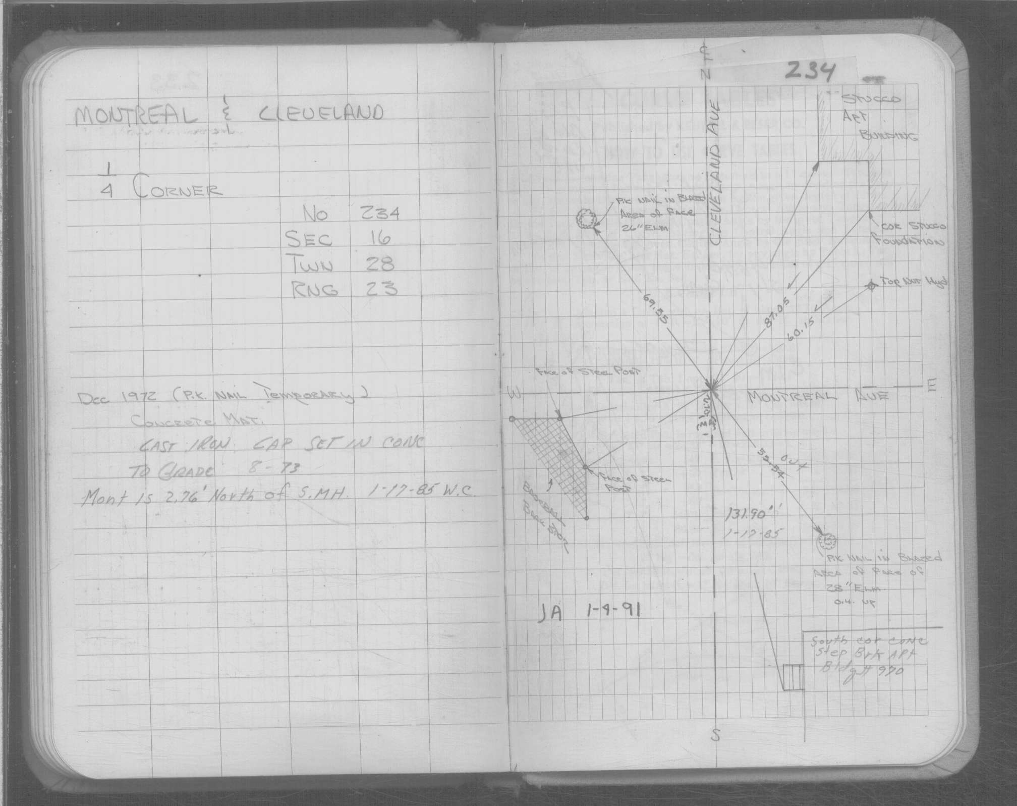
| 4/1/1991 | (Unknown date Apr __, 1991 ) CIM cap set in concrete to grade. |
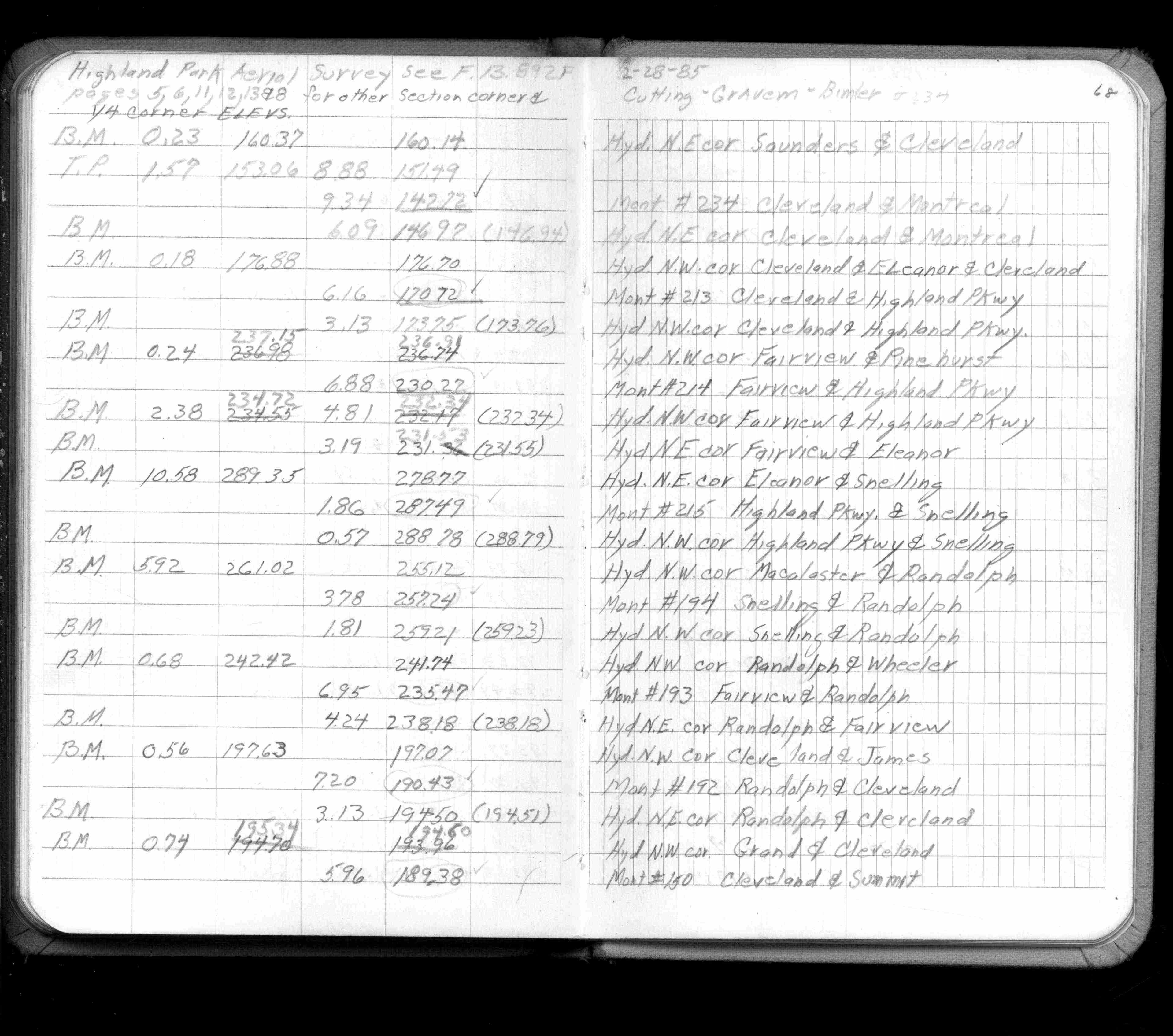
| 2/1/1985 | (Unknown date Feb __, 1985 ) Elev 142.72 ft on ?. See FB 1421A p.68 |
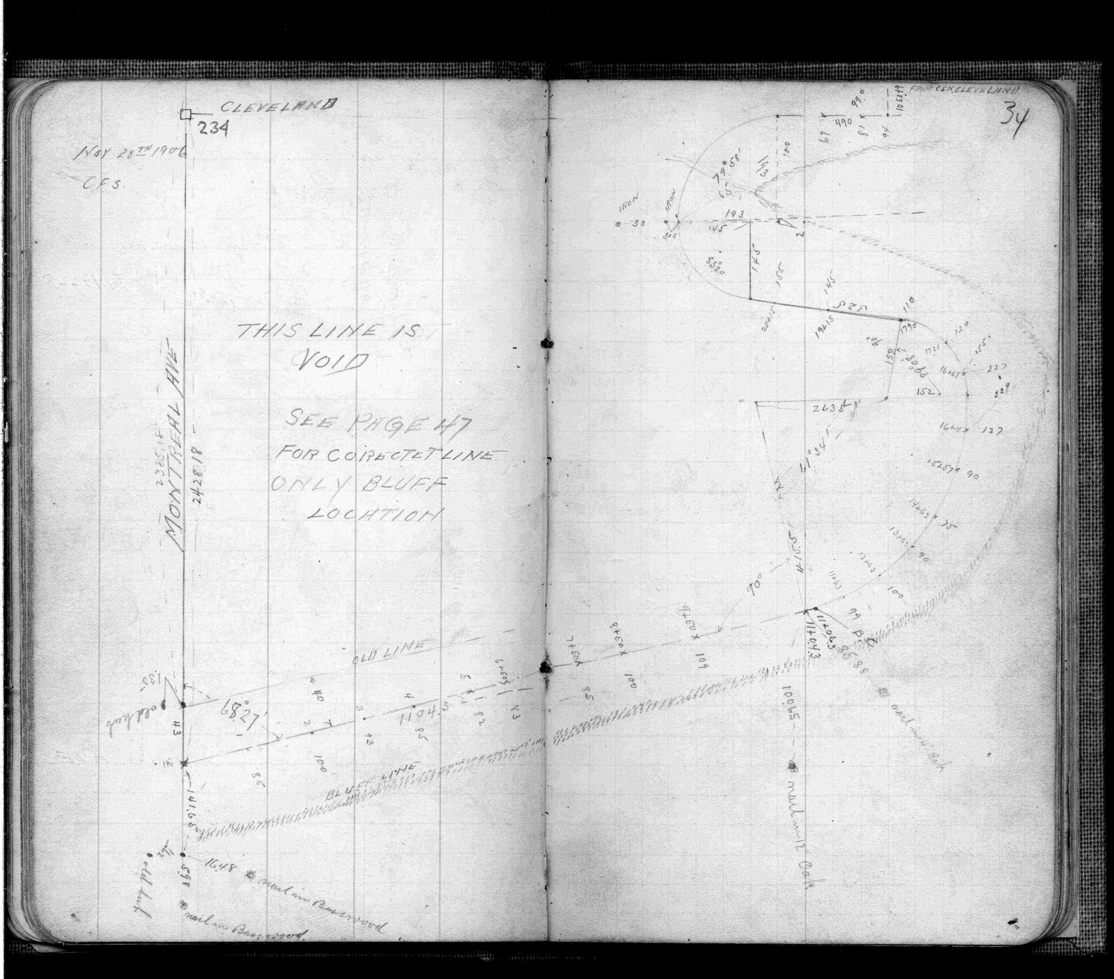
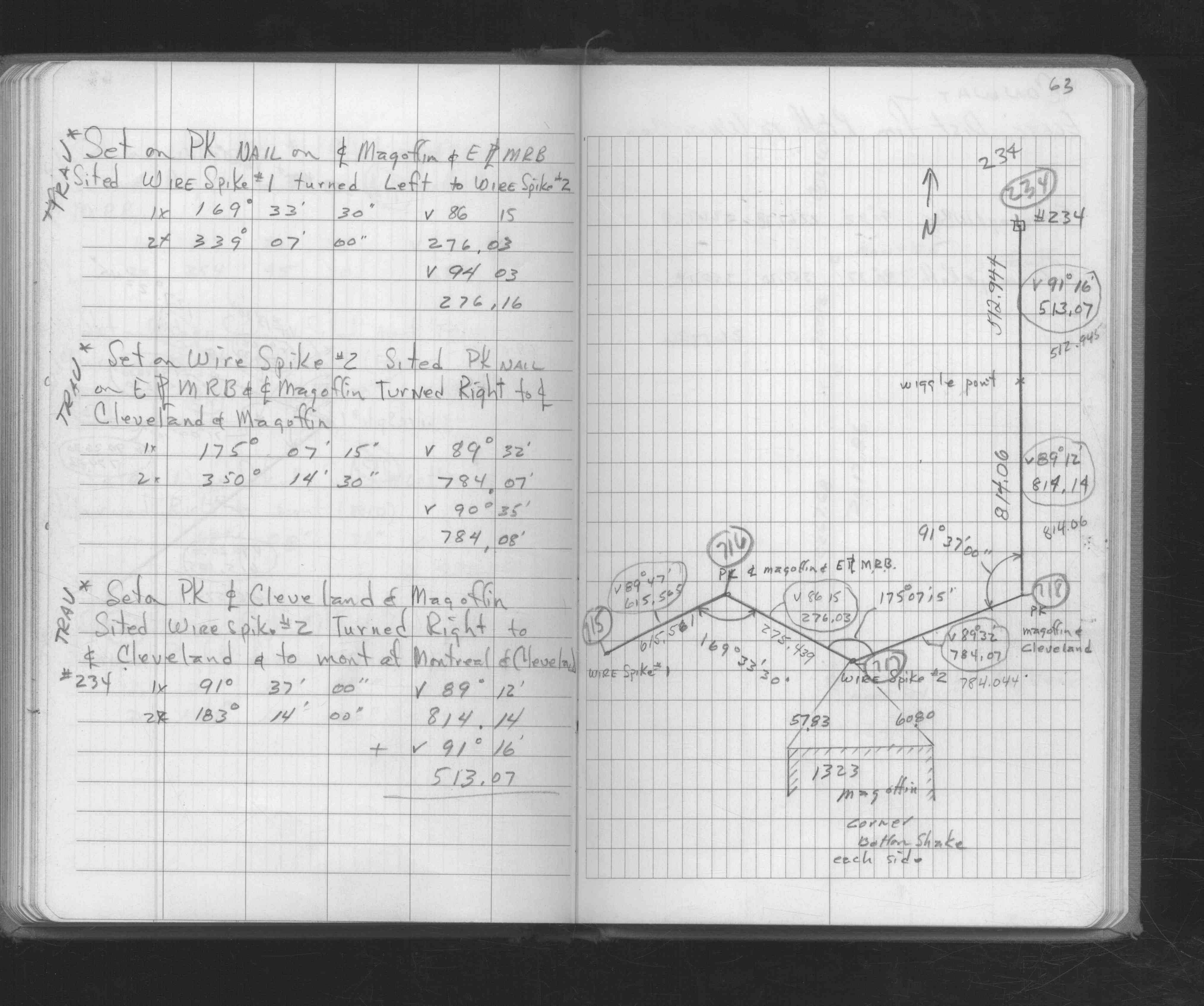
| 2/16/1972 | Monument out, have two ties. See FB 1689A p.8 |
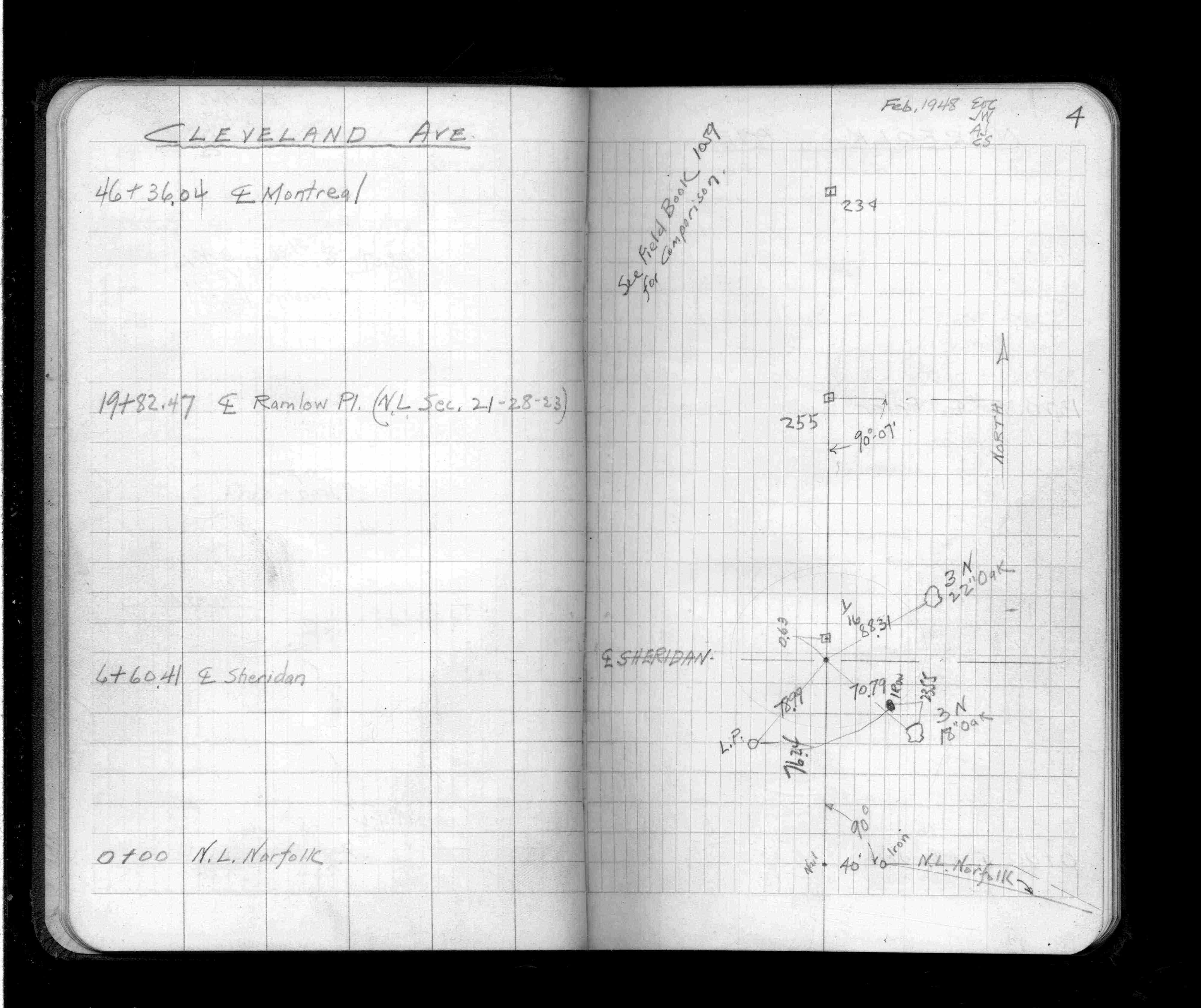
| 4/1/1943 | (Unknown date Apr __, 1943 ) Place ties. See FB 1059 p.4 |
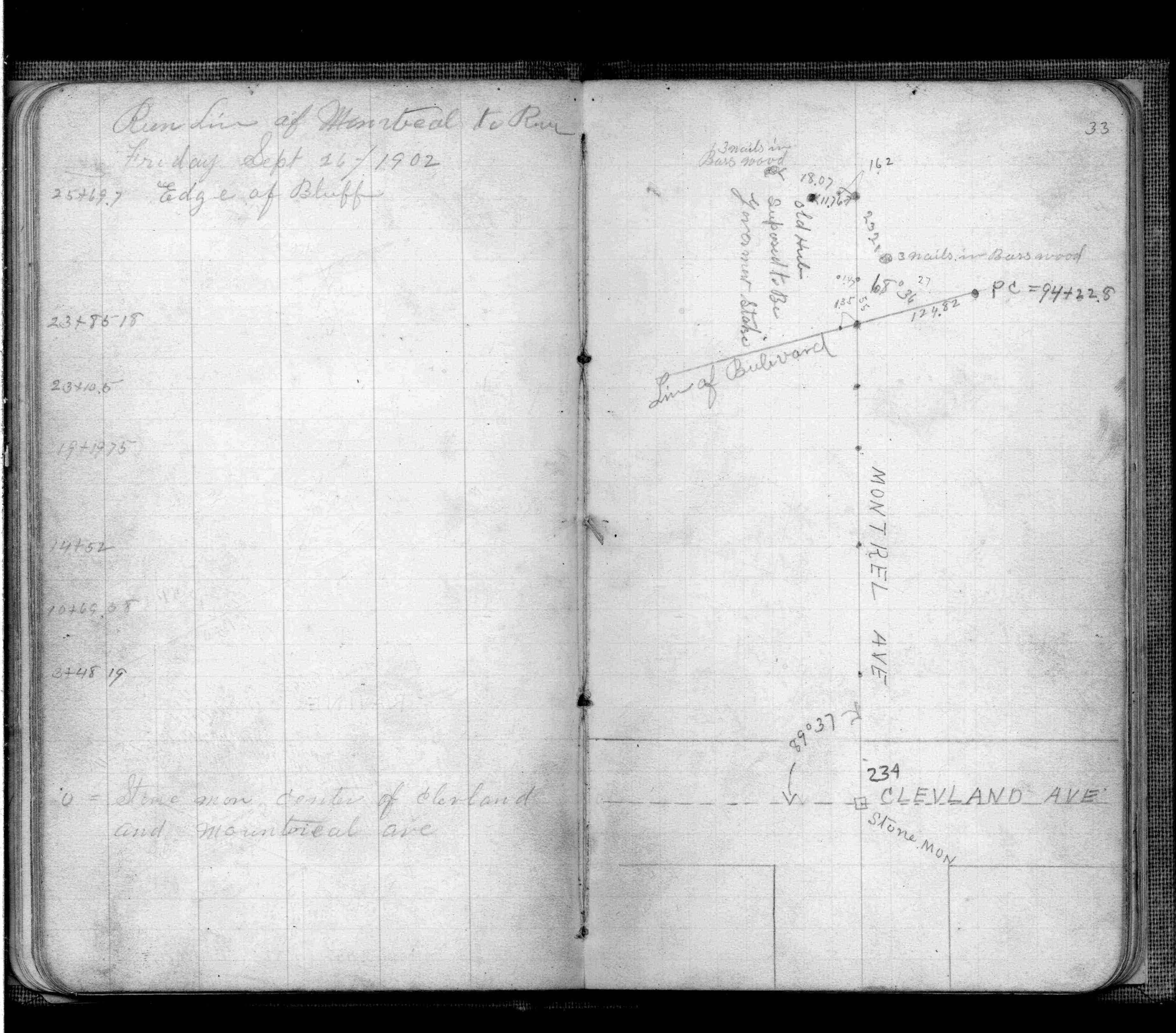
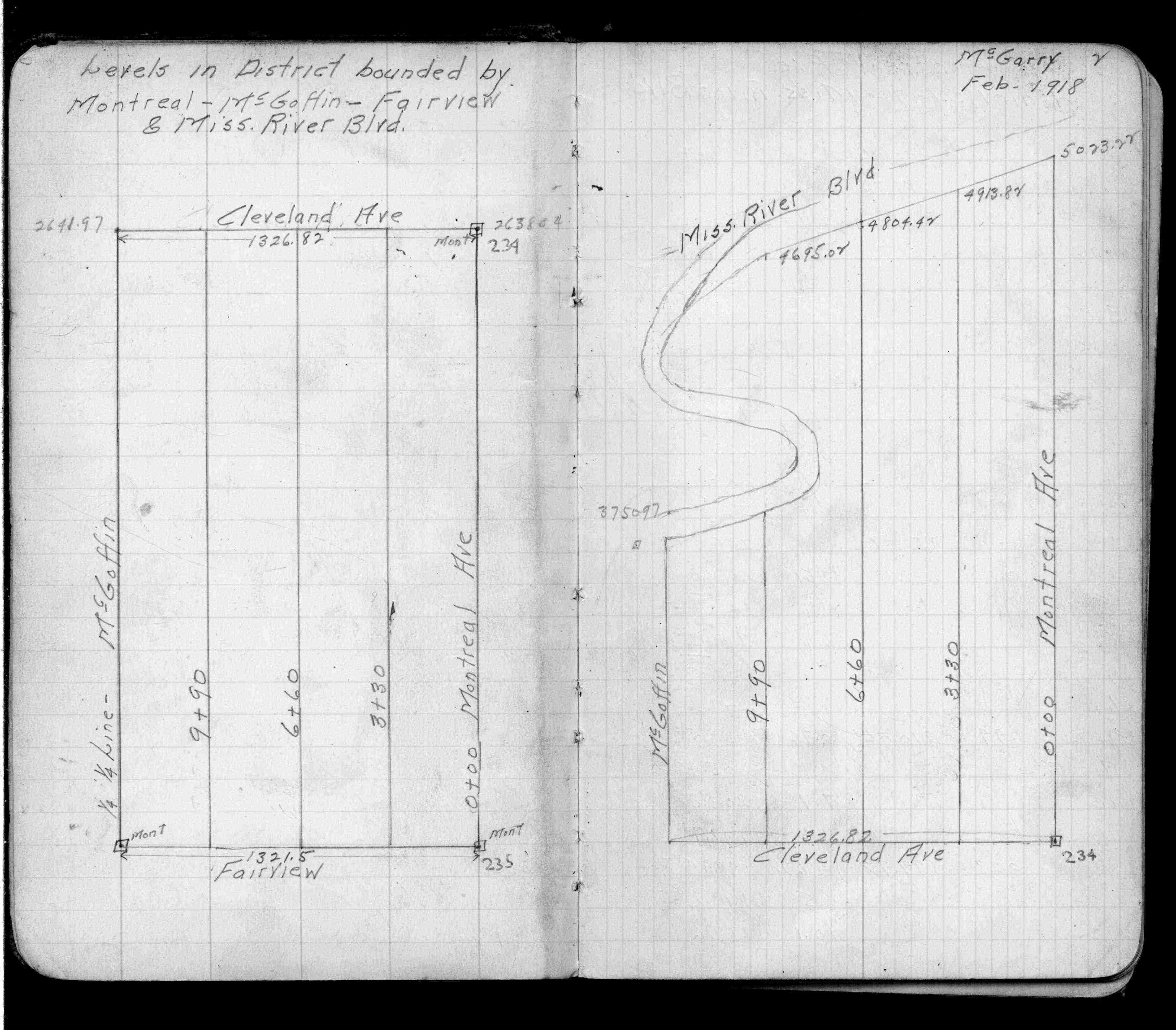
| 9/26/1902 | F OHara found Stone Monument while running out land lines in connection with Mississippi River Blvd. See FB 474 p.33 |
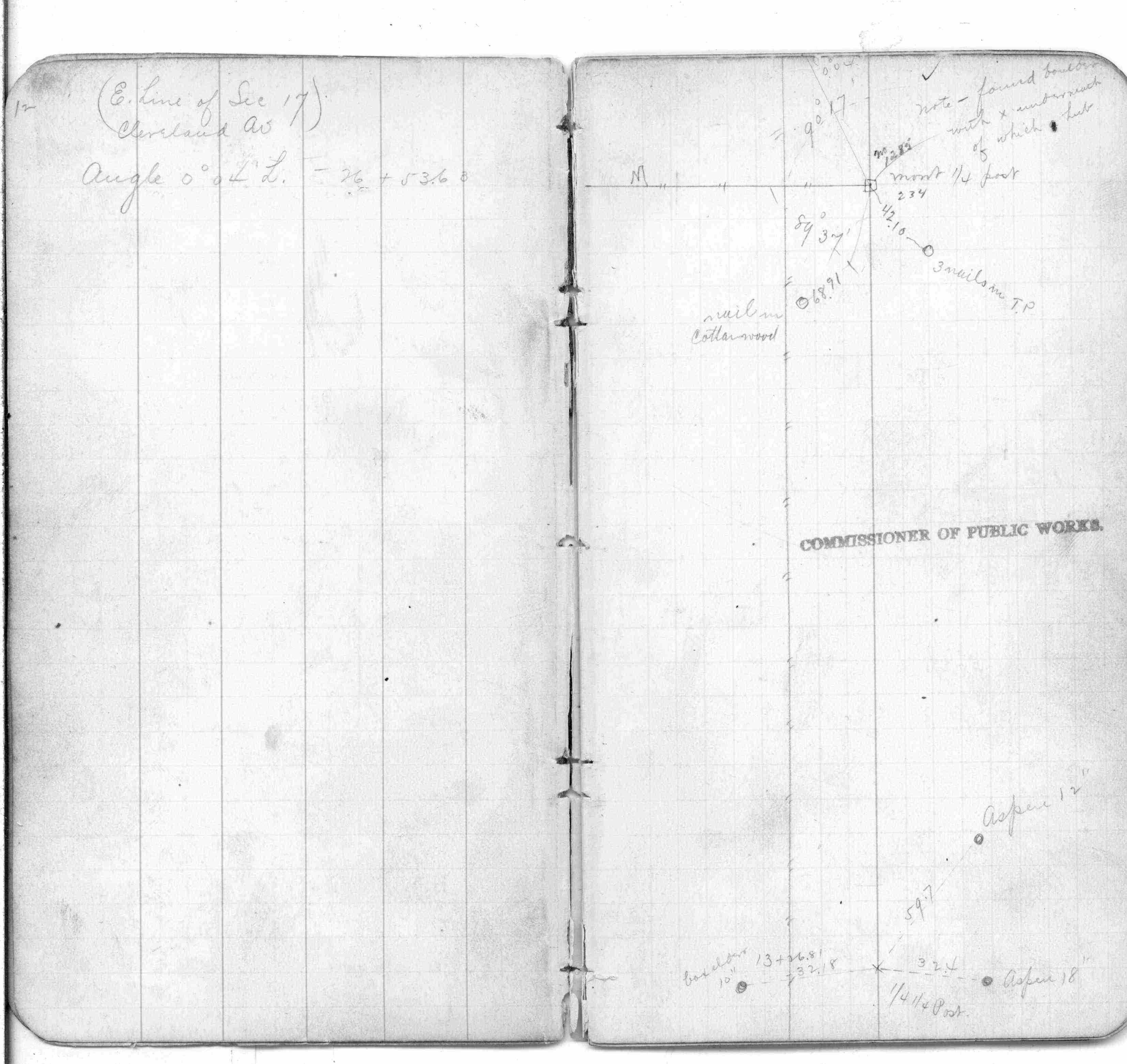
| 3/1/1888 | (Unknown date Mar __, 1888 ) Monument set by R J Johnson in place of boulder with X and hub underneath. See FB 249 p.12 |
| 10/1/1847 | (Unknown date Oct __, 1847 ) Isaac N Higbee deputy surveyor set post. Tied to 2 BTs. See IH p.020-021 2823 |
| 1/1/1800 | (Unknown date ___ __, ____ ) Placed ties. See FB 1484 p.14 |
Above is NOT an all inclusive history of this point. Please review all the links below.
| PLS NOTES | Field | Cross Section | Sewer | J.B. Irvine | Monument | River Survey |
|---|---|---|---|---|---|---|
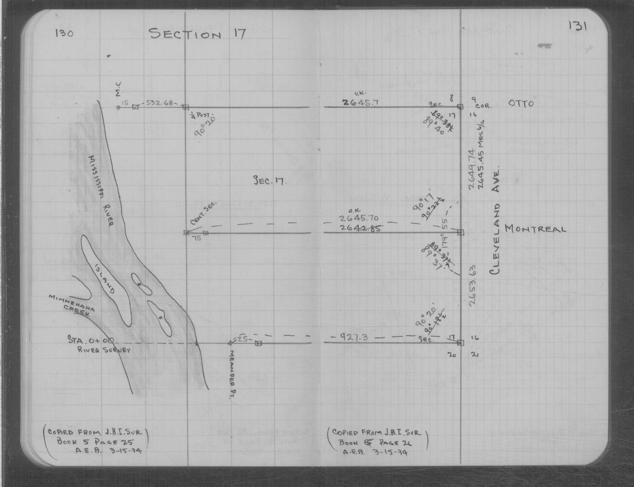
| IH p.020-021 | FB 0249p.12 | MS 0007 p.130-131 | ||||
| FB 0249p.12 | ||||||
| FB 0250CPYp. 01 ,03 ,25 ,32 | ||||||
| FB 0353p.36 | ||||||
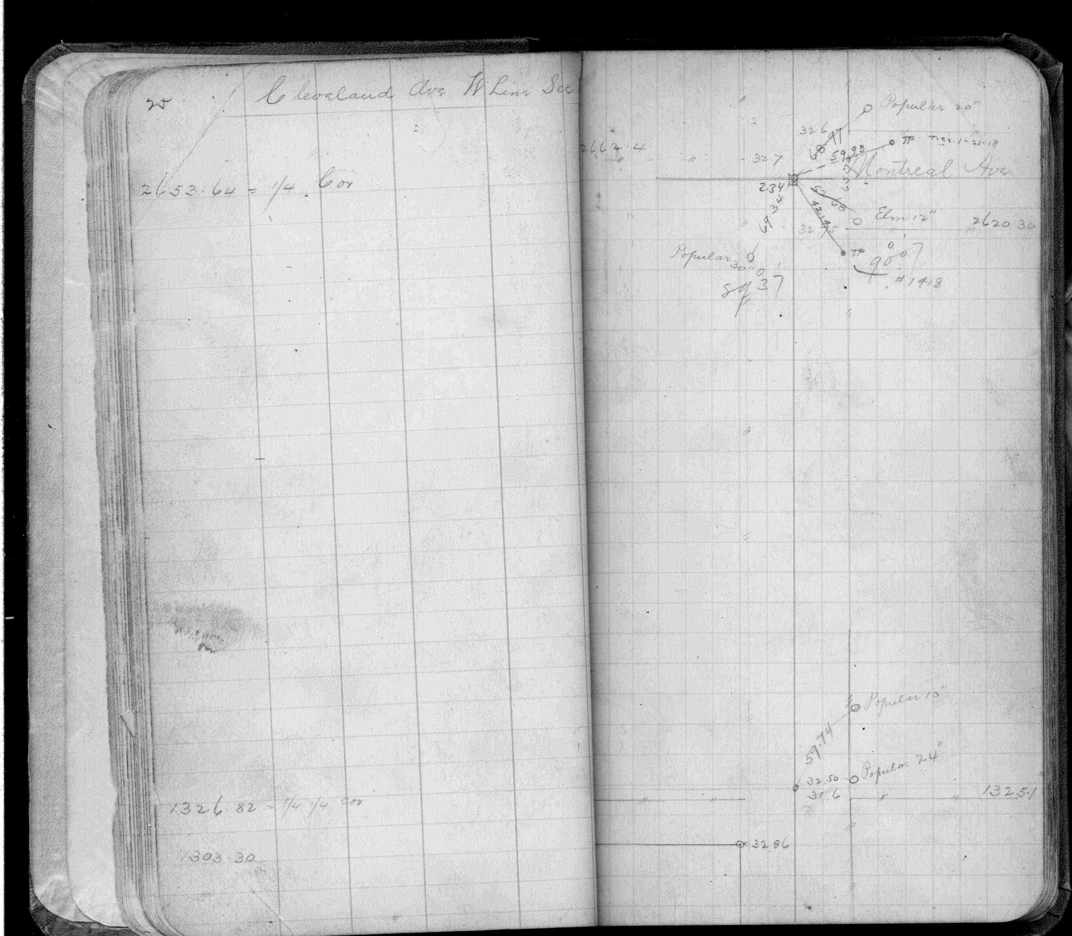
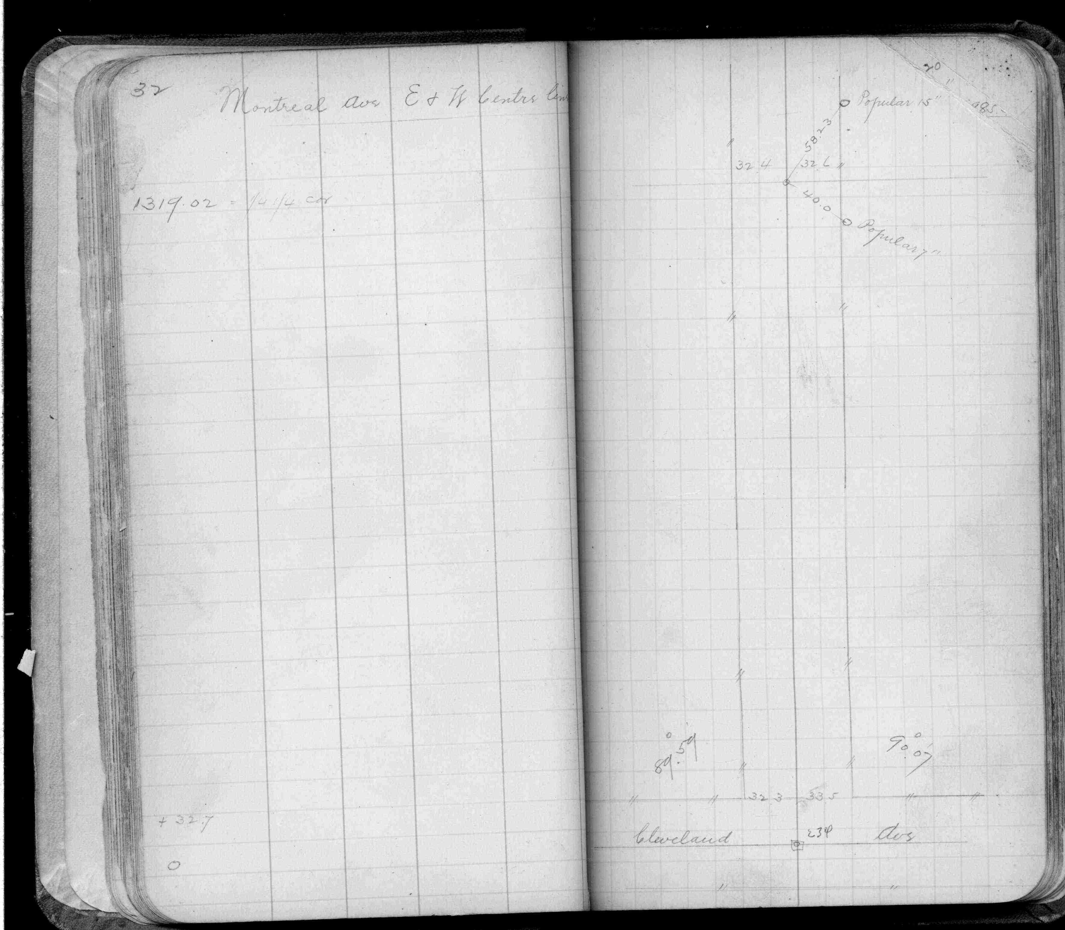
| FB 0474p.33 | ||||||
| FB 0474p. 33 ,34 | ||||||
| FB 0925p.02 | ||||||
| FB 1059p.04 | ||||||
| FB 1059p.04 | ||||||
| FB 1159p.40 | ||||||
| FB 1384p.08 | ||||||
| FB 1392p.04 | ||||||
| FB 1421Ap.68 | ||||||
| FB 1484p.14 | ||||||
| FB 1484p.14 | ||||||
| FB 1549Ep.37 | ||||||
| FB 1676Ap.63 | ||||||
| FB 1689Ap.08 | ||||||
| FB 1694p. 21 ,22 ,23 ,24 | ||||||
| FB 1716p.10 | ||||||
| FB 1719Ap.25 | ||||||
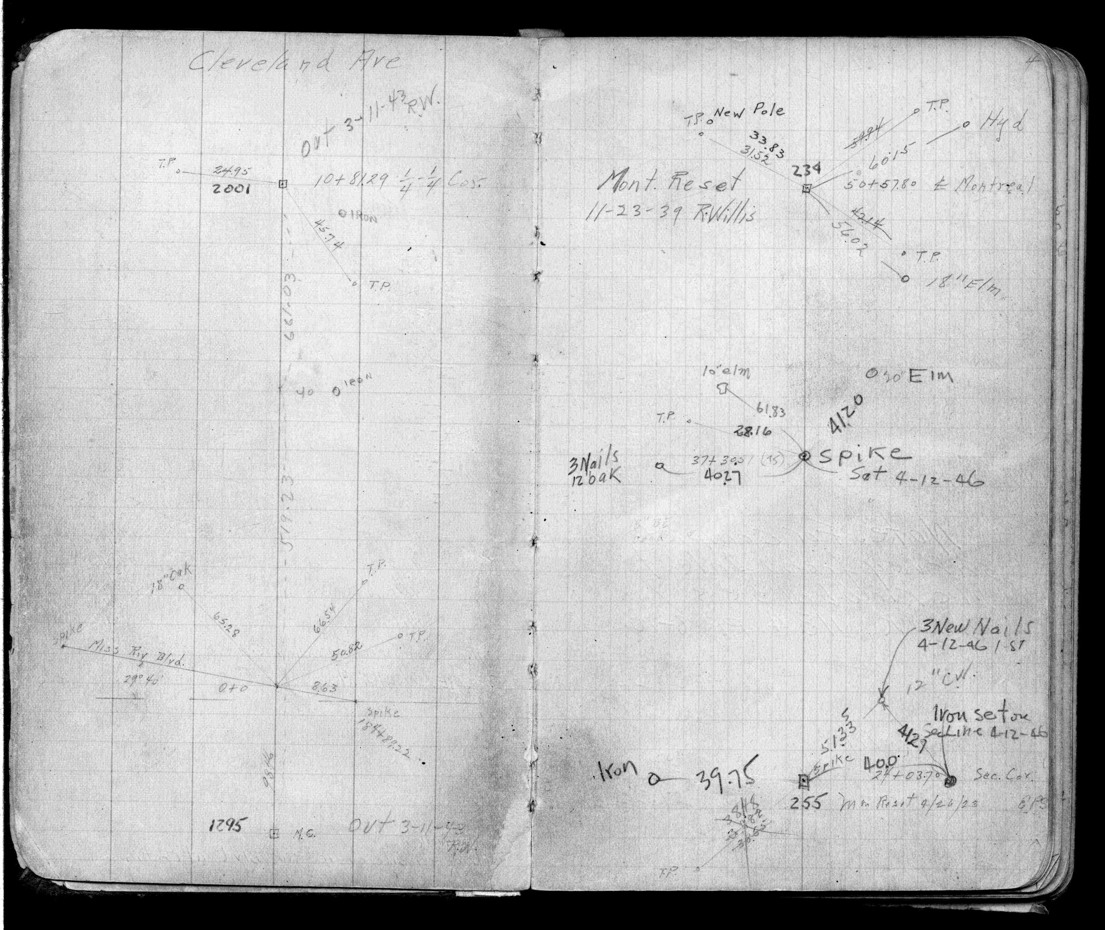
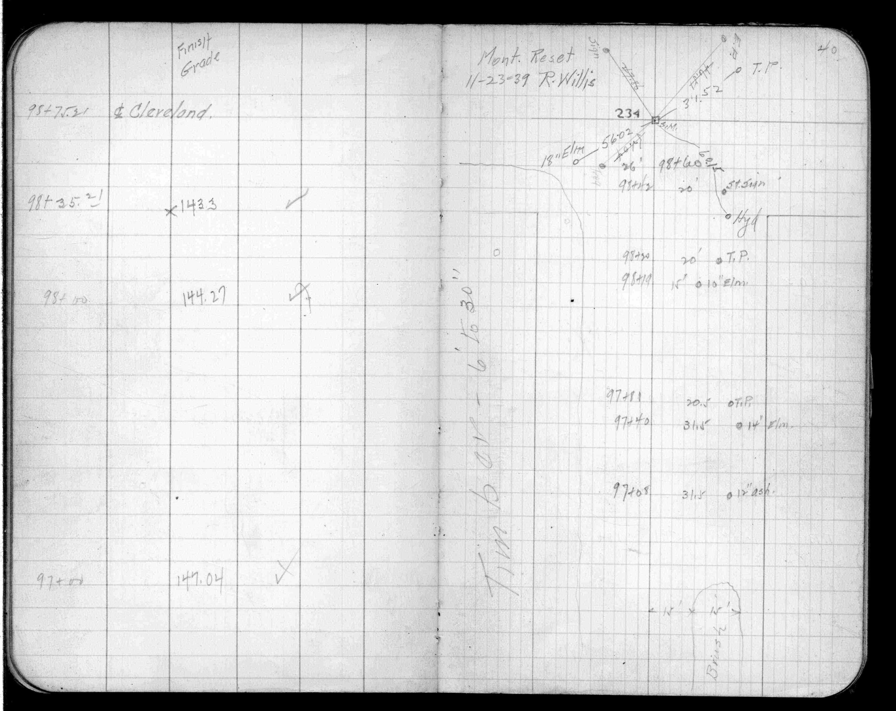
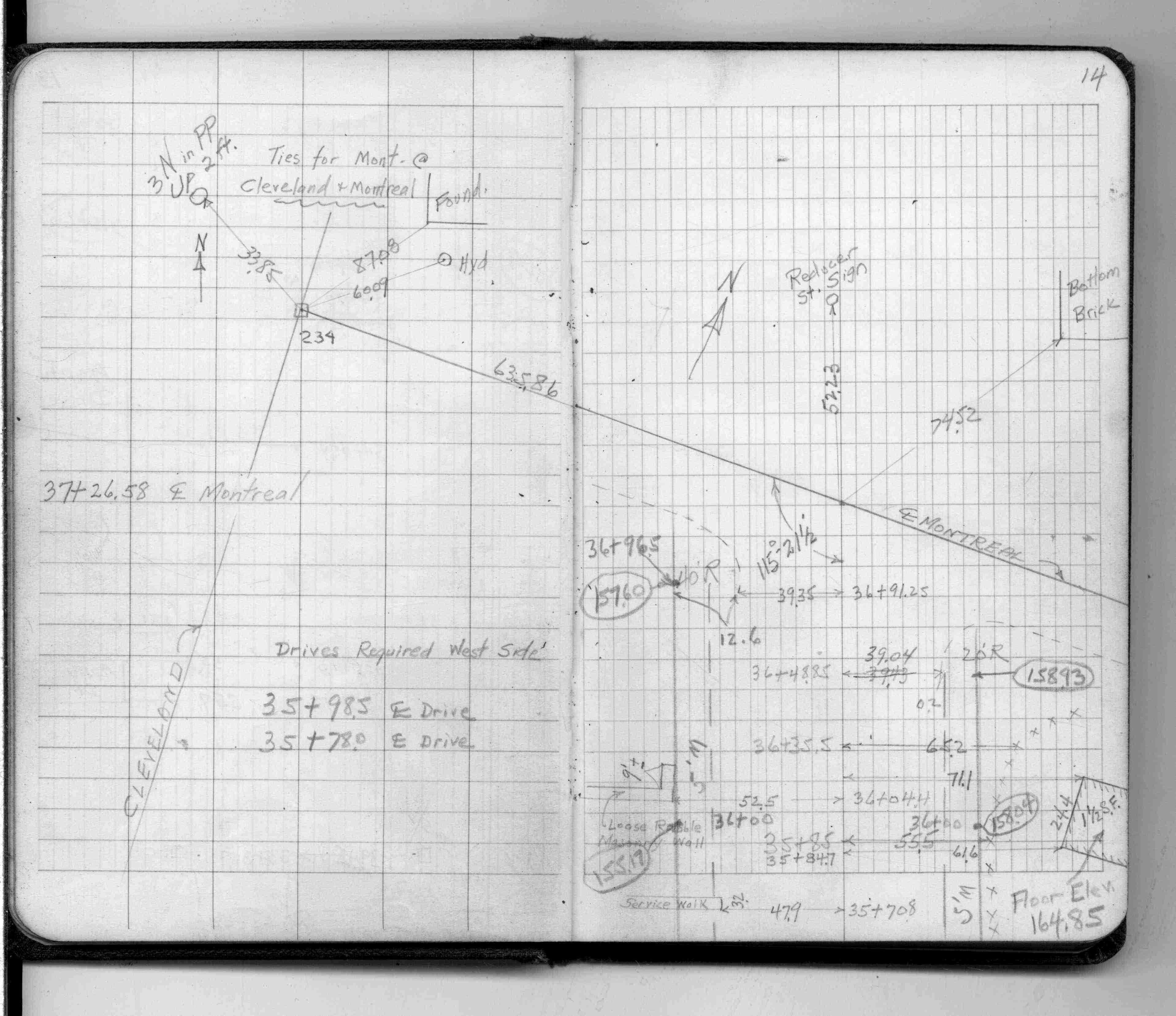
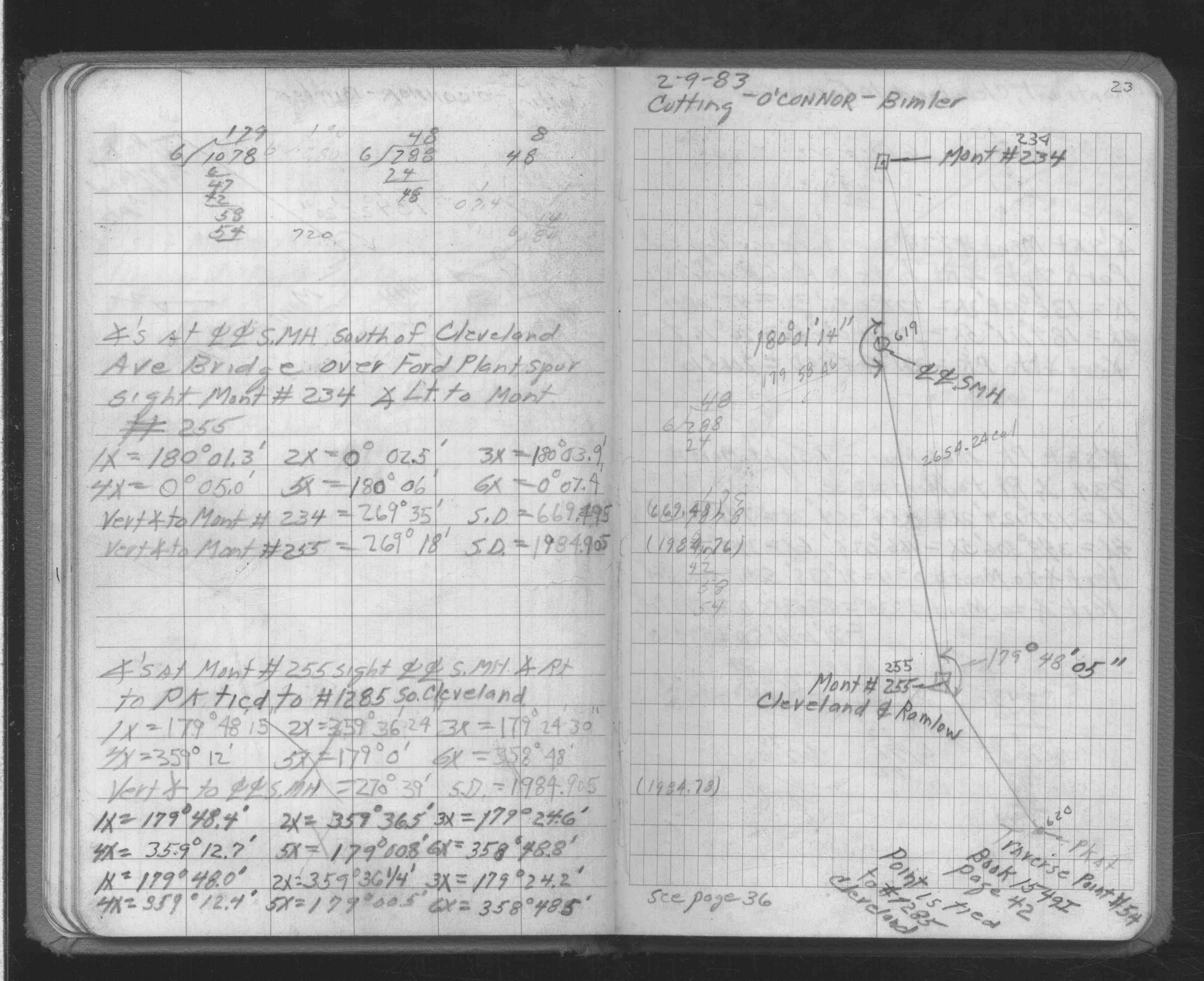
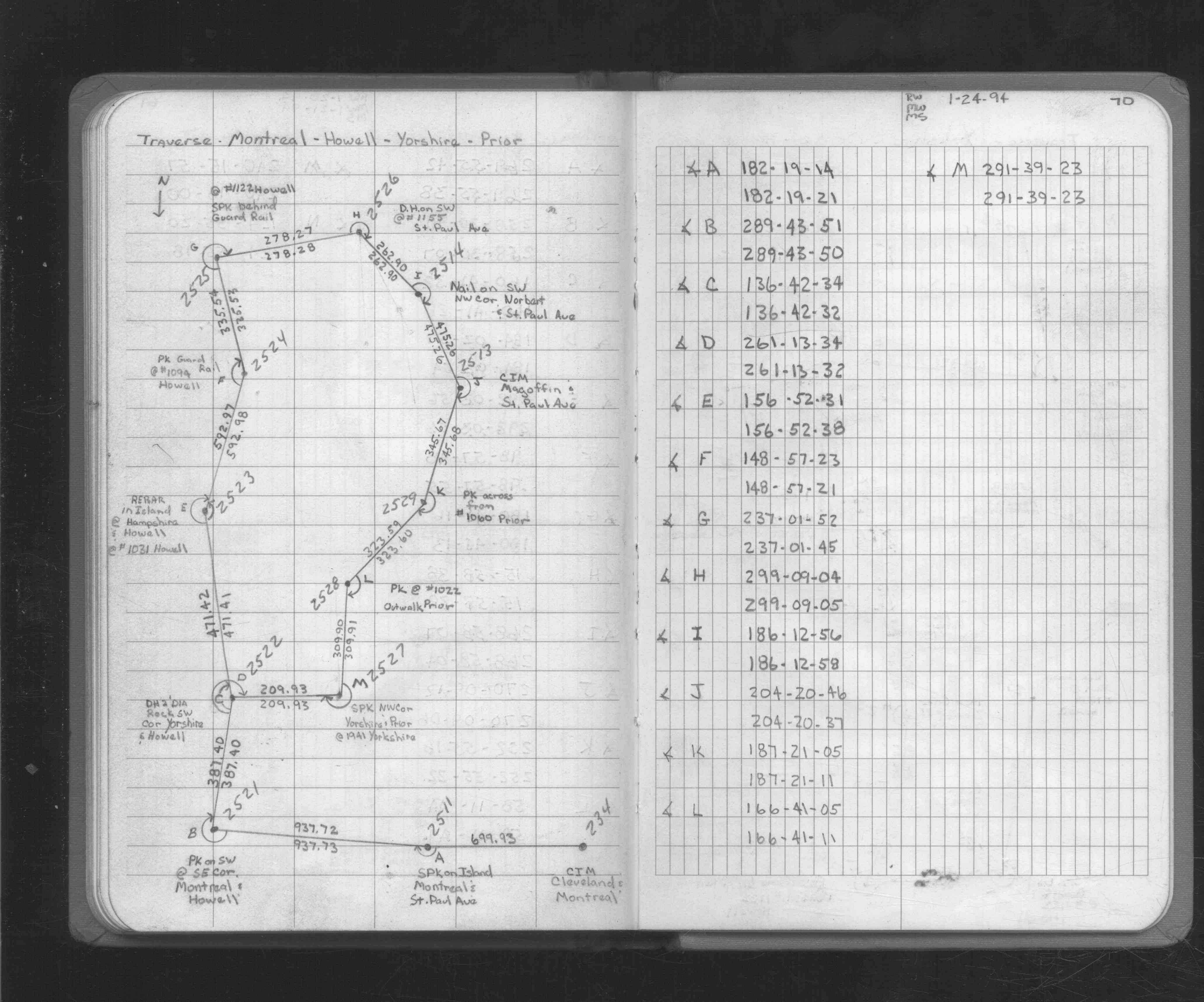
| FB 1726p.69 | ||||||
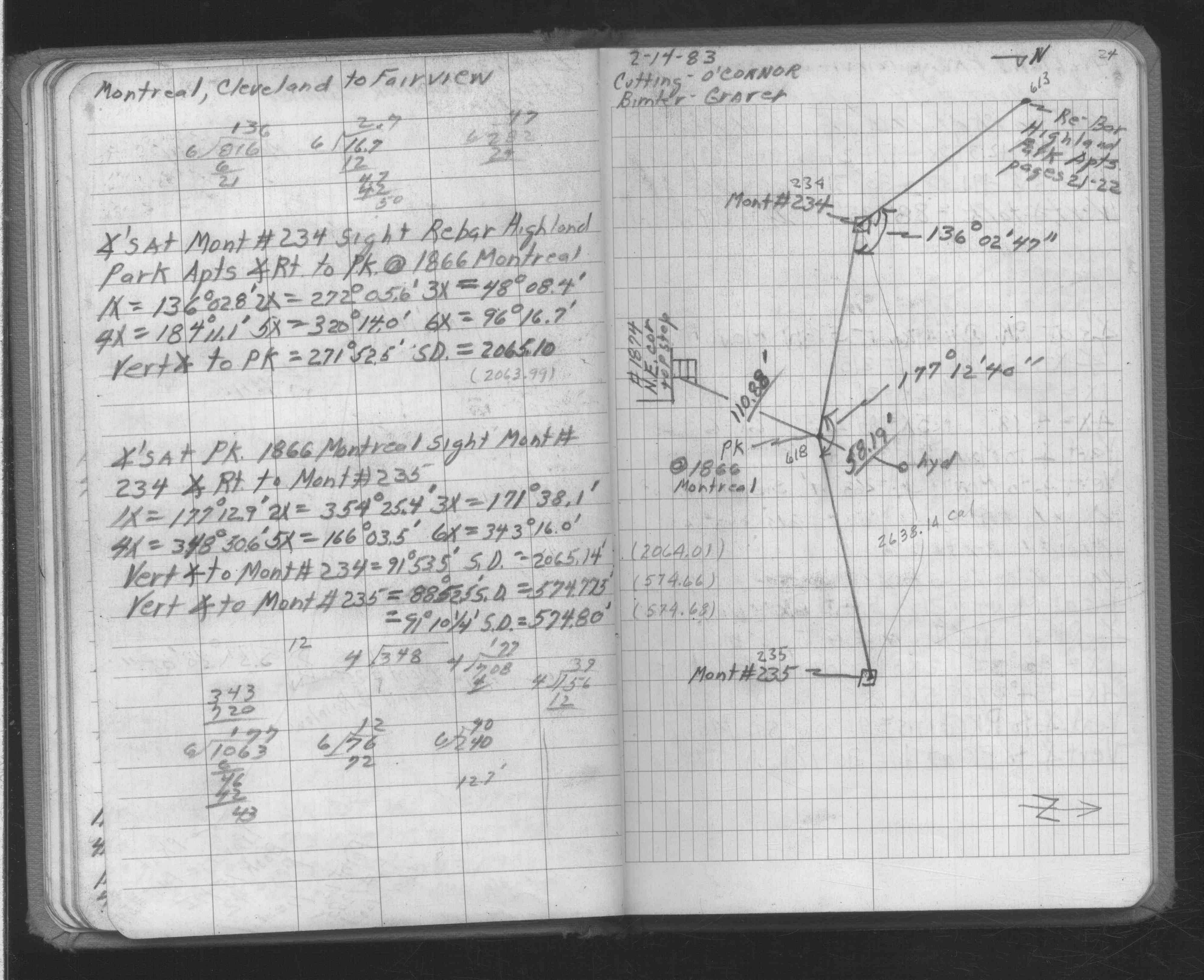
| FB 1726p. 69 ,70 | ||||||
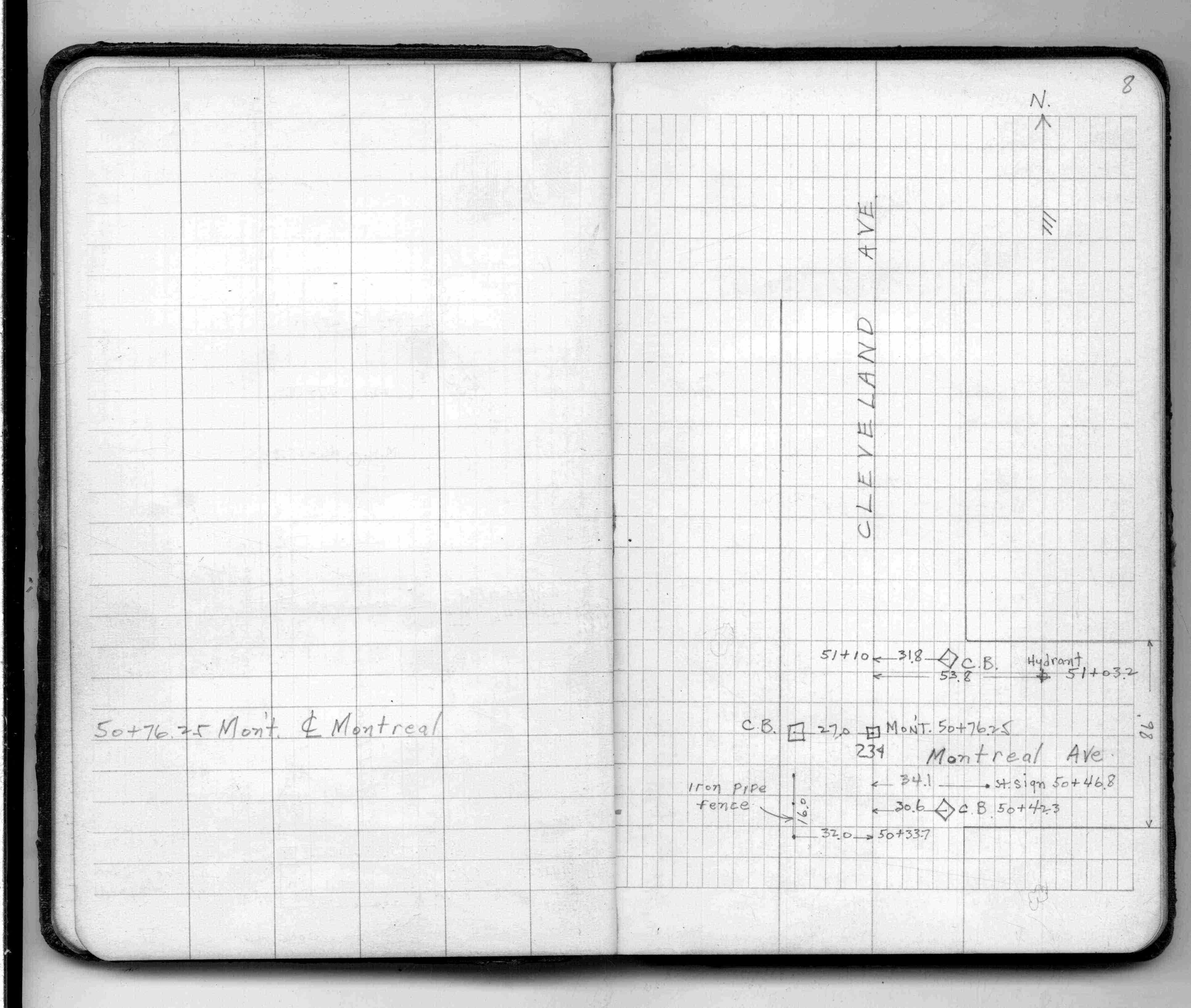
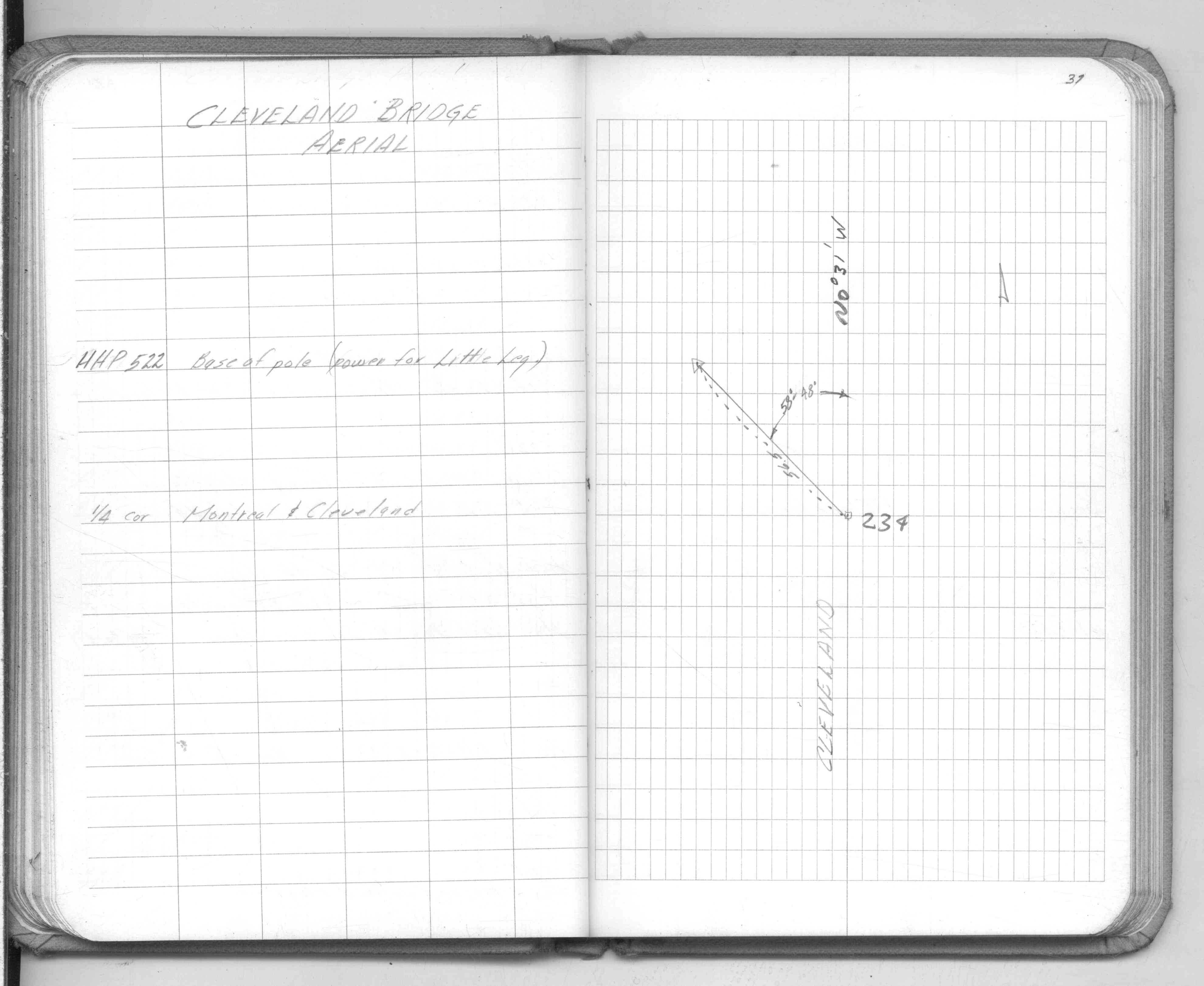
| FB 1736p.31 |
| FILE | SURVEYOR | LIC. NO. | DATE SIGNED | DATE TIED |
|---|---|---|---|---|
| 0234-1285-A.tif | none | none | none | October 26, 1995 |
| 0234-1285-B.tif | William J. Cutting | 20576 | October 20, 1995 | October 19, 1995 |
| ST_157-234p234.jpg | none | none | none | none |
| 0234-1285-A.dwf | none | none | none | none |