| NAD83 COORDINATES (1986 adj.): |
|---|
| * X= 556038.208 Y= 144343.027 Z= 000.00 LSQ 12/06/1991 S FIX |
| 7/16/2012 | Unable to find Witness Corner (unrecorded) located 50 ft east of Monument #236 after street was milled. |
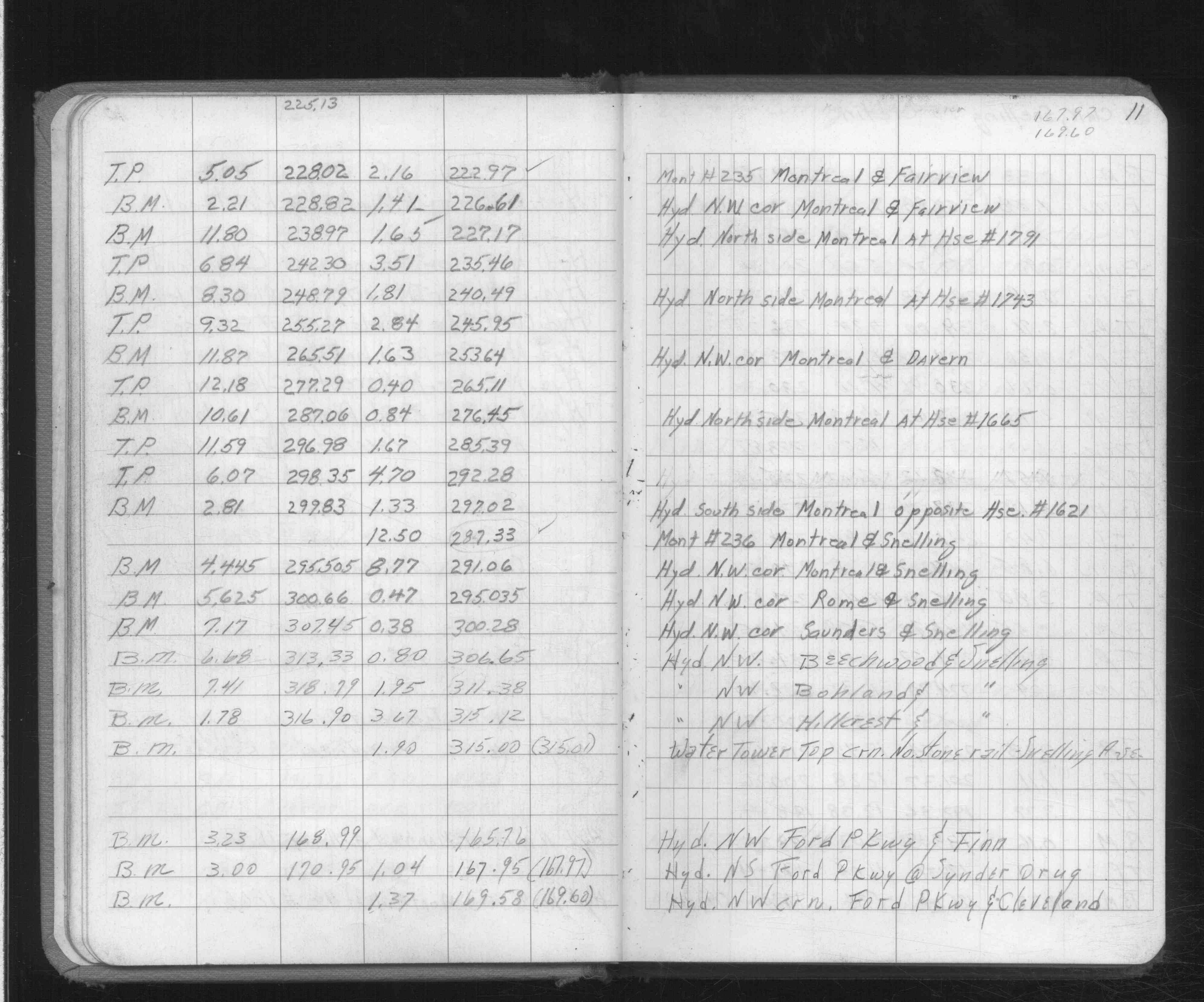
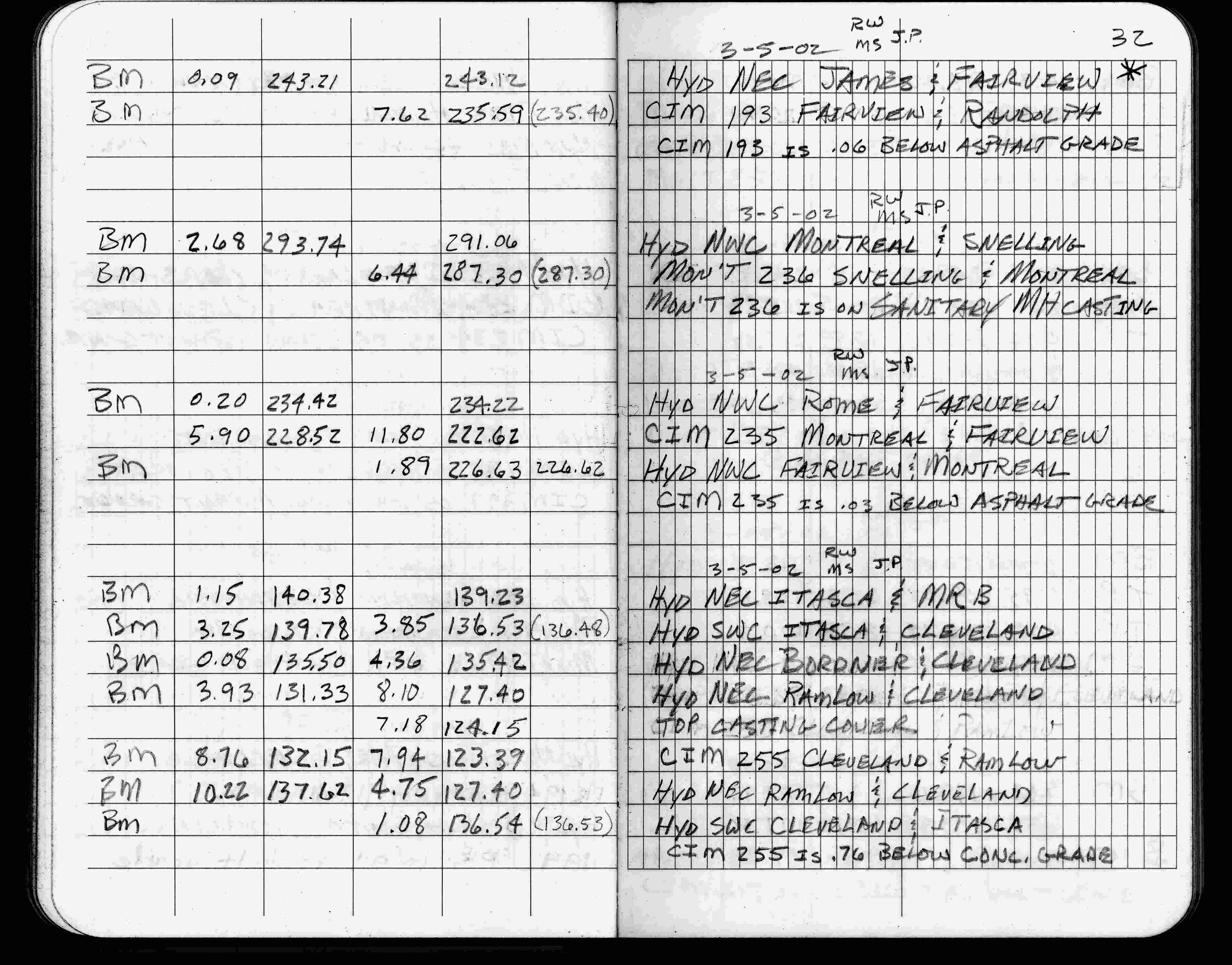
| 3/5/2002 | Elev 287.30 ft on sanitary MH. See FB 1736 p.32 |
| 3/1/2000 | (Unknown date Mar __, 2000 ) Fd pk w/4-2 ft straddles (marked for painting target for 2000 aerial) |
| 3/1/2000 | (Unknown date Mar __, 2000 ) Fd 2 of 4-2 ft straddles, replaced 2-2 ft straddles (marked for painting target for 2000 aerial) |
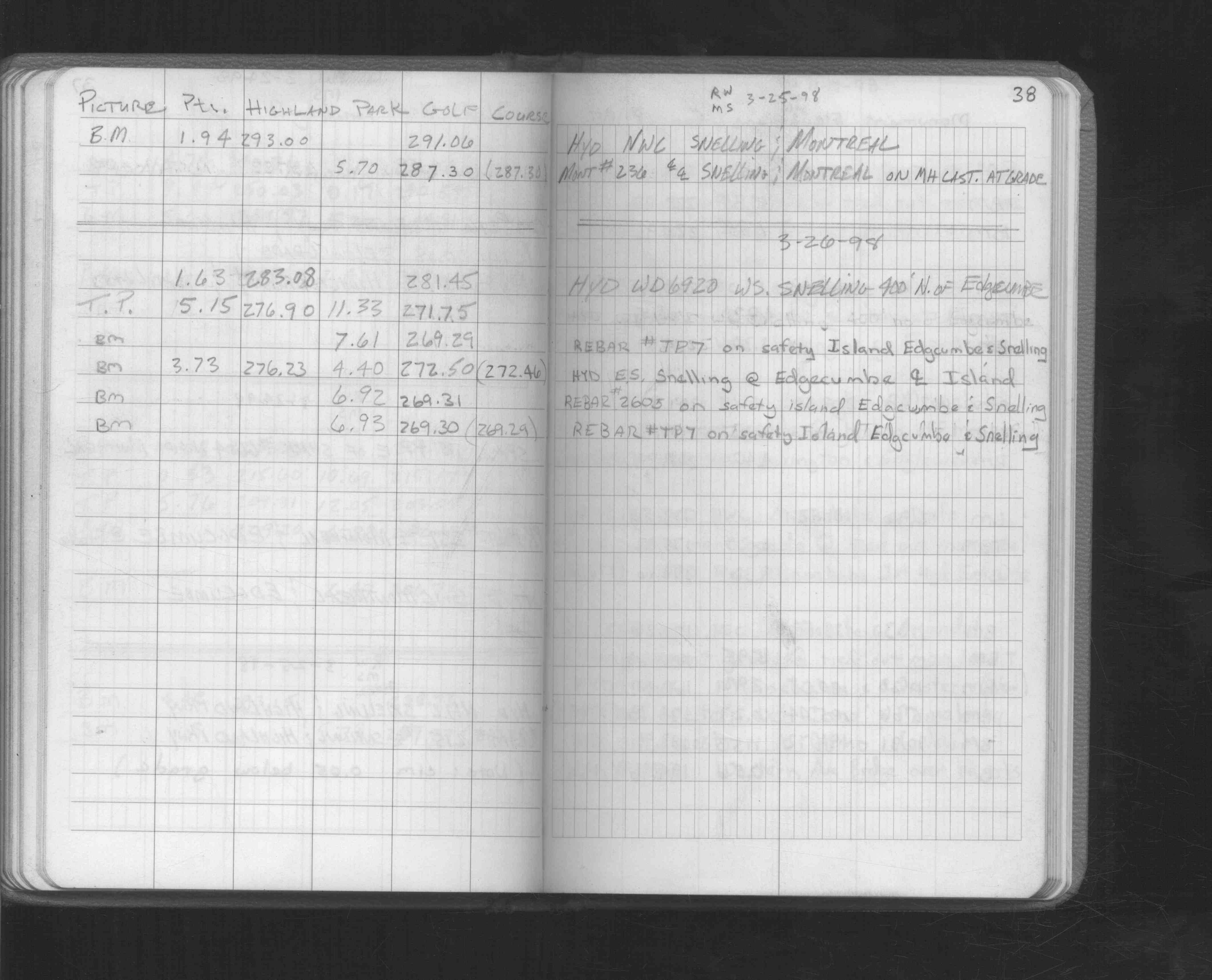
| 3/25/1998 | Elev 287.30 ft on MH casting at grade. See FB 1549L p.38 |
| 9/26/1995 | Fd MH cover, placed 2 ft straddles from ties. See CofL 0236-1276-A |
| 2/23/1995 | Elev 287.30 ft on ?. See 97adj.pts, 1995/snell-montreal.org/snelmont.sdr (loop 025) Digital-Adj |
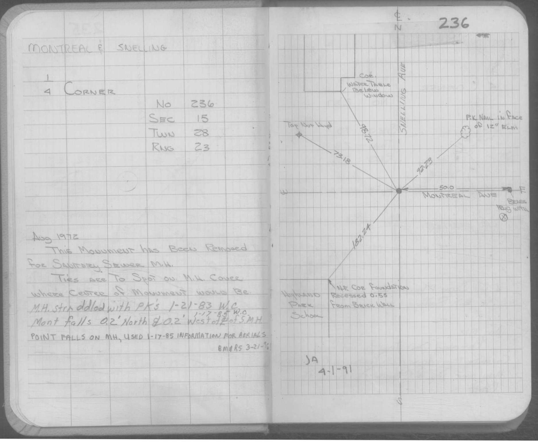
| 4/1/1991 | (Unknown date Apr __, 1991 ) Monument falls on sanitary sewer casting. |
| 2/1/1985 | (Unknown date Feb __, 1985 ) Elev 287.33 ft on ?. See FB 892F p.11 |
| 1/1/1985 | (Unknown date ___ __,1985 ) Historic, one time only GPS survey = S106 |
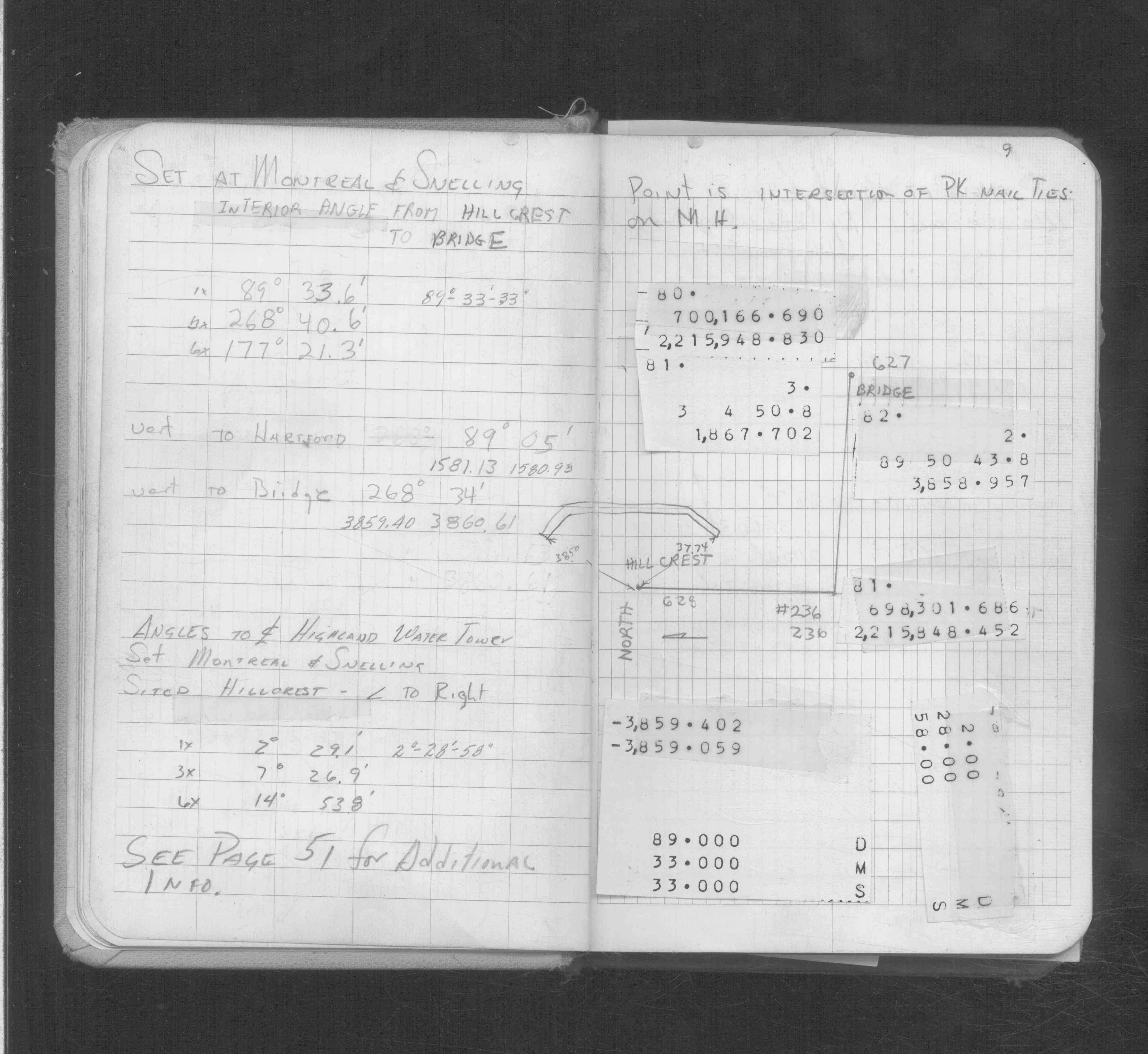
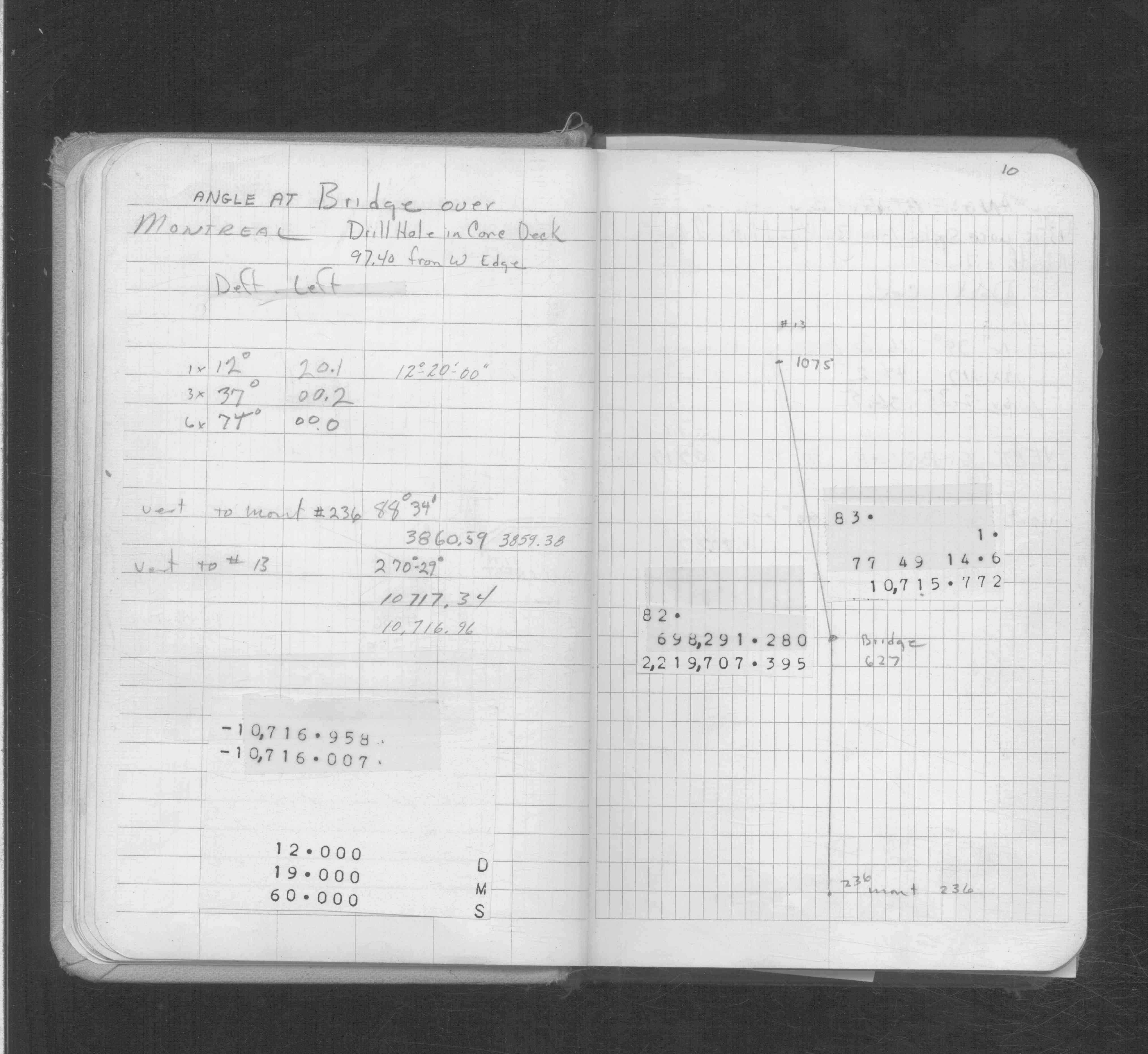
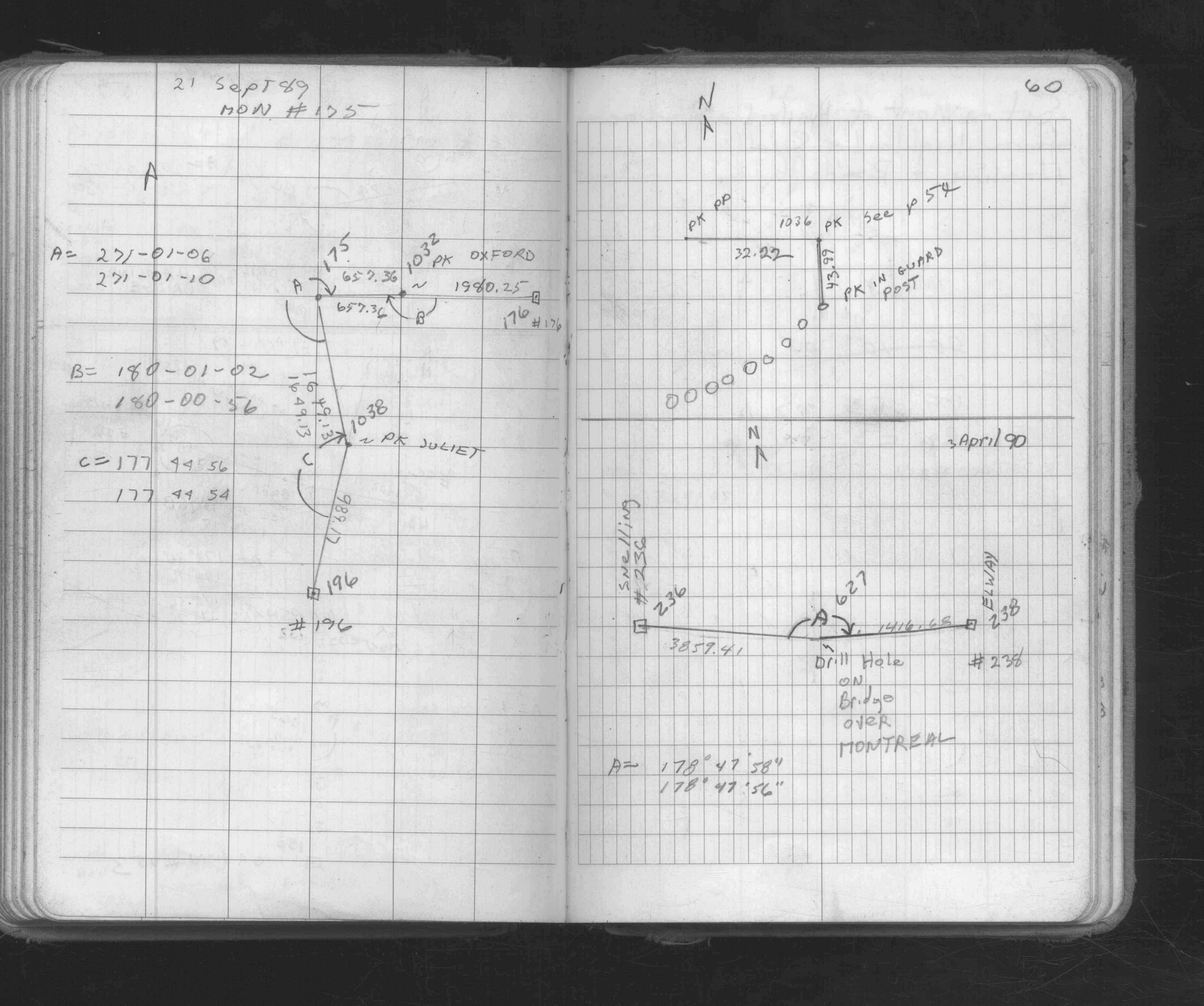
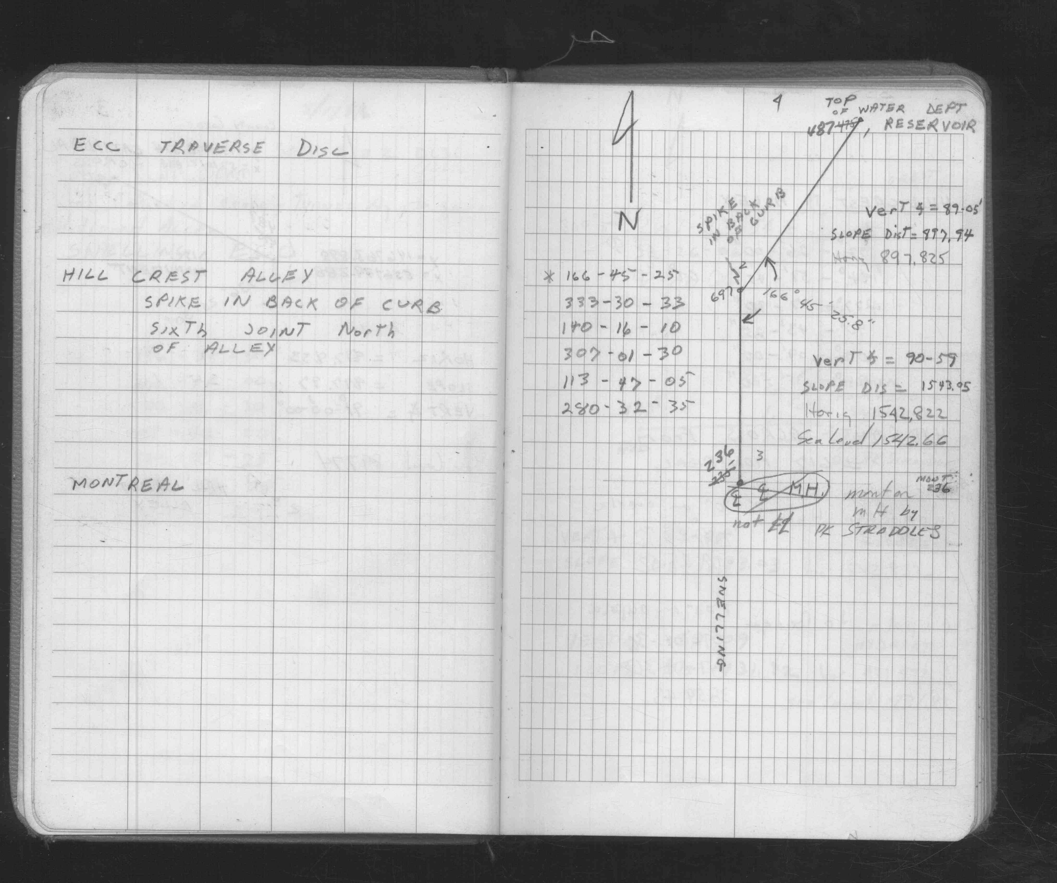
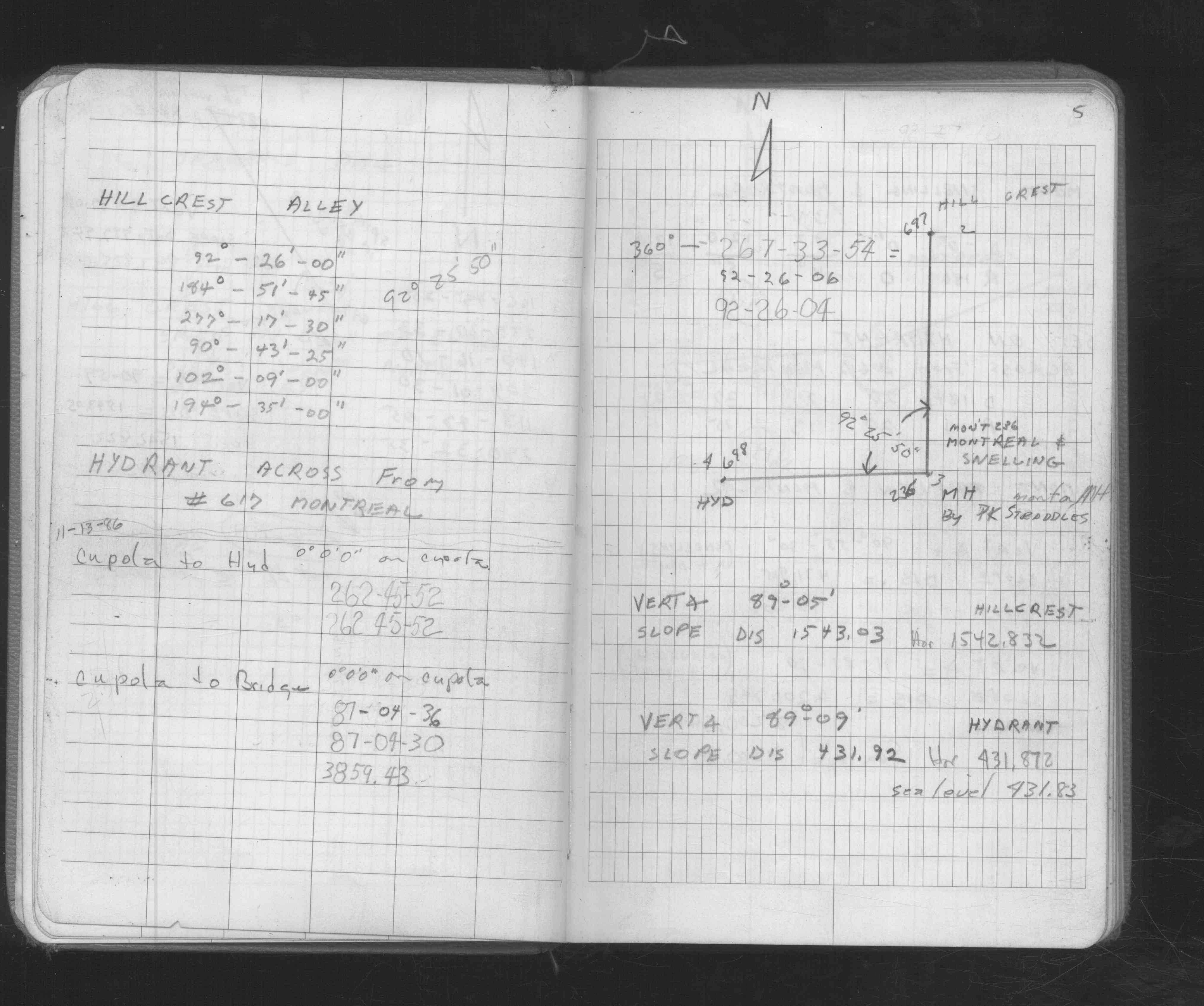
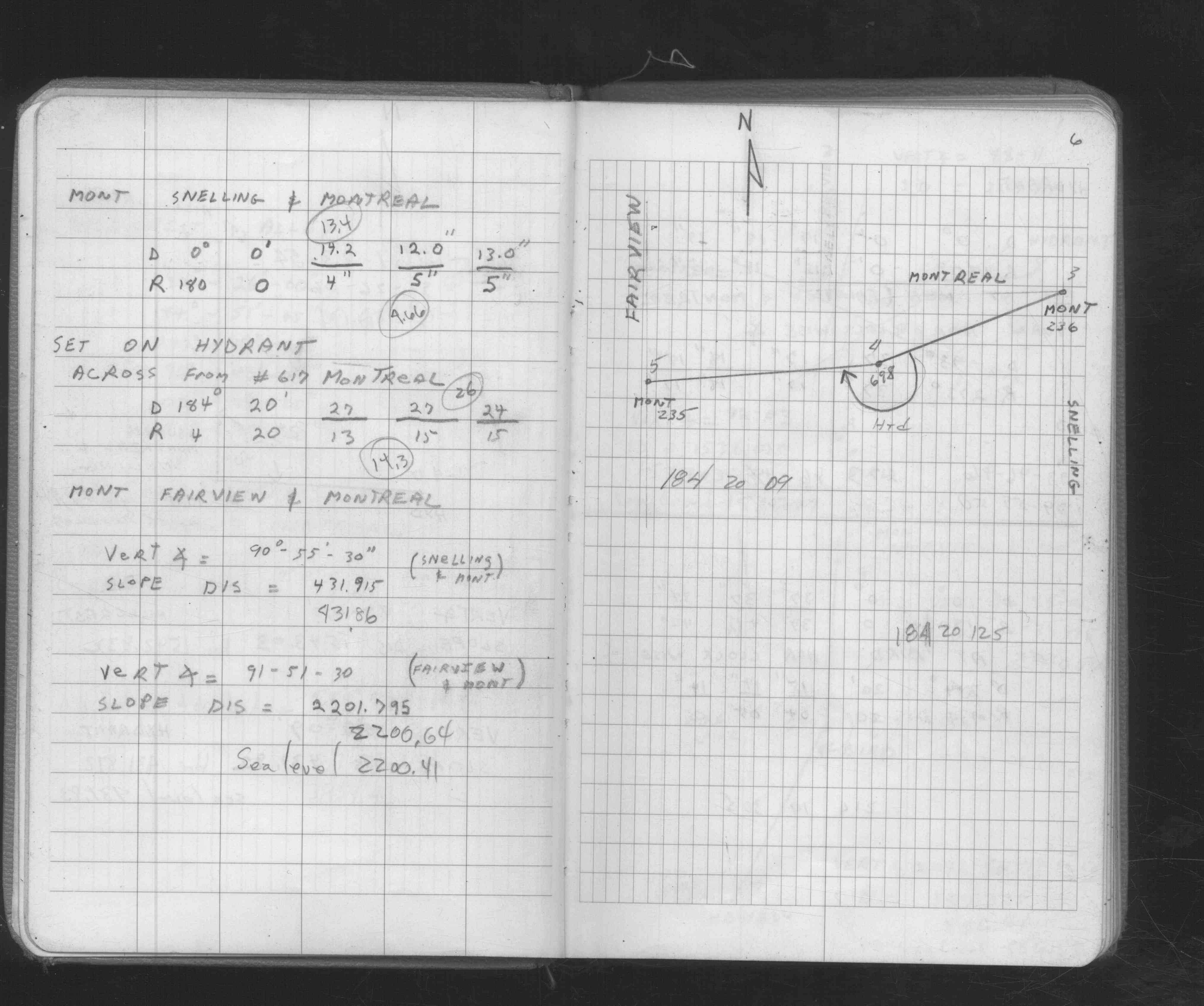
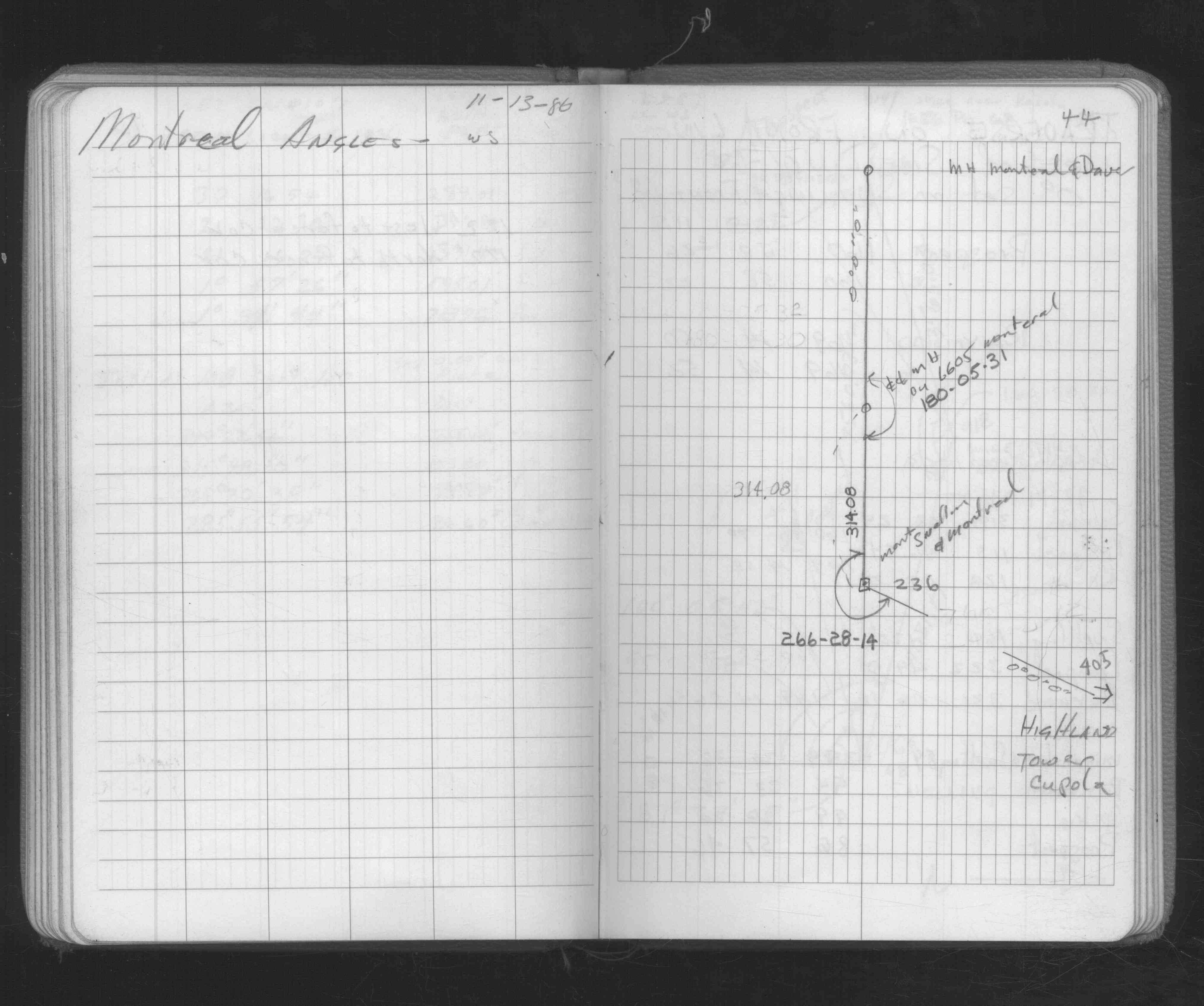
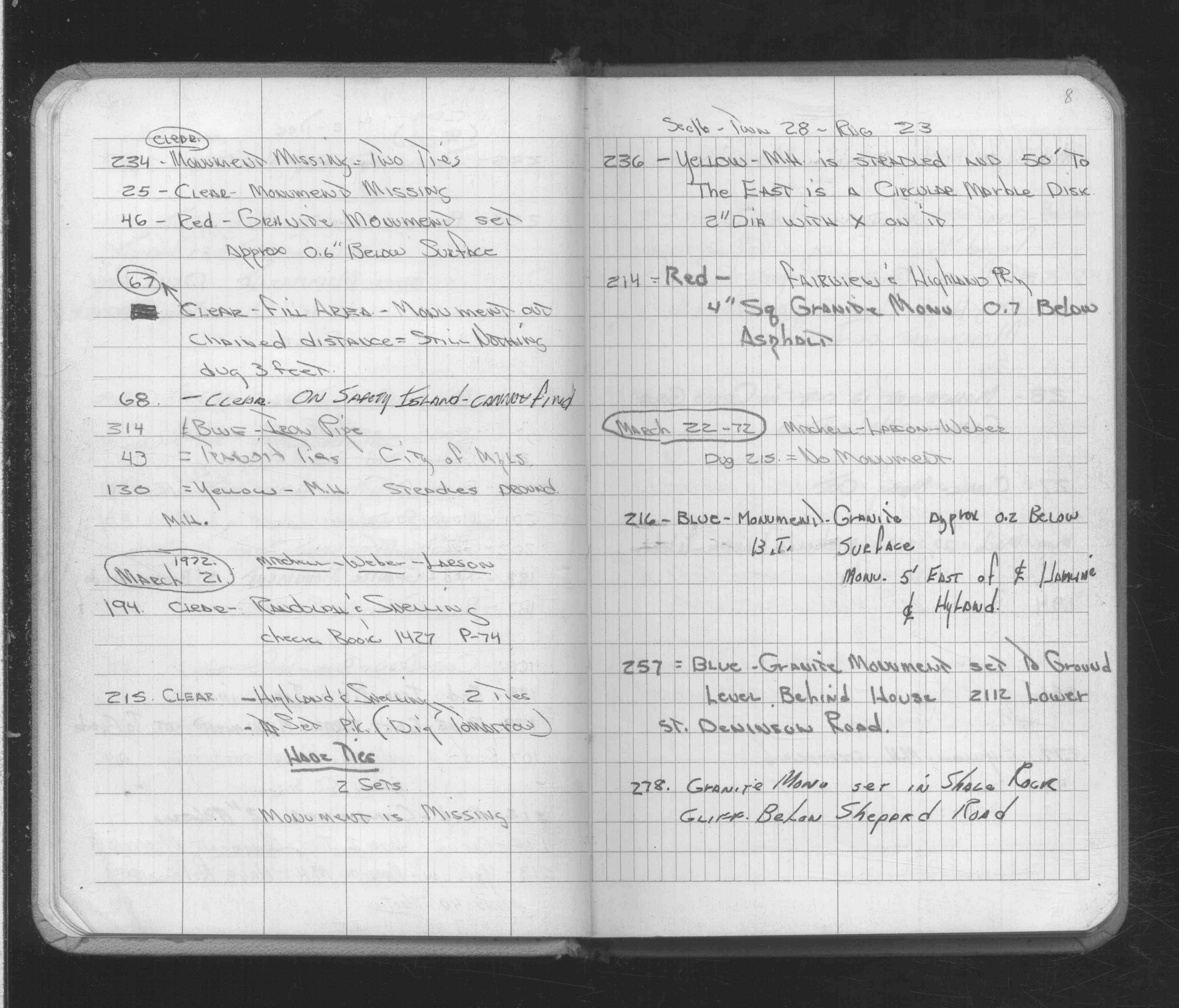
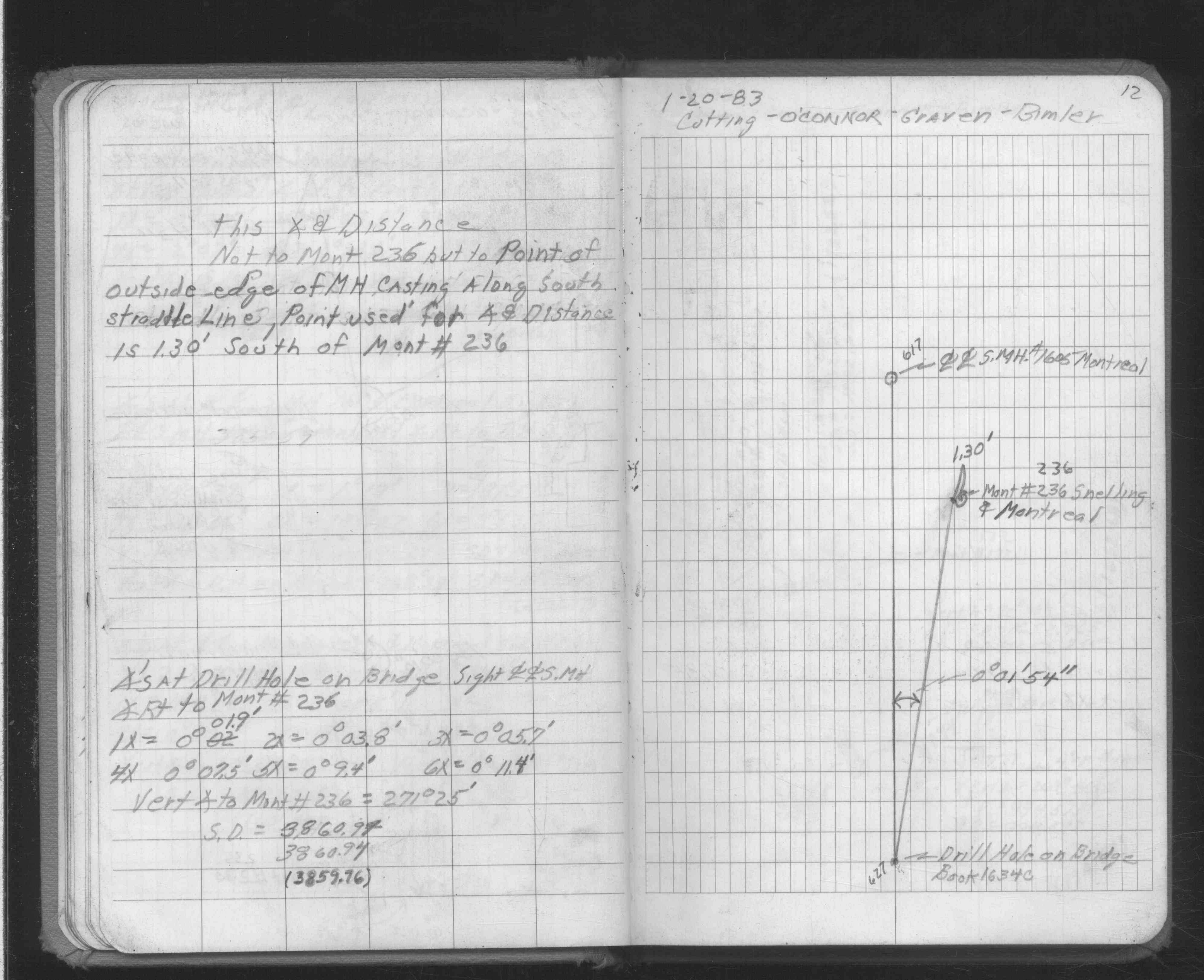
| 3/21/1972 | Monument falls on MH, fd straddles, fd circular marble 2" dia disk 50 ft to the east. See FB 1689A p.8 |
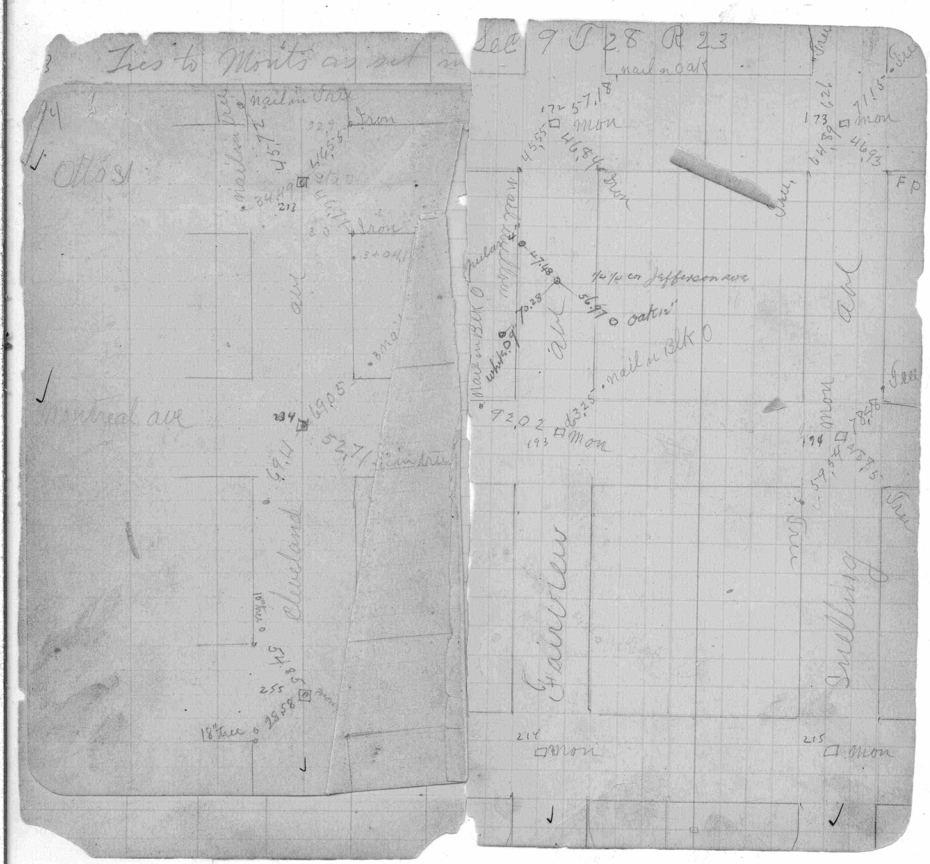
| 6/1/1925 | (Unknown date Jun __, 1925 ) Placed ties. See FB 1159 p.18 |
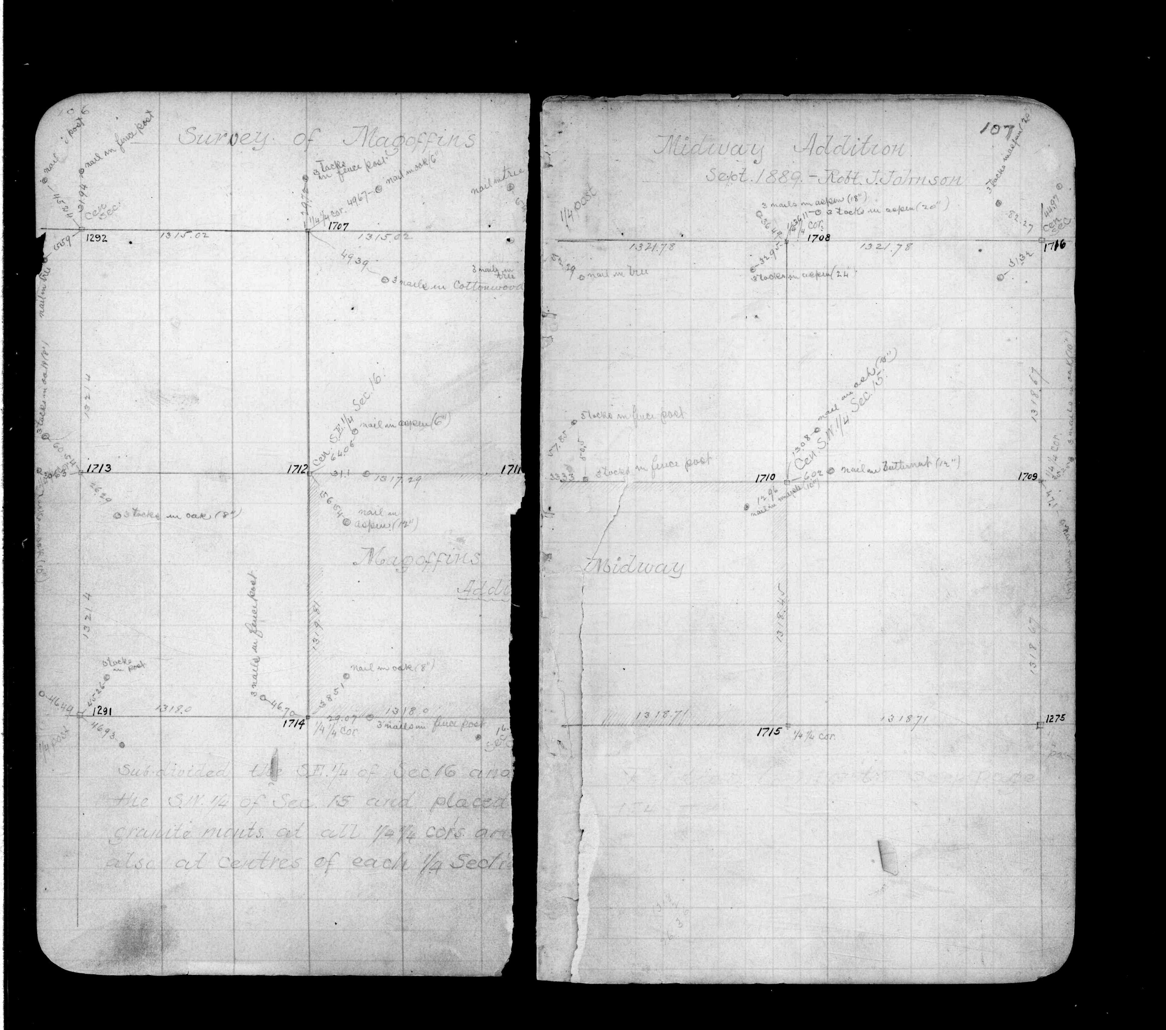
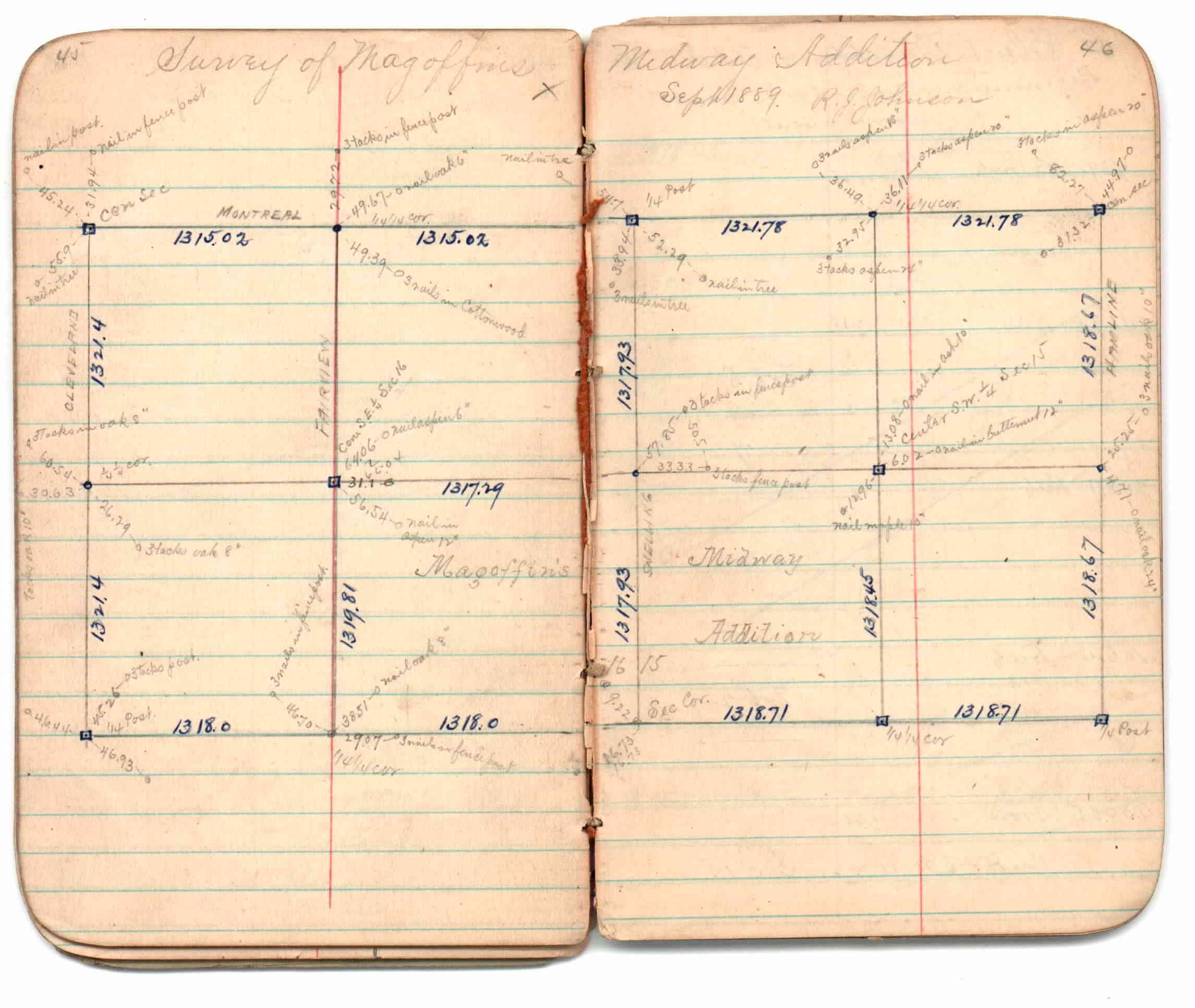
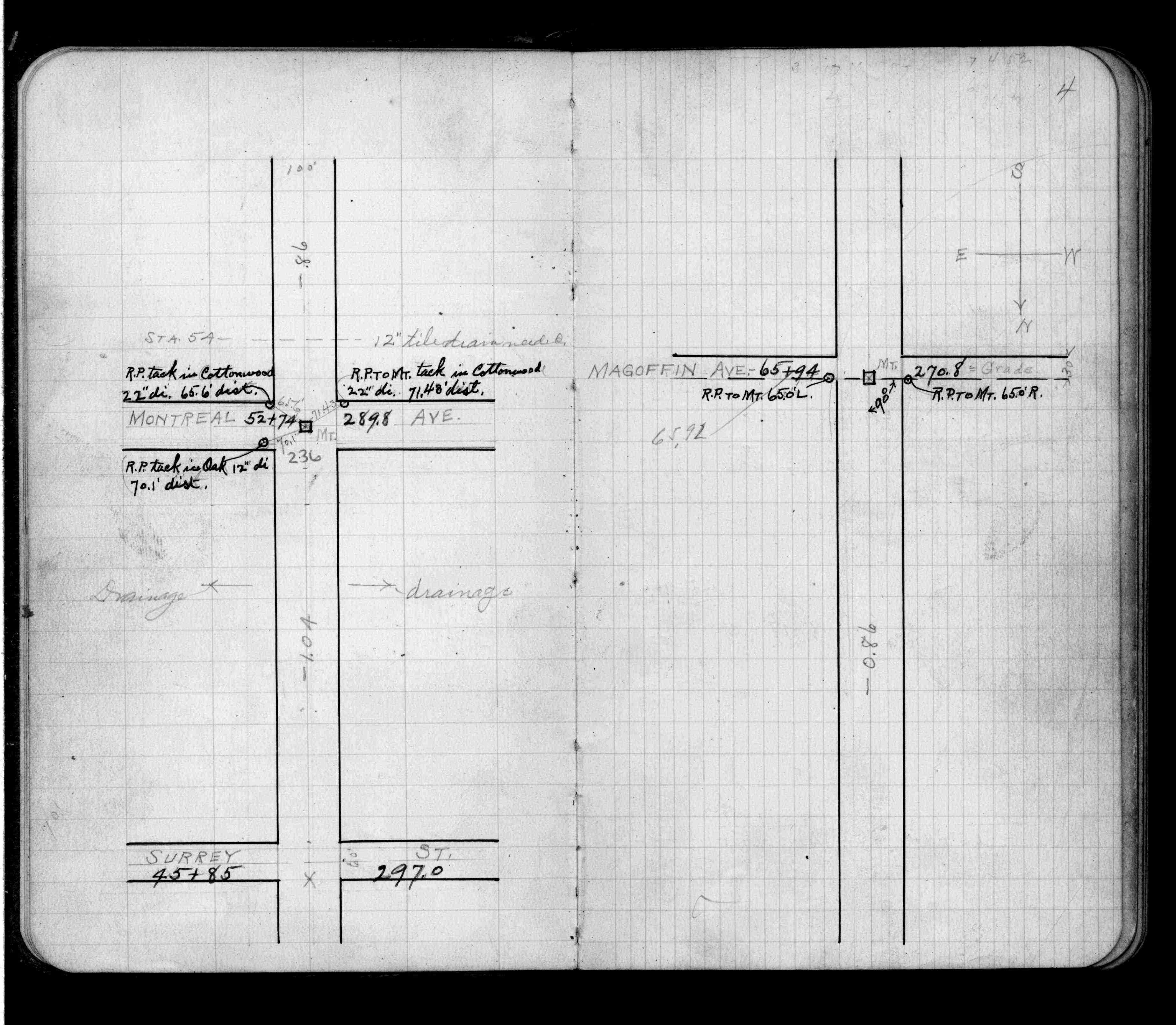
| 9/1/1889 | (Unknown date Sep __, 1889 ) Survey of Magoffins Midway Addition by R J Johnson. See JBI 01 p.45-46 |
| 9/1/1889 | (Unknown date Sep __, 1889 ) Monument tied in by R J Johnson. See Old Index Book, Entry 1708. See FB 236 p.106-107 |
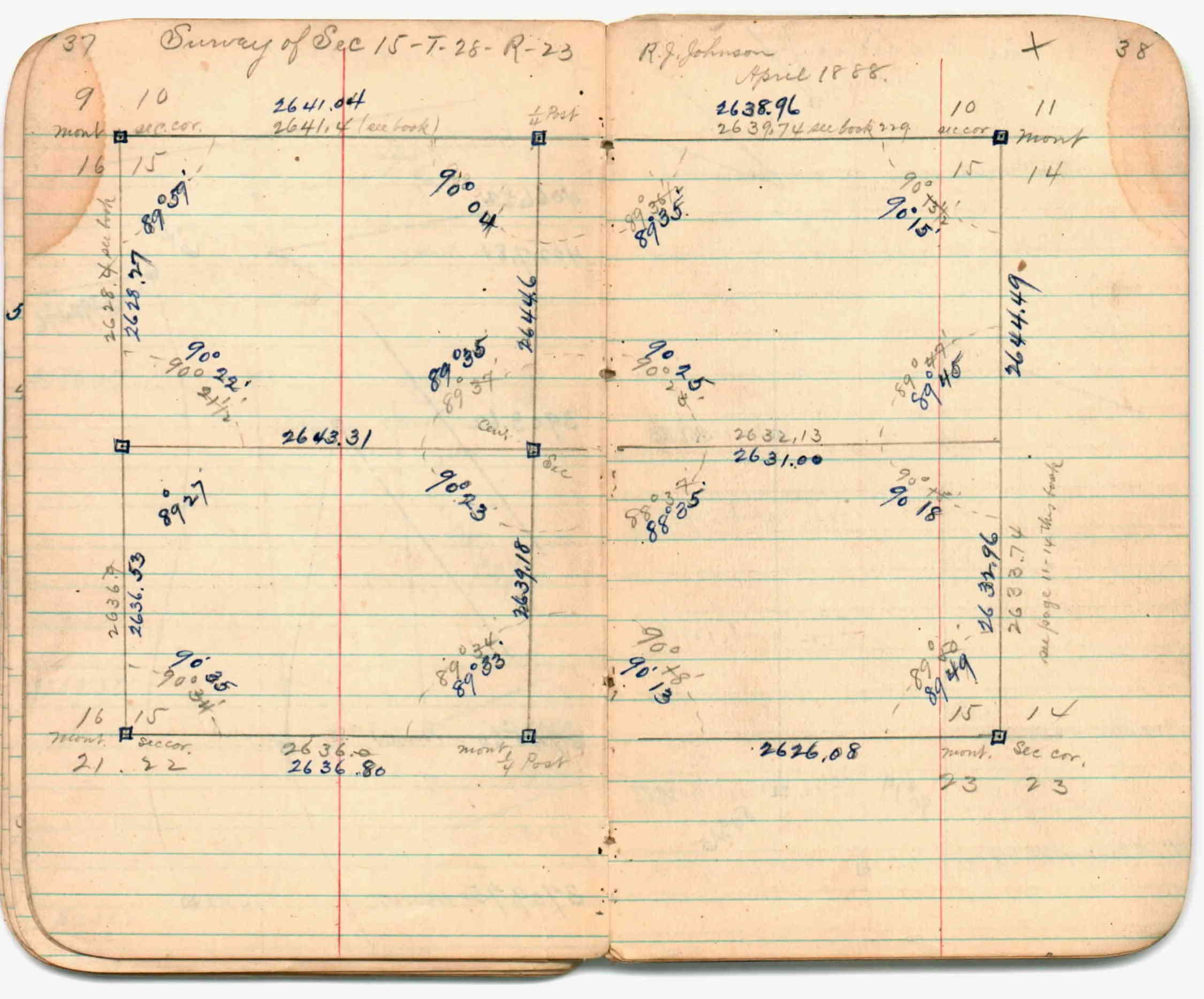
| 4/1/1888 | (Unknown date Apr __, 1888 ) Section break down by R J Johnson. See JBI 01 p.37-38 |
| 1/1/1888 | (Unknown date ___ __, 1888 ) See JBI 01 p.41-42 |
| 10/1/1847 | (Unknown date Oct __, 1847 ) Isaac N Higbee deputy surveyor set post. Tied to 2 BTs. See IH p.012-013 2823 |
Above is NOT an all inclusive history of this point. Please review all the links below. Yellow Tie Books are 'ST' in the Monument category.
| PLS NOTES | Field | Cross Section | Sewer | J.B. Irvine | Monument | River Survey |
|---|---|---|---|---|---|---|
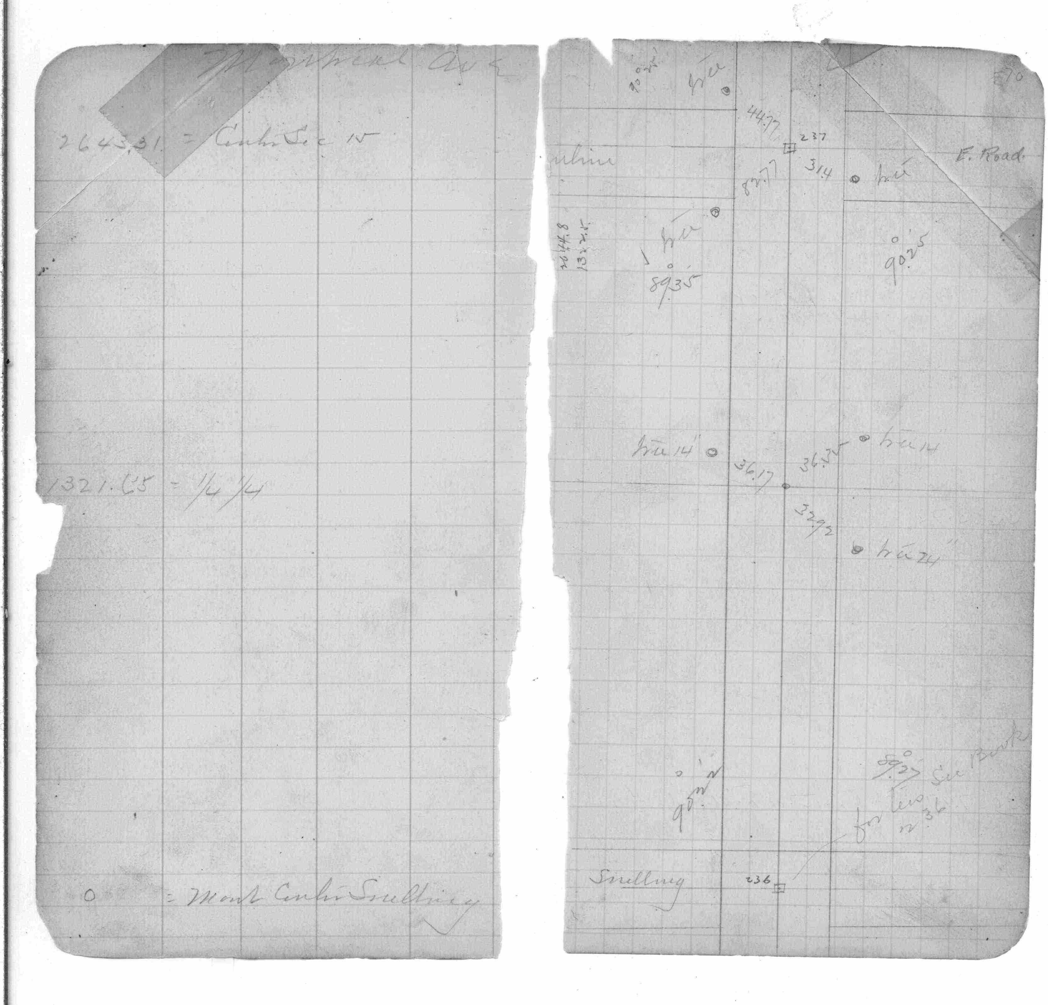
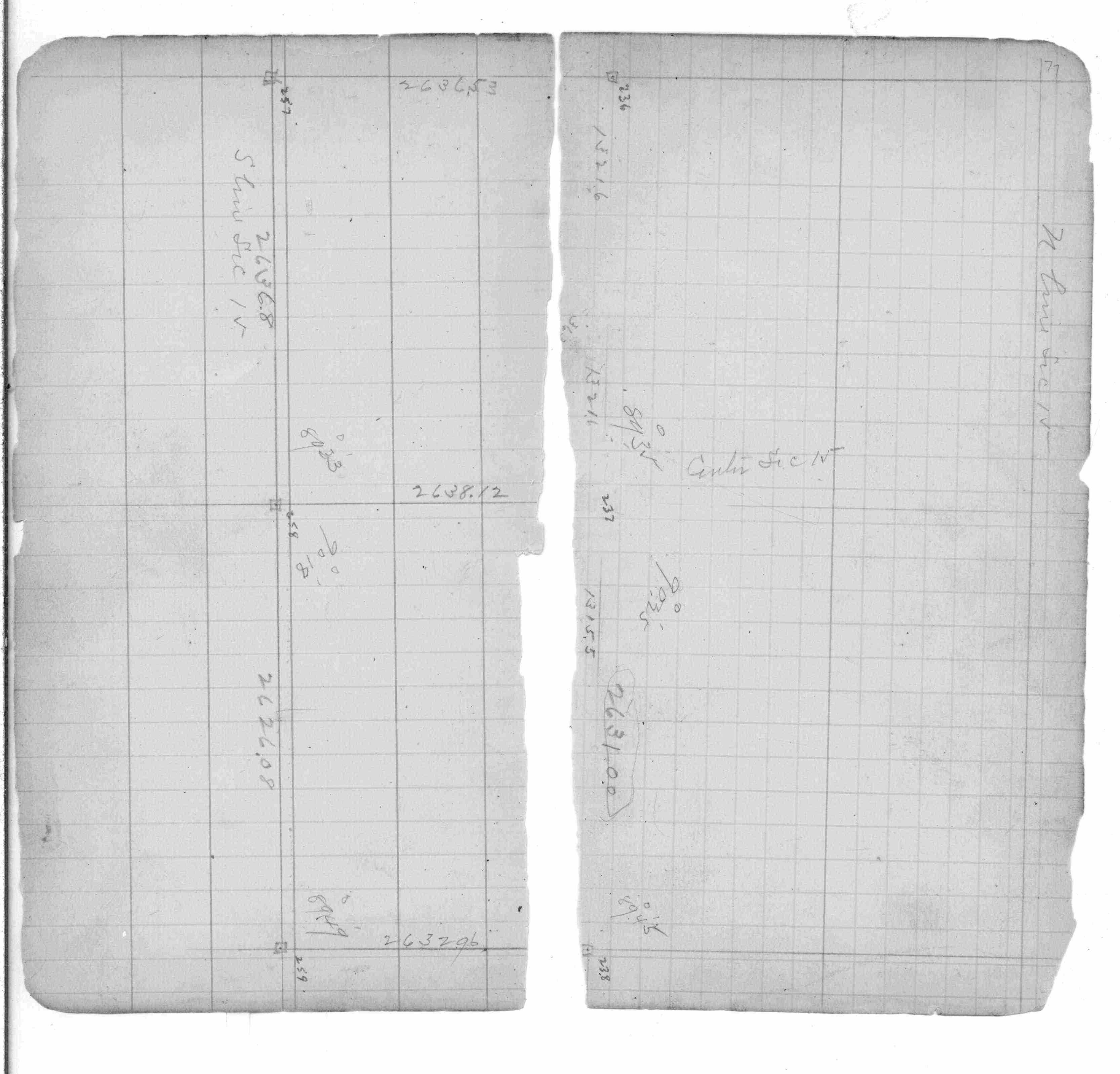
| IH p.012-013 | FB 0236p.106-107 | JBI 01 p.41-42 | ST 235-312 p.236 | |||
| FB 0236p.95101107 | JBI 01 p.37-38 | |||||
| FB 0250CPYp. 01 ,03 ,35 ,41 | JBI 01 p.45-46 | |||||
| FB 0253p. 70 ,77 | JBI 01 p.45-46 JBI 01 p.37-38 JBI 01 p.45-46 | |||||
| FB 0358p.94 | ||||||
| FB 0361p.54 | ||||||
| FB 0637p.04 | ||||||
| FB 0892Fp.11 | ||||||
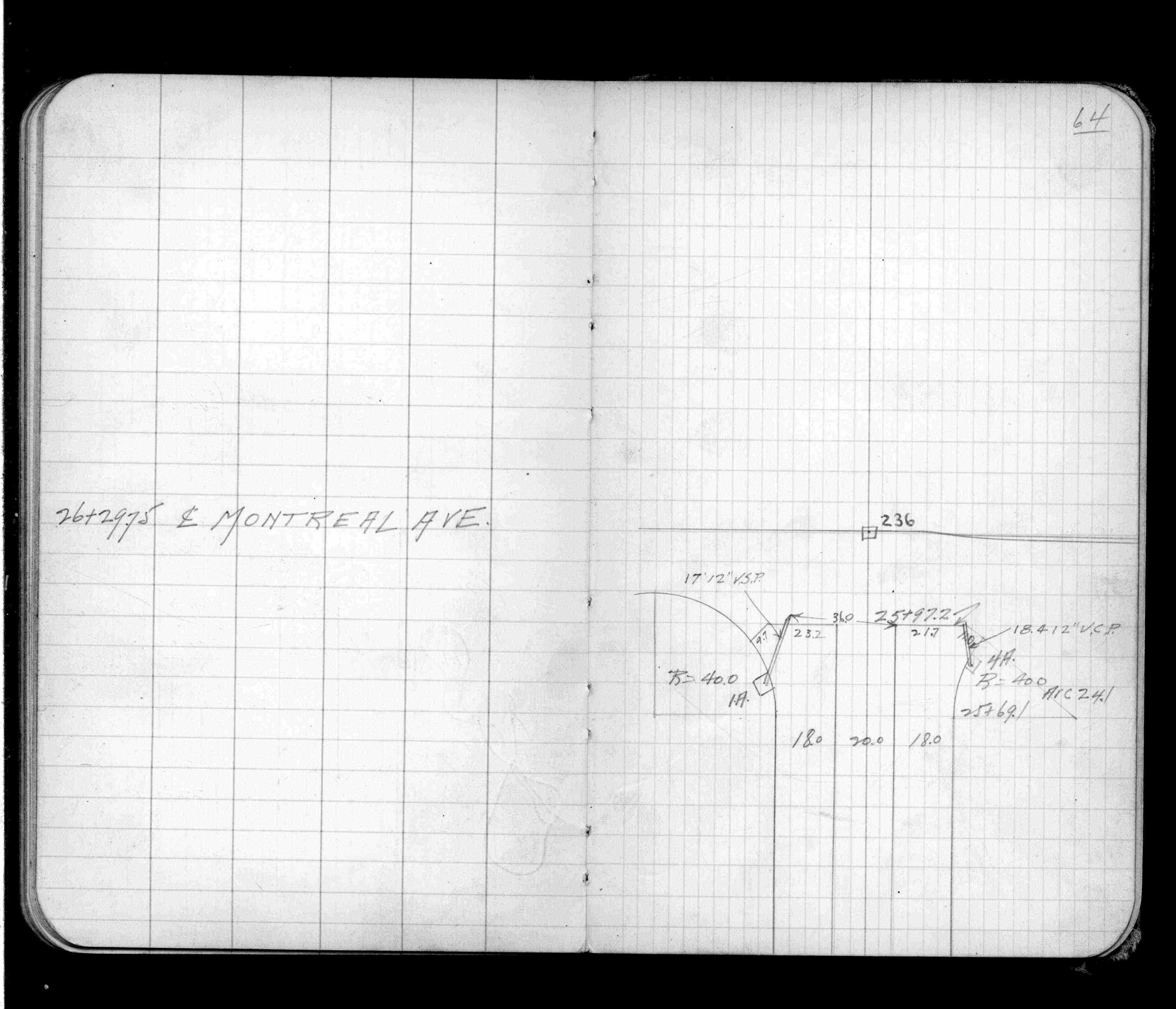
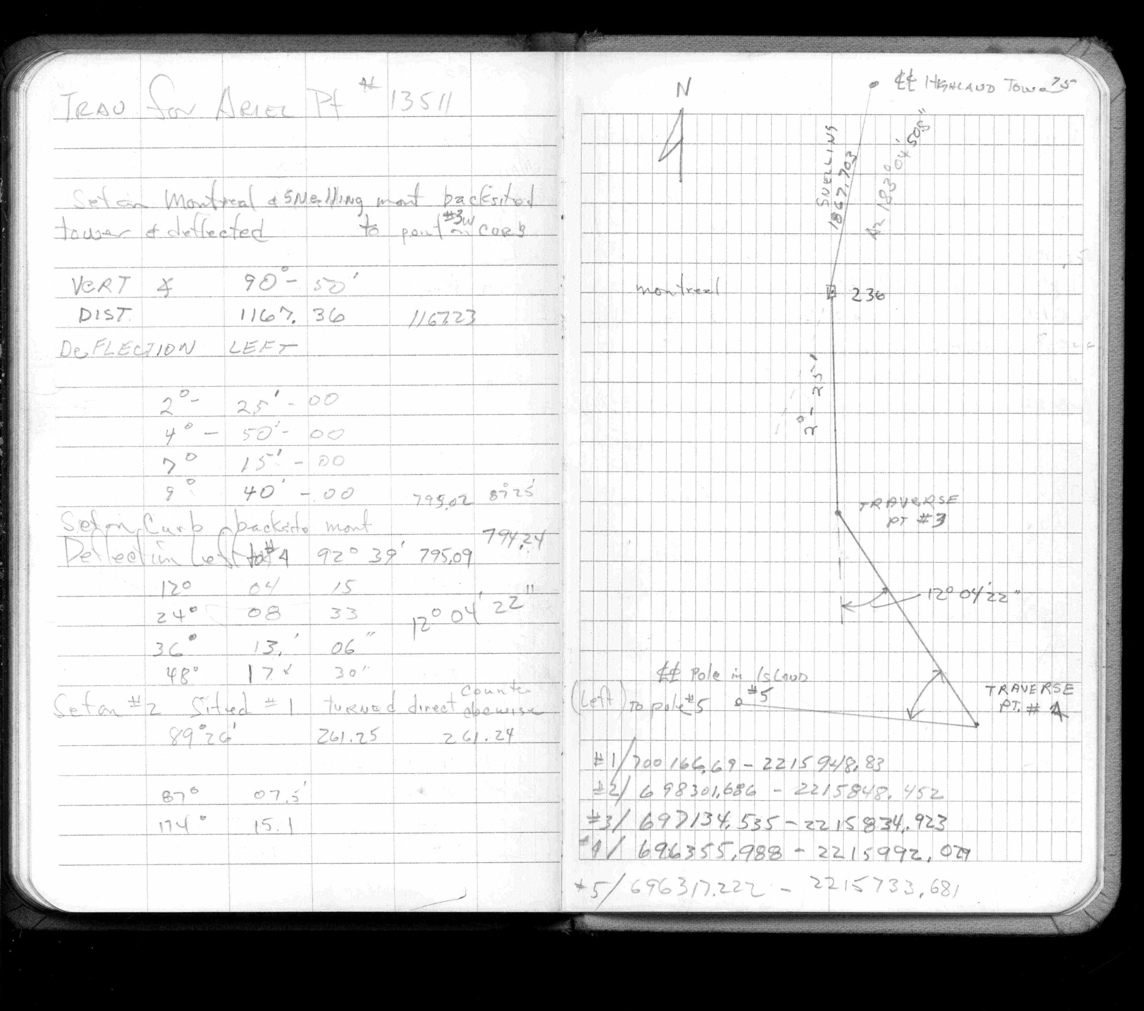
| FB 1137p.64 | ||||||
| FB 1159p.18 | ||||||
| FB 1159p.18 | ||||||
| FB 1188p.21 | ||||||
| FB 1336p.42 | ||||||
| FB 1421Ap.75 | ||||||
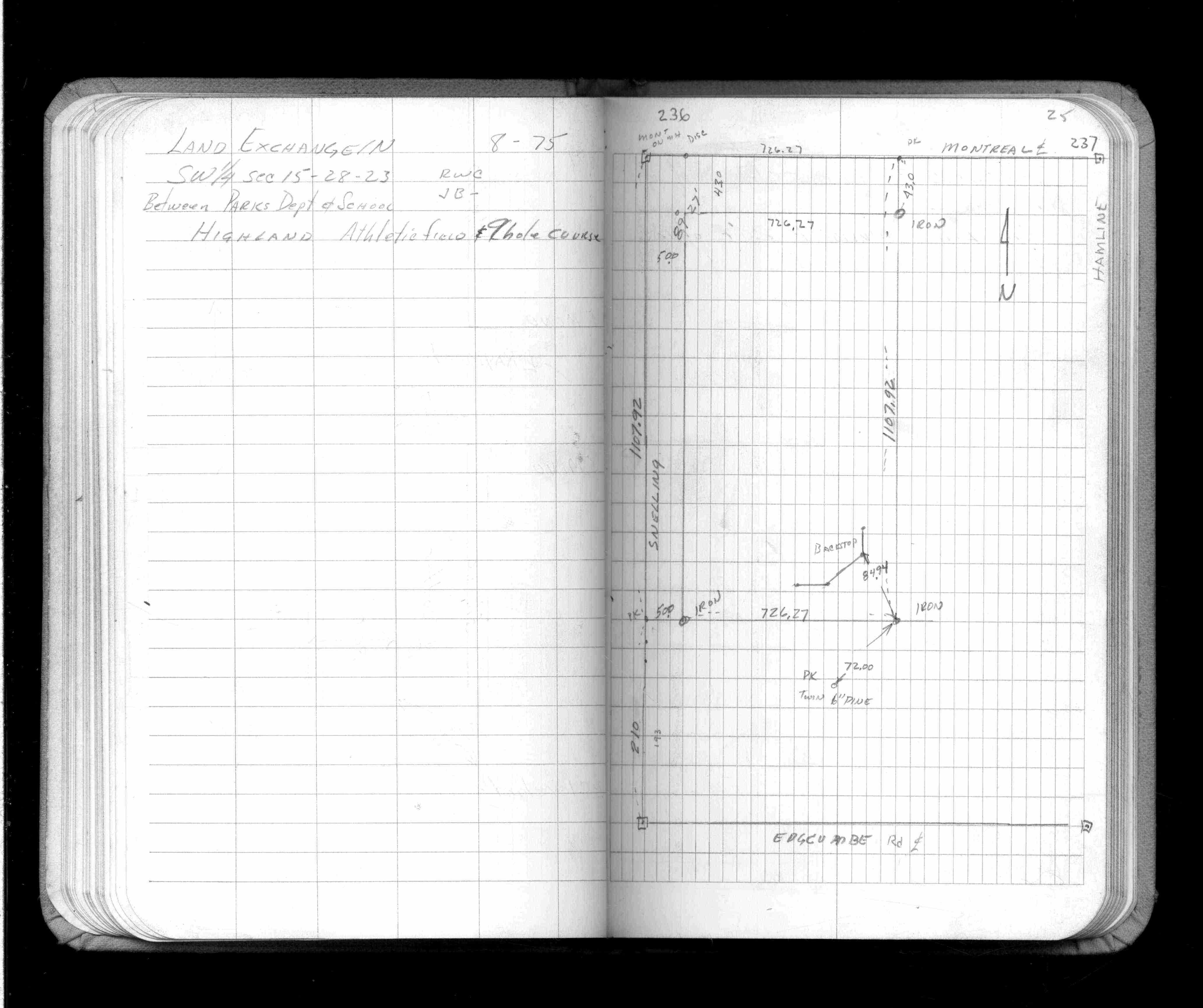
| FB 1422Bp.25 | ||||||
| FB 1427p.78 | ||||||
| FB 1549Lp.38 | ||||||
| FB 1634Cp. 08 ,09 ,10 ,51 | ||||||
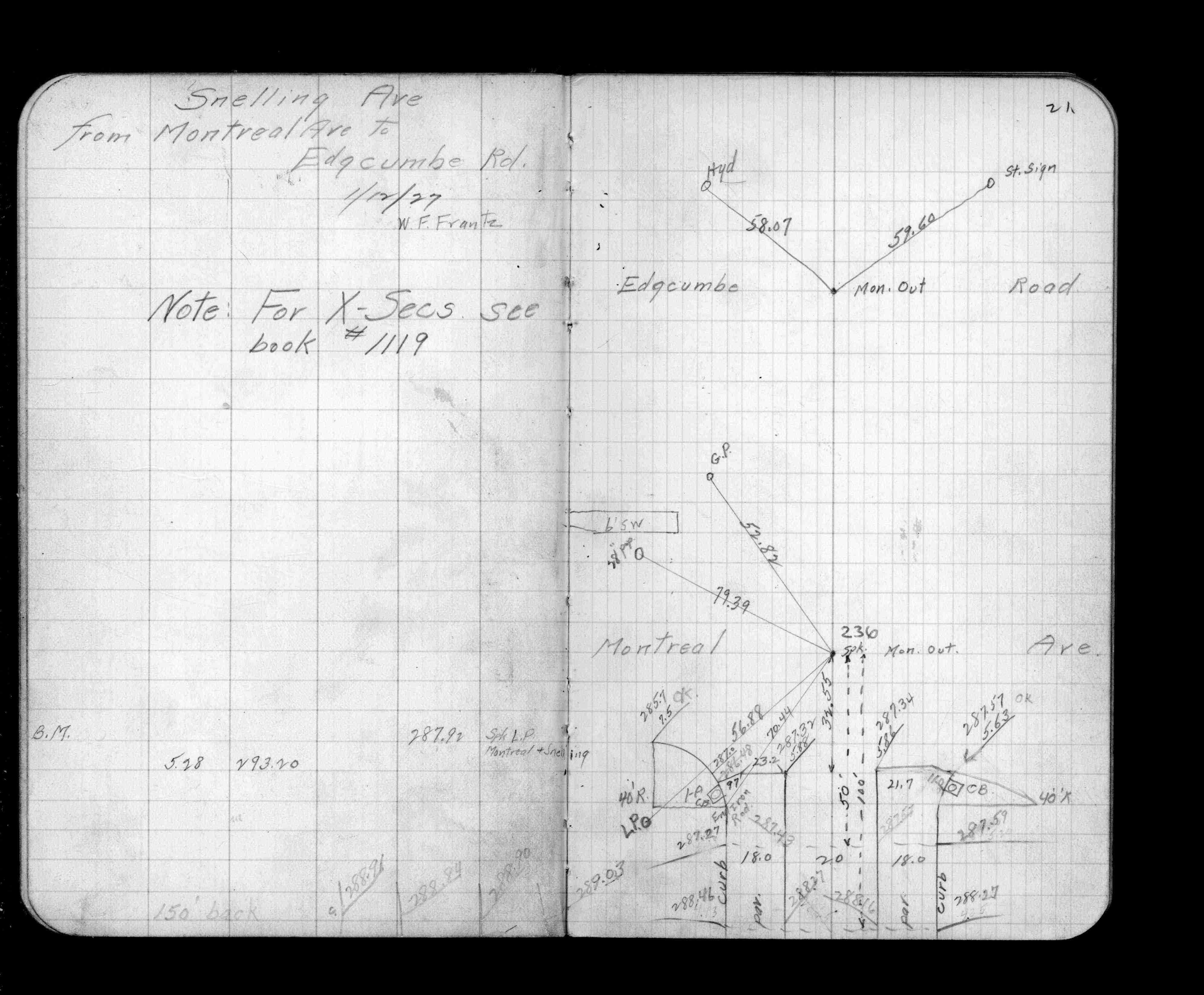
| FB 1673Ap. 59 ,60 | ||||||
| FB 1676Bp. 04 ,05 ,06 ,44 | ||||||
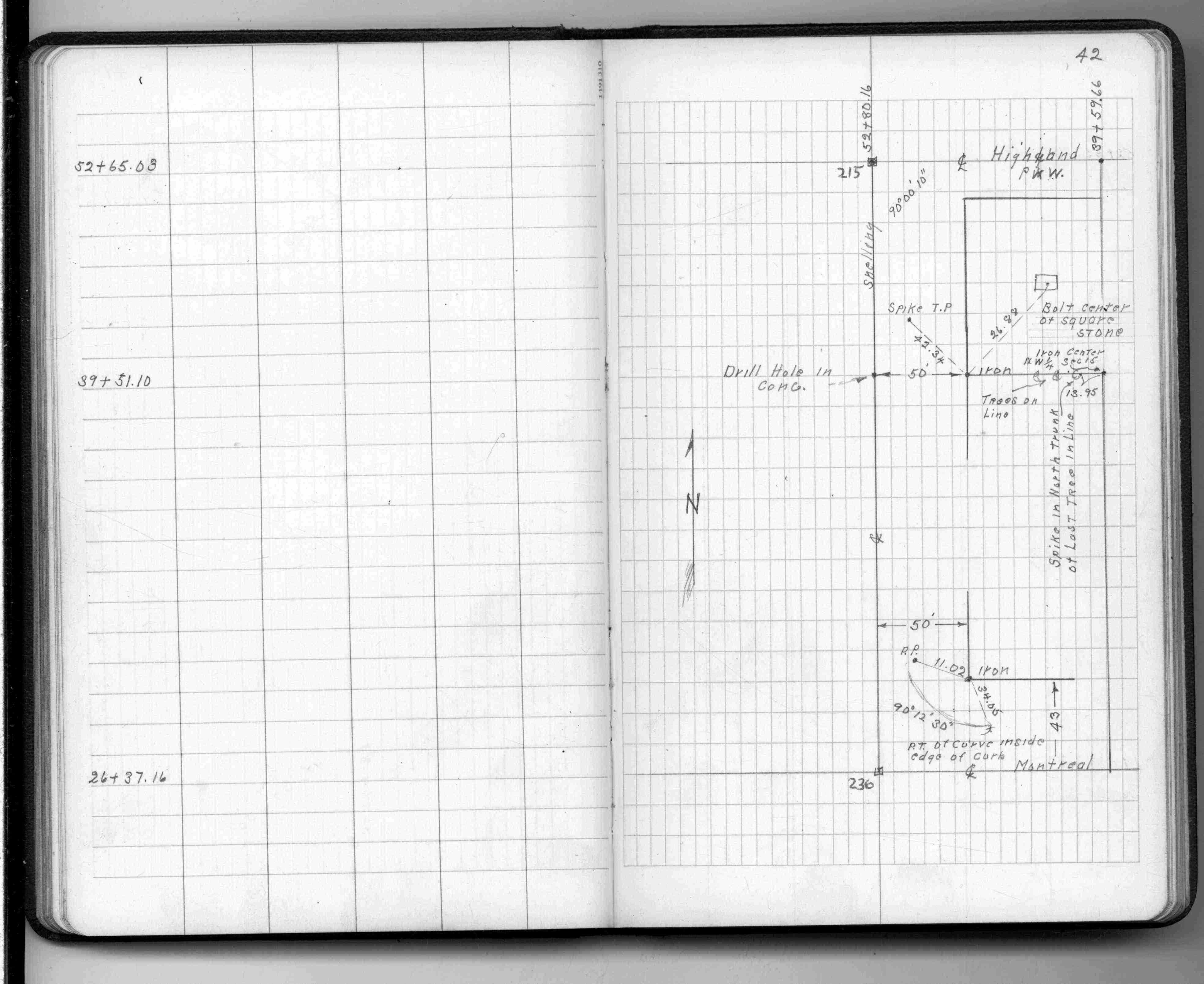
| FB 1689Ap.08 | ||||||
| FB 1694p.12 | ||||||
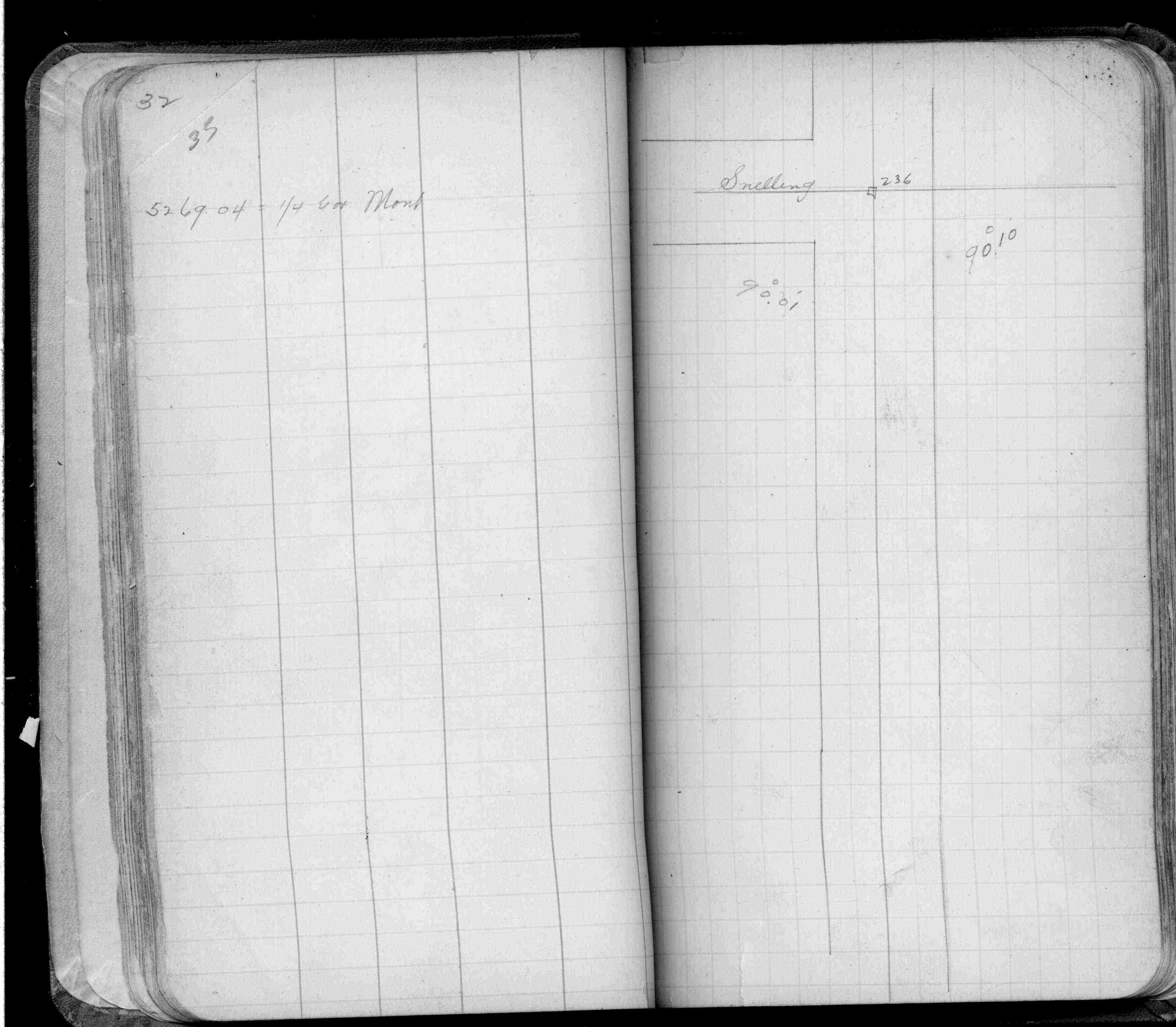
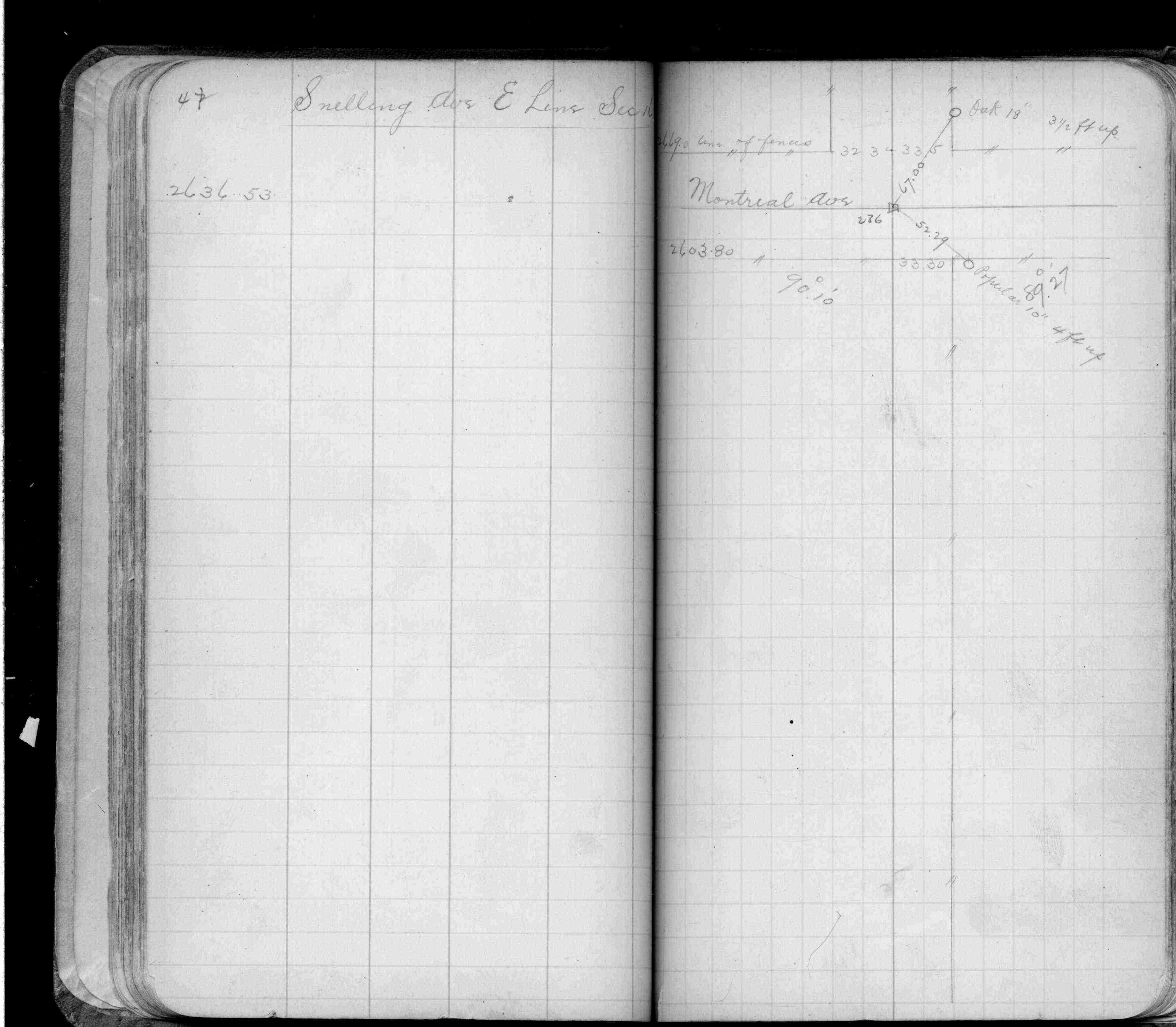
| FB 1736p.32 |
| FILE | SURVEYOR | LIC. NO. | DATE SIGNED | DATE TIED |
|---|---|---|---|---|
| 0236-1276-A.tif | William J. Cutting | 20576 | October 20, 1995 | September 26, 1994 |
| ST_235-312p236.jpg | none | none | none | none |
| 0236-1276-A.dwf | none | none | none | none |