| NAD83 COORDINATES (1986 adj.): |
|---|
| * X= 558682.273 Y= 144331.097 Z= 000.00 LSQ 12/06/1991 S FLT |
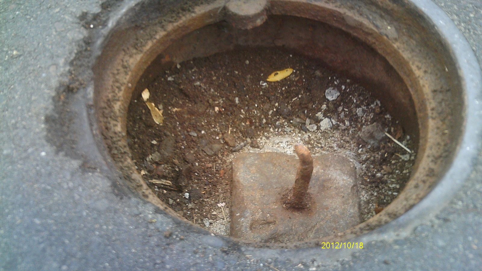
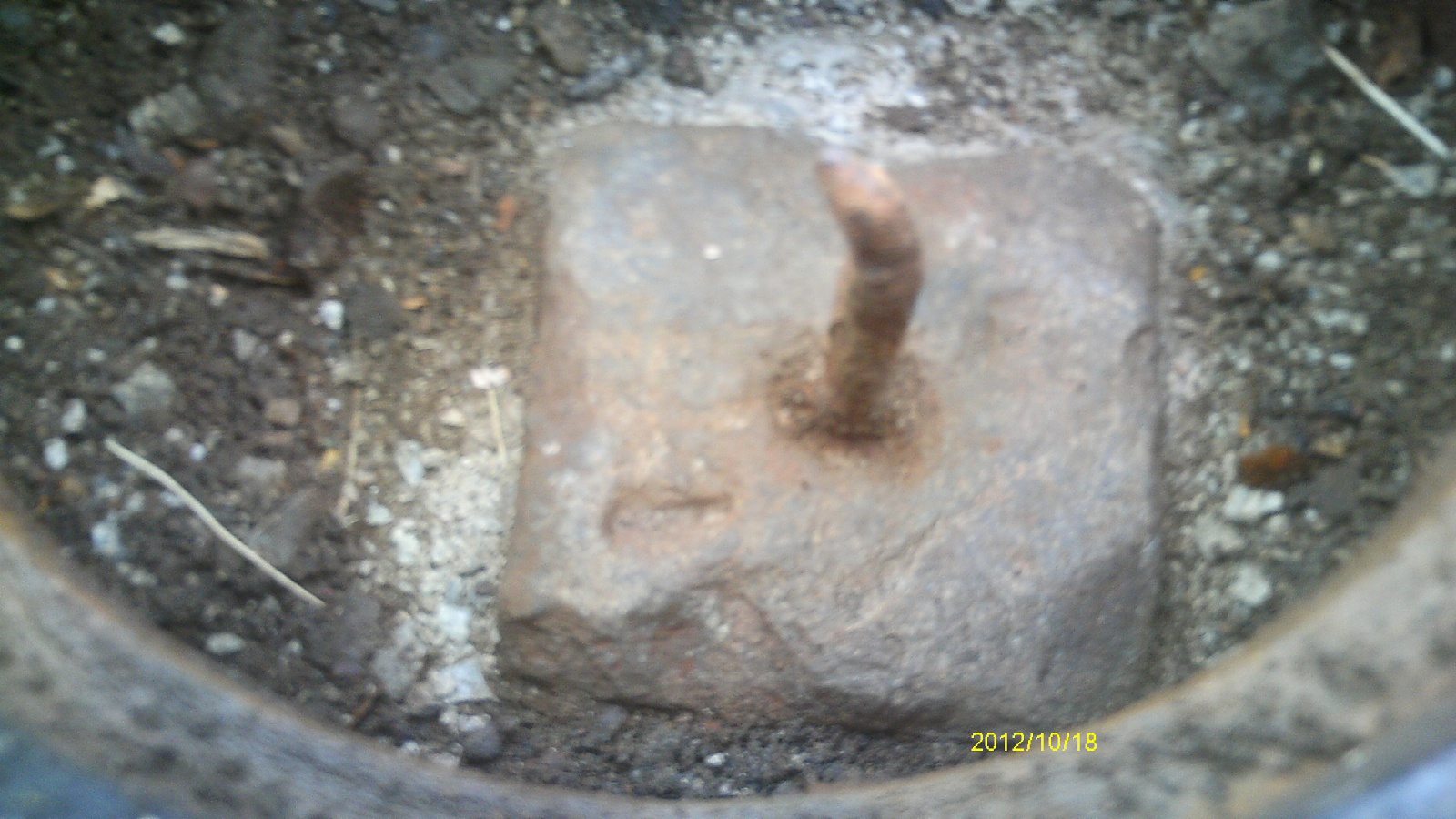
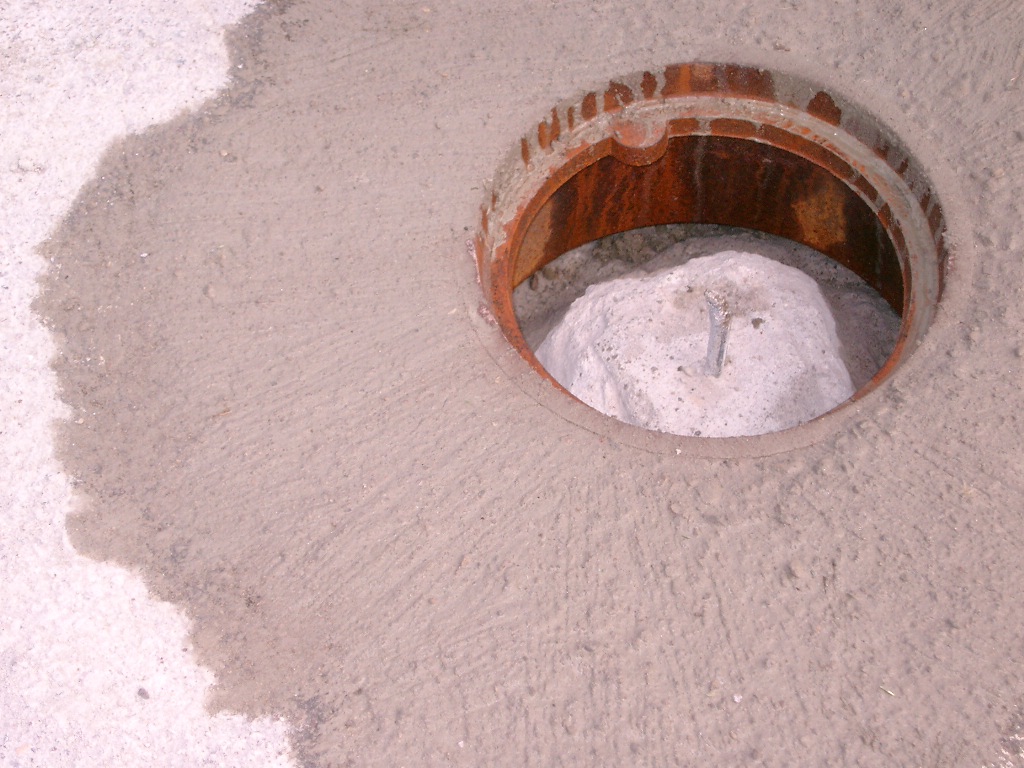
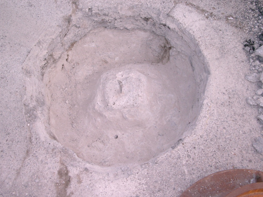
| 10/18/2012 | Found GM under casting after mill & overlay completed. Monument is 0.5 ft below street grade and has a bent iron rod in center hole. Photos taken. |
| 8/7/2004 | Place 1.0 diameter casting over GM. Steel pin still in GM. Placed ties. See CofL 0237-1716-C1 |
| 8/7/2004 | Fd steel pin in center of GM 0.50 feet below asphalt surface. |
| 8/7/2004 | Elev 201.98 ft on top of GM. Elev 202.41 ft on top of casting. See CofL 0237-1716-C2 |
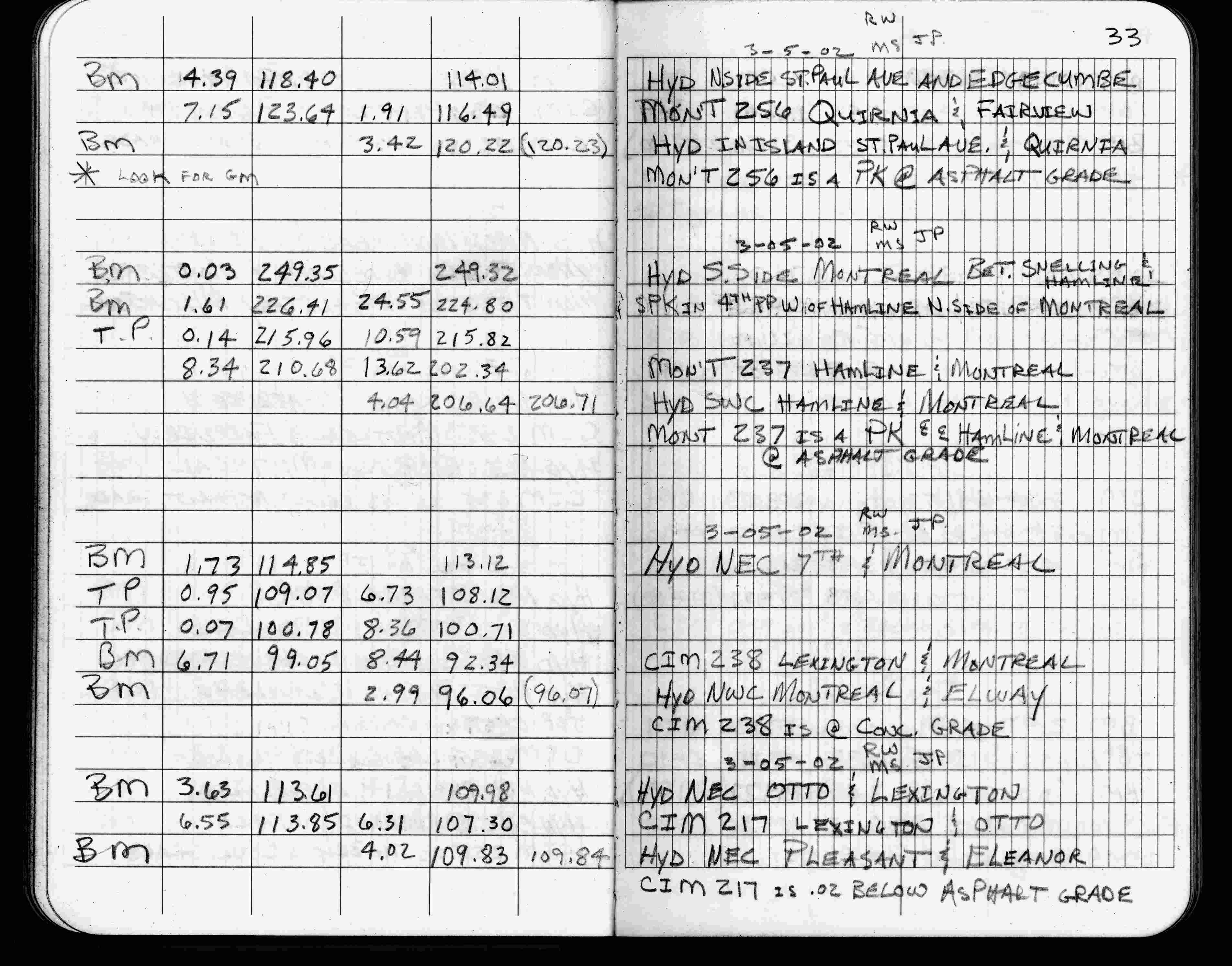
| 3/5/2002 | Elev 202.34 ft on pk nail at asphalt surface. See FB 1736 p.33 |
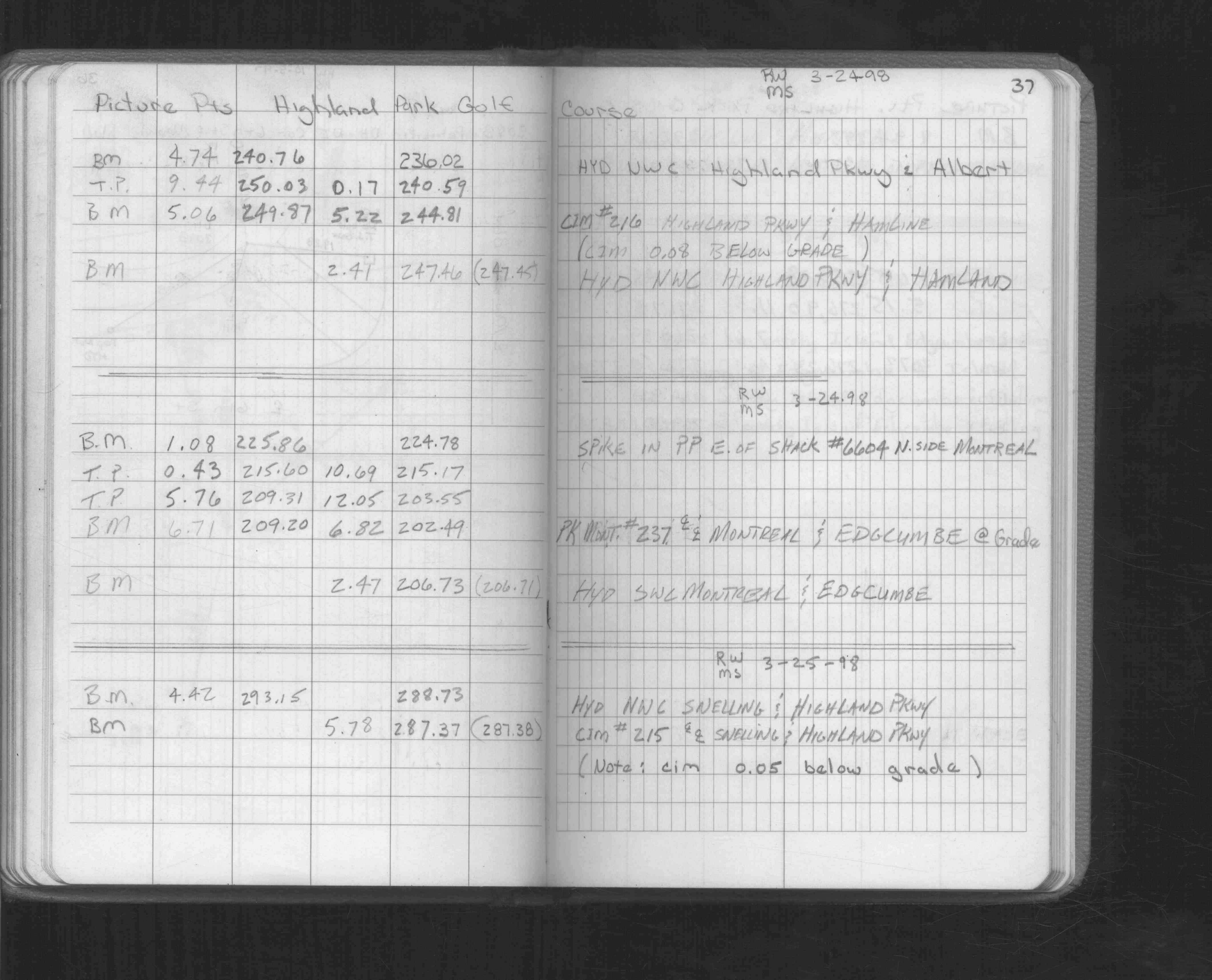
| 3/24/1998 | Elev 202.49 ft on pk nail. See FB 1549L p.37 |
| 10/2/1995 | Fd sheared off CIM 0.15 ft below grade, left monument as found. See CofL 0237-1716-B |
| 4/5/1994 | Fd CIM 0.07 ft below grade, placed ties, left CIM as found. See CofL 0237-1716-A |
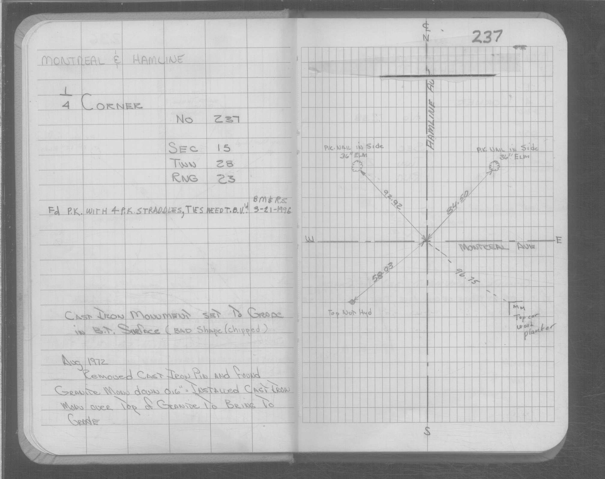
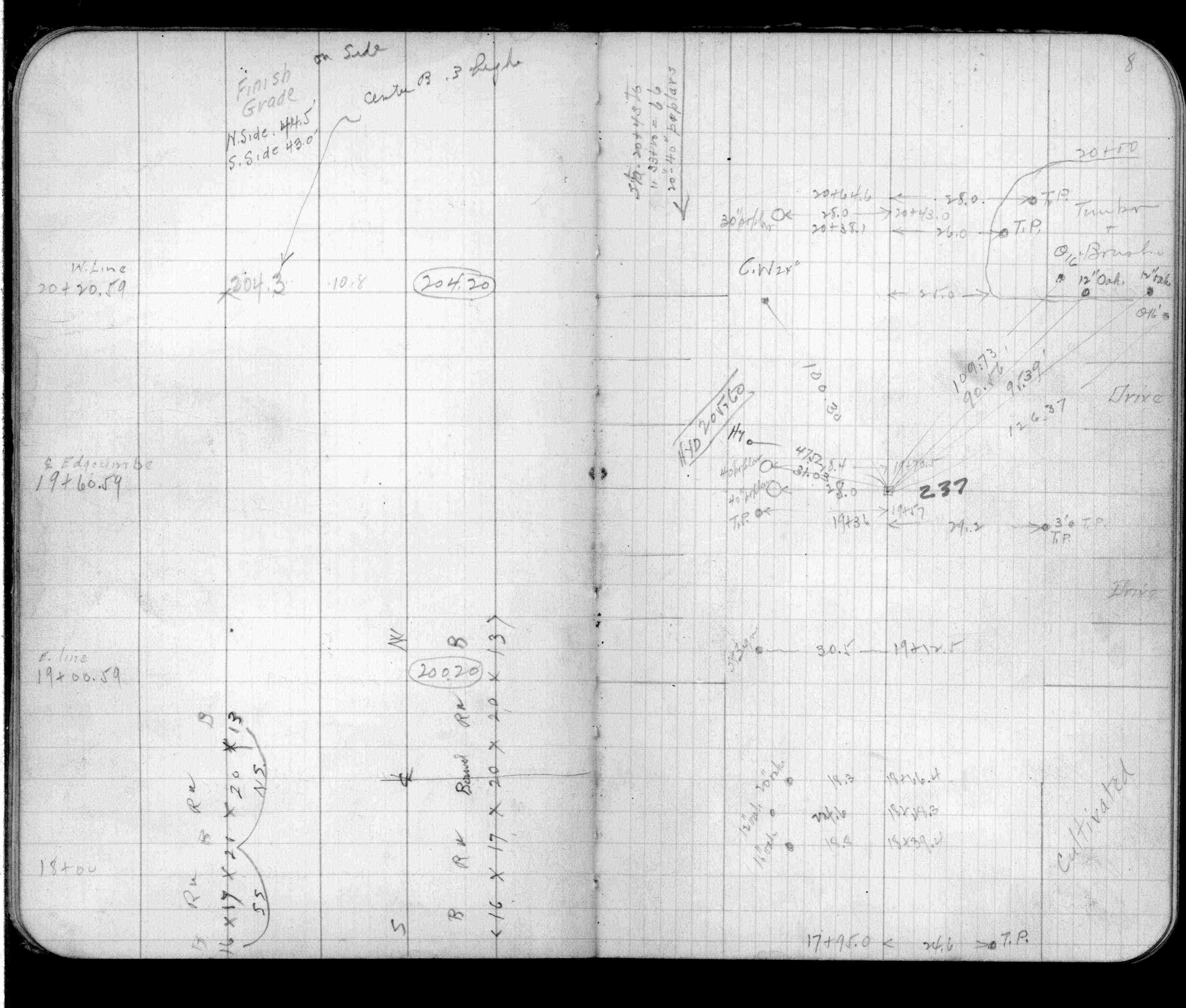
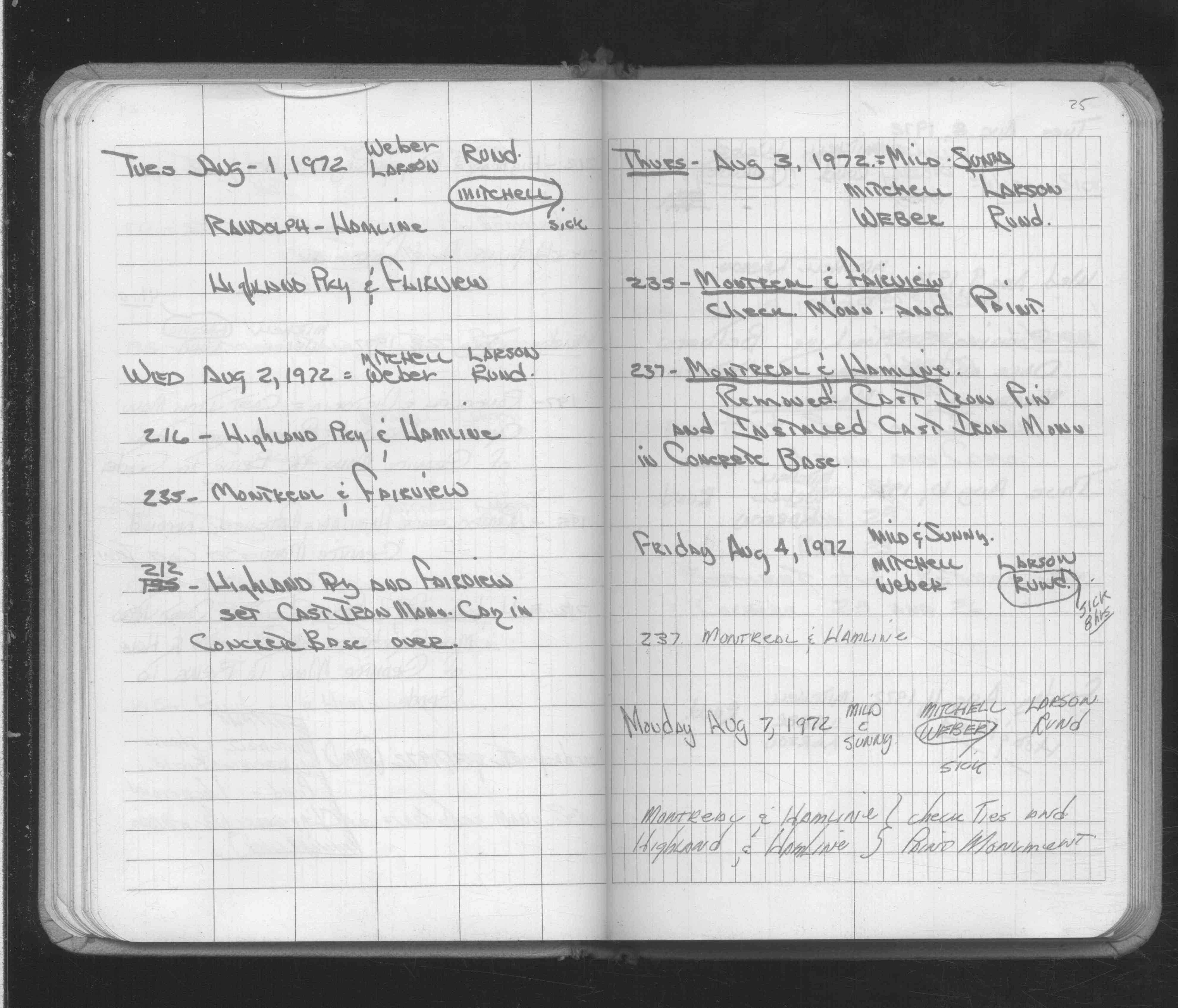
| 8/3/1972 | Fd cast iron pin, removed pin, fd GM 6" below grade, set CIM over GM to bring to grade. See Yellow Tie Book & See FB 1689A p.25 |
| 6/1/1925 | (Unknown date Jun __, 1925 ) Placed ties. See FB 1159 p.8 |
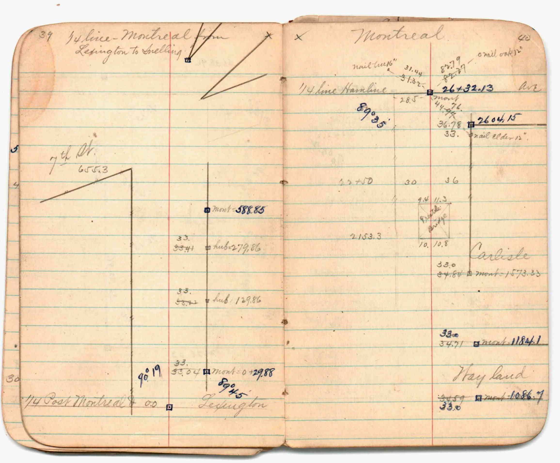
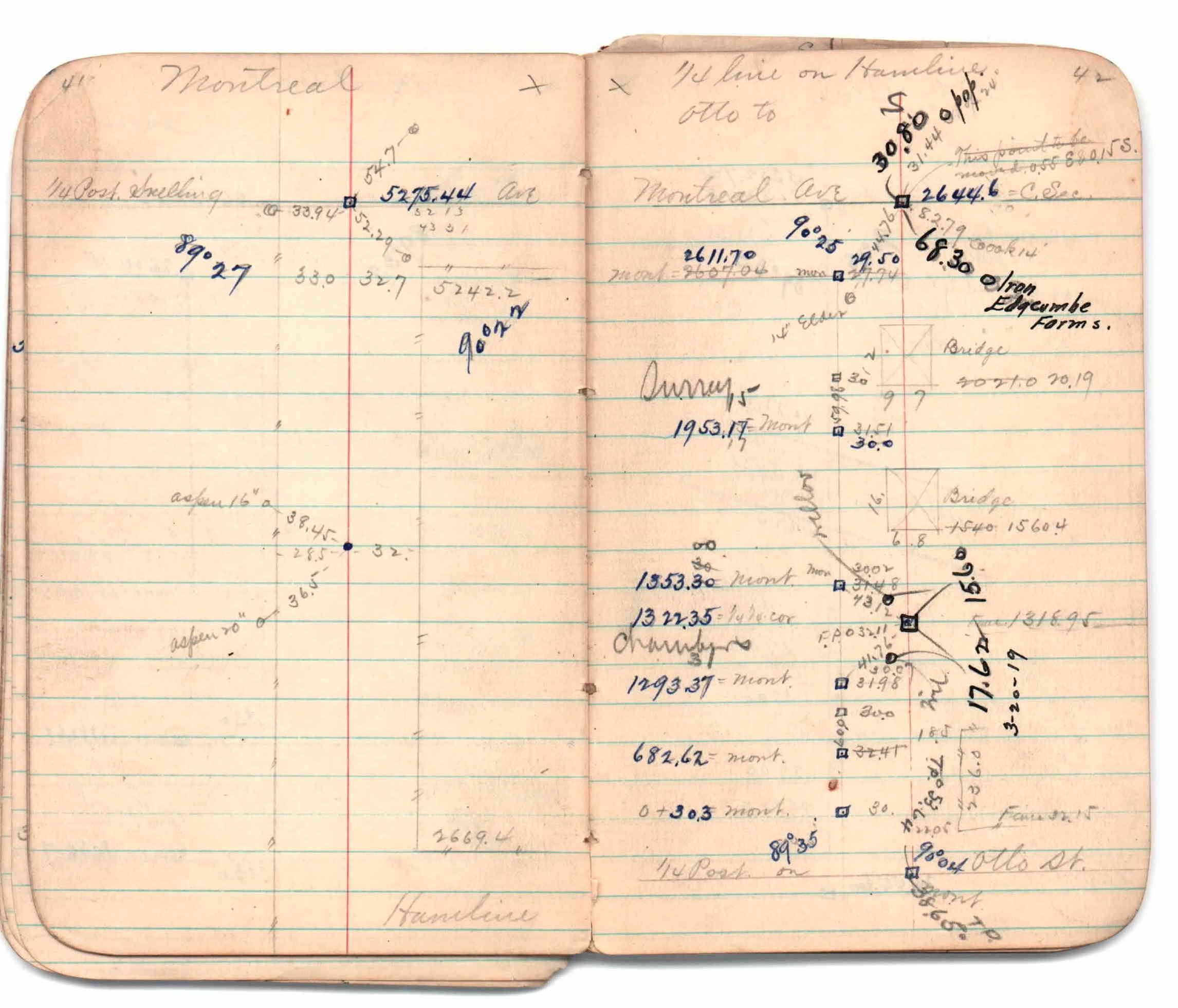
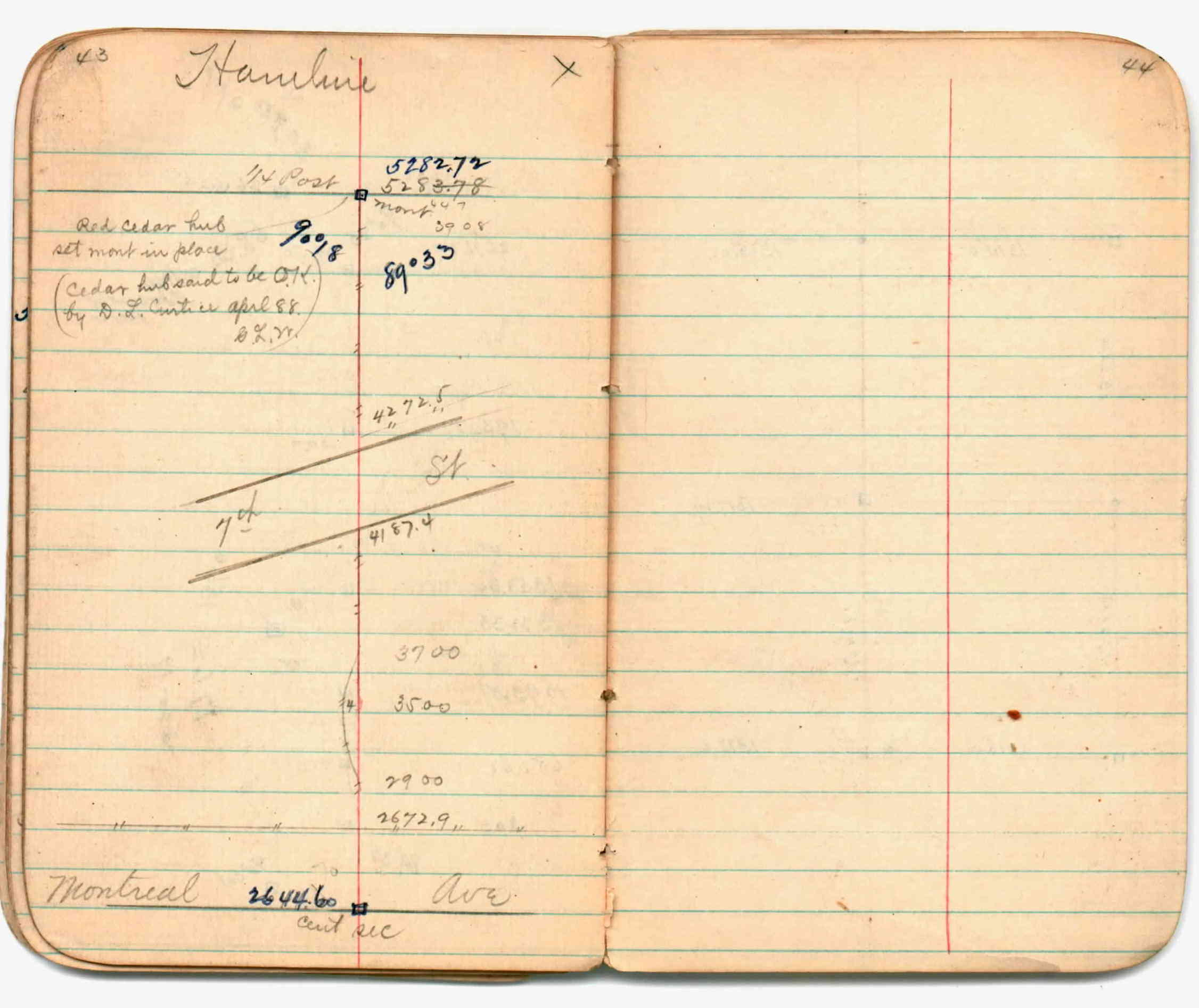
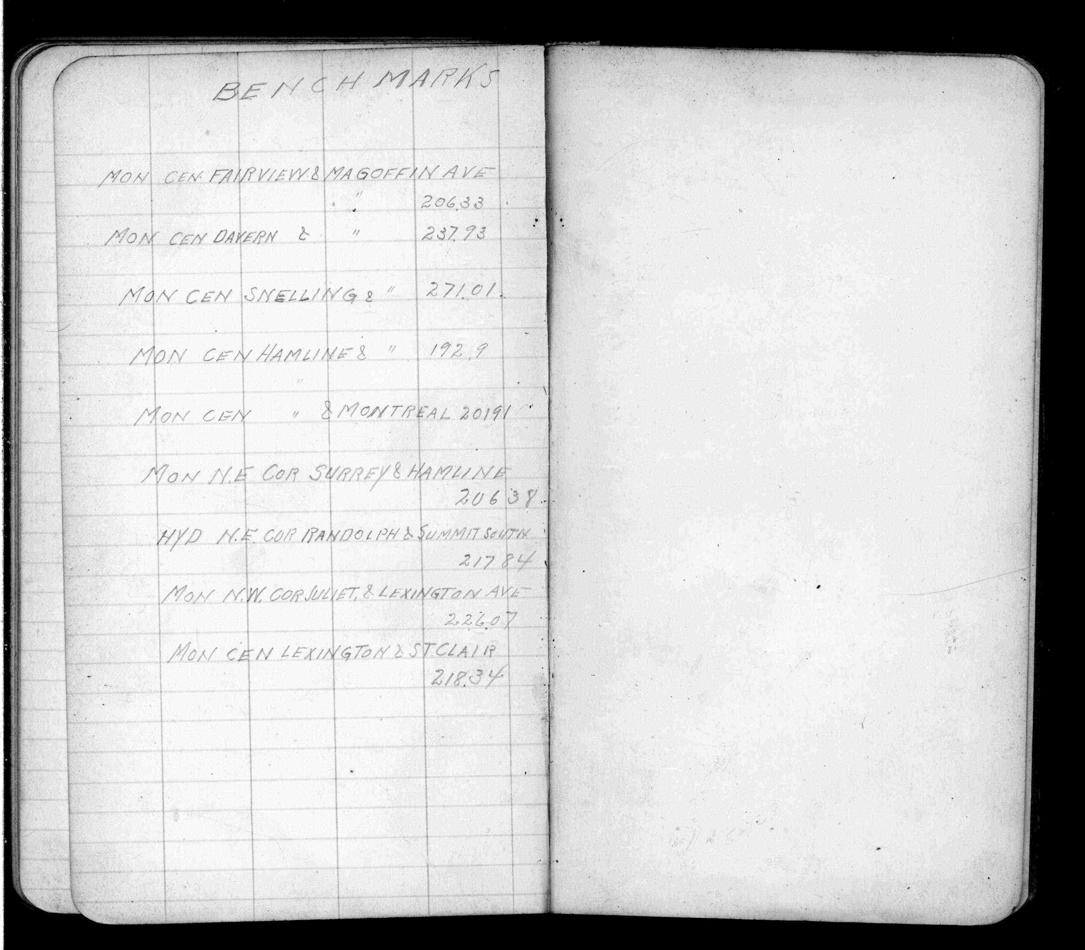
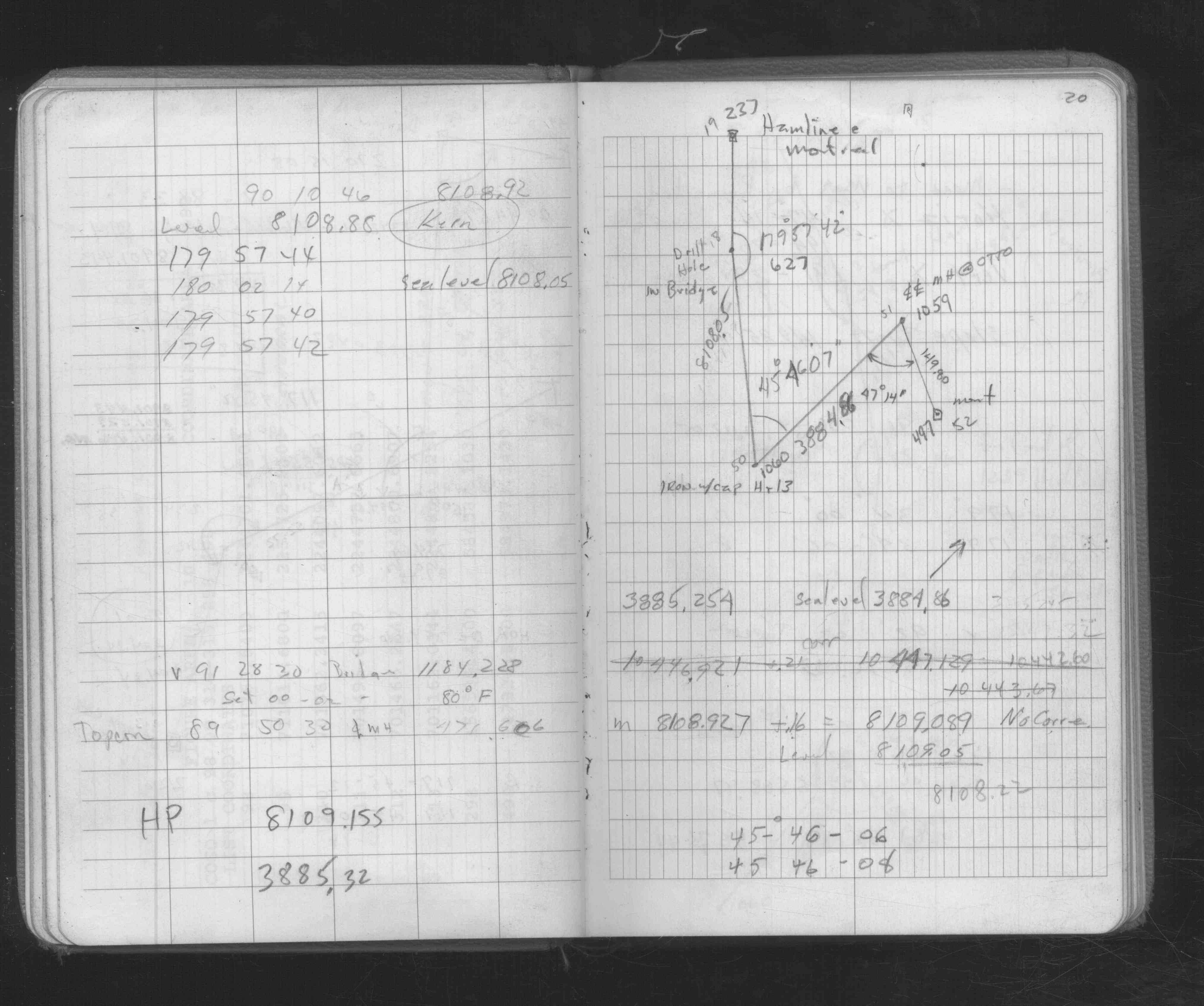
| 1/1/1912 | Recorded elevation of 201.91 on the monument. See FB 675 p.79 |
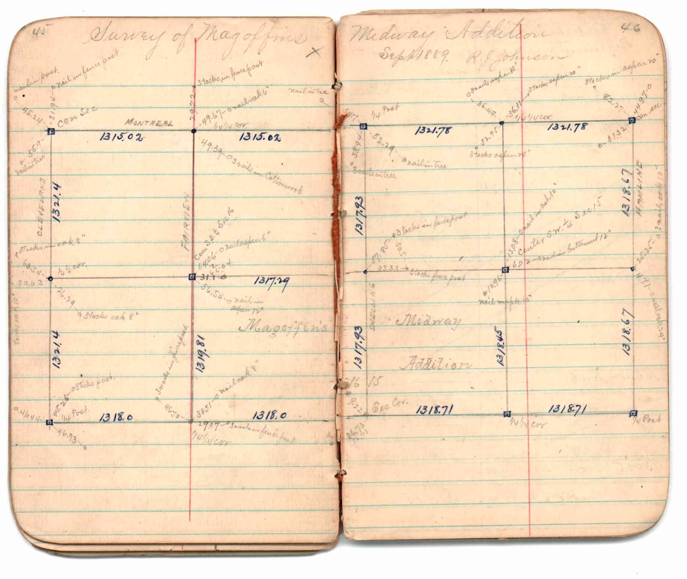
| 9/1/1889 | (Unknown date Sep __, 1889 ) Survey of Magoffins Midway Addition by R J Johnson. See JBI 01 p.45-46 |
| 9/1/1889 | (Unknown date Sep __, 1889 ) Monument set by R J Johnson. See Old Index Book, Entry 1708 |
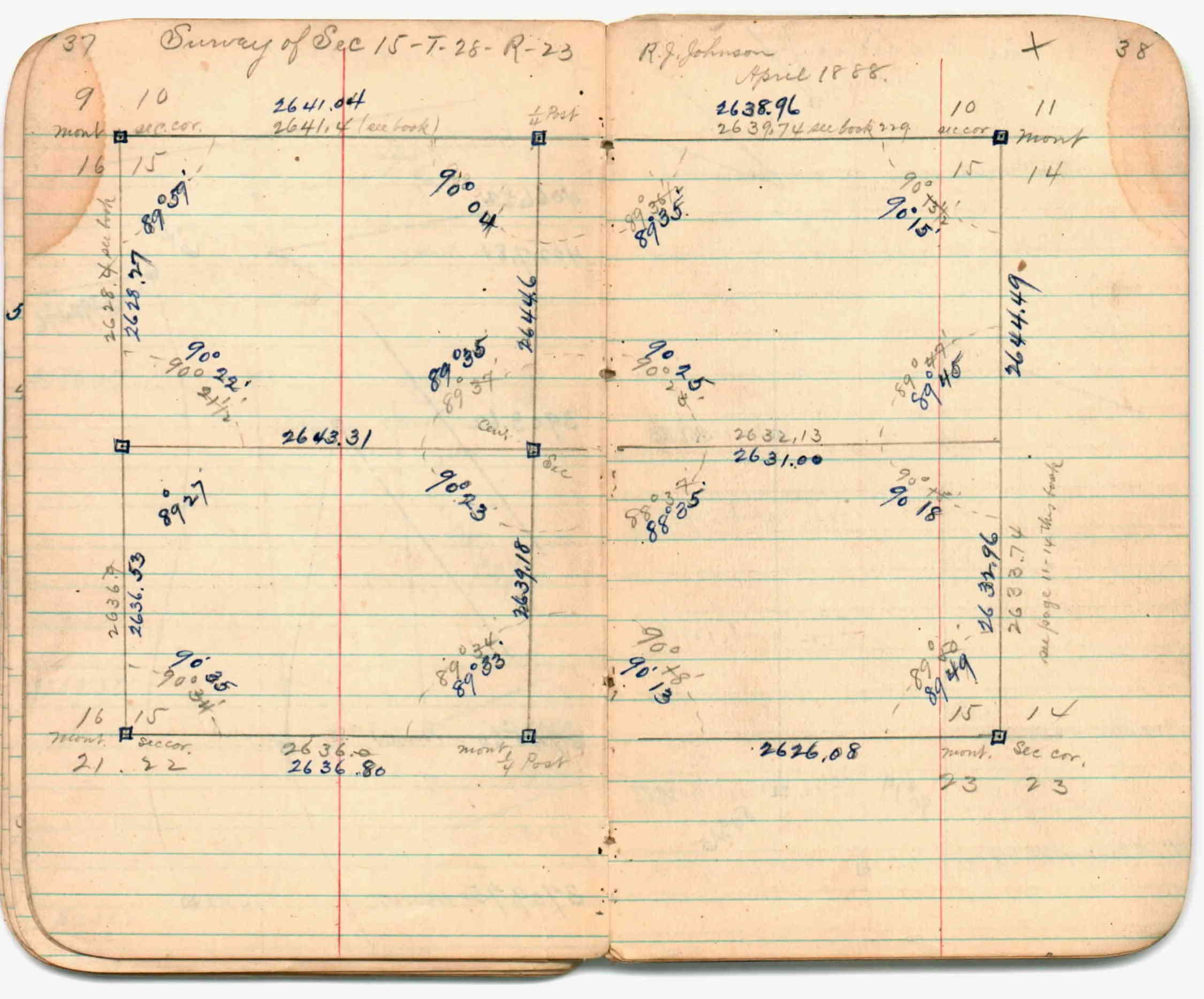
| 4/1/1888 | (Unknown date Apr __, 1888 ) Section break down by R J Johnson. See JBI 01 p.37-38 |
| 1/1/1888 | (Unknown date ___ __, 1888 ) See JBI 01 p.39-40,41-42,43-44 |
Above is NOT an all inclusive history of this point. Please review all the links below. Yellow Tie Books are 'ST' in the Monument category.
| PLS NOTES | Field | Cross Section | Sewer | J.B. Irvine | Monument | River Survey |
|---|---|---|---|---|---|---|
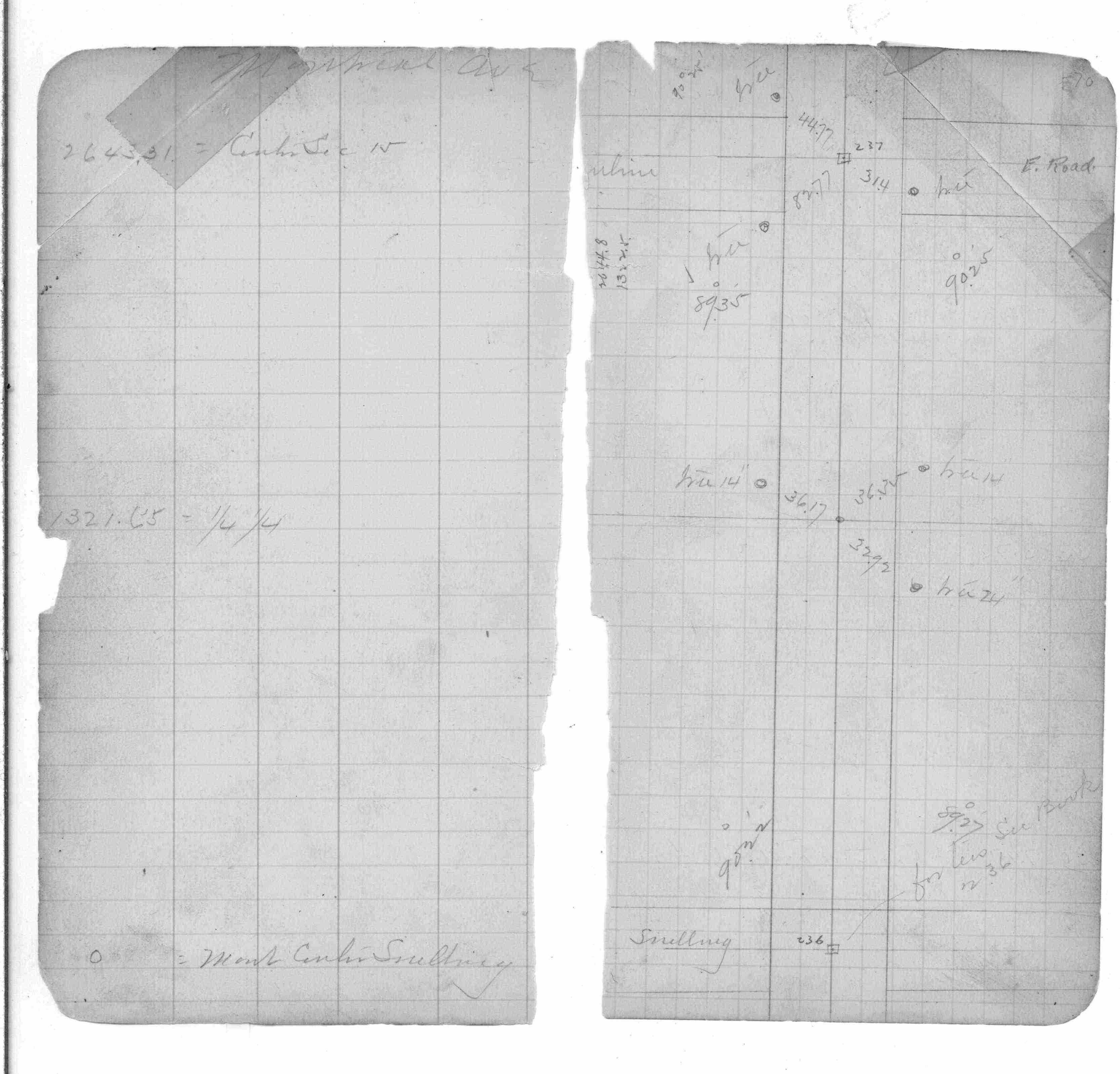
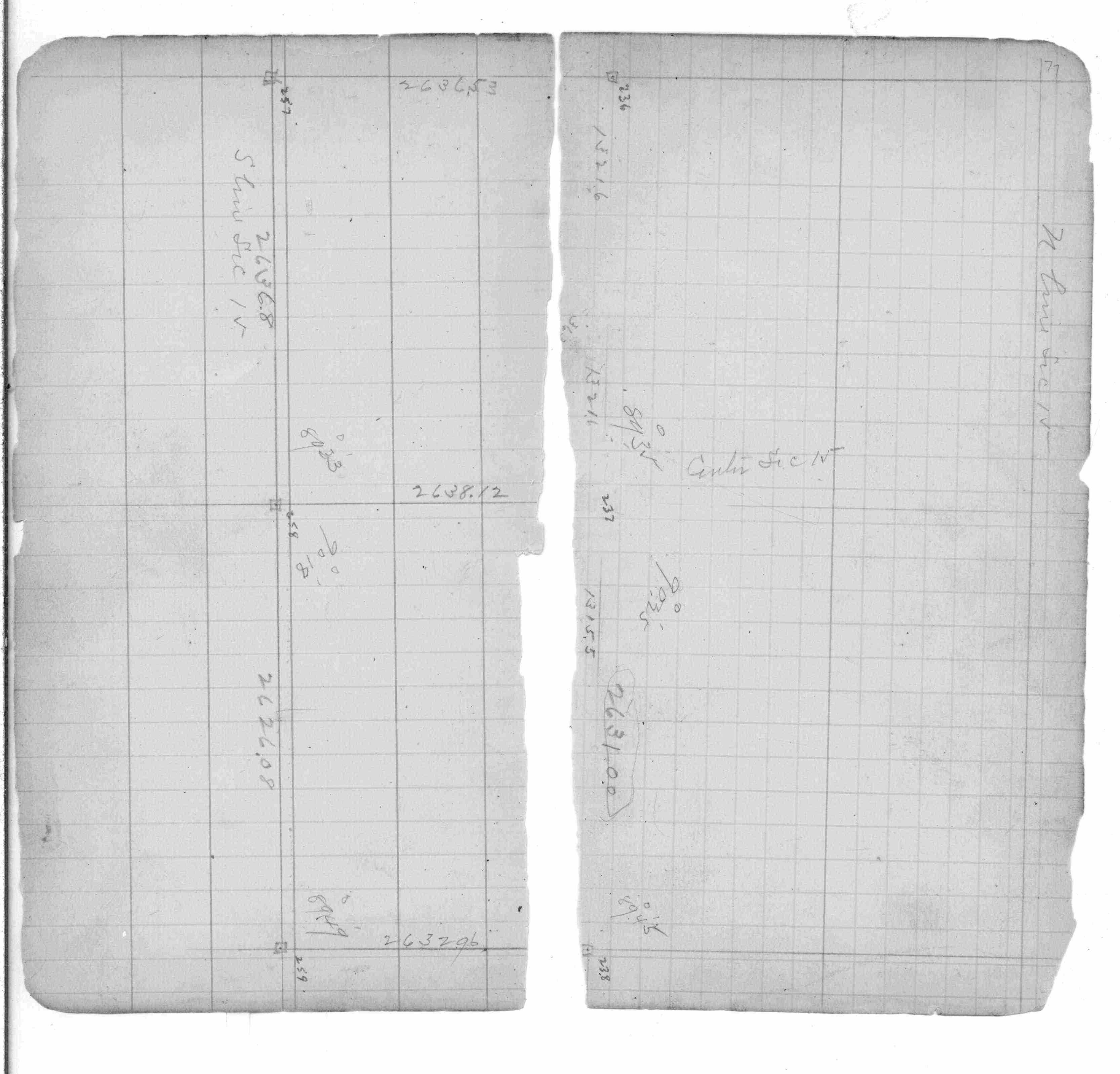
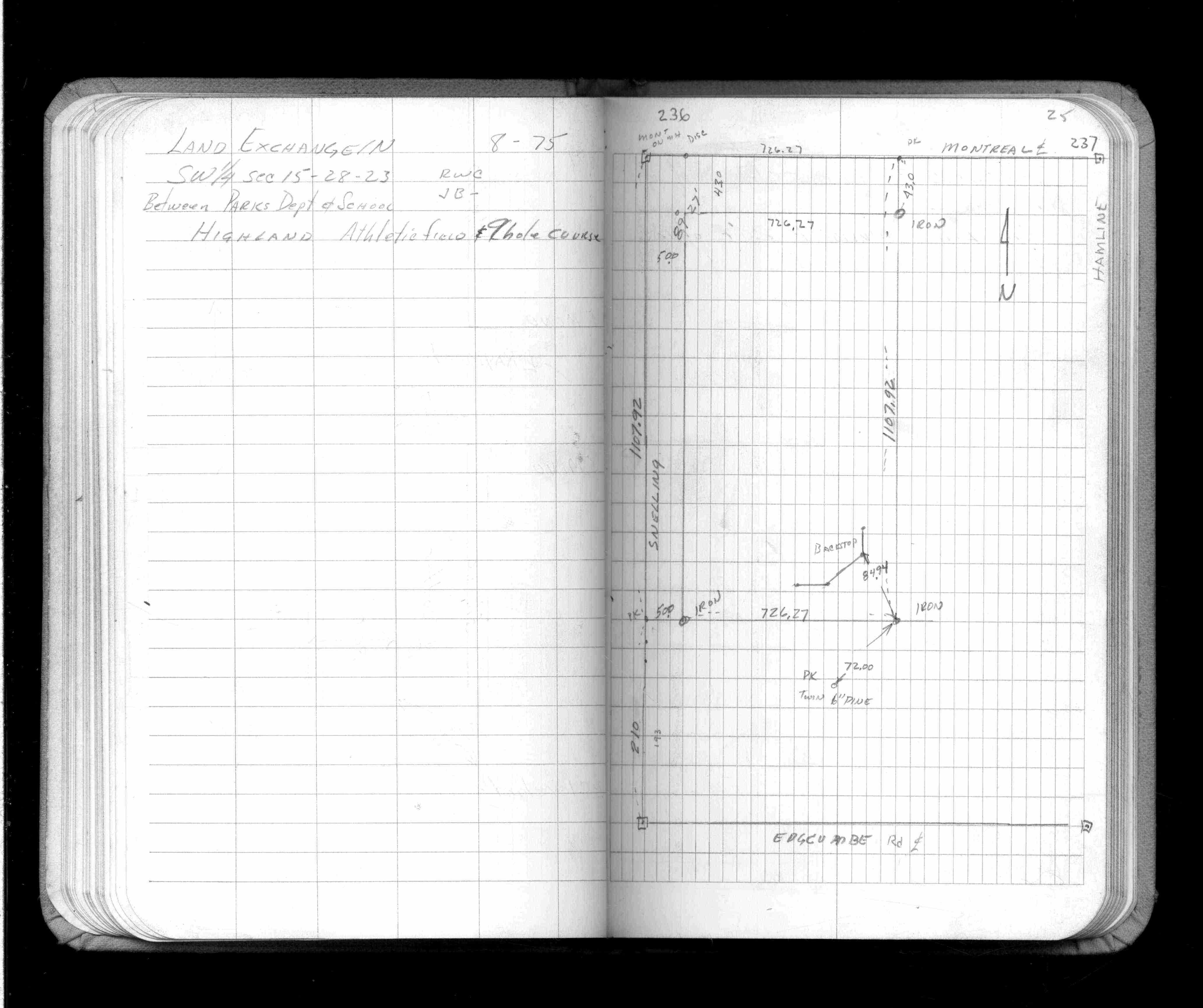
| FB 0236p. 95 ,99 ,103 ,105 ,107 | JBI 01 p.37-38 | ST 235-312 p.237 | ||||
| FB 0253p. 70 ,77 | JBI 01 p.37-38 JBI 01 p.39-40 JBI 01 p.41-42 JBI 01 p.43-44 | |||||
| FB 0675p.79 | JBI 01 p.45-46 | |||||
| FB 0718p. 21 ,38 | JBI 01 p.45-46 JBI 01 p.37-38 JBI 01 p.45-46 | |||||
| FB 1146p.75 | ||||||
| FB 1159p.08 | ||||||
| FB 1422Bp.25 | ||||||
| FB 1549Lp.37 | ||||||
| FB 1673Ap.73 | ||||||
| FB 1676Bp. 14 ,15 ,20 | ||||||
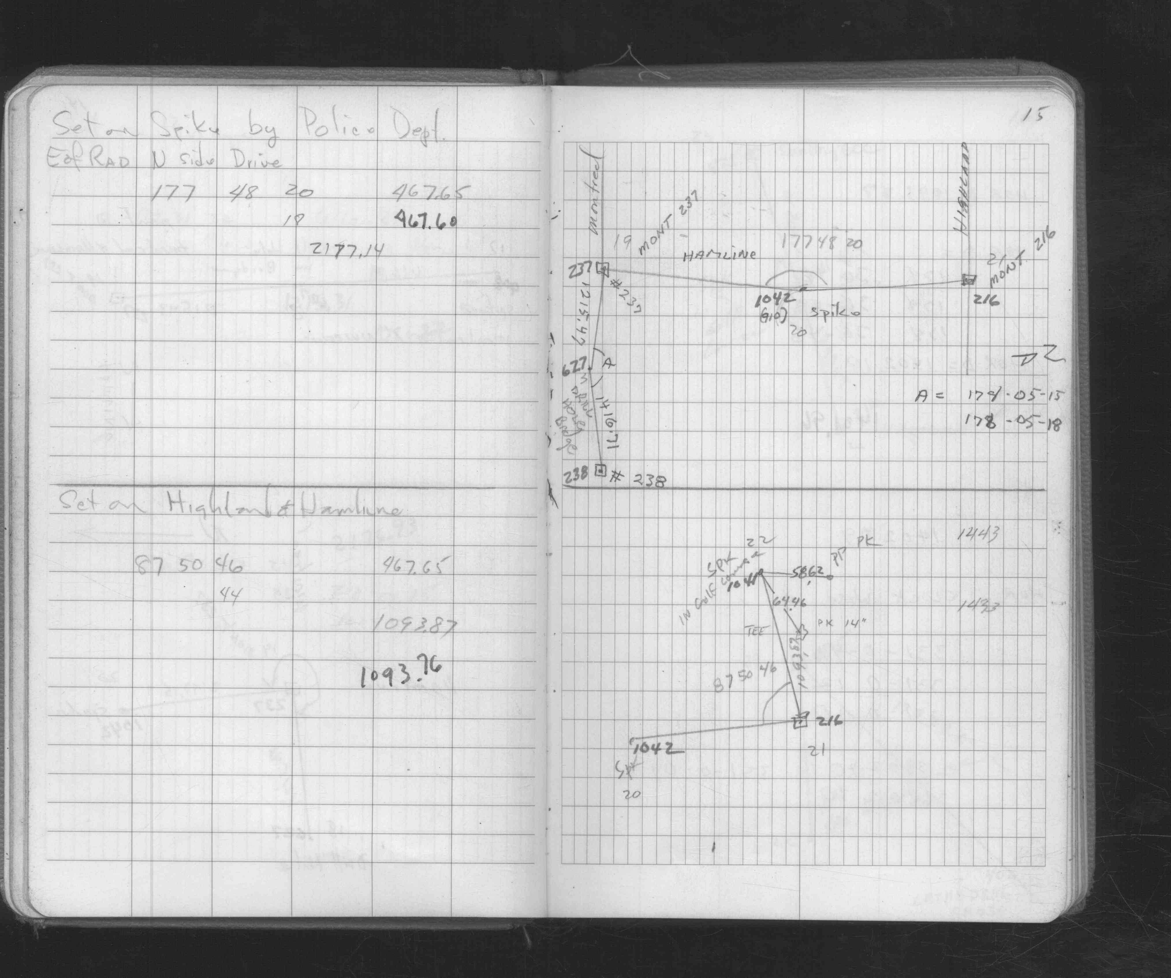
| FB 1689Ap.25 | ||||||
| FB 1694p.31 | ||||||
| FB 1736p.33 |
| FILE | SURVEYOR | LIC. NO. | DATE SIGNED | DATE TIED |
|---|---|---|---|---|
| 0237-1716-C2.tif | Michael P. Murphy | 41001 | August 10, 2004 | August 7, 2004 |
| 0237-1716-C1.tif | Michael P. Murphy | 41001 | August 10, 2004 | August 7, 2004 |
| 0237-1716-B.tif | William J. Cutting | 20576 | October 20, 1995 | October 2, 1995 |
| 0237-1716-A.tif | William J. Cutting | 20576 | April 5, 1994 | April 5, 1994 |
| ST_235-312p237.jpg | none | none | none | none |
| 0237-1716-A.dwf | none | none | none | none |
| FILE | PHOTO DATE | COMMENTS |
|---|---|---|
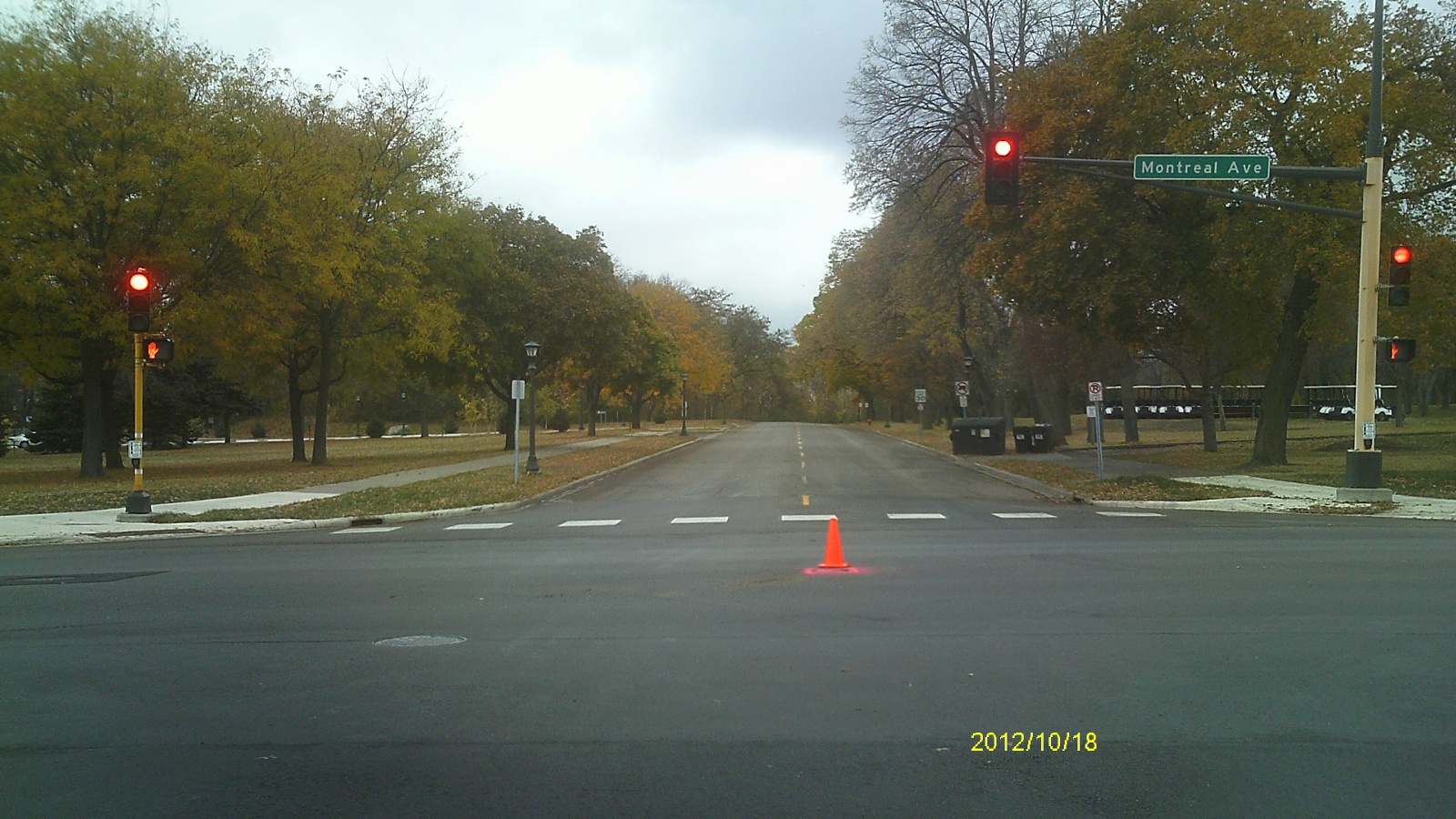
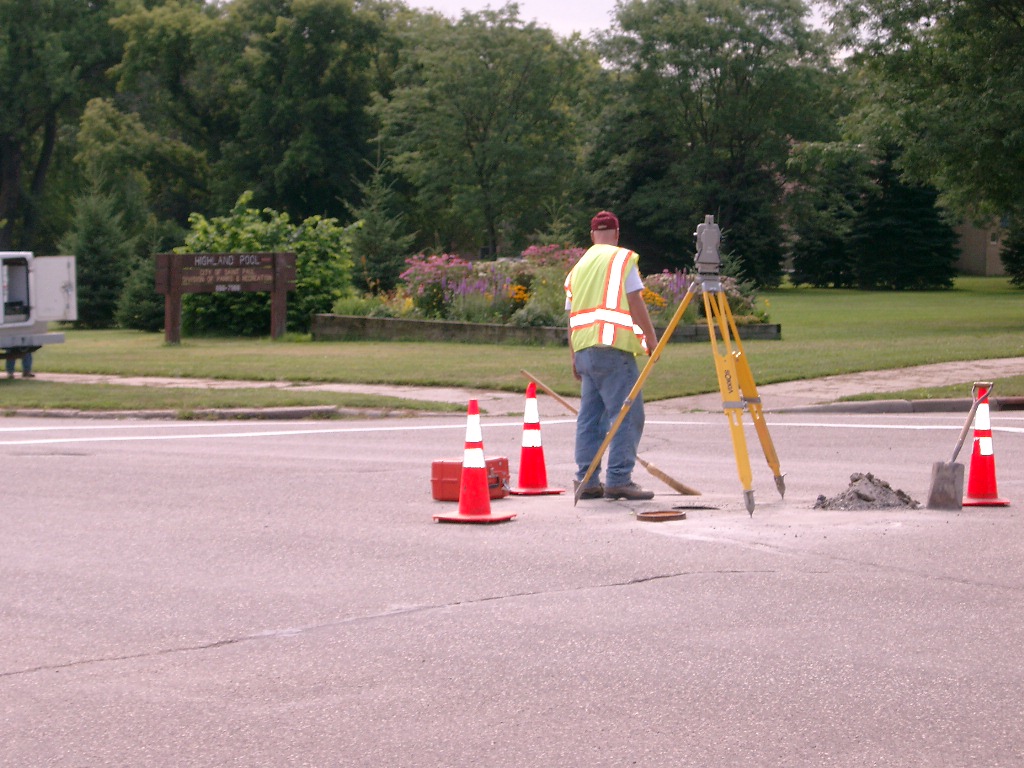
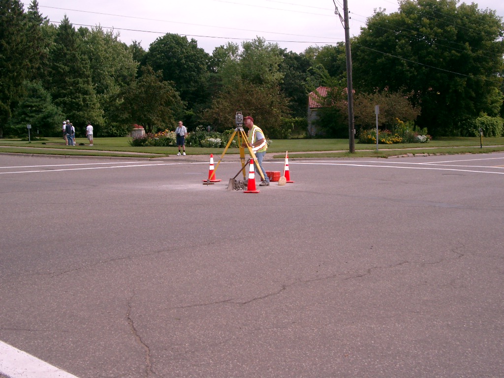
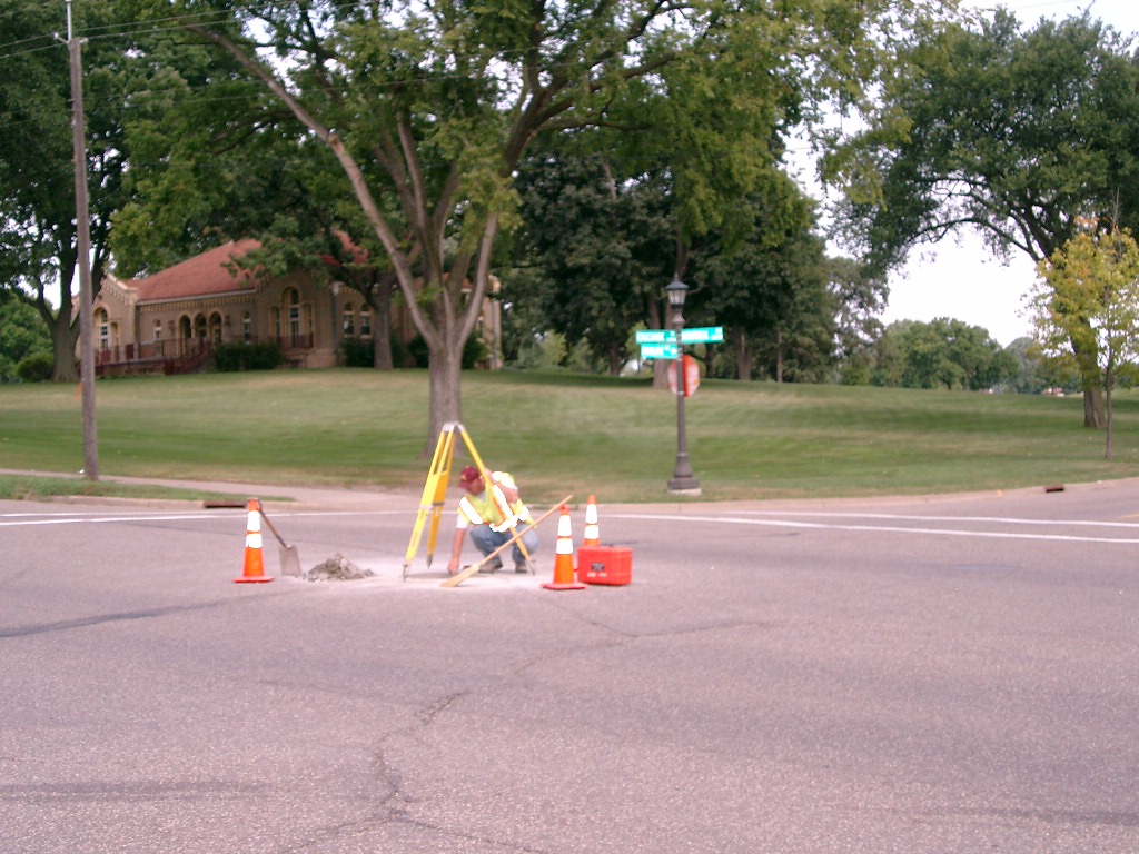
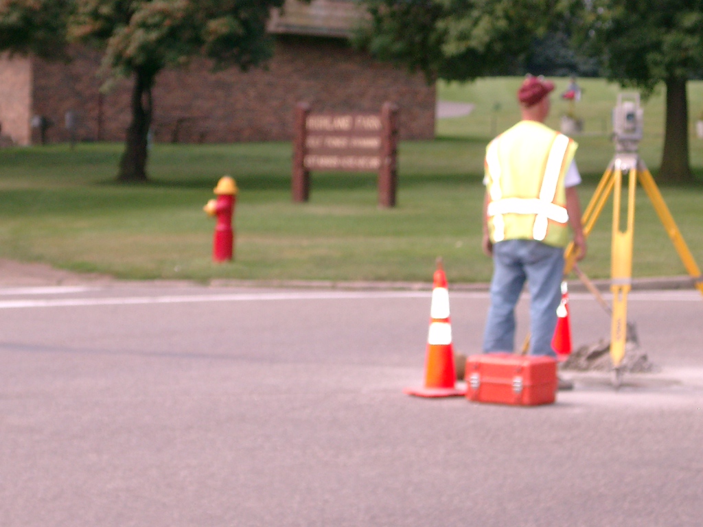
| 0237-1716-16.jpg | October 18, 2012 | Looking west along Montreal Ave. |
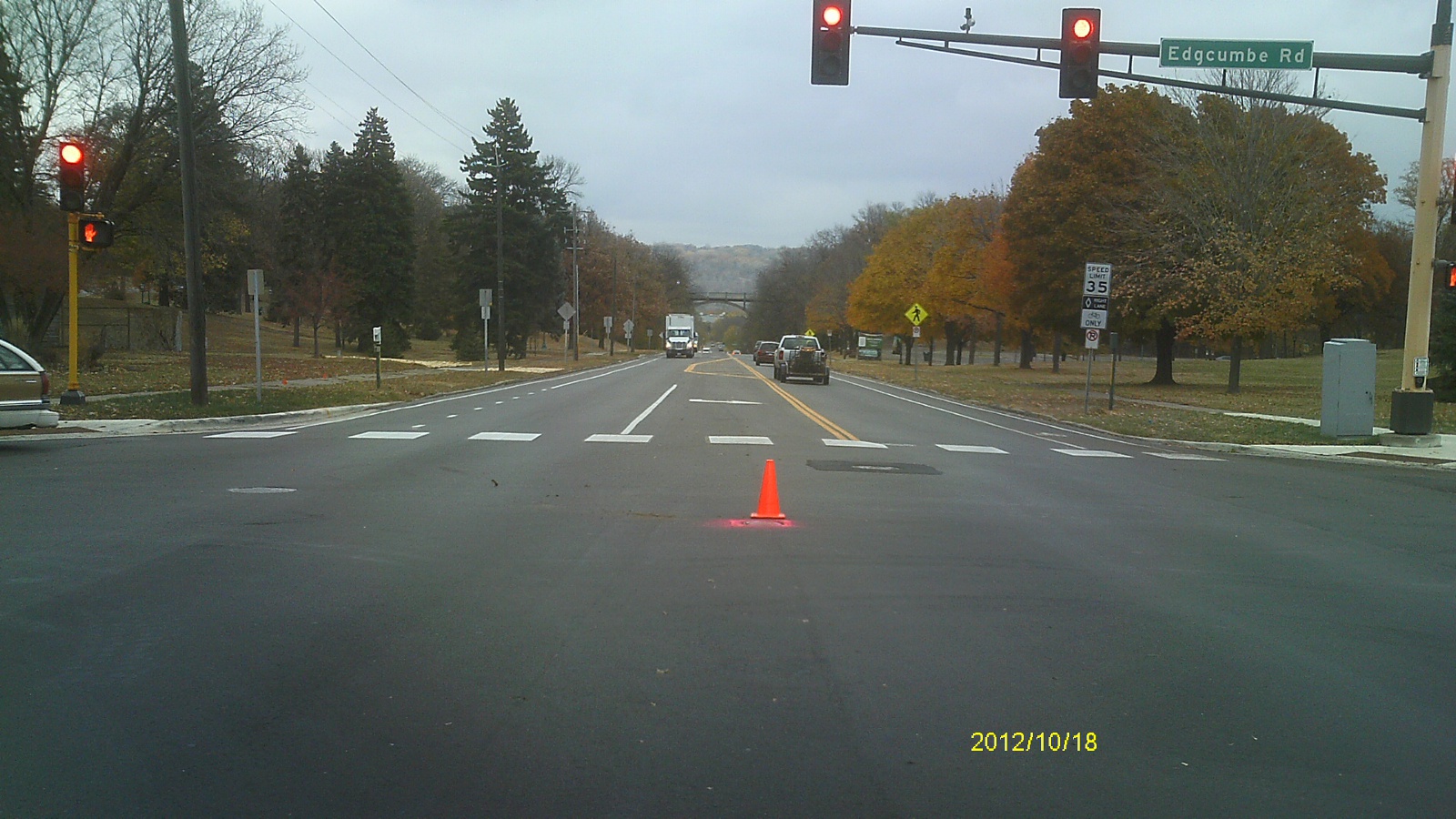
| 0237-1716-15.jpg | October 18, 2012 | Looking south along Edgcumbe Rd. |
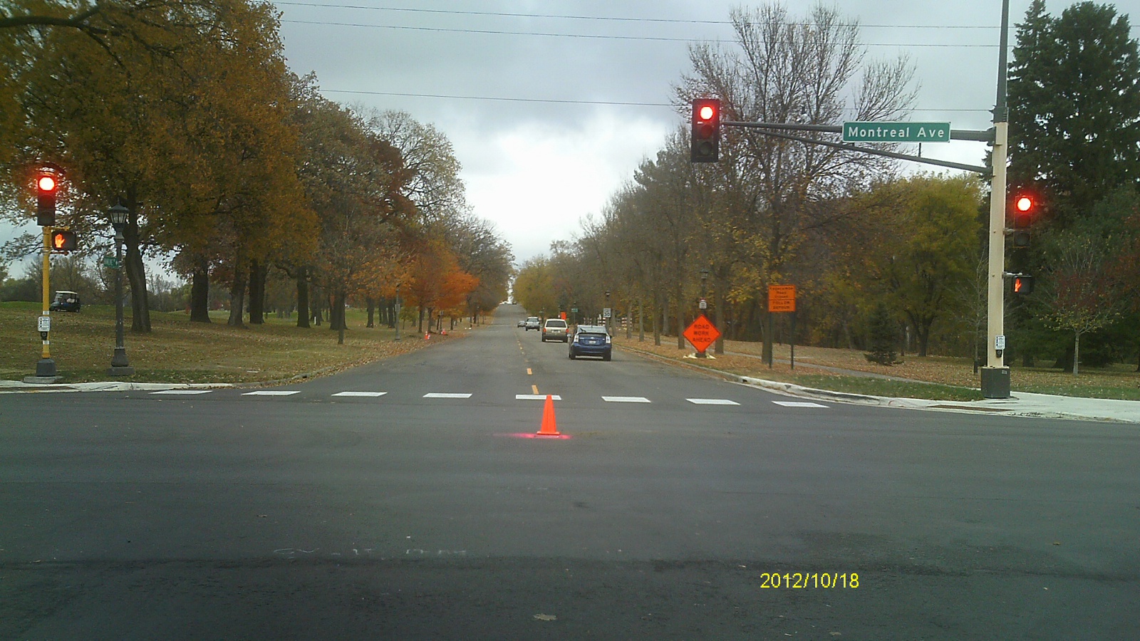
| 0237-1716-14.jpg | October 18, 2012 | Looking east along Montreal Ave. |
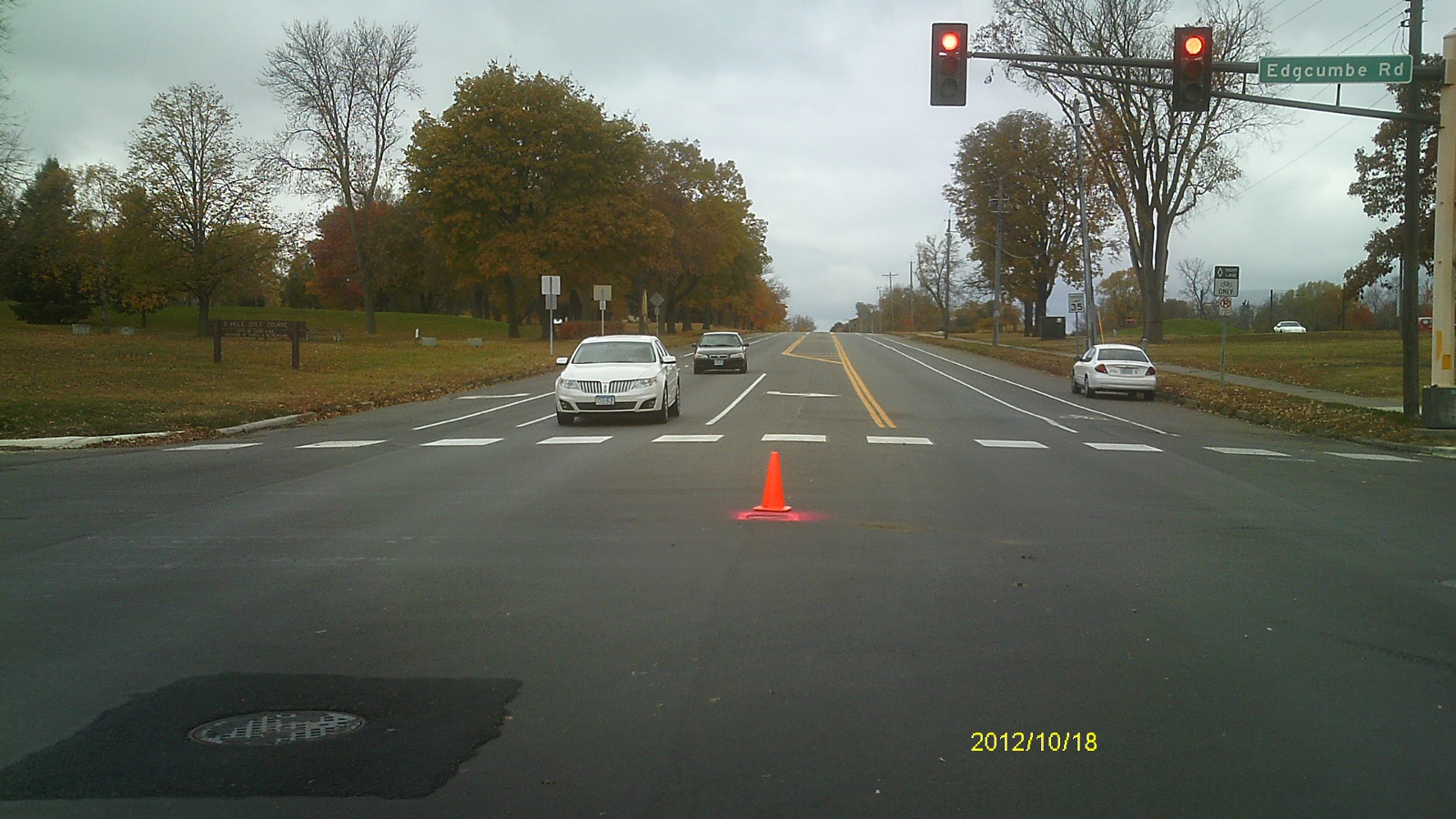
| 0237-1716-13.jpg | October 18, 2012 | Looking north along Edgcumbe Rd. |
| 0237-1716-12.jpg | October 18, 2012 | Close up of monument in casting. |
| 0237-1716-11.jpg | October 18, 2012 | Close up of monument. |
| 0237-1716-9.jpg | August 7, 2004 | Looking Southeasterly. |
| 0237-1716-8.jpg | August 7, 2004 | Looking Northeasterly. |
| 0237-1716-7.jpg | August 7, 2004 | Close-up of monument inside 1.0' diameter casting. |
| 0237-1716-6.jpg | August 7, 2004 | Looking Northwesterly. |
| 0237-1716-4.jpg | August 7, 2004 | Close-up of monument before casting. |
| 0237-1716-10.jpg | August 7, 2004 | Looking Southwesterly. |