| NAD83 COORDINATES (1986 adj.): |
|---|
| * X= 561314.042 Y= 144318.765 Z= 000.00 LSQ 12/06/1991 S FIX |
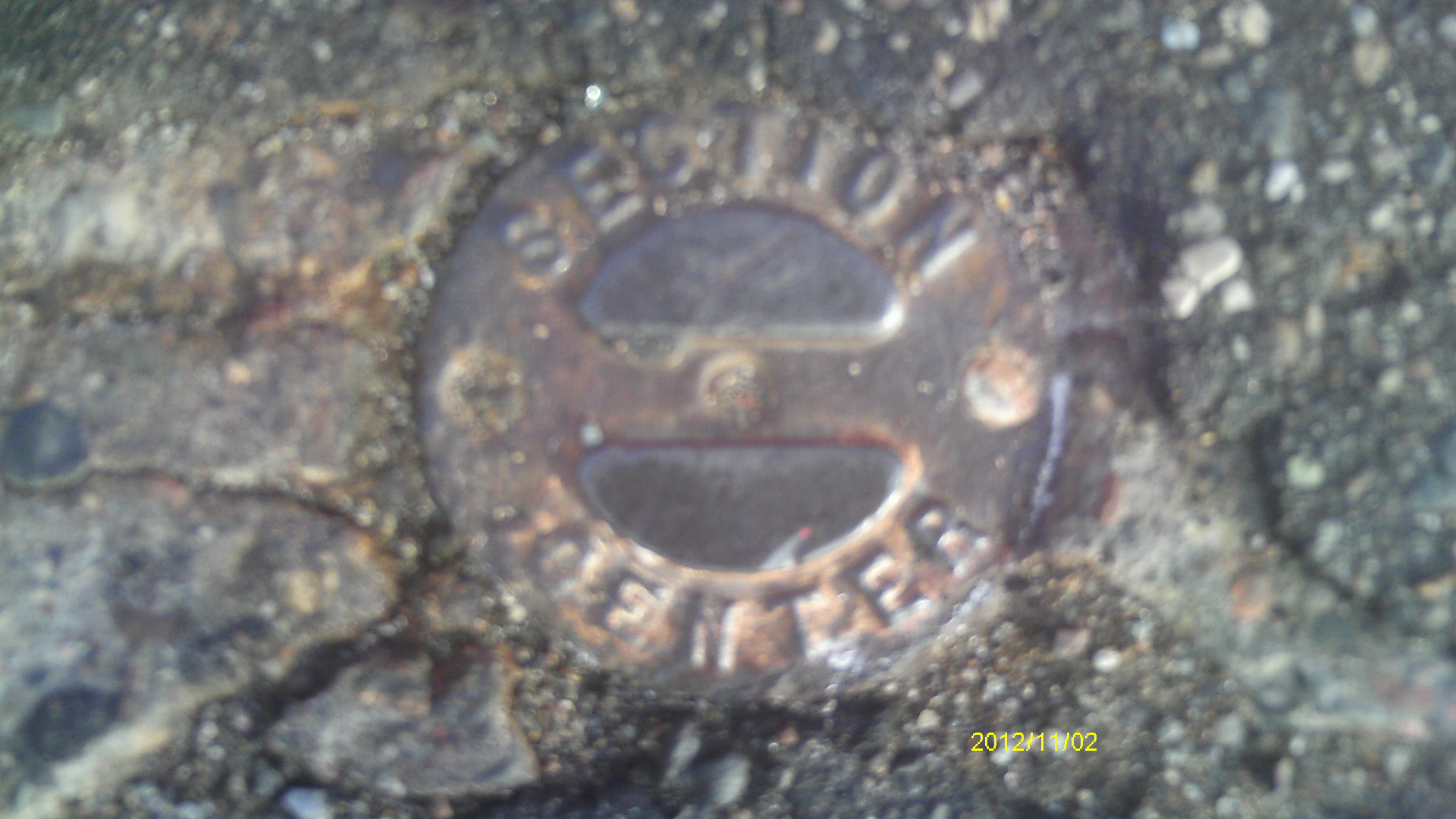
| 11/2/2012 | Found CIM at street grade. Photos taken and ties placed using steel tape. |
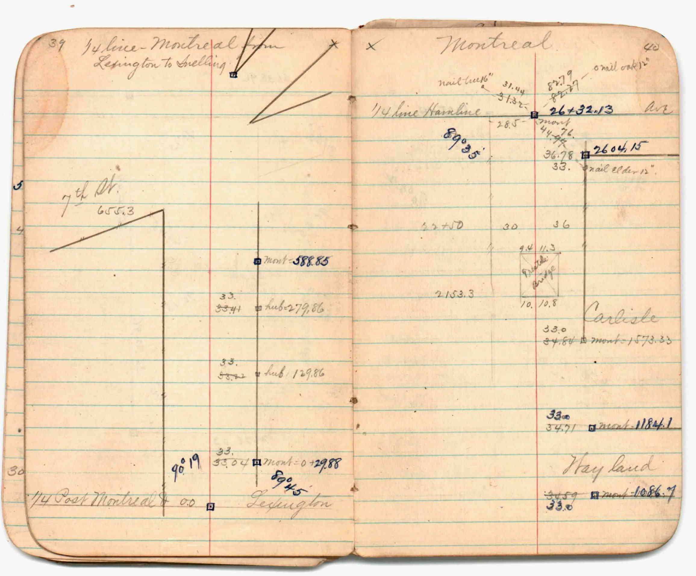
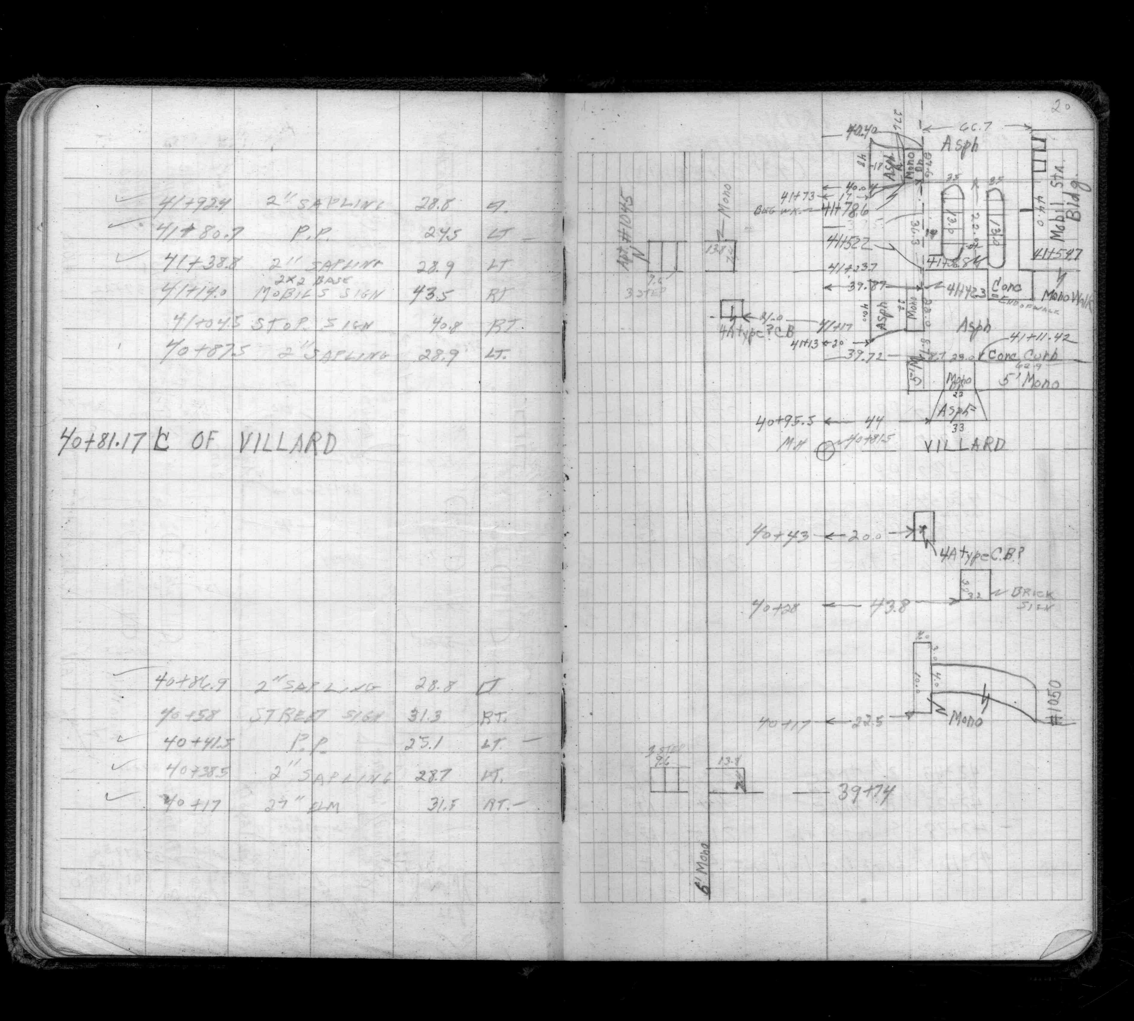
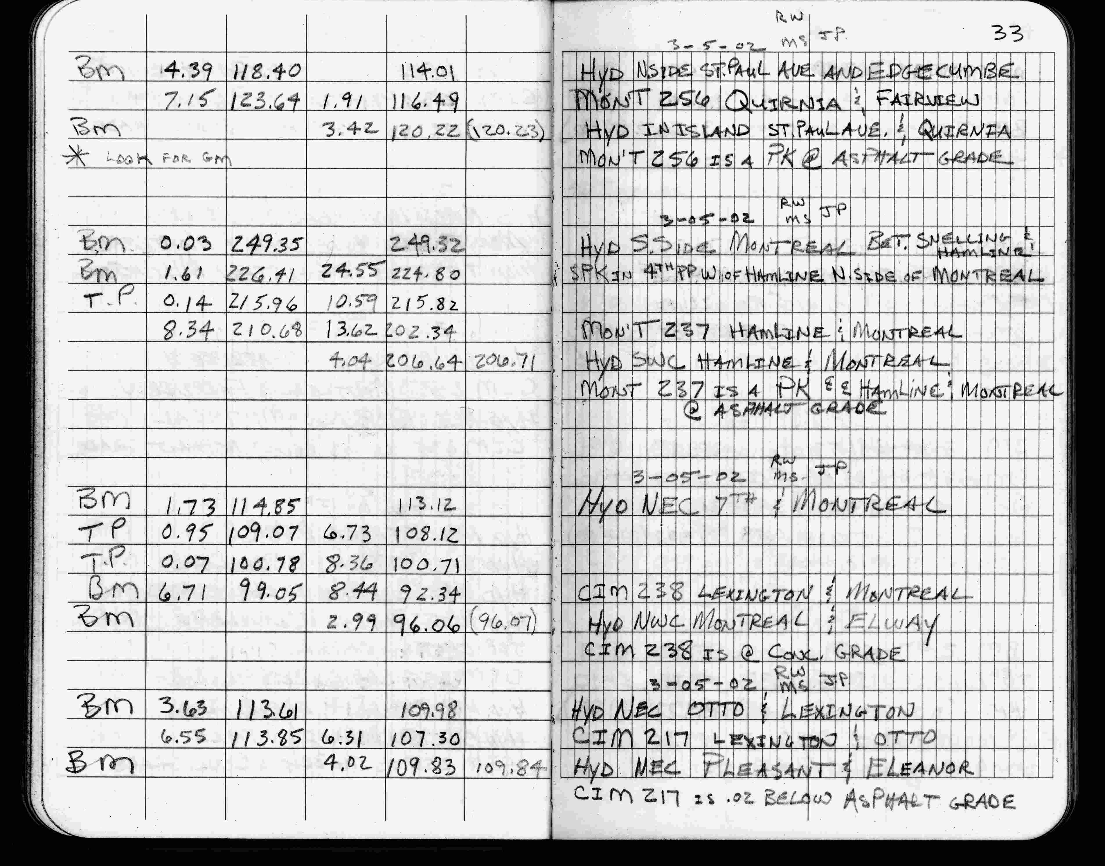
| 3/5/2002 | Elev 92.34 ft on CIM at concrete surface. See FB 1736 p.33 |
| 3/1/2000 | (Unknown date Mar __, 2000 ) Fd CIM at grade (marked for painting target for 2000 aerial) |
| 9/26/1995 | Found CIM set to grade, placed ties, left CIM as found. See CofL 0238-0767A-A |
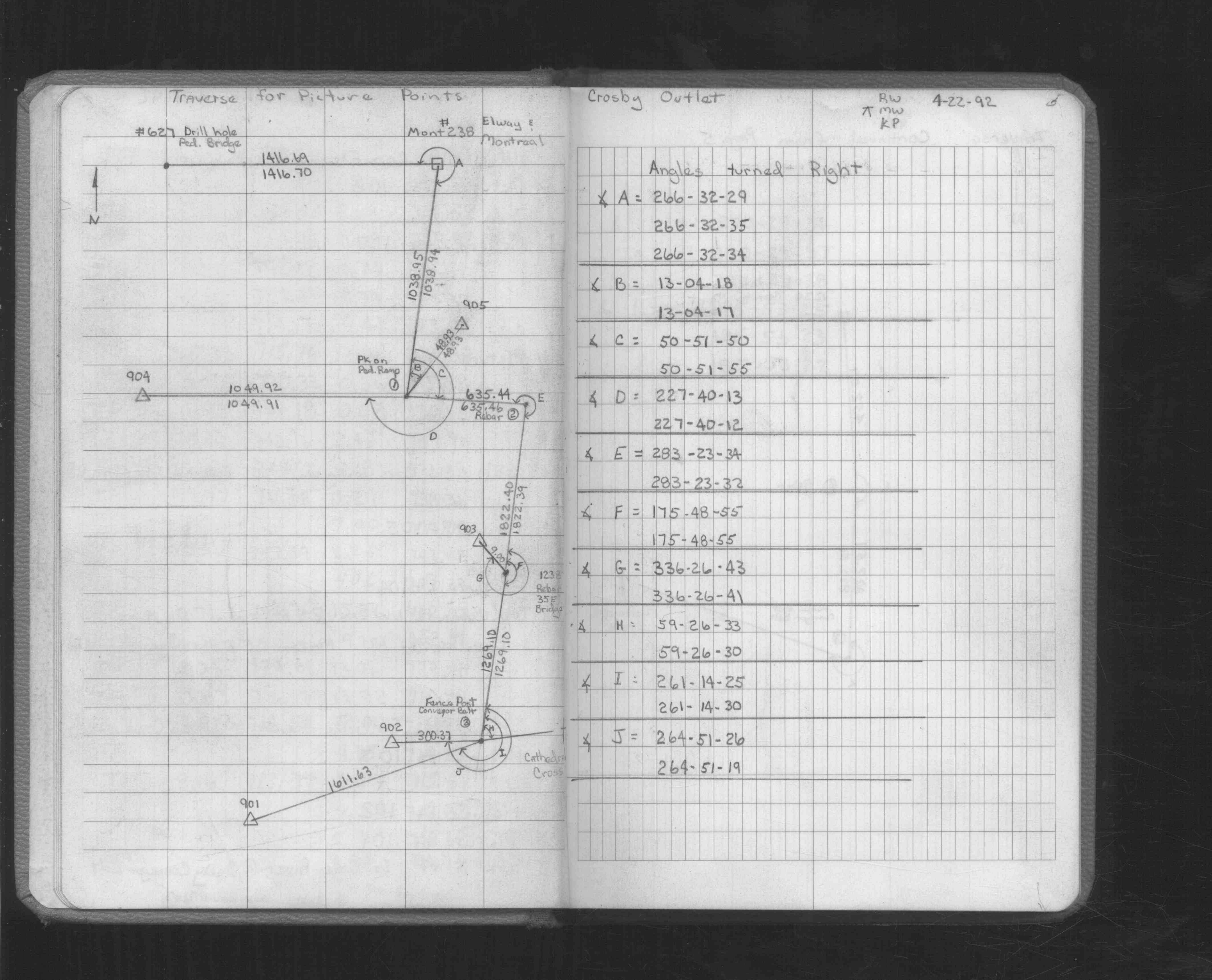
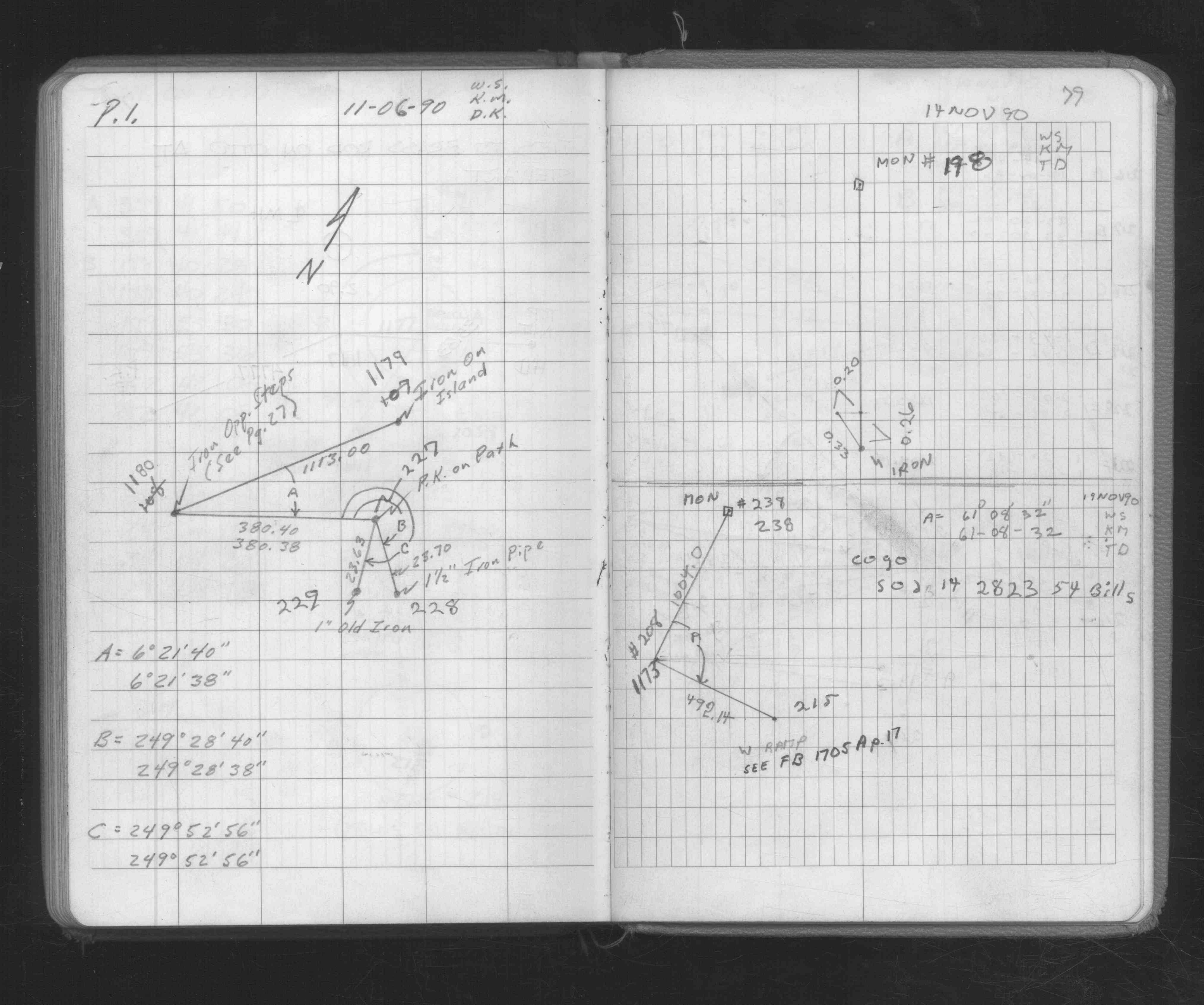
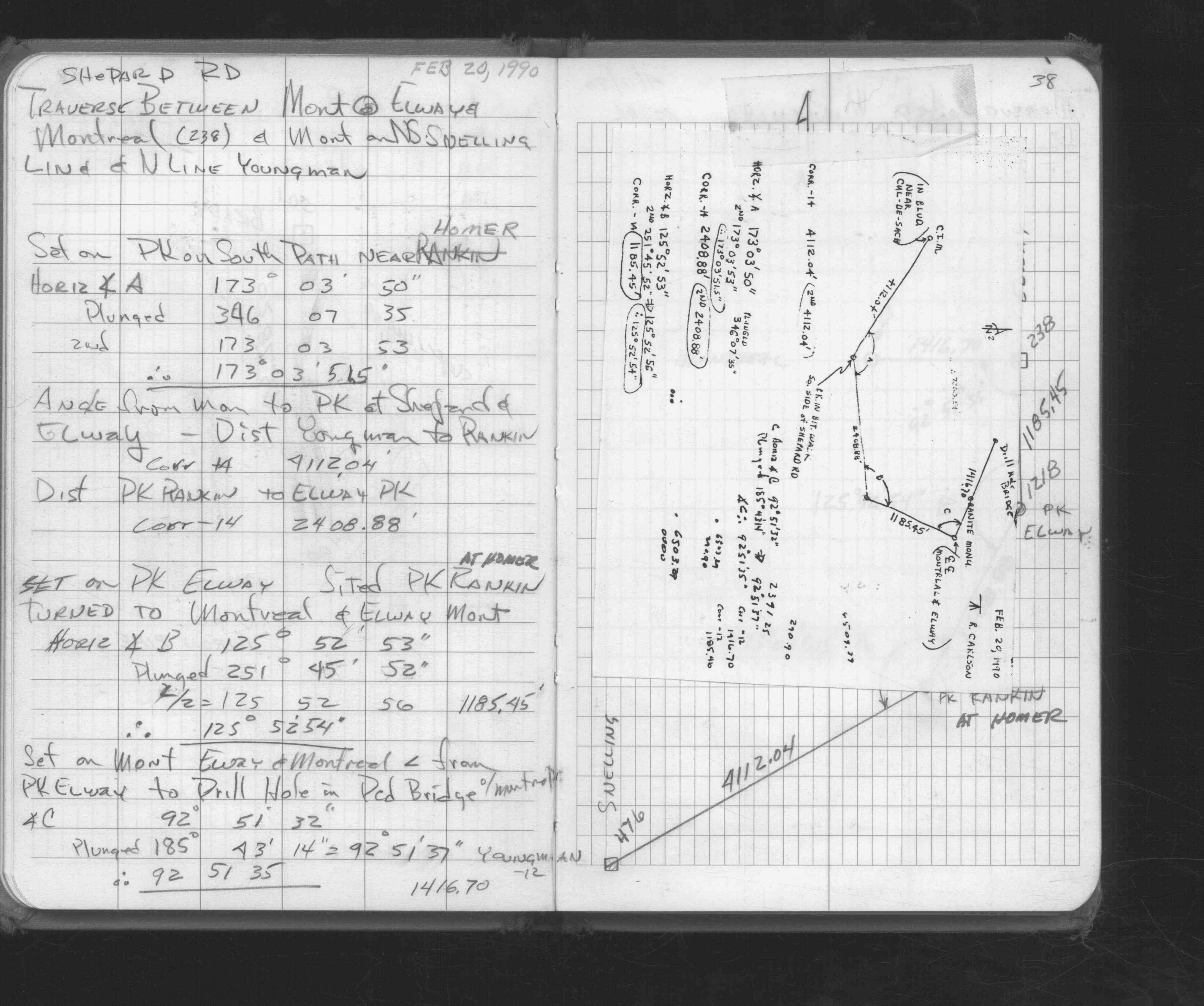
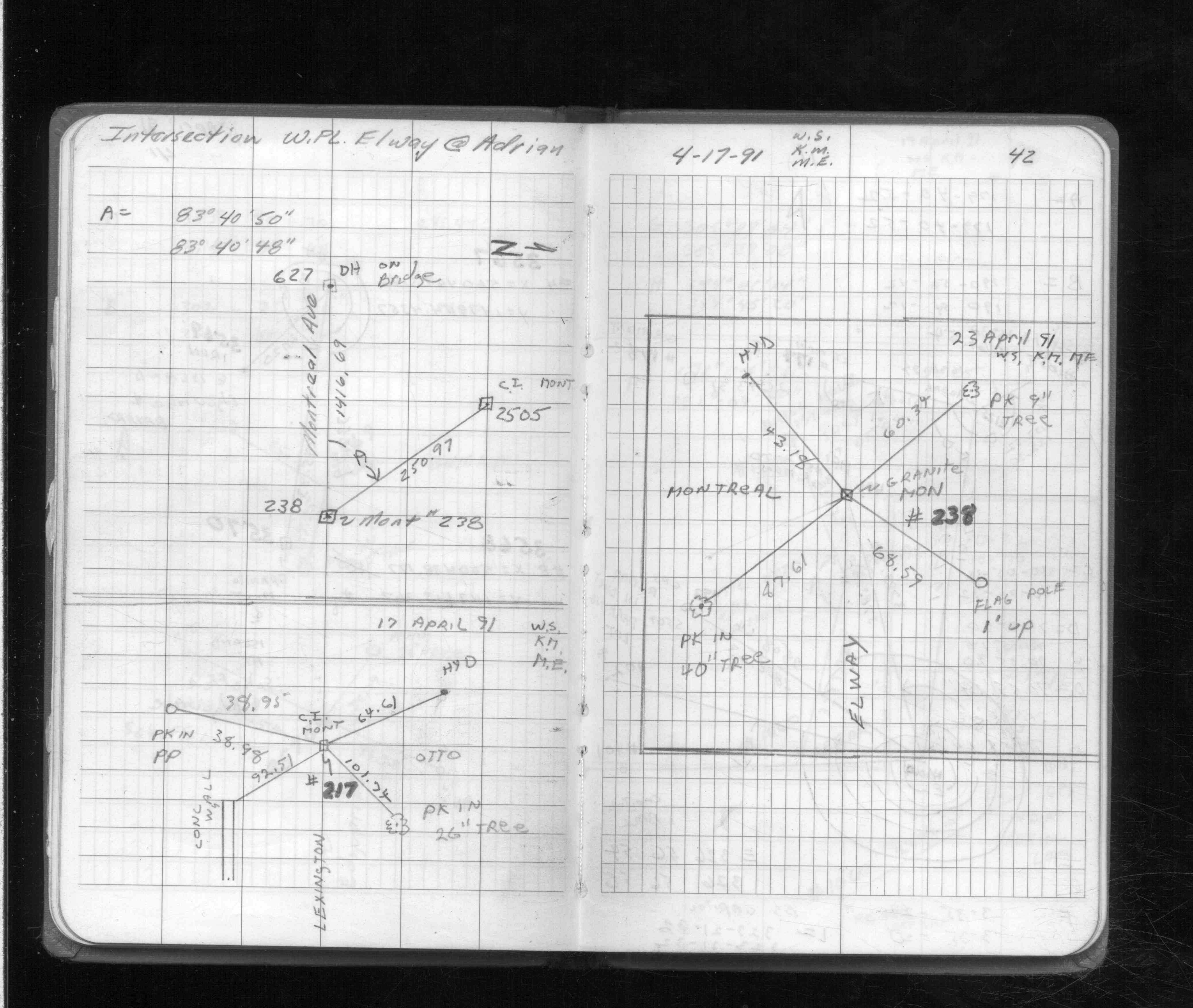
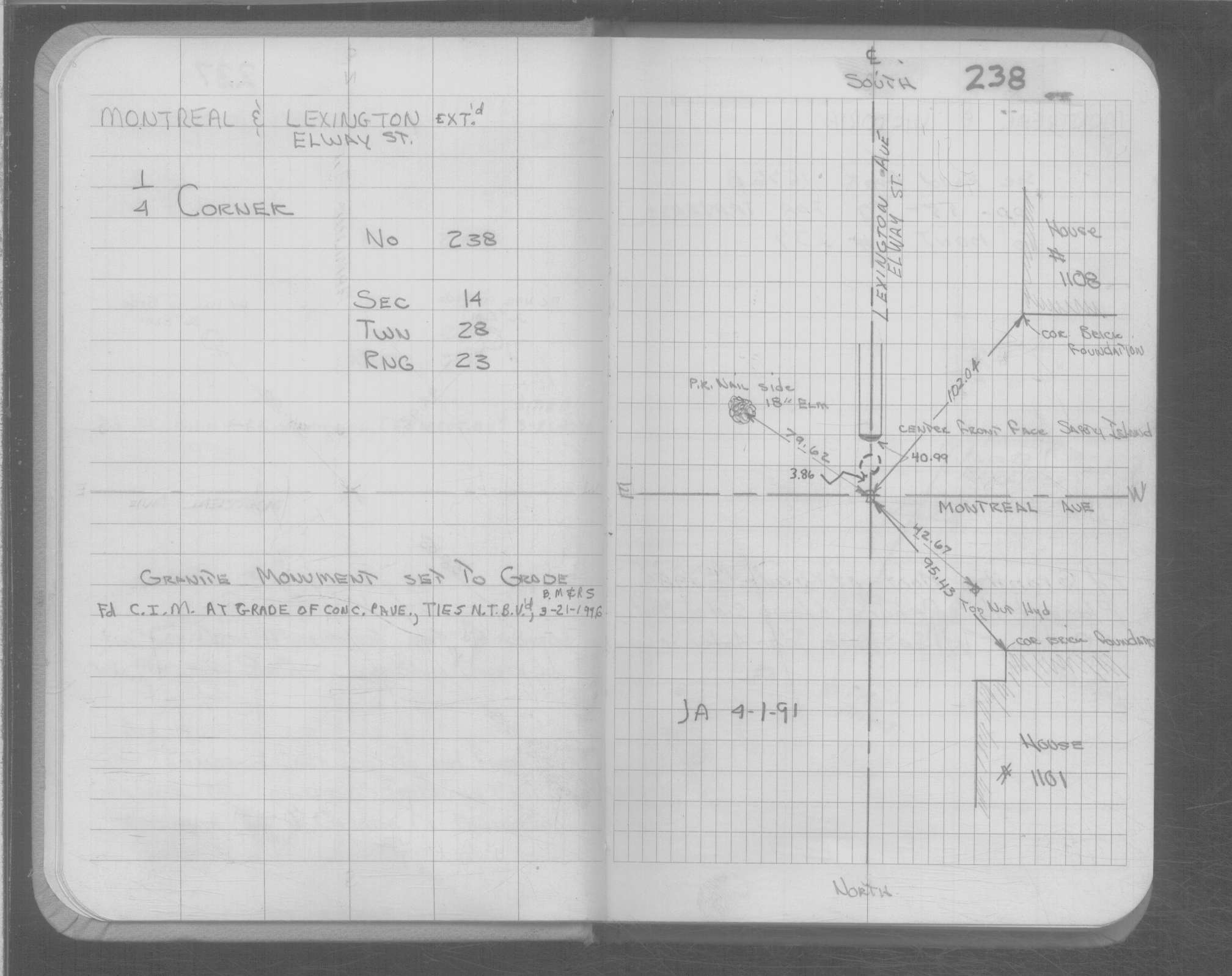
| 4/23/1991 | Placed 4 ties on GM. See FB 1708A p.42 |
| 4/1/1991 | (Unknown date Apr __, 1991 ) GM set to grade. |
| 1/1/1989 | (Unknown date ___ __,1989 ) Historic, one time only GPS survey = S621 |
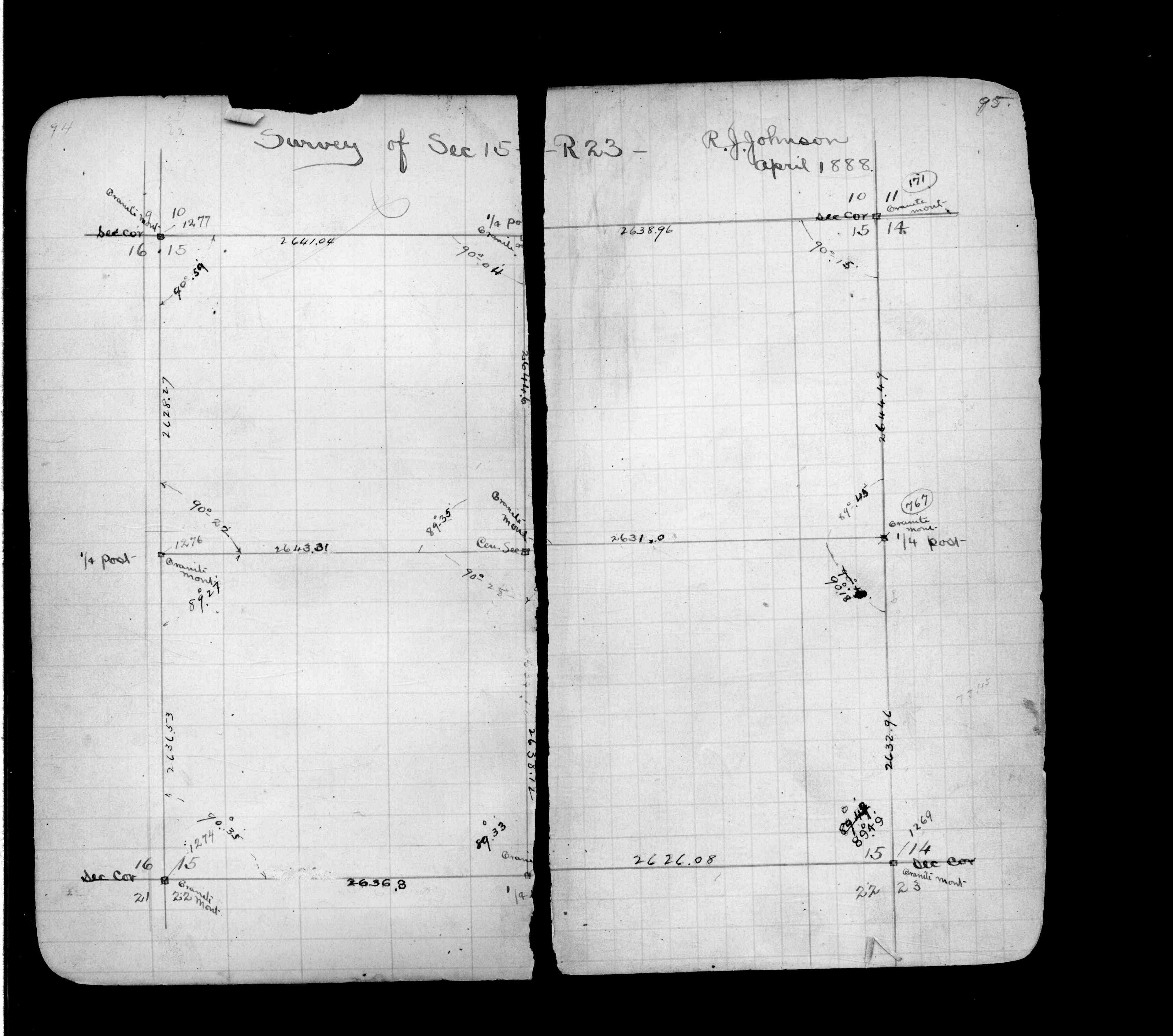
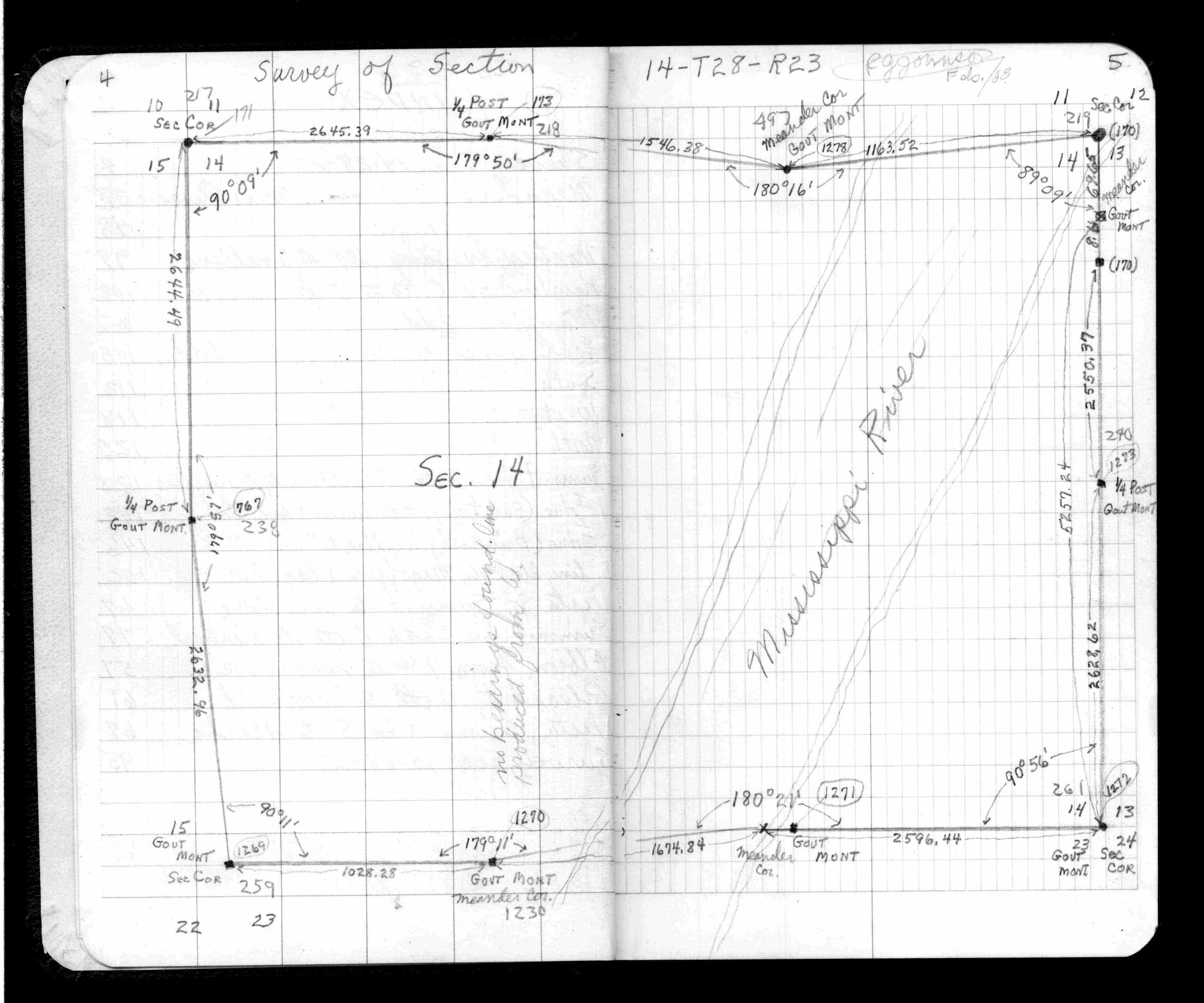
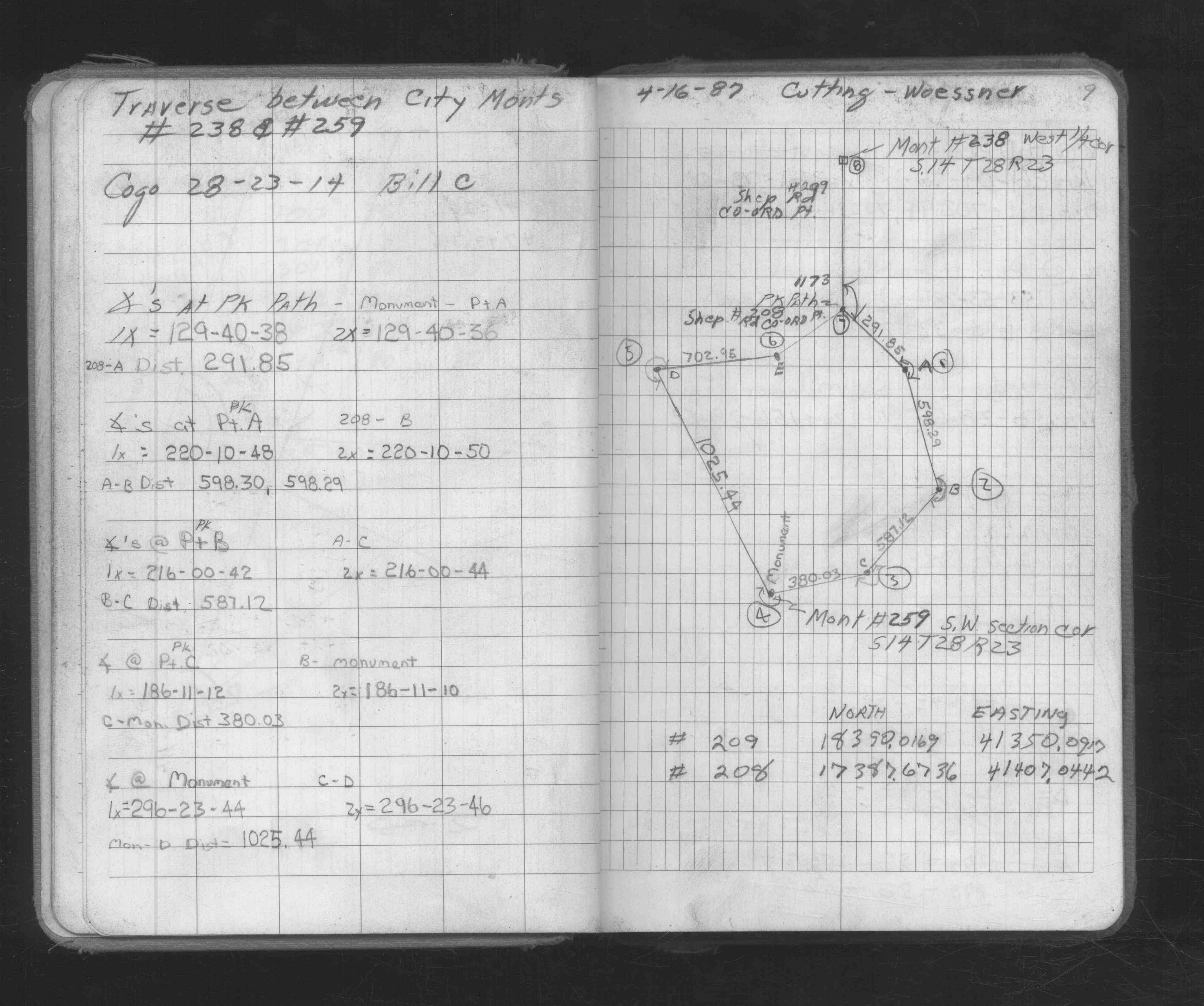
| 2/1/1988 | (Unknown date Feb __, 1988 ) Survey of Section 14-28-23. See JBI 01 p.01-02,39-40 |
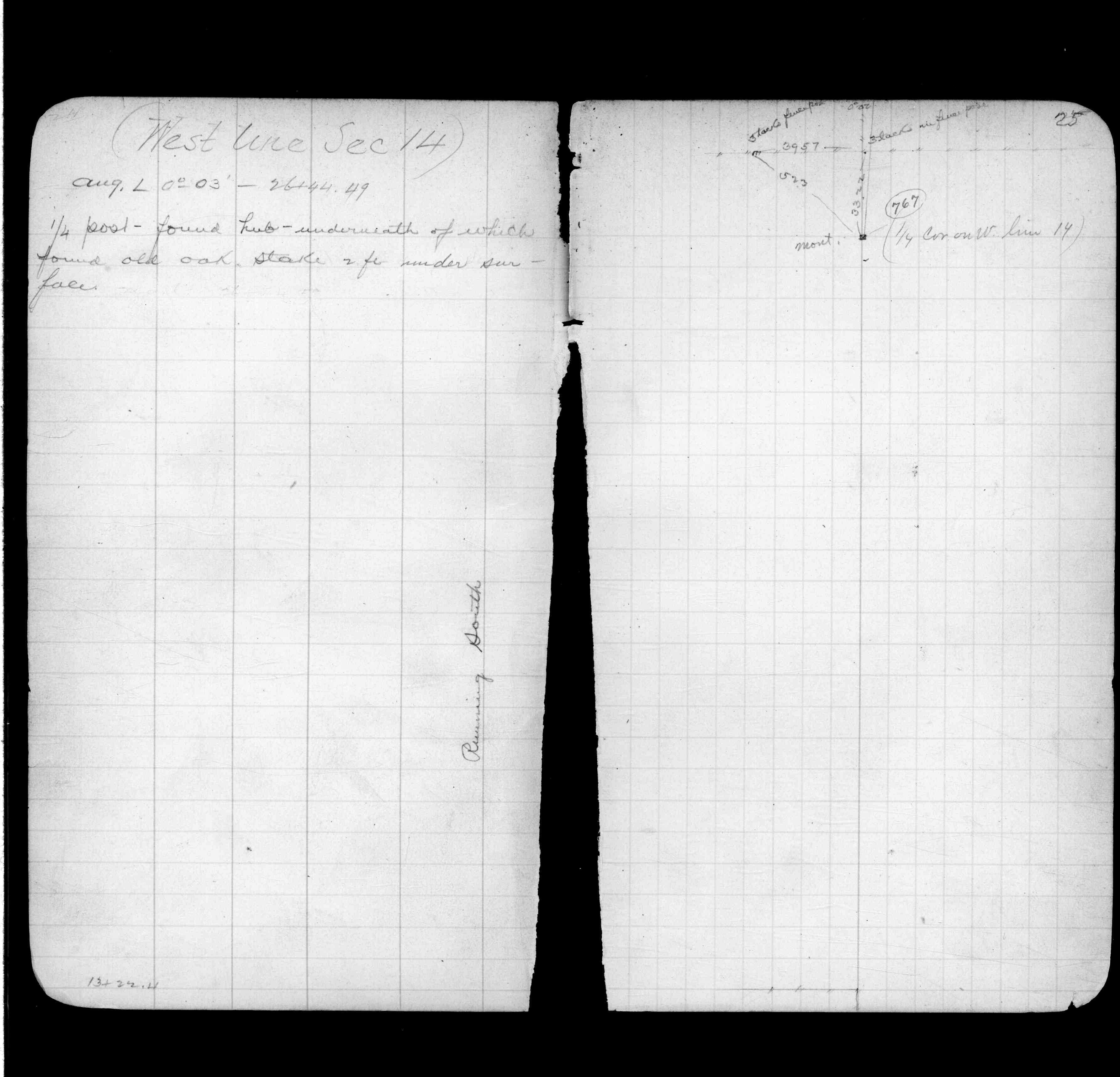
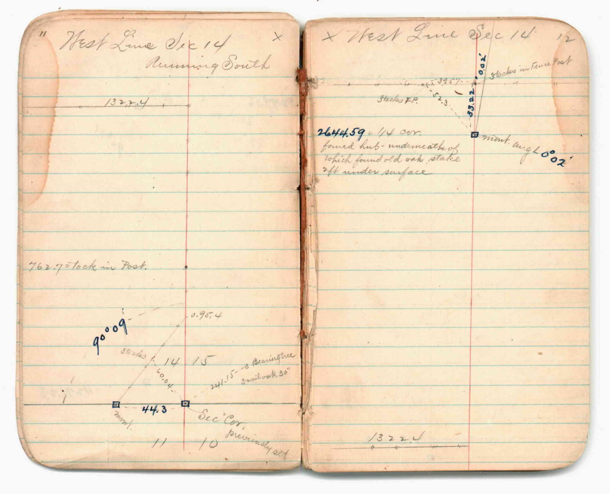
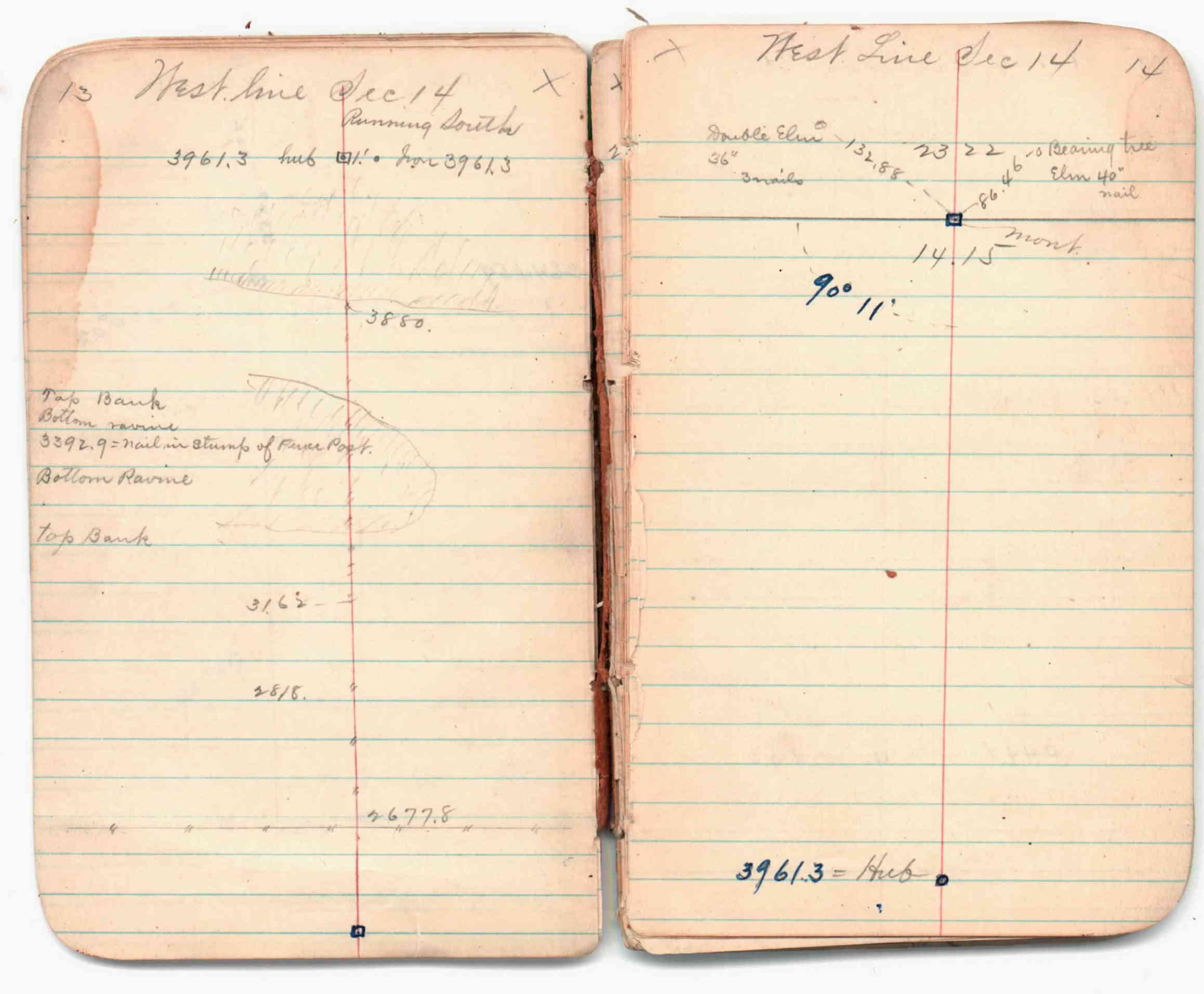
| 2/1/1988 | (Unknown date Feb __, 1988 ) Fd hub, underneath of which found old oak stake, 2 ft under surface. See JBI 01 p.11-12,13-14 |
| 1/1/1988 | (Unknown date ___ __, 1988 ) See JBI 01 p.89-90 |
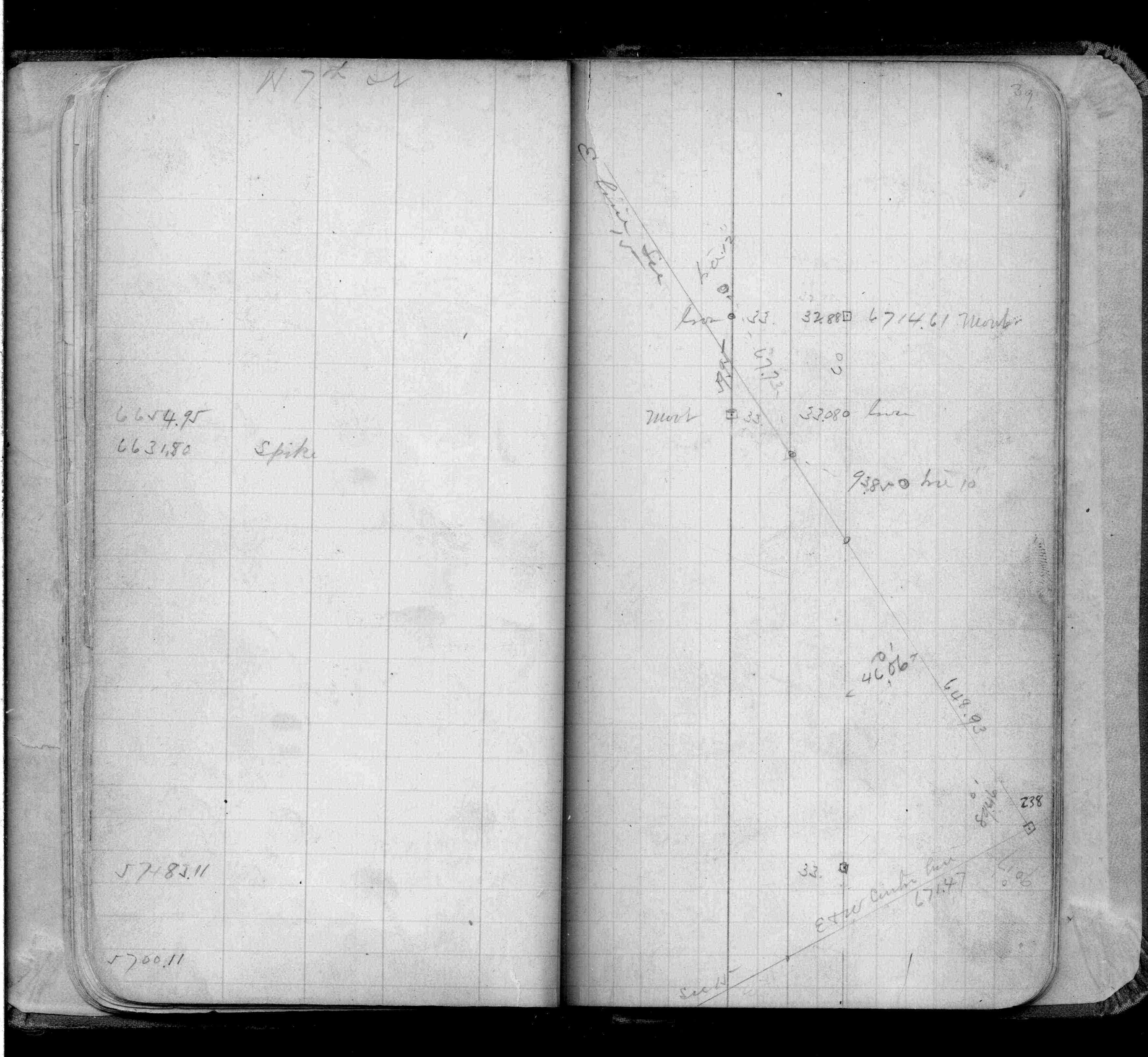
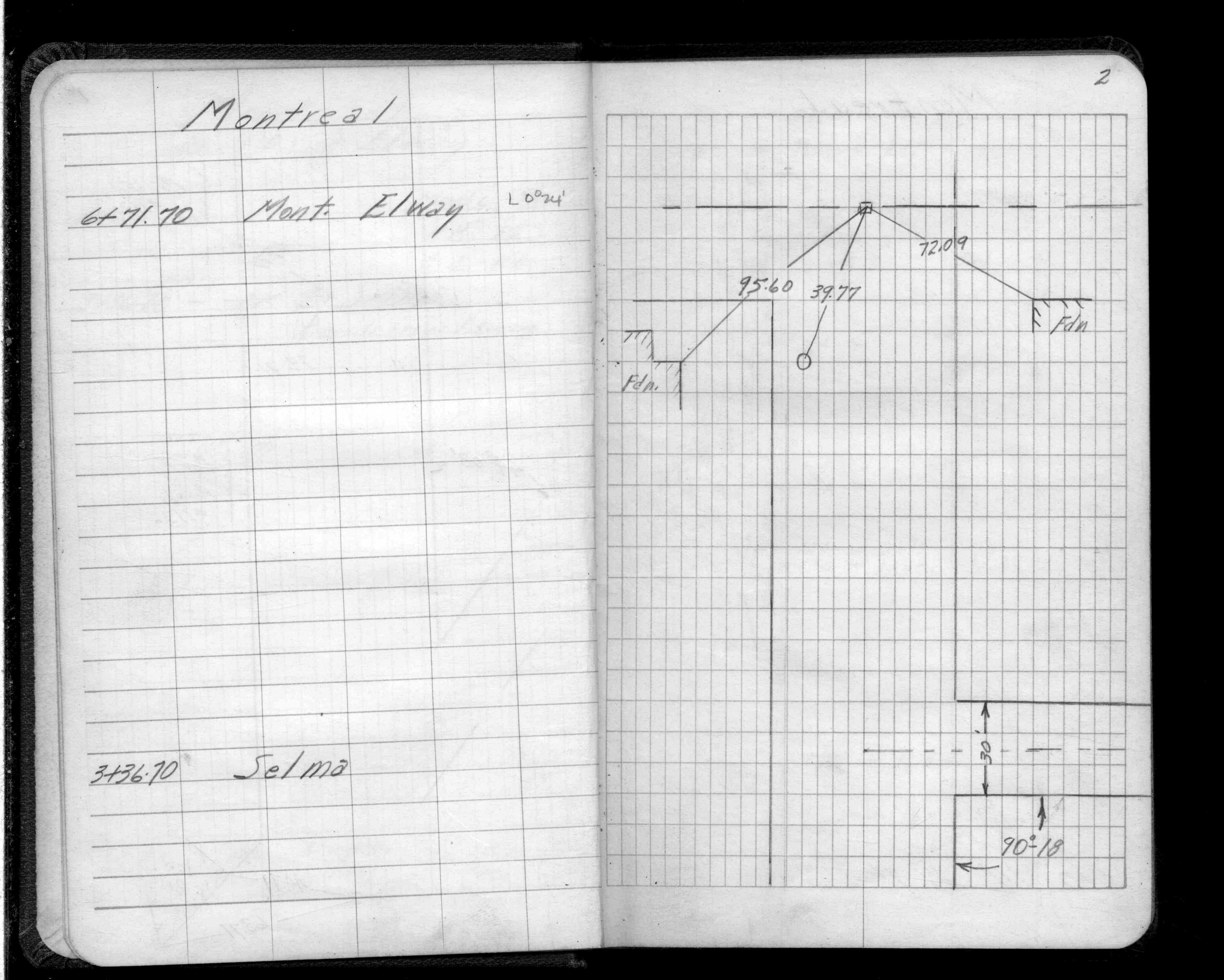
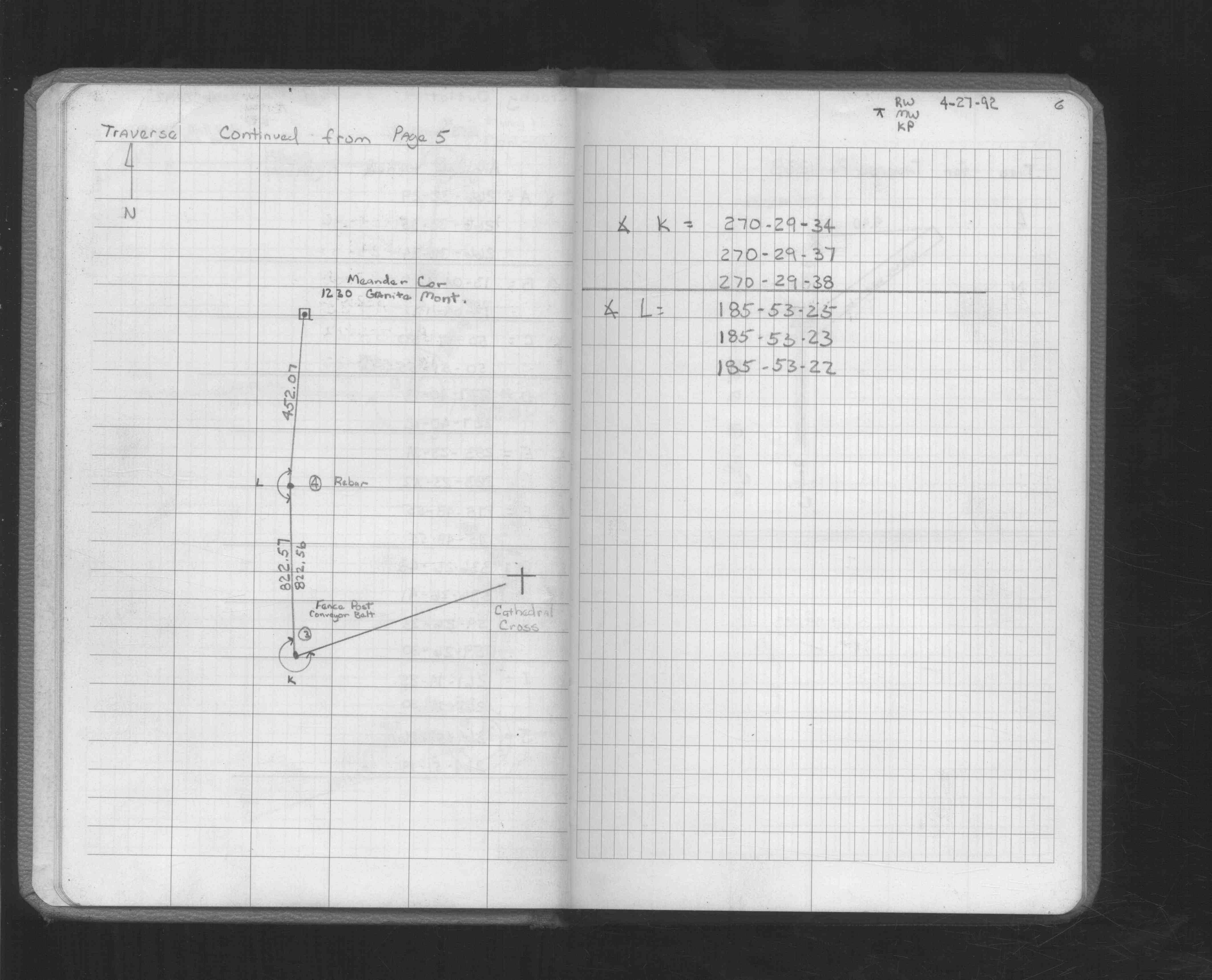
| 3/1/1963 | (Unknown date Mar __, 1963 ) Placed ties. See FB 1539 p.2 |
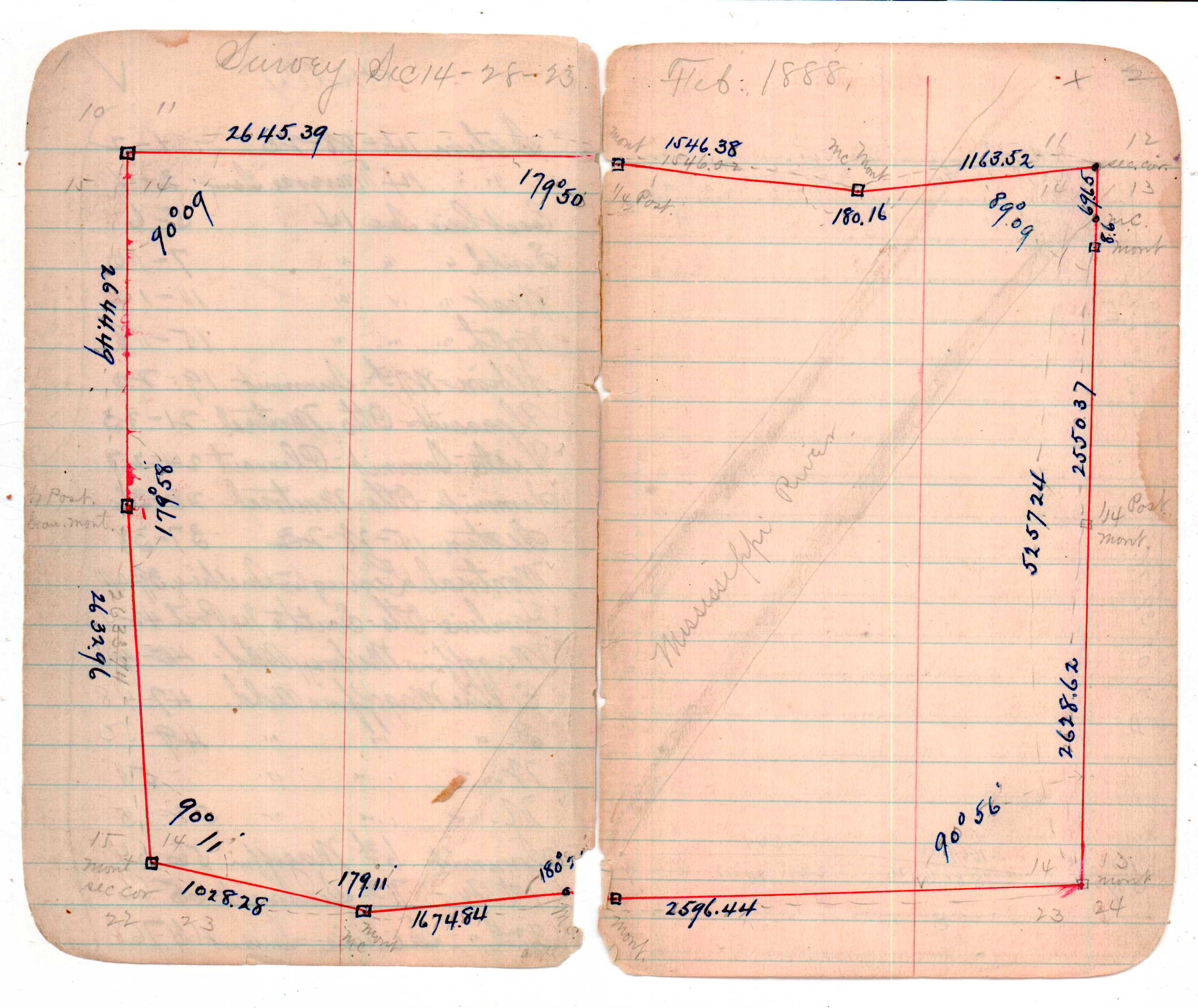
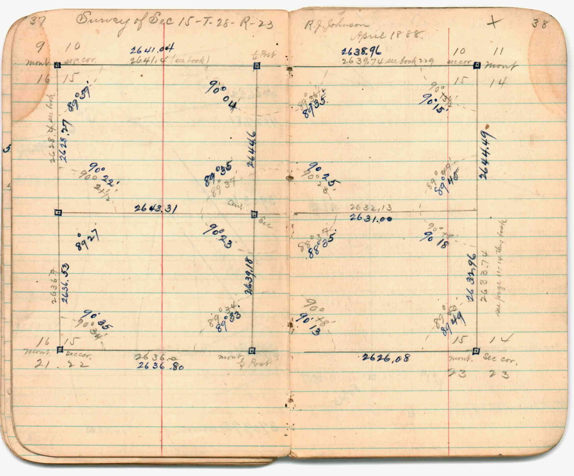
| 4/1/1888 | (Unknown date Apr __, 1888 ) Section break down by R J Johnson. See JBI 01 p.37-38 |
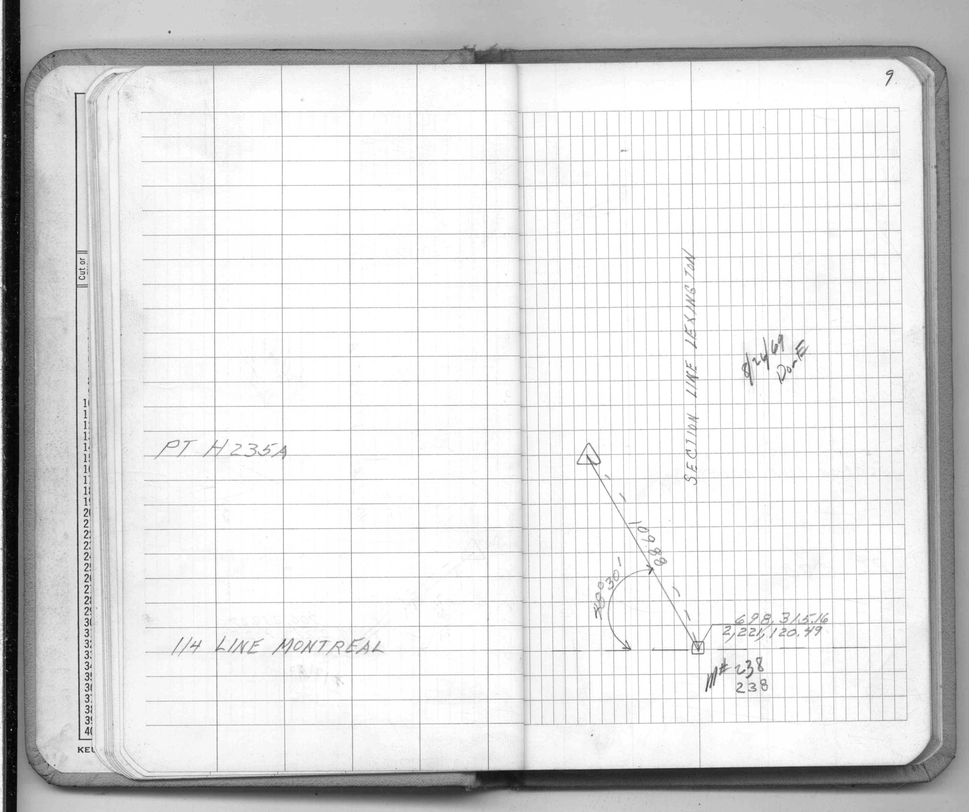
| 2/1/1888 | (Unknown date Feb __, 1888 ) Section break down by R J Johnson. See FB 236CPY p.04-05 |
| 1/1/1885 | (Unknown date ___ __, 1885 ) Monument set by Gates A Johnson. See Old Index Book, Entry 767A |
| 10/1/1847 | (Unknown date Oct __, 1847 ) Isaac N Higbee deputy surveyor set post. Tied to 2 BTs. See IH p.006-007 2823 |
Above is NOT an all inclusive history of this point. Please review all the links below.
| PLS NOTES | Field | Cross Section | Sewer | J.B. Irvine | Monument | River Survey |
|---|---|---|---|---|---|---|
| IH p.006-007 | FB 0236p. 024-025 ,094-095 | JBI 01 p.01-02 JBI 01 p.11-12 JBI 01 p.13-14 | ||||
| FB 0236CPYp. 004-005 ,096-097 | JBI 01 p.01-02 JBI 01 p.11-12 JBI 01 p.13-14 JBI 01 p.37-38 JBI 01 p.39-40 | |||||
| FB 0253p. 39 ,43 ,49 ,71 ,77 | JBI 01 p.89-90 | |||||
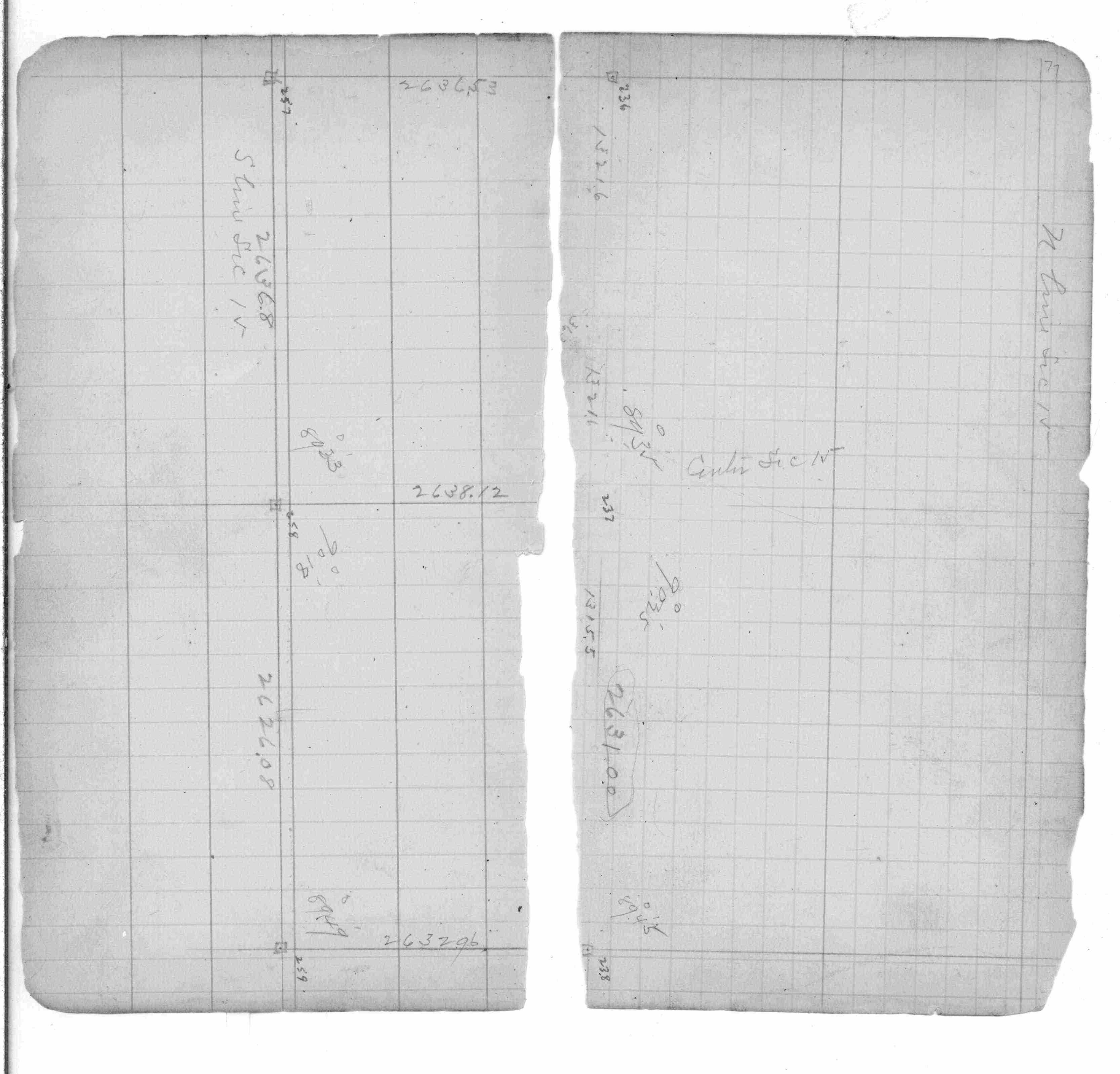
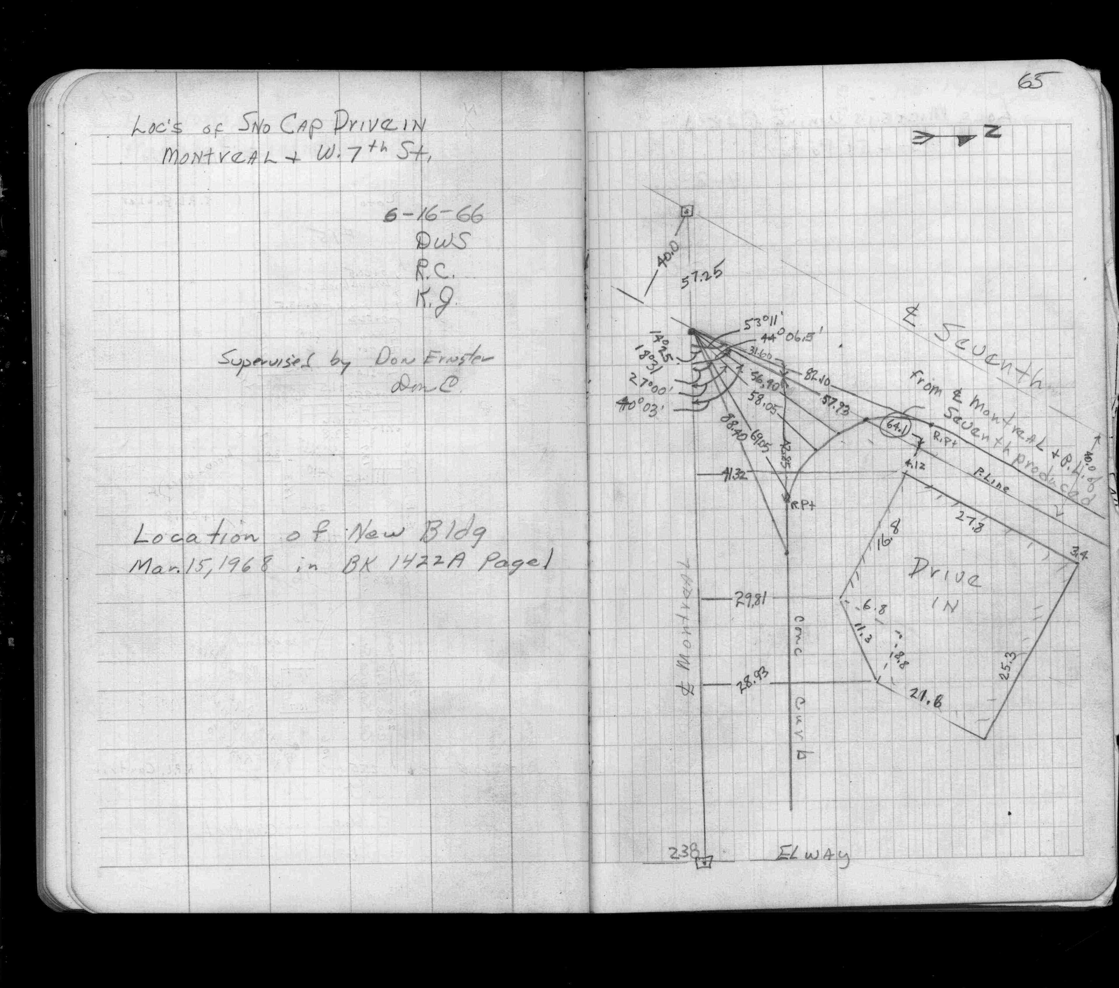
| FB 1422p.65 | ||||||
| FB 1485p.04 | ||||||
| FB 1524p. 06 ,12 ,14 ,18 ,20 | ||||||
| FB 1539p.02 | ||||||
| FB 1549Cp.09 | ||||||
| FB 1549Lp. 05 ,06 | ||||||
| FB 1673Ap. 09 ,60 ,72 | ||||||
| FB 1676Ap. 45 ,48 | ||||||
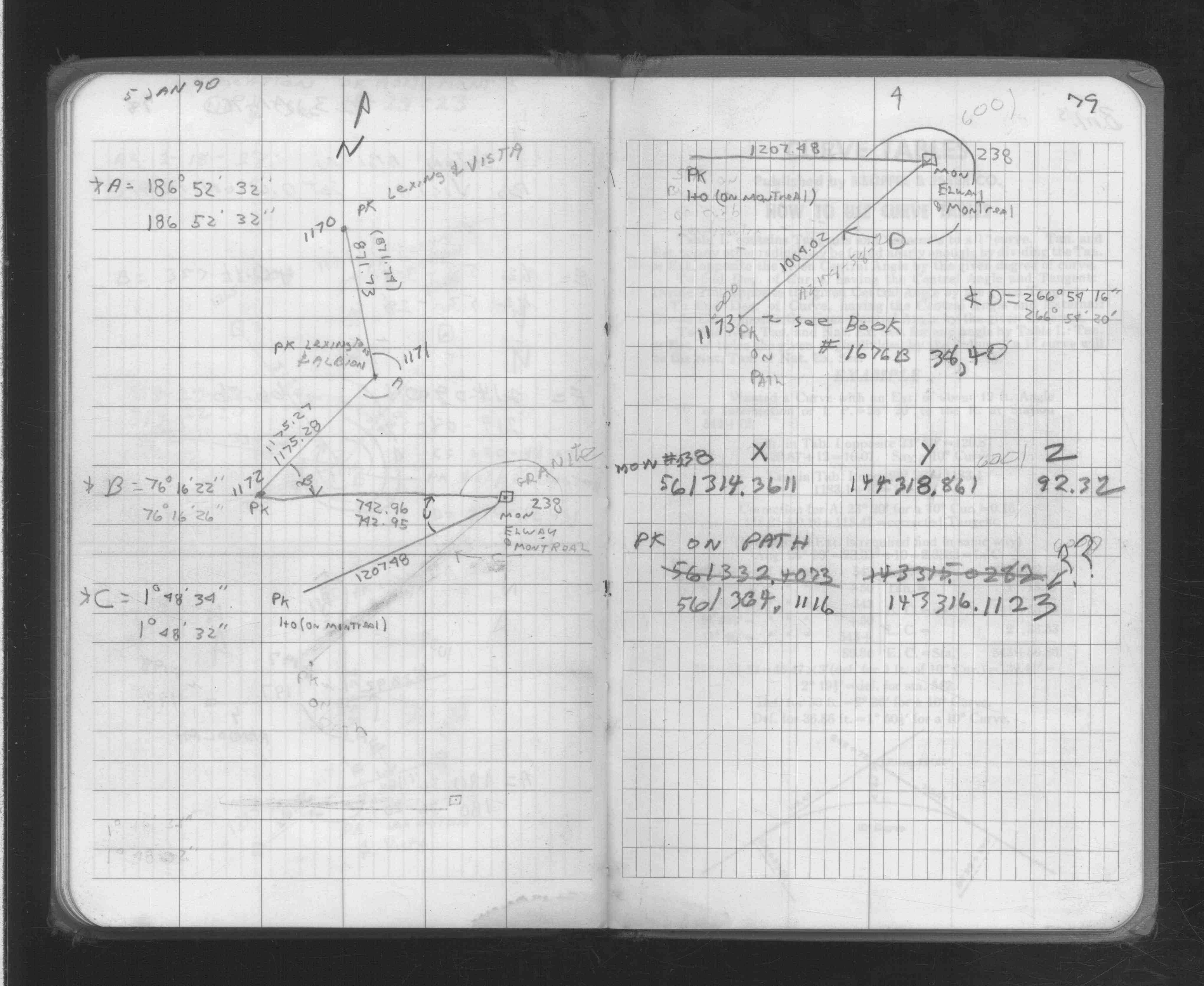
| FB 1676Bp. 15 ,37 ,38 ,52 ,79 | ||||||
| FB 1676Dp.38 | ||||||
| FB 1704p.79 | ||||||
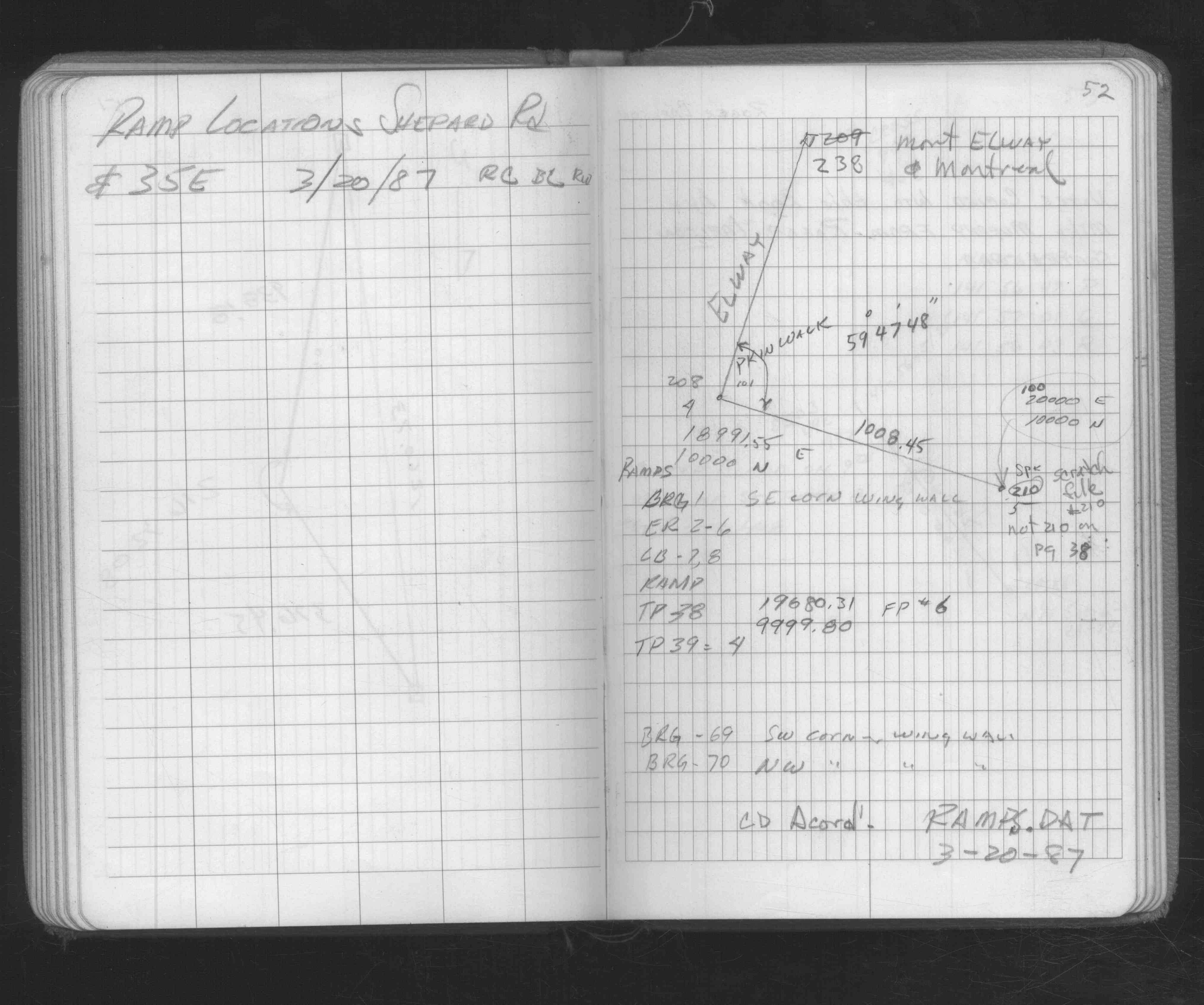
| FB 1708Ap. 42 ,65 | ||||||
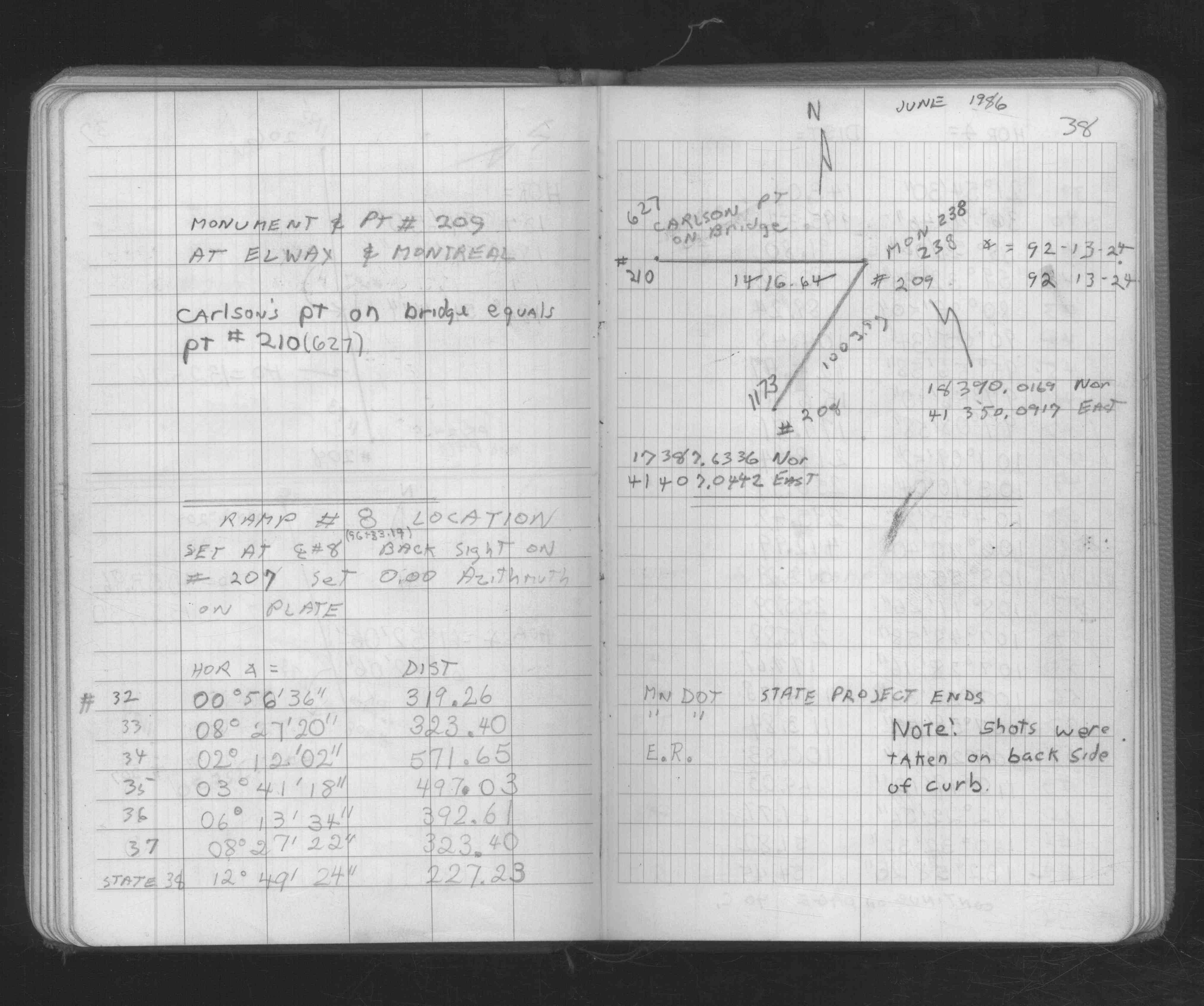
| FB 1736p.33 |
| FILE | SURVEYOR | LIC. NO. | DATE SIGNED | DATE TIED |
|---|---|---|---|---|
| 0238-0767A-B.pdf | Samuel D. Gibson | 44880 | November 2, 2012 | December 24, 2012 |
| 0238-0767A-A.tif | William J. Cutting | 20576 | October 20, 1995 | September 26, 1994 |
| ST_235-312p238.jpg | none | none | none | none |
| 0238-0767A-A.dwf | none | none | none | none |
| FILE | PHOTO DATE | COMMENTS |
|---|---|---|
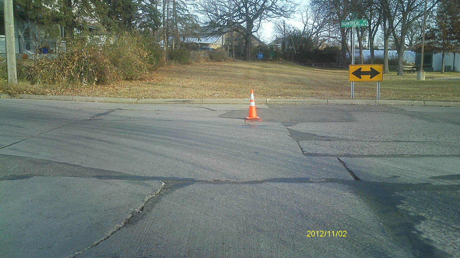
| 0238-0767A-5.jpg | November 2, 2012 | Looking west along Montreal Ave. |
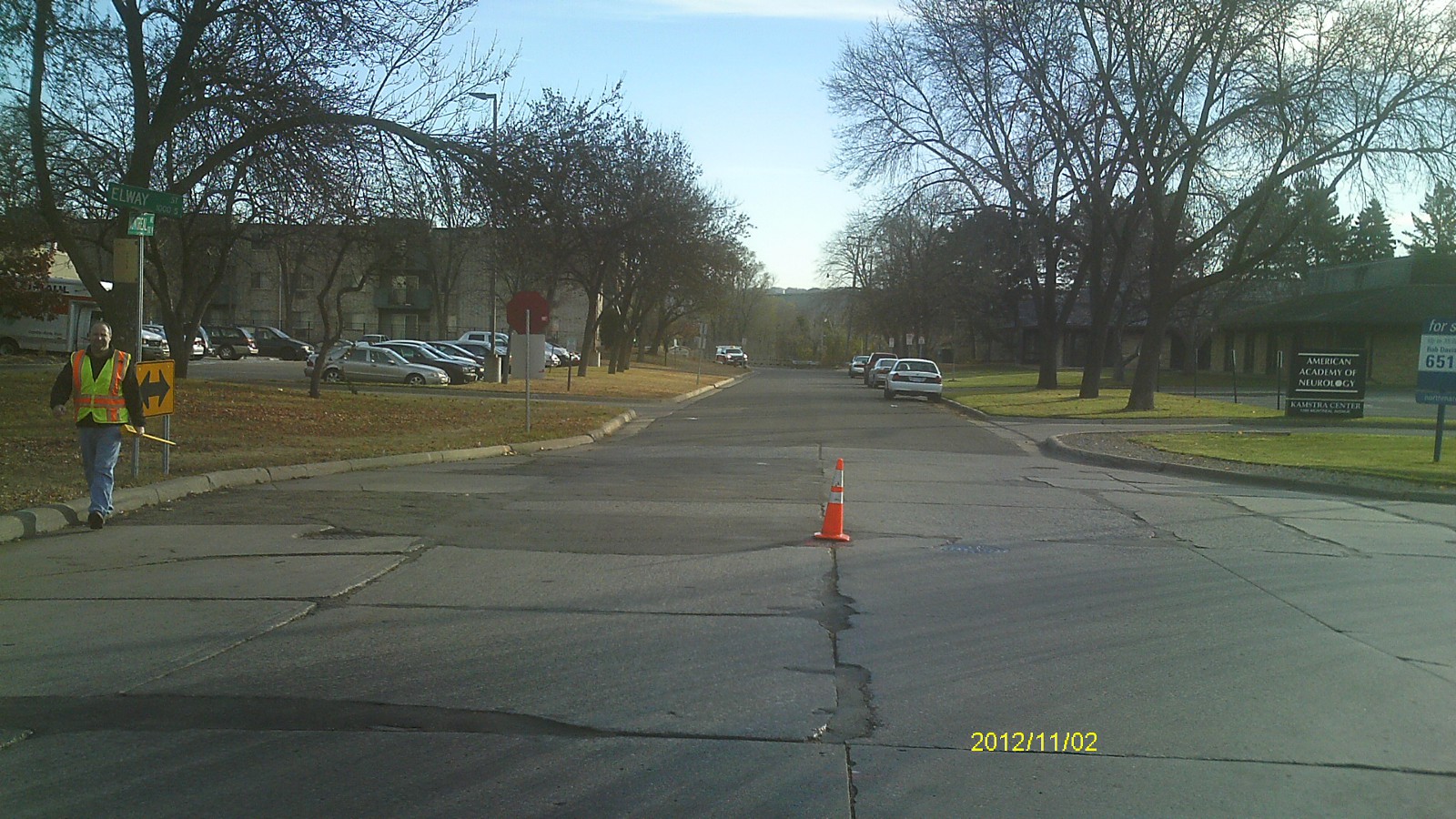
| 0238-0767A-4.jpg | November 2, 2012 | Looking south along Elway St. |
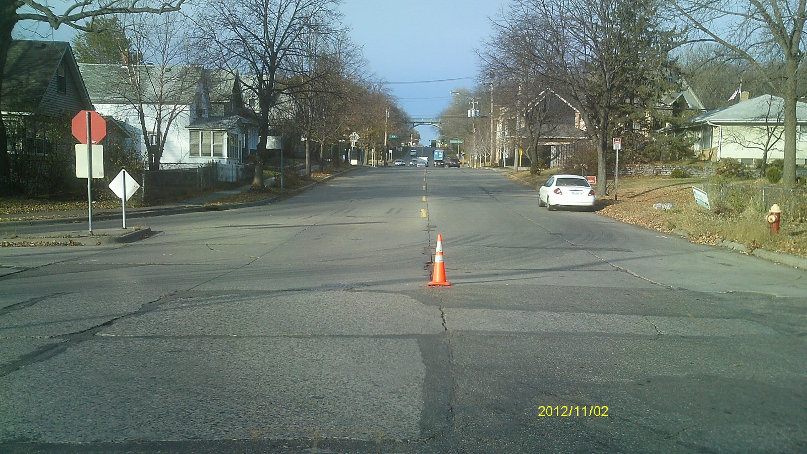
| 0238-0767A-3.jpg | November 2, 2012 | Looking east along Montreal Ave. |
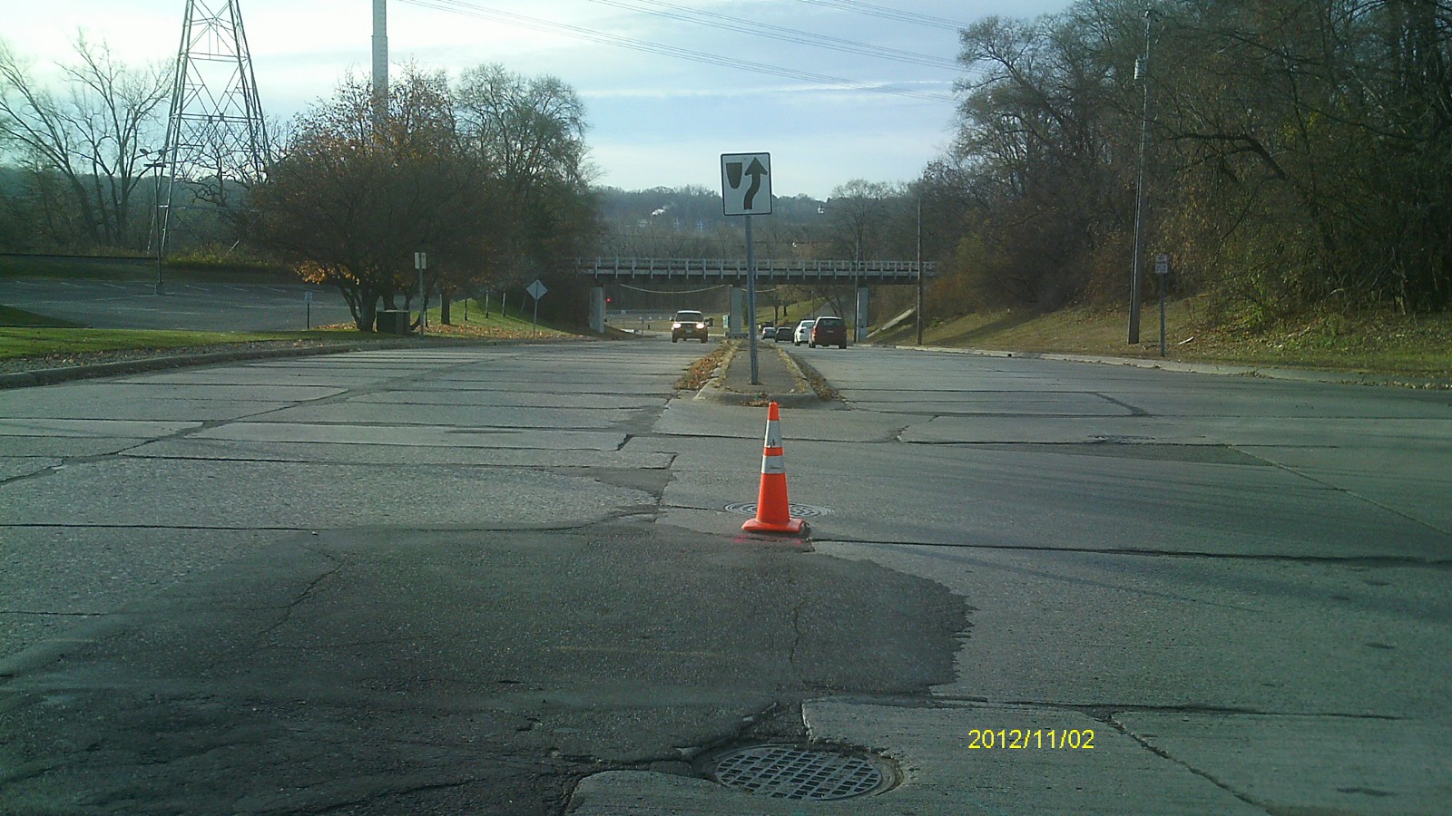
| 0238-0767A-2.jpg | November 2, 2012 | Looking north. |
| 0238-0767A-1.jpg | November 2, 2012 | Close up of monument. |