| NAD83 COORDINATES (1986 adj.): |
|---|
| * X= 553413.268 Y= 141693.975 Z= 000.00 LSQ 12/06/1991 S FIX |
| NAD83 COORDINATES (1996 adj.): |
|---|
| X= 553412.932 Y= 141694.925 Z= 810.7 12/24/2012 MnDot |
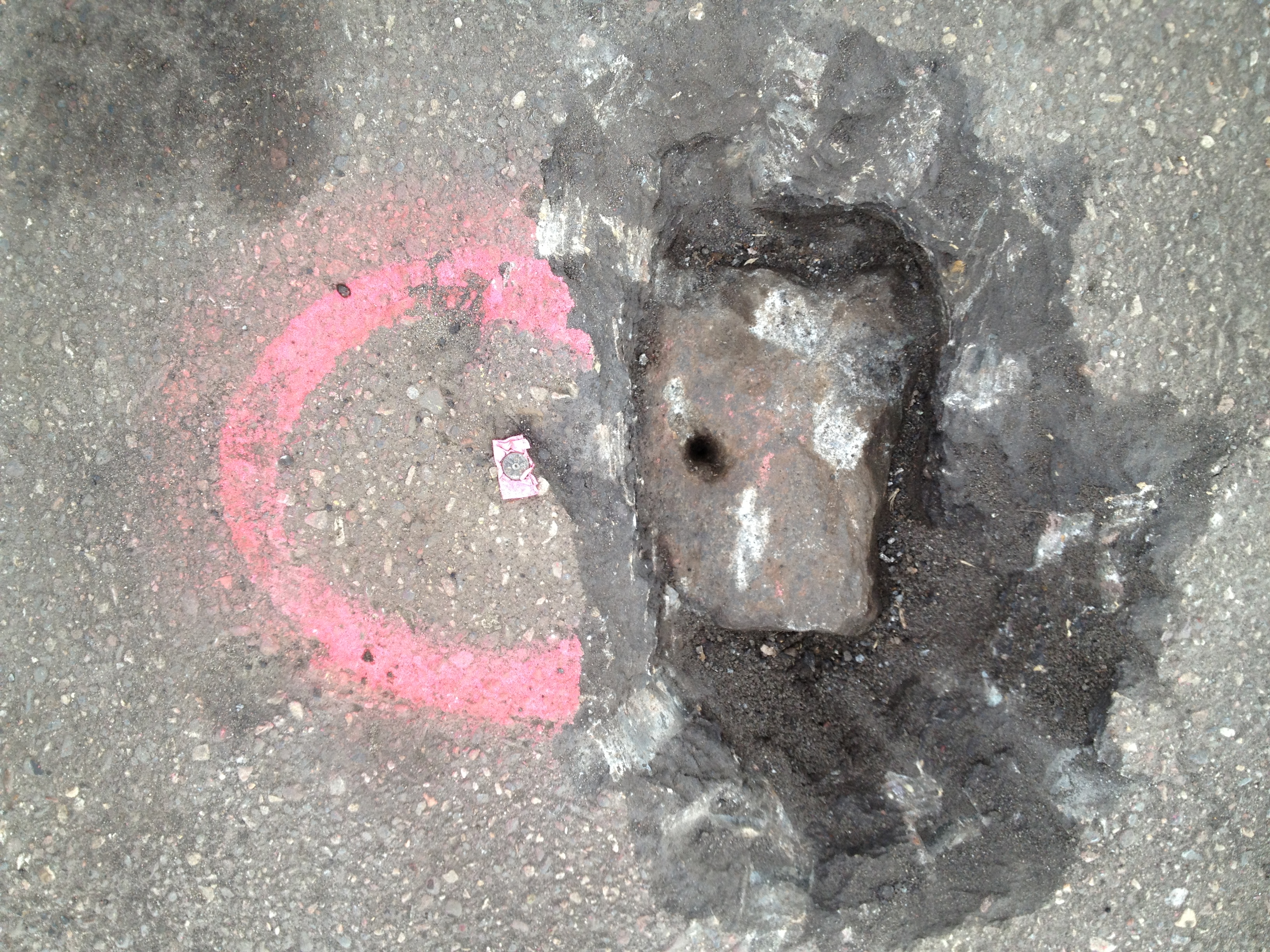
| 12/21/2012 | GM found by MnDOT 0.5 ft below street grade. Coordinate established using static GPS (1996 adj). Photo taken. City Elev = 116.44 ft |
| 2/22/2008 | Monument not found. |
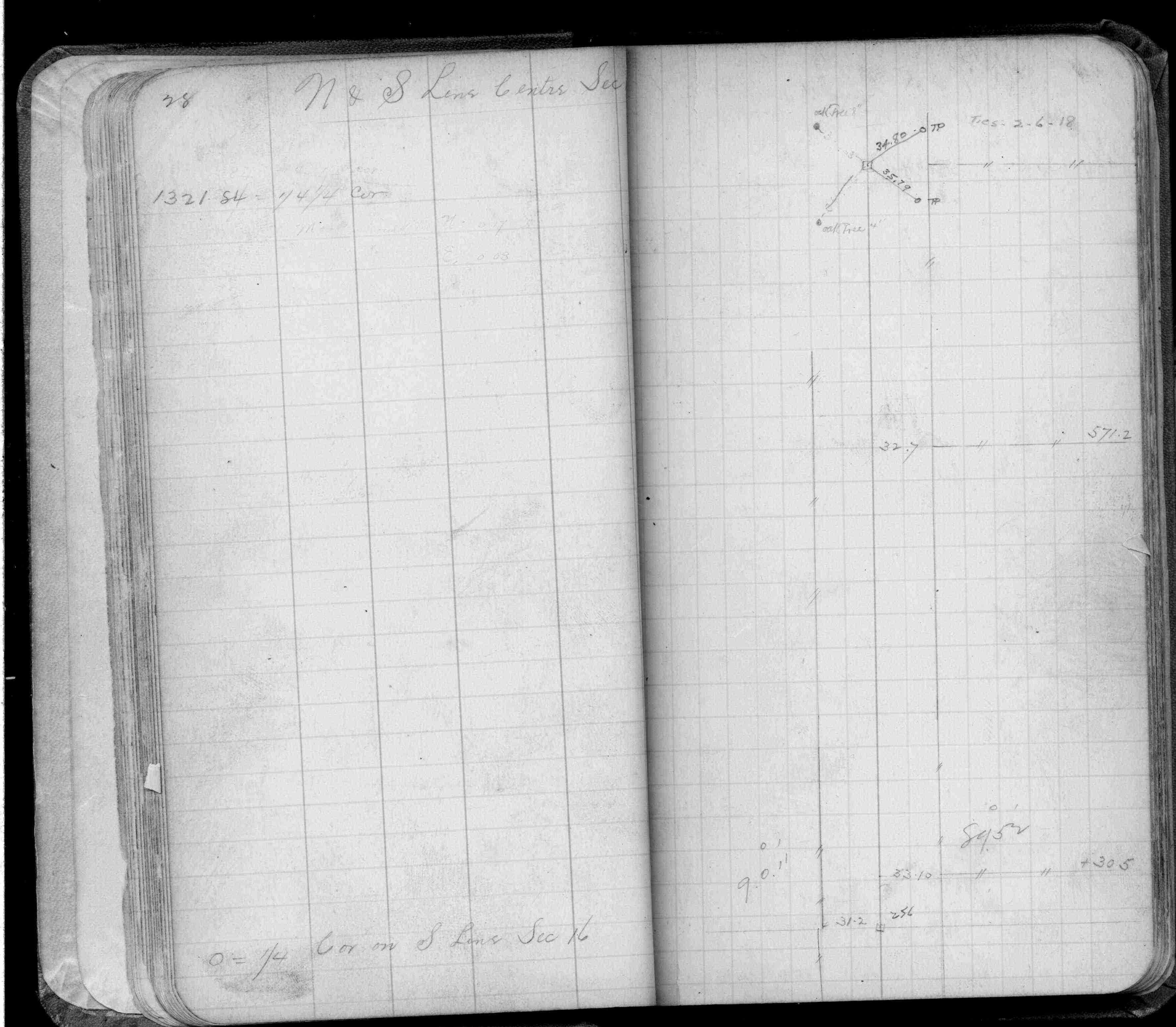
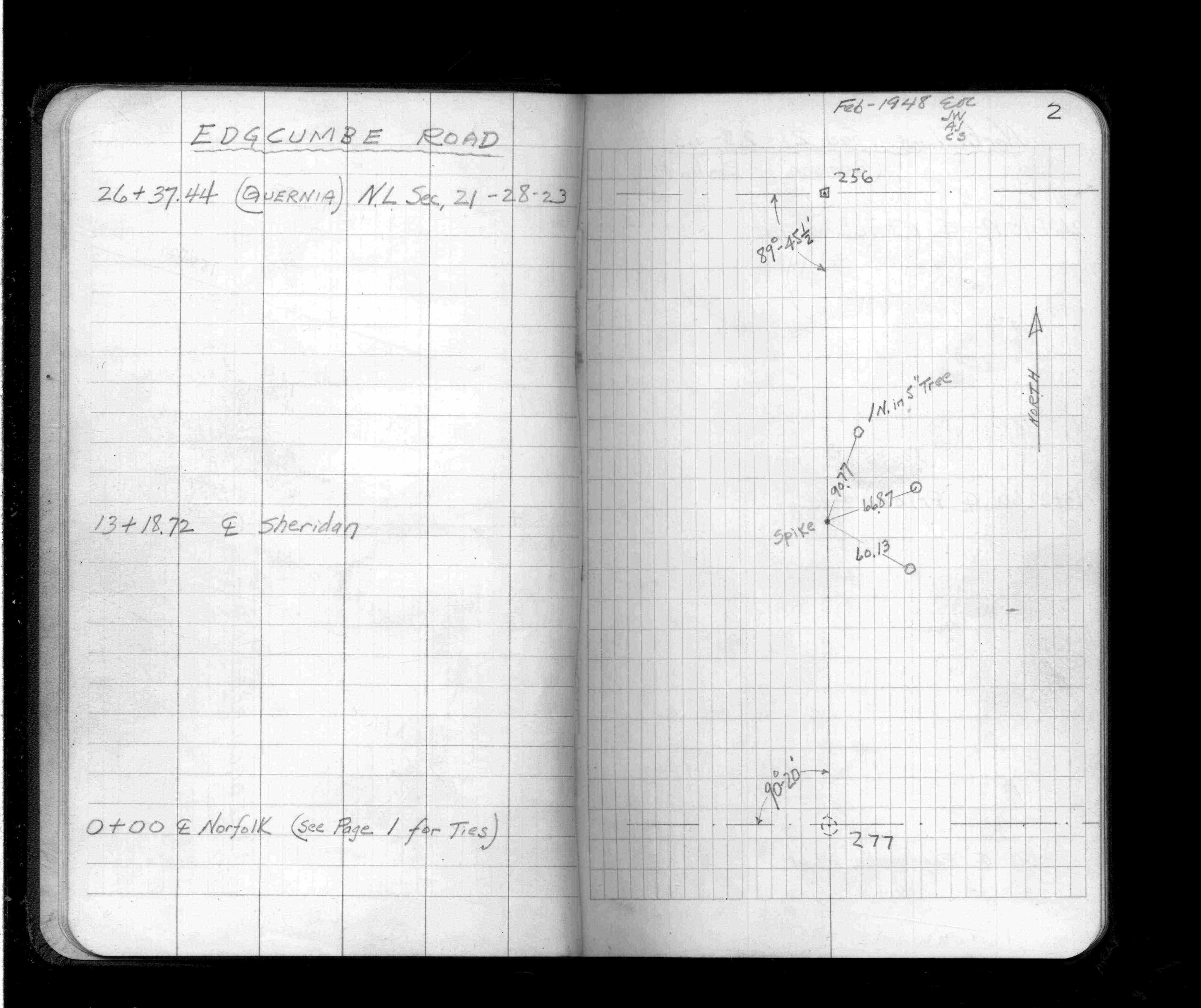
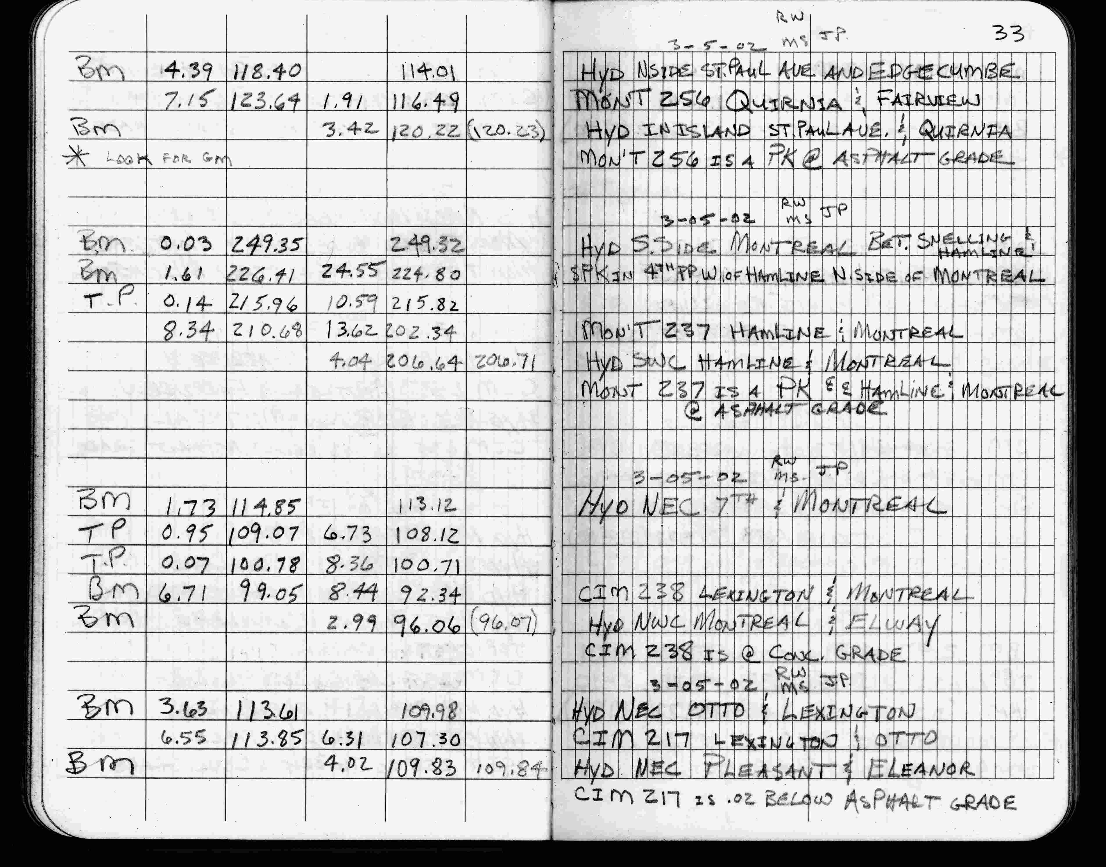
| 3/5/2002 | Elev 116.49 ft on pk nail at asphalt surface. See FB 1736 p.33 |
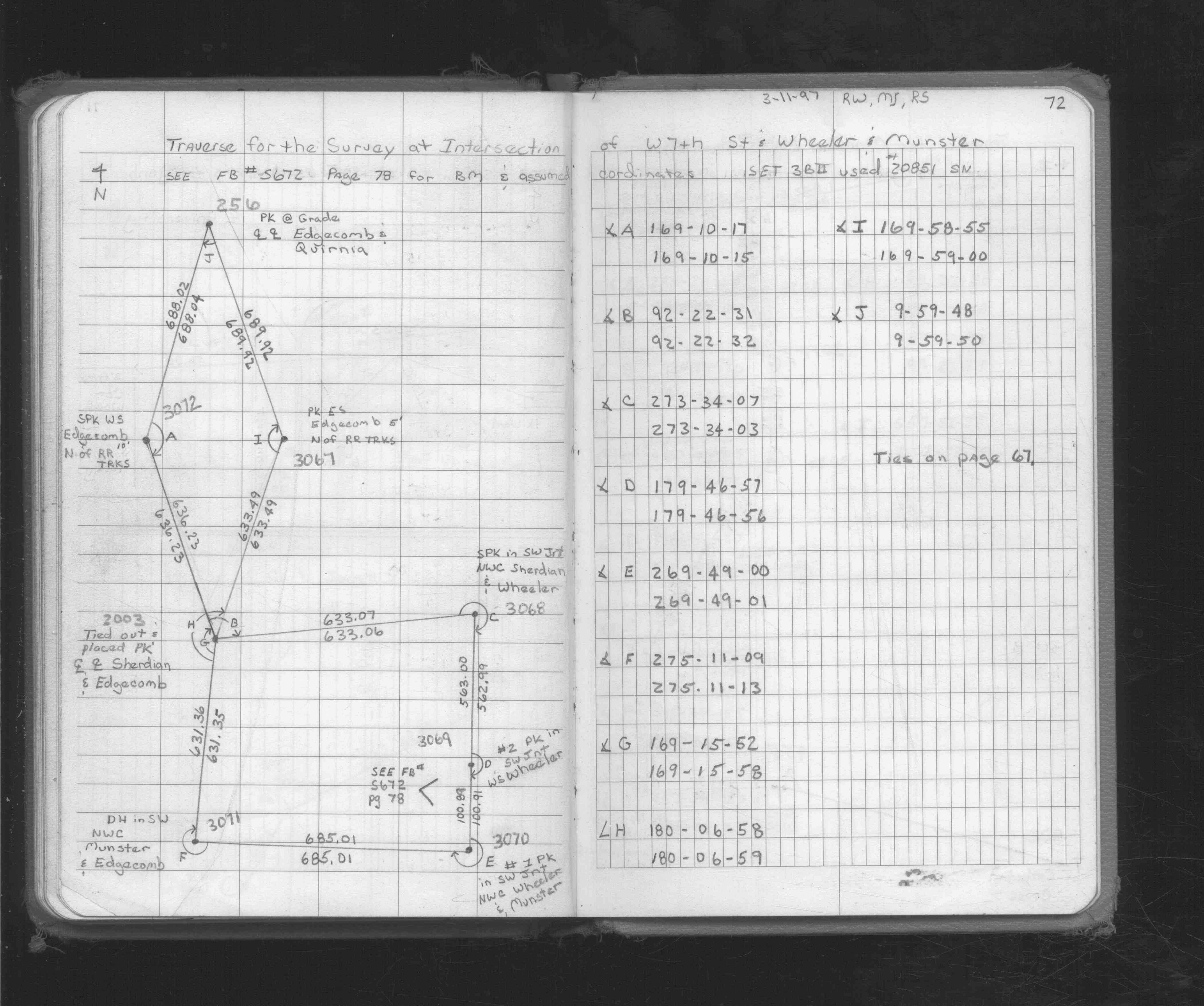
| 3/11/1997 | Used pk nail for traverse control. See FB 1719A p.72 |
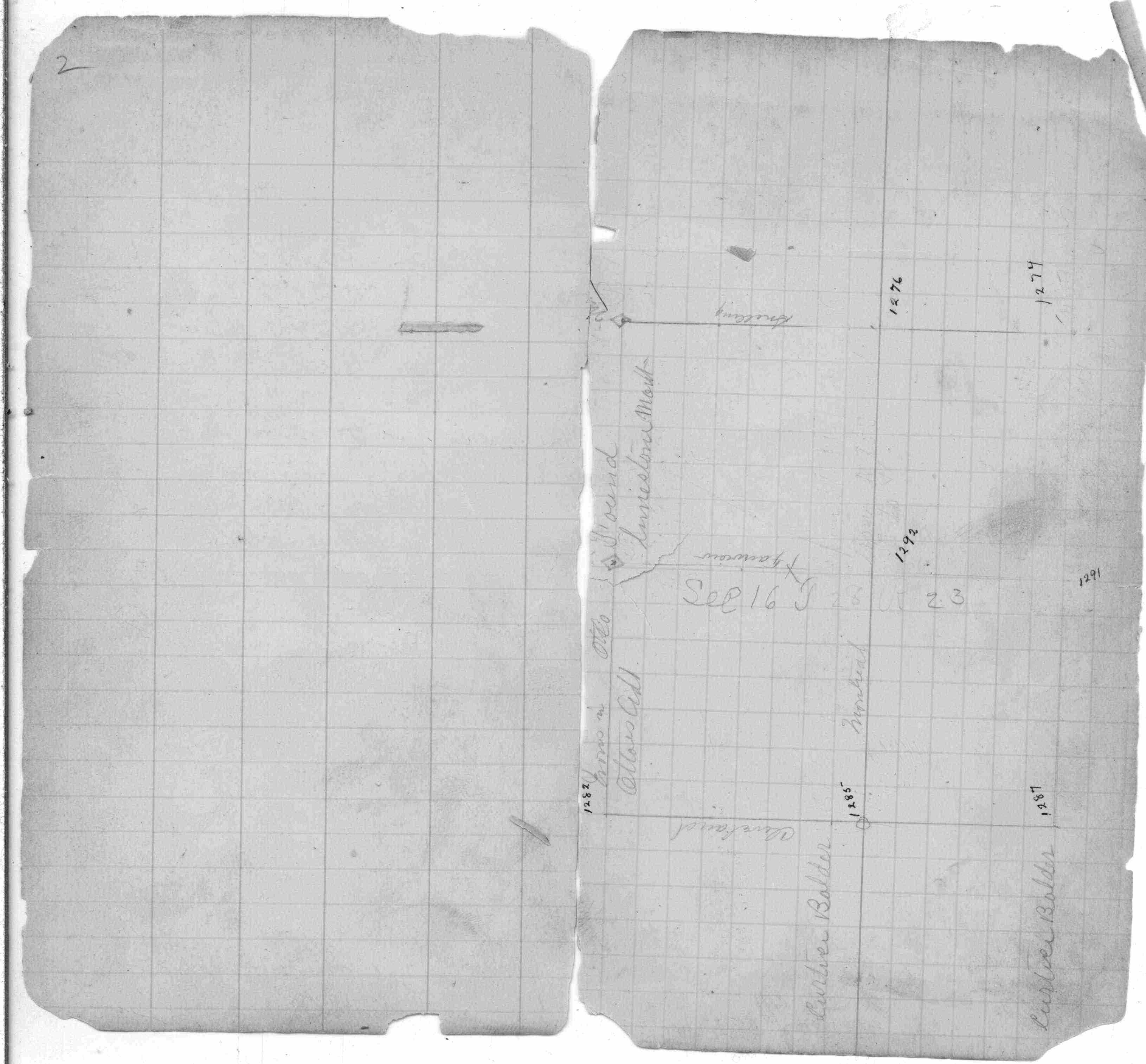
| 9/25/1995 | Placed pk nail from ties. See CofL 0256-1291-B |
| 1/11/1993 | Fd GM, placed ties, left GM as found. See CofL 0256-1291-A |
| 4/1/1991 | (Unknown date Apr __, 1991 ) Fd CIM to grade in bituminous surface |
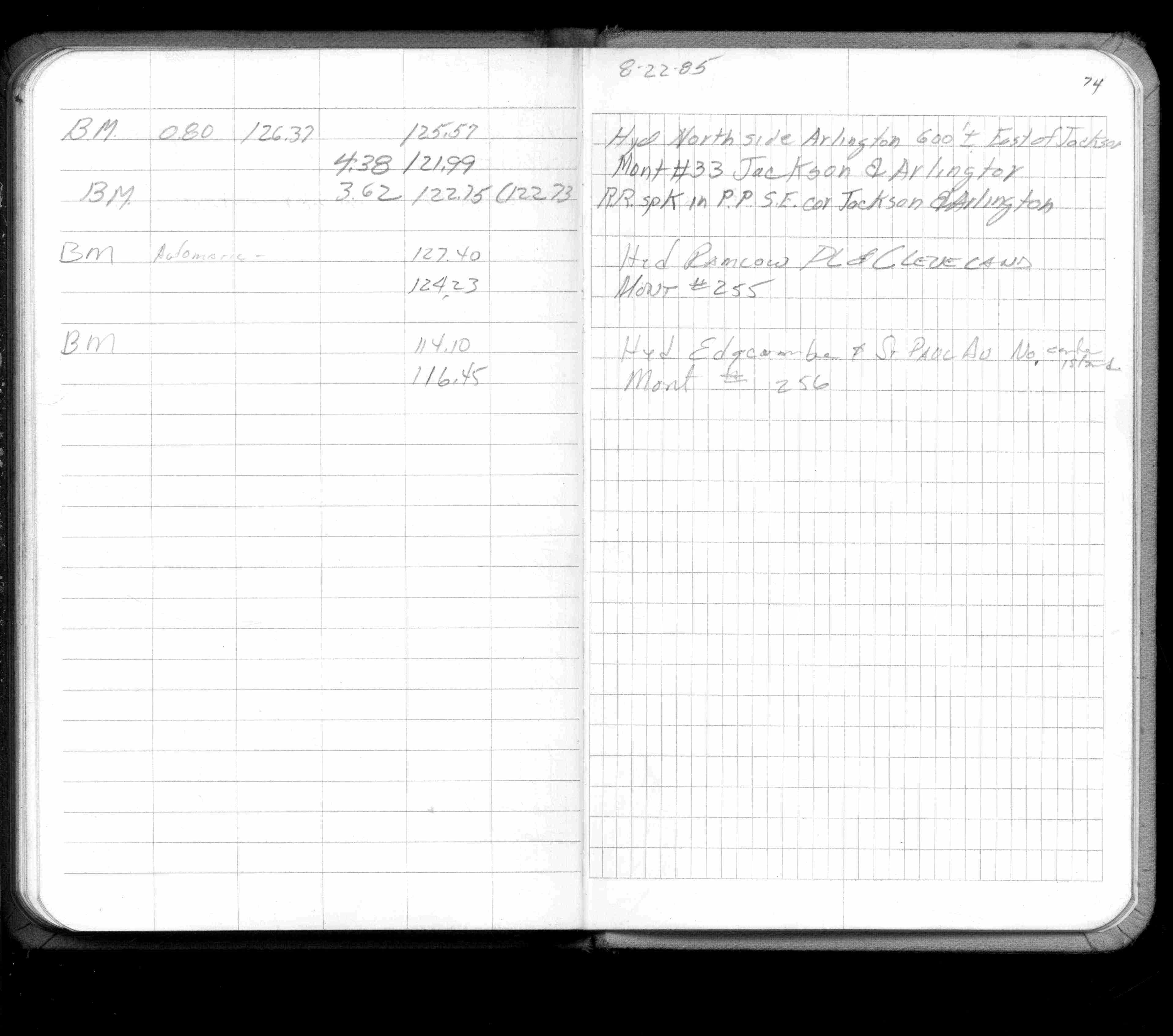
| 8/1/1985 | (Unknown date Aug __, 1985 ) Elev 116.45 ft on ?. See FB 1421A p.74 |
| 1/1/1985 | (Unknown date ___ __,1985 ) Historic, one time only GPS survey = S084 |
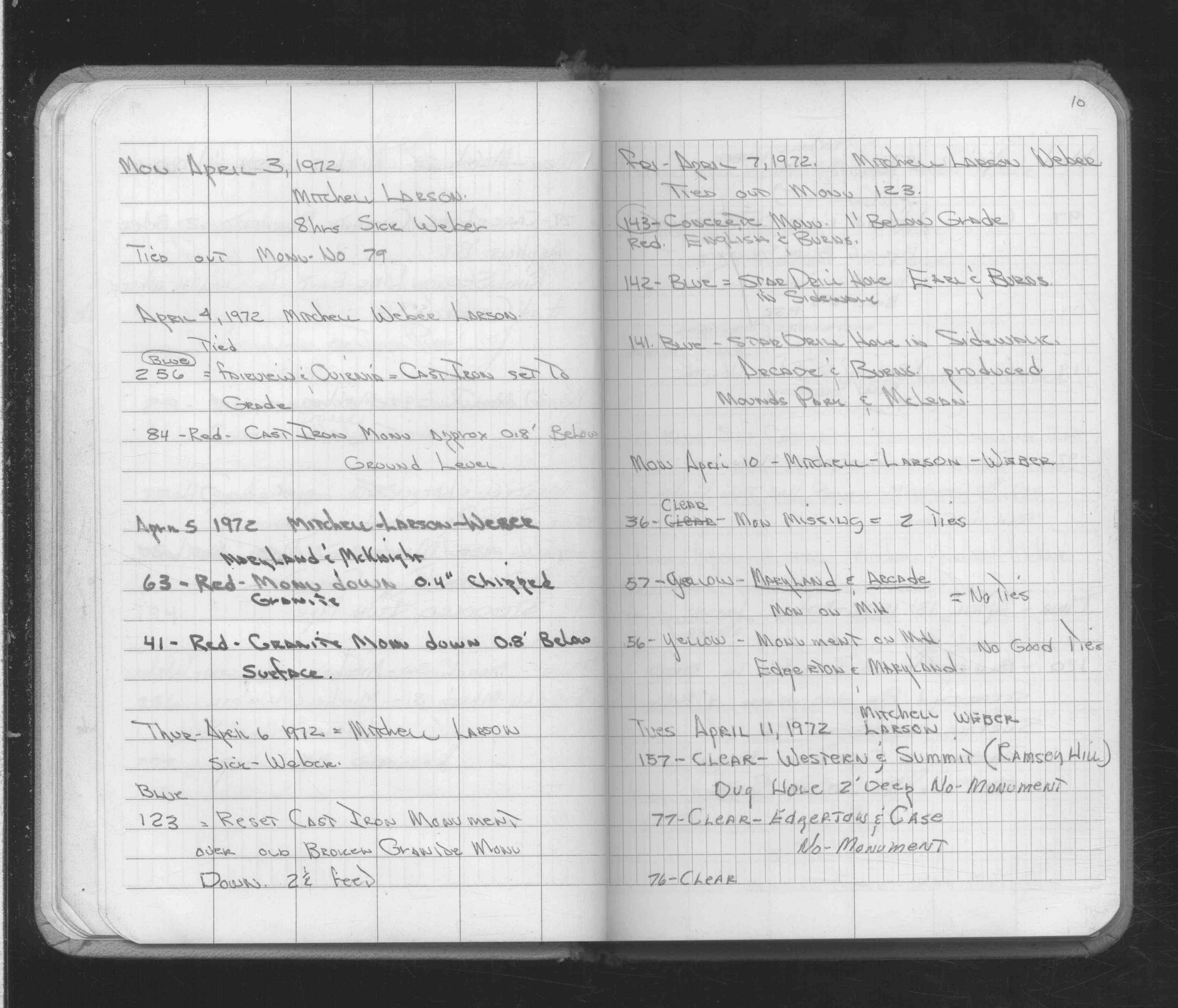
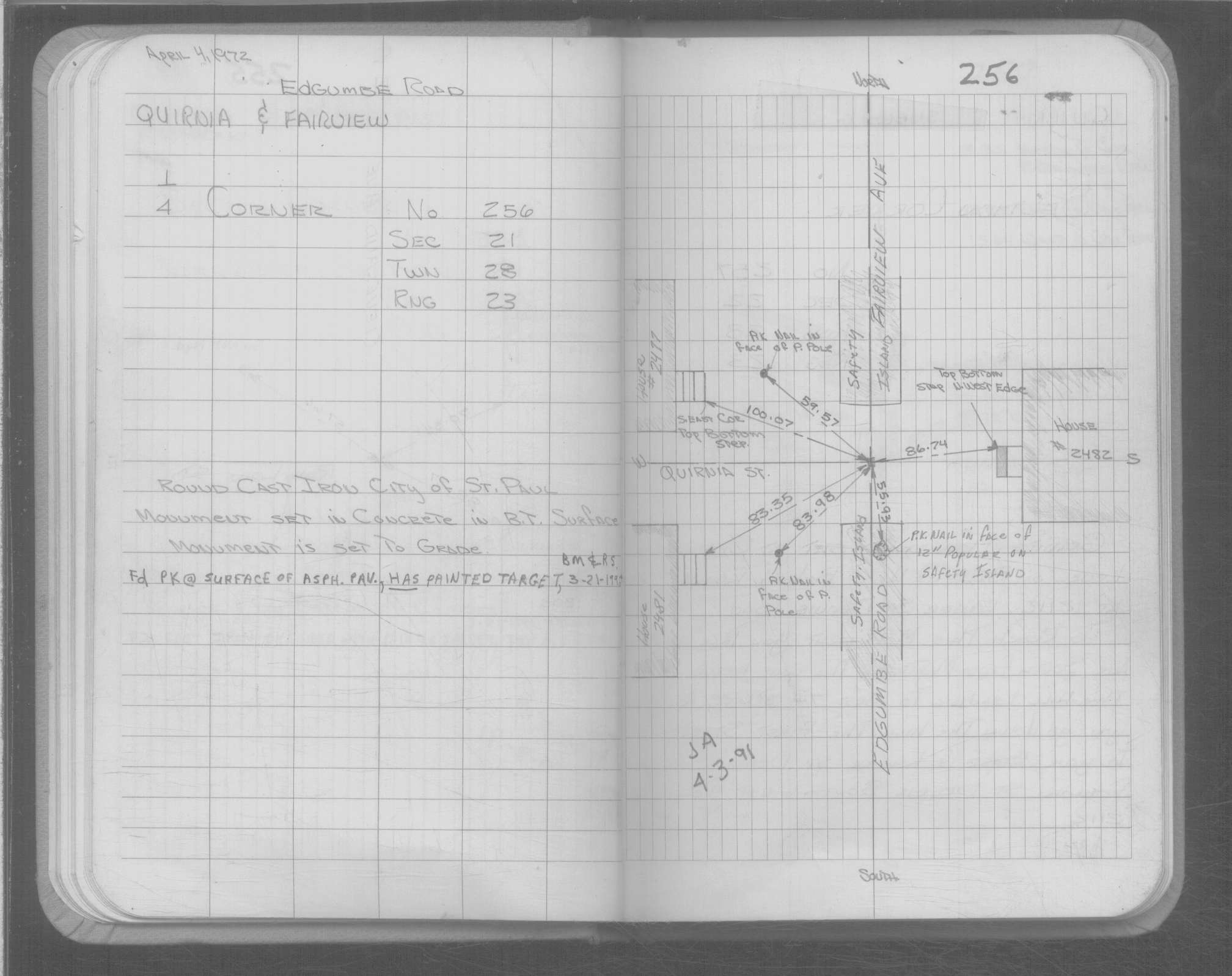
| 4/4/1972 | Fd CIM at grade. See FB 1689A p.10 |
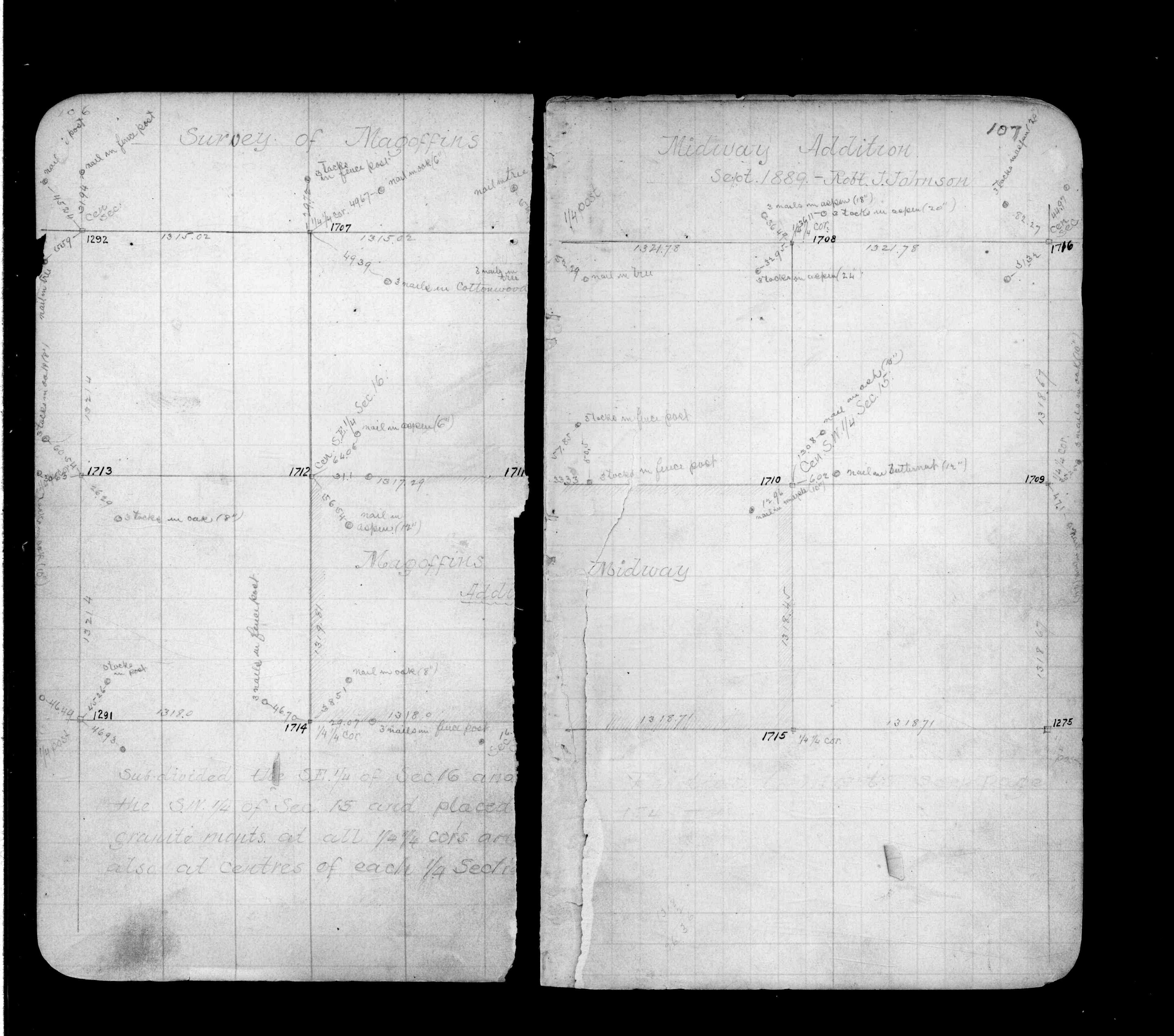
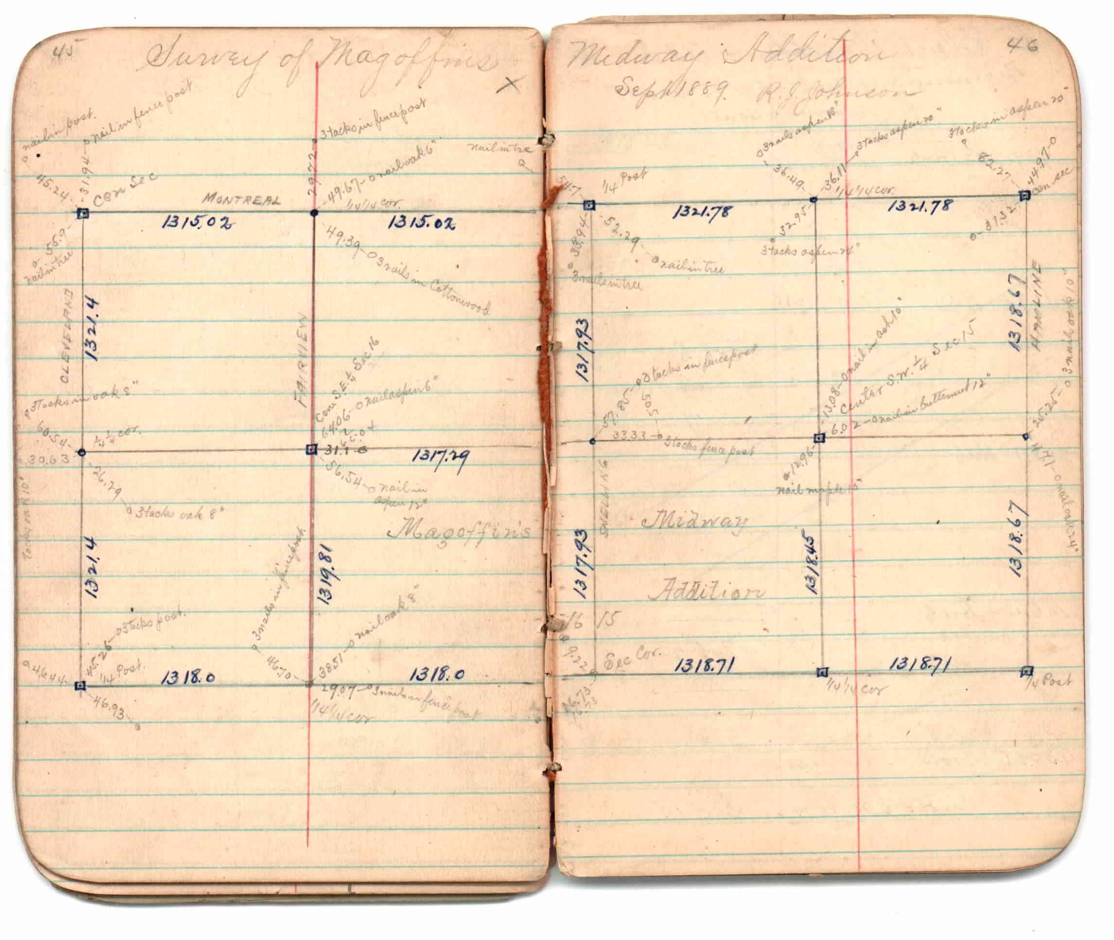
| 9/1/1889 | (Unknown date Sep __, 1889 ) Survey of Magoffins Midway Addition by R J Johnson. See JBI 01 p.45-46 |
| 9/1/1889 | (Unknown date Sep __, 1889 ) Monument tied in by R J Johnson. See Old Index Book, Entry 1708. See FB 236 p.106-107 |
| 3/1/1888 | (Unknown date Mar __, 1888 ) Monument set by McCarron from old notes of survey by D L Curtice. See FB 250 p.2 |
| 10/1/1847 | (Unknown date Oct __, 1847 ) Isaac N Higbee deputy surveyor set post. Tied to 1 BT. See IH p.018-019 2823 |
Above is NOT an all inclusive history of this point. Please review all the links below.
| PLS NOTES | Field | Cross Section | Sewer | J.B. Irvine | Monument | River Survey |
|---|---|---|---|---|---|---|
| IH p.018-019 | FB 0236p.106-107 | JBI 01 p.45-46 | MS 0007 p.044-045 | |||
| FB 0236p.107 | ||||||
| FB 0250CPYp. 01 ,02 ,03 ,28 | ||||||
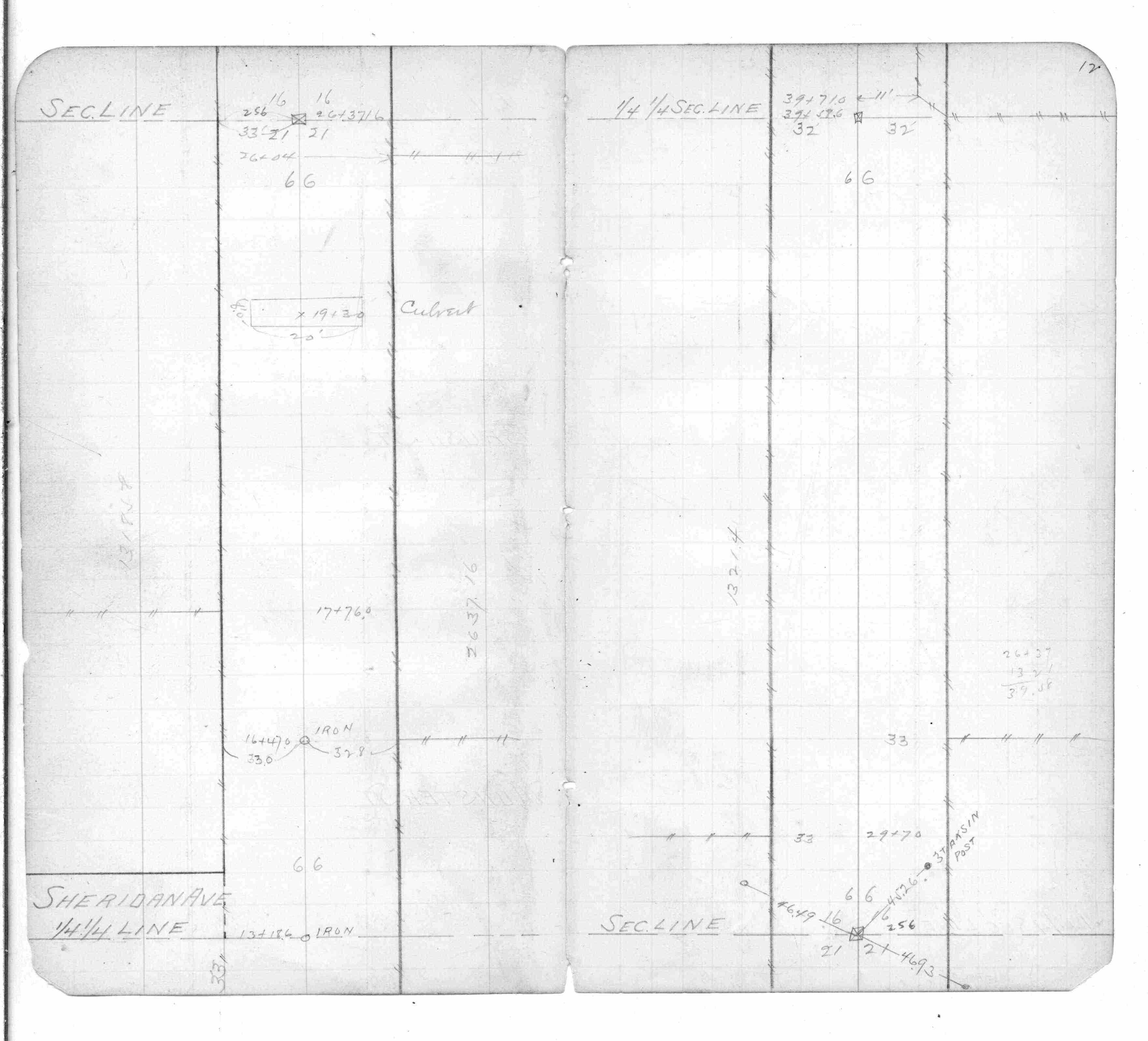
| FB 0253p.46 | ||||||
| FB 0344p.12 | ||||||
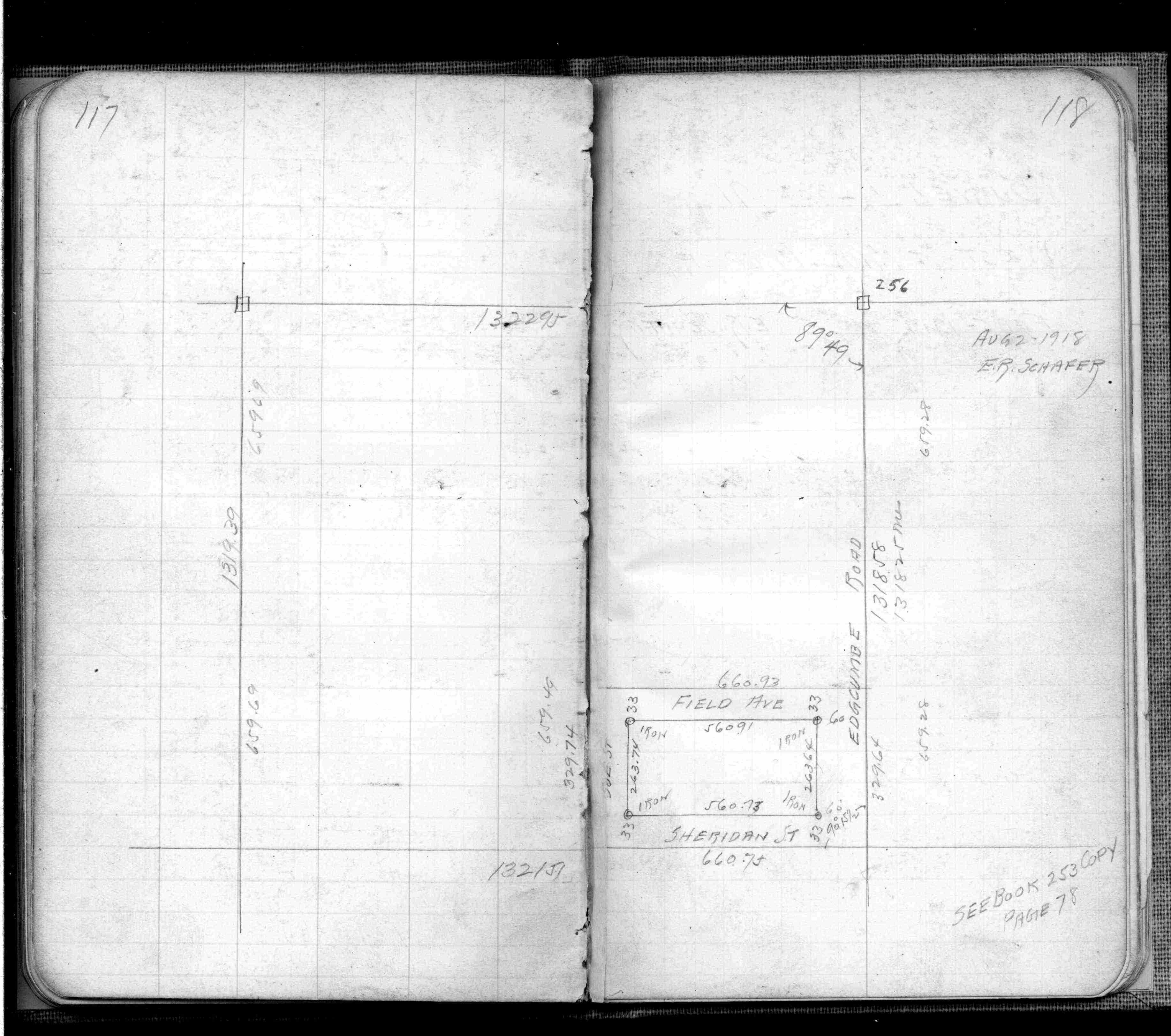
| FB 0358p.117-118 | ||||||
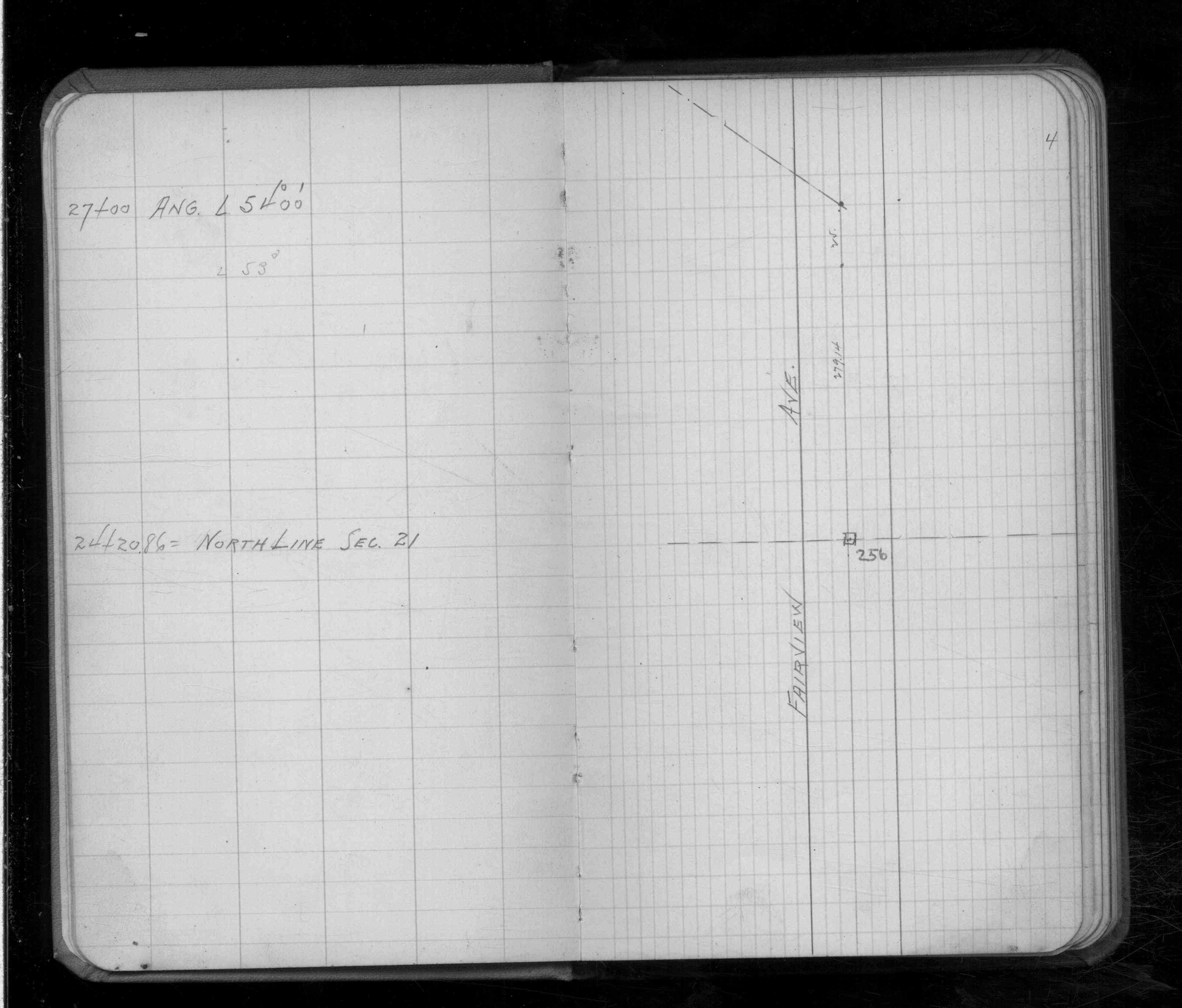
| FB 0674p.04 | ||||||
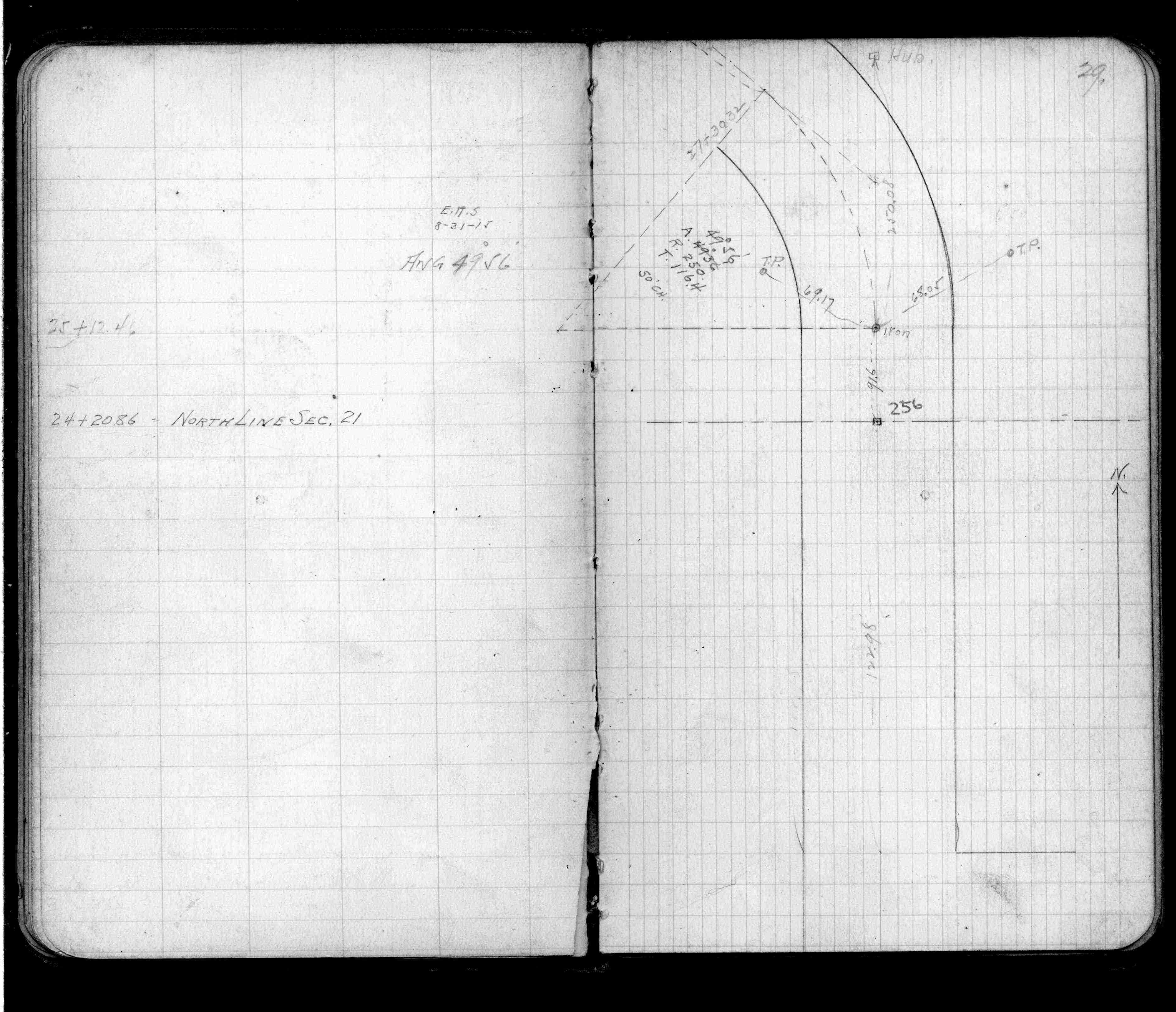
| FB 0718p. 29 ,65 | ||||||
| FB 1216p.05 | ||||||
| FB 1392p. 02 ,03 | ||||||
| FB 1421Ap.74 | ||||||
| FB 1484p.01 | ||||||
| FB 1549Ep.40 | ||||||
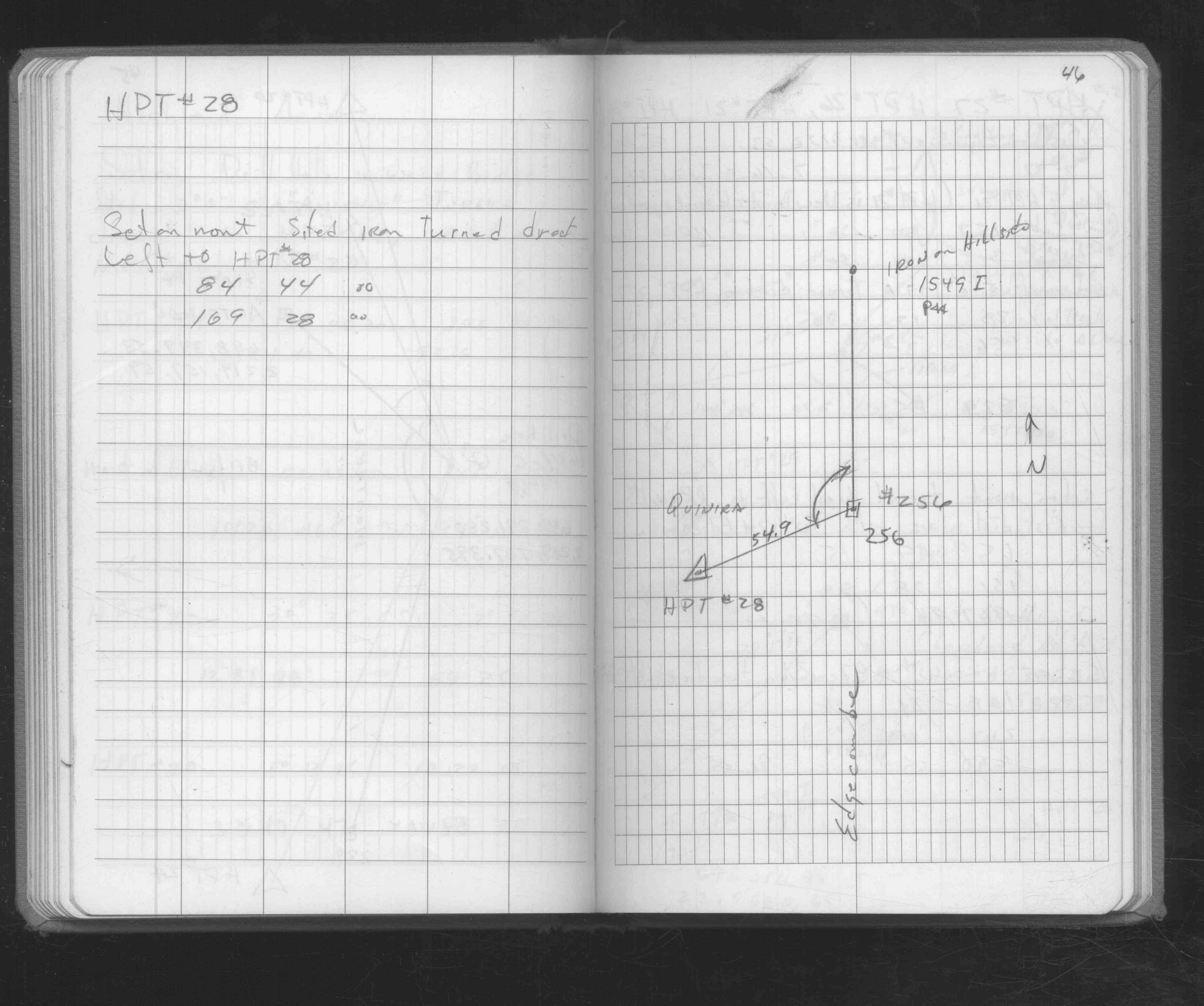
| FB 1549Ip.44 | ||||||
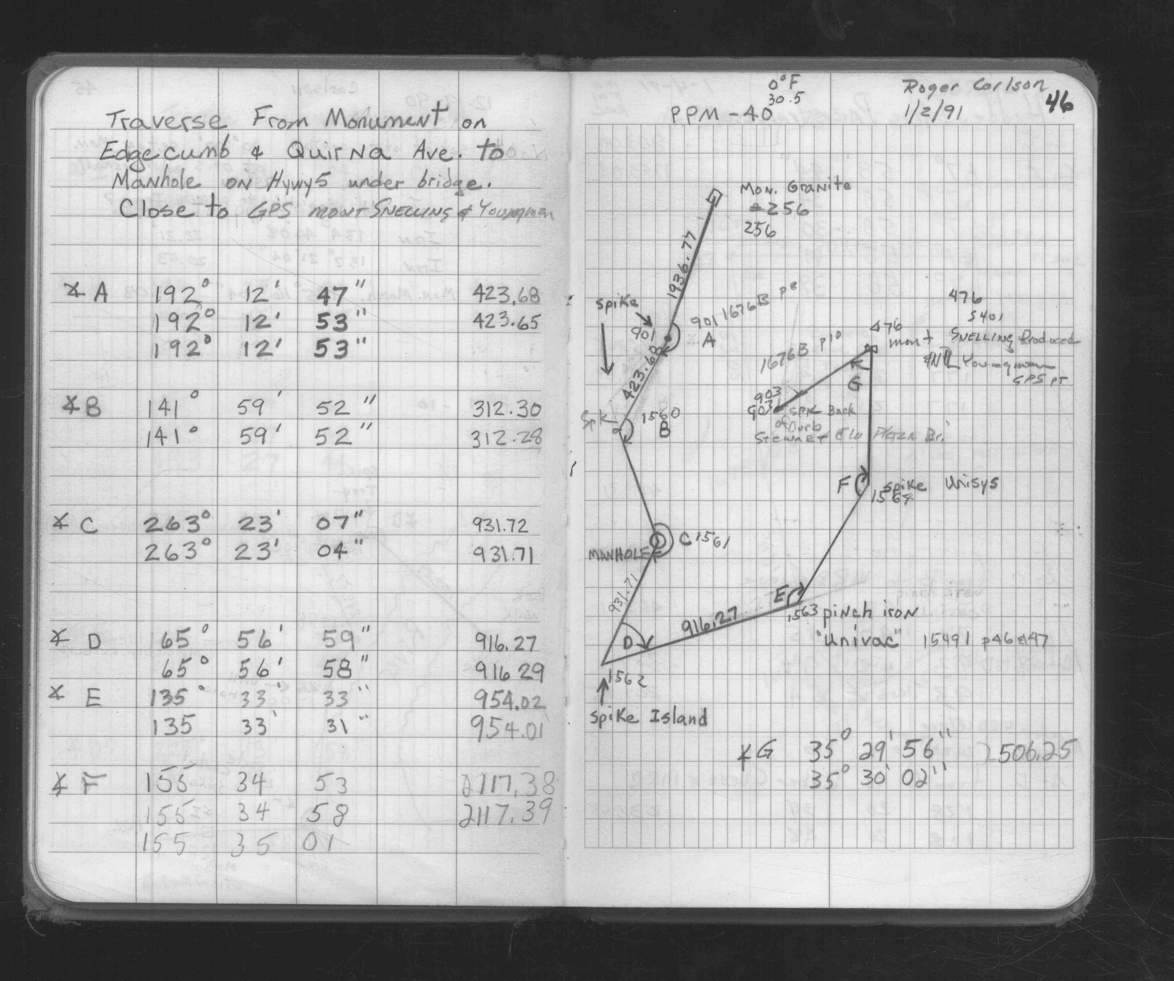
| FB 1676Ap.46 | ||||||
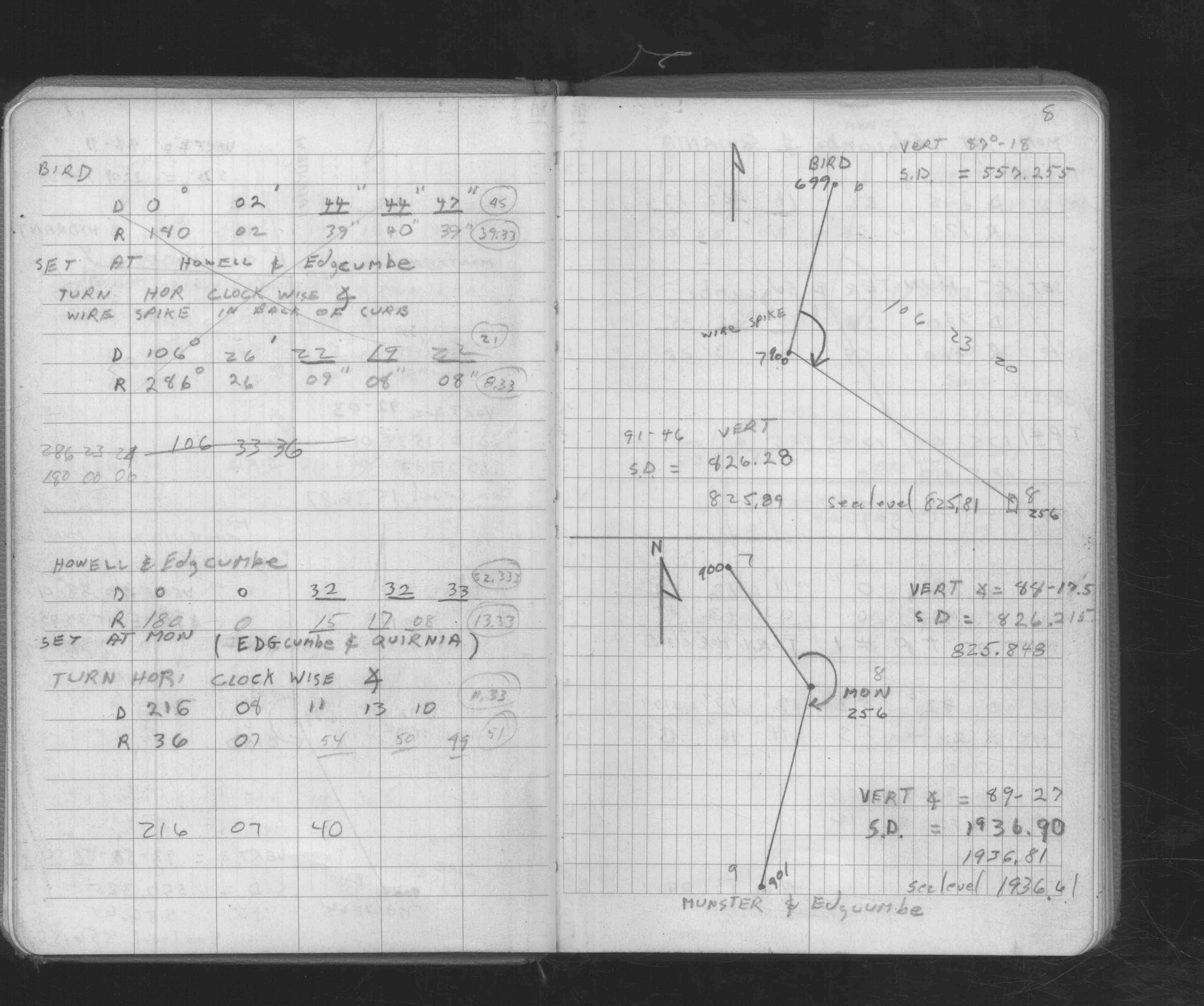
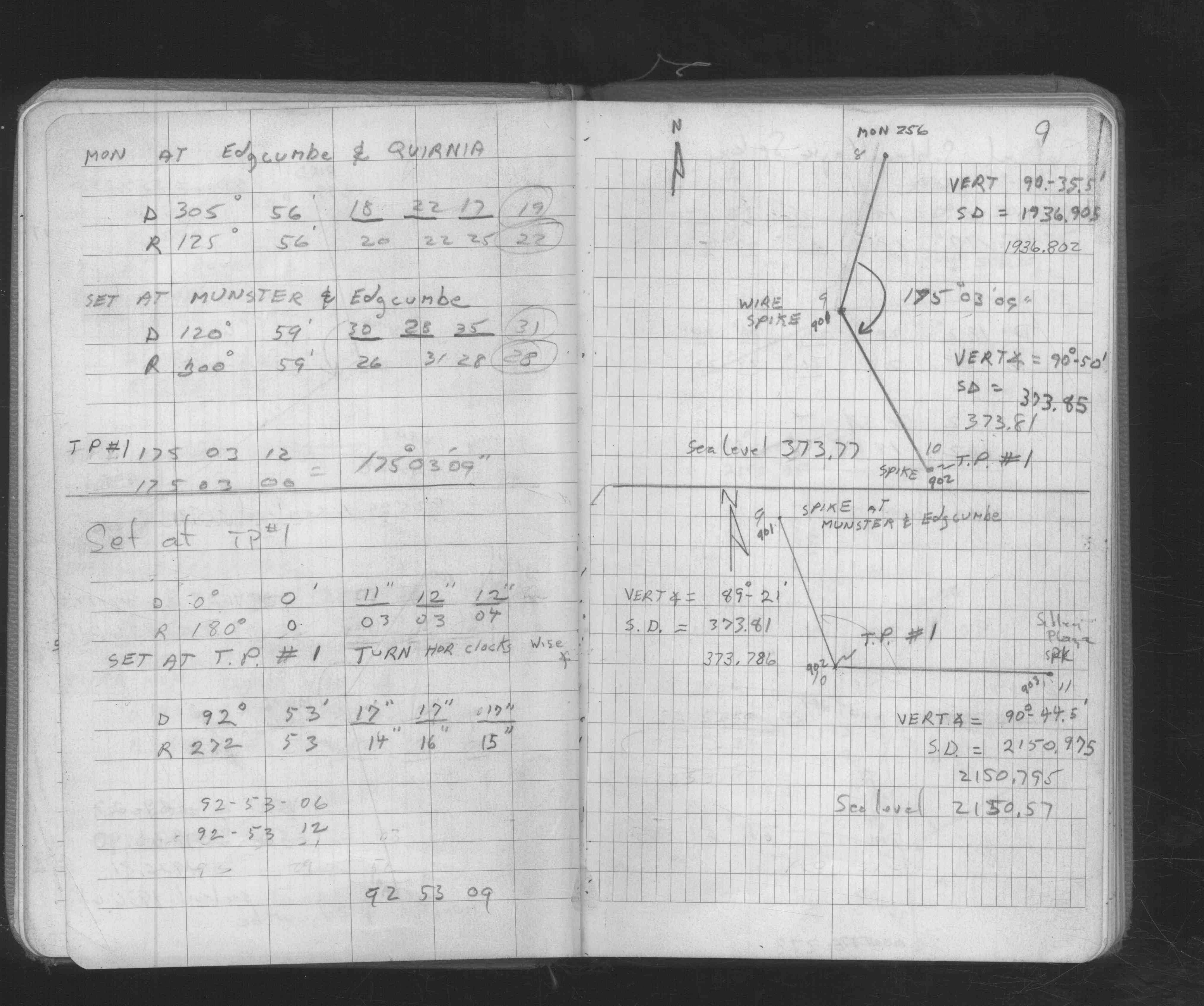
| FB 1676Bp. 08 ,09 | ||||||
| FB 1676Cp. 46 ,48 | ||||||
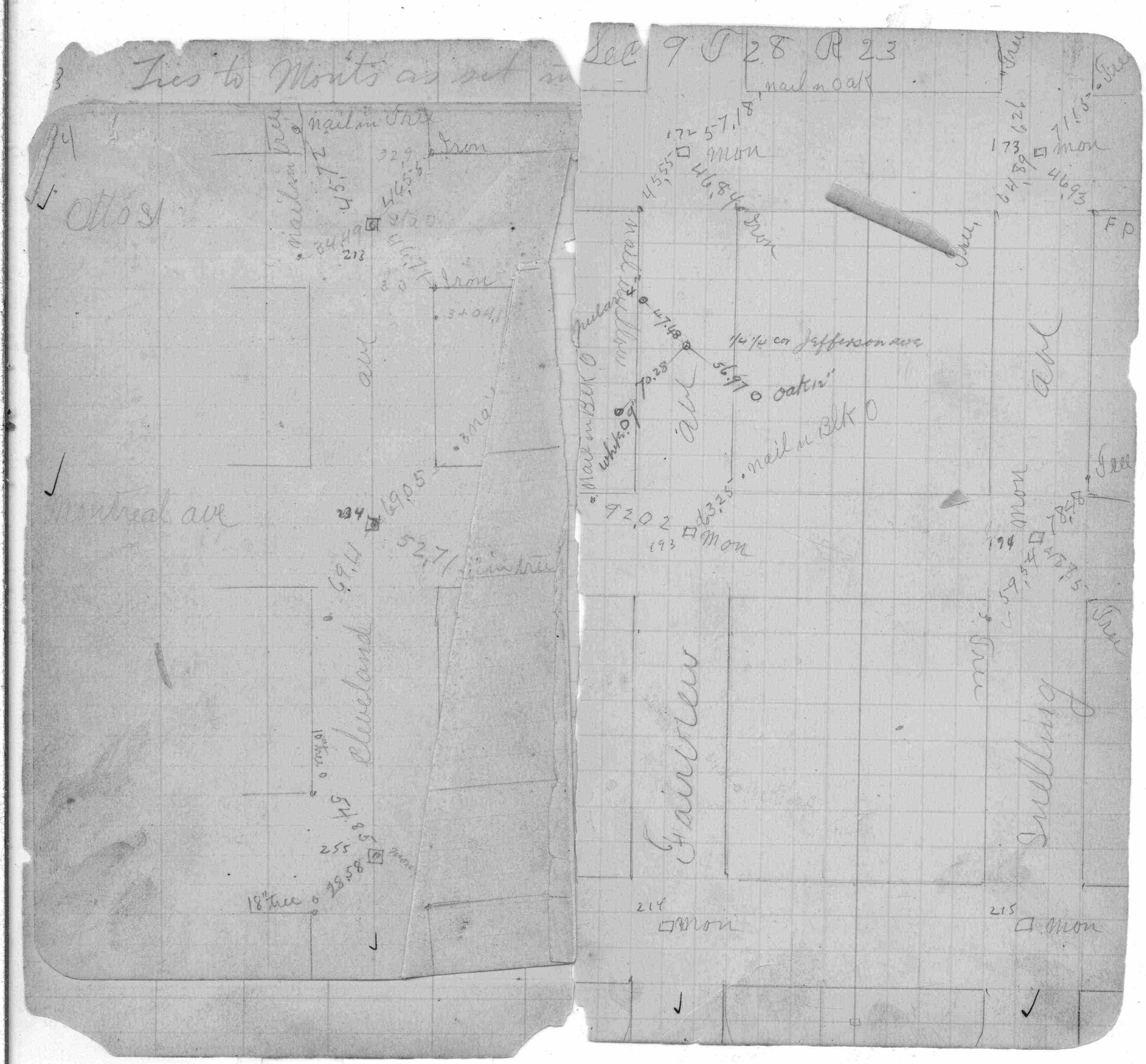
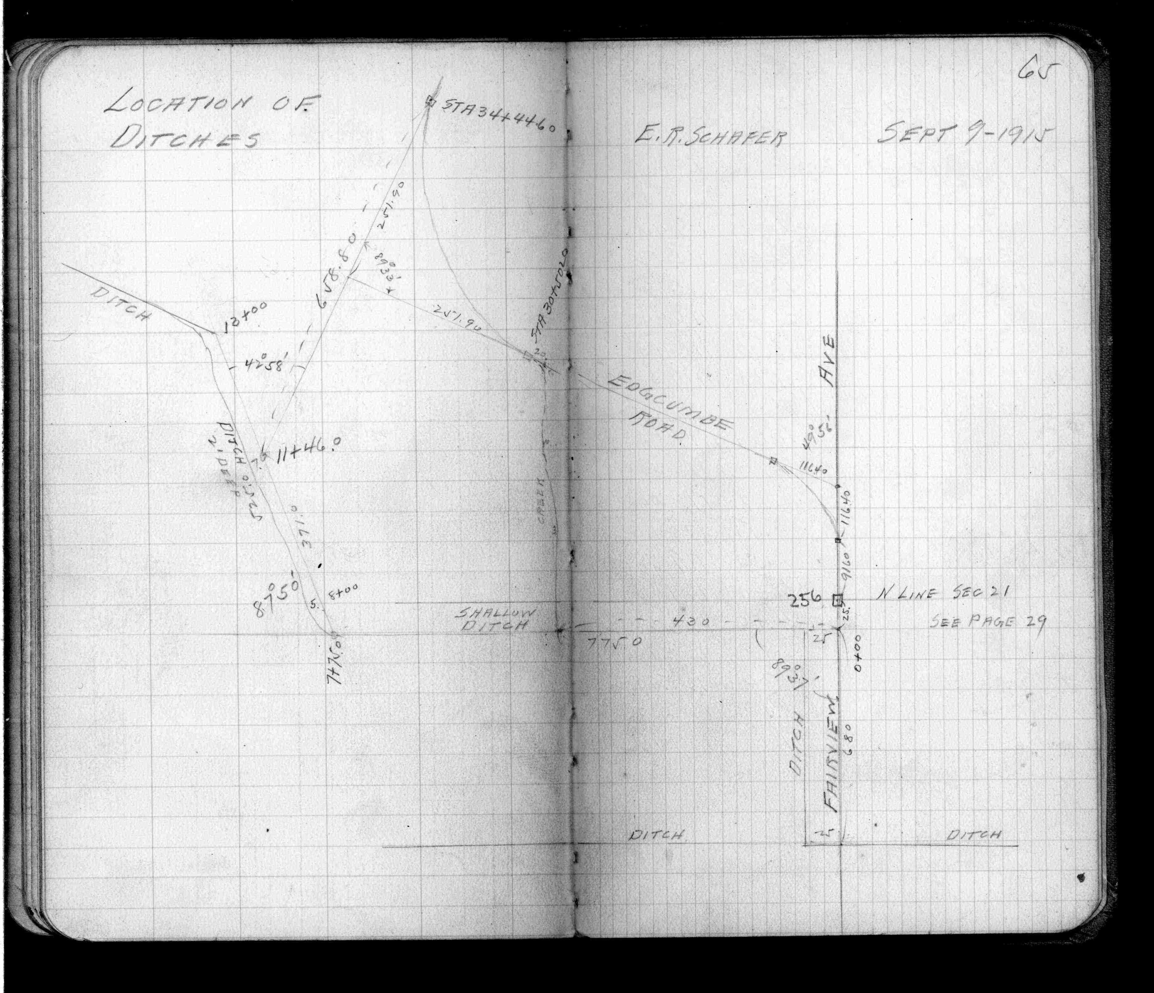
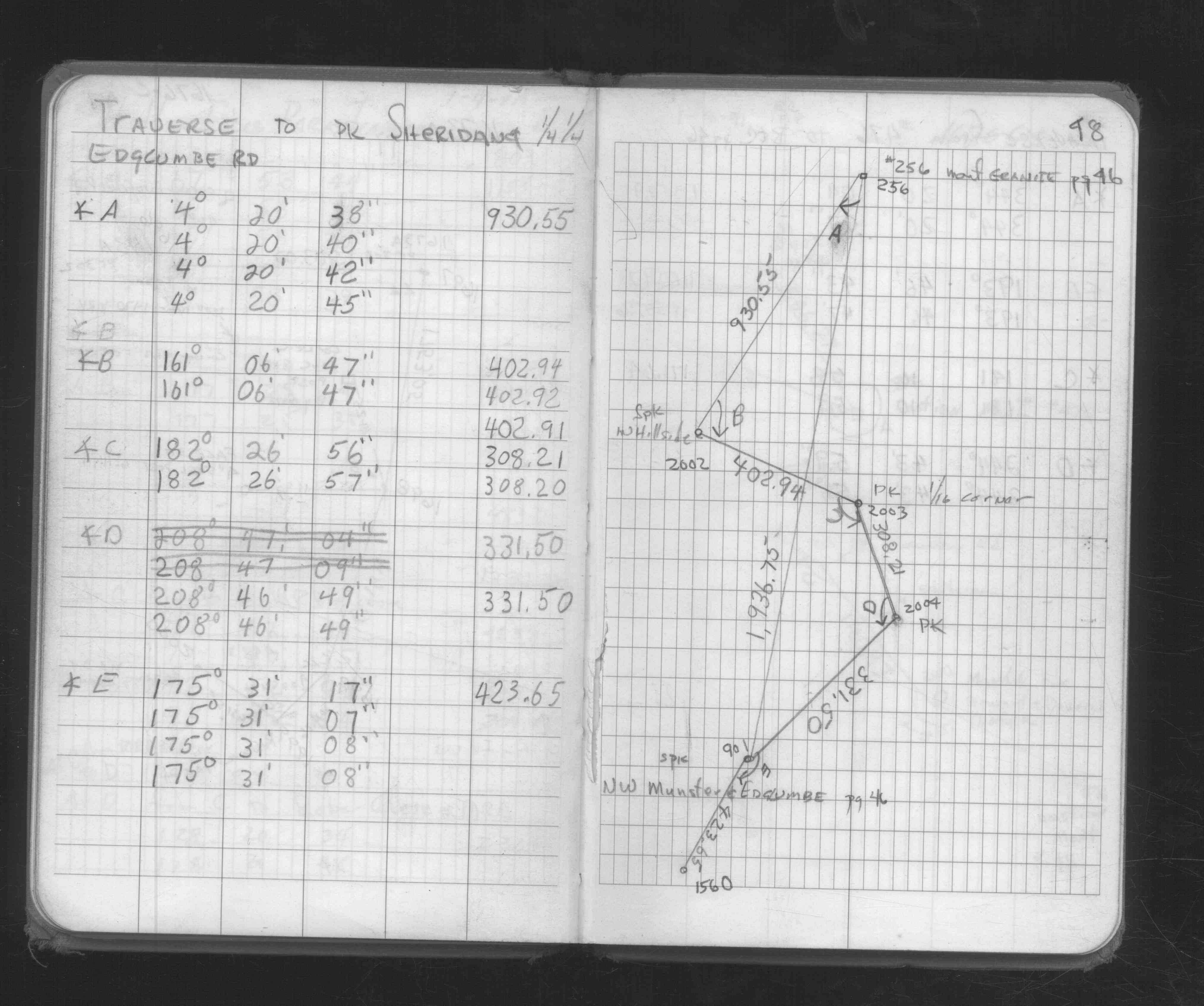
| FB 1689Ap.10 | ||||||
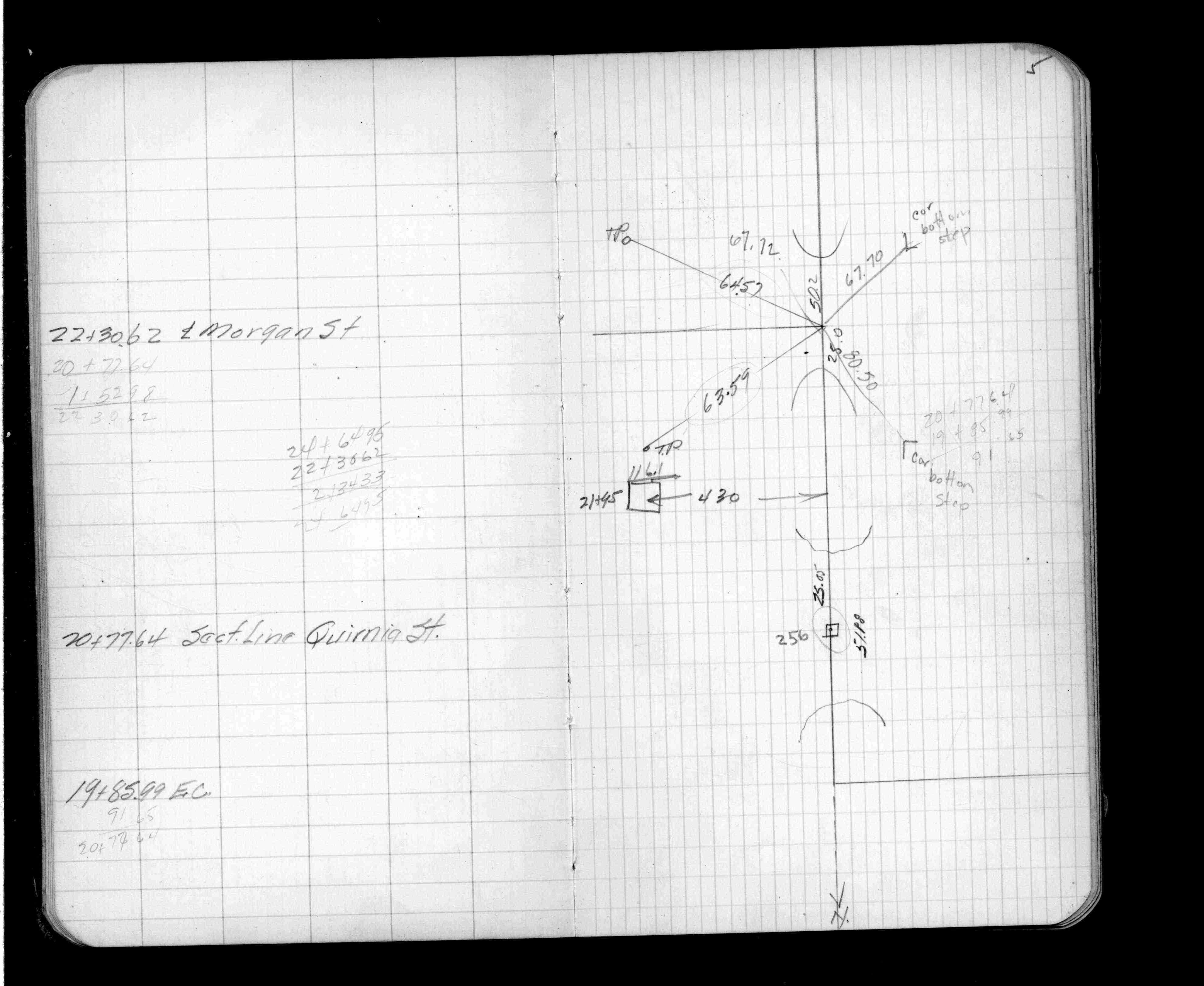
| FB 1719Ap.72 | ||||||
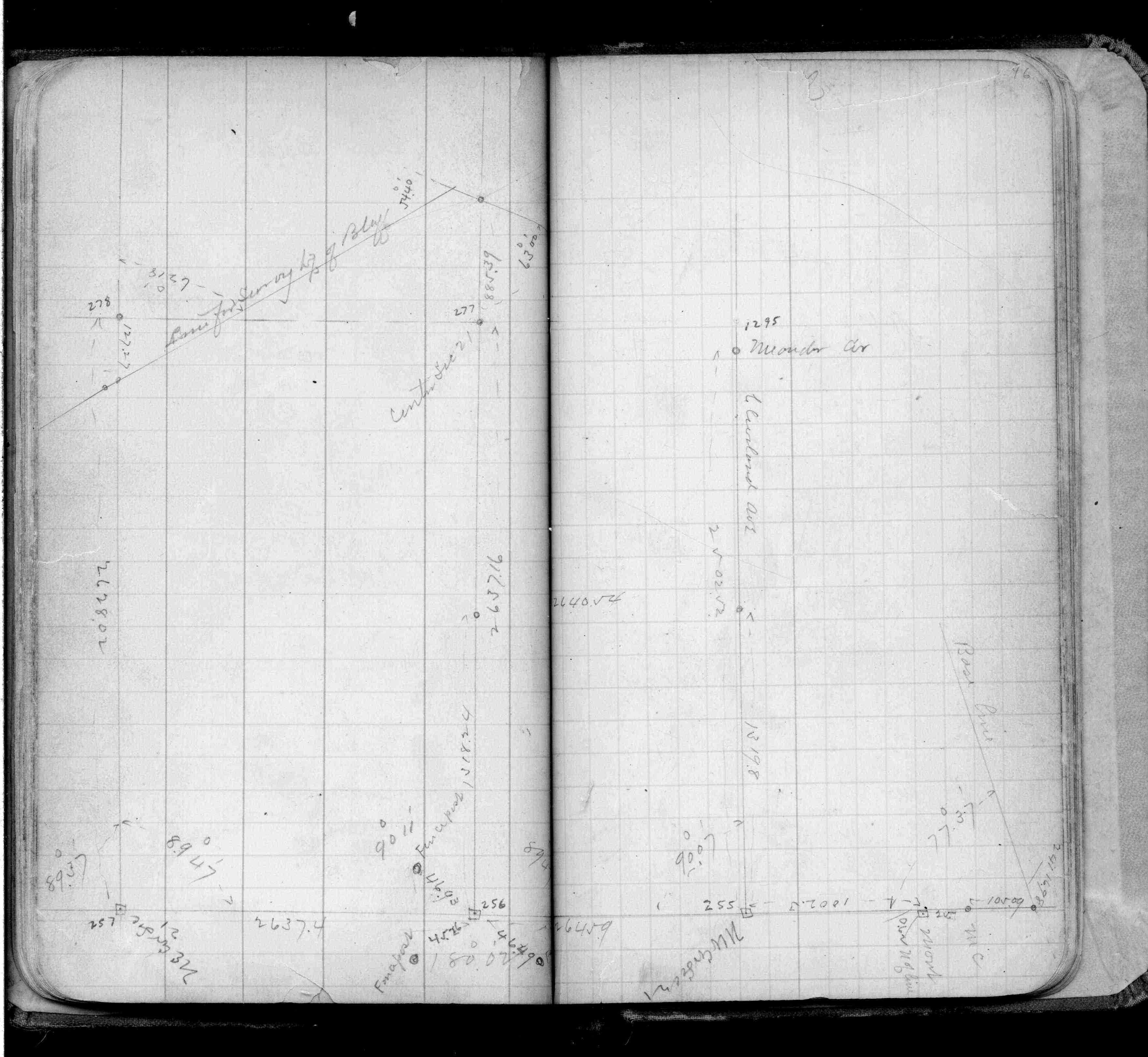
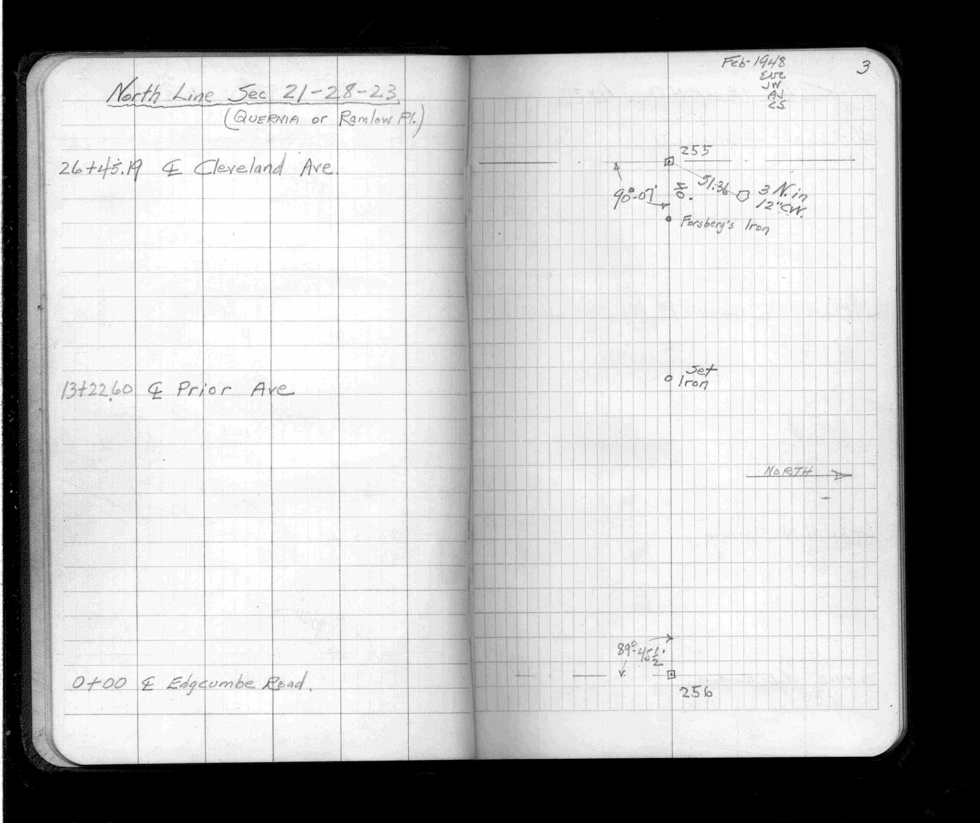
| FB 1736p.33 |
| FILE | SURVEYOR | LIC. NO. | DATE SIGNED | DATE TIED |
|---|---|---|---|---|
| 0256-1291-B.tif | none | none | none | September 25, 1995 |
| 0256-1291-A.tif | William J. Cutting | 20576 | January 14, 1993 | January 11, 1993 |
| ST_235-312p256.jpg | none | none | none | none |
| 0256-1291-A.dwf | none | none | none | none |
| FILE | PHOTO DATE | COMMENTS |
|---|---|---|
| 0256-1291-1.jpg | December 21, 2012 | Close up of monument. |