| NAD83 COORDINATES (1986 adj.): |
|---|
| * X= 561316.469 Y= 141686.025 Z= 000.00 LSQ 12/06/1991 S FLT |
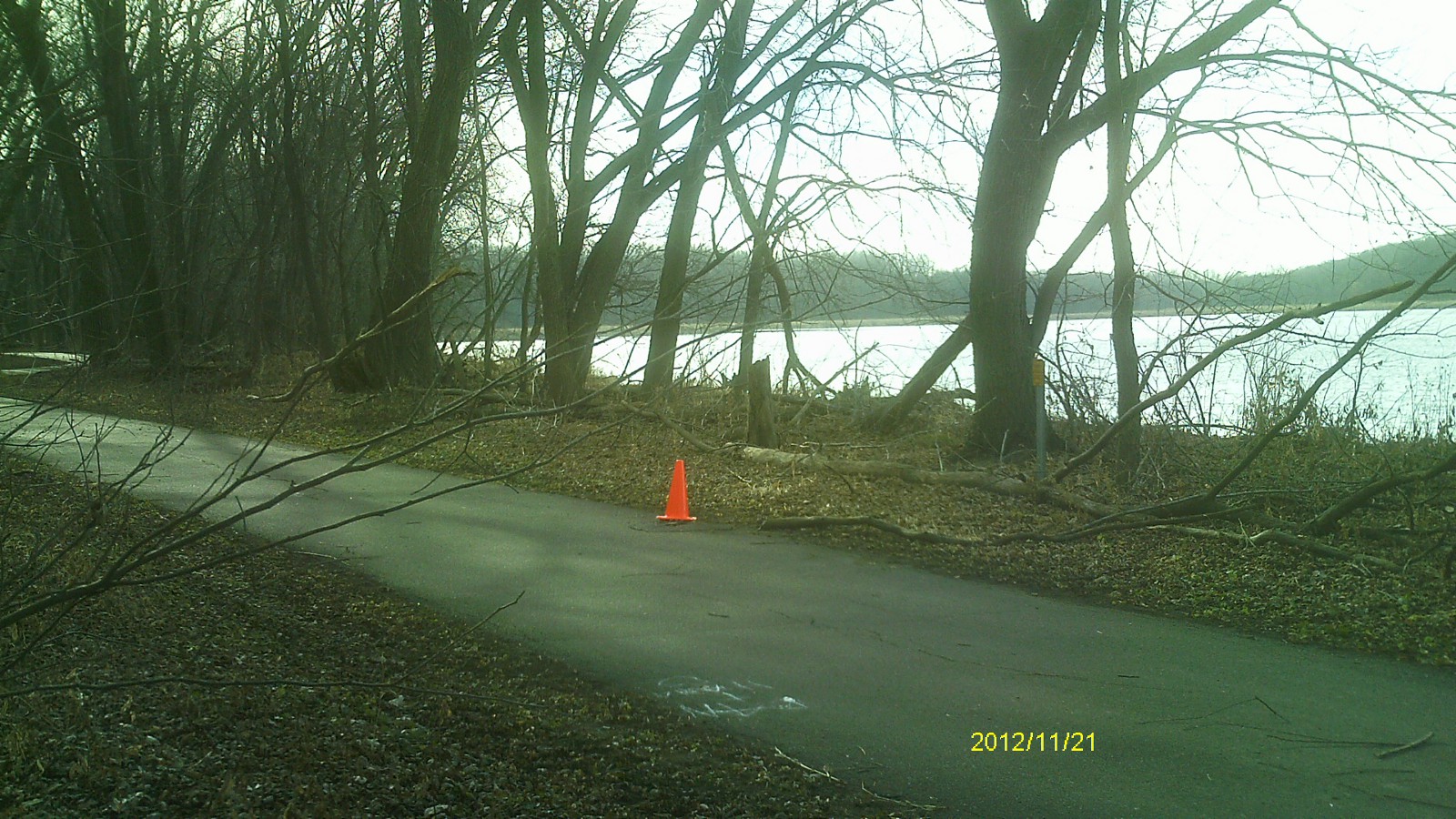
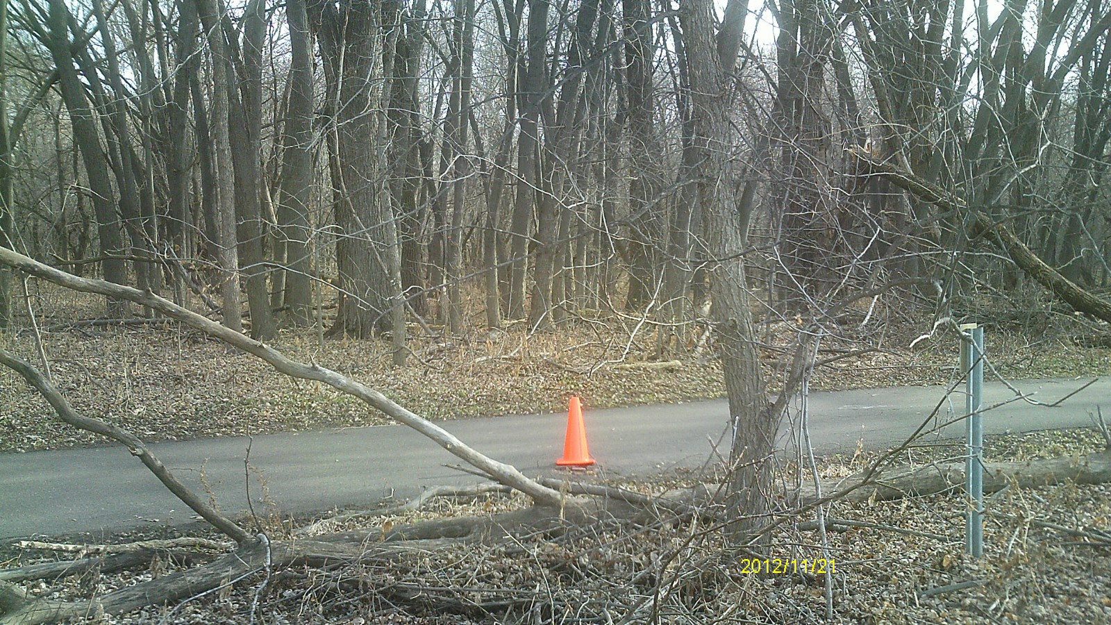
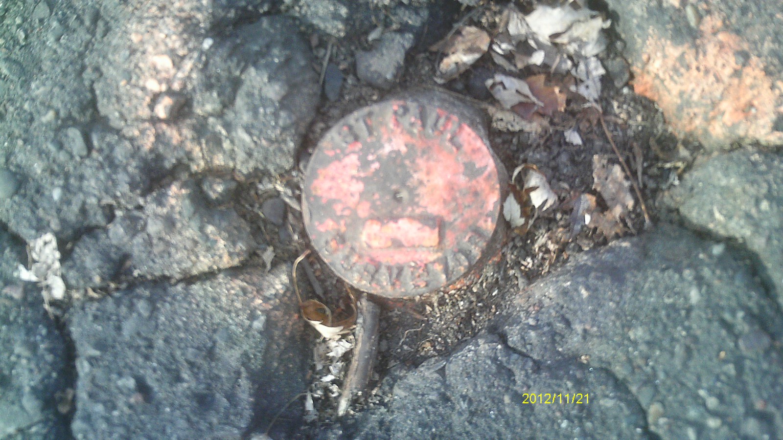
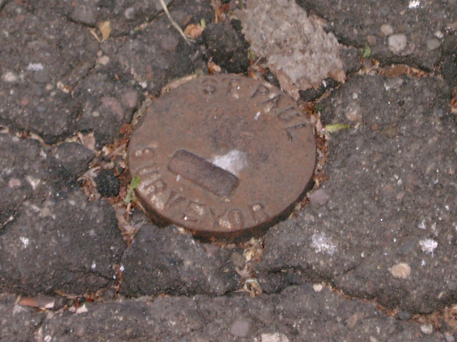
| 11/21/2012 | Found CIM at asphalt grade. Photos taken. |
| 10/6/2008 | Photos Taken. |
| 3/22/2004 | Photos Taken. |
| 4/2/1999 | Set CIM in concrete to grade of asphalt path, placed ties. See CofL 0259-1269-A |
| 3/24/1999 | No monument fd. See CofL 0259-1269-A |
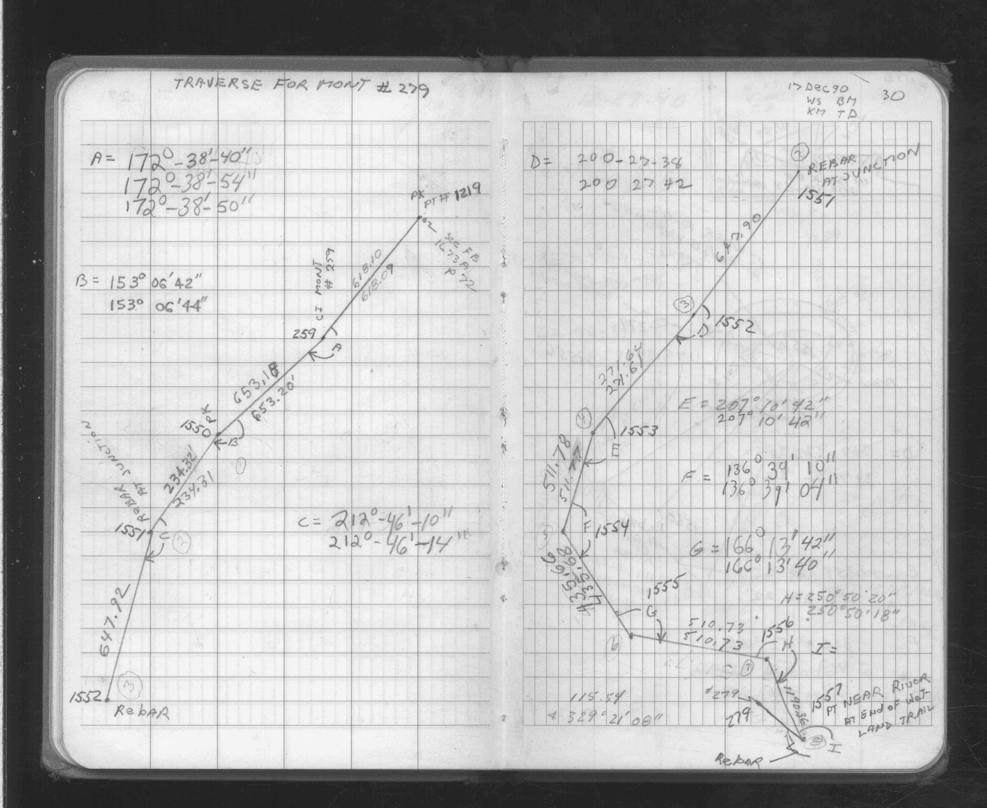
| 12/17/1990 | Traversed through CIM. See FB 1705A p.30 |
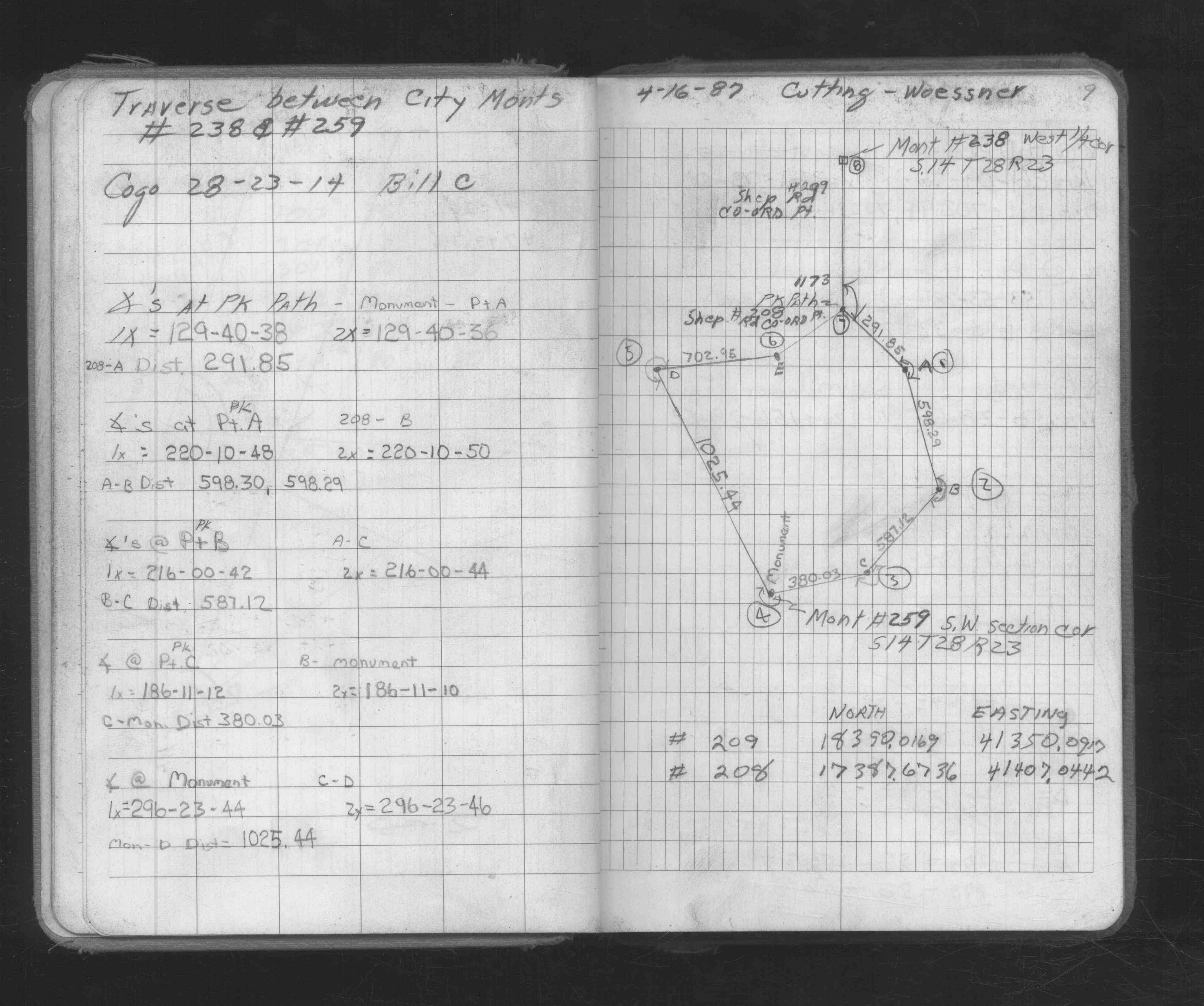
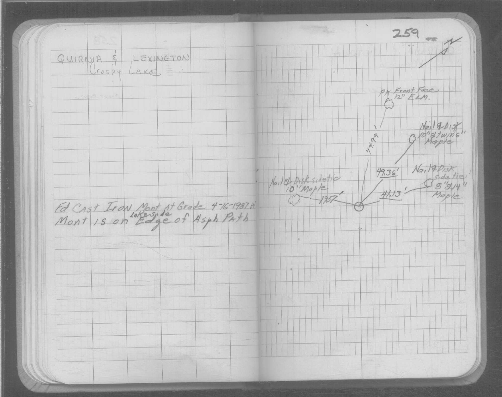
| 4/16/1987 | Traversed through monument. See FB 1673A p.09 |
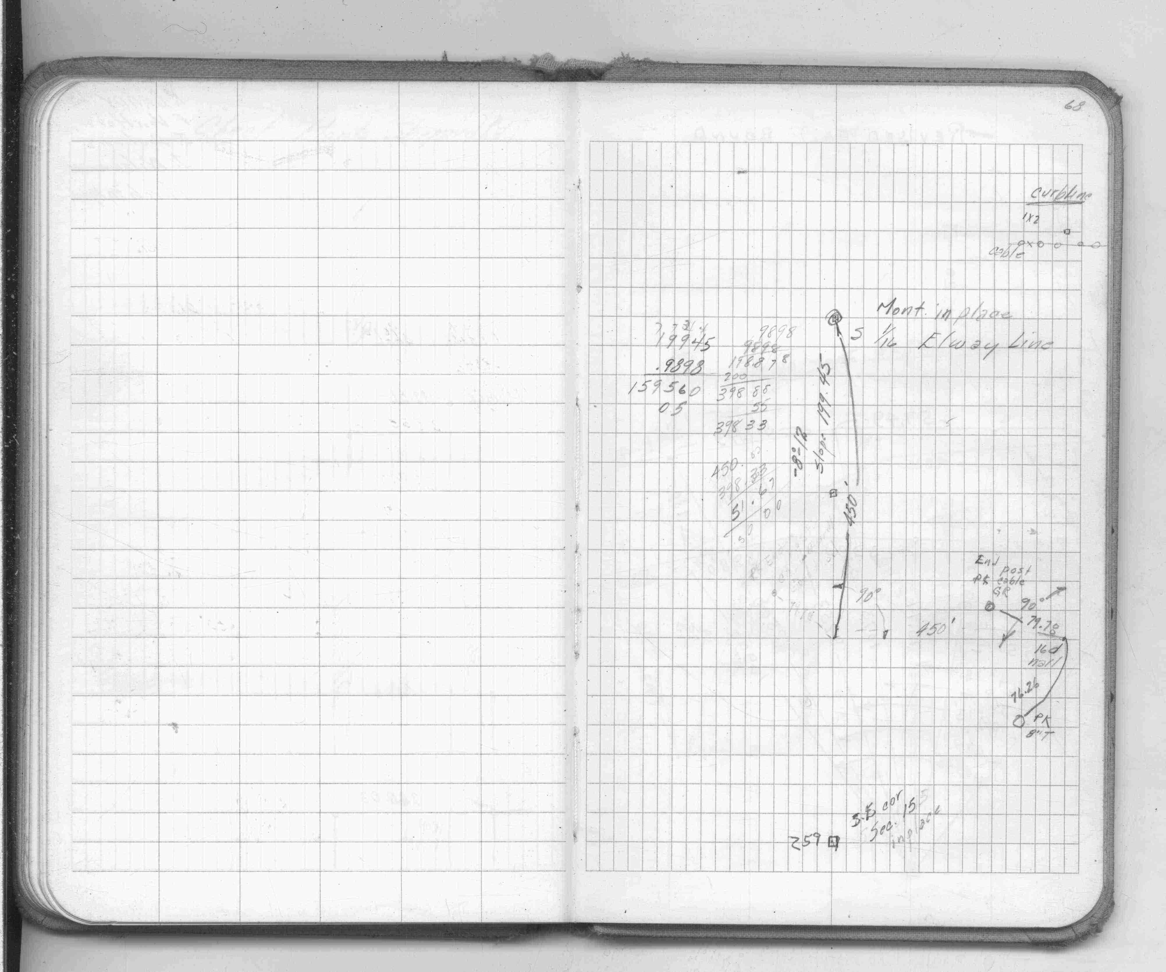
| 4/4/1987 | Fd CIM at grade on lakeside edge of aphalt path. |
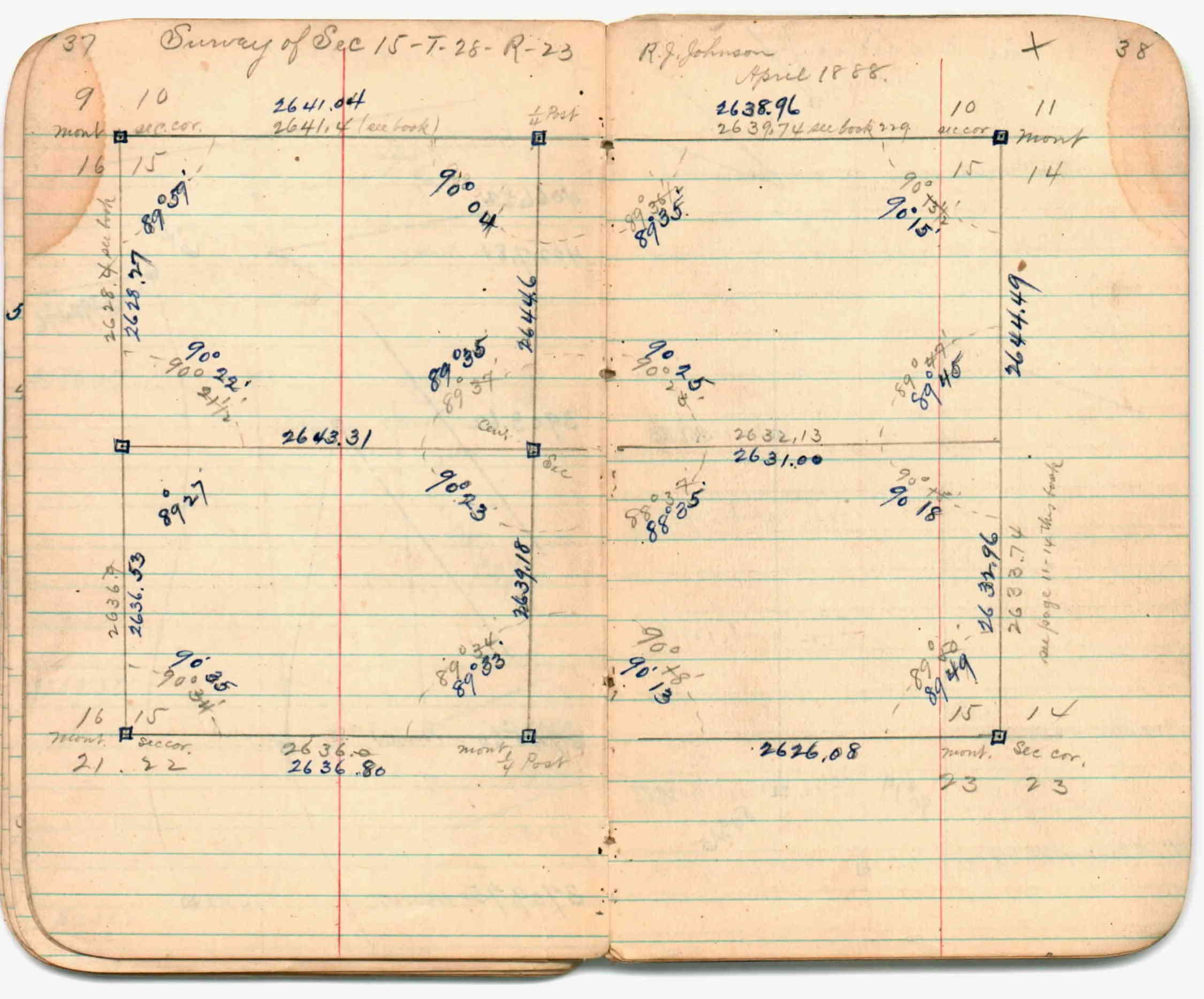
| 4/1/1888 | (Unknown date Apr __, 1888 ) Section break down by R J Johnson. See JBI 01 p.37-38 |
| 2/1/1888 | (Unknown date Feb __, 1888 ) Survey of Section 14-28-23. See JBI 01 p.01-02 |
| 2/1/1888 | (Unknown date Feb __, 1888 ) Monument set by R J Johnson in place of hub which agrees with bearing trees. See FB 236 p.020-021 |
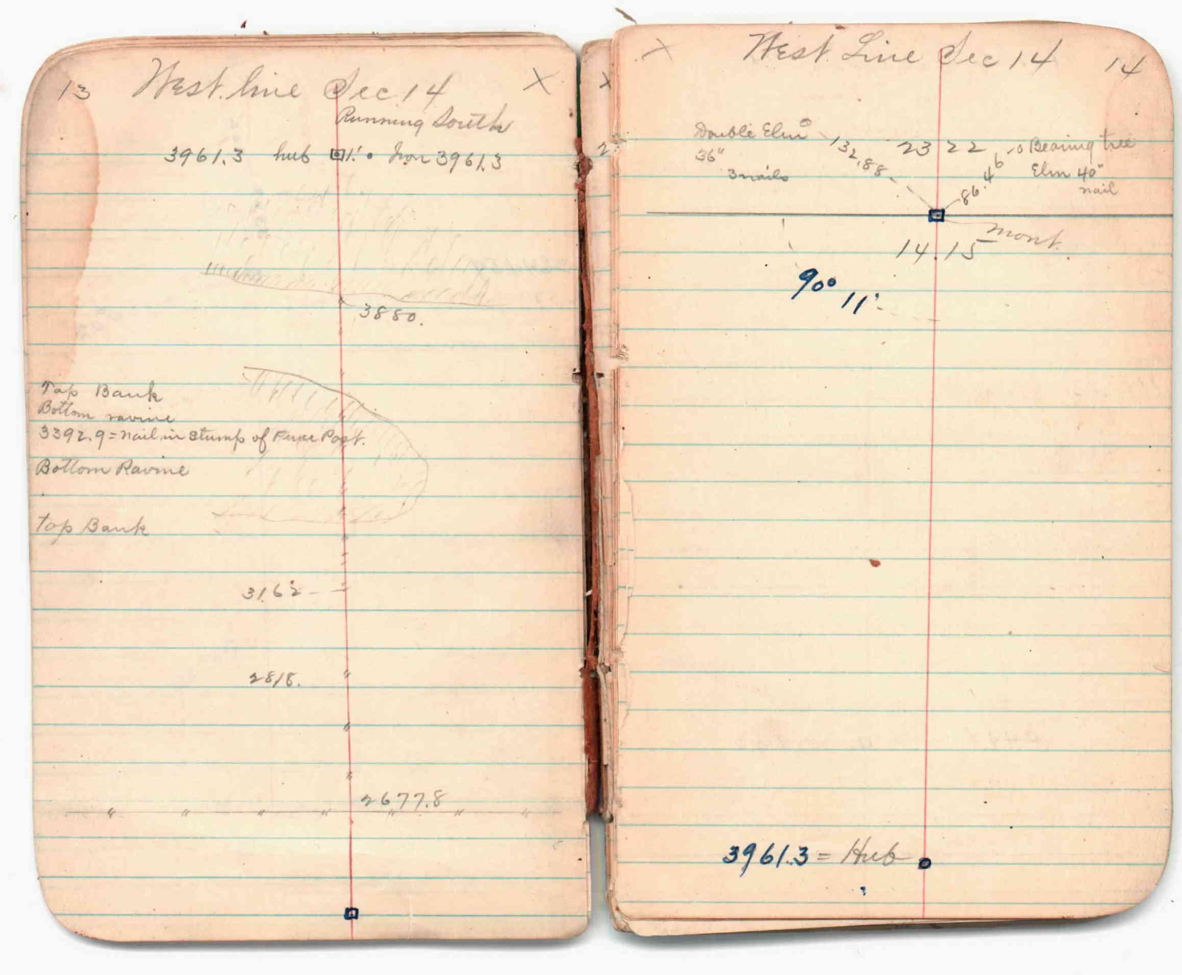
| 2/1/1888 | (Unknown date Feb __, 1888 ) Fd hub corresponding to bearing trees. Survey of south line Sec 14-28-23. See JBI 01 p.09-10,13-14 |
| 10/1/1847 | (Unknown date Oct __, 1847 ) Isaac N Higbee deputy surveyor set post. Tied to 2 BTs. See IH p.006-007 2823 |
Above is NOT an all inclusive history of this point. Please review all the links below.
| PLS NOTES | Field | Cross Section | Sewer | J.B. Irvine | Monument | River Survey |
|---|---|---|---|---|---|---|
| IH p.006-007 | FB 0236p.020-021 | JBI 01 p.01-02 | 1885 p.146-147 p.164-165 | |||
| FB 0236p. 05 ,21 ,29 ,95 | JBI 01 p.01-02 JBI 01 p.09-10 JBI 01 p.13-14 | |||||
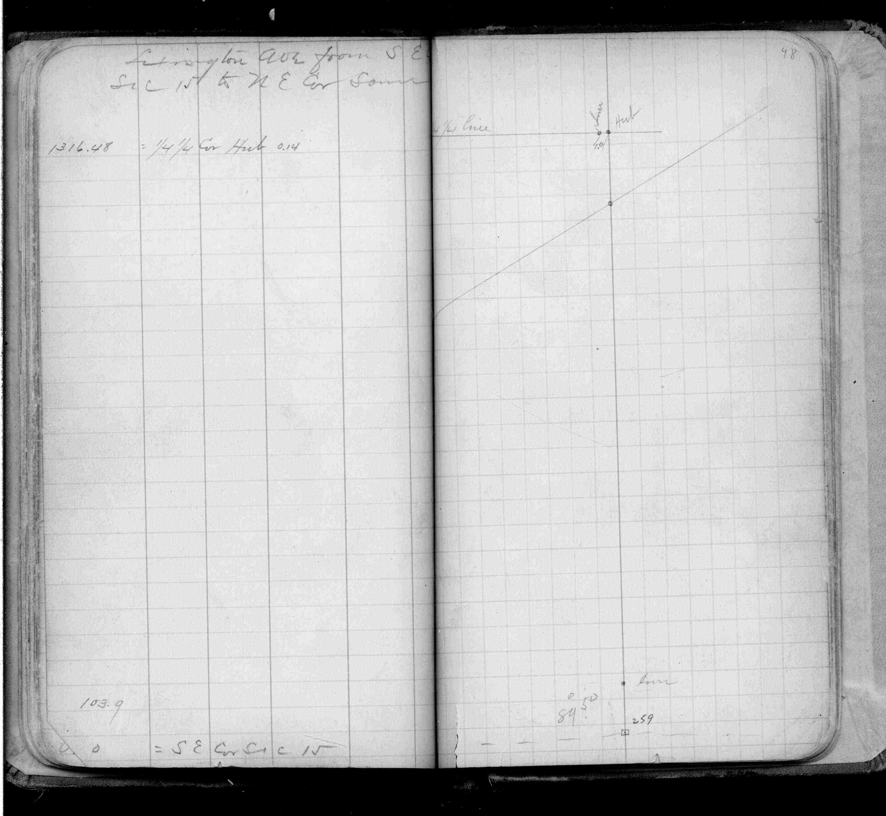
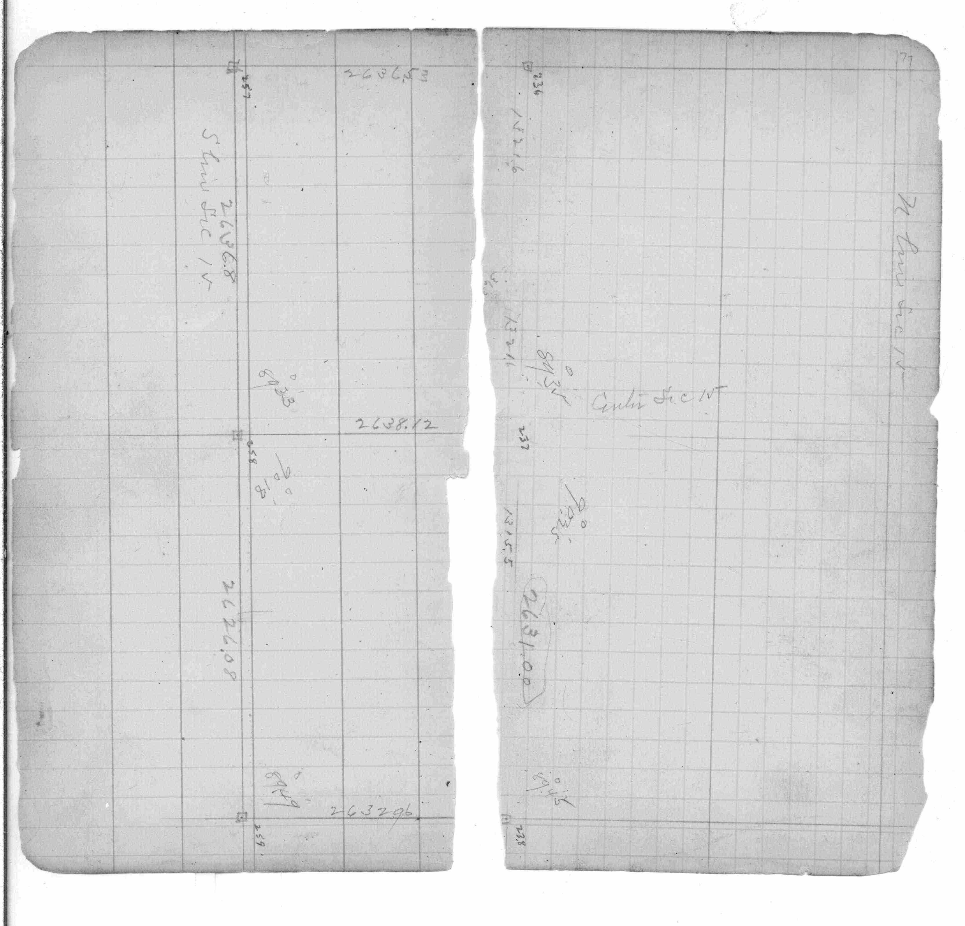
| FB 0253p. 48 ,77 | JBI 01 p.37-38 | |||||
| FB 1514Fp.68 | JBI 01 p.37-38 JBI 01 p.01-02 JBI 01 p.37-38 | |||||
| FB 1673Ap.09 | ||||||
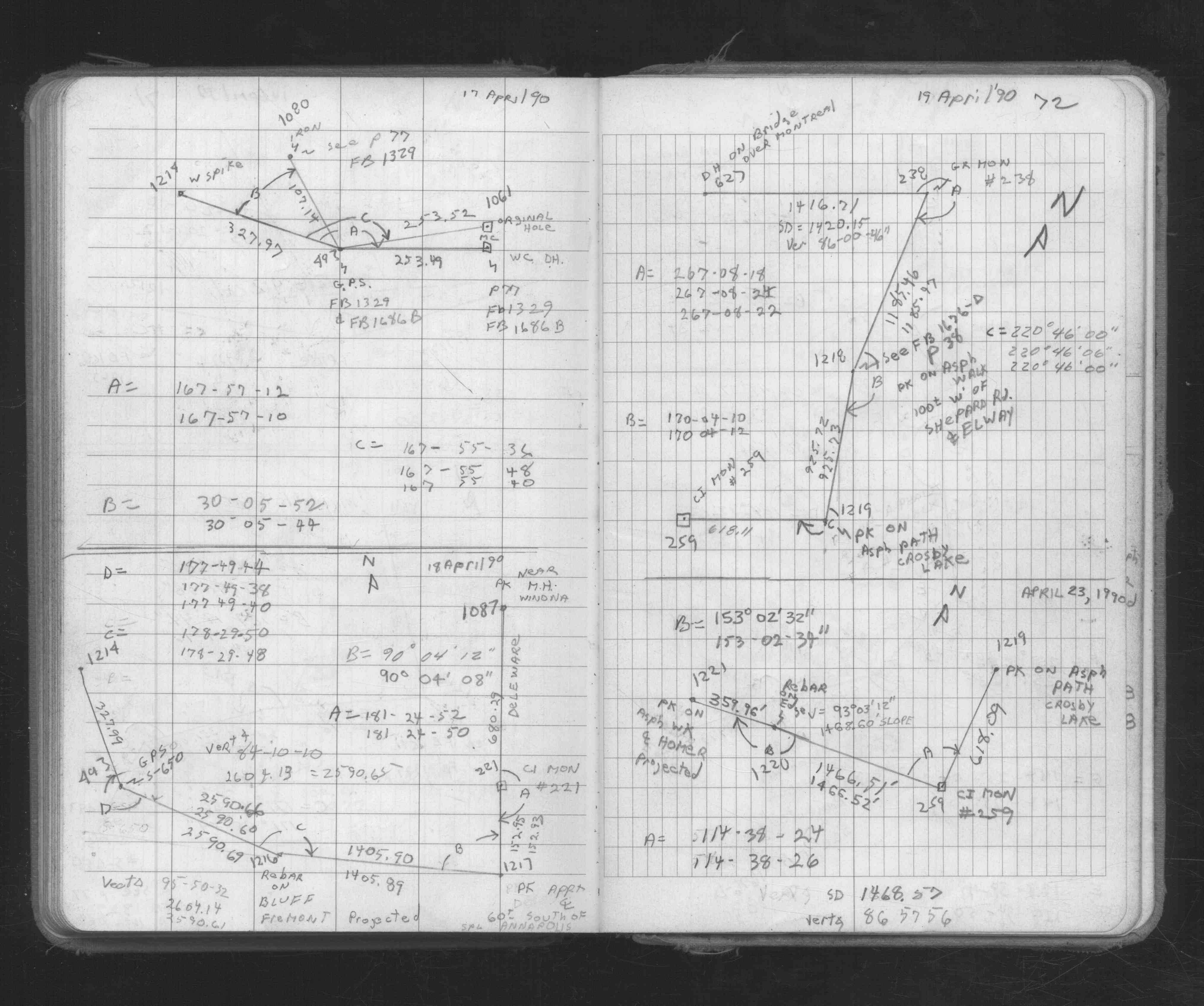
| FB 1673Ap. 09 ,72 | ||||||
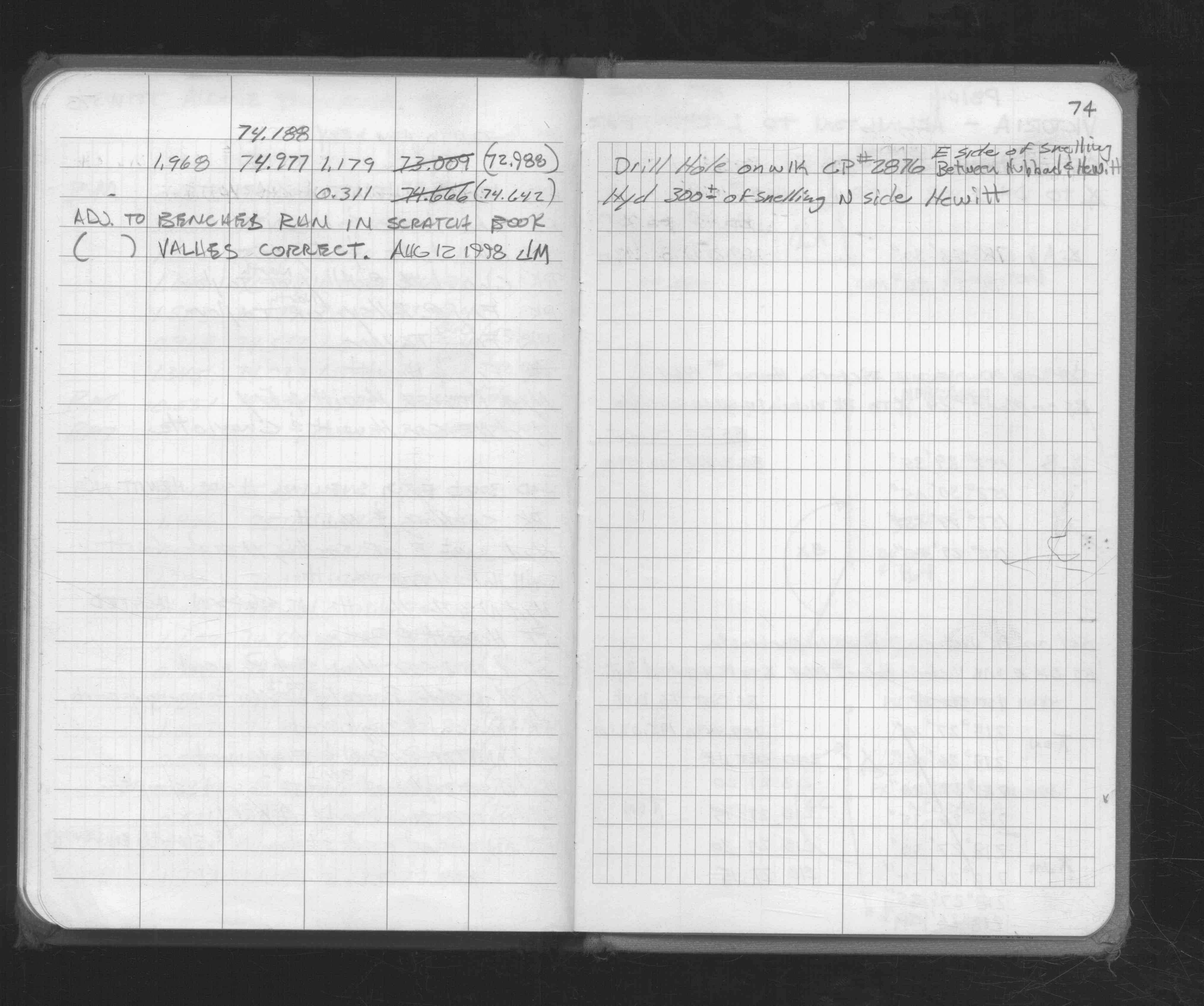
| FB 1676Dp.74 | ||||||
| FB 1705Ap.30 |
| FILE | SURVEYOR | LIC. NO. | DATE SIGNED | DATE TIED |
|---|---|---|---|---|
| 0259-1269-A.tif | Jeffery L. Grosso | 13144 | May 10, 1999 | April 2, 1999 |
| ST_235-312p259.jpg | none | none | none | none |
| 0259-1269-A.dwf | none | none | none | none |
| FILE | PHOTO DATE | COMMENTS |
|---|---|---|
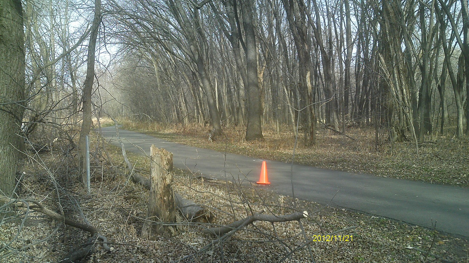
| 0259-1269-15.jpg | November 21, 2012 | Looking west. |
| 0259-1269-14.jpg | November 21, 2012 | Looking south. |
| 0259-1269-13.jpg | November 21, 2012 | Looking east. |
| 0259-1269-12.jpg | November 21, 2012 | Looking north. |
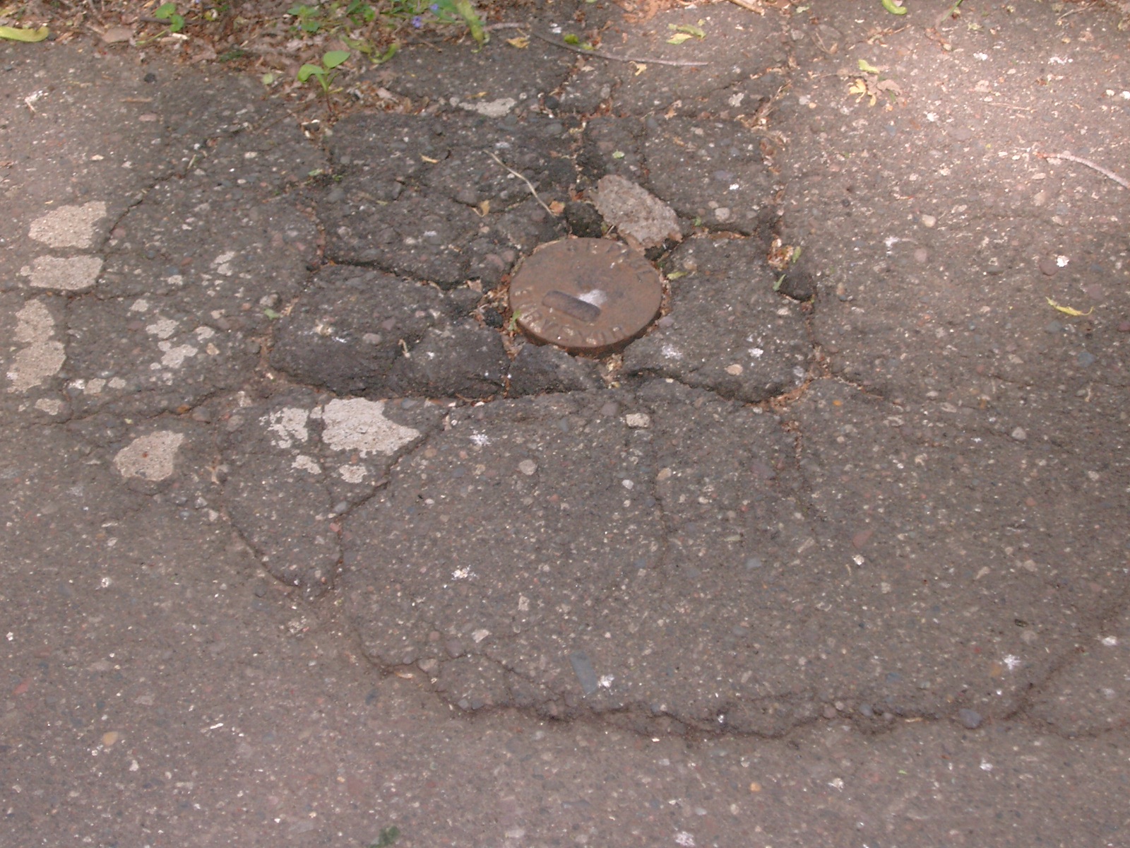
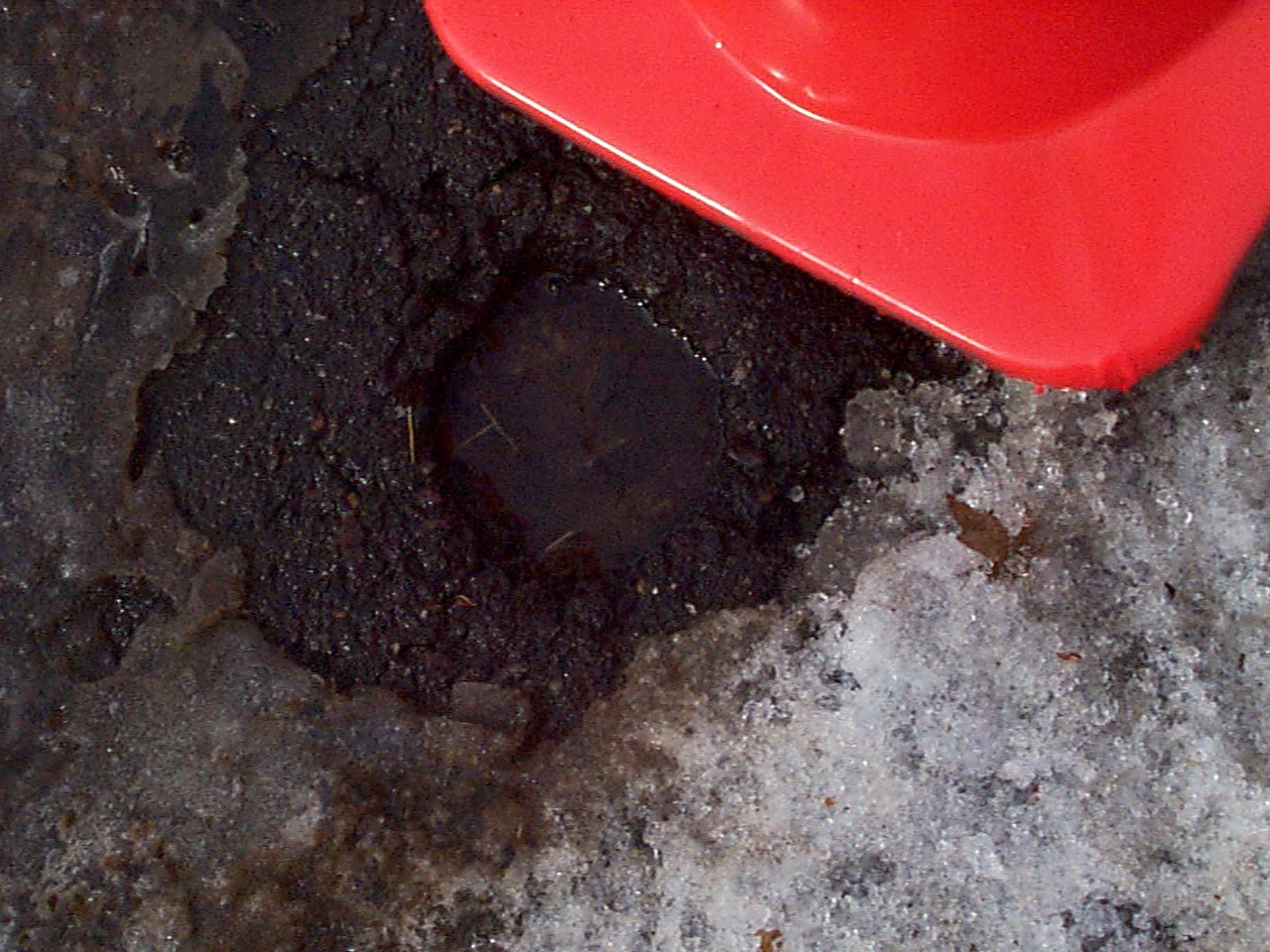
| 0259-1269-11.jpg | November 21, 2012 | Close up of monument. |
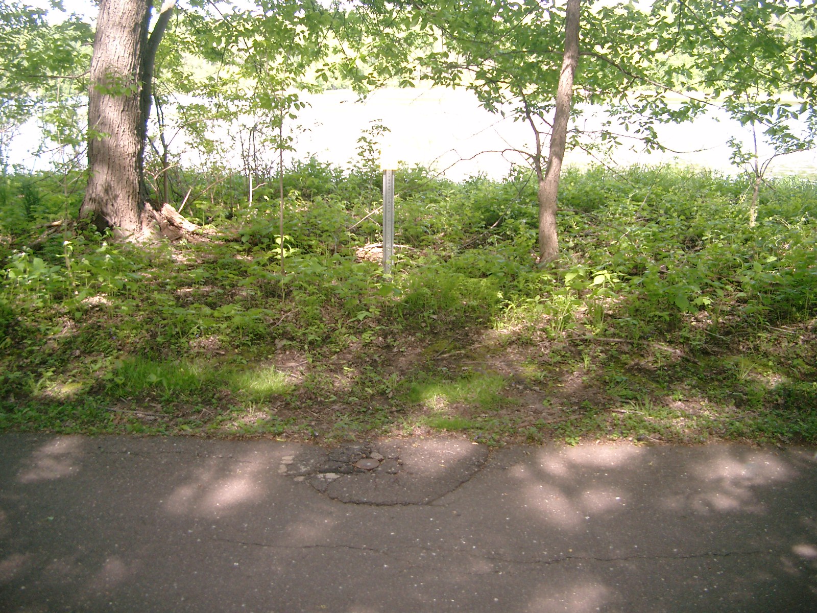
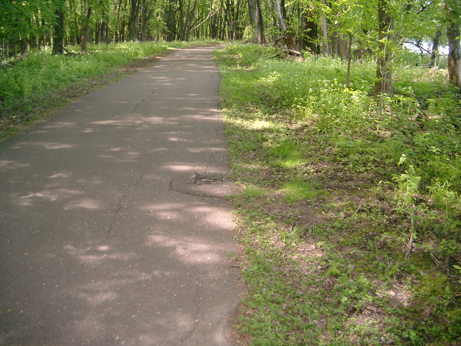
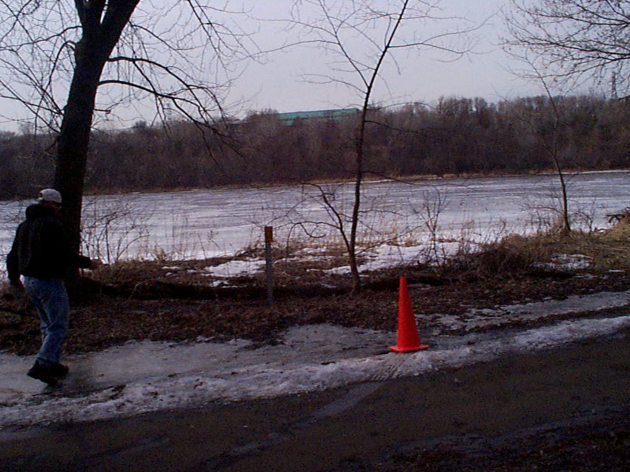
| 0259-1269-9.jpg | October 6, 2008 | Looking at CIM & witness post, Northwesterly side of path. |
| 0259-1269-8.jpg | October 6, 2008 | Looking at CIM, Northwesterly side of path. |
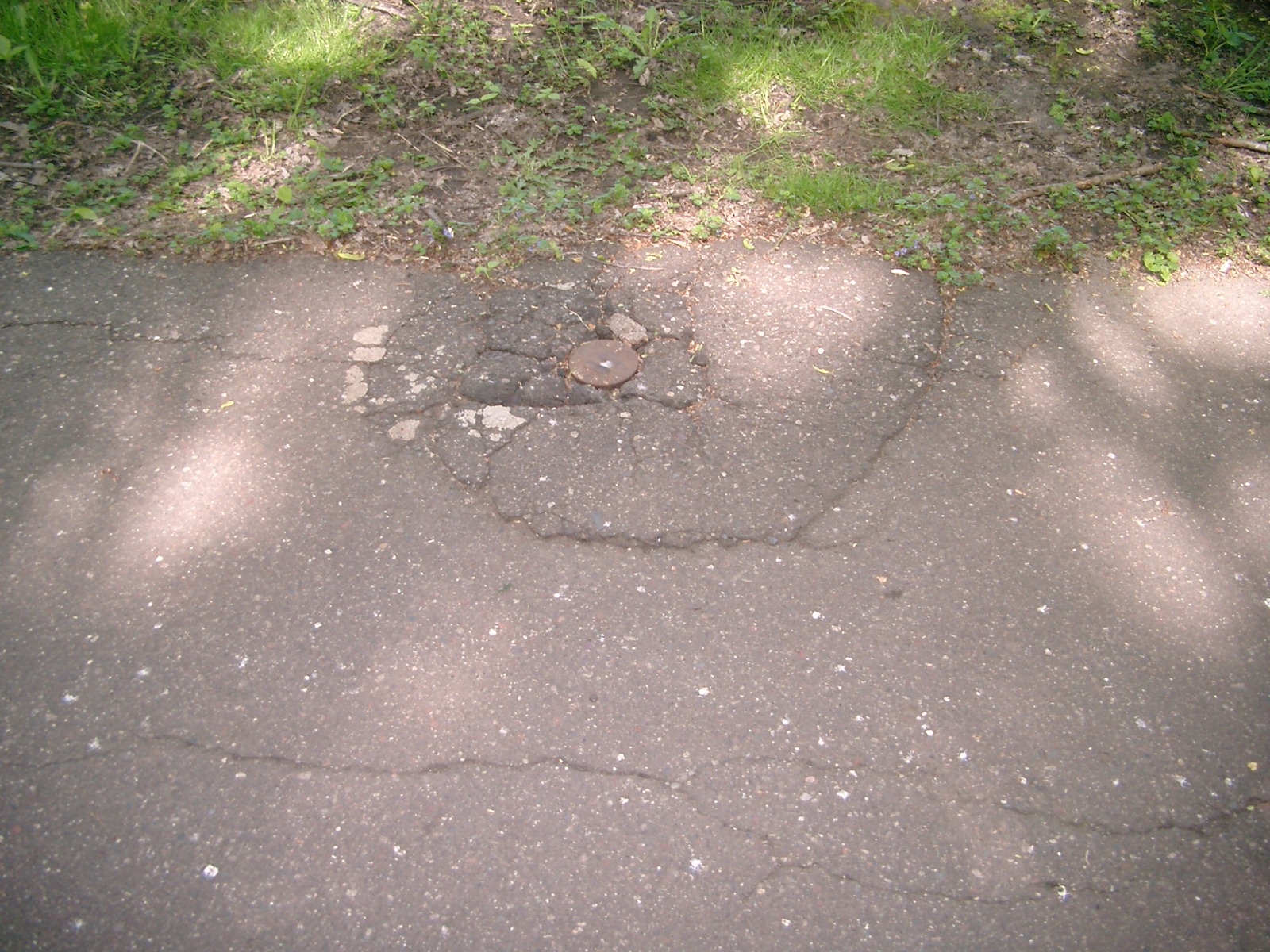
| 0259-1269-7.jpg | October 6, 2008 | Close-up of CIM at grade of path. |
| 0259-1269-6.jpg | October 6, 2008 | Extreme close-up of CIM at grade of path. |
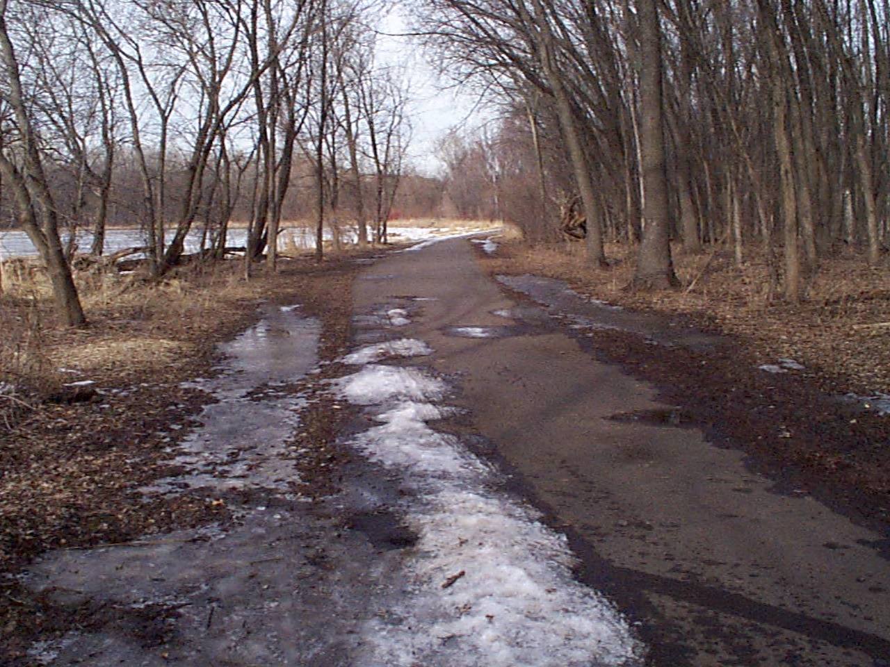
| 0259-1269-10.jpg | October 6, 2008 | Looking Southwest along path, CIM in foreground. |
| 0259-1269-5.jpg | March 22, 2004 | Looking Northeast from the path. |
| 0259-1269-3.jpg | March 22, 2004 | Close-up of CIM in the asphalt path. |
| 0259-1269-2.jpg | March 22, 2004 | Looking North from the path. |
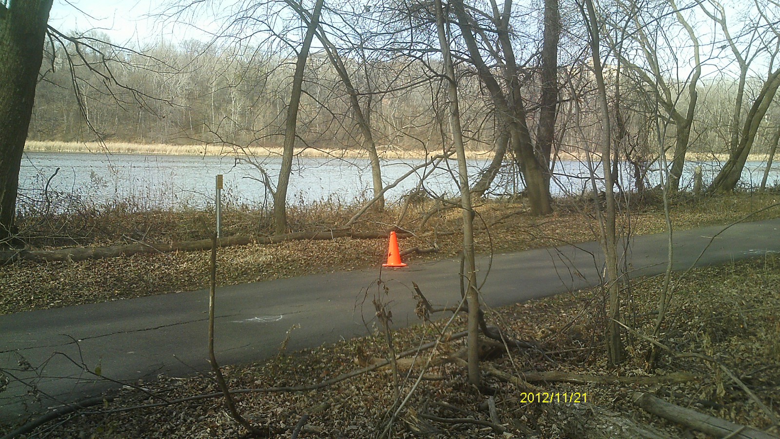
| 0259-1269-1.jpg | March 22, 2004 | Looking Northwesterly toward the lake from the path. |