| NAD83 COORDINATES (1986 adj.): |
|---|
| X= 566613.961 Y= 141716.202 Z= 000.00 CMP 08/29/1996 |
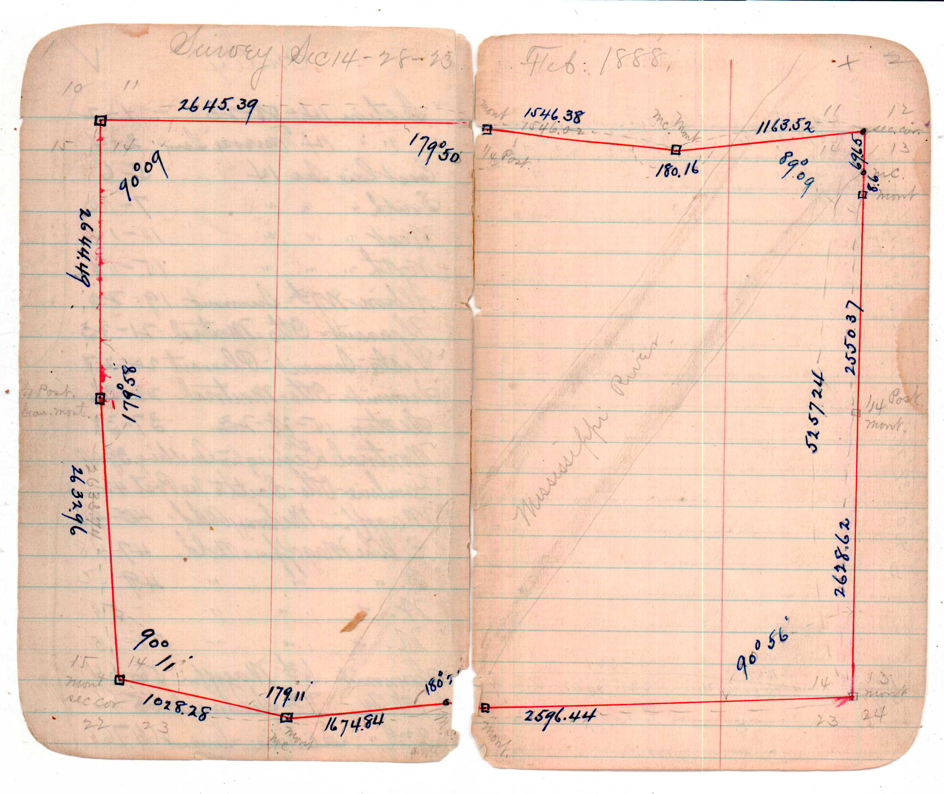
| 2/1/1888 | (Unknown date Feb __, 1888 ) Monument set from bearing tree and in place of old stake. R J Johnson. See 236 p10 |
Above is NOT an all inclusive history of this point. Please review all the links below.
| PLS NOTES | Field | Cross Section | Sewer | J.B. Irvine | Monument | River Survey |
|---|---|---|---|---|---|---|
| FB 0236p. 05 ,11 ,15 | JBI 01 p.01-02 | 1885 p.164-165 |
| FILE | SURVEYOR | LIC. NO. | DATE SIGNED | DATE TIED |
|---|---|---|---|---|
| ST_235-312p261.jpg | none | none | none | none |
| 0261-1272-A.dwf | none | none | none | none |