| NAD83 COORDINATES (1986 adj.): |
|---|
| * X= 592931.765 Y= 141742.836 Z= 000.00 LSQ 12/06/1991 S FLT |
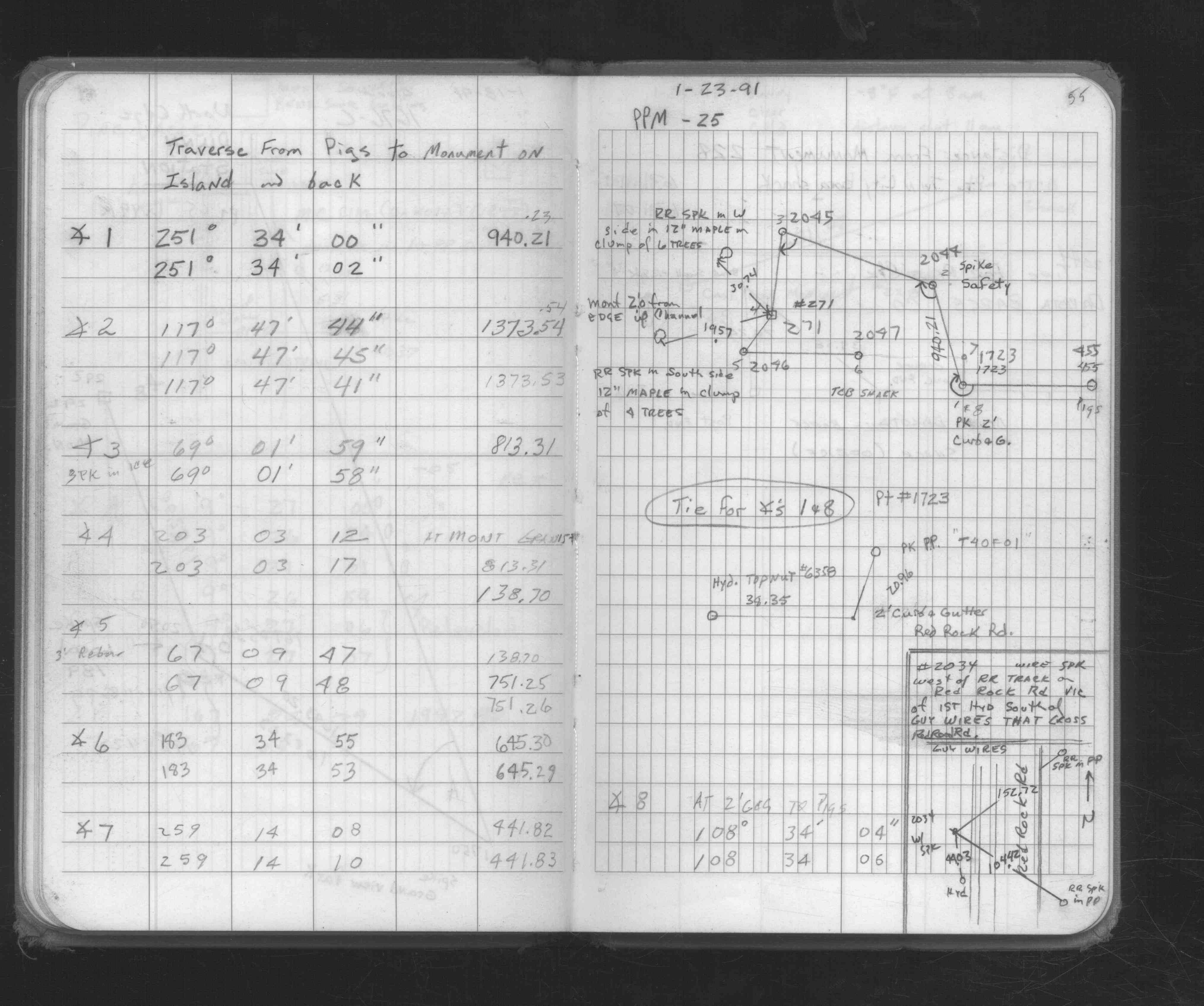
| 1/23/1991 | Traversed through GM and tied. See 1676C p.55 |
| 1/1/1991 | (Unknown date Jan __, 1991 ) GM with 3/4" Iron pin along the E. edge of monument |
| 1/1/1991 | (Unknown date Jan __, 1991 ) Fd GM with 3/4" dia iron pin on east edge, placed ties, left GM as fd. See CofL 0271-2659-B |
| 3/31/1976 | MnDot placed a 3/4" dia iron pin along the east edge of GM for metal detection. See CofL 0271-2659-A |
| 3/31/1976 | MnDot fd 8"x8" GM 0.5 ft below grade & steel fence post 1 ft west of GM, left GM as fd. See CofL 0271-2659-A |
| 1/1/1892 | (Unknown date ___ __, 1892 ) Monument set by J H Armstrong |
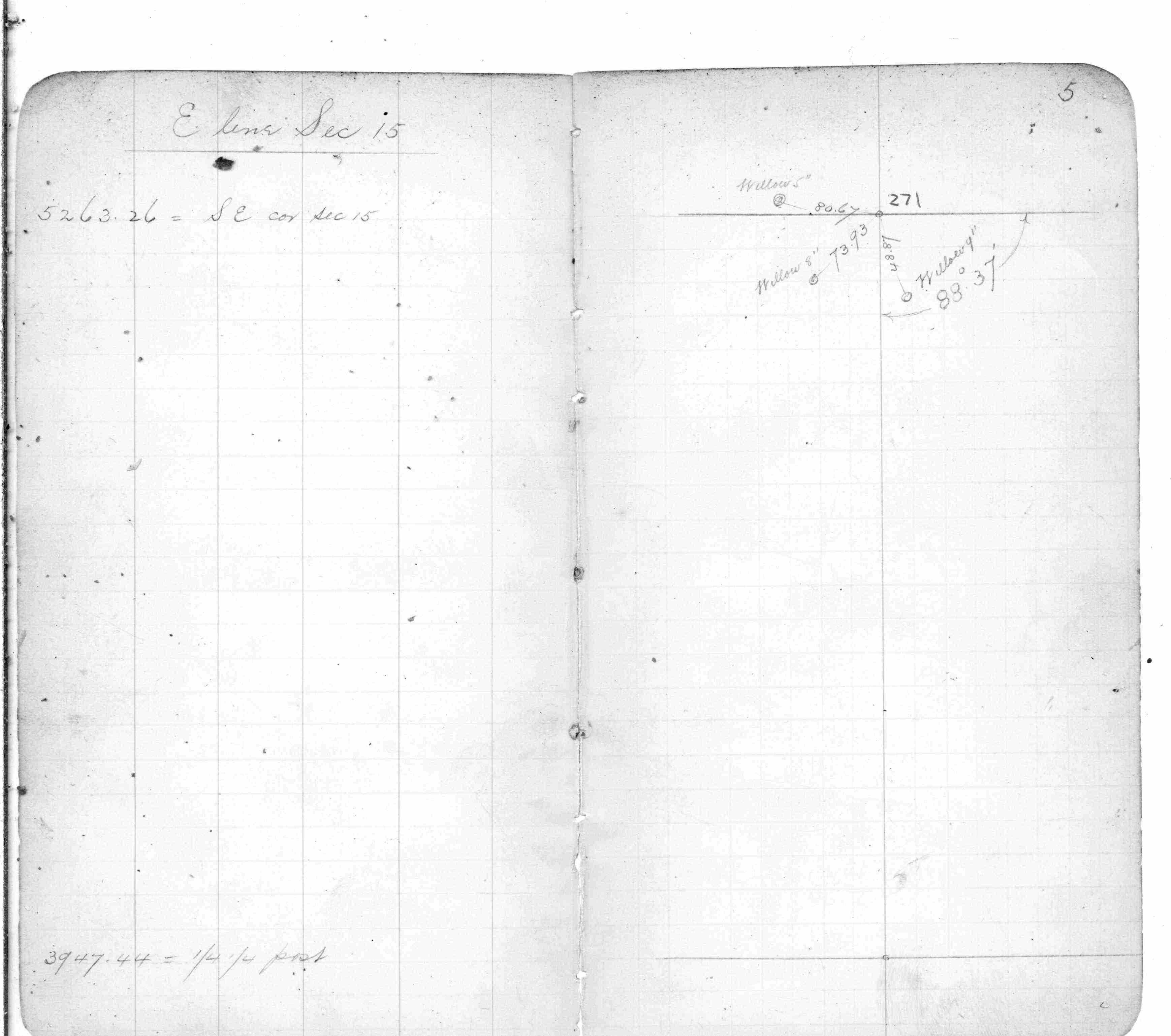
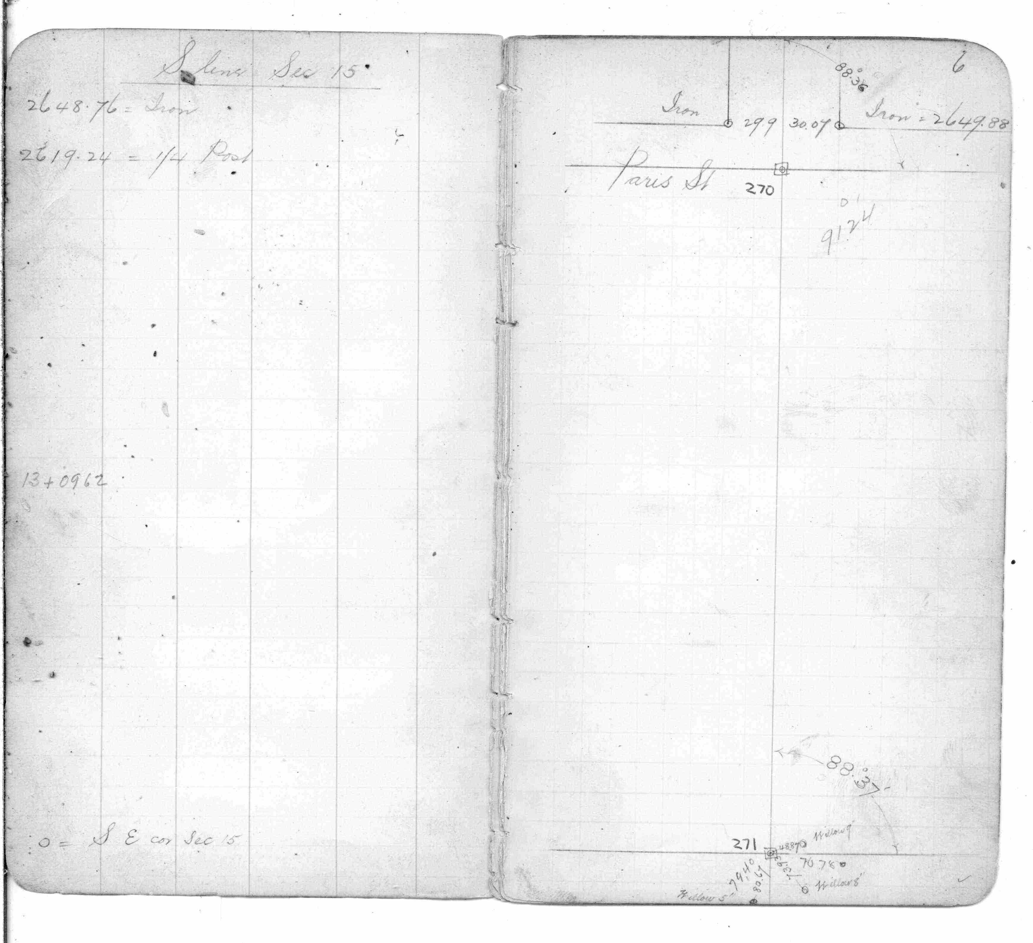
| 10/1/1847 | (Unknown date Oct __, 1847 ) Isaac N Higbee deputy surveyor set post. Tied to 2 BTs. See IH p.078-079 2822 |
Above is NOT an all inclusive history of this point. Please review all the links below.
| PLS NOTES | Field | Cross Section | Sewer | J.B. Irvine | Monument | River Survey |
|---|---|---|---|---|---|---|
| IH p.078-079 | FB 0357p. 05 ,06 ,67 | |||||
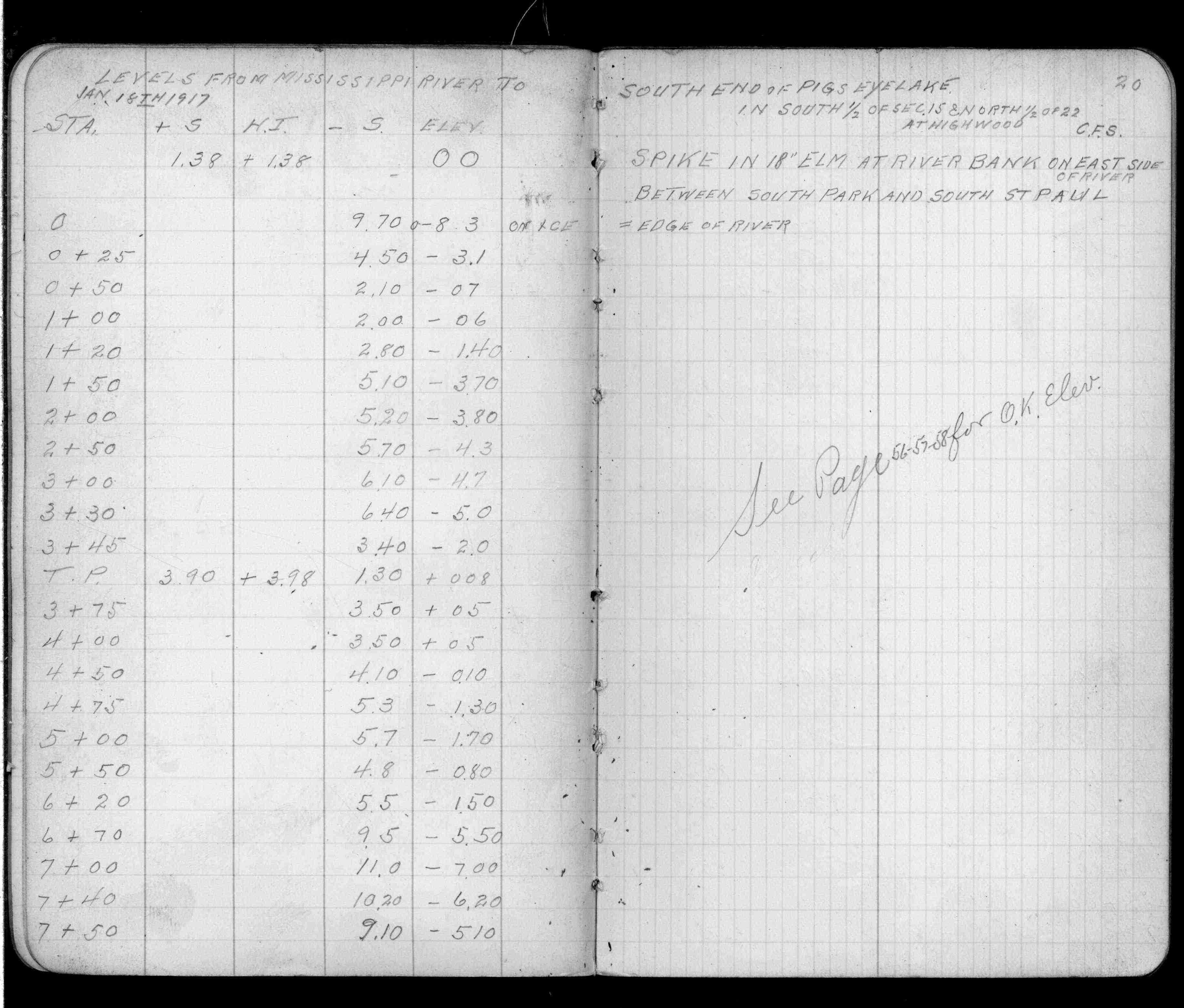
| FB 0893p. 19 ,20 | ||||||
| FB 1676Cp.55 |
| FILE | SURVEYOR | LIC. NO. | DATE SIGNED | DATE TIED |
|---|---|---|---|---|
| 0271-2659-B.tif | William J. Cutting | 20576 | January 29, 1991 | January 1, 1995 |
| 0271-2659-A.tif | David D. Pearson | 11752 | May 24, 1976 | March 31, 1976 |
| ST_235-312p271.jpg | none | none | none | none |
| 0271-2659-A.dwf | none | none | none | none |