| NAD83 COORDINATES (1986 adj.): |
|---|
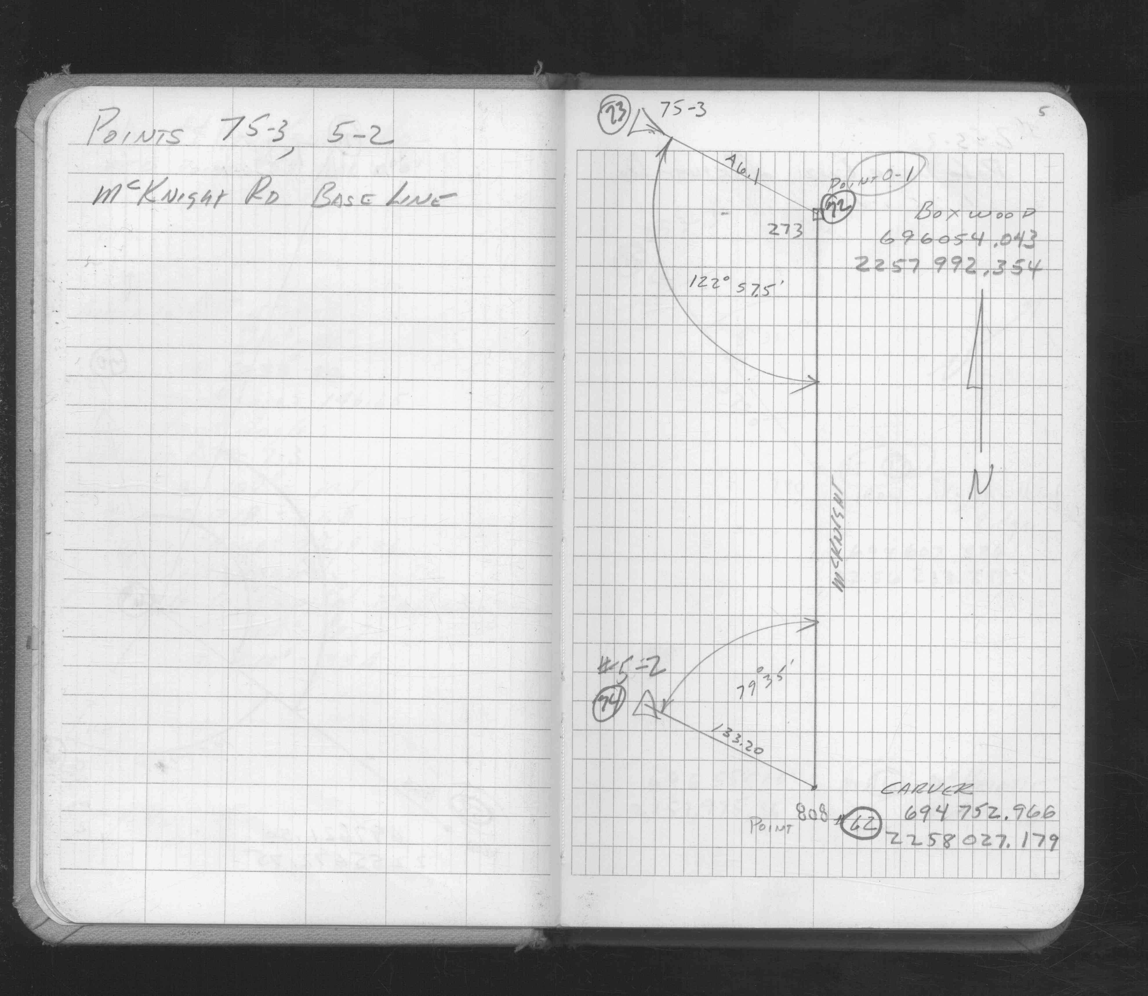
| * X= 598168.675 Y= 141779.089 Z= 000.00 LSQ 12/06/1991 S FLT |
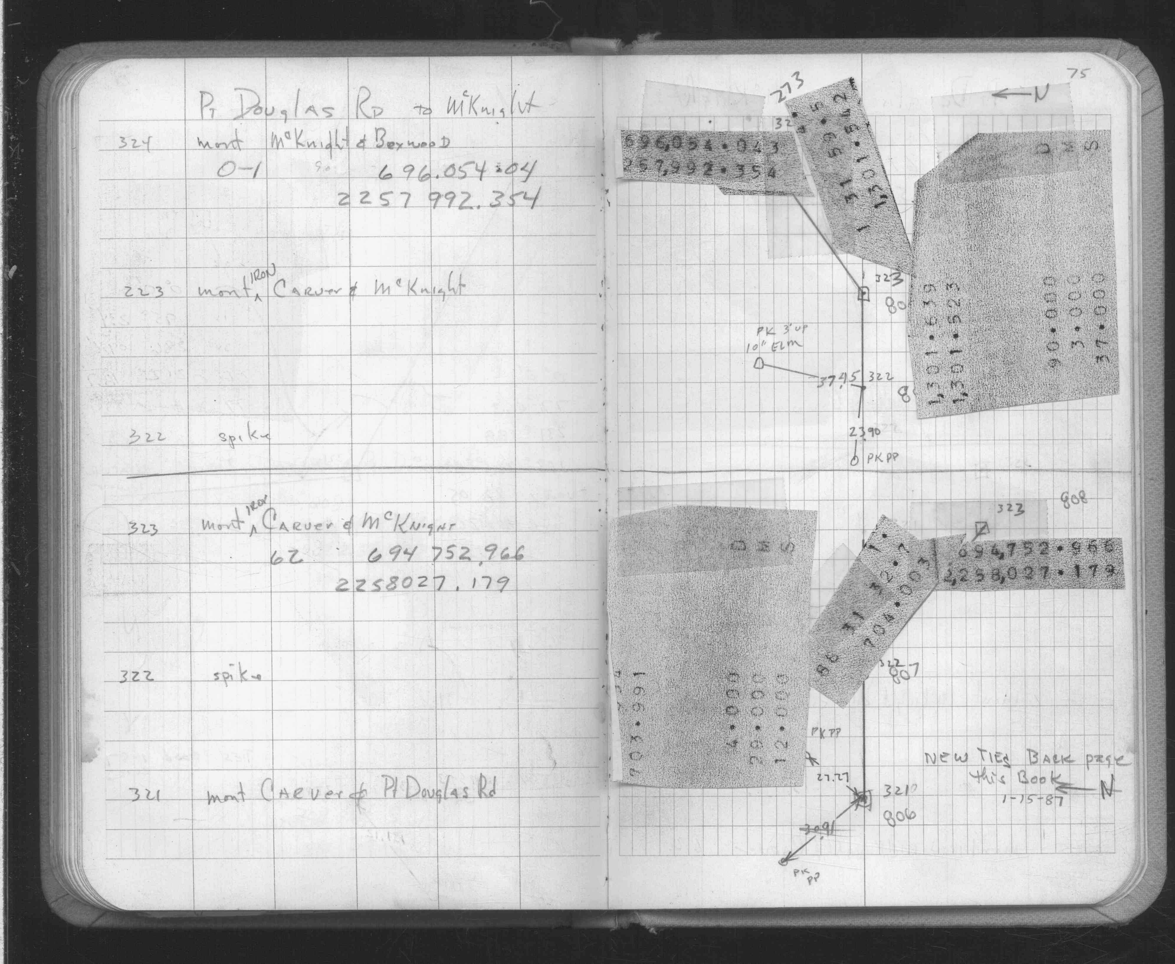
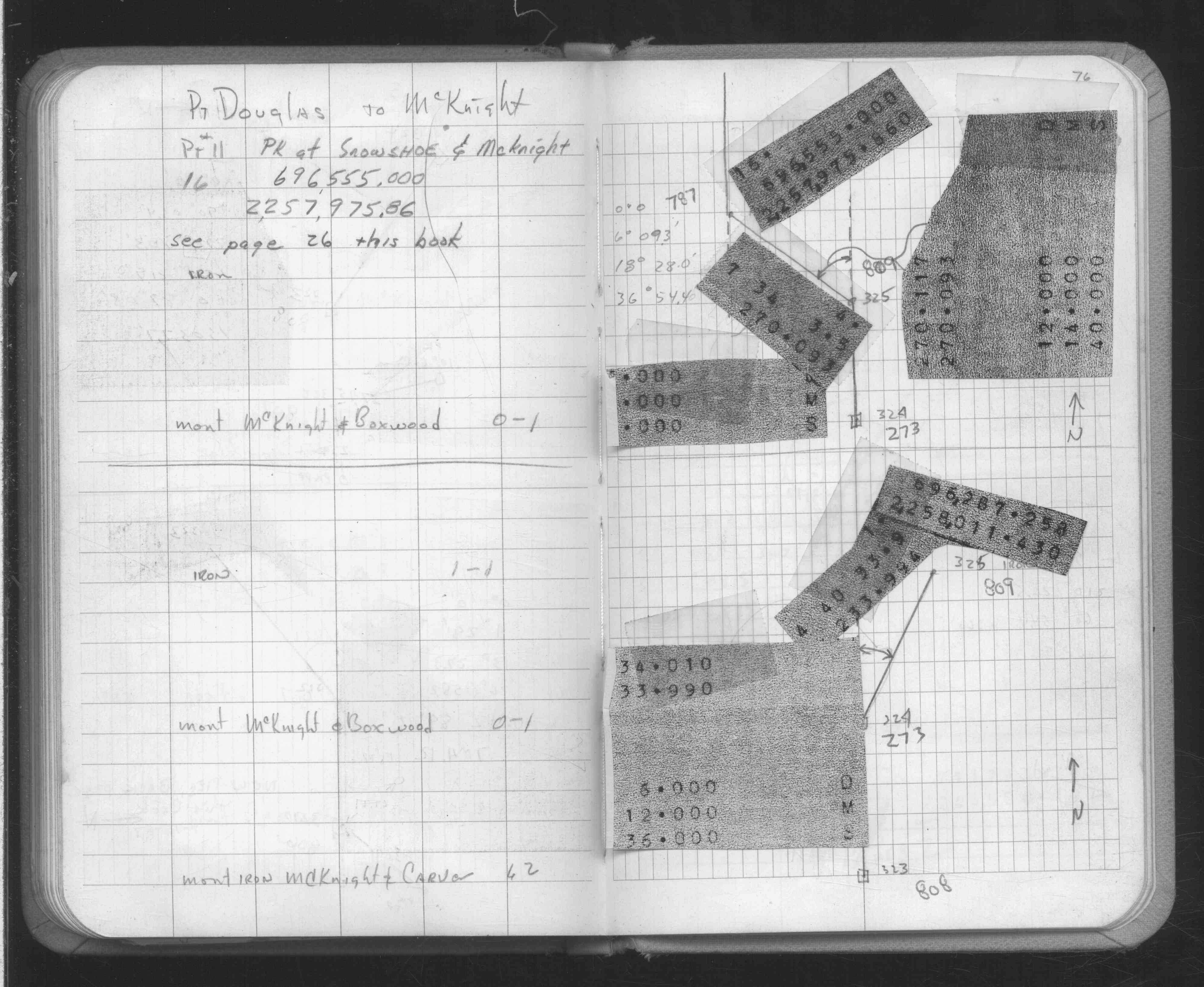
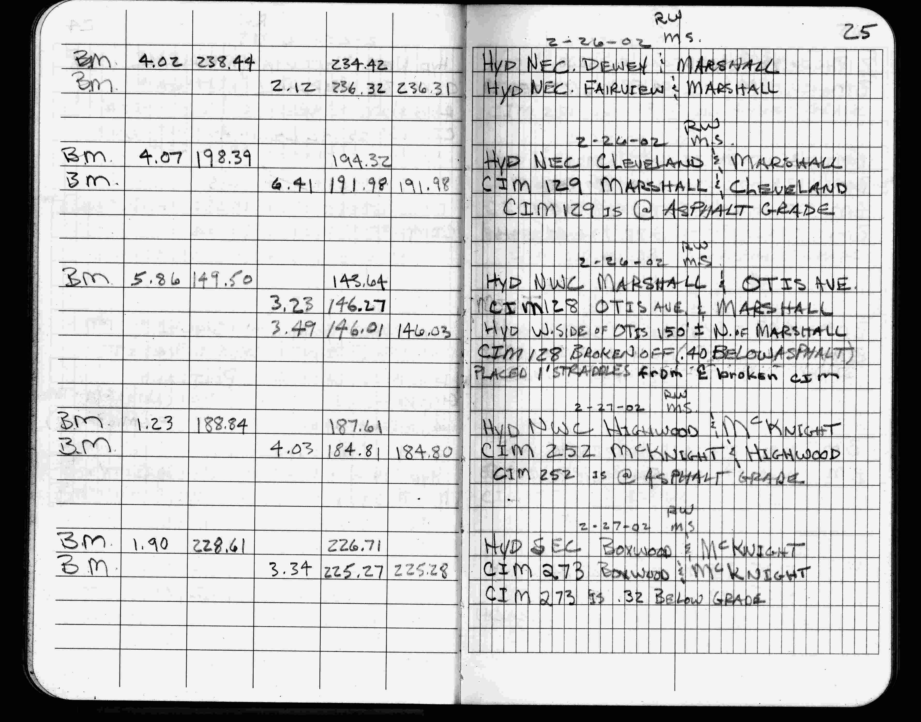
| 2/27/2002 | Elev 225.27 ft on CIM 0.32 ft below grade. See FB 1736 p.25 |
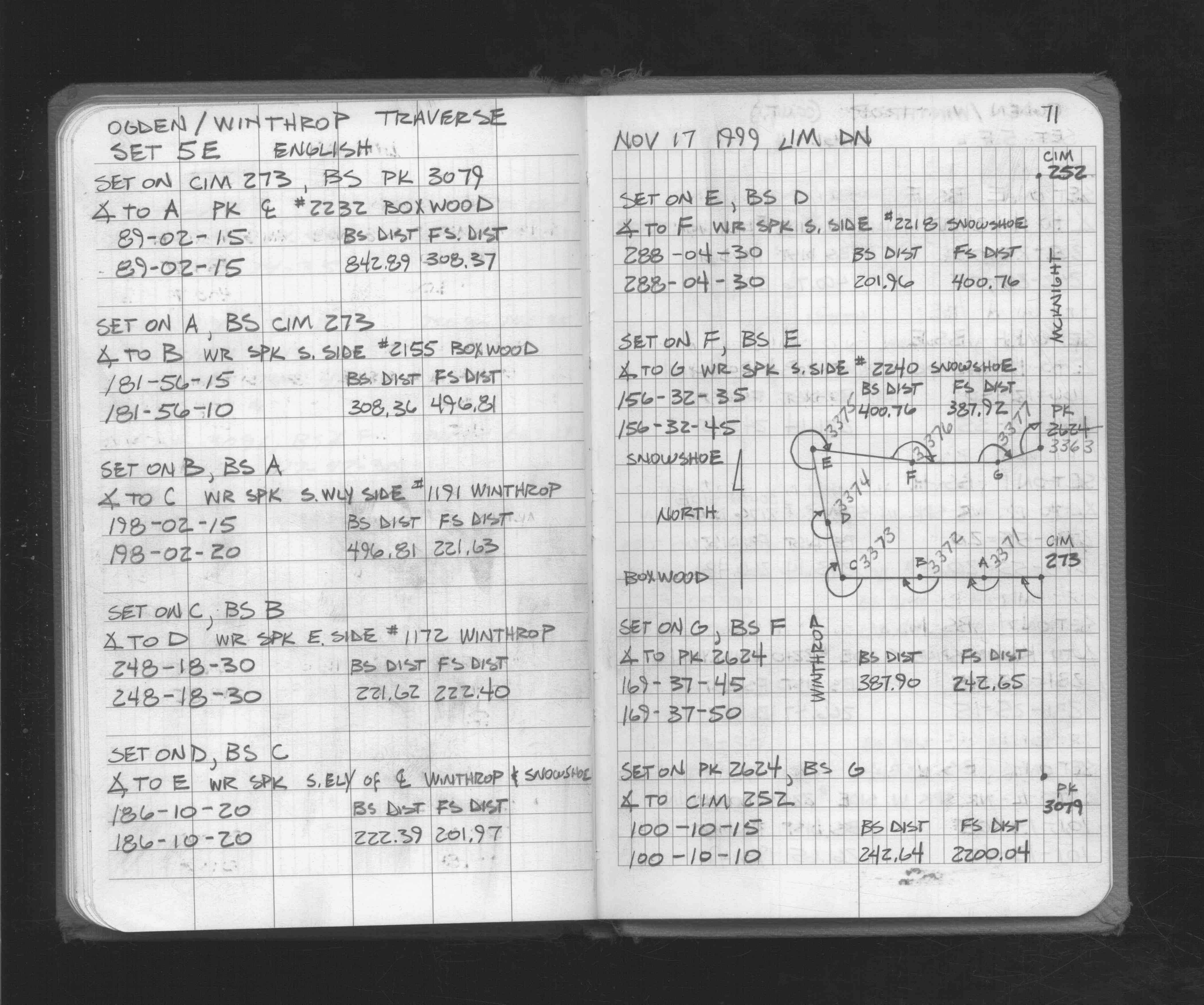
| 11/17/1999 | Used CIM for traverse control. See FB 1716 p.71 |
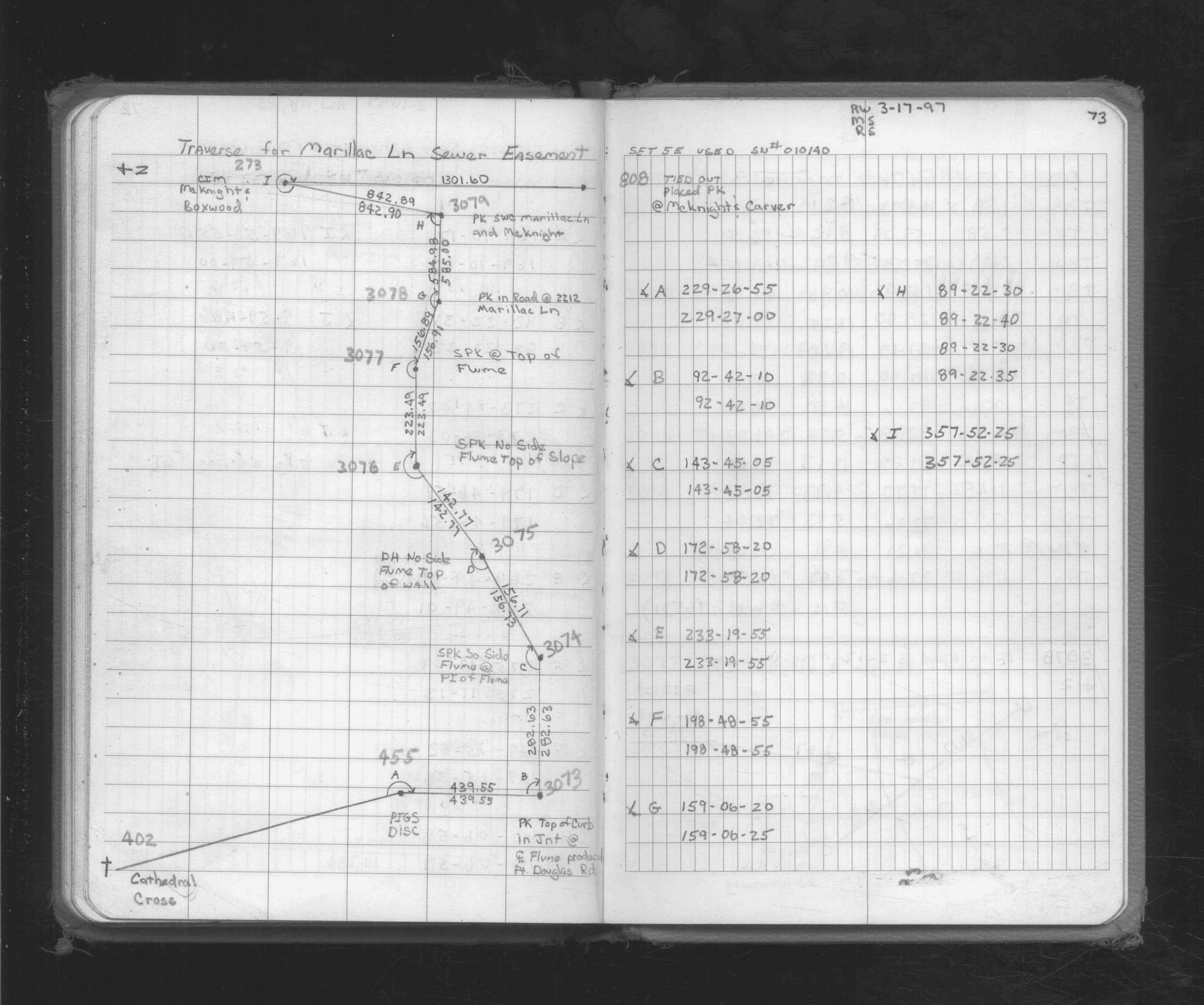
| 3/17/1997 | Used CIM for traverse control. See FB 1719A p.73 |
| 2/7/1996 | Elev 225.28 ft on CIM. See 97adj.pts, 1996/mcknight-carver.org/mcknight.sdr (loop 038) Digital-Adj |
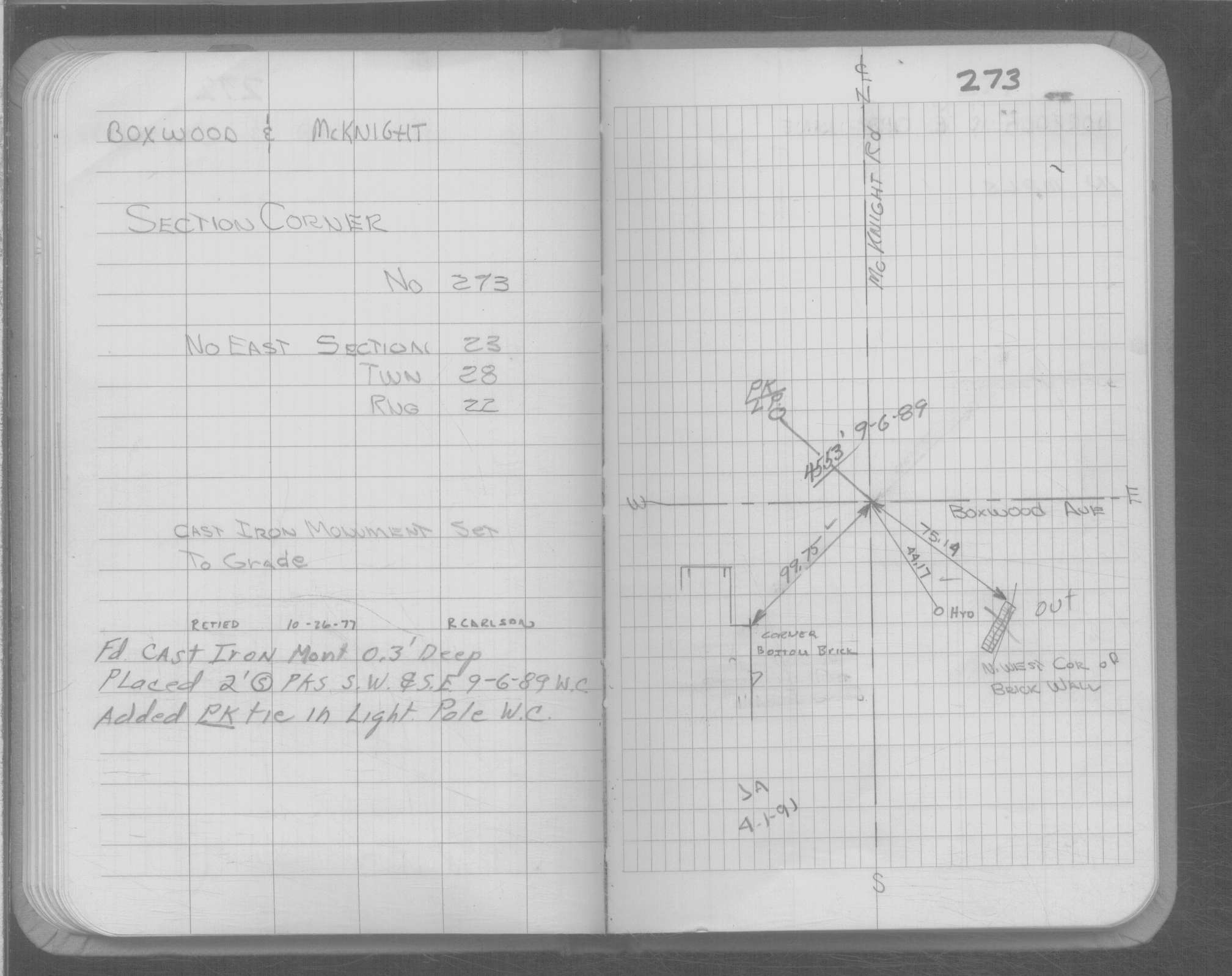
| 4/1/1991 | (Unknown date Apr __, 1991 ) CIM set 0.3 ft below grade. |
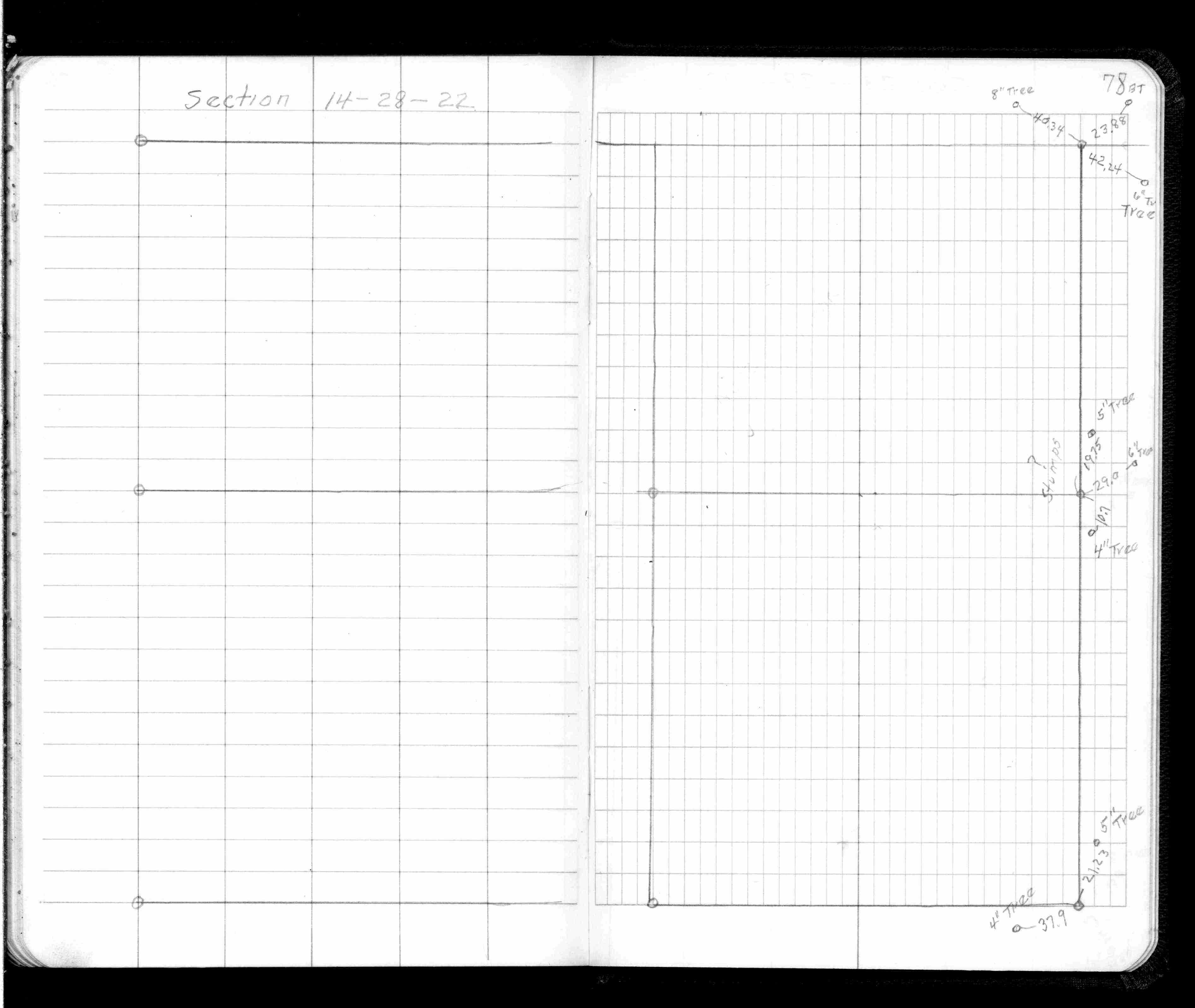
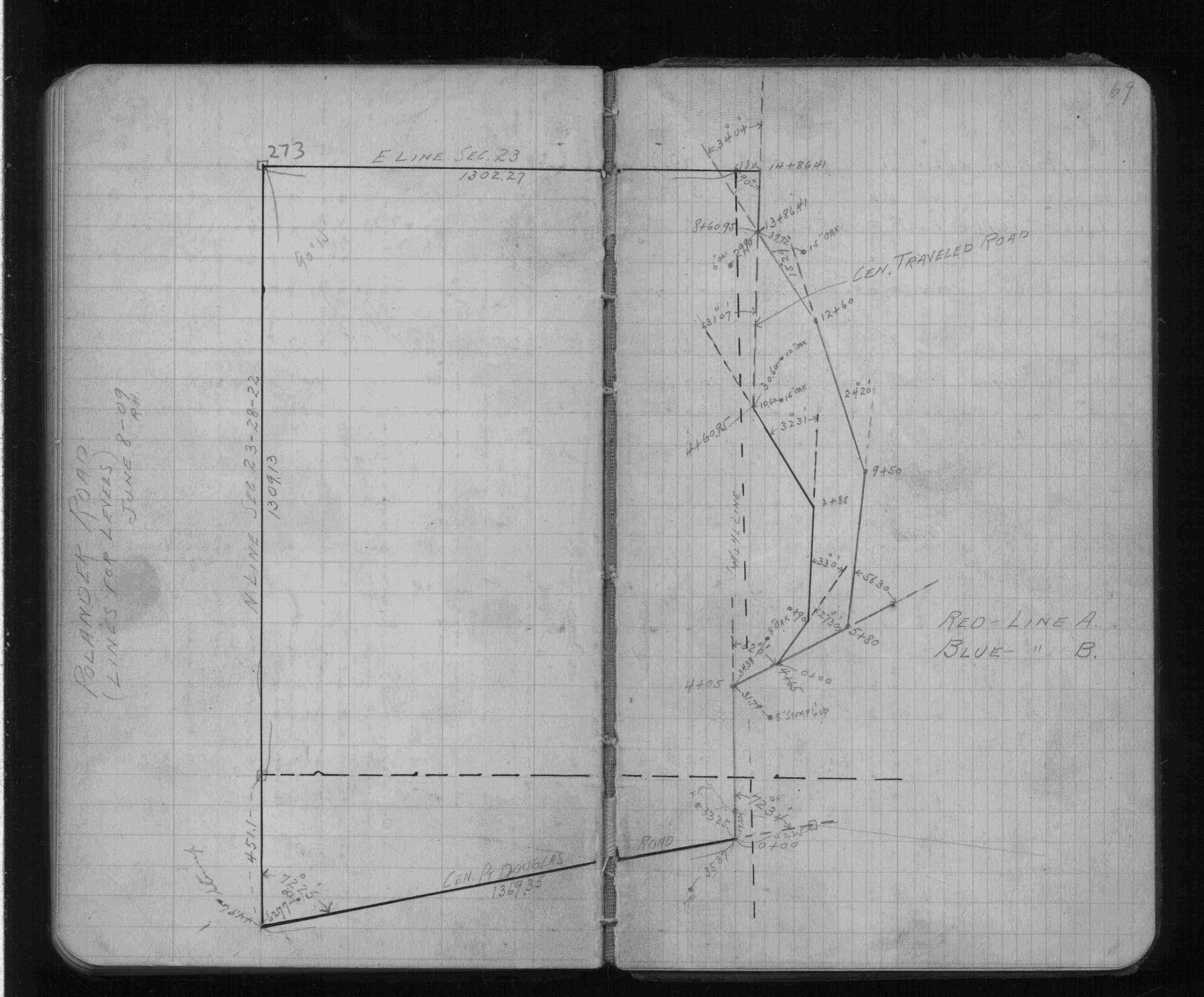
| 10/1/1847 | (Unknown date Oct __, 1847 ) Isaac N Higbee deputy surveyor set post. Tied to 2 BTs. See IH p.070-071 2822 |
Above is NOT an all inclusive history of this point. Please review all the links below.
| PLS NOTES | Field | Cross Section | Sewer | J.B. Irvine | Monument | River Survey |
|---|---|---|---|---|---|---|
| IH p.070-071 | FB 0355CPYp.78 | |||||
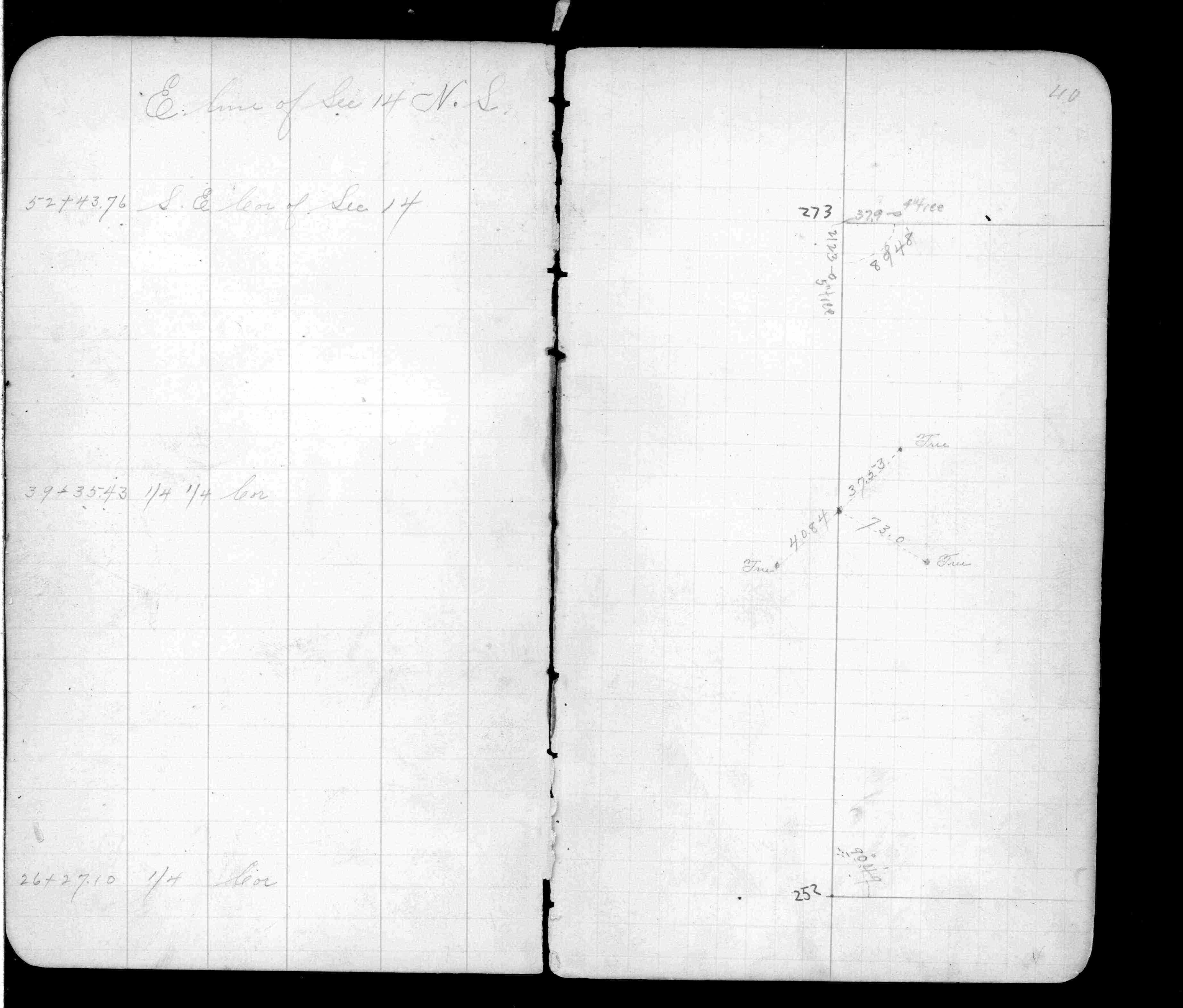
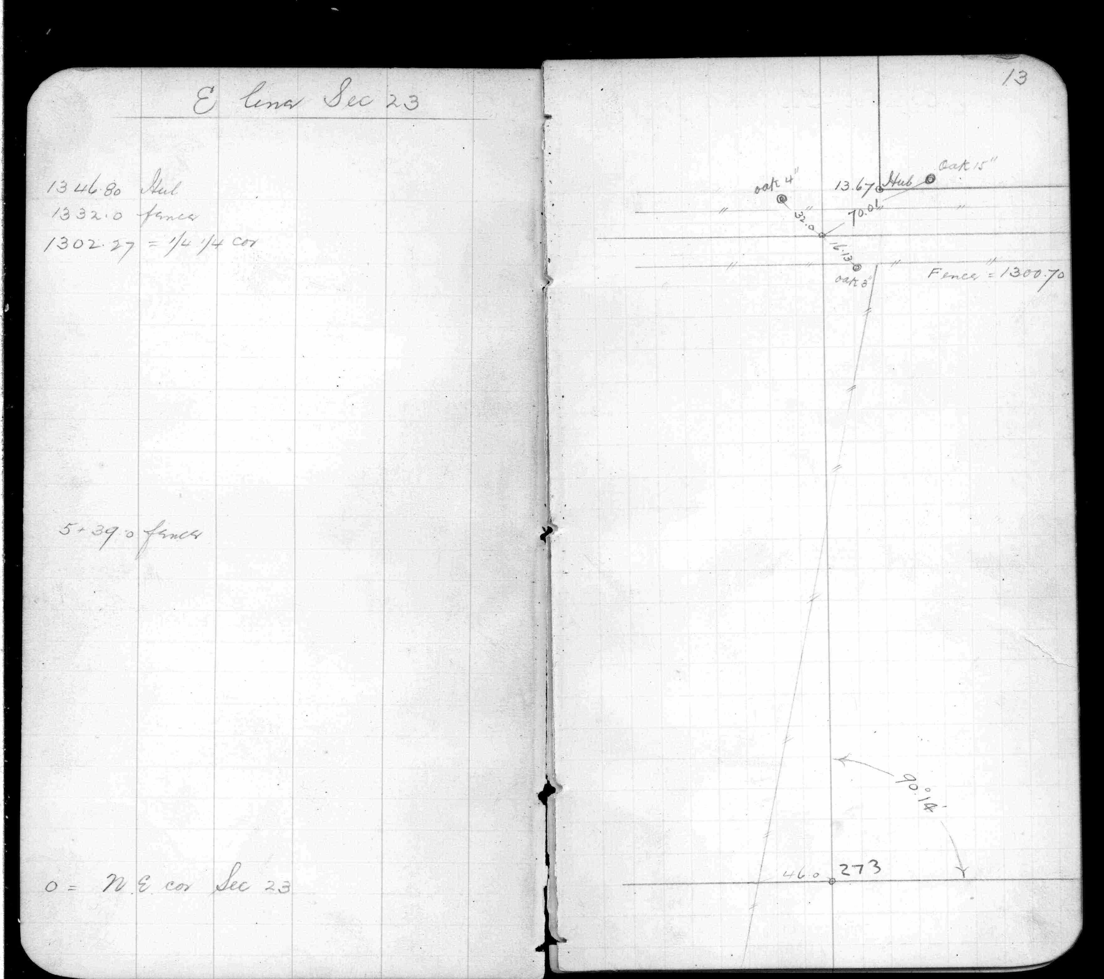
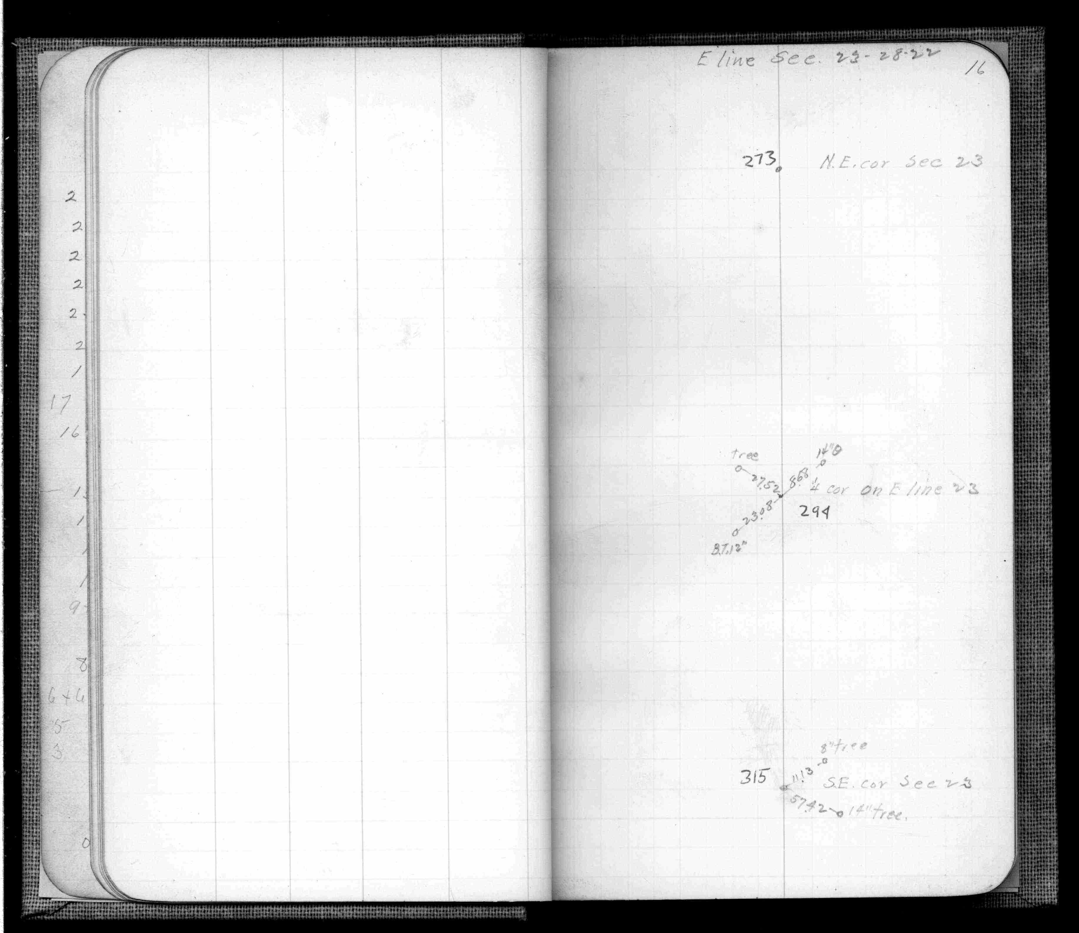
| FB 0357p. 40 ,46 | ||||||
| FB 0359p.13 | ||||||
| FB 0360p.16 | ||||||
| FB 0625p.69 | ||||||
| FB 1549Hp.05 | ||||||
| FB 1634p. 75 ,76 | ||||||
| FB 1716p.71 | ||||||
| FB 1716p.71 | ||||||
| FB 1719Ap.73 | ||||||
| FB 1736p.25 |
| FILE | SURVEYOR | LIC. NO. | DATE SIGNED | DATE TIED |
|---|---|---|---|---|
| ST_235-312p273.jpg | none | none | none | none |
| 0273-2594-A.dwf | none | none | none | none |