| NAD83 COORDINATES (1986 adj.): |
|---|
| * X= 592960.278 Y= 139102.608 Z= 000.00 LSQ 12/06/1991 S FLT |
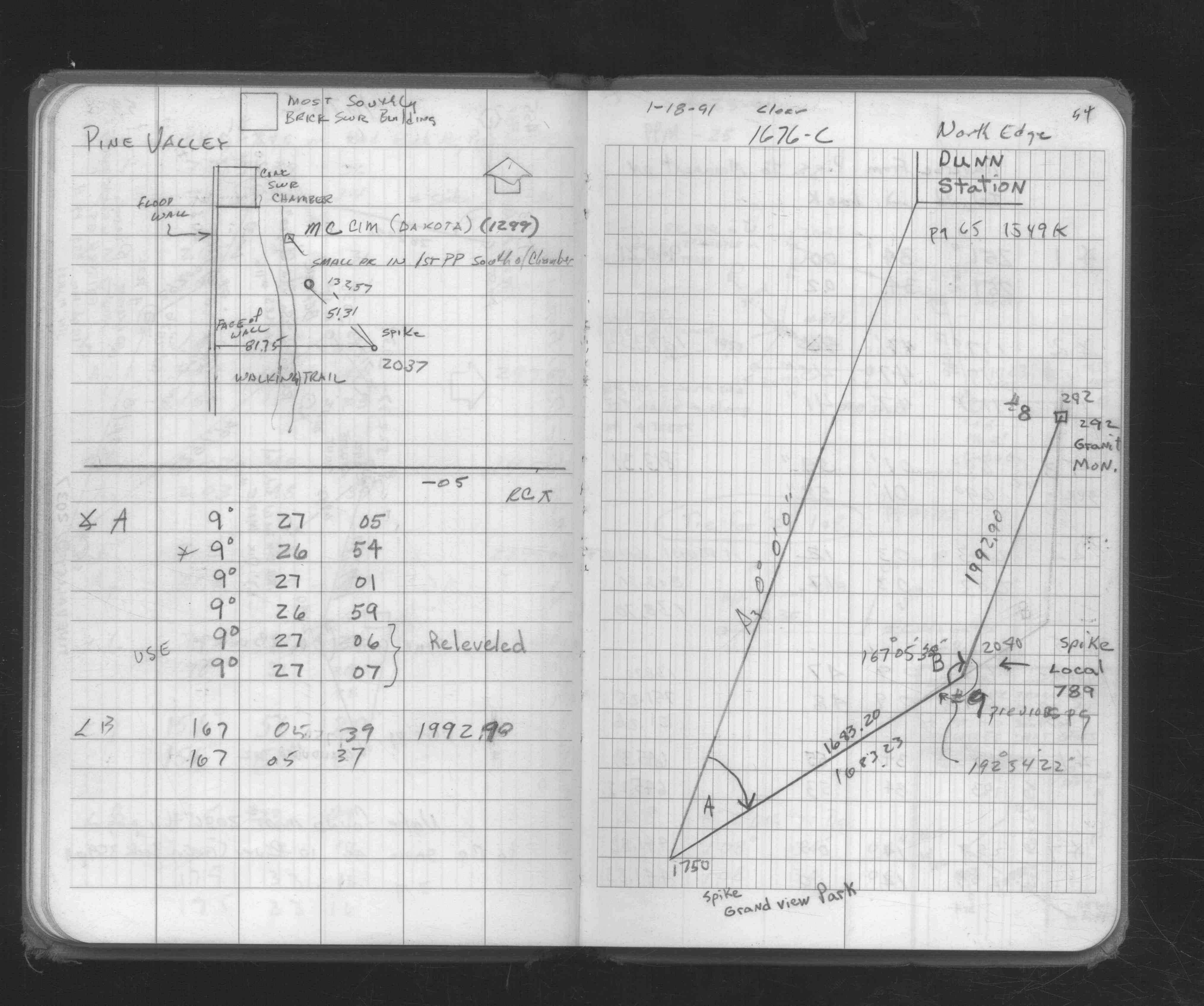
| 1/18/1991 | Located GM by traverse (single stub). See FB 1676-C p.54 |
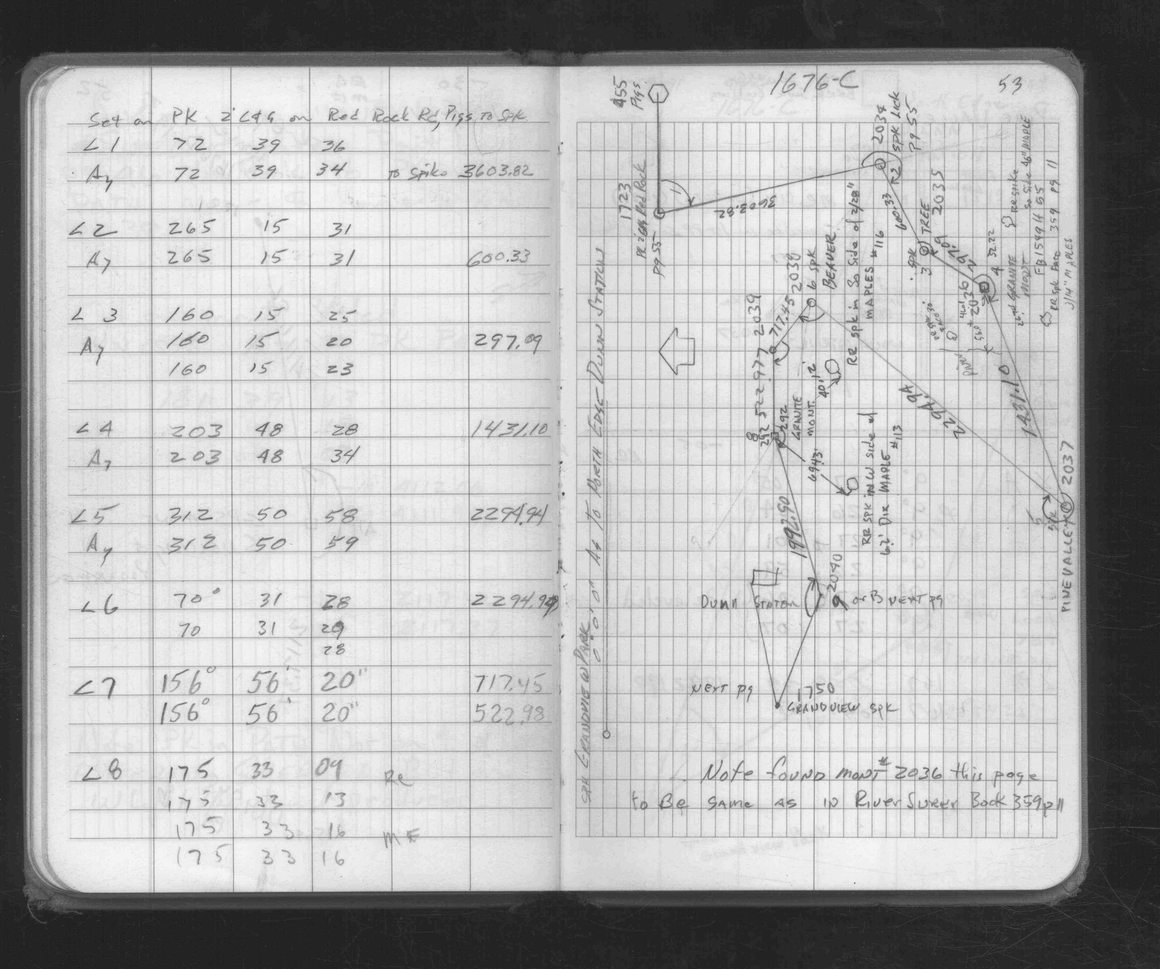
| 1/1/1991 | (Unknown date Jan __, 1991 ) Fd GM, placed ties. See FB 1676C p.53 |
| 1/1/1991 | (Unknown date Jan __, 1991 ) Fd GM w/steel fence post 1 ft east of monument. See CofL 0292-xxxx-B |
| 4/21/1976 | MnDot placed 6' steel fence post 1' east of GM. See CofL 0292-xxxx-A |
| 4/21/1976 | MnDot fd 8"x8" GM, left GM as found. See CofL 0292-xxxx-A |
| 10/1/1847 | (Unknown date Oct __, 1847 ) Isaac N Higbee deputy surveyor set post. Tied to 2 BTs. See IH p.080-081 2822 |
Above is NOT an all inclusive history of this point. Please review all the links below.
| PLS NOTES | Field | Cross Section | Sewer | J.B. Irvine | Monument | River Survey |
|---|---|---|---|---|---|---|
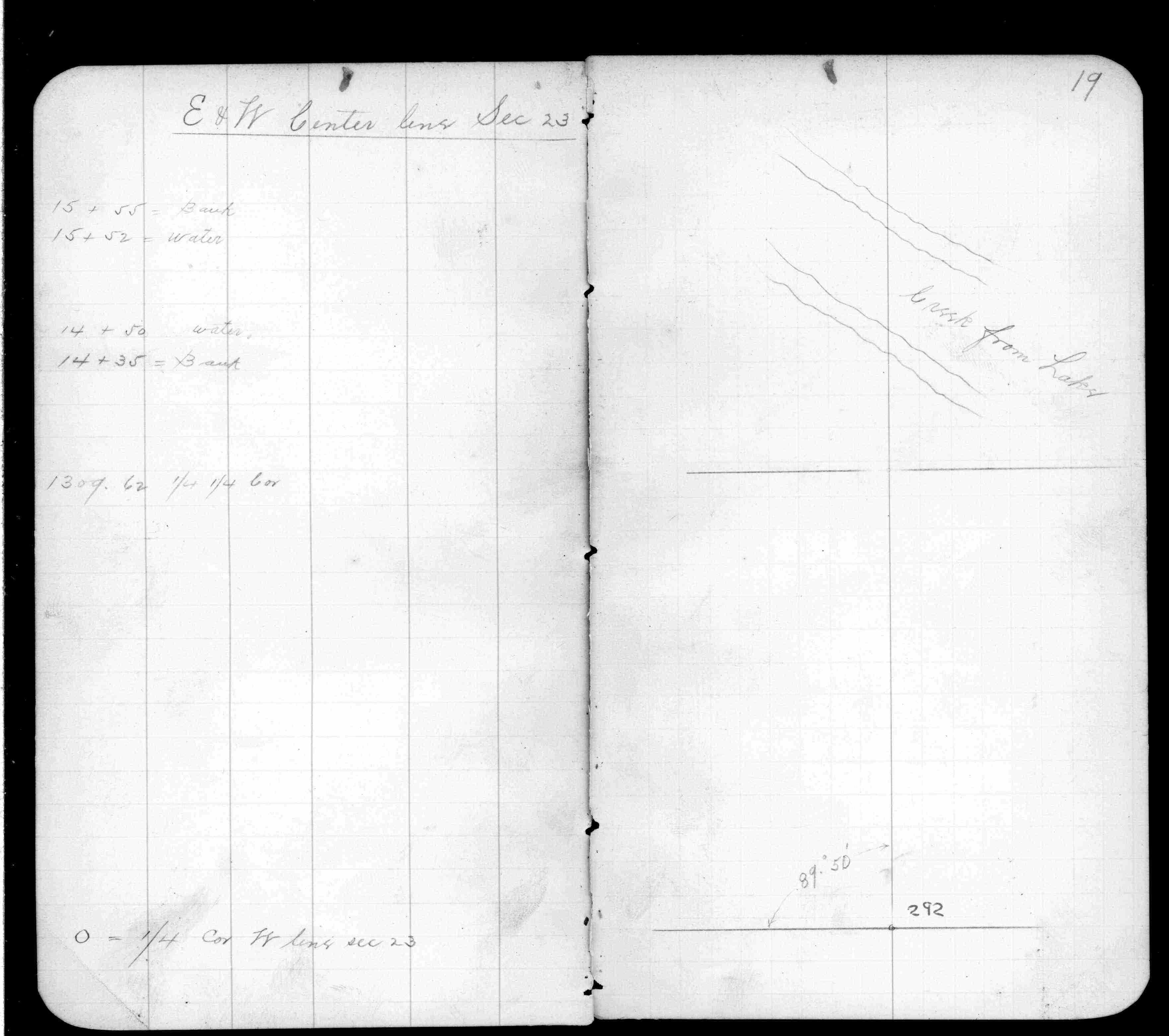
| IH p.080-081 | FB 0359p.19 | |||||
| FB 1676Cp. 53 ,54 |
| FILE | SURVEYOR | LIC. NO. | DATE SIGNED | DATE TIED |
|---|---|---|---|---|
| 0292-xxxx-B.tif | William J. Cutting | 20576 | January 29, 1991 | January 1, 1991 |
| 0292-xxxx-A.tif | David D. Pearson | 11752 | May 24, 1976 | April 21, 1976 |
| ST_235-312p292.jpg | none | none | none | none |
| 0292-xxxx-A.dwf | none | none | none | none |