| NAD83 COORDINATES (1986 adj.): |
|---|
| * X= 595608.626 Y= 136549.353 Z= 000.00 LSQ 12/06/1991 S FLT |
| 6/1/2006 | (Unknown date Jun __, 2006 ) Ramsey County CIM is in place as per conversation with MnDot Metro Office. |
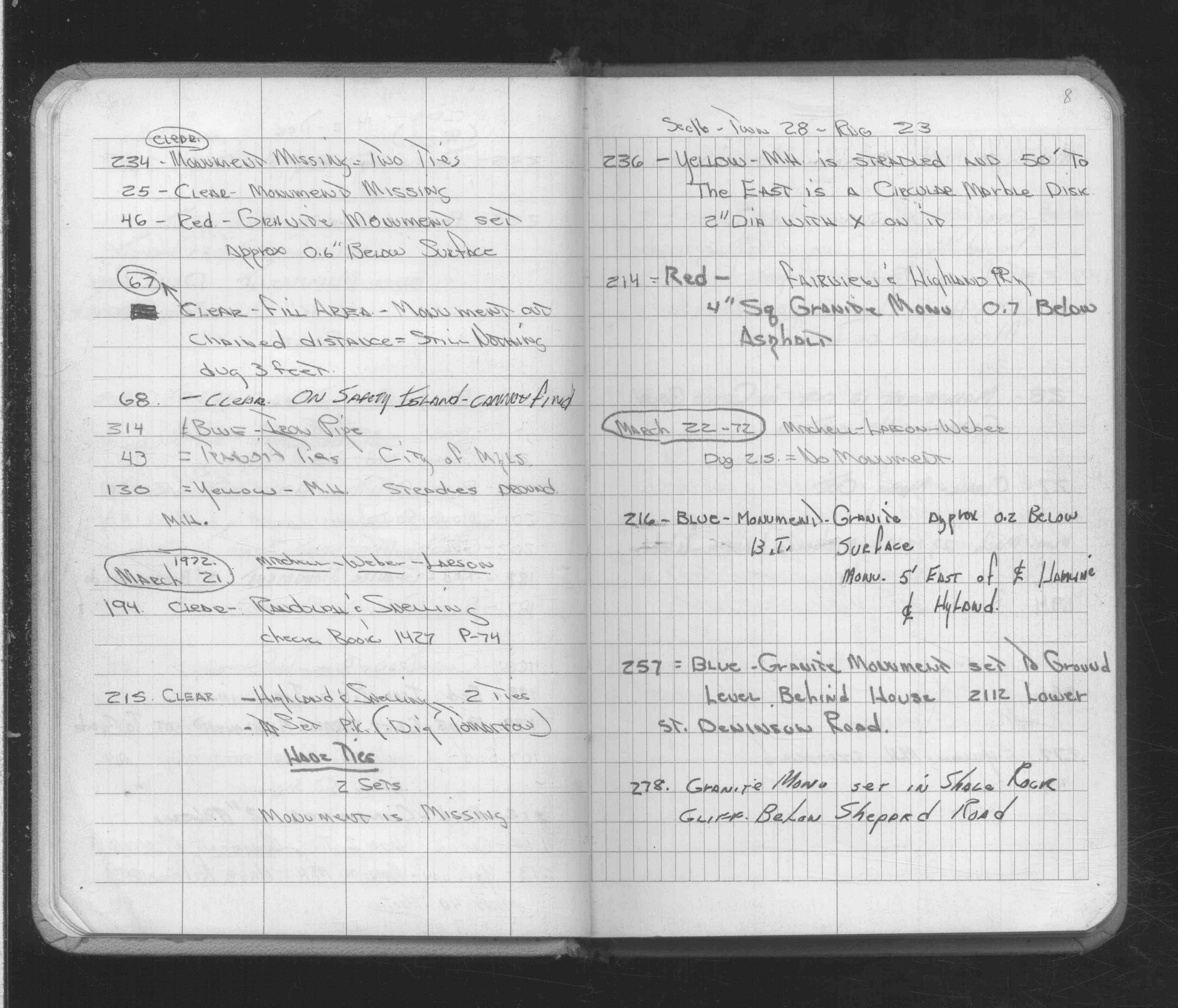
| 2/16/1972 | Fd iron pipe. See FB 1689A p.8 |
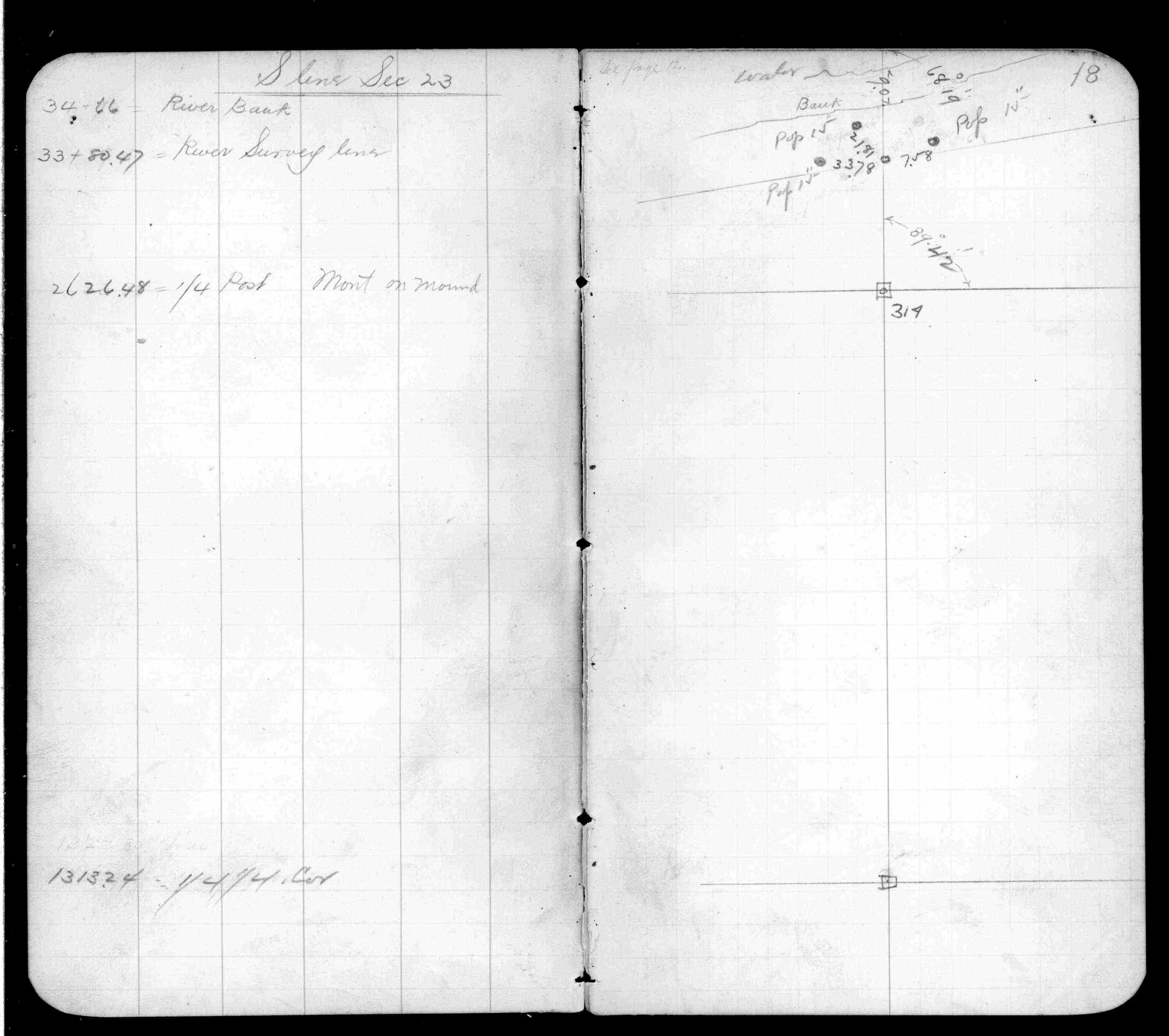
| 10/1/1847 | (Unknown date Oct __, 1847 ) Isaac N Higbee deputy surveyor set post in mound, pit 8 links east for tie. See IH p.078-079 2822 |
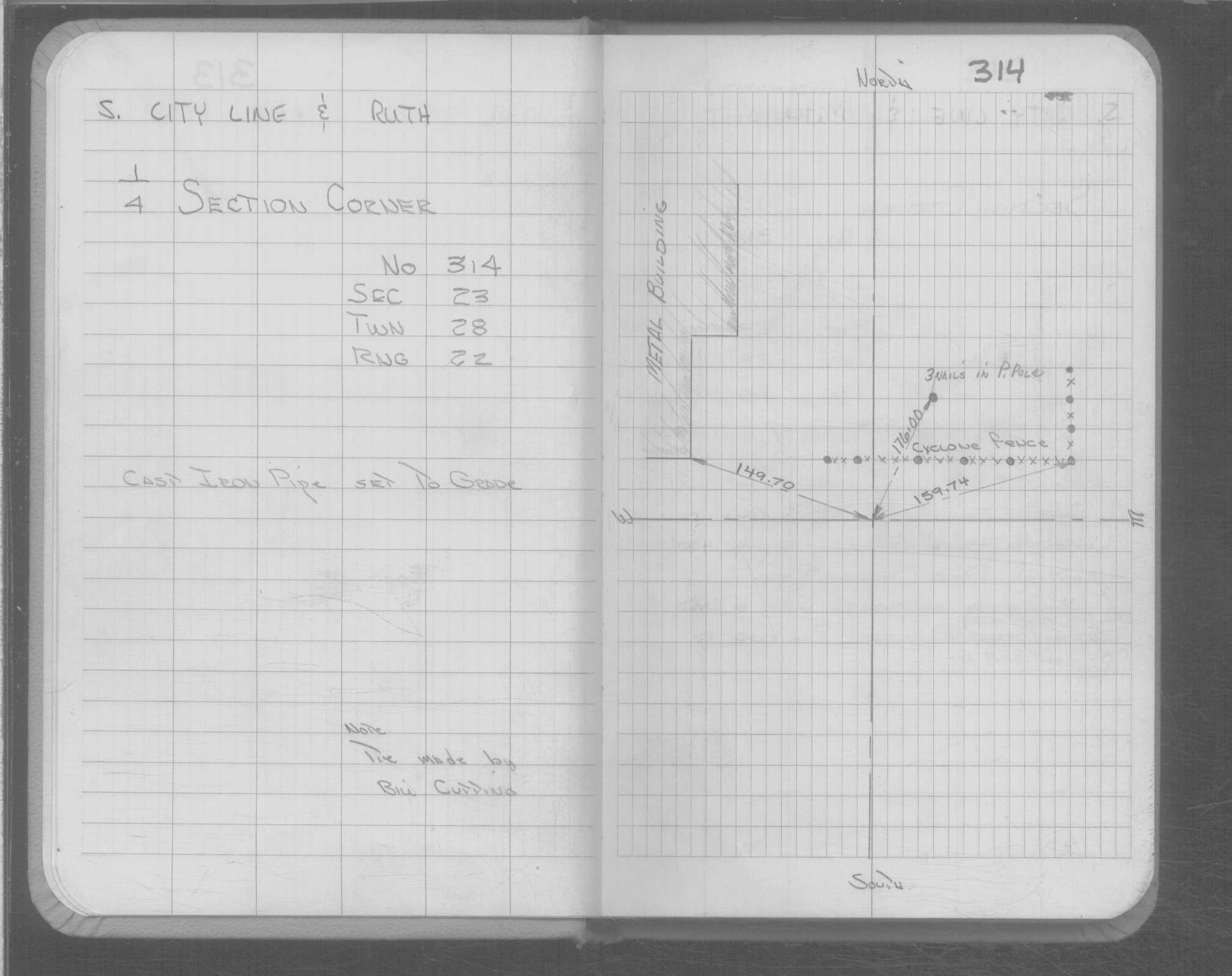
| 1/1/1800 | (Unknown date ___ __, ____ ) CI Pipe set to grade |
Above is NOT an all inclusive history of this point. Please review all the links below.
| PLS NOTES | Field | Cross Section | Sewer | J.B. Irvine | Monument | River Survey |
|---|---|---|---|---|---|---|
| IH p.078-079 | FB 0359p.18 | |||||
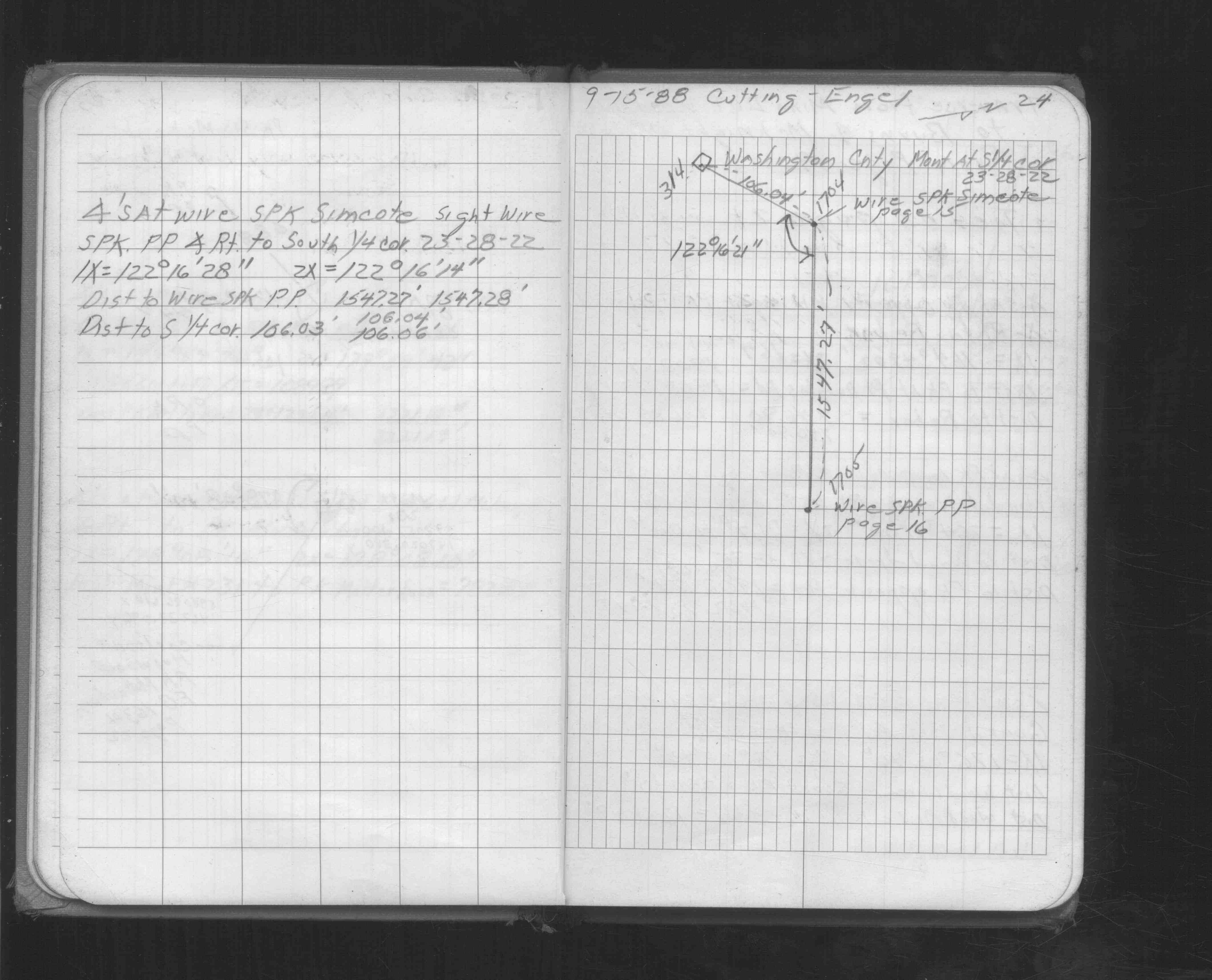
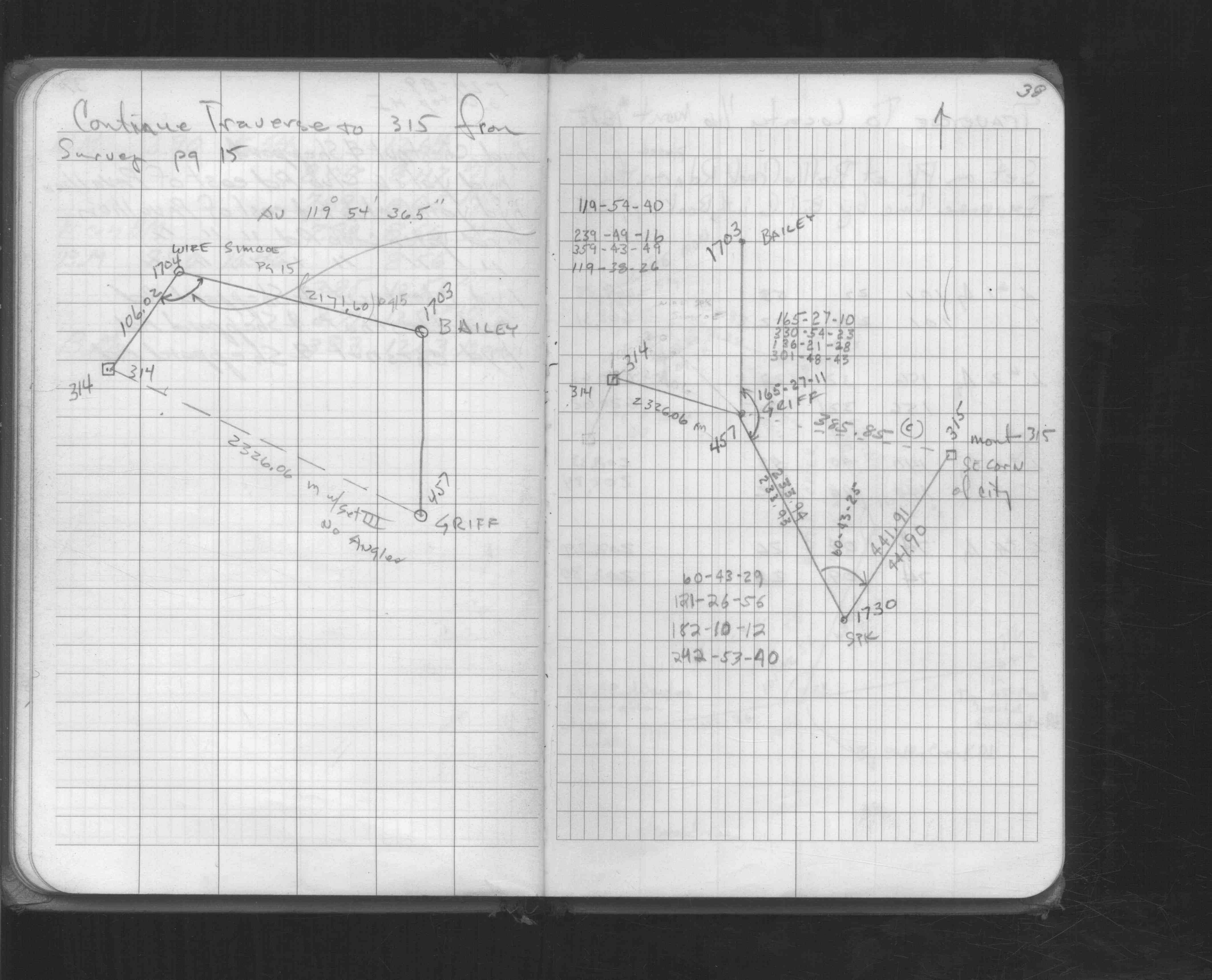
| FB 1549Kp. 24 ,38 | ||||||
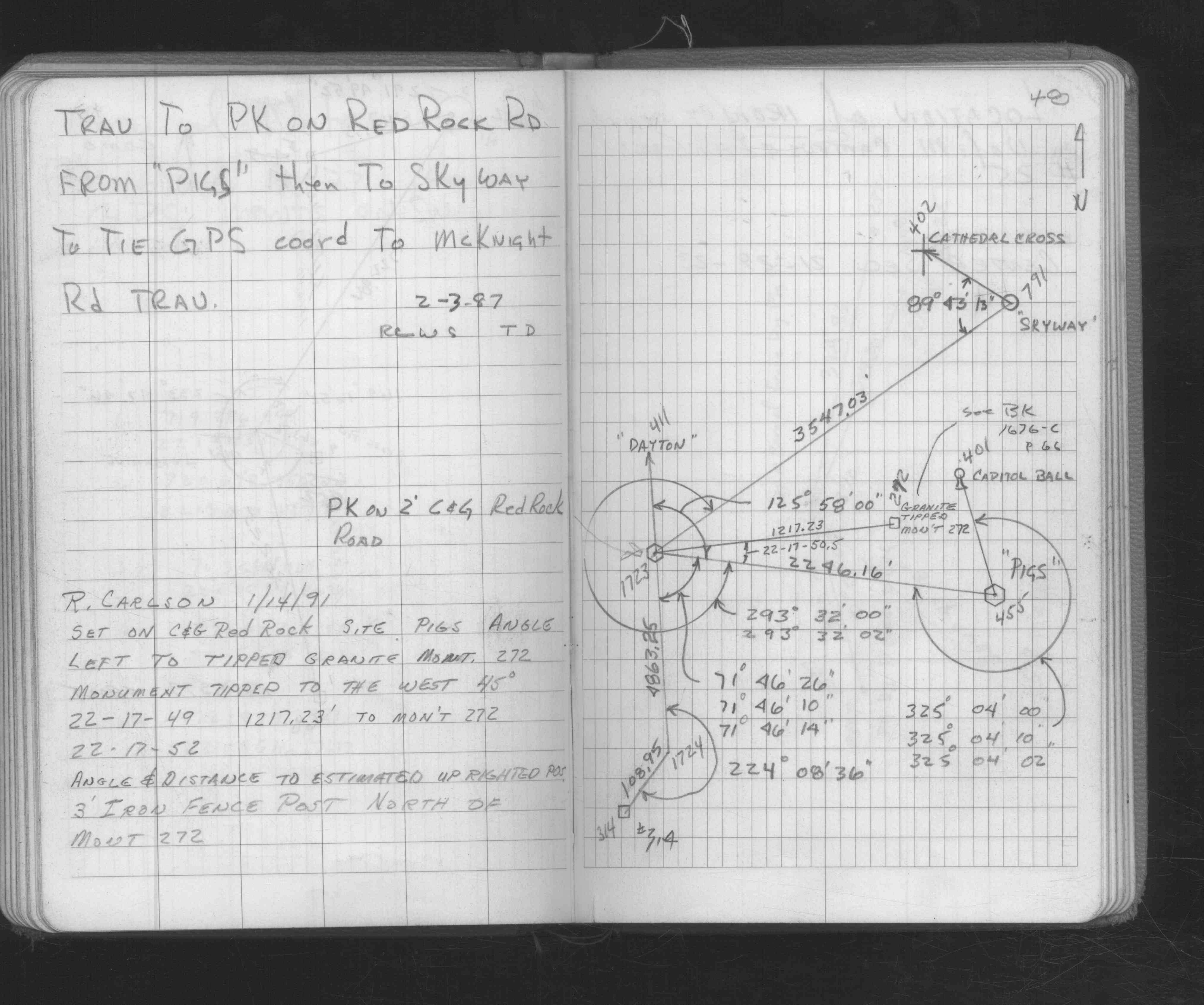
| FB 1676Bp.48 | ||||||
| FB 1689Ap.08 |
| FILE | SURVEYOR | LIC. NO. | DATE SIGNED | DATE TIED |
|---|---|---|---|---|
| ST_313-390p314.jpg | none | none | none | none |
| 0314-xxxx-A.dwf | none | none | none | none |