| NAD83 COORDINATES (1986 adj.): |
|---|
| X= 575610.881 Y= 155966.708 Z= 787.00 01/14/2005 RTK-VRS |
| X= 575610.885 Y= 155966.608 Z= 092.66 LSQ 12/06/1991 S FIX |
| 7/4/2005 | Photos taken of CIM. |
| 3/3/2005 | Position on GM established by RTK-VRS GPS. RTK-VRS. |
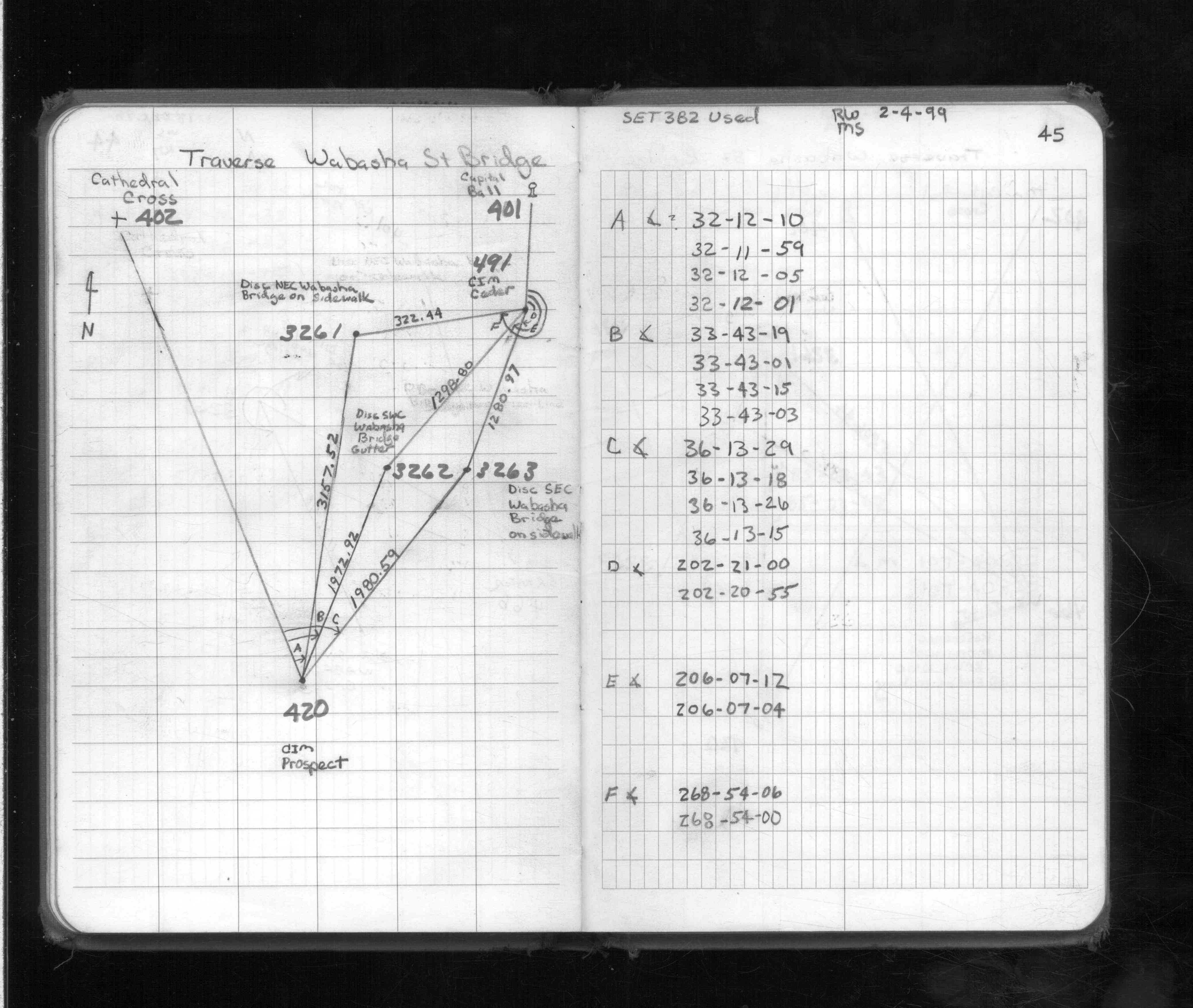
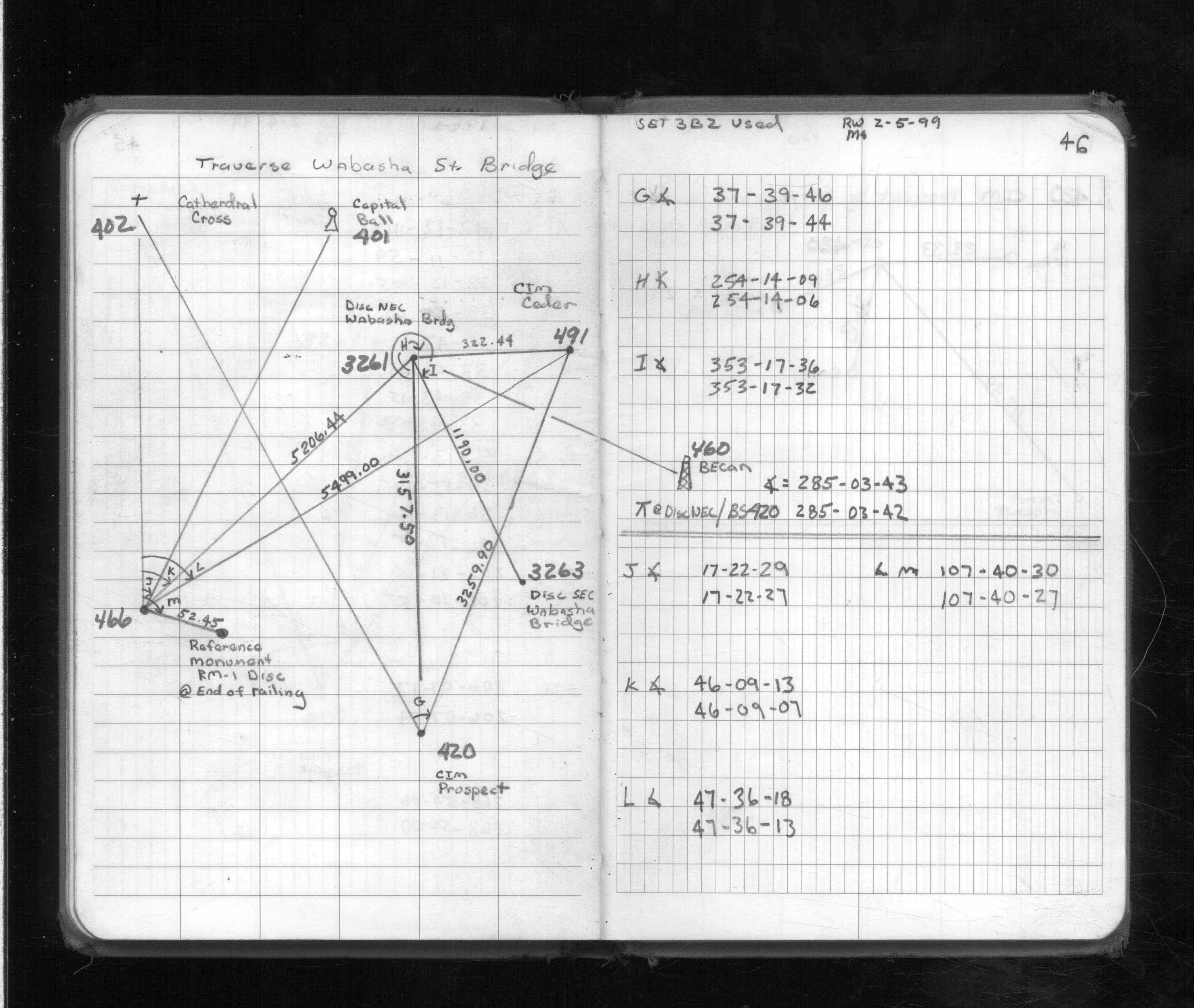
| 2/4/1999 | Used CIM for traverse control. See FB 1713 p.45,46 |
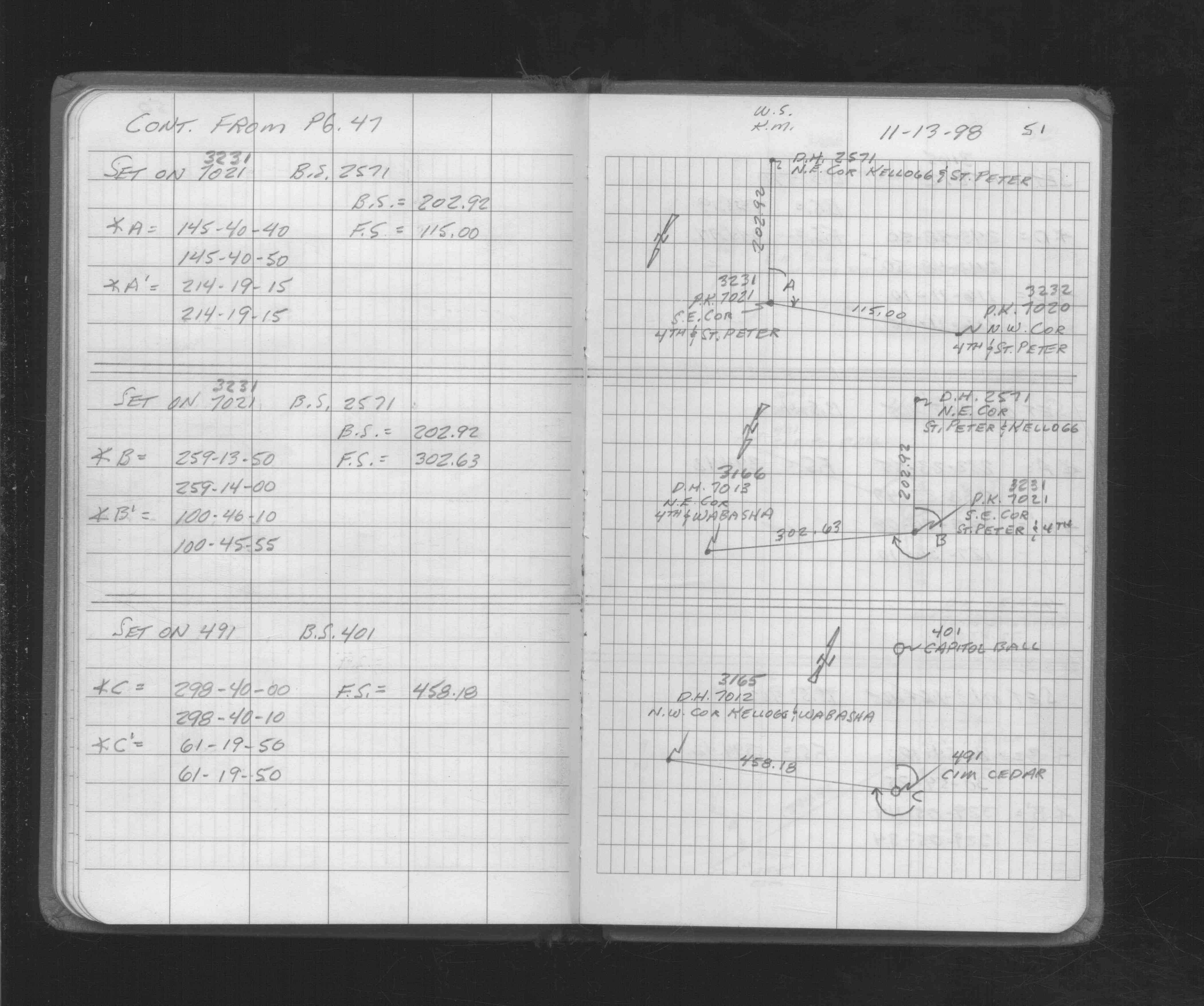
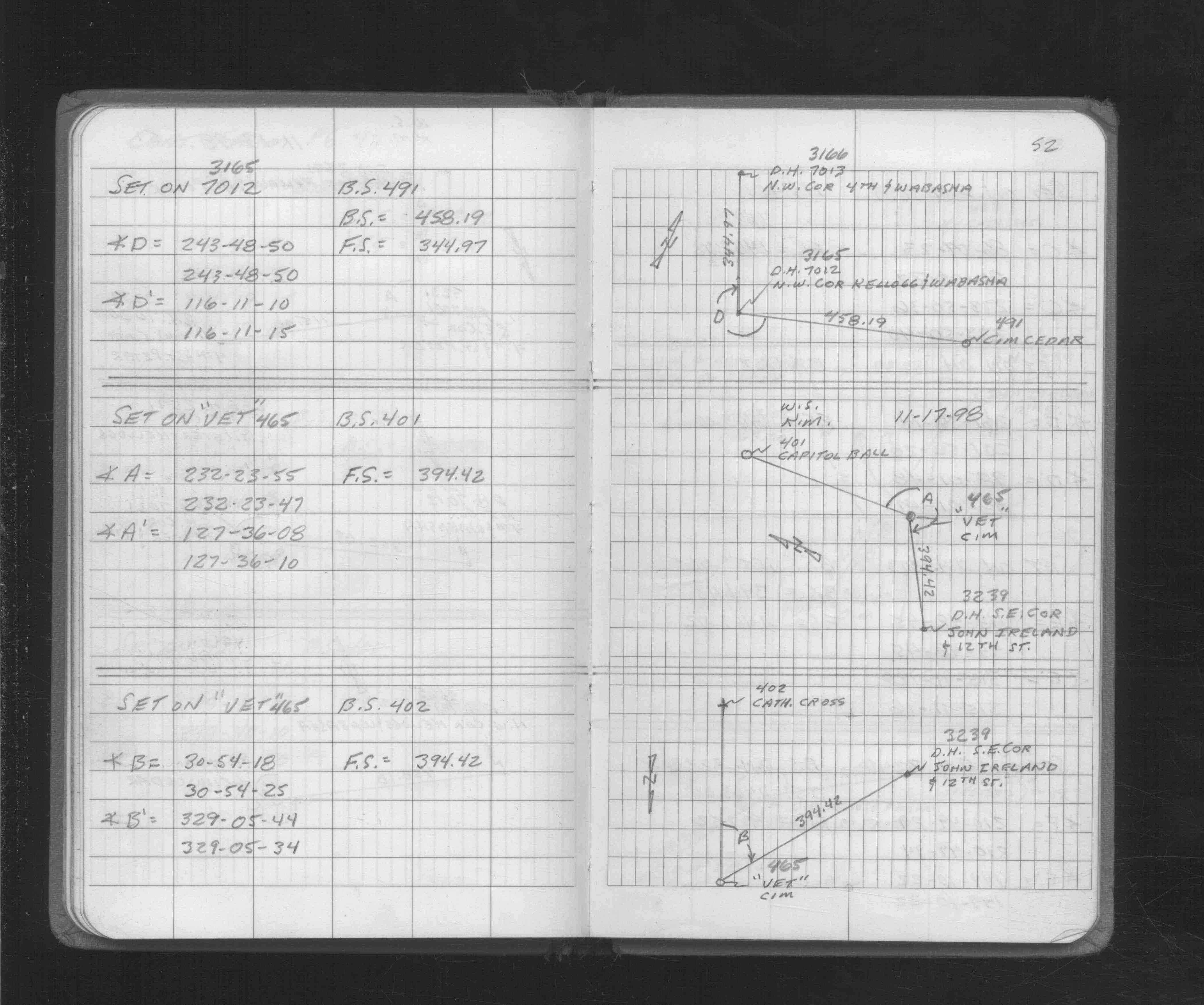
| 11/13/1998 | Used CIM for traverse control. See FB 1712 p.52 |
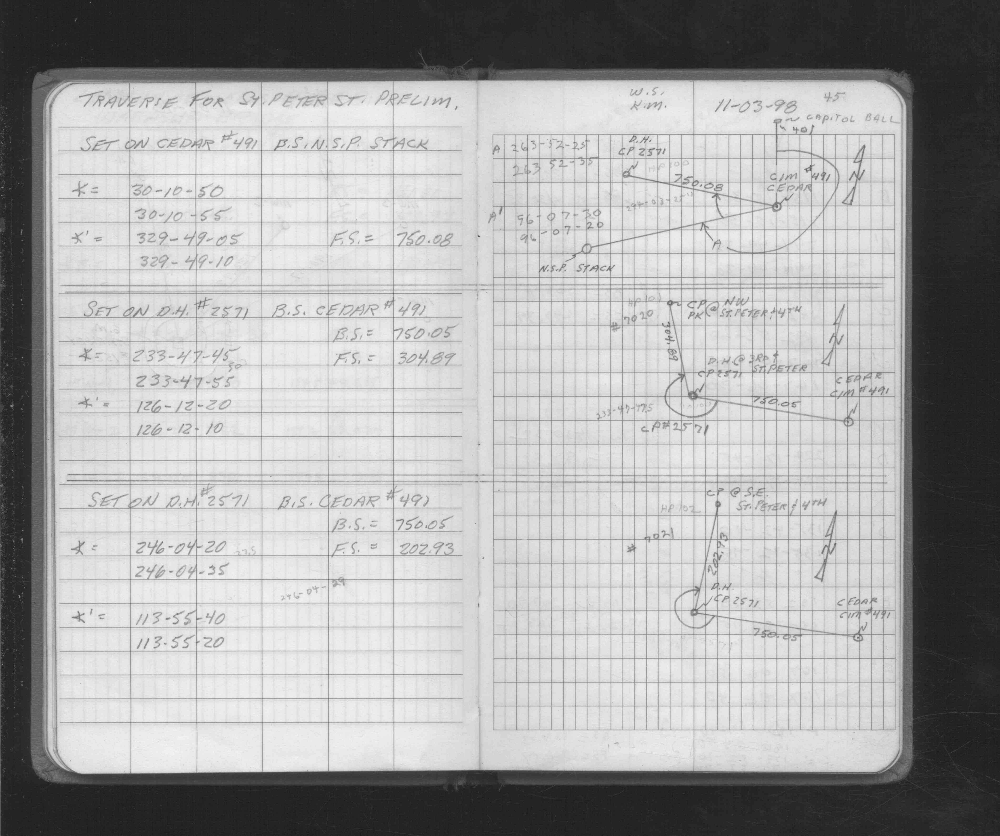
| 11/3/1998 | Used CIM for traverse control. See FB 1712 p.45 |
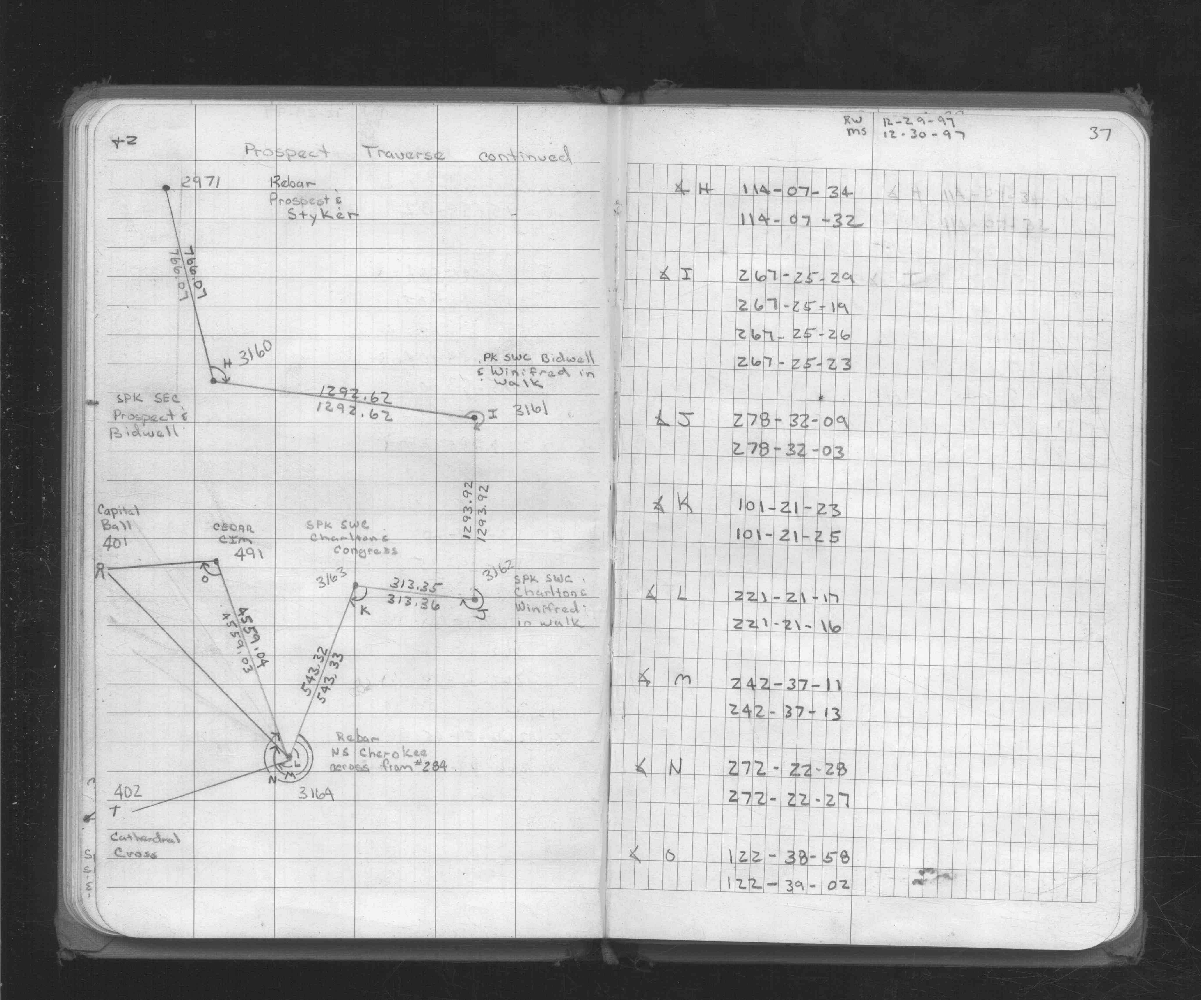
| 12/29/1997 | Closed traverse to CIM. See FB 1734 p.37 |
| 11/13/1991 | Elev 92.66 ft on CIM. See SB 634C p.73 |
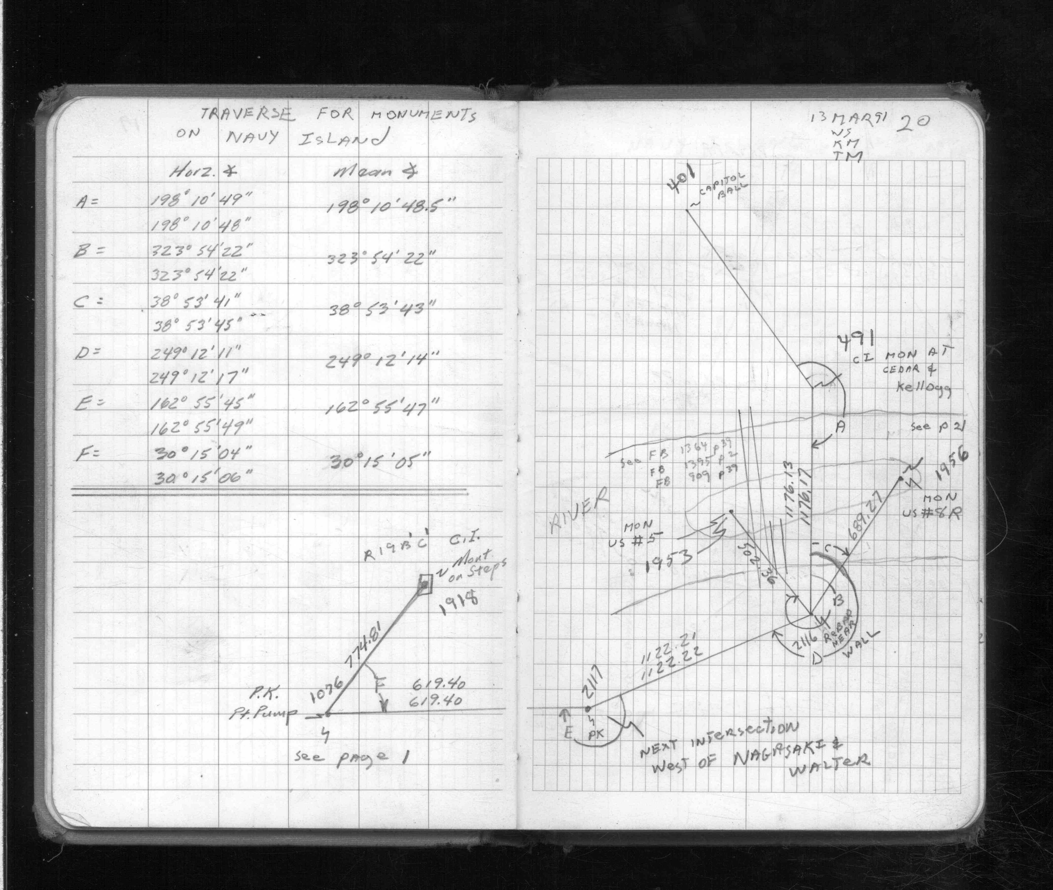
| 3/13/1991 | Used CIM for traverse control. See FB 1713 p.20 |
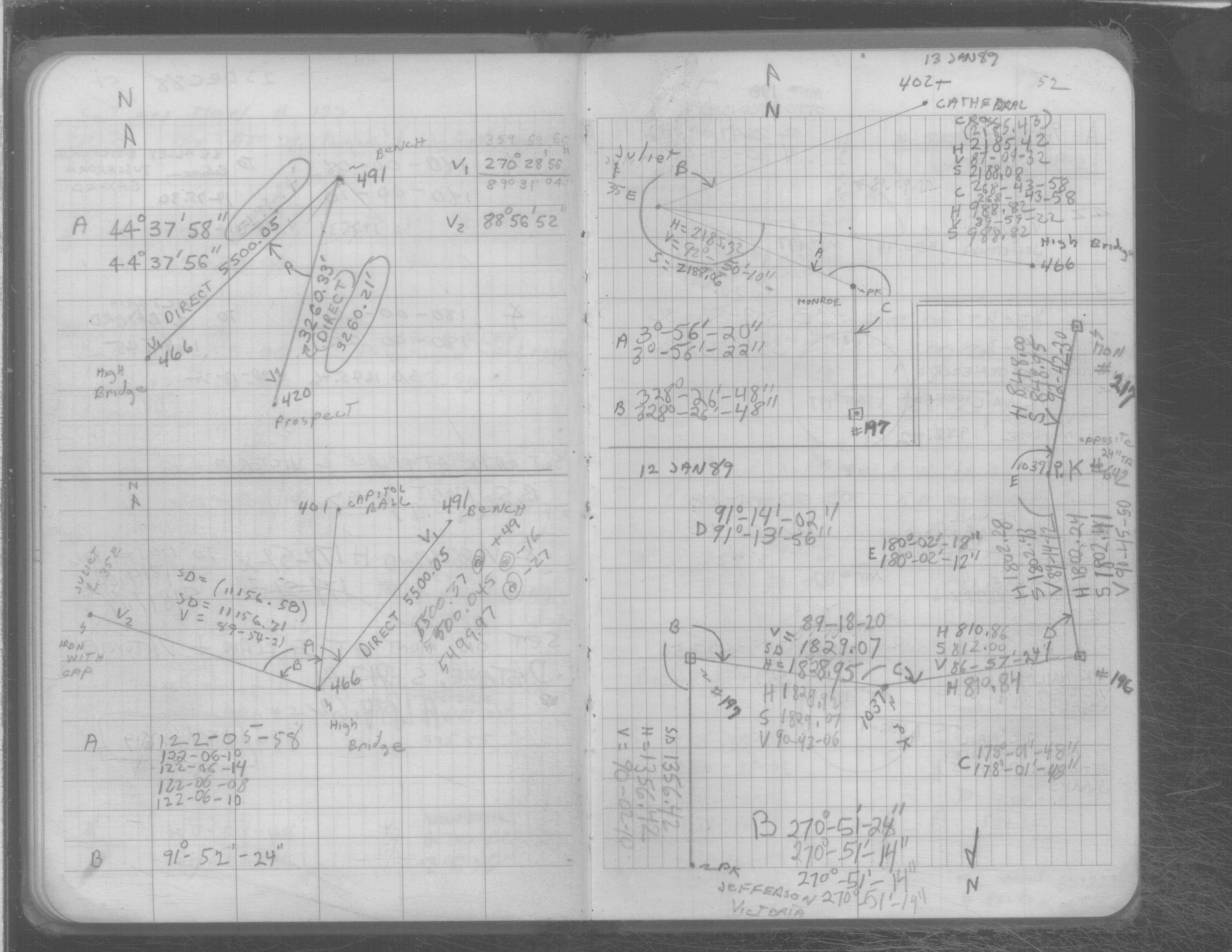
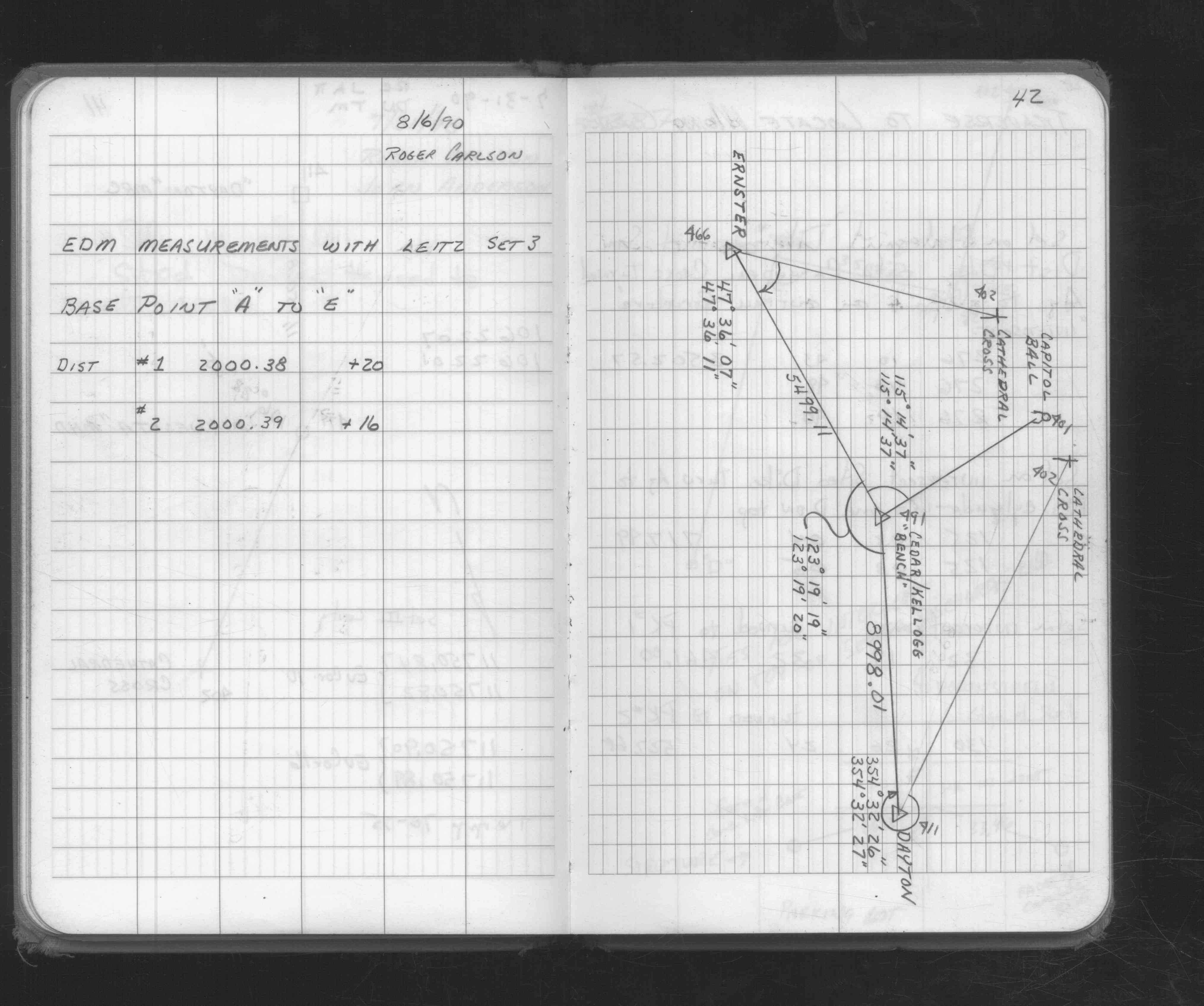
| 3/1/1989 | (Unknown date Mar __, 1989 ) Measured to ERNSTER MNDOT point 466. See FB 1713 p.11 |
| 1/1/1989 | (Unknown date Jan __, 1989 ) Used for traverse control. See FB 1689 p.40 |
| 1/1/1985 | (Unknown date ___ __,1985 ) Historic, one time only GPS survey = S502 |
Above is NOT an all inclusive history of this point. Please review all the links below.
| PLS NOTES | Field | Cross Section | Sewer | J.B. Irvine | Monument | River Survey |
|---|---|---|---|---|---|---|
| FB 1549Kp.80 | SB 0634Cp.73 | |||||
| FB 1676Bp.18 | SB 0641p.52 | |||||
| FB 1676Cp.42 | ||||||
| FB 1689p.40 | ||||||
| FB 1689p. 40 ,41 | ||||||
| FB 1689Ep.40 | ||||||
| FB 1708Ap. 07 ,12 ,13 ,14 ,32 ,48 | ||||||
| FB 1712p. 45 ,51 ,52 | ||||||
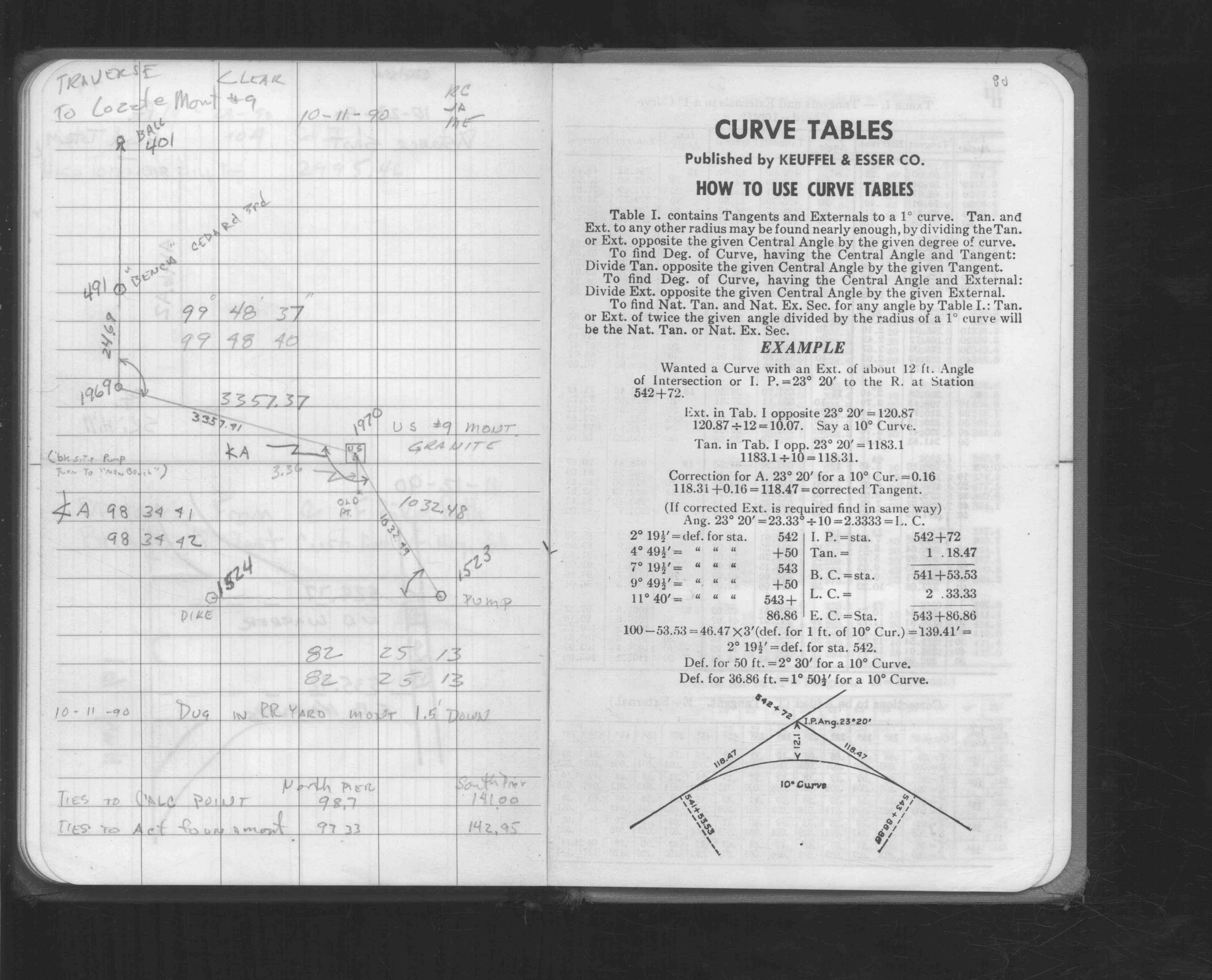
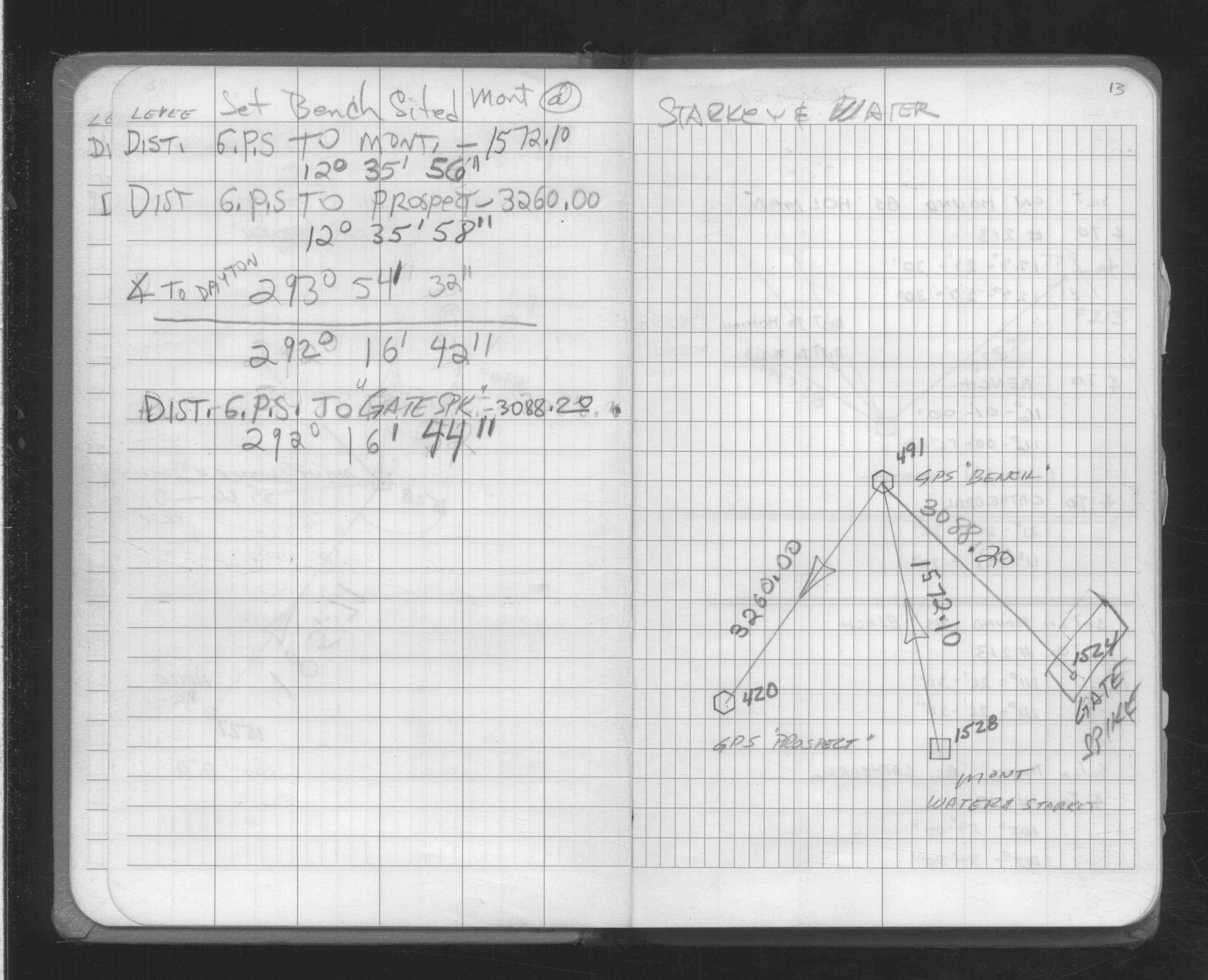
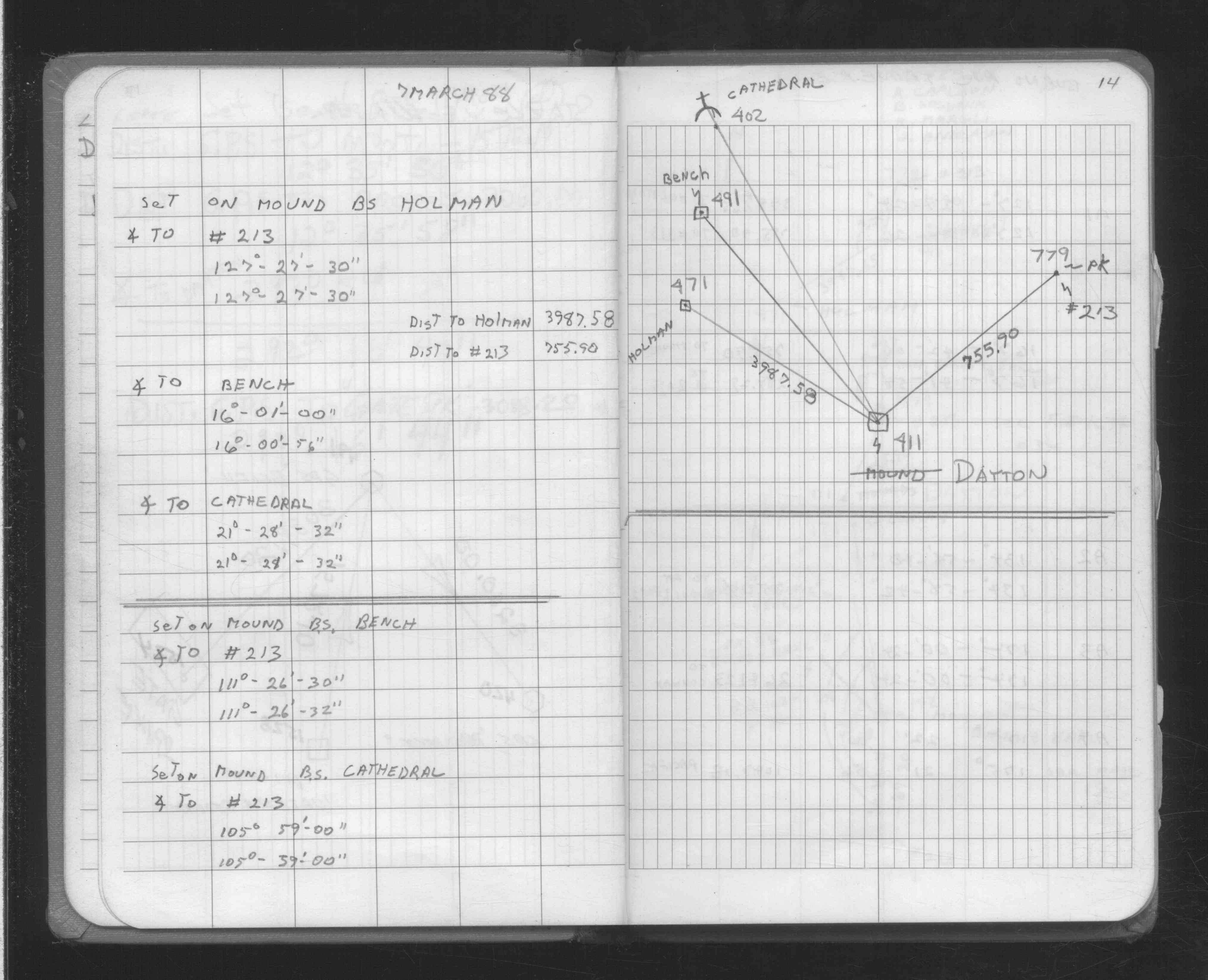
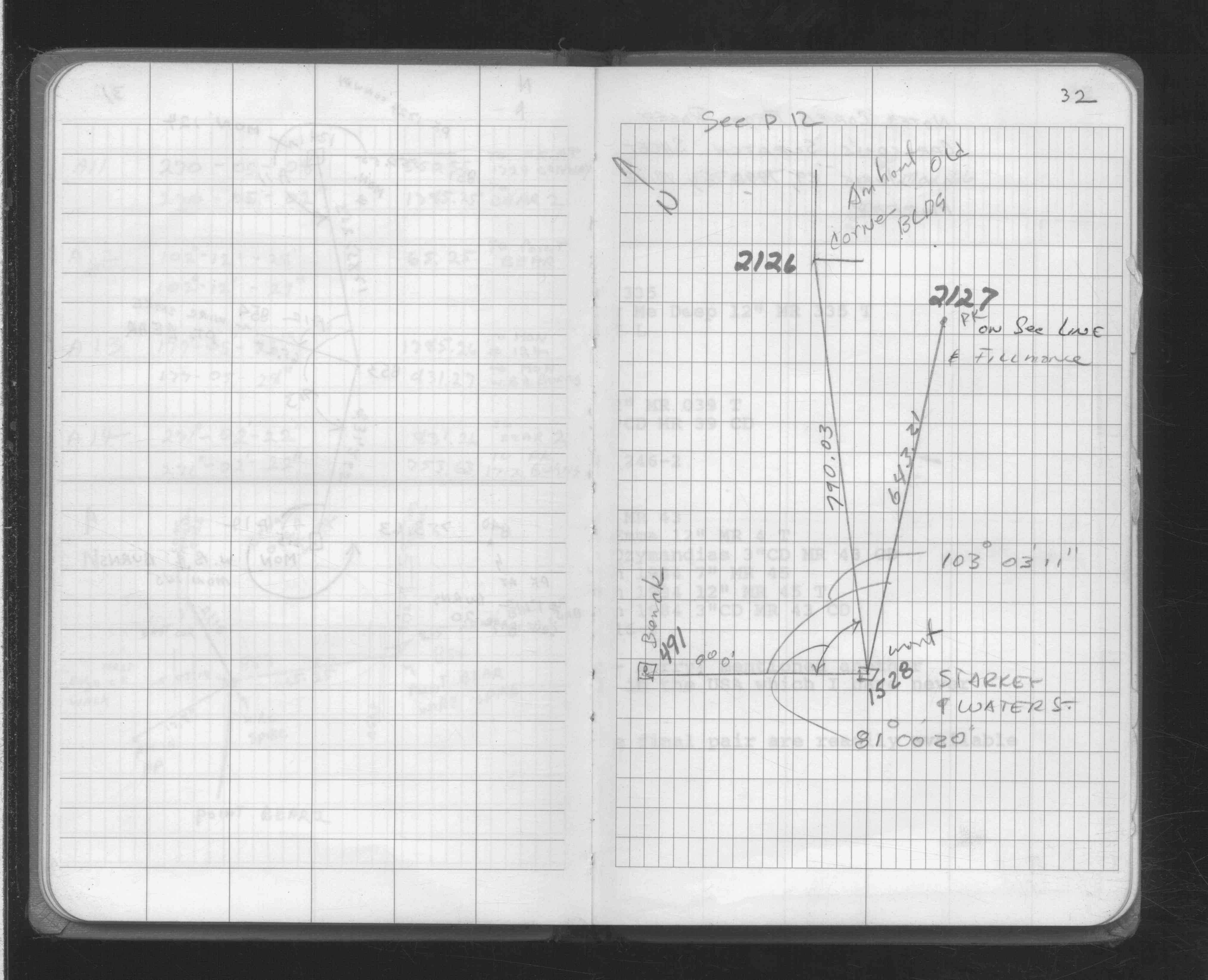
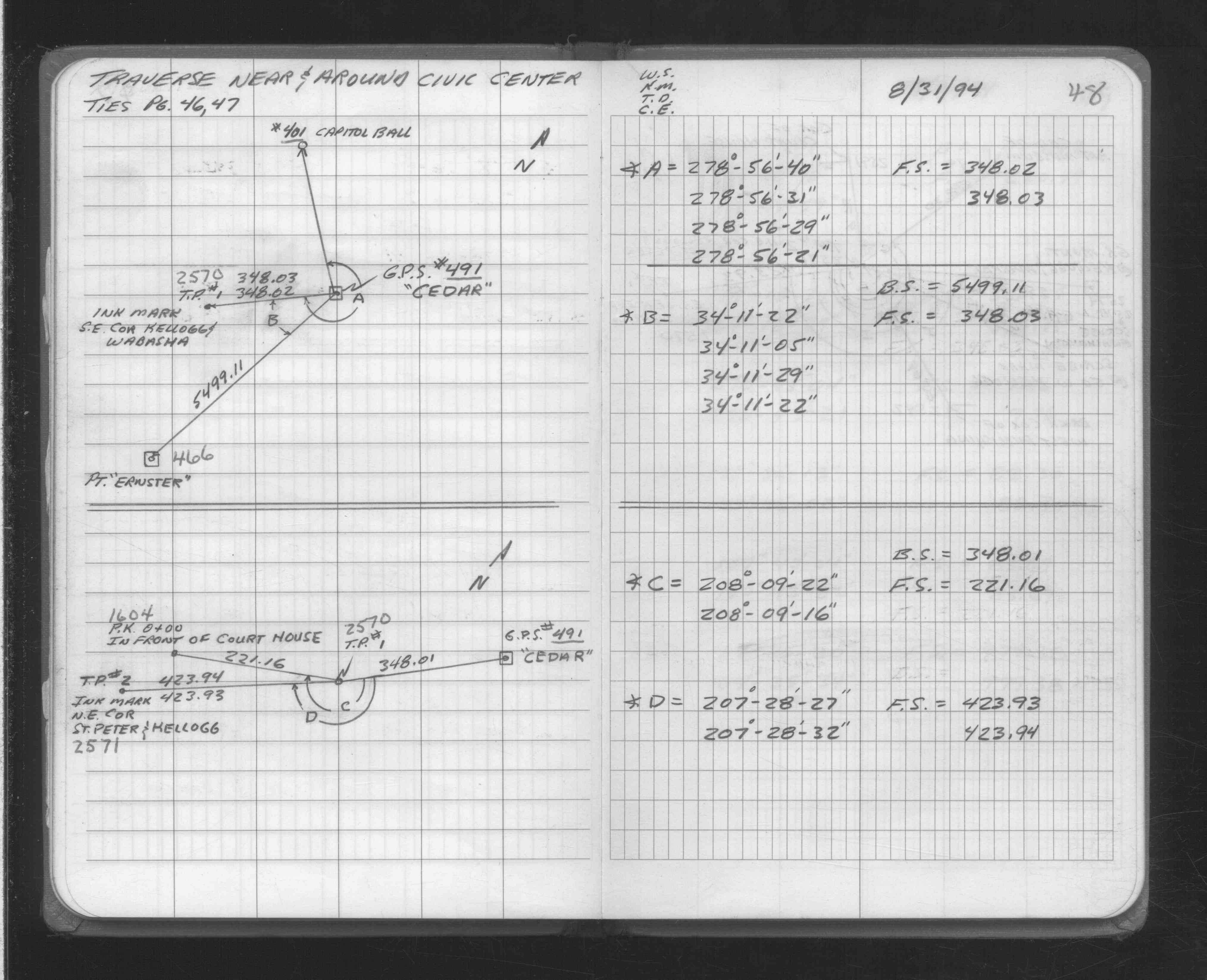
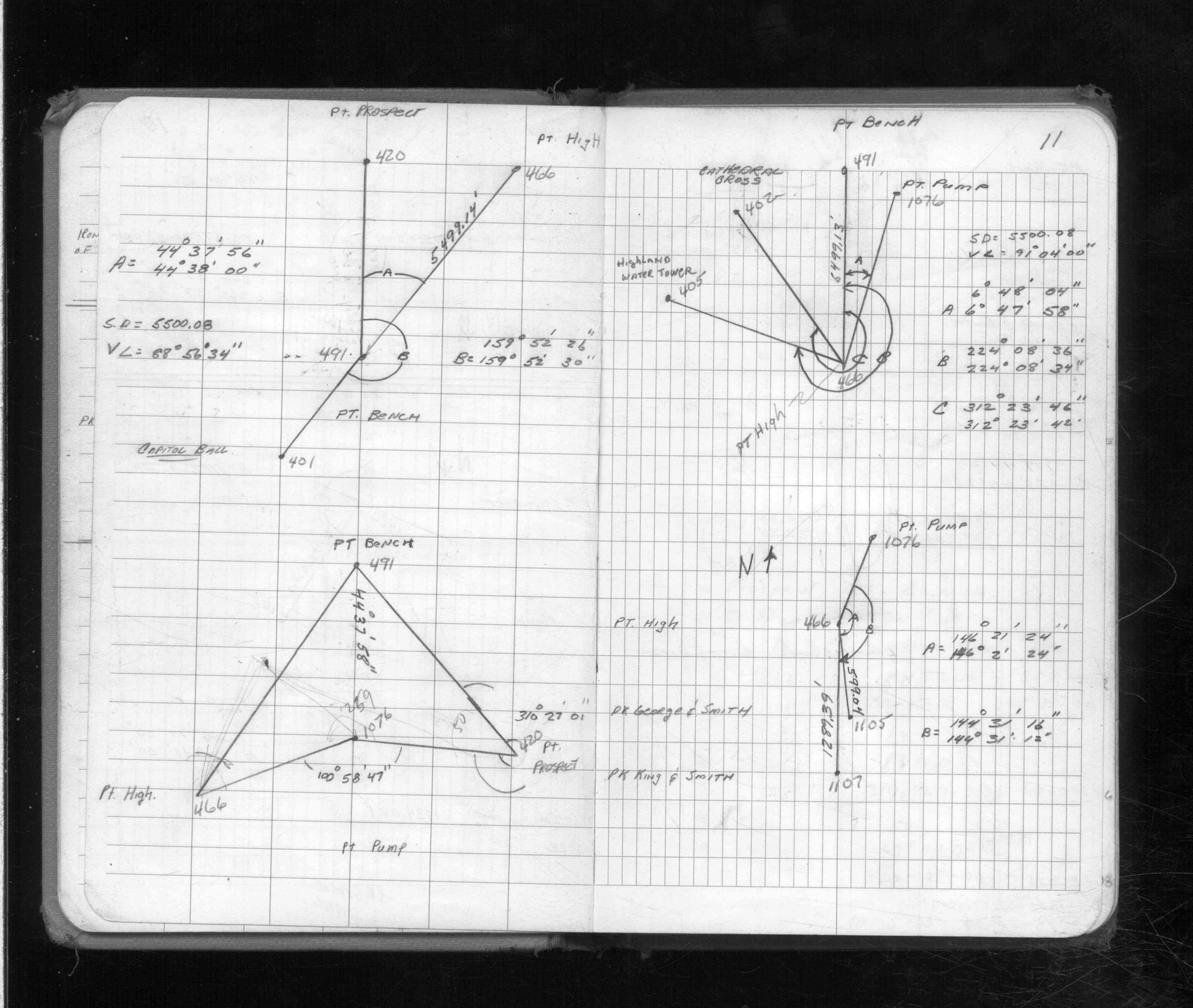
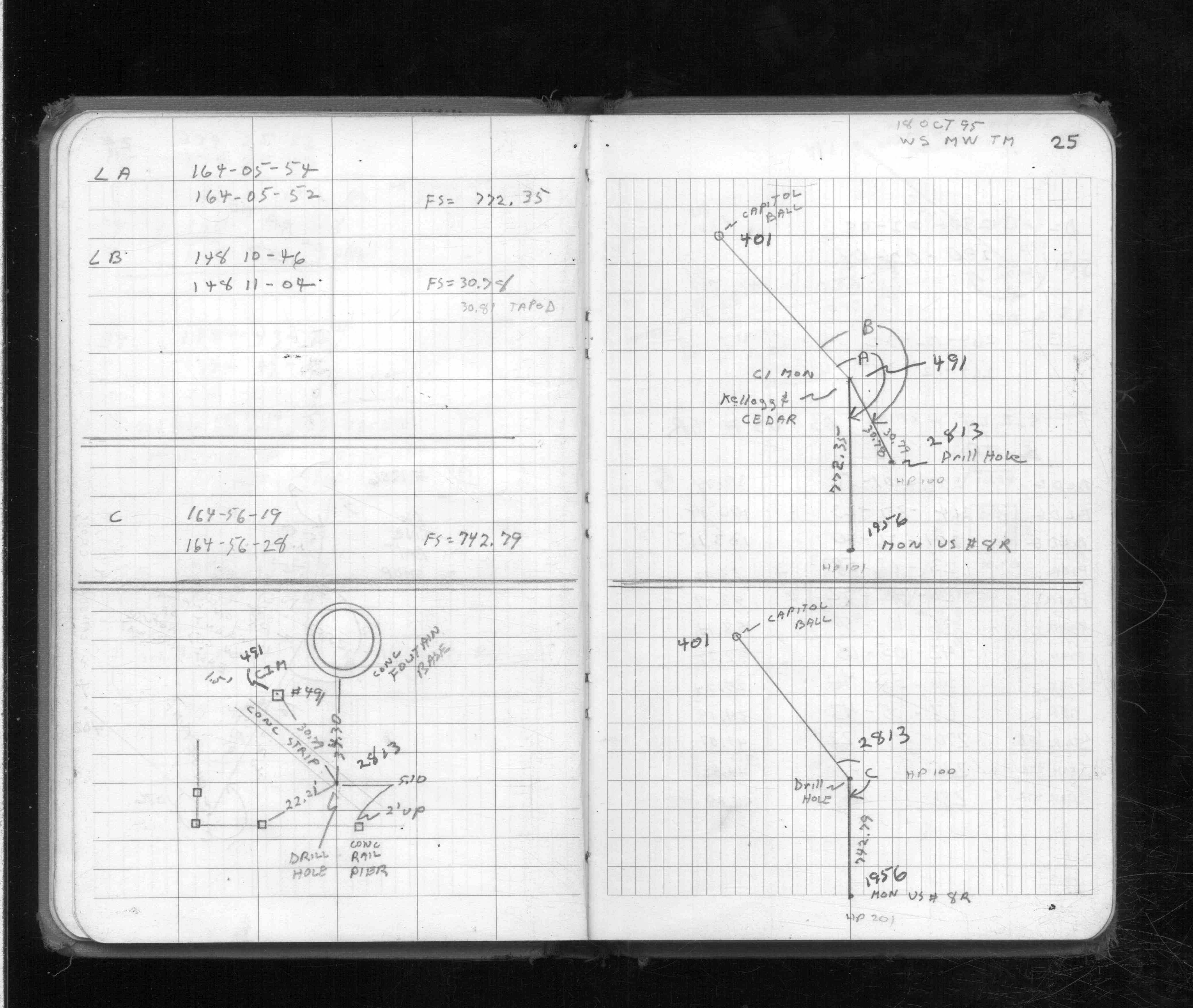
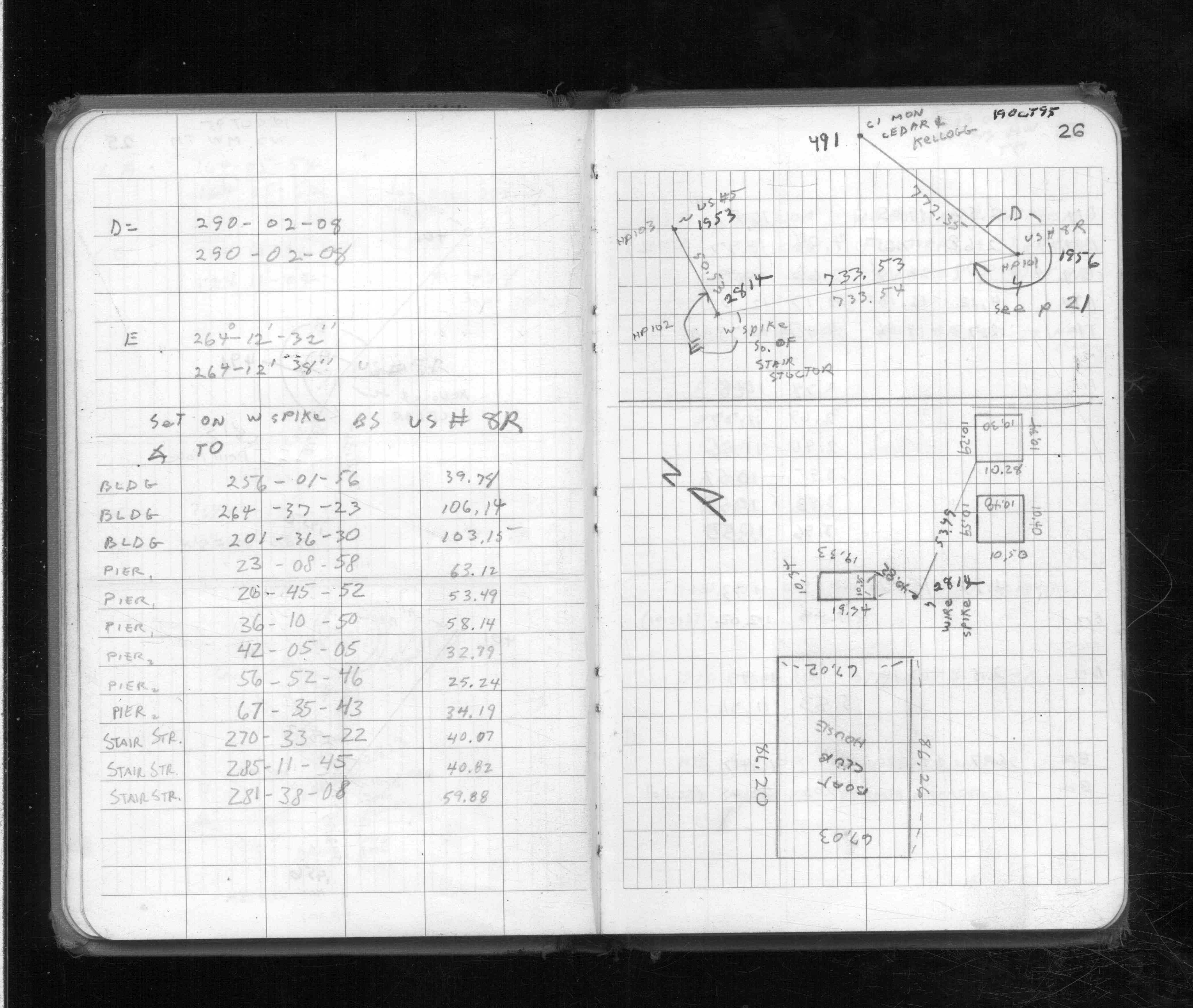
| FB 1713p. 01 ,11 ,20 ,25 ,26 ,45 ,46 | ||||||
| FB 1716p.19 | ||||||
| FB 1734p. 36 ,37 |
| FILE | PHOTO DATE | COMMENTS |
|---|---|---|
| 0491-__fi-5.jpg | July 4, 2005 | Looking Southerly towards the Mississippi River. |
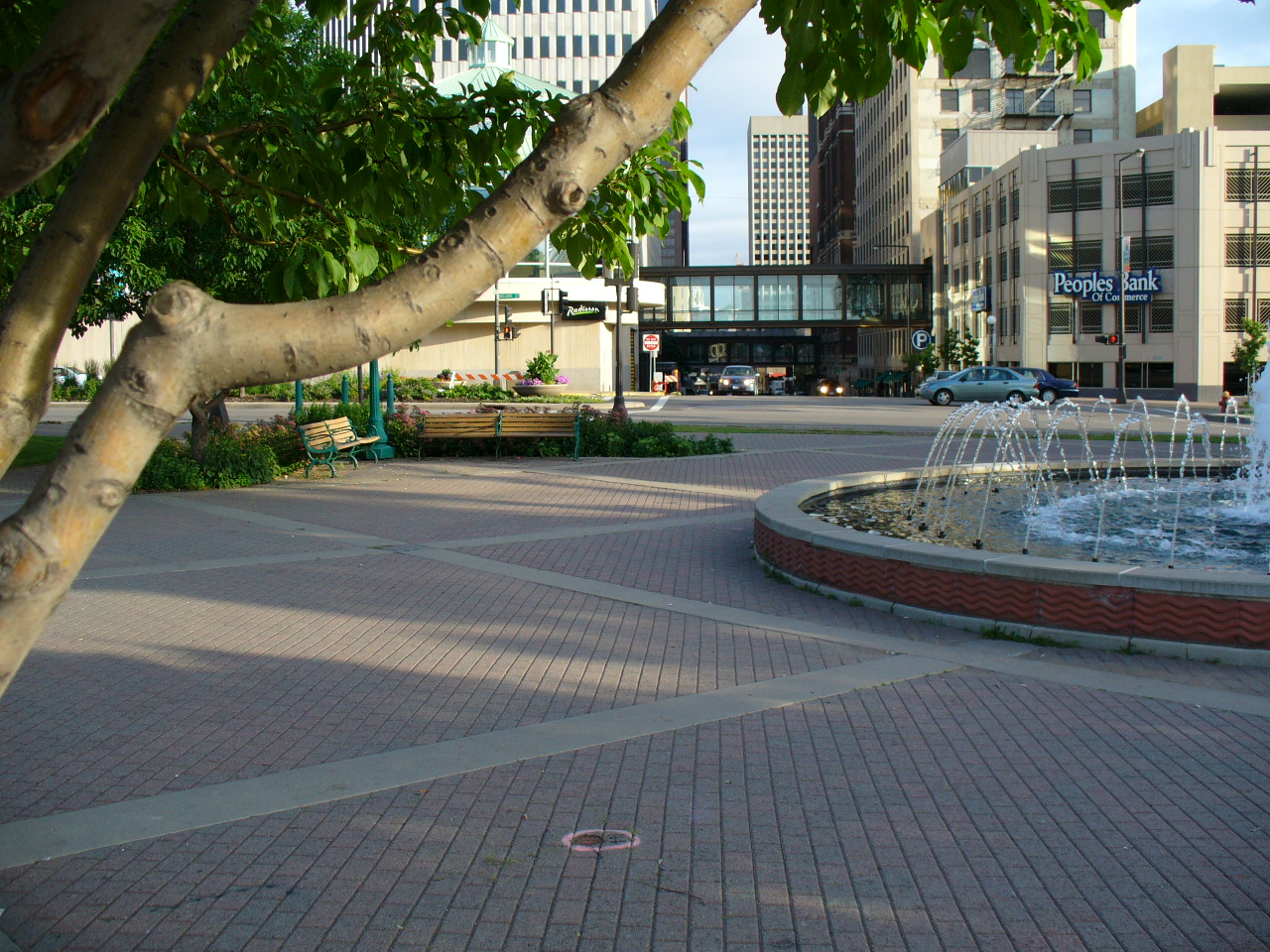
| 0491-__fi-4.jpg | July 4, 2005 | Looking Easterly towards the Robert St. Bridge. |
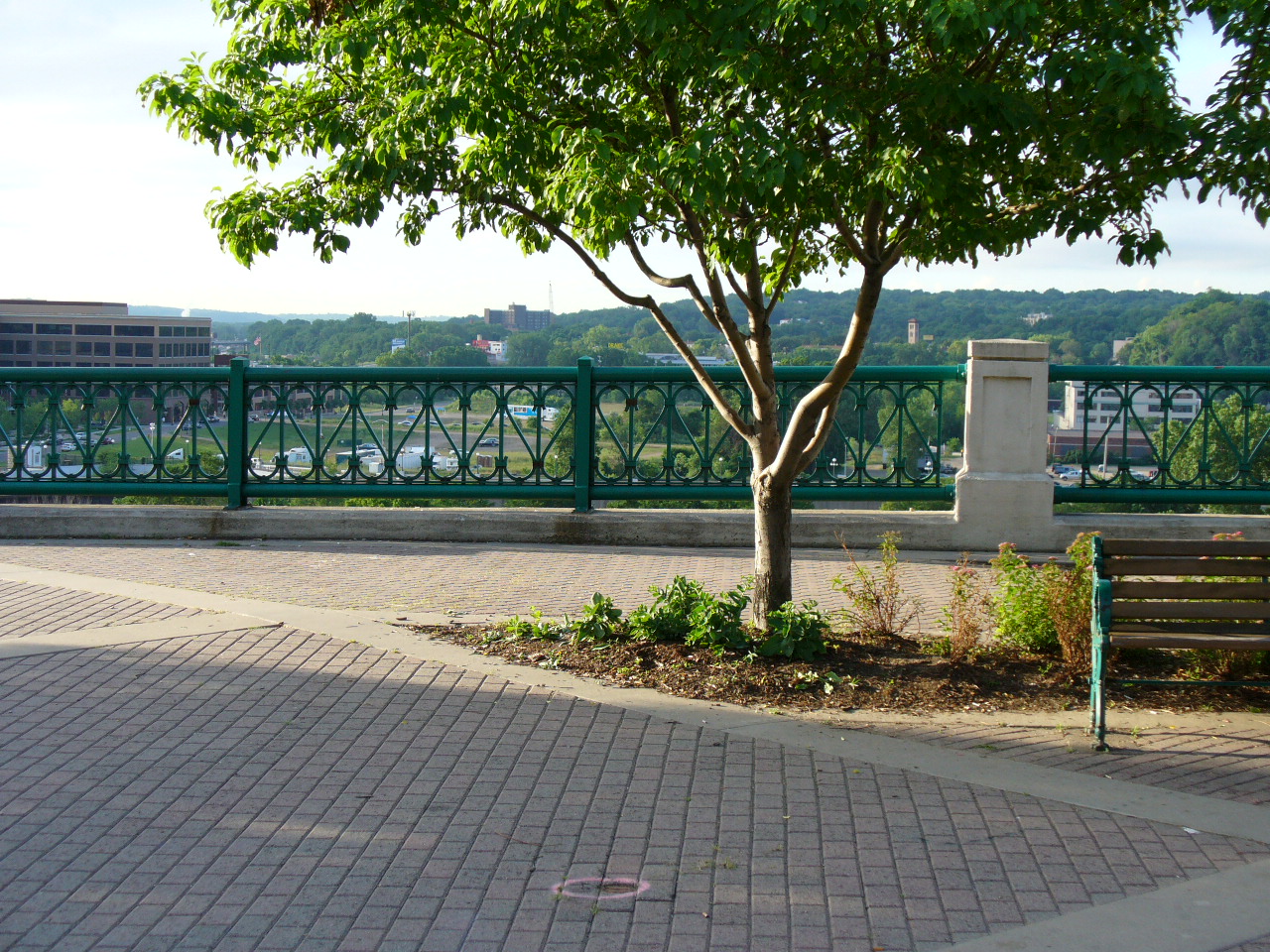
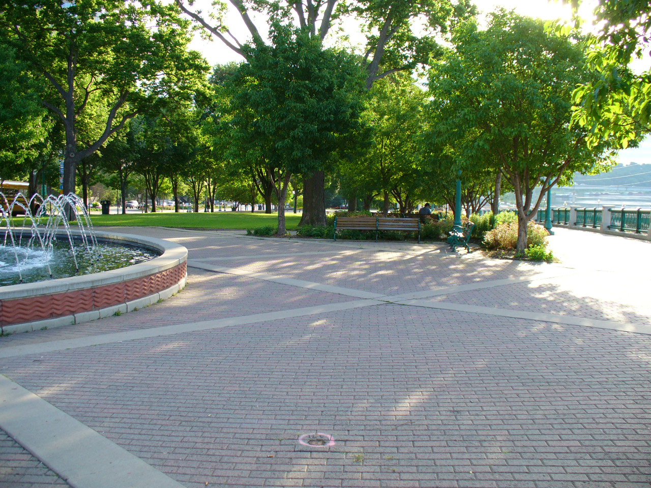
| 0491-__fi-3.jpg | July 4, 2005 | Looking Northerly towards Kellogg Blvd. |
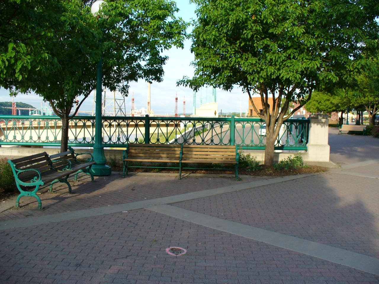
| 0491-__fi-2.jpg | July 4, 2005 | Looking Westerly towards the Wabasha Bridge. |
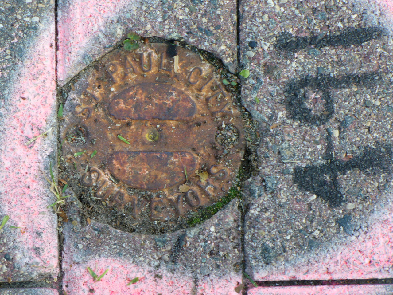
| 0491-__fi-1.jpg | July 4, 2005 | Close-up of CIM. |